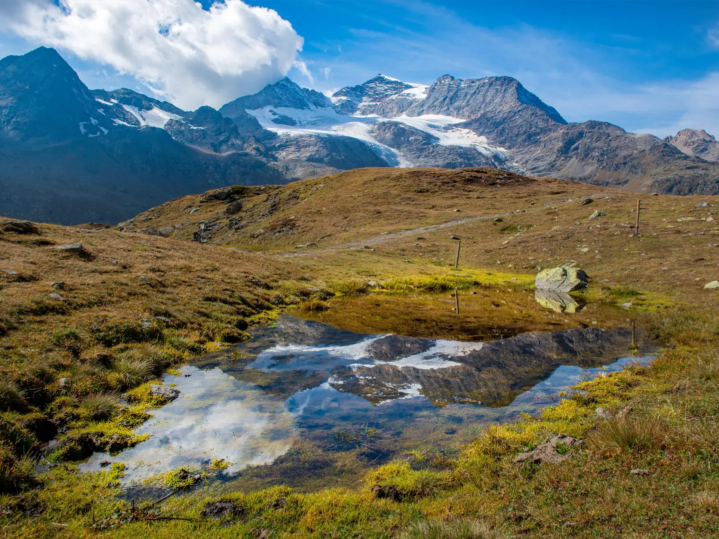
Bernina Trek
How would you rate Bernina Trek?
Tap a star to share your experience and help other hikers.
Bernina Trek: A High-Alpine Hut-to-Hut Guide
HikeList Score
Bernina Trek scored 88/100 on HikeList's trail-quality metrics.
See score breakdownHide breakdown
- Ideal length 98
- Balanced challenge 80
- Scenery & wildness 98
- Varied terrain 94
- Accommodation 66
- Food & support 81
- Path quality 98
- Season flexibility 76
Computed from length, challenge, scenery & wildness, terrain variety, accommodation, food & support, path quality and season flexibility.
The Bernina Trek is a hard, high-alpine hut-to-hut route in Graubünden, Switzerland, circling the Bernina massif from Madulain to Poschiavo. Plan on about 130 km, seven walking stages and around eight days. This is SAC T3 mountain hiking: rocky paths, scree, moraine, high passes and possible snowfields into summer. It suits experienced alpine hikers with surefootedness, a head for heights and comfort staying in staffed SAC/CAI huts.
Route Overview
The route starts in Madulain in the Upper Engadine and finishes in Poschiavo in Italian-speaking Val Poschiavo, so it is a point-to-point trek rather than a closed loop. The official sequence links Chamanna d'Es-cha, Chamanna Jenatsch, Chamanna Coaz, Chamanna da Tschierva, Chamanna da Boval and Rifugio Saoseo before descending through Val di Campo to Poschiavo. Packaged itineraries may vary slightly, sometimes using St. Moritz or Silvaplana overnights, but the core SAC Bernina route is hut-to-hut. This is not a railway valley walk and it does not end in Tirano. For shorter nearby glacier terrain, compare the Diavolezza Glacier Trail; for another high route in the same Graubünden corner, see the Davos to Arosa Panorama Trail; and for a broader Swiss pass-to-pass traverse, the Alpine Pass Route (Route 6).
How the Bernina Trek Developed
The Bernina Trek is a modern themed long-distance route created and promoted by SAC Sektion Bernina, the local Swiss Alpine Club section. Its purpose is to link the established chain of mountain huts around the Bernina group. The landscape also has deep mountaineering history: Piz Bernina was first climbed in 1850 by Johann Coaz, whose name is carried by Chamanna Coaz on the trek.
Notable highlights
Bernina massif and Piz Bernina (4,049 m): The trek circles the Bernina range, whose highest summit is Piz Bernina. It is the highest peak in the Eastern Alps and the only summit above 4,000 m east of the Bernese Alps.
Biancograt: This famous white snow-and-ice ridge on Piz Bernina is seen from the Tschierva side. The trek does not climb it, but it is one of the major visual landmarks of the route.
Morteratsch and Roseg glaciers: Stages near Chamanna da Boval and Chamanna da Tschierva run beside these large glaciers. The Morteratsch valley is also known for markers documenting the glacier’s retreat.
High Fuorclas: The route crosses several alpine cols, including Fuorcla Crap Alv and Fuorcla Suvretta. Fuorcla Suvretta is the trek’s high point at about 2,966 m.
Rifugio Saoseo and Val di Campo: After the bare high country, the route drops into the wooded, lake-dotted Val di Campo nature reserve above Poschiavo.
Poschiavo finish: The trek ends in Italian-speaking Poschiavo, known for its Romanesque and Italianate town centre. The nearby UNESCO-listed Rhaetian Railway Bernina line crosses the valley.
Challenges to expect
Expect long mountain days on SAC T3 terrain: rocky paths, scree, moraine near glaciers and exposed high passes. Snowfields can remain into early summer, especially on the higher cols, so timing and conditions matter. Accommodation is mostly staffed huts, not towns, so book ahead and carry a sleeping-bag liner. Resupply options on the official hut-to-hut line are limited compared with lower valley treks.
HikeList Score
Bernina Trek scored 88/100 on HikeList's trail-quality metrics.
See score breakdownHide breakdown
- Ideal length 98
- Balanced challenge 80
- Scenery & wildness 98
- Varied terrain 94
- Accommodation 66
- Food & support 81
- Path quality 98
- Season flexibility 76
Computed from length, challenge, scenery & wildness, terrain variety, accommodation, food & support, path quality and season flexibility.
 Switzerland
Show more data Show less
- Mountainous
- Alpine
- Forest
- Meadow
- Dirt
- Rocky
- Snow
- Huts
- Hotels
- Pet Friendly
- Restrooms
- Water Sources
- Shelters
Download Our Full Guide to Bernina Trek FREE!
Get our comprehensive guide to this hike for free. Save it for later reading or print out at home.
In these collections
Photos from hikers
Taken on the trail by people who've reviewed Bernina Trek.
Bernina Trek: The Complete Guide
 i
Image by pierluigipalazzi
i
Image by pierluigipalazzi The Bernina Trek is a serious hut-to-hut traverse through Graubünden’s high Alps, linking Madulain in the Upper Engadine with Poschiavo in Val Poschiavo. It follows the chain of SAC Bernina huts around the Bernina massif, moving from Romansh-speaking larch woods into a stark world of Fuorclas, moraine, glacier lakes and staffed mountain huts.
The route is not a valley ramble and not a railway sightseeing walk. Its strongest days cross high cols such as Fuorcla Suvretta, pass beneath the glacier world of Piz Bernina and the Biancograt, and thread between places such as Chamanna Jenatsch, Chamanna Coaz, Chamanna da Tschierva and Chamanna da Boval.
It is also a practical Swiss alpine journey, with excellent rail access at both ends and two planned transport links within the standard route: the Corvatsch gondola from Surlej to Murtèl and a short RhB train hop from Morteratsch to Lagalb. Resupply is limited once above the valleys, so hut bookings, food planning and transport timings matter.
This trek suits experienced alpine walkers who are comfortable with long mountain days, scree, moraine, exposed paths and the routines of SAC/CAI hut dormitories. Snow can linger on the higher passes into early summer, and the reliable season is generally late June to the first week of October.
This guide covers stages, daily logistics, huts, food, transport, terrain and the common planning mistakes that can make the Bernina Trek harder than it needs to be.
Stage-by-Stage Guide
Stage 1: Madulain to Chamanna d'Es-cha
Approx. 5.9 km, +897 m, about 2h40
The opening stage is short in distance but climbs hard from the Upper Engadine to the first high hut. It starts at Madulain, the signed start of the Bernina Trek, and rises through larch and Swiss-stone-pine woodland above the valley, passing through or below the area of neighbouring Zuoz before reaching Chamanna d'Es-cha.
Underfoot, expect mountain paths rather than valley tracks. This is a useful first test of pacing with a hut pack: the climb is sustained, and the hut sits high enough for weather to feel very different from the village.
Food and water planning is straightforward but still important. Madulain is on the RhB Albula line, while nearby Zuoz has the larger station and is sometimes used by packaged itineraries as the practical starting point. Once above the valley, do not expect meaningful resupply before the hut; carry what is needed for the climb and arrange dinner and breakfast through Chamanna d'Es-cha.
Chamanna d'Es-cha is the overnight stop. It is a staffed mountain hut in season, with dormitory accommodation, and should be booked in advance; a sleeping-bag liner is required for the trek's hut nights.
Navigation is not complex in good visibility, but the route is not a single numbered national trail. Follow the Swiss white-red-white mountain waymarks and carry detailed mapping. In early season, lingering snow higher up can obscure the line near the hut, so current conditions should be checked before travelling.
Stage 2: Chamanna d'Es-cha to Chamanna Jenatsch via Fuorcla Crap Alv and Val Bever
Approx. 23.9 km, +1,090 m / −1,030 m, about 8h
This is the first full alpine traverse day and a major step up from Stage 1. The route crosses Fuorcla Crap Alv at about 2,466 m, then works through the Val Bever system before climbing into the remote basin of Chamanna Jenatsch.
The terrain is long, rocky and high, with a mix of mountain path, stony ground and exposed alpine weather. Chamanna Jenatsch, at 2,652 m, is the highest SAC hut in Graubünden, so the stage finishes in genuinely high country rather than dropping to a serviced valley.
Food and water options are limited between huts. Start with a full day's hill food and enough water capacity for a long stage; packed lunches and hut drinking-water arrangements should be dealt with at Chamanna d'Es-cha the evening before.
There is no simple mid-stage town resupply. Val Bever gives a sense of descent into a larger valley system, but this should still be planned as a self-contained hut-to-hut day.
Accommodation is at Chamanna Jenatsch. Because the hut is remote and a key point on the route, advance booking is essential in the main summer season.
Navigation matters more here than on the approach day. Fuorcla Crap Alv and the onward route into Val Bever require close attention in poor visibility, and snow can linger on higher ground into early summer. This is not a stage to start late: the distance, ascent and descent make it a full mountain day.
Stage 3: Chamanna Jenatsch to Chamanna Coaz via Fuorcla Suvretta, Silvaplana, Surlej, Murtèl and Fuorcla Surlej
Approx. 28.2 km, +1,749 m / −1,786 m, about 8h45
Stage 3 is one of the biggest days on the Bernina Trek. It crosses Fuorcla Suvretta at about 2,966 m, the high point of the whole route, then descends by Lej Suvretta towards Silvaplana before using the Corvatsch gondola from Surlej to Murtèl. From there the route continues over Fuorcla Surlej at about 2,755 m to Chamanna Coaz.
This is a demanding high-alpine day with major height gain and loss, plus a deliberate lift-assisted link in the middle. Treat the gondola as part of the standard Classic route, not as an optional shortcut that can be ignored without changing the day's difficulty and timing.
The terrain includes rugged cols, rocky mountain paths and high open ground. Fuorcla Suvretta is exposed to fast-changing weather, and snowfields may persist on the high passes into early summer.
Silvaplana and Surlej are the key practical points on the stage. This is one of the few places on the whole trek where shops and valley services may be available, so it is the best opportunity so far to replace snacks or deal with small logistical issues.
The Corvatsch gondola timetable from Surlej to Murtèl must fit the walking day. Missing the last lift can create a serious problem, so check operating dates and times before relying on this stage plan.
Chamanna Coaz is the overnight stop. It is a staffed hut and should be booked ahead; once beyond Surlej/Murtèl, do not expect further resupply before the hut.
Navigation is significant on both sides of the valley interruption. The descent from Fuorcla Suvretta to the Silvaplana side and the onward high route from Murtèl over Fuorcla Surlej both need clear route-finding in cloud, snow patches or poor weather.
Stage 4: Chamanna Coaz to Chamanna da Tschierva via Lej da Vadret
Approx. 13.4 km, +663 m / −675 m, about 4h50
This is shorter than the preceding stages, but it is still a high mountain day rather than a recovery walk. The route traverses the glacier amphitheatre between the Coaz and Tschierva huts, passing Lej da Vadret and staying in the dramatic Roseg glacier world beneath Il Chapütschin, Piz Roseg and Piz Bernina.
The stage is one of the scenic highlights of the trek. Lej da Vadret and the surrounding moraine-and-glacier landscape give close views into the high Bernina massif without requiring glacier travel on the walking route.
Paths are rocky and alpine, with moraine terrain and exposed sections where poor visibility would make navigation slower. The relatively modest distance should not encourage complacency: this is remote high terrain, and weather can deteriorate quickly.
There is no meaningful shop resupply between the huts. Carry lunch, snacks and water for the full day, and use the huts for meals and overnight arrangements.
Chamanna da Tschierva is the end point, sitting below the north side of Piz Bernina. The Biancograt, the famous white ridge of Piz Bernina, is the defining view from this part of the trek.
Public transport is not part of this stage. If conditions are poor, decisions need to be made before leaving Chamanna Coaz, as the practical exit options are limited once committed to the traverse.
Stage 5: Chamanna da Tschierva to Chamanna da Boval via Val Roseg, Pontresina and Morteratsch
Approx. 22 km, +705 m / −800 m, about 6h40
Stage 5 drops from the Tschierva side into Val Roseg, reaches the Engadine resort village of Pontresina, then continues towards Morteratsch and climbs to Chamanna da Boval above the Vadret da Morteratsch. It is a varied day, moving from high hut terrain to valley services and back into glacial mountain country.
The descent through Val Roseg gives a marked change of character after several high stages. Pontresina is an important practical point on the trek: it offers resupply, public transport and a realistic bail-out or rest-point option if weather, fatigue or injury make continuing unwise.
After Pontresina, the route heads to Morteratsch and then climbs again to Chamanna da Boval. The Boval approach is mountain terrain above the Morteratsch Glacier, with views over one of the best-known glacier valleys in the Bernina region.
Food and water planning is easier than on most stages because Pontresina provides valley services. Even so, the final climb to Boval should be treated as a separate mountain section: leave Pontresina or Morteratsch with enough water, snacks and time to reach the hut safely.
Public transport access is good at Pontresina and Morteratsch on the RhB network. This makes Stage 5 one of the main entry, exit or contingency points on the route.
Accommodation is at Chamanna da Boval, a staffed mountain hut. Book ahead and remember that, once committed to the climb above Morteratsch, the day ends back in hut conditions rather than in a valley hotel.
Navigation is generally helped by the valley landmarks, but the climb to Boval still needs alpine attention. In bad weather, avoid letting the presence of nearby rail stations create a false sense of security: the upper part of the day remains exposed mountain walking.
Stage 6: Chamanna da Boval to Rifugio Saoseo via Morteratsch, train to Lagalb, Val Minor, Fuorcla Minor and La Rösa
Approx. 28.4 km, +772 m / −1,267 m, about 9h
Stage 6 is the hardest logistical and walking day for many hikers. It descends from Chamanna da Boval to Morteratsch, uses a short RhB train hop from Morteratsch station to Lagalb, then crosses Val Minor and Fuorcla Minor before descending via La Rösa towards Val da Camp and Rifugio Saoseo.
This stage is rated difficult and should be treated with particular respect. The distance is long, the descent is substantial, and there is a short steep pathless section after Lej Minor.
The standard route includes the Morteratsch to Lagalb train transfer. Train times need to be checked before the stage, because the connection affects the whole day's timing and the remaining crossing into Val Poschiavo.
Terrain after Lagalb is high, stony and more committing than the valley interlude suggests. Val Minor, Lej Minor and Fuorcla Minor form the key mountain section, with route-finding and footing both important, especially if snow patches remain or weather closes in.
Food and water should be planned conservatively. Morteratsch provides transport access, but the onward crossing to Saoseo should be approached as a long self-sufficient mountain stage; do not rely on resupply between the train transfer and the hut unless current local services have been checked.
La Rösa gives road access on the descent into the Poschiavo side, but onward public transport from there should be checked before travelling. It can be a useful contingency point only if times and services match the day.
Rifugio Saoseo is the overnight stop, in the Val da Camp / Val di Campo area. It is CAI-run rather than an SAC hut, but it functions as the final staffed hut night on the Classic Bernina Trek and should be booked ahead.
An early start is strongly advisable. This is not the stage for marginal weather, tired legs or uncertain navigation: if the forecast is poor, use the Morteratsch rail access to reconsider the plan before committing beyond Lagalb.
Stage 7: Rifugio Saoseo to Poschiavo via Val da Camp
Approx. 14.2 km, +316 m / −1,289 m, about 4h30
The final stage leaves the high hut chain and descends through the wooded, lake-dotted Val da Camp / Val di Campo to Poschiavo. After the bare cols and glacier terrain of the middle stages, this is lower, greener walking with a long net descent into the Italian-speaking side of Graubünden.
The main terrain issue is the amount of descent. Paths through forest and alpine meadow can still be tiring with a hut pack, especially after six previous walking days, so allow enough time and avoid rushing the final kilometres.
Rifugio Saoseo provides the last hut breakfast and the starting point for the day. There is no need to plan this as a remote high crossing, but carry normal hill food and water until Poschiavo unless current services in Val da Camp have been checked.
Poschiavo is the finish of the Bernina Trek. It is a proper valley town with onward rail access on the RhB Bernina line; the trek ends here, not in Tirano.
Public transport from Poschiavo is excellent by Swiss standards, with RhB trains on the Bernina line and connections back over the Bernina Pass towards the Engadine or onwards towards Tirano. Timetables should still be checked before booking onward travel, particularly if finishing late in the day.
Navigation is more forgiving than on the high-pass stages, but the route still uses mountain waymarking rather than a single continuous numbered trail. Keep the map accessible until the final descent into town, as paths and forest tracks in lower valleys can be more confusing than expected after several days of obvious alpine terrain.
Recommended Itinerary
Standard itinerary: 7 walking stages
The standard Bernina Trek is best planned as seven walking days with six hut nights. The stages are deliberately uneven: the first day is short, but three later days are in the 22–28 km range and include high passes, rough ground or transport links that need to line up.
Book the huts before committing to travel dates, and check current Corvatsch gondola, RhB train and PostAuto times before relying on a stage plan.
| Day | From | To | Approx. distance | Why this stage makes sense | Services/accommodation notes |
|---|---|---|---|---|---|
| 1 | Madulain | Chamanna d'Es-cha | ~6 km | A short but useful approach day from the Upper Engadine, climbing from the valley to the first hut. It works well after arriving by train, provided there is enough daylight and hut check-in time. | Start at Madulain on the RhB Albula line; some itineraries start at nearby Zuoz. Overnight at Chamanna d'Es-cha. Carry a sleeping-bag liner for the hut. |
| 2 | Chamanna d'Es-cha | Chamanna Jenatsch, via Fuorcla Crap Alv and Val Bever | ~24 km | This is the first full mountain stage, crossing Fuorcla Crap Alv and entering the remote high country above Val Bever. Keeping it as a standalone day is sensible because of the distance and ascent. | Overnight at Chamanna Jenatsch, the highest SAC hut in Graubünden. There are no town services on this high-level stage, so carry food for the day. |
| 3 | Chamanna Jenatsch | Chamanna Coaz, via Fuorcla Suvretta, Silvaplana, Surlej, Corvatsch gondola to Murtèl and Fuorcla Surlej | ~28 km | The longest and most committing stage of the standard itinerary, crossing Fuorcla Suvretta, the trek high point at about 2,966 m, before using the Corvatsch gondola to regain height from Surlej to Murtèl. | Silvaplana/Surlej provide the main valley-service point on this day. The Corvatsch gondola is part of the standard route; operating times should be checked before travelling. Overnight at Chamanna Coaz. |
| 4 | Chamanna Coaz | Chamanna da Tschierva, via Lej da Vadret | ~13 km | A shorter high-alpine day after the long Jenatsch–Coaz stage, but still serious underfoot, with glacier-country terrain around Lej da Vadret. | Overnight at Chamanna da Tschierva. This is hut-to-hut walking with limited services between huts. |
| 5 | Chamanna da Tschierva | Chamanna da Boval, via Val Roseg, Pontresina and Morteratsch | ~22 km | This stage drops through Val Roseg to Pontresina before continuing towards Morteratsch and climbing to Boval. It gives a valuable mid-trek resupply and bail-out opportunity without leaving the main route. | Pontresina has services and public transport connections. Morteratsch is also on the RhB network. Overnight at Chamanna da Boval. |
| 6 | Chamanna da Boval | Rifugio Saoseo, via Morteratsch, train to Lagalb, Val Minor, Fuorcla Minor and La Rösa | ~28 km | A long, hard crossing from the Bernina side towards Val da Camp, including the short RhB train hop from Morteratsch to Lagalb and the crossing of Fuorcla Minor. This is the stage most worth treating conservatively in poor weather or lingering snow. | The Morteratsch–Lagalb train is part of the standard itinerary and times should be checked before travelling. Expect limited services after leaving the transport corridor. Overnight at Rifugio Saoseo. |
| 7 | Rifugio Saoseo | Poschiavo, via Val da Camp | ~14 km | A shorter final descent through Val da Camp to Poschiavo, useful after the demanding Boval–Saoseo stage. It finishes low in Val Poschiavo rather than returning to the Engadine on foot. | Poschiavo has rail connections on the RhB Bernina line, with onward travel back over the Bernina Pass or towards Tirano. Allow time for the descent and onward train connections. |
Slower variant: add buffer nights rather than splitting every stage
A slower plan suits hikers who want more margin for weather, snow on the high cols, hut availability or recovery after the longest days. The most practical approach is to keep the official hut-to-hut line but add one or two buffer nights where the route touches valley services.
Good places to consider are Silvaplana/Surlej around Stage 3, or Pontresina around Stage 5. Both are useful for food, transport and schedule recovery, but accommodation availability and exact logistics should be checked before booking.
This slower version is best for experienced hikers who are capable of the terrain but do not want to commit to back-to-back long alpine days. It is also the safer choice when walking early or late in the season, when snow or shorter daylight can affect timing.
Faster variant: only for very strong alpine walkers
Strong walkers sometimes compress the Bernina Trek, but the standard seven walking stages are already demanding. Any faster schedule has to deal with stages of roughly 24 km, 28 km and 28 km, high passes, hut booking constraints, and two transport-dependent sections.
The most obvious compression is the short first approach day, but combining it with the next stage creates a very long opening day from Madulain to Chamanna Jenatsch. That is not a normal recommendation unless fitness, weather, daylight, hut arrival time and official mapping all line up.
A faster variant suits only experienced alpine hikers who are comfortable with long days on rocky T3 terrain and who can navigate independently if timing slips. For most independent hikers, the standard 7-stage itinerary is the sensible plan.
Planning the Route
How many days to allow
Plan the Bernina Trek as seven walking stages, with six hut nights, plus travel time at either end. That is the standard “Classic” rhythm and it fits the hut chain naturally: Chamanna d’Es-cha, Chamanna Jenatsch, Chamanna Coaz, Chamanna da Tschierva, Chamanna da Boval and Rifugio Saoseo.
The first day is deliberately short, which helps if arriving by train and starting from Madulain the same day. The middle of the route is much more committing, with several long mountain days and high passes, so it is not a trek to squeeze aggressively unless fitness, weather and hut availability all line up.
Strong walkers sometimes compress the route, but most hikers should not plan on doing so. The limiting factors are not just kilometres: the harder days include rough ground, exposed cols, scree, moraine, lingering snowfields and fixed accommodation points high in the mountains.
Let the huts dictate the itinerary
This is not a route where daily distance can be adjusted freely. The accommodation pattern is defined by staffed mountain huts rather than a string of towns, and several stages have no realistic mid-stage overnight option on the high line.
Book the huts before committing to travel dates. In the main summer window, beds can fill, and the whole itinerary can be disrupted if one hut night is unavailable. A sleeping-bag liner is required for the huts.
The official stages are also very uneven, which matters when judging pace:
| Stage | Route section | Planning implication |
|---|---|---|
| 1 | Madulain to Chamanna d’Es-cha | Short approach day; useful after arrival by train. |
| 2 | Chamanna d’Es-cha to Chamanna Jenatsch | Long, remote day via Fuorcla Crap Alv and Val Bever. |
| 3 | Chamanna Jenatsch to Chamanna Coaz | One of the biggest days, over Fuorcla Suvretta, with descent to Silvaplana/Surlej and the Corvatsch gondola to Murtèl. |
| 4 | Chamanna Coaz to Chamanna da Tschierva | Shorter but still high-alpine, passing Lej da Vadret and glacier terrain. |
| 5 | Chamanna da Tschierva to Chamanna da Boval | Descends through Val Roseg to Pontresina, then continues via Morteratsch. Useful resupply and bail-out day. |
| 6 | Chamanna da Boval to Rifugio Saoseo | Long and difficult, with the Morteratsch–Lagalb train hop, Val Minor, Fuorcla Minor and a short steep pathless section after Lej Minor. |
| 7 | Rifugio Saoseo to Poschiavo | Descent through Val da Camp to the finish in Poschiavo. |
Walking it faster or slower
A slower itinerary is usually more realistic than a faster one. Extra time is useful for weather delays, transport connections, hut availability and tired legs after the long second, third and sixth stages.
The most practical places to add flexibility are where the trek touches the valleys: around Silvaplana/Surlej, Pontresina/Morteratsch and Poschiavo. Some packaged versions replace a high-hut night with a valley hotel in St. Moritz or Silvaplana, but any altered itinerary must still make sense with the next day’s climb, transport link and hut booking.
Shortening the trek is possible only where public transport intersects the route. Madulain or Zuoz, Silvaplana/Surlej, Pontresina, Morteratsch, Lagalb and Poschiavo are the key practical access points. RhB and PostAuto times should be checked before relying on a bail-out or late-day transfer.
Section hiking
Section hiking is possible, but this is not the easiest way to experience the Bernina Trek. The route is built as a hut-to-hut traverse, and the most scenic central stages sit between high huts rather than valley trailheads.
The most practical sections are those starting or ending at public-transport points: Madulain or Zuoz for the opening stage, Silvaplana/Surlej after the Jenatsch stage, Pontresina and Morteratsch in the middle, and Poschiavo at the end. A short section still needs proper alpine planning if it crosses a Fuorcla or enters glacier-moraine terrain.
Do not assume that leaving the route is simple just because the map shows a nearby valley. Weather, fatigue and snow can make a high pass much slower than expected, and the next hut may still be the safest onward objective.
Transport built into the route
The Bernina Trek is a walking route, but the standard Classic itinerary is not a continuous foot-only line. Stage 3 uses the Corvatsch gondola from Surlej to the Murtèl middle station, and Stage 6 uses a short RhB train hop from Morteratsch to Lagalb.
These links need to be planned like part of the route, not treated as optional extras. Check current Corvatsch gondola, RhB and PostAuto timetables before travelling, especially if walking early or late in the season, or if a long stage depends on catching a specific connection.
The start and finish are both rail-served. Madulain is on the RhB Albula line, while Poschiavo is on the RhB Bernina line, with onward links back over the Bernina Pass towards the Engadine or south towards Tirano.
Food and resupply
Food planning is straightforward but not flexible. The hut nights are normally organised around dormitory accommodation and half-board meals, so the main requirement is to carry enough daytime food between huts.
Resupply on the high route is limited. The main shop opportunities are where the route reaches Silvaplana and Pontresina; do not rely on buying food between huts on the longer high stages.
Switzerland is expensive, and costs are in Swiss francs. Confirm current hut half-board prices, transport fares and any package costs before booking.
Navigation and maps
The trek follows standard Swiss white-red-white mountain waymarks between huts rather than a single national route number. Good navigation is still essential, particularly on high passes, moraine, scree and the short pathless section after Lej Minor on the Boval to Saoseo stage.
Carry proper mapping and do not rely only on waymarks in poor visibility. Swisstopo 1:50,000 mapping and the SwitzerlandMobility / SchweizMobil app are appropriate planning tools for the route.
Weather, snow and timing
The reliable trekking window is roughly late June to the first week of October, but conditions vary sharply from year to year. Early June often still has heavy snow on the high cols, and snowfields can linger into early summer.
Check current snow cover before committing to the high stages, especially Fuorcla Suvretta, Fuorcla Surlej and Fuorcla Minor. Also check hut opening dates, as most huts are no longer staffed by late October.
Fast-changing weather is one of the main planning risks. Build in enough margin to avoid being forced over a high pass in poor visibility, storm conditions or unsafe snow.
Towns, Villages and Overnight Stops
The Bernina Trek is planned primarily around staffed mountain huts rather than valley accommodation. The normal hut sequence is Chamanna d'Es-cha, Chamanna Jenatsch, Chamanna Coaz, Chamanna da Tschierva, Chamanna da Boval and Rifugio Saoseo, with Madulain as the start village and Poschiavo as the finish.
Advance booking is essential in the staffed season, and a sleeping-bag liner is required for hut dormitories. Food resupply is limited on the high line; the only clearly useful shop stops on the standard route are where it touches Silvaplana and Pontresina.
Madulain
Madulain is the official start of the Bernina Trek, in the Upper Engadine at about 1,697 m. It sits on the Rhaetian Railway Albula line, making it a straightforward public-transport start rather than a place that needs a road transfer.
Most walkers will use Madulain for arrival rather than as an overnight target on the trek itself. If starting early, staying somewhere in or near the Upper Engadine the night before is sensible, especially because the first stage climbs directly from the valley to Chamanna d'Es-cha.
Do not confuse Madulain with Zuoz: some packaged itineraries begin at Zuoz, but the signed start point is Madulain. Current local accommodation and food options should be checked before travelling.
Zuoz
Zuoz is close to the first stage and is one stop down the line from Madulain. It has the larger station and is used by some packaged versions of the route as the practical starting point.
For independent hikers, Zuoz can be a convenient pre-trek base if train timing or accommodation availability is better than in Madulain. It is not one of the official hut-to-hut overnight stops, so using it does not change the need to book Chamanna d'Es-cha for the first night.
Chamanna d'Es-cha
Chamanna d'Es-cha is the first official overnight stop, reached from Madulain on the short opening stage through the woods above the Upper Engadine. It is a staffed SAC hut rather than a village stop, so expect dormitory sleeping and hut meals rather than private hotel facilities.
This hut works well as the first night because it sets up the long second stage over Fuorcla Crap Alv and through Val Bever to Chamanna Jenatsch. Arrive with enough personal snacks for the following day; there is no meaningful shop resupply between here and the next valley contact.
Book ahead and check hut opening dates before committing to travel. As with the other huts, carry a sleeping-bag liner.
Chamanna Jenatsch
Chamanna Jenatsch is the second official hut night and the highest SAC hut in Graubünden, at 2,652 m. It lies in a remote high basin above Val Bever, after one of the trek’s long days from Chamanna d'Es-cha.
This is not a casual accommodation stop that can be treated like a valley hotel. It is an important logistical anchor: if there is no bed, the stage plan becomes difficult, because the surrounding terrain is high and remote.
The following day is another major undertaking, crossing Fuorcla Suvretta, the highest point of the Bernina Trek, before descending towards Silvaplana and Surlej and continuing via the Corvatsch gondola and Fuorcla Surlej to Chamanna Coaz. Check weather and snow conditions before leaving the hut.
Silvaplana
Silvaplana is the main valley contact on Stage 3 after the descent from Fuorcla Suvretta. It is one of the few places on the standard route where resupply is realistic, so it is a key point for topping up snacks and any small essentials.
Some packaged itineraries substitute a valley hotel night in Silvaplana or nearby St. Moritz / San Murezzan for one of the high-hut nights. Independent hikers should treat this as an alternative itinerary choice, not the default Bernina Trek sequence.
Silvaplana is also useful as a bad-weather or fatigue bail-out point because it sits in the Engadine valley transport network. Exact onward bus or rail connections should be checked before travelling.
Surlej
Surlej is important because the standard Stage 3 uses the Corvatsch gondola from Surlej up to the Murtèl middle station. This is part of the normal Classic itinerary, not an optional sightseeing detour.
The gondola timing matters: missing the last practical uplift can compromise the onward crossing via Fuorcla Surlej to Chamanna Coaz. Check Corvatsch operating dates and daily times before relying on this stage plan.
Surlej is a logistical waypoint rather than a normal overnight stop on the official hut-to-hut route. If using valley accommodation here instead, the hut bookings before and after need to be adjusted accordingly.
Murtèl
Murtèl is the Corvatsch middle station used on Stage 3 after the gondola from Surlej. From here the route continues on foot towards Fuorcla Surlej and then to Chamanna Coaz.
It should be treated as a transport point, not a resupply or overnight base for the trek. Build the day around the gondola timetable and leave enough margin for the onward mountain section to Chamanna Coaz.
Chamanna Coaz
Chamanna Coaz is the official third hut night, reached after the long Stage 3 from Chamanna Jenatsch via Fuorcla Suvretta, Silvaplana, Surlej, Murtèl and Fuorcla Surlej. The day is long and logistically more complex than a simple hut-to-hut crossing because of the gondola section.
The hut is a good place to break the route before the traverse towards Chamanna da Tschierva. Food and sleeping arrangements are hut-style, so book ahead and do not expect shop access.
The next stage passes Lej da Vadret through a serious glacier landscape. Weather, visibility and snow conditions matter, even though this is a marked mountain hiking route rather than a glacier crossing.
Chamanna da Tschierva
Chamanna da Tschierva is the official fourth hut night, reached from Chamanna Coaz via Lej da Vadret. It sits beneath the Bernina massif, with the Biancograt visible above the hut area.
This is a strong overnight position before descending Val Roseg and reaching Pontresina on the following day. As elsewhere on the trek, facilities are those of a staffed mountain hut: dormitories, half-board and limited personal space.
The following stage drops to a major valley service point, so many hikers will use this night to assess tiredness, weather and whether to continue over to Chamanna da Boval as planned.
Val Roseg
Val Roseg is the side valley walked down between Chamanna da Tschierva and Pontresina. It is a route corridor rather than one of the official Bernina Trek overnight stops.
Do not plan on resupply here unless specific current services have been checked in advance. For practical purposes, Pontresina is the dependable valley stop on this stage.
Pontresina
Pontresina is the most useful mid-trek valley stop on the standard route. It comes on Stage 5 between Chamanna da Tschierva and Morteratsch, before the climb towards Chamanna da Boval.
This is a key resupply and bail-out point. The brief route touches Pontresina specifically as one of the only places with shops on the high line, so it is the best opportunity to buy snacks, replace small essentials and reset before the final high stages.
Pontresina is also useful if weather, fatigue or hut availability forces a change of plan. It is in the Engadine public-transport network; current rail and bus times should be checked before relying on a same-day onward connection.
Morteratsch
Morteratsch is reached on Stage 5 before the climb to Chamanna da Boval, and again on Stage 6 when the standard route uses a short RhB train hop from Morteratsch station to Lagalb. It is therefore more than a scenic waypoint: it is part of the trek’s transport logistics.
For most walkers, Morteratsch is not the planned overnight stop; Chamanna da Boval is. Its value is as a station access point and as a possible place to leave the route if conditions or timing deteriorate.
The stage above Morteratsch passes the Morteratsch Glacier area. Allow enough time for the climb to Chamanna da Boval rather than treating the valley as the end of the walking day.
Chamanna da Boval
Chamanna da Boval is the official fifth hut night, positioned above the Morteratsch valley. It follows the long Stage 5 from Chamanna da Tschierva via Val Roseg, Pontresina and Morteratsch.
This hut sets up the hardest logistical day of the trek: Stage 6 to Rifugio Saoseo, including the return to Morteratsch, the short train to Lagalb, Val Minor, Fuorcla Minor, La Rösa and the crossing into the Val da Camp area. The day is long and includes a short steep pathless section after Lej Minor.
Book the hut well ahead and check next-day weather carefully. If the high crossing is not sensible, Morteratsch and the wider Engadine transport network provide the practical escape direction.
Lagalb
Lagalb is reached by the short RhB train hop from Morteratsch on the standard Stage 6. This transfer is part of the Classic route and should be planned, not improvised.
The walking from Lagalb continues into Val Minor, over Fuorcla Minor and on towards La Rösa and Rifugio Saoseo. Check the Morteratsch–Lagalb train times before travelling, as a missed connection can make an already long day harder.
Lagalb is not a normal overnight stop on the Bernina Trek. Treat it as the start point for the next mountain section of Stage 6.
La Rösa
La Rösa is passed on Stage 6 after Fuorcla Minor and before the route heads towards Val da Camp and Rifugio Saoseo. It is a useful named waypoint on a long day, but it is not one of the official overnight stops in the standard hut sequence.
Any food, accommodation or transport use here should be checked before travelling. Do not rely on it as a guaranteed resupply point without a specific current plan.
Rifugio Saoseo
Rifugio Saoseo is the final hut night of the standard Bernina Trek. Unlike the earlier SAC huts, it is CAI-run, and it sits in the Val da Camp / Val di Campo area above Poschiavo.
It is the natural overnight stop after the long Boval–Saoseo stage, which is one of the most demanding days of the trek. Book ahead, carry a sleeping-bag liner and arrive prepared for hut-style dormitory accommodation and half-board meals.
From here the final stage descends through the wooded, lake-dotted Val da Camp to Poschiavo. The terrain is lower than the central high passes, but it is still a proper walking day with a large descent.
Poschiavo
Poschiavo is the official finish of the Bernina Trek, in Val Poschiavo at about 1,014 m. It is in Switzerland, not Italy, and the trek does not finish in Tirano.
This is the best place to plan a post-trek overnight if train timings, tired legs or weather make onward travel unattractive. It has the practical advantage of being on the RhB Bernina line, with trains and PostAuto buses back over the Bernina Pass to the Engadine or onward towards Tirano.
After several nights in huts, Poschiavo is the first proper town finish with broader services. Current accommodation availability, restaurant opening and onward transport times should be checked before booking the final day.
Getting to the Start
The official Bernina Trek starts in Madulain in the Upper Engadine, on the Rhaetian Railway (RhB) Albula line. Some packaged itineraries begin one stop away at Zuoz, which has the larger station, but the signed start point for the trek is Madulain.
By train
Train is the cleanest way to reach the start. Madulain station is on the RhB Albula line and is reached via Chur or Landquart, with regular connections into the Upper Engadine.
From Zürich Airport, the rail journey to Madulain is roughly 3 hours with connections via Chur/Landquart. This is the most practical international arrival route for most walkers flying in.
If your itinerary, booking package or first-night plan starts from Zuoz rather than Madulain, check the exact start instructions carefully. Zuoz is nearby on the same railway line, but it is not the official trailhead.
Current RhB train times should be checked before travelling, especially if arriving late in the day or trying to connect directly to the first hut stage.
By bus
A bus is not normally needed to reach the official start because Madulain has a railway station. The wider Engadine and Val Poschiavo area is served by the RhB/PostAuto network, which is useful for bail-outs and onward travel, but the start itself is best planned around the train.
If a bus connection is being used to reach Madulain or Zuoz from elsewhere in Graubünden, the timetable should be checked before travelling.
By car
Driving to Madulain is possible, but it is not the most convenient option for this trek because the Bernina Trek is point-to-point and finishes in Poschiavo, not back in the Engadine. Leaving a car at the start means returning to Madulain by public transport after the hike.
Long-stay parking arrangements in Madulain or Zuoz are not something to assume. This should be checked before travelling, particularly in the summer hut season when valley accommodation and parking can be busy.
For most independent hikers, arriving by train and leaving by train from Poschiavo is the simpler plan.
From the nearest airport
The main practical airport for this trek is Zürich Airport, with rail connections to the Upper Engadine via Chur/Landquart and onward on the RhB Albula line to Madulain. Allow enough margin for flight delays, train connections and any last-minute food or cash stops before heading into the hut stages.
If arriving from outside Switzerland on the same day, it is sensible to sleep in the Engadine before starting rather than aiming straight for Chamanna d'Es-cha after a long travel day. The first walking stage is short, but hut check-in, weather and transport timing still matter.
Where to stay before starting
The simplest pre-trek bases are Madulain or Zuoz. Madulain puts you at the official start; Zuoz is nearby, has the larger station, and is used as the starting point by some itineraries.
Staying elsewhere in the Upper Engadine, such as St. Moritz / San Murezzan, Pontresina or Silvaplana, can work if accommodation is easier to find, but you will need a morning rail connection to Madulain or Zuoz before starting. This should be checked before booking, especially if you want an early start.
The first stage climbs from Madulain to Chamanna d'Es-cha, so the key booking is the hut night rather than town accommodation. Hut reservations should be in place before committing to travel dates.
Getting Home from the Finish
The Bernina Trek finishes in Poschiavo, in Val Poschiavo, not in Tirano. It is a point-to-point route, so onward travel normally means using the Rhaetian Railway (RhB) Bernina line or PostAuto services rather than trying to return on foot to the Engadine.
By train
Poschiavo has a station on the RhB Bernina line. This is the main way to leave the finish and is the simplest option for most walkers.
From Poschiavo, trains run north over the Bernina Pass towards the Engadine, giving access back towards places such as Pontresina, St. Moritz / San Murezzan, Madulain and Zuoz. For longer onward journeys within Switzerland, continue by RhB connections towards Chur or Landquart, then onto the Swiss mainline network.
The same Bernina line also continues south towards Tirano in Italy. This can be useful for onward travel into Italy, but the trek itself ends at Poschiavo, so do not book finish-night accommodation or baggage arrangements on the assumption that the walking route continues to Tirano.
Timetables matter, especially if leaving Poschiavo late in the day after descending from Rifugio Saoseo through Val da Camp. Train times and connections should be checked before travelling.
By bus
PostAuto buses also serve the Bernina Pass corridor and can be used for connections back towards the Engadine. They are useful if a bus timing works better than the train or if combining services around the pass.
As with the railway, bus departures are timetable-dependent and should be checked before travelling. Do not assume late-evening buses will be available after a slow final descent.
By car/taxi
Driving logistics are awkward because the route starts in Madulain and finishes in Poschiavo. If a car has been left at the start or near Zuoz, the practical return is normally by public transport from Poschiavo back over the Bernina Pass to the Engadine.
A taxi transfer may be possible, but it is likely to be costly in this part of Switzerland and should be arranged in advance rather than relied on at the end of the walk. Current availability and prices should be checked before booking.
From the nearest airport
There is no airport at the finish. For international travel, the most straightforward Swiss gateway is Zürich Airport, reached by rail connections from the RhB network via the Engadine and onward Swiss mainline services.
If travelling south via Tirano, onward Italian rail connections may also be possible, but this depends on the final destination and the day’s timetable. Check the full Poschiavo–airport journey before fixing a flight time, and leave a margin for mountain-weather delays on the final stage.
Where to stay at the finish
Staying overnight in Poschiavo is often the most sensible plan, especially if the final day starts from Rifugio Saoseo and you want time for a relaxed descent through Val da Camp. It also avoids having to chase late connections after seven days of high-alpine walking.
Book finish-night accommodation ahead in the main trekking season. If continuing the same day, aim to reach Poschiavo with enough time to buy food, collect luggage if arranged, and make the train or bus without relying on the last service.
Which Direction Should You Walk?
The Bernina Trek is best planned in the official direction, from Madulain to Poschiavo. That is the direction used by the standard SAC “Classic” itinerary, following the hut chain from Chamanna d'Es-cha through Chamanna Jenatsch, Chamanna Coaz, Chamanna da Tschierva, Chamanna da Boval and Rifugio Saoseo before descending to Poschiavo.
Walking in reverse is possible in principle, but it is not the natural flow of the route. It changes the effort profile, makes the opening days tougher, and requires extra care with hut bookings and the two built-in transport links.
Standard direction: Madulain to Poschiavo
The main advantage of starting in Madulain is that the first walking day is short: about 6 km up to Chamanna d'Es-cha. It is still a proper climb, but it works well as an arrival-day stage and gives time to settle into the hut rhythm before the long alpine days that follow.
The route then builds into the high Bernina terrain, with the long crossings to Chamanna Jenatsch and Chamanna Coaz coming early. Stage 3 crosses Fuorcla Suvretta, the trek’s high point at about 2,966 m, before dropping to Silvaplana and using the Corvatsch gondola from Surlej to Murtèl.
Scenically, the official direction has a strong progression: Upper Engadine forest and pasture, then high cols and glacier country, then the Roseg and Morteratsch valleys, and finally the wooded lakes of Val da Camp before the descent to Poschiavo. The finish also feels clear and satisfying, dropping from Rifugio Saoseo into an actual town with rail connections.
There is also slightly less climbing overall in the official direction. Because Madulain sits higher than Poschiavo, the trek has about 6,200 m of ascent but roughly 7,300 m of descent when walked eastwards to Val Poschiavo. That is still hard on the legs, but the reverse direction turns more of that height loss into ascent.
Reverse direction: Poschiavo to Madulain
Starting in Poschiavo means beginning low and climbing immediately into Val da Camp towards Rifugio Saoseo. The first stage in reverse gains much more height than the official final day loses, so there is no gentle opening unless an extra night or shorter approach is arranged.
The next major day, from the Saoseo side towards Chamanna da Boval, is also a serious undertaking. In the official direction this stage is already rated difficult, includes the short RhB train hop between Morteratsch and Lagalb, crosses Fuorcla Minor, and has a short steep pathless section after Lej Minor. In reverse, that awkward ground should be treated with at least the same caution, especially if conditions are wet, snowy or visibility is poor.
The reverse direction also changes the use of the Corvatsch gondola stage. It can work logistically, but the timing of the gondola, the Morteratsch–Lagalb train hop and any PostAuto links should be checked before travelling. Hut bookings also need to be made in the reverse sequence rather than following the standard Classic flow.
The main reason to walk reverse would be accommodation availability or a personal need to finish in the Upper Engadine. It is not the easier option physically, and it removes the natural low-level finish into Poschiavo.
Weather and mountain conditions
There is no useful route-wide advantage from prevailing wind direction on this trek. The important factor is alpine weather: thunderstorms, cold fronts, snowfields on the high cols and poor visibility can affect either direction.
Whichever way the trek is walked, the key checks are the same: snow cover on Fuorcla Suvretta, Fuorcla Surlej and Fuorcla Minor; hut opening dates; and the current operating times for the Corvatsch gondola, RhB trains and PostAuto services. This should be checked before travelling.
Recommendation
Walk the Bernina Trek from Madulain to Poschiavo unless there is a specific booking or transport reason to reverse it. The official direction gives the best accommodation flow, a manageable first day, slightly less total ascent, a strong scenic progression through the Bernina massif, and a clear finish in Poschiavo.
Accommodation Along the Route
The Bernina Trek is primarily a staffed hut-to-hut route. The standard Classic itinerary uses six mountain overnights: Chamanna d'Es-cha, Chamanna Jenatsch, Chamanna Coaz, Chamanna da Tschierva, Chamanna da Boval and Rifugio Saoseo.
These are not hotel stops. Expect shared dormitory sleeping, half-board meals, simple washing facilities and limited space for drying kit. A sleeping-bag liner is required in the huts.
Booking strategy
Book every hut before committing to travel dates. The reliable trekking window is roughly late June to the first week of October, and most SAC huts are no longer staffed by late October. Opening dates, meal arrangements and availability should be checked before travelling.
Do not rely on turning up without a reservation, especially in the main summer season or at weekends. The route links remote huts with long stages between them, so a full hut can create a serious planning problem rather than a minor inconvenience.
The most important nights to secure are the high and remote huts: Chamanna Jenatsch, Chamanna Coaz, Chamanna da Tschierva and Chamanna da Boval. Chamanna Jenatsch is particularly committing because it sits high in a remote basin above Val Bever and is reached after a long second stage.
Main overnight places
| Place | Accommodation level | Best for | Notes |
|---|---|---|---|
| Madulain | Limited | Official start and pre-trek arrival night | The signed route starts here. It is on the RhB Albula line, but accommodation choice should be checked before travelling. |
| Zuoz | Good / better than Madulain | Alternative pre-trek base | Some packaged itineraries start here instead of Madulain. It has the larger station and is practical for arrival logistics. |
| Chamanna d'Es-cha | Limited | Night 1 on the Classic route | Staffed mountain hut above the Upper Engadine. Book ahead and bring a sleeping-bag liner. |
| Chamanna Jenatsch | Limited | Night 2; remote high-hut stage | The highest SAC hut in Graubünden, reached after the long Es-cha to Jenatsch stage via Fuorcla Crap Alv and Val Bever. No valley accommodation substitute sits naturally on this stage. |
| Silvaplana / Surlej | Good | Valley break, resupply, itinerary variant | The route passes through this area on Stage 3 before using the Corvatsch gondola from Surlej to Murtèl. Some packaged versions use a valley hotel in St. Moritz or Silvaplana instead of a high-hut night. |
| Chamanna Coaz | Limited | Night 3 on the Classic route | Mountain hut reached after the long Jenatsch to Coaz stage over Fuorcla Suvretta and Fuorcla Surlej. Book well ahead. |
| Chamanna da Tschierva | Limited | Night 4; Bernina and Biancograt area | Hut below the north side of Piz Bernina, reached from Chamanna Coaz via Lej da Vadret. This is a hut night, not an inn-to-inn stop. |
| Val Roseg | Limited / none for planning | Passage route towards Pontresina | The route descends through Val Roseg on Stage 5. Treat it as a walking corridor rather than a reliable overnight base unless specific accommodation is booked separately. This should be checked before travelling. |
| Pontresina | Good | Resupply, rest, bail-out or itinerary adjustment | One of the best-served valley points on the trek. Useful if splitting the route, adding a recovery night or leaving the high route. |
| Morteratsch | Limited | Access point before Chamanna da Boval | The route passes Morteratsch on Stage 5 and returns there on Stage 6 before the short train hop to Lagalb. Accommodation availability should be checked before travelling. |
| Chamanna da Boval | Limited | Night 5; Morteratsch Glacier area | Staffed hut above the Morteratsch valley. It is followed by the long and difficult Boval to Saoseo stage, so secure the next night before setting out. |
| Lagalb / La Rösa | Limited / none for standard planning | Transit points on Stage 6 | Stage 6 uses a short RhB train hop from Morteratsch to Lagalb, then crosses Val Minor and Fuorcla Minor before descending via La Rösa. Do not assume these points solve accommodation unless arrangements are made in advance. |
| Rifugio Saoseo | Limited | Night 6; Val da Camp / Val di Campo | CAI-run hut in the lake-dotted Val da Camp area above Poschiavo. The final day descends from here to Poschiavo. |
| Poschiavo | Good | Finish night and onward travel | Best place to book a post-trek night. It is on the RhB Bernina line, with onward rail and PostAuto connections. |
Does it work as an inn-to-inn trek?
Not in its standard form. The Bernina Trek is designed around mountain huts, and several stages deliberately link remote high huts across passes, scree, moraine and glacier-side terrain.
Inn-to-inn walkers can adapt parts of the route where it touches the valley, especially around Silvaplana, Surlej, St. Moritz, Pontresina and Poschiavo. However, a fully continuous inn-to-inn version would require route changes, extra transport or skipped high sections.
Some organised packages replace a high-hut night with a valley hotel in St. Moritz or Silvaplana. This can make the trek more comfortable, but it changes the rhythm of the Classic hut-to-hut itinerary and may add reliance on lifts, trains or local transfers.
Luggage transfer and taxi practicalities
Daily luggage transfer is not a realistic solution for the Classic route because most overnight stops are mountain huts reached on foot. Pack for carrying essential overnight kit, wet-weather layers, hut clothing and a sleeping-bag liner.
Valley points such as Silvaplana, Pontresina, Morteratsch and Poschiavo make it possible to adjust plans, leave the route or build in a hotel night. They do not remove the need to carry suitable kit between the huts.
Taxi or transfer arrangements may help with customised itineraries in the valleys, but they should not be treated as a substitute for hut bookings on the high line. This should be checked before travelling.
Camping and Wild Camping
The Bernina Trek is best planned as a hut-to-hut route, not as a camping trek. The standard itinerary links staffed mountain huts — Chamanna d'Es-cha, Chamanna Jenatsch, Chamanna Coaz, Chamanna da Tschierva, Chamanna da Boval and Rifugio Saoseo — and several stages are long, high and committing, with rocky ground, scree, moraine and exposed Fuorclas rather than easy tent terrain.
Camping is possible only with careful local checking and a willingness to alter the normal logistics. Do not assume that a flat patch near a hut, lake, alp, railway stop or village is legal or appropriate for a tent.
Campsites and valley-based camping
No campsite is part of the official Bernina Trek hut sequence. If you want to camp, look for official campsites in or near the valley settlements the route touches, especially around Silvaplana / Surlej, Pontresina / Morteratsch and Poschiavo. Availability, opening dates and access from the walking line should be checked before travelling.
Valley camping may work for a modified itinerary, but it changes the character of the route. The high huts are deliberately placed to make the long alpine crossings feasible; dropping to a campsite can add distance, descent and ascent, or require public transport.
Wild camping: legality and local restrictions
Wild-camping rules in Switzerland vary by canton, municipality, land ownership and protected-area status. On this route, that matters because the trek crosses high-alpine terrain, working alpine land, areas around staffed huts, and the Val da Camp nature area above Poschiavo. This should be checked locally before travelling.
Do not camp close to huts without asking the hut guardian. Hut surroundings are busy, serviced alpine sites, not informal camping zones, and camping there can create sanitation and waste problems.
Be especially cautious around lakes, wetlands, grazing areas, forest edges and nature areas such as Val da Camp / Val di Campo. If signs prohibit camping, fires or overnight stays, follow them.
Practical suitability by part of the route
| Part of the trek | Camping practicality |
|---|---|
| Madulain / Zuoz to Chamanna d'Es-cha | Short first stage; camping adds little benefit and the intended overnight is the hut. Any lower-valley camping would need to be arranged separately. |
| Chamanna d'Es-cha to Chamanna Jenatsch | Long, high stage over Fuorcla Crap Alv and through Val Bever. Poor as a planned camping section unless local permission and a suitable legal site are arranged in advance. |
| Chamanna Jenatsch to Chamanna Coaz | Very long, high and logistically complex, crossing Fuorcla Suvretta, descending to Silvaplana / Surlej and using the Corvatsch gondola to Murtèl. Valley camping may be possible only as a modified itinerary; check official campsites and transport times. |
| Chamanna Coaz to Chamanna da Tschierva | High glacier-side terrain around Lej da Vadret and Val Roseg. Treat this as a hut stage rather than a camping stage. |
| Chamanna da Tschierva to Chamanna da Boval | The route passes Pontresina and Morteratsch, making this one of the more realistic places to break the trek with valley accommodation or an official campsite. Check current campsite options before relying on this. |
| Chamanna da Boval to Rifugio Saoseo | Long and hard, with the Morteratsch–Lagalb train hop, Val Minor, Fuorcla Minor and a short steep pathless section after Lej Minor. Not a good section for carrying unnecessary camping weight or improvising a tent night. |
| Rifugio Saoseo to Poschiavo | Descends through the wooded, lake-dotted Val da Camp nature area. Use Rifugio Saoseo or continue to Poschiavo rather than assuming wild camping is acceptable in the nature area. |
Water, fuel and campcraft
Water is present in many valleys and around lakes such as Lej da Vadret, Lej Minor and the Val da Camp lakes, but surface water should not be treated as automatically safe. Carry enough between reliable hut and village points, and filter or treat any stream, lake or meltwater used for drinking.
The high cols and rocky traverses can be dry, snow-covered or exposed depending on the season. Do not plan a tent night that depends on finding water late in the day on a pass or moraine.
Open fires are not appropriate on this trek. Much of the route is above or near the tree line, ground is fragile, and local fire bans or nature-area rules may apply; use a stove only where it is legal and safe.
Leave No Trace essentials
If camping is legally permitted in a specific place, keep the impact minimal:
- arrive late, leave early and avoid visible sites near paths, huts, lakes and grazing areas;
- never camp on fragile wet ground, alpine vegetation or beside the water’s edge;
- pack out all waste, including food scraps and toilet paper;
- use toilets at huts, stations and villages whenever possible;
- keep well away from livestock and do not disturb grazing land or fences;
- do not wash with soap in lakes or streams.
For most hikers, the sensible plan is to book the huts and carry only normal hut-to-hut kit, including the required sleeping-bag liner. Camping on the Bernina Trek is a specialist modification, not the default way to complete the route.
Food, Water and Resupply
The Bernina Trek is best planned as a hut-to-hut route with only two meaningful mid-trek resupply points: Silvaplana on Stage 3 and Pontresina on Stage 5. The rest of the route is mostly high-alpine terrain between staffed huts, with long gaps where there are no village shops, supermarkets or reliable food outlets on the walking line.
Book hut half-board in advance and treat breakfast and dinner as the backbone of the food plan. For lunch, carry enough food from the start of each stage unless the next day clearly passes through Silvaplana or Pontresina during opening hours. Huts may be able to provide drinks or simple provisions, but what is available varies by hut, season and supply conditions; this should be checked before travelling.
Resupply strategy
Start with enough trail food for the first two walking days, especially because Stage 2 from Chamanna d'Es-cha to Chamanna Jenatsch is a long, remote day with no shop resupply. Stage 3 drops to Silvaplana before continuing via Surlej, the Corvatsch gondola to Murtèl and Fuorcla Surlej to Chamanna Coaz, so this is the first practical place to restock.
Pontresina is the second key resupply point, reached on Stage 5 between Chamanna da Tschierva and Chamanna da Boval. It is the best place to buy food for the final big mountain day to Rifugio Saoseo, as Stage 6 is long, hard and crosses Val Minor and Fuorcla Minor with no dependable resupply on the high section.
Swiss village and resort shops can have reduced hours, and Sunday opening should not be assumed. Buy food when the route gives the chance rather than planning around a late-afternoon arrival. Seasonal hut opening dates and meal arrangements should be checked before travelling.
Water planning
Refill at huts and in valley settlements wherever possible, then carry enough for the full alpine section ahead. On ordinary conditions most walkers should start each long stage with roughly 1.5–2.5 litres, with more in hot weather or if moving slowly over exposed passes.
There are natural streams, lakes and glacial areas along parts of the route, including the Roseg and Morteratsch glacier landscapes and the Val da Camp area, but natural water should not be treated as automatically safe. Livestock, hut drainage, glacial sediment and variable flow all make a filter, purifier or treatment tablets sensible, especially if relying on water away from huts and villages.
Do not count on finding drinkable water exactly when needed on the higher passes. Fuorcla Suvretta, Fuorcla Surlej and Fuorcla Minor are exposed alpine crossings, and snowfields or streams may be absent, frozen, silty or awkward to reach depending on season.
| Section | Food availability | Water availability | Notes |
|---|---|---|---|
| Madulain / Zuoz to Chamanna d'Es-cha | Eat before starting or carry food from the valley; dinner by hut booking at Chamanna d'Es-cha. | Refill before leaving the valley and at the hut. Natural sources should be treated if used. | Short first stage, but still a climb to a mountain hut rather than a village-to-village walk. |
| Chamanna d'Es-cha to Chamanna Jenatsch | No shop resupply on the stage. Carry a full day of food and emergency snacks. | Start with a full water carry from Chamanna d'Es-cha. Natural water may be available but should be filtered or treated. | Long, remote 24 km stage via Fuorcla Crap Alv and Val Bever. Do not start under-supplied. |
| Chamanna Jenatsch to Chamanna Coaz via Silvaplana and Surlej | Silvaplana is the main resupply opportunity. Otherwise rely on hut meals and carried food. | Refill at the hut and in the valley; carry enough for the high ground before and after Silvaplana. | Very long stage over Fuorcla Suvretta, then through Silvaplana/Surlej and back up via the Corvatsch gondola and Fuorcla Surlej. Check shop and gondola times before travelling. |
| Chamanna Coaz to Chamanna da Tschierva | No village resupply. Carry lunch and snacks from the hut. | Refill at Chamanna Coaz and again at Chamanna da Tschierva. Treat natural water if used. | Shorter than the previous day but still alpine, passing Lej da Vadret and glacier terrain. |
| Chamanna da Tschierva to Chamanna da Boval via Val Roseg, Pontresina and Morteratsch | Pontresina is the key resupply point. Stock up here for Stage 6. | Refill at the hut and in Pontresina. Natural water in the valleys should still be treated if used. | This is the easiest day to fix food shortages, but do not rely on late or Sunday shop opening. |
| Chamanna da Boval to Rifugio Saoseo via Morteratsch, Lagalb, Val Minor and Fuorcla Minor | No dependable high-route resupply. Carry all food for the day from Boval or from Pontresina the previous day. | Leave Boval with enough water for a long day. Natural sources may be present but should be filtered or treated. | One of the hardest food-and-water planning days: about 28 km, rated difficult, with a short RhB train hop from Morteratsch to Lagalb and then remote terrain over Fuorcla Minor. |
| Rifugio Saoseo to Poschiavo via Val da Camp | Breakfast at the rifugio; carry food until Poschiavo. Resupply is available after finishing in Poschiavo. | Refill at Rifugio Saoseo before descending. Treat natural water in Val da Camp if used. | Shorter final stage, but it is still worth carrying snacks and water rather than assuming services before Poschiavo. |
Terrain, Conditions and Difficulty in Practice
The Bernina Trek is hard because of sustained alpine terrain, long stage lengths and exposure to high-mountain weather, not because it involves climbing or glacier travel. The Classic route is generally graded SAC T3, but it should be treated as serious mountain hiking: surefootedness, balance on loose ground and comfort on exposed paths are essential.
Most of the route follows natural mountain paths with Swiss white-red-white waymarking. Expect rocky trails, scree, glacial moraine, high passes and long descents, with only limited easier walking where the route drops into resorts, valley settlements and forested lower ground.
Underfoot: what the trail is actually like
The easier surfaces are at the beginning and end of the trek: larch and Swiss-stone-pine woods above Madulain and Zuoz, alpine meadow, and the wooded, lake-dotted Val da Camp on the way to Poschiavo. These sections are still mountain paths, but they are less severe than the high cols and glacier-side traverses in the middle of the route.
The central stages are much rougher. Between the huts the route crosses rocky passes such as Fuorcla Crap Alv, Fuorcla Suvretta, Fuorcla Surlej and Fuorcla Minor, with scree, blocky ground and glacial moraine around the Tschierva, Roseg and Morteratsch glacier areas.
There is also a short steep pathless section after Lej Minor on the Boval to Saoseo stage. This is one reason Stage 6 is the most serious day in practice, despite the standard route using the short RhB train transfer from Morteratsch to Lagalb.
Road walking is not a defining feature of the Bernina Trek. Any harder-surface walking is mainly associated with passing through or near valley places such as Silvaplana, Surlej, Pontresina, Morteratsch and Poschiavo, rather than being the character of the route.
Exposure, steep ground and technical difficulty
This is not a via ferrata, scrambling route or glacier crossing, but it is still exposed alpine walking. The main difficulty comes from narrow mountain paths, loose rock, moraine and high cols where a slip would matter.
Fuorcla Suvretta, at about 2,966 m, is the highest point of the trek and a major effort on Stage 3. That day is also long, with the route continuing via Silvaplana, Surlej, the Corvatsch gondola to Murtèl, Fuorcla Surlej and on to Chamanna Coaz.
The glacier-side stages around Chamanna Coaz, Lej da Vadret, Chamanna da Tschierva, Morteratsch and Chamanna da Boval require concentration. Moraine can be tiring underfoot, and progress is often slower than the distance alone suggests.
Climbs, descents and cumulative fatigue
The trek gains roughly 6,200 m, but the descent is greater, around 7,300 m, because the route finishes much lower in Poschiavo than it starts in Madulain. The repeated descents are a major part of the difficulty, especially with a hut pack and several consecutive long days.
The stage lengths are very uneven. Stage 1 is short but climbs to the first hut; Stages 2, 3 and 6 are long alpine days of roughly 24–28 km; Stages 4 and 7 are shorter on paper but still include rough mountain or sustained descending terrain.
| Stage | Terrain and difficulty in practice |
|---|---|
| Madulain to Chamanna d'Es-cha | Short opening stage through lower Engadine forest and alpine terrain, but with a real climb from the valley to hut height. |
| Chamanna d'Es-cha to Chamanna Jenatsch | Long mountain day over Fuorcla Crap Alv and through Val Bever, finishing at the highest SAC hut in Graubünden. Distance and remoteness are the main challenges. |
| Chamanna Jenatsch to Chamanna Coaz | One of the hardest days: Fuorcla Suvretta, the trek high point, a long descent towards Silvaplana, the Corvatsch gondola section, then Fuorcla Surlej and the final approach to Chamanna Coaz. |
| Chamanna Coaz to Chamanna da Tschierva | Shorter but still high-alpine, with rocky and moraine-influenced walking past Lej da Vadret in the Roseg glacier area. |
| Chamanna da Tschierva to Chamanna da Boval | A varied day dropping through Val Roseg to Pontresina, then continuing via Morteratsch and up towards Chamanna da Boval above the Morteratsch Glacier. |
| Chamanna da Boval to Rifugio Saoseo | The most demanding stage in many itineraries: long, rated difficult, with the train hop Morteratsch to Lagalb, Val Minor, Lej Minor, a short steep pathless section, Fuorcla Minor and the descent towards La Rösa and Val da Camp. |
| Rifugio Saoseo to Poschiavo | Lower, greener and less technical, but with a large descent through Val da Camp to Poschiavo. Tired legs make this final downhill harder than it looks. |
Snow, weather and seasonal conditions
The normal walking season is roughly late June to early October. Early June often still has heavy snow on the high cols, and snowfields can linger into early summer on the higher passes.
Snow changes the difficulty sharply. A T3 mountain path can become much more serious when waymarks are covered, scree is frozen, or a steep snowfield lies across the line of the path. Current snow cover on the high cols should be checked before travelling.
Weather is another practical difficulty. Much of the middle of the trek is high and exposed, with limited shelter between huts once committed to a pass or glacier-side traverse. Poor visibility can make route-finding harder on moraine, scree and open high ground.
By autumn the trails are often free of early-season snow, but days are shorter and temperatures can drop quickly at hut height and on the Fuorclas. Most huts are no longer staffed by late October, so late-season plans depend heavily on current hut opening dates and weather windows.
What makes the route easier — and what does not
The hut system makes the trek logistically easier than a camping route: food, shelter and dormitory accommodation are available at the staffed huts when booked ahead. It does not make the walking easy, because the stages between huts are long and resupply on the high line is limited.
The standard route also uses transport in two places: the Corvatsch gondola from Surlej to Murtèl and the short RhB train hop from Morteratsch to Lagalb. These are part of the Classic itinerary and reduce the amount of valley-to-mountain climbing, but they do not remove the need for full alpine walking fitness.
Silvaplana, Pontresina and Morteratsch give useful lower-level contact points during the trek. They can make bad-weather decisions and bail-outs more practical than on a fully remote traverse, but the high hut-to-hut stages still require conservative planning and early starts.
Weather and Best Time to Walk
The practical walking season for the Bernina Trek is roughly late June to the first week of October. This is a high-alpine hut-to-hut route with several passes above 2,400 m and a high point at Fuorcla Suvretta, about 2,966 m, so the calendar alone is not enough: snow cover, hut opening dates and transport timetables all need checking before committing to dates.
For most hikers, the most dependable period is mid-summer into early autumn, when the SAC/CAI huts are normally staffed and the high passes are most likely to be clear enough for mountain hiking. Early June is usually too early for a normal walking itinerary, with heavy snow often still lying on the high cols.
Seasonal conditions
| Period | What to expect | Planning advice |
|---|---|---|
| Early June | Often still wintry on the high passes, with heavy snow likely on cols and shaded ground. | Not recommended for the standard hut-to-hut trek. Hut staffing and safe passage over the Fuorclas should be checked before travelling. |
| Late June to July | The route begins to come into season, but lingering snowfields can still affect higher crossings such as Fuorcla Suvretta, Fuorcla Surlej and Fuorcla Minor. | Check current snow conditions with the huts before starting. Be prepared for wet ground, snow patches and slower progress on scree and moraine. |
| August | Usually the core season for the trek, with staffed huts and the best chance of open high-level paths. | Book huts well ahead. Afternoon weather changes can still make early starts important, especially on the long 24–28 km stages. |
| September | Often a good walking month, but colder mornings, shorter days and early snowfall become more relevant at altitude. | Plan conservatively. The long Jenatsch–Coaz and Boval–Saoseo stages leave less margin if weather or visibility deteriorates. |
| October | The reliable window usually ends in the first part of the month. Most SAC huts are no longer staffed by late October. | Only suitable if huts, transport and conditions are all favourable. This should be checked before travelling. |
| Winter and spring | The route is not a normal winter hiking itinerary. High cols, moraine terrain and hut access are snow-covered, and staffed accommodation is generally not available in the same way. | Do not plan the Bernina Trek as a winter walking route. |
Weather hazards that matter on this route
The middle of the Bernina Trek is exposed high-alpine terrain: rocky paths, scree, glacial moraine and open cols. Weather can change quickly, and poor visibility can make navigation more serious than on a lower valley trail.
Snow is the main seasonal issue. Even in the walking season, lingering snowfields can remain on higher passes into early summer, particularly around Fuorcla Suvretta, Fuorcla Surlej and Fuorcla Minor. A snow-covered path can turn a T3 mountain-hiking stage into a much more serious undertaking.
Rain and wet rock also matter. The route includes moraine beside the Tschierva, Roseg and Morteratsch glacier areas, plus a short steep pathless section after Lej Minor on the Boval–Saoseo stage. In wet weather these sections can become slower, looser and more committing.
Fog or low cloud is a particular problem on the high crossings. White-red-white waymarking helps in normal visibility, but the trek is not a single valley path and should not be treated as easy to follow in cloud. Carry proper mapping and do not rely only on seeing the next paint mark.
Wind, cold and sudden temperature drops are normal considerations at almost 3,000 m. Even if Madulain, Pontresina or Poschiavo feel warm, the high passes and hut approaches can require waterproofs, warm layers, gloves and a hat.
Daylight and stage timing
Several stages are long by alpine standards, especially Chamanna d'Es-cha to Chamanna Jenatsch, Chamanna Jenatsch to Chamanna Coaz, and Chamanna da Boval to Rifugio Saoseo. These days are around 24–28 km and include high cols, major descent and rough ground.
In high summer there is more daylight margin, but early starts are still sensible. In September and October, shorter days make delays from snow, rain, fog or missed transport more consequential.
The standard route also depends on the Corvatsch gondola from Surlej to Murtèl and a short RhB train hop from Morteratsch to Lagalb. Operating times should be checked before travelling, as late starts or reduced timetables can affect the day’s plan.
Hut season and booking implications
The Bernina Trek depends on staffed mountain huts: Chamanna d'Es-cha, Chamanna Jenatsch, Chamanna Coaz, Chamanna da Tschierva, Chamanna da Boval and Rifugio Saoseo. These huts must be booked ahead in season, and a sleeping-bag liner is required.
Hut availability is part of the weather decision. If a hut is not yet staffed, already closed, or inaccessible because of snow, the stage plan may not work. Always check hut opening dates, current access conditions and any weather-related advice before setting off.
Safety Notes
The Bernina Trek is a serious high-alpine hut-to-hut route, not a valley walking holiday. Its main risks are long stages, exposed passes, rocky and loose ground, lingering snowfields, fast-changing weather and the consequences of being between huts with limited resupply or bail-out options.
Save the European emergency number 112 before travelling. Mobile coverage should not be relied on across the high sections, especially between huts, in side valleys and around the Fuorclas; carry offline mapping and leave each day’s plan with your hut or accommodation when appropriate.
Terrain and exposure
The route is graded as hard alpine mountain hiking, with standard mountain waymarking rather than a single low-level trail. Expect rocky paths, scree, glacial moraine and exposed high cols, including Fuorcla Crap Alv, Fuorcla Suvretta, Fuorcla Surlej and Fuorcla Minor.
Surefootedness and a head for heights are essential. Stage 6 from Chamanna da Boval to Rifugio Saoseo is especially serious: it is a long day, is rated difficult, crosses Val Minor and Fuorcla Minor, and includes a short steep pathless section after Lej Minor.
Do not assume that a marked hiking route means easy ground. In poor visibility, on snow-covered markings or across moraine, route-finding can become significantly harder.
Snow, weather and temperature
The normal season is roughly late June to early October, but early summer can still leave heavy snow on the high cols. Snowfields can make otherwise straightforward T3 terrain more exposed, especially on steep traverses or descents.
Weather can change quickly around the Bernina massif. Start early on the long stages, avoid being on high passes during thunderstorms, and be prepared to turn back or use a valley exit if conditions deteriorate.
Cold is a real risk even in summer at nearly 3,000 m, particularly in wind, rain or after a slow crossing of a pass. Heat can also be draining on the lower approaches, valley sections and the long descent towards Poschiavo, so carry enough water and sun protection.
Long stages and fatigue
Several days are demanding: Chamanna d'Es-cha to Chamanna Jenatsch is about 24 km, Chamanna Jenatsch to Chamanna Coaz about 28 km, and Chamanna da Boval to Rifugio Saoseo about 28 km. These are not just long distances; they include high passes, rough ground and substantial descent.
Fatigue increases the chance of slips on scree, moraine and steep hut approaches. If timings are slipping, weather is worsening or a walker is struggling, use the available valley points such as Silvaplana, Pontresina, Morteratsch, La Rösa or Poschiavo rather than pressing on late.
Glaciers, lakes and water
The Bernina Trek passes beside glacier terrain around Lej da Vadret, Val Roseg and Morteratsch, but it is a hiking route and does not require glacier travel. Do not step onto glacier ice, snow bridges or unstable moraine edges unless properly equipped and competent for that terrain.
There are no key tidal or river-fording issues on this route. Take care around glacial streams, lake edges and wet rock, especially near Lej da Vadret, Lej Minor and the lake-dotted Val da Camp.
Roads, transport and village sections
Road walking is not the defining hazard of the Bernina Trek, but the route does pass through or near settlements and transport points including Silvaplana, Surlej, Pontresina, Morteratsch, Lagalb, La Rösa and Poschiavo. Take normal care around roads, station areas and gondola access points.
The standard route depends on the Corvatsch gondola from Surlej to Murtèl and a short RhB train hop from Morteratsch to Lagalb. Operating times should be checked before relying on a stage, especially if starting late or walking near the edge of the season.
Livestock and dogs
The route crosses alpine meadow and valley pasture areas as well as high rocky ground. Give any grazing animals plenty of space, keep calm around herds, and avoid walking between cows and calves.
Dogs need careful management around livestock and may not be suitable for the hut-to-hut version because of dormitory accommodation, transport links and high-alpine terrain. Hut rules and transport conditions should be checked before travelling.
Solo hiking
Solo hikers should be comfortable making conservative decisions without immediate help. The route has staffed huts and some valley bail-out points, but long sections between huts are remote enough that a simple injury, weather change or navigation error can become serious.
Carry offline maps, a charged phone, a power bank, warm layers, waterproofs, food, water and a basic first-aid kit. A sleeping-bag liner is required for the huts, but it is not a substitute for emergency warmth on the trail.
Daily checks before setting off
Before leaving each hut or valley stop, check:
- the weather forecast, including thunderstorm risk and wind on the passes;
- current snow conditions on the next Fuorcla;
- expected walking time for the full stage, not just the distance;
- hut booking status for the next night;
- Corvatsch gondola, RhB train and PostAuto times where relevant;
- whether there is a realistic bail-out point before the next hut;
- water and food for the day, especially on the 24–28 km stages;
- offline map coverage and phone battery.
If the hut team advises against a crossing because of snow, storms or timing, treat that advice seriously. On this route, the safer choice is often to wait, descend to a valley, or use the public transport network rather than forcing a high pass in poor conditions.
Gear Recommendations
The Bernina Trek is a high-alpine hut-to-hut route, not a valley walking holiday. Pack for long T3 mountain days on rock, scree, moraine, exposed Fuorclas and possible lingering snowfields, while keeping weight low enough for the 24–28 km stages.
Footwear
Wear proper mountain walking footwear with a reliable sole, good edging on rock and enough support for rough descents. The route includes glacial moraine near the Roseg and Morteratsch glaciers, scree on high passes and a short steep pathless section after Lej Minor, so soft road-style trainers are a poor choice.
Well-broken-in lightweight boots or robust alpine hiking shoes are the usual fit for this trek. In early-season snow or after poor weather, stiffer footwear gives more security on hard snow patches and loose ground.
Clothing and weather protection
Carry full waterproofs: jacket and trousers. The middle of the trek is exposed above the Engadine and Bernina valleys, and there are stages where shelter is limited between huts, especially over Fuorcla Suvretta, Fuorcla Surlej and Fuorcla Minor.
Warm layers are essential even in summer. A fleece or light insulated jacket, hat and gloves are sensible for early starts from Chamanna Jenatsch, Chamanna Coaz, Chamanna da Tschierva and Chamanna da Boval, where wind and cloud can make conditions feel wintry despite a summer forecast.
A practical clothing system for most hikers is:
| Layer | Why it matters here |
|---|---|
| Wicking base layer | Long climbs and hut-to-hut days make sweat management important |
| Mid-layer fleece or active insulation | Useful on high passes and cold mornings |
| Lightweight insulated jacket | For hut approaches, rest stops and sudden temperature drops |
| Waterproof shell and overtrousers | Needed for exposed alpine stages with limited shelter |
| Hat, gloves and buff | Small items with high value above 2,500 m |
Navigation
Do not rely only on waymarks. The Bernina Trek follows Swiss white-red-white mountain routes between huts rather than a single numbered national trail, and poor visibility can make high passes, moraine terrain and snow-covered path sections harder to follow.
Carry offline mapping on a phone, plus a paper map backup. Swisstopo 1:50,000 mapping and the SwitzerlandMobility / SchweizMobil app are appropriate planning and navigation tools for this route. A power bank is strongly recommended, as hut sockets can be limited and long days make phone navigation battery use significant.
A compass and the ability to use it are worthwhile in cloud. GPS is useful, but it should not replace judgement on snowfields, steep ground or exposed traverses.
Hut essentials
The standard itinerary uses staffed SAC/CAI huts: Chamanna d'Es-cha, Chamanna Jenatsch, Chamanna Coaz, Chamanna da Tschierva, Chamanna da Boval and Rifugio Saoseo. A sleeping-bag liner is required for hut dormitories.
Also pack:
- Lightweight hut shoes or clean socks for inside huts
- Earplugs and an eye mask for dormitories
- A small towel and minimal wash kit
- Cash or card as appropriate for huts and transport; current payment options should be checked before travelling
- A compact rubbish bag, as waste should be carried out where required
Keep the overnight kit disciplined. The route has several long stages and significant descent, so unnecessary spare clothing becomes a real burden.
Water and food carry
There is limited resupply on the high line. Shops and fuller services are only where the route touches Silvaplana and Pontresina, so carry enough snacks and lunch food for the long hut-to-hut stages.
Half-board hut meals reduce the need to carry evening food, but do not remove the need for daytime fuel. Stages such as Chamanna d'Es-cha to Chamanna Jenatsch, Chamanna Jenatsch to Chamanna Coaz and Chamanna da Boval to Rifugio Saoseo are long enough that a missed lunch plan can become a real problem.
Carry water capacity for several hours between reliable stops. Around two litres of capacity suits many hikers in normal summer conditions, with more useful in heat or if moving slowly; availability on any specific day should be checked with the huts before setting out.
Trekking poles
Trekking poles are strongly recommended. The Bernina Trek has roughly 6,200 m of ascent and even more descent, finishing much lower in Poschiavo than it starts in Madulain.
Poles are especially useful on scree, moraine, snow patches and the long descents into valleys such as Val Roseg, Morteratsch and Val da Camp. They also help on the short steep pathless section after Lej Minor.
Sun, snow and seasonal extras
High-altitude sun is a serious factor on this route, particularly around snowfields, pale rock and glacier basins. Pack sunglasses, high-SPF sun cream and a brimmed cap or sun hat.
The reliable season is roughly late June to the first week of October, but snow can linger on high cols into early summer. Before an early-season start, check current snow conditions on Fuorcla Suvretta, Fuorcla Surlej, Fuorcla Minor and other high sections.
In normal summer conditions this is a mountain hiking route, not a glacier traverse, so rope and crevasse-rescue equipment are not part of the standard walking kit. Do not step onto glaciers unless equipped and qualified for glacier travel. If snowfields are extensive or firm, light traction may be useful, but this should be matched to current conditions and personal competence.
Camping gear
The Bernina Trek is designed around staffed mountain huts, and the practical way to walk it is hut-to-hut with bookings made ahead. Carrying a tent, stove and full camping kit adds a lot of weight on a route with long alpine stages and no need for self-supported bivouac travel in the standard itinerary.
Anyone planning to camp instead of using huts will need a separate accommodation plan, especially around protected valleys, high huts and transport-linked sections. Camping rules, permitted sites and any restrictions should be checked before travelling.
Advice by hiker type
| Hiker type | Gear focus |
|---|---|
| Hut-to-hut hikers | Keep the pack light; prioritise waterproofs, warm layers, liner, navigation, snacks and water capacity over duplicate clothing |
| Campers | Treat camping as a separate, carefully checked plan rather than the default route style; avoid assuming that a tent can simply replace hut bookings |
| Fast or section hikers | Do not strip kit below safe alpine basics; even a single stage can involve high cols, moraine, weather exposure and limited shelter |
Fast hikers using public transport access points such as Pontresina, Morteratsch or Poschiavo still need full mountain kit for the stage they choose. The ability to move quickly does not remove the need for waterproofs, insulation, navigation backup, food and headtorch.
What not to overpack
Avoid heavy town clothing, large toiletries, excess spare footwear and bulky food for the whole week. The route touches Silvaplana and Pontresina for limited resupply, and the huts provide evening meals when booked on a standard half-board basis.
Technical climbing hardware is also unnecessary for the normal Bernina Trek walking line. The challenge is sustained high-alpine hiking: fitness, surefootedness, weather judgement and a well-balanced pack matter more than specialist mountaineering equipment.
Budget and Costs
Switzerland is expensive, and the Bernina Trek should be budgeted in Swiss francs (CHF / Fr.), not euros. The biggest costs are six staffed hut nights with half-board, food bought from huts or valley shops, and the two on-route transport links: the Corvatsch gondola from Surlej to Murtèl and the RhB train hop from Morteratsch to Lagalb.
Exact hut, transport and meal prices change by season and membership status, so current prices should be checked before booking. Do not rely on old trip reports for hut tariffs, gondola fares or train tickets.
Main cost items
| Cost item | What to budget for |
|---|---|
| Hut accommodation | Six nights in staffed SAC/CAI huts: Chamanna d'Es-cha, Chamanna Jenatsch, Chamanna Coaz, Chamanna da Tschierva, Chamanna da Boval and Rifugio Saoseo. Dormitory sleeping and half-board are the normal planning basis. |
| Food and drink | Breakfast and evening meal are usually tied to half-board in huts. Budget extra for packed lunches, snacks, drinks and any food bought at Silvaplana or Pontresina. |
| Transport to the start | Train travel to Madulain or Zuoz on the RhB Albula line, usually via Chur or Landquart. Zürich Airport to the Upper Engadine is roughly a three-hour rail journey. |
| Transport from the finish | Poschiavo is on the RhB Bernina line, with onward train and PostAuto connections back over the Bernina Pass to the Engadine or towards Tirano. |
| On-route transport | The standard route uses the Corvatsch gondola from Surlej to Murtèl on Stage 3 and a short RhB train from Morteratsch to Lagalb on Stage 6. These are part of the normal itinerary, not optional sightseeing extras. |
| Valley extras | Possible café, shop or restaurant spending at Silvaplana, Pontresina and Poschiavo. These are also the main places where buying extra food is realistic. |
| Maps and navigation | swisstopo mapping and/or the SwitzerlandMobility / SchweizMobil app should be included in planning costs if not already covered. |
| Packages | Organised Bernina Trek packages are available and run well over CHF 1,000 per person. Check exactly what is included before comparing them with a self-organised trip. |
Budget approach
The lowest-cost realistic version is a self-organised hut-to-hut trek using dormitory places, half-board, public transport and minimal paid extras. Carry snacks from the valley where possible, as hut lunches and drinks add up quickly.
This is still not a cheap trek. Six high-mountain hut nights, two compulsory-feeling transport links within the route, and Swiss rail access mean the total will be substantial even without hotels or restaurant meals.
If eligible, SAC membership may reduce hut costs, but the saving depends on hut policy and membership status. This should be checked before travelling.
Mid-range approach
Most independent walkers should budget for hut half-board, bought packed lunches on several days, drinks in the huts, rail travel at both ends, the Corvatsch gondola, the Morteratsch–Lagalb train hop and some food in Pontresina or Silvaplana.
This is the most practical planning model for the Bernina Trek. It keeps the route self-guided and hut-based without assuming unrealistic savings from carrying a full week of food through high-alpine terrain.
Comfortable approach
A more comfortable version adds a valley hotel night before or after the trek, more meals in valley restaurants, and possibly a packaged itinerary. Some packaged versions also alter the hut sequence by using a valley hotel in St. Moritz or Silvaplana.
Package prices should be compared carefully with the self-organised cost of huts, meals, rail, gondola and any added services. Bernina Trek packages run well over CHF 1,000 per person, but inclusions vary.
Costs that are easy to underestimate
The Corvatsch gondola and Morteratsch–Lagalb train are easy to forget because they occur mid-stage rather than at the start or end of the holiday. Include both when calculating the route cost.
Lunches, hot drinks and bottled drinks in huts can also be significant over six nights. Carrying some trail food from the valley helps, but resupply is limited to the points where the route touches Silvaplana and Pontresina.
Late changes can be expensive. If snow, weather or fatigue forces a bail-out, extra rail or PostAuto travel and an unplanned valley night may be needed.
Taxis, camping and luggage transfer
Taxis are not part of the standard Bernina Trek logistics. The route is well served by Swiss public transport at the ends and at key valley contact points, so taxis should be treated as an emergency or convenience cost rather than a core budget item.
Camping is not the normal accommodation model for this route. The Bernina Trek is designed around staffed mountain huts, and the practical budget should be based on hut dormitories with half-board rather than campsites.
Daily luggage transfer is not a normal assumption on a high hut-to-hut line of this kind. If booking a package that advertises baggage services or route support, check exactly which nights and locations are covered before paying.
Luggage Transfer, Guided Tours and Support Services
Luggage transfer: plan to carry your kit
The Bernina Trek is not a typical valley-to-valley hotel walk where a courier can move bags between every overnight stop. The Classic route is a high-alpine hut-to-hut traverse, with nights in Chamanna d'Es-cha, Chamanna Jenatsch, Chamanna Coaz, Chamanna da Tschierva, Chamanna da Boval and Rifugio Saoseo.
For the standard itinerary, expect to carry all personal overnight kit, waterproofs, warm layers, food for the day and a sleeping-bag liner. Keep the pack compact: the long stages to Chamanna Jenatsch, Chamanna Coaz and Rifugio Saoseo are hard enough without unnecessary weight.
Luggage transfer may only be realistic where an itinerary uses valley accommodation, for example packaged versions that swap a hut night for a hotel in St. Moritz or Silvaplana. Do not assume baggage movement is possible to the huts themselves. This should be checked before travelling.
Self-guided packages
Companies such as Eurotrek offer self-guided Bernina Trek packages. These are best suited to hikers who are comfortable walking independently on alpine paths but want the hut and accommodation logistics arranged in advance.
A self-guided package will typically be most useful for:
| Service | Why it helps on this trek |
|---|---|
| Hut and accommodation booking | The route depends on staffed huts with limited dormitory space, which must be booked ahead in season. |
| Route information and maps | The trek follows Swiss mountain waymarks between huts rather than one continuous numbered national trail. |
| Transport notes | The standard route uses the Corvatsch gondola from Surlej to Murtèl and a short RhB train hop from Morteratsch to Lagalb. |
| Itinerary structure | The stages are uneven, including several long 24–28 km days, so a well-planned schedule matters. |
Operator packages for Switzerland are expensive and can run well over CHF 1,000 per person. Current inclusions, baggage arrangements, cancellation terms and prices should be checked carefully before booking.
Guided options
A guide is not normally required for experienced alpine hikers who are comfortable with SAC T3 mountain terrain, route-finding, scree, moraine and exposed high cols. The route is, however, a serious mountain undertaking, and a guide can be sensible for parties unsure about snowfields, poor visibility, exposed ground or the harder Boval to Saoseo stage.
Guided arrangements should be booked well ahead, especially in the main late-June to early-October hut season. If a guide is being used specifically to manage early-season snow or uncertain conditions on the Fuorclas, the current state of the high cols should be checked before committing to dates.
Taxis, rail and bail-out support
Public transport is usually more useful than taxis on this route. Madulain and Zuoz are on the RhB Albula line, Poschiavo is on the RhB Bernina line, and the route passes or reaches valley access points including Silvaplana, Surlej, Pontresina, Morteratsch, Lagalb and La Rösa.
Taxis can be useful for flexible transfers at road-accessible points, especially if changing an itinerary, reaching accommodation off the trail, or leaving the route after bad weather or fatigue. They are not a substitute for the high hut stages and will not remove the need to carry kit across the mountain sections.
If relying on a taxi at any point, book ahead rather than assuming immediate availability in the valleys. This should be checked before travelling.
What to arrange before departure
Book the huts first, then fit transport and any support services around those reservations. The key pre-trip checks are:
- hut availability and opening dates;
- whether a self-guided package includes any luggage handling, and where;
- Corvatsch gondola operating times for Surlej to Murtèl;
- RhB train times for Morteratsch to Lagalb;
- PostAuto or rail options for leaving the route if plans change;
- current snow conditions on the high passes;
- any guide or taxi bookings needed for a specific stage.
For strong independent hikers, the most efficient support plan is usually simple: reserve every hut, carry a light alpine pack, use the built-in gondola and train transfers, and keep the RhB/PostAuto network in mind for bail-outs.
Shorter Hikes and Best Sections
The Bernina Trek can be section-hiked, but it is not a route where every stage starts and finishes conveniently in a valley. Many of the best sections run between staffed huts, so approach and exit walks may add significant time and must be planned from the map.
Distances below are for the Bernina Trek stages named, not for any extra access or descent needed to reach a hut from public transport.
| Best for | Start → end | Approx. distance | Why choose it | Transport notes |
|---|---|---|---|---|
| Best single stage for scenery | Chamanna Coaz → Chamanna da Tschierva | 13.4 km | The most concentrated glacier scenery on the trek, passing Lej da Vadret between the Roseg and Bernina glacier world. It is shorter than the very long 24–28 km stages but still a serious mountain day. | Neither hut is a railhead. Most walkers need to approach via the Surlej / Corvatsch side and leave towards Val Roseg / Pontresina; check mapping, hut availability and onward transport before committing. |
| Best hard weekend section | Chamanna Coaz → Chamanna da Tschierva → Chamanna da Boval | 35.4 km over 2 stages | A strong two-day high-alpine section linking Lej da Vadret, Val Roseg, Pontresina, Morteratsch and Chamanna da Boval. It gives a proper taste of the Bernina glaciers without walking the full traverse. | Useful mid-route access and exit points include Pontresina and Morteratsch, both on the Bernina Trek line. Approach to Chamanna Coaz and descent from Chamanna da Boval add time; this should be checked before travelling. |
| Best 3-day alpine section | Chamanna Jenatsch → Chamanna Coaz → Chamanna da Tschierva → Chamanna da Boval | 63.6 km over 3 stages | This is the strongest short version for experienced hikers: Fuorcla Suvretta, Fuorcla Surlej, Lej da Vadret, Val Roseg and the Morteratsch side of the massif. It includes one of the trek’s longest days, so it is not a soft option. | The section touches Silvaplana, Surlej, Pontresina and Morteratsch, giving better transport and resupply options than the remoter hut-only stages. The Corvatsch gondola from Surlej to Murtèl is part of the standard route and times should be checked before travelling. |
| Best 4-day finish into Val Poschiavo | Chamanna Coaz → Chamanna da Tschierva → Chamanna da Boval → Rifugio Saoseo → Poschiavo | 78 km over 4 stages | A demanding but logical final block, moving from the Bernina glacier terrain to Val Minor, Fuorcla Minor, Rifugio Saoseo and the wooded lakes of Val da Camp before finishing in Poschiavo. | Poschiavo has RhB rail connections on the Bernina line. Stage 6 uses the short RhB train hop from Morteratsch to Lagalb as part of the standard route; train times should be checked before travelling. |
| Least technical taste of the route | Rifugio Saoseo → Poschiavo via Val da Camp | 14.2 km | The final stage avoids the highest Fuorclas and gives the gentler Val da Camp / Val di Campo side of the trek, with forest, lakes and a downhill finish into Poschiavo. It is still a long descent, with about 1,289 m of height loss. | Poschiavo is the cleanest public-transport finish. Access to Rifugio Saoseo or Val da Camp for a one-day version should be checked before travelling. |
| Best section for public transport | Chamanna da Tschierva → Chamanna da Boval via Val Roseg, Pontresina and Morteratsch | 22 km | This stage is the most useful for section hikers because it passes through Pontresina and Morteratsch, giving practical bail-out, resupply and rail access options within an otherwise hut-based trek. | Pontresina is a key resupply and exit point. Morteratsch has a station and is also used on the following stage before the train hop to Lagalb. |
| Best for villages and accommodation flexibility | Chamanna Jenatsch → Chamanna Coaz via Fuorcla Suvretta, Silvaplana, Surlej, Murtèl and Fuorcla Surlej | 28.2 km | A long, varied day that drops from high country to Silvaplana and Surlej before returning to the mountains via the Corvatsch gondola. It is the most obvious stage for hikers wanting a valley accommodation alternative rather than an unbroken hut line. | Some packaged versions use a valley hotel in St. Moritz or Silvaplana instead of a high-hut night. The Corvatsch gondola is part of the Classic route; operating times should be checked before travelling. |
Sections to avoid if you want an easy trip
The long hut-to-hut stages from Chamanna d’Es-cha to Chamanna Jenatsch, Chamanna Jenatsch to Chamanna Coaz, and Chamanna da Boval to Rifugio Saoseo are all around 24–28 km and include serious mountain terrain. The Boval to Saoseo stage is rated difficult, crosses Val Minor and Fuorcla Minor, and includes a short steep pathless section after Lej Minor.
For less experienced walkers, the Bernina Trek is better sampled from the lower valley access points rather than attempted as a shortened high traverse. The final Saoseo to Poschiavo stage is the least committing option listed here, but it is still not a casual beginner walk.
Camping
This is primarily a staffed hut-to-hut route, and the practical short versions above assume hut nights rather than camping. No reliable on-route camping plan should be built without checking the current local rules, protected-area restrictions and land access for the specific valleys involved. Hut booking remains the normal and safest way to section-hike the Bernina Trek.
Highlights and Points of Interest
The Bernina Trek’s interest is concentrated in high mountain terrain rather than in villages. The most memorable sections are the glacier basins, Fuorcla passes and SAC huts around the Bernina massif, with only a few valley stops where it makes sense to pause, resupply or build in an extra night.
Madulain, Zuoz and the Engadine start
The official start is Madulain, a small Upper Engadine village on the RhB Albula line. The first stage climbs from the valley through larch and Swiss-stone-pine woods, passing through or below neighbouring Zuoz before gaining the high hut terrain at Chamanna d'Es-cha.
Some itineraries begin at Zuoz instead because it has the larger station, but the signed Bernina Trek start is Madulain. This is mainly a practical departure point rather than a sightseeing day, though walkers arriving late may find it easier to overnight in the valley before the first climb.
Chamanna d'Es-cha and Fuorcla Crap Alv
Chamanna d'Es-cha is the first mountain hut on the route and marks the shift from valley access into serious hut-to-hut terrain. From here, Stage 2 crosses Fuorcla Crap Alv at about 2,466 m before dropping towards Val Bever and continuing to Chamanna Jenatsch.
This is one of the first days where the trek feels properly alpine: long distance, high ground and a remote finish. It is worth starting early rather than treating the pass as a casual viewpoint stop, as the stage to Jenatsch is about 24 km.
Val Bever and Chamanna Jenatsch
Val Bever gives the second stage a wilder, more secluded character before the climb to Chamanna Jenatsch. The hut sits in a remote high basin and is the highest SAC hut in Graubünden, at 2,652 m.
For many walkers this is one of the strongest hut experiences on the trek: high, isolated and far from road access. It is not a place to rely on for resupply beyond the booked hut meal arrangement, so arrive with the day’s food needs covered.
Fuorcla Suvretta and Lej Suvretta
Fuorcla Suvretta, at about 2,966 m, is the highest point of the Bernina Trek. It is crossed on the long third stage between Chamanna Jenatsch and Chamanna Coaz, before the descent towards Lej Suvretta and Silvaplana.
This is a major scenic and logistical point, not just a summit-style tick. The stage is long and demanding, with substantial ascent and descent, so lingering on the pass needs to be balanced against weather, snow conditions and the onward connection through Surlej and the Corvatsch gondola.
Silvaplana, Surlej and the Corvatsch link
Stage 3 briefly drops into the Engadine valley at Silvaplana and Surlej before using the Corvatsch gondola from Surlej to Murtèl. This is one of the few points on the trek where shops, valley services and public transport access are realistic.
Silvaplana or nearby valley accommodation can be useful if splitting the route, building in a rest night or adjusting plans after bad weather. The Corvatsch gondola is part of the standard Classic route, so its operating times should be checked before relying on the stage plan.
Fuorcla Surlej and Chamanna Coaz
From Murtèl, the route continues over Fuorcla Surlej at about 2,755 m towards Chamanna Coaz. This section gives wide views into the glacier country around Piz Bernina, Piz Roseg and Il Chapütschin.
Chamanna Coaz is named after Johann Coaz, the topographer who made the first ascent of Piz Bernina in 1850. The hut is well placed for the following day’s traverse past Lej da Vadret and into the Roseg glacier amphitheatre.
Lej da Vadret and the Roseg glacier world
The stage from Chamanna Coaz to Chamanna da Tschierva is one of the standout mountain days of the trek. It passes Lej da Vadret, an emerald glacier lake, and traverses below the high glaciated ground between Il Chapütschin, Piz Roseg and Piz Bernina.
This is a section where good visibility matters. In clear weather it is worth allowing time for stops, but the route remains a mountain path through exposed alpine terrain, so pace and conditions should come first.
Piz Bernina and the Biancograt
Piz Bernina, 4,048 m, is the dominant landmark of the trek and the highest peak in the Eastern Alps. The route circles the massif rather than climbing the mountain, but the summit and its surrounding glaciers shape much of the central route.
The Biancograt, the famous white snow-and-ice ridge on the north side of Piz Bernina, is the great visual feature above Chamanna da Tschierva. The trek does not go onto the ridge; it is an alpine climbing objective, not part of the hiking route.
Chamanna da Tschierva and Val Roseg
Chamanna da Tschierva sits below the north side of the Bernina massif and is one of the best-positioned huts for views towards the Biancograt. From here, Stage 5 descends through Val Roseg towards Pontresina.
Val Roseg is a major contrast to the rocky high cols: a wild side valley that brings the route back towards the Engadine and its transport links. It is also a useful psychological midpoint, as the next stop at Pontresina provides services that are absent from the huts.
Pontresina
Pontresina is the most important valley stop on the Bernina Trek. It offers resupply, transport access and a practical bail-out point midway through the route.
This is one of the best places to spend extra time if the plan needs a rest day, laundry, gear adjustment or a weather buffer. From Pontresina the route continues to Morteratsch and then climbs again to Chamanna da Boval.
Morteratsch Glacier and Chamanna da Boval
The Tschierva to Boval stage passes through Morteratsch, then climbs above the Vadret da Morteratsch to Chamanna da Boval. The Morteratsch valley is known for markers documenting the glacier’s retreat, making this one of the clearest places on the trek to see changing alpine landscapes at close range.
Chamanna da Boval sits above the glacier terrain and sets up the long following stage towards Rifugio Saoseo. This is another high hut where the scenery is a major reward, but the next day is demanding and should not be underestimated.
Val Minor, Lej Minor and Fuorcla Minor
Stage 6 uses a short RhB train hop from Morteratsch to Lagalb before continuing through Val Minor towards Lej Minor and Fuorcla Minor. This is one of the harder days of the trek, with a long distance, a difficult rating and a short steep pathless section after Lej Minor.
The terrain here feels more austere and less serviced than the Engadine valley sections. It is a highlight for experienced mountain walkers, but not a place to rush into poor visibility or uncertain snow conditions.
Rifugio Saoseo and Val da Camp
Rifugio Saoseo marks the transition from bare high country into the wooded, lake-dotted Val da Camp, also known as Val di Campo. The hut is CAI-run rather than one of the SAC Bernina huts, and it gives the final night a different valley character before the descent to Poschiavo.
This is one of the most attractive places to slow down if time allows. After several demanding alpine stages, the lakes and forest of Val da Camp offer a gentler finish, though the final day still involves a substantial descent.
Poschiavo
The trek ends in Poschiavo, an Italian-speaking town in Val Poschiavo at about 1,014 m. Its Romanesque and Italianate centre and piazza make it the most rewarding settlement on the route for a post-trek night.
Poschiavo is also practical: it lies on the RhB Bernina line, with onward rail and PostAuto connections back towards the Engadine or towards Tirano. The Bernina Trek finishes here in Switzerland; it does not continue on foot to Tirano as part of the official route.
Common Mistakes and Planning Tips
Mistake: treating the Bernina Trek as a moderate valley walk
The route is often described as T3, but that still means serious Swiss mountain hiking. The middle stages cross rocky high cols, scree, moraine and exposed ground, with lingering snowfields possible into early summer; Stage 6 is rated difficult and includes a short steep pathless section after Lej Minor.
Fix: plan it as a hard alpine hut-to-hut trek, not a scenic resort walk. You need surefootedness, a head for heights, good fitness and kit suitable for fast-changing high-mountain weather.
Mistake: assuming the seven walking days are evenly balanced
The stages are very uneven. Day 1 to Chamanna d'Es-cha is short, while the Es-cha→Jenatsch, Jenatsch→Coaz and Boval→Saoseo stages are all around 24–28 km, with long hours and significant ascent or descent.
Fix: read the stage profile before booking huts. The hardest planning days are likely to be Stage 2, Stage 3 and Stage 6, not the trek as an average distance divided by seven.
Mistake: leaving hut reservations too late
Accommodation is mainly in staffed mountain huts: Chamanna d'Es-cha, Chamanna Jenatsch, Chamanna Coaz, Chamanna da Tschierva, Chamanna da Boval and Rifugio Saoseo. These are not large valley hotels, and the logical stage sequence gives limited flexibility once one hut is full.
Fix: book all hut nights in advance, especially in the main late-June to early-October walking season. Bring the required sleeping-bag liner and check each hut’s staffed opening period before committing to travel dates.
Mistake: planning the route as a continuous foot-only line
The standard Classic route deliberately includes mechanical transport: the Corvatsch gondola from Surlej to Murtèl on Stage 3, and a short RhB train hop from Morteratsch to Lagalb on Stage 6. Missing either can turn an already long day into something quite different.
Fix: build the gondola and train into the day plan rather than treating them as optional extras. Current Corvatsch, RhB and PostAuto times should be checked before travelling.
Mistake: underestimating Stage 3 from Chamanna Jenatsch to Chamanna Coaz
Stage 3 is one of the biggest days of the trek: it crosses Fuorcla Suvretta, the high point at about 2,966 m, descends towards Silvaplana and Surlej, then uses the Corvatsch gondola before continuing over Fuorcla Surlej to Chamanna Coaz. It is long, high and logistically more complex than a simple hut-to-hut crossing.
Fix: start early, check the weather, and know the gondola operating times before leaving Chamanna Jenatsch. Silvaplana and Surlej are useful low-point markers on the day, but they do not make the stage short.
Mistake: treating Stage 6 as just another descent day
The Boval→Saoseo stage is around 28 km and is rated difficult. After descending to Morteratsch and taking the train to Lagalb, the route continues through Val Minor, past Lej Minor and over Fuorcla Minor towards La Rösa and Rifugio Saoseo, including a short steep pathless section.
Fix: give Stage 6 the same respect as the highest-pass days. Check the Morteratsch→Lagalb train timing, carry enough food for a long mountain day, and avoid starting late from Chamanna da Boval.
Mistake: assuming shops and resupply are frequent
Most nights are in high huts, not villages. The main on-route resupply opportunities are where the route touches Silvaplana on Stage 3 and Pontresina on Stage 5; otherwise you are mostly relying on hut meals and what you carry.
Fix: plan snacks and lunch food stage by stage. Do not assume every valley or hut approach has a shop, and do not leave all resupply to the final days.
Mistake: booking travel as if the trek ends in Tirano or loops back to the start
The Bernina Trek finishes in Poschiavo, in Switzerland, and it is point-to-point. It does not return to Madulain on foot, and it does not finish in Tirano in Italy.
Fix: arrange onward travel from Poschiavo on the RhB Bernina line, with options back over the Bernina Pass to the Engadine or onwards towards Tirano. The start at Madulain, or sometimes Zuoz for packaged itineraries, is also on the RhB network.
Mistake: confusing Madulain and Zuoz at the start
The signed official start is Madulain, but some itineraries begin at nearby Zuoz, which has the larger station. This can cause avoidable confusion on arrival day or when matching a package itinerary to the official route.
Fix: check the exact starting point on your booking and map. If following the official route, start from Madulain; if using a package beginning in Zuoz, make sure the first stage has been adjusted accordingly.
Mistake: ignoring early-season snow on the Fuorclas
The trek crosses several high passes, including Fuorcla Crap Alv, Fuorcla Suvretta, Fuorcla Surlej and Fuorcla Minor. Early June often still has heavy snow on the high cols, and snowfields can linger into early summer.
Fix: treat late June to the first week of October as the normal planning window, then check current snow cover before setting off. A clear valley forecast does not guarantee easy conditions at nearly 3,000 m.
Mistake: relying only on painted waymarks
The Bernina Trek follows standard Swiss white-red-white mountain waymarks between huts rather than a single numbered national route. In clear weather this is straightforward for competent alpine walkers, but moraine, scree, snow patches and poor visibility can make navigation less obvious.
Fix: carry proper mapping as well as any GPX track. Swisstopo 1:50,000 mapping and the SwitzerlandMobility / SchweizMobil app are the practical baseline, with batteries managed for long days.
Mistake: focusing only on total ascent
The route has about 6,200 m of ascent, but the total descent is greater — roughly 7,300 m — because it finishes lower in Poschiavo than it starts in Madulain. The long descents to Silvaplana, Pontresina, Morteratsch, La Rösa and finally Poschiavo can be hard on knees and feet.
Fix: train for descending as well as climbing. Trekking poles, well-tested footwear and conservative pacing matter on this route, particularly in the second half.
Mistake: not budgeting for Switzerland and hut-to-hut costs
This is a Swiss alpine hut trek using CHF, not euros. Hut half-board, mountain transport, trains and packaged itineraries can make the total cost high; operator packages run well over CHF 1,000 per person.
Fix: budget in Swiss francs and check current hut, gondola and rail prices before booking. Costs change over time, so confirm current prices before travelling.
Mistake: pushing on in poor weather because the hut is booked
Several stages cross exposed cols and high, rocky terrain where poor visibility, fresh snow or storms can make navigation and footing significantly more serious. A hut booking does not make the day safe.
Fix: check the mountain forecast each evening and morning, and use valley access points such as Silvaplana, Pontresina and Morteratsch sensibly if conditions deteriorate. The RhB and PostAuto network gives useful bail-out options, but timetables should be checked before relying on them.
Final Advice
The Bernina Trek is best suited to experienced alpine hikers who are already comfortable with long hut-to-hut days, rocky ground, scree, moraine, exposed Fuorclas and the practical routines of staffed mountain huts. It is not a good first multi-day trek: the standard route includes several 22–28 km days, a high point at Fuorcla Suvretta around 2,966 m, and a difficult Boval–Saoseo stage with a short steep pathless section after Lej Minor.
The main planning priority is securing the hut sequence before committing to travel. Chamanna d'Es-cha, Chamanna Jenatsch, Chamanna Coaz, Chamanna da Tschierva, Chamanna da Boval and Rifugio Saoseo form the backbone of the route, and spaces should be booked ahead in the staffed season. Bring a sleeping-bag liner, carry enough food between resupply points, and check current hut opening dates, snow conditions on the high cols, and the Corvatsch gondola, RhB train and PostAuto times before travelling.
The most rewarding part of the trek is the sustained high-alpine middle: Fuorcla Suvretta, Fuorcla Surlej, the traverse past Lej da Vadret, the glacier country around Val Roseg and the approach to Chamanna da Boval above the Morteratsch Glacier. These stages give the route its character, but they are also where poor weather, lingering snowfields and tired legs matter most.
For most walkers, the Bernina Trek works best as the full seven-stage traverse from Madulain to Poschiavo. The point-to-point line makes geographical sense, moving from the Romansh-speaking Upper Engadine through the Bernina massif to the Italian-speaking Val Poschiavo, and the RhB network supports both the start and finish well. Section-hiking is possible where the route touches Silvaplana, Pontresina, Morteratsch and the transport links around the Bernina Pass, but it loses some of the hut-to-hut continuity.
Treat the published difficulty seriously even in settled summer weather. If the forecast deteriorates, snow remains on the passes, or the long days look too ambitious, use the valley access points and public transport rather than forcing the itinerary. Planned well, the Bernina Trek is one of Graubünden’s strongest hut-to-hut routes: commit to it with alpine fitness, flexible judgement and all bookings checked before departure.
The official Bernina Trek begins in Madulain in the Upper Engadine and climbs into the high hut terrain at Chamanna d'Es-cha.
A high-alpine linking stage between SAC huts, continuing through rocky mountain terrain towards Chamanna Jenatsch.
This stage continues around the Bernina group towards Chamanna Coaz, with rugged paths and high pass terrain.
The route reaches the Tschierva side of the massif, where views towards the Biancograt and Roseg glacier are a key feature.
A glacier-side stage linking Tschierva and Boval, with moraine and rocky mountain paths near the Morteratsch and Roseg glacier area.
The trek leaves the Boval side and continues towards Rifugio Saoseo in Val di Campo, moving from high alpine terrain towards greener valleys.
The final stage descends through the wooded, lake-dotted Val di Campo area to Poschiavo in Italian-speaking Val Poschiavo.
Useful Links
Hand-picked external resources for planning and researching the Bernina Trek — official trail sites, maps and GPX downloads, baggage transfer and local information. Each link opens in a new tab.
Official & reference
- Bernina Trek — official route site (bernina-trek.ch) bernina-trek.ch
The trek's own official site, run for the route created by SAC Sektion Bernina, with general information on the season and waymarking, the hut chain, booking, and the Berninatrek Pass stamp collected at each hut.
- Bernina-Trek — SAC Sektion Bernina sac-bernina.ch
The Swiss Alpine Club section behind the trek, which links its chain of staffed huts — Chamanna d'Es-cha, Jenatsch, Coaz, da Tschierva and da Boval — into the route around the Bernina massif.
Maps & GPX
- Bernina Trek stages — official stage overview bernina-trek.ch
The official stage-by-stage breakdown of all seven hut-to-hut legs from Madulain to Poschiavo, each with its own map and detail page — the reference for planning daily distances and hut nights.
- Bernina-Trek hut tour — Wandersite.ch wandersite.ch
A long-running Swiss hiking site's detailed description of the trek (in German), with waypoints, walking times and practical stage notes that complement the official pages.
Planning & logistics
- Rhaetian Railway (RhB) — trains to both trailheads rhb.ch
The railway serving both ends of the trek: Madulain sits on the Albula line and Poschiavo on the UNESCO-listed Bernina line, and a short RhB hop from Morteratsch to Lagalb forms part of the stage to Rifugio Saoseo.
-
 Bernina Trek self-guided package — Eurotrek eurotrek.ch
Swiss operator offering the trek as a packaged self-guided itinerary with the hut and hotel nights booked for you, with prices in Swiss francs (CHF) — useful for gauging costs even if you organise the walk yourself.
Local area & national parks
-
 Piz Bernina — Wikipedia en.wikipedia.org
Background on the 4,000-metre peak the trek circles: the highest summit in the Eastern Alps, first climbed in 1850 by Johann Coaz — namesake of Chamanna Coaz — and home of the famous Biancograt snow ridge.
External links are provided for convenience and are not affiliated with HikeList. Always check official sources for the latest trail conditions before you set out.
How long does the Bernina Trek take?
The Bernina Trek covers about 130 km in seven walking stages, normally spread over around eight days with six nights in mountain huts. The stages vary considerably in effort, and the biggest days involve eight to nine hours of walking over high passes. Allowing spare time for weather on the high cols is sensible.
How hard is the Bernina Trek?
The Bernina Trek is a hard, high-alpine hut-to-hut route graded around SAC T3 mountain hiking, with some harder, more exposed sections and one stage signed as difficult. Expect long days on rocky paths, scree, glacial moraine and high cols, where snowfields can linger into early summer. It suits experienced, surefooted alpine hikers with a head for heights rather than first-time trekkers.
Where does the Bernina Trek start and finish?
The trek starts in Madulain in the Upper Engadine and finishes in Poschiavo in the Italian-speaking Val Poschiavo, both in the Swiss canton of Graubünden — it is a point-to-point route, not a loop. Madulain is on the Rhaetian Railway Albula line, roughly three hours by train from Zürich Airport via Chur or Landquart. Poschiavo sits on the UNESCO-listed Bernina line, with trains and PostAuto buses back over the Bernina Pass to the Engadine.
Where do you sleep on the Bernina Trek?
Nights are mostly spent in staffed mountain huts: Chamanna d'Es-cha, Chamanna Jenatsch, Chamanna Coaz, Chamanna da Tschierva and Chamanna da Boval, plus the CAI-run Rifugio Saoseo above Poschiavo. Expect dormitory bunks and half board, paid in Swiss francs (CHF); huts must be booked ahead in season and a sleeping-bag liner is required. Resupply on the high route is limited, with shops only where the trail touches Silvaplana and Pontresina, and some packaged itineraries swap a hut night for a valley hotel in St. Moritz or Silvaplana.
When is the best time to hike the Bernina Trek?
The reliable window runs from late June to early October, matching the season when the huts are staffed. Heavy snow often remains on the high cols into June, and most SAC huts are no longer staffed from mid-October. Snow can linger on the highest passes even in high summer, so check conditions before committing to those stages.
What is the highest point on the Bernina Trek?
The highest point of the Bernina Trek is Fuorcla Suvretta at about 2,966 m, a rugged col crossed between Chamanna Jenatsch and Chamanna Coaz. The route crosses further high passes including Fuorcla Surlej at about 2,755 m and Fuorcla Crap Alv at about 2,466 m. Chamanna Jenatsch, at 2,652 m, is the highest SAC hut in Graubünden.
Is the Bernina Trek waymarked?
Yes — the Bernina Trek mostly follows standard Swiss mountain trails waymarked in white-red-white, linked as a themed route by SAC Sektion Bernina rather than signed as a single numbered national trail. Walkers can collect a stamp at each hut in the Berninatrek Pass and receive a small surprise for completing the whole route. Proper maps or the SchweizMobil app remain essential on the high, remote stages.
Does the Bernina Trek use cable cars or trains?
Yes. The standard itinerary includes two short transport links: the Corvatsch gondola from Surlej up to the Murtèl middle station on the stage to Chamanna Coaz, and a short hop on the Rhaetian Railway from Morteratsch to Lagalb on the long stage to Rifugio Saoseo. Check the gondola and train operating times in advance, as they shape the timing of those two days.
Reviews
How would you rate Bernina Trek?
Tap a star to start your review — you could be the first.