Bergslagsleden
How would you rate Bergslagsleden?
Tap a star to share your experience and help other hikers.
Bergslagsleden: A Complete Hiking Guide
HikeList Score
Bergslagsleden scored 84/100 on HikeList's trail-quality metrics.
See score breakdownHide breakdown
- Ideal length 84
- Balanced challenge 100
- Scenery & wildness 68
- Varied terrain 100
- Accommodation 84
- Food & support 65
- Path quality 98
- Season flexibility 89
Computed from length, challenge, scenery & wildness, terrain variety, accommodation, food & support, path quality and season flexibility.
Bergslagsleden is a 280 km point-to-point trail through Örebro County in Sweden, running north–south from Kloten to Stenkällegården near Tiveden National Park. It is a moderate forest thru-hike, usually walked in 14–17 days across 17 waymarked stages. Expect Scandinavian taiga, lakes, bog boardwalks, mining heritage and free wind shelters rather than alpine terrain. It suits hikers who want a long, well-marked woodland route with wild camping options and manageable daily stages.
Route Overview
The route starts at Kloten in Kloten Nature Reserve, the northern terminus in Bergslagen, and finishes at Stenkällegården by Lake Bocksjön near Tiveden National Park. Bergslagsleden runs the full length of Örebro County and forms part of the European long-distance path E1. Stages are typically 14–23 km and marked with orange paint on trees and posts. Key places include the Kilsbergen ridge, Garphyttan National Park, Nora, Pershyttan and the southern Tiveden stages. For other Swedish long-distance options, compare the coastal Bohusleden, southern forest Blekingeleden and the Höga Kustenleden (High Coast Trail).
Bergslagen Mining History
Bergslagen is Sweden’s historic mining district. Iron and copper have been worked here since the Middle Ages, and in the 18th century the region produced a large share of Europe’s iron from hundreds of small foundries, known as hyttor. Bergslagsleden threads past old mines, slag heaps, ironworks and charcoal-burning landscapes, including places such as Pershyttan, Stjärnfors, Finngruvan and Kopparberg. The trail opened progressively from the 1970s as a regional long-distance route.
Notable highlights
- Tiveden National Park: The southern stages cross Tiveden, a rugged forest landscape of ancient pine, boulders, glacial erratics and small lakes, before the route ends at Stenkällegården.
- Garphyttan National Park: On the route at the foot of the Kilsbergen, this national park protects old hay meadows and a flower-rich cultural landscape from a former ironworks estate.
- Kilsbergen ridge: This wooded escarpment above Lake Hjälmaren gives the trail its steepest climbs and some of its best long views over central Sweden’s plains and lakes.
- Bergslagen mining heritage: Old iron and copper mines, slag heaps and ironworks line the trail, linking the walking route to the industrial district that gave it its name.
- Pershyttan: A preserved historic mining village and ironworks near Nora, with a smelting hut, mine shafts and miners’ cottages in heritage countryside.
- Nora: A well-preserved wooden town beside Lake Norasjön and a useful resupply and rest point roughly mid-trail.
Challenges to expect
Bergslagsleden is not technical, but it is a long forest trail. Expect roots, rocks, boggy sections, boardwalks, lakeside paths and some gravel or forest road. The Kilsbergen ridge and Tiveden have the steepest, roughest ground. Navigation is aided by orange waymarks, but long woodland stretches still need care. May to early October is the main season; winter brings snow.
HikeList Score
Bergslagsleden scored 84/100 on HikeList's trail-quality metrics.
See score breakdownHide breakdown
- Ideal length 84
- Balanced challenge 100
- Scenery & wildness 68
- Varied terrain 100
- Accommodation 84
- Food & support 65
- Path quality 98
- Season flexibility 89
Computed from length, challenge, scenery & wildness, terrain variety, accommodation, food & support, path quality and season flexibility.
 Sweden
Show more data Show less
- Forest
- Lakeshores
- Bog
- Rolling
- Forest Paths
- Forest Tracks
- Rocky
- Rooty
- Boardwalk
- Gravel
- Wind Shelters
- Hostels
- Campsites
- Wild Camping Spots
- Family Friendly
- Pet Friendly
- Water Sources
- Campsites
- Shelters
In these collections
Photos from hikers
Taken on the trail by people who've reviewed Bergslagsleden.
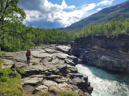
Starting from the northern trailhead at Kloten, the route leads through dense pine forests and alongside tranquil lakes. The section features well-trodden paths with occasional rocky stretches and passes through wilderness areas with few signs of civilization, offering a true immersion into the serene Bergslagen landscape.
Departing Gillersklack, the trail traverses a combination of hilly woodland terrain and open clearings. Expect stretches through managed forest and historic mining sites, ending at the mining town of Kopparberg, which provides opportunities for supplies and accommodation.
This stage takes hikers deeper into the Bergslagen forests, passing several lakes including Ljusnaren. The route is peaceful and predominantly flat but with the occasional rocky segment. Stjärnfors is notable for its mining heritage, with remnants visible along the path.
Continue through untouched woodlands rich with wildlife, passing marshy areas protected by well-maintained boardwalks. There are excellent opportunities for birdwatching in this scenic stretch leading to the small settlement of Nyberget.
This segment is highlighted by tranquil lakeshores and dense birch forests. The terrain is mixed but generally comfortable, with several rest points and wind shelters. Ljusnarsberg offers another look into the area's mining history.
The trail meanders through forested terrain broken by the occasional logging road. This stage is known for its peaceful surroundings and is punctuated by well-marked campsites near Löa.
Leaving Löa, hikers will encounter a roller-coaster of rolling hills and woodland valleys. There are several streams and beautiful lake vistas before reaching Åboda, which offers rustic shelters for overnight stops.
A relatively gentle segment, this stretch passes through mixed forests and meadows with the opportunity to explore the charming historic town of Nora. This is a good place for restocking supplies and enjoying a touch of culture.
Between Nora and Pershyttan, the trail traverses wooded hills and by scenic lakes. Upon arriving at Pershyttan, hikers can explore historical mining installations and traditional Swedish wooden buildings.
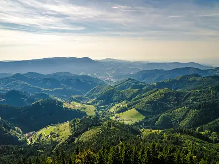
This segment moves through the southern woodlands of Bergslagen and climbs onto the southern edge of the Kilsbergen mountains. The route is undulating, with some steeper slopes and expansive forest views before arriving in Mogetorp.
Climbing further into the Kilsbergen ridge, this section features beautiful views from higher elevations and passes through wildlife-rich territory. Ånnaboda is a popular recreation area with facilities and lakeside scenery.
This leg features a mix of forest tracks and open terrain with panoramic viewpoints. The trail passes several wind shelters and offers ideal conditions for spotting local wildlife.
Between Suttarboda and Leken, hikers traverse undulating ground, often skirting the edge of swamps and forested hills. The trail is generally easy to follow, occasionally crossing peaceful streams.
This section leads hikers out of the northern sections of Kilsbergen, following dirt paths through evergreens and into open meadows near Hällsjön. Expect pastoral scenery and a tranquil rural atmosphere.
Now entering the renowned Tiveden region, the route becomes more rugged with moss-covered boulders, ancient forests, and the soothing remoteness of Sweden’s wilderness. Tivedstorp, a traditional forest village, is the destination.
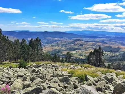
This spectacular segment explores the heart of Tiveden National Park, renowned for its dramatic rock formations, mystical forests, and crystal-clear lakes. The terrain is challenging with steep ups and downs, but the stunning scenery makes the effort worthwhile.
On this final day, the trail leads through the southern reaches of Tiveden National Park, winding past dramatic boulder fields and tranquil woodland lakes before reaching the official end point at Stenkällegården. Celebrate the completion of Bergslagsleden in this scenic locale, perfect for rest and reflection.
Reviews
How would you rate Bergslagsleden?
Tap a star to start your review — you could be the first.