Test Way
How would you rate Test Way?
Tap a star to share your experience and help other hikers.
Test Way: A Hampshire chalk-stream walk
HikeList Score
Test Way scored 85/100 on HikeList's trail-quality metrics.
See score breakdownHide breakdown
- Ideal length 78
- Balanced challenge 100
- Scenery & wildness 90
- Varied terrain 100
- Accommodation 83
- Food & support 54
- Path quality 84
- Season flexibility 100
Computed from length, challenge, scenery & wildness, terrain variety, accommodation, food & support, path quality and season flexibility.
The Test Way is a 71 km waymarked point-to-point walk through Hampshire, with its northern start just over the border in West Berkshire. Usually walked in about 4 days, it follows much of the River Test from Inkpen Beacon / Walbury Hill to Eling on Southampton Water. The route is moderate overall: hilly on the northern chalk downs, then gentler through river valley, farmland, woodland and tidal marsh. It suits walkers wanting a low-altitude England long-distance walk with villages, inns and rail-accessible endpoints.
Route Overview
The official direction is north to south: start at Inkpen Beacon / Walbury Hill car park in the North Wessex Downs and finish at Eling Tide Mill / Eling Wharf, by Totton near Southampton. The route can be walked either way, though Eling-to-Inkpen has slightly more total climb. Key places include Combe, Hurstbourne Tarrant, St Mary Bourne, Longparish, Wherwell, Chilbolton, Stockbridge, Mottisfont, Romsey, Totton and Eling. Rail connections are most useful via Romsey and Totton/Southampton at the south end, and Andover near the north, with buses shown through Traveline. For more gentle, low-level long-distance walking, compare with the Annandale Way, the Amber Valley Route or the Ashby Canal Trail.
History on the Test Way
The Test Way is a modern recreational route created and waymarked by Hampshire County Council, but it links a long chain of older sites. It begins near Walbury Camp, an Iron Age hillfort, and passes close to Danebury hillfort near Stockbridge. South of St Mary Bourne it crosses the prehistoric Harrow Way, and at Wherwell a Roman road from Winchester to Cirencester. Later layers include Mottisfont’s medieval priory, Romsey Abbey, and the Victorian Sprat and Winkle railway trackbed near the southern half of the walk.
Notable highlights
- Inkpen Beacon / Walbury Hill (297 m): The northern trailhead is the highest point in South East England and the highest chalk hill in England. It gives a strong start before the long descent towards the Test valley.
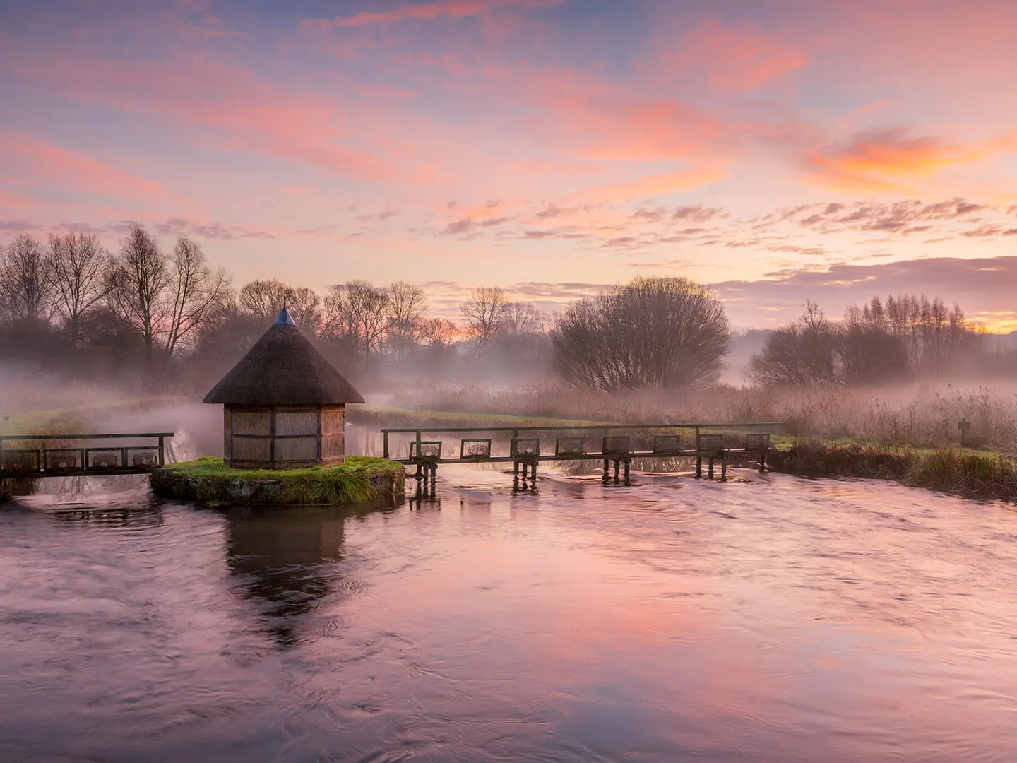
- The River Test (chalk stream and SSSI): The trail follows one of England’s best-known chalk streams, famous for clear water and trout fishing. Expect water meadows, riverside paths and wildlife-rich wet ground.
- Danebury hillfort (near Stockbridge): A large Iron Age hillfort dating from around the 6th century BC. Its ramparts and ditches are still visible and make a worthwhile nearby historical stop.
- Stockbridge (market town): A useful refreshment and resupply point with a wide high street and strong links to fly fishing on the Test.
- Mottisfont Abbey (National Trust property): A medieval Augustinian priory founded in 1201, later a country house. Walkers pass close to its riverside grounds and walled rose garden.
- Eling Tide Mill (southern finish): The route ends where the freshwater Test meets tidal water on Southampton Water. Eling Tide Mill is a rare working tide mill beside the historic wharf.
Challenges to expect
This is a gentle route for its length, with no technical or exposed ground. The main effort is front-loaded: the chalk-downland northern third is hilly, while the southern half is largely level. Water meadows can be wet or muddy after rain, so waterproof footwear helps outside dry spells. Navigation is straightforward with TW waymarks and OS green-diamond marking, but accommodation is concentrated in towns such as Stockbridge, Romsey and Totton.
HikeList Score
Test Way scored 85/100 on HikeList's trail-quality metrics.
See score breakdownHide breakdown
- Ideal length 78
- Balanced challenge 100
- Scenery & wildness 90
- Varied terrain 100
- Accommodation 83
- Food & support 54
- Path quality 84
- Season flexibility 100
Computed from length, challenge, scenery & wildness, terrain variety, accommodation, food & support, path quality and season flexibility.
 United Kingdom
 England
Show more data Show less
- River Valley
- Hills
- Woodland
- Farmland
- Wetland
- Dirt
- Gravel
- Grass
- Paved
- Hotels
- Inns
- B And B
- Family Friendly
- Pet Friendly
Photos from hikers
Taken on the trail by people who've reviewed Test Way.
Reviews
How would you rate Test Way?
Tap a star to start your review — you could be the first.