Ayrshire Coastal Path
How would you rate Ayrshire Coastal Path?
Tap a star to share your experience and help other hikers.
Ayrshire Coastal Path: A Practical Hiking Guide
HikeList Score
Ayrshire Coastal Path scored 90/100 on HikeList's trail-quality metrics.
See score breakdownHide breakdown
- Ideal length 100
- Balanced challenge 90
- Scenery & wildness 71
- Varied terrain 89
- Accommodation 100
- Food & support 88
- Path quality 98
- Season flexibility 89
Computed from length, challenge, scenery & wildness, terrain variety, accommodation, food & support, path quality and season flexibility.
The Ayrshire Coastal Path is a 161 km (100 mile) point-to-point walk along the Firth of Clyde coast in Scotland, usually hiked in about 7 days. It is a moderate long-distance trail from Glenapp Kirk near Ballantrae to Skelmorlie, with easy promenades and beaches balanced by rougher rocky-shore and exposed clifftop sections in the south. It suits hikers who want a coastal thru-hike with towns, rail links, sea views to Arran and a few tide-aware sections rather than sustained mountain climbing.
Route Overview
The route is usually walked south to north, starting at Glenapp Kirk near Ballantrae and finishing at Skelmorlie in North Ayrshire. Key places in order include Glenapp, Ballantrae, Lendalfoot, Girvan, Maidens, Dunure, Ayr, Troon, Irvine, Ardrossan, Portencross, Largs and Skelmorlie. It is a waymarked point-to-point trail, with ScotRail serving many Ayrshire coast towns and Wemyss Bay near Skelmorlie, plus Stagecoach buses; Glasgow Prestwick Airport is on the route. At the southern end it links with the Mull of Galloway Trail towards Stranraer and forms part of the International Appalachian Trail. For comparison, see the Arran Coastal Way, Berwickshire Coastal Path and Assynt Coastal Path.
A Volunteer-Built Scotland’s Great Trail
The Ayrshire Coastal Path was devised and built by the Rotary Club of Ayr, coordinated by retired GP Dr Jimmy Begg with volunteer Rotarians who surveyed the line, cleared scrub and built sections of path. The 100-mile route from Glenapp Kirk to Skelmorlie was officially launched on 28 June 2008. It is now designated one of Scotland’s Great Trails by NatureScot.
Notable highlights
- Ailsa Craig: A dome-shaped granite island 16 km offshore, visible for much of the southern route. Its rare blue hone microgranite is quarried for curling stones.
- Culzean Castle and Country Park: An 18th-century Robert Adam clifftop mansion set in a 260-hectare estate. The path runs through the grounds, making it one of the route’s major cultural stops.
- Dunure Castle: A ruined 13th-century clifftop stronghold of the Kennedy family overlooking the Firth of Clyde. It is passed on the stage between Maidens and Ayr.
- Robert Burns connections: The path passes through Ayr and close to Alloway, birthplace of poet Robert Burns. The Robert Burns Birthplace Museum preserves his cottage and places linked with “Tam o’ Shanter”.
- Electric Brae and Turnberry Lighthouse: Near Dunure the route passes the Electric Brae, a well-known gravity-hill optical illusion. The southern coast also gives long views towards Turnberry Lighthouse and the golf links.
- Firth of Clyde and Arran views: Much of the walk looks across the Firth of Clyde to the mountains of Arran, with seals, roe deer and seabirds commonly seen.
Challenges to expect
Expect a generally moderate coastal walk, not a mountain route, but do not treat it as all promenade. The harder sections are the rocky-shore scrambles between Girvan–Turnberry and Culzean–Ayr, plus exposed clifftop paths in the south. A few short tidal sections are impassable for about two hours around high spring tides. Accommodation is also sparse around Glenapp and Lendalfoot, so book or plan camps carefully.
HikeList Score
Ayrshire Coastal Path scored 90/100 on HikeList's trail-quality metrics.
See score breakdownHide breakdown
- Ideal length 100
- Balanced challenge 90
- Scenery & wildness 71
- Varied terrain 89
- Accommodation 100
- Food & support 88
- Path quality 98
- Season flexibility 89
Computed from length, challenge, scenery & wildness, terrain variety, accommodation, food & support, path quality and season flexibility.
 United Kingdom
 Scotland
Show more data Show less
- Coastal
- Clifftop
- Beach
- Sand
- Shingle
- Rock
- Field Path
- Farm Track
- Promenade
- Minor Road
- Hotels
- Guesthouses
- Hostels
- Campsites
- Wild Camping Spots
- Family Friendly
- Dog Friendly On Leash
- Restrooms
- Established Campsites
- Picnic Areas
- Public Transport Access Points
Download Our Full Guide to Ayrshire Coastal Path FREE!
Get our comprehensive guide to this hike for free. Save it for later reading or print out at home.
In these collections
Photos from hikers
Taken on the trail by people who've reviewed Ayrshire Coastal Path.
Ayrshire Coastal Path: The Complete Guide
 i
Image by Claire
i
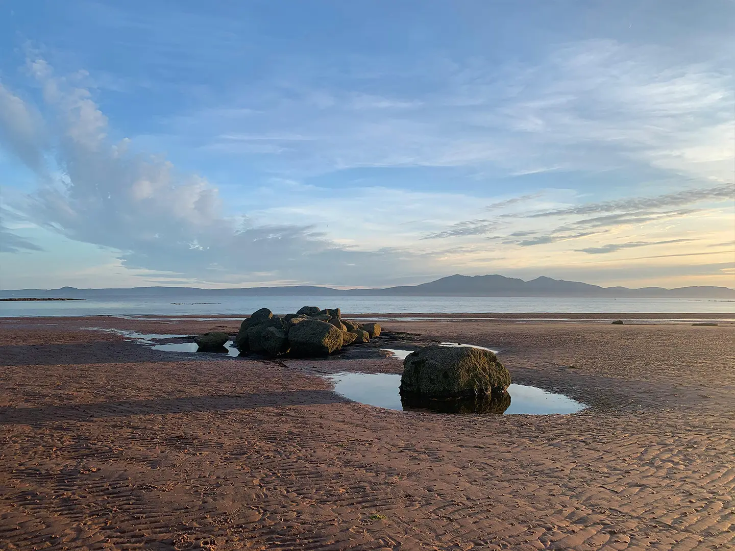
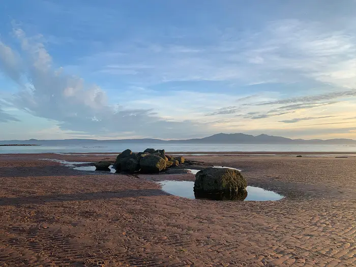
Image by Claire The Ayrshire Coastal Path is a 100-mile waymarked walk along Scotland’s Firth of Clyde, running from Glenapp near the Galloway border to Skelmorlie on the edge of Inverclyde. It suits walkers who want a proper long-distance coastal route with towns, rail links and sea views, rather than a remote mountain traverse.
The southern half gives the route its bite: moorland above Glenapp, rugged clifftops, rocky and shingle shore, and long views to Ailsa Craig. Around Turnberry, Culzean, Dunure and Greenan Castle, the walking mixes coastline, history and exposed ground that needs more care than a simple beach path.
North of Ayr the trail becomes gentler, with beaches, dunes, promenades and seafront paths through places such as Prestwick, Troon, Irvine, Ardrossan, Largs and on to Skelmorlie. The mountains of Arran sit across the Firth of Clyde for much of the way, making even the easier sections feel spacious.
This is a moderate trail, but not one to treat casually. The first days need careful accommodation planning, the Maidens–Ayr stretch includes tide-aware foreshore walking, and 161 km of mixed underfoot conditions still adds up even without major height gain.
This guide covers stages, day planning, accommodation, food, transport, terrain and the common mistakes to avoid.
Stage-by-Stage Guide
The 7-stage itinerary below groups the Ayrshire Coastal Path’s 12 official sections into practical walking days. The first four days, from Glenapp to Ayr, are the demanding half of the route: rougher going, more exposure, fewer services and the main tide-aware sections. North of Ayr the walking becomes more urban and beach-based, with stronger rail access and easier options for shortening a day.
Stage 1: Glenapp Kirk to Ballantrae — 16 km
This opening stage starts at Glenapp Kirk, where the Ayrshire Coastal Path is marked by an information board and links south with the Mull of Galloway Trail. It is immediately more remote than much of the rest of the route, crossing the higher, rougher southern ground before dropping towards Ballantrae.
Expect open moorland tracks, exposed coastal walking and less frequent shelter than on the later promenade sections. The route is waymarked, but this is not a day to rely only on signposts: carry mapping or a GPX file, especially in poor visibility or strong wind.
Food, water and accommodation are limited at the southern end. Glenapp has no railway access and accommodation around Glenapp and the early part of the route is sparse, so overnight plans before starting should be fixed in advance. Ballantrae is the first practical end point, but beds and eating options should still be booked rather than left to chance.
Public transport is the weak point of the whole trail here. Ballantrae and Glenapp are served by bus rather than rail, with access normally planned from Girvan or Stranraer; current bus times should be checked before travelling. Road access exists, but this is not one of the easy rail-based stages found farther north.
Navigation is generally straightforward in clear weather, but the combination of moorland, clifftop exposure and a remote start makes this a proper hill-and-coast day rather than a simple beach walk. Start with enough food and water for the full stage, and allow extra time if conditions are wet, windy or misty.
Stage 2: Ballantrae to Girvan — 21 km
The second stage continues through the rugged southern character of the Ayrshire Coastal Path, passing Lendalfoot before reaching Girvan. This is one of the stages where the coast feels wilder, with rough shore, shingle and rocky sections mixed with clifftop and field or track walking.
The ground around Bennane and Pinbain is among the more awkward parts of the route. Underfoot conditions can be slower than the distance suggests, particularly where the path uses rough shoreline or uneven coastal ground. The views across the Firth of Clyde towards Ailsa Craig are a major feature of this section.
Services are limited between Ballantrae, Lendalfoot and Girvan, so carry food and water from the start of the day. Lendalfoot provides a useful intermediate place on the official section structure, but the 7-day itinerary continues to Girvan to make use of the town’s transport and accommodation.
Girvan is one of the key southern bases on the trail, with hotels, guesthouses, food options and rail access on the Stranraer line. It is a sensible place to recover, resupply and reassess the next two more rugged days before the route reaches Ayr.
The path is signed, but pay close attention where the line leaves beaches, crosses rough foreshore or uses minor-road links. If weather or tides make a coastal section doubtful, check the current official route notes before committing to it.
Stage 3: Girvan to Maidens — 14 km
This is a shorter day by distance, but it is still part of the harder southern half of the trail. From Girvan the route heads north along the coast towards Turnberry and Maidens, with continuing views offshore to Ailsa Craig and across the Firth of Clyde.
The main landmark is the Turnberry coast. The path runs along the shore below Turnberry Lighthouse and crosses the famous Turnberry golf-course area, but it does not go right up to the lighthouse itself. Stay on the waymarked line through this sensitive, managed landscape and avoid straying onto playing areas.
Terrain is a mix of shore, tracks, paths and short linked sections rather than continuous promenade. It is easier than the roughest Glenapp–Ballantrae and Ballantrae–Girvan ground, but still needs proper footwear and attention to waymarking.
Girvan is the best place to start the day fully supplied. Maidens is a practical overnight stop on this itinerary, but accommodation should be booked ahead, especially because the following stage to Ayr is long and contains the most important tide-aware sections of the walk.
Girvan has rail access; transport from Maidens is more dependent on local buses and road access, so onward or fallback arrangements should be checked before travelling. This is a useful stage to keep deliberately short if arriving late into Girvan or if weather on the southern coast has delayed earlier walking.
Stage 4: Maidens to Ayr — 25 km
Maidens to Ayr is the longest and most committing stage in the rugged southern half of the route. It combines major landmarks with the route’s key tide-planning issue, so it should be treated as a full walking day rather than a casual coastal stroll.
The path runs through Culzean Castle and Country Park, the grandest cultural stop on the Ayrshire Coastal Path, before continuing towards Dunure. North of Dunure, the route approaches Ayr via the coastline south of the town, passing Greenan Castle near the mouth of the Doon. Alloway is close to this part of the route, with Robert Burns associations nearby.
Terrain varies constantly: woodland and estate paths around Culzean, clifftop and coastal paths, rougher foreshore sections, field paths and minor-road links. This is still within the official hard, rugged half of the trail, and the distance can feel longer than it looks on paper.
This stage includes the main tide-sensitive foreshore sections of the Ayrshire Coastal Path, around the official Maidens–Dunure and Dunure–Ayr sections. Some short sections are impassable for around two hours either side of high spring tide. Live tide tables and current route notes should be checked before walking this stage.
Food and water planning matters. Maidens, Culzean, Dunure and Ayr are the key named places on the day, but do not assume frequent services exactly when needed; start with enough supplies to cover the long middle of the stage. Ayr has the strongest end-of-day facilities, with a wide choice of accommodation, food and onward rail links.
Navigation is mostly helped by waymarking, but this is a day where timing, exits from the foreshore and any temporary diversions matter. If tides, weather or daylight are unfavourable, splitting the day around Dunure is the obvious way to make the stage more manageable.
Stage 5: Ayr to Irvine — 27 km
North of Ayr the trail changes character. This is a long day, but the walking is generally easier than the southern stages, using beaches, dunes, promenades and seafront paths with urban and semi-urban links through Prestwick, Troon and Barassie before reaching Irvine.
The stage is well suited to walkers who want flexibility. Ayr, Prestwick, Troon and Irvine are all served by the rail network, and Glasgow Prestwick Airport sits right on the route corridor, so there are several practical places to shorten, pause or restart the walk.
Underfoot, expect sand, promenade, dunes, seafront paths, tracks and short minor-road links. The main challenge is the distance rather than technical difficulty. Long beach sections can still be tiring, particularly if the sand is soft or the weather is exposed along the Firth of Clyde.
Food, water and accommodation are much easier to manage than in the far south. Ayr, Prestwick, Troon and Irvine provide the obvious resupply and overnight options, with Troon also a logical place to split the stage for a more relaxed 8- or 9-day itinerary.
Navigation is simpler than on the earlier rugged coastline, but care is still needed where the route threads through promenades, dunes, golf-course edges, road links and town seafronts. Follow the waymarks rather than simply walking the most obvious beach line, especially around urban exits and railway-side settlements.
Stage 6: Irvine to West Kilbride / Portencross — 22 km
This stage continues north through the more settled Ayrshire coast, passing Saltcoats and Ardrossan before heading on towards West Kilbride and Portencross. It combines town seafronts and easier coastal walking with a quieter finish near the point at Portencross.
The official section structure splits this part between Irvine–Ardrossan and Ardrossan–Portencross. On a 7-day itinerary it is a moderate-length stage, but the end point needs planning: West Kilbride gives inland access to services, while Portencross is the coastal landmark and the start of the next official section.
Expect beaches, promenades, paths, farm tracks, field paths and minor-road links rather than rugged cliff walking for most of the day. The route is generally easier than the Glenapp-to-Ayr stretch, though navigation becomes more important where coastal paths, town streets and field links interconnect.
Saltcoats and Ardrossan are useful mid-stage service points. Irvine and Ardrossan are also on the rail-served coastal corridor, making this a practical section for day walkers or anyone needing to shorten the itinerary. Transport for West Kilbride or Portencross should be checked before booking, especially if finishing at the coast rather than in town.
Portencross Castle is the key landmark at the northern end of the stage, a small restored castle on the point. Accommodation is less concentrated here than in the larger towns, so book ahead and be clear whether the night is in West Kilbride, Portencross or another nearby base.
Stage 7: West Kilbride / Portencross to Skelmorlie — 27 km
The final stage is one of the longer days of the 7-day schedule and is a little tougher again than the easy central promenade stages. From Portencross the route continues north below the Three Sisters cliffs, then passes Fairlie and Largs before finishing at Skelmorlie.
This section has some of the best northern views across the Firth of Clyde, with the Isle of Arran prominent across the water in clear conditions. Portencross Castle and the coastal cliffs give the stage a more dramatic start than the flatter Ayr–Irvine and Irvine–Ardrossan sections.
Terrain includes coastal paths, field or farm-track sections, beach or shore stretches, promenades and minor-road links. It is still a low-level coastal walk, but the distance, exposed shoreline and less uniformly urban character make it a serious final day.
Largs is the main service and accommodation centre on the stage and is also rail served. It is the obvious place to split the final day if a 27 km finish feels too long, or if transport arrangements make a late finish at Skelmorlie awkward.
The official finish is at an information board at the north end of Skelmorlie, on the boundary with Inverclyde. Wemyss Bay station is a short way beyond, with onward rail access and the ferry connection to Bute. Check current train times before relying on a same-day connection after finishing.
Navigation is usually straightforward where the route follows promenades and seafront paths, but keep an eye on waymarks around Portencross, Fairlie, Largs and the final approach to Skelmorlie. The end of the trail is not the same as the nearest railway station, so allow time and energy for the short onward walk to Wemyss Bay if using public transport.
Recommended Itinerary
The Ayrshire Coastal Path is officially split into 12 sections, but many end-to-end walkers group these into 7–9 walking days. The 7-day plan below is a practical, faster-paced itinerary using the main coastal towns and known accommodation hubs where possible.
This schedule is best for fit walkers who are comfortable with back-to-back days of 20–27 km, including rougher going in the southern half. The hardest planning is at the start: accommodation around Glenapp and Lendalfoot is limited, so the first two days should be arranged before committing to dates.
Standard 7-day itinerary
| Day | From | To | Approx. distance | Why this stage makes sense | Services/accommodation notes |
|---|---|---|---|---|---|
| 1 | Glenapp Kirk | Ballantrae | 16 km | A short first day, but one of the more rugged southern sections, with moorland and coastal walking rather than easy promenade. It also avoids trying to push too far from the remote southern start. | Glenapp is not a normal accommodation hub, so plan the start logistics carefully. Ballantrae has better onward options than Glenapp, but accommodation should still be booked ahead. There is no railway at Glenapp or Ballantrae; buses link this area with Girvan/Stranraer, but times should be checked before travelling. |
| 2 | Ballantrae | Girvan | 21 km | This combines the official Ballantrae–Lendalfoot and Lendalfoot–Girvan sections, keeping the itinerary efficient while reaching a much stronger overnight base. Expect more demanding coastal ground than the distance alone suggests. | Lendalfoot is a useful intermediate point but not a major accommodation base. Girvan is the first substantial town on the route and is a logical place to stay, resupply and use rail connections. |
| 3 | Girvan | Maidens | 14 km | A shorter day after the harder southern opening, with the route passing the Turnberry coast and golf links before reaching Maidens. This is a good place to avoid overloading the following Culzean/Dunure/Ayr stretch. | Girvan has rail and town services at the start. Maidens is a sensible overnight stop before the more rugged cliff-and-shore walking towards Ayr; book ahead rather than assuming availability. |
| 4 | Maidens | Ayr | 25 km | One of the key southern stages, taking in Culzean, Dunure and the approach towards Ayr. It is a long day with more rugged sections, and the foreshore parts in this area require tide awareness. | Ayr is one of the route’s strongest accommodation and transport hubs, with rail services and a wide choice of town facilities. Check live tide times for the Maidens–Dunure and Dunure–Ayr sections before fixing the day’s start time. |
| 5 | Ayr | Irvine | 27 km | A long but more straightforward central stage, using easier beach, dune, promenade and seafront walking through the Ayrshire towns north of Ayr. It groups the official Ayr–Troon and Troon–Irvine sections. | Ayr, Prestwick, Troon and Irvine all give useful services and transport options, so this is one of the easiest days to shorten if required. Irvine is a practical overnight base with rail access. |
| 6 | Irvine | West Kilbride / Portencross | 22 km | This keeps the northern half moving while linking Irvine with the Ardrossan and West Kilbride/Portencross area. The walking is generally easier than the southern clifftop stages, though there are still mixed surfaces and short linking sections. | Irvine, Saltcoats, Ardrossan and West Kilbride give better transport and service options than the exposed coastal stretches between them. Decide before booking whether the overnight will be in West Kilbride or around Portencross, and check official mapping for the exact finish point used. |
| 7 | West Kilbride / Portencross | Skelmorlie | 27 km | A long final day through the northern end of the route, including the Portencross–Largs and Largs–Skelmorlie sections. It is mostly coastal walking, with the West Kilbride/Portencross to Largs/Skelmorlie stretch a little tougher than the easy promenade sections further south. | Largs is the main service hub on the final day and a useful bail-out or overnight option. The trail finishes at Skelmorlie; Wemyss Bay station is a short way beyond and is the practical rail endpoint for many walkers. |
Slower 8–9 day variant
A slower itinerary suits walkers who want shorter days, more time at Culzean, Dunure, Ayr, Troon or Largs, or less pressure around the tide-affected southern foreshore sections. It is also the better choice if carrying camping kit or if accommodation availability forces shorter hops.
The most useful places to split the 7-day schedule are:
| Split | How to adapt it | Why it helps |
|---|---|---|
| Maidens to Ayr | Walk Maidens–Dunure and Dunure–Ayr as separate stages, using the official section split. Check official mapping before booking. | Reduces one of the more rugged southern days and gives more flexibility around tide timing. |
| Ayr to Irvine | Walk Ayr–Troon and Troon–Irvine as separate stages, using the official section split. Check official mapping before booking. | Turns the longest standard day into two easier coastal days, with good services and rail options in the towns. |
| Irvine to Skelmorlie | Break the northern end around Ardrossan, West Kilbride, Portencross or Largs depending on accommodation. Check official mapping before booking. | Useful if the final 27 km day from West Kilbride/Portencross to Skelmorlie feels too long, or if finishing transport from Skelmorlie/Wemyss Bay needs a more relaxed schedule. |
A 9-day plan normally feels much more forgiving than the 7-day version without changing the character of the walk. The trade-off is accommodation: the southern end still needs careful booking, and smaller coastal settlements should not be treated as guaranteed overnight stops.
Faster variant
The 7-day itinerary is already the fast end of a normal end-to-end plan for this trail. Going faster than this is not recommended as a default itinerary because it would mean combining already long days, including the rougher Glenapp-to-Ayr sections and the tide-aware foreshore stretches.
Very fit walkers using lightweight kit could plan a shorter crossing from current GPX data and official mapping, but distances, tide windows, transport links and accommodation would all need to be checked before booking. For most independent hikers, 7 days is the practical fast schedule; 8–9 days is the more comfortable choice.
Planning the Route
The main planning choice on the Ayrshire Coastal Path is not navigation, but how hard to make the days. The official route is divided into 12 sections, while many end-to-end itineraries combine these into 7 to 9 walking days based around the larger coastal towns.
A 7-day crossing is efficient but fairly demanding, with several days in the low-to-high 20 km range and some of the roughest ground packed into the southern half. Most walkers who want time for tide windows, weather delays and visits such as Culzean or Ayr will be better served by 8 or 9 days.
Choosing a pace
| Pace | Best for | Planning implications |
|---|---|---|
| 7 days | Fit walkers happy with long coastal days | Requires early starts, booked accommodation, and careful tide planning between Maidens, Dunure and Ayr. |
| 8–9 days | Most independent walkers | Gives more flexibility on the rugged southern sections and makes the long Maidens–Ayr and Ayr–Irvine stretches easier to split. |
| 10–12 days | Slower walkers, mixed groups, sightseeing itineraries | Closer to the official 12-section structure, with shorter days and more time in towns and villages. |
The route is better treated as two different walks. Glenapp to Ayr needs the most attention: accommodation is thinner, the going is rougher, and a few foreshore sections are affected by tide. Ayr to Skelmorlie is much easier to manage, with more frequent towns, beaches, promenades and rail-accessible exit points.
Direction and stage planning
The standard line starts at Glenapp Kirk and heads north to Skelmorlie. That direction works well because the route is waymarked north from Glenapp, and the later stages give more frequent transport options through Ayr, Prestwick, Troon, Irvine, Ardrossan, Largs and onwards to Wemyss Bay near the finish.
The awkward logistical point is the start. Glenapp and Ballantrae have no railway, so reaching the southern end normally means using buses from Girvan or Stranraer; current times should be checked before travelling. Accommodation is also sparse around Glenapp and Lendalfoot, so the first one or two nights should be fixed before setting the rest of the itinerary.
Daily stages are naturally dictated by settlements rather than campsites or mountain passes. Girvan, Ayr, Troon, Irvine, Ardrossan, Largs and the other larger coastal towns are the easiest places to build an itinerary around, while smaller places such as Lendalfoot, Maidens, Dunure, Portencross and Fairlie need more careful checking for accommodation and food.
Where to add an extra day
If turning a 7-day itinerary into an easier 8- or 9-day plan, the best places to split are the longer or more complicated days rather than the easy promenade sections.
The Maidens to Ayr stretch is the first obvious candidate. It includes Culzean, Dunure and the approach to Ayr, and sits within the rougher southern half of the walk, so a shorter day here gives more margin for tide, weather and time off the trail.
Ayr to Irvine is another good place to divide. It is less rugged than the southern cliffs, but it is a long day on a route where sand, promenade and minor-road links can still become tiring over distance.
The final West Kilbride / Portencross to Skelmorlie day is also long in a 7-day schedule. If using accommodation around West Kilbride, Portencross, Fairlie or Largs, check exactly where the bed is in relation to the coast path before booking, as small detours at the end of a long day matter.
Accommodation strategy
Book the southern end first. The Glenapp, Ballantrae and Lendalfoot area is the thinnest part of the route for beds, and leaving this loose can force an awkward taxi, bus link or overlong day.
From Girvan northwards, planning becomes easier, especially around Ayr, Prestwick, Troon, Irvine, Ardrossan and Largs. Hotels, guesthouses, B&Bs, hostels and campsites are found in the larger towns, but availability and seasonal opening should still be checked before travelling.
Wild camping is possible in Scotland under access rights, but this does not remove the need to plan carefully. Much of the path passes through farmland, beaches, golf-course margins, country-park land, towns and seafront areas, so camping discreetly, arriving late, leaving early and avoiding enclosed or sensitive ground is essential.
Food and water
Do not assume every village has reliable day-to-day supplies. The route passes many settlements, but small-shop, café and pub hours can be seasonal or limited, especially outside summer and away from the larger towns.
Carry enough food and water for the full walking day on the southern stages, particularly between Glenapp, Ballantrae, Lendalfoot, Girvan, Maidens and Dunure. North of Ayr, resupply is generally easier because the path passes through or close to larger towns with stronger transport and services.
Refill at accommodation, cafés and town facilities where available rather than relying on untreated natural water. This is a coastal route with farmland and settlements, so carrying sufficient drinking water is simpler and safer than filtering opportunistically.
Tides and weather
The main tide issue is on the southern half, especially the Maidens–Dunure and Dunure–Ayr sections. A few foreshore sections are impassable for around two hours either side of high spring tide, so live tide times and current route notes should be checked before walking those stages.
Do not treat the path as a simple beach walk. The southern third includes exposed clifftop paths, rocky or shingle shoreline and open moorland tracks, where wind, rain and poor visibility can slow progress.
The northern half is usually more forgiving underfoot, but long beaches, dunes and promenade walking still take time. Strong coastal wind can make even flat stages feel slower than their distance suggests.
Navigation and variants
The Ayrshire Coastal Path is waymarked, but a map or GPX is still worth carrying. Waymarks are helpful for routine progress, not a substitute for knowing where to go if a sign is missed, a beach exit is unclear, or a temporary diversion is in place.
The official core route is the figure to use when planning an end-to-end schedule. Signed historic detours can increase the total to around 106 miles, so decide in advance whether these are part of the itinerary rather than adding them casually to already long days.
Current diversions should be checked before travelling. This is particularly important on coastal paths, where erosion, estate works, golf-course routing, storm damage or local access changes can affect the signed line.
Section hiking and shortening the route
Section hiking is very practical for much of the Ayrshire Coastal Path. ScotRail serves many of the towns along or near the route, including Girvan, Ayr, Prestwick, Troon, Irvine, Ardrossan and Largs, with Wemyss Bay station a short way beyond Skelmorlie.
The far southern start is the exception. Glenapp and Ballantrae rely on bus access rather than rail, so single-day or weekend sections here need more careful transport planning than the central and northern parts.
Shortening an end-to-end walk is easiest from Girvan northwards, where rail-served towns provide straightforward exit points. If time is limited, the gentler Ayr-to-Skelmorlie half is simpler logistically, while the Glenapp-to-Ayr half gives the more rugged and committing coastal walking.
Towns, Villages and Overnight Stops
Accommodation planning on the Ayrshire Coastal Path is uneven. The central and northern coast has frequent towns, railway stations and services, but the southern start around Glenapp and Lendalfoot is sparse enough that the first night or two should be fixed before travelling.
For a fast 7-day walk, the practical overnight hubs are usually Ballantrae, Girvan, Maidens, Ayr, Irvine, West Kilbride / Portencross, then Skelmorlie or nearby Wemyss Bay. Walkers taking 8–9 days have more flexibility, especially by splitting the longer Maidens–Ayr and Ayr–Irvine stages.
| Place | Best use for walkers | Practical notes |
|---|---|---|
| Glenapp | Start logistics only | Very limited accommodation and services; plan access carefully. |
| Ballantrae | First overnight stop | Useful after the first rugged section from Glenapp. No railway. |
| Lendalfoot | Possible split point | Sparse services; not a reliable overnight base without booking ahead. |
| Girvan | Strong overnight and resupply stop | Railway, accommodation and town services. |
| Maidens | Useful overnight stop before Culzean / Dunure / Ayr | Smaller than Girvan or Ayr; book ahead. |
| Ayr | Major accommodation, food and transport hub | Best full-service stop on the southern half. |
| Irvine | Major overnight and transport hub | Good target after the long Ayr–Irvine day. |
| West Kilbride / Portencross | Final-night area before Largs / Skelmorlie | Accommodation choice is more limited than in larger towns. |
| Largs | Strong northern accommodation and transport hub | Useful alternative to stopping at Skelmorlie. |
| Skelmorlie / Wemyss Bay | Finish logistics | Wemyss Bay station is a short way beyond the trail end. |
Glenapp
Glenapp is the southern trailhead, with the start marked by an information board at Glenapp Kirk. It is not a natural overnight hub for most walkers: accommodation and services are sparse, and there is no railway at the start.
Most hikers should arrive ready to walk, with food and water sorted before reaching Glenapp. Access is by bus from the Girvan / Stranraer side rather than by train; current bus times should be checked before travelling.
Ballantrae
Ballantrae is the first practical stopping point north of Glenapp and the end of the opening 16 km stage in the fast itinerary. It is a sensible first overnight stop because the Glenapp–Ballantrae section is one of the rougher early parts of the route.
Accommodation is not as plentiful as in Girvan, Ayr or Troon, so booking ahead is important. There is no railway here; onward and access travel relies on local bus links, which should be checked before travelling.
Lendalfoot
Lendalfoot sits between Ballantrae and Girvan on the second official section. It can be useful for walkers wanting to shorten the Ballantrae–Girvan day, but it should not be treated as a guaranteed service stop.
Accommodation and facilities are sparse in this part of the coast. Anyone planning to stop here should have a firm booking and should not rely on finding food, supplies or onward transport on arrival without checking in advance.
Girvan
Girvan is the first strong full-service trail town after the southern start. It is the end of the Ballantrae–Girvan day in the 7-day itinerary and a good place to reset after the rugged early stages.
Expect a much better range of accommodation, food and resupply options than at Glenapp, Ballantrae or Lendalfoot. Girvan is also on the rail network, making it a useful access point for section walkers and for anyone starting the route after the most remote southern approach.
Turnberry
Turnberry lies on the Girvan–Maidens section, where the path follows the shore below Turnberry Lighthouse and crosses the golf-course area. It is more of a route feature than a standard long-distance walking stop.
Do not assume there will be walker-friendly budget accommodation or easy resupply here. Most walkers will continue between Girvan and Maidens, using Turnberry as a landmark rather than an overnight base.
Maidens
Maidens is a useful overnight stop between Girvan and Ayr, especially on the common 7-day schedule where it breaks the southern half into manageable stages. It is also well placed before the route through Culzean and onwards towards Dunure and Ayr.
It is smaller than the main towns, so accommodation should be booked ahead, particularly in busy walking months. Food options and local services should be checked before committing to a late arrival.
Culzean
Culzean is passed between Maidens and Dunure as the path runs through Culzean Castle and Country Park. It is an important daytime stop rather than a primary resupply or overnight hub.
Walkers should plan food and accommodation around Maidens, Dunure or Ayr rather than assuming Culzean will solve end-of-day logistics. Opening times, access arrangements and any route notes through the estate should be checked before travelling.
Dunure
Dunure sits between Maidens and Ayr and is a useful intermediate point on one of the more demanding southern stretches. It is well placed for walkers who want to split the long Maidens–Ayr day.
Accommodation and food options are more limited than in Ayr, so advance booking matters if staying overnight. This section also includes tide-aware coastal walking nearby, so stage timing should be planned with live tide tables, especially around high spring tides.
Alloway (near)
The route goes through Ayr and close to Alloway, Robert Burns country south of the town. For most walkers, Alloway is a short detour or local-interest stop rather than a separate overnight base.
Ayr is the practical place to stay, eat, shop and connect with public transport. If visiting the Robert Burns Birthplace Museum or other Alloway sites, allow extra time beyond the walking stage.
Ayr
Ayr is one of the key logistical hubs on the whole trail. It marks the shift from the harder southern coastal sections into the gentler central and northern stretches, and it is the obvious overnight stop after Maidens or Dunure.
Accommodation choice is broad by trail standards, with hotels, guesthouses, B&Bs, hostels and campsites available in larger coastal towns such as Ayr. Food, shops and public transport are also much stronger here than on the southern approach.
Ayr has rail connections and is useful for section hikers. It is also a sensible place to re-check the next day’s plan, as the Ayr–Irvine stage in the fast itinerary is long.
Prestwick
Prestwick lies north of Ayr on the Ayr–Troon section. It is useful for food, short-stage planning and public transport, and Glasgow Prestwick Airport is directly on the route corridor.
Prestwick can work as an overnight stop if splitting the Ayr–Irvine day, although many through-walkers continue to Troon or Irvine. Rail services run through Prestwick, but current train times should be checked before relying on them for a section break.
Troon
Troon is a strong central-coast stopping point between Ayr and Irvine. It is one of the larger service towns on the route and works well for walkers who want to split the long Ayr–Irvine stage.
Accommodation, food and town services are generally better here than in the smaller villages. Troon is also named among the route’s rail-served towns, making it a useful point for joining, leaving or shortening the walk.
Barassie
Barassie lies close to Troon on the central part of the route. For most long-distance walkers it functions as part of the Troon area rather than as a separate overnight decision.
Use Troon for accommodation and services unless a specific booking has been arranged in Barassie. Public transport availability in the immediate Barassie area should be checked before planning a start or finish there.
Irvine
Irvine is the main target at the end of the Ayr–Irvine day in the fast itinerary. It is a practical overnight hub with better services than the smaller settlements immediately before and after it.
The town is on the rail network and is a useful place for section walkers. It is also a sensible resupply point before continuing north towards Ardrossan, West Kilbride and Portencross.
Saltcoats
Saltcoats lies north of Irvine on the approach towards Ardrossan. It can be useful for food, local services or shortening the Irvine–Ardrossan part of the route.
Treat it as part of the well-settled central Ayrshire coast rather than a remote stop. If using it as a stage end, check accommodation and transport details before travelling.
Ardrossan
Ardrossan is a practical town on the Irvine–Portencross part of the route. It is named among the rail-served towns on the Ayrshire Coastal Path, so it works well for section access and exit.
It can be used as an overnight stop if the Irvine–West Kilbride / Portencross stage is being split. Accommodation and food options should still be checked in advance, especially if arriving late after a long day.
West Kilbride
West Kilbride is one of the usual final-night options before the northern finish, often paired with Portencross in itineraries. It is useful because the onward stage to Skelmorlie is long enough that most walkers will want a planned base rather than improvising.
Accommodation availability is more limited than in the largest coastal towns, so book ahead. It is also a practical alternative to staying right on the coast at Portencross if rooms there are unavailable.
Portencross
Portencross is a memorable coastal stop near Portencross Castle and the Three Sisters cliffs, on the northern section before Fairlie and Largs. It is a good position for a final walking day to Skelmorlie, but it is not a large service centre.
Treat accommodation and food as limited and book before committing to an overnight stop. If staying elsewhere, Portencross still makes a useful landmark and rest point on the way north.
Fairlie
Fairlie lies between Portencross and Largs on the later northern stage. It is useful as a route point and possible break before Largs, especially if the weather or pace makes the final day slower than expected.
Do not assume it has the same accommodation depth as Largs. If planning to finish or stay here, check current transport, food and accommodation details before travelling.
Largs
Largs is the strongest northern accommodation and service hub before the finish. It is a good overnight stop for walkers who prefer not to base themselves at West Kilbride, Portencross or Skelmorlie.
The town has rail connections and a broader range of food and accommodation than the smaller places immediately north and south. It is also a practical place to stop if splitting the final West Kilbride / Portencross–Skelmorlie stage into shorter days.
Skelmorlie
Skelmorlie is the official northern finish, with the trail ending at an information board at the north end of the village on the boundary with Inverclyde. It is the place to complete the route, but it is not as convenient a transport finish as Wemyss Bay.
Accommodation and food options should be checked before relying on Skelmorlie for the final night. Many walkers will continue a short way to Wemyss Bay for rail connections.
Wemyss Bay (near)
Wemyss Bay is not the official trail finish, but it is the practical transport extension beyond Skelmorlie. Wemyss Bay station is a short way on from the northern end, and the ferry to Bute also operates from here.
For end-of-walk logistics, Wemyss Bay is often more useful than stopping exactly at the final information board. Train and ferry times should be checked before travelling, particularly if planning a same-day connection after finishing the trail.
Getting to the Start
The Ayrshire Coastal Path starts at Glenapp Kirk, near Ballantrae, where the southern information board marks the start of the waymarked route. This is the most awkward transport point on the whole trail: Glenapp and Ballantrae have no railway, so most walkers approach by rail to Girvan or Stranraer, then continue by bus or pre-booked taxi.
By train
There is no station at Glenapp or Ballantrae. The practical railheads for the start are Girvan, to the north, and Stranraer, to the south, both on ScotRail’s Stranraer line.
From either railhead, continue to Ballantrae or Glenapp by bus or taxi. Timetables on the Stranraer line and onward buses should be checked together before committing to same-day travel to the start, especially if arriving late in the day. This should be checked before travelling.
For walkers coming from the Central Belt, the usual approach is to use ScotRail services towards Ayrshire and the Stranraer line, then connect onwards. The northern end is much easier by rail than the southern start, so public transport generally works best if the car is left out of the plan and the return is made from Wemyss Bay station after finishing.
By bus
Ballantrae and Glenapp are served by bus, but this is the thin public-transport section of the route. The normal approach is to connect from Girvan or Stranraer, rather than expecting frequent services from every direction.
Stagecoach West Scotland operates in the area, with buses filling the gap where the railway does not reach. Exact stops, times and whether a service suits the Glenapp Kirk start should be checked against current timetables before travelling. This should be checked before travelling.
If the bus only gets you as far as Ballantrae, allow for the extra logistics of reaching Glenapp Kirk before starting the walk. A pre-booked taxi from Girvan, Stranraer or Ballantrae is the safer fallback if the bus times do not line up cleanly with your first walking day.
By car
Driving to Glenapp Kirk is possible, but it creates the usual point-to-point problem: the walk finishes far to the north at Skelmorlie, with Wemyss Bay station a short way beyond. Unless someone is collecting the car, returning to the start at the end adds an unnecessary transport complication.
Do not assume long-stay parking is available at Glenapp Kirk or beside the start information board. Parking arrangements at the southern start should be checked locally before leaving a vehicle for several days. This should be checked before travelling.
A more practical car-based plan is often to leave the vehicle at an accommodation base or a suitable town on the rail corridor, then use train, bus or taxi to reach the start. Any long-stay parking should be agreed in advance with the accommodation provider or car park operator.
From the nearest airport
Glasgow Prestwick Airport is directly on the Ayrshire coast and close to the trail corridor, making it the most relevant airport for this route. From there, continue by rail or local transport towards Ayr, Girvan or the Stranraer line, then connect onwards to Ballantrae or Glenapp by bus or taxi.
This airport is much more convenient for the central part of the route than for the exact southern start. If arriving by air and planning to walk north from Glenapp, build in time for the onward transfer and check the final bus or taxi leg before booking flights. This should be checked before travelling.
Where to stay before starting
Accommodation is genuinely sparse around Glenapp and the southern end of the route, so the night before day one needs more care than later nights in Girvan, Ayr, Troon, Largs and the other larger coastal towns. Book early if aiming to stay in or near Ballantrae.
Girvan is often the more practical pre-walk base because it has a railway station and more services than the immediate start area. From Girvan, arrange the onward bus or taxi to Glenapp Kirk for the morning start.
If staying in Stranraer before starting, plan the transfer north to Glenapp in the same way: check the bus times first and pre-book a taxi if the connection is weak. The first day from Glenapp to Ballantrae is not the place to lose time through uncertain transport, especially in poor weather or outside long summer daylight hours.
Getting Home from the Finish
The Ayrshire Coastal Path finishes at the information board at the north end of Skelmorlie, on the boundary with Inverclyde. The most useful onward transport point is Wemyss Bay station, a short way beyond the finish, so most walkers should plan the final day around reaching either Skelmorlie itself or continuing on to Wemyss Bay for the train.
By train
Wemyss Bay station is the key railhead for the northern finish. It is close enough to be the natural public-transport exit from Skelmorlie, and it is also the place to aim for if arranging an onward rail journey after completing the trail.
Check current ScotRail times before committing to a same-day connection, especially on Sundays, public holidays or if finishing late. If the final stage has taken longer than expected, it may be safer to stay locally or arrange a taxi rather than relying on the last train.
Wemyss Bay also has a ferry connection to Bute, but for most Ayrshire Coastal Path walkers the station is primarily useful as the way back into the rail network. Timetables and onward connections should be checked before travelling.
By bus
Buses operated by companies such as Stagecoach West Scotland and McGill’s help fill gaps along the Ayrshire coast, including places not directly served by rail. Around the finish, bus travel can be useful for short local movements or for reaching a larger town if rail times do not suit.
Do not assume late-evening frequency. Bus times, routes and stopping points are timetable-dependent and should be checked before travelling, particularly if the final day is being walked as a long West Kilbride / Portencross to Skelmorlie stage.
By car/taxi
For a pick-up, arrange a clear meeting point in advance: either the finish information board at the north end of Skelmorlie or Wemyss Bay station. Wemyss Bay is often the simpler rendezvous because it is a recognised transport point and avoids ambiguity at the end of the trail.
A taxi is the practical fallback if the train or bus connection has been missed, but late-day availability should not be taken for granted. Pre-booking is sensible if finishing in the evening, walking in poor weather, or needing to reach accommodation in Largs, Wemyss Bay or another nearby coastal town.
Drivers should remember that this is a point-to-point trail. Leaving a car at Skelmorlie only solves the finish logistics; anyone starting at Glenapp will still need a separate plan for reaching the southern trailhead.
From the nearest airport
Glasgow Prestwick Airport is the airport most directly associated with this trail, as it sits on the Ayrshire coast route at Prestwick. From the finish, use Wemyss Bay station or local bus connections to join the wider public-transport network, then plan the onward journey to the airport around live train and bus times.
Do not book a tight flight connection from the same afternoon as the final stage unless the transport chain has been checked carefully. The last day can be long on a 7-day itinerary, and delays from weather, tiredness or missed public transport are easy to underestimate.
Where to stay at the finish
If finishing late, staying overnight near the northern end is often the most relaxed option. Largs is the main larger coastal town close to the final stretch, with the sort of accommodation base walkers are more likely to need at the end of a long-distance walk.
Skelmorlie and Wemyss Bay are useful for the finish and transport, but accommodation choice should be checked before relying on them. Book ahead in busy periods, and keep Wemyss Bay station in mind when choosing where to stay so the next morning’s onward journey is straightforward.
Which Direction Should You Walk?
The standard and most natural direction is south to north, from Glenapp Kirk to Skelmorlie. The route is signed north from Glenapp, the official section order runs Glenapp–Ballantrae through to Largs–Skelmorlie, and this direction fits the way most itineraries are described.
Reverse walking is perfectly possible on a waymarked coastal trail, but it changes the logistics. The main trade-off is simple: northbound walkers tackle the rougher southern stages first and finish with easier transport, while southbound walkers start with better transport and finish in the most awkward part of the route.
South to north: Glenapp to Skelmorlie
This is the best direction for most walkers. The far southern start is the least convenient access point, with no railway at Glenapp or Ballantrae, so reaching Glenapp by bus from Girvan or Stranraer is best dealt with at the beginning while plans are fresh and arrival times can be controlled.
The walking is also front-loaded. The sections from Glenapp to Ayr include the rougher clifftop, moorland, shingle and rocky-shore walking, plus the tide-aware foreshore sections between Maidens, Dunure and Ayr. After Ayr, the route becomes generally easier, with more beaches, promenades, towns and rail links through places such as Prestwick, Troon, Irvine, Ardrossan and Largs.
The finish works well psychologically and logistically. Reaching the information board at the north end of Skelmorlie gives a clear end point, and Wemyss Bay station is a short way beyond for onward travel.
North to south: Skelmorlie to Glenapp
Walking southbound can make sense if transport to the start is the priority. Wemyss Bay station sits close to the northern end, and the route quickly links into the rail-served Ayrshire coast towns.
The downside is that the walk gets harder as it goes on. The rugged southern sections, sparse accommodation around Glenapp and Lendalfoot, and the bus-only exit from the Ballantrae/Glenapp end all come at the end of the trip. That can be awkward if tired legs, bad weather or missed connections affect the final day.
Southbound walkers should be especially disciplined with accommodation and exit planning for the last two days. Glenapp is not a finish where it is sensible to rely on improvising transport or a bed at short notice.
Direction comparison
| Factor | South to north | North to south |
|---|---|---|
| Waymarking and route order | Fits the signed start at Glenapp and the official section sequence | Possible, but against the usual described order |
| Transport logistics | Awkward access dealt with first; easier rail exit near Wemyss Bay | Easy start near Wemyss Bay; awkward bus-only finish at Glenapp/Ballantrae |
| Terrain flow | Harder southern coast first, easier northern towns and promenades later | Gentler start, tougher and more remote-feeling finish |
| Accommodation flow | Sparse southern accommodation must be fixed early in the itinerary | Sparse southern accommodation becomes a final-stage risk |
| Tides | Still requires live tide checks for the Maidens–Dunure–Ayr foreshore sections | Same; direction does not remove the tide constraint |
| Finish appeal | Clear northern finish at Skelmorlie with onward travel close by | Quieter southern finish at Glenapp, but less convenient onward travel |
Weather and wind
Do not choose the direction mainly for wind. This is an exposed Firth of Clyde coastal route, so conditions can affect either direction depending on the forecast, especially on the southern clifftops and rocky-shore sections.
Check the short-range forecast before committing to exposed days, and always check live tide times for the foreshore sections south of Ayr. Direction will not make those sections safe around high spring tide.
Recommendation
Walk the Ayrshire Coastal Path south to north, from Glenapp Kirk to Skelmorlie. It matches the standard route description, gets the roughest and least flexible logistics out of the way early, gives an easier transport finish near Wemyss Bay, and lets the walk settle into the more forgiving rail-linked coast after Ayr.
Accommodation Along the Route
Accommodation is one of the main planning constraints on the Ayrshire Coastal Path. The route works well as an inn-to-inn walk through the larger coastal towns, but the far southern start and a few smaller villages need careful booking rather than a turn-up-and-find-something approach.
The strongest overnight bases are Girvan, Ayr, Prestwick, Troon, Irvine, Ardrossan and Largs, where walkers are most likely to find a mix of hotels, guesthouses, B&Bs and self-catering options. Smaller places such as Glenapp, Lendalfoot, Maidens, Dunure, Portencross, Fairlie and Skelmorlie are more limited and should not be relied on without a booking.
Best Overnight Stops
For a fast 7-day itinerary, the practical accommodation hubs are usually Ballantrae, Girvan, Maidens, Ayr, Irvine, West Kilbride or Portencross, and Skelmorlie or nearby Wemyss Bay. This keeps the route broadly aligned with the longer official sections while still ending most days somewhere with at least some services nearby.
Walkers wanting shorter days have more flexibility from Ayr northwards because the coast is better served by towns, rail stations and seafront settlements. The harder section to soften is the southern third, especially around Glenapp, Ballantrae, Lendalfoot and the approach to Girvan, where accommodation and transport are both thinner.
| Place | Accommodation level | Best for | Notes |
|---|---|---|---|
| Glenapp | Limited | Start positioning only | The trail starts at Glenapp Kirk, not in a major accommodation centre. Many walkers will need to stay elsewhere and arrange transport to the start. This should be checked before travelling. |
| Ballantrae | Limited | First overnight stop after Glenapp | A useful end to the first stage, but choice is limited compared with Girvan or Ayr. Book ahead, especially if committing to a 7-day schedule. |
| Lendalfoot | Limited | Breaking up Ballantrae to Girvan | Useful for shorter itineraries, but not a strong accommodation hub. Check availability before designing a stage around it. |
| Girvan | Good | Reliable southern hub | One of the key overnight towns on the southern half, with better accommodation choice and rail access than the villages to the south. |
| Turnberry | Limited | Splitting Girvan to Maidens | Possible as a stage break area, but accommodation should be checked early rather than assumed. |
| Maidens | Limited | Overnight before Culzean and Dunure | A practical stop on many itineraries, but smaller than Girvan or Ayr. Book ahead. |
| Culzean | Limited | Daytime route landmark | Better treated as a route feature than a default overnight base unless accommodation is specifically booked nearby. |
| Dunure | Limited | Splitting Maidens to Ayr | Useful for avoiding a long day into Ayr, but limited. This is also in the more rugged southern half, so accommodation timing matters. |
| Ayr | Good | Major restock, rest day or flexible overnight | One of the best accommodation bases on the trail, with a broad range of services and onward transport. A good place to build in flexibility. |
| Prestwick | Good | Alternative to Ayr or Troon | Well placed on the gentler central coast and useful for adjusting stage lengths between Ayr and Troon. |
| Troon | Good | Comfortable mid-route stop | Stronger choice than the smaller villages and useful for walkers splitting the long Ayr to Irvine stage. |
| Barassie | Limited | Shortening Ayr/Troon/Irvine stages | Close to larger accommodation centres, but not usually the main overnight target. |
| Irvine | Good | Main northern-half hub | A practical overnight stop with good transport links and services before continuing towards Ardrossan and West Kilbride. |
| Saltcoats | Good | Alternative stop between Irvine and Ardrossan | Useful if adjusting the Irvine to Ardrossan/West Kilbride section. |
| Ardrossan | Good | Stage break before West Kilbride/Portencross | A practical hub on the northern half and a good option if avoiding a long push to West Kilbride or Portencross. |
| West Kilbride | Limited | Overnight before the final northern stretch | A useful inland/near-coast staging point for the Portencross and Largs section, but check availability before relying on it. |
| Portencross | Limited | Scenic stage break | Accommodation is limited, and it should not be treated as a guaranteed overnight stop. Consider West Kilbride, Ardrossan, Largs or transfers if needed. |
| Fairlie | Limited | Shortening the approach to Largs | Useful for adjusting the final section, but accommodation choice is more limited than in Largs. |
| Largs | Good | Strong final-night or penultimate hub | One of the better accommodation centres on the northern end of the trail, with good services before the final walk to Skelmorlie. |
| Skelmorlie | Limited | Official finish | The trail ends at Skelmorlie, but accommodation is not as strong as in Largs or nearby Wemyss Bay. Check options before planning to stay at the finish. |
| Wemyss Bay | Limited | Finish logistics | A short way beyond the Skelmorlie finish and useful for onward transport. Accommodation should still be checked before travelling. |
Booking Strategy
Book the southern end first. Glenapp, Ballantrae and Lendalfoot are the awkward part of the route, and the first two days are not where most walkers want uncertainty over beds, food or onward transport.
Ayr, Troon, Irvine and Largs give much more flexibility, so they are the easiest places to anchor an itinerary. They also work well for rest days, bad-weather adjustments and section hiking because the rail network is stronger from Ayr northwards.
For a 7-day schedule, book every night in advance. The itinerary includes some long days and does not leave much room to walk on spec to the next town if a room is unavailable.
In spring, summer and early autumn, weekend and holiday demand can tighten availability in the coastal towns. This is particularly relevant in smaller places such as Maidens, Dunure, Portencross and Skelmorlie, where a small number of rooms can disappear quickly.
Using Transfers to Solve Awkward Gaps
Taxi or pre-arranged transfer legs can make the route much easier, especially at the far southern start and around limited-accommodation villages. A common tactic is to stay in a stronger hub such as Girvan or Ayr and arrange transport back to the start or end of a stage.
This is most useful for Glenapp, Ballantrae, Lendalfoot, Maidens, Dunure and Portencross, where the route is worth walking but overnight choice is thinner. Any taxi, baggage or accommodation shuttle arrangement should be booked in advance; this should be checked before travelling.
Luggage transfer may be possible through walking-holiday arrangements, but coverage should be confirmed for the full trail before relying on it. Pay particular attention to whether bags can be collected or delivered at Glenapp, Portencross and other smaller settlements.
Camping and Wild Camping
The accommodation mix includes campsites in larger coastal towns, but availability and seasonal opening vary. If camping is central to the plan, check each intended stop before setting off rather than assuming every town has a convenient pitch.
Wild camping may be possible under Scottish access rights, but this does not remove the need for careful route planning. The Ayrshire Coastal Path passes through towns, golf-course areas, beaches, farmland, country parks and seafront promenades, so legal and low-impact camping opportunities are not evenly spread along the route.
Campers should be especially cautious on the southern stages, where the walking is rougher and tide timing can affect the foreshore sections between Maidens, Dunure and Ayr. Do not plan a late finish onto an uncertain camp spot in these sections without a clear fallback.
Camping and Wild Camping
Camping is possible on the Ayrshire Coastal Path, but it needs more planning than the map may suggest. This is a coast-and-town route with long settled stretches, working farmland, golf links, promenades, managed estates and rough shoreline, so a tent is not automatically easier than using B&Bs and hotels.
The route suits lightweight, self-sufficient campers best. It is less well suited to large tents, late starts, or relying on finding a pitch wherever the day happens to end.
Campsites and formal camping
There are campsites in or near some of the larger coastal towns, including places such as Girvan, Ayr, Troon and Largs, with other options along the coast. Exact sites, opening dates, prices and whether they accept backpacking tents should be checked before travelling.
Formal campsites are the simplest option on the busier central and northern parts of the trail, where the path passes beaches, dunes, promenades and seafront towns. Booking ahead is sensible in summer, especially around weekends and school holidays.
The awkward area for camping logistics is the far south around Glenapp, Ballantrae and Lendalfoot. Accommodation is sparse here generally, and the first one or two days should be planned carefully rather than left to chance.
Wild camping in practice
In Scotland, responsible lightweight wild camping is generally possible under access rights, but it must be done carefully on this route. A small tent pitched late, packed early and left without trace is very different from roadside camping, fires, litter or taking over a beach area.
The best prospects are away from towns and promenades, especially on quieter open sections in the southern third. Even there, expect exposed coastal weather, uneven ground, livestock, fences, farmland and sections of rough shore that are poor places to camp.
The northern half from Ayr through Prestwick, Troon, Irvine, Ardrossan, West Kilbride, Fairlie, Largs and Skelmorlie is more settled. Wild camping here is often impractical because the walking is close to beaches, parks, paths, houses, golf courses and public seafronts; use formal campsites or accommodation where possible.
Do not pitch on golf courses, in formal parks, on managed estate grounds, close to houses, near livestock handling areas, on crops, or anywhere that would obstruct access. If local signs, land managers or event restrictions indicate no camping, move on.
Section-by-section camping practicality
| Part of the route | Camping practicality |
|---|---|
| Glenapp to Ballantrae | Remote-feeling by Ayrshire standards, but exposed and logistically thin. Carry enough food and water from the start area and have a clear overnight plan. |
| Ballantrae to Girvan via Lendalfoot | One of the more important sections to plan in advance because services and accommodation are limited around Lendalfoot. Wild camping may be possible in suitable places, but do not assume there will be an easy pitch on the shoreline. |
| Girvan to Maidens | More services and a less remote feel. Formal accommodation or campsites near towns may be easier than searching for a discreet pitch. |
| Maidens to Ayr via Culzean and Dunure | Scenic but mixed, with managed grounds, clifftop sections and tide-aware foreshore walking. Avoid pitching in Culzean Castle and Country Park unless local permission or an official camping option applies. This should be checked before travelling. |
| Ayr to Irvine | Generally a more developed coast with towns, beaches and promenades. Formal campsites or indoor accommodation are the practical choices. |
| Irvine to Ardrossan / West Kilbride / Portencross | Mixed coast, settlement and field-path walking. Wild camping requires discretion and suitable ground; do not rely on the seafront or public areas. |
| Portencross to Largs and Skelmorlie | Attractive but more constrained, with cliffs, settlements and a narrowing coastal corridor in places. Plan a formal overnight stop rather than expecting many easy wild pitches. |
Water, food and resupply
Do not rely on coastal streams or shore-side water. Carry enough water for the day and refill in towns, cafés, shops, accommodation or campsites where available.
A filter or treatment method is still useful for a camping itinerary, but on this route the main strategy should be planned resupply in settlements such as Ballantrae, Girvan, Maidens, Ayr, Troon, Irvine, Ardrossan and Largs. Opening times vary, so do not leave the southern stages with no reserve food.
Tides, shore camping and weather
Avoid camping on the foreshore. Several southern sections include tide-dependent shore walking, particularly between Maidens, Dunure and Ayr, and parts of the route are impassable around high spring tide.
Live tide times must be checked before committing to beach or rocky-shore sections, and a tent should never be pitched where a rising tide, storm surge or wave action could reach it. A flat patch of sand at low tide is not a safe campsite.
The coast is also exposed to wind and rain. Choose sheltered ground where camping is appropriate, pitch securely, and be prepared for damp gear even outside the main winter season.
Fires and Leave No Trace
Use a stove rather than lighting fires. Fires damage turf and dunes, create conflict with land managers and are a poor fit for a route that passes through farms, estates, golf links, beaches and public seafronts.
Camp well away from paths, houses and livestock; keep groups small; arrive late and leave early; take out all litter; and leave no visible pitch mark. Human waste should be dealt with responsibly and never left near paths, beaches, burns, walls or buildings.
Dogs should be kept under close control, particularly where livestock or nesting birds may be present. The official guide lists rich birdlife along the coast, so avoid disturbing wildlife in dunes, shore areas and rough grassland.
Bottom line
A camping itinerary works best with a mix of booked campsites and occasional responsible wild camping where the ground and setting allow it. The southern third needs the most care because services are thin and the terrain is rougher; the central and northern sections are easier for resupply but often less suitable for wild pitches because they are more built up.
Food, Water and Resupply
The Ayrshire Coastal Path is not a remote wilderness route, but food planning is uneven. Resupply is straightforward through the larger coastal towns — especially Girvan, Ayr, Prestwick, Troon, Irvine, Ardrossan and Largs — while the southern start and the smaller villages between Ballantrae, Lendalfoot, Maidens, Culzean and Dunure need more care.
Do not start the Glenapp end expecting last-minute supplies. Glenapp Kirk is a trailhead, not a practical resupply point, and accommodation and services are sparse around Glenapp and Lendalfoot. Arrive at Glenapp with food for the day and enough water to reach Ballantrae.
How much to carry
For the southern half, carry a full day’s walking food: lunch, emergency snacks and enough water for a long exposed stage. This is especially important on the Glenapp–Ballantrae, Ballantrae–Girvan and Maidens–Ayr sections, where rugged ground, foreshore timing and limited intermediate services can make progress slower than the map suggests.
On the central and northern sections from Ayr onwards, it is usually easier to buy food daily, because the route passes through or close to a chain of towns with rail links and normal town services. Even here, do not rely on every seafront café, pub or village shop being open when needed, particularly on Sundays, in poor weather, outside summer, or early and late in the day.
A sensible default is to leave each overnight stop with lunch, snacks and 1.5–2 litres of water. Carry more in warm weather, on the longer 25–27 km stages, or if walking tide-dependent sections where delays are possible.
Water
The most reliable water is from accommodation, cafés, pubs, shops and public toilets where available. Fill up before leaving each town or village rather than assuming there will be a tap later on the coast.
Natural water should not be treated as a routine source on this route. Much of the path is coastal, agricultural or urban-fringe, and any stream or burn may be affected by livestock, runoff or salt/brackish water near the shore. If natural water has to be used, it should be filtered or treated, and coastal pools or brackish water should be avoided.
Shops, cafés and opening hours
The larger towns are the dependable resupply points. Smaller places such as Ballantrae, Lendalfoot, Turnberry, Maidens, Culzean, Dunure, Portencross, Fairlie and Skelmorlie should be treated as limited-service stops unless opening times have been checked before travelling.
Seasonal and rural opening hours matter on this trail. Cafés, pubs and visitor facilities may close early, reduce hours outside the main season, or be shut on certain weekdays. Sunday resupply should be planned in advance, especially before the quieter southern stages.
Resupply by section
| Section | Food availability | Water availability | Notes |
|---|---|---|---|
| Glenapp Kirk to Ballantrae | Limited at the start; carry food from before reaching Glenapp. Ballantrae is the first practical settlement. | Start with full bottles; do not assume water at Glenapp Kirk. Refill in Ballantrae if services/accommodation are available. | One of the least forgiving resupply sections. Carry lunch, snacks and spare food. |
| Ballantrae to Girvan via Lendalfoot | Limited between villages; Lendalfoot should not be relied on without checking current services. Girvan is the main resupply point. | Fill in Ballantrae before leaving; refill properly in Girvan. | Rugged and slower-going in places, so carry more than just a light café-stop allowance. |
| Girvan to Maidens via Turnberry | Girvan is a strong place to buy supplies before setting out. Turnberry and Maidens may offer options, but check opening times. | Fill in Girvan; refill at open businesses or accommodation in Maidens. | A shorter stage in the 7-day itinerary, but still worth carrying lunch if walking outside peak hours. |
| Maidens to Ayr via Culzean and Dunure | Start with food from Maidens or from the previous evening. Dunure may have services, but do not depend on them without checking. Ayr is a major resupply point. | Fill before leaving Maidens. Refill where open at Culzean, Dunure or on arrival in Ayr. | Long stage with rugged coastal walking and tide-aware sections nearby. Carry a full day’s food and water. |
| Ayr to Irvine via Prestwick, Troon and Barassie | Good availability through Ayr, Prestwick, Troon and Irvine. This is one of the easiest resupply days. | Frequent town refill opportunities when cafés, pubs, shops or accommodation are open. | Still carry snacks and water for beach, dune and promenade stretches between towns. |
| Irvine to West Kilbride / Portencross via Saltcoats and Ardrossan | Good town resupply through Irvine, Saltcoats and Ardrossan. West Kilbride is a useful inland/near-route resupply point if using it as an overnight stop. Portencross should be treated as limited. | Fill in Irvine and top up in the towns. Carry enough if continuing to Portencross. | Plan carefully if ending the day at Portencross rather than West Kilbride, as services are more limited. |
| West Kilbride / Portencross to Skelmorlie via Fairlie and Largs | Largs is the main resupply point on the final stage. Fairlie and Skelmorlie should be treated as limited unless checked. | Fill before leaving West Kilbride or Portencross; refill in Largs before the final stretch to Skelmorlie. | The finish at Skelmorlie is close to Wemyss Bay, but do not leave final-day food and water to chance. |
Practical resupply strategy
Book accommodation with breakfast where possible, then buy lunch and snacks the evening before in the larger towns. This avoids being caught by late-opening shops or closed cafés at the start of a walking day.
For a 7-day itinerary, the key resupply anchors are Girvan, Ayr, Irvine and Largs, with Prestwick, Troon, Saltcoats and Ardrossan also useful on the northern half. The weak points are the first day from Glenapp, the Ballantrae–Lendalfoot stretch, and any plan that depends on a small village café or pub being open at a specific time.
If walking with dietary restrictions, carry more between larger towns. Specialist food is much more likely to be found in the bigger settlements than in the smaller coastal villages.
Terrain, Conditions and Difficulty in Practice
The Ayrshire Coastal Path is moderate because it is varied, not because it is high. The route stays predominantly low and has no sustained mountain terrain, but the first half is much rougher than a simple beach-and-promenade walk, and the cumulative distance over 161 km is the main physical test.
Underfoot changes often: moorland track, clifftop path, rocky and shingle foreshore, sand, dunes, field paths, farm tracks, promenades and short road links all occur. Footwear and pacing should be chosen for a mixed-surface coastal trail rather than for an urban seafront walk.
Where the route feels hardest
| Stretch | Typical terrain and difficulty |
|---|---|
| Glenapp to Ballantrae | One of the more serious sections: open moorland, exposed coastal ground and rougher walking from the start. It is not technically mountainous, but it feels remote compared with the towns further north. |
| Ballantrae to Girvan via Lendalfoot | Continued rough coastal walking, with rocky and shingle sections contributing to slower progress. Accommodation and services are also thinner in this southern part, which makes planning more important. |
| Girvan to Maidens | Generally less remote, but still mixed coastal terrain, including shore and links terrain around Turnberry. Expect slower going on sand, shingle or uneven foreshore compared with firm paths. |
| Maidens to Ayr via Culzean and Dunure | A long and varied section with clifftop walking, estate paths, rocky shore and tide-aware foreshore sections. This is one of the key places where conditions can make the day harder than the map distance suggests. |
| Ayr to Skelmorlie | Mostly easier walking: long beaches, dunes, promenades, seafront paths, farm tracks, field paths and minor-road links. The walking is less rugged overall, though the West Kilbride / Portencross to Largs / Skelmorlie stretch becomes a little tougher again. |
The official section pattern is a useful guide to effort: sections 1–6, from Glenapp to Ayr, are the hard and rugged half; sections 7–12, from Ayr to Skelmorlie, are mostly easier beach and promenade walking, with a slightly more demanding northern finish around Portencross, Largs and Skelmorlie.
Surfaces and footing
The southern third needs the most care underfoot. Around Glenapp, Bennane / Pinbain and the Culzean-to-Ayr coastline, the route includes exposed clifftop paths and rough rocky or shingle shoreline. These surfaces slow progress, especially with a multi-day pack.
Rock and shingle are tiring because they move underfoot and force constant small adjustments. On wet days, coastal rock can be slippery, and shingle beaches can make a short distance feel much longer than it looks on the map.
Sandy beach sections in the centre and north are easier in navigational terms but can still be physically wearing. Firm wet sand is usually quicker than dry soft sand, but the usable line will vary with tide state and local conditions.
Promenades and seafront paths around the larger towns are the easiest ground on the trail. They allow faster walking, simpler navigation and cleaner conditions, but they do not remove the need for proper shoes: the route repeatedly returns to beaches, dunes, fields and tracks.
Climbs, descents and exposure
The Ayrshire Coastal Path is not a hill route, and the total ascent is modest for a 100-mile trail. The height gain is spread out rather than concentrated into major climbs.
That said, the southern clifftop and moorland sections can feel exposed in poor weather. Wind, rain and low cloud affect effort and comfort more here than on the later promenades and town paths.
Short climbs and descents are more noticeable where the route moves between shore, cliff and field level. These are not long mountain ascents, but repeated undulations add fatigue over a full day, particularly on the longer 25–27 km stages.
Tide-affected sections
A few foreshore sections are tide-dependent and can be impassable for around two hours at high spring tide. This matters particularly on the Maidens–Dunure and Dunure–Ayr sections.
Live tide times should be checked before committing to these stages, especially if walking a long day into Ayr. Do not assume that a beach or foreshore line will be available simply because it appears on a map or GPX track.
If tide timing is awkward, allow extra time for the signed or practical alternative line where available. Current waymarked diversions should be checked before travelling.
Road, farm and field sections
This is not a continuous wild coast path. North of Ayr especially, the route uses a practical mix of beach, dunes, promenade, farm tracks, field paths and short minor-road links.
Road walking is not the dominant character of the trail, but minor-road links are part of the route. Use normal road-walking discipline: face oncoming traffic where appropriate, stay visible in poor light and take extra care on bends and narrow verges.
Where the route crosses field paths and farm tracks, treat the land as working countryside. Keep to the waymarked line, close gates as found, avoid blocking tracks and give livestock a wide berth if present.
Mud, bog and wet-weather conditions
The route is coastal rather than boggy upland, but the moorland, field and farm-track sections can become muddy after sustained rain. The Glenapp end and the rougher southern sections are the most likely to feel slow and wet underfoot.
Dunes and beach approaches can also be messy after heavy rain or high-use periods. Waterproof footwear is more useful than lightweight urban trainers, especially outside dry summer spells.
After rain, expect slower progress on grass, field paths, rock and shingle. The easier northern half can still become tiring if a day combines soft sand, wet tracks and a headwind.
Seasonal difficulty
Spring, summer and autumn are the normal walking seasons. Spring and early autumn often give good walking temperatures, but daylight, wind and rain still need to be planned for on the longer stages.
Summer gives the longest daylight window, useful for the 7-day itinerary and for tide timing. It can also mean busier promenades, beaches and popular coastal spots, so accommodation in towns should not be left late.
Autumn can be excellent, but shorter days make the long grouped stages less forgiving. Wet grass, slippery rock and stronger coastal winds can turn a moderate day into a slow one.
Winter is not the natural season for this route. The trail remains low-level, but short daylight, cold rain, wind exposure and tide timing make multi-day walking less straightforward.
What makes it easier or harder in practice
The trail feels easier when walked as 8–9 days rather than a fast 7-day itinerary. Splitting the long Maidens–Ayr, Ayr–Irvine and northern finishing stages reduces fatigue and gives more flexibility around weather and tides.
It feels harder when the southern sections are underestimated. Glenapp to Ayr includes the roughest ground, the most exposed walking and the key tide-aware foreshore sections, so early itinerary choices matter.
The easier northern surfaces should not be confused with a rest day. Long beaches, promenades and town approaches can be fast, but repeated hard surfaces and soft sand both take a toll on feet.
For most walkers, the right preparation is simple: carry proper waterproofs, wear shoes or boots that cope with rock, mud, sand and tarmac, check tide times for the southern foreshore sections, and allow the first half of the route more time than its low elevation suggests.
Weather and Best Time to Walk
The Ayrshire Coastal Path is best treated as a spring, summer or autumn walk. It is low-level and coastal rather than mountainous, but the weather still matters: wind, rain, poor visibility and tide timing can all affect progress, especially on the rougher southern half between Glenapp and Ayr.
For an end-to-end walk, the most practical window is late spring to early autumn, when daylight gives more flexibility for the longer stages and for timing the tidal foreshore sections. Summer gives the longest days, but accommodation in coastal towns can be busier, so book ahead rather than assuming same-day availability.
Seasonal planning
| Season | Practical notes for walkers |
|---|---|
| Spring | A strong choice for the full trail, with improving daylight and generally easier logistics than winter. Expect wet ground on field paths and rougher going on the southern clifftops and shore if there has been recent rain. Accommodation at the sparse southern end around Glenapp and Lendalfoot still needs careful planning. |
| Summer | The easiest season for daylight, especially on long grouped stages such as Maidens to Ayr, Ayr to Irvine, and West Kilbride / Portencross to Skelmorlie. Coastal towns such as Ayr, Troon, Irvine and Largs are likely to be busier, so book accommodation early. Carry enough water and sun protection for exposed beach, promenade and clifftop sections. |
| Autumn | Still a realistic season, but shorter days make the 7-day itinerary more demanding. Wind and rain can make the rocky shore, shingle and grassy clifftop sections slower and more tiring. Check accommodation opening and transport times before committing to a full itinerary. |
| Winter | Possible for fit, well-equipped walkers as a low-level route, but not the best season for a first end-to-end attempt. Short daylight, wet underfoot conditions, stronger coastal weather and reduced flexibility around tide windows make the rugged southern sections much less forgiving. This should be checked before travelling, particularly for accommodation, public transport and any current route diversions. |
Weather hazards that matter on this route
Wind is the main coastal issue. The southern third, including Glenapp, Ballantrae, Lendalfoot, Bennane/Pinbain, Culzean and Dunure, has exposed clifftop and rough shoreline walking where strong winds can slow progress and make the day feel much harder than the mileage suggests.
Rain affects footing more than navigation. The path is waymarked, but wet rock, shingle, grass and field paths can become slippery, particularly on the rugged Glenapp-to-Ayr sections. The Ayr-to-Skelmorlie half is generally gentler, with more beach, dune, promenade and seafront walking, but rain can still make long days uncomfortable and exposed.
Fog and low cloud reduce the value of the coast as a handrail. On open clifftop and moorland stretches, poor visibility makes it more important to have mapping and a GPX or compass-based backup rather than relying only on waymarks and sea views.
Stormy weather is a reason to adjust the plan. The route has good rail access from many towns north of Girvan, including Ayr, Prestwick, Troon, Irvine, Ardrossan and Largs, so it is often possible to shorten or postpone a section. The far southern start around Glenapp and Ballantrae has fewer options, so build in more caution there.
Tides and weather together
A few foreshore sections are tide-dependent, particularly on the official sections between Maidens–Dunure and Dunure–Ayr. These can be impassable for around two hours around high spring tide, so live tide times should be checked before setting out.
Do not treat tide timing as separate from weather. A narrow foreshore section that is acceptable in calm conditions can feel very different in strong wind, heavy rain or poor visibility. If walking the 7-day itinerary, the long Maidens-to-Ayr day needs particular care because it combines rugged coastal terrain, tidal timing and a full day’s distance.
Daylight and itinerary choice
The official route is split into 12 sections, but many walkers group it into 7–9 days. In summer, a 7-day schedule is more realistic because there is more daylight for the longer stages; in spring and autumn, splitting the route into 8 or 9 days gives more margin for weather, tides and slower going on rough ground.
The most weather-sensitive part is Glenapp to Ayr, where the path includes moorland tracks, exposed clifftop paths and rocky or shingle shoreline. From Ayr to Skelmorlie, the walking is generally easier underfoot, with long beaches, dunes, promenades and seafront paths, though exposed wind and wet weather can still make the long northern stages tiring.
Accommodation and seasonal availability
Accommodation is available in the larger coastal towns, including Girvan, Ayr, Troon and Largs, but it is sparse at the southern end around Glenapp and Lendalfoot. This is a planning issue in every season, not just in bad weather.
In summer, book ahead because coastal towns can be busy. In the shoulder seasons and winter, check that accommodation, campsites and food options are open before fixing the itinerary. Transport times should also be checked before travelling, especially for the bus-supported start around Ballantrae and Glenapp.
Safety Notes
The Ayrshire Coastal Path is a low-level coastal trail, but it should not be treated as an entirely easy promenade walk. The main safety issues are concentrated on the southern half, where the route uses exposed clifftop paths, rough rocky and shingle shoreline, open moorland tracks and a few tide-dependent foreshore sections.
In an emergency in the UK, call 999 or 112 and ask for the appropriate service. On the coast, that may mean the Coastguard; inland or on roads it may be Police or Ambulance. Give a clear location, nearest town or landmark, and grid reference or GPS coordinates if available.
Tides and foreshore sections
A few sections of the route are tide-dependent, particularly on the Maidens–Dunure and Dunure–Ayr stages. Some foreshore sections are impassable for around two hours around high spring tide, so tide times are not optional planning detail here.
Check live tide times before setting off on these stages, and do not try to force a rocky or narrowing shoreline if the sea is already up. If in doubt, wait or use the signed inland alternative where available. Tide times, current route notes and any diversions should be checked before travelling.
Rough southern terrain and exposed clifftops
The tougher ground is from Glenapp to Ayr, especially around the open southern sections, the Bennane/Pinbain area, and the clifftop and rocky-shore walking between Culzean, Dunure and Ayr. Expect slower progress than on the promenade and beach stages further north.
Keep back from cliff edges, particularly in wind, poor visibility or after rain. Wet rock, shingle and grass can be slippery, and a coastal breeze can make short exposed sections feel colder than expected.
Weather exposure
Although the route is not mountainous, it is exposed to weather coming off the Firth of Clyde. Wind, rain and sudden drops in temperature can make the open clifftops and shore sections feel much more serious than their height suggests.
Carry waterproofs, an insulating layer and a hat or gloves outside settled summer conditions. In warm weather, the long beach and promenade sections can still be tiring if there is little shade, so carry enough water and sun protection.
Mobile signal and remoteness
Many parts of the route pass through or close to towns such as Girvan, Ayr, Troon, Irvine, Ardrossan and Largs, but the far southern end around Glenapp, Ballantrae and Lendalfoot is much thinner for services. Accommodation and transport options are also sparser there, so delays have more consequences.
Do not rely solely on live phone signal for navigation or tide checks. Carry an offline map or GPX, enough battery power, and the day’s key information saved before leaving accommodation.
Roads, farms and livestock
The route includes short minor-road links, farm tracks and field paths. Walk facing oncoming traffic where there is no pavement, use high-visibility clothing in dull weather, and take particular care on bends and narrow lanes.
Where livestock is present, keep gates as found, avoid walking between cows and calves, and give animals space. Dogs should be kept under close control, especially around livestock, wildlife and golf-course sections.
Water safety
The sea edge is part of the appeal of the route, but it is also one of the main hazards. Avoid scrambling over wet rocks close to the water, keep clear of breaking waves in rough weather, and never enter the sea to bypass an awkward section.
On beaches and dunes, soft sand and shingle can slow progress and increase fatigue. Plan timings conservatively on long days, particularly if walking a fast seven-day itinerary.
Solo walking
Solo walkers should be comfortable with basic navigation, tide planning and making conservative decisions on rough ground. The waymarking is useful, but it is not a substitute for checking the day’s route and escape options in advance.
Tell someone the day’s intended finish point, especially on the southern sections from Glenapp to Ayr. If starting late, facing poor weather or unsure about the tide window, shorten the stage rather than relying on speed.
Daily checks before setting off
Before each walking day, check:
- live tide times for any foreshore section;
- the weather forecast, especially wind and rain;
- current waymarked diversions or route notices;
- daylight available for the planned distance;
- onward transport times if finishing at a station or bus stop;
- food and water availability before the next town or village;
- phone battery, offline map/GPX and emergency contact details;
- accommodation arrangements, particularly near Glenapp, Ballantrae and Lendalfoot.
Gear Recommendations
The Ayrshire Coastal Path does not need mountain-expedition kit, but it does need proper coastal walking equipment. The key gear decisions are driven by the rough southern sections from Glenapp to Ayr, the tide-aware foreshore sections around Maidens–Dunure and Dunure–Ayr, and the long exposed beach, promenade and minor-road walking further north.
Footwear
Choose footwear for mixed surfaces rather than for height gain. Expect moorland track, clifftop path, shingle, rock, sand, field path, farm track, promenade and minor road.
Waterproof walking shoes or lightweight boots suit most walkers. Boots are useful on the rougher Glenapp, Ballantrae, Lendalfoot, Culzean and Dunure sections, where ankle support and a stiffer sole help on rocky shore and uneven clifftop ground.
Very soft trail shoes can work for experienced fast hikers in settled weather, but they are less forgiving on wet grass, shingle and rocky foreshore. Trainers are a poor choice for the southern third unless used only for short, easy northern sections.
Gaiters are optional but useful after rain on grassy or muddy paths. Sand will still get into low shoes on beach sections, so choose socks that cope well with grit and damp.
Waterproofs and Warm Layers
Carry full waterproofs every day, even in summer. Much of the route is exposed to weather coming off the Firth of Clyde, and the southern clifftops offer limited shelter once committed to a section.
A waterproof jacket with a proper hood is more important than an ultralight emergency shell. Waterproof trousers are strongly advised for multi-day walkers, especially on the Glenapp to Ayr half of the trail.
Pack a warm layer that can be worn during stops, delays or tide waits. A fleece or light insulated jacket is normally enough outside poor weather, but it should be kept dry in a liner or dry bag.
Navigation and Tide Planning
The path is waymarked, but navigation kit is still needed. Carry a paper map or reliable offline mapping, plus a GPX track on a phone or GPS device; waymarkers are not a substitute for knowing where the next safe exit, road link or town is.
OS mapping for the route is spread across several sheets. The LDWA lists Landranger 63, 70 and 76, and Explorer 309, 317, 326, 333 and 341 for the main route, with Explorer 37 associated with the southern link. Check the exact sheets needed for the itinerary before buying maps.
Live tide times are essential for the foreshore sections in the Maidens–Dunure and Dunure–Ayr stages. A few short sections are impassable around high spring tide, so carry the day’s tide information in a form that does not rely on mobile signal.
Current waymarked diversions should also be checked before travelling. Coastal paths can change after storms, erosion or land-management work.
Water and Food Carry
The trail passes through many coastal towns, but do not assume frequent services on every section. The far southern start around Glenapp and the early stages through Ballantrae, Lendalfoot and Girvan need the most careful planning.
For most inn-to-inn walkers, a normal day’s water capacity is enough if filled before leaving each town. On long days such as Maidens to Ayr, Ayr to Irvine, and West Kilbride / Portencross to Skelmorlie, start with enough water and food to finish the day without relying on an unplanned café or shop.
Carry a packed lunch on the rougher southern sections and on any stage where accommodation or transport timing is tight. A small emergency food reserve is sensible because tide delays, slower rocky walking and diversions can extend the day.
Trekking Poles
Trekking poles are optional rather than essential. They are useful on the rough southern clifftop and rocky-shore sections, and for saving legs over the 100-mile distance.
On promenades, minor roads and busy town sections they can be more nuisance than help. Collapsible poles are the best choice if they will be used only for the rougher days.
Power and Electronics
A power bank is strongly recommended for multi-day walkers using a phone for GPX navigation, accommodation messages, tide checks and public transport information. Keep the phone in a waterproof case or dry bag.
Do not rely on live data alone for navigation or tide decisions. Download maps, GPX files, accommodation details and onward transport information before setting off each morning.
Sun, Wind and Insect Protection
The route is exposed for long periods, particularly on beaches, sea walls, golf-course edges, promenades and clifftops. Pack sun cream, sunglasses and a brimmed cap in spring and summer, even when the forecast looks mixed.
A warm hat or buff is useful outside midsummer because coastal wind can make breaks cold. Insect repellent can be worth carrying in calmer conditions, especially if camping or stopping near dunes, grassland or sheltered burns.
Camping Gear
Camping is possible under Scottish access rights, but this route is not a wilderness trail. Much of the path passes towns, farmland, golf-course edges, beaches, promenades and managed coastal land, so discreet camping choices and careful adherence to the Scottish Outdoor Access Code matter.
Campers should carry a tent that handles wind well, as exposed coastal pitches can be far breezier than inland woodland sites. A fully waterproof shelter, reliable pegs for mixed ground, and dry bags for sleeping kit are more important than shaving every gram.
A stove may be useful where evening food options are limited, particularly near the southern end, but cooking and camping locations must be chosen responsibly. Water planning is more important for campers than for inn-to-inn walkers, as not every scenic coastal stopping point has a convenient refill.
Kit Priorities by Walking Style
| Walking style | Gear priorities |
|---|---|
| Inn-to-inn hikers | Waterproof jacket and trousers, comfortable waterproof footwear, offline navigation, tide times, a packed lunch for quieter stages, and a power bank. A light pack is realistic if accommodation and meals are booked in advance. |
| Campers | Add a wind-stable tent, warm sleeping system, stove if needed, larger water capacity, dry bags and careful food planning. Expect fewer easy camping choices around towns, promenades, farmland and golf-course sections. |
| Fast or section hikers | Lightweight footwear may be suitable on easier northern sections, but the southern stages still need proper grip, waterproofs, tide information and offline navigation. Do not strip kit so far that a tide delay or weather change becomes a problem. |
Budget and Costs
Costs on the Ayrshire Coastal Path vary mainly by accommodation style. The route passes enough towns for a flexible budget north of Ayr, but the southern start around Glenapp, Ballantrae and Lendalfoot needs more careful planning because accommodation is sparse and transport gaps can push up costs.
The figures below are indicative planning ranges in GBP for a 7-day end-to-end walk. Prices change by season, room type, weekends, events and how far ahead you book, so confirm current prices before booking.
Typical trip budgets
| Style | Likely approach | Indicative daily spend | 7-day walking budget* |
|---|---|---|---|
| Budget | Camping where possible, supermarket food, minimal café/pub stops, public transport | £35–£70 | £245–£490 |
| Practical mid-range | B&Bs/guesthouses or modest hotels, packed lunches, pub/café meals some evenings | £90–£160 | £630–£1,120 |
| Comfortable | Hotels, private rooms, more meals out, taxis where convenient, paid attractions | £160–£260+ | £1,120–£1,820+ |
*Excludes travel to and from Ayrshire, major sightseeing admissions, luggage transfer and any rest days. An 8–9 day itinerary usually costs more overall, even if it makes the walking easier, because it adds one or two nights of accommodation and meals.
Accommodation costs
Accommodation is the biggest variable. Girvan, Ayr, Prestwick, Troon, Irvine, Ardrossan, Largs and other larger coastal towns give the best choice of hotels, guesthouses, B&Bs, hostels and campsites. The far south, especially around Glenapp and Lendalfoot, is much thinner, so book the first night or two early rather than trying to improvise on arrival.
As a rough planning guide:
| Accommodation type | Indicative cost guidance |
|---|---|
| Campsite pitch | Often the lowest paid option; allow roughly £15–£35 per person or pitch where available |
| Hostel/bunkhouse-style accommodation | Budget option where available; allow roughly £25–£60 per person |
| B&B/guesthouse | Common mid-range choice; allow roughly £60–£120+ per person depending on room type and season |
| Hotel | Most flexible in the larger towns; allow roughly £90–£180+ for a room, with higher prices in busy periods |
Private rooms are often priced per room rather than per person, so solo walkers usually pay more per head than two people sharing. If walking in peak summer or at weekends, build in a larger accommodation allowance and avoid leaving Ayr, Troon, Largs or the southern start to the last minute.
Wild camping can reduce costs under Scottish access rights, but it is not a substitute for planning. The route includes towns, golf-course edges, farmland, promenades and managed coastal areas, so suitable discreet pitches are not continuous. Carrying camping kit also makes the rugged southern clifftop and rocky-shore sections harder.
Food and drink
Food costs are easy to manage in the central and northern parts of the route because the path passes regular towns. The southern days need more attention: carry enough food and water between Glenapp, Ballantrae, Lendalfoot and Girvan, and do not assume every small place has late-opening supplies.
Indicative daily food budgets:
| Food style | Indicative daily cost |
|---|---|
| Supermarket breakfasts, packed lunches and simple evening food | £10–£25 |
| Mixed self-catering plus cafés or pub meals | £25–£45 |
| Mostly eating out | £45–£70+ |
Packed lunches are a sensible default on the rougher southern sections from Glenapp to Ayr. North of Ayr, the beaches, promenades and towns make café stops and resupply easier, but opening hours should still be checked outside summer.
Transport costs
Public transport is one of the strengths of this trail. ScotRail serves many towns on or near the route, including Girvan, Ayr, Prestwick, Troon, Irvine, Ardrossan, Largs and Wemyss Bay, while Stagecoach West Scotland and McGill’s buses fill gaps. Glasgow Prestwick Airport is also on the route.
The main transport cost risk is the start. Glenapp and Ballantrae have buses but no railway, so most walkers need to reach the southern end by bus from Girvan or Stranraer, or use a taxi for the final approach. Timetables and fares should be checked before travelling, especially for early starts, Sundays and out-of-season journeys.
For budgeting, allow separately for:
- rail or bus travel to Ayrshire and home from Wemyss Bay, Largs or another finishing point;
- bus travel to Ballantrae/Glenapp at the start;
- occasional local bus or rail hops if section-walking;
- taxi contingency for missed connections, poor weather, injury or accommodation that is off the line of the path.
Short taxi transfers can be useful around the thinly served southern end or where accommodation sits away from the trail, but do not rely on taxis being immediately available in small places. Book ahead where possible and agree the fare before travelling.
Luggage transfer and packages
Do not assume the Ayrshire Coastal Path has the same dense baggage-transfer network as Scotland’s busiest long-distance trails. If walking without a full pack is important, check current luggage-transfer or walking-holiday options before booking accommodation.
Where no dedicated service fits the itinerary, some walkers budget for taxis or accommodation providers to move bags between stops. That can work, but it quickly moves the trip from a budget walk into a mid-range or comfortable one, especially on a 7-day schedule with longer stages.
Guided or self-guided packages may be available through walking-holiday operators, but inclusions vary: accommodation standard, baggage movement, maps, emergency support and transport to Glenapp can all change the price. Confirm current prices, what is included, and whether the itinerary follows the 7-day route or a gentler 8–12 day version.
Other costs to allow for
The path passes major cultural stops such as Culzean Castle and Country Park, Robert Burns sites around Alloway/Ayr, Dunure Castle and Portencross Castle. Some visits or facilities may involve admission or donation costs, so add a sightseeing allowance if you plan to stop rather than simply walk through.
Navigation costs are modest because the route is waymarked, but a map, downloaded GPX and battery backup are still sensible. OS mapping or a guidebook adds a small upfront cost and is worthwhile for tide-aware southern sections, diversions and escape options.
A practical contingency is strongly advised. Even with good public transport, one taxi, an unplanned extra night, replacing wet kit or switching accommodation because of weather can add a noticeable amount to the total budget.
Luggage Transfer, Guided Tours and Support Services
Luggage transfer
Do not treat baggage transfer on the Ayrshire Coastal Path as something to arrange casually on arrival. The route passes plenty of sizeable towns, but the far southern end around Glenapp, Ballantrae and Lendalfoot is much thinner for accommodation and services, so luggage plans need to be tied to booked overnight stops before travelling.
Walking with a daypack is most useful on the rougher southern sections from Glenapp to Ayr, where the route includes moorland, clifftop paths, rocky and shingle shoreline, and tide-aware foreshore sections. Carrying a full pack is still possible, but it makes the harder early stages more tiring and leaves less margin for poor weather or awkward underfoot conditions.
If using luggage transfer, check all of the following before booking:
- whether the service covers the full line from Glenapp/Ballantrae through to Skelmorlie or Wemyss Bay;
- whether it will collect from smaller accommodation at the southern end;
- whether campsites, hostels or self-catering stops are accepted as drop points;
- cut-off times for bag collection and delivery;
- maximum bag weight and labelling requirements;
- what happens if a stage is changed because of weather, tides or a waymarked diversion.
Prices and coverage vary, so current details should be checked before booking. Accommodation should also be told in advance that a bag is being collected or delivered.
Self-guided walking holidays
Self-guided packages suit walkers who want the route logistics handled but do not need a guide on the path. These packages typically bundle accommodation, daily route notes or GPX files, baggage transfer and sometimes taxi transfers at the beginning or end of the walk.
The Ayrshire Coastal Path is commonly planned over about 7 to 12 days by walking-holiday operators and itinerary planners. A fast 7-day schedule is realistic for fit walkers, but an 8- or 9-day version gives more room around the longer Maidens–Ayr, Ayr–Irvine and final West Kilbride/Portencross–Skelmorlie stages.
A package is most useful if accommodation availability is tight, especially around the southern start, or if walking one-way without wanting to manage multiple rail and bus links. It is less necessary for confident independent walkers using towns such as Girvan, Ayr, Troon, Irvine, Ardrossan and Largs as bases, because the railway makes many central and northern stages straightforward to access.
Guided walking
A guide is not essential for most walkers. The Ayrshire Coastal Path is waymarked, stays mostly low, and passes through or near regular coastal towns, especially from Ayr northwards.
Guided support may still be worthwhile for groups, less experienced walkers, or anyone wanting help with navigation, tidal timing and the rougher southern coast. The sections from Glenapp to Ayr are the ones where local support adds the most value, because the walking is more exposed and less consistently promenade-like.
If booking a guided day or multi-day itinerary, check whether the guide covers transport between stage ends, whether tide-dependent sections are included, and whether the day’s plan changes around high spring tide.
Taxi transfers and public-transport support
Taxi transfers are most useful at the southern end and for shortening the longest days. Glenapp and Ballantrae have no railway, so the start normally needs planning by bus from Girvan or Stranraer, or by pre-booked taxi.
From Girvan northwards, the route becomes easier to support with rail links. ScotRail serves many towns on or near the path, including Girvan, Ayr, Prestwick, Troon, Irvine, Ardrossan and Largs, with Wemyss Bay station a short way beyond Skelmorlie.
Taxis can also help if accommodation is off-route, if a long day needs splitting, or if weather and tide timing make a planned section impractical. This is particularly relevant on the southern and central coastal stages, where a few foreshore sections are impassable around high spring tide.
Bus and train times should be checked before travelling, especially for the Glenapp/Ballantrae start and for Sunday or evening travel. Where a taxi is needed for an early start, a rural pick-up or a late finish, book it ahead rather than assuming availability on the day.
Shorter Hikes and Best Sections
The Ayrshire Coastal Path is easy to sample because many of the central and northern towns are on the rail network. The main exception is the far southern start at Glenapp, where there is no railway and access depends on buses from Girvan or Stranraer.
For short trips, the simplest planning rule is: choose Girvan, Ayr, Troon, Irvine, Ardrossan, Largs or Wemyss Bay for rail access; use buses or taxis only where the section starts or finishes in smaller places such as Maidens, Dunure, Portencross or Skelmorlie. Bus and train times should be checked before travelling.
| Best for | Section | Approx distance | Why choose it | Transport notes |
|---|---|---|---|---|
| Best day walk | Girvan to Maidens | 14 km | A compact southern section with Ailsa Craig views, the Turnberry shore, the famous golf links and a finish at Maidens. It gives a strong flavour of the coast without needing a long day. | Girvan has a railway station. Maidens is a smaller finish point, so onward bus or taxi arrangements should be checked before travelling. |
| Best weekend | Girvan to Ayr, usually split at Maidens | 39 km | A strong two-day sample of the route: Girvan to Maidens is shorter and scenic, then Maidens to Ayr takes in Culzean, Dunure Castle, Greenan Castle and the approach into Ayr. | Girvan and Ayr are on the rail network. Accommodation around Maidens should be booked ahead. Live tide times are important on the Maidens–Ayr stretch. |
| Best 3-day section | Girvan to Irvine | 66 km | This is one of the most rewarding compact itineraries: Turnberry, Culzean, Dunure, Ayr, Prestwick and Troon, with a final finish at Irvine. It balances rugged southern coast with easier beaches and promenades farther north. | Rail at Girvan, Ayr, Prestwick, Troon and Irvine makes this one of the easiest multi-day sections to arrange. Check tides for the foreshore sections between Maidens, Dunure and Ayr. |
| Best scenery | Maidens to Ayr | 25 km | The route’s grandest coastal-cultural day: Culzean Castle and Country Park, clifftop walking, Dunure Castle, sea views and Greenan Castle before Ayr. It is also one of the more serious day sections, not just promenade walking. | Ayr has rail services. Maidens transport should be checked before travelling. This section includes tide-affected foreshore walking, so use live tide times rather than guessing. |
| Best for beginners | Ayr to Irvine | 27 km | Mostly easier going than the southern third, with beaches, dunes, promenades and seafront paths through Ayr, Prestwick, Troon and Barassie towards Irvine. It suits walkers who want frequent services and easy exit points. | Excellent rail options at Ayr, Prestwick, Troon and Irvine. This is one of the best sections for shortening the day if weather, fitness or time becomes an issue. |
| Best for public transport | Ayr to Irvine | 27 km | The densest cluster of rail-served towns on the route, with plenty of options for day-walking, bailing out or turning the walk into a relaxed two-day trip. | ScotRail serves Ayr, Prestwick, Troon and Irvine. Check current train times before committing to a late finish. |
| Best for towns, services and accommodation | Ayr to Skelmorlie | 76 km | The northern half is the easiest part of the trail to break into flexible days, passing Ayr, Prestwick, Troon, Irvine, Saltcoats, Ardrossan, West Kilbride, Fairlie and Largs before Skelmorlie. It is gentler overall than the rugged southern third, though the Portencross–Largs–Skelmorlie end is a little tougher again. | Rail links are strong throughout this half, including Wemyss Bay near the northern end. Skelmorlie itself is close to Wemyss Bay station, but the final connection should be checked before travelling. |
| Best for camping-based planning | Ayr to Skelmorlie | 76 km | Campsites are more practical to plan around in the larger coastal towns, and Scottish access rights also allow some wild-camping options where done responsibly. The northern half gives more transport fallbacks than the sparse Glenapp and Lendalfoot end. | Build the plan around known overnight stops in larger towns such as Ayr, Troon or Largs rather than assuming every small village has a pitch. Current campsite availability should be checked before booking travel. |
A rugged southern taster
For experienced walkers who want the rougher side of the Ayrshire coast, Glenapp Kirk to Girvan is the obvious short challenge. It is about 37 km over two days if split at Ballantrae, and covers the open southern start, Ballantrae and the shore towards Lendalfoot and Girvan.
This is not the easiest short section logistically. Glenapp has no railway, accommodation is sparse around the southern end, and buses from Girvan or Stranraer need careful checking before travelling. It is a better choice for walkers who are already comfortable with exposed coastal paths, rougher underfoot sections and tighter accommodation planning.
Easiest family-friendly sampling
For a low-commitment taste of the path, use the Ayr–Prestwick–Troon–Irvine corridor rather than the southern clifftops. The full Ayr to Irvine stage is about 27 km, but the rail-served towns along it make it straightforward to choose a shorter out-and-back or one-way walk.
This part of the trail is mostly beach, dunes, promenade and seafront path rather than rugged cliff walking. It is also the safest area for beginners to experiment with distance, because transport and services are much closer together than between Glenapp, Ballantrae and Girvan.
Highlights and Points of Interest
The Ayrshire Coastal Path has its strongest character in the contrast between the rough southern coast and the easier beaches, promenades and seafront towns further north. The places below are the main reasons to slow down, build in a shorter day, or allow time for a visit off the walking line.
| Highlight | Where it fits on the route | Why it matters | Planning note |
|---|---|---|---|
| Ailsa Craig | In view for much of the southern route | The dome-shaped granite island is one of the defining sights of the walk, often seen across the Firth of Clyde from the Glenapp, Ballantrae, Lendalfoot, Girvan and Turnberry sections. Its rare blue hone microgranite is used for curling stones. | Visibility changes quickly with weather and haze, so the best views are usually on clear southern days rather than from one fixed viewpoint. |
| Glenapp to Ballantrae coast | Southern start to Ballantrae | The opening section gives the route its wilder feel, with moorland, exposed coast and high-level coastal walking rather than promenade walking. | This is not the section to underestimate: carry proper footwear and waterproofs, and expect a more remote start than the towns further north. |
| Bennane / Pinbain coast | Between Ballantrae, Lendalfoot and Girvan | One of the rougher parts of the route, with rocky and shingle shoreline, clifftop sections and strong sea views. | Accommodation and services are thinner around the southern end, so do not rely on finding flexible stopping points here. |
| Turnberry Lighthouse and golf links | Girvan to Maidens | The path runs along the shore below Turnberry Lighthouse and crosses the famous Turnberry golf course landscape. | The route does not go right up to the lighthouse itself; stay on the waymarked line and respect golf-course routing. |
| Culzean Castle and Country Park | Between Maidens and Dunure | The grandest cultural stop on the trail: Robert Adam’s 18th-century clifftop mansion set within a large country-park estate. | The path runs through the grounds. If planning to visit the castle or park facilities rather than simply walk through, opening arrangements should be checked before travelling. |
| Dunure Castle and harbour | On the Maidens / Culzean to Ayr stretch | A ruined 13th-century Kennedy stronghold above Dunure harbour, and one of the most memorable historic ruins directly beside the route. | A good place to pause before the onward coastal walking towards Ayr. |
| Greenan Castle | Just south of Ayr, near the mouth of the Doon | A ruined cliff-edge tower house on the approach to Ayr, giving a clear landmark at the transition from rougher southern coast into the larger town. | The approach to Ayr is worth not rushing if the weather is clear. |
| Robert Burns country at Alloway and Ayr | Ayr and nearby Alloway | Ayr’s Auld Brig and Auld Kirk are associated with Tam o’ Shanter, while Alloway is the birthplace of Robert Burns. The Robert Burns Birthplace Museum preserves his cottage a short way off-route. | Build in extra time in Ayr if visiting Burns sites; Alloway is close to, rather than simply a standard on-path town stop. |
| Ayr, Prestwick, Troon and Irvine seafronts | Central section from Ayr to Irvine | This is the easier, more urban coastal stretch, with beaches, dunes, promenades and regular transport links. | Good territory for a shorter day, a rest night, or joining/leaving the trail by rail. |
| Portencross Castle and the Three Sisters cliffs | North of Ardrossan / West Kilbride towards Fairlie and Largs | Portencross Castle is a small restored 14th/15th-century castle on the point, with the route continuing below the sea cliffs known as the Three Sisters. | This northern stretch is a little tougher again than the easiest beach-and-promenade sections, so allow time rather than treating it as a simple urban finish. |
| Largs to Skelmorlie and Wemyss Bay beyond | Final northern section | The closing miles keep the Firth of Clyde setting, with Skelmorlie marking the official finish and Wemyss Bay station a short way on. | Wemyss Bay is useful for onward travel and the ferry to Bute, but the trail finish itself is at Skelmorlie. |
Best places to allow extra time
Culzean Castle and Country Park is the clearest place to protect time in the schedule. Walkers on a fast itinerary often pass through during a long Maidens-to-Ayr day, but the estate is substantial enough to justify a slower day or an early start.
Ayr and Alloway are the best cultural stop for Burns history. Ayr also works well logistically, with services and transport, so it is a practical place for a rest night rather than just a sightseeing diversion.
Portencross is worth more than a quick photograph if the weather is good. The castle, point and cliffs make this one of the strongest northern landscape stops, and it breaks up the long final coastal push towards Largs, Skelmorlie and Wemyss Bay.
Natural features and wildlife
The Firth of Clyde and the Isle of Arran are constant companions on much of the walk. Clear weather brings long views west to Arran’s mountains, while Ailsa Craig dominates many of the southern horizons.
Wildlife interest is strongest along the quieter coast and shore sections. Seals, roe deer and seabirds may be seen, and there is a summer chance of basking sharks offshore. The official guide lists more than 130 bird species, so binoculars are worthwhile if birdwatching is part of the trip.
Near-route curiosity: Electric Brae
Electric Brae, also known as Croy Brae, is the well-known gravity-hill optical illusion on the A719 between Dunure and Croy. It lies in the same broad stretch of coast between Dunure and Ayr, but anyone planning to include it as a definite on-route stop should check the current waymarked line before relying on it. This should be checked before travelling.
Common Mistakes and Planning Tips
The Ayrshire Coastal Path is straightforward to follow in many places, but it is not a simple promenade walk from end to end. Most problems come from treating the whole route like the gentler Ayr-to-Skelmorlie sections, or from leaving the far southern logistics too loose.
Mistake: assuming the first two days are easy because the route is coastal
The southern end from Glenapp through Ballantrae, Lendalfoot and towards Girvan is the roughest part of the trail. Expect moorland tracks, exposed clifftop paths, rocky or shingle shoreline and more awkward underfoot conditions than the low overall height suggests.
Fix: plan the Glenapp-to-Ayr half as the demanding half of the walk. Use realistic timings, carry waterproofs and warm layers even in settled weather, and allow extra time for slow going on rough shore and clifftop sections.
Mistake: booking the route from north to south without thinking through the start/end logistics
The northern end is comparatively easy to leave: Skelmorlie is close to Wemyss Bay station. The southern end is the awkward one, as Glenapp and Ballantrae have no railway and rely on bus links from Girvan or Stranraer.
Fix: sort the Glenapp access plan before booking the first night. Check current bus times for Ballantrae and Glenapp, and allow a buffer if connecting from ScotRail services. This should be checked before travelling.
Mistake: leaving accommodation around Glenapp and Lendalfoot until late
Accommodation is genuinely sparse at the far southern end, especially around Glenapp and Lendalfoot. A loose first-night plan can force an over-long day or an expensive transport workaround.
Fix: book the first one or two nights early, then build the rest of the itinerary around those fixed points. Girvan, Ayr, Troon, Irvine, Ardrossan and Largs give more flexibility, but the opening stages need firmer planning.
Mistake: copying a 7-day schedule without checking whether the stages suit your pace
Seven days is a common fast itinerary, but it groups the 12 official sections into long days. Maidens to Ayr, Ayr to Irvine, and West Kilbride or Portencross to Skelmorlie are especially easy to underestimate when walked with a multi-day pack.
Fix: use 7 days only if comfortable with repeated 20 km-plus coastal days, including rougher ground in the south. Many walkers will have a better trip over 8 or 9 days, especially by breaking the longer Maidens-to-Ayr and Ayr-to-Irvine stages.
Mistake: ignoring the tidal foreshore sections
A few foreshore sections in the southern half are tide-dependent, particularly around the Maidens-to-Dunure and Dunure-to-Ayr stages. These can be impassable for around two hours at high spring tide.
Fix: check live tide times before committing to those days, not just when planning the trip weeks ahead. The official trail information carries tide times and section notes; use them alongside the day’s weather forecast and any current diversion information.
Mistake: relying only on waymarks
The path is signed throughout, but waymarks do not replace navigation. Coastal paths can be affected by temporary diversions, estate works, storm damage, beach conditions and local reroutes.
Fix: carry an offline map or GPX and know how to use it. OS mapping or a reliable offline mapping app is useful, particularly south of Ayr where the route is rougher and less urban. Check current waymarked diversions before setting off.
Mistake: using an old GPX and expecting the mileage to match exactly
Distance figures vary depending on whether signed historic detours are included and which walked line the GPX follows. The core route is usually treated as 161 km / 100 miles, but some recordings are shorter and the Rotary Club describes the route as up to about 106 miles with all detours.
Fix: treat published distances as planning guides rather than exact daily totals. Before booking, compare the itinerary against a current GPX and decide whether to include optional historic detours. Build in enough time for minor route variations.
Mistake: assuming every village stop will solve food and water
The route passes many towns, but the spacing is uneven. The opening stages and some coastal stretches between settlements can leave fewer reliable options than the map might imply.
Fix: start each day with enough water and food to finish the stage without depending on a café, shop or pub being open. This is especially important around Glenapp, Ballantrae, Lendalfoot, Culzean, Dunure and Portencross. Opening days and seasonal hours should be checked before travelling.
Mistake: packing for promenades, not for shingle, rock and wet grass
From Ayr northwards, there are long easy sections on beach, dunes, promenade and seafront paths. That can hide the fact that the southern third includes rough shoreline, field paths, farm tracks and exposed clifftops.
Fix: wear proper walking footwear with grip and support, not lightweight town shoes. Gaiters can be useful after wet weather, and poles may help on shingle or uneven rocky shore, though they are not essential for everyone.
Mistake: underestimating exposure on the clifftop sections
This is not a high-level mountain route, but exposed coastal weather can still be testing. Wind, rain and poor visibility matter on the Glenapp, Bennane/Pinbain, Culzean and Dunure stretches, particularly where the path is close to cliffs or rough shore.
Fix: check the forecast daily and be prepared to alter the order or timing of sections if conditions are poor. Carry full waterproofs, an insulating layer and a charged phone, even on days that finish in a town.
Mistake: treating wild camping as a complete accommodation plan
Scottish access rights allow responsible wild camping, but that does not remove the need to plan carefully. Much of this trail passes farmland, golf courses, towns, beaches and managed coastal land, and the far south has limited services.
Fix: identify realistic stopping areas in advance and follow the Scottish Outdoor Access Code. Avoid enclosed fields with livestock, golf courses, private gardens, dunes vulnerable to erosion and obvious visitor hotspots. If using campsites or booked accommodation for key nights, confirm availability before travelling.
Mistake: not planning public transport around section-walking
The Ayrshire Coast and Stranraer rail lines make many middle and northern sections good for day walks, with stations at places such as Girvan, Ayr, Prestwick, Troon, Irvine, Ardrossan and Largs. The gaps are mainly at the far southern start and some village sections where buses are more important.
Fix: for section hiking, choose start and finish points around confirmed train or bus times rather than ideal map distances. ScotRail, Stagecoach West Scotland and McGill’s timetables should be checked close to the date, especially for Sundays and evenings.
Mistake: expecting the Turnberry Lighthouse section to include the lighthouse itself
The route passes the shore below Turnberry Lighthouse and crosses the Turnberry golf course area, but it does not go right up to the lighthouse.
Fix: follow the waymarked line and respect golf-course routing. If making a separate visit or detour, check access and timing locally rather than assuming it is part of the signed trail.
Mistake: forgetting that the official route is split into 12 sections, not only the compressed itinerary
A 7-day itinerary is convenient for booking, but the official structure is 12 sections. Compressing them can hide where the harder walking sits, especially from Glenapp to Ayr.
Fix: use the 12 official sections to judge difficulty, then group them into days that match fitness, daylight and accommodation. The first six official sections are the ones to treat with most care; the Ayr-to-Skelmorlie half is generally easier, though the West Kilbride/Portencross to Largs/Skelmorlie stretch becomes a little tougher again.
Final Advice
The Ayrshire Coastal Path is best suited to walkers who want a long coastal journey with regular towns, rail links and sea views, but who are still comfortable with rougher days early on. It is not a mountain route, yet the southern sections from Glenapp to Ayr demand more care than the overall profile suggests: expect exposed clifftops, rocky or shingle shoreline, moorland tracks and tide-aware planning.
The main planning priority is the first third of the walk. Accommodation is sparse around Glenapp and Lendalfoot, the southern start has no railway, and the foreshore sections between Maidens, Dunure and Ayr must be checked against live tide times before walking. Book the early nights first, then build the rest of the itinerary around them.
The most rewarding stretch for many walkers will be the southern and central coast, where Ailsa Craig, Turnberry, Culzean, Dunure and the approach to Ayr give the route its strongest sense of place. The northern half is generally easier underfoot, with beaches, promenades and good public transport making it ideal for shorter days or flexible section-walking.
As a full thru-hike, the route works well over 7–9 days for fit walkers who are happy with some longer stages. As a section hike, it is particularly practical because ScotRail serves many coastal towns from Girvan northwards, with Wemyss Bay close to the finish; Ballantrae and Glenapp remain the awkward end and need bus planning from Girvan or Stranraer.
Before setting off, check three things close to travel: current tide times for the southern foreshore sections, any waymarked diversions, and live ScotRail, Stagecoach West Scotland and McGill’s bus times. With those details in place, the Ayrshire Coastal Path is a highly manageable long-distance coastal walk with enough rugged ground to feel satisfying and enough towns to keep logistics realistic.
This first section begins at Glenapp, close to the Scottish border, following quiet roads and tracks towards the coast. The route descends to Ballantrae, crossing forested landscapes and river valleys before joining the shoreline. Expect peaceful countryside, occasional woodland, and the first coastal vistas as you reach Ballantrae, a small seaside village.
From Ballantrae, the trail hugs the coast along shingle beaches and grassy paths, with striking views of Ailsa Craig offshore. The terrain is relatively flat with some pebbly stretches. The day ends at Lendalfoot, a small village nestled at the edge of the sea, after passing notable landmarks like Carleton Hill.
Leaving Lendalfoot, the route continues along the dramatic coastline, at times rising above cliffs with expansive sea vistas. The path eventually descends into Girvan, a larger coastal town ideal for resupply. Highlights include rugged headlands, sandy bays, and glimpses of local wildlife.
The journey from Girvan passes through open farmland and then rejoins the coast near Culzean Castle, one of Scotland’s grandest landmarks. The trail meanders through the surrounding forest parklands before reaching the peaceful village of Maidens. Expect gentle climbs and opportunities to visit castle grounds.
From Maidens, follow long, sweeping beaches northwards, traversing the clifftops near Dunure and passing through the village itself. The route continues through low, grassy headlands and finally approaches the historic town of Ayr, with its array of amenities and famous seaside promenade.
Departing from Ayr, the trail follows the coast through Prestwick, then along stunning sandy stretches towards Troon, a town famed for its golf courses and marina. The route features easy walking but long distances over the beaches, backed by dune systems and salt marsh.
Leaving Troon, walkers pass Barassie and skirt Irvine Harbour, following the coast northwards past Saltcoats and into Ardrossan. The route alternates between sandy beaches, promenade sections, and grassy pathways, with plentiful chances to observe coastal wildlife and bustling seaside towns.
From Ardrossan, the trail continues along varied coastline, passing the towns of West Kilbride and Fairlie. Rolling farmland and woodland provide contrast as you approach the lively seaside resort of Largs. The day features moderate climbs and rewarding views over the Firth of Clyde.
The final stretch leads from Largs northwards via woodland trails and minor roads, hugging the Firth of Clyde. Skirting quaint villages and golf courses, the Ayrshire Coastal Path comes to its end at the village of Skelmorlie, marking a satisfying completion at the boundary with Inverclyde.
Useful Links
Hand-picked external resources for planning and researching the Ayrshire Coastal Path — official trail sites, maps and GPX downloads, baggage transfer and local information. Each link opens in a new tab.
Official & reference
-
 Ayrshire Coastal Path - Official Website ayrshirecoastalpath.org
The official site run by the Rotary Club of Ayr (the trail's creators and managers), with the route broken into 12 sections, tide times, accommodation, responsible-access guidance and the official guidebook. The authoritative source for planning this walk.
-
 Ayrshire Coastal Path - Wikipedia en.wikipedia.org
Encyclopedic overview of the 161 km / 100-mile route from Glenapp to Skelmorlie, its history as a Rotary-built Scotland's Great Trail, terrain, links to the Mull of Galloway Trail and its place on the International Appalachian Trail.
Maps & GPX
-
 Ayrshire Coastal Path - Walking Englishman (map, GPS files, stats) walkingenglishman.com
Free downloadable GPX and Google Earth files for the whole route, plus interactive maps, the recommended OS Explorer map list and stage statistics. Handy for loading the trail onto a GPS or phone before you go.
-
 Ayrshire Coastal Path - LDWA Long Distance Paths ldwa.org.uk
The Long Distance Walkers Association entry with the full OS Landranger and Explorer map list, official guidebook details and downloadable GPX/route files. A reliable reference for the maps you need to navigate the path.
-
 Ayrshire Coastal Path - GPS Routes (downloadable GPX & maps) gps-routes.co.uk
Interactive OS and OpenStreetMap mapping with mobile GPS tracking, an elevation profile and a downloadable route for the full 100-mile path. A quick way to preview the line and key highlights like Culzean Castle.
Planning & logistics
- Ayrshire Coastal Path - Travel & Getting There ayrshirecoastalpath.org
Section-by-section public-transport guidance: ScotRail trains, Stagecoach and McGill's buses, ferries and car parks with postcodes, plus walking distances from stations to the trail. Essential for stringing together day stages without a car.
Local area & national parks
-
 Ayrshire Coastal Path - Destination South Ayrshire destinationsouthayrshire.co.uk
South Ayrshire Council's official tourism page for the area the trail crosses, with an overview of the path, the area's history and geography and pointers to local walks and visitor information.
External links are provided for convenience and are not affiliated with HikeList. Always check official sources for the latest trail conditions before you set out.
How long does the Ayrshire Coastal Path take?
The Ayrshire Coastal Path runs about 161 km (100 miles) from Glenapp Kirk near Ballantrae to Skelmorlie, and most walkers complete it in six to nine days, with a week being typical. The route is officially divided into 12 sections of roughly 3.5 to 5 hours' walking each, so it breaks naturally into short days. Good rail and bus links along the coast also make it easy to walk one section at a time.
How difficult is the Ayrshire Coastal Path?
The Ayrshire Coastal Path is a moderate route with about 1,110 m of total ascent and a highest point of only 191 m, so there is no mountain walking. The southern half is the harder part, with rocky-shore sections between Girvan and Turnberry and between Culzean and Ayr, plus exposed clifftop paths. North of Ayr the walking is mostly flat and easy along sandy beaches, promenades and cycle paths.
Where does the Ayrshire Coastal Path start and finish?
The path starts at Glenapp Kirk, just south of Ballantrae in South Ayrshire, and finishes at Skelmorlie on the boundary with Inverclyde; it is normally walked south to north, keeping the prevailing wind at your back. At the southern end it connects with the Mull of Galloway Trail towards Stranraer, and the route forms part of the International Appalachian Trail. Key towns along the way include Girvan, Ayr, Troon, Irvine, Ardrossan and Largs.
Do you need to check tide times on the Ayrshire Coastal Path?
Yes, on three southern stages: Girvan to Maidens, Maidens to Dunure and Dunure to Ayr, a rising tide can delay walkers for one to four hours on a few days around high spring tides. These peak tides come at roughly two-week intervals around new and full moons, and are much higher outside the summer months. Checking the tide times for Ayr before setting out, as the path's managers advise, avoids being caught out.
Can you wild camp on the Ayrshire Coastal Path?
Yes. Wild camping is allowed wherever access rights apply under the Scottish Outdoor Access Code, provided it is lightweight, leaves no trace and lasts only a night or two in any one spot, and never in enclosed fields with crops or farm animals. Good foreshore and dune pitches include the coast beyond Ballantrae and the sandy stretch from Girvan towards Turnberry. There are also campsites near Culzean and at Fairlie, alongside hotels, guesthouses and hostels in the coastal towns.
Is the Ayrshire Coastal Path waymarked?
Yes, the route is waymarked throughout with frequent markers and is designated one of Scotland's Great Trails. It was created by the Rotary Club of Ayr and opened in 2008, and the club still maintains the path and publishes the official guidebook covering all 12 sections. Downloadable GPX files are also available for walkers who prefer to navigate by phone or GPS.
How do you get to the Ayrshire Coastal Path by public transport?
Access is one of the path's strengths: ScotRail trains serve many of the coast towns, including Girvan, Ayr, Troon, Irvine, Ardrossan and Largs, with Wemyss Bay station close to the Skelmorlie finish. Stagecoach buses fill the gaps, and there are buses to the start and end of every stage except Portencross, where the nearest stop is at West Kilbride. Glasgow Prestwick Airport sits directly on the route.
Are dogs allowed on the Ayrshire Coastal Path?
Dogs can be taken under Scotland's access rights, but they must be kept on a very short lead near cattle, which can act aggressively to protect calves. The path's managers suggest leaving dogs at home on the more sensitive stretches from Glenapp to Girvan, between Culzean and Ayr, and north of Largs. From May to July, walking on the sand below the tide-mark helps protect the nests of oystercatchers and ringed plovers on the shingle above.
Reviews
How would you rate Ayrshire Coastal Path?
Tap a star to start your review — you could be the first.