Yorkshire Wolds Way
How would you rate Yorkshire Wolds Way?
Tap a star to share your experience and help other hikers.
Yorkshire Wolds Way: Gentle Chalk Hills to the North Sea
HikeList Score
Yorkshire Wolds Way scored 88/100 on HikeList's trail-quality metrics.
See score breakdownHide breakdown
- Ideal length 89
- Balanced challenge 100
- Scenery & wildness 66
- Varied terrain 100
- Accommodation 92
- Food & support 88
- Path quality 92
- Season flexibility 89
Computed from length, challenge, scenery & wildness, terrain variety, accommodation, food & support, path quality and season flexibility.
The Yorkshire Wolds Way is a 127 km (79 mile) National Trail in England, walking point-to-point from Hessle beside the Humber Bridge to Filey Brigg on the North Sea. Most hikers take 5 to 6 days, though fit walkers can finish in 4.5 and relaxed itineraries run 6 to 7. It is easy to moderate: no mountains or technical ground, but repeated short climbs through chalk dry valleys. It suits first-time thru-hikers, village-to-village walkers and anyone comparing UK trails such as Beacons Way.
Route Overview
The route runs east and north from Hessle on the Humber foreshore, passing North Ferriby, Welton, Brantingham, South Cave, North Newbald, Goodmanham and Market Weighton before turning into quieter Wolds villages and dry valleys around Millington, Huggate, Fridaythorpe and Thixendale. It then continues via Wharram Percy, Wintringham, Sherburn, Ganton and Muston to finish at Filey Brigg, where it joins the Cleveland Way National Trail. This is a point-to-point walk, so plan separate arrival and onward travel at Hessle and Filey. For other UK point-to-point ideas, compare Annandale Way or the coastal focus of the Anglesey Coastal Path.
A Worked Chalk Landscape
The Yorkshire Wolds are a long-farmed chalk landscape with traces of Neolithic and Bronze Age barrows, Iron Age earthworks and a Roman amphitheatre site near Goodmanham. Later sheep farming and Georgian/Victorian enclosure helped shape the patchwork of fields seen today, and contributed to deserted settlements such as Wharram Percy. The Yorkshire Wolds Way itself opened as a National Trail on 2 October 1982, created to showcase this quieter corner of eastern and northern Yorkshire.
Notable highlights
Wharram Percy: England’s most famous deserted medieval village, abandoned in the early 16th century when residents were evicted for sheep pasture. Hikers pass the ruined church and earthwork house platforms.
Millington Dale and Pastures: A steep-sided chalk dry valley with flower-rich unimproved grassland. It is one of the most distinctive Wolds sections of the trail.
Thixendale: A remote village where several chalk dry valleys converge. The surrounding landscape inspired David Hockney’s Three Trees near Thixendale seasonal paintings.
Filey Brigg: The coastal finish, where the chalk Wolds meet the North Sea on a rocky promontory. It is also the junction with the Cleveland Way National Trail.
Dry valleys of the Wolds: Valleys such as Horse Dale and Holm Dale give the route its regular short climbs and descents, despite the lack of high mountains.
Challenges to expect
The Yorkshire Wolds Way is not technically hard, but it is rarely flat: expect constant short ups and downs through chalk dry valleys. Chalk can be slippery when wet, and field-edge paths may turn muddy or indistinct after rain. Accommodation is available in and near villages, but places are limited in some sections, so book ahead. Waymarking is generally clear with the National Trail acorn symbol.
HikeList Score
Yorkshire Wolds Way scored 88/100 on HikeList's trail-quality metrics.
See score breakdownHide breakdown
- Ideal length 89
- Balanced challenge 100
- Scenery & wildness 66
- Varied terrain 100
- Accommodation 92
- Food & support 88
- Path quality 92
- Season flexibility 89
Computed from length, challenge, scenery & wildness, terrain variety, accommodation, food & support, path quality and season flexibility.
 United Kingdom
 England
Show more data Show less
- Rolling Chalk Hills
- Chalk Dry Valleys
- Wooded Slopes
- Farmland
- Coastal
- Footpaths
- Farm Tracks
- Quiet Lanes
- Field Edge Paths
- Chalk
- B&Bs
- Pubs
- Self Catering
- Hostels Bunkhouses
- Campsites
- Family Friendly
- Dog Friendly On Leash
- Restrooms
- Established Campsites
- Picnic Areas
- Public Transport Access Points
Download Our Full Guide to Yorkshire Wolds Way FREE!
Get our comprehensive guide to this hike for free. Save it for later reading or print out at home.
In these collections
Photos from hikers
Taken on the trail by people who've reviewed Yorkshire Wolds Way.
Yorkshire Wolds Way: The Complete Guide
 i
Image by MacDex
i
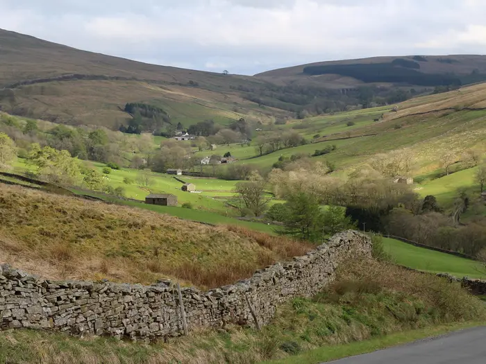
Image by MacDex The Yorkshire Wolds Way is a quiet National Trail across England’s chalk country, running 127 km from Hessle Foreshore beneath the Humber Bridge to Filey Brigg on the North Sea. It suits walkers who want a low-altitude, well-waymarked long-distance route with real rural character rather than mountain drama.
The trail’s appeal is in its rhythm: open arable tops, wooded dales, grassy valley floors and sudden views across big Wolds skies. Villages such as South Cave, Market Weighton, Millington, Thixendale and Sherburn give the walk a practical village-to-village shape, though the middle section feels notably remote.
This is not a technically difficult route, and there are no mountains, scrambling sections or boggy moorland. The challenge comes from the constant short climbs and descents through chalk dry valleys, plus field paths and chalk surfaces that can turn slippery or muddy after rain.
Highlights are spread naturally along the way, from the Humber Bridge start and Millington Dale to Wharram Percy deserted medieval village and the final rocky finish at Filey Brigg. The route is especially strong for walkers planning a first National Trail, or for experienced hikers wanting a quieter week with straightforward navigation.
This guide covers stages, day planning, accommodation, food, transport, terrain and the common mistakes to avoid.
Stage-by-Stage Guide
Stage 1: Hessle to South Cave — 21 km
Route character: The walk starts on Hessle Foreshore beneath the Humber Bridge, with the National Trail acorn waymarks leading away from the estuary. This first stage eases from the built edge of the Humber into the lower Wolds, mixing foreshore paths, field paths, farm tracks, quiet lanes and early wooded chalk dales.
Places and highlights: The route passes through or near North Ferriby, Melton, Welton and Brantingham before reaching South Cave. Welton Dale and Little Wold Plantation give the first proper sense of the Wolds landscape, with wooded chalk slopes and views back towards the Humber.
Food and water: Hessle is the best place to start fully supplied. Villages on the stage give potential stopping points, but opening hours and available services should not be assumed, especially outside the main season or on quieter weekdays. Carry enough water and food to reach South Cave without relying on a mid-stage stop.
Accommodation at the end: South Cave is a practical first-night halt, but individual B&Bs, pubs and self-catering options should be booked in advance. If accommodation in the village is full, an off-route bed or taxi transfer may be needed.
Public transport and access: Hessle has its own railway station, a few minutes from Hull on the Hull–Doncaster/Leeds line. South Cave is road-accessible, but onward rural bus or taxi plans should be checked before travelling.
Navigation and cautions: Waymarking is generally straightforward, but the early transition through settlements, lanes and field edges is where attention is most useful. After rain, chalk, field margins and woodland sections can be slippery or muddy. The day is not high or remote, but it is longer than it may feel on paper because the route is rarely completely flat once it leaves the Humber edge.
Stage 2: South Cave to Market Weighton — 19 km
Route character: This stage moves more fully into the rolling chalk Wolds, with open arable tops, field-edge paths, farm tracks and quiet lanes. The walking remains non-technical, but the pattern of short climbs and descents becomes more noticeable.
Places and highlights: North Newbald and Goodmanham are the main named places before Market Weighton. Goodmanham is one of the historic points on the route, traditionally associated with the destruction of the pagan temple by the high priest Coifi during the conversion of Northumbria to Christianity in AD 627.
Food and water: South Cave and Market Weighton are the main reliable planning points for supplies. North Newbald and Goodmanham may offer opportunities to pause, but do not build the day around unverified opening times. Carry a full day’s water in warm weather, as exposed field sections can feel dry and shelter is limited.
Accommodation at the end: Market Weighton is one of the more useful accommodation and resupply stops on the route compared with the smaller central Wolds villages. Even so, beds should be booked ahead, particularly during peak walking periods.
Public transport and access: Market Weighton has road access and is a sensible point for joining or leaving the trail by pre-arranged lift, taxi or rural bus. Current public transport times should be checked before relying on them.
Navigation and cautions: Field-edge paths can be easy to follow in good visibility, but care is needed at field corners, lane crossings and where waymarks are set back from the obvious line of travel. Mud on cultivated margins can slow progress after rain, and chalk can become slick under a thin film of wet soil.
Stage 3: Market Weighton to Millington — 14 km
Route character: This is a shorter stage and a useful half-step into the quieter central Wolds. The walking is still a mixture of farm paths, tracks, lanes and grassy valley approaches, with the landscape becoming more enclosed and sculpted as the route nears Millington.
Places and highlights: The trail passes Londesborough and Nunburnholme before reaching Millington. The approach to Millington brings the route close to some of the finest chalk-dale scenery of the whole walk, with Millington Dale and Millington Pastures marking a clear change from the lower, more settled sections.
Food and water: Market Weighton is the place to leave well supplied. This is a short day, but the central Wolds have fewer reliable services than the early stages, so carry lunch and enough water rather than depending on village facilities.
Accommodation at the end: Millington is in the accommodation-sensitive central section of the trail. Choice is genuinely limited here, so book early and be prepared for an off-route detour, taxi hop or baggage-transfer arrangement if no bed is available in the village itself.
Public transport and access: Millington has road access, but the surrounding rural transport network is sparse. Any bus, taxi or pick-up plan should be arranged and checked before travelling.
Navigation and cautions: The shorter distance makes this a good stage for a later start or recovery day, but do not underestimate wet chalk paths or field margins. In poor visibility, keep a close eye on waymarks where the path leaves lanes or turns between fields and valleys.
Stage 4: Millington to Thixendale — 19 km
Route character: This is one of the most characteristic Wolds days, with repeated movement between grassy dry valleys and open arable tops. Expect short, sharp climbs, curving chalk slopes and stretches where the path feels remote despite the modest altitude.
Places and highlights: The route passes through the central Wolds around Huggate and Fridaythorpe before reaching Thixendale. Millington Dale and the surrounding dry-valley country are major highlights, and Thixendale itself is a distinctive remote, single-street village where several chalk dry valleys converge.
Food and water: Millington, Huggate, Fridaythorpe and Thixendale sit in the part of the route where services and accommodation are most limited. Do not assume food or drink will be available at the right time of day. Start with a full day’s supplies unless current opening times have been checked.
Accommodation at the end: Thixendale is a memorable overnight stop but has limited accommodation capacity. Booking ahead is essential, and many walkers use nearby or off-route accommodation with taxi or baggage-transfer support when village beds are unavailable.
Public transport and access: This is one of the least convenient sections for public transport. Huggate, Fridaythorpe and Thixendale are road-accessible, but rural buses are sparse and should not be treated as a guaranteed escape option. This should be checked before travelling.
Navigation and cautions: The waymarking remains good, but the open tops and interlocking valleys can make distances deceptive. Carry a map or offline route line to back up the acorn waymarks, especially where the path crosses arable land or turns between dry valleys. There is little serious exposure, but shelter is limited on the tops in wind, rain or hot sun.
Stage 5: Thixendale to Sherburn — 24 km
Route character: This is a longer and more demanding day by Yorkshire Wolds Way standards. The terrain is still easy underfoot in technical terms, but the cumulative effect of chalk-valley climbs, open tops and field paths makes it a proper full walking day.
Places and highlights: The route passes through the high Wolds and visits Wharram Percy, England’s best-known deserted medieval village, with its ruined church and grassed-over house and manor platforms. Wharram le Street and Wintringham come later before the stage finishes at Sherburn. The trail also crosses the highest ground of the route on the open Wold tops north of Huggate, around 215 m, although there is no single distinct summit.
Food and water: Leave Thixendale with enough food and water for the full stage. The villages passed are important landmarks, but services should not be relied on without checking current opening times. On a warm day, the exposed arable tops can make this stage feel much longer.
Accommodation at the end: Sherburn is a practical end point for the six-day itinerary, but accommodation may still require advance booking or an off-route arrangement. If splitting the walk differently, this is one of the stages where a transfer can make logistics easier.
Public transport and access: Sherburn and the intermediate villages have road access, but central-Wolds public transport remains limited. Any plan to leave the route at Wharram le Street, Wintringham or Sherburn should be checked before travelling.
Navigation and cautions: Take particular care around Wharram Percy and the surrounding field-and-valley network, where the attraction, farm tracks and rights of way can make route choice less obvious than a simple linear path. The main practical warning is distance: this is not a technical stage, but it is long enough that slow going on muddy field edges can affect arrival time.
Stage 6: Sherburn to Filey Brigg — 28 km
Route character: The final stage is the longest in this six-day schedule, carrying the trail from the eastern Wolds to the North Sea. It remains a mix of field paths, farm tracks, quiet lanes and open country before the final coastal approach to Filey Brigg.
Places and highlights: The route passes Potter Brompton, Ganton, Muston and Filey before continuing to the official finish on Filey Brigg. The finish is not simply Filey town: the National Trail ends on the rocky promontory of Filey Brigg, where it meets the Cleveland Way National Trail.
Food and water: Start from Sherburn supplied for a long day. Potter Brompton, Ganton, Muston and Filey are useful planning points, but food and water availability before Filey should be checked if it is essential to the day’s plan. Filey is the obvious place for end-of-walk food, transport and onward logistics.
Accommodation at the end: Filey has the broadest end-of-route accommodation possibilities compared with the smaller Wolds villages, but it is still sensible to book ahead. If finishing late, allow for the extra time needed to walk between Filey and Filey Brigg rather than treating arrival in the town as the finish.
Public transport and access: Filey has a railway station on the Hull–Scarborough line, with onward connections to the East Coast Main Line at York. This makes it the easiest point on the route, apart from Hessle, for public-transport planning. Intermediate access by bus or taxi should be checked before relying on it.
Navigation and cautions: The main challenge is the 28 km distance, especially if field edges are muddy or progress is slowed by wet chalk. Keep concentration through the final approach so the official finish at Filey Brigg is not missed. In poor weather, leave enough daylight and energy for the exposed end-of-route section on the promontory.
Recommended Itinerary
The most practical default is a 6-day Hessle to Filey Brigg itinerary. It keeps the early days manageable, but still has two longer finishing stages where accommodation and transport options become more awkward. Treat the distances as trail-stage estimates; check official mapping before booking, especially if your bed is off route.
Standard 6-day itinerary
| Day | From | To | Approx. distance | Why this stage makes sense | Services/accommodation notes |
|---|---|---|---|---|---|
| 1 | Hessle | South Cave | 21 km | A logical first day from the official start on Hessle Foreshore, moving from the Humber Bridge and foreshore into the first Wolds country via North Ferriby, Welton and Brantingham. It is long enough to get clear of the urban edge without being a punishing opening stage. | Hessle is rail-served, which makes a same-day start realistic for many walkers. South Cave is a more practical overnight target than smaller places on the early route, but accommodation should still be booked ahead. |
| 2 | South Cave | Market Weighton | 19 km | A steady village-to-village day via North Newbald and Goodmanham, with the route settling properly into rolling Wolds farmland and chalk country. The distance is moderate and pairs well with the previous day. | Market Weighton is one of the more useful overnight stops before the more restricted central Wolds section. Do not leave accommodation arrangements until arrival. |
| 3 | Market Weighton | Millington | 14 km | A deliberately shorter day that helps balance the itinerary before the more remote central stages. It also gives time to enjoy the approach to Millington and the start of the best chalk-dale scenery. | Millington is in the part of the trail where accommodation choice becomes genuinely limited. Book well ahead and be prepared for an off-route pickup, taxi or baggage-transfer arrangement if staying away from the path. |
| 4 | Millington | Thixendale | 19 km | One of the classic Wolds days, passing through the high chalk landscape around Huggate and Fridaythorpe before reaching Thixendale, a remote village set among converging dry valleys. The distance is manageable but the repeated short climbs make it more tiring than the number suggests. | Huggate, Fridaythorpe and Thixendale are all in the limited-accommodation belt. This is a key night to secure early; check whether your accommodation is directly on route or requires a transfer. |
| 5 | Thixendale | Sherburn | 24 km | A longer and more committing day across the open Wold tops and dry-valley country, with Wharram Percy, Wharram le Street and Wintringham on the line of the route. It includes some of the highest ground of the trail between Thixendale and Sherburn, though there is no distinct summit. | Services are sparse through this section, so start with food and water arranged. If 24 km is too much, this is one of the main stages to shorten with pre-booked transport or an alternative overnight plan. |
| 6 | Sherburn | Filey Brigg | 28 km | The longest day of the standard itinerary, moving from the eastern Wolds through Potter Brompton, Ganton, Muston and Filey before the final walk out to Filey Brigg. It works well for fit walkers who want a clean 6-day completion, but it should not be underestimated. | Filey has a railway station on the Hull–Scarborough line, so it is the simplest place to finish logistically. Allow enough time after reaching the official finish at Filey Brigg to get back into Filey for accommodation or onward travel. |
Slower variant: 7 days
A 7-day schedule suits first-time long-distance walkers, anyone carrying a full pack, and walkers who prefer shorter days through the chalk valleys. The best place to add time is the final third of the trail, where the standard 24 km and 28 km days are the most demanding.
Possible ways to slow the route include breaking the Thixendale to Sherburn stage with a pre-arranged transfer, or splitting the Sherburn to Filey Brigg section with an overnight at or near Ganton. Some itineraries also use accommodation around Huggate or Fridaythorpe to rebalance the central stages. Exact distances depend on where the bed or pickup point is; check official mapping before booking.
This slower version is also the safest choice if central-Wolds accommodation availability forces an off-route stay. Rural bus services in the middle of the Wolds are sparse, so any split stage should be planned around confirmed transport rather than assumed on the day.
Faster variant: 5 days or around 4.5 days
A 5-day Yorkshire Wolds Way is realistic for fit walkers who are comfortable with longer daily distances and repeated short climbs. It normally means combining parts of the standard stages or using accommodation and transfer points that do not match the main 6-day stopping pattern.
Around 4.5 days is a fast schedule and is best treated as a lightweight, high-mileage plan rather than a standard walking holiday itinerary. It leaves little margin for muddy chalk, slower field-edge walking, accommodation detours or poor weather.
For any fast itinerary, secure accommodation before committing to the stage plan. The central Wolds are not the place to rely on finding a bed, a bus or an easy escape option at short notice.
Planning the Route
How many days to allow
Most walkers should plan the Yorkshire Wolds Way as a six-day walk. That fits the natural overnight pattern of South Cave, Market Weighton, Millington, Thixendale and Sherburn, while keeping the daily workload manageable despite the repeated climbs in and out of chalk valleys.
A five-day itinerary is realistic for strong walkers, but it gives less flexibility in the central Wolds and usually means longer days where accommodation is already limited. The route is not technically hard, so the challenge on a quicker schedule is cumulative fatigue, wet field paths and the practical gap between villages rather than mountain terrain.
A relaxed six- or seven-day itinerary often works better for first-time long-distance walkers. It allows more time for Millington Dale, Thixendale and Wharram Percy, and reduces the pressure on the longer Thixendale–Sherburn and Sherburn–Filey Brigg sections. The trade-off is that extra nights in the central Wolds may require off-route accommodation, taxi links or baggage-transfer arrangements.
| Pace | Practicality | Best for | Main planning issue |
|---|---|---|---|
| Around 4.5–5 days | Possible but demanding | Fit walkers happy with long days | Long stages and fewer accommodation options |
| 6 days | Most practical standard plan | Most independent walkers | Book central-Wolds beds early |
| 6–7 days | More relaxed | First long-distance walk, slower pace, sightseeing | May need off-route stays or transfers |
Let accommodation shape the stages
This is not a route where daily stages can always be improvised. The Wolds villages are attractive walking bases, but the choice of B&Bs, pubs, self-catering, bunkhouses and campsites is limited in the remote middle of the trail, especially around Millington, Huggate, Fridaythorpe and Thixendale.
Book those central nights before fixing travel to Hessle or home from Filey. Once those beds are secure, build the rest of the itinerary around them. South Cave, Market Weighton, Sherburn and Filey are more obvious stage anchors, but availability can still dictate whether a standard six-day plan works smoothly.
Expect some itineraries to use short off-route detours, taxis or baggage-transfer hops to reach a bed. This is normal on the Yorkshire Wolds Way and is often simpler than forcing an overlong day to stay exactly on the line of the trail.
Shortening, splitting and extending days
The easiest way to shorten a hard day is not usually by finding another large trail town halfway along it, but by using pre-arranged transport to accommodation nearby. This is particularly relevant on the longer eastern half of the walk, where some walkers split the Thixendale to Sherburn and Sherburn to Filey Brigg days using transfer points or overnight options such as Huggate or Ganton where suitable accommodation is available.
Fit walkers can combine stages, but the route’s gentle profile can be deceptive. A long day over the Wolds still involves frequent short climbs, exposed field-top walking and potentially slow progress on muddy chalk or field margins after rain.
To extend the walk, add time rather than distance unless the aim is to continue onto another trail. Filey Brigg is the junction with the Cleveland Way National Trail, so continuing beyond the official finish is possible, but that should be planned as a separate route with its own accommodation and transport logistics.
Section hiking
Section hiking is practical, but it is much easier at the ends than in the middle. Hessle has its own railway station close to Hull connections, and Filey has a station on the Hull–Scarborough line with onward links via York, making the start and finish straightforward for public-transport planning.
The central Wolds are the constraint. Rural bus services are sparse, so do not assume that every village on the map is a convenient start or finish point. For single-day or weekend sections through Millington, Huggate, Fridaythorpe, Thixendale or Sherburn, check current bus times, taxi availability and return logistics before booking anything.
For multi-weekend completion, it is usually better to plan around reliable access points and accommodation first, then divide the trail into sections. This avoids finishing a day in a small village with no practical onward transport.
What matters most when planning
Accommodation is the first priority. The central section has limited choice, and late booking can force long days, off-route detours or a complete reshuffle of the itinerary.
Food and water planning comes next. The route passes many villages, but the Wolds are not a continuous chain of service centres, and walkers should not rely on finding shops or food at every stop. Arrange packed lunches through accommodation where possible, carry snacks, and start each day with enough water for the distance ahead.
Navigation is usually straightforward because the route is a National Trail with acorn waymarks. Even so, carry proper mapping or a dedicated trail guide: the route uses field paths, farm tracks, quiet lanes, woodland sections and grassy dry valleys, where a missed turn across farmland can be awkward. The relevant OS Explorer sheets are 293, 294, 300 and 301.
Weather planning should focus on exposure and underfoot conditions rather than altitude. There are no mountains, but the open Wold tops can feel bleak in wind or rain, and chalk paths and field margins can become slippery or muddy after wet weather. Waterproofs and footwear with reliable grip matter more than technical mountain kit.
Transport should be planned before committing to a stage plan. The start and finish are rail-served, but mid-route escape options are limited by sparse rural buses. Current bus times, accommodation transfers, baggage-transfer coverage and any National Trail diversions should be checked before travelling.
Permits are not a major planning concern for ordinary end-to-end walkers on this National Trail. The practical constraints are beds, supplies, transport and the condition of the chalk paths.
Towns, Villages and Overnight Stops
Accommodation planning is one of the main practical jobs on the Yorkshire Wolds Way. The trail is not remote in a mountain sense, but the central Wolds have small villages, limited beds and sparse public transport, so a neat village-to-village itinerary can be harder to arrange than the walking itself.
The most practical overnight chain for a 6-day walk is usually Hessle, South Cave, Market Weighton, Millington, Thixendale, Sherburn and Filey. Some walkers adjust this with stops or transfers around Huggate, Fridaythorpe or Ganton, especially to shorten the long final two days.
| Place | Best use for walkers | Planning note |
|---|---|---|
| Hessle | Start night / arrival base | Rail-served; official start is on Hessle Foreshore beneath the Humber Bridge. |
| South Cave | Good first overnight stop | Practical end to the first stage from Hessle. |
| Market Weighton | Good overnight stop | Useful town stop before the quieter central Wolds. |
| Millington | Key central overnight stop | Limited accommodation; book well ahead. |
| Huggate / Fridaythorpe | Possible itinerary adjusters | Useful for shortening stages, but bed availability must be checked early. |
| Thixendale | Key central overnight stop | Remote village; limited choice and little margin for last-minute changes. |
| Sherburn | Practical overnight before Filey | Helps break the eastern end of the trail, though the final stage remains long. |
| Ganton | Possible alternative or transfer point | Sometimes used to manage the Sherburn–Filey section. This should be checked before travelling. |
| Filey | Finish base | Rail-served coastal town after the official finish at Filey Brigg. |
Hessle
Hessle is the practical start base for the trail. The official start is not in the town centre but on Hessle Foreshore beside the Humber, directly beneath the span of the Humber Bridge, where the National Trail acorn waymarks lead off along the foreshore.
It is one of the easiest places on the route to reach by public transport. Hessle has its own railway station, a few minutes from Hull on the Hull–Doncaster/Leeds line, with onward East Coast Main Line connections via Hull or Doncaster.
For most walkers, Hessle is an arrival night rather than a rest stop. Staying nearby makes an early start straightforward, but the distance from accommodation to the foreshore start should be allowed for when timing the first day.
North Ferriby
North Ferriby comes early in the walk after the route has left Hessle and the Humber-side section. It is more useful as a short early-stage landmark than as a main overnight halt on a standard itinerary.
Most walkers continue towards South Cave on day one rather than stopping here. If considering a very short first day or a late start from Hessle, accommodation and food availability should be checked before travelling.
Melton
Melton sits on the early part of the route between North Ferriby and Welton. It is not normally used as a main overnight stop on the standard 5- or 6-day schedule.
Treat it as a passing point unless a custom itinerary or local accommodation arrangement has been made. Do not rely on food, shopping or onward public transport here without checking current options in advance.
Welton
Welton is an early Wolds village and the gateway to the wooded chalk dale country around Welton Dale and Little Wold Plantation. It is a useful place to pace the first day, especially before the route becomes more rural.
It is not the usual end point for the first stage, with most walkers continuing to South Cave. If using Welton as an overnight or meal stop, current accommodation, pub opening and food service times should be checked before booking the wider itinerary.
Brantingham
Brantingham lies between Welton and South Cave on the first day’s walk. It is a small route village and can be useful as a progress marker before the finish of the Hessle–South Cave stage.
For overnight planning, it is usually secondary to South Cave. Any plan to stop here should be built around confirmed accommodation and evening food, as small-village services can be limited or seasonal.
South Cave
South Cave is the usual first overnight stop on the 6-day itinerary, reached after roughly 21 km from Hessle. It is one of the more practical early-route stopping points before the trail heads deeper into the Wolds.
Accommodation is generally easier to plan here than in the central Wolds, but it should still be booked in advance during busy walking periods. It is also a sensible place to check that arrangements for the quieter middle section — especially Millington, Huggate, Fridaythorpe and Thixendale — are fully in place.
Food and pub options change over time, so evening meals and breakfast arrangements should be confirmed with the accommodation or venue before arrival. Public transport beyond the rail-served start and finish becomes less straightforward, so any bus or taxi plans from this point onwards should be checked before travelling.
North Newbald
North Newbald sits on the South Cave to Market Weighton section. It works best as a mid-stage village rather than a standard overnight halt.
It may suit walkers building a slower itinerary, but accommodation and food should not be assumed. Check opening times and availability before relying on it for lunch, supplies or a bed.
Goodmanham
Goodmanham is a small village near the Market Weighton end of the second stage. It is notable on the route for its early Christian history, traditionally associated with Coifi and the conversion of Northumbria in AD 627.
For walkers, its main use is as a route village before Market Weighton rather than a primary overnight base. If planning to stop here, confirm accommodation and food in advance, as Market Weighton is the more practical service centre nearby.
Market Weighton
Market Weighton is one of the most useful overnight stops on the route and a practical place to pause before the central Wolds. On the 6-day schedule it ends the South Cave to Market Weighton stage, about 19 km from South Cave.
As a town, it is generally a better bet for accommodation and services than the smaller villages before and after it. It is a sensible place to make sure snacks, lunches and any cash or supplies needed for the quieter middle stages are sorted before continuing.
Current food, shop and public transport details should still be checked before travelling. Do not assume late-opening services, especially if arriving after a long walking day.
Londesborough
Londesborough comes after Market Weighton on the way towards Nunburnholme and Millington. It is usually a passing village on the short Market Weighton to Millington stage rather than an overnight stop.
It can be useful for breaking up the day, but walkers should carry what they need unless a specific food stop has been checked in advance. Accommodation availability should be treated as limited unless booked directly.
Nunburnholme
Nunburnholme sits between Londesborough and Millington on the approach into the central Wolds. Like several villages in this part of the route, it is useful for navigation and pacing but not usually the main overnight objective.
If using it to adjust the itinerary, confirm all details before committing. Rural bus services in this part of the Wolds are sparse, so it should not be treated as an easy escape point without checking times and connections.
Millington
Millington is a key overnight stop and one of the most important accommodation points on the trail. It is the usual end of the Market Weighton to Millington stage, about 14 km from Market Weighton, and sits close to Millington Dale and Millington Pastures.
This is where accommodation planning becomes much less forgiving. Choice in and around Millington is genuinely limited, so book well ahead and be prepared for an off-route detour, taxi arrangement or baggage-transfer-linked accommodation if village beds are full.
Food arrangements matter here. Confirm whether the overnight stay includes breakfast, whether evening meals are available nearby, and whether a packed lunch can be provided for the next day towards Thixendale.
Huggate
Huggate sits on the high Wolds section between Millington and Thixendale. It is close to the open Wold tops north of the village, where the route reaches its highest ground in broad terms, though there is no distinct summit.
It can be useful for splitting or reshaping the central section, particularly for walkers who do not want to follow the standard stage pattern. Accommodation is limited, so any overnight plan around Huggate needs early booking.
Do not rely on turning up and finding food or a bed. Current pub, accommodation, taxi and baggage-transfer arrangements should be checked before travelling.
Fridaythorpe
Fridaythorpe is another useful central-Wolds planning point, particularly for itineraries that avoid long days through the high Wolds. It sits in the same broad accommodation pinch-point as Huggate, Millington and Thixendale.
It is not a place to leave to chance. If Fridaythorpe is being used as an overnight stop, confirm the bed, evening meal, breakfast and next-day food before finalising the rest of the walk.
Rural public transport in this area is sparse. Any plan to join, leave or skip a section from here should be checked against current bus and taxi availability before travelling.
Thixendale
Thixendale is one of the most important overnight stops on the Yorkshire Wolds Way. It is the usual end of the Millington to Thixendale stage, about 19 km, and sits in a remote single-street village where several chalk dry valleys converge.
The village is atmospheric but accommodation choice is limited. Book well ahead, particularly for weekends and peak walking months, and have a realistic backup plan if no bed is available on the route.
The next stage to Sherburn is long at about 24 km, so food planning is important. Confirm breakfast times, packed lunch availability and evening meal arrangements before arrival rather than assuming services will be available at short notice.
Wharram Percy
Wharram Percy is not a living service village but a deserted medieval village directly on the route. It is an English Heritage site, with a ruined church and earthworks of the former settlement.
It is a major route highlight but not an overnight or resupply point. Carry food and water as needed for the Thixendale to Sherburn section and allow time if you want to explore the site without rushing the rest of the day.
Wharram le Street
Wharram le Street comes after Wharram Percy on the eastern half of the route. It is generally a passing point rather than a standard overnight halt.
If using it to modify the Thixendale to Sherburn stage, all practical details should be checked in advance. Do not assume public transport or food availability without current information.
Wintringham
Wintringham lies between Wharram le Street and Sherburn. It can help break up the long day across the eastern Wolds, but it is not usually the main overnight stop on the standard schedule.
Walkers considering a slower itinerary may look for accommodation in or near the village, but this should be arranged before travelling. Food and onward transport options should also be checked, as rural services are limited.
Sherburn
Sherburn is the usual overnight stop before the final push to Filey Brigg. On the 6-day schedule it ends the Thixendale to Sherburn stage, about 24 km from Thixendale.
It is a practical place to break the eastern end of the trail, though the following day to Filey Brigg is still long at about 28 km. Fit walkers may be comfortable with that distance, but others may prefer to adjust the itinerary using accommodation or transfers around Ganton or elsewhere nearby.
Confirm accommodation, evening meal and breakfast arrangements in advance. Also check any public transport or taxi plan carefully, as rural links away from the start and finish are not as straightforward as the rail connections at Hessle and Filey.
Potter Brompton
Potter Brompton is on the final approach towards the coast, between Sherburn and Ganton. It is normally a passing village on the long Sherburn to Filey Brigg stage.
Its main value is as a marker of progress on a long final day. Carry enough food and water unless a specific stop has been checked in advance.
Ganton
Ganton is a useful possible adjustment point on the final section. Some itineraries use Ganton, or transfers around this part of the route, to reduce the length of the Sherburn to Filey finish.
It may be worth considering if a 28 km final day is too long, but arrangements need to be made deliberately. Accommodation, food, taxi links and baggage-transfer coverage should all be checked before travelling.
Muston
Muston is one of the last villages before Filey. It is most useful as a final-stage landmark as the route heads towards the North Sea coast and the official finish at Filey Brigg.
Most walkers continue to Filey rather than overnighting here. If planning a very short final split or a late finish, confirm accommodation and food before relying on it.
Filey
Filey is the practical finish base for the Yorkshire Wolds Way. The official end is at Filey Brigg, the rocky promontory where the trail meets the Cleveland Way National Trail, so allow time and energy to walk from the town area out to the finish and back as needed.
Filey has a railway station on the Hull–Scarborough line, with connections to the East Coast Main Line at York. This makes it the simplest place to arrange onward travel after finishing.
As the main coastal town at the end of the trail, Filey is the best place to plan a final night, meal and onward transport. Accommodation should still be booked ahead in busy seasons, and train times should be checked before travelling.
Filey Brigg
Filey Brigg is the official finish, not an accommodation stop. It is the point where the Yorkshire Wolds Way reaches the North Sea and meets the Cleveland Way National Trail.
Finish-day planning should allow for the fact that the trail ends on the promontory rather than at a railway platform or hotel door. Most walkers will continue into Filey for accommodation, food and onward rail travel.
Getting to the Start
By train
Hessle is the most convenient railhead for the Yorkshire Wolds Way. Hessle station is on the Hull–Doncaster/Leeds line, only a few minutes by train from Hull, with onward East Coast Main Line connections via Hull or Doncaster.
From Hessle station, the official start is on Hessle Foreshore beside the Humber, directly beneath the span of the Humber Bridge. Allow time to get from the station down to the foreshore and locate the National Trail acorn waymarks before setting off.
For walkers coming from further afield, the simplest plan is usually to route via Hull, Doncaster or Leeds, then take a local train to Hessle. Train times, connection patterns and Sunday services should be checked before travelling.
By bus
Bus can be useful for reaching Hessle or the Humber Bridge area from nearby towns, but train is generally the cleaner option for most walkers starting the full trail. Current bus routes, stops and frequencies should be checked before travelling.
Do not assume that bus coverage on the first day reflects the rest of the walk. The central Yorkshire Wolds have sparse rural services, so any plan involving buses for access, escape days or shortened stages needs checking carefully in advance.
By car
The official start is not in a town centre: it is on Hessle Foreshore under the Humber Bridge. If arriving by car, plan the final approach to the foreshore and do not assume that any nearby parking is suitable for multi-day use.
Because the route is point-to-point and finishes at Filey Brigg, leaving a car at Hessle creates a return-transport problem at the end of the walk. Filey has a railway station on the Hull–Scarborough line, so a rail return towards Hessle via the wider network may be possible, but exact routes and timings should be checked before travelling.
For a full-route walk, it is often simpler to arrive at Hessle by train and travel home from Filey by train. If driving is unavoidable, arrange long-stay parking through accommodation or another suitable provider before committing to the plan. This should be checked before travelling.
From the nearest airport
There is no airport at the trailhead. The practical approach for long-distance or overseas arrivals is to use rail connections into Hull, Doncaster, Leeds or York, then continue by train to Hessle.
Airport-to-rail transfers, late arrivals and Sunday connections can add complexity, especially if aiming to start walking the same day. This should be checked before travelling, and an overnight stop before day one is often the safer option.
Where to stay before starting
Hessle is the most convenient place to stay if the priority is an easy start from the Humber Bridge and Hessle Foreshore. Hull is also practical, with Hessle only a few minutes away by train.
Staying near the start helps avoid a rushed first morning, especially because the opening stage to South Cave is a full walking day. If using baggage transfer, confirm the first pick-up point and time with the operator before booking accommodation.
Getting Home from the Finish
The Yorkshire Wolds Way finishes on Filey Brigg, not at a transport interchange. After reaching the official finish on the rocky promontory, plan to return into Filey for trains, buses, taxis and accommodation.
By train
Filey has a railway station on the Hull–Scarborough line. This is the most straightforward public transport option from the finish, with onward connections towards the East Coast Main Line at York.
For longer journeys, expect to change trains rather than find a direct intercity service from Filey. Hull, Scarborough and York are the key onward hubs to check when planning the journey home.
Train times are timetable-dependent, especially if finishing late in the afternoon or outside the main summer season. Check the last practical departure before committing to a long final day into Filey Brigg.
By bus
Bus can be useful for local movements around Filey and the nearby coast, but it is less dependable as the main way home than the train unless the current timetable fits your finish time. This should be checked before travelling.
Do not assume a late bus will be available after walking the final stage from Sherburn to Filey Brigg. If the day is running long, the safer plan is to use the train, pre-book a taxi, or stay overnight in Filey.
By car/taxi
Because this is a point-to-point trail, driving logistics need deciding before the walk starts. If a car is left at the start near Hessle, the simplest return is usually to travel back by rail from Filey, changing as required towards Hull and Hessle.
Taxis are most useful for the short post-finish transfer to accommodation, for reaching an off-route B&B, or as a fallback if public transport has finished for the day. Book ahead if finishing late, as availability can be limited at short notice.
From the nearest airport
Air travel is not the natural way to leave this trail directly from the finish. The practical first step is to travel by rail from Filey towards a larger rail hub such as York, Hull or Scarborough, then continue to the airport that suits your onward journey.
Airport rail and coach connections are timetable-dependent and should be checked before travelling.
Where to stay at the finish
Filey is the obvious place to stay after completing the trail. It avoids rushing the final walk to meet a train and gives a buffer if weather, muddy chalk paths or tired legs make the last stage slower than expected.
Staying overnight is particularly sensible if walking the long Sherburn to Filey Brigg final stage in one day. Book ahead in busy holiday periods, as Filey is a coastal town and accommodation demand can rise sharply.
Which Direction Should You Walk?
The Yorkshire Wolds Way is normally walked from Hessle to Filey Brigg. That follows the official point-to-point direction: starting on Hessle Foreshore beneath the Humber Bridge, crossing the chalk Wolds, then finishing on the North Sea coast where the route meets the Cleveland Way.
Reverse walks from Filey Brigg to Hessle are perfectly possible, but they feel less natural for most walkers and may need a little more care when matching accommodation to daily stages.
Hessle to Filey Brigg: the standard direction
This is the best direction for the route’s overall progression. The walk begins with a clear landmark at the Humber Bridge, then moves through the gentler early Wolds, the dry valleys around Millington and Thixendale, the higher open Wold tops north of Huggate, and finally out towards Filey and the coast.
The finish at Filey Brigg is a strong psychological endpoint. It gives the walk a definite sense of arrival: the chalk country runs out at the North Sea, and the Yorkshire Wolds Way meets the Cleveland Way on the rocky promontory.
Transport also works well in this direction. Hessle has its own railway station, with links via Hull and onward connections, and Filey also has a railway station on the Hull–Scarborough line with connections towards York. For many walkers, it is simpler to travel to the start, walk east and north across the Wolds, then leave from Filey after finishing.
Accommodation planning is still the main constraint. The central Wolds around Millington, Huggate, Fridaythorpe and Thixendale have limited choice, so beds should be booked well ahead whichever way the trail is walked.
Filey Brigg to Hessle: the reverse direction
Walking westbound from Filey Brigg gives an immediate coastal start, then heads inland through Muston, Ganton, Sherburn and the high Wolds before finishing under the Humber Bridge at Hessle. The waymarking can still be followed in reverse, but the route’s scenery arguably works less well this way: the coast comes at the beginning rather than as the reward at the end.
Reverse direction can suit walkers who have better transport or accommodation availability from Filey, or who want to link from the Cleveland Way at Filey Brigg. It may also help if a specific central-Wolds bed is only available on certain dates.
The practical challenges are much the same as in the standard direction. Rural public transport in the middle of the Wolds is sparse, and any central-section access, escape options, baggage-transfer arrangements or taxi hops should be checked before travelling.
Are the climbs easier one way?
There is no major advantage either way. The Yorkshire Wolds Way has no mountains and no technical ground, but it is rarely flat: the effort comes from repeated short climbs and descents in and out of chalk dry valleys.
Total ascent is effectively the same in both directions. The highest ground is on the open Wold tops north of Huggate, between Thixendale and Sherburn, but there is no single summit that dictates an easier direction.
After rain, chalk paths and field margins can be slippery or muddy in either direction. Footwear and daily pacing matter more than which end is chosen.
Weather and exposure
The Wold tops can feel exposed, especially on open arable sections and in poor weather, but there is no reliable route-wide advantage to choosing one direction on weather grounds alone. Check the forecast before committing to long open sections, particularly between the central villages where services and escape options are limited.
Recommendation
Walk the Yorkshire Wolds Way from Hessle to Filey Brigg unless there is a specific accommodation, transport or Cleveland Way-linking reason to reverse it. The standard direction gives the best scenery progression, straightforward endpoint transport, and the most satisfying finish on the coast at Filey Brigg.
Accommodation Along the Route
Accommodation is one of the main planning constraints on the Yorkshire Wolds Way. The trail works well as an inn-to-inn or B&B-to-B&B walk, but it is not a route where beds appear at regular intervals throughout the day.
The easiest places to build an itinerary around are the recognised overnight hubs: Hessle, South Cave, Market Weighton, Millington, Thixendale, Sherburn and Filey. The awkward section is the central Wolds, particularly around Millington, Huggate, Fridaythorpe and Thixendale, where choice is genuinely limited and a single full lodging can affect the whole schedule.
Book the central section first, then fit the easier start and finish around it. Spring, summer and autumn weekends should be treated as busy enough to require advance booking, especially if walking with a group or relying on pubs/inns rather than mixed B&B, self-catering or camping options.
Practical overnight stops
| Place | Accommodation level | Best for | Notes |
|---|---|---|---|
| Hessle | Good | Start night | Practical for the official start on Hessle Foreshore beneath the Humber Bridge. Hessle has its own railway station, which makes arrival simple. |
| North Ferriby / Welton / Brantingham | Limited | Adjusting the first day | Useful only if shortening or reshaping the Hessle to South Cave stage. Availability should be checked before building an itinerary around these smaller places. |
| South Cave | Limited | Standard first overnight | A practical end to the first stage from Hessle. Book ahead rather than assuming walk-up availability. |
| North Newbald / Goodmanham | Limited | Alternative early-stage splits | Smaller Wolds villages that can help reshape the South Cave to Market Weighton section if suitable accommodation is available. This should be checked before travelling. |
| Market Weighton | Good | Main early-route hub | One of the more useful overnight bases before the route enters the more thinly supplied central Wolds. |
| Millington | Limited | Gateway to Millington Dale and the central Wolds | A key stop on many 6-day itineraries. Accommodation is limited, so secure a bed here early. |
| Huggate / Fridaythorpe | Limited | Shortening or rebalancing the central stages | Useful if a bed is available, especially for walkers not wanting the standard Millington to Thixendale pattern. Availability often dictates whether these work as overnight stops. |
| Thixendale | Limited | Essential central-Wolds overnight | A remote village and a critical planning point. Do not leave this booking late; fallback options may involve off-route travel. |
| Wharram Percy | None | Daytime visit only | The trail passes through the deserted medieval village, but it is not an overnight stop. |
| Sherburn | Limited | Last inland overnight before Filey | A practical stopping point before the long final stage towards Filey Brigg. Book ahead, particularly if finishing over a weekend. |
| Ganton / Muston | Limited | Breaking up or easing the final approach | Can be useful for reshaping the Sherburn to Filey section if accommodation is available. Ganton is also used in some itineraries as an overnight option. |
| Filey | Good | Finish night | The practical place to stay after the official finish at Filey Brigg. Filey has a railway station on the Hull–Scarborough line. |
| Filey Brigg | None | Official finish only | The trail ends on the rocky promontory; overnight accommodation should be arranged in Filey, not at the Brigg. |
Booking strategy
For a straightforward 6-day walk, the classic accommodation pattern is usually built around South Cave, Market Weighton, Millington, Thixendale, Sherburn and Filey. This gives logical stage ends, though the final two walking days are longer than the earlier ones.
A 6- or 7-day relaxed itinerary can work well, but only if intermediate beds or transfers are arranged. Places such as Huggate and Ganton can help break up the harder-to-place sections, but they should be treated as availability-dependent rather than guaranteed solutions.
Fit walkers compressing the route into fewer days have more freedom on distance but less flexibility on accommodation. Long stages may be unavoidable unless transfers are arranged to and from a suitable bed.
Transfers, baggage and off-route beds
Taxi or accommodation transfers are often the practical answer to awkward central-Wolds gaps. If the only suitable bed is off the line of the trail, arrange pick-up and drop-off in advance; rural buses in the middle of the Wolds are sparse and should not be relied on for late-day improvisation.
Baggage-transfer and self-guided operators, including companies such as Mickledore, offer Yorkshire Wolds Way itineraries with luggage movement. Confirm the exact overnight stops, baggage coverage and any transfer arrangements before booking, as these details can change.
Camping, hostels and self-catering
The route has a mixed accommodation base, including B&Bs, village pubs and inns, self-catering, occasional hostels or bunkhouses, and campsites. These are not evenly distributed, so camping or bunkhouse use still needs planning rather than treating it as a simple fallback.
When booking smaller village accommodation, check whether evening meals, breakfast and packed lunches are available. This matters most in the central Wolds, where changing plans at the end of the day is harder than at Hessle, Market Weighton or Filey.
Camping and Wild Camping
Camping is possible on the Yorkshire Wolds Way, but it needs more planning than on some better-served National Trails. The route crosses quiet chalk farmland, small villages and remote dry valleys rather than areas with frequent trail-side campsites, so most camping itineraries will need booked sites, occasional off-route detours, or short taxi hops.
Do not assume there will be a campsite at the end of each standard stage. Accommodation of all types is limited through the central Wolds around Millington, Huggate, Fridaythorpe and Thixendale, and camping options should be checked and booked before committing to daily distances.
Campsites and practical planning
Campsites are found in and near some towns and villages along the wider route corridor, but they are not evenly spaced. The more practical camping sections are generally near the larger settlements at either end of the trail, while the central chalk Wolds require the most careful planning.
| Route section | Camping practicality |
|---|---|
| Hessle to South Cave | More practical than the central Wolds, with larger settlements and better access near the start of the trail. Specific campsite availability should be checked before travelling. |
| South Cave to Market Weighton | Possible with planning, but do not rely on finding a site directly on the line of the trail. Check locations, opening dates and whether walkers are accepted. |
| Market Weighton to Millington | Shorter walking distance, but options become more limited as the route enters quieter Wolds country. Book ahead. |
| Millington to Thixendale | One of the least flexible sections for camping. Villages are small, services are sparse and wild camping is not a reliable legal fallback. |
| Thixendale to Sherburn | A long, remote-feeling day across the high Wolds. Camping plans need to be fixed in advance, with enough water carried for the day. |
| Sherburn to Filey Brigg | More practical again as the route approaches Filey, but the final official finish is at Filey Brigg, not a camping area. Check campsite locations in relation to the trail and public transport. |
When booking, ask whether the site accepts lightweight backpacking tents for one night, whether late arrival is acceptable, and whether there are food shops, pubs or cafés nearby. Seasonal opening can vary, especially outside summer, so this should be checked before travelling.
Wild camping legality
There is no general legal right to wild camp in England without the landowner’s permission. The Yorkshire Wolds Way crosses a landscape of privately owned farmland, field margins, chalk grassland, plantations and small villages, so discreet “stealth camping” should not be treated as part of a normal plan.
If a landowner gives permission, camp late, leave early, keep the tent out of sight of homes and livestock, and leave no trace. Without permission, use an official campsite or arranged accommodation instead.
Why wild camping is difficult on this route
The Wolds are open, agricultural and often exposed. Much of the route follows field edges, farm tracks and dry valleys with little natural screening, and camping on crops, pasture or sensitive grassland is not acceptable.
The best-known landscape areas, including Millington Dale, Millington Pastures and the dry valleys around Thixendale, are exactly the places where damage from camping, fire scars and trampling would be most visible. Wharram Percy is an English Heritage site and should be treated as a heritage landscape, not a camping spot.
Filey Brigg is the official finish and a sensitive coastal promontory where the Yorkshire Wolds Way meets the Cleveland Way. Plan to finish the walk and move on to accommodation or transport in Filey rather than camp at the endpoint.
Water and supplies
Water is the main practical limitation for campers. The trail crosses dry chalk country, and the central Wolds have long stretches between villages and services. Do not rely on streams, springs or troughs for drinking water.
Carry enough water for the full day, including cooking if camping. Refill only from reliable taps, accommodation, cafés, pubs or other agreed sources, and ask before using private supplies.
Food planning also matters. Villages such as Millington, Huggate, Fridaythorpe and Thixendale are small, and services can be limited or seasonal. Check resupply options before setting off each day, particularly if walking with a stove and camping food.
Fires, stoves and low-impact camping
Open fires should be avoided. They are inappropriate on chalk grassland, farmland, field margins, plantations and near heritage sites, and disposable barbecues can scar grass and create fire risk in dry weather.
Use a small backpacking stove only where it is permitted by the campsite or landowner. Cook well away from crops, dry grass, hedges and woodland edges, and pack out all rubbish, including food waste.
Follow strict Leave No Trace practice:
- camp only where permitted;
- keep groups small and quiet;
- never camp on crops, flower-rich chalk grassland or archaeological remains;
- avoid disturbing livestock and close gates properly;
- take all litter home;
- use toilets at campsites, pubs or public facilities wherever possible;
- if no toilet is available, bury human waste well away from paths, water sources, field drains and grazing areas, and pack out toilet paper.
Is the Yorkshire Wolds Way a good camping trail?
It can work for experienced lightweight campers who are happy to plan around limited sites, carry extra water and accept some off-route logistics. It is less suitable for walkers hoping to pitch spontaneously each evening.
For many hikers, the most straightforward approach is a mixed itinerary: campsites where they fit the route, and B&Bs, pubs, hostels or taxi-linked accommodation through the central Wolds. That keeps pack weight down and avoids relying on illegal or unsuitable wild camping in a predominantly private farming landscape.
Food, Water and Resupply
Food and water planning on the Yorkshire Wolds Way is straightforward at the ends of the trail, but needs more care through the central Wolds. The route passes villages regularly, yet not every village should be treated as a reliable resupply point: opening hours can be short, pubs may not serve food every day, and rural services can close on Sundays or outside the main walking season.
The safest approach is to leave each overnight stop with lunch, snacks and enough water for the whole day. This matters especially between Millington, Huggate, Fridaythorpe and Thixendale, where accommodation and services are limited, and again on the longer final stages towards Sherburn and Filey.
Food availability
Hessle and Filey are the easiest places to sort food before and after the walk. Market Weighton is also a useful mid-route resupply point on a standard 6-day itinerary.
Elsewhere, food is more dependent on village pubs, inns, accommodation providers and any small local services that happen to be open. Do not assume that a village on the map has a shop, café or evening meal available. If staying in small villages such as Millington, Huggate, Fridaythorpe or Thixendale, check dinner options when booking accommodation and ask about packed lunches.
For most walkers, carrying one full day of food is enough on the easier-served sections. On the central stages, carry lunch plus emergency snacks even if a pub or café is planned, because a closed kitchen can otherwise leave a long gap.
Water availability
Treat water as a planned refill item rather than something to find casually on the trail. Reliable refills are most likely at accommodation, pubs, cafés and other staffed services, but exact availability varies and should be checked locally.
The Wolds are chalk country with many dry valleys, so natural water is not something to rely on. Field edges, farm tracks and grassy valley floors are common, but dependable streams or safe drinking-water points should not be assumed. If any natural water is used in an emergency, it should be filtered or treated.
In normal spring or autumn conditions, many walkers will be comfortable starting each day with around 1.5–2 litres. In warm summer weather, on the longer 24 km and 28 km stages, or if walking at a slower pace, carry more and refill whenever a definite opportunity appears.
Resupply by section
| Section | Food availability | Water availability | Notes |
|---|---|---|---|
| Hessle to South Cave | Best arranged before leaving Hessle; possible village services may vary through North Ferriby, Welton, Brantingham and South Cave. | Fill before starting and top up only where there is an open staffed service. | Do not rely on every village having food available at the time you pass. Start with lunch and snacks. |
| South Cave to Market Weighton | South Cave and Market Weighton are the key practical points; North Newbald and Goodmanham may have limited rural options. | Fill at accommodation or open services in South Cave and Market Weighton. | Market Weighton is the most useful resupply point before the quieter central Wolds. |
| Market Weighton to Millington | Market Weighton is the main place to buy food before setting off; options become more limited towards Londesborough, Nunburnholme and Millington. | Leave Market Weighton with enough water for the stage unless a definite refill has been arranged. | A shorter stage, but still carry lunch if no confirmed food stop is planned. |
| Millington to Thixendale | Limited central-Wolds availability around Millington, Huggate, Fridaythorpe and Thixendale. | Fill before leaving accommodation; do not assume water will be available in the dry valleys. | Check evening meals and packed lunches when booking beds. This is one of the most important sections for self-sufficiency. |
| Thixendale to Sherburn | Limited food until Sherburn; Wharram Percy is an historic site, not a resupply stop. | Carry enough water from Thixendale for a long day unless a definite refill is known. | At around 24 km on the standard itinerary, this is a long stage with exposed Wold-top walking and repeated short climbs. |
| Sherburn to Filey Brigg | Sherburn is the start point for the day; Filey has the best end-of-walk services. Intermediate village options through Potter Brompton, Ganton and Muston should not be assumed. | Start full from Sherburn and refill only at confirmed open services before Filey. | The standard final stage is around 28 km, so carry a full day’s food and more water in warm weather. |
Terrain, Conditions and Difficulty in Practice
The Yorkshire Wolds Way is technically straightforward, but it is not a flat riverside or canal-style walk. Its difficulty comes from repetition: long days over rolling chalk country, with frequent short climbs and descents in and out of dry valleys.
There is no mountain terrain, scrambling or boggy moorland. Most walkers with regular hillwalking fitness should find the route manageable, but the cumulative ascent — listed here as about 2,700 m over the full trail — is felt most on the central and northern Wolds stages.
Underfoot: chalk, field paths, tracks and lanes
Expect a practical mix of field-edge paths, farm paths, grassy valley floors, farm tracks and quiet lanes. The route crosses a working agricultural landscape, so surfaces can vary quickly between firm chalk track, cropped field margin, grass and compacted earth.
Chalk is the key surface to plan around. In dry weather it can make for fast, easy walking; after rain it can become slippery, especially on descents into the dry valleys and on worn field margins.
Mud is most likely on field paths, valley-bottom grass and farm approaches after wet weather. This is not deep moorland peat or bog, but it can still slow progress and make the shorter climbs more tiring than they look on the map.
Climbs, descents and the Wolds “switchback”
The Wolds are low, with the highest ground around 215 m on the open tops north of Huggate, between Thixendale and Sherburn. There is no single dramatic summit and no sustained mountain climb.
The challenge is the repeated pattern of open tops followed by steep-sided chalk dry valleys. Places such as Millington Dale, Horse Dale, Holm Dale, Deep Dale, Swin Dale and Stocking Dale give the trail its characteristic rhythm of short, sharp climbs and descents.
These ascents are rarely long, but they add up over a day. A 19–24 km stage through the central Wolds can feel harder than the mileage suggests if the ground is wet or if the day includes several valley crossings.
Exposure and shelter
Much of the route crosses open arable tops with big skies and limited shelter. This is not high-altitude exposure, but wind, sun and rain can all feel more pronounced on the Wold tops than in the valleys.
Woodland and plantation sections appear early in the walk, particularly around Welton Dale and Little Wold Plantation, and some dry valleys provide temporary shelter. Do not rely on continuous cover, especially through the central Wolds around Millington, Huggate, Fridaythorpe and Thixendale.
Road walking and built-up sections
The trail uses a mixture of rights of way, farm tracks and quiet lanes, with settlement approaches through or near places such as Hessle, North Ferriby, South Cave, Market Weighton, Millington, Thixendale, Sherburn and Filey. Road walking is part of the route, but the walk is not defined by long road sections.
Take particular care on lanes in the rural Wolds, where traffic may be infrequent but fast, and verges can be narrow. This should be checked against current mapping and official route information before travelling if road sections are a concern.
Gates, field boundaries and farmland
Because the route crosses working farmland, expect the normal mix of field entrances, gates and boundary crossings found on English rights of way. The exact arrangement can change with farming practice, repairs and diversions.
The landscape is heavily arable, so livestock is not the defining feature of the walk. Where animals are present, keep dogs under close control, leave gates as found and follow the National Trail waymarks rather than cutting corners across cropped land.
Rocky or technical ground
There is no technical rocky walking on the inland Wolds sections. The route is suitable for walkers rather than scramblers, and normal walking shoes or boots with good grip are more important than specialist mountain equipment.
The finish at Filey Brigg is a short coastal finale on a rocky promontory where the Yorkshire Wolds Way meets the Cleveland Way. Treat the final section with care in poor weather, but the trail as a whole should not be planned as a rocky or exposed mountain route.
Seasonal conditions
Spring can be an excellent season for the Wolds, but recent rain may leave chalk paths and field margins slick. Early-season days can also feel cool and exposed on the open tops.
Summer usually gives the easiest underfoot conditions, with firm tracks and dry chalk. The trade-off is exposure: long open sections can feel hot and tiring, especially where there is little shade between villages.
Autumn often brings good walking temperatures, but damp grass, wet chalk and shorter daylight can make the central stages feel slower. Plan stage lengths conservatively if walking a 5-day schedule.
Winter is not the main season for this route. The issue is less altitude than short days, wind on open farmland, mud on field paths and fewer daylight hours for the longer stages into Sherburn and Filey.
What makes it easier or harder in practice
The route feels easier when walked over 6–7 days, with stages of roughly 18–21 km and time to take the valley climbs steadily. It feels harder on faster schedules, especially where accommodation availability forces long days through the central Wolds.
Navigation is helped by National Trail acorn waymarks, and the line of the route is generally clear. However, field-edge paths and agricultural landscapes can still require attention, particularly where crops, farm tracks and multiple rights of way meet.
Footwear with reliable grip is more useful than heavy mountain kit. Walking poles can help on repeated chalk descents, especially after rain, but the route does not require technical equipment.
Overall, the Yorkshire Wolds Way is best understood as an easy-to-moderate long-distance trail: gentle in altitude and terrain, but made genuinely tiring by distance, exposed open tops and the constant rise-and-fall of the chalk valleys.
Weather and Best Time to Walk
The Yorkshire Wolds Way is at its best from spring to autumn, when daylight is long enough for the standard 5–6 day itinerary and the chalk paths are more likely to be dry underfoot. The route is low-level, with a high point of around 215 m, so weather rarely creates mountain-style problems, but the Wold tops are exposed and the trail can feel surprisingly hard work in wind, rain or heat.
The main underfoot issue is chalk. After rain, chalk tracks, grassy valley floors and field margins can become slippery or muddy, especially on the repeated short climbs and descents in and out of the dry valleys. In dry weather the walking is generally straightforward, with field-edge paths, farm tracks, quiet lanes and open grassland making navigation and pacing easier.
Best months
Late spring, summer and early autumn are the most practical seasons for most walkers. These months give the best balance of usable daylight, drier going and open accommodation, particularly if walking the route in 5 or 6 days with stages of roughly 19–28 km.
A good planning window is:
| Season | What to expect |
|---|---|
| Spring | Often one of the best times to walk: longer days, active farmland, greener valleys and generally manageable temperatures. Wet spells can still make chalk descents slippery. |
| Summer | Long daylight makes the longer stages easier to schedule, but the open arable tops and big skies mean limited shade. Carry enough water between villages, especially through the quieter central Wolds. |
| Autumn | Usually still a good walking season, particularly early autumn. Shorter days become more relevant on longer stages, and wet weather can quickly affect chalk and field paths. |
| Winter | Possible for fit, well-equipped walkers, but less convenient. Expect short daylight, colder winds on exposed tops and the coast, wetter ground, and a greater need to check accommodation, transport and services before committing. |
Rain, mud and chalk
This is not a boggy moorland route, but rain still matters. The trail crosses many field paths and chalky slopes, and the characteristic dry-valley climbs can become greasy after wet weather. Walking poles and footwear with reliable grip are useful, particularly between Millington, Huggate, Fridaythorpe and Thixendale, where the route repeatedly dips in and out of chalk valleys.
After prolonged rain, allow extra time rather than judging the day only by distance. A 19 km Wolds stage can take longer than expected if every descent is slippery and field edges are muddy.
Wind, exposure and heat
The Wolds are not high, but many sections cross open field tops with little shelter. Wind can be tiring on the higher ground north of Huggate and on the approach towards the coast, and it can make cool days feel much colder than the altitude suggests.
In summer, the same open ground can be hot and exposed. Shade is intermittent, so start early on warm days, refill where possible in villages, and do not rely on finding services between every settlement in the central section.
Fog, storms and poor visibility
The trail is very well waymarked with National Trail acorn signs, but poor visibility can still slow progress on open farmland and indistinct field edges. Carry mapping and know how to follow the route without relying only on line-of-sight waymarks.
In thunderstorms or severe winds, the exposed Wold tops and the finish at Filey Brigg are not places to linger. Adjust timings where necessary rather than pushing on simply to keep to a booked itinerary.
Accommodation and seasonal planning
Accommodation is limited in the central Wolds around Millington, Huggate, Fridaythorpe and Thixendale, whatever the season. In the main walking months, beds should be booked well ahead; outside the main season, opening days and availability should be checked before travelling.
The route is realistic in winter for experienced walkers who are comfortable with short days and wet chalk paths, but it is not the best choice for a first long-distance walk at that time of year. Sparse rural buses in the middle of the route also make poor-weather escape plans less straightforward, so central-section transport options should be checked before travelling.
Safety Notes
The Yorkshire Wolds Way is a low-altitude National Trail with no mountains, scrambling or boggy moorland, but it still needs sensible planning. The main safety issues are repeated short climbs and descents, slippery chalk after rain, exposed field-top walking, limited services in the central Wolds and a few longer days where escape options are not straightforward.
Emergencies and mobile signal
In an emergency in the UK, call 999 or 112. If rescue is needed on the trail, give the operator your location as clearly as possible: nearest village, last waymark or landmark, grid reference from your map app or paper map, and whether you are on the Hessle, central Wolds or Filey end of the route.
Mobile signal should not be relied on throughout the walk, especially in the quieter central Wolds and in the folds of the chalk dry valleys. Download maps for offline use, carry a charged phone and consider a small power bank on the longer stages.
Remote sections and daily checks
The central part of the route around Millington, Huggate, Fridaythorpe and Thixendale has limited accommodation, sparse rural buses and fewer quick exit options. Plan these stages more carefully than the easier-access ends at Hessle and Filey.
Before setting off each day, check:
- the weather forecast, especially wind, heavy rain, heat and poor visibility;
- any current path diversions on the official National Trail information;
- that the day’s accommodation, taxi or baggage-transfer plan is still in place;
- available food and water stops, particularly through the central Wolds;
- daylight for the longer stages, especially Thixendale to Sherburn and Sherburn to Filey Brigg.
Weather exposure
Although the highest ground is only around 215 m, the Wold tops are open and exposed. Wind, driving rain and strong sun can all be more tiring than the modest altitude suggests.
Carry waterproofs and an insulating layer even outside winter, and take sun protection and enough water in warm weather. There is little shelter on some arable field-top sections, so do not leave long exposed stretches until late in the day if the forecast is poor.
Slippery chalk, mud and descents
The route is rarely technical, but chalk paths, field margins and grassy valley slopes can become slippery after rain. The repeated climbs and descents through dry valleys such as Millington Dale, Horse Dale, Holm Dale, Deep Dale, Swin Dale and Stocking Dale can be harder on tired legs than the overall difficulty grade implies.
Wear footwear with a reliable sole rather than smooth trainers. Walking poles are useful if carrying a multi-day pack or walking after wet weather.
Navigation
The trail is waymarked with National Trail acorn signs and is generally straightforward to follow. Even so, field-edge paths, farm tracks and open tops can be confusing in poor visibility or where crops, mud or livestock have made a line less obvious.
Carry mapping rather than relying only on signs. OS Explorer mapping for the route is listed by the National Trail, and an offline digital map is a sensible backup.
Roads, farms and livestock
The Yorkshire Wolds Way uses a mix of field paths, farm tracks and quiet lanes. On road sections, keep alert for traffic, walk facing oncoming vehicles where there is no pavement, and use extra care in poor light or on bends.
This is working farming country. Keep to the waymarked path, close gates as found, do not block farm access and give livestock plenty of space. Dogs should be kept under close control, particularly near animals and through farmed fields.
Water and coastal footing
There are no major water crossings or technical water hazards on the route. The main water issue is having enough drinking water between villages, especially on warm days and through the central Wolds; do not assume there will be a reliable refill point between settlements.
At the start on Hessle Foreshore and the finish at Filey Brigg, stay on the official route and take care on wet or uneven rock and foreshore surfaces. The official finish is on a rocky promontory, so avoid unnecessary scrambling or detours beyond the waymarked walking line, particularly in poor weather.
Gear Recommendations
The Yorkshire Wolds Way does not need mountain kit, but it does reward sensible wet-weather and navigation choices. The main gear issues are slippery chalk after rain, repeated short climbs and descents through dry valleys, exposed open field tops, and limited services through the central Wolds.
Footwear
Choose footwear for mixed field paths, farm tracks, grassy valley floors, quiet lanes and chalk rather than rocky mountain terrain. Lightweight walking boots or grippy trail shoes both work, but the sole matters: smooth-soled trainers are a poor choice when chalk or field margins are wet.
Waterproof boots are useful in spring and after prolonged rain, especially through muddy field edges. In dry summer conditions, breathable trail shoes can be more comfortable for inn-to-inn walkers, provided they have enough grip for steep grassy descents.
Gaiters are optional rather than essential. They are most useful after rain, when long grass, mud and cultivated field margins can wet out socks quickly.
Waterproofs and Layers
Carry a proper waterproof jacket every day, even though the route is low-level. The Wold tops are open, and weather can feel more exposed than the modest height suggests.
Waterproof trousers are worth packing in spring, autumn and unsettled summer forecasts. They are also useful for keeping mud and wet vegetation off walking trousers on field paths.
A warm mid-layer or light insulated layer is sensible for stops, early starts and the coastal finish at Filey Brigg. The trail has no high mountains, but wind across open arable tops can cool you quickly when not moving.
Navigation
The route is a National Trail and is well waymarked with acorn signs, so navigation is generally straightforward. Do not rely on waymarks alone: carry mapping and know where each day’s accommodation, road crossings and exit points are.
Useful mapping is covered by OS Explorer 293, 294, 300 and 301. A dedicated National Trail / Cicerone guide is also available, and an offline mapping app is a practical backup if the phone is kept charged.
This is especially important through the quieter central Wolds around Millington, Huggate, Fridaythorpe and Thixendale, where public transport and services are sparse. If planning escape options or taxi pickups, save phone numbers and grid references before setting out.
Water and Food Carry
Start each day with enough water for the whole stage unless a definite resupply point has been planned. This matters most on the longer and more remote sections, particularly Millington to Thixendale, Thixendale to Sherburn, and Sherburn to Filey Brigg.
Do not assume cafés, pubs or shops will be available exactly when needed in the central Wolds. Carry lunch and high-energy snacks for the day, even on an inn-to-inn itinerary.
In warm summer weather, the open Wold tops provide limited shade for long stretches. A larger water carry than usual may be needed on hot days.
Trekking Poles
Trekking poles are not essential, but they are useful on this route. The Yorkshire Wolds Way has no technical ground, yet the repeated short climbs and descents through chalk dry valleys can be tiring over several days.
Poles are particularly helpful on wet chalk, steep grassy descents and muddy field margins. Fast walkers and anyone carrying camping gear may find them worthwhile for managing cumulative strain.
Power and Electronics
Carry a power bank if using a phone for navigation, accommodation details, transport checks or taxi contacts. The trail passes through quiet rural sections where it is better not to depend on finding charging opportunities during the day.
Download maps and key information offline before leaving Hessle or each overnight stop. Keep the phone protected from rain, and avoid draining the battery with constant screen use.
Sun, Wind and Insect Protection
Sun protection is important in spring and summer because much of the walking is on open field tops and grassy valleys. Pack a sun hat, sunglasses and sunscreen, especially for long days with little shade.
A cap or buff also helps in wind on the exposed Wolds. Insect protection is not a major route-specific concern compared with boggy upland trails, but light repellent can be useful in warm, still conditions around grassy valleys and woodland edges.
For Inn-to-Inn Walkers
Keep the pack light and prioritise daily comfort: waterproofs, spare warm layer, water, lunch, snacks, map or offline navigation, first-aid basics and a power bank. Baggage transfer can make the route much easier, but coverage and arrangements should be checked before travelling.
A change of dry socks is useful because wet chalk paths and field margins can soak footwear even on a low-level trail. Pack casual footwear for evenings if staying in pubs, B&Bs or self-catering accommodation.
For Campers
Camping is possible only where suitable campsites or other booked camping arrangements fit the itinerary. Campsites are occasional rather than guaranteed at every stage, and the central Wolds have limited accommodation generally, so plan this before committing to a camping schedule.
A lightweight tent, warm sleep system and compact cooking setup are the practical approach. Because food resupply is not assured in the remoter middle of the route, campers should be prepared to carry more food than inn-to-inn walkers.
Avoid overpacking: the trail’s cumulative ascent comes from many short climbs rather than one major mountain day, and a heavy camping pack will make those climbs feel much harder.
For Fast and Section Hikers
Fast walkers attempting longer days should still carry waterproofs, warm layer, food, water and offline navigation. The route may be easy to moderate, but long sections such as Thixendale to Sherburn and Sherburn to Filey Brigg leave little margin if pace drops or weather turns poor.
Section hikers using public transport should plan exits carefully, especially away from Hessle, Filey and the larger villages. Rural bus services in the central Wolds are sparse, so timetables and last departures should be checked before travelling.
Budget and Costs
The Yorkshire Wolds Way is not an expensive trail in terms of terrain or permits, but it can become costly if accommodation gaps in the central Wolds force taxi transfers or off-route stays. The main budget items are overnight stops, evening meals, transport to Hessle and from Filey, and any baggage transfer.
No fixed trail fee or permit is needed for the National Trail. Current accommodation, taxi, baggage-transfer and package prices change by season and availability, so confirm current prices before booking.
Main cost drivers
| Cost item | What to budget for |
|---|---|
| Accommodation | B&Bs, village pubs/inns, self-catering, occasional hostels/bunkhouses and campsites. Choice is genuinely limited around Millington, Huggate, Fridaythorpe and Thixendale, so book early. |
| Food | Breakfast may be included with some B&B or pub stays, but this should be checked before travelling. Budget separately for packed lunches, snacks and evening meals. |
| Transport to/from the trail | Hessle has a railway station near the start area, and Filey has a railway station for the finish. Through-ticket costs vary widely by date and booking time. |
| Local buses | Useful in theory for section walking, but rural services through the central Wolds are sparse. Timetables should be checked before travelling. |
| Taxis | May be needed for off-route accommodation, central-section access, or shortening long days such as Thixendale to Sherburn or Sherburn to Filey Brigg. Get quotes in advance. |
| Baggage transfer | Available through some walking-holiday arrangements and specialist services, but coverage and prices should be confirmed before booking, especially for remote central stages. |
| Self-guided packages | Companies such as Mickledore offer self-guided Yorkshire Wolds Way holidays with arranged accommodation and baggage transfer. Package prices vary by itinerary length, room type and season. |
Budget approach
A lower-cost walk usually means using the cheapest available beds, considering campsites where they fit the itinerary, carrying more food, and avoiding taxis unless essential. This is easiest at the start and finish, where rail access is straightforward, and harder in the central Wolds where accommodation choice is thin.
Do not assume camping will make the whole route simple or cheap. Campsites are only occasional in and near the route settlements, so a camping itinerary still needs careful planning and may require longer days or off-route arrangements.
Mid-range approach
Most independent walkers should budget around a B&B or pub-room itinerary, with occasional taxi use to reach a bed where the route has no convenient overnight option. This is the most practical way to walk the standard 5–6 day route without carrying camping gear.
The central section is where costs can rise. Beds around Millington, Huggate, Fridaythorpe and Thixendale should be booked well ahead, and any taxi or baggage-transfer hops should be arranged before the walk rather than left to the day.
Comfortable approach
A more comfortable itinerary uses pre-booked accommodation throughout, baggage transfer, and taxi support where needed to smooth out long or awkward stages. This is especially useful if splitting or adjusting the longer later days between Thixendale, Sherburn and Filey Brigg.
A self-guided package can be good value if it removes the need to coordinate scarce rooms, luggage movement and transfers separately. Compare the package price with the cost of booking accommodation, baggage transfer and taxis independently, and confirm exactly what is included before paying.
Cost-saving tips specific to this trail
- Book central-Wolds accommodation first, then build the rest of the itinerary around those fixed nights.
- Use rail access at Hessle and Filey where possible, rather than arranging long private transfers.
- Check rural bus times before relying on them for section walking or escape options.
- Ask accommodation providers in advance about packed lunches, evening meals and transfer options; do not assume services are available in every village.
- If using baggage transfer, confirm that every planned overnight stop is covered before finalising the route.
- Keep a contingency allowance for taxis, especially if accommodation is off-route or weather makes a long day unattractive.
Luggage Transfer, Guided Tours and Support Services
Luggage transfer
Luggage transfer is useful on the Yorkshire Wolds Way, especially through the quieter central Wolds where accommodation can be off-route or limited around Millington, Huggate, Fridaythorpe and Thixendale. The walking is not technically difficult, but carrying a full pack over repeated chalk-valley climbs can make the middle days feel much harder than the mileage suggests.
Baggage-transfer coverage should be arranged before booking a final itinerary, not after. Check that the courier can serve every overnight stop, including any off-route accommodation, and that the pick-up and drop-off points are happy to hold bags during the day.
Expect to confirm practical details such as bag limits, collection times, labelling, access instructions and whether payment is per bag or per booking. Prices and operating dates vary, so confirm current details when booking.
Self-guided walking holidays
Self-guided packages suit walkers who want the route logistics handled while still walking independently each day. Companies such as Mickledore offer Yorkshire Wolds Way self-guided itineraries with baggage transfer; packages of this type typically bundle accommodation arrangements, daily route information and luggage movement between overnight stops.
This is often the simplest way to manage the trail if walking in high season, travelling from outside Yorkshire, or wanting to avoid phoning round small villages for beds. It is also helpful if splitting the longer Thixendale to Sherburn and Sherburn to Filey Brigg stages with transfers or off-route accommodation.
A package is less necessary for experienced UK walkers who are comfortable booking B&Bs and pubs directly, carrying a day pack and arranging occasional taxis. The route is well waymarked with National Trail acorn signs, so the main value of a package is logistics rather than navigation.
Guided options
A fully guided walk is not essential for this trail. The Yorkshire Wolds Way is a waymarked National Trail with no technical ground, no mountains and no scrambling, so most walkers with basic navigation ability can complete it independently.
Guided group departures, where available, are most useful for solo walkers who prefer company, visitors unfamiliar with UK rights-of-way, or anyone who wants interpretation of the Wolds landscape and villages without managing the day-to-day plan. Availability can be limited compared with busier National Trails, so dates and inclusions should be checked before travelling.
Taxi transfers and off-route support
Taxis are an important back-up on this route because rural bus services in the central Wolds are sparse. They can be useful for reaching off-route accommodation, shortening a long stage, returning to a previous overnight stop, or dealing with injury, severe weather or missed connections.
Do not assume there will be a taxi waiting in small villages. Pre-book evening pick-ups and next-morning returns where an accommodation stop sits away from the line of the trail, particularly around the central section between Market Weighton, Millington, Huggate, Fridaythorpe and Thixendale.
Hessle and Filey are the easiest transport points to manage independently because both have railway stations. The middle of the walk needs more planning; any escape-day plan that relies on rural buses or a same-day taxi should be checked before travelling.
What to arrange in advance
- Accommodation in the central Wolds: book early around Millington, Huggate, Fridaythorpe and Thixendale, where choice is limited.
- Baggage transfer: confirm that every overnight stop is covered before finalising the itinerary.
- Off-route taxi links: pre-book where accommodation is not on or very close to the trail.
- Long-stage support: consider transfers or a revised itinerary if the Thixendale to Sherburn or Sherburn to Filey Brigg stages are too long for the group.
- Current prices and operating details: luggage-transfer, taxi and package-holiday costs vary, so confirm current details before booking.
Shorter Hikes and Best Sections
The Yorkshire Wolds Way works well as a section walk, but the middle of the route is much less convenient than the two ends. Hessle and Filey are the simplest access points by rail; villages through the central Wolds have limited accommodation and sparse rural buses, so taxis, lifts or pre-arranged transfers may be needed.
Distances below use the practical stage distances in this guide. For any shorter cut-down version between intermediate villages, check the exact mileage on OS mapping before booking accommodation or transport.
Best options at a glance
| Best for | Start → end | Approx distance | Why choose it | Transport notes |
|---|---|---|---|---|
| Best single day | Market Weighton → Millington | 14 km / 9 miles | A manageable day with Wolds villages and a finish close to Millington Dale and Millington Pastures, one of the finest landscape areas on the trail. | Neither end is as straightforward as Hessle or Filey by rail. Rural bus options and taxi availability should be checked before travelling. |
| Best weekend section | South Cave → Millington, via Market Weighton | 33 km / 21 miles | A strong two-day sample of the lower Wolds, linking South Cave, North Newbald, Goodmanham, Market Weighton, Londesborough, Nunburnholme and Millington. | Accommodation should be booked ahead, especially around Millington. Public transport at both ends should be checked before travelling. |
| Best 3–5 day section | Millington → Filey Brigg | 71 km / 44 miles | The most concentrated high-Wolds experience: Millington Dale, Thixendale, the dry valleys, Wharram Percy and the final approach to Filey Brigg. | This is the least convenient section to start without a car or taxi. Filey has a railway station at the finish; access to Millington and intermediate escape points should be planned carefully. |
| Best scenery | Millington → Thixendale | 19 km / 12 miles | The classic Wolds landscape: steep-sided chalk dry valleys, flower-rich grassland around Millington Pastures and remote rolling country into Thixendale. | Transport is sparse and accommodation limited. Book beds and confirm any bus or taxi plan before relying on it. |
| Best for beginners | Hessle → Market Weighton, via South Cave | 40 km / 25 miles | A practical two-day introduction with a rail-served start, clear waymarking, no technical ground and regular villages compared with the central Wolds. | Hessle has a railway station. Onward travel from Market Weighton should be checked before travelling. |
| Best for public transport | Hessle → South Cave | 21 km / 13 miles | The easiest way to sample the trail from a rail-served start, beginning beneath the Humber Bridge and moving into the early Wolds around Welton, Brantingham and South Cave. | Hessle is the strongest public-transport access point on the route. South Cave onward travel is more limited and should be checked before travelling. |
| Best for villages and accommodation | Hessle → Market Weighton | 40 km / 25 miles | Better village spacing than the remote middle, with Hessle, Welton, Brantingham, South Cave, North Newbald, Goodmanham and Market Weighton giving more planning flexibility. | Still book ahead, but this is generally less constrained than Millington, Huggate, Fridaythorpe and Thixendale. |
Best single day: Market Weighton to Millington
Market Weighton to Millington is the cleanest short stage from the standard itinerary: around 14 km / 9 miles, so it gives a proper day on the Yorkshire Wolds Way without committing to one of the longer 19–28 km stages.
It is a good choice if the aim is to experience Wolds villages, field paths and the approach to the Millington area rather than just tick off an access-friendly section. The finish also places you close to Millington Dale and Millington Pastures, widely regarded as one of the route’s strongest landscape highlights.
The drawback is logistics. Public transport in the central Wolds is sparse, so bus times, taxi availability and any return journey should be arranged before setting out.
Best weekend: South Cave to Millington
South Cave to Millington gives a satisfying two-day walk of about 33 km / 21 miles, using Market Weighton as the natural overnight stop. It is long enough to feel like a proper section of the National Trail but avoids the longest remote days later in the route.
This section passes a useful chain of villages, including North Newbald, Goodmanham, Market Weighton, Londesborough and Nunburnholme, before reaching Millington. It suits walkers wanting a village-to-village weekend with a strong Wolds feel and a finish near the trail’s best chalk-valley scenery.
Accommodation should be booked in advance. Rural buses in this area are limited, so do not assume a flexible same-day exit is available.
Best 3–5 day section: Millington to Filey Brigg
For walkers who want the most rewarding part of the trail rather than the easiest logistics, Millington to Filey Brigg is the strongest short itinerary. At about 71 km / 44 miles, it can be planned over three demanding days using the standard stages, or spread more comfortably with accommodation detours, taxis or baggage-transfer arrangements where available.
This section includes Millington Dale, the high Wolds around Thixendale, Wharram Percy deserted medieval village, the long run through Sherburn, Ganton and Muston, and the finish on Filey Brigg. It gives the best sense of the route’s quiet chalk-valley character and still includes the coastal finale.
The main challenge is not terrain but logistics. Accommodation is limited in the central section, and access to Millington, Thixendale and Sherburn by public transport needs careful checking before travelling.
Best scenic section: Millington to Thixendale
Millington to Thixendale is the standout scenic day: around 19 km / 12 miles through the most distinctive Wolds country. Expect rolling chalk tops, steep dry valleys and the flower-rich chalk grassland around Millington Pastures.
This is also a good choice for photographers or walkers who want the quietest, most characteristic part of the route without completing the full 127 km. Thixendale’s setting, where several chalk dry valleys converge, makes it a memorable finish.
Do not treat this as a casual turn-up-and-go day unless transport has been sorted. Accommodation around Millington and Thixendale is limited, and rural bus services should be checked before travelling.
Best beginner section: Hessle to Market Weighton
Hessle to Market Weighton is the most sensible first section for newer long-distance walkers. It covers about 40 km / 25 miles over two standard days, starting at Hessle Foreshore beneath the Humber Bridge and overnighting at South Cave.
The terrain still has short Wolds climbs and field paths, so it is not flat, but it avoids the more isolated central stages. The village spacing is also more forgiving than later on the route.
Hessle has a railway station, making the start straightforward. Travel home or onward from Market Weighton should be checked before travelling.
Best for public transport
No central section of the Yorkshire Wolds Way is especially strong for public transport. The simplest rail-served access is at Hessle, and the simplest rail-served finish is at Filey, but the countryside between them has sparse rural services.
For a public-transport-based day, Hessle to South Cave is usually the most practical option because the walk starts near Hessle station and follows the first 21 km / 13 miles of the trail. The return or onward journey from South Cave still needs to be planned in advance.
For a station-linked finish, Sherburn to Filey Brigg gives the final 28 km / 17 miles and ends near Filey station, but it is a long day and access to Sherburn should be checked before travelling.
Best for villages and accommodation
Hessle to Market Weighton is the best section if accommodation choice and village facilities matter more than remoteness. It links the early settlement chain of Hessle, Welton, Brantingham, South Cave, North Newbald, Goodmanham and Market Weighton.
This makes it more forgiving for first-time section walkers, especially compared with the central Wolds around Millington, Huggate, Fridaythorpe and Thixendale. Even here, accommodation should still be booked ahead rather than left to chance.
Camping and low-cost section walking
Camping is possible in principle on parts of the Yorkshire Wolds Way, but campsites are only occasional and should not be assumed at the end of every stage. The route is better suited to B&Bs, inns, self-catering stays and pre-booked village accommodation than to an entirely spontaneous camping itinerary.
For a camping-based section, keep daily distances conservative and confirm each night’s stop before committing to transport. The central Wolds have limited services, so this is not the place to rely on finding an unplanned pitch at the end of the day.
Highlights and Points of Interest
The Yorkshire Wolds Way is strongest in its landscape detail rather than big summit moments: chalk dry valleys, quiet Wolds villages, historic sites and a distinctive estuary-to-coast finish. The places below are the most worthwhile points to slow down, take a longer break or build into a more relaxed itinerary.
| In route order | Why it matters | Planning note |
|---|---|---|
| Humber Bridge and Hessle Foreshore | The official start sits directly beneath the span of the Humber Bridge, with the Humber estuary setting the scale for the first kilometres. | Worth allowing a little time before setting off, especially if arriving by train into Hessle. |
| Welton Dale and Little Wold Plantation | The first real taste of the Wolds: wooded chalk dales, plantation walking and views back towards the Humber. | A good early place to pause before the route settles into more open field and dale country. |
| Goodmanham | A small village with deep early medieval religious history, traditionally linked with Coifi and the conversion of Northumbria in AD 627. | One of the more interesting cultural stops before Market Weighton. |
| Millington Dale and Millington Pastures | A major scenic highlight: steep-sided chalk dry valley scenery and one of the largest surviving areas of flower-rich unimproved chalk grassland in the Wolds. | This is a strong candidate for a shorter walking day or a longer lunch stop if the itinerary allows. |
| High Wolds dry valleys | Horse Dale, Holm Dale, Deep Dale, Swin Dale and Stocking Dale give the trail its repeated pattern of short climbs and descents. | Expect the most characteristic Wolds walking here: not high, but rarely flat. |
| Thixendale | A remote single-street village where several chalk dry valleys converge, with surrounding country repeatedly painted by David Hockney. | A particularly atmospheric overnight stop, but accommodation in this central section is limited and should be booked ahead. |
| Wharram Percy | England’s best-known deserted medieval village, passed directly by the trail, with a ruined church and grassed-over remains of the former settlement. | Allow time to leave the through-walking rhythm and explore the site properly. |
| Filey Brigg | The official finish: a rocky North Sea promontory where the Yorkshire Wolds Way meets the Cleveland Way National Trail. | A memorable end point rather than just a signpost finish; weather and ground conditions can affect how much time to spend out on the Brigg. |
Humber Bridge and the estuary start
The trail begins on Hessle Foreshore, directly beneath the Humber Bridge. It is an unusually dramatic start for a lowland National Trail, with the acorn waymarks leading away from the estuary before the route turns inland towards the Wolds.
This opening is worth treating as part of the walk rather than simply a departure point. If arriving the same morning, build in enough time to reach the foreshore, orientate yourself and take in the bridge before starting the first stage towards South Cave.
Welton Dale, Little Wold Plantation and the first chalk country
North of Welton, the route gives its first proper sense of the Yorkshire Wolds landscape. Welton Dale and the early plantations provide a more enclosed contrast to the later open field tops, with wooded chalk dales and views back over the Humber.
This section is also a useful preview of the trail’s rhythm. The walking is not mountainous or technical, but the ground begins to roll, dip and climb in the pattern that defines the rest of the route.
Goodmanham and early Northumbrian history
Goodmanham is one of the most historically interesting villages on the Yorkshire Wolds Way. It is traditionally associated with Coifi, the pagan high priest said to have destroyed his own temple during the conversion of Northumbria to Christianity in AD 627.
For walkers interested in history, it is worth allowing more than a quick pass-through. It also makes a natural cultural stop between North Newbald and Market Weighton.
Millington Dale and Millington Pastures
Millington Dale and nearby Millington Pastures are among the finest landscape sections of the whole trail. The route passes through classic steep-sided chalk dry valley scenery, with Millington Pastures noted as one of the largest surviving areas of flower-rich unimproved chalk grassland in the Wolds.
This is one of the best places to slow the itinerary down. If choosing where to spend extra time on the walk, the Millington area is more rewarding than rushing through simply to keep mileage even.
Thixendale and the Hockney Wolds
Thixendale is a remote, single-street village set where several chalk dry valleys meet. Its location makes it feel more tucked away than many of the villages on the route, and the surrounding rolling country was painted repeatedly by David Hockney.
The village is also a practical landmark in the central Wolds, where accommodation and services are limited. Anyone planning a night here, or nearby at Millington, Huggate or Fridaythorpe, should book well ahead rather than relying on flexibility on arrival.
The dry valleys of the high Wolds
The high Wolds section is where the trail’s character is clearest. Dry chalk dales such as Horse Dale, Holm Dale, Deep Dale, Swin Dale and Stocking Dale create a constant sequence of grassy descents, short climbs and open tops.
These valleys are the main reason the Yorkshire Wolds Way can feel more demanding than its modest altitude suggests. The high point is around 215 m on the open Wold tops north of Huggate, between Thixendale and Sherburn, but there is no single summit moment; the appeal is the repeated shaping of the landscape.
Wharram Percy deserted medieval village
Wharram Percy is the standout historic site on the route. The trail passes through this English Heritage deserted medieval village, where the ruined church and grassed-over platforms mark the remains of houses and manors abandoned around 1500 after the Black Death and the shift towards sheep farming.
It is worth allowing extra time here rather than treating it as a brief photo stop. This is one of the few places on the trail where the landscape, settlement history and the walking line come together especially clearly.
Filey Brigg and the Cleveland Way junction
The finish at Filey Brigg gives the Yorkshire Wolds Way a proper coastal ending. After days of chalk valleys and arable tops, the route reaches the rocky North Sea promontory where it meets the Cleveland Way National Trail.
This is the most dramatic natural landmark after the central Wolds. If transport allows, leave enough time at the end to enjoy the approach and the finish on the Brigg rather than heading straight for Filey station.
Common Mistakes and Planning Tips
Leaving central-Wolds accommodation too late
The biggest planning error on the Yorkshire Wolds Way is treating it like a trail with a bed in every village. Accommodation is genuinely limited through the central section around Millington, Huggate, Fridaythorpe and Thixendale, and the best places can fill well ahead in walking season.
Fix: book the middle nights first, then build the rest of the itinerary around them. Be prepared for short off-route detours, taxi hops or baggage-transfer arrangements if the nearest bed is not directly on the trail.
Assuming the route is flat because it has no mountains
The trail is low-level and non-technical, but it is rarely flat. The Wolds are a succession of chalk dry valleys, so the walking often comes as repeated short climbs and descents rather than one big ascent.
Fix: plan daily distances by effort, not just kilometres. The longer later stages, particularly Thixendale to Sherburn and Sherburn to Filey Brigg in a 6-day schedule, can feel tougher than the map profile suggests because the climbing keeps returning.
Making the final two days too long
A classic 6-day itinerary puts roughly 24 km from Thixendale to Sherburn and roughly 28 km from Sherburn to Filey Brigg. Those are manageable for fit walkers, but they are not gentle half-days, especially if the weather is poor or the chalk paths are slippery.
Fix: walkers wanting a relaxed first long-distance trail should consider a 6- or 7-day schedule rather than compressing the route. Some itineraries split the longer eastern sections with transfers or off-route accommodation; baggage-transfer coverage and taxi arrangements should be confirmed before booking.
Counting on public transport in the middle of the route
Hessle and Filey are straightforward by rail compared with the interior of the Wolds. Hessle has a station near Hull, and Filey is on the Hull–Scarborough line, but the rural middle of the trail has sparse bus coverage.
Fix: treat the central Wolds as a low-escape-option section. Check current bus times, Sunday services and taxi availability before relying on them for access, rest days, bail-outs or returns to off-route accommodation. This should be checked before travelling.
Assuming every village has food, water and open services
The route passes many villages, but that does not mean every stop has a shop, café, pub meal or reliable opening hours. This matters most in the quieter central stages, where settlements are smaller and further apart in practical terms.
Fix: start each day with enough food and water to complete the stage if nothing is open. Check opening days and times for intended meal stops, especially outside peak season and on Sundays. This should be checked before travelling.
Relying only on waymarks
The Yorkshire Wolds Way is a National Trail and is very well waymarked with acorn signs, but waymarks are not a substitute for navigation. Field paths, farm tracks and field-edge routes can be confusing where crops, gateways or temporary diversions alter the feel of the line on the ground.
Fix: carry current mapping as well as following the waymarks. The route is covered by OS Explorer 293, 294, 300 and 301, and the official National Trail information should be checked for current diversions before setting off.
Using an old GPX without checking diversions
A saved GPX can be useful, but it should not be treated as definitive. National Trails can have temporary diversions, and agricultural land can make the visible path line look different from an old digital track.
Fix: download or check route information shortly before travelling, and compare it with the official National Trail updates. If a signed diversion differs from a device, follow the on-the-ground official signing unless there is a clear safety reason not to.
Underestimating chalk after rain
The trail has no boggy moorland or scrambling, but chalk and field margins can become slippery or muddy after rain. Steep grassy dry valleys can also be awkward when wet, particularly on descents.
Fix: wear footwear with reliable grip rather than lightweight shoes chosen only for dry farm tracks. Walking poles can be useful on wet chalk-valley descents, and daily timings should allow for slower progress after heavy rain.
Not preparing for exposed Wold tops
Much of the route crosses open arable high ground with big skies and limited shelter. Even though the highest ground is only around 215 m north of Huggate, wind, rain and sun can all feel more severe on the exposed tops than in the villages.
Fix: carry proper waterproofs, an insulating layer and sun protection in spring, summer and autumn. Do not judge the day solely by the forecast for Hessle or Filey; conditions on the open Wolds can feel different from the coast or Humber-side start.
Treating Filey as the finish rather than Filey Brigg
The official end is not simply Filey town centre. The Yorkshire Wolds Way finishes on Filey Brigg, where it meets the Cleveland Way National Trail.
Fix: allow time and energy for the final section out to Filey Brigg before heading for transport or accommodation in Filey. If arranging a pick-up or onward train, build in a realistic margin rather than timing everything to the first arrival in the town.
Starting at the wrong place in Hessle
The official start is on Hessle Foreshore beside the Humber, directly beneath the span of the Humber Bridge. Starting from Hessle station or the town without going to the foreshore misses the proper opening of the National Trail.
Fix: plan the first morning so there is time to reach Hessle Foreshore and pick up the acorn waymarks from the official start. This is especially important if arriving by train and trying to walk all the way to South Cave on the same day.
Booking baggage transfer without matching it to the itinerary
Baggage transfer is useful on this route, particularly where accommodation is off the line, but coverage and pick-up points need to match the actual overnight stops. The central Wolds are where mismatches can cause the most inconvenience.
Fix: agree the exact overnight places, transfer dates and any off-route arrangements before committing to accommodation. Confirm current coverage, luggage limits and pick-up instructions directly with the operator before booking.
Ignoring the cumulative ascent figure
The Yorkshire Wolds Way does not have a single major climb, but the cumulative ascent is significant for a lowland trail. The route is often described as easy to moderate because the walking is straightforward, not because the days are effortless.
Fix: train for repeated short climbs, especially if carrying a full pack. A realistic plan is more important than chasing a fast itinerary; relaxed schedules of around 6–7 days suit many walkers better than compressing the full 127 km into fewer long stages.
Final Advice
The Yorkshire Wolds Way is best for walkers who want a National Trail with reliable waymarking, low-altitude terrain and a strong village-to-village rhythm, without committing to mountain ground or technical navigation. It suits first-time long-distance hikers, but it should not be dismissed as flat or effortless: the repeated climbs in and out of chalk dry valleys add up, and wet chalk or field margins can be slippery.
The main planning issue is accommodation through the central Wolds. Beds around Millington, Huggate, Fridaythorpe and Thixendale are limited, so book well ahead and be prepared for short off-route transfers, taxi hops or baggage-transfer arrangements where needed. Rural bus options in the middle of the route are sparse, so any section-hiking plan or escape-day strategy should be checked before travelling.
The most rewarding stretch for many walkers is the central high Wolds, especially Millington Dale, Millington Pastures, Thixendale and the dry valleys towards Wharram Percy. This is where the route feels most distinctive: quiet chalk dales, open arable tops, steep grassy folds and little sense of passing through busy country.
As a full thru-hike, the route works well over 5–6 days, or 6–7 days for a more relaxed pace with shorter daily distances. It also makes a practical section hike at either end, with Hessle and Filey both rail-served, but the remote middle requires more care because public transport is much thinner.
The final recommendation is simple: treat the Yorkshire Wolds Way as an accessible trail that still needs proper long-distance planning. Book the central nights early, carry enough food and water between villages, check current diversions and rural transport before setting off, and allow time at the finish to continue out onto Filey Brigg, where the Wolds meet the North Sea and the trail joins the Cleveland Way.
The Yorkshire Wolds Way begins at Hessle, adjacent to the iconic Humber Bridge. The route quickly leaves the urban fringe and heads north, passing through open farmland and woodlands. Walkers will traverse the attractive Little Wold Plantation and enjoy expansive views over the Humber estuary before moving through Welton Dale. The section continues into the quiet countryside, skirting past villages like Elloughton and Brantingham, before ending in or near the historic village of North Newbald.
From North Newbald, the path traverses the rolling Wolds landscape, passing through peaceful farmland and rural settings. The route passes close to the scenic Sancton Wold and continues to Goodmanham, a village with ancient historical roots. Hikers then head towards Londesborough Park, an area known for its attractive parkland, before gently descending into the market town of Market Weighton.
Leaving Market Weighton, the trail heads northeast through fields and wooded areas, passing close to the pretty village of Londesborough. The way then follows winding paths past Warren Dale and Great Givendale, areas noted for their tranquil beauty and abundant wildlife. This section ends in the small village of Millington, which makes an excellent rest stop with its traditional pub and proximity to the scenic Millington Pastures.
Departing Millington, hikers traverse some of the most attractive dry valleys of the Wolds, including Sylvan Dale and Nettle Dale. The route winds through rolling chalk hills and open farmland, providing sweeping views of the surrounding countryside. The section passes by the remote villages of Huggate and Fridaythorpe—the highest village on the Wolds—before descending into the picturesque hamlet of Thixendale.
From Thixendale, the Way continues through remote and undulating countryside, following fields and narrow valleys such as Deep Dale. The route reaches the charming village of Wharram le Street, close to the Wharram Percy deserted medieval village, before weaving north through Settrington and Wintringham, eventually arriving at the village of Sherburn. This stage features some isolated stretches, so preparation is recommended.
The final stage leaves Sherburn and climbs towards the rolling Wold tops, passing around Ganton and through Muston, with glimpses of the coast gradually appearing. The scenery shifts as the trail approaches the North Sea, culminating in a dramatic finish at Filey Brigg. Here, hikers can join the Cleveland Way, celebrate the journey, and take in panoramic sea views from the clifftop headland.
Reviews
How would you rate Yorkshire Wolds Way?
Tap a star to start your review — you could be the first.