Wigry National Park Trail
How would you rate Wigry National Park Trail?
Tap a star to share your experience and help other hikers.
Wigry National Park Trail: Around Lake Wigry on Foot
HikeList Score
Wigry National Park Trail scored 86/100 on HikeList's trail-quality metrics.
See score breakdownHide breakdown
- Ideal length 70
- Balanced challenge 90
- Scenery & wildness 88
- Varied terrain 100
- Accommodation 84
- Food & support 88
- Path quality 92
- Season flexibility 89
Computed from length, challenge, scenery & wildness, terrain variety, accommodation, food & support, path quality and season flexibility.
The Wigry National Park Trail is the green Around Wigry Trail in Wigry National Park, north-eastern Poland: a roughly 46 km loop around Lake Wigry. Most walkers take 3 days; fit hikers sometimes do it in 2. It is easy to moderate, with gentle post-glacial terrain, forest tracks, lakeside paths, boardwalks and short village-road sections. Choose it for a low-level lakeland walk with forest, wetlands, beaver signs and the Camaldolese Monastery at Wigry.
Route Overview
The green Around Wigry loop starts and finishes around Stary Folwark / Krzywe, near park headquarters at Krzywe by Suwalki. The usual direction runs Stary Folwark → Wigry → Mikolajewo → Jastrzeby → Bryzgiel → Gawrych Ruda → Leszczewek → Stary Folwark, staying close to Lake Wigry for much of the circuit. This is a loop, not a point-to-point route, and it is also signed and used as a combined walking-and-cycling route. No verified public-transport detail is available in the brief. For other lowland Polish forest routes, compare Bialowieza Forest Trails or Drawa National Park Trail.
History of Wigry National Park and the Around Wigry Trail
Wigry National Park was established on 1 January 1989 to protect Lake Wigry, its post-glacial lakeland and surrounding forest, water and farmland. The area’s human history is closely tied to the Camaldolese hermitage at Wigry, active in the 17th and 18th centuries until Prussian authorities seized the estates in 1796 and expelled the monks around 1800. The green walking-and-cycling loop is named after Antoni Patla, a Suwalki-region guide and PTTK tourism activist.
Notable highlights
- Lake Wigry: The park’s centrepiece, about 21.87 km² and up to 73 m deep, with bays, peninsulas and 19 islands. The trail repeatedly returns to its shore, giving the walk its structure.
- Camaldolese Monastery at Wigry: A baroque monastery complex on a peninsula above the lake, founded by the Camaldolese order in 1667 and built up from 1694–1745. Pope John Paul II stayed here in June 1999; his apartments now form a small museum.
- European beavers: Wigry is a stronghold for the species, with around 250 animals. Look for dams, lodges and felled trees along streams and lakeside sections.
- Suchary bog-lakes: Small, dark, acidic dystrophic lakes ringed by floating peat-bog vegetation. They are a distinctive post-glacial habitat reached by side paths and an educational trail.
- Czarna Hancza river: One of Poland’s best-known kayaking rivers, linking Lake Wigry with the Augustow Canal. Its clear water and forested banks define much of the wider region.
Challenges to expect
The route is low and non-technical, but 46 km is still a proper multi-day walk. Expect sandy forest tracks, unsurfaced field and forest roads, timber boardwalks over boggy ground, and short minor-road sections through villages. Spring and post-rain conditions can be wet and muddy. There are no mountain huts, so plan campsites, agritourism rooms or guesthouses in villages such as Stary Folwark, Bryzgiel, Gawrych Ruda and Wigry. For another accessible Polish national-park option, see Kampinos National Park Trail.
HikeList Score
Wigry National Park Trail scored 86/100 on HikeList's trail-quality metrics.
See score breakdownHide breakdown
- Ideal length 70
- Balanced challenge 90
- Scenery & wildness 88
- Varied terrain 100
- Accommodation 84
- Food & support 88
- Path quality 92
- Season flexibility 89
Computed from length, challenge, scenery & wildness, terrain variety, accommodation, food & support, path quality and season flexibility.
 Poland
Show more data Show less
- Forest
- Lakeland
- Wetlands
- Meadows
- Forest Footpaths
- Sandy Tracks
- Unsurfaced Roads
- Boardwalks
- Minor Roads
- Campsites
- Guesthouses
- Farmhouse Rooms
- Monastery Accommodation
- Family Friendly
- Pet Friendly
- Restrooms
- Water Sources
- Campsites
- Picnic Areas
Download Our Full Guide to Wigry National Park Trail FREE!
Get our comprehensive guide to this hike for free. Save it for later reading or print out at home.
Photos from hikers
Taken on the trail by people who've reviewed Wigry National Park Trail.
Wigry National Park Trail: The Complete Guide
 i
Image by Monika
i
Image by Monika The Wigry National Park Trail is a lowland circuit around Jezioro Wigry (Lake Wigry), linking forest tracks, lakeside villages, wetlands and quiet stretches of the Suwałki lakeland. It is well suited to first-time multi-day walkers, families and naturalists who want a signed route with plenty of interest but no mountain terrain.
The green Wokół Wigier trail starts and finishes at Stary Folwark on the north shore, then loops past places such as Wigry, Mikołajewo, Bryzgiel, Gawrych Ruda and Leszczewek. Along the way it gives repeated views across the lake, including the classic approach to the Camaldolese monastery on its peninsula.
This is a walk of forests, reedy bays, post-glacial hummocks, peat bogs and timber boardwalks across the Czarna Hańcza valley. Beavers, suchary bog-lakes, viewing towers and short nature trails make it feel richer than its modest height gain suggests.
What the route asks for is not technical skill, but sensible pacing and logistics. The full loop is about 45–46 km, commonly walked in three days, with some sandy or boggy going and rural services that need planning rather than improvisation.
This guide covers the stages, daily planning, accommodation, food, transport, terrain and the common mistakes to avoid on the Wigry loop.
Stage-by-Stage Guide
Distances on the Wigry National Park Trail vary slightly between maps and trail descriptions, so treat the stage figures below as planning distances rather than GPS-exact measurements. Carry the current Wigierski Park Narodowy map, ideally picked up at the park headquarters and nature-education centre at Krzywe, and check for any boardwalk or trail closures before setting out.
Stage 1: Stary Folwark to Bryzgiel — approx. 22.5 km
This is the longest day of the standard three-day circuit and the one that most needs an early start. From Stary Folwark on the north shore of Jezioro Wigry (Lake Wigry), the green Wokół Wigier trail works around the eastern and southern side of the lake through a chain of small villages, forest tracks and lakeside approaches before finishing at Bryzgiel.
The stage passes or skirts Tartak in the Płociczno-Tartak area, Magdalenowo, Wigry, Czerwony Folwark, Rosochaty Róg, Mikołajewo, Czerwony Krzyż, Jastrzęby, Zakąty and Krusznik before Bryzgiel. Expect a mix of gravel forest roads, sandy tracks, field and lakeside paths, and short minor-road sections through settlements. The walking is not steep or technical, but the distance, soft sandy ground and any muddy sections after rain make it a proper full day.
The main cultural landmark is the pokamedulski klasztor w Wigrach (Camaldolese monastery at Wigry), set on a peninsula above the lake. The monastery area, with its hilltop position, bell tower, hermit cells and museum, is one of the key reasons not to rush this stage; opening times should be checked before relying on a visit.
Near the early part of the route, the Wigry narrow-gauge railway at Płociczno-Tartak and the fish hatchery at Tartak are useful orientation points close to the wider trail corridor. Further on, the Rosochaty Róg area offers access to one of the park’s educational nature loops, while the approach through Krusznik and into Bryzgiel brings raised views over Lake Wigry from timber viewing towers.
Food and water should be planned conservatively. The route links villages, but this is a rural national-park area and walkers should not assume that shops, cafés or seasonal facilities will be open in every settlement. Carry enough water and food for the full day unless specific stops have been checked before travelling.
Bryzgiel is a practical overnight stop on the lake, with low-key accommodation such as agritourism rooms, guesthouses, holiday cottages and lakeside camping in the wider village area. Book ahead in July and August, when accommodation density is good but demand is highest.
Road access is possible at Bryzgiel, but public transport around the park is limited and should not be relied on without checking current timetables. For anyone shortening the stage or arranging luggage support, a taxi or pre-arranged pick-up from Suwałki or local accommodation is usually the more dependable option.
Navigation is generally straightforward on the green waymarks, but this stage has many village edges and forest-track junctions. Pay particular attention after road sections and in sandy forest areas where informal tracks can be confusing. The trail is shared with cyclists, so expect bikes on wider gravel and forest sections, especially in summer.
Stage 2: Bryzgiel to Gawrych Ruda — approx. 6 km
The second stage is deliberately short, giving time to recover after the long first day or to use the morning for the Bryzgiel viewing tower, lakeside stops or a slower nature-focused walk. It links Bryzgiel with Gawrych Ruda on the western side of Lake Wigry and is the easiest day in the standard itinerary.
Terrain remains typical of the park: lowland forest tracks, gravel or unsurfaced paths, sandy sections and short stretches near village roads. There is no significant climbing, but surfaces can still be uneven or damp after rain.
The main value of this stage is the relaxed pace and the lake-and-forest setting rather than a big objective. Bryzgiel has a timber viewing tower, and Gawrych Ruda also has a viewing tower giving elevated views across Lake Wigry and the surrounding forest. This is a good day to allow extra time for photography, birdwatching or simply spacing out the itinerary.
Food and water planning is simpler than on Stage 1 because of the short distance, but supplies should still be treated as limited and seasonal. Carry water from Bryzgiel and check any planned meals or shop stops in advance.
Gawrych Ruda is one of the better overnight points on the loop, with rural accommodation and campsite-style options in the wider area. As elsewhere around Wigry, advance booking is strongly advised in the main summer holiday period.
Road access is available via local roads, but public transport is sparse. If using Gawrych Ruda as a start, finish or emergency exit point, arrange transport in advance rather than assuming same-day connections.
Navigation is not difficult, but the short stage should not encourage complacency. Stay with the green Wokół Wigier markings, particularly where cycleable tracks and local access roads intersect. In wet weather, expect mud in lower forest sections and take care on any timber or compacted surfaces that have become slippery.
Stage 3: Gawrych Ruda to Stary Folwark — approx. 16.5 km
The final stage completes the western and northern side of the Lake Wigry circuit, returning to Stary Folwark via Słupie, Cimochowizna and Leszczewek. It is shorter than Stage 1 but long enough to require a normal full-day walking plan, especially if stopping at viewpoints, nature trails or the museum area near the finish.
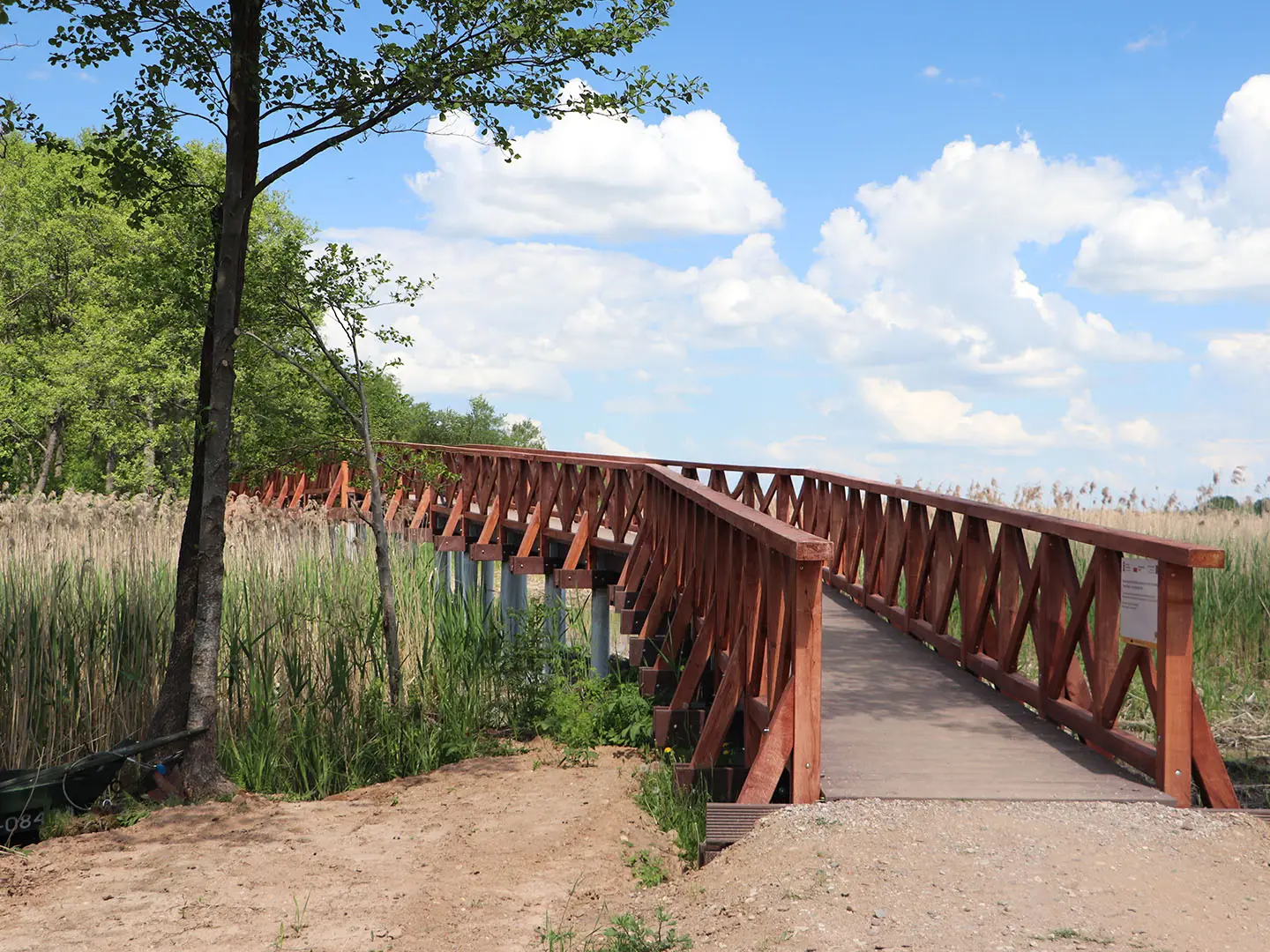
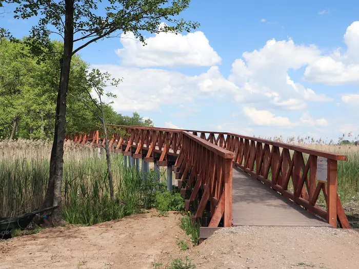
This side of the route includes some of the most characteristic wetland walking in the park. Long timber kładki (boardwalks) cross boggy ground and wetland sections associated with the Czarna Hańcza valley, while forest roads, lakeside tracks and minor asphalt sections link the villages and open areas.
The boardwalks are a highlight but also the main place where care is needed. They can be slippery when wet, and surrounding ground may be boggy in spring or after rain, so stay on the built path where provided. This is not exposed terrain, but a fall on wet timber can still end a trip.
The Słupie area has an educational nature trail through typical Wigry forest and lakeshore habitat. As the route bends back towards the north shore, the final approach through Cimochowizna and Leszczewek brings the walk back towards Stary Folwark, with views across the water to the Wigry monastery among the classic final scenes of the loop.
Look for signs of European beavers along streams, wetlands and quiet lakeside sections: dams, lodges and freshly gnawed trees are often easier to spot than the animals themselves. The suchary bog-lakes and nature paths near Krzywe are close to the start/finish area rather than a compulsory part of this stage, but they are a worthwhile add-on if time and energy allow.
Carry food and water from Gawrych Ruda unless specific open facilities have been checked. Leszczewek and Stary Folwark have accommodation in the wider area, but services should still be treated as rural and seasonal rather than guaranteed on demand.
Stary Folwark is the most convenient finish because it sits on road 653, about 6 km east of Suwałki, and is close to the park headquarters area at Krzywe. Seasonal or municipal buses may run between Suwałki, Stary Folwark and Krzywe, and regional buses towards Sejny pass nearby stops, but services are sparse. Current times should be checked before travelling; a car, taxi or cycling access from Suwałki is often more reliable.
Navigation on the last day is normally simple if the green blazes are followed, but the combination of boardwalks, forest tracks and village lanes makes a current park map useful. Do not confuse this walking-and-cycling loop with the separate Czarna Hańcza kayak route; on this hike the river valley is crossed on foot, not followed by boat.
Recommended Itinerary
The most practical walking plan is the standard 3-day clockwise circuit from Stary Folwark. It follows the park’s recommended split, but note that the days are deliberately uneven: Day 1 is long, Day 2 is very short, and Day 3 is moderate. This works if accommodation is fixed around Bryzgiel and Gawrych Ruda, but stronger walkers may prefer the 2-day version below.
Standard 3-day itinerary
| Day | From | To | Approx. distance | Why this stage makes sense | Services/accommodation notes |
|---|---|---|---|---|---|
| 1 | Stary Folwark | Bryzgiel | 22.5 km | This is the longest day and covers much of the eastern and southern side of Jezioro Wigry, passing through or near Tartak, Magdalenowo, Wigry, Czerwony Folwark, Rosochaty Róg, Mikołajewo, Czerwony Krzyż, Jastrzęby, Zakąty and Krusznik before reaching Bryzgiel. Start early, especially in warm weather or if allowing time for the Camaldolese monastery at Wigry. | Bryzgiel has lakeside accommodation options and is one of the more useful overnight stops on the loop. Book ahead in July-August; this is a rural national-park area, not a hut-to-hut trail. |
| 2 | Bryzgiel | Gawrych Ruda | 6 km | A deliberately short linking stage. It gives time for a slower morning, the viewing tower at Bryzgiel, lakeshore stops, or simply a low-mileage recovery day after the long first stage. | Gawrych Ruda has accommodation options and another viewing tower. Because the walking day is short, it is worth checking check-in times before planning a very early arrival. |
| 3 | Gawrych Ruda | Stary Folwark | 16.5 km | A moderate final day returning along the western and northern side of the lake via Słupie, Cimochowizna and Leszczewek. This side includes forest, wetland terrain and the Czarna Hańcza valley boardwalks, so allow extra time after rain. | Stary Folwark has accommodation and is close to the Wigry Museum and the Krzywe park headquarters area. If leaving by bus or taxi to Suwałki, current times should be checked before travelling. |
Slower variant: 4 days
A 4-day version suits families, first-time multi-day walkers, naturalists and anyone wanting time for the monastery at Wigry, short educational trails, viewing towers and lakeside stops. The simplest way to slow the route is to split the long first day with an overnight around Wigry, where the former Camaldolese monastery also offers rooms.
Exact leg distances for this variant should be checked on the current park map before booking accommodation.
| Day | From | To | Approx. distance | Why this stage makes sense | Services/accommodation notes |
|---|---|---|---|---|---|
| 1 | Stary Folwark | Wigry | Check official mapping before booking | A short opening day keeps the start relaxed and leaves time for the Wigry Museum area, lake views from Stary Folwark and the Camaldolese monastery at Wigry. | Accommodation is available in the Wigry area, including rooms at the former monastery. Opening times for the monastery museum should be checked before travelling. |
| 2 | Wigry | Bryzgiel | Check official mapping before booking | This breaks the standard long first day into a more manageable section through the eastern and southern side of the lake circuit. | Bryzgiel is a practical overnight stop with lakeside accommodation. Book ahead in the main summer season. |
| 3 | Bryzgiel | Gawrych Ruda | 6 km | A very short stage, best treated as a half-day walk with time for the Bryzgiel and Gawrych Ruda viewpoints or a rest afternoon. | Check accommodation arrival times, as the walking distance is short. |
| 4 | Gawrych Ruda | Stary Folwark | 16.5 km | A steady final day through forest, wetland and village sections back to the north shore of Jezioro Wigry. | Finish accommodation is available in Stary Folwark, or onward travel can be arranged towards Suwałki. Bus times should be checked before travelling. |
Faster variant: 2 days
Strong walkers can complete the loop in two days by using Bryzgiel as the overnight point. This creates two broadly even walking days of about 22.5 km each, but it leaves less time for side trails, museum visits and slow wildlife watching.
| Day | From | To | Approx. distance | Why this stage makes sense | Services/accommodation notes |
|---|---|---|---|---|---|
| 1 | Stary Folwark | Bryzgiel | 22.5 km | Follows the standard first stage and reaches a logical overnight village on the southern side of the lake. | Bryzgiel is the key overnight stop. Book ahead, especially in July-August. |
| 2 | Bryzgiel | Stary Folwark via Gawrych Ruda | About 22.5 km | Combines the standard second and third stages into one longer final day. The terrain is not difficult, but sandy tracks, boggy sections and boardwalks can slow the pace after rain. | Finish in Stary Folwark. If relying on public transport back to Suwałki, check current services before committing to a late finish. |
Planning the Route
How many days to allow
Plan on three walking days unless there is a clear reason to go faster. The route is low and non-technical, but its planning challenge is the length, rural logistics and the need to fit accommodation around the lakeside villages rather than the terrain.
The established three-day split is uneven but practical:
| Day | Stage | Approx. distance | Planning note |
|---|---|---|---|
| 1 | Stary Folwark to Bryzgiel | 22.5 km | The longest day; start early, especially if visiting Wigry monastery en route. |
| 2 | Bryzgiel to Gawrych Ruda | 6 km | A deliberately short day, useful for a slower lakeside section, viewpoints or recovery after Day 1. |
| 3 | Gawrych Ruda to Stary Folwark | 16.5 km | A moderate final day back to the north shore and transport connections. |
Strong walkers can compress the loop into two days, but this makes the walk more about covering ground than enjoying the national park. A two-day plan also puts more pressure on accommodation choices, because the villages are rural and the most convenient stopping points may not line up with an ideal halfway split.
Cyclists can cover the loop in a day, but that should not be used as a walking benchmark. On foot, the route rewards a slower pace, particularly around Jezioro Wigry, the monastery at Wigry, the Czarna Hańcza wetlands and the educational trails near Krzywe, Rosochaty Róg and Słupie.
Direction and stage planning
The route is normally planned as a clockwise circuit from Stary Folwark, following the green Wokół Wigier waymarks through or near Tartak, Magdalenowo, Wigry, Czerwony Folwark, Rosochaty Róg, Mikołajewo, Czerwony Krzyż, Jastrzęby, Zakąty, Krusznik, Bryzgiel, Gawrych Ruda, Słupie, Cimochowizna and Leszczewek before returning to Stary Folwark.
Walking it this way makes the common overnight stops at Bryzgiel and Gawrych Ruda straightforward. It also puts the longest day first, which suits walkers who want a shorter middle day rather than three more evenly balanced stages.
The loop can be walked in the opposite direction, but accommodation and transport should be arranged first rather than assuming the same stage pattern will work cleanly in reverse.
Accommodation dictates the itinerary more than the terrain
There are no mountain huts on this route. Overnight stops are usually arranged in agritourism rooms, guesthouses, holiday cottages, campsites or the accommodation at the former Camaldolese monastery at Wigry.
Useful accommodation areas include Stary Folwark, Bryzgiel, Gawrych Ruda, Leszczewek and Wigry. Availability is much better in the main holiday season, but this is still a rural lakeland area, so book ahead for July and August.
Because the second official stage is only around 6 km, some walkers will be tempted to combine Days 2 and 3. That can work for fit walkers, but only if accommodation, weather and return transport are already fixed; otherwise the standard split is the lower-risk plan.
Shortening, extending and section hiking
Shortening the walk is possible in practice because the route passes a chain of road-access villages, but it is not a turn-up-and-go public-transport trail. Buses around Stary Folwark and Krzywe are limited and seasonal, and regional services towards Sejny only help if their stops and times fit the day’s plan. This should be checked before travelling.
A taxi from Suwałki, a parked car, or pre-arranged pick-up gives far more flexibility than relying on buses. Section hiking is therefore practical for walkers based in Suwałki, Stary Folwark or another nearby village, but it needs deliberate transport planning for each section.
The easiest way to extend the trip is not by adding distance to the main loop, but by allowing time for nearby park features: the Muzeum Wigier at Stary Folwark, the monastery at Wigry, the suchary bog-lake nature paths near Krzywe, the educational trails at Rosochaty Róg and Słupie, and the viewing towers at Krusznik, Bryzgiel and Gawrych Ruda. Opening times for museums, the monastery and seasonal attractions should be checked before travelling.
Navigation and maps
The trail is waymarked with green blazes and is also used as a walking-and-cycling route, so expect to share some tracks with cyclists. Most of the navigation is on gravel roads, forest tracks, village lanes, boardwalks and lakeside paths rather than technical footpaths.
Carry the current Wigierski Park Narodowy map and do not rely only on the headline distance. Published figures vary between roughly 42 km and 49 km, so use about 45–46 km for planning but follow the current park map on the ground. The park headquarters and nature-education centre at Krzywe is the key place to pick up current information before starting.
Boardwalks through wet areas, especially around the Czarna Hańcza valley, are an important part of the route. After rain, expect muddy approaches and potentially slippery timber surfaces.
Food, water and daily supplies
Do not plan the walk around finding frequent shops or cafés unless these have been checked locally. The route passes villages, but services are rural and may be seasonal.
Carry lunch, snacks and enough water for each stage when leaving the overnight stop. Refill at accommodation where possible, and confirm meal arrangements when booking rooms, especially outside the main summer season.
For the long first day to Bryzgiel, start with a full day’s food and water rather than assuming resupply will appear at the right time. The short Bryzgiel to Gawrych Ruda stage is more forgiving, but the same principle applies.
Weather, ground conditions and park checks
This is a spring-to-autumn walk. The main weather issue is not exposure or altitude, but wet ground: sandy tracks, boggy sections, forest roads and boardwalks can all slow the pace after rain.
Light walking shoes may be enough in dry summer conditions, but waterproof footwear or fast-drying trail shoes are more sensible in spring, autumn or after prolonged rain. Poles can help on muddy boardwalk approaches, though they are not essential for the low gradients.
Before travelling, check current park information for trail closures, damaged boardwalks, visitor rules and any access requirements. No special mountain permit is involved, but national-park rules and any temporary restrictions should always be checked before the walk.
Towns, Villages and Overnight Stops
Accommodation around Jezioro Wigry (Lake Wigry) is low-key and village-based: agroturystyka farm rooms, guesthouses, holiday cottages and lakeside campsites. There are no mountain huts, and this is not a pub-to-pub trail, so overnight planning should be done before setting off rather than left to chance.
The most practical overnight bases are Stary Folwark, Wigry, Bryzgiel, Gawrych Ruda and Leszczewek. Availability is generally best in summer, but July and August should be booked ahead, especially if walking the standard three-day split.
| Place | Best use for hikers | Accommodation outlook | Food and services |
|---|---|---|---|
| Stary Folwark | Start/finish night; access from Suwałki | Good choice of rural stays and lakeside options | Check current shops/cafes before relying on them |
| Wigry | Monastery stop or short first day alternative | Rooms at the former Camaldolese monastery; other local rural stays may be available | Museum/monastery opening times should be checked |
| Bryzgiel | Standard Day 1 overnight | One of the better trail villages for accommodation/campsites | Do not assume late food availability |
| Gawrych Ruda | Standard Day 2 overnight | One of the better trail villages for accommodation/campsites | Check food options with accommodation |
| Leszczewek | Extra night near the end or alternative final base | Rural accommodation available in the village area | Useful only if pre-booked and planned |
Stary Folwark
Stary Folwark is the natural base for the route because the loop starts and finishes here on the north shore of Lake Wigry. It sits on road 653, about 6 km east of Suwałki, and is close to Krzywe, where the Wigry National Park headquarters and nature-education centre are located.
For most walkers, Stary Folwark is the best place to stay the night before starting and, if needed, the night after finishing. Accommodation is among the more dependable on the trail, with agroturystyka rooms, guesthouses, holiday cottages and lakeside camping in the wider village area.
Food and small-service availability should be checked before travelling. Suwałki is the practical place to stock up if arriving by public transport, taxi or car, particularly for walkers who want to carry lunch for the first stage to Bryzgiel.
Transport is most straightforward here compared with the smaller villages. Seasonal or municipal buses run from Suwałki towards Stary Folwark and Krzywe, and regional PKS Nova buses towards Sejny pass nearby stops, but services are sparse and current times should be checked before travelling. Many walkers use a car, taxi or the cycle path along road 653 from Suwałki.
Local reasons to allow time here include the Wigry Museum near the shore and the classic view across the lake towards the monastery at Wigry. The park map is best picked up at the Krzywe headquarters before committing to the loop, especially after wet weather or if boardwalk closures are possible.
Tartak and the Płociczno-Tartak Area
Tartak, in the Płociczno-Tartak area, comes early on the clockwise circuit from Stary Folwark. It is mainly a passing point rather than a key overnight stop for the standard three-day walk.
The main local feature for hikers is the Wigierska Kolej Wąskotorowa, the Wigry narrow-gauge tourist railway, near the route, along with a fish hatchery at Tartak. These can make the opening section more interesting, but they should not be treated as guaranteed resupply points.
Accommodation, food and transport details for Tartak should be checked before travelling. Unless a specific stay has been booked here, it is safer to plan on continuing towards Wigry, the eastern lakeside villages or Bryzgiel.
Magdalenowo
Magdalenowo lies on the route between the northern shore around Stary Folwark and the monastery area at Wigry. For most walkers it is a small route village rather than a planned overnight halt.
It can be useful as a navigation marker on the way into the eastern side of the lake. Do not rely on it for food, shops or transport unless these have been checked before travelling.
Wigry
Wigry is one of the most useful and distinctive stopping points on the loop. It sits by the pokamedulski klasztor (former Camaldolese monastery), on a peninsula above Lake Wigry, and is a logical place to slow down if turning the route into a more relaxed itinerary.
The monastery complex, now associated with Dom Pracy Twórczej / Fundacja Wigry Pro, offers rooms, making it the clearest named accommodation option on this part of the trail. This is especially useful for walkers who do not want the long first stage all the way to Bryzgiel.
The monastery, bell tower, museum and former papal apartments are major reasons to stop here, but opening times should be checked before travelling. Food availability should also be checked directly with the accommodation or locally; it is not a place to reach late in the day assuming full village services.
Transport connections from Wigry itself are not a dependable planning anchor from the available route information. If starting or ending a section here, arrange a taxi, private transfer or confirmed local bus connection in advance.
Czerwony Folwark
Czerwony Folwark comes after Wigry on the clockwise route. It is best treated as a small settlement on the walking line rather than a main overnight base.
There is no specific accommodation or food provision to rely on here from the route information. Carry enough water and food to continue, and only plan to stop overnight if a specific booking has been made.
Rosochaty Róg
Rosochaty Róg is worth noting because of the educational nature trail in the area, which gives walkers a closer look at characteristic Wigry forest and lakeshore habitat. It is a useful short detour or rest point rather than a core logistics stop.
Accommodation and food availability should be checked before travelling. For most itineraries, Rosochaty Róg sits within the longer first day from Stary Folwark to Bryzgiel, so avoid depending on it for resupply.
Mikołajewo
Mikołajewo is another small village on the eastern and southern arc of the lake circuit. It works mainly as a route marker between the monastery side of the lake and the approach towards Bryzgiel.
Do not assume shops, cafes or transport here. If accommodation is wanted in this part of the lake, book a specific agroturystyka or guest room in advance rather than arriving without a reservation.
Czerwony Krzyż, Jastrzęby and Zakąty
Czerwony Krzyż, Jastrzęby and Zakąty are passed on the approach towards Krusznik and Bryzgiel. They help break up the long first stage, but they are not the principal overnight villages for the standard itinerary.
Treat this section as rural walking with limited dependable services. Carry lunch and enough water from the start or from a confirmed stop, and check any planned accommodation directly before travelling.
Krusznik
Krusznik is useful because of its viewing tower, one of the raised viewpoints over Lake Wigry and the surrounding forest. It is a worthwhile pause before continuing to Bryzgiel.
It is not the main recommended overnight halt on the three-day split. Food, accommodation and onward transport should be checked before travelling if considering it as a stop.
Bryzgiel
Bryzgiel is the standard first overnight stop on the three-day walking itinerary, reached after the long first stage from Stary Folwark. It is one of the key villages for accommodation on the route, with rural stays and lakeside camping among the likely options.
Because the first day is the longest of the standard split, accommodation in Bryzgiel should be booked before setting off. This is particularly important in July and August, when the lake villages are busier and casual availability is less reliable.
The village also has a viewing tower, making it a good place to end the day with a lake viewpoint rather than just a bed for the night. Food and shop options should be checked with the accommodation; walkers should not rely on late-opening services.
Public transport should not be assumed from Bryzgiel. If using it as a section start or finish rather than an overnight stop, arrange a taxi or check current local bus options before travelling.
Gawrych Ruda
Gawrych Ruda is the standard second overnight stop. The day from Bryzgiel is short, so it gives time for a slower morning, side stops, recovery after the first long stage, or a more relaxed pace through the western lakeside and forest sections.
Accommodation availability is among the better options on the loop, with agroturystyka, guesthouses, holiday cottages and lakeside camping in the village area. Book ahead in peak summer, as this is one of the obvious places for walkers and cyclists to stay.
The village has a viewing tower and is also well placed before the final stage back towards the north shore. Food availability should be checked directly with accommodation; carry supplies if the final day is being started early.
Transport is not as dependable as Stary Folwark or Suwałki-based access. For section hiking, confirm local buses or arrange a taxi in advance.
Słupie
Słupie is passed on the final stage from Gawrych Ruda towards Stary Folwark. It is notable for the Słupie educational trail, which can be added if time and energy allow.
For most walkers it is a daytime stop, not an overnight base. Accommodation, food and transport should be checked before travelling if planning anything more than a short halt.
Cimochowizna
Cimochowizna lies on the return side of the loop before Leszczewek and Stary Folwark. It is a small route village and should be treated mainly as a navigation point on the final day.
Do not rely on it for shops, cafes or public transport. Carry what is needed from Gawrych Ruda unless a specific stop has been arranged.
Leszczewek
Leszczewek is one of the better accommodation villages close to the end of the loop. It is useful for walkers who want an extra night near the north shore rather than finishing and leaving immediately from Stary Folwark.
Accommodation is typically rural: agroturystyka rooms, guesthouses or holiday accommodation in the village area. It can also work as an alternative final base if Stary Folwark is full, provided the booking and onward transport have been arranged.
Food and shop availability should be checked before travelling. For onward travel, the practical access point remains the Stary Folwark/Krzywe/Suwałki side of the route, with bus times checked in advance or a taxi arranged.
Getting to the Start
The trail starts and finishes in Stary Folwark, a lakeside village on the north shore of Jezioro Wigry (Lake Wigry), about 6 km east of Suwałki on road 653. Suwałki is the practical gateway: it is the rail and bus hub for the area, while local transport onwards to Stary Folwark and Krzywe is limited.
By train
Use Suwałki as the nearest useful railway station. It sits on the Białystok–Suwałki rail line and is the logical railhead for walkers without a car.
From Suwałki station, the final leg to Stary Folwark is short but not always straightforward by public transport. Seasonal and municipal buses run towards Stary Folwark and Krzywe, but services are sparse, so do not assume a convenient same-day connection. This should be checked before travelling.
If train and bus times do not align, a taxi from Suwałki is often the simplest way to reach the start. The distance is modest, but taxi availability and fares should be checked locally before relying on this option.
By bus
Suwałki is also the main bus hub for the region. From there, local buses serve the Wigry area, including seasonal or municipal services towards Stary Folwark and Krzywe.
PKS Nova regional buses towards Sejny pass nearby stops, which may be useful depending on current routing and timetables. Services in this rural area are limited, especially outside the main summer season, so check both outward and return connections before booking accommodation. This should be checked before travelling.
A practical fallback is to travel by bus to Suwałki, then use a taxi for the last 6 km to Stary Folwark. This is particularly sensible if arriving late in the day or starting the walk early the next morning.
By car
Driving is the most reliable way to reach the start. Suwałki lies on the E67, and Stary Folwark is reached from Suwałki by road 653, about 6 km to the east.
A car also makes the pre-walk logistics easier: collecting a current park map at the Wigry National Park headquarters and nature-education centre at Krzywe, reaching accommodation in smaller villages, and dealing with sparse buses. Rental cars from Suwałki or Augustów are the most dependable option for hikers who want full flexibility.
Because the walk is a loop, leaving a vehicle near the start is logistically simple in principle. Long-stay parking arrangements should be agreed with your accommodation or checked locally before setting off. This should be checked before travelling.
From the nearest airport
There is no major airport immediately at the trailhead. For international arrivals, the practical plan is to choose an airport with onward rail, bus or car access to Suwałki, then continue from Suwałki to Stary Folwark by local bus, taxi, bicycle or rental car.
Do not leave the final Suwałki–Stary Folwark transfer to chance, particularly outside summer. Current airport-to-Suwałki connections and local bus times should be checked before travelling.
Where to stay before starting
The easiest pre-walk base is Stary Folwark itself, especially if you want to start walking without needing a morning transfer. Staying here also places you close to the lake shore and the northern side of the route.
Krzywe is another practical area because it is close to the Wigry National Park headquarters and nature-education centre, where picking up the current park map is sensible before starting. If accommodation in the villages is full, Suwałki gives the widest transport options, but it adds a short transfer to the trailhead on the morning of departure.
Accommodation around the park is mainly agritourism rooms, guesthouses, holiday cottages and campsites, with good summer coverage but limited capacity in a rural area. Book ahead for July and August.
Getting Home from the Finish
The Wigry National Park Trail finishes back at Stary Folwark, so leaving the route is simpler than on a point-to-point trail. The main onward transport hub is Suwałki, about 6 km west of Stary Folwark, with rail and bus connections and access to the E67 road.
Public transport around the park is limited and timetable-dependent. If finishing late in the day, do not assume there will be a convenient bus from Stary Folwark or Krzywe; arrange a taxi in advance, continue to pre-booked accommodation, or plan to stay locally.
By train
Use Suwałki for rail travel. Suwałki is the regional rail hub on the Białystok–Suwałki line, so the practical sequence is: finish at Stary Folwark, transfer to Suwałki, then continue by train.
There is no useful rail access directly at the trail finish. From Stary Folwark, reach Suwałki by seasonal or municipal bus where available, taxi, pre-arranged pick-up, or by cycling the road-653 cycle route if travelling with a bike.
Train times and same-day onward connections should be checked before travelling, especially outside the summer season or if aiming to connect beyond Białystok.
By bus
Seasonal and municipal buses link Suwałki with the Stary Folwark and Krzywe area, close to the park headquarters. PKS Nova regional buses towards Sejny also pass nearby stops.
Services are sparse, so bus travel needs more planning than the short distance to Suwałki suggests. Check current timetables before setting out on the final day, and avoid building a plan around the last bus unless there is a realistic time buffer.
If the day ends at an awkward time, Suwałki is still the place to aim for: it is the main bus hub for onward regional travel.
By car/taxi
For walkers arriving by car, the loop format is the easiest option: leave the car at or near the start in Stary Folwark and finish back where the walk began. Parking arrangements should be checked locally before leaving a vehicle for several days.
A taxi between Stary Folwark, Krzywe and Suwałki is the most flexible public-transport fallback. Because this is a rural national-park area, book ahead if finishing late, travelling outside the main season, or needing to meet a train or long-distance bus in Suwałki.
A rental car from Suwałki or Augustów is also a reliable option for hikers combining the trail with wider travel in north-eastern Poland.
From the nearest airport
Air travel is not a natural finish option for this route. The practical first step after finishing is to get from Stary Folwark to Suwałki, then continue by rail, bus or car towards the airport that suits the wider trip.
The best airport connection depends on current domestic and international routes, onward rail and bus times, and whether a rental car is being used. This should be checked before travelling.
Where to stay at the finish
Stary Folwark has low-key accommodation suited to finishing the loop without rushing for onward transport: agritourism rooms, guesthouses, holiday cottages and lakeside campsites are typical in this area. Nearby villages around the final section, including Leszczewek and Wigry, also have accommodation options.
Staying locally is sensible if the final day runs late, if bus times do not line up with trains from Suwałki, or if travelling in a group where a pre-booked taxi is needed. In July and August, book ahead rather than relying on turning up in the evening.
Suwałki is the better overnight choice for an early train or bus the next morning, or for anyone wanting a wider range of services before leaving the region.
Which Direction Should You Walk?
The usual direction is clockwise from Stary Folwark, following the village order towards Tartak, Magdalenowo, Wigry, Mikołajewo, Bryzgiel, Gawrych Ruda, Leszczewek and back to Stary Folwark. This matches the standard three-day split: Stary Folwark to Bryzgiel, Bryzgiel to Gawrych Ruda, then Gawrych Ruda to Stary Folwark.
Because this is a circular route, transport is not a major reason to choose one direction over the other. You start and finish in the same place, so buses, taxis, parking and the return to Suwałki work in the same way either way. Current bus times from Suwałki to Stary Folwark or Krzywe should still be checked before travelling, as services are limited.
Clockwise: the best default
Clockwise is the most logical direction for most walkers because it follows the established stage pattern and puts the longest day first. The first day to Bryzgiel is around 22.5 km, so it is demanding by distance, but the terrain is low, non-technical and not steep.
This direction also gives a strong scenic opening. The route reaches the Wigry area and the Camaldolese monastery side of the lake early, then continues through the quieter eastern and southern villages before looping back through the western side of the park.
The accommodation flow is also more natural if using the standard three-day plan. Bryzgiel and Gawrych Ruda are sensible overnight stops, with the very short middle day giving time for viewpoints, nature trails, lakeside breaks or a slower pace after the longer first stage.
Anti-clockwise: workable, but less neat
Walking anti-clockwise is perfectly possible, as the route is a waymarked loop rather than a one-way trail. It may suit walkers who find better accommodation availability in Gawrych Ruda for the first night or who want a shorter first day.
The trade-off is that the standard overnight pattern becomes less balanced. Reversing the usual stages gives approximately 16.5 km from Stary Folwark to Gawrych Ruda, then 6 km to Bryzgiel, followed by the longest day of about 22.5 km back to Stary Folwark. That makes the final day the hardest by distance, which is less appealing if onward transport from Stary Folwark or Suwałki is planned the same evening.
There is no meaningful climbing advantage in either direction. The whole route has very modest ascent, gentle moraine undulations and short rises to viewpoints rather than sustained climbs.
Recommendation
Walk clockwise from Stary Folwark unless accommodation availability clearly favours the reverse. It follows the standard trail order, gives the most practical three-day rhythm, puts the longest day early, and finishes with a manageable final stage back to Stary Folwark for transport or parking.
Accommodation Along the Route
Accommodation on the Wigry National Park Trail is low-key and rural. There are no mountain huts, staffed trail shelters or guaranteed walk-in beds; most walkers use agroturystyka farm rooms, guesthouses, holiday cottages and lakeside campsites in the villages around Jezioro Wigry (Lake Wigry).
The route works well as an inn-to-inn style walk if accommodation is booked in advance, but it is not a trail where every hamlet has a reliable choice of beds. July and August, summer weekends and good-weather holiday periods need particular care, especially for lakeside cottages and campsites.
Best overnight stops
The standard three-day walking split uses Stary Folwark → Bryzgiel → Gawrych Ruda → Stary Folwark. This is the simplest arrangement because Bryzgiel and Gawrych Ruda are among the stronger accommodation points on the loop.
The split is uneven: the first day to Bryzgiel is the longest, the second day to Gawrych Ruda is very short, and the final day back to Stary Folwark is moderate. That pattern suits walkers who want time for viewpoints, nature trails or a relaxed lakeside afternoon, but strong walkers may prefer a two-day itinerary if suitable accommodation and transport are arranged.
Stary Folwark is the most convenient start and finish base, with nearby access to Krzywe and the Wigry National Park headquarters area. Leszczewek can also be useful near the end of the circuit if a shorter final walking day is wanted, but it should be booked rather than treated as a fallback.
Accommodation by place
| Place | Accommodation level | Best for | Notes |
|---|---|---|---|
| Stary Folwark | Good | Start/finish nights; leaving a car; an extra night for the Wigry Museum and north-shore views | One of the strongest bases on the route, close to Krzywe and the park headquarters area. Useful before an early start or after finishing the loop. |
| Wigry | Limited | A characterful stop near the Camaldolese monastery | The former Camaldolese monastery complex at Wigry offers rooms through Dom Pracy Twórczej / Fundacja Wigry Pro. Availability and current booking arrangements should be checked before travelling. |
| Intermediate eastern and southern-shore villages | Limited | Flexible walkers with pre-booked rooms | Villages such as Czerwony Folwark, Rosochaty Róg, Mikołajewo, Czerwony Krzyż, Jastrzęby, Zakąty and Krusznik are useful route points, but should not be relied on for spontaneous accommodation. Book ahead if planning to stop before Bryzgiel. |
| Bryzgiel | Good | Main first-night stop on the standard three-day itinerary | A practical overnight point after the longest standard stage from Stary Folwark. Lakeside accommodation and camping options are the main appeal in season. |
| Gawrych Ruda | Good | Main second-night stop; relaxed short middle day | A strong accommodation village on the western side of the lake and the standard stop before the final walk back to Stary Folwark. Also useful for walkers wanting time around the viewing tower and nearby lakeside sections. |
| Leszczewek | Good | Shortening or reshaping the final stage | A useful north-shore accommodation area close to the end of the loop. It can help if the final Gawrych Ruda–Stary Folwark day feels too long, but advance booking is still sensible. |
| Suwałki | Good | Pre- or post-walk nights; backup if route accommodation is full | Not on the trail, but the main rail and bus hub for the area. Staying here usually means arranging bus, taxi, car or cycle access to Stary Folwark/Krzywe. |
Booking strategy
For a straightforward three-day walk, book Stary Folwark, Bryzgiel and Gawrych Ruda before finalising travel. This avoids being forced into long detours or taxi transfers in a rural area with sparse public transport.
In July and August, book earlier and avoid assuming that lakeside campsites or cottages will have space on arrival. The area is popular with Polish holidaymakers, cyclists and paddlers as well as walkers, so weekend pressure can be higher than the trail’s gentle profile suggests.
Outside the main summer season, there may be less pressure but also fewer open facilities. Guesthouses, farm rooms, campsite opening dates and food availability should be checked directly before travelling.
Camping and cottages
Campsites exist around the lake villages, but they should be treated as organised campsites rather than permission to camp freely. Wigierski Park Narodowy is a protected national park, so walkers should use official accommodation and camping places rather than informal pitches in forest or lakeshore areas.
Holiday cottages can work well for groups or for a relaxed base-and-walk trip, but they are not always ideal for one-night stays. Minimum-stay rules, seasonal opening and whether bedding or meals are included should be checked before booking.
Luggage and taxi transfers
Do not assume there is a dedicated luggage-transfer system on this trail. If walking with a small daypack is important, arrange bag movement directly with accommodation providers or by pre-booked taxi; this should be checked before travelling.
Taxi transfers can also solve awkward accommodation gaps, especially if beds in Bryzgiel or Gawrych Ruda are full. The most reliable backup is to use Suwałki or a booked lakeside base and arrange transport to and from the trail, but sparse local services mean this needs planning rather than improvisation at the end of the day.
Camping and Wild Camping
Camping is a realistic way to walk the Wigry National Park Trail, but it should be planned around established sites rather than informal pitches. This is a protected national-park landscape of forest, wetlands, lakeshore and private village land, so do not treat it like open backcountry.
There are no mountain huts on the route. Overnight options are low-key: lakeside campsites, agritourism rooms, guesthouses and holiday cottages in or near the villages around Jezioro Wigry (Lake Wigry), especially Stary Folwark, Wigry, Bryzgiel, Gawrych Ruda and Leszczewek.
Campsites and useful camping bases
The most practical camping locations are the same settlements used for the standard three-day walking split. Facilities and opening seasons can change, so campsite availability, prices and whether tents are accepted should be checked before travelling, particularly outside summer.
| Area | Why it works for campers |
|---|---|
| Stary Folwark | Best start/finish base on the north shore of Lake Wigry, close to the trailhead and useful for a night before or after the loop. |
| Wigry | Useful if shortening or adjusting the first stage; also has other accommodation around the former Camaldolese monastery area. |
| Bryzgiel | The natural first overnight point on the standard route after the long Stary Folwark to Bryzgiel stage. |
| Gawrych Ruda | The standard second overnight point, though the Bryzgiel to Gawrych Ruda stage is very short, so some walkers may prefer to adjust the itinerary. |
| Leszczewek | Useful near the final approach back to Stary Folwark if breaking the last stage or adding a relaxed extra night by the lake. |
For a classic three-day camping itinerary, Bryzgiel and Gawrych Ruda are the obvious overnight targets. The second walking day is only about 6 km, so campers who prefer fuller days may either use it as a rest-heavy nature day or combine sections into a two-day walk if fitness, weather and accommodation logistics allow.
Wild camping
Do not assume wild camping is allowed in Wigierski Park Narodowy (Wigry National Park). The route passes through protected forest, wetland, lakeshore habitat and small villages, with private land close to many sections.
The responsible approach is to use official campsites or booked accommodation. If considering any form of informal overnight stop, check the current Wigry National Park rules locally before relying on it. This should be checked before travelling.
Avoid pitching on lake shores, boardwalk approaches, peat-bog margins, meadows, viewing-tower areas or beside the Czarna Hańcza valley wetlands. These are sensitive habitats and are also poor places to camp in practical terms, with insects, damp ground and limited privacy.
Water and cooking
Although the route circles a large lake and crosses wetland areas, natural water should not be treated as a guaranteed drinking source. Plan to refill from campsite or accommodation taps, and carry enough water between villages, especially on warm summer days.
If using any natural water in an emergency, it should be properly treated. Do not wash cookware, use soap or dispose of food waste in Lake Wigry, the Czarna Hańcza wetlands or small bog-lakes such as the suchary near Krzywe.
For cooking, use a stove only where it is safe and permitted by the place you are staying. Open fires should be avoided unless a managed campsite or marked area explicitly allows them under current conditions; fire rules in forested national-park areas can change with drought risk.
Seasonal camping considerations
Summer gives the best chance of open campsites and warm evenings, but July and August are also the busiest months around the lake. Book ahead rather than arriving late and assuming there will be space.
Spring and autumn are quieter, but campsites may have reduced facilities or be closed. Boardwalks, sandy forest tracks and lakeside paths can also be wet or muddy after rain, so a waterproof groundsheet, dry bags and footwear that copes with mud are useful.
Mosquitoes and other insects can be an issue around reedbeds, boggy ground and still water in warm weather. A tent with good mesh, repellent and long sleeves make camping much more comfortable.
Low-impact camping practice
Keep camping impact low throughout the loop:
- stay on established paths, campsites and durable surfaces;
- use toilets at campsites, accommodation or visitor facilities where available;
- pack out all rubbish, including food scraps;
- keep noise low near villages, lake shore and wildlife areas;
- never cut branches or damage trees for shelter or firewood;
- keep well away from beaver lodges, dams, gnawed trees and wetland margins;
- leave boardwalks, viewing towers and educational trails clear for other visitors.
Camping suits this trail well when arranged through proper sites. Wild camping is the wrong default in a national park: plan around recognised overnight places, check current park rules and keep the lake-and-wetland environment undisturbed.
Food, Water and Resupply
Food and water planning on the Wigry National Park Trail is straightforward if treated as a rural walk rather than a hut-to-hut route. The trail passes villages regularly, but there is no guaranteed chain of shops, cafés or pubs at walking intervals, and no mountain-hut system. Plan to be self-sufficient during the walking day and use overnight villages for meals, packed lunches and bottle refills.
Suwałki is the sensible place for a proper food shop before starting, especially if arriving by rail or bus. Stary Folwark, Bryzgiel and Gawrych Ruda are the key overnight points on the standard three-day split, but opening hours and food service in small lakeside villages can be seasonal and limited. This should be checked before travelling, particularly outside summer and on Sundays.
Food planning
Carry breakfast supplies, lunch and snacks unless these are arranged with accommodation. Agritourism rooms, guesthouses, holiday cottages and campsites may be able to help with meals or packed lunches, but this varies by property and season, so ask when booking rather than assuming food will be available on arrival.
Day 1 is the main resupply risk: Stary Folwark to Bryzgiel is about 22.5 km, and although the route passes or skirts several villages, reliable daytime food availability should not be assumed. Start with a full lunch, high-energy snacks and enough food to reach Bryzgiel even if nothing is open en route.
Day 2 is only about 6 km from Bryzgiel to Gawrych Ruda, so it is easy to cover on breakfast and a small snack. The short stage also gives flexibility for a slower start, local viewpoints or nature-trail detours, but food for the evening should still be arranged in advance.
Day 3 from Gawrych Ruda to Stary Folwark is about 16.5 km and again crosses mostly forest, lakeside and village-edge terrain rather than service-heavy countryside. Carry lunch and snacks from Gawrych Ruda, with Stary Folwark as the dependable finish point rather than an en-route resupply guarantee.
Water planning
There is plenty of water in the landscape — Jezioro Wigry (Lake Wigry), wetlands, streams and the Czarna Hańcza valley — but that does not mean there is reliable potable water on the trail. Treat natural water as untreated: filter, boil or chemically treat it if used, especially near lake shores, boggy ground and village areas.
The simplest approach is to refill at accommodation each morning and ask for bottles to be topped up where you buy food or drink. Do not rely on public taps, fountains or staffed facilities being available along the route unless checked locally.
For most walkers, 1.5–2 litres is a sensible starting carry on mild days, with more in hot summer weather or if walking slowly with children. The lowland terrain is not physically extreme, but exposed lakeside sections, sandy tracks and warm forest roads can still increase water use.
| Section | Food availability | Water availability | Notes |
|---|---|---|---|
| Stary Folwark → Bryzgiel, approx. 22.5 km | Start stocked up. Villages are passed, including the Wigry and Mikołajewo side of the lake, but reliable food stops should not be assumed. | Fill before leaving Stary Folwark. Natural water is common but should be treated if used. | Longest standard stage; carry a full day’s lunch and snacks. Check any planned café/shop/meal stop before relying on it. |
| Bryzgiel → Gawrych Ruda, approx. 6 km | Short stage between overnight villages; arrange breakfast and evening food with accommodation or locally in advance. | Fill at accommodation in Bryzgiel; the carry is short, but do not depend on public taps. | Easiest stage for food and water logistics, but still rural and seasonal. |
| Gawrych Ruda → Stary Folwark, approx. 16.5 km | Limited en-route certainty through Słupie, Cimochowizna and Leszczewek; carry lunch and snacks. | Fill before leaving Gawrych Ruda. Treat lake or stream water if needed. | Finish back at Stary Folwark, but plan the walking day as self-sufficient. |
Practical resupply tips
- Buy core supplies in Suwałki before travelling to Stary Folwark if possible.
- Ask accommodation in Bryzgiel and Gawrych Ruda about breakfast, packed lunches and evening meals when booking.
- Carry more food than the map suggests you might need; villages on the route do not guarantee open shops or cafés.
- Check rural and seasonal opening times before setting off, especially outside July–August and on Sundays.
- Keep an emergency meal or substantial snack in the pack in case a planned stop is closed.
- Do not drink directly from Lake Wigry, wetlands or streams without treatment.
Terrain, Conditions and Difficulty in Practice
The Wigry National Park Trail is physically straightforward but not effortless. The ground is low, the climbing is minimal and there is no exposed or technical terrain, yet the full loop is still about 45–46 km and the first walking day is long at roughly 22.5 km.
The main difficulty is sustained distance on mixed lowland surfaces: gravel roads, unsurfaced forest tracks, sandy sections, lakeside paths, field-edge paths, boardwalks and short village-road stretches. Good fitness matters more than mountain skills.
Path surfaces
Most of the route follows gravel and unsurfaced forest roads through Wigierski Park Narodowy (Wigry National Park), with regular sections on sandy tracks and quieter paths near meadows, peat bogs and the shore of Jezioro Wigry (Lake Wigry). These surfaces are generally easy to follow and not technical, but sandy ground can be surprisingly tiring over a full day, especially with a multi-day pack.
There are also long timber boardwalks, particularly across the boggy Czarna Hańcza valley and wetland areas. They keep walkers out of the wettest ground, but timber can be slippery after rain, in early morning damp or when leaves are down in autumn. Walk rather than rush these sections, and avoid relying on trainers with worn soles.
Short sections of minor asphalt road occur through villages, notably around Bryzgiel and Stary Folwark. These are not major road-walking stages, but the route is also a combined walking-and-cycling trail, so expect occasional cyclists on shared tracks as well as local traffic on village lanes.
| Terrain type | What it means in practice |
|---|---|
| Gravel and forest roads | Fast, non-technical walking; easy navigation where waymarks are clear |
| Sandy tracks | Slower and more tiring than the gradient suggests |
| Lakeside and field paths | Generally gentle, but can become damp or muddy after rain |
| Timber boardwalks | Useful through wetlands; potentially slippery when wet |
| Minor asphalt roads | Short village sections, especially near Bryzgiel and Stary Folwark |
Mud, wetlands and seasonal conditions
This is a lakeland-and-forest route, not a dry upland ridge walk. Spring and periods after heavy rain can bring muddy paths, wet grass, saturated forest tracks and damp approaches to boardwalk sections.
Summer usually makes the route easier underfoot, although dry sandy tracks can slow progress and increase foot fatigue. Autumn is a good walking season, but wet leaves on timber boardwalks and shaded forest tracks can make grip less predictable.
Any current boardwalk or trail closures should be checked before travelling, especially after prolonged rain or stormy weather. The official park map from the Krzywe headquarters area is the best planning reference once in the park.
Climbs, descents and exposure
There is very little ascent for a route of this length, with roughly 120 m of total climbing and no real summit objective. The wider park’s higher ground reaches only about 180 m, while Lake Wigry lies at around 130 m, so the walking is a sequence of gentle undulations rather than sustained climbs.
Expect low moraine hills, small rises above the lake and occasional short pulls to viewpoints or viewing towers at places such as Krusznik, Bryzgiel and Gawrych Ruda. These are brief efforts rather than mountain ascents.
There are no exposed ridges, scrambling sections, cliff paths or steep descents. Bad weather affects comfort, footing and visibility in forest or lakeside sections, but it does not turn the route into a technical mountain walk.
Difficulty by stage
The standard three-day split is uneven. Day 1 from Stary Folwark to Bryzgiel is the hardest in practice because it is the longest stage, at about 22.5 km, despite the easy terrain.
Day 2 from Bryzgiel to Gawrych Ruda is much shorter at about 6 km. Many walkers will use it as a lighter day, but accommodation timing and sightseeing can make it more than just a transfer.
Day 3 from Gawrych Ruda back to Stary Folwark is moderate at about 16.5 km. It remains lowland walking, but tired legs, boardwalks, damp forest tracks and the need to finish in time for onward transport can make pacing important.
Technical requirements
No mountain experience is needed. The route is suitable for first-time multi-day walkers who are comfortable covering consecutive walking days and can manage basic waymarked-trail navigation.
Footwear should be chosen for mixed forest and wetland conditions rather than rock or altitude. Waterproof walking shoes or lightweight boots are more appropriate than heavy mountaineering boots, but very light urban trainers are a poor choice if rain is forecast or boardwalks are wet.
There is no need for specialist equipment such as trekking poles, although they can help on muddy tracks, wet boardwalk approaches and longer sandy sections. The main practical demands are keeping feet dry, carrying enough water and food between villages, and allowing realistic time for the longer first day.
Weather and Best Time to Walk
The normal walking season for the Wigry National Park Trail is spring to autumn. This is a lowland lakeland route, so there is no mountain weather or exposure to plan around, but conditions underfoot change noticeably with rain, season and use: sandy tracks can be tiring in dry spells, while the forest roads, wetlands and Czarna Hańcza boardwalk sections can be muddy or slippery after rain.
Best time to walk
For most walkers, the best periods are late spring, summer and early autumn, when the route is easiest to organise and daylight is sufficient for the longer stages. The standard three-day itinerary includes a long first day from Stary Folwark to Bryzgiel, so short daylight and wet ground make that stage feel more demanding than the height profile suggests.
July and August are the easiest months for accommodation choice, especially around Stary Folwark, Bryzgiel, Gawrych Ruda, Leszczewek and Wigry, but they are also the months when booking ahead matters most. Campsites, agritourism rooms and lakeside accommodation can fill in summer; outside the main holiday period, availability may be quieter but individual places may open less consistently. This should be checked before travelling.
Season-by-season conditions
| Season | What to expect | Planning advice |
|---|---|---|
| Spring | Wet ground is common after rain, especially on forest tracks, peatland edges and around the Czarna Hańcza wetlands. Boardwalks can be slippery. | Waterproof footwear is more useful than heavy mountain boots. Check boardwalk and trail condition before setting out. |
| Summer | Best logistics and longest days, with the widest accommodation choice. Sandy tracks may feel hotter and slower than the map suggests. | Start early on the 22.5 km first day, carry enough water between villages, and book July-August beds in advance. |
| Autumn | A good walking season if daylight is still adequate. Damp leaves, mud and mist around the lake and wetlands can slow progress. | Keep stage timings conservative, especially if adding nature trails or monastery visits. Check accommodation opening before relying on it. |
| Winter | Not the normal season for this route. Snow, ice, frozen boardwalks and short days can turn an easy lowland walk into a more committing trip. | Only treat winter as realistic with current local conditions, suitable footwear and confirmed accommodation/transport. This should be checked before travelling. |
Rain, mud and boardwalks
The route has very little climbing, so weather affects surface conditions more than safety on exposed ground. After rain, expect muddy forest roads, wet grass, slick timber boardwalks and soft patches near wetlands and lake margins. Trekking poles can be useful on the longer boardwalks and on greasy unsurfaced tracks.
The Czarna Hańcza valley boardwalks are one of the key features of the route, but they are also the place where weather-related delays are most likely. Before relying on a fixed itinerary, check for any boardwalk or trail closures with the park, especially after prolonged rain.
Heat, storms and insects
In summer, the route’s low elevation and forest cover make it less exposed than an upland trail, but heat can still be tiring on sandy tracks and minor asphalt sections near villages. Carry water, do not assume every small settlement has convenient supplies, and avoid leaving the long first stage too late in the day.
Thunderstorms are a practical summer risk on a lakeland-and-forest route. If storms are forecast, avoid viewing towers, open lakeside spots and exposed boardwalks until conditions improve.
Because the trail passes through forest, meadows, wetlands and lakeshore vegetation, treat ticks and biting insects as a normal warm-season consideration. Long trousers, repellent and a tick check at the end of each day are sensible.
Daylight and timing
The standard three-day split is manageable in the main walking season, but the first and third days are not equal in effort: Stary Folwark to Bryzgiel is about 22.5 km, while Gawrych Ruda to Stary Folwark is about 16.5 km. In spring and autumn, start early enough to allow for wet ground, photo stops, viewing towers and short detours to nature trails.
In summer, the longer daylight gives more flexibility, but accommodation check-in times, meal availability and sparse public transport still matter. Current bus times from Suwałki and any seasonal service to Stary Folwark/Krzywe should be checked before travelling.
Safety Notes
The Wigry National Park Trail is a lowland, non-technical route, so the main safety issues are distance, wet or sandy ground, shared-use tracks, road sections and the practicalities of walking through forest and rural villages. There is no exposed mountain terrain, but a 45–46 km loop still needs proper daily planning.
Emergency help and mobile signal
In Poland, call 112 for emergency services. 999 is also used for medical emergencies.
Mobile coverage should not be relied on continuously in the forested and wetland sections of Wigierski Park Narodowy (Wigry National Park). Carry an offline map or the current park map, keep enough battery for the full day, and make sure at least one person knows the day’s intended route and overnight stop.
Trail surface and navigation
The green Wokół Wigier trail is waymarked, but junctions on forest roads and village tracks can still be missed, especially where walking and cycling lines share the same corridor. Pay attention at turns around Stary Folwark, Bryzgiel, Gawrych Ruda and the smaller villages, where minor roads, access tracks and local paths intersect.
Boardwalks across the Czarna Hańcza valley and wetland sections can be slippery after rain or in cold morning conditions. Stay on the timber structures and marked paths: stepping off into boggy ground or reedbed edges can damage protected habitats and make progress difficult.
Sandy tracks can be tiring over a long day, particularly with a full pack. Waterproof footwear is useful in spring and after rain, but footwear also needs enough support for repeated gravel-road walking.
Road walking and shared-use sections
Short sections use minor asphalt roads through villages, notably near Bryzgiel and Stary Folwark. Walk facing oncoming traffic where there is no pavement, be visible in poor light, and take extra care on bends and village approaches.
The route is a combined walking-and-cycling trail, so expect bicycles on gravel tracks and narrower forest sections. Keep to one side where sightlines are limited, especially on descents, bends and boardwalk approaches.
Weather, heat and cold
Although the route has little ascent, weather can still affect the day. Open lakeside, meadow and village sections can feel exposed in hot sun, wind or heavy rain, while forest sections may stay damp and cool after poor weather.
In summer, carry enough water between villages and start the longer stages early, especially the Stary Folwark to Bryzgiel day. In spring and autumn, pack a warm layer and waterproofs even when the forecast looks settled.
Water and lake safety
Jezioro Wigry (Lake Wigry) is large and deep, and the trail repeatedly reaches its shore. Treat lakeside breaks, jetties, reeds and wet banks with care, particularly with children or in windy conditions.
Do not assume lake, river or wetland water is safe to drink untreated. Carry sufficient drinking water for each stage or refill only where there is a reliable, suitable source; availability should be checked before setting off each day.
Wildlife, livestock and rural sections
European beavers are a highlight of the park, but dams, lodges and gnawed trees are best observed from the path without disturbing them. Avoid climbing over beaver structures or entering wetland margins for a closer look.
Livestock is not a major defining hazard on this route, but the trail passes rural villages, meadows and farm edges. Close gates where used, give animals space, and keep dogs under close control wherever permitted by park rules.
Solo walking
This is a reasonable route for solo walkers because it is waymarked, low-level and passes villages, but some forest and wetland stretches can still feel quiet. A solo walker should leave an intended stage plan with accommodation staff or a contact, carry a charged phone and offline navigation, and avoid pushing on late in the day if tired.
Check before setting off each day
Before leaving each morning, check:
- the current weather forecast for wind, heavy rain, heat or cold;
- the day’s distance and expected arrival time;
- the current park map and any temporary trail or boardwalk closures;
- food and water for the next section;
- accommodation check-in arrangements in Bryzgiel, Gawrych Ruda or the next planned stop;
- bus or taxi options if relying on transport from Suwałki or needing to shorten the walk.
Boardwalk and trail condition after rain should be checked before travelling, especially around the Czarna Hańcza wetlands and other boggy sections.
Gear Recommendations
The Wigry National Park Trail does not need mountain equipment, but it does reward sensible lowland walking kit. The main gear issues are distance, sandy and boggy ground, wet boardwalks, forest tracks, lakeside exposure and limited services between rural villages.
Footwear
Choose comfortable walking shoes or lightweight boots with good grip rather than heavy mountain boots. The route is low, non-technical and mostly on gravel roads, forest tracks, sandy paths, field edges, boardwalks and short asphalt sections.
Waterproof footwear is useful in spring and after rain, when the boggy Czarna Hańcza valley sections and wet forest tracks can be muddy. On dry summer days, breathable trail shoes are often more comfortable, but they should still have enough tread for damp timber kładki (boardwalks).
Gaiters are optional. They are most useful after rain or for walkers who dislike sand, mud and wet vegetation around the ankles.
Clothing and weather protection
Carry a proper waterproof jacket even though the route is not mountainous. Shelter can be limited between villages, and wet boardwalks, forest roads and lakeside paths become much less pleasant without reliable rain protection.
A light insulating layer is sensible in spring and autumn, and for cool starts or evenings near Jezioro Wigry (Lake Wigry). A spare dry top is worth carrying on multi-day trips, especially if staying in simple agritourism rooms or campsites where drying facilities may vary.
For summer, prioritise sun protection and ventilation. The route has long forested sections, but meadows, village roads, viewing towers and open lakeshore stretches can still be exposed.
Navigation
The green Wokół Wigier trail is waymarked, but do not rely only on painted blazes. The route uses a mix of forest roads, village lanes, tracks and lakeside paths, and junctions can be easy to misread if walking quickly or in poor light.
Carry:
| Item | Why it matters here |
|---|---|
| Official park map | Best practical reference for the national-park trail network; pick one up at the Wigry National Park headquarters/nature-education centre at Krzywe if possible. |
| Offline phone map or GPS app | Useful on forest tracks and around village approaches where several tracks may meet. |
| Power bank | Sensible for a three-day walk, especially if using the phone for navigation, photos and accommodation contact. |
| Small head torch | Useful for early starts, late arrivals at accommodation, campsites, or checking paths around villages after dusk. |
Boardwalk or trail closures after rain should be checked before travelling, especially for the Czarna Hańcza wetland sections.
Water and food
There are villages and accommodation areas around the lake, but this is still a rural national-park circuit, not a hut-to-hut mountain route. Carry enough water for the full day’s stage rather than assuming frequent refills on the trail.
This matters most on the longer walking days: Stary Folwark to Bryzgiel is about 22.5 km, and Gawrych Ruda to Stary Folwark is about 16.5 km. Refill at accommodation, campsites or village services where available, but opening times and seasonal availability should be checked before travelling.
Carry lunch and snacks each day. Do not plan around finding regular cafés or shops between the smaller settlements unless current opening information has been checked in advance.
Trekking poles
Poles are not essential because the trail has very little ascent and no steep ground. They can still be useful on sandy tracks, muddy forest roads and wet boardwalk approaches, particularly for walkers carrying camping gear.
Use poles carefully on timber kładki to avoid catching tips between boards. Rubber tips are useful on asphalt sections through villages and on hard surfaces.
Insect and sun protection
Insect repellent is strongly recommended for the forest, wetland and lakeside sections, particularly around still water, peat-bog areas and the Czarna Hańcza valley. A long-sleeved lightweight shirt is useful in warm weather.
Sun cream, sunglasses and a cap or brimmed hat are sensible in summer. The trail is not high, but open water, meadows, village roads and viewing towers can give more exposure than a forest map suggests.
For inn-to-inn walkers
A light daypack is enough if staying in agritourism rooms, guesthouses, holiday cottages or the former Camaldolese monastery accommodation at Wigry. Keep the pack focused on waterproofs, warm layer, water, food, navigation, first-aid basics and evening essentials.
Because accommodation is low-key and rural, carry personal toiletries, any medication, a phone charger and a power bank. In July and August, book ahead rather than carrying extra gear as a fallback.
For campers
There are lakeside campsites and camping-style options in villages around the route, including areas such as Stary Folwark, Bryzgiel, Gawrych Ruda, Leszczewek and Wigry. Opening dates, facilities and rules should be checked before travelling.
Keep camping gear lightweight: a compact tent, sleeping mat, sleeping bag suitable for the season, waterproof pack liner and dry bags are more useful than heavy expedition kit. The route’s modest terrain makes carrying a camping load manageable, but sandy tracks and wet ground still feel harder with excess weight.
Cooking arrangements should be planned around campsite rules and available facilities. This should be checked before travelling.
For fast walkers and section hikers
Fast walkers can strip kit down, but should not remove rain protection, navigation or water capacity. The route may be easy underfoot overall, yet the longer stages still involve many kilometres of gravel, sand, forest road and boardwalk.
Section hikers using Suwałki transport, taxis or a car shuttle should carry enough food, water and battery power for delays, because public transport around Stary Folwark, Krzywe and nearby villages is limited and seasonal. Current bus times from Suwałki should be checked before travelling.
Seasonal extras
| Season | Extra gear to consider |
|---|---|
| Spring | Waterproof footwear, gaiters, warmer layer, pack liner; expect wetter forest and bog-edge sections after rain. |
| Summer | Insect repellent, sun hat, sun cream, extra water capacity, breathable clothing. |
| Autumn | Warm layer, waterproofs, head torch, gloves or hat for cool starts and shorter days. |
Winter is not the normal recommended season for this route in the hike brief, so winter-specific equipment is outside the standard planning assumptions for this trail.
Budget and Costs
All trail spending should be planned in Polish złoty (PLN / zł). Exact prices for this route are variable and should be checked before booking, especially in July and August when lakeside accommodation around Jezioro Wigry (Lake Wigry) is in highest demand.
The Wigry National Park Trail is not an expensive technical trek: there are no hut fees, no cable cars and no specialist mountain logistics. The main costs are accommodation, food, getting between Suwałki and Stary Folwark, and any optional visits such as the Wigry monastery or Wigry Museum.
Main cost items
| Cost item | What to expect | Planning note |
|---|---|---|
| Accommodation | Campsites, agroturystyka farm rooms, guesthouses, holiday cottages and rooms at the former monastery in Wigry | Book ahead in summer; prices vary strongly by season and room type |
| Food | Village shops and accommodation meals may be available, but do not rely on frequent services during the walking day | Carry lunch and snacks, especially between Bryzgiel, Gawrych Ruda and Stary Folwark |
| Transport to the start | Suwałki is the practical rail and bus gateway; from there use seasonal/municipal buses, regional buses, taxi, bicycle or car | Bus times are sparse and seasonal. This should be checked before travelling |
| Local taxis | Useful for reaching Stary Folwark, Krzywe, Bryzgiel or Gawrych Ruda if bus timings do not work | Agree the fare before setting off or confirm the meter/booking price |
| Park map and local attractions | Allow a small extra budget for the official park map and optional museums or monastery visits | Current opening times and prices should be checked before travelling |
| Luggage transfer | No standard hut-to-hut baggage-transfer system should be assumed | If needed, arrange privately with accommodation or a local taxi in advance |
| Guided or packaged trips | This route is straightforward to walk independently | Any guided/self-guided package prices should be checked directly with operators before booking |
Budget approach
The lowest-cost approach is to use campsites where available, arrive with public transport from Suwałki if the timetable works, and carry most food from larger shops before starting. This keeps paid services to a minimum and suits walkers who are comfortable with simple facilities.
This approach needs more planning than it might appear. Rural bus services around Stary Folwark, Krzywe and the villages around Lake Wigry are limited, so a cheap plan can become more expensive if a taxi is needed at short notice.
Mid-range approach
Most walkers will find the best balance in agroturystyka rooms, small guesthouses or simple private accommodation in places such as Stary Folwark, Bryzgiel, Gawrych Ruda, Leszczewek or Wigry. This avoids carrying camping kit and gives more flexibility in poor weather.
For food, budget for a mix of accommodation breakfasts or dinners, simple self-catering and packed lunches. Because the trail is rural and the daily stages do not pass through large towns, packed food should be treated as part of the normal daily budget rather than an emergency backup.
Comfortable approach
A more comfortable version uses pre-booked private rooms or holiday cottages, taxis where buses are inconvenient, and extra time for the Wigry monastery, the museum at Stary Folwark and nearby nature trails around Krzywe. This is still a low-key rural trip rather than a luxury trekking route.
A car or rental car from Suwałki or Augustów is the simplest way to remove uncertainty from the start and finish logistics. For a circular walk from Stary Folwark, parking and vehicle arrangements should be checked with the accommodation or local provider before arrival.
Cost risks and how to avoid surprises
Summer demand is the main budget risk. Accommodation around the lake can fill in July and August, and late booking may leave fewer low-cost options in the most convenient villages.
Transport is the other variable. If the seasonal bus to Stary Folwark or Krzywe does not line up with train or coach times in Suwałki, a taxi may be necessary. Check current bus times before travelling and keep a taxi fallback in the budget.
There is no need to budget for technical mountain equipment or paid trail access based on the route information available, but timber boardwalks, wet forest tracks and sandy sections make good footwear worthwhile. Any current park closures, map prices, museum tickets or monastery visiting fees should be checked before setting off.
Luggage Transfer, Guided Tours and Support Services
Luggage transfer
Do not plan around a formal door-to-door luggage-transfer network on the Wigry National Park Trail. This is a rural, low-key Polish lakeland route, and baggage movement is best treated as a private arrangement rather than a standard trail service.
For most walkers, luggage transfer is unnecessary. The loop is only about 45–46 km, normally walked over three days, and the terrain is gentle enough for a light overnight pack. The circular start and finish at Stary Folwark also makes it easy to leave spare clothes or non-walking luggage at your first/last accommodation, if they agree.
If baggage movement is important, arrange it directly before travelling with one of the following:
| Option | Best for | Practical notes |
|---|---|---|
| Accommodation-to-accommodation help | Walkers staying in agritourism rooms, guesthouses or cottages | Ask each host in Stary Folwark, Bryzgiel and Gawrych Ruda whether they can hold or move a bag, or arrange a local driver. Do not assume this is available without agreement. |
| Pre-booked taxi transfer | Walkers who need reliable bag movement or a bail-out option | Suwałki is the main transport hub and the most likely place to arrange taxis. Agree the exact pick-up point, delivery address, time and price in PLN before setting off. |
| Carrying all gear | Most independent hikers | The simplest option. Pack light, as the main effort is distance rather than ascent. |
The short second stage from Bryzgiel to Gawrych Ruda makes a full baggage-transfer plan feel disproportionate for many walkers. A more practical approach is often to carry a small overnight kit and use Stary Folwark as the luggage base before and after the loop.
Guided and self-guided walking packages
This is not a trail where packaged walking holidays are a major part of the infrastructure. The route is waymarked, lowland and logistically simple enough for independent walkers who are comfortable booking rural accommodation and checking local transport.
A self-guided arrangement can be built easily by booking accommodation in Stary Folwark, Bryzgiel and Gawrych Ruda, then using the official park map from the Krzywe headquarters area. Book ahead in July and August, when lakeside villages and campsites are busiest.
A guided walk is most useful for specialist interests rather than navigation. Naturalists may benefit from local guidance around the suchary bog-lakes near Krzywe, the Czarna Hańcza wetlands, beaver habitat and forest ecology. Availability, languages, dates and prices should be checked before travelling.
Taxi transfers and bail-out support
Taxis are most useful at the beginning and end of the trip, especially between Suwałki and Stary Folwark or Krzywe. Public transport from Suwałki is limited and seasonal, so a pre-booked taxi is the more reliable option if arriving by rail or bus.
Because the trail is a loop, there is no need for a long end-to-end transfer. The main taxi uses are:
- Suwałki to Stary Folwark or Krzywe at the start of the walk.
- Stary Folwark or Krzywe back to Suwałki after finishing.
- A private pick-up from Bryzgiel, Gawrych Ruda or another lakeside village if illness, weather or tiredness stops the walk.
- Occasional bag movement by prior arrangement.
Do not rely on finding an immediate taxi in the smaller villages. Save taxi numbers in advance, agree fares before travel where possible, and keep accommodation hosts informed if a late pick-up or bag delivery is involved.
When support is worth booking
Book support ahead if walking in peak summer, arriving without a car, travelling with children, or needing luggage moved because of injury, medical needs or camping equipment. It is also sensible if your arrival into Suwałki is late in the day and you need a dependable transfer to Stary Folwark.
For fit walkers with a compact pack, support services can be minimal: reserve beds, carry essentials, pick up the current park map at Krzywe, and use a taxi only for access from Suwałki if the bus timetable does not work.
Shorter Hikes and Best Sections
The green Wokół Wigier loop is short enough to complete in three walking days, but it also works well as a set of linear day walks if you use Stary Folwark, Bryzgiel or Gawrych Ruda as bases. The main planning issue is transport: buses from Suwałki to Stary Folwark and Krzywe are the most useful public-transport option, while other section starts often need a car, taxi or pre-arranged lift.
Best options at a glance
| Best for | Start → end | Approx. distance | Why choose it | Transport notes |
|---|---|---|---|---|
| Best day walk | Gawrych Ruda → Stary Folwark | 16.5 km | A full but manageable day on the western and northern side of Jezioro Wigry, passing Słupie, Cimochowizna and Leszczewek before finishing at the main trailhead area. Good choice if you want a substantial sample without committing to the whole circuit. | Easiest with a car shuttle or taxi. Public transport is most useful at the Stary Folwark/Krzywe end; onward access to Gawrych Ruda should be checked before travelling. |
| Easiest short section | Bryzgiel → Gawrych Ruda | 6 km | The shortest official stage, useful for beginners, families or a low-effort arrival/departure day. It links two of the main lakeside villages and has access to viewing-tower scenery at Bryzgiel and Gawrych Ruda. | Practical if staying locally or being dropped off. Do not rely on same-day buses without checking current services. |
| Best weekend section | Stary Folwark → Bryzgiel → Gawrych Ruda | 28.5 km over 2 days | Gives a strong taste of the route: the north shore, Wigry monastery area, the eastern and southern lake circuit, Bryzgiel, then the short continuation to Gawrych Ruda. Overnight in Bryzgiel keeps the second day deliberately easy. | Start at Stary Folwark, reached from Suwałki by seasonal/municipal bus, taxi, car or cycle path. Finish transport from Gawrych Ruda is less straightforward and should be arranged in advance. |
| Best section for scenery | Stary Folwark → Bryzgiel | 22.5 km | The most varied single long stage, with lake views, villages, the Wigry peninsula and monastery, and onward walking towards the Krusznik/Bryzgiel side of the lake. Best for strong day walkers who want the biggest scenic hit in one outing. | Long for a day walk, so start early. Arrange pick-up or overnight accommodation in Bryzgiel; bus connections should be checked before travelling. |
| Best for public transport | Stary Folwark / Krzywe area out-and-back towards Wigry or nearby nature trails | Distance flexible; exact distance depends on turn-around point | The most reliable short-hike base is the northern side of the lake, close to the park headquarters/nature-education centre at Krzywe, the Wigry Museum area at Stary Folwark and the classic views towards the monastery. This is the simplest option if travelling from Suwałki without a car. | Seasonal/municipal buses run from Suwałki towards Stary Folwark and Krzywe, but services are sparse. Timetables should be checked before travelling. |
| Best for villages and accommodation | Stary Folwark → Bryzgiel, or Bryzgiel → Gawrych Ruda | 22.5 km, or 6 km | These sections link the main overnight stops named on the trail and keep logistics simple. Stary Folwark, Bryzgiel and Gawrych Ruda all have low-key accommodation or camping options in season. | Book ahead in July and August. If ending at Gawrych Ruda, arrange return transport rather than assuming a frequent bus. |
| Best camping-friendly section | Stary Folwark → Bryzgiel → Gawrych Ruda | 28.5 km over 2 days | Uses the villages where lakeside campsites and other simple accommodation are most likely to fit the route. It avoids carrying camping gear around the full loop if only a short Wigry trip is wanted. | Use established campsites or booked accommodation; campsite opening periods and current prices should be checked before travelling. |
Best day walk: Gawrych Ruda to Stary Folwark
This is the most useful one-day section for walkers who want a proper distance rather than a short nature stroll. At about 16.5 km, it is long enough to feel like a real stage but still manageable on Wigry’s gentle lowland terrain.
The route returns towards the north shore through Słupie, Cimochowizna and Leszczewek, with forest, lake-edge walking and wetland sections on this side of the park. The western side of the lake is also where the Czarna Hańcza valley boardwalks are one of the route’s defining features, though boardwalk condition should be checked after prolonged rain.
Logistically, this section works best with a pre-arranged lift or taxi to Gawrych Ruda, then a finish at Stary Folwark. If relying on public transport, base the plan around the Stary Folwark/Krzywe end and check Suwałki bus times before travelling.
Best easy taster: Bryzgiel to Gawrych Ruda
The 6 km Bryzgiel to Gawrych Ruda stage is the simplest way to sample the green trail without taking on a long day. It suits first-time walkers, families and anyone arriving late who still wants time on the marked route.
Both villages sit on the more serviceable side of the lake for accommodation planning, and both are associated with lookout-tower viewpoints over Jezioro Wigry and the surrounding forest. The short distance also makes this a good bad-weather fallback if sandy or boggy sections elsewhere are slow.
Transport is the weak point. This section is best done when staying locally, travelling by car, or using a pre-arranged taxi or lift.
Best weekend section: Stary Folwark to Gawrych Ruda via Bryzgiel
For a two-day trip, the best continuous section is Stary Folwark to Bryzgiel on day one, then Bryzgiel to Gawrych Ruda on day two. The total is about 28.5 km, with the effort deliberately front-loaded: roughly 22.5 km on the first day and 6 km on the second.
This gives a broad sample of the northern, eastern and southern parts of the loop, including the Wigry monastery area, small lake villages and the Bryzgiel side of the park. It is also accommodation-friendly, as Bryzgiel is one of the key overnight villages on the route.
The start at Stary Folwark is the easiest end to reach from Suwałki. The finish at Gawrych Ruda needs more planning; arrange a lift, taxi or return transport in advance.
Best 3–5 day option
There is no meaningful 3–5 day “section” on this trail: the whole loop is normally walked in three days. If three walking days are available, the best use of them is usually the complete Stary Folwark to Stary Folwark circuit rather than cutting the route short.
For a slower trip without walking the full loop, use Stary Folwark/Krzywe and Bryzgiel or Gawrych Ruda as bases and add short local outings such as the suchary nature trails near Krzywe or the educational trails at Rosochaty Róg and Słupie. Exact distances for those add-on walks should be taken from the current park map.
Highlights and Points of Interest
The Wigry National Park Trail is strongest on quiet natural detail rather than big summit moments. The places worth slowing down for are lake viewpoints, wetland boardwalks, short educational trails and the historic monastery at Wigry.
Stary Folwark shore and Muzeum Wigier
Stary Folwark is more than a convenient start point. The shoreline here gives one of the classic views across Jezioro Wigry (Lake Wigry) towards the monastery peninsula, especially useful if you want a strong sense of the lake before setting off.
Muzeum Wigier (Wigry Museum) is also near the start and is a worthwhile stop for understanding the park’s lake, forest and wetland habitats. Opening times should be checked before travelling, especially outside the main summer season.
Suchary bog-lakes near Krzywe
Near the Wigry National Park headquarters at Krzywe, the educational nature paths around the suchary are among the best short add-ons to the main loop. These small, dark, acidic dystrophic lakes are ringed by floating peat-bog vegetation and show a different side of the park from the open shore of Lake Wigry.
This is a good place to spend extra time at the beginning or end of the walk, particularly if collecting a current park map from the Krzywe nature-education centre. Boardwalks and wetland paths can be slippery after rain.
Wigry monastery peninsula
The pokamedulski klasztor w Wigrach (Camaldolese Monastery at Wigry) is the key cultural landmark on the route. The Baroque complex stands above the lake on a peninsula and includes hermit cells, a bell tower and museum spaces.
The monastery was founded under King John II Casimir in 1667, with Camaldolese monks settling here in 1668. Pope John Paul II stayed at Wigry for three days in June 1999, and his apartments are now presented as a museum.
This is the most obvious place on the loop to allow extra time for a visit rather than simply walking through. Museum access and current opening hours should be checked before travelling.
Lake Wigry shoreline, bays and islands
Jezioro Wigry is the centrepiece throughout the walk: a large, deep, irregular lake of about 21.87 km², up to 73 m deep, with a bay-and-peninsula shoreline and around 19 islands. The trail repeatedly returns to its edge, so the best views are spread across the circuit rather than concentrated in one single viewpoint.
The changing shoreline is part of the appeal: open water near Stary Folwark, wooded margins, reedy shallows, low bluffs and quieter village sections around places such as Bryzgiel, Gawrych Ruda, Leszczewek and Wigry.
Viewing towers at Krusznik, Bryzgiel and Gawrych Ruda
The timber viewing towers at Krusznik, Bryzgiel and Gawrych Ruda are the best raised viewpoints on an otherwise lowland route. They are worth using in clear weather for wider views over Lake Wigry and the surrounding forest.
Because the trail has no true summit, these towers provide the main opportunities for height and orientation. They also break up the longer forest and lake-shore sections, particularly around the southern and western parts of the loop.
Czarna Hańcza valley boardwalks
The Czarna Hańcza valley is one of the most distinctive walking sections. Long timber kładki (boardwalks) carry the route across wetland ground on the western side of the lake, keeping walkers out of the boggier parts of the river valley.
Czarna Hańcza is well known as a kayaking river, but on this hike it is experienced on foot, not as a paddling route. After wet weather, allow extra care on timber surfaces and check locally for any temporary boardwalk or trail closures.
Beavers and wetland wildlife signs
Wigry is a stronghold for the European beaver, with around 250 in the national park. Actual sightings are never guaranteed, but signs are often more realistic targets: gnawed trunks, felled stems, lodges and small dams along streams, wetlands and quieter lake margins.
Dawn and dusk are generally the best times to notice wildlife activity, but walkers should keep to marked routes and avoid disturbing shorelines or wetland edges.
Rosochaty Róg and Słupie educational trails
The short educational trails at Rosochaty Róg and Słupie are useful diversions for walkers interested in the park’s forest and lakeshore habitats. They suit a slower itinerary better than a compressed two-day schedule.
These paths are especially good if the main loop is being walked as a nature-focused trip rather than simply as a distance objective. Conditions on minor nature trails should be checked locally after prolonged rain.
Płociczno-Tartak: narrow-gauge railway and fish hatchery
Near the route around Tartak and the Płociczno-Tartak area, the Wigierska Kolej Wąskotorowa (Wigry narrow-gauge railway) is a local-interest stop. It is a heritage narrow-gauge tourist railway rather than part of the walking trail itself, so operating days and times should be checked before relying on a visit.
There is also a fish hatchery at Tartak, adding another practical point of interest on the northern side of the circuit.
Where to allow extra time
| Place / section | Best for | Planning note |
|---|---|---|
| Stary Folwark and Muzeum Wigier | Lake views, park context, museum visit | Good before starting or after finishing; check museum hours |
| Krzywe suchary trails | Bog-lakes, peat-bog vegetation, short nature walks | Best treated as an add-on near the park headquarters |
| Wigry monastery | History, architecture, lake viewpoint | The main cultural stop; check museum and access hours |
| Krusznik, Bryzgiel, Gawrych Ruda towers | Elevated lake and forest views | Useful orientation points on a lowland route |
| Czarna Hańcza boardwalks | Wetland walking, river valley habitat | Take care after rain; check for temporary closures |
| Rosochaty Róg and Słupie trails | Forest and lakeshore interpretation | Better with a relaxed three-day itinerary |
Common Mistakes and Planning Tips
The Wigry National Park Trail is straightforward by hiking standards, but several planning traps are specific to this route: rural services, variable distance listings, mixed walking-and-cycling use, and wetland sections that can change quickly after rain.
| Common mistake | How to avoid it |
|---|---|
| Treating the loop as a short lakeside stroll | Plan for a genuine multi-day walk of about 45–46 km. The terrain is gentle, but the length still matters, especially on the longer Stary Folwark–Bryzgiel and Gawrych Ruda–Stary Folwark days. |
| Assuming all distance figures will match | Different listings give slightly different totals for the green 'Wokół Wigier' route. Use about 45–46 km as the working figure, but pick up or check the current Wigierski Park Narodowy map at Krzywe before setting out. |
| Splitting the three days without noticing the imbalance | The usual three-day split is not even: Stary Folwark to Bryzgiel is about 22.5 km, Bryzgiel to Gawrych Ruda about 6 km, and Gawrych Ruda to Stary Folwark about 16.5 km. If that first day is too long, book accommodation to suit a shorter custom split rather than relying on the standard itinerary. |
| Leaving July–August accommodation too late | Stary Folwark, Bryzgiel, Gawrych Ruda, Leszczewek and Wigry have low-key accommodation such as agritourism rooms, guesthouses, cottages and campsites, but this is a rural holiday area. Book ahead in high summer, particularly if walking as a group or relying on indoor rooms rather than camping. |
| Assuming every village has reliable food supplies | The route passes many villages, but that does not mean there will be a shop, café or evening meal exactly when needed. Start each day with enough food and water to reach the booked overnight stop, and check meal arrangements directly with accommodation. |
| Underestimating public transport to the start | Suwałki is the practical gateway, but buses to Stary Folwark and Krzywe are limited and can be seasonal or sparse. Check current bus times before travelling; if connections do not work, plan for a taxi, car, rental car, or cycling access from Suwałki along road 653. |
| Forgetting that the finish is the start | This is a loop, so there is no end-to-end transfer to arrange if starting at Stary Folwark. The mistake is usually the opposite: booking transport from a different finish point when the simplest plan is to return to the same base, car park or accommodation. |
| Relying only on waymarks | The green blazes are helpful, but the route uses forest roads, sandy tracks, village lanes and boardwalks, with optional nature trails near places such as Krzywe, Rosochaty Róg and Słupie. Carry the current park map or an offline map, and do not depend on mobile signal alone. |
| Using an old GPX without checking trail conditions | Boardwalks in the Czarna Hańcza valley and wetland areas can be affected by maintenance, flooding or damage after rain. Check current trail and boardwalk information with the park before relying on a specific line. |
| Expecting dry feet because the route is lowland | There is almost no steep or exposed ground, but spring and wet spells can make sandy tracks, forest roads, bog-edge paths and boardwalk approaches muddy. Waterproof footwear and a light mud-tolerant setup are more useful here than mountain-specific kit. |
| Treating the route as foot-only | The green trail is a combined walking-and-cycling route. Expect cyclists on suitable sections, especially in better weather, and keep to the side on shared tracks and boardwalk approaches. |
| Confusing this walk with the Czarna Hańcza kayak route | The trail crosses the Czarna Hańcza wetland area on foot, using boardwalks; it is not the river paddling route. Do not plan water access, river logistics or kayak stages as part of the walking loop unless arranging a separate activity. |
| Leaving monastery and museum visits to chance | The Camaldolese monastery at Wigry and the Wigry Museum near Stary Folwark are easy to build into the walk, but opening times can change. Check current hours before making them the centrepiece of a day. |
| Starting too late on the long first day | Stary Folwark to Bryzgiel is the longest standard stage. Begin early enough to allow for the monastery area at Wigry, stops by Lake Wigry, sandy sections, and any navigation pauses through the smaller villages. |
| Carrying unnecessary mountain gear but missing practical lowland items | Heavy mountain equipment is not needed for the modest ascent and low elevation. Prioritise rain protection, insect protection in warm months, sun protection on open lakeside and village sections, an offline map, enough water, and footwear that handles mud and boardwalks. |
Final Advice
The Wigry National Park Trail is best for walkers who want a quiet, lowland multi-day route with strong nature value rather than a physical mountain challenge. It suits first-time multi-day hikers, families used to full walking days, cyclists and naturalists, provided the total distance is taken seriously.
The main thing to plan carefully is logistics, not terrain. Accommodation is rural and seasonal, buses from Suwałki to Stary Folwark and Krzywe are limited, and July-August beds around Stary Folwark, Bryzgiel, Gawrych Ruda, Leszczewek and Wigry should be booked ahead.
The most rewarding sections are the repeated returns to Jezioro Wigry (Lake Wigry), the approach to the Wigry monastery, the Czarna Hańcza valley boardwalks and the lookout towers at Krusznik, Bryzgiel and Gawrych Ruda. Leave enough time for short stops rather than treating the loop as a fast gravel-road march.
As a full hike, the three-day loop makes the most sense: it starts and finishes at Stary Folwark and gives a complete circuit of the lake. Strong walkers can compress it, but the standard split is more comfortable and gives better time for the monastery, wetlands and viewpoints. Section walking is also practical if based in Stary Folwark, Krzywe, Bryzgiel or Gawrych Ruda, especially with a car or pre-arranged taxi.
Before travelling, check the current park map at Wigierski Park Narodowy, bus times from Suwałki, monastery museum opening hours, and any boardwalk or trail closures after wet weather. Footwear with decent grip is enough for most conditions, but sandy tracks, mud and wet timber boardwalks can make this easy route feel slower than its elevation profile suggests.
Start at Stary Folwark and follow the green Around Wigry Trail via Wigry, Mikolajewo and Jastrzeby towards Bryzgiel. This is the longest day of the standard park-recommended 3-day split.
A short middle section from Bryzgiel to Gawrych Ruda on the western side of Lake Wigry, keeping the day deliberately light within the standard itinerary.
Complete the loop from Gawrych Ruda via Leszczewek back to Stary Folwark, returning to the starting area near Krzywe and the park headquarters.
Reviews
How would you rate Wigry National Park Trail?
Tap a star to start your review — you could be the first.