West Island Way
How would you rate West Island Way?
Tap a star to share your experience and help other hikers.
West Island Way: Bute’s Island Thru-Hike
HikeList Score
West Island Way scored 90/100 on HikeList's trail-quality metrics.
See score breakdownHide breakdown
- Ideal length 63
- Balanced challenge 100
- Scenery & wildness 88
- Varied terrain 100
- Accommodation 100
- Food & support 94
- Path quality 98
- Season flexibility 89
Computed from length, challenge, scenery & wildness, terrain variety, accommodation, food & support, path quality and season flexibility.
The West Island Way is a 48 km / 30 mile waymarked walk across the Isle of Bute in Argyll and Bute, Scotland. Usually walked in 2 days, it is a moderate point-to-point route from Kilchattan Bay to Port Bannatyne, with coastal paths, farmland, forest and open moorland. It suits fit beginners and regular walkers who want a short island trail with straightforward logistics. For more routes nearby, see our Scotland walking routes.
Route Overview
The through-route runs south to north across Bute, starting at Kilchattan Bay and finishing at Port Bannatyne. Rothesay, Bute’s main town and ferry port, is the practical hub: Caledonian MacBrayne ferries link Wemyss Bay, on the rail line from Glasgow, with Rothesay. The Way is point-to-point overall, though Stage 1 is a Kilchattan Bay circular and Stage 4 returns from Rhubodach to Port Bannatyne. Expect a varied mix: the southern headland, farmland and woodland, shore walking, the Moor Road near Lochs Fad and Ascog, then the old tramway, quiet glen and Windy Hill. For another Clyde island route, compare the Arran Coastal Way; mainland coastal walkers may also like the Ayrshire Coastal Path.
History of the West Island Way
The West Island Way opened in 2000 as part of Bute’s millennium celebrations and was officially launched by journalist and former Ramblers’ Association president Janet Street-Porter. It was the first waymarked long-distance footpath on a Scottish island and is now one of Scotland’s Great Trails. Along the route, the cleared townships of Glen More and the ruins near Balnakailly add a human history layer to the coastal and moorland walking.
Notable highlights
- St Blane’s Chapel (12th-century ruins): Atmospheric chapel ruins on the site of a much earlier Celtic monastery founded by St Blane, set in a sheltered hollow near Bute’s southern tip.
- Kilchattan Bay Circular (southern coastal loop): Often rated the finest single walk on Bute, this section links Kilchattan Bay and Glencallum Bay with a lighthouse, raised beaches and coastal cliffs.
- Windy Hill (278 m): The highest point of the Way, reached by a short moorland climb, with open views over Bute, Arran and the Cowal hills.
- Glen More townships: Abandoned, cleared settlements that give the route a poignant connection to Bute’s depopulated farming past.
- Lochs Fad and Ascog: The central Moor Road stretch passes Loch Ascog and the long, narrow Loch Fad, which follows the line of the Highland Boundary Fault.
- Views of Arran and Cowal: Open sections look across the Firth of Clyde to Arran’s jagged peaks and the mountains of Cowal; for a more remote coastal feel, see the Assynt Coastal Path.
Challenges to expect
Navigation is helped by waymarking, but do not treat the route as a promenade. Moorland sections can be rough, strenuous and boggy after heavy rain, especially outside the main walking season. The climb to Windy Hill is short but exposed. Plan food, buses or taxis around Rothesay and Port Bannatyne, and check ferry times before committing to start and finish plans.
HikeList Score
West Island Way scored 90/100 on HikeList's trail-quality metrics.
See score breakdownHide breakdown
- Ideal length 63
- Balanced challenge 100
- Scenery & wildness 88
- Varied terrain 100
- Accommodation 100
- Food & support 94
- Path quality 98
- Season flexibility 89
Computed from length, challenge, scenery & wildness, terrain variety, accommodation, food & support, path quality and season flexibility.
 United Kingdom
 Scotland
Show more data Show less
- Coastal
- Farmland
- Forest
- Moorland
- Waymarked Paths
- Forest Tracks
- Moorland Tracks
- Shore
- Minor Roads
- Rough
- B&Bs
- Hotels
- Self Catering
- Wild Camping Spots
- Family Friendly
- Dog Friendly On Leash
- Restrooms
- Potable Water Sources
- Established Campsites
- Picnic Areas
- Public Transport Access Points
Download Our Full Guide to West Island Way FREE!
Get our comprehensive guide to this hike for free. Save it for later reading or print out at home.
In these collections
Photos from hikers
Taken on the trail by people who've reviewed West Island Way.
West Island Way: The Complete Guide
 i
Image by in4adig
i
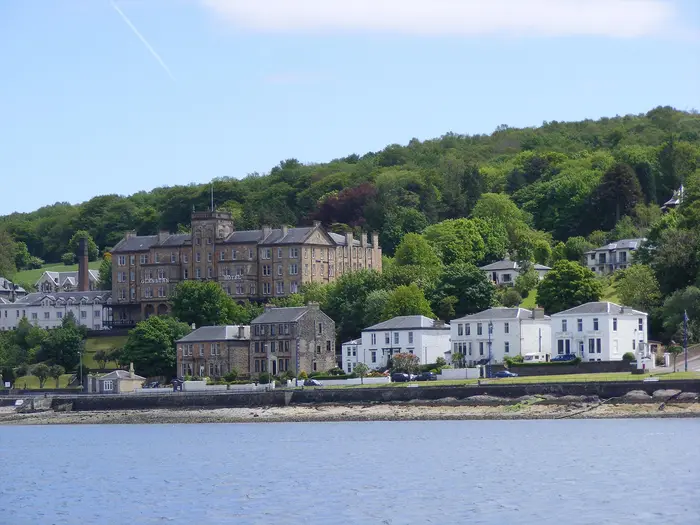
Image by in4adig The West Island Way is a compact Scottish island trail with far more variety than its 48 km length suggests. It runs from Kilchattan Bay at Bute’s southern end to Port Bannatyne in the north, linking rough coast, quiet bays, farmland, woodland, lochs and open heather moorland.
Its best sections feel distinctly wild without being remote for long. The southern loop reaches Rubh'an Eun Lighthouse, Glencallum Bay and St Blane’s Chapel, while the northern half climbs through Glen More to Windy Hill, the highest point on Bute at 278 m.
This is a good choice for fit beginners moving up to a short long-distance route, or regular walkers wanting a two-day trail that is easy to reach without a car. Rothesay and Port Bannatyne make logistics straightforward, with ferries from Wemyss Bay and local buses linking the main access points.
Do not treat it as a soft coastal stroll throughout. The southern headland is rough and strenuous in places, and the northern moorland between Rhubodach and Port Bannatyne is exposed, wet underfoot and sometimes pathless enough to require proper navigation, footwear and weatherproof kit.
This guide covers stages, day splits, accommodation, food, transport, terrain and the common planning mistakes to avoid.
Stage-by-Stage Guide
Stage 1: Kilchattan Bay Circular — 8 km
Stage 1 is a self-contained loop from Kilchattan Bay around the southern headland of Bute, and is often treated as the finest single section of the West Island Way. It is short on paper, but it is not a gentle promenade: the coast around the headland is rough, strenuous in places and more committing than the distance suggests.
The route passes the Rubh'an Eun Lighthouse, known as the Point of the Birds, and continues by raised-beach shore, rocky coastline and open coastal ground towards Glencallum Bay. Views open across the Firth of Clyde towards the Cumbraes, Arran and Ailsa Craig, and seals are often associated with this stretch of coast.
Underfoot, expect a mix of coastal path, rough grass, uneven shoreline terrain and exposed headland walking. Good footwear matters here, especially after rain or in windy weather, when the exposed coastal sections can feel much harder than the map distance implies.
There are no reliable on-route food or water stops around the headland, so carry what is needed from Kilchattan Bay. Services in small island villages can be limited or seasonal; this should be checked before travelling.
Accommodation is not concentrated at Kilchattan Bay in the way it is around Rothesay and Port Bannatyne. Most walkers base themselves in Rothesay or Port Bannatyne and use local transport to reach Kilchattan Bay, or combine this loop with Stage 2 as the long southern day.
Local buses link Rothesay with Kilchattan Bay, making this stage straightforward as a day walk without a car. Timetables should be checked before travelling, especially if relying on a late return.
Navigation is generally helped by waymarking, but the open coastal ground still warrants carrying OS Explorer 362. In poor visibility or strong wind, do not treat the stage as an easy village circuit simply because it begins and ends in the same place.
Stage 2: Kilchattan Bay to Port Bannatyne — 18.5 km
Stage 2 turns the southern loop into a proper cross-island walking day, linking Kilchattan Bay with Port Bannatyne via Bute's south-west shore, inland farmland, lochs and the high ground above Rothesay. Combined with Stage 1, it forms the natural first day of the full two-day West Island Way.
The stage includes St Blane's Chapel, the atmospheric 12th-century chapel ruins near Bute's southern tip, then continues by Suidhe Chatain and Stravanan Bay. From there the character changes steadily: shore and open ground give way to Lord James' Ride, farmland and woodland, then the long Moor Road past Loch Ascog and Loch Fad.
Loch Ascog and Loch Fad are key landmarks on this middle section. Loch Fad lies along the line of the Highland Boundary Fault, and ospreys are sometimes seen over the loch.
The waymarked route skirts above Rothesay on the Moor Road rather than dropping through the town centre. Rothesay is the main ferry and service hub on the island, so a detour into town can be useful for food, accommodation or transport, but it is not part of the main line of the Way.
Mount Stuart is also not on the waymarked route. It can be reached by a signposted detour of about 1.5 miles, which needs to be allowed for separately if added to the day.
Terrain is varied rather than technically difficult: coastal tracks, inland tracks, woodland, farmland edges, roadside verge sections and quieter road walking. The length of the stage is the main challenge, particularly if it follows the rougher Stage 1 on the same day.
Food and water should be planned before leaving Kilchattan Bay. Rothesay is the practical service point if a detour is made; otherwise, carry enough to reach Port Bannatyne. Availability in smaller places should be checked before travelling.
Port Bannatyne is the important planning point at the end of the stage. It is the mid-point hub of the West Island Way and the meeting point between the southern half and the northern Rhubodach loop, with accommodation options in and around Port Bannatyne and nearby Rothesay.
Local buses connect Kilchattan Bay, Rothesay and Port Bannatyne, and taxis are available in Rothesay. This makes it possible to split the stage, return to a Rothesay base, or walk the southern half without using a car.
Navigation is straightforward in settled weather, but care is still needed around junctions, detours and the approach above Rothesay, where it is easy to drift towards town if that is not the intention. Carry OS Explorer 362 and do not rely only on waymarks for the full day.
Stage 3: Port Bannatyne to Rhubodach — 13.75 km
Stage 3 begins the northern half of the West Island Way and is a very different proposition from the southern stages. It starts from Port Bannatyne, follows the line of Bute's former tramway northwards, then works into quieter glen, forest and open hill country before reaching Rhubodach at the Kyles of Bute.
The route passes Kames Bay and continues towards Glen More, where the Glenmore Burn and abandoned cleared townships give the stage a more remote feel. This is one of the most historically poignant sections of the route, as well as one of the least urban.
The high point of the West Island Way comes on the northern moorland at Windy Hill, 278 m, the highest point on Bute. In clear weather the views extend over Bute, Arran, Cowal and the Kyles of Bute, but the same openness makes this section exposed in poor weather.
Underfoot, this is the stage where expectations need to be realistic. The route includes tracks and forest sections, but also exposed heather moorland where the line can be rough, pathless in stretches and very boggy after rain.
This is not technical hillwalking, but it is the part of the Way where map, compass or reliable GPS, waterproofs and proper footwear are most important. Waymarking helps, yet it should not be treated as a substitute for navigation on open, wet ground.
Food and water options between Port Bannatyne and Rhubodach should not be relied upon. Carry enough for the stage, including extra water if walking in warm weather or continuing straight into Stage 4.
Rhubodach is the northern turning point of the route and the location of the Colintraive–Rhubodach CalMac ferry crossing over the Kyles of Bute. Ferry times should be checked before travelling if using the crossing for access, escape or onward travel.
Local buses link Rothesay, Port Bannatyne and Rhubodach, giving useful flexibility for walkers splitting the northern loop. Timetables should be checked before travelling, as missed connections can leave a long wait in a small place.
Forestry operations can affect parts of the Rhubodach section, with Shalunt Wood specifically worth checking before setting out. Check the official route notices for tree-felling closures before relying on the normal line.
Stage 4: Rhubodach to Port Bannatyne — 8.5 km
Stage 4 completes the northern loop by returning from Rhubodach to Port Bannatyne on a shorter but still varied section. It is the final stage of the official route and brings the walk back from the Kyles of Bute towards the east side of the island.
Key landmarks include St Colmac's Church, the roofless 1836 Gaelic church, and Kames Castle, a 14th-century tower house near Kames Bay. The stage finishes back in Port Bannatyne, where the official West Island Way ends.
The terrain is less sustained than the Windy Hill crossing, but it should not be dismissed as a simple finish. Expect a mix of quiet lanes, tracks, field or woodland edges and potentially wet ground depending on recent weather.
An optional loop near Balnakailly, also spelt Balnakeilly, can be added near the north end. This passes a Second World War starfish decoy site and the ruined Balnakeilly farmstead, then descends through ancient oak woodland with views over the Kyles of Bute and the Burnt Islands.
The optional Balnakailly loop adds interest but also adds time and extra navigation. It is best treated as a deliberate extension rather than an automatic part of the shortest finish.
Food and water should be carried from Rhubodach unless current local options have been checked in advance. Port Bannatyne is the practical end point for services and accommodation, with Rothesay nearby for a wider choice of places to stay and onward transport.
Public transport is useful at both ends of the stage: local buses link Rhubodach with Port Bannatyne and Rothesay, while Rothesay has the CalMac ferry connection to Wemyss Bay. Check both bus and ferry times before travelling, particularly if finishing late in the day.
Navigation is generally less exposed than Stage 3, but the northern end of Bute still needs a map, especially if adding Balnakailly or if forestry diversions are in place. Tree-felling closures in the Rhubodach area should be checked before setting out.
Recommended Itinerary
Standard itinerary: 2 days
This is the natural way to walk the West Island Way: the southern half on Day 1, then the northern Rhubodach loop on Day 2. It suits fit walkers who are comfortable with long but manageable days, rough coastal ground and boggy, exposed moorland.
| Day | From | To | Approx. distance | Why this stage makes sense | Services/accommodation notes |
|---|---|---|---|---|---|
| 1 | Kilchattan Bay, including the Stage 1 southern circular | Port Bannatyne | 26.5 km | Links the 8 km Kilchattan Bay Circular with Stage 2 to reach the official mid-point at Port Bannatyne. This keeps the route logical: southern headland, St Blane’s Chapel area, Stravanan Bay, the Moor Road, Loch Ascog and Loch Fad, then down towards Port Bannatyne. | Start from Rothesay using the local bus or a taxi to Kilchattan Bay. The waymarked route skirts above Rothesay rather than passing through the town centre, so plan any food or accommodation detour deliberately. Accommodation is mainly in Rothesay and Port Bannatyne. |
| 2 | Port Bannatyne | Port Bannatyne, via Rhubodach | 22.25 km | Completes the northern half as a loop: Stage 3 to Rhubodach, then Stage 4 back to Port Bannatyne. This is the higher, more exposed day, crossing Glen More and Windy Hill before returning past St Colmac’s Church and Kames Castle. | Port Bannatyne is the practical start and finish. Local buses link Rothesay, Port Bannatyne and Rhubodach, giving options if weather, fatigue or boggy ground slow progress. Check current bus times and any forestry/tree-felling notices before travelling. |
Slower itinerary: 4 official stages
This version suits walkers who want shorter days, more time for the southern headland, or a gentler first long-distance trail. Because accommodation is limited on the line of the route, most walkers using this schedule should expect to base themselves in Rothesay or Port Bannatyne and use buses or taxis to reach the stage starts and finishes.
| Day | From | To | Approx. distance | Why this stage makes sense | Services/accommodation notes |
|---|---|---|---|---|---|
| 1 | Kilchattan Bay | Kilchattan Bay | 8 km | Walks the southern circular as a stand-alone day, allowing enough time for the rough coastal section around Rubh'an Eun Lighthouse, Glencallum Bay and St Blane’s Chapel. | Return transport from Kilchattan Bay to Rothesay should be planned in advance. This should be checked before travelling. |
| 2 | Kilchattan Bay | Port Bannatyne | 18.5 km | Keeps Stage 2 intact, crossing from the south of Bute towards the island’s central lochs and the official mid-point at Port Bannatyne. | Accommodation is most practical in Rothesay or Port Bannatyne. The route passes above Rothesay on the Moor Road; detour into town only if needed for services. |
| 3 | Port Bannatyne | Rhubodach | 13.75 km | Gives the exposed northern moorland its own day, including Glen More and Windy Hill, rather than combining it with the return leg. This is sensible in poor weather or after heavy rain. | Rhubodach has the Colintraive ferry crossing nearby, but do not rely on onward transport without checking current arrangements. Local bus options should be checked before booking. |
| 4 | Rhubodach | Port Bannatyne | 8.5 km | A shorter final stage back to Port Bannatyne, passing St Colmac’s Church, Kames Bay and Kames Castle. It also leaves time for the optional Balnakailly loop if conditions and daylight allow. | Finish in Port Bannatyne, with onward local transport to Rothesay. Check current bus times before travelling. |
Faster variant: 1 very long day
A single-day traverse of the full 48 km is only for very fit walkers moving efficiently and carrying navigation, waterproofs and food for a long day. It is not the best choice for most hikers, because the hardest ground is not confined to the start: the northern moorland can be boggy, exposed and slow, particularly after rain.
| Day | From | To | Approx. distance | Why this stage makes sense | Services/accommodation notes |
|---|---|---|---|---|---|
| 1 | Kilchattan Bay | Port Bannatyne, via the Kilchattan Bay Circular and Rhubodach loop | 48 km | Compresses all four official stages into one continuous outing. This only makes sense with an early start, settled weather, strong fitness and confidence on rough, sometimes pathless moorland. | Transport at both ends must be planned carefully: ferry, bus and taxi timings can make or break this option. This should be checked before travelling. |
Which itinerary to choose
Choose the 2-day itinerary if the aim is to complete the full route efficiently while still following the natural split at Port Bannatyne. Choose the 4-day itinerary if shorter days, uncertain weather or a more relaxed pace matter more than efficiency.
The 1-day variant is a challenge walk rather than the standard backpacking or inn-to-inn approach. For most independent walkers, the two-day plan gives the best balance between logistics, daylight and enjoyment.
Planning the Route
The West Island Way is easiest to plan around Port Bannatyne, not Rothesay. The official route is made up of four stages: a southern circular walk from Kilchattan Bay, a cross-island stage to Port Bannatyne, then a northern loop from Port Bannatyne to Rhubodach and back.
Most walkers with good fitness can complete the route over 2 days by combining Stages 1 and 2, then Stages 3 and 4. A slower 3–5 day plan is often more practical if you want shorter walking days, time for detours, or more margin for rough ground, boggy going and changeable weather.
Choosing a 2-day or slower itinerary
The natural 2-day split is:
| Day | Route | Official stages | Character |
|---|---|---|---|
| 1 | Kilchattan Bay circular, then Kilchattan Bay to Port Bannatyne | Stages 1 + 2 | Long southern day: rough coastal headland, shore, farmland, woodland and the Moor Road past Loch Ascog and Loch Fad |
| 2 | Port Bannatyne to Rhubodach, then back to Port Bannatyne | Stages 3 + 4 | Northern loop: old tramway, Glen More, Windy Hill, open moorland, Rhubodach and return via Kames Bay and St Colmac’s Church |
This is a compact trail, but the 2-day version should not be treated as a soft stroll. The southern headland around Rubh'an Eun Lighthouse and Glencallum Bay is rough and strenuous in places, while the northern moorland over Windy Hill can be exposed, wet and indistinct underfoot.
A 3-day plan gives more flexibility. One sensible approach is to walk the Kilchattan Bay circular as a separate day, then continue north to Port Bannatyne on the next stage, before saving the Rhubodach loop for the final day. A 4-day plan follows the official stages directly and is the simplest option for walkers who prefer moderate daily distances.
Accommodation and base options
Accommodation is concentrated in and around Rothesay and Port Bannatyne, with hotels, guesthouses, B&Bs and self-catering available in the main settled part of the island. There is very little accommodation directly on the route itself, so many walkers base in Rothesay and use local buses or taxis to reach the day’s start and finish.
The waymarked route skirts above Rothesay on the Moor Road rather than passing through the town centre. Rothesay is still the main ferry and service hub, but it should be treated as a practical detour rather than a route milestone.
Port Bannatyne is the key walking hub because it is where the southern and northern halves meet. If staying there, the logistics for the second day are especially simple: the Rhubodach loop starts and finishes in the same village.
Wild camping is possible in Scotland where done responsibly under the Scottish Outdoor Access Code, but this route is short enough that most walkers use fixed accommodation. Anyone camping should plan carefully around water, exposed moorland, farmland, livestock and leave-no-trace responsibilities.
Section hiking and shortening the route
The West Island Way works well as a section-hiking route. The four official stages can be walked individually, and local buses link Rothesay with Kilchattan Bay, Port Bannatyne and Rhubodach. Taxis are also available from Rothesay, which makes it practical to walk one stage at a time without carrying overnight gear.
The easiest shorter options are the Kilchattan Bay Circular and the Port Bannatyne–Rhubodach–Port Bannatyne northern loop. The first gives the best of the southern coast, while the second includes Glen More, Windy Hill and the Kyles of Bute.
The optional Balnakailly / Balnakeilly loop near the north end can be added if time, weather and ground conditions are suitable. Mount Stuart is not on the waymarked route; it is a signposted detour of about 1.5 miles, so allow extra time if adding it.
Transport planning
For most walkers, the standard access route is by CalMac ferry from Wemyss Bay to Rothesay, with Wemyss Bay on the direct rail line from Glasgow Central. The ferry crossing takes about 35 minutes, but timetables and booking arrangements should be checked before travelling.
A second CalMac ferry crosses between Colintraive and Rhubodach at the north end of Bute. This is useful for wider travel plans, but it is not required simply to complete the West Island Way if using the standard Rhubodach turning point.
On-island transport is a major advantage of this trail. Buses link Rothesay with Kilchattan Bay, Port Bannatyne and Rhubodach, and taxis operate from Rothesay. Current bus times, ferry times and taxi availability should be checked before travelling, especially when planning a tight 2-day itinerary.
Navigation and route-finding
The route is waymarked, but a map is still essential. Carry OS Explorer 362: Cowal West & Isle of Bute, plus a backup navigation method for the open northern moorland.
The main navigation pressure comes on the northern half between Rhubodach and Port Bannatyne, where the route crosses exposed heather moorland around Windy Hill. In poor visibility, boggy or pathless stretches can be slow and disorientating despite the overall modest height.
Forestry operations can also affect the route, particularly around the Shalunt Wood area on the Rhubodach section. Check the official West Island Way site for current notices before relying on the line of the route.
Food, water and supplies
Do not plan this as a village-to-village refuelling walk. Services are concentrated around Rothesay and Port Bannatyne, with fewer options once out on the southern headland, Moor Road or northern moorland.
Carry enough food and water for each full walking day, especially on a 2-day itinerary where the first day combines the Kilchattan Bay circular with the onward stage to Port Bannatyne. Treat Rothesay as the main resupply point, even though it is a short detour from the waymarked route.
Water availability away from settlements should not be assumed. If relying on natural sources, use an appropriate treatment method and avoid planning around unverified burns or lochs.
Weather, ground conditions and timing
Spring, summer and autumn are the main walking seasons. Even in settled months, the island position means wind, rain and low cloud can make the exposed moorland feel more serious than the route’s height suggests.
After rain, the northern high ground can be very boggy, and progress may be slower than the stage distances imply. The southern coastal loop also deserves respect: rough ground around the headland can take longer than a simple distance calculation suggests.
There are no special permits needed to walk the route. The most important pre-walk checks are accommodation availability, CalMac ferry times, local bus or taxi connections, forestry closures, weather, and carrying the correct map and waterproof hillwalking kit.
Towns, Villages and Overnight Stops
Accommodation and services on the West Island Way are not evenly spread along the route. The practical hubs are Rothesay and Port Bannatyne, with very little on the waymarked trail itself once you leave the settled parts of the island.
For a two-day walk, the cleanest overnight point is Port Bannatyne, because the official southern half finishes there and the northern Rhubodach loop starts and ends there. Rothesay is the stronger transport and service base, but the waymarked route skirts above the town rather than passing through its centre.
| Place | Route position | Overnight usefulness | Service note |
|---|---|---|---|
| Kilchattan Bay | Start and Stage 1 circular | Useful pre-walk start point, but not the main accommodation hub | Do not rely on extensive services without checking before travelling |
| Rothesay | Off-route detour from the Moor Road | Best all-round base for ferries, buses and town services | Main town on Bute; route does not go through the centre |
| Port Bannatyne | Mid-point hub and finish | Best on-route overnight stop | Accommodation available in and around the village; also close to Rothesay |
| Rhubodach | Northern turning point | Not a natural overnight stop | Ferry point for Colintraive; check onward transport before relying on it |
Kilchattan Bay
Kilchattan Bay is the southern start of the West Island Way and the place where Stage 1 begins and ends. The first official stage is a circular walk around the southern headland before returning to the village, so Kilchattan Bay is both the start point and the reset point before Stage 2 heads north towards Port Bannatyne.
It is a useful place to be dropped off or to reach by local bus from Rothesay. Local buses link Rothesay with Kilchattan Bay, but current times should be checked before travelling, especially if starting early or walking outside the main visitor season.
Kilchattan Bay is not the main overnight hub for the route. Accommodation and wider services are concentrated around Rothesay and Port Bannatyne, so most walkers either travel out to Kilchattan Bay from Rothesay or arrange accommodation elsewhere on Bute before starting.
Do not begin the southern headland loop assuming guaranteed food, shops or late-opening facilities in the village. Carry what is needed for Stage 1 and Stage 2, particularly if continuing all the way to Port Bannatyne the same day.
Rothesay
Rothesay is Bute’s main town and the key arrival point for most walkers, with the CalMac ferry from Wemyss Bay arriving here. Wemyss Bay is on the direct rail line from Glasgow Central, making Rothesay the easiest base for anyone walking the West Island Way without a car.
The important route detail is that the West Island Way does not pass through Rothesay town centre. Stage 2 skirts above Rothesay on the Moor Road, with a short detour into town possible if needed for accommodation, food, shops or transport.
Rothesay is the most practical all-round base for the walk. It gives the best access to ferry connections, local buses to Kilchattan Bay, Port Bannatyne and Rhubodach, and taxis based in town.
For accommodation planning, Rothesay has the broadest choice on the island, including hotels, guesthouses, B&Bs and self-catering in and around the town. This makes it the most flexible option for walkers splitting the trail into day walks or using public transport to reach each stage.
If staying in Rothesay between the two natural walking days, allow for the extra movement between the route and town. The official mid-point is Port Bannatyne, not Rothesay, so transport or an additional walk between Port Bannatyne and Rothesay may be needed depending on where accommodation is booked.
Port Bannatyne
Port Bannatyne is the most important on-route stop on the West Island Way. It is the end of Stage 2, the start of Stage 3, the end of Stage 4 and the overall finish of the trail.
For a straightforward two-day itinerary, Port Bannatyne is the natural overnight stop after completing the southern half from Kilchattan Bay. The following day’s northern half forms a loop from Port Bannatyne to Rhubodach and back to Port Bannatyne, so staying here avoids unnecessary backtracking.
Accommodation is available in and around Port Bannatyne, with further options nearby in Rothesay. Because Bute’s accommodation is concentrated around these two places, booking ahead is sensible, particularly if walking at weekends or in the main spring-to-autumn walking season.
Local buses link Port Bannatyne with Rothesay and Rhubodach, and taxis are available from Rothesay. This makes Port Bannatyne workable as a stage base even if accommodation is ultimately booked in Rothesay.
Port Bannatyne is also the point where route logistics can be adjusted. Walkers short on time can use the southern half and northern half as separate day walks, while section-walkers can return to Rothesay by bus or taxi after finishing at Port Bannatyne.
Rhubodach
Rhubodach is the northern turning point of the West Island Way, reached from Port Bannatyne on Stage 3 before Stage 4 returns south to Port Bannatyne. It is also the Bute side of the short CalMac ferry crossing over the Kyles of Bute to Colintraive.
This is a transport and turning point rather than a natural overnight stop. No route-planning assumption should be made about accommodation, shops or meals at Rhubodach unless arrangements have been checked before travelling.
Local buses link Rhubodach with Port Bannatyne and Rothesay, which can be useful if shortening the northern half or avoiding a long wait after reaching the ferry area. Bus times and ferry times should both be checked before travelling.
The northern approach and return involve more exposed, boggy and sometimes pathless moorland than the southern road-and-shore sections. Treat Rhubodach as a remote-feeling route point: carry food, waterproofs, navigation and enough time to complete the return to Port Bannatyne.
Other route points with limited or no services
Many named places on the West Island Way are important for navigation or interest rather than logistics. Rubh'an Eun Lighthouse, Glencallum Bay, St Blane’s Chapel, Suidhe Chatain, Stravanan Bay, Lord James’ Ride, Loch Ascog, Loch Fad, Glen More, Windy Hill, Balnakailly, St Colmac’s Church, Kames Bay and Kames Castle should be treated as route features, not reliable service stops.
This matters most on the long southern day from Kilchattan Bay to Port Bannatyne and on the northern moorland loop. Once away from the villages, carry the food, water and clothing needed to finish the stage without depending on facilities en route.
Wild camping is possible in Scotland where done responsibly under the Scottish Outdoor Access Code, but the West Island Way’s short distance and good bus links mean most walkers use Rothesay or Port Bannatyne instead. Anyone planning to camp should avoid assuming that named bays, woods or moorland areas have suitable pitches, water or shelter.
Getting to the Start
The West Island Way starts in Kilchattan Bay, at the southern end of the Isle of Bute. Most walkers reach the island via Rothesay, then use the local bus network or a Rothesay taxi to get to Kilchattan Bay for the start of Stage 1.
By train
The simplest public-transport approach is by train to Wemyss Bay, which is on the direct rail line from Glasgow Central. From Wemyss Bay, take the Caledonian MacBrayne ferry to Rothesay on Bute; the crossing takes about 35 minutes.
From Rothesay, local buses link the town with Kilchattan Bay. This final island connection is an essential part of the journey, so bus times should be checked against the ferry arrival before booking travel. This should be checked before travelling.
By bus
On Bute, local buses link Rothesay with Kilchattan Bay, Port Bannatyne and Rhubodach, making the route practical without a car. For the start, the key connection is Rothesay to Kilchattan Bay.
The first stage is a circular walk from Kilchattan Bay back to Kilchattan Bay, before Stage 2 continues north towards Port Bannatyne. If walking the southern half in one day, make sure the morning bus arrival leaves enough daylight for both Stage 1 and Stage 2.
Taxis are available in Rothesay and are the sensible fallback if bus times do not match ferry arrivals, early starts or accommodation check-in times. Taxi availability and current fares should be checked before travelling.
By car
Drivers normally reach Bute using the CalMac ferry from Wemyss Bay to Rothesay. Ferry times, booking requirements and current disruption notices should be checked before travelling.
Once on Bute, Kilchattan Bay is reached by road from Rothesay. Because the route is not a simple car-friendly loop from the start, think carefully before leaving a vehicle at Kilchattan Bay: the natural two-day split finishes Day 1 at Port Bannatyne, then returns to Port Bannatyne after the northern loop on Day 2.
Parking and overnight parking arrangements at Kilchattan Bay, Rothesay and Port Bannatyne should be checked locally before travelling. Many walkers avoid this problem by staying in Rothesay or Port Bannatyne and using bus or taxi links to reach the start.
From the nearest airport
For air travel, the practical approach is to get into Glasgow, then continue from Glasgow Central by train to Wemyss Bay and ferry to Rothesay. Airport-to-Glasgow transfer options and timings should be checked before travelling.
Allow enough time for the linked train, ferry and island bus journey. A late arrival in Rothesay may make it awkward to reach Kilchattan Bay the same evening without a taxi.
Where to stay before starting
Accommodation is concentrated in and around Rothesay and Port Bannatyne, with hotels, guesthouses, B&Bs and self-catering options. There is very little accommodation on the trail itself, so Rothesay is the most practical pre-walk base for walkers arriving by ferry.
Staying in Rothesay gives the easiest access to the ferry terminal, shops and onward bus or taxi to Kilchattan Bay. Port Bannatyne is also useful if splitting the route over two days, as it is the mid-point hub where the southern and northern halves meet.
If relying on public transport, check the first bus from Rothesay to Kilchattan Bay before fixing accommodation and start times. This should be checked before travelling.
Getting Home from the Finish
The West Island Way finishes in Port Bannatyne, just north of Rothesay. For most walkers, the practical exit route is: Port Bannatyne to Rothesay by local bus or taxi, CalMac ferry from Rothesay to Wemyss Bay, then train to Glasgow Central.
Timetables matter on an island route. Check current bus, ferry and rail times before travelling, especially if finishing late in the day or walking outside the main summer season.
By train
There is no railway on the Isle of Bute. The nearest rail connection is at Wemyss Bay, reached by the CalMac ferry from Rothesay.
From Port Bannatyne, take a local bus or taxi into Rothesay. From Rothesay, the CalMac ferry crosses to Wemyss Bay in about 35 minutes, where trains run on the direct line to Glasgow Central.
A typical journey home is:
| Leg | Transport | Notes |
|---|---|---|
| Port Bannatyne to Rothesay | Local bus or taxi | Short island transfer; check current bus times |
| Rothesay to Wemyss Bay | CalMac ferry | About 35 minutes; timetable-dependent |
| Wemyss Bay to Glasgow Central | Train | Direct rail line to Glasgow Central |
Allow a buffer between the bus, ferry and train. Missing the last sensible ferry or rail connection can turn a straightforward finish into an overnight stay on Bute.
By bus
Local buses link Port Bannatyne with Rothesay, and Rothesay is the main onward transport hub for leaving Bute. Buses also serve other points on the island, including Kilchattan Bay and Rhubodach, which is useful if section-walking or returning to a parked vehicle elsewhere on Bute.
Evening, Sunday and off-season services may be limited. This should be checked before travelling, particularly if the final northern moorland section takes longer than expected in boggy or poor-weather conditions.
For travel beyond Bute, the bus is normally just the first link to the Rothesay ferry. Continue by ferry to Wemyss Bay, then rail onwards to Glasgow Central.
By car/taxi
If travelling without a car, taxis are available in Rothesay and can be used for the short transfer from Port Bannatyne. This is the simplest fall-back if the bus timing is awkward, but availability should be checked before relying on a late pick-up.
If a car has been left at Port Bannatyne, the finish is straightforward. If the car is elsewhere on Bute, use the local bus network or a Rothesay taxi to retrieve it.
Drivers leaving the island usually return via the Rothesay–Wemyss Bay CalMac ferry. The Colintraive–Rhubodach ferry at the north end is useful for access to or from the Kyles of Bute side, but it is not the standard exit from the Port Bannatyne finish; check both ferry timetables if planning to use that northern crossing.
From the nearest airport
There is no airport on Bute. For flights after the walk, plan to leave the island via Rothesay and Wemyss Bay, then travel by train to Glasgow Central for onward city and airport connections.
The airport transfer is separate from the trail’s core logistics and should be checked before travelling. Do not assume a late finish in Port Bannatyne will connect cleanly with an evening flight.
Where to stay at the finish
Accommodation is concentrated around Port Bannatyne and Rothesay, with hotels, guesthouses, B&Bs and self-catering options in and around the two settlements. Rothesay has the advantage of being the ferry hub, while Port Bannatyne is directly at the trail finish.
Staying overnight at the finish is a sensible option if completing the northern loop late in the day, if weather has slowed progress over Windy Hill, or if onward ferry and train connections are tight. Book ahead in busy periods and confirm check-in arrangements if arriving after a long final day.
Which Direction Should You Walk?
The West Island Way is best walked in its standard official order: Kilchattan Bay to Port Bannatyne, with the Kilchattan Bay circular first and the northern Rhubodach loop from Port Bannatyne last. This follows the route’s four-stage structure and keeps the mid-point exactly where it belongs: Port Bannatyne, not Rothesay.
Because the trail includes two loop-like sections, direction is slightly less straightforward than on a simple end-to-end route. Stage 1 returns to Kilchattan Bay, while the northern half runs from Port Bannatyne to Rhubodach and back to Port Bannatyne by a different line.
| Direction | Best for | Main drawbacks |
|---|---|---|
| Standard: Kilchattan Bay → Port Bannatyne | Following the official stage order, simple 2-day logistics, finishing near the main accommodation/transport hub | First day is the longer southern half if walking over 2 days |
| Reverse: Port Bannatyne → Kilchattan Bay | Walkers who specifically want to finish with the southern coastal headland | Less natural stage flow; final transport back from Kilchattan Bay needs arranging |
Standard Direction: Kilchattan Bay to Port Bannatyne
This is the clearest way to walk the route. Start with the Kilchattan Bay Circular, then continue north via Stravanan Bay, the Moor Road, Loch Ascog and Loch Fad to Port Bannatyne. The second half is then a self-contained northern circuit from Port Bannatyne to Rhubodach and back over the higher, rougher ground around Windy Hill.
Logistically, this direction works well because most walkers base themselves in or around Rothesay or Port Bannatyne. From Rothesay, local buses link to Kilchattan Bay for the start, and the route finishes at Port Bannatyne, close to the island’s main accommodation and transport services. Current bus and taxi options should be checked before travelling.
The scenery also builds well in this direction. The route begins with the rough southern coast around Rubh'an Eun Lighthouse, Glencallum Bay and St Blane’s Chapel, then moves through farmland, woodland and the central lochs before saving the exposed northern moorland and Windy Hill for the final day.
There is no major climbing advantage either way. The high point, Windy Hill, is on the northern half and remains an exposed moorland crossing whichever direction is chosen. After rain, the northern moorland can be boggy and slow, so timing and weather matter more than direction.
Walking the Route in Reverse
A reverse walk is perfectly possible in principle, but it is less tidy. You would normally begin at Port Bannatyne, complete the northern Rhubodach loop, then continue south towards Kilchattan Bay and finish with the southern circular section.
The main appeal is psychological rather than practical: the southern headland is one of the strongest sections of the Way, so ending with Glencallum Bay, Rubh'an Eun Lighthouse and the return to Kilchattan Bay can make a dramatic final day. However, it also means finishing in a smaller village and then arranging onward travel back to Rothesay or the ferry.
Reverse direction also front-loads the rougher northern moorland. That may suit strong walkers who want to tackle Windy Hill early, but it is not the easiest introduction to the trail in poor weather. On an exposed island route, wind direction can affect comfort on the day, but there is no reliable reason to choose the whole itinerary around it; check the forecast before setting out.
Recommendation
For most walkers, the best direction is Kilchattan Bay to Port Bannatyne in the official stage order. It gives the cleanest navigation, the most logical accommodation flow, straightforward public-transport planning and a strong progression from coast and farmland to the higher northern moorland. Walk it in reverse only if there is a specific reason to finish at Kilchattan Bay or if transport arrangements make that direction easier on the chosen dates.
Accommodation Along the Route
Accommodation on the West Island Way is straightforward if planned around Rothesay and Port Bannatyne, but sparse if trying to sleep directly on the more rural sections of the trail. The route passes long stretches of coast, farmland, moorland and forest with little or no accommodation on the line of walk itself.
Most walkers use Rothesay as the practical base, because it is Bute’s main town and the ferry hub, with the strongest choice of hotels, guesthouses, B&Bs and self-catering. Port Bannatyne is the key walking hub: it is the official mid-point between the southern half and the northern Rhubodach loop, and also has accommodation options in and around the village.
Best overnight strategy
For a 2-day walk, the cleanest arrangement is:
- Night before: stay in Rothesay or Port Bannatyne, then travel to Kilchattan Bay for the start.
- End of Day 1: finish the southern half at Port Bannatyne and stay there, or transfer/stay in nearby Rothesay.
- End of Day 2: finish back at Port Bannatyne, then stay locally or return to Rothesay for the ferry.
This works well because local buses link Rothesay with Kilchattan Bay, Port Bannatyne and Rhubodach, and taxis are available in Rothesay. Timetables and taxi availability should be checked before travelling, especially if finishing late or walking outside the main season.
Accommodation by place
| Place | Accommodation level | Best for | Notes |
|---|---|---|---|
| Rothesay | Good | Main base, ferry access, wider choice | Best overall choice of hotels, guesthouses, B&Bs and self-catering. The waymarked route skirts above Rothesay on the Moor Road, so reaching town involves a short detour or local transfer. |
| Port Bannatyne | Good | Mid-route overnight, 2-day split, finish logistics | The most useful trail-side hub. The southern half ends here and the northern loop starts and finishes here, making it the best place to stay between walking days. |
| Kilchattan Bay | Limited | Start access only | The official route begins here, but it is not the main accommodation base. Many walkers stay in Rothesay or Port Bannatyne and travel to Kilchattan Bay for the start. Availability should be checked before relying on an overnight here. |
| Southern coastal and moorland sections | None / very limited | Not suitable for inn-to-inn planning | Do not assume accommodation around Rubh'an Eun Lighthouse, Glencallum Bay, St Blane’s Chapel, Suidhe Chatain or Stravanan Bay. These sections are better planned as a continuous walking day. |
| Loch Ascog / Loch Fad / Moor Road area | Very limited | Passing-through only | The route crosses the island towards Port Bannatyne rather than following a chain of villages. Plan to continue to Port Bannatyne or detour/transfer to Rothesay. |
| Rhubodach | Very limited / none on-route | Northern turning point | Rhubodach is a walking and ferry point, not a reliable overnight stop for the Way. Most walkers return to Port Bannatyne the same day. This should be checked before travelling. |
| Wild camping | Possible where responsible | Self-sufficient walkers | Wild camping may be possible under the Scottish Outdoor Access Code, but it must be discreet, low-impact and responsibly sited. The exposed northern moorland can be wet and boggy after rain. |
Booking ahead
Booking ahead is strongly advised if relying on indoor accommodation, particularly for weekends, school holidays and the main spring-to-autumn walking season. Bute has a good accommodation base for a small island, but the useful options are concentrated in Rothesay and Port Bannatyne rather than spread evenly along the trail.
Self-catering may suit walkers staying several nights and using buses or taxis to walk the official stages as day walks. For a point-to-point 2-day itinerary, check whether one-night stays are available before building the schedule around them.
Inn-to-inn practicality
The West Island Way is not a classic village-to-village inn trail. It works better as a base-and-transfer walk or a two-night short break centred on Rothesay and Port Bannatyne.
An inn-to-inn approach is still possible if accommodation is secured at Port Bannatyne for the mid-point, but there are awkward gaps elsewhere. The southern headland and northern moorland sections should be treated as accommodation-free walking terrain, with transport used to bridge the start and finish logistics.
Luggage and transfers
Because the route is only 48 km / 30 miles and naturally splits at Port Bannatyne, many walkers carry a light overnight pack or leave luggage at accommodation and use local transport. Taxis from Rothesay can also solve awkward transfers between Rothesay, Kilchattan Bay, Port Bannatyne and Rhubodach.
Dedicated luggage-transfer arrangements are not something to assume for this route. If baggage movement is essential, this should be checked before travelling and agreed directly with accommodation or a local taxi operator.
Camping and Wild Camping
Camping is possible on the West Island Way, but it is not essential to completing the route. At 48 km / 30 miles, with buses linking Rothesay, Kilchattan Bay, Port Bannatyne and Rhubodach, many walkers base themselves in Rothesay or Port Bannatyne rather than carrying overnight kit.
Formal campsites
Do not assume there will be a campsite directly on the line of the Way. Accommodation on Bute is mainly concentrated around Rothesay and Port Bannatyne, with hotels, guesthouses, B&Bs and self-catering much more relevant to most walkers than formal trail camping.
Any current commercial campsites, campervan pitches or tent pitches on Bute should be checked before travelling. Opening dates, facilities and whether tent campers are accepted can change seasonally.
Wild camping in practice
Wild camping in Scotland is permitted under the Scottish Outdoor Access Code when done responsibly. On this route that means small-scale, lightweight camping for one night, pitching late, leaving early, and avoiding houses, enclosed fields, livestock, crops, roads, golf links and historic sites.
The practical issue is not legality so much as finding a discreet, durable and sheltered pitch. The West Island Way crosses farmland, woodland, shore, roadside sections and exposed moorland, so good tent ground is patchy rather than continuous.
| Section | Camping practicality |
|---|---|
| Kilchattan Bay and the southern headland | The Stage 1 loop has rough coast, raised beaches and exposed ground. It may offer discreet possibilities for experienced wild campers, but avoid the village, St Blane’s Chapel, farmed land and any fragile coastal vegetation. Shore camping needs particular care with exposure and tide position; check locally before relying on it. |
| Kilchattan Bay to Port Bannatyne | This is less convenient for camping because the route passes farmland, woodland, golf links, roadside verges and the Moor Road near Loch Ascog and Loch Fad. It is generally better treated as a walking day ending in Port Bannatyne or with a detour into Rothesay. |
| Port Bannatyne to Rhubodach and back | The northern half is the wildest part of the Way, crossing Glen More, Windy Hill and open heather moorland. It is also exposed, often boggy and pathless in stretches, so only camp here with a suitable tent, a reliable forecast and confidence in poor ground conditions. Temporary forestry or tree-felling closures, especially around the Rhubodach / Shalunt Wood area, should be checked before travelling. |
Water and supplies
Carry enough water from the settlements rather than relying on easy refills on the hill. The route passes Loch Ascog, Loch Fad, burns and coastal ground, but natural water should not be assumed safe to drink untreated, especially near farmland, grazing land, lochs used for other purposes, or slow-moving water.
Any water taken from burns or lochs should be filtered, treated or boiled. Loch Ascog is a Rothesay water supply, so do not camp on its margins or treat it as a casual backcountry water source.
Leave No Trace and access responsibilities
Wild campers should keep groups small, use a stove rather than a fire, and pack out all litter, food waste and used hygiene items. Human waste should be dealt with well away from paths, buildings and watercourses, and toilet paper should be packed out or disposed of responsibly.
Open fires are a poor choice on this route. Heather moorland, peat, woodland and dry coastal vegetation are easily damaged, and summer fire risk can be serious; use a stove and follow any local fire warnings or estate notices.
Pitch out of sight where possible, avoid blocking access tracks or gates, and move on if asked by land managers. If ground conditions, closures, lambing, shooting activity or local restrictions are unclear, this should be checked locally before pitching.
Food, Water and Resupply
The West Island Way is short, but it is not a trail with regular on-route resupply. Plan it as a series of self-sufficient day walks, using Rothesay and Port Bannatyne as the practical food bases rather than expecting to buy meals and snacks during the walking day.
Rothesay is Bute’s main town and the best place to stock up before or between stages. The waymarked route skirts above Rothesay on the Moor Road rather than passing through the town centre, so a food stop there requires a deliberate detour or a bus/taxi transfer.
Port Bannatyne is the key mid-point for the official route split. It is a sensible place to base yourself or end the southern half, but current food and drink opening hours should be checked before relying on it for dinner, breakfast or packed lunches.
Practical resupply strategy
For a 2-day walk, carry the full day’s food from the start of each day. On Day 1 that means leaving Kilchattan Bay with enough snacks, lunch and water for the Kilchattan Bay circular plus the onward route to Port Bannatyne. On Day 2, leave Port Bannatyne with everything needed for the Rhubodach loop and return.
For a 3–5 day version, do not assume every village or ferry point has open food services at the time you pass. Rural and island opening hours can be seasonal, shorter on Sundays, and affected by local staffing or ferry disruption. This should be checked before travelling.
If basing in Rothesay, buy breakfast supplies, lunch food and hill snacks before setting out. If staying in Port Bannatyne, confirm in advance whether evening meals and packed lunches are available locally or through your accommodation.
Water planning
There are no reliable public water refill points listed for the route, so start each stage with enough water to reach your next known settlement or accommodation. For the longer southern half and the exposed northern moorland, many walkers will want around 1.5–2 litres, with more in warm weather or if walking slowly.
Natural water is present in the wider landscape — including burns, lochs and boggy moorland — but it should not be treated as ready-to-drink. Filter, boil or chemically treat any natural water, and avoid taking water from lowland farmland areas where livestock, runoff and settlement may affect quality.
The northern half crosses exposed, wet moorland around Glen More and Windy Hill. Although the ground can be boggy after rain, that does not remove the need to carry drinking water; moorland water is often peaty and should be treated if used.
| Section | Food availability | Water availability | Notes |
|---|---|---|---|
| Kilchattan Bay circular via Rubh'an Eun Lighthouse, Glencallum Bay and St Blane’s Chapel | Do not rely on buying food once walking. Start with snacks and lunch if continuing straight onto Stage 2. | Carry enough from the start; treat any natural water if used. | Rougher coastal walking can take longer than the distance suggests, so avoid starting under-supplied. |
| Kilchattan Bay to Port Bannatyne via Stravanan Bay, Loch Ascog and Loch Fad | Limited on-route resupply; Rothesay is the main practical food option but requires a detour from the waymarked route. | Carry enough to reach Port Bannatyne or your accommodation. Natural water should be treated. | This is the longer food-planning day on a 2-day itinerary, especially if Stage 1 is walked first. |
| Port Bannatyne to Rhubodach via Kames Bay, Glen More and Windy Hill | No dependable food stop should be assumed between Port Bannatyne and Rhubodach. | Carry sufficient water from Port Bannatyne. Moorland sources need treatment. | Exposed, boggy ground can slow progress; pack extra snacks rather than relying on a quick return. |
| Rhubodach to Port Bannatyne via St Colmac’s Church and Kames Castle | Do not rely on food at Rhubodach unless checked in advance. | Carry water for the return to Port Bannatyne. | This is shorter than Stage 3, but still remote enough to justify self-sufficiency. |
What to carry
A sensible food kit for each walking day is a packed lunch, high-energy snacks, and one spare item in case the moorland or coastal sections take longer than expected. The route is waymarked, but poor ground underfoot can make the northern loop slower than its distance implies.
If walking outside peak summer, on a Sunday, or after arriving late by ferry, buy food before leaving Rothesay. For any planned café, pub, hotel meal or packed lunch arrangement in Kilchattan Bay, Port Bannatyne or Rothesay, confirm current opening times before booking the day around it.
Terrain, Conditions and Difficulty in Practice
The West Island Way is moderate because of its variety rather than any single severe climb. There is no scrambling, no technical mountain ground and the highest point is Windy Hill at 278 m, but the route changes repeatedly between coast, farmland, woodland, roadside verge, forest track and open moor.
The main practical challenge is underfoot condition. In dry weather much of the Way is straightforward walking; after rain, the northern moorland between Port Bannatyne, Windy Hill and Rhubodach can become slow, wet and tiring, with boggy and sometimes pathless stretches.
Terrain by section
| Section | What to expect underfoot | Main difficulty |
|---|---|---|
| Stage 1: Kilchattan Bay circular | Rough coastal walking, rocky shoreline, raised-beach terrain and sandy bays around the southern headland, including Rubh'an Eun Lighthouse and Glencallum Bay | The roughest coastal ground on the route; strenuous in places despite the short distance |
| Stage 2: Kilchattan Bay to Port Bannatyne | A mixed inland and coastal stage through farmland, woodland, golf-link terrain, shore sections and the Moor Road past Loch Ascog and Loch Fad | Longer distance, hard surfaces on road/verge sections, and less sense of remoteness near Rothesay, which the route skirts above rather than enters |
| Stage 3: Port Bannatyne to Rhubodach | Old tramway, glen, forest and open heather moorland, climbing over Windy Hill before dropping northwards | The most exposed and potentially boggy section; navigation matters more where the line becomes faint or pathless |
| Stage 4: Rhubodach to Port Bannatyne | Return leg from Rhubodach towards Port Bannatyne via St Colmac's Church, Kames Castle and Kames Bay | Shorter than Stage 3, but still part of the northern loop and affected by the same weather and ground conditions |
Coast, shore and rough ground
The southern Kilchattan Bay circular is often the section that feels most rugged. Around the headland the walking is coastal rather than mountainous, but the surface can be uneven, rocky and slower than the distance suggests.
Good footwear matters here. Lightweight road-style shoes can feel inadequate on wet rock, rough grass and raised-beach ground, especially if carrying overnight kit.
Moorland, bog and exposure
The open northern half is the section to treat with the most respect. Windy Hill is low by Highland standards, but it is exposed island moorland with little shelter in poor weather.
After rain, expect saturated grass, boggy patches and slower progress on the heather moorland between Rhubodach and Port Bannatyne. This is the part of the route where waterproof footwear, gaiters and a willingness to walk wet ground make the biggest difference.
The route is waymarked, but waymarks do not remove the need for navigation. Carry OS Explorer 362 and know where the route goes before leaving Port Bannatyne or Rhubodach, especially in mist, low cloud or heavy rain.
Roads, tracks and easier walking
Not all of the West Island Way is rough. The central section includes clear tracks, woodland paths and the long Moor Road past Loch Ascog and Loch Fad.
These easier surfaces help with pace, but they can also be tiring in a different way. Long firm-surface sections are harder on feet than soft path, and short roadside-verge sections require attention to traffic and footing.
Farmland, woodland and access points
Farmland is part of the character of the route, particularly in the southern and central sections. Follow the waymarks, close gates where required and keep dogs under close control wherever livestock may be present.
Woodland and forest sections can be straightforward in good conditions, but they are also the parts most likely to be affected by forestry work. Tree-felling closures, especially around the Shalunt Wood area on the Rhubodach section, should be checked before travelling.
Climbs, descents and effort level
The headline ascent figure used for the route is 869 m, although total-ascent figures vary between sources. In practice, the climbing is spread across the Way rather than concentrated into one sustained mountain ascent.
The effort comes from cumulative undulation, rough coastal ground and wet moorland rather than altitude. A fit walker can cover the route over two days, but the southern day combines the rough Kilchattan Bay circular with the longer walk to Port Bannatyne, so it is not simply an easy lowland stroll.
Seasonal conditions
Spring, summer and autumn are the practical walking seasons. In spring, wet moorland can still be heavy after prolonged rain; in summer, bracken and vegetation can make faint sections feel less obvious; in autumn, shorter daylight and wetter ground increase the need for efficient navigation and early starts.
The route is on an island in the Firth of Clyde, so wind can change the feel of the walk quickly, especially on Windy Hill and the open northern moor. Even when the forecast looks mild at sea level, carry a waterproof layer, warm layer, map and a reliable means of navigation.
Weather and Best Time to Walk
The West Island Way is best treated as a three-season walk: spring, summer and autumn. The route is low by Scottish hill standards, with Windy Hill topping out at 278 m, but the northern half is open, exposed and boggy in places, so conditions can feel much harsher than the height suggests.
For most walkers, late spring to early autumn gives the best balance of usable daylight, transport flexibility and underfoot conditions. A dry spell makes a noticeable difference on the rough southern headland and on the high moorland between Rhubodach and Port Bannatyne, where wet ground can turn slow and tiring.
Best months
May, June and September are likely to be the most practical months for many walkers: reasonable daylight, generally workable temperatures and less pressure on accommodation than peak holiday periods. The route is still a Scottish island walk, so waterproofs and warm layers are needed even in settled-looking weather.
July and August are also realistic, especially for a relaxed 3–5 day itinerary or day-walking from Rothesay. Expect busier accommodation around Rothesay and Port Bannatyne, and book ahead rather than assuming rooms will be available at short notice.
April and October can be good in settled conditions, but margins are smaller. Shorter daylight, wetter ground and stronger winds make the exposed sections more demanding, particularly the northern moorland over Windy Hill.
Winter walking
The West Island Way is not a high mountain route, but winter should not be underestimated. The route includes rough coastline, roadside sections, open moor, boggy ground and stretches that can be indistinct under poor visibility.
A winter traverse is realistic only for well-equipped walkers with good navigation, flexible plans and enough daylight for the chosen stage. Snow is not the main planning issue at this height; wind, cold rain, waterlogged ground, fog and short days are usually more important.
If walking in winter, avoid committing to the Windy Hill moorland in poor visibility or strong winds unless navigation and escape plans are solid. Check current bus and ferry timetables before travelling, as seasonal timetables and weather disruption can affect logistics.
Rain, bog and underfoot conditions
Rain has the biggest effect on pace. The southern Kilchattan Bay circular includes rough coastal ground, while the northern half has exposed heather moorland, pathless stretches and boggy sections after wet weather.
Waterproof boots are strongly preferable to lightweight shoes unless conditions have been very dry. Gaiters can be useful on the northern stages where wet grass, heather and bracken can soak trousers quickly.
After prolonged rain, allow extra time between Port Bannatyne, Glen More, Windy Hill and Rhubodach. The waymarking helps, but it does not remove the need for map-and-compass navigation when the line across rough moorland becomes unclear.
Wind, fog and visibility
Wind is a key factor on the exposed parts of the route, especially around the southern headland and on Windy Hill. Strong winds can make even low-level walking tiring and can affect balance on rough ground.
Fog or low cloud is most relevant on the northern moorland. The high point is only 278 m, but visibility can still deteriorate enough to make waymarks hard to link together. Carry OS Explorer 362 and know how to use it rather than relying only on phone mapping.
The coastal and lochside sections are easier to follow in poor visibility, but the route still includes road verges, farmland edges and woodland tracks where missing a turn can cost time.
Daylight and itinerary planning
In high summer, the full 2-day itinerary is much more forgiving because there is ample daylight for the long southern day from Kilchattan Bay to Port Bannatyne and the northern loop to Rhubodach. In spring and autumn, start early and avoid treating the moorland section as an afterthought late in the day.
The official four-stage structure is useful in marginal weather. Splitting the route over 3–5 shorter days makes it easier to wait out poor conditions, avoid rushing the boggier ground and use buses from Rothesay, Kilchattan Bay, Port Bannatyne and Rhubodach.
Insects, ticks and vegetation
Ticks are a sensible precaution on this route because it crosses rough grass, bracken, moorland and woodland. Wear long trousers or treat exposed skin carefully, and check for ticks at the end of each day.
Midges may be a nuisance in still, damp conditions, especially in sheltered woodland or around lochs and burns. The more open coastal and moorland sections are usually less problematic when there is a breeze, but insect repellent is worth carrying in summer.
Bracken and wet vegetation can be more of a practical issue than insects on some sections. In summer and early autumn, expect damp legs after rain even where the route itself is not deeply boggy.
Accommodation and seasonal checks
Accommodation is concentrated around Rothesay and Port Bannatyne rather than evenly along the trail. During summer and holiday periods, book ahead; outside the main season, availability and opening patterns should be checked before travelling.
Before setting off, check the official West Island Way information for any temporary closures or diversions, especially forestry or tree-felling works around the Rhubodach section and Shalunt Wood area. Also check current CalMac ferry times for Wemyss Bay–Rothesay and Colintraive–Rhubodach if those crossings are part of the plan.
Safety Notes
The West Island Way is a moderate, waymarked island trail, but it should still be treated as a proper hill and coastal walk. The main safety issues are exposure on open ground, rough and boggy going, short road sections, limited services away from Rothesay and Port Bannatyne, and the need to stay flexible around weather and transport.
Emergency help
In an emergency in the UK, call 999 or 112. For an incident on the hill or moor, ask for Police, then Mountain Rescue; for an emergency on the coast or in the water, ask for the Coastguard.
Mobile signal should not be relied on across the whole route, particularly on the more remote moorland, woodland and coastal sections. Carry a charged phone, keep a battery reserve, and leave your route plan and expected finish time with someone off-trail if walking alone.
Navigation and remoteness
The route is waymarked, but do not depend only on signs. Carry OS Explorer 362 and know how to use it, especially for the northern moorland between Rhubodach, Windy Hill and Port Bannatyne, where the ground can be exposed, boggy and pathless in stretches.
Services are concentrated around Rothesay and Port Bannatyne, with very little directly on the trail. Carry enough food and water for the full stage, and do not assume natural water on the route is safe to drink untreated.
Weather exposure
Bute’s high point is only Windy Hill at 278 m, but the northern half is open heather moorland with little shelter. Low cloud, strong wind and heavy rain can make navigation harder and the ground much slower than the distance suggests.
The southern headland around Rubh'an Eun Lighthouse and Glencallum Bay is rough and strenuous in places. Wet rock, mud and wind can make this section more tiring than a simple coastal path.
Carry waterproofs, warm layers, hat and gloves outside high summer. In warm weather, there is still limited shade on open sections, so carry enough water and sun protection.
Bog, rough ground and footwear
Expect rough grass, bracken, muddy tracks and boggy moorland, particularly after rain. Waterproof walking boots or sturdy trail shoes with good grip are more suitable than light trainers.
Poles can help on boggy or uneven ground, but they are not a substitute for careful pacing. Allow extra time in wet conditions, especially on the northern loop to Rhubodach and back to Port Bannatyne.
Roads and traffic
There are short roadside and verge sections, including parts around the central route near the Moor Road. Walk facing oncoming traffic where there is no pavement, stay visible, and take particular care on bends and in poor light.
A small reflective item or bright waterproof is useful if finishing late or walking in mist, rain or dusk.
Livestock, farmland and dogs
The route passes through farmland, so expect gates, stock boundaries and working land. Leave gates as found, keep to the line of the route, and give animals plenty of space.
Dogs should be kept under close control, and on a lead where livestock, ground-nesting birds or farm activity are present. Follow the Scottish Outdoor Access Code throughout.
Coast, lochs and water edges
The trail includes shore, beach and lochside sections around places such as the southern coast, Loch Ascog and Loch Fad. Keep back from wet rocks, unstable edges and slippery seaweed, and take extra care with children or dogs near water.
Do not enter the water in poor weather, cold conditions or where exit points are unclear. If someone is in difficulty in coastal water, call 999 or 112 and ask for the Coastguard.
Checks before setting off each day
Before starting each stage, check:
- the day’s weather forecast, including wind, rain and visibility;
- current CalMac ferry times if relying on the Wemyss Bay–Rothesay or Colintraive–Rhubodach crossings;
- local bus times or taxi availability if using transport to reach or leave stages;
- any forestry or tree-felling closures, particularly around the Shalunt Wood area on the Rhubodach section;
- that the planned finish point is realistic for daylight and transport;
- that food, water, waterproofs, warm layers, map and phone battery are adequate for the whole stage.
If conditions are poor, the route is easy to split into shorter day walks from Rothesay or Port Bannatyne rather than forcing the full two-day schedule.
Gear Recommendations
The West Island Way is short enough for light kit, but it should not be treated like a low-level town-to-town path. The rough southern headland and the exposed northern moorland around Windy Hill justify proper hillwalking equipment, even for a 2-day itinerary.
Footwear
Wear waterproof walking shoes or lightweight boots with good grip. The route includes rocky coastline, rough grass, bracken, farm tracks, forest paths and boggy moorland, so smooth-soled trainers are a poor choice after rain.
Boots are the safer option if carrying camping kit or walking the northern half in wet conditions. The moorland between Rhubodach and Port Bannatyne can be pathless in stretches and very boggy, where ankle support and a stiffer sole are useful.
Gaiters are worth considering in spring and autumn, and after prolonged rain, especially for the Windy Hill section and any wet grass or bracken on the northern loop.
Waterproofs and warm layers
Carry a proper waterproof jacket and waterproof overtrousers. The highest point is only 278 m, but the northern moorland is open and exposed, and weather can feel much harsher than it does in Rothesay or Port Bannatyne.
A warm mid-layer, hat and gloves are sensible outside settled summer weather. Even in summer, a light insulating layer is useful for breaks on Windy Hill, the Rhubodach loop and the more exposed coastal sections around the southern headland.
Navigation
The route is waymarked, but a map and navigation backup are still important. Carry OS Explorer 362: Cowal West & Isle of Bute, plus a compass and the ability to use them.
A phone with offline mapping or a downloaded GPX track is a useful backup, particularly on the northern moorland where the path can be faint or absent. Do not rely only on mobile signal, waymarks or battery life.
Check for forestry and tree-felling closures before setting out, particularly around the Shalunt Wood area on the Rhubodach section. This should be checked before travelling.
Water and food
Carry enough water for the whole stage being walked. Do not plan on reliable water sources on the open moorland, and avoid depending on streams or burns unless carrying a suitable treatment method.
Food planning should be stage-based rather than shop-based. There is very little directly on the trail itself, and most services are concentrated around Rothesay and Port Bannatyne, so carry lunch, snacks and emergency food before leaving each hub.
Opening times for any cafés, shops or pubs should be checked before travelling, especially if walking outside peak season or linking stages by bus.
Trekking poles
Trekking poles are useful but not essential. They help on the rougher southern coastal loop, through boggy ground on the northern moorland and when carrying a heavier overnight pack.
Poles are also helpful for balance on wet grass, muddy sections and uneven ground around the headland near Rubh'an Eun Lighthouse and Glencallum Bay.
Power and communications
Carry a charged phone and a small power bank, particularly if using digital mapping, bus information or ferry details. Keep the phone protected from rain in a dry bag or waterproof case.
For a 2-day itinerary, one compact power bank is usually enough for navigation and emergency use, provided maps are downloaded in advance and the phone is kept on battery-saving settings when not needed.
Camping gear
Wild camping is possible only if done responsibly under the Scottish Outdoor Access Code. Campers should carry a compact tent or shelter that can handle wind, plus a warm sleeping bag, insulated mat, stove and full water-carrying capacity.
Because accommodation and services are concentrated around Rothesay and Port Bannatyne, campers should still plan food and water carefully before leaving town. Avoid assuming that remote shore, farmland or moorland sections will provide convenient or appropriate camp spots.
Pack out all litter and avoid camping close to buildings, enclosed fields, livestock, golf links, roads or the trail itself.
Sun, insects and seasonal extras
Bring sun cream, sunglasses and a cap in settled weather. The route includes exposed coast, open farmland and high moorland where there is little shelter.
Insect repellent is useful in still, warm conditions, and a tick remover is sensible on a route with bracken, rough grass and heather. Check for ticks after walking through overgrown or moorland sections.
In spring and autumn, add an extra warm layer and a headtorch, even if the planned walking day is short. In wet periods, prioritise waterproof trousers, gaiters and dry spare socks.
Kit by walking style
| Walking style | Recommended approach |
|---|---|
| Inn-to-inn or B&B hikers | Keep the pack light but carry full waterproofs, warm layer, map, compass, water, lunch and snacks each day. Do not strip kit down just because accommodation is nearby at the end of the stage. |
| Campers | Add robust shelter, sleep system, stove, extra food, larger water capacity and dry bags. Footwear should be supportive enough for boggy moorland with a heavier pack. |
| Fast or section hikers | A light daypack is fine, but still carry waterproofs, insulation, navigation backup, food and water. The northern loop and southern headland are not suitable for relying on fair-weather kit alone. |
Budget and Costs
The West Island Way is a relatively low-cost long-distance walk compared with remote Scottish routes, mainly because it is short, easy to do by public transport and has no hut system or compulsory trail fees. The main costs are getting to Bute, accommodation around Rothesay or Port Bannatyne, food, and any local buses or taxis used to reach Kilchattan Bay, Rhubodach or the ferry terminal.
Prices on Bute and on CalMac services change seasonally and over time, so treat any budget as a planning allowance and check current prices before booking.
Main costs to allow for
| Cost | What to allow for | Notes |
|---|---|---|
| Travel to Wemyss Bay | Variable | Wemyss Bay is on the direct rail line from Glasgow Central. Rail fares should be checked before travelling. |
| CalMac ferry: Wemyss Bay–Rothesay | Variable | This is the main ferry access to Bute, taking about 35 minutes. Check current CalMac fares and timetable before booking. |
| Island buses | Variable | Local buses link Rothesay with Kilchattan Bay, Port Bannatyne and Rhubodach, making the route practical without a car. Check current routes, times and fares before travelling. |
| Taxis on Bute | Variable | Taxis are available in Rothesay and are useful for early starts, missed bus connections or shortening a day. Confirm availability and fare before relying on one. |
| Accommodation | Main trip cost | Most options are in Rothesay and Port Bannatyne, with hotels, guesthouses, B&Bs and self-catering. Very little accommodation sits directly on the trail. |
| Food and drink | Variable | Rothesay is the practical resupply and meal hub. Carry food and water for each stage, especially the southern headland and northern moorland sections. |
| Camping | Low cost if wild camping responsibly | Wild camping is possible under the Scottish Outdoor Access Code. If planning to use a formal campsite rather than wild camping, this should be checked before travelling. |
| Maps and navigation | Small extra cost | OS Explorer 362 is the recommended map. A paper map is still sensible because the northern moorland can be boggy, exposed and indistinct. |
Budget approach
The cheapest way to walk the West Island Way is to travel by train and ferry, use island buses, self-cater from Rothesay, and either wild camp responsibly or use the lowest-cost accommodation available in Rothesay or Port Bannatyne.
For a 2-day itinerary, the likely paid items are return travel to Wemyss Bay, the Wemyss Bay–Rothesay ferry, bus travel to Kilchattan Bay and back from Port Bannatyne or Rhubodach, food for two walking days, and one night’s accommodation if not camping. Keeping the trip based around Rothesay usually gives the most flexibility for food, transport and accommodation choice.
Wild camping can reduce costs, but it should not be treated as a fallback if conditions are poor. The northern half crosses exposed, boggy moorland around Windy Hill, so camp only where legal, discreet, low-impact and safe under the Scottish Outdoor Access Code.
Mid-range approach
A typical comfortable-but-not-luxury plan is to stay in a B&B, guesthouse or modest hotel in Rothesay or Port Bannatyne, eat out in Rothesay, and use local buses for the stage starts and finishes.
This suits the natural 2-day split well: southern half from Kilchattan Bay to Port Bannatyne, then the northern loop from Port Bannatyne to Rhubodach and back. Staying in or near Rothesay gives the easiest access to the ferry and the best chance of evening food options, while Port Bannatyne is the route’s actual mid-point hub.
Comfortable approach
A higher-budget version is to book better hotel or self-catering accommodation, add an extra night on Bute, and use taxis where bus times do not fit the walking plan. This is particularly useful if walking the official four stages over 3–5 shorter days rather than completing the route over two days.
Taxis can also be useful for reaching Kilchattan Bay at the start, returning from Port Bannatyne, or managing the Rhubodach section if weather, forestry closures or tiredness affect the plan. Agree the fare and pick-up point in advance, as the northern sections are more remote than the Rothesay area.
Luggage transfer and guided packages
The West Island Way is short enough that many walkers carry their own kit, especially over a 2-day itinerary. There is no need to plan around a hut-to-hut baggage system in the way there is on some longer UK trails.
If using a self-guided package, luggage transfer or guided service, check exactly what is included: accommodation location, stage transfers, ferry travel, baggage movement, and what happens if forestry closures affect the Rhubodach section. Current package availability and prices should be checked before booking.
Practical budgeting tips
Book accommodation early for busy spring, summer and autumn dates, as most walkers will want to stay around Rothesay or Port Bannatyne rather than on the trail itself. The limited spread of accommodation along the route makes location more important than on longer mainland trails.
Check CalMac ferry times and island bus times before fixing the itinerary. A cheap fare is of little use if the connection leaves too little time to reach Kilchattan Bay or to return from Port Bannatyne at the end of the walk.
Carry enough food and water for each walking day. The route passes long stretches of coast, farmland, forest and moorland where there should be no assumption of shops, cafés or reliable resupply directly on the waymarked line.
Luggage Transfer, Guided Tours and Support Services
Luggage transfer
The West Island Way is short enough that many walkers do not need a formal luggage-transfer service. The most practical setup is often to base in Rothesay or Port Bannatyne, leave overnight luggage at your accommodation, and walk each half with a daypack.
This works particularly well because local buses link Rothesay with Kilchattan Bay, Port Bannatyne and Rhubodach, and taxis are available in Rothesay. If staying in the same accommodation for both nights, ask in advance whether bags can be stored before check-in or after check-out.
If changing accommodation between Rothesay and Port Bannatyne, a local taxi is usually the simplest way to move both walkers and bags. Agree the pick-up point, drop-off point, time and fare before relying on this, especially if finishing late or walking outside the main season. This should be checked before travelling.
For wild campers, there is no luggage-transfer equivalent: expect to carry camping kit throughout and plan around the exposed, boggy northern moorland between Rhubodach and Port Bannatyne.
Self-guided walking packages
A self-guided package is useful if you want accommodation, ferry timing, daily route notes and transfers arranged together rather than booking each element separately. On this route, that is a convenience rather than a necessity: the island is compact, the trail is waymarked, and the usual 2-day split is straightforward to organise independently.
If booking any self-guided itinerary, make sure it uses the correct trail structure: the natural split is Kilchattan Bay to Port Bannatyne for the southern half, then Port Bannatyne to Rhubodach and back to Port Bannatyne for the northern half. The route skirts above Rothesay rather than passing through the town centre, so check whether any package includes optional transfers or detours into Rothesay.
Check current prices, inclusions, cancellation terms and luggage arrangements before booking. Also ask whether the operator monitors temporary route issues such as forestry or tree-felling closures on the Rhubodach section.
Guided walking
A guide is not essential for most competent walkers on the West Island Way. The route is waymarked and the logistics are manageable, especially with OS Explorer 362 and a sensible weather forecast.
Guided support may still suit groups, less experienced walkers, or anyone wanting local interpretation around places such as St Blane’s Chapel, Glen More, Windy Hill and the Kyles of Bute. It can also be useful in poor visibility on the open northern moorland, where the ground can be wet, exposed and indistinct in places.
Availability of guided days or private walking guides should be checked before travelling, particularly outside spring, summer and autumn.
Taxi and local transport support
Taxis are available in Rothesay and are the most flexible support option for this trail. They are useful for early starts at Kilchattan Bay, returns from Port Bannatyne, connections to Rhubodach, or moving bags between accommodation bases.
Local buses are also useful for independent walkers, linking Rothesay with Kilchattan Bay, Port Bannatyne and Rhubodach. Timetables should be checked before travelling, as missed connections can turn a short transfer into a long wait.
The CalMac Wemyss Bay–Rothesay ferry is the main access route to Bute, with Wemyss Bay connected by direct rail from Glasgow Central. The Colintraive–Rhubodach ferry is relevant at the northern end of the island, especially if building the walk into a wider Argyll or Cowal itinerary. Check both ferry timetables before travelling.
Shorter Hikes and Best Sections
The West Island Way is unusually easy to break into day walks because Rothesay, Port Bannatyne, Kilchattan Bay and Rhubodach are linked by local buses, with taxis available from Rothesay. Timetables change seasonally, so bus times, CalMac ferry times and any forestry closures should be checked before travelling.
Best single day walk: Kilchattan Bay Circular
| Start | End | Approx. distance | Best for | Transport notes |
|---|---|---|---|---|
| Kilchattan Bay | Kilchattan Bay | 8 km | The best short sample of the route, with coast, lighthouse, raised beaches and St Blane’s Chapel | Bus or taxi from Rothesay to Kilchattan Bay; circular route returns to the same place |
This is the strongest choice if only one section can be walked. It is short, self-contained and includes Rubh’an Eun Lighthouse, Glencallum Bay, the southern headland and St Blane’s Chapel.
Do not underestimate it because of the distance. The southern coastal headland is rough and strenuous in places, so proper footwear is still needed.
Best weekend section: the southern half
| Start | End | Approx. distance | Best for | Transport notes |
|---|---|---|---|---|
| Kilchattan Bay | Port Bannatyne | 26.5 km | A varied two-day taste of the Way without committing to the northern moorland loop | Bus or taxi to Kilchattan Bay; finish at Port Bannatyne, with onward bus or taxi links to Rothesay |
This combines Stage 1, the Kilchattan Bay Circular, with Stage 2 from Kilchattan Bay to Port Bannatyne. It gives the widest range of terrain in a manageable weekend: rough southern coast, St Blane’s Chapel, Stravanan Bay, farmland, woodland, Loch Ascog, Loch Fad and the Moor Road.
A sensible split is to walk the 8 km circular as one shorter day, then the 18.5 km Kilchattan Bay to Port Bannatyne stage the next day. Accommodation is most practical in Rothesay or Port Bannatyne rather than on the line of the trail itself.
Best 3–5 day approach: walk the official stages as day walks
The route is short enough that a 3–5 day plan is usually a slower completion of the whole West Island Way rather than a partial section. The four official stages work well as separate day walks from a base in Rothesay or Port Bannatyne.
| Stage | Start | End | Approx. distance | Notes |
|---|---|---|---|---|
| 1 | Kilchattan Bay | Kilchattan Bay | 8 km | Best coastal loop and the simplest standalone day |
| 2 | Kilchattan Bay | Port Bannatyne | 18.5 km | Longest stage; good central island variety via Loch Ascog and Loch Fad |
| 3 | Port Bannatyne | Rhubodach | 13.75 km | Highest and most exposed section, crossing Windy Hill |
| 4 | Rhubodach | Port Bannatyne | 8.5 km | Shorter return stage via St Colmac’s Church and Kames Castle |
This format avoids carrying overnight kit and makes public transport easier to use. It also leaves flexibility to move the exposed northern moorland stage to the best weather window.
Best section for scenery: Port Bannatyne to Rhubodach via Windy Hill
| Start | End | Approx. distance | Best for | Transport notes |
|---|---|---|---|---|
| Port Bannatyne | Rhubodach | 13.75 km | Open moorland, Glen More, Windy Hill and views over Bute, Arran, Cowal and the Kyles of Bute | Bus links serve Port Bannatyne and Rhubodach; check times before committing |
This is the high-level section of the Way and reaches Windy Hill, the highest point on Bute at 278 m. It is the best choice for walkers who want the wilder side of the island rather than the easier shore-and-village sections.
It is also the section that most demands judgement. The northern moorland can be exposed, pathless in stretches and very boggy after rain, so carry OS Explorer 362 and do not rely only on waymarks.
The optional Balnakailly loop near the north end adds interest with a WWII “starfish” decoy site, the ruined Balnakeilly farmstead, ancient oak woodland and views over the Kyles of Bute and the Burnt Islands. The extra distance depends on the exact variant and should be checked on the map before setting out.
Best section for beginners: Rhubodach to Port Bannatyne
| Start | End | Approx. distance | Best for | Transport notes |
|---|---|---|---|---|
| Rhubodach | Port Bannatyne | 8.5 km | A shorter point-to-point stage with a village finish | Bus to Rhubodach, then bus, taxi or accommodation options from Port Bannatyne/Rothesay |
Stage 4 is the most approachable official point-to-point section because it is shorter than the Kilchattan Bay to Port Bannatyne and Port Bannatyne to Rhubodach stages. It also finishes at Port Bannatyne, close to the main accommodation concentration around Port Bannatyne and Rothesay.
It still needs normal hillwalking preparation. Check the current route status before walking, especially for any forestry or tree-felling closures affecting the Rhubodach side.
Best section for public transport: Kilchattan Bay Circular
| Start | End | Approx. distance | Best for | Transport notes |
|---|---|---|---|---|
| Kilchattan Bay | Kilchattan Bay | 8 km | The simplest no-car day with no end-to-end shuttle problem | Bus or taxi from Rothesay; return from the same stop area |
For walkers arriving by ferry at Rothesay, this is the least complicated section logistically. Take local transport to Kilchattan Bay, walk the circular stage, then return the same way.
The Port Bannatyne and Rhubodach stages can also be done by public transport, but they depend more heavily on matching bus times at both ends. This should be checked before travelling.
Best section for villages and accommodation: Kilchattan Bay to Port Bannatyne
| Start | End | Approx. distance | Best for | Transport notes |
|---|---|---|---|---|
| Kilchattan Bay | Port Bannatyne | 18.5 km | A through-walk ending near the main accommodation base | Bus or taxi to Kilchattan Bay; finish at Port Bannatyne, with Rothesay close by by local transport |
This is the best single through-stage for walkers who want to finish close to beds, food and onward transport. The waymarked route skirts above Rothesay on the Moor Road rather than passing through the town centre, but Rothesay is the main ferry and service hub and can be reached by a short detour or onward local transport.
Accommodation is concentrated around Rothesay and Port Bannatyne, with very little directly on the trail. Booking ahead is the safest approach, especially in the main walking season.
Best option for camping
| Start | End | Approx. distance | Best for | Transport notes |
|---|---|---|---|---|
| Kilchattan Bay | Port Bannatyne | 26.5 km | A lightweight overnight-style southern section, where the route can still be reached and left by public transport | Bus or taxi to Kilchattan Bay; finish at Port Bannatyne for onward bus/taxi links |
Wild camping is possible in Scotland when done responsibly under the Scottish Outdoor Access Code, but the West Island Way is not a route where camping logistics are supplied at regular intervals. Much of the island walking passes farmland, villages, shore paths, forestry and exposed moorland, so camp choices need careful judgement on the ground.
The southern half is the most coherent short camping-style trip because it gives a clear start and finish with transport at both ends. The northern moorland around Windy Hill is more exposed and can be boggy after rain, so it is a less forgiving choice for an inexperienced camper.
Formal campsite options are not detailed here. This should be checked before travelling.
Highlights and Points of Interest
Southern headland: Kilchattan Bay Circular, Rubh'an Eun and Glencallum Bay
Stage 1 is the most concentrated scenic section of the West Island Way and is worth treating as more than a warm-up. The circular loop from Kilchattan Bay takes in rougher coastal walking around Bute’s southern tip, with raised beaches, rocky shoreline and wide views towards the Cumbraes, Arran and Ailsa Craig.
Rubh'an Eun Lighthouse — the “Point of the Birds” — is the key landmark on this loop. Glencallum Bay is another good place to slow down, especially if conditions are clear and the sea views are open; seals may be seen along this stretch.
Allow enough time here if walking the full southern half in one day. The ground is more strenuous than the modest distance suggests, and it is one of the sections where rushing can make the day feel harder than necessary.
St Blane’s Chapel and Suidhe Chatain
St Blane’s Chapel is one of the most atmospheric historic sites on the route. The 12th-century chapel ruins sit in a sheltered hollow near Bute’s southern tip, on the site of a much earlier Celtic monastery associated with St Blane, who later founded Dunblane.
This is one of the best places on the Way to pause rather than simply pass through. The setting gives a strong sense of Bute’s early Christian history, and it also makes a useful break after the exposed southern coast.
Stravanan Bay
Stravanan Bay gives the south-west side of the island a quieter, more open feel after the headland. It is a sandy bay reached after the southern loop section and is a natural stopping point before the route turns inland towards the middle of Bute.
There are no major facilities implied here, so treat it as a scenic pause rather than a resupply point. Carry food and water from Kilchattan Bay or your accommodation base.
Loch Ascog and Loch Fad
The central part of the Way follows the long Moor Road past Loch Ascog and Loch Fad. Loch Ascog is used as a Rothesay water supply and fishery, while long, narrow Loch Fad lies along the line of the Highland Boundary Fault.
This is one of the more distinctive landscape changes on the route: the walking shifts from coast and farmland into lochside and moor-edge country. Ospreys are sometimes seen over Loch Fad, so it is worth keeping binoculars handy if wildlife is a priority.
The waymarked route skirts above Rothesay rather than passing through the town centre. Rothesay is an optional detour and the main island hub for ferries, accommodation and services, but it is not the official mid-point of the trail.
Port Bannatyne and Kames Bay
Port Bannatyne is the practical hinge of the West Island Way: the southern half ends here and the northern loop starts and finishes here. It is also one of the more useful places to plan extra time, as accommodation and onward bus or taxi logistics are easier here than on the more remote northern sections.
Kames Bay marks the start of the northern outing from Port Bannatyne. The route then follows the line of Bute’s former tramway before climbing away towards the glen and higher ground.
Glen More and the old tramway
The old tramway out of Port Bannatyne is a quiet but important piece of local-interest walking, giving the northern half a different character from the southern coast. It leads towards Glen More, where the Glenmore Burn and abandoned cleared townships provide one of the more reflective sections of the route.
Glen More is worth taking slowly if historical landscape interests you. The cleared townships are a visible reminder of Bute’s depopulated farming past, set within a quiet northern glen rather than a formal heritage site.
Windy Hill
Windy Hill is the high point of the West Island Way and the highest point on the Isle of Bute at 278 m. It is crossed on the open heather moorland of the northern half between Rhubodach and Port Bannatyne.
In clear weather this is the route’s best broad viewpoint, with views over Bute, Arran, Cowal and the Kyles of Bute. The appeal here is not height in a mountain sense, but exposure, space and the island-wide perspective.
Do not underestimate this section because of the modest altitude. The moorland can be wet, boggy and pathless in stretches, and poor visibility can make navigation more demanding than on the lower waymarked tracks.
Balnakailly optional loop
The Balnakailly, also spelt Balnakeilly, loop is an optional addition near the north end. It passes a Second World War “starfish” decoy site and the ruined Balnakeilly farmstead before descending through ancient oak woodland.
This loop is most worthwhile for walkers with time in hand and an interest in Bute’s wartime and rural history. It also gives views over the Kyles of Bute and the Burnt Islands, making it a strong candidate for extra time on a settled-weather day.
Rhubodach and the Kyles of Bute
Rhubodach is the northern turning point of the Way, beside the narrow Colintraive–Rhubodach ferry crossing. The setting on the Kyles of Bute is one of the most scenic on the route, with a strong west-coast sea-loch feel despite the trail’s short overall length.
If using buses or considering a section walk, Rhubodach is a key logistics point as well as a scenic one. Ferry times and local transport should be checked before travelling, especially if connecting with the Colintraive crossing.
St Colmac’s Church and Kames Castle
The final stretch back towards Port Bannatyne passes St Colmac’s Church and Kames Castle near Kames Bay. St Colmac’s is a roofless 1836 Gaelic church, while Kames Castle is a 14th-century tower house.
These landmarks make the closing miles more than just a return to Port Bannatyne. They are best treated as short stops rather than major detours, fitting naturally into the final section of the Way.
Worth noting: Mount Stuart is off-route
Mount Stuart is not on the waymarked West Island Way. It is a signposted detour of around 1.5 miles from the route, so it should be planned deliberately rather than assumed to be part of the day’s walking.
For walkers building in extra time on Bute, it may be a worthwhile separate visit, but it changes the timing of the southern half. Check opening arrangements and transport before relying on it for a same-day addition.
Common Mistakes and Planning Tips
The West Island Way is short and well waymarked, but it catches people out because it is an island route with uneven services, exposed moorland and a slightly unusual stage layout. The fixes are mostly simple: plan around Port Bannatyne, carry what is needed for the day, and check transport and route notices before travelling.
| Common mistake | Practical fix |
|---|---|
| Treating Rothesay as the route mid-point | Use Port Bannatyne as the practical mid-point. The official two-day split is the southern half from Kilchattan Bay to Port Bannatyne, then the northern loop from Port Bannatyne to Rhubodach and back to Port Bannatyne. Rothesay is the ferry and accommodation hub, but the waymarked trail skirts above it on the Moor Road rather than passing through the town centre. |
| Underestimating the first day on a two-day itinerary | Remember that the usual southern day combines Stage 1 and Stage 2: the 8 km Kilchattan Bay Circular followed by the 18.5 km route from Kilchattan Bay to Port Bannatyne. That makes a long first day by West Island Way standards, especially with the rougher coastal going around the southern headland. If that sounds too much, use the official four-stage structure over more days. |
| Assuming the route is easy throughout because it is only 48 km | Treat the northern half seriously. The ground between Rhubodach and Port Bannatyne crosses exposed heather moorland, including Windy Hill, and can be boggy or pathless in places after rain. Waterproof footwear, full waterproofs, warm layers and navigation back-up are sensible even in settled weather. |
| Relying only on waymarks | The route is waymarked, but the northern moorland is not a place to depend on signs alone. Carry OS Explorer 362 and have a reliable offline map or GPX on a charged device. This matters most around open moor, forestry and any temporary diversions. |
| Not checking route closures before setting off | Check the official West Island Way notices before travelling, especially for forestry or tree-felling closures around Shalunt Wood on the Rhubodach section. If there is a diversion, follow the current signed route rather than an older GPX line. |
| Booking accommodation too late or in the wrong place | Accommodation is concentrated in Rothesay and Port Bannatyne, with very little directly on the trail. Most walkers either base in Rothesay and use local transport to reach the stages, or stay around Port Bannatyne for the natural halfway point. Book ahead in busy periods rather than assuming there will be a convenient bed at the end of each stage. |
| Assuming every village or stage has food and drink available | Carry enough food and water for each walking day. The route crosses farmland, moorland, shore, forest and quiet lanes, and services are not evenly spread along the trail. Plan resupply around the main hubs rather than expecting shops or cafés on the line of the walk. |
| Leaving island transport to the last minute | The main access route is the CalMac ferry from Wemyss Bay to Rothesay, with Wemyss Bay on the direct rail line from Glasgow Central. Local buses link Rothesay with Kilchattan Bay, Port Bannatyne and Rhubodach, and taxis are available in Rothesay. Check current ferry, bus and taxi arrangements before travelling, especially if walking to a tight schedule. |
| Forgetting that Rhubodach is a turning point, not the finish | Stage 3 runs from Port Bannatyne to Rhubodach, but the West Island Way continues back to Port Bannatyne on Stage 4. Do not plan the route as a simple south-to-north finish at Rhubodach unless deliberately adapting it and arranging onward transport. |
| Assuming Mount Stuart is on the waymarked trail | Mount Stuart is a signposted detour, not part of the main West Island Way. Add time and energy if visiting it, rather than counting it as something passed naturally on the route. |
| Ignoring the forecast because the hills are low | Windy Hill is only 278 m, but it is the highest point on Bute and sits on open moorland. Strong wind, rain and poor visibility can make the northern section feel much more serious than its height suggests. Check the forecast and avoid committing to the moor in conditions beyond the group’s ability. |
| Using ascent figures too literally | Published total-ascent figures for the West Island Way vary, while the route’s headline figure here is 869 m. Use the ascent as a guide rather than a precise promise, and expect a rolling walk with enough climbing to matter over a two-day schedule. |
| Planning around an outdated ferry or bus time | Timetables can change. Check the CalMac Wemyss Bay–Rothesay ferry before booking travel, and also check the Colintraive–Rhubodach ferry if using that northern crossing for access or onward travel. Local bus times should also be checked before travelling. |
| Expecting a continuous wilderness route | The trail deliberately mixes coast, farmland, woodland, moorland, quiet road and short roadside verge sections. That variety is part of the route, but it means road awareness and normal countryside access etiquette are needed as well as hillwalking kit. |
| Wild camping without understanding Scottish access responsibilities | Wild camping is possible under the Scottish Outdoor Access Code, but it must be done responsibly. Camp lightweight, keep well away from buildings and enclosed fields, avoid causing damage, and leave no trace. Many walkers avoid this complication by basing in Rothesay or Port Bannatyne and using local transport. |
Final Advice
The West Island Way is best for walkers who want a short Scottish island trail with proper variety: rough coast, quiet farmland, lochs, forest and open moorland, without committing to a long expedition. Fit beginners can manage it with sensible pacing, but it should not be treated as a casual seaside stroll — the southern headland can be rough and the northern moorland around Windy Hill is exposed, boggy and indistinct in places.
The most important planning decision is how to handle accommodation and transport. Port Bannatyne is the practical mid-point of the official route, while Rothesay is the main ferry and services hub; most walkers will need to use local buses or taxis to connect stages, especially if staying in Rothesay. Check CalMac ferry times, island bus options and any forestry closures before travelling, particularly around the Rhubodach section.
The route works well as a two-day walk if you are comfortable with a long first day from Kilchattan Bay to Port Bannatyne after completing the Stage 1 circular. For a more relaxed trip, the four official stages make better sense, especially if poor weather is forecast or if you want time for St Blane’s Chapel, Stravanan Bay, Loch Fad, Glen More and the Rhubodach end of the island.
The finest walking is split between two very different sections: the rugged Kilchattan Bay circular around Rubh'an Eun Lighthouse and Glencallum Bay, and the high northern ground over Windy Hill with views towards Arran, Cowal and the Kyles of Bute. Together, they give the Way its character; skipping either half makes the trail feel much less complete.
Carry OS Explorer 362, proper waterproofs and footwear suitable for wet moorland. The waymarking is a major help, but it is not a substitute for navigation on the open northern sections. Treat the West Island Way as a compact but real long-distance route, and it rewards careful planning with one of Scotland’s most accessible island walks.
This first section of the West Island Way starts at the picturesque southern shore of Kilchattan Bay and follows the coastline with gentle ascents through fields and open moorland. The route passes the historic St Blane’s Chapel ruins before heading north along the rugged coastal path toward Stravanan Bay. It then continues through tranquil woodland around Ascog and alongside the striking lawns of Mount Stuart Estate. Hikers enjoy sea views and the chance to spot local wildlife before reaching the outskirts of Rothesay. The day ends in the lively island town of Rothesay, providing the opportunity to restock supplies or enjoy local amenities.
Leaving Rothesay, the trail heads north along the shoreline, initially passing through Serpentine Road before veering inland towards Craigberoch. Walkers traverse the expansive upland moors, enjoying wide island vistas and the peace of secluded trails. The route descends to the ferry point at Rhubodach, where it skirts the tranquil eastern shore before turning south towards Port Bannatyne. This section is characterized by quiet forest paths, lochside walking, and stretches of open countryside. The walk ends at the friendly coastal village of Port Bannatyne, marking the conclusion of the West Island Way.
Useful Links
Hand-picked external resources for planning and researching the West Island Way — official trail sites, maps and GPX downloads, baggage transfer and local information. Each link opens in a new tab.
Official & reference
-
 The West Island Way (official site) westislandway.co.uk
The dedicated website for the trail, with a stage-by-stage breakdown (Kilchattan Bay circular, the cross-island link, and the Rhubodach loop), safety and forestry notices, and advice on which maps to carry.
-
 West Island Way - Wikipedia en.wikipedia.org
Concise factual overview of the route: its 2000 opening as the first waymarked long-distance path on a Scottish island, the 48 km Kilchattan Bay to Port Bannatyne line, terrain, and its status as one of Scotland's Great Trails.
Maps & GPX
-
 West Island Way - Walking Englishman (map & GPX) walkingenglishman.com
Downloadable GPX and Google Earth KMZ files for the full route, plus an embedded map and statistics (30 miles, around 926 m of ascent) for planning and navigation.
Planning & logistics
-
 CalMac ferry: Wemyss Bay to Rothesay calmac.co.uk
Official timetable, fares and booking for the 35-minute ferry from Wemyss Bay (on the Glasgow rail line) to Rothesay - the essential getting-there link for reaching the start of the trail on Bute.
Local area & national parks
-
 West Island Way - Visit Bute visitbute.com
The island tourism board's page for the trail, useful for context on Bute's landscapes and for finding island-wide accommodation, attractions and visitor information around the walk.
External links are provided for convenience and are not affiliated with HikeList. Always check official sources for the latest trail conditions before you set out.
Reviews
How would you rate West Island Way?
Tap a star to start your review — you could be the first.