Via Dinarica (Montenegro Section)
How would you rate Via Dinarica (Montenegro Section)?
Tap a star to share your experience and help other hikers.
Via Dinarica Montenegro: High-Mountain Balkan Traverse
HikeList Score
Via Dinarica (Montenegro Section) scored 89/100 on HikeList's trail-quality metrics.
See score breakdownHide breakdown
- Ideal length 100
- Balanced challenge 80
- Scenery & wildness 98
- Varied terrain 64
- Accommodation 92
- Food & support 81
- Path quality 98
- Season flexibility 76
Computed from length, challenge, scenery & wildness, terrain variety, accommodation, food & support, path quality and season flexibility.
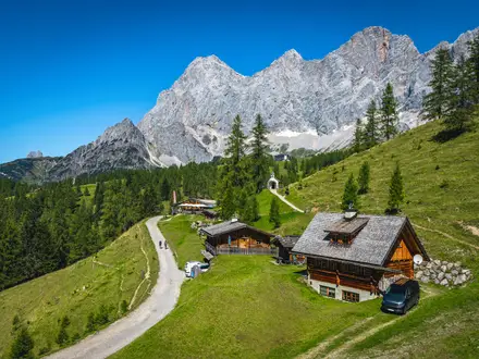
The Via Dinarica Montenegro section is a 120 km, 7-day, hard point-to-point hike on the White Trail through Montenegro. It crosses Durmitor National Park from the Tara-Piva area via Trsa and Žabljak, then continues south towards Biogradska Gora and the Komovi mountains. Expect sustained high-mountain terrain, rocky passes, forested canyons, huts, katuns and guesthouses. It suits experienced hikers comfortable with long days, navigation gaps and remote mountain logistics.
Route Overview
The route enters Montenegro from Bosnia near Šćepan Polje / Mratinje, in the Tara-Piva area, then crosses Durmitor National Park via Trsa to Žabljak. From there it continues south towards Biogradska Gora and the Komovi, following a point-to-point line rather than a loop. Key terrain shifts from forest paths in the Sušica canyon to rocky alpine ground around Škrka Pass and Bobotov Kuk. For shorter add-ons or alternatives, see the Bobotov Kuk Summit Trail, the Black Lake Loop near Žabljak, and the Biogradska Gora Lake Loop.
How the Via Dinarica Was Created
The Via Dinarica was conceived in 2006 by Croatian mountaineer Gordan Papac as a mega-trail linking existing routes through the Dinaric Alps. Coordinated development began around 2010, first connecting national parks in Bosnia and Herzegovina and Montenegro, with later support from USAID, UNDP and the EU. The wider White Trail now runs across Slovenia, Croatia, Bosnia and Herzegovina, Montenegro and Albania.
Notable highlights
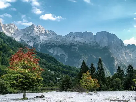
- Durmitor National Park: A UNESCO World Heritage mountain massif and the core of the Montenegro section, known for limestone peaks and alpine lakes.
- Bobotov Kuk (2,523 m): The highest peak of the Durmitor massif and the high point of this section, reached over rocky mountain terrain.
- Škrčko Jezero and Škrka Pass (2,112 m): A glacial lake basin beneath Durmitor’s high peaks, approached through the Sušica canyon and crossed by a high mountain pass.
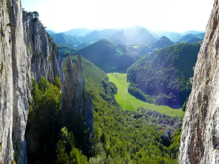
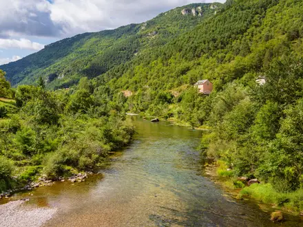
- Sušica canyon: A deep, forested gorge with Sušičko lake and the Skakala waterfall on the approach towards the Škrka huts.
- Biogradska Gora National Park: A protected forest area on the southward continuation, known for primeval beech-and-conifer woodland.
- Komovi: Rocky peaks above alpine pastures and seasonal katuns, with views towards Albania.
Challenges to expect
This is a hard mountain section: expect 5–8 hour walking days, steep climbs, rocky ground, scree and exposed high passes. Waymarking can be patchy on higher sections, so carry reliable offline maps and know how to navigate. Huts and katuns are seasonal, while wild camping is prohibited inside national parks; use designated campsites or booked accommodation where required.
HikeList Score
Via Dinarica (Montenegro Section) scored 89/100 on HikeList's trail-quality metrics.
See score breakdownHide breakdown
- Ideal length 100
- Balanced challenge 80
- Scenery & wildness 98
- Varied terrain 64
- Accommodation 92
- Food & support 81
- Path quality 98
- Season flexibility 76
Computed from length, challenge, scenery & wildness, terrain variety, accommodation, food & support, path quality and season flexibility.
 Montenegro
Show more data Show less
- Mountainous
- Forest
- Dirt
- Rocky
- Huts
- Campsites
- Wild Camping Spots
- Hotels
- Hostels
- Pet Friendly
- Water Sources
- Campsites
- Shelters
Download Our Full Guide to Via Dinarica (Montenegro Section) FREE!
Get our comprehensive guide to this hike for free. Save it for later reading or print out at home.
Photos from hikers
Taken on the trail by people who've reviewed Via Dinarica (Montenegro Section).
Via Dinarica (Montenegro Section): The Complete Guide
The Via Dinarica Montenegro section is a hard, high-mountain traverse through some of the wildest ground on the White Trail. It runs from the Tara–Piva borderlands towards Durmitor National Park, then south across Sinjajevina, Biogradska Gora, Bjelasica and Komovi to Gusinje in the Prokletije (Bjeshkët e Nemuna).
This is a route of limestone peaks, glacial lakes, forested canyons and open katun pastures rather than a polished hut-to-hut holiday trail. The Durmitor stage alone gives deep mountain terrain around Kanjon Sušice, Škrčko jezero, Škrčko ždrijelo and the optional rocky spur to Bobotov Kuk.
Beyond Žabljak the character changes: long linking days cross the huge grasslands of Sinjajevina, the primeval forest around Biogradsko jezero, and the Bjelasica and Komovi ranges. The official line also crosses briefly into Vermoshi (Vermosh, Albania) before returning to Gusinje, so border practicalities matter.
The reward is real solitude and big Balkan mountain scenery, but the walk asks for fitness, self-sufficiency and sound navigation. Waymarking is inconsistent, accommodation is seasonal and sparse between towns, and several days involve remote alpine ground where weather can change quickly.
This guide covers stages, timings, accommodation, food, transport, terrain and the common planning mistakes to avoid.
Stage-by-Stage Guide
The stages below follow the practical nine-stage breakdown used for this HikeList route. Distances are approximate: the official Via Dinarica White Trail through Montenegro is longer than the condensed line shown on some summaries, so GPX files, accommodation stops and border arrangements should be checked before travelling.
Stage 1: Plužine / Šćepan Polje area to Trsa — approx. 18 km
This is the access stage from the Tara–Piva border area towards the Durmitor mountains, climbing from the Plužine / Šćepan Polje / Mratinje side onto Pivska planina (Piva plateau). Many hikers treat Trsa as the practical start of the Montenegro mountain section, especially if arranging a transfer from Plužine or Žabljak.
Expect a mixed linking day rather than continuous high-alpine walking: tracks, shepherd routes, dirt-road sections and possible road walking across open plateau country. The main objective is to reach Trsa in a sensible condition for the more committing Durmitor stages that follow.
Food and water should be sorted before leaving Plužine or the start area. Do not assume reliable supplies between the border area and Trsa, and confirm any meal or overnight arrangement in Trsa before setting out.
Accommodation at Trsa is limited and seasonal, with basic mountain-village lodging or katun-style options rather than a large choice of hotels. This should be booked or confirmed ahead, especially outside the core summer season.
Public transport to the wider start area is awkward. The route is normally reached by bus or transfer from Nikšić, Plužine or Žabljak; exact bus times and transfer availability should be checked before travelling.
Navigation is important from the first day because the official start can vary in practice between Šćepan Polje, Mratinje, Plužine and Trsa. Load the intended GPX in advance and make sure the start point matches the accommodation and transport that have been booked.
Stage 2: Trsa to Škrka huts via Nedajno, Kanjon Sušice and Škrčko jezero — approx. 14 km
This is the first major Durmitor stage and one of the most distinctive days of the route. From Trsa the line heads through the Nedajno area towards Kanjon Sušice (Sušica canyon), with Sušičko jezero and the Skakala waterfall among the key features before the trail rises towards the Škrčko jezero (Škrka lakes) basin.
The terrain becomes more serious than on Stage 1. Expect forested canyon walking, rougher mountain paths, rocky ground and sustained ascent into a high glacial lake basin beneath Durmitor’s limestone walls.
The Škrka huts are the natural end point for this stage. They are seasonal mountain huts, so opening dates, staffing, beds and food availability must be confirmed before committing to this itinerary.
Carry food for the day and enough water capacity to be self-sufficient between known stops. Natural water in the canyon and lake areas should not be treated as guaranteed drinking water without filtering or treatment.
There is no useful public transport at the Škrka huts. Once past Trsa and Nedajno this is a committed mountain section, so retreat options are limited compared with the town-based stages.
Navigation can be awkward where waymarking fades in forest, grass or rocky ground. Offline mapping and GPS are strongly advised, and the day should not be underestimated because of the modest distance.
Wild camping should not be used as a fallback inside Durmitor National Park. Use huts, designated accommodation or a pre-planned alternative that complies with current national-park rules.
Stage 3: Škrka huts to Žabljak via Škrčko ždrijelo, optional Bobotov Kuk and Crno jezero — approx. 16 km
This is the high Durmitor crossing and the most alpine stage of the northern section. The route leaves the Škrka lakes area, crosses the Škrčko ždrijelo / Škrka pass at around 2,112 m, then descends towards Crno jezero (Black Lake) and Žabljak.
Bobotov Kuk, at 2,523 m, is the iconic summit above this stage but should be treated as an optional spur rather than an unavoidable part of the traverse. The official line itself does not need to reach the summit, and poor weather, snow, fatigue or exposure are all valid reasons to skip it.
Underfoot, expect rocky alpine paths, scree and exposed mountain ground. This is not a stage for poor visibility unless navigation skills and equipment are strong.
There are no reliable resupply options between the Škrka huts and Žabljak, so carry food from the previous stop and start with sufficient water. Any hut breakfast, packed lunch or hot meal should be arranged in advance rather than assumed.
Žabljak is the key service town for the Durmitor part of the hike, with guesthouses, hotels and onward bus connections. It is the best place on the route so far for rest, laundry, food resupply and a weather reset.
Navigation around the pass, the Bobotov Kuk spur and the descent towards Crno jezero must be handled carefully. In bad weather it is easy to lose time on rocky ground, and the summit spur should not be attempted without suitable conditions.
This stage lies within Durmitor National Park, where current park rules and any fees should be checked before travelling. Wild camping is not a suitable contingency plan inside the park.
Stage 4: Žabljak to Sinjajevina high pastures — approx. 24 km
After Žabljak the route changes character, leaving Durmitor’s concentrated limestone peaks for the broad open country of Sinjajevina. This is a long linking day across high pasture and plateau terrain, with a far more spacious feel than the Durmitor stages.
Terrain is likely to include open grassland, shepherd and katun tracks, dirt roads and occasional road-walking sections. The walking is less technically alpine than the Bobotov Kuk area, but the distance, exposure to weather and navigation across open ground make it demanding.
Žabljak is the place to restock before leaving. Once on Sinjajevina, food options are sparse and seasonal; any katun meal or lodging must be arranged in advance.
Accommodation on or near Sinjajevina is thin and generally based around seasonal katuns or basic mountain lodging. These can be an excellent fit for the route, but they are not a walk-up certainty outside the main summer grazing season.
Public transport is available from Žabljak at the start of the day, but the Sinjajevina end is remote. If using this stage as part of a section hike, arrange a pickup or confirm road access before committing.
Navigation is a key issue on the plateau. Tracks can divide, fade in grass or fail to match older GPS lines exactly, so a current offline map and GPX are essential.
Expect livestock on the katun pastures and give animals space. Weather can move quickly across open ground, with little shelter once away from settlements.
Stage 5: Sinjajevina to Biogradska Gora National Park — approx. 22 km
This stage continues the traverse south from the open Sinjajevina plateau towards Nacionalni park Biogradska gora. It is a transition day, moving from high grazing country towards forested national-park terrain and the Biogradsko jezero area.
The walking combines pasture tracks, rougher paths, forest approaches and possible dirt-road sections. After rain, forested sections can be slower and more slippery than the open plateau walking.
There are no dependable resupply points to rely on between the Sinjajevina overnight stop and Biogradska Gora. Carry a full day of food and enough water capacity, and treat or filter any natural water used en route.
Accommodation at the Biogradska Gora end must be planned carefully. Use established or park-approved options only, and confirm what is open before travelling.
This is not a good stage on which to improvise camping. Wild camping is prohibited inside Biogradska Gora National Park, so the overnight plan should be fixed before leaving Sinjajevina.
Public transport is not useful for the high-country part of this stage. Kolašin, reached on the next stage, is the practical transport hub for this part of the route.
Navigation remains important, especially in the transition from open plateau to forest. Waymarks can be inconsistent, and a GPS line should be treated as a planning tool rather than a substitute for map judgement.
Stage 6: Biogradska Gora National Park to Kolašin — approx. 16 km
This shorter stage links Biogradska Gora with Kolašin, making it a useful recovery and logistics day after the remote Sinjajevina crossing. The key landscape feature is the primeval beech-and-conifer forest around Biogradsko jezero.
Terrain is mainly forest path and track, with some linking sections as the route approaches Kolašin. It is generally less exposed than Durmitor or Komovi, but wet forest paths can still be slow underfoot.
Kolašin is one of the most important resupply and rest points on the Montenegro section. It has town accommodation, food options and transport links, making it a sensible place to repair kit, check weather and confirm arrangements for the southern stages.
Accommodation in Kolašin includes guesthouses and hotels. Book ahead in busy periods, but it offers much more flexibility than the huts and katuns on the route.
Kolašin is also the handiest railway access point for the trail, on the Belgrade–Bar line, and is served by intercity buses. It is the best mid-route access or exit point for hikers section-walking the Montenegro section.
Check current Biogradska Gora National Park rules and any fees before setting out. If leaving the park and continuing straight through to town, do not assume that camping or informal stopping points are permitted inside the protected area.
Navigation is easier near a town than on the high plateaux, but still use offline mapping. The official trail line, local paths and practical access routes may not always align perfectly.
Stage 7: Kolašin to Komovi / Eko Katun Štavna — approx. 20 km
This stage leaves Kolašin for the Bjelasica and Komovi part of the route. It is the gateway to the southern high mountains, with the rocky Komovi summits rising above the Štavna katun pastures.
Expect a sustained mountain day, climbing away from the town environment towards high pasture and rougher upland paths. The scenery builds towards the Komovi group: Kom Vasojevički, Kučki Kom and Ljevorečki Kom.
Stock up in Kolašin before leaving. Do not rely on intermediate food supply, and confirm whether Eko Katun Štavna can provide dinner, breakfast or packed food before arrival.
Eko Katun Štavna is the logical overnight stop for this stage. It is a seasonal mountain accommodation option, so opening dates, beds and meals should be checked before travelling.
Kolašin has both rail and bus access at the start of the stage. Once heading towards Komovi, public transport becomes limited and any road transfer to or from the Štavna area should be arranged in advance.
Navigation becomes more serious again south of Kolašin. Waymarking on the higher and southern sections of the Via Dinarica can be patchy, especially where paths cross grassland or katun tracks.
Weather exposure increases as the route gains height. Carry layers even in July and August, when valleys can be hot but the high ground can be cool, windy or stormy.
Stage 8: Komovi / Eko Katun Štavna to Vermoshi (Vermosh, Albania) — approx. 24 km
This is a long, committing stage from the Komovi area towards the Montenegro–Albania borderlands. It is one of the more serious southern stages because of distance, remoteness, navigation and the international border crossing.
The terrain is high-mountain Dinaric country: pasture, rough mountain paths, rocky sections and exposed ground beneath the Komovi peaks. Views open towards Albania and the Prokletije (Bjeshkët e Nemuna) region as the route heads south-east.
Leave Eko Katun Štavna with a full food plan for the day. There should be no assumption of resupply before Vermoshi unless a specific arrangement has been made.
Accommodation in Vermoshi must be arranged in advance, or an onward transfer must be planned. This should be checked before travelling, particularly outside the main summer walking season.
The official line crosses into Albania at Vermoshi before returning to Montenegro on the following stage. Carry a passport and check the current Montenegro–Albania border-crossing requirements before setting out; do not treat this as an ordinary domestic walking stage.
Public transport at either end of this stage is not something to rely on without prior checking. If the stage is being shortened or supported, transfer logistics should be fixed before leaving Kolašin or Komovi.
Navigation is a major planning point. Carry offline maps, a loaded GPX and enough battery capacity, and expect waymarking to be inconsistent in the higher and southern sections.
Stage 9: Vermoshi (Vermosh) to Gusinje / Plav — approx. 16 km
The final Montenegro-section stage brings the route from the Albanian borderlands back towards Gusinje and Plav, on the edge of the Prokletije (Bjeshkët e Nemuna). It is the bridge between the Montenegro section and the onward Via Dinarica route towards Albania and Theth.
The walking remains mountainous, but the focus shifts from the Komovi massif to the Prokletije gateway. Expect a mix of mountain paths, tracks and borderland terrain rather than a serviced valley walk.
Food should be carried from Vermoshi unless meals have been specifically arranged at the start. Gusinje and Plav are the next practical service centres, with guesthouses, hotels and onward transport options.
Accommodation is available in Gusinje and Plav, and this is the sensible place to end, rest or reorganise before continuing into the Albanian Prokletije. Book ahead if arriving late in the day or outside peak season.
Leaving the route is by bus from Gusinje or Plav towards Podgorica. Timetables change, so current bus times should be checked before travelling.
Border formalities remain relevant on this stage because the route has crossed via Vermoshi. Carry passport documents and make sure the planned crossing is legal and currently permitted.
Navigation should still be treated seriously until the finish. The southern Via Dinarica waymarking can be unreliable, and the final approach should be followed on a current offline map rather than by trail marks alone.
Recommended Itinerary
The most practical plan for the Montenegro section is a 9-day mountain itinerary using the stage sequence below. Distances are approximate planning figures; if following the full official Via Dinarica White Trail rather than a condensed line, check official mapping before booking accommodation, as the full Montenegro section is longer than the shorter HikeList line.
Standard itinerary — 9 walking days
This is the best default for experienced hikers who want to walk the main north-to-south line without forcing repeated double stages. It still leaves little margin for bad weather, hut closures or navigation delays, so an extra night in Žabljak or Kolašin is sensible if travel dates allow.
| Day | From | To | Approx. distance | Why this stage makes sense | Services/accommodation notes |
|---|---|---|---|---|---|
| 1 | Plužine / Šćepan Polje area | Trsa | 18 km | Gets the route from the Tara–Piva border area up towards the Pivska planina (Piva plateau), positioning you for the Durmitor crossing. Many hikers treat Trsa as the practical mountain start. | Accommodation is limited and should be arranged ahead. If starting directly at Trsa, this day can be skipped, but transport to the village must be organised in advance. |
| 2 | Trsa | Škrka huts, via Kanjon Sušice (Sušica canyon) and Škrčko jezero (Škrka lakes) | 14 km | A shorter but serious mountain day through one of the key Durmitor approaches, with canyon, lake and high-cirque terrain before the huts. Keeping this day moderate helps before the high pass and optional summit day that follows. | The Škrka huts are the key overnight point here. Hut opening is seasonal and must be checked before travelling; do not rely on wild camping inside Durmitor National Park. |
| 3 | Škrka huts | Žabljak, via Škrčko ždrijelo (Škrka pass) and optional Bobotov Kuk | 16 km | This is the main high Durmitor day, crossing Škrčko ždrijelo and descending towards the Žabljak side. Bobotov Kuk is an optional exposed summit spur, not a compulsory part of the traverse, and should be skipped in poor weather or if timing is tight. | Žabljak is the first major service stop: guesthouses, hotels, food, transport links and recovery options. It is the logical place for a rest or weather day. |
| 4 | Žabljak | Sinjajevina high pastures | 24 km | A long linking stage out of Durmitor towards the open Sinjajevina plateau. Expect a change from rocky alpine terrain to broad grassland, katun country and more exposed navigation. | Services are thin away from Žabljak. Plan this night around a known open katun or arranged lodging; seasonal availability should be checked before travelling. |
| 5 | Sinjajevina high pastures | Biogradska Gora National Park | 22 km | Continues the remote plateau traverse and brings the route into the Biogradska Gora area, one of the major natural anchors of the Montenegro section. The distance is substantial and navigation can be harder in open country. | Accommodation and food options are limited between settlements. National park rules apply in Biogradska Gora; use official accommodation or designated options rather than informal camping. |
| 6 | Biogradska Gora National Park | Kolašin | 16 km | A shorter recovery-style day after two longer remote stages, moving from Biogradsko jezero and forest terrain to the main town service point of Kolašin. | Kolašin has the most useful mid-route transport and resupply options, including access to the Belgrade–Bar railway line. This is a strong place for a rest night, laundry, food resupply and itinerary reset. |
| 7 | Kolašin | Komovi, Eko Katun Štavna | 20 km | Climbs back into high country through the Bjelasica/Komovi transition, ending at the Štavna katun pastures below the Komovi peaks. The stage places you well for the southern mountain crossing. | Eko Katun Štavna is the key accommodation reference point here. Katun accommodation is seasonal, roughly summer into early autumn, and should be booked or checked in advance. |
| 8 | Komovi, Eko Katun Štavna | Vermoshi (Vermosh, Albania) | 24 km | A demanding southern stage from the Komovi area towards the Montenegro–Albania borderlands. This is one of the stages where navigation, weather and border logistics need particular attention. | The official line crosses briefly into Albania at Vermoshi. Carry a passport and check current border-crossing requirements before travelling. Accommodation in or around Vermoshi should be arranged ahead. |
| 9 | Vermoshi (Vermosh) | Gusinje / Plav | 16 km | Completes the Montenegro section into the Prokletije (Bjeshkët e Nemuna) gateway area. Gusinje is the natural finish for the section, with Plav also relevant for services and onward transport. | Gusinje and Plav offer the finish-point services for food, lodging and buses towards Podgorica. Check current bus times before committing to same-day onward travel. |
Slower variant — 10 to 12 days
Choose this if carrying a heavier pack, walking early or late in the season, or wanting more margin for Durmitor weather and patchy waymarking. The simplest slower plan is to keep the same walking stages but add at least one rest or contingency night in Žabljak and one in Kolašin.
A slower schedule is also useful if local katun accommodation allows you to split the longer linking sections across Sinjajevina, Bjelasica or the approach to Komovi. Exact stopping points and opening dates vary seasonally, so these should be checked before travelling rather than assumed from the map.
Good places to add time:
- Žabljak: best for weather delays before or after the Durmitor high crossing, and for anyone considering Bobotov Kuk.
- Kolašin: best mid-route reset point for food, accommodation, transport access and route decisions.
- Komovi / Eko Katun Štavna: useful if the Komovi-to-Vermoshi stage looks marginal because of weather, fatigue or border logistics.
Faster variant — 8 days, or 7 days only on a condensed plan
A faster version suits very fit, experienced hikers with light packs, settled weather and accommodation already arranged. The cleanest 8-day version is to start at Trsa rather than in the Plužine / Šćepan Polje area, then follow Days 2–9 of the standard itinerary.
That avoids forcing the Durmitor high stages together, which is usually the wrong place to save time. It also reflects how many hikers treat Trsa as the practical start of the Montenegrin mountain section.
A 7-day itinerary should be treated as a condensed route, not the full official Montenegro White Trail. It may require transfers, omitted linking kilometres or very long days; check official mapping before booking and do not assume the shorter distance represents the complete official line.
Planning the Route
The main planning decision is whether to walk the full official Montenegro White Trail line or a shorter practical version. The official Montenegro section is about 206 km over Via Dinarica stages 39–43, while the shorter HikeList line of about 120 km is a condensed itinerary and should not be treated as the official length.
Most experienced walkers should allow 8–10 walking days for the full Montenegro section, plus at least one spare day for weather, transport or accommodation problems. A 7-day schedule is only realistic for a shortened line or for very strong hikers moving fast with light packs and pre-arranged lodging.
How the stages are dictated
This route is not easily broken into arbitrary daily distances. Stages are shaped by the limited places to sleep: Trsa, the Škrka huts, Žabljak, seasonal katuns on Sinjajevina and around Komovi, Biogradska Gora, Kolašin, Vermoshi and Gusinje or Plav.
That means planning should start with accommodation, not mileage. Once beds, huts or katuns are available, the walking days can be built around them. If a seasonal hut or katun is closed, the stage may need a major redesign rather than a simple adjustment.
A practical full-section rhythm is:
| Section | Planning notes |
|---|---|
| Plužine / Šćepan Polje area to Trsa | Many hikers use Trsa, or the Plužine area, as the practical start for the Durmitor part of the route. Access should be arranged carefully, as this is a remote start area. |
| Trsa to Škrka huts | A remote Durmitor day through Nedajno, Kanjon Sušice, Sušičko jezero and the Škrka lakes area. Accommodation at or near the huts must be checked before committing to the stage. |
| Škrka huts to Žabljak | Crosses the high Durmitor ground via Škrčko ždrijelo / Škrka pass. Bobotov Kuk is an optional exposed summit spur, not a compulsory part of the traverse. |
| Žabljak to Biogradska Gora via Sinjajevina | Long, open linking ground where katun availability and water planning matter. Do not assume easy resupply between towns. |
| Biogradska Gora to Kolašin | Kolašin is the key mid-route reset point, with rail and bus access useful for section hikers. |
| Kolašin to Komovi / Eko Katun Štavna | Plan around lodging on or near the Štavna katun pastures. This is a good place to build in flexibility for weather before the southern stages. |
| Komovi to Vermoshi and Gusinje / Plav | The official line crosses briefly into Albania at Vermoshi before returning towards Gusinje / Plav. Passport and border-crossing requirements must be checked before travelling. |
Fast or slow?
Walking quickly is possible only if accommodation, food and transport are already tied down. The route has long 5–8 hour mountain days, patchy waymarking and exposed high passes, so a fast plan leaves little margin for bad weather, navigation errors or a closed katun.
A slower plan is usually safer and more practical. Extra time is especially useful around Durmitor, where Bobotov Kuk should only be attempted in suitable conditions, and around Komovi and the Prokletije borderlands, where the route is remote and waymarking can be inconsistent.
Shortening, extending and section hiking
The easiest places to shorten or split the route are Žabljak, Kolašin, Plav and Gusinje. Kolašin is the most useful mid-route access point because it sits on the Belgrade–Bar railway, while Žabljak, Kolašin, Plav and Gusinje have bus links that make section hiking realistic with planning.
Common practical sections are:
- Durmitor section: Trsa to Žabljak via Kanjon Sušice, the Škrka lakes and the Škrka pass.
- Central section: Žabljak to Kolašin via Sinjajevina and Biogradska Gora.
- Southern section: Kolašin to Gusinje / Plav via Bjelasica, Komovi, Eko Katun Štavna and Vermoshi.
Extensions are possible by continuing the Via Dinarica south-east into Albania towards Theth. Side objectives such as Bobotov Kuk or peaks in the Komovi area should be treated as weather-dependent additions, not assumed parts of a tight itinerary.
What to organise first
Accommodation is the first priority. Mountain huts, katuns and small guesthouses are seasonal and sparse, especially away from Žabljak, Kolašin, Plav and Gusinje. Hut and katun opening, availability and food arrangements should be checked before travelling, particularly outside the main July–September window.
Food planning is the second priority. The reliable resupply points are the towns, especially Žabljak and Kolašin, with Plav and Gusinje at the south-eastern end. Between them, meals may depend on seasonal katuns or booked accommodation, so carry enough food to cover a missed meal or an unexpectedly closed stop.
Water needs active planning. The route crosses limestone, high pasture and exposed plateau terrain where dependable water should not be assumed at every point marked on a map. Carry enough capacity for long dry sections and ask locally about current sources before leaving each overnight stop.
Navigation is critical. The route is mostly on existing paths and tracks, but waymarking is inconsistent, particularly on higher and southern sections, and paint marks can disappear in grass or open pasture. Carry offline maps and GPS, download the route before leaving mobile coverage, and do not rely on waymarks alone.
Transport should be fixed at both ends before booking the walk. Podgorica is the main gateway, with buses to Žabljak, Kolašin, Plav and Gusinje; Tivat is an alternative airport. The start around Plužine, Šćepan Polje, Mratinje or Trsa is remote and may require a bus connection or transfer from Nikšić or via Žabljak. Current bus times should be checked before travelling.
National park rules and any current fees should be checked for Durmitor National Park and Biogradska Gora National Park. Wild camping must not be planned inside these national parks; use huts, designated campsites, katuns or booked accommodation instead.
Weather and seasonal timing
July to September is the most practical window. Late June can work in some years, but snow can linger on high ground, while early autumn can bring colder nights and early weather changes at altitude.
July and August can be hot in valleys and lower towns, but the high passes remain exposed, cooler and changeable. Build the itinerary so that Durmitor’s high traverse, the Bobotov Kuk spur and the Komovi / Vermoshi stages are not forced in poor conditions.
Towns, Villages and Overnight Stops
Accommodation on the Montenegro section is useful but unevenly spaced. The dependable town bases are Žabljak, Kolašin, Plav and Gusinje; between them, nights usually depend on seasonal mountain huts, katuns or pre-arranged local lodging.
Mountain huts and katuns are generally simple rather than hotel-style. Huts are typically around €5–15 per person per night, but opening dates, staffing, meals and prices should be checked before travelling, especially outside the main summer season.
Šćepan Polje / Mratinje and the Plužine area
Šćepan Polje / Mratinje sits in the Tara–Piva border area where the route enters Montenegro from Bosnia and Herzegovina. Many hikers do not treat the border itself as a comfortable first-night base, instead using Plužine or arranging a transfer onwards towards Trsa.
This is a remote start area, so do not assume easy last-minute accommodation, food or onward transport at the trailhead. Access is generally by bus or transfer from Nikšić or via Žabljak, and current connections should be checked before travelling.
The main reason to stop nearby is logistical: to avoid starting the climb onto Pivska planina (Piva plateau) after a long travel day. If beginning the Montenegro section here rather than at Trsa, arrive with food for the first mountain stage already sorted.
Pivska planina (Piva plateau)
Pivska planina is the high plateau crossed between the Tara–Piva start area and Trsa. It is more of a walking section than a service stop, with exposed, open terrain and little scope for casual resupply.
Any overnight here should be planned around a known lodging or katun arrangement rather than assumed on arrival. Treat the plateau as a self-sufficient stretch: carry the food, water information and navigation needed to reach Trsa.
Trsa
Trsa is the practical mountain start for many hikers on the Montenegrin Durmitor section. It sits on the Piva plateau before the route pushes into the more committing terrain towards Nedajno, Kanjon Sušice (Sušica canyon), the Škrka lakes and the Durmitor high passes.
It is a sensible overnight stop before the Durmitor stage, particularly if arriving from Plužine, Šćepan Polje or Žabljak by transfer. Accommodation and food are limited and seasonal, so a bed and any evening meal should be arranged in advance.
Trsa is also a useful place to make a final kit and weather check before entering the remote canyon-and-lake section. Once beyond the village, there is no town-style resupply until Žabljak.
Nedajno
Nedajno is a small mountain village on the Durmitor approach, before the route drops towards Kanjon Sušice (Sušica canyon). It is useful as a route landmark and possible staging point, but it should not be treated as a guaranteed service village.
Accommodation, meals and any local transfer options should be checked before travelling. If using Nedajno to shorten or adjust the Durmitor stage, book or arrange the stop specifically rather than relying on turning up.
Kanjon Sušice (Sušica canyon), Sušičko jezero and Skakala waterfall
Kanjon Sušice is a scenic but remote passage rather than a supply point. The route passes the seasonal Sušičko jezero and Skakala waterfall on the approach to the Škrka lakes and huts.
Do not plan on food shops, cafés or accommodation in the canyon itself. This section sits within the Durmitor mountain environment, and wild camping should not be used inside national park areas; use huts, katuns, designated sites or booked lodging where permitted.
Škrčko jezero (Škrka lakes) and the Škrka huts
The Škrka huts are one of the key mountain overnight stops on the Durmitor traverse. They sit by the Škrka lakes below the high wall of Durmitor, before the route climbs towards Škrčko ždrijelo (Škrka pass) and the optional Bobotov Kuk spur.
This is a practical place to break the Trsa–Žabljak crossing into two manageable mountain days. The huts are seasonal, typically staffed in summer, and should be booked or checked ahead.
Expect simple hut conditions rather than full guesthouse facilities. Carry enough food and cash for the stage, and do not rely on a shop or flexible meal service unless it has been arranged.
Škrčko ždrijelo (Škrka pass) and Bobotov Kuk
Škrčko ždrijelo (Škrka pass) is a high crossing, not an overnight stop. Bobotov Kuk is an optional exposed summit spur above the main line and should be treated as a weather- and ability-dependent addition, not as a place to linger with heavy overnight plans.
There are no services on the pass or summit route. The practical overnight choices are the Škrka huts before the crossing and Žabljak after descending through the Durmitor side of the route.
Crno jezero (Black Lake)
Crno jezero sits near Žabljak and is usually encountered near the end of the Durmitor crossing. It is a useful landmark for the descent out of the high mountains and into town services.
This is not a resupply stop in the same sense as Žabljak. National park rules and any fees should be checked before travelling, and overnight plans should be made in permitted accommodation rather than by wild camping in the park.
Žabljak
Žabljak is the main service town for Durmitor and the most important northern trail base on this section. It is a natural overnight stop after the Škrka lakes, Škrka pass and optional Bobotov Kuk stage.
Accommodation is much broader here than in the mountain settlements, with family guesthouses and some hotel options. It is also the best place on the northern half of the route to take a rest day, dry kit, reorganise food and reset the itinerary before the long Sinjajevina crossing.
Žabljak is served by intercity buses and is one of the more realistic places to join, leave or pause the route. Bus times change seasonally and should be checked before travelling.
Sinjajevina
Sinjajevina is a vast high plateau between Žabljak and Biogradska Gora. It is a demanding linking section with open grassland, katuns and long distances between reliable services.
Overnight stops here need careful planning around seasonal katuns or other pre-arranged lodging. Do not assume there will be food, beds or transport available without prior contact.
This is one of the sections where self-sufficiency matters most. Carry enough food for the crossing, have offline maps and GPS ready, and allow for slower progress if weather or navigation becomes difficult.
Nacionalni park Biogradska gora and Biogradsko jezero
Biogradska Gora National Park is the next major natural stop after Sinjajevina, centred around Biogradsko jezero and primeval beech-and-conifer forest. It is a logical overnight area before continuing towards Kolašin.
Accommodation and camping arrangements inside or around the park should be checked in advance. Wild camping is prohibited inside national parks, so plan around permitted lodging, designated facilities or an onward walk to Kolašin.
The park is not a place to rely on for broad resupply. Arrive with enough food to complete the stage and reach Kolašin unless a meal or lodging arrangement has been made.
Kolašin
Kolašin is the key mid-route town and the most useful transport hub on the Montenegro section. It has family guesthouses and hotel options, intercity buses, and the handiest rail access to the route via the Belgrade–Bar line.
For section-hikers, Kolašin is one of the easiest places to start or finish a shorter itinerary. It is also the obvious place to restock and prepare for the Bjelasica and Komovi stages, where accommodation again becomes sparse and seasonal.
Current train and bus times should be checked before travelling. If bad weather affects the high route, Kolašin is the most practical place to pause and re-plan.
Bjelasica
Bjelasica is the mountain range crossed after Kolašin on the way towards Komovi. It is not a town stop, and services should be treated as limited unless a specific katun or accommodation arrangement has been made.
Most hikers should plan this section from Kolašin to the Komovi/Štavna area as a committed mountain link. Carry food from Kolašin and do not count on spontaneous resupply en route.
Komovi and Eko Katun Štavna
The Komovi area, including Eko Katun Štavna, is a major overnight point before the long crossing towards Vermoshi (Vermosh). It sits below the Komovi peaks, including Kom Vasojevički, Kučki Kom and Ljevorečki Kom.
Eko Katun Štavna is the practical accommodation focus here, but it is seasonal and should be booked or checked ahead. Food may be available as part of a katun stay, but this should be arranged before arrival.
This is a good place to reassess weather, border logistics and food before the route turns towards Albania. The following stages are remote, and waymarking can be inconsistent on the higher and southern sections.
Vermoshi (Vermosh, Albania)
The official Via Dinarica line crosses briefly into Albania at Vermoshi (Vermosh) before returning towards Gusinje. This has practical passport and border-crossing implications and should be checked before travelling.
Vermoshi can function as an overnight stage stop between Komovi and Gusinje/Plav, but accommodation and food should be booked or checked in advance. Do not assume that border formalities, lodging or onward options will be straightforward without current information.
Carry identification, allow time for the crossing, and keep offline maps available on both sides of the border. This is not a stage to approach casually at the end of the day without a clear plan.
Plav
Plav is a useful town near the finish area in the Prokletije (Bjeshkët e Nemuna). It can serve as an alternative final overnight, a resupply point, or a practical base if continuing to explore the surrounding mountains.
Accommodation includes family guesthouses and some hotel options. Buses connect the Plav/Gusinje area with Podgorica, but current timetables should be checked before travelling.
Plav is particularly useful if finishing tired, arriving late from Vermoshi, or needing a slightly larger town base before onward travel. It is also a practical fallback if accommodation in Gusinje is full.
Gusinje
Gusinje is the official finish town for the Montenegro section, in the Prokletije (Bjeshkët e Nemuna) near the Albanian border. It is the natural final overnight after the Vermoshi stage and the main place to organise onward travel.
Accommodation is available in town through guesthouses and some hotel-style lodging. Food and transport should be straightforward compared with the mountain sections, but onward bus times to Podgorica should still be checked before travelling.
The Via Dinarica continues from this borderland area towards Albania, including the onward Prokletije stage towards Theth. Anyone continuing beyond Gusinje should check current border, route and accommodation arrangements before setting out.
Getting to the Start
The northern end of the Montenegro section is not a simple railhead-to-trailhead start. The official line enters Montenegro around Šćepan Polje / Mratinje on the Bosnia–Montenegro border in the Tara–Piva region, but many hikers make Trsa, on the Piva plateau (Pivska planina), the practical starting point for the Durmitor stage.
For planning, treat the start area as Plužine / Šćepan Polje / Trsa rather than one transport hub. Public transport is limited, so most itineraries need a bus to the nearest useful town, then a local taxi or pre-arranged transfer to the exact trailhead.
By train
No railway reaches the start area or the Durmitor trailhead directly. The nearest useful rail access for the wider route is the Belgrade–Bar railway, which runs through Kolašin and Mojkovac; Kolašin station is the handiest rail access point for the middle of the Montenegro section, not for the northern start.
Using the train to start the hike normally means travelling to Kolašin or another town on the Belgrade–Bar line, then continuing by road towards Žabljak, Plužine or Trsa. Exact onward connections vary and should not be assumed. This should be checked before travelling.
By bus
The most practical public-transport approach is by intercity bus to a mountain town, then onward by local transfer. Žabljak and Kolašin are served by intercity buses, and Podgorica has bus links to Žabljak, Kolašin, Plav and Gusinje.
For the start area, hikers commonly work towards Plužine, Šćepan Polje or Trsa by bus or transfer from Nikšić, or by approaching via Žabljak. Trsa is a small mountain village and should not be treated as a place with frequent public transport.
A realistic plan is usually:
| Step | Practical approach |
|---|---|
| 1 | Travel to Podgorica, Nikšić, Žabljak or Kolašin by bus or train/bus combination |
| 2 | Continue towards Plužine, Šćepan Polje or Trsa by bus where available |
| 3 | Use a pre-arranged taxi or accommodation transfer for the final road section if no suitable bus runs |
Bus times in Montenegro can change seasonally and may not line up neatly with a same-day trail start. Build in slack time and check current services before booking accommodation. This should be checked before travelling.
By car
Driving gives the easiest access to the remote northern start area, especially if beginning at Trsa rather than trying to connect precisely to Šćepan Polje / Mratinje by public transport. It also makes it easier to arrive with food, gas and other supplies sorted before the first high-mountain stage.
The main drawback is that this is a point-to-point route ending at Gusinje / Plav, far from the northern start. Leaving a car at Plužine, Trsa or Žabljak creates a retrieval problem at the end of the hike, so a one-way private transfer is often simpler than self-driving.
Long-stay parking should be arranged through a hotel, guesthouse or other local provider rather than assumed at the trailhead. This should be checked before travelling.
From the nearest airport
Podgorica Airport (TGD) is the main gateway for this hike. From Podgorica, use intercity buses towards Žabljak, Kolašin, Plav or Gusinje, or arrange a private transfer towards Plužine / Trsa for the northern start.
Tivat Airport (TIV) on the coast is an alternative gateway, but it is less directly useful for the mountain start unless combined with onward bus travel or a private transfer. For a short trip with fixed accommodation, the reliability of the final transfer matters more than the nominal distance from the airport.
If arriving late in the day, staying overnight in Podgorica, Žabljak, Nikšić or Plužine before moving to the trailhead may be more reliable than attempting to reach Trsa and start walking the same day. Current bus times and transfer availability should be checked before travelling.
Where to stay before starting
The most practical pre-hike bases are Plužine, Trsa or Žabljak, depending on where the first walking day begins. Plužine works well for staging access to the Tara–Piva start area; Trsa is the practical mountain start for many Durmitor itineraries; Žabljak has better services but sits after the first Durmitor crossing if following the north-to-south line.
Accommodation in and around the start area is thinner than in the main towns and can be seasonal. Book ahead, especially if relying on a guesthouse or transfer to position you at Trsa.
Before leaving for the first stage, sort food, cash, offline maps/GPX and onward hut or katun arrangements. The route quickly enters remote mountain country, and transport back to shops or services from Trsa or the Piva plateau should not be relied on without prior arrangement.
Getting Home from the Finish
The Montenegro section finishes in Gusinje, close to Plav in the Prokletije (Bjeshkët e Nemuna) borderlands. This is a remote mountain finish, so onward travel should be treated as part of the hike plan rather than an afterthought.
Most hikers should plan to spend a night in Gusinje or Plav before travelling on, especially if arriving after a long final stage from Vermoshi (Vermosh). Same-day connections out of the mountains may be limited, and all bus times should be checked before travelling.
By train
There is no railway at Gusinje or Plav, and no train line reaches the Prokletije finish area directly.
The nearest useful railway for the wider route is the Belgrade–Bar line, which serves places including Kolašin and Mojkovac. From the finish, however, the practical first step is usually to travel by road to Podgorica or another connected town before using rail or onward buses. Exact rail-and-bus combinations are timetable-dependent and should be checked before travelling.
By bus
The standard public-transport exit from the finish is by bus from Gusinje or Plav to Podgorica. Podgorica is the main onward hub for Montenegro, with onward buses and the country’s main airport.
Services from the mountain towns are not something to leave to chance. Check current departures from Gusinje, Plav and Podgorica before committing to flights, accommodation or onward travel. If finishing late in the day, staying locally and taking a morning bus is the safer plan.
If the final walking stage has involved the official Via Dinarica line through Vermoshi (Vermosh), Albania, remember that the route has crossed an international border shortly before the finish. Passport and border-crossing arrangements should be checked before travelling.
By car/taxi
A private transfer or taxi is the most flexible way to leave Gusinje or Plav, particularly for groups, late finishes, or onward travel that needs to connect with a flight. It is also useful if bus times do not line up with the end of the walk.
Pre-arrange transfers where possible through accommodation in Gusinje or Plav, rather than assuming a vehicle will be available at short notice. Prices and availability should be confirmed before booking.
From the nearest airport
Podgorica Airport (TGD) is the main airport for leaving the route. The usual sequence is bus or transfer from Gusinje/Plav to Podgorica, then onward to the airport.
Do not plan a tight same-day flight after the final stage unless a private transfer has been arranged and the walking day is deliberately short. Weather, fatigue, border formalities around Vermoshi (Vermosh) and limited mountain transport can all make a same-day airport connection risky.
Tivat Airport (TIV) on the coast is an alternative gateway for Montenegro, but it is less direct from the Prokletije finish than Podgorica. Any route from Gusinje or Plav to Tivat will require onward road or bus connections; this should be checked before travelling.
Where to stay at the finish
Both Gusinje and Plav have accommodation options, including family guesthouses and some hotels. Staying at the finish is strongly recommended if completing the full final mountain stage, arriving from Vermoshi (Vermosh), or needing to organise onward buses or a transfer the next morning.
Book ahead in the main hiking season, and confirm arrival time with the accommodation if the final day may run late. The finish area is remote enough that a confirmed bed is part of sensible route planning, not just a comfort choice.
Which Direction Should You Walk?
Standard direction: north to south
The natural direction for the Montenegro section is north to south, from the Tara–Piva / Šćepan Polje–Mratinje area towards Trsa, Durmitor, Žabljak, Kolašin, Komovi, Vermosh and Gusinje. This follows the official Via Dinarica White Trail line through Montenegro and also matches the broader logic of the route continuing from Bosnia and Herzegovina towards Albania.
For most independent hikers, this is the direction that makes the route easiest to understand on the ground. The sequence of mountain areas is clear: Durmitor first, then the long crossing over Sinjajevina, the forested section through Biogradska Gora, the Bjelasica and Komovi mountains, and finally the Prokletije (Bjeshkët e Nemuna) borderlands.
It also gives a strong psychological finish. Ending in Gusinje, with the Prokletije rising above the Albanian border, feels like a natural conclusion to the Montenegrin section and a logical handover point if continuing onwards towards Albania.
Transport and practical logistics
Neither end is especially convenient, but north to south is usually the tidier option. The start around Plužine, Šćepan Polje, Mratinje or Trsa is remote and normally requires bus-and-transfer planning from places such as Nikšić or Žabljak. Sorting that awkward access at the beginning is often preferable to finishing tired in a small mountain village and still needing to arrange onward transport.
At the southern end, Gusinje and nearby Plav have bus links towards Podgorica, making the exit more straightforward. Kolašin is also a useful mid-route access or exit point because it lies on the Belgrade–Bar railway line and has intercity bus connections.
Walking south to north is possible, but it puts the more awkward Tara–Piva / Trsa logistics at the end. It can make sense if you are already in Gusinje, Plav or the Albanian Prokletije, or if accommodation availability forces that direction, but it is not the simpler default.
Scenery progression
North to south gives the route a good sense of escalation and variety. The traverse begins with the dramatic limestone country of Durmitor National Park, including the Sušica canyon, Škrčka lakes, Škrka pass and the optional Bobotov Kuk spur, before opening out onto the wide grasslands of Sinjajevina.
The middle of the walk then changes character through Biogradska Gora National Park and Bjelasica, before the sharper peaks of Komovi and the approach to the Prokletije provide a wilder final act. In reverse, the scenery is still outstanding, but the route starts with the southern border mountains and then finishes with the more fragmented access back towards Tara–Piva.
Climbs, descents and difficulty by direction
There is no easy direction. The route is a hard high-mountain traverse either way, with steep climbs, rocky passes, scree, exposed ground and long days between services.
Reversing the route does not remove the main difficulty; it simply changes which slopes are climbed and which are descended. On this terrain, long rocky descents can be just as tiring as ascents, especially with a full pack. The optional Bobotov Kuk summit remains a serious exposed spur whichever way the main traverse is walked.
Weather and accommodation flow
There is no dependable weather or wind advantage in either direction. At altitude, the important point is flexibility: snow can linger into early summer, storms can build quickly, and autumn weather can close in early. Direction should not override a safe weather window for Durmitor, Komovi or the Prokletije.
Accommodation works best when planned around the established sequence of towns, huts, katuns and guesthouses. In the standard direction, Žabljak and Kolašin act as useful reset points after remote sections, while the southern stages require careful planning around Eko Katun Štavna, Vermosh, Plav and Gusinje. Seasonal huts and katuns should be booked or checked before travelling, whichever direction is chosen.
Recommendation
Walk the Via Dinarica Montenegro section north to south unless there is a specific reason not to. It follows the natural White Trail direction, gives the cleanest route logic, puts the awkward Tara–Piva access at the start rather than the finish, and ends strongly in Gusinje beneath the Prokletije.
Choose south to north only if transport, accommodation availability or a wider itinerary from Albania makes it more practical. For most hikers planning the Montenegro section as a standalone traverse, Trsa / Plužine to Gusinje is the best direction.
Accommodation Along the Route
Accommodation on the Via Dinarica Montenegro section is workable, but it is not a simple hotel-to-hotel trek. The route alternates between towns with proper choice — especially Žabljak, Kolašin, Plav and Gusinje — and long high-mountain sections where beds may mean a basic planinarski dom, a seasonal katun or a bivouac-style shelter.
The main planning rule is simple: do not arrive in the remote sections assuming there will be an open bed. Huts and katuns are seasonal, commonly operating around the summer grazing and hiking season, and opening can vary from year to year. Book or at least confirm each non-town overnight before committing to your stage plan.
Mountain huts typically cost roughly €5–15 per person per night, but prices, staffing and meal availability should be checked before travelling. Katuns can be an excellent way to reduce food weight if meals are available, but they are still basic mountain accommodation rather than guaranteed year-round lodging.
Best overnight bases
| Place | Accommodation level | Best for | Notes |
|---|---|---|---|
| Šćepan Polje / Mratinje / Plužine area | Limited | Starting logistics, pre-trail night | Useful for approaching the Tara–Piva start area, but many walkers make Trsa or the Plužine area their practical starting point. Current options and transfers should be checked before travelling. |
| Trsa | Limited | First mountain overnight, access to Durmitor | A practical staging point on Pivska planina before entering the Durmitor traverse. Reserve ahead in season, as options are limited. |
| Nedajno | Limited | Durmitor approach / Sušica canyon access | A small mountain village rather than a reliable accommodation hub. Treat it as a planned stop only if lodging has been arranged in advance. |
| Kanjon Sušice / Sušičko jezero | None | Day passage through the canyon | Do not rely on finding accommodation in the canyon itself. Plan the day around Trsa, Nedajno or the Škrka huts. |
| Škrčko jezero / Škrka huts | Limited | Essential Durmitor high-mountain stop | One of the key overnight points for the Durmitor crossing. Expect simple hut conditions and confirm staffing, beds and food before travelling. |
| Žabljak | Good | Rest day, resupply, weather buffer, Durmitor access | The strongest accommodation base in the northern part of the route, with guesthouses and hotels. A sensible place to build in a flexible night after the exposed Durmitor section. |
| Sinjajevina | Limited | Remote plateau crossing | Accommodation is sparse and tied to seasonal katuns or simple mountain lodging. Do not treat this as an improvised overnight; organise it before leaving Žabljak. |
| Biogradska Gora National Park / Biogradsko jezero | Limited | National park stop, forest stage | Options are much thinner than in Kolašin. National park rules apply, and wild camping should not be used inside the park. Check current accommodation and campsite rules before travelling. |
| Kolašin | Good | Rest day, resupply, transport access | One of the most useful logistics towns on the route, with hotels and guesthouses and the handiest rail access near the trail via the Belgrade–Bar line. |
| Bjelasica | Limited | High-pasture link towards Komovi | Expect sparse seasonal lodging rather than dependable village accommodation. Confirm any katun or hut stop in advance. |
| Komovi / Eko Katun Štavna | Limited | Komovi stage base, approach to Vermosh | A key overnight area below the Komovi peaks. Seasonal operation and meal availability should be checked before setting the Kolašin–Komovi–Vermosh stages. |
| Vermoshi / Vermosh | Limited | Cross-border overnight before Gusinje | The official line crosses briefly into Albania here before returning towards Gusinje. Carry a passport and check current border-crossing requirements before travelling. |
| Plav | Good | Alternative finish/logistics base, Prokletije access | A useful town base near the end of the route, with better services than the mountains. Often paired logistically with Gusinje. |
| Gusinje | Good | Finish, onward Prokletije stages | The natural finish for the Montenegro section and gateway to the Prokletije. Accommodation is far easier here than on the preceding mountain stages. |
Booking strategy
For a continuous traverse, book the town nights first — Žabljak, Kolašin and Gusinje or Plav — then build the mountain overnights around them. These towns are the best places to absorb bad weather, rest, resupply and reset the itinerary if a hut or katun plan changes.
The most important fragile nights are the high or remote ones: Trsa, Škrka huts, Sinjajevina, Biogradska Gora, Bjelasica/Komovi and Vermosh. These are the places where a missed booking can force a long day, a retreat to a roadhead or a major change of plan.
In July and August, expect more pressure on the best-known bases around Durmitor, Žabljak, Biogradska Gora and Komovi. Late June and September can be quieter, but this is also when seasonal opening, snow conditions and weather windows need closer checking.
Camping and national park rules
Wild camping should not be planned inside Durmitor National Park or Biogradska Gora National Park. Use designated campsites, huts, katuns or booked lodging instead, and check current national park rules and any fees before travelling.
Outside the parks, accommodation is still a better planning anchor than an assumed wild camp. The terrain is remote, water and shelter are not guaranteed on every high section, and poor weather can make an exposed camp a poor fallback.
Does it work as an inn-to-inn hike?
Only partly. The Montenegro section can be walked with a roof over your head each night, but it is not a classic inn-to-inn route with guesthouses at easy intervals throughout.
Walkers wanting private rooms most nights will need to accept a few basic hut or katun nights, shorten or alter stages, or use pre-arranged transfers where road access allows. This should be checked before travelling, especially for the Sinjajevina, Biogradska Gora, Bjelasica and Komovi links.
Routine luggage transfer should not be assumed on the remote mountain stages. A lighter pack is possible if meals are arranged at huts or katuns, but independent hikers should still carry enough sleeping, waterproof and emergency kit for a hard high-mountain route with patchy waymarking and long gaps between services.
Camping and Wild Camping
Camping can be useful on the Via Dinarica Montenegro section, but it is not a simple “camp anywhere” route. The line crosses protected national-park terrain, remote karst plateaux, seasonal katun pastures and long dry-feeling high ground where water and legal camping spots cannot be assumed.
For most hikers, the most reliable plan is a mixed approach: use huts, katuns and guesthouses where available, and carry a shelter only as a flexibility or emergency option on the more remote linking stages. Do not build an itinerary that depends on wild camping inside the national parks.
Legal position and protected areas
Wild camping is prohibited inside Durmitor National Park and Biogradska Gora National Park. On these sections, use huts, booked accommodation, official/designated camping areas where available, or accommodation outside the park boundary. Current national-park rules, fees and designated camping arrangements should be checked before travelling.
This matters particularly around the Durmitor stage through Kanjon Sušice, Škrčko jezero, Škrčko ždrijelo and the approach to Crno jezero near Žabljak, and again around Biogradsko jezero in Biogradska Gora National Park. These are not places to rely on discreet wild camping.
Outside the national parks, camping rules can be less obvious in practice. Much of the route crosses grazing land, katun summer settlements and mountain pastures, so permission should be sought where there are shepherds, huts or houses nearby. If local rules are unclear, this should be checked locally before pitching.
Formal and semi-formal camping options
There is no dependable chain of formal campsites along the whole route. Towns and access points such as Žabljak, Kolašin, Plav and Gusinje are better treated as places for guesthouses, hotels and resupply rather than assumed camping stops unless a specific campsite has been booked or checked.
Seasonal mountain huts and katuns are often more practical than camping. The accommodation pattern is sparse and seasonal, roughly June to September for many katun-based services, so opening dates, meals and bed space should be confirmed ahead.
Mountain huts typically cost roughly €5–15 per person per night, which can make them a lighter and simpler option than carrying full camping kit. They are also valuable in bad weather, especially on Durmitor, Sinjajevina, Bjelasica and Komovi, where exposed ground can be unforgiving in storms.
Where camping is most practical
The more realistic camping opportunities are on the non-national-park linking sections, especially where the route crosses high pasture and katun country. Even there, camping should be low-impact, discreet, and only where permission and local rules allow.
| Route section | Camping practicality | Notes |
|---|---|---|
| Trsa to Škrka huts / Durmitor | Low | Inside or associated with Durmitor National Park terrain; do not plan to wild camp. Use huts or designated options where permitted. |
| Škrka huts to Žabljak | Low | High, rocky, exposed Durmitor ground; wild camping in the park is prohibited. Žabljak is the practical accommodation stop. |
| Žabljak to Sinjajevina | Moderate, outside protected areas | Remote pasture terrain may suit emergency or permitted camping, but water and shelter are not guaranteed. Ask at katuns where possible. |
| Sinjajevina to Biogradska Gora | Mixed | Pasture sections may allow permitted camping, but Biogradska Gora National Park itself is restricted. Plan the park night carefully. |
| Biogradska Gora to Kolašin | Low to moderate | Use official accommodation or checked camping options; Kolašin is a practical town stop. |
| Kolašin to Komovi / Eko Katun Štavna | Moderate | Katun accommodation is often the better option. If camping nearby, ask permission and confirm local rules. |
| Komovi to Vermosh / Gusinje | Moderate but logistically sensitive | Remote borderland walking; the official line crosses briefly into Albania at Vermoshi. Passport and border-crossing arrangements, as well as camping rules, should be checked before travelling. |
Water and camp planning
Do not assume regular water on the high limestone and pasture sections. Karst terrain can be dry on the surface, and streams or springs may be seasonal. Carry enough capacity to get between reliable sources, especially on Sinjajevina, Bjelasica, Komovi and the longer southern stages.
The safest places to refill are settlements, huts, katuns and known accommodation stops. Water availability at huts and katuns can change with season, livestock use and dry weather, so this should be checked before travelling.
Camp well away from lakes, streams and springs, and avoid contaminating water used by katuns or livestock. Treat or filter water unless it is provided as potable by accommodation.
Fires, stoves and bad-weather use
Do not plan on campfires. Fire risk, forest protection and national-park rules make open fires inappropriate on this route, especially around Durmitor, Biogradska Gora and dry high-pasture areas.
Use a lightweight stove only where permitted and safe, and cook on durable ground away from dry grass, forest litter and hut structures. In hot July and August conditions, even small flames and sparks can be a serious risk.
A tent must be able to handle exposed mountain weather. Summer is the main hiking season, but high passes can still be cold, windy and storm-prone; snow can linger into early summer and return early in autumn at altitude.
Leave No Trace on katun and mountain terrain
Camp only on durable ground and avoid hay meadows, grazing enclosures, lake shores and fragile alpine vegetation. Keep clear of livestock, dogs, shepherd shelters and water points used by animals.
Pack out all rubbish, including food waste. Burying or burning rubbish is not acceptable, and food scraps attract animals around huts and katuns.
Toilet practice needs particular care in karst country, where pollution can move quickly underground. Use toilets at huts, katuns and accommodation whenever available; otherwise go well away from paths, water, buildings and grazing areas, and pack out toilet paper.
Practical recommendation
For this route, camping is best treated as a selective tool rather than the main accommodation strategy. A strong independent hiker may carry a lightweight shelter for flexibility on the remote non-park sections, but the core plan should still be built around confirmed huts, katuns and town accommodation.
Before setting off, check current national-park camping rules, hut and katun opening, water availability, weather, and the Montenegro–Albania border arrangements at Vermoshi. This is especially important late in June, in September, and on any itinerary that depends on camping away from towns.
Food, Water and Resupply
Food planning is one of the main logistical challenges on the Montenegro section. Proper resupply is concentrated in the towns — especially Žabljak and Kolašin, with Plav and Gusinje at the south-eastern end — while the high sections across Durmitor, Sinjajevina, Bjelasica and Komovi have long gaps where food depends on huts, katuns or what you carry.
Do not treat every village, hut or katun as a guaranteed shop. Many places are seasonal, family-run and basic, and opening depends on weather, grazing season and local demand. Accommodation and meals should be booked or confirmed ahead, especially outside the main July–September window.
Where to resupply
Žabljak is the key northern resupply point after the Durmitor traverse. It is the best place to restock food before the long link across Sinjajevina towards Biogradska Gora and Kolašin.
Kolašin is the main mid-route resupply point and the most useful place to reset food, fuel and logistics before Bjelasica, Komovi and the onward stages towards Vermosh and Gusinje.
Plav and Gusinje are the practical end-point towns for food, accommodation and onward transport. They are also useful if continuing into the Prokletije (Bjeshkët e Nemuna) or Albania.
The start area around Šćepan Polje / Mratinje, Plužine and Trsa should be treated cautiously for food planning. Basic meals may be possible where accommodation is arranged, but hikers should arrive with enough food to reach Žabljak unless supplies have been specifically organised.
Huts, katuns and meals
Mountain huts and katuns can be extremely useful on this route, but they are not the same as a reliable town resupply. Expect simple food, limited choice and seasonal opening, rather than a place to buy several days of trail food.
Katuns are seasonal shepherd settlements, generally most relevant from roughly June to September. Where staying at a katun, ask in advance whether dinner, breakfast and a packed lunch are available. This should be checked before travelling.
The same applies to the Škrka huts, accommodation around Biogradska Gora and Eko Katun Štavna in the Komovi area. These can reduce the amount of food carried, but only if meals have been arranged before arrival.
Water strategy
Tap water is most reliable in towns, guesthouses, huts and booked accommodation. Always leave Žabljak and Kolašin with full bottles, as the next reliable refill may be many hours away.
Natural water can be found in parts of the route, including lake basins, forested sections and mountain pasture areas, but it should not be assumed to be clean or flowing. Karst limestone terrain drains quickly, and seasonal sources can dry, shift or become contaminated by livestock.
Filter, boil or chemically treat water taken from streams, lakes, troughs or springs unless a local accommodation provider specifically identifies it as drinking water. Do not rely on glacial lakes such as Škrčko jezero, Crno jezero or Biogradsko jezero as untreated drinking water.
Most walkers should be ready to carry 2–3 litres on exposed or dry high-level stages, and more in hot weather. The open plateaux and long links across Sinjajevina, Bjelasica and Komovi are the places to be most conservative with water.
Food carry between stages
A sensible approach is to carry at least one full day of food beyond the next planned meal stop, with an emergency reserve for delays. Poor weather, navigation problems and long mountain days can easily push arrival times beyond kitchen hours.
For the remote sections between Žabljak and Kolašin, and again between Kolašin, Komovi, Vermosh and Gusinje, many hikers will be more comfortable carrying two days of trail food unless all meals are pre-booked. Lightweight, no-cook or quick-cook food is useful because shop choice outside the towns can be limited.
Sunday and holiday opening, rural shop hours and seasonal restaurant hours should be checked before travelling. Do not plan a tight itinerary that depends on arriving late in the day and still being able to buy food.
| Section | Food availability | Water availability | Notes |
|---|---|---|---|
| Šćepan Polje / Mratinje / Plužine area to Trsa | Limited and should not be relied on unless arranged with accommodation. Start with food already packed. | Fill before setting out; natural sources may exist but should be treated. | Many hikers begin at Trsa or near Plužine, but the start area is still remote. Confirm meals and supplies before travelling. |
| Trsa to Škrka huts via Nedajno and Kanjon Sušice | Very limited. Possible food only if arranged through accommodation, huts or local providers. | Water may be encountered in canyon/lake areas, but treat all natural water. | Carry enough food for the Durmitor crossing to Žabljak unless hut meals are confirmed. |
| Škrka huts to Žabljak via Škrčko ždrijelo / Bobotov Kuk spur | Hut food only if available and arranged; proper resupply comes at Žabljak. | Start full from the huts; high rocky terrain can be dry. Treat natural sources. | This is a hard alpine day. Carry spare food in case weather or the optional Bobotov Kuk spur delays arrival. |
| Žabljak to Sinjajevina | Good resupply in Žabljak before leaving; little to rely on once on the plateau. | Leave Žabljak with full bottles. Plateau water can be seasonal and affected by livestock. | This is one of the most important food-planning points on the route. |
| Sinjajevina to Biogradska Gora National Park | Sparse. Katuns or accommodation may offer food only if arranged. | Natural sources are not guaranteed; filter or treat all non-tap water. | Carry a full food margin for the crossing. Do not assume every katun is open or serving meals. |
| Biogradska Gora National Park to Kolašin | Limited until Kolašin, where proper resupply is available. | Water is more likely in forested/national-park terrain, but treatment is still advised for natural sources. | Kolašin is the main mid-route reset point for food and logistics. |
| Kolašin to Komovi / Eko Katun Štavna | Good resupply in Kolašin; food at Eko Katun Štavna should be arranged in advance. | Fill in Kolašin and again where accommodation provides drinking water. Natural sources should be treated. | Leave Kolašin with enough food to cover the Komovi stage if katun meals fall through. |
| Komovi to Vermoshi (Vermosh, Albania) | Very limited between the start and Vermosh. Carry the day’s food plus reserve. | Exposed mountain terrain; carry ample water and treat natural sources. | The route crosses briefly into Albania. Food, accommodation and border practicalities should be checked before travelling. |
| Vermoshi to Gusinje / Plav | Food may be available in Vermosh if arranged; reliable resupply is at Gusinje / Plav. | Start full from accommodation; treat natural water en route. | Gusinje and Plav are the practical end-point resupply towns and gateways for onward travel. |
Terrain, Conditions and Difficulty in Practice
This is a hard mountain traverse in practice, not simply because of the daily distances, but because the route repeatedly links remote high ground, rocky passes, open pasture and imperfectly marked trail. The walking is varied: limestone paths and scree in Durmitor, forest and dirt tracks around Biogradska Gora, broad grassland across Sinjajevina, and rougher alpine terrain again around Komovi and the Prokletije (Bjeshkët e Nemuna) borderlands.
The route is mostly on existing paths, shepherd trails, dirt tracks and some short road-walking links. It is not technically a climbing route, but several sections require secure footing, comfort on loose rock and the ability to navigate when paint marks or path lines become unclear.
Underfoot terrain
Expect a mixture of:
- Rocky limestone mountain paths in Durmitor and around the higher passes.
- Scree and loose stone on alpine approaches, especially where the route climbs towards high cols or optional summits.
- Forest paths and dirt tracks in and around Kanjon Sušice (Sušica canyon) and Biogradska Gora National Park.
- Open grassland and katun pasture on Sinjajevina, Bjelasica and around Komovi.
- Shepherd trails and linking tracks between mountain settlements and seasonal katuns.
- Occasional road walking on connecting stages between the major mountain areas.
The harder walking is concentrated on the high mountain sections rather than the road or track links. On dry days the rocky sections are mainly a question of stamina and foot placement; after rain, polished limestone, forest paths and steep dirt tracks can become much slower and more slippery.
Durmitor: the most alpine part of the northern section
The Durmitor traverse is the most immediately mountainous part of the route. From Trsa and Nedajno the line drops into and climbs out of Kanjon Sušice (Sušica canyon), passes Sušičko jezero and the Skakala waterfall area, then rises towards the Škrčko jezero (Škrka lakes) basin and the Škrka huts.
The crossing of Škrčko ždrijelo (Škrka pass, around 2,112 m) is a serious mountain section, with rocky ground, steep gradients and exposure to fast-changing weather. It is a place to start early, carry warm layers even in summer, and avoid pushing on in poor visibility unless navigation is certain.
Bobotov Kuk at 2,523 m is the highest summit associated with this section, but it is an optional spur above the main traverse rather than an unavoidable part of the official line. The summit route is more exposed and rocky than the standard crossing, and should be treated as an additional mountain objective, not as a casual detour at the end of a long day.
Sinjajevina and the open plateaux
Sinjajevina changes the character of the walk. Instead of tight rocky passes, the route crosses broad high pasture and open grassland, with katuns and grazing country rather than continuous village infrastructure.
This terrain can feel easier underfoot than Durmitor, but it is not necessarily easier to manage. In mist, poor weather or high grass, the line can be harder to follow, and waymarking may be less reliable than expected. The exposure here is more about openness, distance and navigation than scrambling or steep rock.
Biogradska Gora and Bjelasica
Around Biogradska Gora National Park the terrain becomes more forested, with ancient beech-and-conifer woodland around Biogradsko jezero and a mix of paths and dirt tracks through the national park landscape. These sections can offer a break from the roughest limestone ground, but they are still mountain walking days rather than lowland strolls.
The onward route over Bjelasica returns to higher pasture and mountain terrain. Expect a combination of open slopes, tracks and shepherd-path country rather than consistently engineered trail.
Komovi and the southern mountains
Komovi brings the route back into sharper alpine terrain. The mountains above Eko Katun Štavna are steep and rocky, with the major summits of Kom Vasojevički, Kučki Kom and Ljevorečki Kom forming a much more rugged backdrop than the surrounding pastures.
The official line continues towards Vermoshi (Vermosh) and then Gusinje, entering the Prokletije (Bjeshkët e Nemuna) borderlands. This southern part should not be underestimated: waymarking can be patchy, the walking is remote, and the border crossing into Albania before returning towards Montenegro has practical implications as well as navigational ones. Passport and border-crossing requirements should be checked before travelling.
Climbs, descents and daily effort
The condensed HikeList line carries about 6,300 m of ascent, while the full official Montenegro White Trail section is longer and involves substantially more climbing. Either way, the difficulty comes from repeated mountain days rather than one isolated hard pass.
Typical walking days are long, often in the 5–8 hour range, with limited options to shorten stages once committed between huts, katuns or towns. Descents can be as tiring as climbs where the path is loose, rocky or steep, especially with a multi-day pack.
Waymarking and navigation
The route is waymarked in places, but the marking is inconsistent, especially on higher and southern sections. Paint marks can disappear across grass, open pasture or rocky ground, and relying only on waymarks is not suitable for this route.
Offline mapping, a loaded GPX track, spare phone battery or power bank, and the ability to navigate without phone signal are essential. GPX accuracy and current route information should be checked before travelling, particularly where the route crosses remote pasture or approaches the Montenegro–Albania border.
Seasonal conditions
The best practical window is summer into early autumn, with July to September the most dependable period for high passes. Late June can still hold lingering snow at altitude, while snow and cold weather can arrive early in autumn.
July and August can be hot in valleys and lower settlements, but the high passes remain cooler and weather can change quickly. A clear morning in Durmitor or Komovi can still become windy, wet or cold by afternoon, so waterproofs and warm layers belong in the pack even during the main season.
After heavy rain, expect slower progress on limestone, forest paths and dirt tracks. In poor visibility, the broad pasture sections of Sinjajevina and Bjelasica can become more difficult to navigate than the map might suggest.
What makes it harder than it looks on paper
The main difficulty is the combination of distance, remoteness, altitude and inconsistent waymarking. The route passes through towns such as Žabljak, Kolašin, Plav and Gusinje, but between them the accommodation and resupply options are sparse and seasonal.
The walking also changes character often: rocky alpine ground one day, open plateau the next, forest and dirt track after that, then another high mountain section. Strong fitness helps, but safe completion depends just as much on conservative timing, weather judgement and competent navigation.
Weather and Best Time to Walk
The practical walking season for the Via Dinarica Montenegro section is roughly July to September. This is when the high passes are most likely to be snow-free, the long mountain days are realistic, and seasonal huts and katuns are most likely to be operating.
Late June can work in good years, but snow can linger on the higher Durmitor, Komovi and Prokletije ground. September is often the best compromise for experienced hikers: cooler, quieter and still within the likely katun season, but with shorter days and a higher chance of early cold or snow at altitude.
Season-by-season planning
| Period | Practical verdict | What to expect |
|---|---|---|
| May to mid-June | Usually too early for a full traverse | Lingering snow may affect high passes and rocky sections. Huts and katuns may not yet be open. Only suitable for flexible hikers prepared to reroute or turn back. |
| Late June | Possible, but check conditions carefully | Quieter and cooler than high summer, but snow can still remain in gullies and on shaded high ground. Seasonal accommodation should be checked before travelling. |
| July–August | Main season | Best chance of open huts/katuns and passable high ground. Valleys can be hot, around 25–30°C, while high passes remain cooler and exposed to rapid weather changes. Start early on long days. |
| September | Often excellent | Cooler walking, lower crowds and generally good conditions early in the month. Days shorten and early autumn snow or cold weather can arrive on the high sections, especially later in the month. |
| October | Unreliable for the full route | Possible for selected lower sections in settled weather, but too late to assume open huts/katuns or snow-free high passes. This should be checked before travelling. |
| November–April | Not a normal hiking season | The route crosses sustained high mountain terrain. Snow, ice, closed seasonal accommodation and avalanche/mountaineering conditions make the full trail unrealistic as a standard trek. |
Heat, cold and daily timing
In July and August, heat is most relevant in the lower valleys and on road or dirt-road linking sections. The high terrain over Durmitor, Sinjajevina, Bjelasica, Komovi and the Prokletije borderlands is cooler, but also more exposed to wind and fast-changing weather.
Plan long stages with early starts, especially where there is limited shade or a long distance between reliable shelter. The route includes several 5–8 hour mountain days, and the open plateaux and passes leave little margin if the weather deteriorates late in the day.
September brings more comfortable walking temperatures, but daylight becomes a more important planning constraint. Do not rely on finishing difficult, poorly waymarked or rocky ground in dusk or darkness; offline maps and GPS are already essential on this route and become even more important as days shorten.
Snow, rain, fog and wind
Snow is the key seasonal limiter. It can linger into early summer and arrive early in autumn at altitude, affecting high passes, scree slopes and exposed rocky ground. The optional Bobotov Kuk spur is particularly weather-sensitive and should be skipped in poor visibility, strong wind, wet rock or any snow/ice conditions beyond the party’s ability.
Rain changes the character of the route quickly. Limestone, scree and rocky mountain paths become slower and more awkward, while forest and dirt-track sections can become muddy. Allow extra time after wet weather, especially on the Durmitor stages around Kanjon Sušice, Škrčko jezero and Škrčko ždrijelo, and on the higher southern stages towards Komovi and Vermosh.
Fog and low cloud are serious navigation issues on this trail. Waymarking is inconsistent in places, and higher grassland, plateau and southern mountain sections can be difficult to follow without a reliable GPX and offline mapping. If cloud drops on Sinjajevina or the Komovi/Prokletije stages, navigation can become the main difficulty rather than distance or ascent.
Accommodation season and weather margins
Accommodation is a major seasonal constraint. Mountain huts and katuns are typically seasonal, with katuns operating roughly June to September and Durmitor huts staffed in summer. Opening dates, meal availability and bed space should always be checked before travelling, especially in late June, September and any time outside the core July–August season.
Do not plan a tight itinerary that depends on every high-stage lodging option being open without confirmation. Between Žabljak, Kolašin, Plav and Gusinje, services are sparse and weather delays can create real logistical problems. Build in a spare day if attempting the full Montenegro section rather than a shorter condensed line.
Wild camping is not a simple fallback in the national parks: camping rules and any fees should be checked before travel, and wild camping is not permitted inside Durmitor and Biogradska Gora National Parks. In poor weather, a booked hut, katun or guesthouse is the safer plan than improvising late in the day.
Winter and shoulder-season reality
This is not a winter trekking route. The trail crosses high Dinaric Alps terrain, including Durmitor, Bjelasica, Komovi and the Prokletije borderlands, with exposed passes, scree, rocky alpine sections and remote ground between settlements. In winter these become mountaineering conditions, not ordinary long-distance hiking conditions.
A shoulder-season attempt should be treated as conditional, not guaranteed. Before committing, check current snow cover, hut and katun opening, national-park rules, the Montenegro–Albania crossing via Vermosh, and the latest mountain forecast for the specific sections being walked.
Safety Notes
This is a hard, remote high-mountain route for experienced walkers. The main safety issues are not technical climbing, but long days, exposed weather, patchy waymarking, sparse accommodation, limited resupply and the difficulty of changing plans once committed to the higher sections.
Emergency planning and communication
Do not rely on UK emergency numbers such as 999. Save the current emergency numbers for Montenegro and Albania, plus any relevant mountain rescue or national park contacts, before travelling. This should be checked before travelling.
Mobile signal should not be relied on throughout the route, especially in the higher Durmitor sections, across Sinjajevina, around the Komovi and in the Prokletije (Bjeshkët e Nemuna) borderlands. Carry offline maps, the route GPX, a power bank and a paper or backup navigation option.
Leave a route plan with someone who will notice if you are overdue. This is particularly important on the longer linking days between Žabljak, Sinjajevina, Biogradska Gora, Kolašin, Komovi and Vermosh/Gusinje, where exit options are limited.
Navigation and remoteness
The Via Dinarica White Trail is waymarked in places, but markings are inconsistent and can be difficult to follow on higher grassland, shepherd paths and southern sections. A GPS track is strongly advised, but it should not be followed blindly: check it against the terrain, weather and your intended accommodation each day.
The official Montenegro line and shorter practical itineraries do not always match exactly. Before setting off, know which version you are walking, where you intend to sleep, and whether the day’s route crosses any national park or border section.
Accommodation is seasonal and sparse outside towns such as Žabljak, Kolašin, Plav and Gusinje. Avoid starting a long stage on the assumption that a hut, katun or guesthouse will be open without checking ahead.
Weather, exposure and altitude
The route crosses high, exposed mountain terrain, including Durmitor, Sinjajevina, Bjelasica, Komovi and the Prokletije borderlands. Weather can change quickly at altitude, and the open plateaux and passes offer little shelter in poor conditions.
Snow can linger into early summer and arrive early in autumn on higher ground. The Bobotov Kuk spur is optional and more exposed than the main traverse; do not treat it as an automatic part of the day if cloud, wind, snow or fatigue make conditions unsafe.
July and August can be hot in valleys and lower settlements, while high passes remain cool and weather-prone. Carry sun protection, warm layers and waterproofs even on apparently settled summer days.
Water and heat
Do not assume that every stream, lake or seasonal water source is usable. Sušičko jezero is seasonal, and high karst terrain can be dry between known sources.
Carry enough water for the full stage, especially on open sections such as Sinjajevina and the approach to Komovi. Treat or filter natural water unless it comes from a reliable safe supply.
In hot weather, start early, protect against sun exposure and plan breaks around shade where available. Heat risk can be significant on lower approaches, while cold wind and rain can become the bigger hazard once above the tree line.
Road walking, livestock and local access
Some linking sections use dirt roads, tracks and occasional road walking. Stay alert for vehicles, especially near settlements and road-accessible katun areas, and avoid walking roads in poor visibility where possible.
The route crosses working mountain pasture, including katun areas with grazing livestock. Give animals plenty of space, do not walk through the middle of herds, close gates where required, and follow any instructions from shepherds or local residents.
National parks, camping and border sections
Wild camping is prohibited inside Durmitor National Park and Biogradska Gora National Park. Plan around huts, katuns, designated camping options or booked accommodation so that a late finish does not force a poor or illegal overnight choice.
The official route crosses briefly into Albania at Vermosh before finishing towards Gusinje/Plav. Carry a passport and check the current Montenegro–Albania border-crossing requirements before committing to that stage.
Solo hiking
Solo hikers should be comfortable with independent navigation, bad-weather decision-making and long remote days without guaranteed help nearby. This is not a suitable first solo mountain trek.
If walking alone, use conservative timings, avoid optional exposed spurs in marginal weather, and make daily check-ins whenever signal is available. If a stage depends on a seasonal hut or katun, confirm it before leaving the previous settlement.
Daily safety checklist
Before setting off each morning, check:
- the day’s route, distance, ascent and realistic walking time;
- the latest mountain weather, especially wind, storms, heat and snow risk;
- whether the next hut, katun, guesthouse or hotel is open and expecting you;
- water availability and how much needs to be carried;
- battery levels for phone, GPS and power bank;
- offline maps and any alternative descent or exit options;
- national park rules, fees or camping restrictions where relevant;
- border and passport requirements for the Vermosh stage;
- whether the optional Bobotov Kuk spur is sensible in the conditions.
Gear Recommendations
Pack for a remote high-mountain traverse, not a hut-to-hut stroll. The Via Dinarica Montenegro section crosses limestone peaks, scree, open plateaux, forested national parks and long linking stages where services are sparse and seasonal, so gear needs to cover poor waymarking, sudden weather changes and full days between reliable supplies.
Footwear
Use well-broken-in mountain footwear with good grip on limestone, scree and rocky paths. Lightweight trail shoes can work for experienced hikers with strong ankles and a low pack weight, but many walkers will be better served by supportive hiking boots or robust approach-style shoes, especially over Durmitor, the Škrčko ždrijelo (Škrka pass), Komovi and the rougher southern sections.
Waterproof footwear is useful in wet grass, forest and after storms, but breathability matters in July and August. Whatever the choice, prioritise a stiff enough sole for rocky ground and enough comfort for repeated 5–8 hour days.
Waterproofs and warm layers
Carry a proper waterproof jacket and waterproof trousers, even in settled summer weather. The route spends long periods at altitude, including exposed passes and open plateaux such as Sinjajevina, where shelter can be limited.
A warm mid-layer and hat or gloves are sensible in any season. Late June and September can be cooler, snow can linger into early summer, and early autumn weather can change quickly at height.
Navigation and electronics
Navigation is one of the most important gear categories on this route. Waymarking exists but is inconsistent, with gaps on higher and southern sections, so do not rely on paint marks alone.
Carry:
- offline maps on a phone or GPS device;
- downloaded GPX files for the current route version;
- a backup navigation method, such as a second device or paper mapping where available;
- a power bank large enough for several days of phone/GPS use;
- charging cables and a plug suitable for accommodation stops.
GPX accuracy and current trail alignment should be checked before travelling, especially if following the official line through Vermosh before Gusinje.
Water and food carry
Water sources and services should not be assumed between settlements, huts and katuns. A carrying capacity of several litres is sensible, especially for hot valley approaches, open pasture stages and long days across Sinjajevina or towards Komovi.
Carry a water filter, purification tablets or another treatment method. This is particularly useful where water is taken from pastoral areas, seasonal sources or hut/katun supplies.
Food planning should be conservative. Žabljak, Kolašin, Plav and Gusinje are the main practical resupply points, while huts and katuns are seasonal and must not be treated as guaranteed shops. Leave towns with enough food to reach the next confirmed accommodation or resupply point, plus emergency calories for delays, bad weather or a missed booking.
Trekking poles
Trekking poles are strongly recommended. They help on steep descents from high passes, reduce strain on long days with a full pack, and add stability on scree, dirt tracks and uneven shepherd trails.
They are particularly useful if carrying camping gear or if tackling the optional Bobotov Kuk spur, where rocky ground and exposure demand careful foot placement.
Camping and sleeping gear
Camping can make the route more flexible, but it does not remove the need for planning. Wild camping is prohibited inside the national parks, including Durmitor and Biogradska Gora, so use designated campsites, huts, katuns or booked accommodation where required.
Campers should carry a mountain-capable shelter, warm sleeping bag, insulating mat and reliable cooking setup if not depending on hut or katun meals. Fuel availability, hut opening and katun food should be checked before travelling, as seasonal services are not guaranteed outside the main summer period.
Inn-to-inn hikers can keep packs lighter, but a sleeping bag liner is useful for basic huts and katuns. Do not assume hotel-style bedding or heating in every mountain stop.
Sun, insects and small essentials
Sun protection is important on open limestone, high grassland and exposed passes. Carry sunglasses, high-factor sunscreen and a brimmed cap or sun hat.
Insect repellent is useful around forests, lakes, katun pastures and lower evening stops. A small first-aid kit should include blister care, pain relief, personal medication and basic supplies for minor cuts on rocky ground.
A head torch is essential for huts, early starts and any delayed finish. Carry cash in euros for smaller accommodation, huts, katuns and local transport, as card payment should not be assumed in remote places.
Seasonal extras
For July and August, prioritise sun protection, water capacity and breathable layers, while still carrying full waterproofs and insulation for high passes.
For late June or September, add a warmer layer and be prepared for colder nights. If snow remains on high ground, specialist equipment such as microspikes or an ice axe is only useful for hikers who know how to use it; otherwise, adjust the route, wait for safer conditions or skip exposed high options.
Adjusting kit by hiking style
| Hiking style | Gear priorities |
|---|---|
| Inn-to-inn / hut-to-hut | Keep the pack light but still carry waterproofs, warm layers, offline navigation, power bank, water treatment, emergency food and a liner for basic huts or katuns. Accommodation and meals should be booked or checked ahead. |
| Camping | Add a robust shelter, sleeping system, stove/cooking kit and enough food capacity for sparse resupply. Do not plan wild camps inside Durmitor or Biogradska Gora National Park; use legal, designated or hosted options. |
| Fast or section hikers | Do not strip kit below mountain safety basics. Even on shorter sections, carry offline maps, waterproofs, insulation, water capacity, a head torch and emergency food, especially on Durmitor, Sinjajevina, Komovi and the approach to the Prokletije. |
A passport should also be carried on the southern section, as the official line crosses briefly into Vermosh in Albania before returning towards Gusinje. Current border-crossing requirements should be checked before travelling.
Budget and Costs
Montenegro uses the euro (€). The biggest budget variables on this route are not trail fees but accommodation availability, food arrangements in katuns and the cost of getting to or from remote trailheads such as Šćepan Polje, Plužine and Trsa.
The only firm route-wide accommodation benchmark is for mountain huts: expect roughly €5–15 per person per night in basic planinarski dom accommodation. Current hut, katun, guesthouse, transport and national-park prices should be checked before booking.
Main Cost Items
| Cost item | What to budget for |
|---|---|
| Mountain huts | The cheapest fixed-cost lodging option where available. Budget around €5–15 per person per night, usually with simple facilities. Opening is seasonal, especially outside the main summer period, so confirm ahead. |
| Katuns | Seasonal shepherd settlements can offer basic lodging and food, particularly across areas such as Sinjajevina, Bjelasica and Komovi. Prices and opening vary by season and family, so contact them before relying on them. |
| Town accommodation | Žabljak, Kolašin, Plav and Gusinje have guesthouses and some hotel options. These nights are likely to cost more than mountain huts but are useful for laundry, charging devices, resupply and weather delays. Confirm current rates before booking. |
| Camping | Camping can reduce costs only where it is legal and practical. Wild camping is prohibited inside Durmitor National Park and Biogradska Gora National Park; use designated campsites or formal accommodation and check current park rules and any fees before travel. |
| Food | The cheapest approach is to buy trail food in towns and carry enough for the remote sections. Meals at huts and katuns cost more than groceries but can reduce pack weight and are often valuable where resupply is thin. Confirm what is available when booking accommodation. |
| Transport | Buses are the low-cost option for reaching Žabljak, Kolašin, Plav and Gusinje from Podgorica, and for wider access via Nikšić or the Belgrade–Bar railway at Kolašin/Mojkovac. Timetables and fares should be checked before travelling. |
| Taxis and transfers | Private transfers are most relevant for the start around Šćepan Polje, Plužine or Trsa, for awkward connections, or for bad-weather exits. They can become one of the larger costs on a remote point-to-point hike. Agree the fare in advance. |
| National parks | Durmitor and Biogradska Gora may involve entrance, camping or local-use fees. This should be checked before travelling. |
| Border crossing | The official line passes briefly into Vermoshi (Vermosh), Albania, before returning to Gusinje/Plav. Carry a passport and check current border requirements; any change to the crossing plan can add transport costs. |
Budget Approaches
| Style | How it works on this route | Main trade-offs |
|---|---|---|
| Budget / self-sufficient | Use huts where possible, simple katuns or designated camping where legal, self-cater from town resupplies, and use buses rather than private transfers. Hut nights alone work out at €5–15 per person per night, but the total will rise with town accommodation and food. | Cheapest, but requires more planning, more food carried, and less flexibility if a hut or katun is closed. |
| Mid-range / practical | Mix huts, katuns with meals, and booked guesthouses in Žabljak, Kolašin, Plav or Gusinje. Use buses for main access and the occasional taxi or transfer for the start, finish or bad-weather adjustments. | The best balance for most independent hikers: lower pack weight and better recovery, without turning the trip into a fully supported holiday. |
| Comfortable / supported | Book private rooms where available, arrange meals in advance, use transfers to simplify access, and consider a guide or package for the more remote and navigationally awkward sections. | Higher cost, but useful for hikers who want less logistical risk on a route with sparse accommodation and patchy waymarking. |
Package, Guide and Luggage Costs
Do not assume a continuous luggage-transfer system exists across the Montenegro section. The route crosses remote high ground, katun areas and national parks, so baggage movement would normally need to be arranged privately through accommodation providers, local drivers or a tour operator.
Commercial guided and self-guided Via Dinarica itineraries are available through operators such as The Natural Adventure, but prices depend heavily on inclusions: transfers, accommodation standard, meals, guiding, baggage movement and whether the itinerary follows the full official Montenegro section or a shorter practical line. Compare the route length and included services carefully before booking.
Cash Planning
Carry enough euros in cash for huts, katuns, small food purchases, local taxis and possible national-park fees. Card payment should not be relied on away from the main towns.
Plan to sort out cash and resupply in the larger stops such as Žabljak, Kolašin, Plav and Gusinje rather than expecting services on the high stages. Accommodation, katun meals, park rules, bus times and transfer prices should all be checked close to departure, especially outside July–September.
Luggage Transfer, Guided Tours and Support Services
This is not a route to plan around routine daily baggage transfer. The Montenegro section of the Via Dinarica crosses remote high ground, seasonal katuns, mountain huts and long sections away from road access, so most independent hikers should expect to carry their own overnight kit between Trsa, the Škrka huts, Žabljak, Sinjajevina, Biogradska Gora, Kolašin, Komovi and Gusinje.
Support is still useful, but it usually means booking a full walking package, arranging private transfers at the start or finish, or using local help for specific road-access points rather than relying on an end-to-end courier system.
Luggage transfer
Do not assume there is a continuous inn-to-inn luggage-transfer service along the whole Montenegro White Trail. The route’s accommodation pattern is too sparse and seasonal for the kind of daily bag-moving system found on more developed European trails.
A luggage-supported itinerary may be possible only where a tour operator or local host has specifically built it into the trip. This is most realistic around the more accessible hubs — Žabljak, Kolašin, Plav and Gusinje — rather than across the more remote high sections such as Sinjajevina, Komovi and the Vermosh crossing.
If walking independently, pack as if no bag transfer is available. That means carrying sleeping and bad-weather essentials, food between resupply points, offline navigation and enough flexibility to manage hut or katun closures.
Guided and packaged trips
Commercial walking-holiday operators such as The Natural Adventure offer Via Dinarica itineraries in Montenegro and Bosnia and Herzegovina. These trips typically suit hikers who want the route logistics handled for them: accommodation booking, selected transfers, route notes or GPX files, and sometimes luggage or local support where the itinerary allows.
Package details vary by operator and departure. Check exactly which section is included, whether the itinerary follows the full official Montenegro White Trail or a shorter condensed route, and whether the Durmitor stage includes the optional Bobotov Kuk summit spur.
Guided support is particularly useful if you are unsure about navigation on patchily waymarked ground, uncomfortable arranging seasonal hut and katun accommodation, or want help managing the brief Albania crossing via Vermoshi (Vermosh) before returning to Gusinje. It is less necessary for experienced, self-sufficient mountain hikers who are happy carrying kit, booking ahead and navigating with offline maps and GPS.
Private transfers and taxis
Private transfers are most useful at the beginning and end of the hike. The start area around Šćepan Polje, Mratinje, Plužine and Trsa is remote, and many hikers use a transfer from Nikšić or via Žabljak rather than relying entirely on public transport connections.
At the finish, Gusinje and Plav have onward bus links towards Podgorica, but a private transfer can simplify airport connections, late arrivals or group travel. Kolašin is the handiest mid-route rail access point on the Belgrade–Bar line, so it is also the most practical place to join, leave or shorten the route with onward transport.
Road-access support can also be useful for weather delays or itinerary changes around Žabljak, Kolašin, Plav and Gusinje. In the higher sections, especially Sinjajevina, Komovi and the Prokletije borderlands, bailout options are more limited and should not be treated as guaranteed.
What to book or check ahead
| Support need | Practical advice |
|---|---|
| Luggage transfer | Only rely on it if a tour operator or accommodation provider has explicitly included it. This should be checked before travelling. |
| Guided trip | Book well ahead for summer and early autumn, and check whether the route is guided throughout or partly self-guided. |
| Accommodation support | Huts and katuns are seasonal, roughly June to September, and should be booked or confirmed before committing to a stage plan. |
| Start transfer | Arrange access to Plužine, Šćepan Polje, Mratinje or Trsa in advance, especially if arriving from Podgorica, Nikšić or Žabljak. |
| Finish transfer | Check current buses or private transfer options from Gusinje or Plav to Podgorica before booking flights. |
| Border logistics | The official line crosses briefly into Albania at Vermoshi before Gusinje; passport and border-crossing arrangements should be checked before travelling. |
| Route support | Carry offline maps and GPS even on a supported itinerary, as waymarking can be inconsistent on higher and southern sections. |
For most hikers, the best balance is to use transfers only for access and exit, then walk the trail independently with a full pack. A guided or packaged trip is worth the extra cost if the priority is reducing logistical risk on a remote Balkan mountain route rather than carrying the absolute minimum.
Shorter Hikes and Best Sections
Distances vary with the exact GPX line, accommodation choice and any summit spurs, so treat the figures below as planning distances. Bobotov Kuk is an optional exposed summit spur, not a compulsory part of the main traverse.
Best shorter options
| Best for | Start → end | Approx. distance | Why choose it | Transport and logistics |
|---|---|---|---|---|
| Best single big mountain day | Škrka huts → Žabljak, via Škrčko ždrijelo / Škrka pass and optional Bobotov Kuk | ~16 km | The most concentrated Durmitor day: high limestone terrain, the Škrka lakes basin, a serious pass crossing and the option to tag Bobotov Kuk in good conditions. It finishes near Crno jezero (Black Lake) and Žabljak. | This is not an easy public-transport day walk because the start is at the Škrka huts. It works best after spending the previous night at the huts, normally reached from Trsa. Žabljak has intercity bus links; hut opening should be checked before travelling. |
| Best weekend section | Trsa → Škrka huts → Žabljak | ~30 km over 2 walking days | The classic Durmitor slice of the Montenegro route, linking Kanjon Sušice (Sušica canyon), Sušičko jezero, Skakala waterfall, Škrčko jezero, the Škrka pass, optional Bobotov Kuk and Crno jezero. It gives the strongest high-mountain experience without committing to the full traverse. | Reach Trsa via the Plužine / Šćepan Polje / Tara–Piva start area by bus or transfer from Nikšić or via Žabljak. Finish in Žabljak, which is served by intercity buses. Accommodation at the Škrka huts is seasonal and should be confirmed ahead. |
| Best 3–5 day section | Trsa → Žabljak → Sinjajevina → Biogradska Gora National Park → Kolašin | ~92 km over 5 walking days | The strongest short thru-hike: Durmitor’s canyon, lakes and passes, followed by the open Sinjajevina plateau and the forested approach to Biogradska Gora before finishing in Kolašin. It captures most of the route’s variety in one demanding block. | Trsa access usually needs careful bus or transfer planning. Žabljak can be used as a resupply and reset point after the Durmitor section. Kolašin is the easiest mid-route exit, with buses and the Belgrade–Bar railway. Accommodation between towns is sparse and seasonal. |
| Best section for scenery | Trsa → Žabljak | ~30 km over 2 days | Choose this if scenery matters more than distance. The route passes through the Sušica canyon, climbs to the Škrka lakes and crosses beneath Durmitor’s highest peaks, with Bobotov Kuk available as a serious side objective. | Same logistics as the weekend section: arrange access to Trsa, book or confirm the Škrka huts, and finish in Žabljak for bus connections. Do not rely on Bobotov Kuk in poor weather, lingering snow or if carrying a heavy pack. |
| Best for public transport | Žabljak → Sinjajevina → Biogradska Gora National Park → Kolašin | ~62 km over 3 walking days | This is the most practical town-to-town sample of the central route. It starts in Žabljak, crosses the broad Sinjajevina high pastures and finishes at Kolašin, avoiding the harder start and finish logistics of the full Montenegro section. | Žabljak and Kolašin are both served by intercity buses, and Kolašin has the handiest railway access on the route. The middle of the section is remote, so accommodation and food need planning before leaving Žabljak. |
| Best for villages, katuns and accommodation stops | Kolašin → Komovi / Eko Katun Štavna → Vermoshi (Vermosh) → Gusinje / Plav | ~60 km over 3 walking days | This southern block links Kolašin, the Bjelasica and Komovi area, Eko Katun Štavna, Vermosh and the Prokletije gateway around Gusinje / Plav. It is a good choice for hikers who want a mix of mountain walking, katun culture and settled overnight stops. | Kolašin has bus and rail access; Gusinje / Plav has bus links to Podgorica. The route crosses briefly into Albania at Vermosh, so passport and border-crossing requirements should be checked before travelling. Waymarking can be unreliable on higher and southern sections, so offline maps and GPS are essential. |
| Least committing option for newer hikers | Biogradska Gora National Park → Kolašin | ~16 km | There is no truly beginner-friendly multi-day section of this trail. This single stage is the least committing way to sample the route because it finishes in Kolašin and avoids linking several remote overnights, while still giving a taste of Biogradska Gora and the mountain terrain above town. | Start access to Biogradska Gora National Park needs arranging in advance; this should be checked before travelling. Kolašin is a practical finish because it has buses and the Belgrade–Bar railway. Newer hikers should only attempt this in stable summer conditions with offline navigation. |
Camping and shorter sections
Camping is not the best basis for shortening this route. Wild camping is prohibited inside Durmitor National Park and Biogradska Gora National Park, so shorter itineraries should be planned around huts, katuns, guesthouses, hotels or designated camping where allowed.
If carrying a tent outside the national parks, current local rules, land access and water availability should be checked before travelling. For most hikers, the practical short-section choices are the hut-based Durmitor weekend, the town-to-town Žabljak–Kolašin traverse, or the Kolašin–Gusinje / Plav southern block with booked accommodation.
Highlights and Points of Interest
The Montenegro section is strongest on natural landmarks rather than built sights. The places worth slowing down for are the high Durmitor basins, the Sušica canyon, the open katun country of Sinjajevina and Štavna, the primeval forest of Biogradska Gora, and the final approach to the Prokletije (Bjeshkët e Nemuna).
Best places to allow extra time
| Place | Why it matters | Good reason to spend longer |
|---|---|---|
| Trsa and Pivska planina | Remote plateau country and a practical northern start for the Durmitor stage | Useful for positioning before the first major mountain day |
| Kanjon Sušice and Škrčko jezero | Deep forested gorge, Sušičko jezero, Skakala waterfall and the glacial Škrka lake basin | One of the most scenic approaches into Durmitor; poor weather can make the high pass less rewarding |
| Škrčko ždrijelo and Bobotov Kuk | High Durmitor crossing, with Bobotov Kuk as the optional 2,523 m summit spur | Worth keeping a weather-flex day if the summit is a priority |
| Crno jezero and Žabljak | Durmitor’s best-known glacial lake and the main mountain town on the route | Best place for a rest, resupply and a lower-level lake walk after the high Durmitor stage |
| Sinjajevina | Vast open plateau of grassland, katuns and grazing | Good for hikers interested in the pastoral side of the route, but navigation must be treated seriously |
| Biogradska Gora National Park | Primeval beech-and-conifer forest around Biogradsko jezero | A strong contrast to the limestone and pasture stages; useful place to slow the pace before Kolašin |
| Komovi and Eko Katun Štavna | Dramatic rocky peaks above traditional katun pastures | One of the best mountain viewpoints on the southern half, with views towards Albania |
| Plav, Gusinje and Prokletije | Gateway to the wild Montenegro–Albania border mountains | Natural place to add time before continuing towards Albania or leaving the trail |
Durmitor National Park
Durmitor National Park (Nacionalni park Durmitor) is the headline mountain section of the route and a UNESCO World Heritage limestone massif. The trail links deep forest, glacial lakes, rocky passes and the highest ground on the Montenegro itinerary.
The approach through Kanjon Sušice (Sušica canyon) is one of the most memorable parts of the northern route. The gorge includes the seasonal Sušičko jezero and Skakala waterfall before the climb towards the Škrka huts and the Škrčko jezero (Škrka lakes).
Above the lakes, Škrčko ždrijelo (Škrka pass) gives the route its main high-mountain Durmitor character. This is exposed, rocky terrain rather than an easy viewpoint stop, so it is best appreciated in settled weather and with enough time in the day.
Bobotov Kuk, at 2,523 m, is the iconic summit above this section, but it is an optional spur rather than the standard line of the official traverse. It is a serious rocky addition with exposure, so it should be treated as a separate summit objective, not as an automatic part of the day.
Crno jezero (Black Lake) gives a gentler finish to the Durmitor crossing near Žabljak. It is the most famous glacial lake in the park and a good place to spend time if legs need recovery after the Škrka pass and Bobotov Kuk option.
Žabljak
Žabljak is the main service town in the Durmitor part of the route and the best place on the northern half to pause, reset and adjust plans. It is particularly useful if weather has disrupted the Durmitor stages or if food and accommodation need to be reorganised before Sinjajevina.
The town also works well for hikers who want extra time around Crno jezero without committing to another high summit day. National park rules, any fees and local conditions should be checked before travelling.
Sinjajevina and katun country
Sinjajevina is one of Europe’s largest mountain plateaus and feels very different from the enclosed drama of Durmitor. Expect broad grassland, open horizons, grazing country and seasonal katuns rather than sharp limestone walls.
The plateau is a cultural highlight as much as a scenic one. Katuns are seasonal shepherds’ summer settlements, generally active in the warmer months, and some offer basic lodging or food; opening and availability should be checked before travelling.
This is also a section where the scale of the landscape can make navigation feel less obvious. The openness is part of the appeal, but it is not a place to rely on waymarking alone.
Biogradska Gora National Park
Biogradska Gora National Park (Nacionalni park Biogradska gora) is the route’s major forest highlight. Its primeval beech-and-conifer woodland around Biogradsko jezero is a marked contrast to the exposed plateaux and rocky Durmitor ground.
This is a good place to slow down if the itinerary has been dominated by long exposed days. The lake and forest setting also make it one of the more varied natural stops on the Montenegro section.
Kolašin and Bjelasica
Kolašin is the practical town between Biogradska Gora and the southern mountains. It is useful for accommodation, food, transport connections and reorganising the next stages towards Bjelasica and Komovi.
The Bjelasica range links the forested national park country with the more dramatic Komovi skyline. This part of the route is best valued as a transition through high pasture and mountain terrain rather than as a single named landmark.
Komovi and Eko Katun Štavna
Komovi is one of the strongest visual highlights of the southern section: a compact group of rocky horns above the Štavna katun pastures. The main peaks are Kučki Kom at 2,487 m, Ljevorečki Kom at 2,469 m and Kom Vasojevički at 2,461 m.
Eko Katun Štavna is a natural place to pause because it combines mountain scenery with katun accommodation. The setting gives a clear sense of the route’s shift towards the Albania-facing borderlands, with views towards Albania from the Komovi area.
Vermoshi, Plav, Gusinje and the Prokletije
The official line crosses briefly into Vermoshi (Vermosh) in Albania before reaching the Plav and Gusinje area. This makes the final stages feel more like a borderland traverse than a simple domestic route, and passport and border-crossing requirements should be checked before travelling.
Gusinje sits in the Prokletije (Bjeshkët e Nemuna), the wild Accursed Mountains on the Montenegro–Albania border. For hikers continuing beyond Montenegro, it is the natural gateway towards the higher Albanian stages; for those finishing here, it is the place to build in a final night rather than rushing straight onto onward transport.
Common Mistakes and Planning Tips
The Via Dinarica through Montenegro is not difficult because of one single technical obstacle. Most problems come from planning it like a well-serviced European hut-to-hut route, when in practice it is a remote high-mountain traverse with patchy waymarking, seasonal accommodation and long gaps between reliable services.
| Common mistake | How to avoid it |
|---|---|
| Treating the route as a simple 7-day, 120 km walk | Decide early whether you are following the shorter HikeList line or the full official Montenegro White Trail. The official Montenegro section is about 206 km and is more realistically planned as 8–10 walking days, not a compressed week. |
| Assuming Bobotov Kuk is on the main line | Bobotov Kuk is the highest summit of Durmitor, but it is an optional spur above the Škrčka lakes, not a mandatory point on the official traverse. Build time, weather margin and energy into the day if adding it. |
| Relying only on painted waymarks | Carry offline maps and a GPS track, and know how to use them. Waymarking exists but is inconsistent, especially on higher and southern sections where paths can fade through grass, scree or open pasture. |
| Using an old GPX without checking it | Compare the planned GPX with current route information before leaving and keep an offline backup. GPX accuracy should be checked before travelling, particularly around remote linking stages and the Komovi–Vermosh–Gusinje section. |
| Leaving huts, katuns and guesthouses to chance | Book or confirm accommodation ahead, especially outside Žabljak, Kolašin, Plav and Gusinje. Mountain huts and katuns are seasonal, with many operating roughly from late June to September, and availability should be checked before travelling. |
| Assuming every settlement has food | Treat Trsa, katuns and remote high-pasture areas as places where food may depend on what has been arranged in advance. Plan proper food carries between the main towns, especially across Sinjajevina, Bjelasica and the Komovi approach. |
| Planning to wild camp inside national parks | Do not rely on wild camping in Durmitor National Park or Biogradska Gora National Park, where it is prohibited. Use huts, katuns, designated campsites or booked lodging instead, and check current national-park rules and any fees before travelling. |
| Underestimating the start and finish logistics | No railway reaches the mountain route directly. Plan access to Plužine, Šćepan Polje, Trsa or Žabljak by bus or transfer, and plan the exit from Gusinje or Plav back to Podgorica; bus times should be checked before travelling. |
| Forgetting the Albania crossing | The official line crosses briefly into Vermosh in Albania before returning towards Gusinje. Carry the necessary travel documents and check the current Montenegro–Albania border-crossing situation before travelling. |
| Treating the high passes as summer hillwalking in benign weather | Snow can linger into early summer and return early in autumn, while exposed passes remain weather-prone even in July and August. Check the forecast before Durmitor, Sinjajevina, Bjelasica, Komovi and the Prokletije borderlands, and be prepared to shorten or delay a stage. |
| Overloading the itinerary with summit extras | The main traverse already includes long 5–8 hour mountain days. Add Bobotov Kuk or Kom Vasojevički only if conditions, daylight and fitness allow; they should not be treated as automatic additions to a tight schedule. |
| Misreading the Durmitor order | Nedajno, Kanjon Sušice, Sušičko jezero, the Škrčka lakes and Škrčko ždrijelo come before the descent towards Crno jezero and Žabljak on the Durmitor crossing. Check the stage order carefully when booking accommodation or arranging luggage support. |
Planning tips that make the route smoother
Build at least one flexible day into the itinerary if walking the full Montenegro section. It is useful for bad weather on Durmitor or Komovi, accommodation gaps, transport delays, or a slower-than-expected stage across open plateau terrain.
Use Žabljak and Kolašin as the main practical reset points. They are the most useful places on the route for accommodation, transport links and regrouping before the next remote section.
Keep cash available in euros for huts, katuns, transfers and small rural services. Mountain huts typically cost roughly €5–15 per person per night, but current prices and payment methods should be confirmed before booking.
Start early on the longer exposed days. The stages from Žabljak towards Sinjajevina, across the Biogradska Gora/Bjelasica link, and from Komovi towards Vermosh are not places to be finding the route late in poor visibility.
Plan for independence rather than rescue from poor planning. This route suits experienced hikers who are comfortable carrying food, navigating without continuous waymarks and making conservative decisions in high mountains.
Final Advice
The Via Dinarica Montenegro section is best treated as a serious high-mountain traverse, not a casual hut-to-hut holiday. It suits experienced, fit walkers who are comfortable with long remote days, rocky passes, patchy waymarking and making decisions in changeable alpine weather.
The most important planning job is linking accommodation, food and transport before setting off. Huts and katuns are seasonal, services are sparse between Žabljak, Kolašin, Plav and Gusinje, and the southern stages leave little room for improvisation if a lodging option is closed. Hut and katun opening, national-park rules and any fees, bus times, GPX accuracy and the Montenegro–Albania border crossing at Vermosh should be checked before travelling.
For most hikers, the strongest section is Durmitor: the approach through Kanjon Sušice, the Škrčko jezero basin, the Škrčko ždrijelo crossing and the optional Bobotov Kuk spur make this the route’s most concentrated alpine day. Komovi and the approach towards Prokletije add a wilder, more remote finish, with a stronger sense of the trail continuing beyond Montenegro into the Albanian mountains.
A full north-to-south traverse gives the best sense of the Via Dinarica as a continuous Dinaric Alps journey, but it demands time, fitness and careful logistics. Strong walkers with limited time may be better off section-hiking Durmitor to Žabljak, or Kolašin to Komovi and onward towards Gusinje, rather than rushing the whole line.
Do not rely on waymarks alone. Carry offline mapping, a GPS track, enough food between settlements and a weather plan that allows for lingering early-season snow or early autumn storms at altitude. With that preparation, this is one of the most rewarding and least crowded high-mountain walks in the Balkans.
Begin your journey from the area around Plužine, traversing the gateway to Durmitor National Park. The trail steadily climbs through forested slopes and alpine meadows, revealing views of Tara Canyon and Durmitor’s peaks. You’ll pass sparsely inhabited hamlets and water sources as you head for the remote mountain village of Trsa, a classic base for hikers in the region.
Leaving Trsa, the route leads into the heart of Durmitor National Park, rising across Moraca plateaus and ascending to panoramic viewpoints over glacial valleys. The day includes both forested and open terrain, skirting the base of the massif before dropping towards Žabljak, the main settlement and a popular mountain town with various resupply options.
Departing Žabljak, you quickly re-enter wild mountain country, crossing high meadows dotted with shepherd huts and passing close to the Tara River Canyon rim. The path weaves through undulating terrain as you gradually make your way to the isolated village of Nedajno, which offers limited accommodation and stunning sunset views.
This section involves ascending out of the village, crossing through remote woodland, mountain pastures, and sections of rocky alpine landscape. As you approach Biogradska Gora National Park, the trail enters one of Europe’s last primeval forests, surrounding you with ancient trees and bringing a unique sense of peace and wildness.
From the deep forest and serene lake of Biogradska Gora, the route weaves towards the lively mountain town of Kolašin. The day involves both gentle forest trails and moderate climbs, offering occasional views of the Bjelasica mountain range. Kolašin is a convenient resupply and resting stop, with various accommodations and amenities.
Leave Kolašin and follow a trail that climbs into the rolling green highlands and towards the dramatic Komovi Mountains. This segment is characterized by rugged alpine scenery, wild pastures, and occasional katuns (seasonal shepherd huts) along the route. The final stretch ascends towards the base of Komovi peaks, setting the stage for the trail’s most mountainous terrain.
The final day features some of the wildest and least developed terrain, cresting high ridges of the Komovi and descending into deep valleys toward the town of Gusinje near the Albanian border. Expect rocky sections, occasional steep descents, and rewarding vistas before reaching the trail’s conclusion at Montenegro’s southeastern edge.
Reviews
How would you rate Via Dinarica (Montenegro Section)?
Tap a star to start your review — you could be the first.