Via Alpina (Swiss Section)
How would you rate Via Alpina (Swiss Section)?
Tap a star to share your experience and help other hikers.
Via Alpina (Swiss Section): Route 1 Across the Swiss Alps
HikeList Score
Via Alpina (Swiss Section) scored 86/100 on HikeList's trail-quality metrics.
See score breakdownHide breakdown
- Ideal length 75
- Balanced challenge 80
- Scenery & wildness 98
- Varied terrain 71
- Accommodation 92
- Food & support 88
- Path quality 98
- Season flexibility 76
Computed from length, challenge, scenery & wildness, terrain variety, accommodation, food & support, path quality and season flexibility.
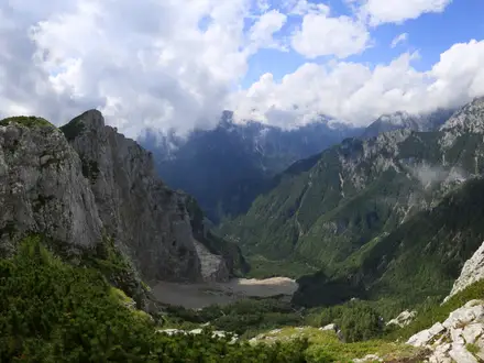
The Via Alpina Swiss Section is SchweizMobil national hiking Route 1: a fully waymarked Alpine traverse across Switzerland, usually planned from Sargans to Montreux, with the official start at Vaduz. The route is 390 km and officially split into 20 stages. It is a hard point-to-point trek for experienced mountain hikers, with 23,500 m of ascent, rocky passes, steep scree and long days through the eastern Alps, Central Switzerland, the Bernese Oberland and down to Lake Geneva.
Route Overview
Walked east to west, the route starts officially in Vaduz, with Sargans the common first Swiss rail-accessible start, and finishes in Montreux on Lake Geneva. Key places include Weisstannen, Elm, Linthal, Urnerboden, Altdorf, Engelberg, Meiringen, Grindelwald, Lauterbrunnen, Mürren, Griesalp, Kandersteg, Adelboden, Lenk, Gstaad, L’Etivaz and Rossinière. The central Meiringen–Lenk section is the popular Bärentrek. Transport is a major advantage: Swiss rail, postbuses, cable cars and mountain railways serve many stages, making it easy to shorten, skip or join sections. If comparing Swiss mountain routes, see the Alpine Pass Route (Route 6), Bernina Trek and Aletsch Glacier UNESCO Trail.
History of the Via Alpina
The Via Alpina grew from the 1991 Alpine Convention between the eight Alpine states. In 1999, the French association Grande Traversée des Alpes proposed linking existing and new paths into a single trans-Alpine network. The name and logo were adopted in 2000, the trail launched for the 2002 International Year of Mountains, and the network was completed by 2005. The Swiss section became SchweizMobil national Route 1; its Bernese Oberland core is also known as the historic Bärentrek.
Notable highlights
Hohtürli (2,778 m): The highest pass on the route, reached by a steep wooden-stepped climb from Griesalp below the glaciated Blümlisalp. The Blümlisalphütte sits just above for an overnight stop or short detour.
Lauterbrunnen Valley, Mürren and the Bernese Oberland: The trail crosses the Jungfrau Region beneath the Eiger, Mönch and Jungfrau. Expect classic Swiss mountain villages, cliffs, waterfalls and high passes rather than remote wilderness throughout.
The Bärentrek, Meiringen to Lenk: Stages 10–15 form the six-day Bear Trek, often walked as a stand-alone route. It is the best-known central section of the Via Alpina 1.
Engelberg and the Surenenpass: From the monastery town and mountain resort of Engelberg, the route climbs towards the Surenenpass and descends towards Altdorf, with views to the Titlis massif.
Klausenpass and Urnerboden: This historic trade-pass area links Glarus and Uri. Urnerboden is a large alpine pasture area, busy with grazing cattle in summer.
Montreux and Lake Geneva: The final stages descend past Col de Chaude to Montreux on Lake Geneva, a clear change from the high alpine terrain of the earlier route.
Challenges to expect
The difficulty is mainly physical: 390 km, 20 stages and 23,500 m of ascent. High passes such as Sefinafurgga and Hohtürli involve steep rocky or scree terrain, with wooden-step or ladder sections. Snow can linger into early summer, so July to September is the safest planning window. Waymarking is strong, but weather, exposure, accommodation costs and long daily climbs still demand proper mountain fitness and planning.
HikeList Score
Via Alpina (Swiss Section) scored 86/100 on HikeList's trail-quality metrics.
See score breakdownHide breakdown
- Ideal length 75
- Balanced challenge 80
- Scenery & wildness 98
- Varied terrain 71
- Accommodation 92
- Food & support 88
- Path quality 98
- Season flexibility 76
Computed from length, challenge, scenery & wildness, terrain variety, accommodation, food & support, path quality and season flexibility.
Show more data Show less
- Mountainous
- Forest
- Dirt
- Rocky
- Gravel
- Hotels
- Huts
- Hostels
- Campsites
- Pet Friendly
- Restrooms
- Water Sources
- Campsites
- Shelters
Download Our Full Guide to Via Alpina (Swiss Section) FREE!
Get our comprehensive guide to this hike for free. Save it for later reading or print out at home.
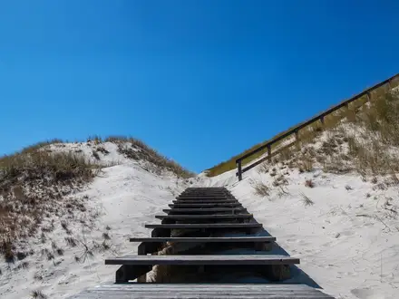
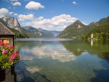
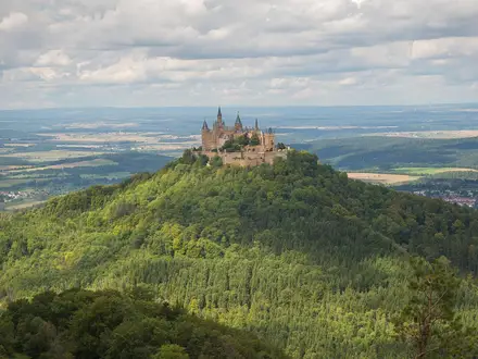
Photos from hikers
Taken on the trail by people who've reviewed Via Alpina (Swiss Section).
Via Alpina (Swiss Section): The Complete Guide
 i
Image by Simon
i
Image by Simon The Via Alpina’s Swiss section is a full east-to-west crossing of the Swiss Alps, officially beginning at Vaduz in Liechtenstein and usually joined at rail-served Sargans for the Swiss walking line to Montreux. It follows SchweizMobil national Route 1 across 390 km of waymarked mountain paths, valley tracks and high Alpine passes.
The route moves from the Rhine valley through Glarus and Central Switzerland into the Berner Oberland (Bernese Oberland), then on through the Pays-d'Enhaut and Vaud Alps to Lac Léman (Lake Geneva). Along the way it links working alp pastures, resort towns, mountain inns, SAC huts and some of the most recognisable pass country in Switzerland.
This is not a technical Alpine route: there is no glacier travel or via ferrata on the standard line. It is still a hard mountain trek, with about 23,500 m of ascent, 14 Alpine passes and demanding sections on scree, wooden steps, chains and ladders around cols such as Sefinenfurgge and Hohtürli.
It suits fit, experienced mountain hikers who can handle long consecutive days, changing weather and steep descents as well as climbs. Excellent Swiss rail, PostBus and mountain transport make the route unusually easy to shorten, section-hike or adapt, but huts, high inns and summer accommodation need planning ahead.
This guide covers stages, timing, accommodation, food, transport, terrain and the common mistakes that can make this route harder than it needs to be.
Stage-by-Stage Guide
The stages below follow the common Swiss-section start at Sargans. If beginning at the official Route 1 start in Vaduz, add the Vaduz–Sargans stage before this sequence.
Stage 1: Sargans to Weisstannen — approx. 15 km
This is the practical entry stage for most walkers, starting from rail-served Sargans and leaving the Rhine valley for quieter mountain country. The walking is a useful warm-up rather than one of the major pass days, with a mix of valley paths, forest, pasture and some farm-track or paved sections typical of the lower parts of the Via Alpina.
Fill bottles and buy food before leaving Sargans; do not assume reliable refreshment between the start and Weisstannen. Accommodation at Weisstannen is much more limited than in the large resort towns later on the route, so book ahead. Sargans has excellent rail access, while onward road or PostBus connections from Weisstannen should be checked before travelling. Navigation is straightforward on SchweizMobil Route 1 waymarks, but pay attention at the transition out of Sargans where town, farm and valley paths can create several junctions.
Stage 2: Weisstannen to Elm — approx. 17 km
The route now becomes properly Alpine, crossing the Foopass at 2,223 m between Weisstannen and Elm. This first major pass gives the route its mountain character: a long ascent through pasture and open high ground to a grassy col overlooked by the Foostock and Piz Sardona, followed by a sustained descent into canton Glarus.
Carry enough food and water for the full pass crossing, as high-level refreshments should not be assumed. Snow can linger on high passes into early summer, and wet grass or steep descending paths can make the day slower than the distance suggests. Elm is the overnight base, with village accommodation that should be reserved in advance in summer. Road and public-transport access exists in the valley system, but timetables should be checked before committing to a start, finish or bailout here.
Stage 3: Elm to Linthal — approx. 20 km
This is another serious pass stage, crossing the Richetlipass at 2,261 m. The col has a wilder and more remote feel than the lower valley stages, with rugged peaks around the pass and a descent towards the glacial valley above Linthal.
Expect mountain paths, rocky or scree-influenced sections and a long descent that can be hard on tired legs. Start with full water bottles and lunch from Elm, as there should be no reliance on food or drink during the high crossing. Linthal provides the next valley stop for accommodation and services, with public-transport connections in the wider Swiss network. In poor weather, navigation remains waymarked, but visibility on open high ground can make it important to keep close to Route 1 signs and have offline mapping available.
Stage 4: Linthal to Urnerboden — approx. 16 km
From Linthal, the route climbs back into high pasture country towards Urnerboden, one of Switzerland’s largest alpine pastures. This stage sits around the historic Glarus–Uri crossing of the Klausenpass area and has a very different feel from the sharper rocky cols: wide grazing land, farm access tracks and open alpine slopes are part of the day.
Livestock is a genuine consideration in summer. Give cattle plenty of space, keep gates as found and take extra care if herds are close to the path. Food and accommodation at Urnerboden are more limited than in the larger valley towns, so do not arrive without a booking in the main season. Road and PostBus access over the pass area is useful for logistics, but seasonal timetables should be checked before travelling.
Stage 5: Urnerboden to Altdorf — approx. 19 km
This stage continues the crossing from high pasture into Uri, using the historic Klausenpass corridor before the long descent towards Altdorf. The walking is varied: open alp terrain, mountain paths, farm roads and lower valley approaches, ending in the Uri capital beneath the next major climb.
Carry food and water from Urnerboden until reliable valley services are reached. The descent can be tiring, especially in hot weather or after rain on steep tracks. Altdorf has a broader choice of accommodation and services than the smaller mountain-stage ends, and it is a good point to reassess weather before the Surenenpass. The Wilhelm Tell (William Tell) monument is the main cultural landmark in town, but the key planning point is practical: this is one of the better places for transport, resupply and a reset before a hard day.
Stage 6: Altdorf to Engelberg — approx. 22 km
This is one of the hardest stages of the eastern half, crossing the Surenenpass at 2,292 m between Altdorf and Engelberg. The stage is long, high and committing, with a major climb from the Uri side and views towards the Titlis massif from the pass area.
Treat the Surenenpass as a full mountain day. Snow can remain on high ground into early summer, and weather exposure is real if cloud, wind or storms arrive while crossing the pass. Food and water should be carried from Altdorf, with no assumption of dependable mid-stage supply. Engelberg is a major resort town with accommodation, food and onward transport, making it the natural place to recover after this stage or to insert a rest day if the previous days have taken their toll.
Stage 7: Engelberg to Engstlenalp — approx. 16 km
From Engelberg, Route 1 climbs past the Trübsee to the Jochpass at 2,207 m before descending to Engstlenalp. The stage is shorter than the previous day but still involves high mountain walking, with resort-area paths giving way to a pass crossing and a lakeside mountain-inn finish.
Engstlenalp is not a full-service town; it is a high mountain overnight stop with seasonal accommodation, so booking ahead is essential. Carry lunch and water from Engelberg unless current opening hours for intermediate facilities have been checked. Navigation can be busy around Engelberg and the Trübsee area, where local paths, lift infrastructure and tourist routes intersect, so stay with the red Route 1 markers. In early or late season, check snow conditions and hut or inn opening dates before relying on this stage end.
Stage 8: Engstlenalp to Meiringen — approx. 19 km
This stage leaves the high alp setting of Engstlenalp and descends towards Meiringen in the Haslital. It is less about a headline pass and more about moving from high grazing and mountain paths back into a serviced valley town.
The main physical issue is the descent: sustained downhill walking on mountain paths and tracks can be slow, particularly in wet conditions. Fill water before leaving Engstlenalp and carry food until Meiringen unless current facilities on the route have been checked. Near Meiringen, the Reichenbach Falls and the Aareschlucht (Aare Gorge) are notable local highlights, although visiting them may require time off the main walking line. Meiringen is a practical overnight and resupply point with public transport, accommodation and the option to shorten or pause the route.
Stage 9: Meiringen to Grindelwald — approx. 23 km
This long stage crosses into the classic Berner Oberland (Bernese Oberland) scenery via the Grosse Scheidegg at 1,962 m. The pass sits beneath the Wetterhorn and gives the first of the route’s major Jungfrau-region panoramas before the descent towards Grindelwald.
Although the pass is lower than Surenenpass or Hohtürli, the day is still long and should not be underestimated. Carry sufficient food and water from Meiringen, and be prepared for changing weather on the open pass. Grindelwald has extensive accommodation, food and transport options, but it is a busy resort, so summer beds should still be booked well ahead. Navigation is generally clear on Route 1, with extra attention needed where local hiking paths and tourist routes meet around major viewpoints and resort areas.
Stage 10: Grindelwald to Lauterbrunnen — approx. 18 km
This stage crosses Kleine Scheidegg at 2,061 m, one of the best-known passes on the Swiss Via Alpina, beneath the Eiger, Mönch and Jungfrau. It links Grindelwald with the Lauterbrunnen Valley and is one of the most scenic but also one of the busiest parts of the whole route.
The walking is mountain hiking rather than technical climbing, but the climb and descent still demand fitness, especially with a multi-day pack. Carry enough food and water for the crossing, even though the area is more developed than the remote eastern passes; opening times and availability should always be checked before relying on facilities. Lauterbrunnen has a wide choice of accommodation and strong public-transport links. Mürren is near the route and features in popular high-level variants, but the strict main line should be followed carefully if sticking to SchweizMobil Route 1.
Stage 11: Lauterbrunnen to Griesalp — approx. 22 km
This is the first of the two big central test pieces and part of the celebrated Bärentrek (Bear Trek) section. From the Lauterbrunnen Valley, the route climbs towards the Sefinenfurgge at 2,612 m, a steep pass with scree and ladder or step sections before descending to Griesalp above the Kiental.
This is a serious mountain stage. The Sefinenfurgge should not be attempted in poor visibility, storm conditions or lingering snow unless conditions are clearly safe for mountain hiking. Carry food and plenty of water from Lauterbrunnen, as the high pass crossing is not a place to depend on supplies. Griesalp is a mountain-stage end with seasonal accommodation rather than a large town, so book ahead and check transport or road access before travelling. Navigation is waymarked, but it is important not to drift onto high-level variants unless they are deliberately planned.
Stage 12: Griesalp to Kandersteg — approx. 17 km
This is the highest and most demanding stage on the route, crossing the Hohtürli at 2,778 m beneath the glaciated Blüemlisalp. The climb from Griesalp is steep and includes wooden steps on exposed mountain terrain; the SAC Blüemlisalphütte sits just above the pass for those using it as an overnight stop or short detour.
The descent towards Kandersteg passes the Oeschinensee, one of the great highlights of the Via Alpina, but it comes after a hard high crossing. Snow, ice, wind and poor visibility can make the Hohtürli a no-go; check conditions before setting out and be willing to delay or reroute using Swiss public transport if necessary. Food and water should be carried from Griesalp unless hut arrangements have been made. Kandersteg has accommodation, services and transport links, making it the logical recovery point after the route’s high point.
Stage 13: Kandersteg to Adelboden — approx. 16 km
The route remains rugged after Kandersteg, crossing the Bunderchrinde at 2,385 m on the way to Adelboden. This pass rises above the Oeschinensee area and keeps the route firmly in high Alpine walking, with steep mountain paths and open, exposed sections.
Do not treat this as an easy day simply because it follows the Hohtürli. The Bunderchrinde is still a high pass where weather, snow patches and loose ground can affect progress. Start with food and water from Kandersteg, and check conditions if travelling early in the season. Adelboden is a resort town with accommodation and services, plus useful public-transport access for anyone shortening the route or taking a rest day.
Stage 14: Adelboden to Lenk — approx. 14 km
This is one of the shorter stages in distance, linking two Bernese Oberland resort towns through alpine pasture, forest sections, farm tracks and mountain paths. It can feel like a relative easing after Sefinenfurgge, Hohtürli and Bunderchrinde, but it still sits within a demanding multi-day mountain route.
Use the shorter day for recovery rather than for overloading the schedule. Carry normal hill food and water from Adelboden, as intermediate availability should not be assumed without checking. Summer livestock is common on alp pastures, so give cattle room and move calmly through grazing areas. Lenk has accommodation, food and transport links, and it is a practical end point for walkers completing only the Bärentrek section from Meiringen to Lenk.
Stage 15: Lenk to Gstaad — approx. 21 km
This stage continues west from the Bernese Oberland towards Gstaad, with a long day over mixed alpine terrain. Expect pasture, forest, farm roads and mountain paths rather than the extreme stepped terrain of the highest central passes, but the distance makes it a substantial walking day.
Food and water should be carried from Lenk, with any intermediate stops treated as a bonus unless current opening times have been checked. Weather can still be a serious factor on exposed high ground, especially after several consecutive days when fatigue affects pace and decision-making. Gstaad is a major resort town with accommodation, food and transport, but prices and availability in Switzerland can be challenging in high season. Book ahead and use this stage end for resupply before the quieter Vaud Alps stages.
Stage 16: Gstaad to L’Etivaz — approx. 17 km
The route now moves towards the Pays-d’Enhaut and the French-speaking side of Switzerland. The walking becomes a transition from the German-speaking Bernese Oberland into the Vaud Alps, with alp pasture, chalet country and the traditional cheese-making village of L’Etivaz as the stage end.
Navigation remains on SchweizMobil Route 1 markers, but the language shift means place names, signs and local information change character. Leave Gstaad with food and water, as L’Etivaz is a smaller village and intermediate services should not be relied on without checking. Accommodation at L’Etivaz is more limited than in Gstaad, Grindelwald or Engelberg, so reservations are important. Road and public-transport access in this area should be checked before travelling, especially if planning to join or leave the route here.
Stage 17: L’Etivaz to Rossinière — approx. 19 km
This stage continues through the Pays-d’Enhaut, around the L’Etivaz and Col des Mosses area, towards Rossinière. The terrain is generally alp and Vaud mountain country rather than the highest glaciated-pass terrain, but the day still involves sustained mountain walking and should be treated as part of the same hard traverse.
Carry food and water from L’Etivaz and check local opening times if planning any stop en route. The main practical hazards are weather exposure, wet pasture or farm tracks, and livestock in summer. Rossinière is a smaller stage end, so accommodation should be booked rather than left to chance. Public transport and road access are useful for logistics in the region, but exact connections and timetables should be checked before travelling.
Stage 18: Rossinière to Rochers-de-Naye — approx. 23 km
This is the final major mountain stage, climbing from Rossinière to the high viewpoint of Rochers-de-Naye above Lac Léman (Lake Geneva). It is a long day and should not be underestimated: the distance, ascent and exposed high ground make it a serious finish to the Alpine part of the traverse.
Start early, carry enough food and water, and check the mountain forecast carefully. Rochers-de-Naye is a high-stage end rather than a normal valley town, so accommodation, food availability and any transport options must be checked and booked in advance. Late snow, wind or poor visibility can make the upper section awkward, particularly after many days of accumulated fatigue. Navigation should be kept disciplined on Route 1, as this is not the place to lose time near the end of a long climb.
Stage 19: Rochers-de-Naye to Montreux — approx. 15 km
The final stage descends from Rochers-de-Naye towards Montreux on the shore of Lac Léman (Lake Geneva), passing via the Col de Chaude on the long drop to the lake. The walking is downhill overall, but it is not a throwaway stage: steep descents can be tough on knees, especially with a full pack after nearly three weeks of walking.
Carry water and snacks from the start, as it is better not to rely on finding supplies until lower down or in Montreux. In wet weather, descending paths and farm tracks can be slippery, and warm conditions can make the drop into the lake basin feel harder than expected. Near the finish, the lakeside Château de Chillon is one of the final landmarks of the route. Montreux has extensive accommodation and is on the main SBB line, with fast onward trains towards Lausanne, Geneva and Geneva Airport.
Recommended Itinerary
Standard itinerary: Sargans to Montreux in 19 walking days
This is the most practical Swiss-section schedule for most fit, experienced walkers: start at rail-served Sargans, follow the natural stage towns, and finish at Montreux. If walking from the official Route 1 start in Vaduz, add the Vaduz–Sargans stage before Day 1; check official mapping before booking that extra day.
Build at least one weather or recovery buffer into the trip if accommodation dates allow. The stages over Sefinenfurgge and Hohtürli should not be treated as flexible “push on regardless” days in poor weather.
| Day | From | To | Approx. distance | Why this stage makes sense | Services/accommodation notes |
|---|---|---|---|---|---|
| 1 | Sargans | Weisstannen | 15 km | A sensible first Swiss stage from the main rail-served start into the mountains without immediately overloading the day. | Sargans has the best start logistics by rail. Weisstannen is a small valley stop, so book ahead and do not assume late-arrival food without checking. |
| 2 | Weisstannen | Elm | 17 km | Crosses the Foopass, the first major pass of the Swiss section, and drops into canton Glarus. | Elm is the natural overnight after the pass. Accommodation is more limited than in the major resort towns, so reserve in advance. |
| 3 | Elm | Linthal | 20 km | A remote mountain day over the Richetlipass, linking the Glarus valleys without needing transport. | Linthal gives a valley overnight after a demanding pass stage. Use it for resupply and schedule-checking before continuing west. |
| 4 | Linthal | Urnerboden | 16 km | A shorter stage on paper, useful before the longer crossing towards Uri. The route moves towards the Klausenpass area and the broad pastures of Urnerboden. | Urnerboden is an alpine-pasture settlement rather than a large resort. Book accommodation ahead, especially in summer. |
| 5 | Urnerboden | Altdorf | 19 km | Crosses from the Glarus side into Uri and finishes in the Uri capital, a logical low-level reset before the Surenenpass stage. | Altdorf is one of the more useful service stops on the eastern half, with onward public transport options. Good place to sort food, cash and weather plans. |
| 6 | Altdorf | Engelberg | 22 km | One of the big physical stages, crossing the Surenenpass with sustained ascent and mountain exposure. | Engelberg is a major resort town with hotels, guesthouses and transport links. Book well ahead in peak summer. |
| 7 | Engelberg | Engstlenalp | 16 km | Climbs from Engelberg towards the Jochpass and ends high at Engstlenalp, avoiding an overlong push to Meiringen. | Engstlenalp is a mountain-inn style overnight. Seasonal opening and availability should be checked before travelling. |
| 8 | Engstlenalp | Meiringen | 19 km | A good valley-to-valley day after the high overnight, finishing in the Haslital near Reichenbach Falls and the Aareschlucht. | Meiringen is a practical resupply and transport point. It is a sensible place for a buffer night if the previous high stages have been tiring. |
| 9 | Meiringen | Grindelwald | 23 km | A long classic Bernese Oberland stage over Grosse Scheidegg beneath the Wetterhorn, ending in a major mountain resort. | Grindelwald has extensive accommodation, but demand is high in summer. Reserve early if walking in July, August or early September. |
| 10 | Grindelwald | Lauterbrunnen | 18 km | Crosses the Jungfrau-region corridor towards Kleine Scheidegg and drops to Lauterbrunnen, keeping the day manageable before Sefinenfurgge. | Lauterbrunnen has valley hotels, guesthouses and strong transport links. It is a strong candidate for a rest or weather-buffer night. |
| 11 | Lauterbrunnen | Griesalp | 22 km | A hard mountain stage over Sefinenfurgge, with steep scree, ladder or stepped sections and serious weather exposure. | Griesalp is a mountain overnight before Hohtürli. Book ahead and check conditions on Sefinenfurgge before setting out. |
| 12 | Griesalp | Kandersteg | 17 km | Crosses Hohtürli, the highest pass on the route at 2,778 m, then descends towards Oeschinensee and Kandersteg. | The SAC Blüemlisalphütte sits just above the pass and can be used for an overnight or short detour if planned in advance. Kandersteg has resort accommodation and transport. |
| 13 | Kandersteg | Adelboden | 16 km | Continues over the Bunderchrinde, keeping the central Bärentrek rhythm of one major pass per day. | Adelboden is a resort town with a wider choice of beds than the smaller mountain stops. Advance booking is still important in summer. |
| 14 | Adelboden | Lenk | 14 km | A shorter stage, useful after several big Bernese Oberland crossings and before the longer day to Gstaad. | Lenk has valley accommodation and services. This is a practical recovery point without leaving the route. |
| 15 | Lenk | Gstaad | 21 km | A longer westbound stage carrying the route out of the highest Bernese Oberland sequence towards the Saanenland. | Gstaad has extensive accommodation but can be expensive. Book early and check transport options if shortening is needed. |
| 16 | Gstaad | L'Etivaz | 17 km | Moves towards the Col des Mosses area and the language transition into French-speaking Switzerland. | L'Etivaz is a smaller village stop known for traditional cheese-making. Accommodation should be reserved ahead. |
| 17 | L'Etivaz | Rossinière | 19 km | A Pays-d'Enhaut stage through the western Vaud Alps, continuing the traverse without forcing an overlong finish. | Rossinière is a smaller overnight than Gstaad or Montreux. Check availability before fixing dates. |
| 18 | Rossinière | Rochers-de-Naye | 23 km | The final big mountain day, climbing to the high viewpoint above Lac Léman before the descent to Montreux. | Rochers-de-Naye is a high, exposed overnight point. Check seasonal opening and accommodation availability before relying on it. |
| 19 | Rochers-de-Naye | Montreux | 15 km | A final descent from the mountains to Lac Léman, finishing in Montreux after the Col de Chaude area. | Montreux is on the main SBB line with onward trains towards Lausanne, Geneva and Geneva Airport. Accommodation is plentiful but can be costly. |
Slower variant: 22–24 days with buffers
A slower schedule suits experienced hikers who want more margin for weather, sore legs and high-pass conditions, or anyone travelling in the early or late part of the season when snow and hut openings are more uncertain. Keep the same stage structure, but add rest or buffer nights at larger service towns such as Altdorf, Engelberg, Meiringen, Grindelwald, Lauterbrunnen, Kandersteg, Lenk, Gstaad or Montreux.
The most useful buffers are before or after the hardest central stages: Lauterbrunnen–Griesalp over Sefinenfurgge and Griesalp–Kandersteg over Hohtürli. An overnight at the SAC Blüemlisalphütte above Hohtürli can also reduce pressure on the Griesalp–Kandersteg crossing, but hut opening dates and beds must be checked before travelling.
Where transport, cable cars or mountain railways are used to shorten a day, check current timetables before booking accommodation. Do not assume late-season services or high-mountain accommodation will be operating.
Faster variant: 18 days or fewer
A faster schedule is only suitable for very fit mountain hikers already comfortable with repeated long Alpine days, steep descents and high passes. The practical way to keep the trip fast is to walk the Sargans–Montreux itinerary without rest days and use Switzerland’s rail, PostBus, cable car and mountain-railway network to shorten approaches or recover time when needed.
Combining stages should be approached cautiously. The shorter-looking days around Adelboden and Lenk are more realistic candidates for compression than the high-pass days over Surenenpass, Sefinenfurgge, Hohtürli or Bunderchrinde, where weather, footing and fatigue matter more than distance on paper.
For any compressed itinerary, check official mapping before booking. Exact daily distances and ascent can change significantly if using transport shortcuts, high-level variants or accommodation away from the standard stage towns.
Planning the Route
How many days to allow
Most walkers should plan around the SchweizMobil stage pattern rather than treating the Via Alpina as a distance target. The route is not technically extreme, but the repeated climbs to high passes make a fast schedule tiring and leave little margin for bad weather.
A practical plan is:
| Plan | Best for | Notes |
|---|---|---|
| 18–20 walking days | Very fit mountain walkers | Possible if starting at Sargans and keeping moving, but it gives limited flexibility for weather or tired legs. |
| Around 20 stages plus buffer days | Most independent hikers | The safest default for a full traverse, especially with high passes such as Sefinenfurgge and Hohtürli. |
| 22–25+ days | Walkers wanting rest, side trips or shorter days | More comfortable for using valley towns properly, waiting out poor weather, or splitting demanding stages where accommodation allows. |
Do not plan this route as a race. The cumulative ascent is the limiting factor, and several days include long climbs followed by steep descents on mountain paths, scree or stepped ground. A slower schedule also makes it easier to adapt if snow, storms or low cloud affect the higher passes.
Start point: Vaduz or Sargans
The official national Route 1 begins at Vaduz in Liechtenstein, with Vaduz–Sargans forming the first official stage. In practice, many hikers begin the Swiss section at Sargans because it is the first major rail-served start and is easy to reach by train from Zürich or Zürich Airport.
Starting at Vaduz gives the full official east-to-west line. Starting at Sargans is the more straightforward Swiss-section plan and avoids adding a less convenient approach stage before the main Alpine traverse begins. Vaduz can be reached by bus from Sargans or Buchs if walking the official start matters.
Let accommodation shape the itinerary
Daily stages are strongly shaped by the chain of valleys, resort towns, mountain inns and huts. In the larger places — Engelberg, Grindelwald, Lauterbrunnen, Kandersteg, Adelboden, Lenk, Gstaad and Montreux — there is more flexibility, with hotels, guesthouses and other services.
The high and intermediate stopping points need more care. Places such as Engstlenalp and Griesalp are part of the natural stage structure, and the SAC Blüemlisalphütte above Hohtürli is a useful high-mountain overnight option for some itineraries. High-mountain inns and huts are seasonal, broadly June/July to September/October, and should be booked ahead in summer.
Avoid assuming that every stage can be shortened on foot by simply stopping halfway. Some sections cross high passes between valleys, and the practical overnight choices may be at the start or end of the stage rather than in the middle. Book the constrained high-stage accommodation first, then build the easier valley nights around it.
Where to build in buffer days
Buffer days matter more here than on a low-level long-distance trail. The route crosses 14 Alpine passes, and poor weather can make navigation, exposure and steep descents significantly more serious.
Useful places to pause include the larger transport hubs and resort towns, where accommodation and onward travel are easier. Altdorf, Engelberg, Meiringen, Grindelwald, Lauterbrunnen, Kandersteg, Adelboden, Lenk and Gstaad all make more practical rest or adjustment points than remote high inns.
The hardest weather-dependent stages are the high-pass days, especially those involving Surenenpass, Sefinenfurgge, Hohtürli and Bunderchrinde. If the forecast is poor, it is usually better to wait, shorten using public transport where possible, or rejoin the route later than to force a crossing in unsafe conditions.
Shortening, skipping and section hiking
This is one of the easiest major Alpine traverses to adapt because Swiss public transport reaches most stage towns. SBB trains, PostBus services, cable cars and mountain railways make it realistic to skip a stage, leave the route, rejoin later or turn the walk into a series of shorter trips.
Section hiking is especially practical. Strong options include:
- Sargans to Altdorf for the eastern passes through St. Gallen, Glarus and Uri.
- Altdorf to Meiringen for the Surenenpass, Engelberg, Jochpass and Engstlenalp.
- Meiringen to Lenk for the classic Bärentrek (Bear Trek) through the Berner Oberland (Bernese Oberland).
- Lenk to Montreux for the western stages into the Pays-d'Enhaut, L'Etivaz, Rossinière and the final descent to Lac Léman (Lake Geneva).
Timetables for buses, trains, cable cars and mountain railways should be checked before travelling, especially at the beginning and end of the summer season. Do not rely on an emergency exit from a high pass itself; the realistic escape points are usually in the valleys before or after the pass.
Food, water and resupply planning
Food planning is generally manageable, but it should not be casual. Larger resort towns and valley settlements are the best places to resupply, while high-stage accommodation should be treated as booked meal stops rather than guaranteed flexible shops.
Carry enough food for each full mountain day, plus an emergency reserve. This is particularly important on stages that climb from one valley over a pass into the next, where services may be concentrated at the start and finish rather than along the route.
Water is usually less difficult than in dry-country trekking, but availability still varies by stage, season and livestock/alp activity. Do not assume every hut, alp building or fountain will be open or usable. Start each high-pass day with enough water to complete the climb and descent if intermediate sources are unavailable.
Navigation and route finding
The route is well waymarked as SchweizMobil national Route 1, using red “1” route markers on the standard Swiss white-red-white mountain-hiking signposts. It is also signed as the Via Alpina Green Trail.
Good waymarking does not remove the need for proper mountain navigation. Low cloud, remaining snow patches, unsigned variants and tiredness late in the day can all make decisions harder. Carry offline mapping, keep the stage profile visible, and know the name of the next pass and valley before leaving each town.
The white-red-white grading indicates mountain hiking rather than glacier travel or via ferrata. Even so, the route includes steep scree, wooden-step sections and occasional chain or cable-protected ground on the highest cols, especially around Sefinenfurgge and Hohtürli.
Weather and season planning
The most reliable window is July to September. Snow can linger on the highest passes into early summer, and the high huts and mountain inns are seasonal, so early or late trips need more checking and a willingness to change plans.
Weather planning should be part of the daily routine. A fine morning in the valley is not enough reason to commit to a high pass if storms, snow, strong wind or poor visibility are forecast for the afternoon. Start early on long pass days and keep enough time in hand for slow descents.
Costs and bookings
Switzerland is expensive, and this route uses exactly the things that add up: mountain accommodation, meals, rail, PostBus services and occasional mountain transport. Budget in CHF and allow more than a basic lowland walking budget.
Advance booking is most important for high huts, mountain inns and popular resort towns in the main summer season. Flexible walkers can often adjust the route using transport, but accommodation shortages can still force an unwanted long day or detour. Confirm current prices, opening dates and booking conditions before committing to an itinerary.
Towns, Villages and Overnight Stops
Accommodation on the Via Alpina changes character repeatedly: rail towns and resorts in the valleys, small villages at the foot of big passes, then seasonal mountain inns and SAC huts on the higher stages. Book the smaller high-level stops early for July to September, and avoid planning any long mountain day around an unreserved bed.
Switzerland is expensive by long-distance hiking standards. Hotels, huts, evening meals, packed lunches, rail tickets, PostBus journeys and cable cars all add up, so it is worth deciding in advance where to use simpler dormitory-style accommodation and where to spend more for a valley hotel.
Vaduz (Liechtenstein)
Vaduz is the official eastern start of SchweizMobil national Route 1, before the route enters Switzerland at Sargans. Many walkers skip this official opening stage and begin at Sargans because it is the practical Swiss rail-served start.
Vaduz is useful if completing the full signed route from its official start matters. Access is by bus from Sargans or Buchs; current bus times should be checked before travelling.
Sargans
Sargans is the usual starting point for the Swiss section and the first practical logistics base for most independent walkers. It sits at the eastern end of the traverse before the first stage to Weisstannen.
This is the best place to arrive by public transport, sort food for the first day and make any last equipment purchases that cannot wait. Sargans has direct trains from Zürich in about an hour and is also accessible from Zürich Airport, making it a straightforward arrival point.
Accommodation is more practical here than in the smaller first-stage villages, but book ahead if starting in peak summer. From Sargans the character changes quickly from transport hub to mountain-valley walking.
Weisstannen
Weisstannen is the first overnight stop on the Sargans-start itinerary, reached after the opening Swiss stage. It is a small valley stop rather than a major resort, so it works best as a pre-booked overnight rather than a place to improvise on arrival.
Food and accommodation should be treated as limited. Carry enough snacks and do not rely on late-opening shops or multiple dinner choices; this should be checked before travelling.
Its main value is position. Staying here sets up the crossing of the Foopass to Elm, the first major pass of the Swiss section.
Elm
Elm is the stage stop after the Foopass and a useful base before the remote Richetlipass stage to Linthal. It is one of the early-route villages where accommodation needs more care than in the large Berner Oberland resorts.
Expect a quieter overnight with fewer services than in places such as Engelberg, Grindelwald or Kandersteg. Book accommodation in advance and check food availability before travelling, especially outside the main summer season.
For walkers feeling the first big pass in their legs, Elm is an important recovery stop before another demanding mountain day.
Linthal
Linthal sits at the end of the stage from Elm over the Richetlipass and before the climb towards Urnerboden. It is a valley stop and a sensible place to reset after two substantial early passes.
Use Linthal for an overnight if keeping to the standard stage rhythm. Public transport serves many stage towns on this route, but exact onward options and timetables should be checked before travelling.
Food resupply is more plausible here than at the high alpine stops, but opening hours should not be assumed. Buy what is needed for the next stage before leaving the valley.
Urnerboden
Urnerboden is an alpine pasture settlement reached between Linthal and Altdorf, associated with the Klausenpass crossing. It is not a large resort, but it is a strategically placed overnight before the descent towards Uri.
Accommodation and meals are likely to be limited compared with the larger towns. Reserve ahead and check whether your chosen place can provide dinner and breakfast.
This stop is valuable because it breaks the route naturally between the Glarus side and Altdorf. In summer the area is busy with grazing cattle, so expect agricultural activity around the path and settlements.
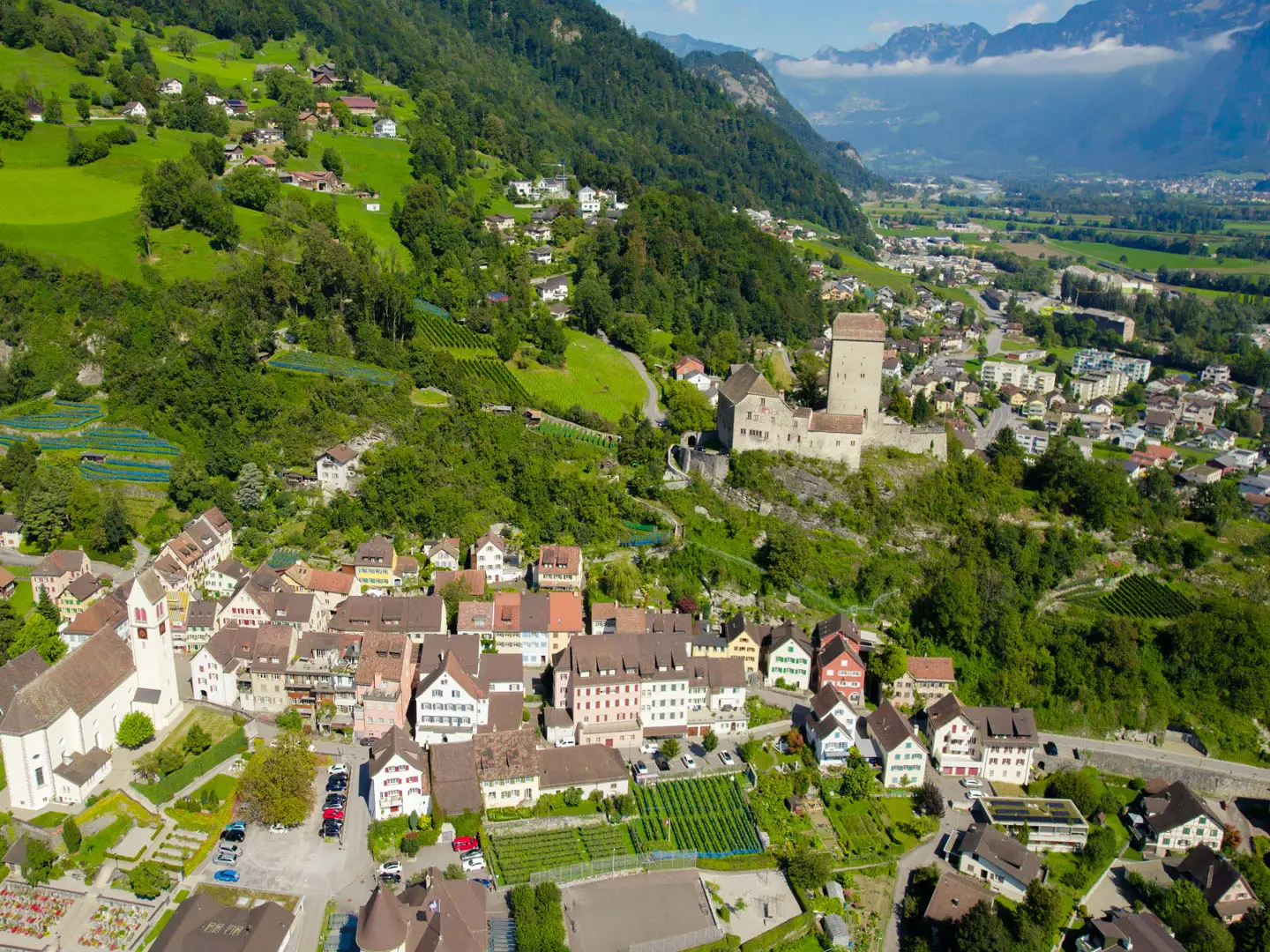
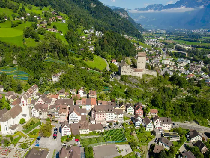
Altdorf
Altdorf is the Uri capital and a significant valley stop before one of the hardest days of the route: the crossing of the Surenenpass to Engelberg. It is a practical place to rest, resupply and reorganise before committing to the long climb.
Accommodation and food options are broader here than in the smaller mountain villages. The town is also a useful transport access or exit point for anyone section-hiking the eastern half of the route.
The Wilhelm Tell (William Tell) monument is the main local landmark, but the practical reason to stop is recovery. Leave Altdorf with enough food and clothing for a high, exposed pass day where weather can change quickly.
Engelberg
Engelberg is one of the major resort towns on the route and one of the easier places to find a full range of hiker services. It sits after the Surenenpass stage and before the climb past Trübsee towards the Jochpass and Engstlenalp.
This is a strong candidate for a rest, laundry or buffer stop if the schedule is tight or the weather forecast is poor. Hotels, guesthouses and other valley accommodation are part of the normal accommodation mix here, but summer demand can still be high.
Food, cafés and transport links are much more substantial than at the small alpine stops. Engelberg is also a good place to reassess conditions before continuing into the central section of the Swiss Alps.
Engstlenalp
Engstlenalp is a high mountain overnight between Engelberg and Meiringen, reached after the Jochpass. It is a classic example of the route’s seasonal alpine accommodation rather than a town with broad services.
The brief identifies Engstlenalp as a mountain inn stop, so booking ahead is essential in the main season. Opening dates can vary, especially at high elevation, and should be checked before travelling.
Do not rely on shops here. Plan to have meals arranged with the accommodation and carry daytime food from Engelberg or another valley stop.
Meiringen
Meiringen is a major valley stop in the Haslital and the eastern gateway to the best-known central part of the route. It comes after Engstlenalp and before the long stage over the Grosse Scheidegg to Grindelwald.
This is a practical place for a proper resupply, a rest night or a transport join/exit. Accommodation is more varied than at the high alpine inns, and food options are better suited to independent hikers needing to restock.
Nearby landmarks include Reichenbach Falls and the Aareschlucht (Aare Gorge), but the key hiking reason to stop is logistics. From here the route enters the famous Berner Oberland (Bernese Oberland) stages, where accommodation should be booked well ahead in summer.
Grindelwald
Grindelwald is one of the major resort towns on the route, reached after the Grosse Scheidegg stage below the Wetterhorn. It is a full-service overnight before crossing towards Lauterbrunnen via the Kleine Scheidegg.
Hotels, guesthouses and other valley accommodation are part of the normal mix here, with plenty of demand in the summer walking season. Book early if dates are fixed, especially during settled weather windows.
This is one of the easiest places on the route to deal with practical needs: food, cafés, transport connections and rest-day options. It is also a sensible place to wait out poor weather before taking on the exposed Jungfrau-region passes.
Lauterbrunnen
Lauterbrunnen sits in the deep valley below the cliffs and waterfalls of the Jungfrau region, after the stage from Grindelwald. It is a major overnight before the hard stage over Sefinenfurgge to Griesalp.
Accommodation is usually more plentiful than in the small high-stage stops, though demand can be intense in summer. Book ahead and do not assume last-minute availability.
This is a key resupply and transport point before one of the tougher days of the Via Alpina. Leave with enough food for the Sefinenfurgge stage, as services between the valley and Griesalp should not be relied on without checking current opening.
Mürren (near route)
Mürren is near the route rather than a required stop on the strict main line. It sits on a popular high-level variant above Lauterbrunnen, while the main waymarked route continues towards Griesalp and Sefinenfurgge.
It can be useful for walkers deliberately choosing that variant or adding time in the Lauterbrunnen area. Because it is not the standard through-line stop in the stage list, any accommodation or transport plan involving Mürren should be checked carefully against the intended route.
Do not include Mürren in a booking chain unless the day’s navigation and onward connection are clear. It is best treated as an optional side or variant stop, not a default Via Alpina overnight.
Griesalp
Griesalp is a mountain stop after the Sefinenfurgge and before the Hohtürli, the highest pass of the route. It is one of the most important strategic overnights on the whole traverse.
Accommodation is in the mountain-inn style rather than broad town lodging, and summer beds should be reserved early. Meals should be arranged with the accommodation, and hikers should not expect extensive shop facilities.
A night here positions the Hohtürli climb sensibly. This is not a place to arrive without a plan, because the next day involves steep wooden steps, high ground beneath the Blüemlisalp and a long descent towards Kandersteg.
Blüemlisalphütte (above Hohtürli)
The SAC Blüemlisalphütte sits just above Hohtürli, close to the highest point of the route. It is not a village, but it is an important optional overnight or short detour for hikers who want to split the high crossing.
This is seasonal alpine-hut accommodation and must be booked ahead. Hut opening dates, meal arrangements and any current access notes should be checked before travelling.
Staying here changes the rhythm of the Griesalp–Kandersteg stage and can help with weather or fatigue, but it also means committing to a high overnight. Carry appropriate warm layers even in summer.
Kandersteg
Kandersteg is a major valley resort reached after the Hohtürli descent and the Oeschinensee area. It is one of the best recovery stops on the route after the hardest high pass.
Accommodation is much broader here than at Griesalp or the Blüemlisalphütte, with hotels, guesthouses and other hiker-friendly options in the normal route mix. It is a strong candidate for a buffer night if the Hohtürli stage has been tiring or delayed by weather.
Food and transport links are practical for resupply and section changes. From Kandersteg the next stage crosses towards Adelboden over the Bunderchrinde, so it is worth leaving with a full day’s provisions.
Adelboden
Adelboden is a resort overnight between Kandersteg and Lenk. It follows the Bunderchrinde stage and gives another full-service pause before continuing west through the Berner Oberland.
Hotels and guesthouses are part of the normal accommodation mix here, though advance booking remains sensible in high season. Food and cafés are more reliable than at the small mountain stops.
This is a useful place to reset after the Kandersteg–Adelboden crossing. It is also a logical join or exit point for walkers doing only the central Bärentrek (Bear Trek) section.
Lenk
Lenk marks the western end of the best-known Bärentrek section when walked from Meiringen, and it is a practical valley stop before the route continues to Gstaad. It is a resort-style overnight with better services than the high alpine inns.
Accommodation should still be booked ahead, particularly in the main summer and early autumn walking season. Food resupply is easier here than in L'Etivaz or the smaller western villages, so use the stop accordingly.
Many hikers treat Lenk as a natural break point. It works well for ending, starting or pausing a section of the route because the surrounding stage towns are generally well connected by Swiss public transport.
Gstaad
Gstaad is a major resort town and one of the most comfortable service stops on the western half of the Via Alpina. It comes after the Lenk stage and before the route heads towards L'Etivaz and the language border.
Expect the widest range of accommodation and food choices in this part of the route, but also high Swiss resort prices. Book ahead if travelling in peak season or if aiming for lower-cost rooms.
This is a good place to make final adjustments before the quieter Pays-d'Enhaut/Vaud Alps stages. Stock up on food here rather than assuming every smaller village ahead will have convenient shop hours.
L'Etivaz
L'Etivaz is a traditional cheese-making village in the Pays-d'Enhaut and marks the move into French-speaking Switzerland on the western stages. It is a smaller stop than Gstaad, so logistics become more limited again.
Accommodation and meals should be booked rather than left to chance. Check current food and shop options before travelling, particularly if arriving late in the day.
This stop is useful for breaking the route between Gstaad and Rossinière and for adjusting to the different language and village pattern of the western section. Place names, menus and local information are increasingly French from here onwards.
Rossinière
Rossinière is the next Pays-d'Enhaut overnight after L'Etivaz and before the long stage to Rochers-de-Naye. It is a practical small-village stop rather than a large resort base.
Reserve accommodation ahead and confirm dinner arrangements if staying somewhere with limited catering nearby. Carry enough food for the following day, as the route to Rochers-de-Naye is long and high-level.
This is the last settled overnight before the final high viewpoint stage. Treat it as a preparation stop for the closing climb rather than a place to improvise supplies.
Rochers-de-Naye
Rochers-de-Naye is the final high overnight point in the stage list, above Lac Léman (Lake Geneva) and before the descent to Montreux. It is a mountain stop, not a town, and services should be assumed to be limited.
Any accommodation, food availability and transport options here should be checked before travelling. Do not rely on broad shop facilities or late-arrival flexibility.
The main reason to stop is strategic: it breaks the final approach and gives a high starting point for the descent past the Col de Chaude towards Montreux. Weather can still matter here, despite being near the end of the route.
Montreux
Montreux is the western finish of the Via Alpina on the shore of Lac Léman (Lake Geneva). After the long descent from Rochers-de-Naye, it provides the easiest end-of-route logistics on the whole trail.
Accommodation, food and onward travel are much broader here than in the mountain stages, though prices can still be high. Montreux is on the main SBB line, with fast trains to Lausanne, Geneva and Geneva Airport.
It is a sensible place to book a final night rather than planning a rushed same-day international departure. The descent is still a real walking day, and delays from weather, fatigue or transport changes are easier to absorb with a booked finish-night in town.
Getting to the Start
Most walkers starting the Swiss section begin at Sargans, the first rail-served Swiss trailhead on the route. The official SchweizMobil Route 1 start is Vaduz in Liechtenstein, with Vaduz–Sargans forming the official first stage before the route continues west across Switzerland.
By train
Sargans is the most practical start point because it is on the Swiss rail network. There are direct trains from Zürich to Sargans in about 1 hour, and the town is also reachable by train from Zürich Airport.
For most independent hikers, the simplest plan is to travel to Sargans the day before starting, stay overnight, and begin walking towards Weisstannen the next morning. If starting at the official trailhead in Vaduz, travel by train to Sargans or Buchs, then continue by bus.
Train times, platform changes and any engineering works should be checked before travelling.
By bus
Vaduz is reached by bus from Sargans or Buchs. This is the relevant connection for hikers who want to start at the official Liechtenstein beginning of national Route 1 rather than at Sargans.
Bus timings matter if arriving late in the day, especially with an onward walk planned. This should be checked before travelling.
By car
Driving to the start is usually less convenient than using public transport because the Via Alpina is a long point-to-point traverse finishing at Montreux on Lac Léman (Lake Geneva), far from Sargans or Vaduz. Leaving a car at the start creates an awkward return journey across Switzerland at the end of the hike.
If driving to Sargans or Vaduz, long-stay parking availability, rules and charges should be checked before travelling. A better option for many walkers is to use Swiss public transport to reach the start and return from Montreux by train.
From the nearest airport
Zürich Airport is the practical airport for the start of the Swiss section. From the airport, take the Swiss rail network towards Sargans; some journeys may be direct, while others may require a change depending on the timetable.
If continuing to the official start in Vaduz, travel onward by bus from Sargans or Buchs. Flight arrival times should be matched carefully with the final train and bus connections, particularly if not staying overnight before the first stage.
Where to stay before starting
For a Sargans start, staying in Sargans the night before is the simplest option. It avoids a same-morning rail connection before the first walking day to Weisstannen.
For the official start, stay in Vaduz or travel to Vaduz in the morning from Sargans or Buchs by bus. Accommodation should be booked ahead in the summer hiking season, especially if linking the first days directly into smaller mountain villages and inns.
Getting Home from the Finish
The Via Alpina finishes in Montreux, on the shore of Lac Léman (Lake Geneva), after the descent from Rochers-de-Naye. This is one of the easiest finishes of any major Alpine traverse: Montreux is a sizeable lakeside town with an SBB railway station, accommodation and onward connections towards Lausanne, Geneva and Geneva Airport.
By train
Montreux station is the key exit point. It sits on the main SBB line, with fast onward trains to Lausanne, Geneva and Geneva Airport.
For most walkers, the simplest plan is to walk down into Montreux, go straight to the station and continue by rail the same day. SBB timetables should be checked before committing to a late finish, especially if connecting to an international train or flight.
If the final descent from Rochers-de-Naye takes longer than expected, or weather slows progress, staying in Montreux is often the safer option than rushing for an evening connection. Build in enough time for the long descent, food, collecting any stored luggage and reaching the platform without stress.
By bus
Bus is not the main way to leave the finish, because Montreux has direct rail access. Local buses may be useful for short movements within Montreux or to reach accommodation away from the station, but onward travel to major cities is normally better by train.
Local bus routes and late-evening services are timetable-dependent. This should be checked before travelling.
By car/taxi
Driving logistics are less convenient than rail because this is a long point-to-point traverse starting far to the east at Sargans or Vaduz. Leaving a car in Montreux for the whole hike is possible only if suitable long-stay parking is arranged in advance, and parking costs in Switzerland can add up.
Taxis can be useful within Montreux at the end of the walk, particularly if finishing tired, arriving in poor weather or staying somewhere away from the station. Availability, fares and late-night service should be checked before travelling.
From the nearest airport
Geneva Airport is the most practical airport for leaving the route. Montreux has fast rail connections towards Geneva and Geneva Airport, making it straightforward to finish the hike and fly out from western Switzerland.
Do not book a tight same-day flight after the final stage unless there is a generous buffer. The last walking day descends from Rochers-de-Naye to Montreux, and mountain weather, fatigue or delays can easily make the day longer than planned.
Where to stay at the finish
Montreux has the best finish-line services on the route: hotels, guesthouses, restaurants, shops and rail connections are all available in town. It is a sensible place to book a final night, especially after a full Sargans-to-Montreux traverse.
Staying overnight also gives flexibility if the final high section around Rochers-de-Naye is slow or if onward rail and flight times do not line up neatly. Accommodation in Montreux can be expensive, particularly in the summer walking season, so booking ahead is recommended.
Which Direction Should You Walk?
The standard and most practical direction is east to west: Vaduz or Sargans to Montreux. This follows the official SchweizMobil Route 1 numbering, with Vaduz as the formal start and Sargans as the usual rail-served starting point for the Swiss section.
Reverse walking is possible — the route is waymarked and Switzerland’s public transport network makes either end straightforward — but most planning material, stage descriptions and natural route progression work better east to west.
East to west: Vaduz/Sargans to Montreux
This is the traditional direction for the Via Alpina Swiss Section. Starting from Sargans, the trail builds through the Rhine valley edge, Glarus and Central Switzerland before reaching the most famous Bernese Oberland stages and then crossing into the Pays-d'Enhaut/Vaud Alps.
The scenery progression is one of the strongest arguments for walking this way. The route becomes increasingly dramatic as it approaches the classic high-pass section around Meiringen, Grindelwald, Lauterbrunnen, Griesalp, Kandersteg and Adelboden, then finishes with the descent from Rochers-de-Naye to Montreux and Lac Léman (Lake Geneva).
East to west also gives a strong psychological finish. Ending at Montreux, on the main SBB line and by the lake, feels more natural than finishing inland at Sargans or returning to Vaduz by bus.
There is also a practical mountain-walking advantage on the highest pass. In the standard direction, Hohtürli is climbed from Griesalp by the steep wooden-stepped ascent below the Blüemlisalp, then descended towards Oeschinensee and Kandersteg. Many walkers prefer very steep stepped or exposed ground as an ascent rather than as a tired descent, though it remains a hard day whichever way it is walked.
West to east: Montreux to Sargans/Vaduz
Walking west to east can work if accommodation availability, travel plans or weather windows make it more convenient. Montreux has excellent rail access, so starting there is logistically simple.
The main disadvantage is that the route feels less aligned with the official structure. Stage numbering, the common Sargans-start Swiss itinerary and the classic sense of crossing Switzerland towards Lac Léman all run the other way.
Reverse walkers should also think carefully about the major high-pass days. Descending the steep ground on Hohtürli towards Griesalp may feel more awkward than climbing it, especially with a full pack or in poor conditions. The same general caution applies to the other high passes with scree, steps, ladders or chains, including Sefinenfurgge and Bunderchrinde.
Transport and accommodation
Transport is excellent at both ends. Sargans is reached by direct train from Zürich and Zürich Airport, while Vaduz is reached by bus from Sargans or Buchs. Montreux is on the main SBB line with fast connections towards Lausanne, Geneva and Geneva Airport.
Accommodation does not strongly favour either direction, because the route links regular stage towns, mountain inns and high huts. The main issue is availability: high-mountain inns and SAC huts are seasonal and should be booked ahead in summer, especially around the Bernese Oberland stages.
Weather and timing
There is no strong route-planning reason to choose a direction based on prevailing wind. The important factor is high-pass condition: snow can linger into early summer on the highest passes, and weather can make exposed mountain-hiking terrain significantly more serious.
Whichever direction is chosen, check current conditions, hut opening dates and public transport timetables before travelling.
Recommendation
For almost all walkers, the best direction is east to west, from Sargans to Montreux — or from Vaduz if completing the official route from its formal start. It matches the official route direction, gives the best scenery build-up, places the Hohtürli climb in the more natural direction, and ends with a memorable descent to Lac Léman at Montreux.
Accommodation Along the Route
The Via Alpina is very workable as an inn-to-inn trek, but accommodation is unevenly distributed. The main resort towns have plenty of hotels, guesthouses and some hostel-style options, while the smaller valley villages and high-alp stops can have only a handful of beds.
Book the route before committing to travel dates, especially for the high and remote nights. Engstlenalp, Griesalp, Rochers-de-Naye and any SAC hut night such as the Blüemlisalphütte are the places where availability matters most, because there are fewer alternatives and opening dates are seasonal.
Where accommodation is easiest
The strongest choice is in the larger resort and transport towns: Engelberg, Grindelwald, Lauterbrunnen, Kandersteg, Adelboden, Lenk, Gstaad and Montreux. These are the easiest places to add a rest day, upgrade to a private room, do laundry, replace gear or recover from bad weather.
Meiringen and Altdorf also make practical overnight stops because they sit in substantial valley settlements with public transport connections. Sargans is the most convenient Swiss starting point if skipping the official Vaduz–Sargans stage.
Where choice is limited
The smaller stage ends need more care: Weisstannen, Elm, Linthal, Urnerboden, L'Etivaz and Rossinière should be treated as limited-choice stops rather than places where it is safe to arrive without a booking in peak season. They are perfectly usable for a planned itinerary, but there may be little flexibility if a preferred guesthouse is full.
The high-stage stops are the most important to secure early. Engstlenalp is a classic mountain-inn stop, Griesalp is the key overnight before the Hohtürli crossing, and the Blüemlisalphütte above Hohtürli is a seasonal SAC hut option rather than a valley-hotel night.
Booking strategy
For a full traverse, most walkers should reserve every night in advance for July, August and weekends. This is not a route where every stage can easily be solved by walking a few extra kilometres to the next village: several days cross high passes, and extending the day can mean adding another major climb or descent.
A flexible itinerary still helps. Build in one or two buffer nights in larger towns such as Engelberg, Grindelwald, Kandersteg, Gstaad or Montreux, or keep these as places where stages can be shortened using public transport if weather closes in on the high passes.
High-mountain inns and huts generally operate on a shorter summer season, roughly June/July to September/October. Exact opening dates, meal arrangements and cancellation rules should be checked before travelling.
Luggage transfer, taxis and public transport
The Via Alpina is one of the better Swiss long-distance routes for inn-to-inn logistics because SBB rail, PostBus, cable cars and mountain railways serve many of the stage towns. This makes it realistic to shorten, skip or rejoin stages without abandoning the route.
Luggage transfer may be possible through organised walking companies or local arrangements, but it should not be assumed for every high or remote overnight. Coverage, prices and handover points should be checked before booking. Taxi transfers can help in valley areas, but they are not a substitute for booking scarce accommodation at places such as Engstlenalp, Griesalp or Rochers-de-Naye.
Accommodation table
| Place | Accommodation level | Best for | Notes |
|---|---|---|---|
| Vaduz | Good | Official start logistics | Official start of national Route 1; most Swiss-section walkers instead begin from Sargans. |
| Sargans | Good | Swiss rail-served start | Practical first night or morning start point, with direct rail access from Zürich and Zürich Airport. |
| Weisstannen | Limited | First mountain-valley overnight | Book ahead; limited flexibility if full. |
| Elm | Limited | End of the Foopass stage | Useful small-stage stop before the Richetlipass day. |
| Linthal | Limited | Valley reset after Richetlipass | Practical overnight before the climb towards Urnerboden. |
| Urnerboden | Limited | Alpine-pasture overnight | Important to book ahead, especially in the main summer walking season. |
| Altdorf | Good | Services before the Surenenpass stage | A useful town stop before one of the harder pass crossings to Engelberg. |
| Engelberg | Good | Rest day, services, wider room choice | One of the strongest accommodation bases on the route. |
| Engstlenalp | Limited | Mountain-inn overnight | Seasonal high-stage stop; reserve early in summer. |
| Meiringen | Good | Services and rest day option | Practical valley town before entering the best-known Berner Oberland stages. |
| Grindelwald | Good | Resort facilities, rest day, resupply | Strong choice, but also a busy resort area in summer. |
| Lauterbrunnen | Good | Berner Oberland base | Good place to pause before the tough Sefinenfurgge stage. |
| Mürren | Good | High-level variant or nearby stay | Near the route rather than the strict main line; useful only if it fits the chosen variant or transfer plan. |
| Griesalp | Limited | Overnight before Hohtürli | Key booking point before the highest pass of the route. Do not leave this night to chance. |
| Blüemlisalphütte | Limited | SAC hut night above Hohtürli | Seasonal hut option just above the pass; check opening dates and book ahead. |
| Kandersteg | Good | Recovery after Hohtürli, services | Strong choice and a sensible rest or buffer stop. |
| Adelboden | Good | Resort overnight | Good accommodation choice after the Bunderchrinde stage. |
| Lenk | Good | Stage break and services | Useful stop at the western end of the Bärentrek section. |
| Gstaad | Good | Rest day, upgrade night, transport | One of the easier places to find a wider range of accommodation. |
| L'Etivaz | Limited | Small village overnight | Limited-choice stop in French-speaking Switzerland; book ahead. |
| Rossinière | Limited | Final long-stage preparation | Useful overnight before the long stage to Rochers-de-Naye. |
| Rochers-de-Naye | Limited | Final high overnight | Seasonal/high-level accommodation situation; check current options before relying on it. |
| Montreux | Good | Finish night and onward travel | Broadest end-of-route choice, with main-line rail connections to Lausanne, Geneva and Geneva Airport. |
Camping and Wild Camping
Camping is possible on the Via Alpina Swiss section, but it is not the easiest way to walk the route. The trail is a hard, high-level mountain traverse with about 23,500 m of ascent, many steep pass crossings and several exposed high stages where a heavier camping pack makes a real difference.
Most walkers use a mix of valley hotels, guesthouses, Berggasthaus accommodation and SAC huts. A camping-based itinerary needs more planning than a hut-to-hut itinerary because formal campsites are not available at every stage end, and wild camping rules are local rather than something to assume across the whole route.
Formal campsites
The best places to look for campsites are the larger valley and resort towns on or near the route, such as Sargans, Altdorf, Engelberg, Meiringen, Grindelwald, Lauterbrunnen, Kandersteg, Adelboden, Lenk, Gstaad and Montreux. These are also the easiest points for food shopping, public transport links and rest days.
Do not assume that every official stage end has a campsite. Smaller or higher places such as Weisstannen, Urnerboden, Engstlenalp, Griesalp, L'Etivaz, Rossinière and Rochers-de-Naye are more likely to require careful checking, and mountain inns or huts may be the more practical option. Campsites, mountain huts and high inns can be seasonal, so opening dates and booking requirements should be checked before travelling.
For a camping itinerary, it usually makes sense to plan tent nights in valleys after major pass crossings rather than trying to camp high. The stages over Foopass, Richetlipass, Surenenpass, Sefinenfurgge and Hohtürli are demanding enough without searching late in the day for a legal, sheltered pitch.
Wild camping
Wild camping should not be treated as a default strategy on this route. The Via Alpina crosses multiple cantons and municipalities, as well as alpine pasture, private land, busy resort areas and sensitive mountain environments, so rules can change from one valley to the next. This should be checked locally before relying on any wild-camping plan.
Where camping away from a formal site is being considered, ask the landowner, hut, local tourist office or municipality first. This is especially important around farms, cattle pastures, huts, lakes, popular viewpoints and protected or heavily managed areas such as around Oeschinensee and the main Berner Oberland (Bernese Oberland) tourist corridors.
The official route also begins in Vaduz, Liechtenstein, before reaching the usual Swiss rail start at Sargans. If walking the official Vaduz–Sargans opening stage, camping rules for Liechtenstein should be checked separately.
Practical limitations of camping this trail
A tent, mat, stove and extra food add weight on a route already defined by long climbs and repeated high passes. The highest pass, Hohtürli at 2,778 m, and other cols above 2,500 m are exposed, rocky and vulnerable to rapid weather changes. Snow can linger on the highest passes into early summer, making high camping colder and less predictable.
The central Bärentrek section from Meiringen towards Lenk is spectacular but busy, steep and accommodation-led. For many hikers, using huts and valley accommodation through the hardest Berner Oberland stages is safer and simpler than carrying a full camping load over Sefinenfurgge, Hohtürli and Bunderchrinde.
Camping works best for hikers who are prepared to be flexible: use campsites where they exist, book huts or guesthouses where they do not, and use Swiss public transport to shorten or reroute stages if weather, snow or fatigue make a planned camping night unrealistic.
Water, cooking and fires
Reliable water should be taken from villages, accommodation, huts and known serviced stops rather than assumed on high passes. Long climbs can be hot, and exposed cols do not guarantee water or shelter. Surface water in alpine pasture should be treated or avoided, especially where cattle are grazing.
Stoves and fires need care in dry alpine conditions. Do not light fires unless they are explicitly permitted at an official fireplace and there is no local fire ban. Fire rules and drought restrictions should be checked locally, particularly in summer.
Leave No Trace
Camp only where it is legal and permitted, pitch late and leave early where a local bivouac-style overnight is allowed, and never leave waste behind. Pack out all rubbish, avoid washing or toileting near water, and keep well away from livestock, huts, farms and hay meadows.
A good camping plan for the Via Alpina is conservative: book or identify formal campsites in advance, have hut or guesthouse alternatives for high stages, and never rely on finding an unplanned wild pitch at the end of a hard mountain day.
Food, Water and Resupply
Food and water logistics are manageable on the Via Alpina Swiss Section, but they still need planning. The route passes through regular villages and major mountain resorts, yet many of the hardest days cross high passes where there may be no dependable food between the overnight stops.
The safest approach is to leave each stage start with a full day’s hill food unless a meal stop has been specifically planned and checked. Mountain huts and Berggasthaus accommodation can usually provide meals for guests, and often packed lunches, but opening dates, serving times and availability should be checked before travelling.
Food resupply
The best places to restock are the larger valley towns and resort centres on the route, especially Sargans, Altdorf, Engelberg, Meiringen, Grindelwald, Lauterbrunnen, Kandersteg, Adelboden, Lenk, Gstaad and Montreux. These are the most practical points for replacing several days of snacks, breakfast supplies and emergency food.
Smaller overnight stops such as Weisstannen, Urnerboden, Engstlenalp, Griesalp, L'Etivaz, Rossinière and Rochers-de-Naye should be treated more cautiously. They may have accommodation meals or seasonal hospitality, but not necessarily the kind of shop where a walker can reliably rebuild a food bag. This should be checked before travelling.
On the high Alpine stages, carry lunch and enough high-energy food for delays. This matters most on the long pass crossings: Weisstannen–Elm over the Foopass, Elm–Linthal over the Richetlipass, Altdorf–Engelberg over the Surenenpass, Lauterbrunnen–Griesalp over the Sefinenfurgge, and Griesalp–Kandersteg over the Hohtürli.
Sunday and public-holiday opening can be restrictive in Switzerland, and rural or seasonal opening hours are not guaranteed. Buy food the evening before if the next morning starts from a small village, a mountain inn or an early bus/train connection.
Water
Refill at accommodation whenever possible and start each stage with enough water for a full mountain day. On hot days, long climbs to exposed passes can use more water than the map distance suggests, particularly on the Sefinenfurgge, Hohtürli, Surenenpass and other high cols.
Natural water may be present in valleys, pastures and mountain areas, but it should not be treated as automatically safe. Much of the route passes through grazing country, including large alpine pastures such as Urnerboden, so streams and troughs may be affected by livestock. If relying on natural water, carry a filter, purifier or other treatment method.
For a typical stage, most walkers should leave with at least enough water to reach the next certain refill point rather than assuming streams, huts or cafés will be available. In remote sections, that usually means carrying water from the overnight stop and topping up only where water quality is clear and treated if necessary.
| Section | Food availability | Water availability | Notes |
|---|---|---|---|
| Sargans to Altdorf via Weisstannen, Elm, Linthal and Urnerboden | Good at the larger valley towns; more limited in smaller villages and pasture settlements. | Refill at accommodation; natural sources may exist but should be treated if used. | Carry a full day’s food over Foopass, Richetlipass and the Klausenpass area. Do not rely on small overnight stops for major resupply without checking. |
| Altdorf to Meiringen via Engelberg and Engstlenalp | Good resupply in Altdorf, Engelberg and Meiringen; Engstlenalp is a mountain-inn stop rather than a major resupply point. | Refill before the long climbs; treat natural water in pasture or high mountain areas. | The Altdorf–Engelberg stage over the Surenenpass is a serious long day, so carry lunch, snacks and sufficient water from the start. |
| Meiringen to Lenk via Grindelwald, Lauterbrunnen, Griesalp, Kandersteg and Adelboden | Best resupply in Meiringen, Grindelwald, Lauterbrunnen, Kandersteg, Adelboden and Lenk; Griesalp is limited and seasonal. | Use village and accommodation refills; carry enough for the high passes. | This is the Bärentrek core and includes the Sefinenfurgge and Hohtürli. Treat these as no-resupply mountain days unless hut or inn meals have been booked and checked. |
| Lenk to Montreux via Gstaad, L'Etivaz, Rossinière and Rochers-de-Naye | Stronger resupply in Lenk, Gstaad and Montreux; smaller western villages may be limited. | Refill at accommodation and villages; do not depend on untreated natural water. | The route crosses into French-speaking Switzerland around the western stages. Check opening hours in L'Etivaz, Rossinière and at Rochers-de-Naye before relying on food there. |
How much to carry
For most stages, carry one full day of walking food: lunch, snacks, and a reserve in case of bad weather, slower progress or transport changes. On stages ending in smaller or seasonal places, also carry breakfast or an extra meal if accommodation catering has not been arranged.
A practical water strategy is to start each day full, refill in villages or accommodation, and treat any natural water used between them. In warm weather or on exposed high-pass days, carry more than usual and avoid starting a major climb with only a token amount left.
Terrain, Conditions and Difficulty in Practice
The Via Alpina Swiss section is not technically an alpine climbing route, but it is a serious mountain-hiking traverse. The waymarked line is a Swiss white-red-white mountain hiking route: there is no glacier travel and no via ferrata, but you should be confident on steep, loose, narrow and exposed mountain paths.
What makes the route hard in practice is the combination of height gain, repeated passes and consecutive days. Across the full traverse there is roughly 23,500 m of ascent and 14 Alpine passes, several above 2,500 m, so tired legs are often the main risk factor rather than any single obstacle.
Underfoot: what the walking is actually like
The route mixes valley tracks, forest paths, alp pasture, rocky mountain trails, scree, steep zig-zags and some paved farm roads. Lower sections between villages are often straightforward underfoot, but they are not representative of the whole route: most stages eventually climb hard from valley level to a pass, then descend steeply again.
Expect a lot of sustained ascent rather than short, sharp climbs. Many days involve a long pull from a valley or resort town to a col, followed by a descent that can be just as demanding on knees and concentration.
Paved roads and farm lanes occur, especially around villages, valley floors and working alp areas. These sections are useful for making progress but can feel hard on feet during a multi-week walk, so footwear needs to handle both hard surfaces and loose high-mountain ground.
Rocky, steep and exposed sections
The highest and most demanding ground is in the central mountain stages, especially through the Berner Oberland (Bernese Oberland). Sefinenfurgge and Hohtürli are the key passes to treat with particular respect: both involve steep mountain terrain, with scree and built aids such as ladders, chains or wooden steps on the steepest sections.
Hohtürli is the route’s high point at 2,778 m. The climb from Griesalp is steep and stepped, with the Blüemlisalp glacier above and the SAC Blüemlisalphütte sitting just above the pass. This is mountain terrain where poor visibility, snow patches or fatigue can quickly make progress more serious.
Sefinenfurgge, at 2,612 m, is another committing pass, with steep scree-and-ladder terrain above the Kiental. It is not a place to rush, especially with a heavy pack or in wet conditions.
Other major passes, including Foopass, Richetlipass, Surenenpass, Jochpass, Grosse Scheidegg, Kleine Scheidegg and Bunderchrinde, add repeated high-level effort. Not all are equally technical, but the cumulative effect is substantial.
Climbs, descents and day-to-day effort
The daily distances can look moderate on paper, but the ascent changes the character of the walk. A 16–19 km day over a high pass can be far more tiring than a much longer lowland stage.
The hardest days are usually those with a full valley-to-pass-to-valley profile. Long descents into places such as Kandersteg, Adelboden, Lenk or Montreux can be punishing after the climb, particularly on steep zig-zags, rough tracks or hard-surfaced lanes near settlements.
The route is easier to manage because transport links are excellent. SBB rail, PostBus services, cable cars and mountain railways serve many stage towns and resort areas, allowing tired walkers to shorten, skip or rejoin stages. This does not make the mountain terrain easier, but it does make the overall undertaking much more flexible than many Alpine traverses.
Pasture, livestock and valley terrain
Much of the route passes through working alpine pasture, especially in the lower and mid-level sections between high passes. Urnerboden is one of the largest alpine pastures in Switzerland and is busy with grazing cattle in summer.
In livestock areas, keep to the marked path, close gates where present and give cattle plenty of space. This is particularly important with calves or where the path crosses open pasture rather than following a track.
Forest and pasture paths can become slippery after rain. Mud is not the defining feature of this route, but wet grass, polished rock, wooden steps and steep earth paths can all slow progress and make descents more awkward.
Snow, weather and seasonal conditions
Snow can linger on the highest passes into early summer, especially around the higher cols such as Sefinenfurgge and Hohtürli. A pass that is straightforward in late summer can be significantly more serious with old snow on steep ground. Current pass conditions should be checked before travelling.
The most reliable walking window is summer into early autumn, with July to September generally the core season for a full traverse. High-mountain inns and SAC huts are seasonal, often opening around June/July and closing in September/October, so route plans must match both conditions and accommodation availability.
Weather exposure is a major part of the difficulty. The route repeatedly climbs above valley level onto open cols where wind, cold rain, low cloud or thunderstorms can affect navigation and safety. Even with strong Swiss waymarking, poor visibility on high, rocky ground can make route-finding slower and more stressful.
What makes it easier — and what does not
The waymarking is a major advantage. SchweizMobil national Route 1 uses the red “1” route markers on standard Swiss white-red-white mountain-hiking signposts, and the route passes frequent villages and resort towns compared with more remote Alpine treks.
Accommodation is also varied, ranging from valley hotels and guesthouses to Berggasthaus mountain inns and SAC huts. This reduces the need for wild or self-sufficient camping logistics, but it does not remove the need to book ahead in summer, especially on the high and popular stages.
The route is still beyond a first long-distance walk for most hikers. Strong fitness, sure-footedness, comfort on loose scree and the ability to manage long mountain days in changing weather are all more important than raw speed.
Weather and Best Time to Walk
The safest and most practical window for the Via Alpina Swiss section is July to September. This is when the high passes are most likely to be clear, public transport is running to the mountain resorts and most high-mountain inns and SAC huts are open.
This is still a high Alpine route, not a guaranteed summer stroll. The trail crosses 14 Alpine passes, several above 2,500 m, with the high point at Hohtürli, 2,778 m. Snow, wind, poor visibility and storms can affect the route even in the main season.
Month-by-month planning
| Month | What to expect | Practical verdict |
|---|---|---|
| May | Too early for the full route. Snow can remain on the high passes and many high huts/inns may not yet be open. | Not suitable for a continuous traverse. Low valley sections only, with current conditions checked carefully. |
| June | Early summer conditions vary. Snow can linger on the highest passes into early summer, especially on shaded approaches and cols such as Sefinenfurgge and Hohtürli. | Possible only in a settled year and with flexibility. Hut opening dates and pass conditions must be checked before travelling. |
| July | Main season begins. Long daylight, open accommodation and generally the most reliable access to high passes. Afternoon storms are a real consideration. | One of the best months, especially for a full east-to-west traverse. Book accommodation ahead. |
| August | Peak summer season, with the broadest range of open huts, inns and transport options. Valleys and resort towns can be busy. | Excellent for the full route, but accommodation should be booked well in advance. Start early on long pass days. |
| September | Often a strong month for experienced walkers: cooler temperatures, fewer crowds and generally good mountain conditions. Days are shorter and early snow becomes more possible later in the month. | Very good, especially early to mid-September. Check hut closing dates and build in weather flexibility. |
| October | High accommodation starts to close and early winter conditions can affect the passes. Shorter daylight makes the long stages harder to manage. | Not ideal for the whole route. Some lower sections may be possible in settled weather. This should be checked before travelling. |
| November–April | Winter conditions dominate the high route. Snow covers the passes and the standard mountain-hiking line is not a normal walking proposition. | Not realistic as a continuous hike on the summer trail. |
Snow and high-pass conditions
Snow is the main seasonal limiter. The route does not involve glacier travel, but it does cross steep, high cols where old snow can make otherwise straightforward mountain-hiking terrain serious.
The most important stages to treat with caution are the higher and steeper passes, especially Sefinenfurgge, Hohtürli, Bunderchrinde, Surenenpass, Richetlipass and Foopass. Hohtürli and Sefinenfurgge have steep ground, scree, wooden steps and ladder or chain/cable sections; these are much more committing when wet, icy or snow-covered.
Before setting out in June, early July, late September or October, check current pass conditions with SchweizMobil, local tourist offices, hut staff or accommodation providers. If a pass is unsafe, the route’s public transport network makes it relatively easy to skip or rejoin later rather than forcing a crossing.
Rain, storms, wind and visibility
Summer thunderstorms are one of the main day-to-day hazards. The route has many long climbs to exposed passes, so early starts are sensible on big stages, particularly before crossings such as Surenenpass, Sefinenfurgge and Hohtürli.
Wet weather changes the character of the trail. Grass, wooden steps, polished rock, scree and steep zig-zag descents can become slow and slippery, and the chain or cable sections should not be treated casually in poor conditions.
Fog and low cloud are also important. The Swiss waymarking is strong, but visibility can deteriorate quickly on open cols and pastureland, making navigation and timing harder. Carry reliable offline mapping and be prepared to wait, descend or use public transport if the forecast is poor.
Heat and cold
In settled summer weather, the lower valleys and resort approaches can be hot, particularly on long climbs out of towns such as Altdorf, Meiringen, Grindelwald, Kandersteg and Lenk. Carry enough water between settlements and avoid leaving the biggest climbs until the hottest part of the day.
At altitude, conditions can be cold even in midsummer. Wind on passes above 2,000 m can make rest stops uncomfortable, and rain can quickly become a hypothermia risk when combined with fatigue. A waterproof jacket, warm layer, gloves or light hat, and dry spare layers are sensible even in July and August.
Accommodation and seasonal services
The walking season is closely tied to accommodation availability. Valley hotels and guesthouses in places such as Engelberg, Grindelwald, Lauterbrunnen, Kandersteg, Adelboden, Lenk, Gstaad and Montreux have a longer season, but high-mountain inns and huts are largely seasonal, typically from about June or July to September or October.
Key high or remote overnight points such as Engstlenalp, Griesalp and the Blüemlisalphütte need particular attention when planning. Opening dates, meal arrangements and availability should be checked before booking travel, and reservations are strongly advised in summer.
Daylight and stage timing
The standard stages are long mountain days with major ascent, not short valley walks. July and August give the most daylight margin; by September, the shorter days make early starts more important, especially on stages over high passes or with long descents.
Avoid planning tight connections at the end of the hardest days. Weather delays, slow snow patches, slippery descents and tired legs can all add time, and Swiss public transport makes it better to keep some flexibility rather than press on in worsening conditions.
Winter suitability
The Via Alpina Swiss section is not a realistic winter long-distance hike on the normal summer line. The high passes, steep scree slopes, ladders, wooden steps and exposed cols are snowbound or hazardous, and many mountain huts and inns are closed.
Winter travel in these areas belongs in the realm of ski touring, snowshoeing or alpinism on appropriate routes, with avalanche knowledge and specialist equipment. For the Via Alpina as a waymarked mountain-hiking route, plan for summer or early autumn.
Safety Notes
The Via Alpina Swiss Section is a well-waymarked mountain hiking route, but it is still a serious Alpine traverse. The main risks are weather, fatigue, snow or ice on high passes, steep loose ground, and committing to long climbs between valley exits.
Emergency and communication
In an emergency, call 112, the European emergency number. Do not rely on UK emergency numbers; save the relevant Swiss and Liechtenstein emergency contacts before the trip. This should be checked before travelling.
Mobile signal is usually good around towns, resorts and transport corridors, but it should not be relied on between high passes, in remote valleys or below steep mountain walls. Download offline maps, carry a charged phone and power bank, and keep a paper or independent backup for navigation.
The route’s strong SchweizMobil waymarking is a major safety advantage, but white-red-white mountain signs can still be missed in mist, snow patches or poor light. If the next marker is not visible, stop and re-check the line rather than continuing on a vague animal track or scree path.
High passes and exposed ground
Several passes are above 2,500 m, including Sefinenfurgge and Hohtürli, the route high point at 2,778 m. These are not glacier or via-ferrata stages, but they involve steep mountain paths, scree, wooden steps and short chain or ladder sections.
Treat the high cols as weather-dependent objectives, not guaranteed walking days. Wet rock, old snow, fresh snow, ice, strong wind or thunderstorm risk can make an otherwise normal stage unsafe. If conditions are poor, use the route’s public transport options to delay, shorten or bypass a stage.
Snow can linger on the highest passes into early summer. Early-season walkers should check pass conditions carefully before committing to stages such as the Surenenpass, Sefinenfurgge and Hohtürli.
Weather, heat and cold
July to September is the safest general walking window, but Alpine weather can still change quickly. Start early on long pass days so that the main climb and exposed descent are not left until late afternoon.
Carry layers for cold wind and rain even when starting in warm valley conditions. The route moves repeatedly from forest and pasture to open, high-altitude terrain where wind chill can be severe.
Heat can also be a problem on long climbs out of valleys and on open pasture or scree. Carry enough water between villages, huts and mountain inns, and do not assume every high section will have a reliable refill point.
Livestock and alpine pasture
The route crosses working alpine pasture, including areas such as Urnerboden, where cattle are common in summer. Give livestock plenty of space, move calmly, and avoid walking between cows and calves.
If using a dog, keep it under close control around livestock and be prepared to take a wide detour where animals block the path. Gates and fences should be left exactly as found.
Roads, tracks and valley approaches
Most of the route is on mountain paths, alp tracks and village approaches, with some paved farm roads. Road risk is generally limited, but walkers still need to stay alert for farm vehicles, local traffic, buses and cyclists, especially near settlements and mountain access roads.
Use signed pedestrian lines where available and avoid assuming that a quiet alp road is traffic-free. Visibility can be limited on bends, in forest and in poor weather.
Water and rivers
There are no tide or ferry issues on this route, and river fording is not a defining feature of the standard trail. The more relevant water risks are dehydration, slippery wet rock, and complacency around streams, gorges, lakes and waterfall areas.
Do not step onto unstable banks or wet slabs for photographs, and take extra care near steep-sided water features such as the Aareschlucht (Aare Gorge) area and around mountain lakes such as the Oeschinensee. If relying on natural water, treat or filter it.
Solo hiking
Solo walkers can complete this route safely with conservative planning, but should be disciplined about decision-making. The frequent villages, SBB rail, PostBus services, cable cars and mountain railways make it easier to shorten or exit stages, but they do not remove the seriousness of the high passes.
Leave a daily plan with accommodation or a trusted contact, including the intended stage and any planned detours. Avoid pushing over Sefinenfurgge, Hohtürli or other high cols late in the day simply to keep to a schedule.
Check before setting off each day
Before leaving the valley or hut, check:
- the latest mountain weather forecast, including thunderstorm risk and wind;
- snow or ice conditions on the day’s pass;
- SchweizMobil route updates and any local path closures;
- hut, mountain inn and accommodation opening status;
- PostBus, rail, cable car or mountain railway options for shortening the stage;
- whether the day’s water and food plan is realistic;
- the amount of ascent and descent still to do, not just the distance.
The safest approach is to treat buffer days and transport shortcuts as part of the plan, not as failure. On a 390 km Alpine route with roughly 23,500 m of ascent, good judgement matters as much as fitness.
Gear Recommendations
The Via Alpina Swiss Section is not a technical alpine route, but it is a serious mountain walk. Pack for long climbs, high passes, scree, steep descents, rapid weather changes and occasional chain, cable, ladder and wooden-step sections, especially around Sefinenfurgge and Hohtürli.
The strongest packing strategy is to keep weight low without stripping out safety kit. Over 390 km and about 23,500 m of ascent, every unnecessary item is felt on the climbs, but the route is too high and exposed for a lightweight summer-valley kit.
Footwear
Choose footwear for mountain paths rather than smooth tracks. The route includes forest and pasture, alp tracks, paved farm roads, scree, rocky passes, wooden steps and long zig-zag descents, so grip and stability matter more than road-walking comfort.
Most walkers should use either lightweight mountain boots or robust trail shoes with an aggressive sole. Boots are the safer choice for those carrying a heavier pack, crossing lingering snow in early summer, or wanting more support on the long descents from high cols such as Hohtürli, Sefinenfurgge and Bunderchrinde.
Trail shoes can work for experienced mountain hikers with strong ankles and a light pack, particularly in settled summer conditions. They should still have a stiff enough sole for scree and wet rock; soft road-running shoes are a poor fit for this route.
Waterproofs and Warm Layers
Carry full waterproofs: a proper waterproof jacket and waterproof trousers. The trail repeatedly climbs above 2,000 m, and several passes are exposed to fast-changing alpine weather. A forecast that looks benign in a valley town can feel very different on a windy col.
A warm layering system is essential even in summer. A practical setup is a base layer, fleece or active mid-layer, lightweight insulated jacket, hat and gloves. These are not just comfort items; they matter during long breaks, delayed descents, or poor weather on passes such as Surenenpass, Sefinenfurgge and Hohtürli.
Avoid relying on a single heavy layer. Several lighter layers are easier to manage during the repeated climb-pass-descent rhythm of the route.
Navigation
The trail is strongly waymarked as SchweizMobil national Route 1 on Swiss white-red-white mountain-hiking signs, also associated with the Via Alpina Green Trail. Even so, do not treat the waymarking as the only navigation tool.
Carry offline mapping on a phone or GPS device, with the route downloaded before each stage. A paper map or guidebook is sensible backup for the more remote pass days, and is especially useful if bad weather, snow patches or missed signs force a change of plan.
A power bank is strongly recommended. Long days, photography, route checking and accommodation messages can drain a phone quickly, and charging opportunities may be less convenient in mountain inns and huts than in valley hotels.
Water and Food Carry
There are frequent villages, resort towns, mountain inns and public-transport links along the full route, but not every high stage has reliable services exactly where they are needed. Carry enough water for a long climb and exposed pass crossing, particularly on the harder days between Lauterbrunnen, Griesalp, Kandersteg and Adelboden.
Do not assume that a mountain inn or hut will be open unless it has been checked before the stage. High-mountain accommodation and services are seasonal, broadly summer into early autumn, and opening dates can change with weather and snow conditions.
Carry lunch and emergency food every day. This is especially important on stages with big height gain, remote cols or late arrivals into smaller places such as Weisstannen, Urnerboden, Engstlenalp, Griesalp, L'Etivaz and Rossinière.
Trekking Poles
Trekking poles are highly recommended. The route has repeated long climbs and steep descents over nearly three weeks of walking, and poles reduce strain on knees and calves during the cumulative ascent and descent.
They are particularly useful on scree, wet grass, snow-streaked paths and the long descents from the higher passes. Poles should be collapsible or easy to stow, as hands may be needed on short chain, cable, ladder or wooden-step sections.
Snow, Seasonal Extras and Sun Protection
The best normal walking window is summer into early autumn, but snow can linger on the highest passes into early summer. Hohtürli reaches 2,778 m, and Sefinenfurgge, Bunderchrinde, Surenenpass and other high cols can hold awkward snow patches depending on the season.
Before an early-season start, check current conditions for the high passes. If a pass requires winter equipment or confident snow travel, most walkers should delay, reroute or use public transport rather than force the crossing.
Sun protection is important throughout the route. Carry sunglasses, high-factor sun cream and a brimmed cap or sun hat, especially where the path climbs above tree line or crosses lingering snow. A small insect repellent can be useful in warm valley and pasture sections, but insects are not a defining logistical issue on this route.
Inn-to-Inn Hikers
Inn-to-inn hikers can keep packs relatively light because the route has valley hotels, guesthouses, mountain inns and SAC huts. This is the most efficient style for completing the full traverse, but it still requires full mountain day kit.
Pack around walking clothes, waterproofs, warm layers, navigation, first-aid basics, water, food, headtorch, power bank and minimal evening clothing. Avoid carrying duplicate casual clothing; laundry and drying time should be planned around town stops such as Engelberg, Grindelwald, Lauterbrunnen, Kandersteg, Gstaad or Montreux.
For SAC huts or high mountain inns such as those around Engstlenalp, Griesalp and the Blüemlisalphütte area, check bedding, towel and payment requirements before travelling. Hut and inn arrangements can differ from valley hotels.
Campers
Camping is possible only with more planning, because the route is built around villages, mountain inns, huts and transport links rather than continuous wild-camp infrastructure. There are some campsites, but availability, location and rules should be checked before travelling.
A camping load makes the Via Alpina significantly harder. The cumulative ascent is severe, and carrying a tent, sleeping system, stove and extra food over 14 Alpine passes will slow most walkers.
Use lightweight but mountain-appropriate camping equipment: a stable tent, warm sleeping bag, insulating mat and reliable waterproof packing. Do not plan to camp high without checking local rules, weather and water access for that specific stage.
Fast and Section Hikers
Fast hikers and section walkers can use Switzerland’s rail, PostBus, cable car and mountain railway network to keep loads small and tailor stages. This works particularly well for the Berner Oberland (Bernese Oberland) stages and for hikers walking only the Bärentrek section.
A lighter pack must not mean leaving behind waterproofs, warm layers, navigation, food, water and a headtorch. Many of the hardest sections are high mountain days, not simple valley walks, and weather exposure remains the same whether the route is walked as a full traverse or as a short section.
For single-day or weekend sections, check the first and last transport connection before committing to a stage. Missing a late connection can turn a lightweight day into an unplanned mountain evening.
Budget and Costs
Switzerland is expensive, and the Via Alpina (Swiss Section) is not a cheap long-distance walk. Accommodation, evening meals, packed lunches, rail tickets, PostBus connections and occasional mountain railways can add up quickly over a route of about 20 stages.
Exact prices vary by season, canton, accommodation type and booking conditions, so current accommodation, transport and package prices should be checked before booking. Budget in Swiss francs (CHF).
Main cost drivers
| Cost item | What to expect on this route |
|---|---|
| Accommodation | A mix of valley hotels, guesthouses, hostels, Berggasthaus mountain inns, SAC huts and some campsites. Resort towns such as Engelberg, Grindelwald, Lauterbrunnen, Kandersteg, Adelboden, Lenk, Gstaad and Montreux are likely to be the most expensive overnight stops. |
| Food | Mountain huts and inns usually mean eating where you sleep, especially on high or remote stages such as Engstlenalp, Griesalp and around the Blüemlisalp/Hohtürli area. Valley towns give more flexibility for supermarkets, bakeries and cheaper lunches. |
| Transport | SBB rail, PostBus, cable cars and mountain railways are a major advantage for shortening stages or joining/leaving the trail, but they should be treated as a real budget line rather than a minor extra. |
| Huts and mountain inns | High-mountain accommodation is seasonal and must be booked ahead in summer. Prices and half-board arrangements should be checked directly with each hut or inn before committing to an itinerary. |
| Rest or buffer days | A weather or recovery day in a resort town can increase costs significantly, especially in the Berner Oberland (Bernese Oberland) and at the Montreux end. |
Budget approaches
| Style | Practical approach |
|---|---|
| Lower-cost | Use hostels, dormitory rooms in huts/inns, simple guesthouses and campsites where they genuinely fit the stage plan. Buy lunches and trail food in valley towns such as Sargans, Altdorf, Engelberg, Meiringen, Grindelwald, Lauterbrunnen, Kandersteg, Lenk and Gstaad where shops are more likely. Avoid unnecessary cable cars and mountain railways unless needed for safety or timing. |
| Mid-range | Mix dormitory hut nights with private rooms in guesthouses or modest hotels in the valleys. Use half-board where it is the normal hut or mountain-inn arrangement, and allow for paid transport links if a stage needs shortening due to weather, fatigue or snow on high passes. |
| Comfortable | Book private rooms where available, choose hotels in the main resort towns, use luggage transfer or a self-guided package if offered, and budget for more frequent cafés, restaurant meals and transport adjustments. This is the least flexible financially, especially in peak summer. |
Accommodation costs
Accommodation is the largest predictable expense. The route passes through both small alpine settlements and high-demand Swiss resort towns, so costs can change sharply from one stage to the next.
Dormitory accommodation in SAC huts, Berggasthaus mountain inns and hostels is usually the most economical roofed option. Private hotel rooms in places such as Grindelwald, Lauterbrunnen, Gstaad and Montreux should be expected to cost considerably more than simple mountain or valley lodging.
High-stage accommodation is not optional in the same way as in a city: if the next realistic overnight is Engstlenalp, Griesalp, a hut near the Hohtürli, or another mountain stop, book early and accept the local price structure. Opening dates and current rates should be checked before travelling.
Food and drink
Food budgeting depends heavily on how often accommodation is booked with dinner or half-board. On remote stages, eating at the hut or inn may be the only practical choice; on valley stages, supermarkets, bakeries and cafés can reduce costs.
Carry enough food for long pass crossings where there may be no shop between overnight stops. The highest and toughest stages, including Sefinenfurgge and Hohtürli, are not places to rely on finding cheap or frequent supplies.
Transport costs
The start is easy to reach by train to Sargans, with Vaduz accessible by bus from Sargans or Buchs. The finish at Montreux is on the main SBB line with onward trains towards Lausanne, Geneva and Geneva Airport.
Local transport is one of the route’s strengths, but it can become a meaningful part of the budget. PostBus services, cable cars and mountain railways are useful for shortening stages, escaping bad weather or rejoining the trail, but current fares and timetables should be checked before travelling.
Do not build a tight budget that assumes every stage will be walked exactly as planned. Weather, lingering snow on high passes and fatigue over roughly 23,500 m of ascent can all make a paid descent or skip-stage connection the sensible decision.
Campsites and lower-cost options
There are some campsites along or near the route, but camping is not a complete solution for every stage. The high Alpine sections and hut-based stages require careful planning, and campsite availability, rules and opening dates should be checked before travelling.
A lower-cost itinerary is usually built from a combination of dormitories, hostels, occasional campsites and supermarket food, rather than camping alone. This is still Switzerland, so it should not be treated as a low-budget route by European long-distance walking standards.
Luggage transfer and packages
Self-guided and guided Via Alpina or Bärentrek-style packages are relevant on this trail, with many operators using 18–20 walking days plus rest or buffer days. Package prices vary with accommodation grade, season, luggage transfer, meals and whether public transport is included.
Luggage transfer can make the route more comfortable, but it may not be practical or included for every high-mountain overnight. Check exactly which stages are covered, whether huts are included, and what happens if weather forces a route change.
Practical budgeting advice
Build the budget around the full number of nights, not just walking days. Add at least one contingency night if travelling independently, because a storm, snow on a high pass or a missed connection can make a delay the safest option.
Book the most constrained overnight stops first, especially high huts and mountain inns. Then work out the cheaper valley nights around them.
Before committing, check current prices for accommodation, half-board, rail or PostBus connections, cable cars and any package inclusions. The route is logistically forgiving because of Switzerland’s transport network, but financially it rewards careful planning.
Luggage Transfer, Guided Tours and Support Services
Luggage transfer on the Via Alpina 1
Luggage transfer is useful on this route, but it is not as simple as a lowland hotel-to-hotel trail. The Via Alpina crosses 14 Alpine passes and includes seasonal mountain inns and huts, so baggage movement is easiest on itineraries that overnight mainly in road- or rail-served towns.
Expect transfer arrangements to be most straightforward between larger valley and resort stops such as Sargans, Altdorf, Engelberg, Meiringen, Grindelwald, Lauterbrunnen, Kandersteg, Adelboden, Lenk, Gstaad and Montreux. It can be more complicated, or impractical, for high or seasonal overnights such as Engstlenalp, Griesalp, the Blüemlisalphütte and Rochers-de-Naye. This should be checked before travelling.
Even with a luggage-transfer package, carry a proper mountain daypack. Waterproofs, warm layers, food, water, first-aid kit, navigation, phone power and any hut essentials should stay with you, especially on exposed high-pass days such as Sefinenfurgge and Hohtürli. Do not send bad-weather kit ahead in a suitcase.
Self-guided walking packages
Self-guided packages are a good fit for walkers who want the independence of walking without a guide but prefer accommodation, baggage logistics and stage planning to be arranged in advance. Companies and booking platforms covering Via Alpina 1 and the Bärentrek section include Alpine Exploratory and Bookatrekking; check the exact itinerary and inclusions before booking.
A typical self-guided package may include accommodation reservations, route notes or digital maps, some luggage transfer where practical, and advice on public transport shortcuts. In Switzerland, clarify whether meals, cable cars, mountain railways, PostBus journeys and hut supplements are included, as these can add significantly to the total cost.
Many commercial itineraries focus on the best-known central Bärentrek section between Meiringen and Lenk rather than the full east-to-west traverse. If the aim is to complete the whole Swiss section, check that the package starts at Vaduz or Sargans and continues all the way to Montreux.
Guided options
A guide is not normally necessary for experienced mountain walkers: the route is well waymarked as SchweizMobil national Route 1 on white-red-white mountain-hiking signs, and it does not involve glacier travel or via ferrata. However, a guided trip can be worthwhile for walkers who are less confident with Alpine weather decisions, exposed passes, long consecutive climbs or hut logistics.
Guided trips are also useful for groups with limited time who want firm accommodation bookings and a leader to manage route changes if snow, storms or transport disruption affect the high stages. Availability, group size, guiding credentials and what is included should be checked directly before booking.
Taxi transfers and public transport support
The route’s main support network is Switzerland’s public transport system. SBB rail, PostBus services, cable cars and mountain railways serve many stage towns and make it relatively easy to shorten, skip or rejoin stages when needed.
Taxis are best treated as a backup or local link rather than the default way to move along the trail. They may be useful for early starts, missed connections, injury, bad-weather reroutes or transfers between accommodation and a station or bus stop, but costs in Switzerland can be high. Confirm current prices before booking.
For remote high-pass days, do not assume a taxi can solve the problem from the col itself. Practical escape options usually depend on descending to a valley, roadhead, bus stop or mountain-railway connection, so check SBB, PostBus and mountain-transport timetables before relying on them.
What to book ahead
| Service | Book ahead? | Practical notes |
|---|---|---|
| Accommodation | Yes | Essential in summer, especially in high huts, mountain inns and busy resort towns. |
| Luggage transfer | Yes | Arrange before the trip; check whether every overnight stop is covered. |
| Self-guided package | Yes | Check start/end points, number of walking days, baggage coverage and included transport. |
| Guided trip | Yes | Confirm route version, guide arrangements, group size and weather-contingency plans. |
| Taxi transfer | Usually | Especially for early morning, evening or remote valley transfers. |
| Public transport shortcuts | Check before travelling | Timetables for PostBus, cable cars and mountain railways vary by season. |
Shorter Hikes and Best Sections
The Via Alpina Swiss Section is unusually easy to break into shorter trips because many stage towns have public transport, accommodation and valley escape options. Do not choose a section by distance alone: a 16–18 km day over a high pass can be much harder than a longer valley stage, especially with snow, heat or poor visibility.
| Best for | Start → end | Approx. distance | Why this section works | Transport notes |
|---|---|---|---|---|
| Best single day walk | Grindelwald → Lauterbrunnen | 18 km | A compact Jungfrau-region day over Kleine Scheidegg, with the Eiger, Mönch and Jungfrau above and the Lauterbrunnen Valley as the finish. It gives a strong taste of the route without committing to a hut or multi-day traverse. | Both ends are major resort stage towns with good onward connections. Timetables should be checked before travelling, especially if using mountain railways or cable cars to adjust the day. |
| Best weekend section | Lauterbrunnen → Griesalp → Kandersteg | 39 km | Two of the route’s most dramatic and demanding stages: Sefinenfurgge, Hohtürli, the Blüemlisalp and the descent towards Oeschinensee. This is the best short hit of the high Bernese Oberland, but it is not a casual weekend. | Plan around an overnight at or near Griesalp, and book ahead in summer. Check pass conditions, hut/inn opening dates and onward transport before travelling. |
| Best 3–5 day classic section | Meiringen → Grindelwald → Lauterbrunnen → Griesalp → Kandersteg | 80 km | A shortened version of the celebrated Bärentrek terrain, linking Grosse Scheidegg, Kleine Scheidegg, the Lauterbrunnen Valley, Sefinenfurgge, Hohtürli and Oeschinensee. This is the strongest choice for experienced hikers who want the best-known scenery in four walking days. | Meiringen and Kandersteg are practical section endpoints, with public transport at the beginning and end. Griesalp and high-stage accommodation must be booked, and early-season snow on Sefinenfurgge and Hohtürli can affect plans. |
| Best section for scenery | Lauterbrunnen → Kandersteg | 39 km | If time is tight, this two-day section concentrates the route’s most famous high-pass scenery: waterfalls below Lauterbrunnen, the steep Sefinenfurgge crossing, the Hohtürli high point and the Blüemlisalp/Oeschinensee landscape. | Public transport is available at the section endpoints, but the middle of the section is a mountain crossing rather than an easy transport corridor. This should be treated as a serious Alpine weekend. |
| Best for beginners wanting one stage | Adelboden → Lenk | 14 km | This is the shortest listed stage on the Sargans–Montreux itinerary and links two established resort towns. It is still a Swiss white-red-white mountain route, so it suits fit walkers testing the Via Alpina style rather than complete beginners to hillwalking. | Use public transport to reach and leave the resort towns. Check the day’s weather and current path conditions before committing. |
| Best for villages and accommodation | Kandersteg → Adelboden → Lenk → Gstaad | 51 km | Three manageable stages linking well-known accommodation centres, with the Bunderchrinde and Oeschinensee on the first day and easier booking options than the more remote high-hut sections. Good for hikers who want mountain walking but prefer valley hotels and guesthouses. | Kandersteg, Adelboden, Lenk and Gstaad are all useful overnight bases. Accommodation still books out in summer, so reserve ahead and check onward transport times. |
| Best public-transport short break | Engelberg → Engstlenalp → Meiringen | 35 km | A two-day Central Switzerland section with a classic climb from Engelberg past the Trübsee to the Jochpass, an overnight at Engstlenalp and a descent towards Meiringen. It is a good option when a short trip needs strong start/end logistics. | Engelberg and Meiringen are practical transport nodes for joining and leaving the trail. Engstlenalp accommodation is seasonal, and exact bus, rail and mountain-railway options should be checked before travelling. |
| Best quieter eastern section | Sargans → Weisstannen → Elm → Linthal → Urnerboden → Altdorf | 87 km | A five-stage entry into the Swiss Alps with Foopass, Richetlipass, Urnerboden and the Klausenpass. It is less famous than the Bernese Oberland stages but gives a strong sense of the full traverse. | Sargans is the usual rail-served Swiss start, with direct trains from Zürich taking about an hour. Valley transport and accommodation should be checked stage by stage before booking. |
| Best western finale | Gstaad → L’Etivaz → Rossinière → Rochers-de-Naye → Montreux | 74 km | A four-stage finish through the Pays-d’Enhaut and Vaud Alps, with the language shift into French-speaking Switzerland, L’Etivaz, Rossinière, Rochers-de-Naye and the final descent to Lac Léman (Lake Geneva). | Gstaad and Montreux are strong start/end points; Montreux is on the main SBB line with fast trains towards Lausanne, Geneva and Geneva Airport. Intermediate transport should be checked before travelling. |
Camping-focused sections
Camping is possible only where established campsites and local rules allow it, and the Via Alpina is generally easier to plan around huts, mountain inns, hotels and guesthouses. For a camping-led itinerary, the most practical choice is a service-rich valley/resort section such as Kandersteg → Adelboden → Lenk → Gstaad rather than the remote high-pass stages around Griesalp and Hohtürli.
Do not assume camping will be possible beside high inns, huts or passes. Campsite locations, opening dates and local rules should be checked before travelling.
Highlights and Points of Interest
The Via Alpina’s strongest highlights come in clusters rather than as isolated viewpoints. The eastern stages feel quieter and more pastoral, the central Berner Oberland (Bernese Oberland) is the scenic and physical crux, and the western stages bring a clear cultural shift into French-speaking Switzerland before the final descent to Lac Léman (Lake Geneva).
For extra nights or rest days, the most useful bases are the larger valley towns with transport and accommodation: Engelberg, Meiringen, Grindelwald, Lauterbrunnen, Kandersteg, Gstaad and Montreux. High places such as Engstlenalp, Griesalp, the Blüemlisalphütte above Hohtürli and Rochers-de-Naye are better treated as memorable overnight stops than full resupply bases.
Eastern Alps: Sargans to Altdorf
| Highlight | Why it matters for walkers | Good reason to spend extra time |
|---|---|---|
| Foopass (2,223 m) | The first major pass of the Swiss section, crossing from St. Gallen into canton Glarus between Weisstannen and Elm. | A good early benchmark for judging fitness and pacing before the higher central passes. |
| Richetlipass (2,261 m) | A remote, rugged col above Elm, followed by the descent towards the glacial valley above Linthal. | One of the quieter high-pass stages, with a wilder feel than the busier resort areas further west. |
| Urnerboden and Klausenpass (1,948 m) | Urnerboden is one of Switzerland’s largest alpine pastures, and the Klausenpass is the historic Glarus–Uri trade pass. | Worth slowing down for the pastoral landscape, especially in summer when cattle are on the alp. |
| Altdorf | The Uri capital, known for the Wilhelm Tell (William Tell) monument and its connection with the Swiss founding legend. | A practical valley stop before the demanding climb towards the Surenenpass and Engelberg. |
The first major passes give the route an immediate alpine character without the crowds of the Jungfrau region. Foopass and Richetlipass are especially useful psychological markers: if these days feel excessive, the later Berner Oberland stages will feel harder still.
Altdorf is the most obvious cultural stop in this eastern block. It is not just a resupply point; it gives the route a historical anchor before the trail climbs back into high mountain terrain.
Central Switzerland: Altdorf to Meiringen
| Highlight | Why it matters for walkers | Good reason to spend extra time |
|---|---|---|
| Surenenpass (2,292 m) | A long, hard crossing between Altdorf and Engelberg, often snow-streaked, with views towards the Titlis massif. | A key weather-sensitive stage where an extra night in Altdorf or Engelberg can be useful if conditions are poor. |
| Engelberg | A Benedictine monastery resort town below Titlis. | One of the best places for a rest, laundry, resupply and transport connections before continuing west. |
| Trübsee and Jochpass (2,207 m) | The route climbs from Engelberg past Trübsee to the Jochpass before reaching Engstlenalp. | A scenic high-stage transition from resort infrastructure into a quieter mountain-inn setting. |
| Engstlenalp | A lakeside mountain-inn stop on the route west of the Jochpass. | A strong choice for a memorable mountain overnight rather than pushing straight through to the next valley. |
| Reichenbach Falls and Aareschlucht (Aare Gorge), near Meiringen | Reichenbach Falls is associated with Sherlock Holmes and Moriarty; the Aareschlucht is a deep limestone gorge in the Haslital. | Meiringen is one of the best places to add a non-walking half-day without leaving the line of the route. |
The Altdorf–Engelberg stage over the Surenenpass is one of the first genuinely serious days after the eastern passes. It combines distance, ascent and exposure to weather, so the surrounding towns are useful places to build in flexibility.
Meiringen deserves more than a hurried overnight if the itinerary allows it. Reichenbach Falls and the Aareschlucht (Aare Gorge) are both close enough to make Meiringen a natural pause before the route enters the most famous mountain scenery of the Berner Oberland.
Berner Oberland: Meiringen to Lenk
| Highlight | Why it matters for walkers | Good reason to spend extra time |
|---|---|---|
| Grosse Scheidegg (1,962 m) | A classic pass beneath the Wetterhorn on the way towards Grindelwald. | The start of the route’s most celebrated scenery, with big mountain views becoming constant. |
| Grindelwald | A major mountain resort below the Eiger region. | A practical and scenic rest stop with transport, accommodation and resupply options. |
| Kleine Scheidegg (2,061 m) | The pass crossed between Grindelwald and Lauterbrunnen, beneath the Eiger, Mönch and Jungfrau. | One of the signature viewpoints of the whole route, especially for walkers interested in the Eiger north face. |
| Lauterbrunnen Valley | A U-shaped valley of cliffs and free-falling waterfalls, including the Staubbach, with car-free Mürren on the terrace above. | A strong choice for an extra night, especially if taking time to explore the valley or the terrace settlements nearby. |
| Sefinenfurgge (2,612 m) | A steep scree-and-ladder pass above the Kiental on the tough Lauterbrunnen–Griesalp stage. | A major physical highlight, but not a place to rush in poor weather or when tired. |
| Hohtürli (2,778 m) and Blüemlisalp | The highest pass on the route, reached by a steep wooden-stepped climb from Griesalp below the glaciated Blüemlisalp. | The route’s alpine high point; the SAC Blüemlisalphütte just above the pass makes this one of the most memorable overnight options. |
| Oeschinensee | A turquoise glacial lake on the descent towards Kandersteg after Hohtürli, also seen in the wider Kandersteg–Adelboden mountain setting. | Worth allowing time for photographs, food and an unhurried descent rather than treating it as a simple pass-through. |
| Bunderchrinde (2,385 m) | The pass on the Kandersteg–Adelboden stage. | Another high, demanding crossing that keeps the Bernese Oberland intensity going beyond Hohtürli. |
| Kandersteg, Adelboden and Lenk | Well-established mountain towns on the central section. | Useful for rest, resupply and shortening stages if the hardest pass days have taken their toll. |
This is the most famous section of the Swiss Via Alpina. The stretch from Meiringen to Lenk is widely known as the Bärentrek (Bear Trek) and is often walked as a standalone six-day trek, which makes it busier but also easier to plan around established mountain accommodation.
Grosse Scheidegg and Kleine Scheidegg deliver the classic Jungfrau-region views, with the Wetterhorn, Eiger, Mönch and Jungfrau defining the skyline. Grindelwald and Lauterbrunnen are the obvious places to add time if scenery, transport convenience and accommodation choice matter more than staying high every night.
The Lauterbrunnen–Griesalp–Kandersteg sequence is the crux for many walkers. Sefinenfurgge and Hohtürli are both serious high passes, with steep scree, ladders or wooden steps, and the Hohtürli crossing reaches the route high point at 2,778 m. The Blüemlisalphütte, just above the pass, is the standout high-mountain overnight where the schedule and hut availability allow it.
Western Alps and Lac Léman: Lenk to Montreux
| Highlight | Why it matters for walkers | Good reason to spend extra time |
|---|---|---|
| Gstaad | A major resort town after the long eastern and central mountain stages. | A practical recovery stop with services before entering the Pays-d'Enhaut and French-speaking Switzerland. |
| L'Etivaz and Col des Mosses | The route crosses the language border into French-speaking Switzerland and passes through the traditional cheese-making village of L'Etivaz. | A clear cultural shift after the German-speaking stages, with chalet landscapes and Pays-d'Enhaut character. |
| Rossinière | A village in the Pays-d'Enhaut on the western approach to Rochers-de-Naye. | A quieter stop before the final high viewpoint above Lac Léman. |
| Rochers-de-Naye | The final high viewpoint before the descent to Montreux. | Best treated as a finale rather than merely a transit point, weather permitting. |
| Col de Chaude and the descent to Montreux | The route drops from the Rochers-de-Naye area towards the lakeside finish. | A long final descent where knees and timing matter; allow enough daylight and avoid underestimating it. |
| Château de Chillon and Montreux | The lakeside Château de Chillon lies near the finish, with Montreux on Lac Léman. | A natural place to stay after finishing, with onward rail connections and a complete change from the high-pass terrain. |
The western stages are less dominated by the great ice-and-rock walls of the Berner Oberland, but they add variety. The move through L'Etivaz, the Col des Mosses and the Pays-d'Enhaut marks the transition into French-speaking Switzerland, and the villages and chalet landscapes give the final week a different feel.
Rochers-de-Naye is the last major mountain objective. In clear weather, it is worth allowing time there before committing to the long descent through the Col de Chaude area to Montreux.
Montreux gives the route a distinctive finish: after nearly three weeks of passes, pastures and mountain towns, the trail ends at Lac Léman. If time allows, the lakeside Château de Chillon is the most obvious final point of interest near the finish.
Common Mistakes and Planning Tips
The Via Alpina Swiss section is logistically friendly by Alpine standards, but that can make it easy to plan too casually. Most problems come from underestimating the cumulative ascent, booking too late, or treating the high passes as ordinary hillwalking stages.
Common mistakes and how to avoid them
| Mistake | Why it causes problems on this route | Better plan |
|---|---|---|
| Treating it as easy because it is waymarked | SchweizMobil Route 1 is well signed, but it still crosses 14 Alpine passes with about 23,500 m of ascent. Sefinenfurgge, Hohtürli and other high cols involve steep scree, wooden steps, chains or ladders, and serious weather exposure. | Plan it as a hard mountain-hiking traverse, not a simple village-to-village walk. Build fitness for repeated long climbs and descents, and be ready to shorten stages by public transport if legs or weather deteriorate. |
| Confusing the official start with the usual Swiss start | The official Route 1 begins at Vaduz in Liechtenstein, while many walkers begin at Sargans, the first Swiss rail-served start. This affects stage numbering and total walking time. | Decide at the booking stage whether the itinerary is Vaduz–Montreux or Sargans–Montreux. If using guidebooks, GPX files or accommodation schedules, check that the same start point and stage numbering are being used. |
| Assuming the standard stage plan leaves enough margin | The route is commonly described in around 20 stages, but several days are demanding even for fit walkers, including Altdorf–Engelberg, Lauterbrunnen–Griesalp, Griesalp–Kandersteg and Rossinière–Rochers-de-Naye. | Add rest or buffer days, especially around the Berner Oberland section. Avoid booking an inflexible flight or train home immediately after the planned finish in Montreux. |
| Booking high accommodation too late | Valley towns such as Engelberg, Grindelwald, Lauterbrunnen, Kandersteg, Adelboden, Lenk, Gstaad and Montreux have more choice, but mountain inns and SAC huts are seasonal and can fill in summer. Engstlenalp, Griesalp and the Blüemlisalphütte are the kind of places where late booking can limit the whole itinerary. | Book key high-stage accommodation well ahead for July, August and early September. Check opening dates directly before relying on any hut or mountain inn. |
| Starting too early in the season | Snow can linger on the highest passes into early summer. This matters most on the higher and steeper cols, including Surenenpass, Sefinenfurgge, Hohtürli and Bunderchrinde. | Treat July to September as the safer main window. Before committing to early-season stages, check current pass conditions and be prepared to reroute, delay or use transport. |
| Ignoring the forecast because villages are frequent | The route often drops to villages, but the exposed sections between them can still be long and committing. Bad weather on high passes can make route-finding, footing and descent safety much harder. | Check the mountain forecast before each high pass, not just the town forecast. Start early on pass days and use SBB, PostBus, cable cars or mountain railways to shorten or skip a stage when conditions are poor. |
| Relying only on red Route 1 waymarks | The waymarking is strong, but mist, snow patches, diversions or tiredness can still cause mistakes, especially near cols and on long descents. | Carry offline mapping and current route data as well as following the white-red-white signs and red 1 markers. Compare any GPX file with the current SchweizMobil route before travelling. |
| Assuming every overnight stop has full resupply | The route alternates between resort towns, smaller villages, mountain inns and huts. A bed for the night does not always mean a supermarket, late food options or full resupply. | Stock up in larger towns such as Sargans, Altdorf, Engelberg, Meiringen, Grindelwald, Lauterbrunnen, Kandersteg, Adelboden, Lenk, Gstaad and Montreux. For smaller places and high stops, food availability should be checked before travelling. |
| Leaving transport checks until the end of the day | Swiss public transport is excellent, but mountain railways, cable cars and some bus links are timetable-dependent and can be seasonal. Missing the last useful connection can turn a simple escape plan into a costly or awkward evening. | Check SBB, PostBus and mountain-transport times before starting each stage where a shortcut or bailout may be needed. Do not assume a cable car or bus is running late in the day. |
| Budgeting as if this were a low-cost hut trek | Switzerland is expensive, and costs build quickly across accommodation, meals, rail, buses, cable cars and mountain railways. Remote mountain lodging can also tie walkers into set meal arrangements. | Build a realistic CHF budget before booking. Factor in half-board, packed lunches, paid transport shortcuts and one or two weather-buffer nights. |
| Underestimating the descent fatigue | The headline difficulty is often the climbing, but repeated steep descents on rocky paths, farm tracks and zig-zags can be just as wearing. The long drops after high passes can punish knees and feet. | Use trekking poles if they suit you, keep pack weight controlled, and avoid stacking the hardest pass days back-to-back without recovery. Footwear should be broken in before the route. |
| Treating the Bärentrek section as the whole story | The Meiringen to Lenk section is the best-known central part, but the full traverse from Sargans or Vaduz to Montreux has harder logistics and more cumulative fatigue than a short Berner Oberland trek. | If walking the full route, plan the eastern approach and western stages with the same care as the famous central passes. Do not spend all buffer time before reaching the later stages through Gstaad, L'Etivaz, Rossinière and Rochers-de-Naye. |
Passes that deserve extra margin
Several stages need more conservative planning than their distance alone suggests:
- Surenenpass on the Altdorf–Engelberg stage: a long, high crossing where weather and remaining snow can matter.
- Sefinenfurgge between Lauterbrunnen and Griesalp: steep, exposed mountain-hiking terrain with scree and ladder sections.
- Hohtürli between Griesalp and Kandersteg: the route high point at 2,778 m, reached by a steep wooden-stepped climb below the Blüemlisalp.
- Bunderchrinde between Kandersteg and Adelboden: another high pass where tired legs after Hohtürli can be a planning issue.
- Rochers-de-Naye to Montreux: the finish looks close on the map, but it is still a long descent to Lac Léman.
Practical planning habits that work well here
Check the next stage every evening: weather, accommodation, food, transport alternatives and any snow or route issue on the next pass. The route’s excellent public transport is a major advantage, but it only helps if the timetable is known before setting out.
Keep the itinerary flexible enough to protect the best high days. It is usually better to use a train, PostBus, cable car or mountain railway to avoid a dangerous weather window than to force a pass in poor conditions for the sake of a pre-booked schedule.
Use native place names when booking and navigating. The route passes from German-speaking Switzerland into French-speaking Switzerland around the western stages, so names such as L'Etivaz, Rossinière and Montreux should be matched carefully against tickets, reservations and maps.
Final Advice
The Via Alpina Swiss Section is best suited to experienced mountain hikers who can handle long back-to-back days, steep climbs, high passes and exposed weather without needing technical glacier or via-ferrata terrain. Strong waymarking and excellent Swiss public transport make the route logistically forgiving, but they do not reduce the physical demand of roughly 23,500 m of ascent and 14 Alpine passes.
The main planning priority is timing. July to September is the safest core window, but snow can linger on the higher passes into early summer, especially around Sefinenfurgge and Hohtürli. Hut and mountain-inn opening dates, pass conditions, PostBus services and mountain railway timetables should be checked before travelling.
Accommodation should also be booked early for summer, particularly on the high stages and in popular resort valleys such as Engelberg, Grindelwald, Lauterbrunnen, Kandersteg, Adelboden and Gstaad. Switzerland is expensive, and the cumulative cost of huts, hotels, meals, rail, buses and cable cars can be as demanding to manage as the route itself.
For many walkers, the most rewarding section is the Berner Oberland (Bernese Oberland), where the route crosses the Grosse Scheidegg, Kleine Scheidegg, Sefinenfurgge, Hohtürli and Bunderchrinde amid the Eiger, Mönch, Jungfrau, Blüemlisalp and Oeschinensee scenery. This central Bärentrek section from Meiringen to Lenk is the obvious choice for a shorter trip with maximum mountain drama.
A full Sargans-to-Montreux traverse gives the strongest sense of crossing Switzerland from the Rhine valley to Lac Léman (Lake Geneva), including the shift from German-speaking to French-speaking Switzerland in the western stages. A section hike is often the better choice if time, fitness or budget is limited; SBB rail, PostBus links, cable cars and mountain railways make it straightforward to join, leave, shorten or skip stages.
The final recommendation is simple: treat the route as a serious Alpine journey, not just a long waymarked walk. Start fit, carry appropriate mountain clothing, allow buffer time for weather, and be willing to use public transport rather than forcing a high pass in poor conditions.
The hike begins in Sargans, a historic town near the Rhine and Liechtenstein, and follows the Seez river into the Tamina Valley. The route climbs steadily through forests and open meadows, passing quaint mountain hamlets and offering the first glimpses of the dramatic alpine scenery ahead. The day ends in the traditional mountain village of Weisstannen.
This section features one of the early major climbs as you ascend to the Foopass (2,223m), marking the entry from St. Gallen canton into Glarus. The ascent takes you through scenic alpine landscapes and is rewarded with spectacular views from the top. After crossing the pass, descend steeply into the Sernftal valley and reach Elm, famous for its mineral water.
Leaving Elm, the trail continues to climb southwest, crossing the Richetlipass (2,261m), a remote and wild section surrounded by rugged peaks. Descend into the glacial valley above Linthal, with panoramic sights of dramatic cliffs and mountain pastures before reaching the village of Linthal.
The route today follows a gentler valley route, gradually ascending through forests and floral meadows toward the alpine plateau of Urnerboden. The expansive Urnerboden is one of Switzerland’s largest high pastures, enlivened with grazing cattle in the summer months, and offers a peaceful end to the day’s trek.
This day includes the historic crossing of the Klausenpass (1,948m), a centuries-old trade route linking Glarus and Uri. After summiting, descend through alpine tombs and along mountain roads to reach Altdorf, known for its William Tell monument and rich Swiss heritage.
Heading into central Switzerland, the trail climbs steeply from Altdorf through forested slopes and upland meadows. Cross the Surenenpass (2,292m), which often still holds snow early in the season, before descending to the monastery village of Engelberg, nestled in a broad alpine basin.
From Engelberg, climb past the crystal-clear Trübsee and climb to the dramatic Jochpass (2,220m), then descend gently through high alpine terrain to reach the tranquil mountain inn at Engstlenalp, surrounded by lakes and wildflower-filled pastures.
The route descends alongside cascading streams toward Innertkirchen before reaching the town of Meiringen, located in the Haslital. The region is famous for the nearby Reichenbach Falls, site of Sherlock Holmes’ legendary duel, and its proximity to the Aare Gorge.
Climb from Meiringen over the Grosse Scheidegg (1,962m), traversing scenic passes below the peaks of the Wetterhorn and the Eiger. The descent toward Grindelwald presents spectacular views of glaciers and lush valleys before arriving in the iconic alpine resort.
Ascend from Grindelwald via the Kleine Scheidegg (2,061m), beneath the north face of the Eiger, then descend into the Lauterbrunnen Valley, famous for its dramatic cliffs and waterfalls. This stage offers some of the most photographic landscapes in the Alps.
From the valley floor, hike up through forest and pastures to Isenfluh, then tackle the steep climb to the Sefinenfurgge pass (2,612m). Descend on high trails through remote moorland to Griesalp, located in the Kiental valley and surrounded by pristine mountain wilderness.
Perhaps the toughest stage, this day features a challenging ascent to the Hohtürli pass (2,778m), the highest point of the Via Alpina Swiss Section. Take in breathtaking panoramic views before descending steeply past the stunning Blüemlisalp Glacier and alpine meadows to reach Kandersteg.
Follow the route through lush valleys and past tranquil alpine lakes such as Oeschinensee. Cross the Bunderchrinde pass (2,385m) and descend to Adelboden, a renowned mountain resort with plenty of facilities for hikers.
Enjoy a leisurely day over rolling meadows and through pine forests, with a moderate ascent to the Hahnenmoospass (1,950m). Descend to the village of Lenk in the Simmental, famed for its soothing mineral springs.
From Lenk, the trail climbs gently over the Trüttlisbergpass (2,038m) and winds through high pastures dotted with alpine huts. Enter the exclusive region of Gstaad, known for its luxury resorts and scenic alpine landscapes.
Today’s route features the crossing of the Col de Jable (1,884m) and a transition from the German-speaking to the French-speaking part of Switzerland. Descend through forests and open fields into the Vaud Alps, finishing in the traditional cheese-making village of L’Etivaz.
Leave L’Etivaz via undulating pastures and forest tracks, crossing the Col des Mosses (1,445m). Continue through peaceful countryside with spectacular views of the Pays d’Enhaut and its wooden chalets, ending in the artistically vibrant village of Rossinière.
This high-alpine stage ascends through forests and rocky slopes, taking you up toward the scenic Rochers-de-Naye. The summit features panoramic views over Lake Geneva and the Swiss-French border regions. Accommodation is available at the mountain hotel here.
Begin with a dramatic descent from the rocky summit of Rochers-de-Naye through forests and alpine meadows, catching spectacular views of Lake Geneva. The trail ends in Montreux, a lakeside town known for its beautiful promenade, Mediterranean flair, and world-famous jazz festival.
Reserve this day as a rest, buffer, or exploration day in case of delays, poor weather, or for a leisurely journey’s end in Montreux. Hikers can use this time to relax along Lake Geneva, visit the Chillon Castle, or enjoy Montreux’s vibrant atmosphere.
Reviews
How would you rate Via Alpina (Swiss Section)?
Tap a star to start your review — you could be the first.