Vale of Glamorgan Heritage Coast Path
How would you rate Vale of Glamorgan Heritage Coast Path?
Tap a star to share your experience and help other hikers.
Vale of Glamorgan Heritage Coast Path: Cliff-Top Day Walk
HikeList Score
Vale of Glamorgan Heritage Coast Path scored 80/100 on HikeList's trail-quality metrics.
See score breakdownHide breakdown
- Ideal length 55
- Balanced challenge 100
- Scenery & wildness 98
- Varied terrain 52
- Accommodation 75
- Food & support 75
- Path quality 98
- Season flexibility 89
Computed from length, challenge, scenery & wildness, terrain variety, accommodation, food & support, path quality and season flexibility.
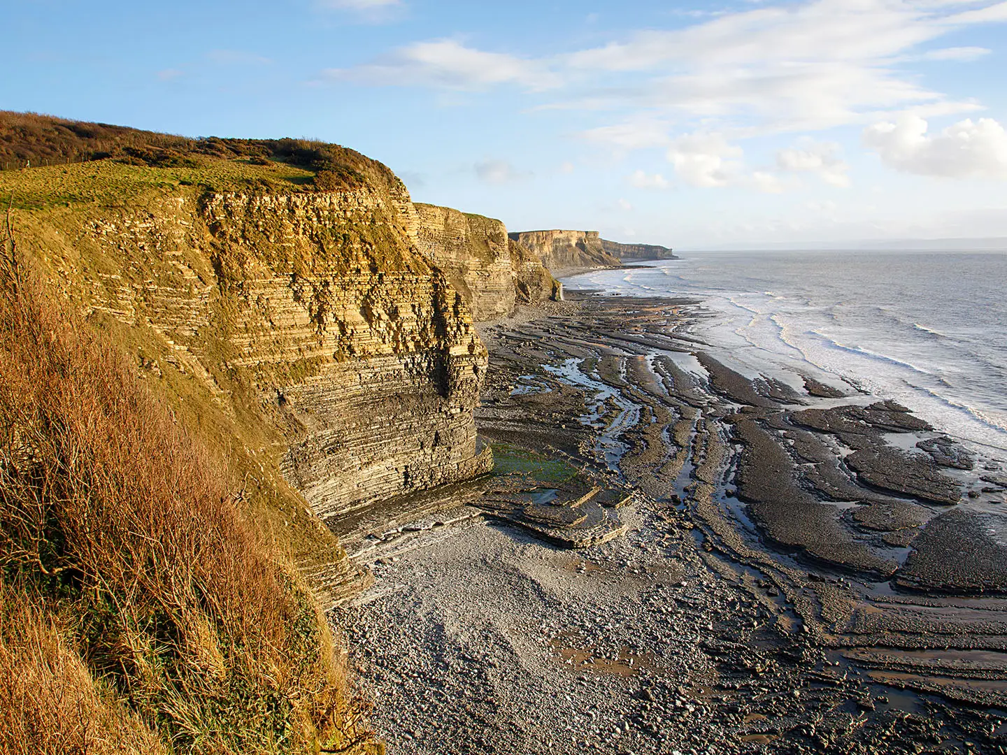
The Vale of Glamorgan Heritage Coast Path is a 22.5 km point-to-point coastal walk in South Wales, following the Lias-limestone cliffs of the Glamorgan Heritage Coast between Ogmore-by-Sea and the Aberthaw / St Athan area. It is a moderate but strenuous day walk, with repeated descents into wooded cwms and climbs back to exposed cliff tops. It suits fit walkers who want a full-day Wales Coast Path section with fossils, headlands, beaches, castles and straightforward waymarking rather than a multi-day trek.
Route Overview
Walk generally west to east from Ogmore-by-Sea, where the impassable Ogmore river mouth forces an inland detour past Ogmore Castle and the stepping stones. The route then returns to the coast around Southerndown and Dunraven Bay, continues past Traeth Mawr, Cwm Nash and Monknash, crosses Nash Point, then passes St Donat’s and Llantwit Major before finishing towards Aberthaw / St Athan. Llantwit Major is a common alternative finish because it has a railway station. This is a linear Wales Coast Path section, waymarked in both directions; car parks at places such as Dunraven Bay and Nash Point may charge. For longer coastal trips, compare the Anglesey Coastal Path, Ayrshire Coastal Path and Arran Coastal Way.
Fossils, Castles and the Wales Coast Path
The Glamorgan Heritage Coast was one of the early UK coastlines to receive Heritage Coast status in the 1970s. Its blue-lias limestone and shale cliffs preserve a Jurassic fossil record, while Iron Age promontory forts, Ogmore Castle, St Donat’s Castle and St Illtud’s Church at Llantwit Major add layers of human history. The 1831 Frolic disaster on the Nash Sands led to the Nash Point lighthouses. Today the route forms part of the Wales Coast Path, completed in 2012.
Notable highlights
- Nash Point: A limestone headland with twin lighthouses built after the 1831 wreck of the paddle-steamer Frolic on the Nash Sands. An eroded Iron Age promontory fort sits above the coast.
- Dunraven Bay, Southerndown: A sheltered bay backed by banded blue-lias cliffs and rock pools, popular with fossil hunters. Above the beach are the walled garden, gatehouse and earthworks of Dunraven on Witches Point.
- Monknash / Cwm Nash beach: A quiet fossil-rich beach reached by a wooded cwm, with a waterfall dropping over the cliff near the shore. It is one of the wilder-feeling sections of the walk.
- St Donat’s Castle: A medieval castle above the Bristol Channel, later restored by William Randolph Hearst and now home to Atlantic College. It is not generally open to walkers, but it is a strong landmark on the coast.
- Ogmore Castle and stepping stones: The route’s inland detour passes the 12th-century Norman ruins of Ogmore Castle and the well-known stepping stones across the river.
- St Illtud’s Church, Llantwit Major: An ancient church linked with one of Britain’s early centres of learning, with notable early-medieval Celtic carved stones.
Challenges to expect
Expect more effort than the modest cliff heights suggest. The path repeatedly drops into and climbs out of steep cwms, giving about 400 m of ascent, and exposed cliff-top sections can be windy or misty. Surfaces include grassy dirt, rocky shelves, pebbles, sand dunes near Ogmore and short road sections. Check tides carefully: beach-level alternatives can flood, and the official route detours inland at the Ogmore river mouth.
HikeList Score
Vale of Glamorgan Heritage Coast Path scored 80/100 on HikeList's trail-quality metrics.
See score breakdownHide breakdown
- Ideal length 55
- Balanced challenge 100
- Scenery & wildness 98
- Varied terrain 52
- Accommodation 75
- Food & support 75
- Path quality 98
- Season flexibility 89
Computed from length, challenge, scenery & wildness, terrain variety, accommodation, food & support, path quality and season flexibility.
 United Kingdom
 Wales
WalesShow more data Show less
- Coastal
- Dirt
- Rocky
- Hotels
- Campsites
- Wild Camping Spots
- Family Friendly
- Pet Friendly
- Restrooms
- Campsites
- Picnic Areas
Photos from hikers
Taken on the trail by people who've reviewed Vale of Glamorgan Heritage Coast Path.
Reviews
How would you rate Vale of Glamorgan Heritage Coast Path?
Tap a star to start your review — you could be the first.