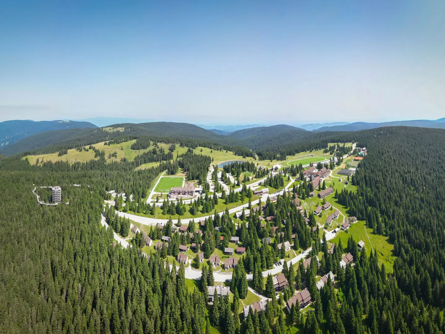
Rogla to Klopni Vrh Trail
How would you rate Rogla to Klopni Vrh Trail?
Tap a star to share your experience and help other hikers.
Rogla to Klopni Vrh Trail: Forested Pohorje Ridge Walk
HikeList Score
Rogla to Klopni Vrh Trail scored 81/100 on HikeList's trail-quality metrics.
See score breakdownHide breakdown
- Ideal length 55
- Balanced challenge 100
- Scenery & wildness 85
- Varied terrain 83
- Accommodation 66
- Food & support 88
- Path quality 98
- Season flexibility 89
Computed from length, challenge, scenery & wildness, terrain variety, accommodation, food & support, path quality and season flexibility.
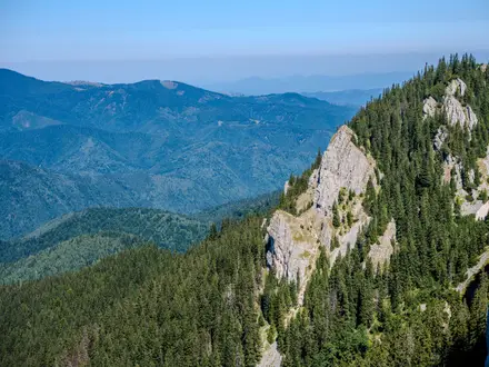
The Rogla to Klopni Vrh Trail is a 10.2 km one-way, waymarked ridge walk across the wooded central Pohorje massif in north-east Slovenia. It links Rogla resort with Klopni vrh summit via Koca na Pesku and forms Stage 6 of the Pohorje-Kozjak Trail, also following the Slovenian Mountain Trail. Expect an easy to moderate single-day hike: shaded forest paths, gravel roads, peat bog boardwalks and modest undulations rather than big climbs or summit panoramas.
Route Overview
Start at Rogla resort by the Hotel Planja area, the high point of the route at about 1,517 m. The trail heads towards Koca na Pesku, then continues north-east along the broad Pohorje ridge towards Klopni vrh, crossing the Skrbinsko borovje peat bog on wooden boardwalks and passing several small streams. The stage ends at the wooded Klopni vrh summit, 1,340 m, with the Slovenian Mountain Trail control stamp on the top; Koca na Klopnem vrhu below is closed. This is a point-to-point stage, though hikers often return the same way or make a local loop via Pesek and Zgornja/Spodnja brv. Rogla has hotels and parking. For more Pohorje hiking, see the Lovrenc Lakes Trail, or compare it with the lower-level Drava River Trail.
Pohorje Ridge History
Pohorje is a broad, forested mid-mountain massif traditionally used by shepherds, woodcutters and glassmakers. The wider plateau also has strong WWII Partisan associations, including the area around Osankarica, linked with the Pohorje Battalion’s last stand in 1943. The Rogla–Klopni vrh ridge has long been part of the Slovenian Mountain Trail and now also forms Stage 6 of the Pohorje-Kozjak Trail, a roughly 170 km, 20-stage circular route around Pohorje and Kozjak.
Notable highlights
- Rogla resort (~1,517 m): The starting point and high point of the walk, with hotels, parking and year-round mountain facilities on the Pohorje plateau.
- Koca na Pesku: A mountain hut on the ridge between Rogla and Klopni vrh, useful as a waypoint and rest stop on both the Pohorje-Kozjak and Slovenian Mountain trails.
- Skrbinsko borovje peat bog: A protected sphagnum high-moor bog with dwarf pine, crossed on wooden boardwalks. It gives the hike a distinctly Pohorje character: flat, wet plateau habitat rather than alpine rock.
- Klopni vrh summit (1,340 m): The wooded destination and Slovenian Mountain Trail stamp point. Do not expect a panorama; views are limited by forest.
- Koca na Klopnem vrhu: The former hut below the summit has been closed since 2018, so do not rely on it for food, drink or shelter.
- Pohorje forests and Partisan heritage: The route runs through dark spruce forest on a massif with notable WWII Partisan history. If you are planning longer routes in Slovenia, the European Long-Distance Path E6 and European Long-Distance Path E7 are relevant comparisons.
Challenges to expect
The route is not technically hard, but conditions can slow you down. Forest paths and boggy ground may be muddy after rain, and boardwalks can be slippery. Waymarking is established, but the shaded ridge has few views, so keep track of markers and junctions. There are no staffed services on the ridge itself; Koca na Klopnem vrhu is closed, so carry food and water.
HikeList Score
Rogla to Klopni Vrh Trail scored 81/100 on HikeList's trail-quality metrics.
See score breakdownHide breakdown
- Ideal length 55
- Balanced challenge 100
- Scenery & wildness 85
- Varied terrain 83
- Accommodation 66
- Food & support 88
- Path quality 98
- Season flexibility 89
Computed from length, challenge, scenery & wildness, terrain variety, accommodation, food & support, path quality and season flexibility.
 Slovenia
Show more data Show less
- Forest
- Plateau
- Bog
- Dirt
- Gravel
- Boardwalk
- Huts
- Hotels
- Family Friendly
- Pet Friendly
- Restrooms
- Water Sources
- Shelters
- Picnic Areas
Photos from hikers
Taken on the trail by people who've reviewed Rogla to Klopni Vrh Trail.
Reviews
How would you rate Rogla to Klopni Vrh Trail?
Tap a star to start your review — you could be the first.