Tour des Baronnies Provençales
How would you rate Tour des Baronnies Provençales?
Tap a star to share your experience and help other hikers.
Tour des Baronnies Provençales: Drôme Variant Hiking Guide
HikeList Score
Tour des Baronnies Provençales scored 86/100 on HikeList's trail-quality metrics.
See score breakdownHide breakdown
- Ideal length 93
- Balanced challenge 80
- Scenery & wildness 98
- Varied terrain 64
- Accommodation 75
- Food & support 88
- Path quality 98
- Season flexibility 76
Computed from length, challenge, scenery & wildness, terrain variety, accommodation, food & support, path quality and season flexibility.
The Tour des Baronnies Provençales is a waymarked GR de Pays loop in south-east France, crossing the Parc naturel régional des Baronnies provençales on the Drôme/Hautes-Alpes border. This guide covers the 137 km Drôme variant from Buis-les-Baronnies, typically walked here in 6 hard days with about 6,200 m of ascent. Expect mid-mountain terrain, rocky and dirt paths, forest, long climbs, hot dry weather and long gaps between villages. It suits fit hikers used to self-sufficient days rather than casual walkers.
Route Overview
This is a loop starting and finishing in Buis-les-Baronnies, marked as a GR de Pays with yellow-and-red balisage. The Drôme variant branches from the full two-department circuit at Saint-Auban-sur-l’Ouvèze and stays mainly within the Drôme, linking stage villages such as Vergol, Montbrun-les-Bains, Rosans, Rémuzat, Villeperdrix and Sainte-Jalle before returning to Buis-les-Baronnies. Key terrain includes limestone ridges, wooded valleys, garrigue, lavender country and the Eygues gorge area near Rémuzat. Transport details are not verified in the brief, so plan access and accommodation village by village. For a gentler French route, compare the Canal du Midi Towpath; for another mountain option, see the Chartreuse Trail GR9 segment.
History of the Baronnies Provençales route
The route was created in the 2000s, initially at about 110 km, then extended to around 226 km in 2015 when the Parc naturel régional des Baronnies provençales was established, linking the Drôme and Hautes-Alpes. The Baronnies take their name from the medieval baronies that controlled land between Provence and the Dauphiné. Near Rémuzat, griffon vultures were reintroduced at the Rocher du Caire from December 1996, making the cliffs one of the route’s defining wildlife areas.
Notable highlights
- Rocher Saint-Julien: A 125 m limestone blade above Buis-les-Baronnies and a well-known sport-climbing crag. It is the signature landmark at the start and finish of the loop.
- Rocher du Caire & the vultures of Rémuzat: Limestone cliffs above the Eygues where griffon vultures were reintroduced from 1996. Hikers may see birds soaring over the gorges in this key wildlife area.
- Gorges de l’Eygues / Gorges de Saint-May: A limestone river canyon between Saint-May and Rémuzat, with cliffs and turquoise water. It is one of the most dramatic sections of the Drôme variant.
- Montbrun-les-Bains: A hillside thermal-spa village listed among the Plus Beaux Villages de France. It sits beneath Mont Ventoux and is one of the main overnight stops.
- Sainte-Jalle: A village in the Ennuyé valley with the Romanesque church of Notre-Dame-de-Beauvert, a former Cluniac priory. The surrounding area includes Coteaux des Baronnies vineyards.
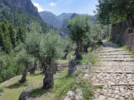
- Lavender, olive and almond country: The route crosses garrigue, lavender fields, olive groves and almond orchards typical of the Drôme Provençale.
Challenges to expect
This is a hard 6-day hike: daily ascent is large, the terrain is rocky and sometimes remote, and summer heat can be severe. Water is sparse between settlements, so carry more than you would on wetter mountain routes. Waymarking is generally reliable, but some remote sectors need attention. Spring and autumn are best; summer brings heat, fire risk and possible thunderstorms at altitude. For a different high-mountain comparison, see the Cirque de Gavarnie Trails.
HikeList Score
Tour des Baronnies Provençales scored 86/100 on HikeList's trail-quality metrics.
See score breakdownHide breakdown
- Ideal length 93
- Balanced challenge 80
- Scenery & wildness 98
- Varied terrain 64
- Accommodation 75
- Food & support 88
- Path quality 98
- Season flexibility 76
Computed from length, challenge, scenery & wildness, terrain variety, accommodation, food & support, path quality and season flexibility.
 France
Show more data Show less
- Mountainous
- Forest
- Dirt
- Rocky
- Hotels
- Huts
- Campsites
- Family Friendly
- Pet Friendly
- Water Sources
- Campsites
- Shelters
- Picnic Areas
Download Our Full Guide to Tour des Baronnies Provençales FREE!
Get our comprehensive guide to this hike for free. Save it for later reading or print out at home.
Photos from hikers
Taken on the trail by people who've reviewed Tour des Baronnies Provençales.
Tour des Baronnies Provençales: The Complete Guide
The Tour des Baronnies Provençales is a hard, waymarked GR de Pays circuit through the dry limestone hills between the Drôme and Hautes-Alpes. This Drôme variant starts and finishes in Buis-les-Baronnies, linking Provençal villages, rocky crests, wooded valleys and the gorges around Rémuzat over about 137 km.
It is a route of sharp contrasts: lavender, olives and almond orchards in the valleys, then long climbs onto exposed ridges with views towards Mont Ventoux. The Rocher Saint-Julien marks the start and finish, while the Rocher du Caire and Gorges de l’Eygues bring one of the most dramatic sections of the loop, with griffon vultures often circling above the cliffs.
This is not a gentle village-to-village ramble. Expect around 6,173 m of ascent, rocky paths, steep loose descents, sparse water and long gaps between places to eat or buy supplies.
Spring and autumn suit the route best; summer can be brutally hot and affected by fire-risk restrictions. Accommodation is limited to small gîtes, chambres d’hôtes, hotels and occasional campsites in scattered villages, so planning matters as much as fitness.
This guide covers stages, timings, accommodation, food, transport, terrain, water, heat and the common mistakes to avoid.
Stage-by-Stage Guide
The official Drôme variant is set out below as an 8-stage circuit. Strong, self-sufficient walkers sometimes combine stages into a 6-day itinerary, but the logistics become much tighter: water, food, heat management and booked beds matter more than the headline distance.
Use the yellow-and-red GR de Pays balisage as the primary waymarking, backed up by mapping. This is not a route where every end point can be treated as a fully serviced trail town; check accommodation, meals, water and onward transport before committing to each stage.
Stage 1: Buis-les-Baronnies to Plaisians (Les Girards)
The opening stage leaves Buis-les-Baronnies at the foot of the Rocher Saint-Julien, the limestone blade that dominates the start and finish of the circuit. At around 12 km, it is one of the shorter official days, but it still introduces the character of the Tour des Baronnies Provençales: dry limestone ground, scrubby Provençal slopes, rocky tracks and sustained mid-mountain walking rather than easy valley paths.
Expect a steady move out of town into open, hot terrain with sections of garrigue, old agricultural country and limestone underfoot. The stage is useful as a controlled first day if arriving late in Buis or if packs are heavy, but it should not be treated as a casual warm-up in high temperatures.
Stock up properly in Buis-les-Baronnies before leaving. Do not rely on finding open food or water once away from town; small hamlets and rural accommodation may not have shops or daytime services. Accommodation around Plaisians / Les Girards should be booked in advance, and an evening meal should be arranged when booking if there is no nearby restaurant option.
Road access exists at both ends, but there is no railway at Buis-les-Baronnies and local public transport in the Baronnies villages is sparse and seasonal. A taxi or private transfer may be the only practical fall-back if plans change. This should be checked before travelling.
Navigation out of Buis deserves attention because local paths, climbing approaches and other walking routes may share the area around Rocher Saint-Julien. Stay with the yellow-and-red GRP markings and do not assume every obvious path leaving town is part of the circuit. In summer or during fire-risk periods, check local restrictions before setting out.
Stage 2: Plaisians (Les Girards) to Vergol / Montbrun-les-Bains
This is one of the most scenic early stages, crossing towards Brantes and briefly stepping into Vaucluse before continuing towards the Montbrun-les-Bains area. The views towards Mont Ventoux are a major feature of this part of the route, especially from the perched terrain around Brantes and the Toulourenc side of the hills.
The walking is typical Baronnies mid-mountain terrain: a mix of rocky paths, tracks, wooded sections, open scrub and old routes linking villages and agricultural slopes. Expect exposed ground and uneven limestone, with heat reflecting strongly off pale rock in settled weather.
Brantes is an important landmark, but walkers should not depend on it for resupply unless current services and opening times have been checked. Carry enough food and water from the start for the full day. Vergol is treated as the stage end for the route, with Montbrun-les-Bains nearby as the key accommodation and service centre.
Montbrun-les-Bains is one of the main overnight bases on the western side of the loop, with small hotels, chambres d’hôtes and gîte-style accommodation more likely than in smaller hamlets. It is still a small village, so beds and evening meals should be booked well ahead, particularly in holiday periods.
Road access around Brantes, Vergol and Montbrun-les-Bains can help with transfers, but public transport should not be assumed. Check any bus or taxi options before relying on them.
Navigation is usually straightforward if the GRP balisage is followed, but there are several villages and local paths in this more visited part of the Baronnies. Take care not to drift onto short local circuits towards viewpoints or village walks unless deliberately planned.
Stage 3: Vergol / Montbrun-les-Bains to Saint-Auban-sur-l’Ouvèze
This stage leaves the Montbrun-les-Bains area and heads into the upper Ouvèze country, finishing at Saint-Auban-sur-l’Ouvèze. At around 15 km, it is a moderate-distance day by the standards of the route, but the terrain remains hilly and dry, with no reason to expect frequent services between settlements.
The landscape shifts between limestone ridges, wooded valleys and Provençal agricultural ground. Underfoot, expect a mix of dirt paths, stony tracks and steeper rougher sections where descents can be loose.
Start with water and food from Montbrun-les-Bains or your accommodation. Saint-Auban-sur-l’Ouvèze is a stage village rather than a large service centre, so book accommodation and meals in advance and check whether packed lunches can be provided for the following day.
Saint-Auban-sur-l’Ouvèze is a key route-planning point because the Drôme variant separates from the full two-department Tour des Baronnies Provençales in this part of the circuit. Anyone using wider GRP mapping or signage must be careful to stay on the Drôme variant rather than following indications for the longer Hautes-Alpes loop.
Road access at Saint-Auban can be useful for a pre-arranged pick-up, but local public transport is limited. This should be checked before travelling.
The main warning on this stage is complacency: shorter distance does not mean plentiful water or easy walking. In hot weather, leave early and manage water as if there will be no reliable refill until the end.
Stage 4: Saint-Auban-sur-l’Ouvèze to Rosans
The route from Saint-Auban-sur-l’Ouvèze to Rosans is a longer and more committing crossing of the eastern arc of the Drôme variant. At around 19 km, with typical Baronnies ascent and descent, it is a full hill day rather than a village-to-village stroll.
Expect remote mid-mountain walking through limestone ridges, woodland, scrub and high pastoral-feeling country. Paths may alternate between narrow rocky trails, forest tracks and old mule paths, with loose descents that require concentration late in the day.
Treat this as a self-sufficient stage. Carry enough water and food from Saint-Auban for the full day unless a specific intermediate service has been arranged. Water scarcity is one of the defining practical issues of the Tour des Baronnies Provençales, especially outside spring.
Rosans is a key overnight stop on the Hautes-Alpes borderlands, with a medieval hilltop centre, old lanes and ramparts. Accommodation is still limited in scale, so book ahead and confirm whether evening meals and next-day provisions are available.
Road access exists at Rosans, making it one of the more practical points for a planned transfer or itinerary adjustment. Public transport remains limited and should not be relied on without checking current timetables.
Navigation on this stage needs steady map attention, particularly where forestry tracks, side paths and route variants appear. The GRP waymarking is the main guide, but in remote country a missed turn can add significant time, water use and descent/ascent.
Stage 5: Rosans to Rémuzat
From Rosans the circuit turns towards Rémuzat, with Sahune passed nearby on the wider route line. The day is around 18 km and begins in the medieval hilltop setting of Rosans before moving back into the dry ridges and valleys that lead towards the Eygues country.
The terrain remains varied and tiring: rocky paths, rough tracks, wooded sections and open slopes where heat can build quickly. The approach towards Rémuzat brings the walker closer to one of the signature landscapes of the route, the limestone cliff country around the Rocher du Caire.
Rémuzat is strongly associated with the griffon vultures of the Baronnies, reintroduced at the Rocher du Caire from 1996. Vultures are often seen soaring over the cliffs and gorges, particularly where thermals rise from the limestone walls.
Carry food and water from Rosans and do not assume usable resupply before Rémuzat. If passing near Sahune, check in advance whether any services are open and whether they lie directly on the day’s route.
Rémuzat is one of the principal overnight villages on the Drôme variant, with accommodation more likely than in smaller hamlets but still limited. Book ahead, especially if walking during spring holiday periods, autumn weekends or the lavender season.
Road access at Rosans and Rémuzat makes this stage more manageable for a planned transfer than some remote sections, but there is still no simple railway connection. Any bus, taxi or luggage-transfer arrangement should be fixed before arrival.
Navigation should remain focused near junctions and around any optional viewpoints. A side trip to the Rocher du Caire area may add time and ascent; it should only be included if it fits the day’s heat, water and accommodation schedule.
Stage 6: Rémuzat to Villeperdrix
This stage crosses one of the most dramatic parts of the Drôme variant, with the Gorges de l’Eygues / Gorges de Saint-May forming the main scenic focus. The Eygues has cut a long limestone canyon through this part of the Baronnies, with cliffs rising up to around 150 m and rich birdlife around the gorge environment.
The route passes the Saint-May area and continues towards Villeperdrix over rocky, dry terrain. Expect a mixture of canyon-edge or gorge-country walking, stony paths, tracks and exposed slopes, with descents that can be loose underfoot.
Start the day well supplied from Rémuzat. Saint-May is an important landmark, but walkers should not rely on shops, food or water unless current services have been checked. Villeperdrix is a small stage end, so accommodation and meals need arranging in advance.
This is a stage where heat and exposure can feel more severe than the map distance suggests. Limestone gorges reflect heat, shade may be intermittent, and water access cannot be assumed just because the route is near a river canyon.
Road access in the Rémuzat, Saint-May and Villeperdrix area can support a planned transfer, but it is not the same as dependable public transport. This should be checked before travelling.
Navigation through gorge country requires attention to the marked route. Do not take unmarked shortcuts on steep limestone ground or descend towards the river unless it is clearly part of the GRP or a planned, mapped detour. In wet weather, rocky sections may become slippery; in summer, fire-risk restrictions may affect access.
Stage 7: Villeperdrix to Sainte-Jalle
At around 23 km, Villeperdrix to Sainte-Jalle is the longest official stage of the Drôme variant and one of the hardest to compress further. It passes through a sparse section of the circuit, with Rochebrune nearby and Arpavon on the route line before the descent towards the Ennuyé valley.
Expect a long day of mid-mountain terrain: ridges, wooded valleys, scrub, rocky paths and tracks, with repeated ascent and descent rather than one simple climb. Loose descents can be tiring late in the day, especially with a multi-day pack.
This is a full self-sufficiency stage. Carry enough water and food from Villeperdrix for the entire day unless a specific stop has been arranged. Do not assume open services in small settlements or hamlets along the way.
Sainte-Jalle is a more useful overnight point than the intervening countryside, with accommodation options in the village area, but capacity is limited. Book beds and evening meals ahead and check whether breakfast or packed lunches are available for the final stage.
The village is known for Notre-Dame-de-Beauvert, a 12th-century Provençal Romanesque church and former Cluniac priory in the Ennuyé valley. The church has been closed since 2024 for restoration, so do not plan an interior visit unless the current status has changed.
Road access at Sainte-Jalle is helpful for an arranged pick-up, but public transport remains sparse. For walkers considering an emergency exit on this long stage, taxis or transfers should be arranged by phone before setting out where reception allows.
Navigation fatigue is the main risk here. Keep checking the GRP markings at junctions, especially when leaving or entering small settlements, and avoid pushing into the hottest part of the afternoon with low water.
Stage 8: Sainte-Jalle to Buis-les-Baronnies
The final stage returns from Sainte-Jalle down the Ennuyé valley towards Buis-les-Baronnies. At around 19 km, it is a substantial last day, and the loop should not be considered finished until the final descent and approach into Buis are complete.
The stage links vineyard country, dry valleys and the limestone-and-scrub terrain typical of the Drôme Provençale. The Rocher Saint-Julien eventually reappears as the landmark above Buis-les-Baronnies, closing the circuit where it began.
Carry enough water and food from Sainte-Jalle for the day. Buis-les-Baronnies has the best end-of-route services, but there may be little of practical use before reaching town. In warm weather, the valley environment can still be very hot, even though the route is heading back towards the finish.
Buis-les-Baronnies is the logical place for the final night, vehicle collection or onward transfer. There is no railway in the town; the nearest mainline railheads are Montélimar and Orange, both about an hour away by road, with onward buses or taxis depending on season and timetable. This should be checked before travelling.
The final approach can be mentally easy to underestimate. Stay on the yellow-and-red GRP markings where local paths and tracks converge near Buis, and keep enough water back for the last kilometres rather than assuming the finish is immediately accessible once the town appears.
If leaving the Baronnies the same day, allow generous time for delays, heat, tired legs and limited transport. A pre-booked taxi or transfer is often more realistic than trying to improvise public transport at the end of the walk.
Recommended Itinerary
Standard itinerary: 8 walking days
The safest planning base is the 8-stage Drôme variant. It keeps the walking days more even, leaves fewer forced very-long days, and fits the thin accommodation pattern better than a compressed schedule.
Distances below are approximate. Stage lengths vary slightly by mapping source, so check official mapping before booking accommodation, especially where the overnight is listed as Vergol / Montbrun-les-Bains or Plaisians / Les Girards.
| Day | From | To | Approx. distance | Why this stage makes sense | Services/accommodation notes |
|---|---|---|---|---|---|
| 1 | Buis-les-Baronnies | Plaisians (Les Girards) | 12 km | A short first day gives time to arrive in Buis-les-Baronnies, settle into the GRP waymarking and start the loop without committing to a long remote stage immediately. | Buis-les-Baronnies is the main logistical base at the start. Accommodation and meals at Plaisians / Les Girards should be booked ahead; do not rely on flexible walk-in options. |
| 2 | Plaisians (Les Girards) | Vergol (Montbrun-les-Bains) | 18 km | This is a sensible full mountain day across the western arc of the circuit, with the route passing through the Brantes / Mont Ventoux landscape before reaching the Montbrun-les-Bains area. | Montbrun-les-Bains has more accommodation potential than many smaller hamlets, but the stage endpoint is listed as Vergol, so check the exact location of your bed and any meal arrangements before booking. |
| 3 | Vergol (Montbrun-les-Bains) | Saint-Auban-sur-l'Ouvèze | 15 km | A moderate-distance day that keeps the schedule controlled before the longer eastern stages. It also positions the walk at Saint-Auban-sur-l'Ouvèze, an important point on the Drôme variant. | Services are limited. Book accommodation and dinner in advance, and leave with enough food and water for the next day rather than assuming easy resupply. |
| 4 | Saint-Auban-sur-l'Ouvèze | Rosans | 19 km | A longer day into the eastern side of the loop, but still within the standard stage pattern. It avoids overloading the following Rosans–Rémuzat section. | Rosans is a key overnight village on the route. Beds are limited in small villages, so reserve early and check whether an evening meal is available. |
| 5 | Rosans | Rémuzat | 18 km | This stage keeps the approach to the Eygues / Rémuzat sector manageable and avoids combining two demanding canyon-and-ridge days. | Rémuzat is one of the more important overnight stops on the route. It is the logical place to plan food carefully before the Gorges de l'Eygues / Saint-May section. |
| 6 | Rémuzat | Villeperdrix | 18 km | A strong but reasonable day through one of the most dramatic parts of the circuit, including the Rémuzat and Gorges de l'Eygues / Saint-May area. | Treat water and food as planned supplies, not assumptions. Accommodation at Villeperdrix should be arranged before travelling. |
| 7 | Villeperdrix | Sainte-Jalle | 23 km | The longest standard stage, so it is best walked with an early start and a conservative pace. Keeping this as its own day is preferable to combining it with neighbouring stages. | Sainte-Jalle is a key final overnight before the return to Buis-les-Baronnies. Book accommodation and evening food ahead; small-village services may be seasonal. |
| 8 | Sainte-Jalle | Buis-les-Baronnies | 19 km | A full final day down the Ennuyé valley back to Buis-les-Baronnies, completing the circuit without needing an onward transfer from a remote finish. | Buis-les-Baronnies is the best place to arrange the final night, onward taxi or bus connection. Public transport is limited, so onward travel should be checked before travelling. |
Slower variant: 9–10 days
A slower plan suits walkers who want more recovery time, are carrying camping or heavier self-sufficient kit, or are walking in warm conditions when early starts and long rests are sensible. Rather than inventing awkward short stages, the practical slower option is to keep the same 8 walking stages and add rest or buffer nights.
The most useful extra nights are usually in places with better accommodation prospects and route significance, such as Montbrun-les-Bains / Vergol, Rosans or Rémuzat. This gives more room for heat, storms, fire-risk restrictions, tired legs or a missed accommodation connection.
Splitting individual stages may be possible only if suitable on-route or near-route accommodation is available. This should be checked before travelling.
Faster variant: 6 hard walking days
A 6-day schedule is only for fit, efficient walkers used to long mid-mountain days, limited water and carrying food between small villages. It is not a good choice in severe heat, during high fire-risk periods, or for anyone depending on short days and regular resupply.
One workable compression is to combine two of the shorter-to-moderate official stages and leave the longest standard stage intact. The combined distances below are simple sums of the stage figures above; check official mapping before booking.
| Day | From | To | Approx. distance | Why this stage makes sense | Services/accommodation notes |
|---|---|---|---|---|---|
| 1 | Buis-les-Baronnies | Vergol (Montbrun-les-Bains), via Plaisians / Les Girards | About 30 km | Combines the short opening stage with the following 18 km stage, creating a very long but logical first day if accommodation is secured at the Montbrun-les-Bains / Vergol end. | Start early from Buis-les-Baronnies. Carry full food and water for the day and check the exact location of the booked accommodation. |
| 2 | Vergol (Montbrun-les-Bains) | Rosans, via Saint-Auban-sur-l'Ouvèze | About 34 km | Combines two moderate stages into one demanding day, allowing the rest of the route to follow the standard eastern-stage rhythm. | This is a serious day with limited flexibility. Do not attempt it without confirmed accommodation and meal arrangements in Rosans. |
| 3 | Rosans | Rémuzat | 18 km | Keeps the Rémuzat approach as a standalone day after two heavy opening days. | Use Rosans and Rémuzat as planned food-and-bed stops; do not assume intermediate resupply. |
| 4 | Rémuzat | Villeperdrix | 18 km | Leaves enough time for the Gorges de l'Eygues / Saint-May sector without over-compressing the most distinctive terrain. | Water planning is important. Accommodation at Villeperdrix should be fixed before setting out. |
| 5 | Villeperdrix | Sainte-Jalle | 23 km | Retains the longest standard stage as its own day, which is more realistic than combining it with either side. | Start early and carry adequate water. Book Sainte-Jalle ahead, including dinner if needed. |
| 6 | Sainte-Jalle | Buis-les-Baronnies | 19 km | Finishes the circuit with the standard final stage back into Buis-les-Baronnies. | Arrange onward transport from Buis-les-Baronnies in advance; there is no railway station in the town. |
Planning the Route
Allow 8 days unless you are deliberately compressing it
The Drôme variant is officially split into 8 stages, and that is the most practical schedule for most walkers. The overnight villages are spaced by terrain as much as distance: long climbs, exposed ridges, rocky descents and heat can make an 18–23 km day feel much harder than it looks on a map.
A 6-day crossing is possible for fit, self-sufficient hikers, but it means combining stages and accepting long days with limited margin for heat, water shortages or accommodation constraints. It is best treated as a fastpacking-style plan rather than the default itinerary.
For a first visit, the 8-stage version is the safer planning baseline. It gives more time to manage water, avoid the hottest hours, and absorb the remoteness between villages without turning every day into a forced march.
The route is dictated by village spacing
This is not a trail where you can freely choose between many overnight stops every few kilometres. Accommodation and food are concentrated in small villages such as Buis-les-Baronnies, Montbrun-les-Bains / Vergol, Saint-Auban-sur-l'Ouvèze, Rosans, Rémuzat, Villeperdrix and Sainte-Jalle, with long gaps between them.
That makes the official stage pattern important. Before committing to dates, check that each overnight village has a bed available and that meals or food supplies can be arranged. Some stages have no reliable on-route resupply, so the next day’s food and water may need to be carried from the previous stop.
Book accommodation before travel rather than trying to improvise day by day. Gîtes d'étape, chambres d'hôtes and small hotels can be seasonal, small-capacity and spread out, and a single unavailable night can disrupt the whole circuit.
Fast itinerary versus slower itinerary
Use this as a broad planning guide:
| Plan | Best for | Main trade-off |
|---|---|---|
| 8 days | Most independent hikers | Best fit with the official stage villages and gives more margin for heat, water and rough ground |
| 7 days | Strong walkers with some flexibility | One stage will need to be combined or adjusted; accommodation spacing must work exactly |
| 6 days | Very fit, self-sufficient walkers | Hard days, bigger water and food carries, less recovery time and little room for delays |
A slower itinerary is usually more useful than a faster one here. The Baronnies are dry, hot and surprisingly remote in places, and starting early with a shorter afternoon is often better than chasing distance through exposed terrain.
Shortening, extending and section hiking
Shortening the Drôme loop is not especially straightforward because public transport in the Baronnies villages is sparse and seasonal. If you need to leave the route mid-way, plan around a taxi, private transfer or pre-arranged lift rather than assuming a convenient bus connection. This should be checked before travelling.
Rosans and Rémuzat are useful practical anchors because they are established overnight points on the eastern side of the loop, but they should not be treated as guaranteed transport hubs. Any section-hike plan needs transport confirmed before accommodation is booked.
Extending the walk is more natural than shortening it. The Drôme variant is the shorter circuit; the full GRP Tour des Baronnies provençales continues into the Hautes-Alpes and is around 222–226 km in total. Do not mix the two itineraries casually: the full circuit changes the accommodation, transport and resupply plan substantially.
Direction of travel
The usual Drôme-variant sequence starts and finishes at Buis-les-Baronnies and runs via Plaisians, Brantes, Montbrun-les-Bains / Vergol, Saint-Auban-sur-l'Ouvèze, Rosans, Rémuzat, Villeperdrix and Sainte-Jalle before returning down the Ennuyé valley to Buis-les-Baronnies.
Because it is a circuit, it can in principle be walked either way. In practice, accommodation availability, guidebook directions and transport at the start/end normally matter more than direction. If walking in reverse, check maps and route notes carefully rather than relying on descriptions written for the standard order.
The planning priorities that matter most
Accommodation: arrange every night in advance. The villages are small, options are thin, and seasonal closures can make spontaneous walking risky.
Food: plan meals stage by stage. Do not assume every village has a shop open at the time you arrive, and ask accommodation in advance about evening meals and packed lunches where needed.
Water: carry more than you would on a greener mountain route. Water is sparse, the terrain is dry, and summer heat can make long exposed sections demanding. Current water availability should be checked before travelling.
Navigation: the route is a waymarked GR de Pays with yellow-and-red balisage, but remote sections still require attention. Carry proper mapping, know the day’s exit points, and do not rely only on waymarks or a phone battery.
Weather and fire risk: spring and autumn are the best planning windows. High summer brings severe heat and fire risk; if walking then, expect very early starts, shorter days and the need to check local restrictions before setting out.
Transport: Buis-les-Baronnies has no railway. Montélimar and Orange are the nearest mainline stations, with onward bus or taxi arrangements; local links are limited, so timetables and transfers should be checked before booking.
Access changes: private-land issues and local closures can affect mountain routes in the Baronnies, particularly around higher ground such as the Montagne d'Angèle area, which the Drôme GRP does not summit. Check the latest route status before travelling.
Towns, Villages and Overnight Stops
Accommodation on the Tour des Baronnies Provençales is thin and needs planning village by village. The reliable pattern is not a chain of large trail towns, but small Baronnies settlements with a mix of gîtes d’étape, chambres d’hôtes, small hotels and occasional campsites, plus some stages where food and water cannot be assumed.
Book beds and evening meals ahead, especially outside the main holiday period or if walking the official 8-stage version. Shops, cafés and transport links are limited across the route; opening days, meal availability, bus times and water points should be checked before travelling.
Buis-les-Baronnies
Buis-les-Baronnies is the start and finish of the loop, at the foot of the Rocher Saint-Julien. It is the most useful place on the circuit for arrival logistics, pre-walk supplies, a first night and a recovery night after the final stage.
Accommodation is better here than in most villages on the route, with small-town options such as hotels, chambres d’hôtes and gîtes. It is the sensible place to organise any last-minute food, fuel or trail essentials before leaving, as later stages pass through smaller settlements with far fewer services.
There is no railway in Buis-les-Baronnies. The nearest mainline stations are Montélimar and Orange, both about an hour away by road, with onward buses or taxis; local public transport is sparse and seasonal, so timetables and transfer options should be checked before travelling.
Plaisians / Les Girards
Plaisians, specifically the Les Girards area, is the first official overnight stop on the 8-stage Drôme variant from Buis-les-Baronnies. It works mainly as a stage-end halt rather than a full-service trail town.
Expect limited accommodation and services, and do not rely on turning up without a reservation. Evening meals, breakfast and packed-lunch options should be arranged directly with the accommodation when booking.
This is an important early logistics point because the route is already moving into small-village terrain. Water and food availability between Buis-les-Baronnies and the next overnight should be checked before travelling.
Brantes
Brantes is a brief incursion into Vaucluse on the early part of the circuit, above the Toulourenc with views towards Mont Ventoux. It is more of a route village and scenic landmark than a standard stage end on the Drôme variant.
It may be useful for a pause or a variant overnight if accommodation fits the itinerary, but availability should be checked before travelling. Do not assume shop, café or meal service will be available on the day of passage.
Because Brantes is not one of the core Drôme-stage overnight stops, it is best treated as an optional logistics point rather than a place to solve an under-planned day.
Montbrun-les-Bains
Montbrun-les-Bains is one of the key overnight areas on the western side of the loop, reached via the Vergol stage. It is a hillside thermal-spa village and one of the more significant settlements available to walkers on this part of the route.
Accommodation is more realistic here than in many smaller hamlets, with options such as chambres d’hôtes, gîtes and small hotels in the wider village area. It is a good place to plan a proper overnight, but beds and meals still need booking ahead.
Food and basic services are more likely here than in the smaller stage villages, but opening hours can be seasonal. Anyone relying on a shop, restaurant meal or packed lunch should check directly before arrival.
Vergol
Vergol is used as the official stage end for the Montbrun-les-Bains stage on the Drôme variant. It is a practical route halt, but the accommodation and service picture should be treated as very limited unless booked in advance.
For planning purposes, think of Vergol and Montbrun-les-Bains together: the exact overnight location may depend on where accommodation is available and how transfers or short off-route connections are handled. This should be checked before travelling.
Do not assume resupply at Vergol. Arrange dinner, breakfast, water and next-day food before committing to the stage plan.
Saint-Auban-sur-l’Ouvèze
Saint-Auban-sur-l’Ouvèze is an official overnight stop in the upper Ouvèze valley and an important junction in route planning, as the Drôme variant separates from the broader two-department Tour des Baronnies Provençales around this sector.
It is a useful place to break the walk before the longer eastern arc towards Rosans. Accommodation should be booked ahead, and meal availability should be confirmed directly with the host.
Services are limited compared with a town such as Buis-les-Baronnies. Carry enough food and water to be independent if opening times or meal arrangements do not match the walking day.
Rosans
Rosans is one of the most important overnight stops on the eastern side of the loop, close to the Hautes-Alpes borderlands. The official stage from Saint-Auban-sur-l’Ouvèze ends here, and the following stage continues towards Rémuzat.
It is a sensible place to plan a full overnight rather than a passing stop. Accommodation is part of the route’s small-village network of gîtes, chambres d’hôtes and small hotels, but capacity is limited and should be reserved early.
Check food availability before arrival, including whether dinner and a packed lunch can be provided. Rosans is a key point for resetting supplies before continuing into the remote middle stages of the circuit.
Sahune
The route passes near Sahune on the Rosans to Rémuzat sector. It is best regarded as a nearby settlement rather than a guaranteed on-route service stop.
Sahune may be relevant for accommodation, a detour, or logistics if the planned stage into Rémuzat needs adjusting, but this should be checked before travelling. Do not assume it solves food or transport problems without a definite arrangement.
For most walkers, Sahune is simply part of the wider route context between Rosans and Rémuzat, with the main overnight normally planned at Rémuzat.
Rémuzat
Rémuzat is a major overnight stop on the Drôme variant and one of the best places to plan a rest, shorter day or schedule buffer. It sits close to the Gorges de l’Eygues and the Rocher du Caire, the limestone cliff associated with the Baronnies’ griffon vultures.
Accommodation is among the more useful on-route options, with gîtes, chambres d’hôtes and small hotels in the wider village network. Book ahead, especially if arriving on a popular walking or holiday date.
Food and resupply are more plausible here than in the smallest villages, but nothing should be assumed without checking current opening times. Rémuzat is also a logical place to reassess weather, heat and water strategy before the next stages.
Saint-May
Saint-May lies in the Gorges de l’Eygues / Gorges de Saint-May area, one of the most dramatic parts of the circuit. It is important for route character, but not necessarily a standard overnight base for every itinerary.
Accommodation or food options should be checked before travelling if planning to stop here. The gorge terrain can make the day feel committing, so walkers should start the stage with sufficient water and food rather than relying on finding services en route.
Saint-May is a worthwhile place to build time into the day for the landscape and birdlife around the Eygues, but practical logistics should remain centred on the booked overnight stop.
Villeperdrix
Villeperdrix is the official stage end between Rémuzat and Sainte-Jalle on the 8-stage itinerary. It is a small and important overnight point because the following day to Sainte-Jalle is one of the longer official stages.
Accommodation should be treated as limited and pre-booked. Confirm whether dinner, breakfast and a packed lunch are available, as relying on spontaneous catering is risky on this route.
This is one of the places where the Baronnies’ sparse-service character matters. Arrive with enough food and water margin, and check the next day’s water options before leaving.
Rochebrune
The route passes near Rochebrune before the final approach towards the Ennuyé valley and Sainte-Jalle. It is not one of the main listed stage-end villages for the Drôme variant.
Rochebrune may be relevant for nearby accommodation or route adjustment, but this should be checked before travelling. Do not build a plan around unconfirmed services here.
For most itineraries, it is better treated as a reference point on the Villeperdrix to Sainte-Jalle sector, with the overnight arranged at Sainte-Jalle.
Arpavon
Arpavon appears on the later part of the loop before Sainte-Jalle. It is a small route village and should be treated as a limited-service point unless a specific booking or arrangement has been made.
It may provide a useful pause in the day, but food, water and accommodation availability should be checked before travelling. The long stage into Sainte-Jalle means walkers should leave Villeperdrix prepared for a full mountain day rather than depending on mid-stage facilities.
Sainte-Jalle
Sainte-Jalle is the final overnight village before returning to Buis-les-Baronnies. It sits in the Ennuyé valley and is a key stop for the last stage of the official 8-day itinerary.
Accommodation is part of the thin Baronnies network, so book beds and meals in advance. It is not a place to assume late, flexible or walk-in availability.
The village is also known for Notre-Dame-de-Beauvert, a 12th-century Provençal Romanesque church and former Cluniac priory; the church has been closed since 2024 for restoration. From a walking-planning perspective, the main reason to stop is practical: it breaks the route before the final 19 km stage back down the Ennuyé valley to Buis-les-Baronnies.
Planning overnight stops on a 6-day itinerary
Compressing the route into 6 days changes the accommodation problem. Instead of following every official stage village, walkers need to combine stages and identify which villages have beds, meals and realistic arrival times.
This is only suitable for fit, self-sufficient walkers comfortable with long days and substantial ascent. Before booking, check that each selected overnight has confirmed accommodation, dinner, breakfast, packed lunch options and enough water access for the next day.
Getting to the Start
The Tour des Baronnies Provençales Drôme variant starts and finishes in Buis-les-Baronnies, a small town in the Drôme at the foot of the Rocher Saint-Julien. It is a circuit, so the simplest logistics are to arrive in Buis-les-Baronnies the day before walking and either leave a car there or arrange a pre-booked road transfer from the nearest rail station.
By train
There is no railway station in Buis-les-Baronnies. The nearest practical mainline stations are Montélimar and Orange, both roughly an hour away by road, with onward travel needed by bus, taxi or private transfer.
For most walkers using public transport, the plan is:
- Travel by train to Montélimar or Orange.
- Continue by local bus if a suitable service is running.
- Use a taxi or pre-booked transfer if bus times do not work.
Do not assume an easy same-day connection from the train to Buis-les-Baronnies, especially outside peak periods. Local onward transport is limited and seasonal, so rail arrival times and the final road leg should be planned together. This should be checked before travelling.
Avoid confusing this Drôme loop with the longer Hautes-Alpes variant: Serres has a station on the Grenoble–Veynes–Gap line, but it is not the normal access point for the Buis-les-Baronnies circuit described here.
By bus
Bus access into the Baronnies villages is limited. Services from the wider Drôme / Vaucluse area towards Buis-les-Baronnies may be useful, but timetables can be sparse, seasonal and poorly aligned with long-distance train arrivals.
If relying on buses, check the full chain of transport before booking accommodation: train arrival, bus departure, arrival in Buis-les-Baronnies, and whether the service runs on the required day. This should be checked before travelling.
A missed connection can be awkward, as the start town is not on a rail line and the surrounding villages are small. For a fixed itinerary with pre-booked gîtes, a taxi or private transfer from Montélimar or Orange is often the safer fallback.
By car
Driving is the most straightforward way to reach the start. Because the route is a loop, a car can be left in Buis-les-Baronnies and collected at the end of the final stage from Sainte-Jalle back into town.
Long-stay parking arrangements should not be assumed. Check with your accommodation in Buis-les-Baronnies before arrival, especially if leaving a vehicle for 6–8 days. This should be checked before travelling.
A car also gives useful flexibility if arriving late, collecting supplies before the first stage, or adjusting plans around heat, fire risk or accommodation availability. Once the walk begins, however, the villages are far apart and road access does not remove the need for careful food and water planning.
From the nearest airport
There is no airport access directly into Buis-les-Baronnies. The practical approach is to fly into a major airport with onward rail links, then travel by train to Montélimar or Orange and complete the final leg by bus, taxi or private transfer.
Airport choice matters less than the onward connection to the Baronnies. Build in enough time for the final road transfer, and avoid planning a tight same-day start on the trail after a flight. This should be checked before travelling.
Where to stay before starting
Staying in Buis-les-Baronnies the night before the first stage is strongly recommended. It gives time to collect supplies, check weather and fire-risk information, organise water for the first day, and start early in hot conditions.
Accommodation in and around the route villages is mixed but limited: expect small hotels, gîtes d'étape, chambres d'hôtes and occasional campsites rather than abundant large-scale lodging. Book the first and last nights in Buis-les-Baronnies well ahead, particularly in spring, autumn and holiday periods.
If arriving by public transport, choose accommodation that can advise on taxi access or local bus stops. If arriving by car, ask specifically about leaving a vehicle while walking the circuit.
Getting Home from the Finish
The Drôme variant is a circuit, so the finish is back in Buis-les-Baronnies. That simplifies vehicle logistics, but not public transport: Buis-les-Baronnies has no railway station, and onward travel is still best planned before setting out.
By train
There is no train from Buis-les-Baronnies itself. The nearest useful mainline stations are Montélimar and Orange, both roughly an hour away by road, with onward travel by bus, taxi or private transfer.
For onward journeys to larger French cities, plan around reaching either Montélimar or Orange first, then continuing by mainline rail. Train times, seat reservations and any engineering works should be checked before travelling, especially if connecting to a long-distance service the same day.
If finishing late in the day, staying in Buis-les-Baronnies is usually the safer plan than relying on a same-evening connection to a station.
By bus
Local bus links in the Baronnies are limited, sparse and seasonal. Do not assume there will be a convenient bus from Buis-les-Baronnies to Montélimar, Orange or nearby villages at the time you finish walking.
Check the current timetable shortly before travel and build in a fallback option. This is particularly important on Sundays, public holidays and outside the main visitor season.
By car/taxi
Leaving a car in Buis-les-Baronnies is the simplest arrangement for this loop, as the route returns to the start town. Check parking rules locally before leaving a vehicle for several days.
If using a taxi or private transfer to Montélimar or Orange, book it in advance rather than trying to arrange one on arrival. Buis-les-Baronnies is a small town, and availability can be limited, especially in the evening or outside peak season.
A pre-booked transfer is also the most reliable option if you need to catch a specific train after finishing the final stage from Sainte-Jalle.
From the nearest airport
Airport choice depends on how you plan to connect back through Montélimar or Orange, or whether you are hiring a car. No airport is directly linked to Buis-les-Baronnies by rail, so the final leg will still involve bus, taxi, transfer or car hire.
Flight times, rail connections and car-hire opening hours should be checked before travelling. If arriving or departing on a tight schedule, allow for the road transfer between Buis-les-Baronnies and the mainline rail network.
Where to stay at the finish
Buis-les-Baronnies is the logical place to stay after completing the circuit. Accommodation is in small-town style rather than a large resort: expect a mix of gîtes, chambres d’hôtes and small hotels, with seasonal pressure on beds.
Booking ahead is strongly recommended, particularly if finishing at a weekend or during holiday periods. An overnight in Buis-les-Baronnies gives a much more relaxed exit, lets you recover after the final descent through the Ennuyé valley, and avoids depending on limited late-day transport.
Which Direction Should You Walk?
The practical default is to follow the published 8-stage direction from Buis-les-Baronnies to Plaisians, Montbrun-les-Bains, Saint-Auban-sur-l'Ouvèze, Rosans, Rémuzat, Villeperdrix and Sainte-Jalle, then back to Buis-les-Baronnies. This is the natural way to use the official stage sequence and is the simplest direction for matching accommodation, meals and village stops.
Because the Tour des Baronnies Provençales is a circuit, transport logistics are essentially the same in either direction: you start and finish in Buis-les-Baronnies, where there is no railway and onward buses or taxis need checking before travel. Direction choice is therefore less about transport and more about daily pacing, accommodation availability and how you want the route to build.
Standard direction: Buis-les-Baronnies to Sainte-Jalle, then back to Buis
The standard direction has the better pacing for most walkers. It begins with the shortest official stage, Buis-les-Baronnies to Plaisians (Les Girards), around 12 km, which gives a gentler first day before the longer, more remote mid-route stages.
The scenery also develops well in this direction. The early stages take in the southern Baronnies, with Brantes, Mont Ventoux views and Montbrun-les-Bains, before the route pushes east towards Saint-Auban-sur-l'Ouvèze and Rosans. The more dramatic northern arc around Rémuzat, Rocher du Caire and the Gorges de l'Eygues then arrives later, when most walkers are settled into the rhythm of the route.
The finish is also satisfying. The last stage comes from Sainte-Jalle down the Ennuyé valley back into Buis-les-Baronnies, returning to the Rocher Saint-Julien and closing the loop in the same town where the route began.
The main drawback is that the longest official stage, Villeperdrix to Sainte-Jalle, around 23 km, comes late in the walk. That is demanding, but it also arrives after several days of acclimatisation rather than immediately after leaving Buis.
Reverse direction: Buis-les-Baronnies to Sainte-Jalle first
Walking in reverse is perfectly possible, provided accommodation and meals can be booked in the required order. The waymarking is GR de Pays yellow-and-red balisage, but remote sections still demand attention, especially when following signs and junctions against the usual stage order.
The reverse direction gives a shorter final day, because the last stage would be Plaisians to Buis-les-Baronnies, around 12 km. That can be useful if a taxi, bus connection or long onward journey is planned from Buis, although current local transport should be checked before travelling.
The trade-off is early difficulty. Reversing the official schedule puts Buis-les-Baronnies to Sainte-Jalle, around 19 km, first, followed by the long Sainte-Jalle to Villeperdrix, around 23 km stage on day two. For walkers arriving with heavy packs, limited water information or no time to warm into the route, that is a tougher opening than the standard direction.
Reverse also changes the route’s scenic rhythm. You reach Sainte-Jalle, Villeperdrix, Rémuzat and the Gorges de l'Eygues early, then leave the Montbrun-les-Bains and Brantes side of the circuit for the second half. That is not worse, but it feels less like the published progression of the Drôme variant.
Are the climbs easier one way?
There is no obvious easy direction for this route. The circuit has around 6,173 m of total ascent, with repeated mid-mountain climbs, rocky paths and steep loose descents whichever way it is walked.
Reversing the route will turn some descents into climbs and some climbs into descents, but it does not remove the main difficulty: long, dry days between small villages with limited resupply. Direction choice should not be used as a substitute for carrying enough water, starting early in hot weather and booking overnight stops carefully.
Recommendation
For most independent hikers, the best direction is the standard published direction from Buis-les-Baronnies via Plaisians, Montbrun-les-Bains, Saint-Auban-sur-l'Ouvèze, Rosans, Rémuzat, Villeperdrix and Sainte-Jalle back to Buis.
Choose the reverse only if accommodation availability, a desired short final day or a specific transport arrangement makes it more practical. Otherwise, the standard direction offers the smoother start, the most logical accommodation flow and the strongest finish back into Buis-les-Baronnies.
Accommodation Along the Route
Accommodation is one of the main planning constraints on the Tour des Baronnies Provençales. This is not a hut-to-hut mountain route with a bed at every pass; it is an inn-to-inn style walk linking small Provençal villages where gîtes d'étape, chambres d'hôtes, small hotels and occasional campsites are spread thinly.
Book every night before committing to travel dates. Villages are far apart, some stages have little or no resupply, and a closed gîte or full chambre d'hôtes can turn a normal walking day into a much longer one. Opening periods, evening meals and packed lunches should all be checked before travelling.
Best overnight bases
Buis-les-Baronnies is the natural place to stay before and after the loop. It is the start and finish point, has the strongest practical value for arrival logistics, and gives a buffer if transport into the Baronnies is delayed.
Montbrun-les-Bains, Rosans and Rémuzat are the key intermediate bases with the best chance of finding conventional walker-friendly accommodation by route standards. Sainte-Jalle is also a recognised stage village, but should be treated as a small-place booking rather than a flexible fallback.
The most awkward nights are around the smaller stage ends: Plaisians / Les Girards, Vergol, Saint-Auban-sur-l'Ouvèze and Villeperdrix. These stops can work well, but they are exactly where availability, meals and exact location matter most. Do not assume there will be multiple options within walking distance.
| Place | Accommodation level | Best for | Notes |
|---|---|---|---|
| Buis-les-Baronnies | Good | Start/end nights; buffer night; transport logistics | Best base for beginning and finishing the circuit. Book the first and final nights early, especially if arriving by limited public transport or private transfer. |
| Plaisians / Les Girards | Limited | Official first-stage overnight | Small settlement stage end. Check exact location, evening meal availability and whether a packed lunch is possible for the following day. |
| Brantes | Limited | Possible early-route stop or meal stop if available | The route makes a brief incursion into Vaucluse here. Treat accommodation as limited and check before building an itinerary around it. |
| Montbrun-les-Bains / Vergol | Good by route standards | Key overnight on the western arc; useful place to reset | Montbrun-les-Bains has the strongest practical pull in this sector, while Vergol is the named stage end. Check whether accommodation is in the village itself or requires a short transfer or road approach. |
| Saint-Auban-sur-l'Ouvèze | Limited | Stage overnight before the eastern arc | Important junction area where the Drôme variant separates from the wider two-department circuit. Book ahead and check food options. |
| Rosans | Good by route standards | Key overnight; resupply and recovery point | One of the most important bases on the eastern side of the loop. Still a small village, so availability should not be treated as open-ended. |
| Sahune area | Limited | Possible off-stage adjustment | The route passes near Sahune rather than using it as the main official stage end. Any use as an overnight base needs careful distance and transfer planning. |
| Rémuzat | Good by route standards | Key overnight before/after the Gorges de l'Eygues sector | A practical base for the Rocher du Caire and Gorges de l'Eygues part of the walk. Book early in walking season. |
| Saint-May | Limited | Possible stop near the gorges | Useful only if accommodation and meals line up with the planned stage. This should be checked before travelling. |
| Villeperdrix | Limited | Official stage overnight before the long Sainte-Jalle day | Treat this as a critical booking. If no suitable bed is available, the next day's logistics may need a taxi transfer or a reworked itinerary. |
| Rochebrune / Arpavon area | Limited | Itinerary adjustment only | These are small-route places rather than dependable accommodation hubs. Do not rely on finding a last-minute bed. |
| Sainte-Jalle | Limited | Final overnight before returning to Buis-les-Baronnies | Recognised stage village in the Ennuyé valley. Book ahead and check dinner/breakfast arrangements, as the final stage back to Buis is still a full walking day. |
Booking strategy
For the standard 8-stage itinerary, accommodation should be booked in the same order as the walking days: Buis-les-Baronnies, Plaisians / Les Girards, Vergol or Montbrun-les-Bains, Saint-Auban-sur-l'Ouvèze, Rosans, Rémuzat, Villeperdrix, Sainte-Jalle, then Buis-les-Baronnies again. This avoids being forced into a long transfer because one small village is full.
For a compressed 6-day itinerary, accommodation becomes harder rather than easier. Strong walkers may combine stages physically, but the available beds do not automatically fall at convenient 6-day intervals. Expect to use longer days, private transfers or an off-route overnight if the natural stage villages do not line up.
Ask each accommodation provider three practical questions when booking: whether dinner is available, whether breakfast is early enough for a hot-weather start, and whether a packed lunch can be provided. On this route, food logistics matter almost as much as the bed itself.
Seasonal and weekend pressure
Accommodation in the Baronnies is seasonal and small-scale. Spring and autumn are the best walking seasons, but those same periods can concentrate walkers into a limited number of open beds.
Weekends and French holiday periods should be treated cautiously. Even where a village has several options, a wedding, local event or holiday weekend can remove the safety margin. This should be checked before travelling.
High summer brings severe heat and fire risk, so it is not the best season for this route despite the appeal of lavender season. If walking in hotter months, early starts and short days are essential, and every accommodation booking should be checked for water, food and arrival-time flexibility.
Camping and gîtes
Occasional campsites exist along the wider route corridor, but this is not a simple campsite-to-campsite trek. Do not plan a full camping itinerary unless every night has been checked individually.
Wild camping and bivouac rules can vary with land ownership, protected-area management and fire-risk restrictions. This should be checked before travelling, especially in dry or windy periods.
Gîtes d'étape are often the most practical accommodation style for walkers, but they should not be confused with high-mountain refuges. Expect village-based lodging, limited capacity and the need to reserve meals in advance.
Luggage transfer, taxis and off-route nights
Luggage transfer or taxi support can make the route much easier to schedule, particularly if a small stage village is full or closed. It can also help walkers who want the scenery and daily walking without carrying a full multi-day load.
Public transport within the Baronnies villages is sparse and seasonal, so do not rely on buses to solve accommodation gaps. Private transfers should be arranged ahead of time, with pickup points agreed clearly.
The route can work well for inn-to-inn walkers, but only with disciplined booking. It is best approached as a remote village-to-village trek with occasional logistical workarounds, not as a flexible trail where accommodation can be decided day by day.
Camping and Wild Camping
Camping is possible on the Tour des Baronnies Provençales, but it needs more planning than on many long-distance routes. The Drôme variant passes through small villages with thin services, long dry sections and significant summer fire risk, so a camping itinerary should be built around known overnight points rather than assuming there will be easy pitches each evening.
The route is better suited to experienced, self-sufficient walkers carrying a light camping setup than to casual campers. The extra weight makes the long climbs, rocky descents and hot exposed sections harder, and water scarcity is the main limiting factor.
Campsites and organised camping
There are occasional campsites on or near the route, alongside the more typical gîtes d'étape, chambres d'hôtes and small hotels in places such as Buis-les-Baronnies, Montbrun-les-Bains, Rosans, Rémuzat and Sainte-Jalle. Exact openings, pitch availability and whether a campsite is directly on the GRP or requires a detour should be checked before travelling.
Do not rely on finding an open campsite every night. Villages are small, services can be seasonal, and some stages have no meaningful resupply between overnight stops. In spring and autumn, campsites may not keep the same opening pattern as in high summer, so book or contact ahead wherever possible.
A practical camping plan is usually to combine official campsites where available with booked indoor accommodation on the thinner stages. This avoids carrying excessive food and water, and gives a fallback during storms, heatwaves or periods of elevated fire risk.
Wild camping and bivouac
Wild camping rules in this part of France are local and can vary with land ownership, protected areas, municipal by-laws and seasonal fire restrictions. The route crosses the Parc naturel régional des Baronnies provençales and passes sensitive limestone, gorge and birdlife areas, including the Gorges de l'Eygues / Gorges de Saint-May near Rémuzat. Rules should be checked locally with the relevant mairie, the regional natural park, accommodation providers or tourist offices before planning any bivouac.
Do not assume that a discreet tent is acceptable simply because an area looks remote. Much of the landscape is working rural land, with tracks, orchards, lavender fields, woodland, grazing areas and private property. Camping on private land requires permission.
Where bivouac is permitted locally, keep it minimal: pitch late, leave early, use a small tent or bivvy, avoid cultivated land and do not camp near houses, livestock, water infrastructure or marked sensitive sites. Never make a fire.
Fire risk and summer restrictions
Fire risk is one of the main reasons to be cautious about camping on this route. The Baronnies Provençales are hot, dry and exposed in summer, with garrigue, woodland and scrub that can become highly flammable.
Open fires are inappropriate, and stove use may also be restricted during high-risk periods. This should be checked before travelling, especially from late spring through summer and during heatwaves. If restrictions are in force, a camping itinerary may become impractical unless meals can be bought in villages or eaten cold.
High summer is also physically demanding for campers because more water must be carried. Spring and autumn are the better seasons for a camping-based traverse.
Water and camping logistics
Water is the key constraint. The route has long gaps between villages, sparse reliable water and several hot, exposed sections, so camp spots cannot be chosen independently of water access.
Plan each day around where drinking water can be obtained, not just where a tent might fit. Fill up in villages whenever possible, and carry enough for the next dry section, the evening meal and the following morning if camping away from services. Water points should be checked locally before setting out, as seasonal flow and availability can change.
Avoid camping beside rivers or in gorge areas unless it is clearly permitted and safe. The Gorges de l'Eygues / Gorges de Saint-May are environmentally sensitive and should be treated as a place to pass through carefully, not as a default wild-camping zone.
Where camping fits best on the route
Camping works best around established overnight settlements rather than in the middle of remote stages. The most sensible places to investigate for camping or campsite access are the main stage villages: Buis-les-Baronnies, the Montbrun-les-Bains / Vergol area, Saint-Auban-sur-l'Ouvèze, Rosans, Rémuzat, Villeperdrix and Sainte-Jalle.
The harder stretches are the long, dry links between villages, especially when compressing the official 8-stage itinerary into 6 days. Carrying camping gear on those longer days is possible, but it increases the difficulty significantly.
Leave No Trace for this route
Keep all camps invisible after departure. Pack out all rubbish, food scraps and toilet paper, and avoid contaminating scarce water sources.
Use existing durable ground where camping is permitted, stay well clear of crops and orchards, and avoid disturbing livestock or wildlife. Around Rémuzat and the Rocher du Caire, give particular respect to the vulture habitat and signed restrictions.
For most walkers, the safest and least stressful approach is a mixed itinerary: campsites where they are open and convenient, booked gîtes or chambres d'hôtes on thinner stages, and no wild camping unless current local rules and land permission make it clearly acceptable.
Food, Water and Resupply
Food and water planning is one of the main difficulties on the Tour des Baronnies Provençales. This is not a hut-to-hut Alpine route with frequent staffed refuges: villages are small, services are thin, and several stages cross hot, dry mid-mountain terrain with long gaps between settlements.
Treat Buis-les-Baronnies as the main provisioning point at the start and finish. Montbrun-les-Bains, Rosans, Rémuzat and Sainte-Jalle are the other key places to organise meals, accommodation food and any resupply, but opening days and seasonal hours can make a big difference. This should be checked before travelling.
Food and resupply strategy
Do not plan around guaranteed shops at every overnight stop. Some stage villages may have accommodation and meals but little or no practical food resupply for walkers passing through at the wrong time of day.
When booking gîtes d'étape, chambres d'hôtes or small hotels, ask specifically about:
- demi-pension: evening meal and breakfast;
- packed lunches / pique-niques for the next stage;
- arrival-time constraints if there is no alternative place to eat;
- whether there is a shop, bakery, bar or restaurant open locally on the date of travel.
Carry at least one emergency meal and a full day of snacks. On the more remote stages, it is sensible to leave the village with all food needed until the next booked accommodation, rather than assuming there will be a café or shop en route.
Rural French villages often have short opening hours, midday closures, weekly closing days and reduced out-of-season services. Sundays and public holidays can be especially awkward for resupply. This should be checked before travelling.
Water planning
Water is sparse and heat is a serious issue on this route. Start each stage with enough water for the whole day unless a reliable potable source has been checked in advance.
For normal spring or autumn conditions, many walkers will want at least 2–3 litres at the start of a stage, with more needed in hot weather, on exposed ridges, or if compressing the route into longer days. In summer, the combination of dry limestone terrain, garrigue, long climbs and fire-risk restrictions can make water management the limiting factor of the walk.
Do not rely on streams, rivers or springs as safe drinking water. The route passes valleys and river landscapes including the Ouvèze, the Eygues and the Ennuyé, but natural water should be treated or filtered unless it is explicitly signed as potable. Seasonal dryness can also make minor sources unreliable.
Village fountains and taps may exist in some settlements, but they should not be assumed to be drinkable unless marked eau potable. Ask accommodation providers about the next day’s water before setting out.
Stage-by-stage resupply notes
| Section | Food availability | Water availability | Notes |
|---|---|---|---|
| Buis-les-Baronnies to Plaisians (Les Girards) | Best to leave Buis fully supplied. Do not rely on meaningful resupply at Plaisians / Les Girards. | Fill up in Buis and carry enough for the stage. Any later water points should be checked before travelling. | Buis is the safest place to buy food before committing to the loop. |
| Plaisians (Les Girards) to Vergol / Montbrun-les-Bains | Food depends on booked accommodation and local openings. Montbrun-les-Bains is the main service point in this part of the route. | Carry a full day’s water unless a potable source has been checked. | Ask ahead about evening meal, breakfast and a packed lunch, especially if staying outside the centre of Montbrun-les-Bains. |
| Vergol / Montbrun-les-Bains to Saint-Auban-sur-l'Ouvèze | Limited village-based options; arrange food before leaving. | Start with full bottles. Natural water in the Ouvèze valley should be treated if used. | Do not assume a café or shop will be open on arrival. |
| Saint-Auban-sur-l'Ouvèze to Rosans | Long enough to require a full day’s food. Rosans is a key overnight and resupply point, but services are still rural and seasonal. | Carry enough water for the whole stage unless current potable points are known. | This is a stage where a packed lunch is useful. |
| Rosans to Rémuzat | Rosans and Rémuzat are the practical food-planning points; little should be assumed between them. | Fill up before leaving Rosans. Treat or filter any natural water. | Rémuzat is one of the better places on the eastern arc to organise meals and onward supplies. |
| Rémuzat to Villeperdrix | Arrange food in Rémuzat before departure. Do not rely on resupply at Villeperdrix without checking. | Carry a full day’s water; the Gorges de l'Eygues area can be hot and exposed. | Despite the presence of the Eygues, drinkable water should not be assumed from natural sources. |
| Villeperdrix to Sainte-Jalle | One of the longer official stages, so carry all food needed for the day. Sainte-Jalle is the next key overnight point. | Start with extra water and check potable sources in advance. | This stage is particularly important to plan well if walking in warm weather. |
| Sainte-Jalle to Buis-les-Baronnies | Carry food for the final day from Sainte-Jalle unless relying on a booked meal or packed lunch. Full services return at Buis-les-Baronnies. | Fill up before leaving Sainte-Jalle and carry enough for the Ennuyé valley approach back to Buis. | Do not relax water planning just because it is the last stage; the route remains dry and hilly until the finish. |
Terrain, Conditions and Difficulty in Practice
The Tour des Baronnies Provençales is hard because of sustained mid-mountain walking rather than technical mountaineering. The Drôme variant reaches about 1,486 m and totals roughly 6,173 m of ascent over 137 km, so the difficulty comes from repeated climbs, steep loose descents, heat, water scarcity and long gaps between villages.
Underfoot: limestone, tracks and old paths
Expect a mix of dirt paths, rocky limestone tracks, forest tracks and old mule paths. The ground is often dry, stony and uneven, with loose material on descents where poles are useful.
This is not a smooth valley trail. Even where the gradients are moderate, progress can be slowed by broken limestone, narrow hillside paths and rougher sections through garrigue, scrub and woodland.
Boggy ground is not a defining feature of this route. After rain, the likely issue is slippery rock, greasy dirt and loose descents rather than sustained mud or peat.
Climbs and descents
The official 8-stage version spreads the effort more evenly, but every itinerary still involves regular ascent and descent between valleys, ridges and small villages. Compressing the walk into 6 days makes it a significantly harder undertaking, with longer days and less recovery time.
The route is best treated as a sequence of mid-mountain crossings rather than a village-to-village ramble. Long climbs can be exposed in hot weather, and descents on loose limestone can be as tiring as the ascents, especially late in the day with a full pack.
Exposure and technical difficulty
The GRP is a waymarked walking route, not a scrambling route. There is no need to plan for via ferrata equipment or climbing gear on the standard circuit, despite the presence of limestone crags such as Rocher Saint-Julien near Buis-les-Baronnies.
That said, the terrain can still feel committing. Ridge and crest sections, the Gorges de l'Eygues area and remote limestone slopes can be exposed to sun, wind and weather, with limited quick escape to services.
Heat, water and remoteness
Heat is one of the main practical difficulties. Much of the landscape is dry Provençal mid-mountain terrain: garrigue, limestone ridges, scrub, lavender, olive and almond country, with shade varying sharply from section to section.
Water is sparse and some stages have little or no on-route resupply. Carry more water than would be needed on a cooler, wetter mountain route, and do not assume that a hamlet or map-marked settlement will provide an open shop, café or fountain. Water points should be checked before travelling.
Summer adds two separate problems: severe heat and fire risk. Spring and autumn are the most sensible seasons for most walkers; if walking around the late-June to July lavender period, plan conservatively, start early and check local fire-risk restrictions before setting out each day.
Waymarking and navigation
The trail is a GR de Pays / GRP with yellow-and-red balisage, and waymarking is generally reliable. Even so, remote sections demand attention, particularly where tracks split in woodland, scrub or old pastoral terrain.
Carry mapping rather than relying only on paint marks. IGN 1:25,000 mapping and the current FFRandonnée topo-guide are the appropriate planning tools for checking variants, closures, water and exact stage lines.
Roads, villages and cultivated land
The character of the route is mainly paths and tracks, with village approaches and links through places such as Buis-les-Baronnies, Montbrun-les-Bains, Rosans, Rémuzat and Sainte-Jalle forming the more settled parts of the walk. Any hard-surface or lane sections are secondary to the overall mountain-trail character.
The route passes through cultivated and pastoral landscapes as well as wild limestone country. In lavender fields, olive groves, almond orchards and grazing areas, stay on the balisage, respect private land and leave gates as found where encountered.
What makes it easier or harder in practice
The route feels easier when walked in the official 8-stage rhythm, with accommodation and meals booked in advance and enough water carried for dry stages. It feels much harder when compressed into 6 days, walked in hot weather, or attempted with optimistic assumptions about shops and water.
Fit, experienced hikers who are comfortable with long dry days, rough limestone paths and self-sufficient planning should find the route demanding but manageable. Beginners, casual walkers and anyone relying on frequent resupply will likely find the Baronnies far harder than the pastoral scenery suggests.
Weather and Best Time to Walk
The best seasons for the Tour des Baronnies Provençales are spring and autumn. The route is a hot, dry, exposed mid-mountain circuit with long climbs, rocky descents and sparse water, so choosing the right walking window matters as much as fitness.
High summer is the main season to avoid unless you are deliberately planning very early starts, short days and heavy water carries. Winter is not a normal season for this route as a multi-day itinerary: the trail reaches about 1,486 m, daylight is short, accommodation is more limited, and snow or ice can affect higher crests and shaded paths.
Best walking windows
| Season | Practical verdict |
|---|---|
| Spring | Usually the best overall choice: milder walking temperatures, longer daylight than autumn, and more comfortable climbing. Check accommodation openings before committing to dates. |
| Late June to July | Lavender can be in bloom, but this overlaps with rising heat and the start of the most serious water-management issues. Walk only with early starts and conservative stage plans. |
| High summer | The worst period for most hikers. Expect severe heat risk, exposed limestone and garrigue sections, sparse water, and possible fire-risk restrictions. This should be checked before travelling. |
| Autumn | Another strong choice: cooler walking conditions and good temperatures for long ascents. Days shorten, so compressed 6-day itineraries need careful timing. |
| Winter | Not recommended for a standard end-to-end walk. Possible snow or ice at higher elevations, cold conditions, short daylight and reduced services make it a much more committing proposition. |
Heat, water and fire risk
Heat is the key weather hazard on this route. Much of the walking crosses limestone ridges, dry scrub, forest tracks, old mule paths and exposed Provençal valleys, with limited shade in places and long gaps between villages.
Carry more water than would normally be needed for a European village-to-village walk. Some stages have little or no reliable resupply, and water points should be checked before setting out each day.
In summer, local fire-risk rules can affect access to dry hills and wooded areas. Do not assume the route will always be open in hot, windy or very dry conditions; current restrictions should be checked before travelling and again locally in Buis-les-Baronnies or the stage villages.
Rain, storms, wind and trail surface
The trail is mostly dirt, rocky path, forest track and old mule path. After rain, expect loose descents to be slower and rocky limestone sections to feel more awkward underfoot, especially on steep ground.
Thunderstorms are a practical concern on exposed ridges and crests. If storms are forecast, start early, avoid lingering on high ground, and be prepared to shorten or delay a stage rather than pushing across remote terrain with no quick exit.
Wind can also matter on open ridges and passes, particularly where the path is exposed. The route is not a technical alpine traverse, but it is still mid-mountain terrain and should not be treated like a lowland footpath.
Daylight and stage planning
The official Drôme variant is split into 8 stages, while strong walkers sometimes compress it into 6 hard days. In spring and autumn, the 8-stage schedule gives much more margin for weather delays, slow rocky descents, accommodation timings and water stops.
Shorter daylight becomes important in autumn and winter. If walking outside the longer days of spring and early summer, avoid late starts and do not underestimate the time needed for the 23 km Villeperdrix to Sainte-Jalle stage or other long, hilly days.
Accommodation and seasonal services
Accommodation is thin and seasonal: gîtes d'étape, chambres d'hôtes, small hotels and occasional campsites in small stage villages. Openings, meals and availability can vary significantly outside the main walking season.
Book beds and evening meals ahead, especially in spring holiday periods, around the lavender season, and in autumn when options may be fewer. Do not rely on turning up and finding accommodation or food in the next village.
Is the route realistic in winter?
For most hikers, no. The Tour des Baronnies Provençales is best planned as a spring or autumn trek, not a winter circuit.
A winter attempt would require short-day planning, current weather and snow checks, verified accommodation, and the ability to deal with cold, ice or closed services. This should be checked before travelling.
Safety Notes
Emergency help and communication
In France, dial 112 for emergency assistance. If travelling from the UK, do not rely on 999 once in France.
Treat mobile coverage as intermittent on this route. The circuit crosses remote valleys, wooded slopes and limestone ridges between small villages, so a phone signal should not be assumed away from Buis-les-Baronnies, Montbrun-les-Bains, Rosans, Rémuzat, Sainte-Jalle and other settlements.
Carry offline mapping, a charged phone and a power bank. A paper map or topo-guide is strongly recommended, especially on remote sections where waymarking is generally reliable but still demands attention.
Heat, exposure and fire risk
Heat is one of the main hazards on the Tour des Baronnies Provençales. The terrain is dry, rocky and exposed in places, with long climbs, garrigue, open crests and limited shade.
Spring and autumn are the safest normal walking seasons. In summer, severe heat and fire risk can make full stages unsafe; if walking then, start very early, shorten days where possible and avoid exposed climbs in the hottest part of the day.
Fire-risk restrictions can affect access to paths and natural areas in south-east France. Current restrictions should be checked before travelling and again locally before starting each day.
Water and food gaps
Water is sparse and some stages have little or no resupply. Do not assume that every hamlet, fountain or accommodation stop will provide water at the time needed.
Carry more water than would be normal for a cooler mountain route of similar distance, especially between Saint-Auban-sur-l'Ouvèze, Rosans, Rémuzat, Villeperdrix and Sainte-Jalle. Refill whenever there is a reliable opportunity, and check the next day’s water options with accommodation hosts or local offices.
Food planning matters as much as water. Several villages are small, and shops or meal options may be limited, seasonal or closed on particular days. Carry an emergency food buffer for each stage.
Terrain, navigation and slips
This is a hard mid-mountain route, not a gentle village-to-village walk. Expect long ascents, steep loose descents, rocky paths, forest tracks and old mule paths.
Limestone can be awkward underfoot, particularly on descents and after rain. Use poles if helpful, keep footwear grippy, and avoid rushing late in the day when fatigue makes slips more likely.
The GRP is waymarked with yellow-and-red balisage, but attention is still needed at junctions, in woodland and around remote ridges. If a marker has not appeared for a while, stop and check the map rather than continuing on assumption.
Weather and cold
Although the route feels Provençal, it reaches mid-mountain height, with the Drôme variant topping out at about 1,486 m. Wind, sudden rain and cold conditions can still affect high or exposed sections, particularly in spring and autumn.
Carry a waterproof layer, warm layer and sun protection on the same day. The risk profile can change quickly between shaded valleys, open ridges and hot south-facing slopes.
Roads, villages and rural hazards
The route is mainly on paths, tracks and old ways, but village approaches and linking sections may include lanes or minor roads. Walk facing traffic where appropriate, stay visible, and take particular care on bends and narrow roads.
This is working rural country. Close gates where required, keep clear of farm machinery, do not enter private land off the waymarked route, and give livestock plenty of space if encountered.
Cliffs, gorges and wildlife areas
Around Rémuzat, Saint-May, the Gorges de l'Eygues and the Rocher du Caire, limestone cliffs and steep ground are part of the landscape. Stay on the marked path and keep back from edges, especially in wind or poor visibility.
Griffon vultures are a major feature of the Rémuzat area, but cliff and nesting zones should be treated with respect. Do not leave the path to approach birds or cliff sites.
The Rocher Saint-Julien above Buis-les-Baronnies is a climbing and via-ferrata landmark. Those activities are separate from walking the GRP and require the correct equipment, conditions and competence.
Solo hiking
Solo hikers should be comfortable with long, self-sufficient days and route-finding without immediate help. This is not a route where it is sensible to depend on passing walkers, open shops or a constant phone signal.
Leave the day’s intended destination with accommodation hosts or a trusted contact. If changing the itinerary, especially on the longer or more remote stages, update that plan as soon as possible.
Daily safety checklist
Before setting off each morning, check:
- the day’s weather, including heat, wind and storms;
- local fire-risk restrictions and any path closures;
- the next reliable water point and whether it is likely to be available;
- food and meal arrangements at the next village;
- accommodation booking and arrival time;
- map, offline route and phone battery;
- estimated walking time, allowing for ascent, rocky ground and heat;
- whether any stage needs to be shortened or started earlier because of conditions.
If in doubt, take the conservative option. On this circuit, the main safety margin comes from early starts, generous water carrying, confirmed accommodation and not underestimating the remoteness between villages.
Gear Recommendations
Footwear and clothing
Choose footwear for rocky Provençal mid-mountain terrain rather than soft village-to-village walking. The Tour des Baronnies Provençales uses dirt paths, forest tracks, old mule paths, limestone ridges and steep loose descents, so most walkers will be better served by grippy trail shoes or lightweight boots with a protective sole.
Ankle support is a personal choice, but underfoot grip and stability matter more than speed. The long descents and loose limestone are tiring late in the day, especially with several days of accumulated ascent.
Carry waterproofs even in the preferred spring and autumn seasons. This is not a high-Alpine route, but the trail reaches about 1,486 m and crosses exposed crests where wind, rain and sudden temperature changes can make a lightweight shell essential.
A warm layer is also needed outside high summer. Mornings, shaded valleys and breezy ridges can feel cool, particularly before the day heats up.
Water and heat management
Water capacity is one of the most important gear decisions on this route. The Baronnies are hot, dry and exposed in summer, with sparse water and long gaps between villages; some stages have no reliable on-route resupply.
Do not set out with only a small bottle. Carry enough water for a full hot stage, plus a margin for delays, navigation mistakes or a closed village facility. Water points and accommodation availability should be checked before travelling.
Sun protection is not optional. Pack a wide-brimmed cap or sun hat, sunglasses, high-factor sunscreen, lip protection and clothing that covers shoulders and arms when needed. A light neck covering is useful on exposed ridges and through dry garrigue.
Avoid relying on high-summer walking conditions. Fire risk and severe heat can affect access, comfort and safety; current restrictions should be checked before travelling.
Navigation and electronics
The GR de Pays is waymarked with yellow-and-red balisage and waymarking is generally reliable, but remote sections still demand attention. Carry offline mapping rather than relying on mobile signal.
Useful paper mapping includes the relevant IGN 1:25,000 sheets for the circuit, including 3139OT Nyons / Rémuzat / Baronnies and 3140ET Mont-Ventoux, with additional eastern sheets needed depending on the exact itinerary. The FFRandonnée topo-guide Le Parc naturel régional des Baronnies provençales à pied covers the GRP.
A phone with offline maps, route file and accommodation details is highly useful, but should not be the only navigation tool. Bring a power bank, especially if using GPS throughout the day or staying in small gîtes where charging points may be limited.
Route changes, private-land issues near the Montagne d'Angèle area, water points and seasonal restrictions should be checked before travelling.
Food carry and village gaps
Pack food with the assumption that not every stage village will provide full resupply at the time you arrive. The route passes small villages such as Plaisians, Vergol, Saint-Auban-sur-l'Ouvèze, Rosans, Rémuzat, Villeperdrix and Sainte-Jalle, but services are thin and seasonal.
Carry enough lunch and snacks for the full day before leaving each overnight stop. An emergency meal is sensible on the longer or more remote stages, particularly if walking the compressed 6-day version.
If staying in gîtes or chambres d'hôtes, check whether evening meals and packed lunches are available when booking. Do not assume shops, cafés or restaurants will be open in every village.
Trekking poles
Trekking poles are strongly recommended. The route has about 6,173 m of total ascent, long climbs and steep loose descents, where poles reduce strain and improve balance on rocky ground.
They are particularly useful for walkers carrying several days of water and food, and for anyone compressing the official 8 stages into harder 6-day itineraries.
For inn-to-inn hikers
Inn-to-inn walkers can keep the pack reasonably light, but should not strip out safety gear. Accommodation is mainly gîtes d'étape, chambres d'hôtes and small hotels, not a dense hut network.
Carry a sleeping liner if required by booked accommodation, plus a compact towel if staying in simpler gîtes. This should be checked with each host before travelling.
Even with pre-booked beds, pack full rain protection, warm layers, navigation, headtorch, first-aid basics, power bank, sun protection, and enough water and food for each stage. The remoteness of some sections makes this more than a simple luggage-light village walk.
For campers
Camping is possible only with careful planning, as the route has occasional campsites rather than frequent formal camping infrastructure. Do not assume there will be an official campsite at every stage village.
Campers need a lightweight shelter, sleeping system and cooking setup appropriate for dry mid-mountain conditions, while still allowing for cool nights outside summer. Fire-risk restrictions and outdoor cooking rules should be checked before travelling.
A camper’s pack will be heavier, so footwear, poles and water capacity become even more important. Plan food carry conservatively, as resupply is limited and some stages have no dependable services.
For fast and section hikers
Fast hikers compressing the Drôme variant into 6 hard days should prioritise low pack weight without compromising water, navigation or weather protection. The biggest risk is carrying too little water or food in order to save weight.
Use a compact kit, but keep a real waterproof, warm layer, headtorch, emergency food, offline navigation and a power bank. Early starts are sensible in warm weather because exposed climbs and ridges become much harder later in the day.
Section hikers should plan gear around transport limitations as much as distance. Buis-les-Baronnies has no railway and local bus links are sparse and seasonal, so carry enough clothing, food and battery reserve to handle delays or changed pickup plans. This should be checked before travelling.
Budget and Costs
The Tour des Baronnies Provençales is not an expensive trail because of permits or mountain huts; the main costs are accommodation, meals and getting into and out of Buis-les-Baronnies. Prices vary significantly by season, room type and whether evening meals are included, so current rates should be checked before booking.
Because villages are small and accommodation is thin, cost control is harder than on routes with frequent towns. The cheapest bed may not be available on the exact night needed, and using taxis to solve a missed booking or transport gap can quickly raise the total budget.
Main cost drivers
| Cost item | What to expect |
|---|---|
| Accommodation | Gîtes d'étape, chambres d'hôtes and small hotels in or near the stage villages, with occasional campsites. Book well ahead, especially in the smaller stops such as Plaisians, Vergol, Saint-Auban-sur-l'Ouvèze, Villeperdrix and Sainte-Jalle. |
| Food | Some stages have little or no on-route resupply, so budget for evening meals where available, packed lunches from accommodation, and food carried from larger villages. |
| Transport | Buis-les-Baronnies has no railway station. Most walkers need to reach the area via Montélimar or Orange, then use a bus, taxi, private transfer or car. Local bus links are sparse and seasonal. This should be checked before travelling. |
| Taxis and private transfers | Useful for access from Montélimar or Orange, or as a contingency if accommodation is off-route, but potentially one of the largest variable costs. Confirm current prices before booking. |
| Camping | Occasional campsites can reduce costs, but they are not available in every stage village. Do not build a budget around camping unless each night has been checked in advance. |
| Luggage transfer | Not something to assume on this route. If needed, ask accommodation providers or local operators directly and confirm availability before committing to the itinerary. |
| Maps and guidebook | Budget for IGN 1:25,000 mapping and/or the relevant FFRandonnée topo-guide. Digital navigation is useful, but a paper map remains sensible on the more remote sections. |
Budget approaches
| Style | Best suited to | Practical approach |
|---|---|---|
| Lower-cost | Strong walkers who can carry more food and are flexible on comfort | Use campsites where they genuinely fit the stage plan, choose gîtes d'étape where available, carry lunches and snacks from larger villages, and minimise taxis by arranging public transport carefully. |
| Mid-range | Most independent walkers | Mix gîtes, chambres d'hôtes and small hotels, book demi-pension where offered, and pay for packed lunches on stages with poor resupply. This is usually the simplest balance of reliability and cost. |
| Comfortable | Walkers prioritising private rooms, meals and simpler logistics | Use chambres d'hôtes and small hotels, add nights in Buis-les-Baronnies before or after the loop, pre-arrange taxis or transfers where public transport is inconvenient, and consider luggage support only if it can be arranged locally. |
Accommodation and meal budgeting
For an 8-stage itinerary, plan for accommodation each night in or near Buis-les-Baronnies, Plaisians, the Montbrun-les-Bains / Vergol area, Saint-Auban-sur-l'Ouvèze, Rosans, Rémuzat, Villeperdrix and Sainte-Jalle. A compressed 6-day version reduces nights on trail but may force longer days and less choice over where to stay.
Where demi-pension is available, it is often the most practical option because resupply is limited between villages. If accommodation does not offer dinner or breakfast, check nearby food options before booking; small villages may have restricted opening days or seasonal services.
Packed lunches should be treated as a planning item rather than an afterthought. On water-scarce and resupply-poor stages, carrying enough food from the previous village can be more important than saving a few euros.
Transport costs
The largest transport variable is the final leg into Buis-les-Baronnies. Montélimar and Orange are the nearest mainline rail access points, both about an hour away by road, but onward public transport is limited and seasonal.
A taxi or private transfer from a rail station can be convenient, especially for a group sharing the fare. Solo walkers should price this before travel, as it may cost more than several nights of basic accommodation.
Leaving a car in Buis-les-Baronnies simplifies the loop logistics, but parking arrangements should be checked locally before departure. If using buses, verify the current timetable for both the arrival and departure dates, not just the outward journey.
Contingency budget
Carry a contingency for this route. The most likely extra costs are an unplanned taxi, an off-route accommodation detour, an additional night in Buis-les-Baronnies, or buying meals where self-catering is not realistic.
Heat, fire-risk restrictions, water scarcity and long gaps between villages can all affect the plan. A slightly higher budget is safer than relying on a tight itinerary with no room for changes.
Luggage Transfer, Guided Tours and Support Services
Luggage transfer
Do not assume this route has the kind of daily baggage-transfer network found on the major Alpine or Camino-style routes. The Tour des Baronnies Provençales is a remote GR de Pays circuit through small villages, with thin accommodation and long gaps between services, so independent walkers should be prepared to carry their own overnight kit.
If walking inn-to-inn and hoping to move only with a daypack, ask each booked gîte, chambre d'hôtes or hotel whether they can help arrange luggage transport to the next stop. This should be checked before travelling, and ideally before paying deposits, because not every stage village will have an easy local solution.
Where luggage transfer is possible, expect it to depend on local taxis or accommodation owners rather than a dedicated trail-wide courier. It is most likely to be practical on the standard 8-stage itinerary through places such as Plaisians, Montbrun-les-Bains / Vergol, Saint-Auban-sur-l'Ouvèze, Rosans, Rémuzat, Villeperdrix and Sainte-Jalle; compressed 6-day itineraries may be harder to support because transfers become longer and less conventional.
Self-guided walking packages
Self-guided packages may be available through French walking-holiday operators or local agencies, typically bundling accommodation, route notes, maps or GPX files, some meals and sometimes baggage movement. Current availability, inclusions and prices should be checked before booking.
A package makes most sense for walkers who want the logistics handled but do not need a guide on the trail. It can be particularly useful here because accommodation is sparse, some villages have little or no resupply, and local transport is limited.
Before committing, check exactly which variant is being sold. The Drôme variant is the shorter circuit from Buis-les-Baronnies, while the full GRP Tour des Baronnies provençales continues into the Hautes-Alpes and is much longer. The itinerary should name the overnight villages and match the number of days you intend to walk.
Guided walking
Fully guided departures are less essential on this route than on high alpine terrain, but they can be worthwhile for walkers who are not confident managing navigation, heat, water planning and long remote days independently. A guide may also be useful for groups wanting local interpretation of the Baronnies landscape, villages and wildlife around places such as Rémuzat and the Gorges de l'Eygues.
Guided trips should still be treated as serious mid-mountain walking. The route has around 6,173 m of ascent, rocky paths, steep loose descents and exposed hot sections, so a guided format does not remove the need for fitness, suitable footwear and disciplined water carrying.
Ask in advance whether the guide provides only daily leadership or also manages accommodation, meals, transfers and emergency contingency plans. This should be checked before travelling.
Taxi and private transfers
Buis-les-Baronnies has no railway station, so taxis or private transfers can be useful at the start and end of the walk. The nearest mainline rail access is via Montélimar or Orange, both around an hour away by road, with onward buses or taxis depending on current timetables.
Private transfers can also be useful for bail-outs, missed stages or linking awkward accommodation, but they should not be relied on casually. Villages are small, distances by road can be indirect, and availability may be limited outside busy periods.
For a circuit, the simplest arrangement is often to leave a car in Buis-les-Baronnies and return to it at the end. If using public transport, check current bus times and taxi availability before booking accommodation, not after.
What to book ahead
Book accommodation first, then arrange any luggage movement or transfers around the confirmed overnight stops. This matters because the route has limited beds, seasonal services and some stages with little or no on-route resupply.
Before departure, confirm:
- each night’s accommodation and whether an evening meal is available;
- whether packed lunches can be provided for stages with no reliable resupply;
- any luggage-transfer possibility between specific villages;
- taxi or private-transfer contacts for arrival, departure and emergency shortening;
- current bus timetables if travelling without a car;
- water-point reliability and any summer heat or fire-risk restrictions.
Walkers comfortable carrying a full pack and booking accommodation independently do not need a support package for this route. Walkers wanting a lighter pack, fixed logistics or public-transport arrival should organise support well in advance, as last-minute arrangements in the Baronnies are not something to count on.
Shorter Hikes and Best Sections
The Tour des Baronnies Provençales is a hard point-to-point circuit once you leave Buis-les-Baronnies, so shorter trips need more logistics than the map suggests. Most useful sections are linear, with small villages at either end and limited public transport; arrange accommodation, meals and transfers before committing.
Distances below use the official 8-stage Drôme variant structure and are approximate.
| Best for | Section | Approx. distance | Time needed | Main reason to choose it |
|---|---|---|---|---|
| Best first taste / easier day | Buis-les-Baronnies to Plaisians (Les Girards) | 12 km | 1 day | Shortest official stage, starting below Rocher Saint-Julien |
| Best scenery | Rémuzat to Villeperdrix | 18 km | 1 long day | Gorges de l’Eygues, Saint-May and vulture country around Rocher du Caire |
| Best weekend | Rosans to Villeperdrix via Rémuzat | 36 km | 2 days | Strong two-day section linking Rosans, Rémuzat and the gorge stage |
| Best 3–5 day section | Rosans to Buis-les-Baronnies via Rémuzat, Villeperdrix and Sainte-Jalle | 78 km | 4 days | The eastern and southern arc, finishing back into Buis-les-Baronnies |
| Best for villages and booked beds | Vergol / Montbrun-les-Bains to Rosans via Saint-Auban-sur-l’Ouvèze | 34 km | 2 days | Montbrun-les-Bains, the Ouvèze valley and Rosans with a clear stage-village structure |
| Best for public transport | Buis-les-Baronnies-based day section, usually Buis to Plaisians | 12 km one way | 1 day | Buis is the most practical access point, though still not rail-served |
Best day walk: Buis-les-Baronnies to Plaisians (Les Girards)
This is the most manageable way to sample the GRP without taking on a remote multi-day itinerary. The stage leaves Buis-les-Baronnies beneath Rocher Saint-Julien and gives an immediate taste of the limestone, garrigue and mid-mountain terrain that define the route.
At about 12 km, it is the shortest official stage on the Drôme variant, but it should not be treated as a casual stroll. Expect rougher ground, ascent and heat exposure, and carry enough water for the full day.
Transport is the main constraint. Buis-les-Baronnies has no railway station; access is usually via Montélimar or Orange by onward road transport, and a return from Plaisians needs a pre-arranged lift, taxi or overnight booking. Local bus options are sparse and seasonal, so this should be checked before travelling.
Best scenic section: Rémuzat to Villeperdrix
For one big scenic day, the Rémuzat to Villeperdrix stage is the standout choice. It places you in the most dramatic part of the Drôme variant, close to the Gorges de l’Eygues, Saint-May and the vulture cliffs around Rocher du Caire.
The distance is about 18 km, so it is best suited to fit walkers who are comfortable with a full mountain day rather than anyone looking for a short village walk. Start early in warm weather, as the Baronnies can be very hot and dry.
Rémuzat and Villeperdrix are small, so do not assume transport will be available on demand. Book accommodation and any taxi or transfer in advance, and check food and water options before setting out.
Best weekend section: Rosans to Villeperdrix via Rémuzat
A strong two-day itinerary is Rosans to Rémuzat, then Rémuzat to Villeperdrix, for about 36 km in total. It combines the medieval hilltop village of Rosans with the Rémuzat sector and the gorge-and-vulture scenery around Saint-May.
This is still a hard weekend, not a soft introduction. The two days are both around 18 km, and the route remains a remote mid-mountain walk with limited resupply between villages.
Plan the overnight in Rémuzat well ahead. Transport at both ends is likely to require a private transfer, taxi arrangement or a car-based plan, as local links across these villages are limited.
Best 3–5 day section: Rosans to Buis-les-Baronnies
For a substantial short trek, the four-stage section from Rosans to Buis-les-Baronnies is the most rewarding cut of the circuit. It follows the route through Rémuzat, Villeperdrix and Sainte-Jalle before returning down the Ennuyé valley to Buis-les-Baronnies.
The total distance is about 78 km over four official stages. This gives a concentrated version of the route’s eastern and southern character: Rosans, the Gorges de l’Eygues, Rocher du Caire, Sainte-Jalle and the final return into Buis-les-Baronnies.
The finish in Buis makes onward logistics simpler than ending in a smaller village, but the start at Rosans still needs planning. Arrange the transfer to Rosans, reserve beds and meals village by village, and carry food and water for the longer gaps.
Best section for villages and accommodation: Vergol / Montbrun-les-Bains to Rosans
Walkers more interested in villages than in completing a large arc should look at the two-stage section from Vergol / Montbrun-les-Bains to Rosans via Saint-Auban-sur-l’Ouvèze. It is about 34 km in total, split into stages of roughly 15 km and 19 km.
Montbrun-les-Bains is one of the route’s key village highlights, with its hillside thermal-spa setting below Mont Ventoux. Saint-Auban-sur-l’Ouvèze gives a logical intermediate stop, while Rosans makes a strong finish with its medieval lanes and hilltop setting.
This is one of the neater short sections for a booked-bed itinerary, but availability is still thin and seasonal. Reserve gîtes, chambres d’hôtes or small hotels ahead, and check whether evening meals or shops are available on the dates you plan to walk.
Best option for beginners
There is no genuinely beginner-friendly multi-day section of the Tour des Baronnies Provençales. Even the shorter stages sit within a hard mid-mountain route with rocky paths, heat, ascent, sparse water and long gaps between services.
The least committing GRP option is the 12 km Buis-les-Baronnies to Plaisians stage, provided the walker is already fit, starts early in warm conditions and has a confirmed end-of-day plan. Beginners should avoid stringing stages together unless they are used to self-sufficient hillwalking and have booked accommodation and transport in advance.
Best option for public transport
Public transport is not a strength of this route. Buis-les-Baronnies has no railway station, and the nearest mainline stations are Montélimar and Orange, both about an hour away by road; onward buses and taxis need checking before travel.
For that reason, the most practical public-transport-based approach is usually to access Buis-les-Baronnies, walk a short first section such as Buis to Plaisians, and arrange a return transfer. Linear sections between smaller villages are possible, but they are rarely simple without a pre-booked taxi, private transfer or support vehicle.
Camping and bivouac-style short trips
Camping is not the easiest way to shorten this route. Accommodation on the Drôme variant is mainly gîtes d’étape, chambres d’hôtes and small hotels, with only occasional campsites, and water can be sparse.
A camping-led short section should only be planned once current campsite openings, water points and fire-risk restrictions have been checked for each night. Do not assume wild camping is acceptable or practical in the Baronnies, especially in summer fire-risk periods.
Highlights and Points of Interest
Rocher Saint-Julien and Buis-les-Baronnies
Rocher Saint-Julien is the defining landmark of the circuit: a narrow limestone blade rising roughly 120–125 m directly above Buis-les-Baronnies. It is a well-known sport-climbing and via-ferrata crag, and it gives the start and finish of the walk a very distinctive setting.
Buis-les-Baronnies is the best place on the loop to allow extra time for practical reasons as well as scenery. It is the start/end point, has the broadest range of services on the circuit, and sits at the foot of the crag before the route heads into much thinner village infrastructure.
Brantes and the Mont Ventoux views
The early stages make a brief incursion into Vaucluse at Brantes, a perched village above the Toulourenc. This is one of the key viewpoints of the western half of the route, with Mont Ventoux’s bare limestone dome prominent across the valley.
Brantes is worth treating as more than just a pass-through if the day’s timing allows. The setting is especially useful for orientation: behind you lies the Baronnies terrain already crossed, while Ventoux dominates the southern skyline.
Montbrun-les-Bains
Montbrun-les-Bains is one of the most rewarding village stops on the Drôme variant. The hillside village is ranked among Les Plus Beaux Villages de France and is known for sulphurous thermal springs used since Roman times.
The route reaches this area via the Vergol stage, so accommodation planning matters: the village and nearby hamlets form an important overnight zone rather than a large service centre. If adding a gentler day or a rest stop, Montbrun-les-Bains is one of the strongest candidates on the loop.
Saint-Auban-sur-l’Ouvèze and the upper Ouvèze valley
Saint-Auban-sur-l’Ouvèze marks an important junction in the geography of the route, where the Drôme variant separates from the full two-department circuit. The village sits in the upper Ouvèze among limestone ridges, with a more enclosed mid-mountain feel than the Ventoux-facing early stages.
This is a practical overnight rather than a major sightseeing stop, but it helps break up one of the more remote arcs of the circuit. Check food and accommodation arrangements in advance, as services between villages can be limited.
Rosans
Rosans is a key overnight on the eastern side of the Drôme loop, close to the Hautes-Alpes borderlands. It is a medieval hilltop village with concentric ramparts and old lanes, making it one of the more characterful built stops on the itinerary.
Because Rosans sits roughly midway around the circuit, it can be a sensible place to slow the schedule if walking the route in 8 stages rather than compressing it into 6 hard days. Do not rely on turning up without a booking in the smaller villages on this side of the route.
Rémuzat, Rocher du Caire and the griffon vultures
Rémuzat is one of the natural highlights of the whole circuit. Above the village, the east-facing limestone cliff of Rocher du Caire is associated with the reintroduction of griffon vultures (vautours fauves) from 1996 by the Vautours en Baronnies association.
The Baronnies now hold one of the largest vulture colonies in the Alpine arc, and birds are often seen soaring over the cliffs and gorges. Carry binoculars if wildlife is a priority, and avoid rushing the Rémuzat and Saint-May section if conditions are clear.
Gorges de l’Eygues and Gorges de Saint-May
The limestone canyon around Rémuzat and Saint-May is one of the most dramatic landscapes on the Drôme variant. The Eygues has cut more than 25 km of gorges here, with cliffs rising up to around 150 m.
This area is also a Natura 2000 site rich in birdlife, so it combines scenery and wildlife interest in a short stretch of the circuit. It is a section to walk with enough time in hand, particularly if heat, photography stops or vulture watching will slow progress.
Villeperdrix, Rochebrune and Arpavon sector
The stage from Rémuzat to Villeperdrix and onward towards Sainte-Jalle passes through one of the more remote parts of the Drôme variant. The appeal here is less about a single landmark and more about the Baronnies pattern of limestone ridges, old paths, dry hillsides and small settlements.
This is not a section to treat casually. Water and resupply should be planned before leaving the previous overnight stop, and the long Villeperdrix to Sainte-Jalle stage is one of the places where strong walkers benefit most from an early start.
Sainte-Jalle and Notre-Dame-de-Beauvert
Sainte-Jalle sits in the Ennuyé valley on the final arc back towards Buis-les-Baronnies. Its main point of interest is Notre-Dame-de-Beauvert, a 12th-century Provençal Romanesque church and former Cluniac priory.
The church has been closed since 2024 for restoration, so access should be checked before travelling if visiting the interior is important. Even without going inside, Sainte-Jalle is a useful final overnight village before the descent down the Ennuyé valley back to Buis-les-Baronnies.
Lavender, olives, almonds and Drôme Provençale landscapes
Much of the route’s appeal comes from the changing agricultural and natural landscape rather than from isolated monuments. The circuit crosses garrigue, lavender fields, olive groves and almond orchards, with limestone crests and dry wooded valleys giving the route its typical Drôme Provençale character.
Lavender usually flowers from late June into July, but this overlaps with the hottest part of the walking season. Anyone timing the route for lavender should plan very early starts, carry extra water and pay close attention to fire-risk restrictions.
Common Mistakes and Planning Tips
The Tour des Baronnies Provençales is well waymarked, but it is not a casual village-to-village stroll. The common planning errors are mostly logistical: water, beds, transport, heat and the difference between the Drôme variant and the full GRP.
| Common mistake | Why it causes problems here | Better plan |
|---|---|---|
| Treating the 137 km Drôme variant as an easy 6-day walk | Six days means long, hard days with repeated ascent, rocky ground and limited recovery time. The official Drôme variant is split into 8 stages. | Use the 8-stage schedule unless you are fit, efficient and used to mid-mountain walking with a full pack. Compressing to 6 days is realistic only for strong walkers who have accommodation and food logistics firmly arranged. |
| Assuming every stage village has food and water | Villages such as Plaisians, Vergol, Villeperdrix, Arpavon and Sainte-Jalle are small, and some stages have little or no on-route resupply. Water can be sparse, especially in hot weather. | Plan food village by village before departure. Carry enough for the full day plus a reserve, and start each stage with more water than would normally be carried on wetter mountain routes. Water points and shop openings should be checked before travelling. |
| Booking accommodation late | Accommodation is thin: mainly gîtes d'étape, chambres d'hôtes, small hotels and occasional campsites. Stage villages are far apart, so a full gîte can disrupt the whole itinerary. | Book all nights before committing to travel dates, especially in spring, autumn and holiday periods. Also confirm whether evening meals and packed lunches are available, as this affects food carry. |
| Expecting a mountain-hut style network | This is not a hut-to-hut alpine route with staffed refuges at regular intervals. The accommodation pattern is village-based and seasonal. | Treat each overnight as a separate booking. Confirm arrival time, meal options, bedding requirements and payment method directly with the host. |
| Underestimating access to Buis-les-Baronnies | There is no railway station in Buis-les-Baronnies. The nearest mainline stations are Montélimar and Orange, both around an hour away by road, with onward buses or taxis. | Build the first and last travel days around limited local transport. Check current bus timetables before booking trains, and consider a taxi/private transfer or leaving a car in Buis-les-Baronnies. |
| Confusing the Drôme variant with the full GRP | The Drôme circuit is about 137 km. The full two-department Tour des Baronnies Provençales is about 222–226 km and includes different Hautes-Alpes sections. | Make sure maps, GPX files and bookings match the variante drômoise via Buis-les-Baronnies, Montbrun-les-Bains, Saint-Auban-sur-l'Ouvèze, Rosans, Rémuzat, Villeperdrix and Sainte-Jalle. Do not accidentally plan using the full circuit unless that is the intended route. |
| Relying only on yellow-and-red waymarks | The GRP balisage is generally reliable, but remote sections still need attention, especially where tracks, old mule paths and forest routes intersect. | Carry current mapping as well as a GPX track. The relevant IGN 1:25,000 maps and the FFRandonnée topo-guide are the safest planning base. Keep a paper or offline map available when phone signal or battery life becomes unreliable. |
| Using an old GPX without checking route status | Routes in the Baronnies can be affected by private-land issues and local closures; the Montagne d'Angèle area is a known place where walkers are routed below the range summit rather than over it. | Use current route information from FFRandonnée or the Parc naturel régional des Baronnies provençales before departure. Any private-land closures, diversions and fire-risk restrictions should be checked before travelling. |
| Assuming the trail reaches Montagne d'Angèle | Montagne d'Angèle, at 1,606 m, is the range high point, but it is off-route. The Drôme variant’s highest waymarked point is about 1,486 m. | Do not add off-route summit ambitions unless they are legal, current and properly mapped. Plan around the GRP line rather than the highest nearby named summit. |
| Planning for high summer because of lavender | Lavender is typically in bloom from late June to July, but the route is hot, dry and exposed in summer, with serious fire risk. | Spring and autumn are the best walking seasons. If walking in early summer, start very early, carry extra water, shorten days where possible and check local heat and fire restrictions every day. |
| Ignoring the effect of rocky descents | The Baronnies are mid-mountain terrain: limestone ridges, loose descents, wooded valleys and rough paths. Distance alone understates the effort. | Choose footwear with good grip and allow time for slower downhill travel. Trekking poles are useful on long descents and for conserving energy over repeated climbs. |
| Assuming a village name means services are directly on the trail | Some listed places are small hamlets or near-route references rather than service centres. A village may not have an open shop, café or accommodation on the exact line of the GRP. | Check each overnight and resupply point precisely, not just the place name. Where a booking or shop is off-route, account for the detour and opening hours. |
| Forgetting that the loop still needs an exit plan | Finishing back in Buis-les-Baronnies avoids a point-to-point transfer, but the town still has limited public transport. | Arrange the return connection before starting the walk. Do not assume a same-day bus or taxi will be available without checking current timetables and booking where necessary. |
Final Advice
The Tour des Baronnies Provençales is best suited to experienced, self-sufficient walkers who are comfortable with long mid-mountain days, rocky ground, repeated ascent and limited services. It is not a gentle village-to-village ramble: the scenery is pastoral in places, but the walking is serious, especially in heat.
The main planning task is not navigation, as the GRP is generally well waymarked in yellow and red, but logistics. Accommodation in villages such as Montbrun-les-Bains, Rosans, Rémuzat, Villeperdrix and Sainte-Jalle is limited and seasonal, water can be sparse, and some stages have little or no resupply. Book beds and meals well ahead, carry more water than usual, and check openings, fire-risk restrictions and local transport before travelling.
For most walkers, the 8-stage Drôme variant is the better way to experience the route. Compressing it into 6 days is possible for fit hikers, but it turns an already hard circuit into a demanding physical itinerary with less margin for heat, rough descents or a slow village stop. Section-hiking also works well because the loop passes through several villages, but public transport is limited, so transfers or a parked car in Buis-les-Baronnies may be needed.
The most rewarding parts of the circuit are the contrasts: limestone ridges above dry Provençal valleys, the Mont Ventoux views near Brantes and Montbrun-les-Bains, the vulture country around Rémuzat and the Gorges de l'Eygues, and the quieter final return through the Ennuyé valley to Buis-les-Baronnies. These are the sections that justify the effort and make the route feel wilder than its modest altitude suggests.
Spring and autumn are the safest and most comfortable seasons. Summer brings lavender and long daylight, but also severe heat, exposed climbs and fire risk; unless conditions are favourable, high summer should be treated with caution rather than as the default walking season. Go prepared, keep the daily plan realistic, and this circuit offers one of the most rewarding multi-day walks in the Drôme Provençale.
Reviews
How would you rate Tour des Baronnies Provençales?
Tap a star to start your review — you could be the first.