The Forth and Clyde Canal Path
How would you rate The Forth and Clyde Canal Path?
Tap a star to share your experience and help other hikers.
The Forth and Clyde Canal Path: Easy Lowland Towpath Walk
HikeList Score
The Forth and Clyde Canal Path scored 73/100 on HikeList's trail-quality metrics.
See score breakdownHide breakdown
- Ideal length 63
- Balanced challenge 50
- Scenery & wildness 59
- Varied terrain 94
- Accommodation 100
- Food & support 88
- Path quality 80
- Season flexibility 89
Computed from length, challenge, scenery & wildness, terrain variety, accommodation, food & support, path quality and season flexibility.
The Forth and Clyde Canal Path is an easy 56 km point-to-point towpath walk across central Scotland, from Grangemouth on the Firth of Forth to Bowling on the River Clyde. It suits walkers wanting a low-level, off-road weekend route: allow 2 days, with about 50 m of total ascent and a highest point around 48 m. The path is level and well surfaced, but the daily distance is still substantial. If you like canal walking, compare the Ashby Canal Trail.
Route Overview
Walk east to west from Grangemouth, passing Falkirk/Camelon, Bonnybridge, Banknock and Kilsyth before the natural overnight around Auchinstarry. The second half continues through Kirkintilloch and Bishopbriggs, then along Glasgow’s northern edge at Maryhill and Stockingfield Junction before Clydebank, Old Kilpatrick and Bowling Basin. You can also walk it west to east. This is a point-to-point route, not a loop, but rail links make staging simple: Falkirk and Croy near Kilsyth are useful access points. For Scottish coastal alternatives, see the Ayrshire Coastal Path or the Arran Coastal Way.
Canal history
Designed by engineer John Smeaton, the Forth and Clyde Canal was built from 1768 and completed in 1790 to give seagoing vessels a safer cross-Scotland route than sailing around the north. It was linked with early steamboat development, including trials of the Charlotte Dundas. Railway and road competition led to decline, and the canal officially closed in 1963. It was restored through the National Lottery-funded Millennium Link project and reopened to full navigation in 2001/2002, with the Falkirk Wheel reconnecting it to the Union Canal.
Notable highlights
Falkirk Wheel: A short detour near Falkirk reaches the world’s only rotating boat lift, opened in 2002 to reconnect the Forth and Clyde Canal with the Union Canal.
Kelvin Aqueduct, Maryhill: This four-arch masonry aqueduct carries the canal over the River Kelvin in Glasgow. It is one of the route’s most distinctive pieces of canal engineering.
Maryhill Locks and Stockingfield Junction: Maryhill has a flight of five locks with oval passing basins. At Stockingfield Junction, the Port Dundas branch meets the main line and the towpath changes bank via a modern footbridge.
Auchinstarry: The marina and basin near Kilsyth make the most practical midpoint stop. Croy rail station is nearby, and Auchinstarry Quarry is known for rock climbing.
Kirkintilloch: The town is styled the “Canal Capital of Scotland”, with canal heritage and the Antonine Wall passing nearby.
Clydebank and wildlife: Towards the west, the canal passes the Clydebank shipbuilding waterfront and the Titan Crane. Wetlands, reedbeds and nature reserves along the towpath support herons, swans, moorhens and other waterfowl.
Challenges to expect
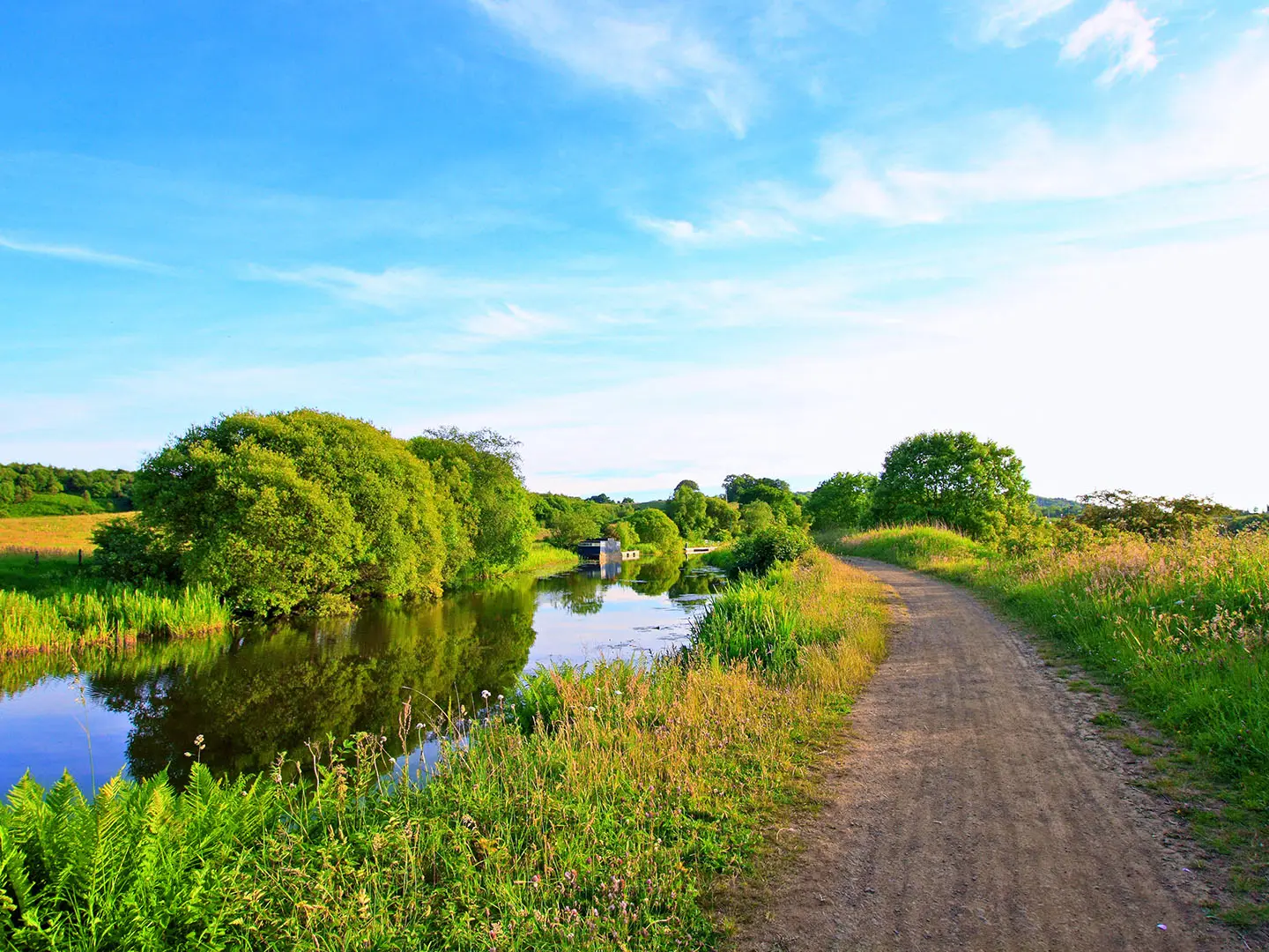
The walking is technically easy: near-level towpath, no meaningful altitude, and frequent towns for food, accommodation and transport. The main challenge is distance — about 28 km per day if completed over a weekend. Expect urban and industrial sections as well as open countryside, and take waterproofs: central Scotland has high rainfall. Surfaces are generally good but can become muddy or slippery after prolonged rain.
HikeList Score
The Forth and Clyde Canal Path scored 73/100 on HikeList's trail-quality metrics.
See score breakdownHide breakdown
- Ideal length 63
- Balanced challenge 50
- Scenery & wildness 59
- Varied terrain 94
- Accommodation 100
- Food & support 88
- Path quality 80
- Season flexibility 89
Computed from length, challenge, scenery & wildness, terrain variety, accommodation, food & support, path quality and season flexibility.
 United Kingdom
 Scotland
Show more data Show less
- Urban
- Industrial
- Wetlands
- Meadows
- Countryside
- Canal Towpath
- Paved
- Gravel
- Firm Aggregate
- Hotels
- Guesthouses
- Hostels
- Campsites
- Wheelchair Accessible
- Stroller Accessible
- Family Friendly
- Pet Friendly
- Restrooms
- Water Sources
- Campsites
- Picnic Areas
Photos from hikers
Taken on the trail by people who've reviewed The Forth and Clyde Canal Path.
Start at the eastern terminus near Grangemouth and follow the towpath west through the Falkirk/Camelon area, then on via Bonnybridge and Banknock to the Auchinstarry basin near Kilsyth. This is the natural midpoint, with nearby Croy station useful for access or exit.
Continue west through Kirkintilloch and Bishopbriggs, then through Glasgow’s northern edge at Maryhill and Stockingfield Junction. The final stretch passes Clydebank and Old Kilpatrick before reaching Bowling Basin at the western terminus on the Clyde.
Reviews
How would you rate The Forth and Clyde Canal Path?
Tap a star to start your review — you could be the first.