Tegernsee to Schliersee Trail
How would you rate Tegernsee to Schliersee Trail?
Tap a star to share your experience and help other hikers.
Tegernsee to Schliersee Trail: Prinzenweg Hiking Guide
HikeList Score
Tegernsee to Schliersee Trail scored 81/100 on HikeList's trail-quality metrics.
See score breakdownHide breakdown
- Ideal length 55
- Balanced challenge 100
- Scenery & wildness 98
- Varied terrain 71
- Accommodation 66
- Food & support 81
- Path quality 98
- Season flexibility 89
Computed from length, challenge, scenery & wildness, terrain variety, accommodation, food & support, path quality and season flexibility.
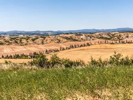
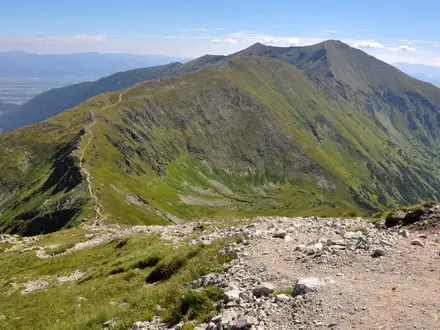
The Tegernsee to Schliersee Trail is a 14.5 km point-to-point day hike in the Bavarian Prealps of Upper Bavaria, Germany. Also known as the Prinzenweg, it links two lake towns via forest climbs, alpine pasture and the Gindelalmschneid ridge. With about 620 m of ascent, rocky/rooty sections and some sure-footing needed, it is best treated as a moderate walk. It suits fit day hikers who want a scenic, rail-friendly crossing rather than a multi-day hut trek.
Route Overview
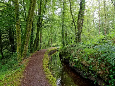
Most hikers start at Tegernsee railway station, climb through forest to Berggasthof Neureuth, continue past Kreuzbergalm and cross the Gindelalmschneid, the 1,335 m high point, before descending via Gindelalm to Schliersee. The route is linear but easy to organise because both Tegernsee and Schliersee are served by rail; it is also commonly walked in reverse. Underfoot it is mostly forest track, gravel and natural path, with short asphalt sections at the valley ends. For longer German waymarked trails, compare the Goldsteig or the Altmühltal Panorama Trail.
History of the Prinzenweg
The trail is the historic Prinzenweg, or “Prince’s Way”. After the Wittelsbachs acquired the dissolved Tegernsee Abbey in 1817 under King Maximilian I Joseph, a connecting path was used between the family’s residences at Tegernsee and Schliersee. It took its name from Prince Carl/Karl von Bayern, who was well regarded in the Tegernsee valley. The way also forms part of the European long-distance path E4 and largely follows the Maximiliansweg, linked to King Maximilian II’s 1858 journey through the Bavarian Alps.
Notable highlights
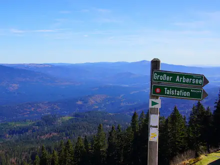
- Gindelalmschneid (1,335 m): The grassy ridge summit is the high point of the walk and the main panorama, with views over Tegernsee, Schliersee, Wendelstein and the Bavarian Prealps.
- Berggasthof Neureuth (~1,263 m): A year-round mountain inn above Tegernsee, reached after the forest climb from the lake and useful for a first major rest stop.
- Gindelalm (~1,242 m): A seasonal working alpine pasture below the summit, with rustic huts and classic Bavarian food such as Kaiserschmarrn.
- Kreuzbergalm (~1,223 m): A seasonal hut on the Schliersee side of the ridge, often used as a pause point with views towards the Schliersee basin.
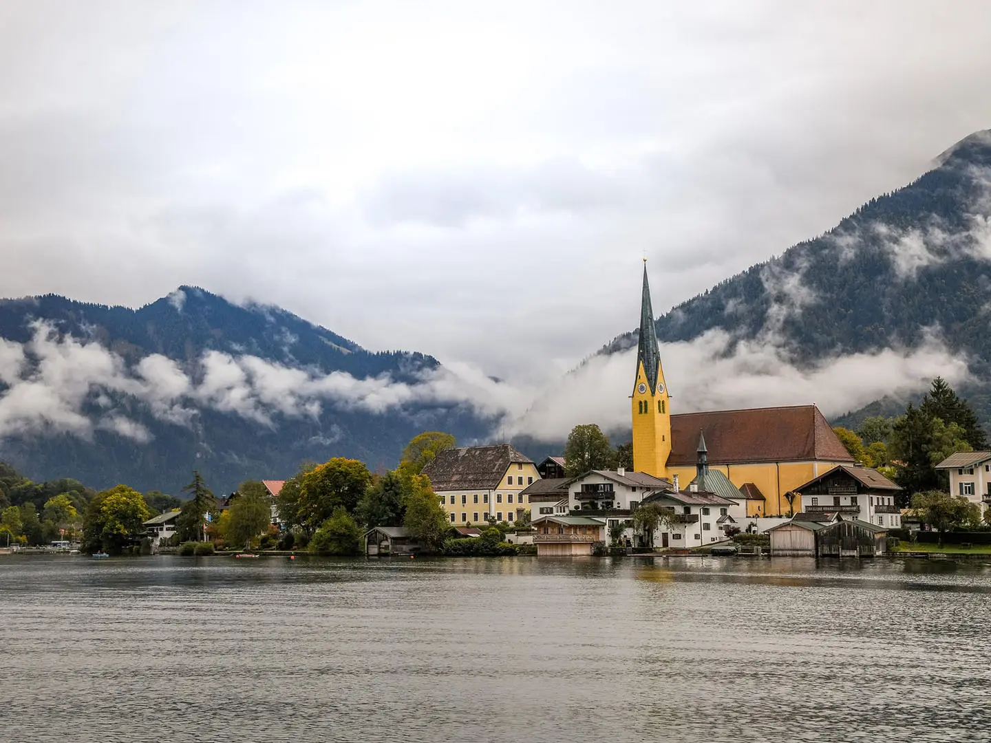
- Tegernsee: The lake town at one end of the trail, known for the former Benedictine Tegernsee Abbey, later converted into Tegernsee Castle.
- Schliersee: The smaller lake town at the other terminus, with a lakeside promenade and bathing areas for an easy finish.
Challenges to expect
The trail is not technically hard, but it is not flat: expect about 620 m of ascent and a descent of around 680 m. Forest tracks can be steady and sustained, while the ridge has rougher, rooty or rocky sections where sure-footing helps. Hut opening is seasonal except at Neureuth, so carry water and food outside the main May–October period. In wet or winter conditions, footing can be less straightforward.
HikeList Score
Tegernsee to Schliersee Trail scored 81/100 on HikeList's trail-quality metrics.
See score breakdownHide breakdown
- Ideal length 55
- Balanced challenge 100
- Scenery & wildness 98
- Varied terrain 71
- Accommodation 66
- Food & support 81
- Path quality 98
- Season flexibility 89
Computed from length, challenge, scenery & wildness, terrain variety, accommodation, food & support, path quality and season flexibility.
Show more data Show less
- Mountainous
- Forest
- Dirt
- Gravel
- Rocky
- Hotels
- Huts
- Family Friendly
- Pet Friendly
- Restrooms
- Water Sources
- Picnic Areas
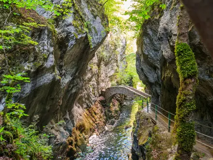
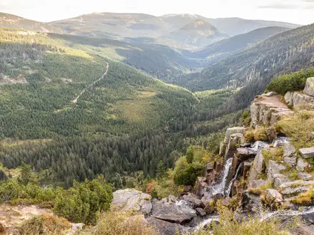
Photos from hikers
Taken on the trail by people who've reviewed Tegernsee to Schliersee Trail.
Reviews
How would you rate Tegernsee to Schliersee Trail?
Tap a star to start your review — you could be the first.