Semois Valley Trail
How would you rate Semois Valley Trail?
Tap a star to share your experience and help other hikers.
Semois Valley Trail: GR16 Through the Ardennes
HikeList Score
Semois Valley Trail scored 87/100 on HikeList's trail-quality metrics.
See score breakdownHide breakdown
- Ideal length 92
- Balanced challenge 84
- Scenery & wildness 98
- Varied terrain 83
- Accommodation 66
- Food & support 88
- Path quality 98
- Season flexibility 89
Computed from length, challenge, scenery & wildness, terrain variety, accommodation, food & support, path quality and season flexibility.
The Semois Valley Trail is the GR 16 – Sentier de la Semois, a 209 km point-to-point GR route in Belgium with a short final stretch in France. It runs from Arlon, near the source of the Semois, to Montherme, where the river meets the Meuse. Allow 10-12 days and treat it as a hard walk: around 4,400 m of cumulative ascent, repeated valley-to-ridge climbs, forest tracks, river paths and rocky belvedere sections. It suits fit hikers wanting an inn-to-inn Ardennes thru-hike rather than a Bouillon loop.
Route Overview
Walk generally downstream from Arlon through the Gaume and into the wooded Ardennes of the Semois valley: Etalle, Tintigny, Jamoigne, Chiny, Florenville and Chassepierre, Herbeumont, Bertrix, Dohan, Bouillon, Botassart, Rochehaut, Frahan, Vresse-sur-Semois, Membre, Bohan and Les Hautes-Rivieres before finishing at Montherme in France. This is a point-to-point route, so plan separate arrival and departure logistics rather than a return to Bouillon. The trail is marked with standard white-over-red GR flashes, with 11 signed variants offering riverbank or ridge-line options. Do not confuse it with the separate GR 126 Semois & Meuse Rivers; for other Wallonia walking ideas, compare the Abbey Trail of Wallonia or the Ardennes-focused Battle of the Bulge Trail.
Semois Valley history
The Semois shaped settlement and defence in this part of the Ardennes, carving tight meanders and rocky spurs such as the site of Bouillon Castle, linked with Godfrey of Bouillon before the First Crusade in 1096. The valley slopes were also associated with tobacco and small-scale farming. The GR16 itself is a modern Belgian GR route maintained by GR Sentiers, designed to follow the river from near its source at Arlon to its confluence with the Meuse at Montherme. In 2023, much of the Belgian valley became the Vallee de la Semois National Park.
Notable highlights
- Bouillon and its castle: A major mid-route stop on a tight Semois meander. Chateau de Bouillon is a large medieval fortress on a rocky spur, historically linked to Godfrey of Bouillon.
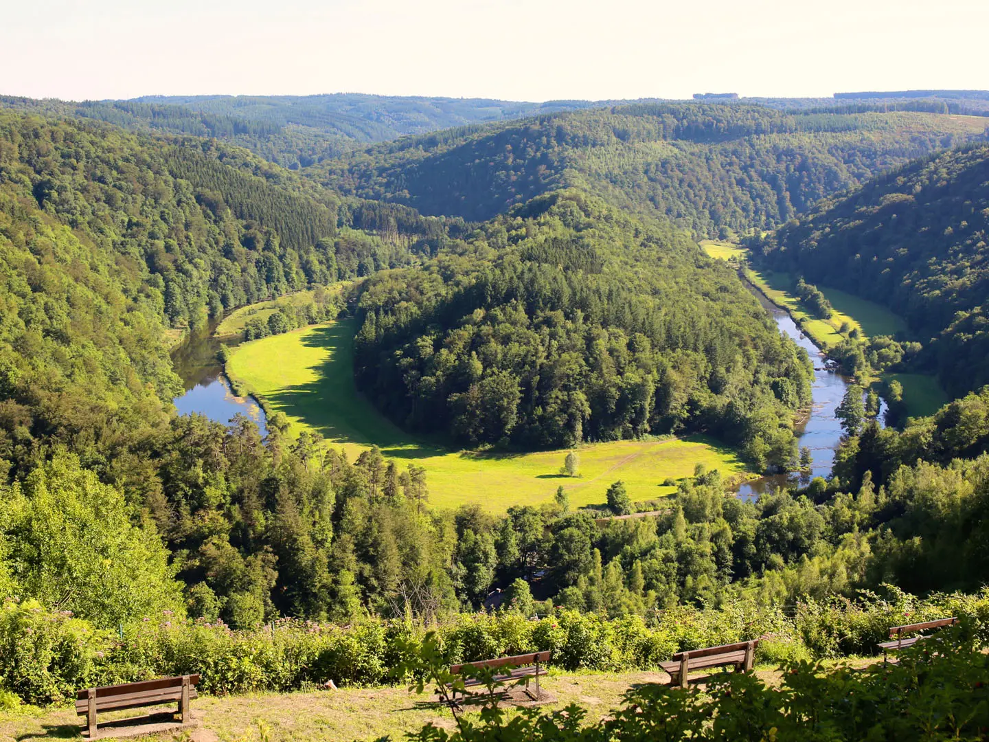
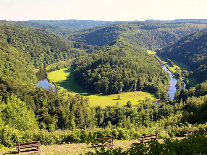
- Tombeau du Geant, Botassart: A celebrated viewpoint outside Bouillon over a wooded horseshoe bend of the Semois. It is one of the valley’s classic panorama stops.
- Rochehaut and Frahan: Rochehaut sits above a sharp river bend with a famous view down to the hamlet of Frahan. The steep Echelles de Rochehaut ladders add a more exposed descent from ridge to valley.
- Vallee de la Semois National Park: Much of the Belgian section runs through this forested national park, operational from 2023. It protects the deep meanders, tributaries and Ardennes woodland that define the GR16.
- Florenville and the Gaume: The eastern part of the route crosses the Gaume around Florenville and Chassepierre. Florenville’s church tower gives a broad view over the upper Semois plain.
- Montherme and the Meuse confluence: The French finish lies where the Semois, known as the Semoy in France, joins the Meuse. Steep wooded ridges and viewpoints such as Roc la Tour frame the end of the walk.
Challenges to expect
The GR16 is hard because of cumulative effort, not technical altitude: about 4,400 m of ascent over rolling river-valley and ridge terrain. Expect repeated climbs to belvederes, muddy forest and valley paths after rain, rocky sections such as Rochehaut, and changeable Ardennes weather with mist over the river. Waymarking is standard GR white-over-red, but carry a map or GPS in dense forest. Accommodation is village-based; there are no purpose-built trail huts.
HikeList Score
Semois Valley Trail scored 87/100 on HikeList's trail-quality metrics.
See score breakdownHide breakdown
- Ideal length 92
- Balanced challenge 84
- Scenery & wildness 98
- Varied terrain 83
- Accommodation 66
- Food & support 88
- Path quality 98
- Season flexibility 89
Computed from length, challenge, scenery & wildness, terrain variety, accommodation, food & support, path quality and season flexibility.
 Belgium
Show more data Show less
- Forest
- River Valley
- Hills
- Dirt
- Rocky
- Gravel
- Hotels
- Campsites
- Family Friendly
- Pet Friendly
- Restrooms
- Water Sources
- Campsites
- Picnic Areas
Download Our Full Guide to Semois Valley Trail FREE!
Get our comprehensive guide to this hike for free. Save it for later reading or print out at home.

Photos from hikers
Taken on the trail by people who've reviewed Semois Valley Trail.
Semois Valley Trail: The Complete Guide
 i
Image by cromary
i
Image by cromary The Semois Valley Trail is Belgium’s classic long river walk: a 209 km GR route from Arlon, near the source of the Semois, to Monthermé in France, where the Semoy meets the Meuse. It suits experienced walkers who want a full inn-to-inn traverse through the Gaume and the wooded Ardennes rather than a short Bouillon day walk.
The route follows GR 16 white-over-red waymarks through farmland, forest, riverbank paths, quiet lanes and old railway greenways. Its best-known moments come where the river tightens into deep meanders: Bouillon, Tombeau du Géant, Rochehaut, Frahan and the lower valley towards Monthermé.
This is not a high mountain route, with a modest high point of 447 m at Heinsch, but it is still a hard walk. The effort comes from roughly 4,400 m of cumulative ascent, repeated climbs from valley to ridge, long wooded sections, muddy ground after rain and the exposed Rochehaut ladders, which should only be tackled in dry conditions.
Planning matters because the trail is village-based, with hotels, guesthouses, gîtes and campsites rather than trail huts. Bouillon is the main mid-route hub, but some stretches are thinner for beds and services, and the cross-border finish means transport needs arranging separately at Arlon and Monthermé.
This guide covers stages, daily planning, accommodation, food, transport, terrain and the common mistakes to avoid.
Stage-by-Stage Guide
The stages below use a practical 10-day inn-to-inn schedule. Distances are approximate: the GR 16 has signed variants, and the exact line can change slightly depending on whether you take ridge-line or riverbank alternatives.
Carry enough food and water for each day unless you have checked services in the villages ahead. The Semois is a constant companion, but river water should not be treated as a guaranteed drinking source without purification.
Stage 1: Arlon to Etalle — approx. 21 km
This opening stage leaves Arlon from near the source of the Semois, with a marked variant linking the source area to Arlon centre. Expect an urban edge at the start, then a gradual shift into the upper Gaume landscape of farmland, lanes and village paths through places such as Viville, Lottert and Fouches.
The route is not high, but the trail’s highest point is reached early in the upper section near Heinsch at 447 m. That makes this a useful reminder of the GR 16’s character: modest altitude, but a steady accumulation of distance and small climbs.
Underfoot, this is generally easier than the later Ardennes stages, with more quiet lanes, tracks and field-edge walking than rocky forest path. After rain, lower paths and farm tracks can still be muddy, so waterproof footwear is sensible from the first day.
Arlon is the best place to start with supplies, and it has a railway station on the Belgian network. Do not rely on finding reliable food or water between the smaller villages unless this has been checked in advance; Etalle should be treated as the next proper planning point.
Accommodation at Etalle or nearby should be booked ahead rather than assumed on arrival. Public transport and road access away from Arlon become more local and less flexible, so any plan to join or leave at Etalle should be checked before travelling.
Navigation is usually straightforward on the white-over-red GR flashes, but pay attention leaving Arlon because of the source/centre variant. If starting from the railway station rather than the source, allow time to connect cleanly with the GR line.
Stage 2: Etalle to Florenville — approx. 28 km
This is one of the longest days in the standard 10-stage schedule and should not be underestimated. The route continues through the upper Semois plain and Gaume countryside, passing Fratin, Breuvanne, Jamoigne and Moyen before reaching Florenville.
Terrain is mixed: quiet lanes, tracks, river-valley paths and sections through settled farmland. It is generally less rugged than the middle Ardennes section, but the distance makes pacing important, especially in wet or warm weather.
Florenville is the main objective of the day and a more useful overnight stop than the smaller settlements before it. The town is also one of the upper-valley highlights, with broad views over the Semois plain from around the church tower area.
Food and water should be planned conservatively. The villages on the line are useful for orientation and possible stops, but walkers should carry a full day’s provisions unless opening times and services have been checked.
Accommodation in Florenville should be arranged before walking, especially in busy periods. Road access exists along this more settled upper section, but local bus options and onward connections should be checked before relying on them.
The main navigation risk is complacency: the walking feels less remote than later stages, but a 28 km day leaves little margin for delays. Keep to the GR markings through village exits and field-track junctions, where wrong turns can add unwanted distance.
Stage 3: Florenville to Herbeumont — approx. 18 km
This stage begins the transition from the open Gaume into the more enclosed, wooded Ardennes character that defines much of the route. From Florenville the GR passes Chassepierre and Sainte-Cécile before reaching the Herbeumont area.
Chassepierre is one of the notable upper Semois villages, sitting close to the river and giving the day a more intimate valley feel after the broader plains around Florenville. Beyond Sainte-Cécile, expect more woodland, more enclosed paths and a stronger sense of entering the Ardennes.
The stage is shorter than the previous day, but the terrain becomes more varied. Dirt paths, gravel tracks and river-valley sections can be slippery after rain, and the forested parts can feel colder and damper in misty weather.
Near Herbeumont, the route is associated with the old railway greenway known as the voie des pierres qui parlent. The Roche aux Corbeaux viewpoint over a cut-off meander is nearby and is one of the key landscape features of this part of the valley.
Food and water should be filled in Florenville before departure. Do not assume full services in Chassepierre, Sainte-Cécile or at the Herbeumont end without checking; accommodation providers may be the most reliable source of evening meals in smaller places.
Accommodation at or near Herbeumont should be booked in advance. Public transport options in this part of the valley are limited compared with Arlon and Bouillon, so any stage break or bailout here should be planned rather than improvised.
Navigation is mostly on the GR 16 waymarks, but pay attention where the route uses old railway alignments, local paths and forest tracks. Signed variants can alter the feel of the day, so check the chosen line before leaving Florenville.
Stage 4: Herbeumont to Dohan — approx. 16 km
This is a compact but more typically Ardennes stage, threading wooded slopes, river bends and small valley settlements. The line passes Mortehan, Cugnon and Auby before reaching Dohan.
Expect more repeated movement between valley level and higher wooded ground. The climbs are not mountain-sized, but they become tiring because they come again and again along the meanders of the Semois.
Path conditions are more variable than in the open upper valley. Forest singletrack, dirt paths and gravel sections can all become muddy, and rocky or rooty descents need care after rain or in autumn leaf fall.
Mortehan and Cugnon provide useful intermediate landmarks, but they should not be treated as guaranteed resupply points unless services have been checked. Start the day with enough food and water to reach Dohan comfortably.
Dohan is a small overnight target, so accommodation should be secured before committing to the stage. If no bed is available at the stage end, the day may need to be adjusted around nearby villages with confirmed accommodation.
Road access exists through the valley settlements, but public transport should be checked before travelling. Navigation is mainly a matter of staying alert at forest junctions and not following local riverside paths away from the GR 16 flashes.
Stage 5: Dohan to Bouillon — approx. 16 km
This stage leads into the main mid-route hub of Bouillon. It remains a river-and-forest walk, with the route passing near Bertrix before dropping towards the tight Semois meander dominated by the Château de Bouillon.
The walking is not long, but it can still be slow in wet conditions. Expect a mixture of forest tracks, dirt paths, river-valley walking and some quiet lanes on the approach to town.
Bouillon is one of the major landmarks of the entire GR 16. The medieval fortress stands on a rocky spur above the river and makes the town the most obvious place on the route for a restock, rest day or itinerary reset.
Start from Dohan with enough food and water for the day, as intermediate services should not be assumed. Bouillon is the best supplied place on the trail after Arlon and is the safest mid-route point for food, accommodation and practical errands.
Accommodation in Bouillon is more plentiful than in the smaller villages, but it still needs booking ahead in summer and at busy times. Bouillon has no railway station; it is reached by bus, including connections from the wider Belgian rail network via places such as Libramont. Current bus times should be checked before travelling.
Navigation into Bouillon is important because town approaches often include side paths, local walks and road crossings. Follow the GR markings rather than simply aiming for the castle or riverfront, especially if staying off the exact trail line.
Stage 6: Bouillon to Rochehaut — approx. 15 km
This is one of the signature landscape stages of the Semois Valley Trail. From Bouillon the route climbs out towards Botassart and the Tombeau du Géant, the celebrated viewpoint over a wooded horseshoe bend of the Semois.
The day is short on paper, but it includes the kind of valley-to-ridge climbing that gives the GR 16 its cumulative difficulty. Expect forest paths, rocky viewpoints and sections where the route repeatedly leaves and returns towards the river landscape.
Botassart and the Tombeau du Géant are the main highlights before Rochehaut. In clear weather this is one of the best belvedere sections of the whole route; in mist or heavy rain, allow extra time and do not rush descents on wet rock or mud.
Bouillon is the place to stock up before leaving. Do not rely on services at Botassart without checking; Rochehaut is the next overnight target and should be planned as such.
Accommodation in Rochehaut should be booked ahead, particularly because it is a popular viewpoint village above the Semois. Public transport is less straightforward than in Bouillon, so road or bus access at Rochehaut should be checked before building a section-hike around it.
The GR 16 has variants in this part of the valley, and the choice between ridge-line and riverbank options affects both effort and exposure. If continuing beyond Rochehaut the same day, check the Rochehaut ladder section before committing, as it should only be tackled in dry conditions.
Stage 7: Rochehaut to Vresse-sur-Semois — approx. 16 km
This is the most exposed and hands-on stage in the standard schedule if the main GR line via the Échelles de Rochehaut is used. The route descends between Rochehaut and the valley using fixed metal ladders on steep rock before reaching the meander hamlet of Frahan.
The ladders are a genuine route decision, not a novelty to take lightly. They should only be used in dry conditions and are unsuitable for walkers uncomfortable with heights; a riverbank variant exists and is the sensible choice in wet weather or for anyone carrying a heavy pack who does not want exposure.
Frahan is one of the classic Semois views from above and an atmospheric valley stop once reached. The stage then continues through or near Alle and Mouzaive, with a signed variant through Membre before the Vresse-sur-Semois area.
Terrain alternates between rocky descent, riverside walking, wooded paths and village links. Even after the ladders, the day remains active rather than easy, with mud and slippery tree-rooted paths possible after rain.
Food and water planning should be conservative. Rochehaut, Frahan, Alle, Mouzaive, Membre and Vresse-sur-Semois are useful place names for staging, but services should be checked rather than assumed, especially outside the main season.
Accommodation in or near Vresse-sur-Semois should be booked ahead. This Bouillon–Vresse stretch is among the better supplied parts of the route, but demand can still be high in summer.
Navigation deserves particular attention at the start of the day. Decide before leaving Rochehaut whether to take the ladder route or the safer riverbank alternative, then follow the relevant waymarks carefully through the descent and valley settlements.
Stage 8: Vresse-sur-Semois to Bohan — approx. 14 km
This shorter stage continues down the wooded Semois valley towards Bohan. It is useful as a slightly easier day after the Rochehaut section, but the walking still includes forest paths, riverbank sections and the repeated undulation typical of the lower Belgian valley.
The stage is more about steady progress through the Ardennes landscape than major towns. Expect damp woodland, shaded tracks and occasional quiet lanes, with mud and slippery surfaces likely after rain.
Views come from the rhythm of the valley rather than one single set-piece landmark. In clear conditions, the best moments are often where the path gains enough height to look back over the river bends before dropping again.
Fill water and carry food from Vresse-sur-Semois unless current services at intermediate points have been checked. Bohan should be treated as the next reliable overnight planning point, not as a place to arrive without arrangements.
Accommodation at Bohan can be limited compared with Bouillon or larger towns, so book ahead and check meal options. Road access is possible, but any public transport connection should be checked before travelling.
Navigation is generally simpler than the previous stage, but do not relax in forest junctions or where local walking routes share the valley. In misty Ardennes weather, a map or offline route line is a useful backup to the white-over-red flashes.
Stage 9: Bohan to Thilay — approx. 13 km
This stage crosses from Belgium into France, where the Semois becomes the Semoy. The route passes Failloué before reaching Thilay in the French Ardennes.
The distance is modest, but the day still has the feel of a through-hike stage rather than a simple riverside stroll. Expect wooded valley walking, small settlements and paths that can be muddy or greasy after rain.
The border itself is not the difficulty; the practical change is logistical. Accommodation, transport information and local services now need to be checked on the French side as well as the Belgian side, particularly if section-hiking or arranging a pickup.
Bohan is the sensible place to start with enough food and water for the day. Do not rely on finding supplies at Failloué unless this has been checked before setting off.
Accommodation at Thilay should be booked before arrival. Public transport in this cross-border section should not be assumed; any bus, taxi or road transfer plan should be checked before travelling.
Navigation remains on the long-distance route, but place names, mapping labels and the river name change to French usage. Make sure the map or GPS file covers the Belgian–French transition cleanly and does not stop at the border.
Stage 10: Thilay to Monthermé — approx. 13 km
The final stage follows the lower Semoy valley towards Monthermé, passing Tournavaux before the finish near the former Laval-Dieu abbey. The route ends at the La Racine site, just upstream of where the Semoy meets the Meuse.
This is a short final day, but it still deserves normal walking attention. The lower valley is wooded and enclosed, with river paths, tracks and possible slippery sections in wet weather.
The approach to Monthermé brings the trail into the Meuse landscape, with the Semoy meeting the larger river below the finish area. The confluence lies about 200 m below the bridge, so allow a little extra time if you want to visit the exact meeting of the waters after completing the GR line.
The rapids of Phades and the steep wooded ridges around the lower valley give the final kilometres a different character from the upper Semois. Viewpoints such as Roc la Tour are part of the wider Monthermé landscape, though any detour should be planned separately from the stage distance.
Start from Thilay with food and water unless current services in Tournavaux have been checked. Monthermé is the practical endpoint for accommodation, onward travel and post-walk logistics.
Monthermé is on the SNCF TER line up the Meuse valley from Charleville-Mézières, which is the main rail gateway at the French end. Train times should be checked before booking onward travel, especially if finishing late in the day.
Navigation at the finish is worth checking in advance: the trail finishes at La Racine beside the former Laval-Dieu abbey, not simply at the first point where the town or railway is reached. Keep the French spelling Semoy in mind when using local signs and maps.
Recommended Itinerary
The 10-day schedule below is the cleanest inn-to-inn structure for the GR 16, using the main overnight places in the stage plan. Distances are approximate and can change with signed variants, local diversions and the exact position of accommodation, so check official mapping before booking.
Standard 10-day itinerary
| Day | From | To | Approx. distance | Why this stage makes sense | Services/accommodation notes |
|---|---|---|---|---|---|
| 1 | Arlon | Etalle | 21 km | A solid but manageable opening day from the railway-accessible start, leaving Arlon and moving into the upper Semois countryside. If staying in Arlon centre, allow time to reach the official start/marked source variant before the walking day begins. | Arlon is the easiest place to reach at the start by train. Etalle is a practical first overnight stop, but book ahead rather than assuming late availability. |
| 2 | Etalle | Florenville | 28 km | This is the longest stage in the standard plan and should be treated as a full day. It keeps the itinerary moving through the Gaume section without creating awkward extra transfers. | Start early and carry enough food and water for a long rural day. If 28 km is too much, look at breaking the stage around intermediate villages such as Jamoigne, Moyen or Chassepierre, but accommodation availability should be checked before travelling. |
| 3 | Florenville | Herbeumont | 18 km | A shorter day after the long Etalle–Florenville stage, with the route moving towards the more wooded Ardennes character of the Semois valley. | Florenville is one of the more useful upper-valley stops. Herbeumont accommodation can be limited compared with Bouillon, so reserve in advance. |
| 4 | Herbeumont | Dohan | 16 km | This stage keeps the approach to Bouillon controlled, rather than forcing a long push through to the main town. Expect more enclosed woodland and river-valley walking. | Dohan is a smaller overnight stop, so do not leave booking until arrival. Carry what is needed if shops or meal options are limited. |
| 5 | Dohan | Bouillon | 16 km | A moderate day into the main mid-route hub, giving useful time for resupply, laundry or a shorter afternoon after several consecutive walking days. | Bouillon is the best logistical reset on the trail, but it is also popular. Book early in summer and around busy weekends. |
| 6 | Bouillon | Rochehaut | 15 km | A short but rewarding stage through the classic meander country above Bouillon, including the Botassart/Tombeau du Géant area before reaching the Rochehaut sector. | Rochehaut is a key overnight before the more exposed rocky section. If accommodation is full, look for nearby alternatives only after checking how they fit the GR route and next day’s start. |
| 7 | Rochehaut | Vresse-sur-Semois | 16 km | This is one of the most important terrain days: the Rochehaut–Frahan area includes the fixed metal ladders and steeper rocky ground. Keep the day moderate so there is no pressure to rush exposed sections. | The Rochehaut ladders should only be tackled in dry conditions and are unsuitable for walkers uneasy with heights. A riverbank variant exists; decide based on weather and confidence, not on schedule pressure. |
| 8 | Vresse-sur-Semois | Bohan | 14 km | A shorter lower-valley stage after the Rochehaut section, keeping the final Belgian day comfortable before the border crossing. | The Bouillon–Vresse–Bohan stretch is among the better supplied parts of the route, but smaller villages still require advance accommodation planning. |
| 9 | Bohan | Thilay | 13 km | A short cross-border stage into France, where the Semois becomes the Semoy. This is sensible because services, accommodation and transport systems change after leaving Belgium. | Check opening days for accommodation and food in the French villages before committing to this stage. Carry euros in card/cash form as appropriate for small rural businesses. |
| 10 | Thilay | Monthermé | 13 km | A compact final day into Monthermé, allowing time to finish at the Semoy–Meuse confluence area and connect with onward transport. | Monthermé is on the SNCF TER line up the Meuse valley from Charleville-Mézières. Train times and any onward connections should be checked before travelling. |
Slower 11–12 day variant
A slower plan suits walkers who prefer shorter days, want more margin for wet Ardennes conditions, or are booking accommodation in smaller villages where availability may force a different split.
The most useful ways to slow the route are:
| Adjustment | Who it suits | Planning note |
|---|---|---|
| Split the Etalle–Florenville stage | Walkers who do not want a 28 km day early in the hike | Look at intermediate villages on or near the route, such as Jamoigne, Moyen or Chassepierre, but only book once the exact GR distance and accommodation availability have been checked. |
| Add a second night in Bouillon | Walkers wanting a rest, resupply and laundry stop at the main mid-route hub | This is the easiest place on the trail to build in a non-walking day. It also creates flexibility if the first half has been wet or slower than expected. |
| Build a buffer around Rochehaut | Walkers who want to avoid being forced onto the ladders in poor conditions | The Échelles de Rochehaut are weather-dependent. A buffer night in the Rochehaut/Bouillon–Vresse part of the route gives more freedom to use the dry-weather window or choose the riverbank variant. |
A 12-day version is often more comfortable than a pure 10-day push if accommodation is being booked independently and the long Etalle–Florenville day looks marginal.
Faster variant
A faster schedule is only suitable for fit, well-trained walkers carrying a light pack and happy with long cumulative days on muddy forest paths, rocky viewpoints and repeated meander climbs. It is not the best choice for a first long-distance hike in the Ardennes.
The most logical compressions are to combine two shorter stages rather than extend the already long Etalle–Florenville day:
| Compression | Approx. combined distance | Why it can work | Caution |
|---|---|---|---|
| Herbeumont to Bouillon via Dohan | 32 km | Combines two moderate stages and finishes in the main service hub of Bouillon. | Long for this terrain; start early and do not underestimate the cumulative climbing. |
| Vresse-sur-Semois to Thilay via Bohan | 27 km | Combines two shorter lower-valley days and crosses into France in one push. | Check accommodation and food options at the French end before relying on this. |
| Bohan to Monthermé via Thilay | 26 km | Creates a longer final day into the finish if Thilay accommodation is unavailable or a transport connection is preferred from Monthermé. | Only sensible if the final transport from Monthermé has been checked and there is enough daylight. |
Do not compress the Rochehaut stage in poor weather. If the ladders are wet, exposed or outside a walker’s comfort zone, the safer decision is to use the riverbank variant or slow the itinerary rather than chase a faster schedule.
Planning the Route
Allow enough days for the valley, not just the distance
Most walkers should plan the full Semois Valley Trail as a 10–12 day inn-to-inn walk. The route is not high-altitude, but the repeated climbs from river level to ridges and belvederes make the days add up, especially through the Ardennes forest sections.
A 10-day schedule is already fairly purposeful. Adding one or two extra days gives more margin for poor weather, slower forest going, accommodation availability, or a shorter day around the steeper Bouillon–Rochehaut–Frahan section.
Compressing the walk into far fewer days is only realistic for very fit, well-trained walkers using an adapted itinerary. For most independent hikers, the main risk of going too fast is not the waymarking or terrain in isolation, but cumulative fatigue combined with long days, village-based accommodation and limited flexibility in the thinner stretches.
Let accommodation dictate the stages
This is a village-to-village GR, not a hut-to-hut trail. There are hotels, guesthouses, gîtes/chambres d’hôtes and campsites in the riverside towns and villages, but no purpose-built trail huts or refuge system.
The practical planning spine is therefore built around places such as Etalle, Florenville, Herbeumont, Dohan, Bouillon, Rochehaut, Vresse-sur-Semois, Bohan, Thilay and Monthermé. Bouillon is the major mid-route hub and the Bouillon–Vresse stretch is generally the best supplied, while some inland and forest sections give fewer easy fallback options.
Book ahead, especially in summer and around Bouillon. Do not assume that every village on the map has suitable accommodation, evening food or a convenient shop; this should be checked before travelling.
Decide how to use the GR 16 variants
The GR 16 has 11 signed variants, usually giving a choice between riverbank and ridge-line options. These are useful planning tools, not just scenic extras: a ridge variant may add effort and exposure, while a riverbank option can be the more conservative choice in poor weather.
The most important decision is around Rochehaut. The Échelles de Rochehaut use fixed metal ladders on steep rock between the ridge and the valley, and should only be tackled in dry conditions by walkers comfortable with exposure. If the rock is wet, visibility is poor, or anyone in the party is uneasy with heights, use the riverbank variant instead.
Because variants affect distance, ascent and timings, daily schedules should allow a little slack. Treat the headline distance as a planning figure rather than a guarantee that every chosen line will match it exactly.
Shortening, extending and section hiking
The route can be shortened by walking only part of the valley, with Bouillon the most obvious dividing point because it is the main mid-route hub. It has no railway station, so access depends on buses, for example via Libramont station; current services should be checked before travelling.
Section hiking is practical, but it needs more transport planning than a simple linear rail trail. Arlon is straightforward for the start because it has a railway station on the Belgian network, while Monthermé is on the SNCF TER line up the Meuse valley from Charleville-Mézières. Between them, many useful access points are bus-dependent, and cross-border connections can be limited.
A sensible section-hiking approach is to split the trail into upper Semois/Gaume, middle valley around Bouillon, and lower Semois/Semoy into France. Exact start and finish points for each section should be chosen around accommodation and public transport rather than mileage alone.
What matters most when planning
| Planning issue | What to do |
|---|---|
| Accommodation | Reserve village accommodation in advance; there are no trail huts and some stretches are thin on beds. |
| Food | Plan each day around known villages, not assumptions. Check evening meals and shop availability before travelling. |
| Water | Carry enough between settlements and do not rely on every hamlet having a convenient public supply. This should be checked before travelling. |
| Navigation | Follow the GR white-over-red flashes, but carry the GR Sentiers topo-guide or reliable mapping for variants, forest junctions and bad-weather visibility. |
| Transport | Plan separate arrival and departure logistics: train to Arlon, bus links for Bouillon, and SNCF TER from Monthermé via Charleville-Mézières. |
| Weather | Expect changeable Ardennes conditions, mud after rain and mist on wooded ridges. Build in time for slower going. |
| Access rules | Much of the Belgian valley lies within the Parc National de la Vallée de la Semois; check current national-park guidance and any forest closures before travelling. |
Build in bad-weather alternatives
The Semois Valley Trail is often most demanding when the weather turns ordinary: wet forest tracks, slippery riverbank paths, misty viewpoints and slow rocky descents. A plan that only works in dry, clear conditions is too tight.
The safest itinerary includes conservative choices for the exposed sections, especially around Rochehaut, and avoids making the ladder descent a fixed obligation. If using a 10-day schedule, keep daily starts early enough that a slower, wetter day does not become a race to reach the next village before dark.
Towns, Villages and Overnight Stops
Accommodation on the GR 16 is village-based: hotels, guesthouses, gîtes/chambres d’hôtes and campsites, with no purpose-built trail huts or refuges. The Bouillon to Vresse-sur-Semois stretch is the best supplied; the upper Gaume and some forest sections are thinner, so overnight stops should be booked before committing to daily distances.
Do not assume every village on the map has food, a shop or available beds. Opening days, seasonal restaurant hours, campsite dates and local bus links can change, especially outside summer. This should be checked before travelling.
Arlon (Aarlen)
Arlon is the practical start base for the trail. The official GR 16 begins near the source of the Semois on the edge of town, with a marked variant linking the source to Arlon centre.
It is the easiest place on the route to reach by public transport at the start, as Arlon has a railway station on the Belgian network, including the Brussels/Namur–Luxembourg line. For most walkers, it is the best place to arrive the night before, buy food for the first stage and start with transport stress removed.
Accommodation and services are stronger here than in the smaller villages immediately ahead. If starting late in the day, staying in Arlon and walking out fresh is usually more sensible than trying to push on to a rural first night.
Etalle
Etalle is the first standard overnight stop on a 10-day inn-to-inn schedule, reached after the opening stage from Arlon. It sits in the upper, more open Gaume section before the route becomes increasingly wooded and enclosed along the river valley.
It is a useful place to break the long opening transition from town to countryside. Accommodation should be arranged in advance rather than treated as guaranteed on arrival.
Food and shop options should also be checked before the day starts. If there is no reliable evening meal at the accommodation, carry enough from Arlon or from any confirmed services en route.
Florenville
Florenville is one of the more important upper-valley stops and a natural overnight after the Etalle stage. It is a good place to reset before the route turns towards Chassepierre, Sainte-Cécile and the more wooded approaches to Herbeumont.
As an upper-valley town, it is a better candidate than the smaller villages nearby for accommodation, food and basic resupply. Even so, booking ahead remains important, particularly in peak walking periods.
Hikers may want to allow time here because Florenville is one of the main places in the Gaume section and has a broad outlook over the upper Semois plain from around the church tower. It also sits close to Chassepierre, one of the notable riverside villages on the next part of the route.
Herbeumont
Herbeumont is the usual overnight target after Florenville, although the route is described as passing near Herbeumont rather than simply threading a continuous line of town centres. Check the exact location of accommodation against the GR 16 line before booking, as a bed that looks close on a map may still involve an extra climb or road walk.
This is an important planning stop because accommodation becomes more dependent on individual villages and pre-booked gîtes or chambres d’hôtes. Do not rely on being able to improvise late in the day.
The nearby old railway greenway, the “voie des pierres qui parlent”, is one of the more distinctive route features around Herbeumont. It is also a useful psychological marker: from here onwards the walk feels more like a sustained Ardennes river-and-forest traverse than an upper-valley approach.
Dohan
Dohan is a small riverside stop before Bouillon and works well as an overnight on the standard schedule. It keeps the Herbeumont–Bouillon section manageable by avoiding an overlong push through the wooded Semois bends.
Because Dohan is not a major service hub, accommodation and evening food should be fixed before arrival. Carry enough daytime food from the previous stop unless current services have been checked.
Stopping here also gives a shorter following day into Bouillon, which is useful if using Bouillon for a rest, resupply or transport connection.
Bouillon
Bouillon is the main mid-route hub and one of the most important booking points on the entire GR 16. It sits on a tight Semois meander and is dominated by the Château de Bouillon, making it both a practical base and one of the route’s major stops.
This is the best place on the trail to plan a rest, catch up on food, replace small items and reorganise luggage. Accommodation is better supplied than in the smaller villages, but demand is also higher, especially in summer and around weekends, so book early.
Bouillon has no railway station. Access is by bus, for example from Libramont station, and any bus connection should be checked before relying on it. It is the most logical mid-route access or exit point, but it still requires coordination between rail and local bus timetables.
For walkers using baggage transfer or splitting the route into sections, Bouillon is the obvious hinge point. It also marks the start of the best-supplied part of the valley, continuing towards Rochehaut, Alle and Vresse-sur-Semois.
Botassart and Tombeau du Géant
Botassart is just outside Bouillon and is chiefly important for the Tombeau du Géant viewpoint over a wooded horseshoe bend of the Semois. It is a place to plan time for, not necessarily a default overnight anchor.
Accommodation or food in the immediate village should not be assumed unless booked. Many walkers will treat Botassart as part of the Bouillon–Rochehaut day, using Bouillon or Rochehaut as the stronger overnight base.
The viewpoint is one of the classic reasons to avoid rushing this section. In poor visibility it may be less rewarding, but it still affects timing because the route repeatedly climbs away from and drops back towards the river.
Rochehaut
Rochehaut is a key overnight stop above the Semois and a logical end to the Bouillon stage. It is best known for the view down to Frahan and for the Échelles de Rochehaut, the fixed metal ladders used by the GR 16 on the steep rocks between ridge and river.
Book accommodation ahead, particularly in dry summer spells when this area is busy. Food availability should be checked with the accommodation or village services, as a late arrival after the ladder section is not the time to discover limited evening options.
The ladders should only be tackled in dry conditions and are unsuitable for walkers uneasy with heights. A riverbank variant exists, so Rochehaut is also a sensible point to decide which line to take depending on weather, confidence and pack weight.
Frahan
Frahan is the small hamlet below Rochehaut in the river meander, notable for its old tobacco-drying sheds and its position beneath the famous viewpoint. It is an important trail landmark rather than a guaranteed service stop.
Use Frahan for orientation and pacing on the Rochehaut section, but do not rely on it for food or beds unless arrangements are already in place. The steep terrain around Rochehaut means “nearby” places can still feel slow to reach with a full pack.
Alle and Mouzaive
Alle and Mouzaive sit on the Bouillon–Vresse-sur-Semois stretch, one of the better supplied parts of the valley. They can be useful for adjusting stage length between Rochehaut and Vresse-sur-Semois, especially if the planned overnight in Vresse is full or if a shorter day is needed.
Accommodation and food should still be booked or checked rather than assumed. These villages are more useful when treated as planned stops, not emergency fallbacks.
This part of the route is attractive for walkers who want the river close by for longer stretches, but the day is still shaped by climbs, river crossings and route variants rather than by a flat towpath-style walk.
Vresse-sur-Semois
Vresse-sur-Semois is the standard overnight target after Rochehaut on the sample schedule, although the route is described as passing near it. Check the exact accommodation location against the GR 16 and allow for any extra approach from the trail.
It is one of the more useful lower-valley bases and sits within the better supplied Bouillon–Vresse stretch. That makes it a good place to secure a bed before the quieter run towards Bohan and the French border.
If using local transport to join or leave the trail around here, current bus options should be checked before travelling. Do not plan a tight connection without verifying the timetable for the exact date.
Bohan
Bohan is the final Belgian overnight on the standard itinerary before the route crosses into France. It is a practical place to pause before the shorter but more cross-border stages to Thilay and Monthermé.
Book accommodation ahead and check food options carefully. Once beyond the better supplied central Semois villages, the margin for improvisation narrows.
This is also a useful point to make sure French-side logistics are in order. The river becomes the Semoy in France, and onward accommodation and transport should be planned with the French place names and timetables.
Thilay
Thilay is the first French overnight stop on the standard schedule, after the route has crossed into the French Ardennes. It sits on the Semoy side of the trail before the final stage towards Tournavaux and Monthermé.
It is a sensible final-night stop because it keeps the walk into Monthermé short enough to connect with onward rail, provided the timetable allows. Accommodation and evening food should be booked in advance.
There is no need to change currency, as both Belgium and France use the euro. The practical change is logistical: public transport, opening hours and local information are now French-side, so check details separately from the Belgian stages.
Monthermé
Monthermé is the finish town, where the trail ends at the “La Racine” site beside the former Laval-Dieu abbey, just upstream of where the Semoy meets the Meuse. The confluence is about 200 m below the bridge.
It is the best place to plan the final night if onward travel would make the last day rushed. It also gives a buffer if the final approach is slower than expected because of weather, muddy forest paths or time spent around the Meuse confluence.
Monthermé is on the SNCF TER line up the Meuse valley from Charleville-Mézières, which is the main rail gateway at the French end. Check the current TER timetable before fixing the final walking day, especially for weekends, public holidays or onward international connections.
Smaller intermediate villages and near-route places
Several villages and hamlets are important for route-finding, breaks and flexible pacing, but should not be treated as guaranteed overnight stops unless accommodation has been booked. Many are small, and services may be seasonal or absent.
| Place | Where it fits | Practical use |
|---|---|---|
| Viville, Lottert and Fouches | Between Arlon and Etalle | Useful early waypoints on the first stage; do not rely on services unless checked. |
| Fratin, Breuvanne, Jamoigne and Moyen | Between Etalle and Florenville | Potential break points on a longer second stage; carry enough food for the day unless current facilities are known. |
| Chassepierre and Sainte-Cécile | Between Florenville and Herbeumont | Chassepierre is a notable artists’ village on the river; both are useful pacing markers before the Herbeumont area. |
| Mortehan, Cugnon and Auby | Between Herbeumont and Dohan | Small route villages on a quieter section; good for orientation, but overnight plans should be pre-arranged. |
| Bertrix (near) | Near the Dohan/Bouillon part of the route | A near-route place rather than a simple on-trail stop; check the exact access before using it for accommodation or transport. |
| Membre | On a signed variant | Only relevant if taking the variant line; check that the chosen route and accommodation match. |
| Failloué | Between Bohan and Thilay | A useful marker on the cross-border approach; services should not be assumed. |
| Tournavaux | Between Thilay and Monthermé | A final-stage village before Monthermé; useful for pacing, with onward rail planned from Monthermé rather than here. |
Getting to the Start
By train
Arlon is the practical access point for the start of the Semois Valley Trail. It has a railway station on the Belgian network, on the Brussels/Namur–Luxembourg line, so the start is much easier to reach by public transport than many of the later riverside villages.
The official start is near the source of the Semois on the edge of Arlon. A marked variant links the source area with Arlon centre, where the GR 16 white-over-red waymarks lead out of town. Allow time on arrival to get from the station or accommodation to the marked route rather than assuming the first kilometre begins directly on the platform.
Train times and connections should be checked before travelling, especially for weekend, evening or public-holiday arrivals. If starting the same day as arrival, build in enough margin for delays; the first stage to Etalle is a full walking day rather than a short warm-up.
By bus
A bus is usually not needed to reach Arlon itself, because the town has a railway station. Local buses may be useful if staying outside the centre or if arranging a customised start from accommodation on the edge of town, but routes and frequencies can change. This should be checked before travelling.
For section-hikers, do not assume the same level of access elsewhere on the route. Bouillon, the main mid-route hub, has no railway station and is reached by bus, for example from Libramont station; that matters if joining or leaving the GR 16 part-way rather than starting in Arlon.
By car
Driving to Arlon is straightforward in principle, but it creates the main logistical problem of the whole route: the Semois Valley Trail is a point-to-point walk finishing in Monthermé in France, not a loop back to Arlon. Leaving a car at the start means arranging a cross-border return from the French finish.
Monthermé is on the SNCF TER line up the Meuse valley from Charleville-Mézières, which is the main rail gateway at the French end. Any plan to return from Monthermé to Arlon by public transport will involve separate French and Belgian transport legs and should be checked carefully before relying on it.
Do not assume long-stay parking is available at the start without checking. If driving, ask accommodation in Arlon about parking for the duration of the hike, or make a separate long-stay parking plan before booking the first night. This should be checked before travelling.
Taxis can be useful for short local transfers between Arlon station, accommodation and the trailhead area, especially for early starts or late arrivals. They should be booked in advance rather than treated as a guaranteed walk-up option.
From the nearest airport
For international arrivals, choose an airport with a simple onward rail connection to the Brussels/Namur–Luxembourg corridor, then continue by train to Arlon. The key planning point is not the airport itself but the final rail connection into Arlon and the timing of the onward walk.
If arriving late in the day, staying in Arlon before starting is the safer plan. Airport-to-rail transfers, last trains and any Sunday or public-holiday reductions should all be checked before travelling.
Where to stay before starting
Arlon is the logical place to spend the night before beginning the GR 16. Staying in town gives access to the railway station, food, last-minute supplies and a straightforward start onto the marked route or the variant linking the centre with the Semois source area.
Booking a first night is sensible if arriving by train from Brussels, Namur, Luxembourg or from an airport connection. It also avoids turning the opening day to Etalle into a rushed stage after a long journey.
If arranging baggage transfer, taxis or a parked car, settle those details before leaving Arlon. Once the trail moves into the smaller villages of the upper Semois, services become less flexible than in the start town.
Getting Home from the Finish
By train
Monthermé is the practical exit point for the trail because it sits on the SNCF TER line along the Meuse valley. The main rail gateway is Charleville-Mézières, reached by TER from Monthermé, with onward rail connections from there.
The GR 16 finishes at the La Racine site beside the former Laval-Dieu abbey, just upstream of the Semois/Semoy–Meuse confluence. Allow time after the final stage to get from the trail finish into Monthermé and to the station; the exact walking route, train times and platform arrangements should be checked before travelling.
Do not assume late-evening services will suit a same-day departure. If the final stage from Thilay to Monthermé runs long, or if weather slows the approach through the lower Semoy valley, staying overnight in Monthermé is the safer plan.
By bus
Bus should be treated as a backup rather than the main finish strategy unless a specific local service has been checked in advance. This is a cross-border rural finish, and local bus timetables can be limited, especially at weekends, in the evening and outside school or commuter periods.
If planning to connect by bus from Monthermé or nearby villages, check current local timetables before fixing accommodation or onward tickets. This should be checked before travelling.
By car/taxi
A taxi can be useful for short local transfers at the finish, particularly if accommodation is away from the station or if train times do not line up with the end of the final walking day. Pre-booking is strongly advisable, as Monthermé is not a large transport hub and taxis should not be assumed to be waiting at the trail finish.
Leaving a car at Monthermé can work for hikers who arrange the start separately, but the GR 16 is a point-to-point route starting in Arlon and finishing in France. A car shuttle between the two ends is a cross-border logistical job rather than a simple local hop, so timings, parking and any taxi transfer should be arranged before setting off.
From the nearest airport
There is no airport-based finish logistics for this trail. The sensible airport strategy is to leave Monthermé by TER to Charleville-Mézières first, then continue by rail towards whichever larger city or airport matches the onward journey.
Flight connections, airport choice and through-ticketing are timetable-dependent and should be checked before booking non-refundable travel. Build in a buffer if flying the same day as finishing the hike.
Where to stay at the finish
For most independent walkers, the least stressful finish is to book a night in or near Monthermé, then take the TER out the next morning. This avoids being tied to a specific late train after ten or more days of walking and gives room for bad weather, fatigue or a slower final descent into the Meuse valley.
If accommodation in Monthermé is full or onward travel works better from the rail hub, Charleville-Mézières is the next practical target after taking the TER from Monthermé. Book ahead in summer and check the last useful train before committing to a same-day exit.
Which Direction Should You Walk?
The natural direction for the Semois Valley Trail is Arlon to Monthermé. This follows the GR 16 from near the source of the Semois on the edge of Arlon to the Semoy–Meuse confluence at Monthermé, which gives the route a clear geographical logic: source to river mouth.
Walking in reverse is entirely possible, but it feels less intuitive as a full thru-hike. It also turns the final Belgian/Gaume section into the closing act, rather than finishing at the much stronger landscape endpoint beside the Meuse.
Standard direction: Arlon to Monthermé
This is the direction that best matches the official start and finish. Arlon is straightforward to reach by rail on the Belgian network, while Monthermé has onward rail access on the SNCF TER line via Charleville-Mézières, making the end of the walk manageable without needing to return across the whole route.
The scenery also builds well in this direction. The route starts in the upper Semois country around Arlon, Etalle and Florenville, then moves into the deeper wooded Ardennes, Bouillon, the Tombeau du Géant, Rochehaut, Frahan and the lower Semoy before ending at the Meuse confluence.
The main practical drawback is that the Rochehaut ladders are normally encountered as a descent from the ridge towards the river. That can feel more exposed than climbing them, especially with a full pack. They should only be tackled in dry conditions, and walkers uneasy with height should use the riverbank variant instead.
Accommodation flow is generally workable in the standard direction, provided nights are booked around the villages with beds. The upper section has some longer planning gaps, while Bouillon and the Bouillon–Vresse-sur-Semois stretch are better supplied.
Reverse direction: Monthermé to Arlon
The reverse direction can make sense if transport, accommodation availability or personal scheduling works better that way. Starting from Monthermé is feasible by rail via Charleville-Mézières, and finishing in Arlon gives a simple Belgian rail departure.
The biggest practical advantage is that the Rochehaut ladders are likely to be taken as an ascent rather than a descent, which some walkers find less intimidating. This does not remove the exposure or the need for dry conditions, but it can make that specific section feel more controlled.
The trade-off is psychological and scenic. Instead of finishing at the Semoy–Meuse confluence, the route ends inland at Arlon near the river’s source. The final days also become the more open upper-valley stages rather than the dramatic lower Semois and French Ardennes finish.
Does direction change the difficulty?
Not significantly. The GR 16 is a river-valley route with repeated climbs from valley floor to ridge and back again, so the total ascent and effort are much the same in either direction.
There is no major pass where one direction gives a clearly easier profile. The real difficulty comes from cumulative ascent, long forest and riverbank days, mud after rain, and the exposed rocky sections around Rochehaut.
Prevailing wind is not a meaningful planning factor on this route. Weather matters mainly because Ardennes rain and mist can make forest paths slippery and the ladders unsuitable.
Recommendation
For most hikers, walk the Semois Valley Trail from Arlon to Monthermé. It follows the official source-to-confluence logic, gives the best scenic progression, starts and ends with sensible rail logistics, and finishes strongly beside the Meuse.
Choose the reverse only if accommodation or transport works better that way, or if climbing rather than descending the Rochehaut ladders is an important preference. In either direction, book village accommodation ahead and check current bus and rail links before travelling.
Accommodation Along the Route
Accommodation on the Semois Valley Trail is village-based. Expect hotels, guesthouses, gîtes/chambres d’hôtes and campsites in the towns and riverside settlements, not mountain huts or dedicated GR refuges.
This makes the GR 16 workable as an inn-to-inn hike, but only with planning. The trail repeatedly leaves the valley for wooded ridges and viewpoints, so the practical overnight options are the named villages rather than the forest sections between them.
Where accommodation is easiest
Bouillon is the main accommodation hub on the route and the best place to build in flexibility, a rest night or a shorter day. The stretch from Bouillon towards Rochehaut, Alle, Mouzaive and Vresse-sur-Semois is generally the best supplied part of the walk, with more riverside tourism infrastructure than the quieter upper and final sections.
Arlon is the logical place to stay before starting, particularly if arriving by train. Florenville is the main upper-valley stop before the route becomes more rural, while Monthermé is the practical finish point on the French side.
Where accommodation is limited
The thinner sections are the inland and forested stretches between the smaller villages, especially where the day’s endpoint is not a larger town. Places such as Etalle, Herbeumont, Dohan, Bohan and Thilay can work well as overnight stops, but should not be treated as flexible last-minute options.
If a planned village is full, the solution is usually to adjust the day length, use a nearby settlement, or arrange a taxi transfer from the trail. Do not assume that every signed village has multiple beds, food and camping available.
Booking strategy
Book ahead for the full route if walking in summer, during holidays, or around Bouillon. Friday and Saturday nights are the most likely to cause problems in the more popular Semois villages, so these should be fixed first when building an itinerary.
For a 10-day schedule, it is sensible to reserve each night before committing to daily distances. For an 11- or 12-day schedule, the same rule applies, but the extra time can make it easier to use smaller villages and avoid forced long days.
Campsites can add flexibility in the river valley, but established sites should be used. Any rules on camping, bivouacking, national-park access or temporary forest closures should be checked before travelling.
Luggage and transfers
There is no built-in hut-to-hut system on the GR 16. If walking with luggage transfer or using taxi shuttles, arrange this directly with accommodation providers or local operators before the hike.
Transfers can help if a preferred overnight stop is full or if a stage needs shortening, but they should not be relied on spontaneously in the quieter sections. Availability, costs and cross-border arrangements into France should be checked before travelling.
| Place | Accommodation level (good/limited/none) | Best for | Notes |
|---|---|---|---|
| Arlon | good | Night before the start | Best base for starting the trail, with rail access and a marked link from the centre towards the source area. |
| Etalle | limited | First-stage overnight | Works as a practical early stop, but beds should be booked before fixing the day. |
| Florenville | good | Upper-valley base | One of the stronger stops in the Gaume section and useful before the route becomes more rural. |
| Chassepierre / Sainte-Cécile | limited | Shorter-stage planning | Useful only if accommodation is arranged in advance; do not assume broad choice. |
| Herbeumont area | limited | Overnight before the middle Semois section | Check the exact location of the accommodation relative to the GR, as some options may be off the immediate line. |
| Mortehan / Cugnon / Auby / Dohan | limited | Breaking the approach to Bouillon | Small river settlements; Dohan is a practical stop on a 10-day itinerary, but advance booking matters. |
| Bouillon | good | Main rest, resupply and accommodation hub | The strongest mid-route base. Book early in summer and at weekends. |
| Botassart / Frahan | limited | Adjusted short days near the Tombeau du Géant and Rochehaut area | Scenic but small; treat as a pre-booked option rather than a fallback. |
| Rochehaut | limited | Overnight after Bouillon | A useful stage stop above the Semois; book ahead, especially if planning around the Rochehaut ladders. |
| Alle / Mouzaive / Vresse-sur-Semois | good | Flexible middle-lower valley planning | This corridor is among the better supplied parts of the route and can help fine-tune stage lengths. |
| Bohan | limited | Last Belgian overnight before France | Practical for the border section, but options are limited and should be fixed in advance. |
| Thilay / Tournavaux | limited | French Semoy stage break | Small French-side stops before Monthermé; check availability before committing to the final two days. |
| Monthermé | good | Finish night or onward travel | Practical end point on the Meuse valley rail line; useful if not travelling out immediately. |
| Forest and ridge sections between villages | none | Not suitable as accommodation points | There are no trail huts or refuges; plan every night around a village, town, gîte, guesthouse, hotel or campsite. |
Camping and Wild Camping
Camping is possible on the Semois Valley Trail, but it needs more planning than an inn-to-inn itinerary. The route is village-based rather than hut-based, and there are no purpose-built trail refuges, so a camping plan should be built around established campsites and riverside settlements rather than informal overnight stops.
The best-served area for camping logistics is the middle and lower Belgian valley, especially around Bouillon and the Bouillon–Vresse-sur-Semois stretch. Some riverside towns and villages have campsites, but not every stage-end does, and the inland or forested sections can be thin for services.
Using campsites on the route
Plan campsites before setting out, not day by day from the trail. The GR 16 passes through or near places such as Florenville, Herbeumont, Dohan, Bouillon, Rochehaut, Frahan, Alle, Vresse-sur-Semois and Bohan, but campsite availability, opening dates and minimum-stay rules can change seasonally. This should be checked before travelling.
A camping itinerary may not match the standard 10-day walking schedule neatly. Be ready to shorten or lengthen days, take one night in a guesthouse, or use local transport if the next open campsite is poorly placed for the day’s distance.
Booking ahead is sensible in summer and around Bouillon, where demand is highest. Do not assume a small riverside campsite will have space for late arrivals, especially at weekends or during holiday periods.
| Section | Camping practicality |
|---|---|
| Arlon to Florenville | More planning needed. The upper Gaume section has towns and villages, but camping options should be checked in advance rather than assumed. |
| Florenville to Bouillon | Better prospects, with the route increasingly following the Semois valley and passing established visitor villages. Still check opening dates. |
| Bouillon to Vresse-sur-Semois | Usually the strongest camping section for logistics, with Bouillon as the main hub and several riverside settlements along the valley. |
| Vresse-sur-Semois to Monthermé | Possible, but cross-border planning matters. Check Belgian and French campsite availability separately, especially around Bohan, Thilay, Tournavaux and Monthermé. |
Wild camping and bivouacking
The Semois Valley Trail should not be planned as a wild-camping route. Much of the Belgian valley lies within the Parc National de la Vallée de la Semois, and the trail also crosses private land, managed woodland, villages and riverside areas where overnight camping may be restricted.
Do not pitch a tent outside an official campsite unless it is clearly permitted or the landowner has given permission. Local rules can vary by municipality, forest area, protected-area status and fire-risk conditions. This should be checked locally before relying on any bivouac plan.
The French final section along the Semoy should be treated the same way. Do not assume that a quiet woodland or riverbank near Thilay, Tournavaux or Monthermé is legal or appropriate for camping.
Water and camp logistics
The Semois is a constant presence for much of the walk, but river water should not be treated as a guaranteed drinking source. Carry enough water between villages, and if using natural water it should be properly filtered or treated.
Villages and campsites are the practical places to refill, buy food and manage waste. Some stages include long forest or riverbank stretches where services are limited, so leave each overnight stop with enough water and food for the next day’s distance.
A lightweight camping load is important on this trail. The total ascent is modest by mountain standards, but the repeated climbs from river to ridge, muddy forest paths after rain and rocky sections around belvederes make a heavy pack tiring over several days.
Fires, waste and protected areas
Open fires are not appropriate on this route unless a campsite has a clearly designated and permitted place for them. Forested Ardennes sections, dry summer spells and protected-area rules make fire discipline especially important.
Use a stove only where allowed, keep cooking well away from dry vegetation, and follow any campsite or local restrictions. During periods of high fire risk, extra restrictions may apply. This should be checked before travelling.
Carry out all litter, including food waste, tissues and used gas canisters. Camp only on durable ground within official sites, avoid damaging riverbanks, and keep noise low in small villages and valley campsites.
Is the Semois Valley Trail good for camping?
Yes, if the itinerary is built around official campsites and flexible stage lengths. It is less suitable for hikers expecting a simple wild-camping traverse with guaranteed legal pitches every night.
For most walkers, the most reliable approach is a mixed plan: campsites where they fit naturally, and guesthouses or hotels where the gap between open campsites is too long. That keeps the route practical without relying on illegal or uncertain overnight stops.
Food, Water and Resupply
The Semois Valley Trail is village-based rather than wilderness, but resupply still needs planning. The route passes many named settlements, yet rural Wallonia and the French Ardennes do not guarantee a shop, café or evening meal in every village, every day.
Arlon and Bouillon are the most useful food-planning points. Florenville, Vresse-sur-Semois, Bohan, Thilay and Monthermé are also logical places to plan meals around, but current opening hours should be checked before travelling, especially outside summer.
Food planning
Do not assume that a café, bar, village shop, supermarket or petrol-station shop will be open when you arrive. Small rural businesses may close for lunch, have weekly closing days, operate reduced hours outside the main season, or close on Sundays and Mondays.
For an inn-to-inn itinerary, the safest approach is to arrange breakfast and, where possible, a packed lunch through accommodation. On thinner sections, book evening meals in advance or choose accommodation that serves dinner.
Carry enough food to complete the day without buying anything en route. For most stages that means lunch plus substantial snacks; for the longer Etalle–Florenville day, and for the more rural forest and cross-border stages, carrying an additional emergency meal is sensible.
Water
The Semois/Semoy is often close to the path, and the route crosses the river many times, but river water should not be treated as drinkable without filtration or purification. The same applies to streams and other natural sources.
Plan potable water around accommodation, cafés, restaurants and clearly safe public sources. When leaving a village in the morning, fill bottles before setting off rather than assuming there will be a convenient refill mid-stage.
As a practical baseline, carry about 1.5–2 litres of water on normal cool-weather days. In warm weather, on longer stages, or where the route spends time away from services in forest and on ridges, 2–3 litres is more appropriate.
Resupply by section
| Section | Food availability | Water availability | Notes |
|---|---|---|---|
| Arlon to Etalle | Best to start fully supplied in Arlon. Intermediate village services should not be relied on without checking. | Fill before leaving Arlon; refill at accommodation or open businesses in Etalle. | A straightforward first day logistically, but do not treat every village on the map as a guaranteed resupply point. |
| Etalle to Florenville | Limited certainty between the stage ends; carry lunch and snacks for the full day. | Start with a full water carry; use only known potable sources or open businesses. | This is one of the longer standard stages, so food and water should be sorted before leaving Etalle. |
| Florenville to Herbeumont | Florenville is a useful place to stock up before the route heads towards smaller settlements. | Fill in Florenville; natural water should be filtered or treated. | Check dinner options at or near Herbeumont before arrival, as this is not a trail-hut route. |
| Herbeumont to Dohan | Treat this as a rural walking day with no guaranteed mid-stage resupply. | Carry enough from Herbeumont; use safe taps or businesses where available. | The itinerary is shorter, but forest and river-valley walking can still feel remote once away from villages. |
| Dohan to Bouillon | Carry food from Dohan unless meal options have been arranged. | Start full; refill on arrival in Bouillon. | Bouillon is the main mid-route hub and a good place to reset food supplies, laundry, accommodation and onward plans. |
| Bouillon to Rochehaut | Bouillon is the best place to buy lunch and snacks before leaving. | Fill in Bouillon; do not rely on untreated river water. | The Tombeau du Géant and Rochehaut area can be busy in season, but opening hours still need checking. |
| Rochehaut to Vresse-sur-Semois | The Bouillon–Vresse stretch is among the better supplied parts of the valley, but small-place opening hours remain variable. | Fill at the start and use potable sources in villages or accommodation. | If taking variants, check whether the chosen line passes through the same villages and services. |
| Vresse-sur-Semois to Bohan | Plan around Vresse-sur-Semois and Bohan rather than assuming much between them. | Leave Vresse-sur-Semois with enough water for the day. | A shorter stage on the standard schedule, but still worth carrying lunch. |
| Bohan to Thilay | Cross-border services can be sparse; carry enough food from Bohan to reach Thilay. | Start with a full carry; filter or treat any natural water. | The river becomes the Semoy on the French side. Check Thilay meal and shop options before committing to accommodation. |
| Thilay to Monthermé | Carry food for the final walking day unless breakfast/lunch has been arranged. | Fill before leaving Thilay; resupply on arrival in Monthermé. | Monthermé is the finish and the rail-access point for departure logistics, but current shop and restaurant hours should still be checked. |
Practical resupply rules for this trail
Book accommodation with food in mind, not just distance. A bed in a small village is less useful if there is no dinner nearby and no way to buy breakfast or lunch for the next day.
Check Sunday and holiday opening hours before the hike. This matters particularly if the itinerary reaches a smaller village on a Sunday evening or starts a long stage early on a Monday.
Carry a small reserve that does not need cooking. There are no purpose-built trail huts or refuges on the GR 16, so a missed shop or closed restaurant can otherwise become a real problem rather than an inconvenience.
If camping, do not assume campsite shops or snack bars will be open outside peak periods. Confirm food availability directly when booking, and carry enough to be self-sufficient between confirmed resupply points.
Terrain, Conditions and Difficulty in Practice
The GR 16 is hard because of repetition, not altitude. The high point is only 447 m at Heinsch, but the full route still accumulates around 4,400 m of ascent as it repeatedly leaves the Semois valley floor, climbs to wooded ridges or belvederes, then drops back towards the river.
There is no alpine terrain and the route is waymarked with GR white-over-red flashes, but it is a proper long-distance Ardennes walk. Long forest sections, slippery riverbank paths, rocky viewpoints and the Rochehaut ladders make it more demanding than the modest elevations suggest.
Underfoot: what the walking is actually like
Expect a mix of dirt paths, gravel tracks, forest singletrack, riverside paths, quiet lanes and sections on old railway greenways. The upper Gaume section out of Arlon is gentler in character, passing through farmland, villages and broader valley country before the route becomes more enclosed and wooded further west.
From the Florenville, Herbeumont, Bouillon and Vresse-sur-Semois areas onwards, the trail feels increasingly Ardennes: forest tracks, narrower paths, rocky climbs and repeated viewpoints over tight Semois meanders. The old railway-style greenway near Herbeumont, including the “voie des pierres qui parlent”, gives easier going than the steeper ridge-and-river sections.
Road walking is part of the route but not its defining feature. The GR uses quiet lanes where needed to link villages, accommodation and valley crossings, but the main difficulty comes from natural surfaces: mud, rock, roots, gravel and repeated ascent/descent.
Climbs, descents and cumulative effort
The climbs are generally short to moderate rather than mountainous, but they arrive again and again. A day that looks manageable by distance can feel much harder after several valley-to-ridge pulls, especially with a full pack.
The steepest-feeling sections are around the more enclosed Ardennes meanders, where the trail climbs to belvederes and drops back to riverside hamlets. Around Bouillon, Botassart, Rochehaut and Frahan, the route alternates between high viewpoints and river level, so pacing matters more than raw speed.
The realistic 10–12 day schedule keeps the effort sensible for most fit walkers. Compressing the route increases the difficulty sharply because the ascent is cumulative and recovery options depend on village-based accommodation rather than trail huts.
Mud, wet rock and forest conditions
Forest and valley paths can become muddy or slippery after rain. The Ardennes weather is changeable and often misty, so a dry-looking itinerary can still involve wet roots, greasy rock and reduced visibility on wooded ridges.
Good footwear matters. Lightweight trail shoes may be comfortable in dry summer conditions, but walkers should still expect mud and slick descents after rain; boots or grippy hiking shoes are the safer choice for many people carrying multi-day kit.
Riverbank sections can be slower than expected when wet because the walking is often on dirt, gravel, roots or rock rather than smooth path. Poles are useful on repeated descents and for controlling slips on muddy forest tracks.
Rocky and exposed sections: Rochehaut ladders
The most hands-on terrain is at Rochehaut, where the GR 16 uses the Échelles de Rochehaut: fixed metal ladders on steep rock between the ridge and the river. This is not technical climbing, but it is exposed enough to be unsuitable for walkers uneasy with heights.
The ladders should only be tackled in dry conditions. Wet metal, damp rock and loaded rucksacks make this section significantly more serious, and a cautious pace is essential.
A riverbank variant exists for walkers who want to avoid the ladders or who arrive in poor weather. This is the sensible choice in rain, mist, ice risk, or for anyone not comfortable on exposed metal ladders.
Navigation and waymarking in practice
The GR 16 is a waymarked trail, using the standard white-over-red GR flashes. That makes it much easier to follow than an unmarked wilderness route, but walkers should still carry a reliable map, guidebook or offline route file.
There are 11 signed variants, generally offering alternatives such as riverbank or ridge-line options. These can be useful for adapting a day to weather, fatigue or accommodation, but they also mean attention is needed at junctions.
Forest navigation is where mistakes are most likely: tracks can look similar, and mist or rain can make waymarks easier to miss. Check junctions carefully rather than following the most obvious forest road by habit.
Seasonal conditions
Spring, summer and autumn are the normal walking seasons. Each changes the route in practical ways rather than altering the basic difficulty grade.
| Season | Practical implications |
|---|---|
| Spring | Greener, cooler walking, but forest and riverbank paths may be muddy after rain. Mist and wet roots can slow descents. |
| Summer | Long daylight helps with the 10–12 day schedule, and riverside towns such as Bouillon are at their most practical for services. Book accommodation ahead, especially around Bouillon. Heat can make repeated climbs out of the valley tiring. |
| Autumn | Often well suited to wooded Ardennes walking, but shorter days and damp conditions increase the need for careful timing. Wet leaves, roots and rock can make descents slippery. |
Winter is not the natural season for this itinerary. The route has no high-mountain ground, but short days, mud, mist and the Rochehaut ladders make winter planning more restrictive. Any forest closures, national-park access rules or local conditions should be checked before travelling.
What makes the route feel easier
The waymarking, frequent villages on many sections and lack of high-altitude terrain make the GR 16 manageable for experienced walkers. The walking is varied, and old railway greenways or quiet lane links provide easier sections between rougher forest and riverside paths.
The village-based structure also helps: a well-planned inn-to-inn itinerary keeps pack weight lower than a camping-heavy traverse. Bouillon is the main mid-route hub and is the natural place to reset supplies, rest or adjust the schedule.
What makes it feel harder
The main trap is underestimating the route because the elevations look modest. A 209 km river-valley trail with around 4,400 m of ascent is still a serious multi-day undertaking, particularly when daily distances, muddy paths and repeated climbs are combined.
The harder days are not necessarily the longest on paper. Rocky belvedere sections, wet forest descents, misty navigation and the Rochehaut ladders can all slow progress more than distance alone suggests.
Accommodation logistics also affect difficulty. There are no purpose-built trail huts or refuges, so days must be shaped around villages with beds; in thinner inland or forest stretches, pushing on may be necessary if accommodation is not booked in advance.
Weather and Best Time to Walk
The Semois Valley Trail is best treated as a three-season walk: spring, summer or autumn. It is not a high-altitude route, but the Ardennes weather is changeable, often misty, and rain can quickly make forest tracks, riverbank paths and rocky belvedere sections slippery.
For most walkers, the most practical windows are late spring, summer and early autumn, when daylight is long enough for the bigger stages and village services are more likely to be available. Summer brings the easiest daylight logistics, but accommodation should be booked ahead, especially in Bouillon and along the Bouillon–Vresse-sur-Semois stretch.
Season-by-season planning
| Season | What to expect | Planning advice |
|---|---|---|
| Spring | A good walking season, but rain can leave dirt paths, riverbank sections and forest descents muddy. Mist is common in the valley and on wooded ridges. | Carry waterproofs and expect slower progress after wet weather. Check accommodation and campsite opening dates before committing to fixed stages. |
| Summer | The most straightforward season for daylight and services. It is also the busiest period in the main Semois villages, particularly around Bouillon. | Book beds in advance and start early on longer days. Carry enough water between villages, especially on ridge variants and the more open Gaume section near the start. |
| Autumn | Often a strong choice for experienced walkers, with quieter trails and cooler walking conditions. Shorter days and wet leaves can make steep wooded descents more slippery. | Avoid overlong stages late in the season. Keep a head torch accessible and check that accommodation, campsites and food options are still operating. |
| Winter | Not the normal season for a full GR 16 thru-hike. Short daylight, cold rain, mud, possible ice or snow on shaded slopes, and reduced village services make the route much less forgiving. | Realistic only for well-equipped walkers with flexible plans. Accommodation, transport and any forest or national-park access restrictions should be checked before travelling. |
Rain, mud and slippery ground
Rain is the main weather issue on the GR 16. Much of the route uses dirt, gravel and rock through woodland and along the Semois, so wet weather affects pace more than the modest altitude suggests.
After rain, allow extra time for steep climbs out of the meanders and descents back to the river. Poles are useful on muddy forest paths and on leaf-covered autumn slopes.
The Rochehaut ladders should only be tackled in dry conditions. If the rock is wet, visibility is poor, or anyone in the party is uneasy with exposure, use the riverbank variant rather than treating the ladders as obligatory.
Fog, storms and visibility
Misty Ardennes weather is part of the planning problem on this route. Fog can make belvederes less rewarding and can also make waymarking harder to follow where paths leave the river and climb into forest.
Carry an offline map or GPS track as well as following the GR white-over-red flashes. This matters most on wooded sections, around variants, and in poor visibility late in the day.
In stormy weather, avoid committing to exposed rocky viewpoints or the Rochehaut ladders. Forest sections also deserve caution in strong winds; adjust the day rather than pushing through hazardous conditions.
Daylight and stage timing
The standard 10–12 day schedule is much easier outside the short-day months. Several stages involve repeated climbs, forest navigation and village-to-village logistics, so average pace can be slower than on a flat riverside path.
The longer early stages, particularly around Etalle to Florenville, need an early start if conditions are wet or daylight is limited. In autumn, plan conservative days and avoid arriving at small villages after dark without confirmed accommodation.
Accommodation and seasonal availability
There are no trail huts or refuges on the Semois Valley Trail, so weather planning is tied directly to village accommodation. In summer, book ahead; in the shoulder seasons, check that hotels, guesthouses, gîtes, campsites and food options are open on the exact dates needed.
Bouillon is the main mid-route hub and the best-supplied section is around Bouillon and the Bouillon–Vresse-sur-Semois stretch. Inland and forest stretches are thinner, so bad-weather escape options can be limited between overnight stops.
Seasonal closures and access checks
Much of the Belgian valley lies within the Parc National de la Vallée de la Semois, and the route also passes through extensive woodland. Any current national-park access rules, forest closures or local restrictions should be checked before travelling, especially outside the main summer walking season.
Safety Notes
The Semois Valley Trail is not a technical mountain route, but it is a long, committing GR with repeated climbs, forest sections, muddy riverbank paths and one notably exposed ladder section near Rochehaut. Most safety issues come from tiredness, wet ground, poor visibility and underestimating the spacing between villages.
Emergency help
Use 112 for emergency services in both Belgium and France. Save key accommodation numbers, taxi contacts where available, and the details of the next village before leaving each morning, especially on the quieter forest and river sections.
Mobile signal should not be assumed everywhere in the wooded Ardennes valleys. Carry an offline map or GPX, keep enough phone battery for navigation and emergency use, and do not rely on being able to search for transport or accommodation from the trail.
Weather, footing and visibility
Ardennes weather can change quickly and is often misty. Low cloud and rain make waymarking harder to follow in forest, and can turn dirt, gravel and rock into slippery ground.
Waterproofs, warm layers and a headtorch are sensible even in the main walking seasons of spring, summer and autumn. In summer, carry enough water for the full stage: some stretches pass through forest or small villages where services are limited.
After prolonged rain, expect mud on forest tracks and riverbank paths. Slow down on descents into the meanders, where wet leaves, roots and rock can make the trail much slower than the map distance suggests.
Rochehaut ladders and exposed ground
The Échelles de Rochehaut are the main hands-on hazard on the GR 16. These fixed metal ladders descend steep, rocky ground between the ridge and the river and should only be used in dry conditions.
Avoid the ladders if the rock is wet, if visibility is poor, or if anyone in the party is uneasy with heights. A riverbank variant exists, and choosing it is the sensible option in bad weather or with a heavy pack.
Riverbank paths and bridges
The route follows the Semois closely and crosses it many times, but water safety still matters. Keep clear of steep or undercut riverbanks, take care on wet riverside rock and do not step onto flooded or unstable-looking ground.
Do not treat the river as a reliable drinking-water source without proper treatment. Plan water around villages and accommodation, and refill whenever there is a dependable opportunity.
Roads, villages and farmland
Some sections use quiet lanes and pass through villages and farmland, particularly in the Gaume and around the upper valley. Walk facing oncoming traffic where there is no pavement, use reflective detail or a light in poor visibility, and take extra care at bends and in mist.
Close gates where required, give livestock space, and avoid entering fields or farm tracks that are not part of the marked route. Dogs should be controlled wherever livestock, villages or other walkers are present.
Solo hiking and remote sections
Solo walkers should be comfortable with long forest sections, route-finding from GR waymarks and the possibility of limited phone signal. Leave the day’s intended stage with accommodation or a trusted contact, particularly on stretches where villages and services are thin.
The trail is village-based rather than hut-based, so there is no guaranteed shelter at fixed intervals. Carry enough food, water and warm clothing to wait safely if delayed by weather, navigation errors or an injury.
Daily checks before setting off
Before each stage, check:
- the day’s distance, ascent and likely finish time;
- whether the route uses a ridge option, riverbank option or signed variant;
- the weather forecast, especially rain, mist and heat;
- whether the Rochehaut ladders are on the day’s route and whether conditions are dry enough;
- current accommodation check-in arrangements and food availability at the finish;
- public transport options if a stage needs to be shortened;
- any national-park access rules, forestry work or local closures. This should be checked before travelling.
The safest approach is to treat the GR 16 as a full multi-day hill-and-valley walk rather than a string of riverside strolls. Conservative pacing, dry-weather decisions on exposed sections and reliable offline navigation remove most of the avoidable risk.
Gear Recommendations
The GR 16 is not a high-mountain route, but it is a long, wet-weather-prone river-and-forest trail with repeated climbs, muddy valley paths and some rocky belvedere sections. Gear should be chosen for reliable traction, rain protection and long days between village services rather than for altitude or technical terrain.
Footwear
Wear broken-in walking shoes or boots with a grippy sole that handles mud, wet rock and forest tracks. The route uses dirt paths, gravel, rocky climbs and riverbank sections, and the Ardennes can stay slippery after rain.
Light trail shoes can work for experienced walkers in dry summer conditions, but they should still have strong tread and decent foot protection. Waterproof boots or waterproof-lined shoes are more reassuring in spring and autumn, especially on long forest days and muddy riverbank paths.
The Rochehaut ladders and rocky descent towards Frahan are the section where footwear matters most. Avoid smooth-soled shoes, and only tackle the ladders in dry conditions.
Waterproofs and clothing layers
Pack a proper waterproof jacket even in summer. The Semois valley and Ardennes woodland are known for changeable, often misty weather, and long forest sections can feel damp even without heavy rain.
Waterproof trousers are strongly recommended outside settled summer weather. They are useful on wet vegetation, muddy paths and cooler days when repeated climbs and descents make it hard to stay dry.
A light insulating layer is enough for most spring-to-autumn itineraries, but it should be easy to access during breaks on exposed viewpoints and in shaded woodland. Add a warmer mid-layer for early spring, late autumn or slow inn-to-inn days with long stops.
Navigation
The GR 16 is waymarked with white-over-red GR flashes, and the signed variants give options between riverbank and ridge-line alternatives. Do not rely on waymarking alone: carry the official topo-guide, an offline map on a phone or GPS device, and enough battery to use it through a full day.
Navigation is usually straightforward in villages and on maintained paths, but forest junctions, variants and poor visibility can cause mistakes. A paper map or topo-guide is particularly useful if a variant is chosen to avoid the Rochehaut ladders or to adjust a day around accommodation.
Water and food carry
Plan water around the day’s villages rather than assuming frequent reliable refill points on the trail. The route follows the Semois closely in places, but river water should not be treated as a normal drinking source without appropriate purification.
Carry enough water to be comfortable between settlements, with extra capacity in warm weather and on longer stages such as Etalle to Florenville. Refill whenever practical in towns and villages, especially before forested or inland stretches where services are thinner.
Food carry can usually be kept moderate on an inn-to-inn schedule, but do not start every day assuming cafés or shops will be open. Carry at least a full day of snacks and an emergency meal, particularly on quieter sections away from Bouillon and the better-supplied Bouillon–Vresse-sur-Semois stretch.
Trekking poles
Trekking poles are useful on this route. The cumulative ascent is around 4,400 m, mostly from repeated climbs in and out of meanders, and poles reduce strain on knees during muddy or steep descents.
They should be collapsible or easy to stow. On the Rochehaut ladders and any hands-on rocky ground, poles need to be packed away so both hands are free.
Power and phone use
Carry a power bank if using a phone for navigation, accommodation details and transport information. The point-to-point route crosses from Belgium into France, so offline maps, saved booking details and downloaded transport information are sensible.
A charging plug and cable should be kept accessible for village accommodation. Campers and fast walkers covering longer days should carry more power margin, as navigation use increases when linking variants or walking in poor visibility.
Gear for inn-to-inn hikers
Inn-to-inn walkers can keep pack weight modest because the route is village-based rather than hut-based. There are no purpose-built trail huts or refuges, so the priority is not a full mountain bivvy kit but reliable weather protection, spare dry layers and enough food and water between villages.
A comfortable 25–35 litre pack is usually sufficient for walkers staying in hotels, guesthouses, gîtes or chambres d’hôtes. Include lightweight evening clothes, basic toiletries, a small first-aid kit, blister care and a dry bag or pack liner for electronics and spare clothing.
Book accommodation ahead, especially in summer and around Bouillon. Some inland and forest stretches are thin for beds, so gear choices should support the planned stages rather than an assumption that the day can easily be shortened.
Gear for campers
Campers need a full sleep system: tent, sleeping bag, sleeping mat, stove if not relying on village food, and enough capacity for evening food and breakfast. Campsites exist in some riverside towns, but there are no trail refuges, so camping stages must be planned carefully around places that actually offer pitches.
Opening dates, booking requirements and local camping rules should be checked before travelling. This is especially important in the Parc National de la Vallée de la Semois and on the French final section, where access rules or forest restrictions may affect where it is appropriate to camp.
Because camping adds weight, poles and supportive footwear become more valuable on the repeated climbs and descents. Keep the camping kit compact and weather-resistant rather than ultralight at the expense of rain performance.
Gear for fast or section hikers
Fast walkers and section hikers can travel lighter, but should not strip the kit down to fair-weather day-hike levels. Even a short section can include steep woodland climbs, slippery riverbank paths and limited services between villages.
For one-day or weekend sections, carry waterproofs, warm layer, offline navigation, headtorch, food, water and a small first-aid kit. A compact power bank is still useful if transport connections, accommodation bookings or GPS navigation are phone-dependent.
Anyone compressing the route into longer days should prioritise foot care, spare socks and a pack system that remains comfortable over repeated 20 km-plus stages. The difficulty of the GR 16 comes from cumulative effort, not altitude.
Seasonal extras
In spring and autumn, add warmer gloves or a hat if starting early, plus waterproof trousers and a slightly warmer insulating layer. Forest shade, mist and damp ground can make the valley feel cooler than the modest altitude suggests.
In summer, pack sun protection for open farmland, belvederes and exposed lanes, plus insect repellent for riverbank and woodland sections. A cap, sunglasses and extra water capacity are sensible during warm spells.
After prolonged rain, prioritise traction and waterproofing, and be prepared to choose safer variants. The Rochehaut ladders should only be used in dry conditions; walkers uneasy with exposure should use the riverbank alternative.
Budget and Costs
All costs on the Semois Valley Trail are in euros (€). Belgium and France are both in the eurozone, so the short final stretch from Bohan towards Thilay and Monthermé does not require a currency change.
Current prices vary by season, day of week, booking platform and operator, so use this section as a budgeting framework rather than a fixed price list. Confirm current prices before booking accommodation, transport, taxis or any luggage arrangements.
What drives the cost
Accommodation is the main cost on the GR 16. There are no trail huts or refuges with predictable walker tariffs, so the budget depends heavily on whether you camp, share rooms, book chambres d'hôtes or use hotels.
Food is the second major cost. Eating restaurant meals in riverside villages is much more expensive than carrying lunches and buying simple supplies where available.
Transport is usually moderate if planned around rail and bus links, but the point-to-point nature of the route means arrival and departure logistics must be priced separately. Taxi use can quickly raise the total, especially where accommodation is away from the trail or public transport does not line up with your stage plan.
Budget styles
| Approach | Best suited to | Main costs | Watch-outs |
|---|---|---|---|
| Budget | Campers and flexible walkers | Campsites where available, self-catered food, trains and buses | Campsites are not available at every useful stage; some village gaps may still require a room or a longer day |
| Mid-range | Most inn-to-inn walkers | Guesthouses, gîtes/chambres d'hôtes, simple hotels, mixed self-catering and meals out | Book ahead on thinner sections and around Bouillon; solo walkers pay more per person than two sharing |
| Comfortable | Walkers prioritising convenience | Better-located hotels or private rooms, restaurant meals, occasional taxis, possible baggage help | Taxis and private transfers can become a major cost item; check availability before relying on them |
For a 10–12 day schedule, budget for roughly 9–11 nights on or near the route, depending on whether you sleep in Arlon before starting and whether you stay in Monthermé at the finish. Add extra nights if train or bus timings require a slower arrival or departure.
Accommodation costs
The cheapest approach is to use campsites where they fit the itinerary, particularly in the better-supplied riverside areas. This can work well on parts of the valley, but it should not be assumed for the full route: inland and forest stages are thinner for services, and campsites may not sit exactly at the end of a sensible walking day.
Most walkers should plan around village-based accommodation: hotels, guesthouses, gîtes and chambres d'hôtes. Bouillon and the Bouillon–Vresse-sur-Semois stretch offer the best supply, while other sections require more careful stage planning.
Book ahead in summer and around Bouillon. If accommodation at a planned stop is full, the knock-on cost can be significant: a taxi to an off-route bed, a more expensive room, or a forced change to the next day’s distance.
Food and drink costs
A budget walker will keep costs down by carrying breakfast items, lunches and snacks, then using simple evening meals where possible. This is more realistic when passing larger settlements, but small hamlets should not be treated as guaranteed resupply points.
A mid-range budget should allow for regular café or restaurant meals, especially on the busier river section. A comfortable budget can include restaurant dinners most nights, but opening days and hours should still be checked locally.
Carry enough food for the day before leaving each overnight stop. Forest and riverbank sections can be long, and the route is not a continuous chain of shops and cafés.
Transport costs
The start at Arlon is straightforward to reach by train on the Belgian network. The finish at Monthermé is on the SNCF TER line up the Meuse valley from Charleville-Mézières.
Bouillon, the main mid-route hub, has no railway station and is reached by bus, for example from Libramont station. Any plan to join, leave or shorten the route around Bouillon should include the bus fare and the possibility of a taxi if the timetable does not work.
Because this is a point-to-point hike, price the outward journey to Arlon and the return from Monthermé separately. This should be checked before travelling, particularly for cross-border train connections and local buses.
Taxis, transfers and luggage
Local taxis are useful as a contingency rather than something to rely on casually. They may be needed if accommodation is off-route, if a bus connection fails, or if bad weather makes a stage change sensible.
Pre-book taxis wherever possible, especially in smaller valley villages, at weekends or for early starts. Cross-border or long valley transfers can be costly, so get a quote before committing.
Do not assume there is a route-wide luggage-transfer system built into the GR 16. If baggage movement is important, arrange it directly through accommodation, a taxi provider or a walking-holiday operator and confirm current prices before booking.
Guided and self-guided packages
The Semois Valley Trail is straightforward to organise independently if accommodation and transport are booked carefully. A self-guided package may still be worthwhile for walkers who want accommodation, stage planning, transfers or baggage handling arranged for them.
When comparing package prices, check exactly what is included: number of nights, meals, luggage transfer, taxis to off-route accommodation, route notes, and whether the itinerary follows the full Arlon–Monthermé GR 16 or an adapted version. Small differences in inclusions can make two apparently similar prices very different in practice.
Luggage Transfer, Guided Tours and Support Services
The Semois Valley Trail is best planned as an independent inn-to-inn walk unless you deliberately want extra support. It is waymarked as the GR 16 and passes through a chain of villages and small towns, but it is not a hut-to-hut trail with a built-in baggage system.
Support is still possible, especially around better-served places such as Florenville, Bouillon, Rochehaut, Vresse-sur-Semois and Monthermé, but it usually needs arranging in advance. The cross-border finish in France adds another layer: do not assume a Belgian taxi, hotel or luggage provider will automatically cover Thilay, Tournavaux or Monthermé.
Luggage transfer
There is no trail-wide luggage-transfer system to rely on by default. If walking with only a daypack is important, arrange this before booking the whole itinerary, not after accommodation is fixed.
The most practical options are:
- Ask each accommodation when booking whether they can move a bag to the next stop or arrange a local taxi.
- Use taxis for selected transfers, especially on longer or awkward stages where public transport does not line up with the day’s walk.
- Base for a few days in a hub such as Bouillon and use local transfers or buses for day sections, rather than trying to move luggage every day.
- Book through a walking-holiday organiser if an available package includes baggage movement between overnight stops.
Keep luggage small and simple: one clearly labelled soft bag is easier for small hotels, chambres d’hôtes and taxi drivers than a heavy suitcase. Always agree the collection point, delivery address, delivery time, contact number and payment method in advance.
Because the route crosses from Belgium into France near the end, pay particular attention to the Bohan–Thilay–Monthermé section. Cross-border taxi and luggage arrangements should be checked before travelling.
Self-guided walking packages
A self-guided package can be useful on the GR 16 because accommodation is unevenly spread and some inland or forest sections have fewer services. A typical package, where available, may include pre-booked accommodation, daily route notes or GPX files, luggage transfer and local support contact details.
This suits walkers who want the independence of following the GR 16 waymarks without managing every hotel, taxi and baggage conversation themselves. It is especially useful if walking in summer, around Bouillon, or with limited French.
Before booking, check exactly what is included:
| Point to check | Why it matters on the Semois Valley Trail |
|---|---|
| Start and finish | Some itineraries may cover only part of the GR 16 rather than the full Arlon–Monthermé trail. |
| Stage length | The full route is normally planned over 10–12 days; shorter versions can mean long days or skipped sections. |
| Luggage coverage | Make sure baggage transfer includes the French finish if your itinerary continues to Monthermé. |
| Rochehaut ladders | Check whether the route uses the Échelles de Rochehaut or a lower/safer variant. The ladders should only be tackled in dry conditions. |
| Accommodation type | Expect village hotels, guesthouses, gîtes/chambres d’hôtes and campsites, not trail huts. |
| Transport support | Bouillon has no railway station, so arrival or escape logistics may involve bus or taxi links. |
Prices, dates and package inclusions change by season and operator, so current details should be checked before booking.
Guided walking options
Fully guided end-to-end trips are less central to planning this trail than on alpine or high-risk routes. The GR 16 is waymarked, non-technical in normal conditions and suitable for experienced walkers who can navigate, pace long days and handle repeated climbs.
A guided option may still be worthwhile for groups, less confident walkers, or anyone who wants interpretation of the Semois valley, the Gaume and the Ardennes woodland without managing navigation. It can also help on variant choices, including whether to avoid the Rochehaut ladders in wet weather or if anyone in the group is uneasy with exposure.
If booking a guide, check whether they cover the full Belgian and French sections, whether transport between stages is included, and what happens if weather makes a planned variant unsuitable.
Taxi transfers and short cuts
Taxis are most useful as a practical back-up rather than a daily necessity. They can help with:
- reaching or leaving accommodation slightly off the GR 16;
- shortening a long stage if weather, fatigue or injury becomes a problem;
- connecting to rail stations where buses are limited;
- moving between Bouillon and nearby stage points;
- handling the final French section if public transport times do not fit.
Do not leave taxi arrangements until late evening in small villages. Book ahead where possible, especially for morning departures, Sunday travel and cross-border journeys.
When support is unnecessary
Fit, experienced walkers carrying a normal multi-day pack can complete the GR 16 independently. The trail is marked with white-over-red GR flashes, accommodation is village-based, and the main challenge is cumulative rather than technical: repeated valley climbs, muddy forest paths after rain, and careful decision-making around the Rochehaut ladders.
For many hikers, the best compromise is a mostly independent trip with a few pre-booked tactical transfers. Prioritise support for the less flexible parts of the route: accommodation in thinly served stretches, luggage or taxis around the French border, and any stage where public transport would be hard to use as a fallback.
Shorter Hikes and Best Sections
The GR 16 works well as a section hike because the route is village-based and the official line is split naturally by riverside settlements. The main limitation is transport: Arlon and Monthermé are the strongest railheads, Bouillon is the main mid-route hub but has no railway station, and many smaller Semois villages need bus, taxi or accommodation-based transfer planning. This should be checked before travelling.
Best options at a glance
| Best for | Start → End | Approx. distance | Why choose it | Transport notes |
|---|---|---|---|---|
| Best day walk | Bouillon → Rochehaut | 15 km | A concentrated Ardennes stage with Bouillon, the Botassart / Tombeau du Géant area, high meander views and the approach to Rochehaut. | Bouillon is reached by bus, for example from Libramont station. Rochehaut onward transport or a return taxi should be arranged in advance; this should be checked before travelling. |
| Best weekend section | Bouillon → Vresse-sur-Semois | 31 km | Two classic lower-Semois days through Botassart, Rochehaut, Frahan, Alle and Mouzaive, with the route’s most dramatic viewpoints and meanders. | Start via bus to Bouillon. Local onward links from Vresse-sur-Semois should be checked before travelling. |
| Best 3–5 day section | Bouillon → Monthermé | 71 km | The strongest short thru-hike: Tombeau du Géant, Rochehaut, Frahan, the Vresse and Bohan area, the crossing into France and the final Semoy approach to the Meuse at Monthermé. | Start via bus to Bouillon. Finish at Monthermé, which is on the SNCF TER line up the Meuse valley from Charleville-Mézières. |
| Best for scenery | Bouillon → Bohan | 45 km | The densest run of signature Semois landscapes: wooded horseshoe bends, ridge viewpoints, Rochehaut and Frahan, then the riverside villages towards Bohan. | Bouillon has bus access but no station. Bohan transport is more limited and should be checked before travelling. |
| Best for beginners | Florenville → Herbeumont | 18 km | A manageable single stage compared with the bigger lower-Ardennes sections, with the upper Semois, Chassepierre nearby and the Herbeumont / old railway greenway area. | Public transport at both ends should be checked before travelling. Beginners should not use this as a guarantee of easy walking: the GR 16 still has forest paths, mud after rain and route-finding in places. |
| Best for public transport | Bohan → Monthermé | 26 km | A short two-day finish that ends at a rail-served town, with the Semois becoming the Semoy on the French side and the final approach to the Meuse confluence. | Monthermé has SNCF TER services via Charleville-Mézières. Access to Bohan by local transport or taxi should be checked before travelling. |
| Best for villages and accommodation | Bouillon → Vresse-sur-Semois | 31 km | The Bouillon–Vresse stretch is among the best supplied parts of the route, with several riverside villages and more practical options for an inn-to-inn weekend. | Bouillon is the easiest mid-route base but has no railway station. Confirm bus times, accommodation availability and onward transport from Vresse-sur-Semois before booking. |
| Best for camping | Bouillon → Bohan | 45 km | The lower Semois has the best concentration of riverside settlements and campsites, making it the most practical part of the trail for a camping-based section. | Use official campsites and book or check opening dates in advance. Do not assume wild camping is allowed, especially within the Parc National de la Vallée de la Semois; current access and camping rules should be checked before travelling. |
Best day walk: Bouillon to Rochehaut
This is the best one-day taste of the GR 16 if the aim is to see the famous lower Semois scenery rather than simply tick off an easy riverside stroll. The stage is around 15 km and links Bouillon with the Botassart area and Rochehaut, putting the walker into the meander-and-belvedere landscape that defines the route.
It is still a point-to-point mountain-forest day rather than a casual town walk. The Rochehaut area includes the Échelles de Rochehaut, fixed metal ladders on steep rock between ridge and river; these should only be tackled in dry conditions and are unsuitable for walkers uneasy with exposure. A riverbank variant exists, so check the intended line before setting off.
Transport is the main planning issue. Bouillon is reached by bus, commonly via Libramont station, but Rochehaut is not a major transport hub. Arrange a taxi, overnight stay or onward local connection in advance; this should be checked before travelling.
Best weekend: Bouillon to Vresse-sur-Semois
For a two-day section, Bouillon to Vresse-sur-Semois gives the highest reward for the least time. The approximate total is 31 km, usually split as Bouillon to Rochehaut, then Rochehaut to Vresse-sur-Semois.
This section includes Bouillon, Botassart and the Tombeau du Géant area, Rochehaut, Frahan, Alle and Mouzaive. It is the most obvious choice for walkers who want the headline Ardennes scenery without committing to the full 209 km trail.
Book accommodation before fixing dates, especially in summer and around Bouillon. The first stage includes exposed rocky ground around Rochehaut, so have a wet-weather alternative or use the riverbank variant if conditions make the ladders inappropriate.
Best 3–5 day hike: Bouillon to Monthermé
Bouillon to Monthermé is the strongest short thru-hike on the Semois Valley Trail. At about 71 km over five standard stages, it keeps the daily distances moderate while covering the most dramatic lower valley and the cross-border finish into France.
The standard sequence is Bouillon → Rochehaut → Vresse-sur-Semois → Bohan → Thilay → Monthermé. It passes the Tombeau du Géant area, Rochehaut and Frahan, the Vresse and Bohan section, then follows the Semoy towards Monthermé and the Meuse confluence.
This is not the easiest part of the GR 16, but it is the most complete shorter version. Expect repeated climbs from river to ridge, forest paths that can be slippery after rain, and some careful logistics around smaller villages. The finish is practical because Monthermé is on the SNCF TER line via Charleville-Mézières.
Best section for scenery: Bouillon to Bohan
Bouillon to Bohan, about 45 km, is the densest scenic section of the route. It includes the classic Semois meanders, high viewpoints, Rochehaut above Frahan, and the sequence of riverside villages through Alle, Mouzaive and the Vresse-sur-Semois area.
This is a good choice for walkers who care more about landscape than completing a neat transport-to-transport itinerary. It is also one of the more practical areas for accommodation, though beds should still be booked ahead.
Transport is less tidy than the scenery. Bouillon has bus access but no railway station, while onward travel from Bohan needs advance checking.
Best section for beginners
The GR 16 is not a beginner trail in full: the waymarking is good, but the cumulative ascent, long forest sections and slippery valley paths make it a serious multi-day route. For a first single stage, Florenville to Herbeumont is a more manageable option at about 18 km.
This upper-valley stage gives a useful sample of the Semois without immediately committing to the more exposed Rochehaut ladders. It also links into the Herbeumont area and the old railway greenway section, one of the more distinctive parts of the trail.
Beginners should still treat it as a full walking day. Carry food, water, waterproofs and navigation, and check transport at both ends before travelling.
Best for public transport
Public transport is workable on the GR 16, but it is not evenly distributed. Arlon is straightforward by rail at the official start, Bouillon is the main mid-route hub but requires a bus connection, and Monthermé is the most practical finish because it sits on the SNCF TER line via Charleville-Mézières.
For a shorter public-transport-aware section, Bohan to Monthermé is a sensible two-day finish at about 26 km. The advantage is ending at a rail-served town rather than being left in a small Semois village at the end of the walk.
The weak point is reaching Bohan. Local bus or taxi options should be checked before travelling, and accommodation should be booked before relying on the stage plan.
Best for villages, accommodation and camping
For village-based walking, Bouillon to Vresse-sur-Semois is the safest shorter choice. The Bouillon–Vresse stretch is one of the best supplied parts of the route, with several settlements close enough to make accommodation planning more flexible than on thinner inland or forest stretches.
For camping, the most practical section is again the lower Semois, especially Bouillon to Bohan over roughly 45 km. This part of the valley has the best concentration of riverside towns, villages and campsites mentioned for the route.
Use official campsites and check opening dates before building an itinerary around them. The route passes through the Parc National de la Vallée de la Semois, so current access rules, forest closures and any camping restrictions should be checked before travelling.
Highlights and Points of Interest
The GR 16 is at its best where the Semois tightens into wooded meanders and the path repeatedly climbs to viewpoints before dropping back to the river. The places below are the main points worth allowing extra time for, either as longer stops during a walking day or as overnight bases.
Florenville, Chassepierre and the upper Gaume
Florenville is the first major upper-valley town after the agricultural and village walking of the Gaume. Its church tower gives a broad view over the upper Semois plain, making it a useful place to understand the gentler opening character of the route before the deeper Ardennes section begins.
Nearby Chassepierre is one of the more attractive riverside villages on this part of the trail. It is a good place to slow down if the schedule allows, especially before the route becomes more wooded and enclosed beyond the upper valley.
Herbeumont and the old railway greenway
Around Herbeumont, the GR 16 uses the old railway greenway known as the voie des pierres qui parlent. This gives a different rhythm from the forest tracks and riverbank paths elsewhere on the route, with easier underfoot going and a strong sense of the valley’s former transport corridor.
The Roche aux Corbeaux viewpoint near Herbeumont looks over a cut-off meander of the Semois. It is one of the early examples of the route’s main visual theme: high wooded overlooks above loops of river.
Bouillon and the Château de Bouillon
Bouillon is the main mid-route town and the obvious place to build in extra time. The town sits on a tight bend of the Semois and is dominated by the Château de Bouillon, a large medieval fortress on a rocky spur.
The castle is historically linked to Godfrey of Bouillon, who pledged it to finance the First Crusade of 1096. For walkers, Bouillon is also one of the most practical resupply and accommodation points on the trail, so it works well as a rest stop rather than just a quick overnight.
Tombeau du Géant, Botassart
The Tombeau du Géant near Botassart is one of the signature viewpoints of the Semois Valley Trail. The belvedere looks over a dramatic horseshoe bend where a wooded hill is almost enclosed by the river.
This is one of the most photographed landscapes in Belgium and is worth timing carefully if the day’s schedule allows. Mist, low light and unsettled Ardennes weather can change the view quickly, so do not treat it as a rushed tick-box stop.
Rochehaut, Frahan and the Échelles de Rochehaut
Rochehaut stands above one of the most memorable bends of the Semois, with a classic view down to the hamlet of Frahan. The contrast between the cliff-top village, the river loop and the small settlement below makes this one of the strongest landscape sections of the GR 16.
Frahan itself is a tiny meander-hugged hamlet, noted for its old tobacco-drying sheds. It is best appreciated both from above on the Rochehaut crest and then at valley level as the trail descends into the bend.
The Échelles de Rochehaut are fixed metal ladders on the steep rocks between ridge and river. This is a more exposed, hands-on section and should only be tackled in dry conditions; walkers uneasy with heights should use the riverbank variant instead.
The Parc National de la Vallée de la Semois
Much of the Belgian Semois valley became part of the Parc National de la Vallée de la Semois in 2023. The national park protects the deep meanders, tributaries and Ardennes woodland that define the central and lower parts of the GR 16.
For hikers, this means long stretches where the appeal is not a single monument but the continuous combination of river, forest, ridges and viewpoints. Any current access rules or forest closures should be checked before travelling, especially after storms or during periods of land-management work.
Alle, Mouzaive, Vresse-sur-Semois and Bohan
The Bouillon to Bohan stretch is one of the best parts of the route for walkers who want classic Semois scenery without leaving the river for too long. Villages such as Alle, Mouzaive, Vresse-sur-Semois and Bohan sit in the wooded lower valley, with the trail switching between riverbank walking, forest tracks and climbs to higher ground.
This is a good area to consider slower stages if accommodation is available, because the interest is spread across the walking rather than concentrated in a single town. The signed variants can also affect the character of the day, with alternatives between riverbank and ridge-line options.
The French Semoy and Monthermé
After Bohan, the route crosses into France, where the Semois is known as the Semoy. The final section through Thilay and Tournavaux leads towards Monthermé, with the valley narrowing into the wooded French Ardennes.
On the approach to Monthermé, the rapids of Phades and viewpoints such as Roc la Tour frame the lower valley. The finish is at the La Racine site beside the former Laval-Dieu abbey, just upstream of the point where the Semoy joins the Meuse; the confluence lies about 200 m below the bridge.
Monthermé is worth more than a functional departure stop if time allows. The meeting of the Semoy and Meuse amid steep wooded ridges gives the route a clear geographical ending rather than simply a town finish.
Common Mistakes and Planning Tips
The GR 16 is well waymarked, but it is easy to make poor planning decisions because it looks, on paper, like a low-altitude river walk. The main risks are cumulative distance, uneven services, cross-border transport and weather-sensitive terrain.
| Common mistake | Better planning approach |
|---|---|
| Treating 209 km as a gentle riverside stroll | Plan for a hard multi-day walk with around 4,400 m of total ascent. The high point is only 447 m, but the repeated climbs from river level to ridges and belvederes are what tire walkers out. |
| Building stages that are too long | Use a realistic 10–12 day schedule unless travelling very light and already well conditioned. The middle and lower Semois sections include steep meander climbs, forest paths and rocky viewpoints that can make short kilometre counts feel slower than expected. |
| Assuming every village has beds, food and supplies | Plan each overnight stop around actual accommodation, not just the next village name on the map. There are hotels, guesthouses, gîtes/chambres d’hôtes and campsites in the valley, but there are no trail huts and some inland or forest stretches are thin. |
| Leaving accommodation too late | Book ahead, especially in summer and around Bouillon. Bouillon is the main mid-route hub; smaller places may have limited capacity and fewer alternatives if a chosen stop is full. |
| Forgetting that Bouillon has no railway station | Do not plan a rail transfer directly to or from Bouillon. It is reached by bus, for example from Libramont station; current bus times should be checked before travelling. |
| Under-planning the finish at Monthermé | The route ends in France, not back in Belgium. Monthermé is on the SNCF TER line up the Meuse valley from Charleville-Mézières, so departure logistics need to be planned separately from the arrival at Arlon. |
| Relying only on waymarks | The GR white-over-red flashes are helpful, but carry the official GR 16 topo-guide, a reliable map or an up-to-date GPX as backup. Forest junctions, variants and riverbank/ridge alternatives are easier to manage when the intended line is clear before setting out. |
| Ignoring the 11 signed variants | Decide in advance where a variant makes sense. Some alternatives affect the character of the day, such as choosing a riverbank line instead of a ridge or avoiding exposed ground near Rochehaut. |
| Treating the Rochehaut ladders as an all-weather feature | The Échelles de Rochehaut should only be tackled in dry conditions and are unsuitable for walkers uneasy with heights. Use the riverbank variant if conditions are wet, visibility is poor or exposure is an issue. |
| Assuming low altitude means easy weather | Ardennes weather can be misty and changeable, and forest or riverbank paths can become muddy or slippery after rain. Check the forecast before committing to rocky belvedere sections and carry footwear with good grip. |
| Carrying too little food between stops | Do not assume every settlement listed on the route has an open shop or café when needed. Buy supplies in larger service centres such as Arlon, Florenville and Bouillon, and check opening times locally before relying on smaller villages. |
| Planning water and meals around cafés alone | Carry enough water and trail food to complete the day independently. Riverside walking does not mean treated drinking water is available, and services may be seasonal or closed on the day you pass. |
| Using old distance figures without understanding the route | Treat 209 km as the main planning figure, but expect small differences depending on variants and mapping source. Daily effort is better judged by ascent, terrain and accommodation spacing than by headline distance alone. |
| Confusing the route with other Semois/Meuse itineraries | Follow GR 16, the Sentier de la Semois, from Arlon to Monthermé. Do not mix it up with separate long-distance routes using the Semois or Meuse names. |
| Forgetting the river name changes in France | In Belgium the river is the Semois; in France it is the Semoy. This matters when checking maps, transport information and local signage near Thilay, Tournavaux and Monthermé. |
| Not checking current access conditions | Much of the Belgian valley now lies within the Parc National de la Vallée de la Semois. Any current forest closures, access restrictions or local diversions should be checked before travelling, particularly after storms or forestry work. |
Practical tips that make the route easier
Start with transport, not just the first day’s walking. Arlon is straightforward by rail on the Belgian network, while the finish at Monthermé uses French rail via Charleville-Mézières; the middle of the route, especially Bouillon, depends on bus connections.
Keep a buffer in the itinerary if possible. A spare half-day or shorter stage around Bouillon, Rochehaut or Vresse-sur-Semois gives more flexibility if weather makes the ladders or belvedere sections a poor choice.
Book the scarce stops first. Once the smaller overnight places are secured, the better-supplied towns can usually be fitted around them more easily.
Carry navigation that works offline. Mobile coverage and battery life should not be treated as the only navigation system on long forest days.
Check the next day’s services each evening. Confirm breakfast timing, food options, water carry and the next accommodation before leaving, especially on shorter village-to-village stages where it is tempting to assume everything will be available en route.
Final Advice
The Semois Valley Trail is best suited to experienced walkers who enjoy a sustained inn-to-inn journey rather than a short scenic circuit. It is not technically alpine, but the repeated climbs from river level to wooded ridges, long forest sections and cumulative ascent make it a serious multi-day walk.
The main planning task is accommodation. There are no trail huts or refuges, so each stage has to be built around villages with beds, campsites or guesthouses. Book ahead, especially around Bouillon and in summer, and avoid assuming that every riverside settlement has reliable overnight options.
Transport also needs careful handling because the route is a true point-to-point walk across two countries. Arlon is straightforward by rail, Bouillon is an important mid-route hub but has no station, and the finish at Monthermé depends on French rail connections via Charleville-Mézières. Current bus and train times should be checked before travelling.
The most rewarding section for many walkers is the middle and lower Semois, where the river tightens into wooded meanders around Bouillon, Botassart, Rochehaut, Frahan and Vresse-sur-Semois. This is also where the route feels most physically distinctive, with belvederes, steep descents and the Rochehaut ladders adding interest beyond ordinary river walking.
The full Arlon to Monthermé thru-hike gives the route its strongest logic: following the Semois from near its source to the Meuse confluence. That said, it also works well as a section hike, particularly for walkers with limited time who want to focus on the Bouillon–Bohan or Bouillon–Monthermé stretch.
The final caution is weather. Mud, mist and slippery rock can change the character of the trail quickly, and the Rochehaut ladders should only be used in dry conditions by walkers comfortable with exposure. Carry proper navigation, keep daily stages realistic, and treat the GR 16 as a demanding Ardennes traverse, not a casual riverside stroll.
How long is the Wray Valley trail?
The Wray Valley Trail is a different route located in the UK, not Belgium. The Semois Valley Trail in Belgium is approximately 55 kilometers long and typically completed over three days.
How long is the Elan Valley walk?
The Elan Valley walk is located in Wales and is separate from the Semois Valley Trail in Belgium. The Semois Valley Trail itself is about 55 kilometers in length and usually takes three days to complete.
How long is the full Bruce Trail?
The full Bruce Trail is located in Canada and stretches for about 900 kilometers. In comparison, the Semois Valley Trail in Belgium is approximately 55 kilometers long and typically takes three days to complete.
How long is the Boo Hoff Trail?
The Boo Hoff Trail is located in California, USA, and is not related to the Semois Valley Trail in Belgium. The Semois Valley Trail is approximately 55 kilometers long and is generally completed over three days.
How long is the Rocky Valley walk?
The Rocky Valley walk is a different trail, typically found in places like Cornwall, UK. The Semois Valley Trail in Belgium is about 55 kilometers long and is usually hiked over three days.
How long is the Bruce Pit trail?
The Bruce Pit trail is located in Ottawa, Canada, and is not connected to the Semois Valley Trail. The Semois Valley Trail in Belgium is approximately 55 kilometers long and typically takes three days to complete.
How long is the Cuckoo Trail?
The Cuckoo Trail is located in East Sussex, UK, and is separate from the Semois Valley Trail. The Semois Valley Trail in Belgium is roughly 55 kilometers long and is generally completed over three days.
How long is the LoBo trail?
The LoBo Trail is found in Colorado, USA, and is not related to the Semois Valley Trail. The Semois Valley Trail in Belgium is about 55 kilometers long and typically takes three days to complete.
How long is the Berry Reserve walk?
The Berry Reserve walk is a separate trail, usually found in New South Wales, Australia. The Semois Valley Trail in Belgium is approximately 55 kilometers long and is generally completed over three days.
How long is the Dragoon trail?
The Dragoon Trail is located in Iowa, USA, and is not the same as the Semois Valley Trail. The Semois Valley Trail in Belgium is around 55 kilometers long and is typically completed in three days.
How long is the King's trail?
The King's Trail, known as Kungsleden, is located in Sweden and stretches about 440 kilometers. In contrast, the Semois Valley Trail in Belgium is approximately 55 kilometers long and typically takes three days to complete.
How long is Drake's Trail?
Drake's Trail is located in Devon, UK, and is not connected to the Semois Valley Trail. The Semois Valley Trail in Belgium is about 55 kilometers long and generally takes three days to hike.
How long does the Skull Rock trail take?
The Skull Rock Trail is in Joshua Tree National Park, USA, and is unrelated to the Semois Valley Trail. For the Semois Valley Trail in Belgium, the hike is about 55 kilometers long and typically takes three days to complete.
Reviews
How would you rate Semois Valley Trail?
Tap a star to start your review — you could be the first.