Ryten and Kvalvika Beach
How would you rate Ryten and Kvalvika Beach?
Tap a star to share your experience and help other hikers.
Ryten and Kvalvika Beach: Lofoten’s Classic Summit-and-Beach Hike
HikeList Score
Ryten and Kvalvika Beach scored 82/100 on HikeList's trail-quality metrics.
See score breakdownHide breakdown
- Ideal length 55
- Balanced challenge 100
- Scenery & wildness 98
- Varied terrain 89
- Accommodation 75
- Food & support 61
- Path quality 98
- Season flexibility 89
Computed from length, challenge, scenery & wildness, terrain variety, accommodation, food & support, path quality and season flexibility.
Ryten and Kvalvika Beach is a 12.5 km day-hike loop on Moskenesøya in the Lofoten archipelago, northern Norway, near Fredvang. It combines the 543 m summit of Ryten with a descent to road-free Kvalvika Beach. The route is easy to moderate by Lofoten standards, but bog, mud, a steep beach descent and about 930 m of ascent make it a proper full-day outing for reasonably fit hikers.
Route Overview
The full loop starts and ends near Fredvang, most commonly from the paid Innersand/Indresand parking area; Fredvang school car park and the free Torsfjorden car park are alternatives. The approach crosses wet moorland with boardwalks, passing Einangsvatnet and Forsvatnet before climbing towards Ryten. Most hikers visit the “mini-Trolltunga” ledge just below the summit, then continue to the cairn at 543 m. The loop then drops steeply to Kvalvika Beach before climbing back out to close the circuit. If you want another northern Norway day hike, compare it with Dronningruta, the Queen’s Route; for a very different mountain classic, see Besseggen Ridge.
Kvalvika, North of the Sun and Ryten’s Rise
Kvalvika and Ryten were once known mainly to local hikers. The beach became internationally recognised after Norwegian surfers Inge Wegge and Jørn Nyseth Ranum lived for nine winter months in a driftwood cabin on Kvalvika in 2010–11 while surfing Arctic swells. Their stay was documented in the 2012 film North of the Sun. Later, the “mini-Trolltunga” viewpoint below Ryten’s summit spread widely on social media, helping make this one of Lofoten’s busiest day hikes.
Notable highlights
- Mini-Trolltunga viewpoint: A flat rock ledge just below Ryten’s summit, named for its resemblance to Trolltunga in Hardanger. It gives the route’s signature view down to Kvalvika Beach and the Norwegian Sea.
- Kvalvika Beach: A remote, road-free white-sand beach backed by steep cliffs and reached only on foot. Its turquoise Arctic water and sense of isolation are the main reason many hikers add the beach descent.
- North of the Sun cabin: A driftwood shelter at Kvalvika built by surfers Inge Wegge and Jørn Nyseth Ranum during their 2010–11 winter stay. Their story became the 2012 film North of the Sun.
- Ryten summit cairn (543 m): The true summit is a short walk beyond the photo ledge. From the cairn, views extend over the Norwegian Sea, the Fredvang Bridges, surrounding peaks and fjords.
- Midnight sun and wild camping: In high summer the sun does not set here. Many hikers camp on Kvalvika Beach under Norway’s right-to-roam rules, making it a classic Lofoten overnight experience.
Challenges to expect
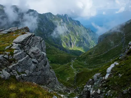
Expect wet, muddy ground even in the main season. Boardwalks protect the boggiest sections, but the path still crosses marshy moorland, mountain-birch slopes and rocky ground near Ryten. The descent to Kvalvika Beach is steep and can be slippery. The viewpoint and beach are exposed to weather. Winter is possible only with microspikes, crampons or snowshoes and appropriate experience.
HikeList Score
Ryten and Kvalvika Beach scored 82/100 on HikeList's trail-quality metrics.
See score breakdownHide breakdown
- Ideal length 55
- Balanced challenge 100
- Scenery & wildness 98
- Varied terrain 89
- Accommodation 75
- Food & support 61
- Path quality 98
- Season flexibility 89
Computed from length, challenge, scenery & wildness, terrain variety, accommodation, food & support, path quality and season flexibility.
 Norway
Show more data Show less
- Coastal
- Mountainous
- Moorland
- Boardwalk
- Muddy
- Rocky
- Sand
- Wild Camping Spots
- Cabins
- Guesthouses
- Family Friendly
- Pet Friendly
- Campsites
In these collections
Photos from hikers
Taken on the trail by people who've reviewed Ryten and Kvalvika Beach.
Reviews
How would you rate Ryten and Kvalvika Beach?
Tap a star to start your review — you could be the first.