Romsdalseggen Ridge
How would you rate Romsdalseggen Ridge?
Tap a star to share your experience and help other hikers.
Romsdalseggen Ridge: Norway’s Airy Fjord Day Hike
HikeList Score
Romsdalseggen Ridge scored 72/100 on HikeList's trail-quality metrics.
See score breakdownHide breakdown
- Ideal length 55
- Balanced challenge 46
- Scenery & wildness 78
- Varied terrain 100
- Accommodation 83
- Food & support 68
- Path quality 98
- Season flexibility 76
Computed from length, challenge, scenery & wildness, terrain variety, accommodation, food & support, path quality and season flexibility.
Romsdalseggen Ridge is a 10.3 km point-to-point mountain day hike above Åndalsnes in Møre og Romsdal, north-west Norway. It is strenuous rather than long: expect about 970 m of ascent, rough rock, exposure, narrow ridge sections and short chain-assisted scrambles. The standard route suits fit hikers who are comfortable with heights and settled mountain weather. If you like airy Norwegian ridges, compare it with the Besseggen Ridge and summit days such as the Galdhøpiggen Summit Trail.
Route Overview
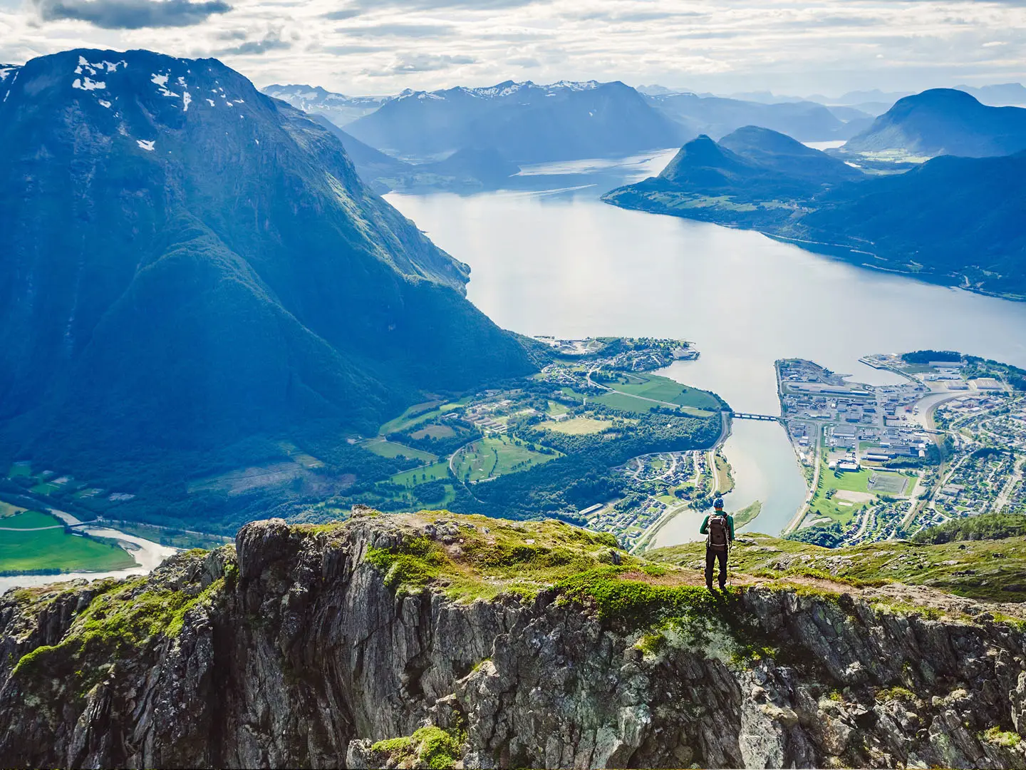
The standard Romsdalseggen route starts at Venjesdalssetra / Vengedalen, usually reached by the seasonal Romsdalseggen shuttle bus from Åndalsnes or Norsk Tindesenter. From the trailhead the waymarked red-T path climbs steeply, partly through boulder fields, to the ridge. It then crosses Mjølvafjellet, the 1,216 m high point, and the narrow Mjølvaskaret notch before following the exposed crest with views to Romsdalshorn, Store Venjetind, Trolltindene and Trollveggen. The route descends via Nesaksla, near Rampestreken and Eggen restaurant, then drops into Åndalsnes on the Romsdalstrappa stone staircase. It is a one-way hike; the shuttle removes the need for a second car.
Romsdalen Mountaineering Context
Romsdalen has attracted mountaineers for well over a century, with Åndalsnes widely regarded as Norway’s mountaineering capital. Trollveggen and Romsdalshorn are among the valley’s classic historic objectives. The Romsdalseggen ridge walk is a modern signed route, notably promoted from around 2010, and later additions such as the Rampestreken viewpoint and Sherpa-built Romsdalstrappa have made the steep finish above Åndalsnes safer and more accessible.
Notable highlights
- Mjølvafjellet (1,216 m): The highest point on the standard ridge route. This is the most exposed, hands-on section, with narrow rock and fixed chains where confidence with heights matters.
- Trollveggen — the Troll Wall: Seen across the valley for much of the hike, this huge vertical rock wall sits below the jagged Trolltindene peaks and is a landmark of Norwegian climbing history.
- Romsdalshorn and the Trolltindene: These distinctive peaks dominate the opposite side of Romsdalen. They give the ridge its classic “sea of peaks” view and underline the area’s mountaineering character.
- Rampestreken viewpoint: A cantilevered steel platform above Åndalsnes near the end of the walk. It gives a direct, exposed view down to the town, fjord and Rauma river.
- Romsdalstrappa staircase: The Sherpa-built stone steps form the final steep descent from Nesaksla into Åndalsnes, protecting the slope and making the last section more structured underfoot.
Challenges to expect
Expect steep ascent, boulder fields, rough rock, cliff-edge exposure and short scrambles with fixed chains. The route is waymarked, but fog can make the ridge serious and wind or heavy rain can make exposed sections unsafe. There is no accommodation or resupply on the ridge. Plan around the seasonal shuttle, carry food and layers, and avoid the hike outside the snow-free season.
HikeList Score
Romsdalseggen Ridge scored 72/100 on HikeList's trail-quality metrics.
See score breakdownHide breakdown
- Ideal length 55
- Balanced challenge 46
- Scenery & wildness 78
- Varied terrain 100
- Accommodation 83
- Food & support 68
- Path quality 98
- Season flexibility 76
Computed from length, challenge, scenery & wildness, terrain variety, accommodation, food & support, path quality and season flexibility.
 Norway
Show more data Show less
- Mountainous
- Alpine
- Rocky
- Exposed Ridge
- Rock
- Boulders
- Stony Path
- Bare Rock
- Stone Steps
- Hotels
- Guesthouses
- Campsites
- Pet Friendly
- Restrooms
- Shelters
Photos from hikers
Taken on the trail by people who've reviewed Romsdalseggen Ridge.
Reviews
How would you rate Romsdalseggen Ridge?
Tap a star to start your review — you could be the first.