Ribble Way
How would you rate Ribble Way?
Tap a star to share your experience and help other hikers.
Ribble Way: Upstream from the Lancashire Coast to the Dales
HikeList Score
Ribble Way scored 92/100 on HikeList's trail-quality metrics.
See score breakdownHide breakdown
- Ideal length 96
- Balanced challenge 100
- Scenery & wildness 98
- Varied terrain 76
- Accommodation 83
- Food & support 88
- Path quality 98
- Season flexibility 89
Computed from length, challenge, scenery & wildness, terrain variety, accommodation, food & support, path quality and season flexibility.
The Ribble Way is a 116 km waymarked long-distance footpath in northern England, following the River Ribble upstream from Longton on the Lancashire estuary to Grove Head / Gavel Gap below Cam Fell near Ribblehead. Most walkers take 6-7 days. It is a moderate point-to-point route: pastoral and accessible for much of the way, but with muddy riverside paths, farmland navigation and a higher, wilder final approach into the Yorkshire Dales.
Route Overview
Walk the Ribble Way south to north, starting at the Dolphin Inn in Longton, south-west of Preston, and finishing near the Ribble’s source at Grove Head / Gavel Gap, close to where the Pennine Way crosses. The route passes Preston’s Avenham and Miller Parks, Ribchester, Hurst Green, Stonyhurst College, Cromwell’s Bridge, Great Mitton, Clitheroe, Sawley, Gisburn, Settle, Horton in Ribblesdale, Chapel-le-Dale and Ribblehead. It is a linear trail, so plan separate start and finish logistics. If you like river or valley-led routes, compare it with the Annandale Way or the gentler Ashby Canal Trail.
History of the Ribble Way
The Ribble valley has Roman, medieval and industrial history: Ribchester grew around the cavalry fort of Bremetennacum, while Clitheroe Castle, packhorse bridges and old mills mark later settlement. The footpath is modern. It was proposed in 1967 by the Preston and Fylde Ramblers, promoted in the 1970s as a riverside long-distance path, and the first section opened on 1 June 1985. The route was later extended to the source using a line devised by Gladys Sellers, author of the first Cicerone guide.
Notable highlights
- Ribblehead Viaduct (24-arch Victorian railway viaduct): A landmark on the Settle-Carlisle line, standing on open moorland near the northern end of the walk.
- Ribchester Roman fort and museum: The village sits on the Roman fort of Bremetennacum Veteranorum; the museum displays finds that explain the area’s Roman cavalry history.
- Clitheroe Castle: A small Norman keep on a limestone knoll above Clitheroe, giving a strong sense of the Ribble Valley’s historic settlement.
- Stonyhurst College and the Tolkien connection: The route passes Stonyhurst near Hurst Green, where J.R.R. Tolkien stayed; this section overlaps the popular Tolkien Trail.
- Cromwell’s Bridge: A 16th-century packhorse bridge over the Hodder, associated with Oliver Cromwell’s army before the Battle of Preston in 1648.
- Source of the Ribble below Cam Fell: The finish is on remote moorland near Gavel Gap / Grove Head at about 558 m, close to the Pennine Way and the Yorkshire Three Peaks.
Challenges to expect
Do not treat the Ribble Way as only a lowland stroll. The early estuary and riverside paths can be wet or muddy, farmland waymarking can be patchy, and a closed footbridge diversion east of Preston plus a road hazard on the B6245 near Ribchester require attention to current updates. The final northern section climbs onto wilder moorland. For rougher upland comparison, see the Beacons Way; for another valley route, see the Amber Valley Route.
HikeList Score
Ribble Way scored 92/100 on HikeList's trail-quality metrics.
See score breakdownHide breakdown
- Ideal length 96
- Balanced challenge 100
- Scenery & wildness 98
- Varied terrain 76
- Accommodation 83
- Food & support 88
- Path quality 98
- Season flexibility 89
Computed from length, challenge, scenery & wildness, terrain variety, accommodation, food & support, path quality and season flexibility.
 United Kingdom
 England
Show more data Show less
- Wetlands
- River Valley
- Moorland
- Dirt
- Gravel
- Hotels
- Hostels
- Campsites
- Family Friendly
- Pet Friendly
- Restrooms
- Water Sources
- Campsites
- Picnic Areas
Download Our Full Guide to Ribble Way FREE!
Get our comprehensive guide to this hike for free. Save it for later reading or print out at home.
In these collections
Photos from hikers
Taken on the trail by people who've reviewed Ribble Way.
Ribble Way: The Complete Guide
 i
Image by Matt
i
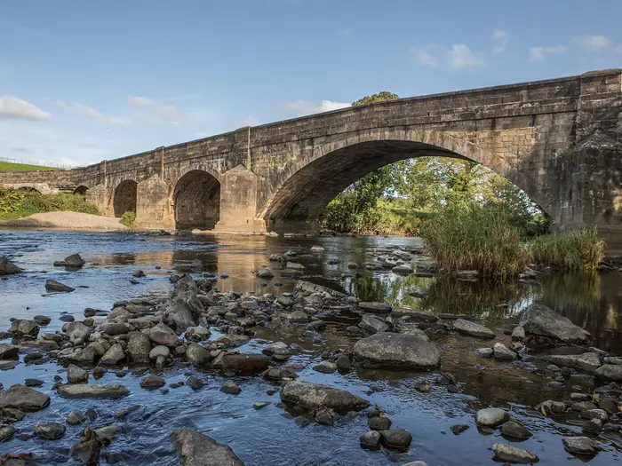
Image by Matt The Ribble Way is a 116 km journey from the tidal edge of the Lancashire coast at Longton to the river’s high moorland source below Cam Fell in the Yorkshire Dales. It is a river walk with a clear purpose: follow the Ribble upstream as it changes from broad estuary to pastoral valley river, then to a small upland stream near Gavel Gap.
For most of its length this is gentle, practical multi-day walking on riverside paths, farm tracks, field paths and quiet lanes. It suits fit first-time long-distance walkers, families tackling selected sections, and experienced hikers looking for a quieter alternative to the busier national trails.
The variety is the reward: saltmarsh near Longton, Preston’s Avenham and Miller Parks, Roman Ribchester, Stonyhurst and the Tolkien Trail, Clitheroe’s limestone knoll, Settle, Horton-in-Ribblesdale and the open country around Ribblehead Viaduct. By the final approach to Grove Head / Gavel Gap, the route has become a proper fell walk rather than a valley stroll.
Do not underestimate the last section, or the cumulative effect of several days on muddy farmland and riverside paths. Waymarking can be patchy in fields, waterproof footwear is sensible throughout, and the Cam Fell finish needs navigation skills and respect for moorland weather.
This guide covers stages, daily planning, accommodation, food, transport, terrain, navigation, gear, budget and common mistakes.
Stage-by-Stage Guide
The Ribble Way is normally walked south to north, from the tidal Ribble near Longton to the source area below Cam Fell. The six-stage schedule below follows the standard itinerary used on this page; the final day is deliberately longer and more serious than the earlier valley stages.
Stage 1: Longton to Preston — approx. 13 km / 8 miles
This short opening stage is flat, exposed and quite different from the rest of the Ribble Way. It begins at the Ribble Way marker by the Dolphin Inn on Marsh Lane, Longton, then follows the tidal estuary and salt marsh before entering Preston through riverside parkland.
The first kilometres use the flood embankment along Longton Marshes, part of the Ribble Marshes National Nature Reserve. Underfoot it is generally easy, but the estuary edge can be muddy after rain and the line of the path can feel less obvious near the start, so pay attention to waymarks before settling into the embankment walking.
The River Douglas confluence is visible from the embankment, and the stage gradually changes from open marsh to urban riverside. The route passes beneath the West Coast Main Line railway bridge into Miller Park, then continues through Miller Park and Avenham Park, two attractive Victorian parks close to Preston city centre. The conventional stage end is at the London Road A6 bridge over the Ribble.
There are no reliable shops or cafés between Longton and Preston. The Dolphin Inn is at the start, but opening times vary and it should not be relied on for an early breakfast or supplies. Carry water and snacks from the outset, then use Preston for a full resupply.
Preston is the easiest overnight stop on the route. The city has a wide range of hotels, B&Bs and budget accommodation, and the A6 London Road bridge is within walking distance of the centre. There is no dedicated walkers’ hostel on the route in Preston.
For access, Longton is reached by bus from Preston; current timetables should be checked before travelling. Preston is a major rail hub on the West Coast Main Line, making this stage straightforward to reach for a weekend start or section walk.
Navigation is generally uncomplicated once on the embankment and through the parks, but the salt-marsh start deserves care in poor weather or low visibility. If combining this stage with Stage 2, check the latest position on the Red Scar / Tun Brook diversion east of Preston before setting off.
Stage 2: Preston to Ribchester — approx. 19 km / 12 miles
This stage leaves Preston and moves into a more rural Ribble Valley landscape. It begins with urban and suburban edges, then uses quiet lanes, field paths and riverside sections as the Ribble starts to feel like a country river.
East of Preston, the route passes the Red Scar and Grimsargh area. Field paths here can be muddy and indistinct, especially after wet weather, and the waymarking is not always as obvious as it is later in the Yorkshire Dales. A GPX track and OS mapping are useful rather than optional.
The Red Scar / Tun Brook area has had a diversion because the Tun Brook footbridge at SD 5908 3247 is closed, with walkers directed to an upstream footbridge at SD 5922 3343. This should be checked on the LDWA page and against an up-to-date GPX before walking.
Grimsargh provides a possible pub stop at the Plough, but hours should be checked and supplies should still be carried from Preston. The final approach to Ribchester includes the B6245 road section near Stone Bridge to Ribchester Bridge, where the road is narrow and in places lacks a pavement. Walk facing traffic, stay alert, and consider the alternative footbridge at SD 6554 3576 if suitable for the day’s route.
Ribchester is one of the key historic stops on the Ribble Way. The village stands on the Roman cavalry fort of Bremetennacum Veteranorum, with Roman remains and finds associated with the Roman Museum. The Church of St Wilfrid, with parts dating from the 13th century and built on Roman foundations, is also close to the route.
Food and water are limited between Preston and Ribchester, so leave Preston with lunch and enough water. Ribchester has the White Bull and the Ribchester Arms for food, and Potters Barn pottery-painting café, although opening times vary and should be checked; do not rely on finding a general store in the village.
Accommodation in Ribchester is limited, mainly small B&B-style options, so book ahead. Some walkers continue a few kilometres to Hurst Green, where there are more overnight possibilities including the Shireburn Arms and local B&Bs.
Ribchester has bus links with Preston and Clitheroe, but no railway station. Timetables should be checked before relying on public transport at the end of the day.
Stage 3: Ribchester to Clitheroe — approx. 19 km / 12 miles
This is one of the most varied and historically rich stages of the Ribble Way. The route follows field paths and farm tracks through the Ribble Valley, with woodland sections, riverside bends and several memorable villages before reaching Clitheroe.
From Ribchester the walking remains pastoral, with typical Lancashire farmland underfoot. Expect a mixture of field edges, farm tracks, short lanes and potentially muddy sections after rain. Waymarking can be patchy in farmland, so keep checking the map rather than relying on signs at every field boundary.
The route passes through Hurst Green, a useful village and the centre of the local Tolkien Trail area. Stonyhurst College lies nearby, and the Ribble Way overlaps ground associated with J.R.R. Tolkien’s visits to the area.
A major highlight is the River Hodder crossing near Cromwell’s Bridge, a 16th-century packhorse bridge linked to Cromwell’s army before the 1648 Battle of Preston. The crossing area may be affected after heavy rain, so conditions should be treated with caution if the Hodder is running high.
Great Mitton is another worthwhile pause, with All Hallows Church and the Aspinall Arms close to the route. Sale Wheel is a scenic riverside spot on this section, and views towards Pendle Hill become a clear feature as the walk approaches Clitheroe.
Food is available at Hurst Green, where the Shireburn Arms serves as a pub and hotel, and at Great Mitton, where the Aspinall Arms offers food and accommodation. These are useful but should not replace carrying snacks and water, as opening hours can vary.
Clitheroe is one of the best service stops on the whole trail. It has cafés, pubs, restaurants, supermarkets, deli shops, a weekly market and an outdoor gear shop. Clitheroe Castle, a small Norman keep on a limestone knoll above the town, is the natural landmark at the stage end.
Accommodation is good in and around Clitheroe, with hotels, B&Bs and guesthouses. Options include the Rose and Crown Hotel in the town centre and the Calf’s Head at Worston, around two miles from town, but location should be weighed carefully if walking back to the route the next morning.
Clitheroe has a railway station with services on the line from Manchester Victoria and Blackburn, and buses link the town with Preston, Burnley and nearby villages. Hurst Green also has bus links to Clitheroe and Longridge, giving useful flexibility if section-walking.
Stage 4: Clitheroe to Gisburn — approx. 16 km / 10 miles
This is the shortest stage in the six-day schedule, but it still needs a normal walking-day mindset. It begins with attractive Ribble-side walking north of Clitheroe, then becomes quieter and more agricultural as the route heads through Chatburn, Sawley and towards Gisburn.
Leaving Clitheroe, the path follows the Ribble through a wooded gorge. This is an appealing section but can be muddy, particularly after prolonged rain. Quarry workings near Clitheroe may be visible, though they do not dominate the walking.
The route crosses the Ribble at Chatburn, a small village on the A59, then continues across open farmland. Around the Chatburn and Paythorne area the walk also marks the transition from Lancashire towards Yorkshire, a useful mental milestone on the journey north.
Sawley Abbey is the main historic highlight of the day. The ruins of the 12th-century Cistercian abbey stand beside the Ribble and are free to visit. Beyond Sawley, the walking is quieter, with the route using field paths, tracks and parkland approaches into Gisburn.
Gisburn Park is a private estate with a concessionary path through it. Access arrangements can change, so this should be checked locally if planning depends on that line being open.
Food and water options are better than the stage length might suggest, but they are still spread out. Chatburn has the Cross Keys and a small village store, Sawley has the Spread Eagle, and Gisburn has the Ribblesdale Arms plus small shops and some cafés. Opening hours should be checked, especially outside peak season or on quieter weekdays.
Gisburn has limited accommodation compared with Clitheroe and Settle. The Ribblesdale Arms offers rooms in the town centre, and there are some B&Bs in and around the village. Book ahead, particularly at weekends.
There is no railway on this stage. Chatburn has limited bus links to Clitheroe, and Gisburn has bus connections towards Clitheroe and Skipton, but services are infrequent enough that current timetables matter.
Navigation is mostly straightforward but can become fiddly across farmland where paths leave the river. Keep an eye on field exits and avoid being drawn along farm tracks that are not the right of way.
Stage 5: Gisburn to Settle — approx. 19 km / 12 miles
This stage marks the shift from lowland Ribble Valley walking towards the Pennines. The valley narrows, the hills start to close in, and Pen-y-ghent and Ingleborough begin to appear on the horizon.
The route uses field paths and farm tracks through and beyond Gisburn Park, then crosses the broad, flatter vale around Paythorne. Paythorne is a picturesque hamlet on a bend of the Ribble, but it has no facilities, so treat it as a scenic pause rather than a service stop.
The walk continues through Halton West and Rathmell before reaching Long Preston and then Settle. Rathmell has no shop or pub, so do not plan lunch or water around it. Long Preston is the useful mid-stage service point, with the Maypole Inn providing a possible food stop.
The approach to Settle is through farmland and across the railway line. By this point the route has a more Dales-like feel, with the limestone country and higher ground ahead becoming more prominent.
Navigation across the open vale around Paythorne can be awkward in poor visibility. Field boundaries, gates and waymarks need careful checking, and a GPX track is strongly recommended. The terrain is not technically difficult, but this is exactly the kind of pastoral stage where small errors can waste time.
Water should be carried from Gisburn unless planning to refill in Long Preston. Streams are present in the wider landscape, but any untreated water should be filtered or otherwise treated.
Settle is the best-equipped overnight stop on the northern half of the Ribble Way. It has cafés, pubs, bakeries, restaurants, a Co-op supermarket, Castleberg Sports for outdoor gear, and a good spread of B&Bs, hotels and self-catering accommodation. The Golden Lion Hotel and Talbot Arms are among the central options.
Settle is also a useful transport hub. Long Preston and Settle both have stations on the Settle-Carlisle line, and Settle has bus connections to Skipton, Clitheroe and surrounding villages. Seasonal DalesBus services add further links into the Yorkshire Dales, but all public transport should be checked before depending on it.
Booking ahead in Settle is sensible in summer and at weekends. This is also the right place to resupply fully before the longer, wilder final stage.
Stage 6: Settle to Ribblehead Station via Horton-in-Ribblesdale and the source below Cam Fell — approx. 24 km / 15 miles
This is the longest and most demanding stage of the standard six-day itinerary. The Ribble Way changes character here: riverside paths and farmland give way to limestone Dales scenery, then to open, exposed moorland below Cam Fell.
From Settle to Stainforth the walking follows riverside and field paths, with the Ribble, limestone walls, barns and the Settle-Carlisle line all shaping the valley. Giggleswick is passed early on, and the hills begin to close in as the route heads north.
Stainforth is worth a pause for Stainforth Force, a series of low but powerful waterfalls on the Ribble, and the old packhorse bridge. The Craven Heifer may provide food, but opening times should be checked.
From Stainforth to Helwith Bridge the route stays close to the river where access allows, with limestone underfoot and the surrounding fells becoming more prominent. Helwith Bridge has the Helwith Bridge Inn, a useful walker-friendly stop for food if open.
Beyond Helwith Bridge the Ribble Way leaves the immediate riverbank and climbs slightly towards the south-west of Overdale before rejoining the valley at Horton-in-Ribblesdale. Horton is the main Three Peaks village and a key decision point. It has pubs, accommodation, camping and a railway station on the Settle-Carlisle line.
Food is usually available at the Crown Hotel and the Golden Lion in Horton-in-Ribblesdale, with other refreshment options varying by season. The well-known Pen-y-Ghent Cafe has closed, so do not rely on it for supplies. Above Horton there are no facilities until Ribblehead.
The final section from Horton to the source area is the serious part of the route. The Ribble becomes progressively smaller as the path heads upstream past Thorn Gill, Gayle Beck, Long Gill and Jam Sike towards Gavel Gap / Grove Head on Gayle Moor below Cam Fell. This is open moorland, often wet and boggy, with fewer obvious features than the valley below.
The source area, around 558 m, is close to the Pennine Way junction and lies on exposed ground. In poor visibility this section needs proper navigation with map, compass and GPX; waymarks alone are not enough. Full waterproofs and warm layers should be carried even in summer, as the weather can change quickly on the moor.
After reaching the source area, the route descends towards Ribblehead, where the 24-arch Ribblehead Viaduct dominates the view. The stage ends at Ribblehead Station on the Settle-Carlisle line, with the Station Inn nearby for food, accommodation and bunkhouse options.
This stage should be started early from Settle. Missing a train at Ribblehead can cause real problems, as services are not frequent and Ribblehead is a request stop. Check the Northern timetable in advance and plan the day around a realistic finishing time.
Accommodation at the northern end is limited but useful. The Station Inn at Ribblehead offers B&B and bunkhouse accommodation, and Gearstones Lodge is another nearby bunkhouse option. Horton-in-Ribblesdale has the Crown Hotel, camping and bunkbarn options if splitting the stage.
Splitting the final day is a sensible choice for many walkers: Settle to Horton-in-Ribblesdale, then Horton to Ribblehead via the source. This reduces the pressure on the moorland section and gives more margin for weather, navigation and train connections.
Recommended Itinerary
The Ribble Way is most straightforward south to north, from Longton towards the source below Cam Fell. A seven-day split is the most balanced option for most walkers because it keeps the final upland section separate from the approach through Settle and Horton-in-Ribblesdale.
A fit walker can complete the route in six days by combining Settle to Horton-in-Ribblesdale with the final walk to the source and Ribblehead Station, but that makes the last day about 24 km and significantly tougher. Accommodation is limited in smaller villages, so book Ribchester, Gisburn, Horton-in-Ribblesdale and Ribblehead well ahead.
Standard itinerary: 7 walking days
Best for most independent walkers, especially those using B&Bs, pubs or baggage transfer. It gives a manageable progression from estuary and riverside paths into the higher Yorkshire Dales finish.
| Day | From | To | Approx. distance | Why this stage makes sense | Services/accommodation notes |
|---|---|---|---|---|---|
| 1 | Longton | Preston / Penwortham Bridge | 13 km | A short, flat start along the estuary and riverside paths, giving an easy first day and simple transport logistics. It finishes by Preston’s Avenham and Miller Parks rather than pushing straight into a long rural stage. | Preston has the best arrival logistics near the start, with a mainline rail station, hotels, B&Bs, restaurants, cafes and shops. Longton is reached by bus from Preston; check the current timetable before travelling. |
| 2 | Preston / Penwortham Bridge | Ribchester | 20 km | This is a full but sensible day through river valley and farmland. It reaches a proper village overnight stop rather than leaving a long gap between services. | Ribchester has pub accommodation, a café and the Roman fort/museum area, but do not count on a general store for resupply. Check current route information before setting off, especially for the Red Scar / Tun Brook diversion east of Preston and the narrow B6245 section near Ribchester. |
| 3 | Ribchester | Clitheroe | 20 km | A strong middle-stage day with several of the route’s best lowland landmarks, including Hurst Green, Stonyhurst College, Cromwell’s Bridge and Great Mitton. Clitheroe is the natural overnight because it has the widest choice of services on the route. | Clitheroe has supermarkets, pubs, restaurants, B&Bs, hotels and a railway station. It is the best place on the route for restocking, replacing kit or building in a short recovery afternoon. |
| 4 | Clitheroe | Gisburn / Gisburn Bridge | 15–16 km | A shorter day after the longer Ribchester to Clitheroe stage, moving through Chatburn, Sawley and quieter Ribble Valley countryside. Sawley makes this a useful day if accommodation in Gisburn is tight. | Chatburn has limited village services. Sawley has The Spread Eagle inn on the route, which is a useful accommodation or lunch stop but should be booked ahead. Gisburn is a small village with limited accommodation and no supermarket. |
| 5 | Gisburn | Settle | 20 km | This is the main transition into the northern half of the route, passing Paythorne, Halton West, Rathmell and Long Preston before reaching the last properly serviced town before the wilder Dales section. | Settle has shops, cafes, pubs, B&Bs, small hotels and a station on the Settle-Carlisle line. Long Preston also has a station and can be useful as an escape or shortening point. |
| 6 | Settle | Horton-in-Ribblesdale | 12 km | A shorter stage that sets up the final moorland day. It passes Giggleswick, Stainforth, Helwith Bridge and limestone country without forcing the source and Ribblehead exit into the same day. | Horton-in-Ribblesdale has limited but useful services, including the Crown Hotel, the Golden Lion and a station on the Settle-Carlisle line. The well-known Pen-y-Ghent Café has closed, so do not rely on it; check pub food opening before depending on it, especially outside the main walking season. |
| 7 | Horton-in-Ribblesdale | Grove Head / Gavel Gap and Ribblehead Station | 17 km | The hardest day by ascent, following the Ribble towards its remote source below Cam Fell before walking out towards Ribblehead. Keeping it separate allows an early start, better navigation time and more margin for weather. | Ribblehead has the Station Inn and Ribblehead Station, but services are limited. Check the Settle-Carlisle timetable before committing to a same-day departure, particularly on Sundays or in winter. |
Slower variant: 8 walking days
Best for beginners, older walkers, families or anyone wanting shorter days around Settle and the Dales. It also works well if accommodation availability pushes the itinerary towards Sawley or Long Preston.
| Day | From | To | Approx. distance | Why this stage makes sense | Services/accommodation notes |
|---|---|---|---|---|---|
| 1 | Longton | Preston | 13 km | Keeps the first day easy and solves start logistics with a city overnight. | Full services in Preston; arrange the Longton start bus in advance. |
| 2 | Preston | Ribchester | 20 km | A normal full day through the lower Ribble valley without combining it with the Longton approach. | Ribchester has limited village accommodation and pub options; book ahead. |
| 3 | Ribchester | Clitheroe | 20 km | Reaches the best-serviced town on the route after a landmark-rich stage via Hurst Green, Stonyhurst College, Cromwell’s Bridge and Great Mitton. | Clitheroe is the main resupply and accommodation hub. |
| 4 | Clitheroe | Sawley | About 11 km | A deliberately short day, useful for a later start from Clitheroe or for breaking up the Ribble Valley section. | Sawley has The Spread Eagle on the route; book ahead as accommodation is limited. |
| 5 | Sawley | Long Preston | About 23 km | A longer day through Gisburn and the quieter middle section, but with Long Preston providing a rail-accessible overnight or escape point. | Long Preston has limited services and a station on the Settle-Carlisle line. Check accommodation before fixing this stop. |
| 6 | Long Preston | Settle | About 10 km | A short day into Settle, leaving time for laundry, resupply and a proper break before the northern end. | Settle has the best services after Clitheroe, including shops, cafes, pubs, B&Bs, small hotels and rail access. |
| 7 | Settle | Horton-in-Ribblesdale | 12 km | Keeps the Dales approach relaxed and avoids making the final source day too long. | Horton-in-Ribblesdale has a station and limited walker services. Check opening times before relying on food. |
| 8 | Horton-in-Ribblesdale | Grove Head / Gavel Gap and Ribblehead Station | 17 km | Gives the remote source section its own day, with more time for navigation and weather changes near Cam Fell. | Ribblehead services are very limited. Book the Station Inn well ahead or check train times carefully for departure. |
Faster variant: 5 walking days
Only suitable for strong, experienced walkers with long-day fitness, reliable navigation and accommodation already booked. It is best kept for settled weather and long daylight; it is not a good choice for beginners.
| Day | From | To | Approx. distance | Why this stage makes sense | Services/accommodation notes |
|---|---|---|---|---|---|
| 1 | Longton | Ribchester | About 33 km | Combines the easy Longton to Preston start with the Preston to Ribchester stage, creating a long but mostly low-level first day. | Ribchester is the first practical village overnight after Preston. Start early and check the bus to Longton before travelling. |
| 2 | Ribchester | Sawley | About 26 km | Pushes through the main central landmarks and beyond Clitheroe, reducing pressure later in the route. | Clitheroe is the key resupply point during the day. Sawley accommodation is limited, so this day depends on booking ahead. |
| 3 | Sawley | Long Preston or Settle | About 23–26 km | Covers the quieter middle section and positions the walk for the Yorkshire Dales finish. Settle is preferable if accommodation and fitness allow. | Long Preston has rail access but limited services. Settle has much better food, shops and accommodation. |
| 4 | Settle | Horton-in-Ribblesdale | 12 km | A deliberately short day before the hardest upland finish, allowing time to restock, recover and start early the next morning. | Horton-in-Ribblesdale has limited accommodation and a station. Book before relying on it as an overnight stop. |
| 5 | Horton-in-Ribblesdale | Grove Head / Gavel Gap and Ribblehead Station | 17 km | Finishes with the source below Cam Fell and the walk out to Ribblehead, the most demanding part of the route by height gain and exposure. | Check Ribblehead train times before setting off and do not rely on late services without confirming the timetable. Accommodation at Ribblehead is limited. |
Six-day option
The six-day version follows the common Longton–Preston–Ribchester–Clitheroe–Gisburn–Settle progression, then combines Settle to Horton-in-Ribblesdale and the final source/Ribblehead section into one long final day of about 24 km. This is practical for fit walkers but removes the safety margin that the seven-day itinerary gives on the higher, rougher ground near Cam Fell.
If using the six-day plan, start early from Settle, carry enough food for the full day, and check the Ribblehead train timetable before leaving. Missing the last train can turn an already long final day into a difficult logistics problem.
Planning the Route
How many days to allow
Most walkers should plan the Ribble Way as a full-week walk. Six to seven days is the normal range, with seven days giving a more sensible split for the northern end and more margin for muddy ground, field navigation and transport connections.
A six-day itinerary is perfectly workable for fit walkers, but it usually means either absorbing the short Longton–Preston opening into a longer first day or taking on a demanding final leg from Settle to the source below Cam Fell and out to Ribblehead. That last option should not be treated as just another riverside day: it is longer, higher and more exposed than the pastoral middle of the route.
| Pace | Typical use | Planning implications |
|---|---|---|
| 4–5 days | Fast walkers with light packs | Long days, little flexibility, and accommodation becomes harder to fit around the route. |
| 6 days | Fit walkers on a compact schedule | Usually combines either the opening day or the final two northern stages. The Settle–Ribblehead finish is the key test. |
| 7 days | Best fit for most independent walkers | Matches the natural towns and villages more comfortably, especially if the final approach is split at Horton-in-Ribblesdale. |
| 8 days | Leisurely walkers, families or those wanting shorter days | More forgiving, but may require extra accommodation or transport planning in the smaller villages. |
Commercial self-guided operators such as Brigantes English Walks offer itineraries of roughly 4–8 days, and Maximum Adventure offers a 7-night package. Those options are useful benchmarks, but independent walkers still need to check where beds are available before fixing daily stages.
Let accommodation shape the itinerary
The Ribble Way is not a trail where every village has several places to stay. The obvious overnight stops are dictated by the settlements along the valley: Preston, Ribchester, Clitheroe, Gisburn, Settle and Horton-in-Ribblesdale are the main practical anchors.
Preston, Clitheroe and Settle offer the best choice. Ribchester and Gisburn are much more limited, and smaller places such as Rathmell and Long Preston give little flexibility if accommodation is full.
Longton has very limited accommodation near the start, so many walkers stay in Preston before travelling out to the Ribble Way marker by the Dolphin Inn. The Dolphin Inn itself is useful for food at the start, but overnight options are limited around Longton.
Horton-in-Ribblesdale is a strong penultimate stop because it has pubs, B&Bs, camping and bunkbarn options, plus a station on the Settle–Carlisle line. It is also popular with Pennine Way and Yorkshire Three Peaks walkers, so beds can disappear quickly from May to September.
There is no accommodation at the actual finish near Grove Head / Gavel Gap below Cam Fell. Plan the final day so that you can continue out to Ribblehead, return to Horton-in-Ribblesdale, or be collected.
Book every night before starting. In the smaller villages, some places may be reluctant to take single-night bookings at busy times, especially at weekends, so do not rely on arranging rooms on the day.
Shortening or extending the walk
The simplest way to shorten the route is to start at Preston rather than Longton, skipping the flat estuary section. That also removes some of the early navigation and transport awkwardness around the start.
At the northern end, finishing at Horton-in-Ribblesdale instead of continuing to the source is the practical shortcut. It gives direct access to the Settle–Carlisle railway and avoids the remote moorland approach near Cam Fell.
To extend the walk, the obvious continuation is from Gavel Gap / Cam Fell onto the Pennine Way. This only suits walkers who are already equipped and planned for further upland walking in the Yorkshire Dales.
Section hiking
The Ribble Way is unusually practical as a section hike because several key points are linked by rail or bus. Preston, Clitheroe, Settle, Horton-in-Ribblesdale and Ribblehead are the most useful transport points for breaking the trail into separate days or weekends.
Longton is reached by local bus from Preston. Ribblehead and Horton-in-Ribblesdale are on the Settle–Carlisle railway, but services are not hourly, so the finish needs to be timed around the train timetable.
The Service 11 bus between Clitheroe and Horton-in-Ribblesdale via Dunsop Bridge, Slaidburn, Newton and Settle is particularly useful for mid-route access. It runs Monday to Saturday about every two hours; timetables and fares should be checked before travelling.
DalesBus services can also help on the northern sections, especially at weekends and bank holidays in season. Sunday services are limited or absent on some routes, so weekend section plans need careful checking against current bus and train times.
Food and water planning
The southern and middle sections pass through enough settlements to make resupply straightforward if stages are planned sensibly. Ribchester, Clitheroe and Settle are the main places to restock, with Clitheroe and Settle the strongest resupply towns.
The gaps still matter. Carry food for the full day where shops are sparse, and do not assume that every village pub will be open when you arrive.
| Section | Planning note |
|---|---|
| Longton to Ribchester | No significant shop en route; carry enough food from the start. |
| Gisburn to Settle | Mostly rural; Gisburn and Long Preston have pub options, but shop access is limited. |
| Horton-in-Ribblesdale to the source below Cam Fell | No services beyond Horton; carry all food and plenty of water. |
Tap water is available in villages and accommodation. Streams are present on the upland sections, but natural water should be treated or filtered before drinking.
Navigation and route-finding
Do not plan to follow waymarks alone. The Ribble Way has blue-and-white RW discs and is marked on OS mapping, but waymarking is uneven, especially through farmland and on the less-walked estuary paths near Longton.
There is little to mark the start or finish on the ground, and walkers report long gaps between waymarks at both ends of the route. In Lancashire field sections, stiles can be hidden in hedgerows and waymarks may be missing or overgrown.
Carry OS mapping, a guidebook and a downloaded GPX track. The recommended OS Explorer sheets are OL2, OL21, OL41, 286 and 287, and the Cicerone guidebook is a useful dedicated reference for the route.
Check the LDWA route page before walking for current diversions. Particular points to watch are the Tun Brook footbridge diversion near Red Scar east of Preston and the narrow, pavement-less B6245 road section near Ribchester, where an alternative footbridge route may be preferable.
Weather, ground conditions and timing
Spring and autumn are the most practical seasons for many walkers: accommodation is usually easier than in high summer, and conditions are often better for a multi-day walk. Summer gives longer days but increases pressure on accommodation, especially around Settle, Horton-in-Ribblesdale and Ribblehead.
Heavy rain can quickly change the character of the route. Riverside paths may become awkward or impassable, farmland can turn very muddy, and the final moorland approach near Cam Fell becomes more serious in poor visibility or cold wind.
Check the weather forecast and Environment Agency flood warnings before each day in wet periods. Winter is possible only for properly equipped walkers with the experience to deal with cold, short days and exposed upland conditions.
The key planning priorities
Before fixing dates, sort the items that most often cause problems on this route:
- Book accommodation in advance, especially Ribchester, Gisburn and Horton-in-Ribblesdale.
- Decide whether to split the final northern section at Horton-in-Ribblesdale.
- Plan the exit from Ribblehead or Horton-in-Ribblesdale around actual train times.
- Carry maps, GPX and a guidebook rather than relying on waymarks.
- Check current diversions and awkward road sections before setting off.
- Carry food for the longer rural gaps, especially beyond Horton.
- Watch weather and flood conditions after heavy rain.
Permits are not the main planning concern here; the real constraints are beds, transport, navigation and weather.
Towns, Villages and Overnight Stops
The Ribble Way is easiest to plan around a few strong service points: Preston, Ribchester, Clitheroe, Gisburn, Long Preston, Settle, Horton-in-Ribblesdale and Ribblehead. Between them are several small villages where the pub may be the only facility, so do not assume food, shops or late-opening services will be available without checking ahead.
For most walkers, Preston is the best place to stay before or after the first short stage, Clitheroe is the main resupply point in the Lancashire half, Settle is the main resupply point in the Yorkshire half, and Horton-in-Ribblesdale or Ribblehead are the key practical options near the finish.
Longton
Longton is the southern start of the Ribble Way. The marker is near the Dolphin Inn on Marsh Lane, south-west of Preston, on the tidal estuary.
This is a quiet village rather than a trail town, and services at the actual start are very limited. The Dolphin Inn is the main facility: a traditional real-ale pub with meals, outdoor seating and a changing selection of locally brewed ales.
There are no shops at the Dolphin itself. The nearest proper shop is Booths in Longton village centre, about 2 miles from the start, so walkers should buy food and any day-one supplies in Preston before travelling out.
Longton has no railway station. Buses run from Preston to Longton, with a stop near St Andrew’s Church and Booths; current timetables should be checked before travelling. Preston is the nearest mainline rail hub and is usually the simplest base for starting the walk.
Preston
Preston sits at the end of the first stage and is the most useful logistics base at the southern end of the route. The Ribble Way passes through Avenham and Miller Parks, giving a straightforward riverside approach into the city.
This is a full-service stop with supermarkets, restaurants, cafes, chain hotels, B&Bs, outdoor gear options and onward transport. Avenham Park Pavilion has a café and toilets during park opening hours, which can be useful if passing through rather than staying overnight.
Preston railway station is a major mainline station on the West Coast Main Line, with direct services to London Euston, Manchester, Birmingham and Scotland, as well as local services. It is also the regional bus hub for Lancashire, including buses towards Longton.
Preston works well as a night-before-start base if arriving by train. It also makes sense as the Stage 1 overnight if starting with the short Longton-to-Preston section rather than walking straight on towards Ribchester.
Ribchester
Ribchester is a strong overnight stop after the long rural section north-east from Preston. The village sits on the site of the Roman cavalry fort of Bremetennacum Veteranorum, and the Roman Museum near the church is worth allowing time for if opening hours fit the day.
Accommodation is limited but practical for walkers. The White Bull on Church Street is a historic village pub with en-suite rooms and a beer garden close to the Roman bathhouse ruins. The Ribchester Arms, on the edge of the village, also offers en-suite guest rooms. Potters Barn is a pottery-painting café in the village serving food most days.
Shops are very limited, so Ribchester should not be treated as a resupply point; do not count on a general store. Plan to arrive with anything needed for the evening and next morning unless booked accommodation or pub meals cover this.
There is no railway station in Ribchester. Bus connections link the village with Preston and Clitheroe, but these should be checked before travelling, especially if using Ribchester as a section-walk start or finish.
Hurst Green
Hurst Green is a small Ribble Valley village on the Ribchester-to-Clitheroe stage. It is a useful lunch or overnight option if splitting the stage more gently, but it has very limited services beyond the inn.
The Shireburn Arms is the key walker facility: a long-established coaching inn with rooms, food and views over the valley. It is a sensible option for those wanting a quieter overnight stop before Clitheroe.
There are no reliable village shops for trail resupply. Treat Hurst Green as an inn stop rather than a provisioning point.
The route passes near Stonyhurst College, and the area overlaps the popular Tolkien Trail. Stonyhurst College is private and should not be treated as a casual visitor facility for walkers.
Great Mitton lies further on towards Clitheroe. It is a very small settlement with no shops; The Three Fishes is a high-quality dining pub, and Mitton Hall Hotel nearby is an upmarket accommodation option rather than a budget trail stop.
Clitheroe
Clitheroe is the most important town in the Lancashire half of the Ribble Way and one of the best places to plan an overnight stop. It comes at the end of the Ribchester-to-Clitheroe stage and is the last large service centre before the quieter middle section towards Gisburn and Settle.
The town has full market-town services: supermarkets, independent shops, cafes, restaurants, pubs, Post Office, pharmacy, banks and outdoor gear options. This is the best place to replace forgotten items, buy food for the next day and sort any minor kit issues.
Accommodation is broad by trail standards, with hotels, B&Bs, guesthouses and self-catering options. Weekends can be busy, so booking ahead is sensible, particularly in good walking weather or during local events.
Clitheroe railway station is on the Ribble Valley line, with Northern services towards Blackburn and Manchester Victoria, and some Preston connections. It is the best transport hub on the Lancashire half of the walk and a practical place to start or finish a section.
The castle keep and museum sit close to the town centre, so they are easy to fit in without adding awkward mileage. For walkers, Clitheroe’s real value is practical: good beds, proper shops, transport and a straightforward restart the next morning.
Chatburn, just north of Clitheroe, is passed soon after leaving town. It has limited services and some B&B options, but it is usually a passing-through point rather than a main planning stop.
Sawley
Sawley is a small village between Clitheroe and Gisburn, close to the ruins of Sawley Abbey. It is a good lunch stop or quieter overnight option if the stage into Gisburn is being shortened.
The Spread Eagle Inn is the main facility, a 17th-century coaching inn with en-suite rooms, restaurant and dog-friendly accommodation. For walkers wanting a country-inn stop rather than a larger village, Sawley is one of the better choices on the middle section.
There is no supermarket in the village, so carry snacks and any essentials from Clitheroe. The abbey ruins are close enough to be a worthwhile short stop without complicating the day.
Gisburn
Gisburn is the principal village around the Stage 4 endpoint, with the Ribble Way crossing near Gisburn Bridge. It marks the transition from the Lancashire section towards North Yorkshire and the Settle-Carlisle corridor.
The White Bull is the main accommodation and food option: an 18th-century coaching inn with en-suite rooms, pub and restaurant. The village also has cafes, a deli and small shops, making it a useful stop before the quieter approach to Long Preston.
Gisburn is a small linear village on the A59, so road noise and traffic are more noticeable here than in the smaller riverside villages. It is still a practical overnight stop because accommodation, food and some resupply are available in one place.
There is no railway station. Bus connections run along the A59 corridor, but current services should be checked before relying on them for section walking or a bailout.
Paythorne, Halton West and Rathmell are passed on the onward route towards Long Preston and Settle. These are small settlements with very limited walker services, so do not plan around them for food or accommodation unless something has been booked in advance.
Long Preston
Long Preston is a useful service village on the approach to Settle, about 4 miles south-south-east of Settle. It works well as an overnight stop if the Gisburn-to-Settle stage is being split or if a shorter day before Settle is preferred.
The village has two pubs offering accommodation: The Maypole Inn, near Maypole Green, and The Boar’s Head, a traditional pub/hotel with en-suite rooms, real ales and food. Gallaber Park provides camping and motorhome facilities nearby.
Long Preston is more useful for resupply than many villages on the route. The Village Stores & Post Office near Maypole Green is open daily from 9am to 6pm, making it a practical stop for food, basic supplies and postal services.
Long Preston station is on the Leeds/Skipton to Settle-Carlisle line, with services towards Leeds, Skipton, Settle and Carlisle. This makes the village a good section-walking access point and a practical fallback if plans change before Settle.
Settle
Settle is the main town on the Yorkshire half of the Ribble Way and the key overnight stop before the final upland section. It has the best combination of accommodation, food, shops, transport and outdoor services north of Clitheroe.
The town has supermarkets, cafes, restaurants, pubs, Post Office, health centre, petrol station, pharmacy and outdoor gear options, including a Rohan outlet nearby. This is the best place to resupply before the remote northern finish, especially if continuing beyond Horton-in-Ribblesdale to the source and Ribblehead.
Accommodation is wide-ranging, with B&Bs, guesthouses, hotels and self-catering options. Settle is popular with Yorkshire Three Peaks walkers and Settle-Carlisle Railway visitors, so book ahead in summer and at weekends.
Ye Olde Naked Man Café is a long-established walker-friendly café with bakery and sandwich options. Pub options include The Golden Lion, a 17th-century coaching inn with rooms, and The Talbot Arms, with real ales, food and a large beer garden.
Settle railway station is on the Settle-Carlisle line, with services to Leeds via Skipton and north towards Carlisle. The Saturday Yorkshire Dales Explorer service from Manchester Victoria also serves the route via Clitheroe and Ribblehead, which can be useful for linking the Lancashire and Dales sections.
Giggleswick lies just across the Ribble from Settle and should be treated as part of the Settle area for planning purposes. It is largely residential from a walker’s point of view, with limited separate services.
Stainforth
Stainforth is a small village north of Settle inside the Yorkshire Dales National Park. It is a worthwhile rest stop on the final day, and it can also work as an overnight break for walkers who want a shorter push towards Horton-in-Ribblesdale or Ribblehead.
The Craven Heifer is the main village pub, with accommodation and food. Across the river at Little Stainforth, Knight Stainforth has a campsite and the Knights Table café/restaurant, useful for walkers and Pennine Bridleway traffic.
There is no supermarket, and provisions are limited. Stock up in Settle rather than relying on Stainforth for anything beyond pub or café food.
Stainforth Force, where the Ribble drops over limestone ledges into a broad pool, is a short walk from the village pub and makes a natural break point. The medieval Stainforth Packhorse Bridge is another useful landmark on this section.
Helwith Bridge, further north, is a tiny hamlet with the Helwith Bridge Inn. It is best treated as a pub stop only: there is no shop, and opening hours should be checked before building a day around it.
Horton-in-Ribblesdale
Horton-in-Ribblesdale is the main services village on the final day and a key walker hub because it sits on both the Ribble Way and the Pennine Way area used by Yorkshire Three Peaks walkers. It is the best place to pause, reassess weather and decide whether to continue to the source and Ribblehead.
The village has a Yorkshire Dales National Park car park and public toilets in the centre, with additional summer overflow parking nearby. Accommodation includes B&Bs, bunkhouse-style options such as 3 Peaks Bunkroom, and pub accommodation.
The Crown Hotel and The Golden Lion are both walker-oriented pubs used to muddy boots, wet kit and dogs. Food is available in the pubs, but do not treat Horton as a major resupply stop.
There is no supermarket, and provisions are limited. Carry food from Settle unless the village stores are known to be open when needed.
Horton-in-Ribblesdale station is on the Settle-Carlisle line, with trains south towards Settle, Skipton and Leeds, and north towards Carlisle. This is the most useful escape point before committing to the wilder ground towards Cam Fell, Gavel Gap and Ribblehead.
Ribblehead
Ribblehead is the practical endpoint for most Ribble Way logistics, even though the source itself is at Grove Head / Gavel Gap below Cam Fell. After reaching the source, most walkers descend to Ribblehead for the railway station, food, accommodation or onward travel.
The Station Inn is the main facility at Ribblehead. It is a traditional Dales inn beside Ribblehead station, with en-suite guest rooms, bunkhouse accommodation, real ales, pub food and dog-friendly options.
There is no shop at Ribblehead. If staying there, rely on the inn for food or carry supplies from Settle or Horton-in-Ribblesdale.
Ribblehead station is on the Settle-Carlisle line, with trains south towards Settle and Leeds and north towards Carlisle. The Saturday Yorkshire Dales Explorer service also calls here, giving another useful option for walkers returning towards the Lancashire side.
The Ribblehead Viaduct is the major landmark here, but Ribblehead’s practical value is transport. It turns the remote moorland finish into a manageable endpoint for a linear walk, provided train times have been checked before committing to the final section.
Getting to the Start
The Ribble Way starts at the route marker by the Dolphin Inn on Marsh Lane, Longton, south-west of Preston. Longton has no railway station, so most walkers use Preston as the main gateway, then continue by bus or taxi to the village.
The route is linear and finishes near Ribblehead, not back at Longton. Before committing to parking or return tickets, make sure the finish logistics are planned as well.
By train
Preston is the key railhead for the start of the Ribble Way. It is on the West Coast Main Line and has frequent national and regional services, making it the most practical place to arrive the day before or on the morning of Day 1.
Approximate direct journey times to Preston include:
| From | Typical journey time | Notes |
|---|---|---|
| London Euston | About 2 hours | Avanti West Coast inter-city services |
| Manchester Piccadilly | About 35–45 minutes | Frequent Northern and TransPennine Express services |
| Manchester Airport | About 51 minutes–1 hour 10 minutes | Direct trains to Preston |
| Liverpool Lime Street | About 43 minutes–1 hour 17 minutes | Northern and TransPennine Express services |
| Glasgow Central | About 1 hour 20 minutes–1 hour 40 minutes | Avanti West Coast services |
| Edinburgh Waverley | About 2 hours | Avanti West Coast services |
| Leeds | About 1 hour | Northern and TransPennine Express services |
Timetables, operators and stopping patterns vary, particularly at weekends and during engineering works. This should be checked before travelling.
From Preston station, either walk to Preston bus station for the Longton bus or take a taxi directly to the Dolphin Inn. The bus station is around 15–20 minutes on foot from the railway station, so leave enough time if connecting from a train.
A taxi from Preston station to the Dolphin Inn in Longton is the simplest option if arriving with a heavy pack or starting early. The road journey is short, with typical fares around £8–£15, but fares should be confirmed before travelling.
By bus
Buses run from Preston bus station to Longton, with Stagecoach route 12 currently serving the Preston–Longton corridor. Route numbers and operators in this area have changed before, so the current service should be checked before travelling.
The most useful stop for the Ribble Way start is Longton, St Andrews Church, opposite Booths supermarket. From there, the Dolphin Inn and the trailhead marker are still about 1.2 miles / 2 km south along Marsh Lane, which usually means allowing 25–30 minutes on foot before the walk itself begins.
The Preston to Longton bus journey is typically around 19–25 minutes. Weekday services are roughly every 20 minutes, but Sunday and evening services may be less frequent and should be checked before travelling.
Typical single fares are around £2–£4, but current prices should be confirmed with the operator. If starting a full walking day from Longton, remember that the bus-stop-to-trailhead walk is additional to the day’s route mileage.
By car
Longton is reached from the Preston area via the A59. From the M6, practical approaches include Junction 29 for the M65/A6 or Junction 31 for the A59 towards Longton and Penwortham.
The Dolphin Inn on Marsh Lane has a car park, but multi-day walkers should not assume they can leave a vehicle there for the duration of the Ribble Way. Long-term parking must be arranged with the pub in advance.
A more flexible option is to park in Preston and take the bus or a taxi to Longton. Preston has city-centre long-stay parking, including the bus station car park above Preston bus station, which is open 24 hours and has around 600 spaces; current tariffs, payment rules and maximum stays should be checked before travelling.
Longton is a small village with limited on-street parking. Leaving a car on residential streets for a week is not a reliable or considerate plan.
From the nearest airport
Manchester Airport is the most convenient airport for most walkers starting the Ribble Way. Direct trains run from Manchester Airport to Preston, generally taking about 51 minutes to 1 hour 10 minutes, with services operated by Northern and TransPennine Express.
From Preston, continue to Longton by bus from Preston bus station or by taxi direct to the Dolphin Inn. This makes Manchester the simplest airport choice for international or long-distance arrivals.
Liverpool John Lennon Airport is also possible, but less direct. Travel from the airport to Liverpool Lime Street, then take a train to Preston; allow about 2 hours overall from airport to Preston, depending on connections.
Leeds Bradford Airport is another workable but less convenient option. Take a bus or taxi to Leeds station, then a train to Preston; allow about 2 hours overall.
Blackpool Airport has limited charter and seasonal flights and is not a practical gateway for most walkers.
Where to stay before starting
Preston is the best overnight base before Day 1. It has the widest choice of accommodation, good rail connections, access to buses for Longton, and straightforward taxi options if starting early.
Useful Preston areas are the city centre, near the railway station, or within easy reach of the bus station. Options include larger chain hotels, smaller hotels and B&Bs, with typical city-centre B&B prices around £50–£70 per night and chain hotels often around £70–£120 depending on date and demand; current rates should be checked before booking.
Longton itself has much more limited accommodation. The Dolphin Inn may offer rooms, which would put you at the trailhead, but availability should be checked directly before relying on it.
For most walkers, staying in Preston the night before and taking the morning bus or taxi to Longton is the most robust arrangement. It also avoids being dependent on scarce village accommodation at the start of a linear walk.
Getting Home from the Finish
The Ribble Way does not finish in a village. The official endpoint is at Grove Head / Gavel Gap below Cam Fell on Gayle Moor, close to the source of the River Ribble, with no road access, public transport or facilities at the actual finish.
Plan the final day as a walk to Ribblehead, not just to Gavel Gap. Ribblehead station is roughly 3.5 miles / 5.6 km downhill from the official endpoint, so allow around an extra hour of walking after reaching the source area. The usual exit is by moorland paths and tracks towards Gearstones, then down to the B6255 and on to Ribblehead station.
By train
Ribblehead station is the key public transport exit from the northern end of the Ribble Way. It is an unstaffed halt on the Settle–Carlisle line, operated by Northern Trains.
Southbound trains run via Horton-in-Ribblesdale, Settle and Skipton to Leeds. Journey time from Ribblehead to Leeds is usually about 1 hour 10 minutes to 1 hour 30 minutes, with onward mainline connections to London Kings Cross, Manchester and Birmingham New Street.
Northbound trains run towards Carlisle, useful for connections to Scotland and the Lake District. Services are not frequent: expect roughly every two hours, with fewer trains on Sundays.
| From Ribblehead | Typical onward use | Notes |
|---|---|---|
| Settle | Fallback town, accommodation, taxis, cafés and shops | Around 10–15 minutes by train; single fares are often around £3–£6, but check current fares before travelling |
| Leeds | Mainline rail hub for London, Manchester and Birmingham | Usually around 1 hr 10 min–1 hr 30 min from Ribblehead |
| Carlisle | Connections north and west | Useful for Scotland and the Lake District |
There is no ticket machine at Ribblehead. Buy in advance online where possible, or pay on board; if paying on board, speak to the guard promptly after boarding.
The last train matters. Finishing late on Cam Fell, losing time in poor visibility, or reaching Ribblehead after the final service can leave an overnight stay as the only practical option. Check the current Northern Trains timetable before fixing the final stage plan.
By bus
Bus provision at Ribblehead is very limited. The train is the normal and most reliable public transport option for getting away from the finish.
A seasonal DalesBus service connects Ribblehead with Hawes and Settle on Sundays and Bank Holidays, generally in the warmer months. This should be checked before travelling, as routes and operating dates change by year.
There is no regular weekday bus from Ribblehead. Horton-in-Ribblesdale has occasional bus links towards Settle, but these are not frequent enough to rely on without checking Traveline or current local transport information in advance.
By car/taxi
There is no road to the official finish at Gavel Gap, so even a taxi pick-up requires walking down to Ribblehead, Horton-in-Ribblesdale or another agreed road access point. Do not plan on being collected from the source itself.
There is no taxi rank at Ribblehead or Horton-in-Ribblesdale. Pre-booking is essential, especially at weekends, in summer, or if finishing late. Local options serving the area include Dales Cab Company, Dalesman Central Taxis in Skipton, and Cross Dales Taxis; quote and availability should be checked before travelling.
Settle is a useful fallback if transport plans become awkward. It has better services, rail links, shops, cafés and more scope for arranging taxis than Ribblehead.
For drivers, roadside parking near Ribblehead Viaduct on Blea Moor Road can fill at busy times. There is also a small visitor car park at Ribblehead, with pay-and-display operating during peak periods. Long-stay parking for a multi-day linear walk needs arranging in advance; the Station Inn car park is for guests.
Many walkers leaving a car use Settle as the more practical rail-and-road base, or arrange a two-car shuttle. Leaving a vehicle at Ribblehead for several days is less straightforward and should be planned rather than assumed.
From the nearest airport
Leeds Bradford Airport is the nearest major airport for the Ribblehead end of the walk. From Ribblehead, take the Settle–Carlisle line south towards Leeds, then use the airport bus connection from Leeds station. Total journey time is typically around 2.5–3 hours, depending on connections.
Manchester Airport is also possible but usually involves more complex rail connections. Options may route via Leeds, or via Lancashire rail links depending on the day and timetable. Allow roughly 2.5–3.5 hours and check current rail times before booking flights.
On Saturdays, the Yorkshire Dales Explorer provides a useful direct rail option between Ribblehead and Greater Manchester / Lancashire via Blackburn and Manchester Victoria. It operates on Saturdays only, so it is helpful for a Saturday finish but not a general everyday exit plan.
Where to stay at the finish
Staying at or near Ribblehead is often the simplest finish strategy, especially if travelling a long distance home. It removes the pressure of racing for the last train after the moorland section and allows a morning departure on the Settle–Carlisle line.
The Station Inn at Ribblehead is the obvious overnight option beside the finish-side transport point. It has en-suite rooms, bunkhouse accommodation, food, real ales, free parking and Wi-Fi, and is popular with Three Peaks walkers, so book ahead for weekends and summer dates.
Horton-in-Ribblesdale is another practical base, particularly for walkers who want to break the final stage or avoid a very long last day. The village has its own station on the Settle–Carlisle line, and the Crown Hotel is a walkers’ pub with accommodation close to the station.
If accommodation at Ribblehead or Horton-in-Ribblesdale is full, Settle is the best fallback. It is only a short train ride from Ribblehead, has more services, and is easier for onward rail, taxi and accommodation arrangements.
Which Direction Should You Walk?
The Ribble Way is best walked south to north, from Longton on the Lancashire estuary upstream to Gavel Gap / Grove Head below Cam Fell, then down to Ribblehead for onward transport. This is the normal direction used by guidebooks, walking itineraries and self-guided operators such as Brigantes, and it fits the character of the route much better than walking it in reverse.
South to north: Longton to Cam Fell / Ribblehead
Walking upstream gives the route a clear natural progression. The early miles begin on low, flat estuary and riverside ground around Longton and Preston, then move through Ribchester, Hurst Green, Clitheroe and the Ribble Valley before the country becomes progressively hillier and wilder towards Settle, Horton-in-Ribblesdale and Ribblehead.
That progression matters on a moderate long-distance walk. The hardest, highest and most exposed ground comes late, near Cam Fell and the source of the Ribble, when most walkers have several days of trail fitness in their legs.
It also gives the walk its strongest finish. The final approach into the Yorkshire Dales, with Ribblehead Viaduct and open moorland near the end, is a far more satisfying conclusion than finishing on flat estuary ground near Longton.
Transport works better this way
South to north is also the cleaner transport plan. Preston is a major mainline rail hub near the start, with onward bus access to Longton, so it works well as an arrival point from much of the UK.
From Preston, Longton is reached by bus; Stagecoach route 12 serves the village, with weekday buses running roughly every 20 minutes and a journey of about 20–25 minutes. The nearest convenient bus stop in Longton is around 2 km from the Ribble Way marker by the Dolphin Inn on Marsh Lane, so allow time for that connecting walk. Timetables should be checked before travelling.
At the northern end, the official finish at Gavel Gap / Grove Head is remote, so most walkers continue or descend to Ribblehead station. Ribblehead is on the Settle–Carlisle line, with trains south towards Settle and Leeds and north towards Carlisle. Services are not hourly, especially later in the day and on Sundays, so the last train must be checked before committing to a late finish.
| Direction | Start logistics | Finish logistics | Practical verdict |
|---|---|---|---|
| South to north | Train to Preston, then bus to Longton and a short walk to the marker | Descend from the source area to Ribblehead station for the Settle–Carlisle line | Best overall option |
| North to south | Train to Ribblehead, then start with remote upland ground | Bus from Longton back to Preston, with a walk from the trail end to the bus stop | Possible, but less tidy |
Climbing and difficulty by direction
South to north spreads the climb gradually from near sea level to about 558 m below Cam Fell. The ascent is not severe by mountain-walking standards, but the northern end is the rougher, wetter and more exposed part of the route.
Walking north to south means beginning with the most remote upland section almost immediately. That can suit a strong walker who wants to get the hardest ground done first, but it is less forgiving if the weather is poor, navigation is uncertain or travel delays shorten the first day.
Accommodation and resupply flow
The south-to-north direction also matches the way services thin out along the route. Preston, Clitheroe and Settle are the main practical service centres, with Settle the key place to resupply before the final wilder section towards Horton-in-Ribblesdale, Chapel-le-Dale, Ribblehead and Cam Fell.
In reverse, the walk starts with sparse upland services and only later moves into the better-served Ribble Valley and Preston area. That is manageable with careful booking, but it makes the first day or two less flexible.
Commercial self-guided itineraries, including those with baggage transfer, are normally arranged Longton to Ribblehead. If walking north to south, accommodation and luggage arrangements would need to be reversed manually with each provider.
Weather and wind
Prevailing winds in the UK are generally south-westerly to westerly, while the Ribble Way runs broadly south-west to north-east. On the more exposed northern sections, this can put the wind partly side-on or slightly behind a south-to-north walker, although actual conditions vary day by day.
Wind direction should not be the deciding factor on this route. Forecast, visibility and ground conditions matter more, particularly for the higher finish near Cam Fell.
Is the reverse direction worth considering?
Walking north to south is perfectly possible. It may appeal if transport, accommodation availability or a wider itinerary makes Ribblehead the most convenient starting point.
The trade-off is that the route’s strongest scenery comes first, and the finish near Longton is less dramatic. The estuary and farmland sections can also feel more fiddly at the end of a long walk, particularly where paths are muddy or waymarking is less obvious.
Recommendation
Walk the Ribble Way south to north: Longton to Gavel Gap / Grove Head below Cam Fell, then out via Ribblehead station. It gives the best scenery progression, the most natural build-up in difficulty, the simplest accommodation flow and the most satisfying finish beneath the high Dales and the Settle–Carlisle railway.
Accommodation Along the Route
The Ribble Way works well as an inn-to-inn walk, but it is not a route to leave unbooked. Accommodation is plentiful in Preston, Clitheroe and Settle, thinner through the smaller Ribble Valley villages, and tight again at the northern end where Ribble Way walkers compete with Pennine Way walkers, Yorkshire Three Peaks groups and Settle-Carlisle railway visitors.
For most independent walkers, the key is to book the bottlenecks first: Ribchester, Gisburn, Horton-in-Ribblesdale and Ribblehead. Clitheroe and Settle have the strongest choice and are the most forgiving places to adjust an itinerary.
Accommodation by place
| Place | Accommodation level | Best for | Notes |
|---|---|---|---|
| Longton | Limited | Trail start only | Few overnight options at the start itself. Many walkers stay in Preston before the walk and travel out to Longton for the first day. |
| Preston | Good | Night before the walk or end of Day 1 | Large city with budget chains such as Travelodge and Premier Inn, plus city-centre hotels and guesthouses. Book ahead for busy weekends and events. |
| Ribchester | Limited | End of the Preston stage | Small village with only a few places to stay, including pub accommodation and smaller guesthouses. Book several weeks ahead at minimum. |
| Hurst Green / Stonyhurst | Limited | Alternative stop between Ribchester and Clitheroe | The Shireburn Arms at Hurst Green is a useful country-inn option with en-suite rooms and walkers welcome. Good for a shorter or adjusted stage plan. |
| Great Mitton | Limited | Food stop or short break | Small hamlet. Treat this as an in-between stop rather than a reliable overnight base. |
| Clitheroe | Good | Major overnight halt in the Lancashire half | One of the best-served towns on the route, with hotels, B&Bs, guesthouses, pubs, restaurants and supplies. Book ahead for summer weekends and the Ribble Valley Food Festival. |
| Chatburn / Paythorne / Halton West / Rathmell | Limited | Passing villages | Accommodation is sparse. These villages are better used as route points between larger overnight bases. The Buck Inn at Paythorne should not be relied on for rooms without checking in advance. |
| Sawley | Limited | Comfortable mid-route alternative | The Spread Eagle at Sawley is a strong inn option near the River Ribble and Sawley Abbey. It is popular beyond the walking market, so book ahead. |
| Gisburn | Limited | Standard overnight stop after Clitheroe | The White Bull is one of the main village options. Gisburn has little spare capacity, so this is an essential advance booking. |
| Long Preston | Limited | Possible alternative before Settle | Small Dales village with limited accommodation. Many walkers continue to Settle for better choice. |
| Settle / Giggleswick | Good | Main northern hub | The best-equipped town in the northern half, with hotels, B&Bs, guesthouses and self-catering. Also useful for section hikers because Settle is on the Settle-Carlisle Railway. |
| Stainforth / Helwith Bridge | Limited | Camping, bunkhouse or stage split | Knight Stainforth Caravan and Camping Park is useful for campers. Helwith Bridge Inn has camping and a basic 4-bed bunk facility; the Old School nearby has bunk beds bookable by non-members. Book early. |
| Horton-in-Ribblesdale | Good but high demand | Final-stage split or northern overnight | Strong walker infrastructure for its size, including the Crown Hotel, Golden Lion, B&Bs and bunkhouse options. It fills very quickly during Three Peaks season, bank holidays and summer weekends. |
| Chapel-le-Dale | Limited | Off-route alternative near the final section | The Old Hill Inn is a traditional walker-friendly inn in the wider Ribblehead / Ingleborough area. It is not directly on the main Ribble Way line, so plan the access carefully. |
| Ribblehead | Limited but key | Finish-night base or rail departure | The Station Inn is the main walker’s pub by the viaduct, with rooms and a bunkhouse. Ashes Farm also offers B&B, cottage and lodge accommodation near Ribblehead. Book well ahead. |
| Cam Fell / Grove Head / Gavel Gap | None | Route finish only | The Ribble source is on remote moorland. There is no accommodation at the finish; walkers must descend to Ribblehead or arrange transport. |
Best overnight stops for a standard itinerary
A typical south-to-north plan uses Preston, Ribchester, Clitheroe, Gisburn, Settle and Ribblehead or Horton-in-Ribblesdale as the main overnight anchors. This keeps the walk close to the established 6–7 day pattern while using the places with the best practical accommodation.
Preston is the easiest place to stay before starting or after the short first day from Longton. Longton itself is not a strong overnight base, so it is usually simpler to sleep in Preston and take a bus or taxi to the trail marker on the morning of departure.
Ribchester and Gisburn are the two places where availability can shape the whole itinerary. If either is full, a nearby inn such as the Shireburn Arms at Hurst Green or the Spread Eagle at Sawley may help, but this can change stage lengths and may require a taxi.
Settle is the most useful northern hub. It has the widest choice after Preston and Clitheroe, good services for food and supplies, and rail access on the Settle-Carlisle line.
The northern accommodation bottleneck
The final approach from Settle towards Horton-in-Ribblesdale, Ribblehead and Cam Fell needs more care than the gentler middle of the route. Horton-in-Ribblesdale and Ribblehead serve several walking markets at once: the Ribble Way, the Pennine Way, Yorkshire Three Peaks walkers and railway visitors.
For a 6-day itinerary, the last walking day from Settle to the source below Cam Fell and down to Ribblehead is a long day. Many walkers split this section with a night in Horton-in-Ribblesdale, Stainforth or Helwith Bridge, especially if carrying overnight gear or walking outside high summer daylight.
Ribblehead is the most convenient finish-night location because of the Station Inn and the railway station. However, there are few beds, and the area fills quickly in July–August, on bank holidays and around Three Peaks events.
Booking strategy
Book all accommodation before setting off. The Ribble Way has enough places to make inn-to-inn walking realistic, but not enough spare capacity to rely on turning up, especially in Ribchester, Gisburn, Horton-in-Ribblesdale and Ribblehead.
As a practical guide, allow at least 4–6 weeks for April–June and September. For July–August, bank holidays and weekend stays in the Yorkshire Dales, 2–3 months is much safer, with Horton-in-Ribblesdale and Ribblehead booked first.
Clitheroe and Settle are the easiest places to rework an itinerary because they have more beds, food options and transport links. Ribchester and Gisburn offer far less flexibility, so treat them as fixed points once booked.
Luggage transfer, packages and taxi transfers
Self-guided packages are useful on the Ribble Way because the awkward accommodation gaps are administrative rather than technical: the walking is generally manageable, but room availability can be tight. Brigantes English Walks offers Ribble Way itineraries of roughly 4 to 8 walking days with accommodation, breakfast and daily baggage transfer during its April to September walking season.
Maximum Adventure also offers a 7-night Ribble Way package with luggage transfer, breakfast and rooms with en-suite or private bathroom. Its package pricing has been listed from £949 per person, with supplements for solo travellers or single rooms; current prices should be checked before booking.
Package operators may use alternative nearby accommodation with taxi transfers where a village is full. This is particularly relevant around Ribchester, Gisburn and the northern Dales section.
Camping, bunkhouses and budget options
Camping and bunkhouse options exist, but they are scattered rather than continuous. The best-supported camping and bunkhouse stretch is around Stainforth, Helwith Bridge, Horton-in-Ribblesdale and Ribblehead.
Knight Stainforth Caravan and Camping Park is useful for campers near the northern half of the route. Helwith Bridge Inn has camping and a very basic 4-bed bunk facility where a sleeping bag is needed, and the Old School nearby has a larger bunk-bed set-up bookable by non-members.
At Ribblehead, the Station Inn has both en-suite rooms and bunkhouse accommodation. The bunkhouse requires a sleeping bag, with sheets and pillowcases provided.
Prices and seasonal pressure
Indicative costs vary by season and location. Budget bunkhouse or hostel-style accommodation is typically around £20–£35 per person per night, while B&Bs and guesthouses commonly fall around £80–£120 per room per night. Pub inns and mid-range hotels are often higher, commonly around £100–£160 per room per night in popular villages.
Preston, Clitheroe and Settle have enough choice to cover several budgets. Ribblehead, Horton-in-Ribblesdale, Sawley and Hurst Green are more constrained, so availability matters more than shopping around for the lowest price.
Most walker-focused accommodation is available through the main walking season, but smaller B&Bs and guesthouses may reduce availability outside spring, summer and early autumn. If planning the route from November to March, each overnight stop should be checked before travelling.
Camping and Wild Camping
The Ribble Way can be camped, but it is not an evenly served backpacking route. The lower half through the estuary fringe, Preston approaches and Ribble Valley farmland has long gaps with no obvious campsite on the line, while the upper valley from Settle to Horton-in-Ribblesdale is much better suited to tent-based walking.
A practical camping plan is usually a hybrid one: use B&Bs, pubs or hotels for the early stages, then camp from Clitheroe, Gisburn/Paythorne or Settle northwards where established sites are available. A fully camping-based itinerary is possible only with careful detours, advance calls to campsites and realistic expectations about carrying extra food and kit.
Wild camping legality on the Ribble Way
Wild camping is not legal in England and Wales without explicit permission from the landowner. The Ribble Way crosses extensive private farmland in Lancashire and then enters the Yorkshire Dales National Park, where the National Park Authority does not permit wild camping on the land it owns and cannot authorise camping on private land.
This matters on the Ribble Way because much of the route follows fields, riverbank pasture, farms, estates and enclosed land. Discreet upland camping may be tolerated in some parts of Britain, but it should not be relied upon here, particularly in the Yorkshire Dales section where the official position is clear.
If camping away from an established site, permission must be sought from the relevant landowner in advance. Do not pitch on farmland, near livestock, beside farm buildings, on access land, or on the open moorland near Cam Fell without permission.
Open fires are not appropriate anywhere on this route. Use a raised gas stove only, and follow any campsite or estate rules on stoves and barbecues.
Campsites on or close to the route
| Area | Campsite / option | Best use for Ribble Way walkers | Notes |
|---|---|---|---|
| Clitheroe | Clitheroe Camping and Caravanning Club Site, Edisford Road | Good endpoint after the Ribchester to Clitheroe stage | Very close to the route by the River Ribble. Has tent pitches, toilets/showers and laundry. Opens roughly mid-February to late October. Members’ rates start from about £11.30, but non-member availability and current prices should be checked before booking. |
| Gisburn | Holgates Ribble Valley Holiday Park | Possible option around the Clitheroe to Gisburn stage | Just outside Gisburn. More of a holiday park than a classic backpacker campsite, so tent availability and prices should be checked directly. |
| Paythorne | Ribble Valley Country and Leisure Park | Possible option between Gisburn and Long Preston | Close to the Ribble Way corridor and open all year. It is primarily a holiday park, so check whether touring tent pitches are available before relying on it. |
| Little Stainforth / Stainforth | Knight Stainforth Hall Caravan and Camping Park | One of the best-placed sites for the upper Ribble Way | On the River Ribble, around 2 miles north of Settle and close to Stainforth. Seasonal grass tent pitches are generally available April to late September, with hardstanding available for a longer season. Facilities include showers, laundry, shop and The Knight’s Table café/restaurant. No group camping; open fires are prohibited. |
| Helwith Bridge | Helwith Bridge Inn campsite | Simple, informal stop between Stainforth and Horton-in-Ribblesdale | Small pub campsite with non-electric grass pitches, water and basic bathroom access. Camping is generally informal and linked to using the pub, but arrangements should be checked directly with the inn before arrival. |
| Horton-in-Ribblesdale | Holme Farm Campsite | Very useful final-night camp before the Ribblehead / Cam Fell section | In the village, close to pubs, cafés and Horton-in-Ribblesdale station. Facilities include toilets, coin showers, washing-up room, small drying room and charging lockers. Tent pitches are bookable; summer and Three Peaks periods should be booked well ahead. |
Stage-by-stage camping practicality
Longton to Preston: this is not a practical camping section. There is no established campsite on the tidal estuary and urban fringe stretch, so Preston accommodation is the sensible option.
Preston to Ribchester: there is no useful campsite on the line of the route. The walking is largely through farmland and river country where wild camping is not recommended without permission.
Ribchester to Clitheroe: this is the first stage with a strong camping endpoint. Clitheroe Camping and Caravanning Club Site is the most practical option for walkers reaching the town.
Clitheroe to Gisburn: camping is possible only if the Gisburn or Paythorne holiday parks can accommodate tents. These should be contacted before setting an itinerary, as they are not guaranteed backpacker-style campsites.
Gisburn to Settle: this section has limited camping directly on the walking line until the Settle/Stainforth area. Knight Stainforth Hall is a strong option just north of Settle for walkers continuing into the upper valley.
Settle to Ribblehead and the source below Cam Fell: this is the best camping section of the Ribble Way. Knight Stainforth, Helwith Bridge and Holme Farm in Horton-in-Ribblesdale all sit in useful positions before the final moorland approach.
Water and food considerations
The River Ribble is nearby for much of the route, but river water should not be treated as safe to drink untreated. The route passes through agricultural land with livestock upstream, so any natural water used away from a campsite should be filtered or purified.
Established campsites at Knight Stainforth, Holme Farm and Helwith Bridge provide mains water. Food planning is still important in the upper section, especially before leaving Horton-in-Ribblesdale for Ribblehead and the source area.
Horton-in-Ribblesdale has pubs and cafés, but no village shop. Resupply should be arranged earlier, with Settle the obvious place to stock up before the final stage.
Leave No Trace and campsite etiquette
Pack out all rubbish, including food waste, wipes and used toilet paper. Do not leave anything in walls, field corners, riverbanks or behind campsite facilities.
Keep noise low, especially on small pub campsites and rural sites close to farms. Respect livestock, close gates properly and avoid spreading gear across working land.
Use only raised stoves where allowed. Do not light wood fires, cut branches, scorch grass or build fire rings.
Seasonal and booking advice
Most tent-friendly sites on or near the Ribble Way are most reliable from spring to early autumn. Knight Stainforth has a longer season for some pitches, while Holme Farm should be checked directly for current availability.
Summer weekends, bank holidays and Yorkshire Three Peaks periods can fill quickly around Horton-in-Ribblesdale, Stainforth and Ribblehead. Booking ahead is strongly recommended for the upper valley.
Autumn can bring muddy fields in the lower and middle sections, making a heavy camping pack more tiring. Winter camping is possible only for properly equipped walkers, and the exposed moorland near Cam Fell should not be treated as a casual tenting area.
Food, Water and Resupply
The Ribble Way is not a wilderness trail for most of its length, but it is still worth planning food carefully. The southern and middle sections pass through regular villages and towns, while the northern end beyond Settle has longer gaps and a much more exposed finish below Cam Fell.
Clitheroe and Settle are the two key resupply towns. Preston is also excellent for supplies early on, but most walkers will not need a major shop there unless starting with minimal food.
Main resupply points
Longton has a Co-op and convenience stores, so last-minute food and drinks are easy at the start. The Dolphin Inn marks the start of the route, but do not assume pub food will fit an early walking schedule.
Preston has full city-level food options: supermarkets, cafés, restaurants and shops. Avenham Park café is useful on the riverside line through the city.
Clitheroe is the main resupply point in the Lancashire half. It has Lidl on Shawbridge Street, Asda at Ribble Valley Enterprise Park, Co-op Food on King Street, outdoor market days on Tuesday, Thursday and Saturday, plus cafés, bakeries, specialist food shops and Ribble Valley Supplies at Link 59 Business Park for outdoor kit.
Long Preston is the important stop between Gisburn and Settle. Village Stores & Post Office is open daily, 9am–6pm, and the Maypole Inn provides pub food and accommodation.
Settle is the last proper town before the upper Ribble and the remote finish. Booths on Kirkgate is the best full resupply option, with Co-op Food at Market Place / Market Square and a good choice of cafés, bakeries and delicatessens. Booths has shorter Sunday hours, so weekend walkers should stock up before the final day if needed.
Food by section
| Section | Food availability | Water availability | Notes |
|---|---|---|---|
| Longton to Preston | Easy: Longton shops at the start; Preston has full city food options | Taps and services in settlements | Short opening stage with no serious resupply issue |
| Preston to Ribchester | Good at each end; Ribchester has pubs including The White Bull, The Aspinall Arms and The Ribchester Arms, plus Potters Barn café | Treated tap water in Ribchester; river nearby but not a drinking source without treatment | Rural between settlements, so carry lunch or snacks from Preston |
| Ribchester to Clitheroe | Good: The Shireburn Arms at Hurst Green; The Three Fishes near Great Mitton; full resupply in Clitheroe | Taps in villages and town | Clitheroe is the best place to restock before the next rural stretch |
| Clitheroe to Gisburn | Moderate: limited options in Chatburn; The Spread Eagle Inn at Sawley; The White Bull at Gisburn | Carry from Clitheroe; treated water mainly from pubs/villages | Do not rely on finding a shop between Clitheroe and Gisburn |
| Gisburn to Settle | Limited until Long Preston; no useful resupply in Paythorne, Halton West or Rathmell; Long Preston has Village Stores & Post Office and the Maypole Inn; Settle has full resupply | Carry from Gisburn or Long Preston; natural water should be treated | This is one of the more important food-planning stages |
| Settle to Horton-in-Ribblesdale | Limited: Giggleswick has pubs; Stainforth has a pub and toilets; Helwith Bridge Inn serves walkers; Horton has The Crown Hotel and The Golden Lion, plus a small tea room/craft shop on the village edge | Free outdoor drinking-water tap at Horton-in-Ribblesdale public toilets | Buy food in Settle before setting off; there is no large supermarket in Horton |
| Horton-in-Ribblesdale to Ribblehead / Cam Fell | Very limited: The Station Inn at Ribblehead is the last practical food stop; no facilities at Cam Fell / Gavel Gap | Carry at least 2 litres from Horton; moorland streams require filtering or purification | The finish is on open moorland with no services whatsoever |
Pubs, cafés and rural opening hours
Pubs are useful on the Ribble Way, but they should not be treated as guaranteed lunchtime resupply. Rural kitchens commonly close between lunch and evening service, and smaller places may have reduced weekday or out-of-season food hours. This should be checked before travelling, especially if a pub meal is replacing carried lunch.
Useful pub and café stops include Ribchester, Hurst Green, Sawley, Gisburn, Long Preston, Stainforth, Helwith Bridge, Horton-in-Ribblesdale and Ribblehead. The Helwith Bridge Inn and The Station Inn are particularly useful on the northern section, where alternatives are fewer.
The historic Pen-y-Ghent Café in Horton-in-Ribblesdale has closed, so do not plan around it. Food in Horton is now based around The Crown Hotel and The Golden Lion, with only a small tea room/craft shop besides and no supermarket in the village.
Water planning
On the lower and middle Ribble, treated water is normally easy to obtain from towns, villages, accommodation, cafés and pubs. The river is beside the route for long stretches, but it should not be used untreated.
From Settle northwards, natural water is more common than serviced water. The Ribble and its tributaries run through the upper valley and moorland, but sheep grazing and upland runoff mean streams should be filtered or purified before drinking.
Horton-in-Ribblesdale is the key water point before the high finish. There is a free outdoor tap outside the public toilets in the village centre, and walkers heading for Cam Fell should fill up there.
How much to carry
For most stages south of Settle, carry enough food for the walking day even where pubs are expected en route. A packed lunch or substantial snacks are sensible because pub hours, kitchen closures and village-shop stock can be awkward on a linear walk.
Between Gisburn and Settle, carry food from Gisburn unless planning a definite stop at Long Preston. Paythorne, Halton West and Rathmell should be treated as no-resupply settlements.
For the final stage, leave Settle with enough food for the day and refill water at Horton-in-Ribblesdale. From Horton to the source at Gavel Gap / Grove Head there are no facilities on the moorland finish; carry at least 2 litres of water from Horton, more in hot weather, and have a filter or purification tablets as a backup.
Terrain, Conditions and Difficulty in Practice
The Ribble Way is moderate because of its length, mud, route-finding and changing ground conditions rather than sustained mountain terrain. Most of the walk is low-level river, meadow and farmland walking, but the final approach to Gavel Gap / Grove Head below Cam Fell is a genuine upland finish on open, exposed moorland.
The 1,900 m of ascent is spread over 116 km, so the route rarely feels steep for long. The practical difficulties are more often wet fields, unclear lines across pasture, stiles, livestock, flooded river margins and the need to navigate confidently once the route reaches the higher ground beyond Horton-in-Ribblesdale.
Terrain by Section
| Section | Ground and conditions | Practical difficulty |
|---|---|---|
| Longton to Preston | Level estuary-edge pasture, soft ground near Longton Marshes, then urban riverside paths, streets and parks through Preston. | Easy walking in distance and gradient, but the start can be wet and indistinct. Stay on the right of way and do not wander onto open tidal flats. |
| Preston to Ribchester | Grassy riverside paths, field paths, pasture, stiles and kissing gates. | Low-level and steady, but muddy after rain. The narrow B6245 section near Ribchester has no pavement and needs care. |
| Ribchester to Clitheroe | Riverside and higher farmland paths, field edges, pastures, wooded sections and lanes around Hurst Green and Stonyhurst College. | Generally easy to moderate. Route-finding across fields can be the main issue, with many gates and stiles. |
| Clitheroe to Gisburn | Pastoral Ribble Valley farmland, farm tracks, short quiet lanes and field paths around Chatburn and Sawley. | Gentle walking, but some paths through fields can be muddy or indistinct, particularly around farmed land. |
| Gisburn to Settle | Farmland, riverside paths, meadows, farm lanes and occasional road sections through Paythorne, Halton West, Rathmell and Long Preston. | Mostly straightforward, though low-lying meadows near Long Preston can flood after heavy rain. Limestone scenery begins to appear approaching Settle. |
| Settle to Ribblehead via the source | Riverside meadows, limestone country, lanes, drystone-wall pasture, then upland moorland beyond Horton-in-Ribblesdale towards Gavel Gap / Grove Head. | The hardest section. Longer, higher, more exposed, boggier and less clearly waymarked in places, with proper navigation needed near the source. |
Underfoot: Paths, Tracks and Lanes
For much of the route, expect a mixture of riverside paths, field paths, farm tracks, grassy pasture and short sections of quiet lane. Surfaces are rarely technically difficult, but they are often soft, uneven or churned up by livestock and wet weather.
The Lancashire sections are typical old field-path walking: stiles, wooden kissing gates, field edges and paths through grazing land. Some lines are not heavily trodden, so a map or reliable GPX is useful even where the route is waymarked.
Through Preston the walking becomes more urban and easier underfoot, using streets and the riverside through Avenham Park and Miller Park. This is one of the least demanding parts of the route physically, though current diversions around Red Scar / Tun Brook east of Preston should be checked before travelling.
In the Yorkshire Dales section, the character changes. From Settle northwards there are more limestone features, drystone walls, stone barns and well-used paths around Stainforth, Helwith Bridge and Horton-in-Ribblesdale, before the final upland ground becomes rougher and more exposed.
Mud, Flooding and Wet Ground
Mud is one of the main real-world difficulties on the Ribble Way. Riverside grass, field paths and pasture can be slow after rain, and the estuary-edge ground near Longton is naturally soft.
Heavy rain can also raise the River Ribble enough to affect low-lying sections of path. Some riverside stretches may become flooded or impassable after prolonged wet weather, and alternative arrangements may be needed rather than forcing a flooded line.
Long Preston meadows are a particular low-lying area to treat with caution in wet periods. On the final moorland approach above Horton-in-Ribblesdale, boggy ground and peat patches are common, especially in winter and spring.
Waterproof boots are a better choice than lightweight trail shoes for most walkers, particularly outside a dry summer spell. Gaiters are useful if the route is walked after rain or during the muddier shoulder seasons.
The Estuary Start and Tidal Ground
The route begins close to the tidal Ribble estuary at Longton, beside wide salt-marsh and estuary land. The Ribble has a large tidal range, and the open tidal flats are not walking terrain.
The Ribble Way follows rights of way on solid ground, but the path can be indistinct near the marshes. The safe approach is to stay on the line of the route and avoid any temptation to cut across open flats or salt-marsh channels.
This is not a coastal cliff or beach walk, but the tidal setting at the start is still a real navigation and safety consideration in poor visibility, high water or wet weather.
Road Walking and Traffic Hazards
Road walking is not a dominant feature of the Ribble Way, but it appears in short sections throughout the route. Most lane sections are quiet and mainly serve to link field paths, farms and villages.
The most important exception is the B6245 section near Ribchester, between Stone Bridge and Ribchester Bridge. This is a narrow road with no pavement and is a known hazard; walk facing traffic where appropriate, keep the group tight, and avoid lingering on bends or narrow verges.
There is also tarmac lane walking around Helwith Bridge and Little Stainforth. This is not usually the same level of traffic concern, but it can feel hard underfoot late in a long day.
Stiles, Gates and Livestock
Stiles are common across the Lancashire farmland sections, with kissing gates and standard farm gates also frequent. Some riverside stiles can be awkward, especially when wet or when carrying a large pack.
Expect cattle in pasture on the lower and middle sections of the route. Give livestock space, keep dogs under close control, and avoid getting between cows and calves.
Sheep are more common on the higher Yorkshire Dales and moorland sections. Gates should be left exactly as found, particularly on enclosed farmland and around drystone-wall country.
The Northern Upland Finish
The section from Settle to Ribblehead via Horton-in-Ribblesdale and the source below Cam Fell is the clear step up in seriousness. It is longer than the earlier stages, reaches the high point of the route at around 558 m, and finishes on open moorland with little shelter.
Beyond Horton-in-Ribblesdale the path becomes narrower and the ground more upland in character. There are well-defined tracks in places, but the route towards Gavel Gap / Grove Head can be less clear, with streams, boggy patches and open acid moorland.
The final approach near Long Gill and Jam Sike needs careful navigation, especially in mist, rain or low cloud. Just before the end, the route crosses the stream twice and the line can be unclear on the ground.
This final section should be treated as hill walking, not simply as an extension of the riverside path. Carry a map, compass or reliable offline navigation, waterproof layers, spare warm clothing and enough food and water for a remote finish.
Rocky or Technical Terrain
The Ribble Way is not a technical route and there is no scrambling. Limestone country becomes more prominent north of Settle, with limestone pavements, scars and rougher tracks around the Dales fringe, but the normal route remains a walking route.
The difficulty lies in uneven grass, wet ground, mud, rough moorland and route-finding rather than exposed rock or steep technical descents. Walking poles can help on muddy fields and boggier upland sections, but they are not essential.
Seasonal Conditions
| Season | What to expect | Planning note |
|---|---|---|
| Spring | Mud left from winter, soft fields, wet riverside ground and boggier moorland. | Good daylight returns, but waterproof footwear remains important. |
| Summer | Usually the best underfoot, with drier fields and easier long days. | Flooding can still occur after heavy rain, so river conditions still matter. |
| Autumn | Cooler walking, returning mud and wetter grass, with potentially firmer moorland than spring. | Shorter days make the long Settle to Ribblehead stage more serious. |
| Winter | Lowland sections may be walkable, but the Horton-in-Ribblesdale to Cam Fell section can be very boggy, exposed and difficult in short daylight. | Not recommended for the northern upland finish without winter hill-walking experience. |
What Makes the Ribble Way Harder Than It Looks
The route’s easy-looking profile can be misleading. A flat muddy field with unclear waymarking can take longer than a dry track, and repeated stiles slow progress when carrying a multi-day pack.
The main practical difficulty factors are:
- patchy waymarking and indistinct field paths in parts of the Lancashire farmland;
- muddy riverside and pasture sections after rain;
- possible flooding on low-lying river margins;
- the narrow, pavement-less B6245 road section near Ribchester;
- livestock in grazing fields;
- the much wilder final moorland approach to Gavel Gap / Grove Head;
- exposure and poor visibility risk near the source below Cam Fell.
For most walkers, the Ribble Way is comfortably moderate in settled weather but can become slow and tiring after rain. The final day to Ribblehead via the source is the section that most strongly determines whether the route feels like a gentle valley walk or a proper long-distance hill route.
Weather and Best Time to Walk
The best window for the Ribble Way is late April to September, with May, late May–June and September usually offering the best balance of daylight, manageable temperatures and less saturated ground. The route crosses two very different weather zones: the low, pastoral Ribble valley and the higher Yorkshire Dales moorland around Horton-in-Ribblesdale, Ribblehead and Cam Fell.
There is no reliable dry season. Rain can affect the walk in any month, and a six-day crossing should be planned on the assumption that waterproofs, muddy paths and at least one wet day are likely.
Best months
| Period | What to expect | Planning advice |
|---|---|---|
| Late April–May | Often the strongest choice: improving temperatures, longer daylight and the driest part of the year. Field paths are usually recovering from winter wetness. | A very good time for an end-to-end walk. Still pack warm layers for the upper Dales and expect cold wind on Cam Fell. |
| June | Long days, comfortable walking temperatures and generally favourable conditions. June has around 17 hours of daylight, which helps with the longer final stage. | Excellent for a 6-day itinerary, especially if you want more margin on Settle–Horton-in-Ribblesdale–Ribblehead–Cam Fell. |
| July–August | Warmest period, typically comfortable rather than hot, but heavy rain is still possible. The Ribblehead and Three Peaks area is busier. | Book accommodation ahead, especially around Horton-in-Ribblesdale and Ribblehead. Do not assume summer means dry ground. |
| September | Often excellent: cooler, quieter and still realistic for the whole route. Early autumn colours begin in the valley and Dales. | A good choice for experienced walkers who can manage shorter evenings and changeable weather. |
| October | Possible, but wetter, muddier and with noticeably shorter days. The upper moorland becomes more committing in poor weather. | Start early, carry reliable navigation and be prepared to adjust the final stage if cloud, wind or rain are poor. |
| November–March | Walkable in settled conditions, but not the best season for a full end-to-end hike. Flooding, mud, short daylight, frost, snow and strong winds are all realistic issues. | Not recommended unless you have winter hill-walking experience, full winter kit and flexible transport/accommodation plans. |
Temperatures and exposure
The lower Ribble valley has a mild, temperate climate, with an average annual temperature around 10°C. Typical walking temperatures range from 6–13°C in spring, 13–24°C in summer, and 8–14°C in early autumn, falling sharply into November.
Winter temperatures can range from −2°C to +10°C, with January daytime highs around 7°C in the wider area. The final approach to Grove Head / Gavel Gap below Cam Fell reaches about 558 m, so it can feel much colder than the valley, especially in wind, rain or mist.
Prevailing winds are generally from the south-west. The lower valley sections have more shelter, but the Settle–Horton-in-Ribblesdale–Ribblehead–Cam Fell section is exposed and should be treated as hill country rather than a riverside stroll.
Rain, mud and flooding
Annual rainfall in the Ribble Valley is around 845 mm, with more on the Yorkshire Dales uplands. The Clitheroe area sees rain on roughly 140 days a year, so waterproofs and wet-ground footwear are normal equipment, not emergency extras.
The most important route-specific issue is flooding along the River Ribble. After heavy rain or prolonged wet weather, riverside paths can become flooded, debris-strewn or impassable, especially on the lower sections around Longton, Preston, Ribchester and the pastoral Ribble Valley.
Field paths between Preston, Ribchester, Clitheroe and Gisburn can become heavily waterlogged. In winter and early spring, expect slow going through mud, wet pasture and churned gateways; waterproof boots or shoes with good grip are more useful than lightweight summer footwear.
Before starting in a wet spell, check Environment Agency flood alerts for the River Ribble. Local flood information is also available via Ribble Valley Borough Council. Current path diversions should be checked before travelling, particularly where riverside paths or footbridges are affected.
Snow, frost, fog and winter conditions
Snow is uncommon at valley level but much more relevant in the upper Dales. Settle, Horton-in-Ribblesdale, Ribblehead and Cam Fell can see frost, ice and snow between December and March, with drifting possible on exposed ground.
Low cloud and mist are common on the moorland near Cam Fell. This is the section where poor visibility matters most: the route becomes wilder, more exposed and more dependent on confident map, compass or GPS navigation.
December has only about 7.4 hours of daylight, which leaves little margin for delays, detours, transport connections or slow progress through mud or snow. A winter traverse should be planned as a serious hill-walking undertaking, not simply a quieter version of the summer route.
Stage-by-stage weather implications
| Section | Main weather issues |
|---|---|
| Longton–Preston–Ribchester | Low-lying estuary and riverside walking. Flooding, fog and muddy field paths are the main concerns, especially after winter rain. |
| Ribchester–Clitheroe–Gisburn | Generally more sheltered pastoral valley walking, but still prone to waterlogged fields and slow going after rain. |
| Gisburn–Settle | A transition towards limestone country and more open terrain. Wind exposure increases, though this is not yet the most serious upland section. |
| Settle–Horton-in-Ribblesdale–Ribblehead–Cam Fell | The most weather-dependent day. Expect stronger wind, colder temperatures, mist risk and possible snow or ice in winter and early spring. |
Accommodation and seasonal pressure
Self-guided walking packages are commonly offered from 1 April to 30 September, which reflects the practical walking season for the route. Outside that period, some small B&Bs and guesthouses, particularly in the northern section, may have reduced availability or close seasonally; this should be checked before travelling.
July and August are the busiest months, especially near Horton-in-Ribblesdale and Ribblehead because of Yorkshire Three Peaks walkers. Accommodation should be booked ahead for the upper stages in summer and on weekends.
Insects and ticks
Ticks are present in the Ribble Valley and Yorkshire Dales, particularly in bracken, long grass and rough pasture from spring to autumn. Use repellent if needed, check skin and clothing at the end of the day, and remove ticks promptly with a proper tick remover.
Midges can be present in the Dales in summer, especially on still, damp evenings in sheltered spots. They are usually a nuisance rather than a route-defining problem, but a headnet or repellent can be useful for campers.
Forecasts to check before setting out
Use normal valley forecasts for the lower Ribble Way, but check a hill forecast before the final Dales section. Useful resources include:
- MWIS Yorkshire Dales and North Pennines forecast for wind, cloud, rain and hill conditions.
- Met Office forecasts for Horton-in-Ribblesdale and the Yorkshire Dales.
- DalesBus weather and webcam links, including Ribblehead weather and webcam information.
- Environment Agency flood alerts for the River Ribble before committing to low riverside sections after heavy rain.
Safety Notes
The Ribble Way is not a technically difficult trail in normal conditions, but its risks change noticeably from south to north. The main hazards are flooded riverside paths, muddy estuary and farmland sections, livestock, short road sections, patchy waymarking and the exposed moorland finish near Cam Fell.
Emergency help and mobile signal
In an emergency in the UK, dial 999 or 112 for ambulance, police or mountain rescue. On the northern moorland section, give a clear location, grid reference or nearby landmark if possible; the Cave Rescue Organisation covers much of the limestone and moorland area around the Yorkshire Dales end of the route.
Mobile signal is generally better around larger places such as Preston, Clitheroe and Settle, but it becomes much less reliable in the northern half. The Yorkshire Dales National Park warns that mobile and data signal can fail even in towns and villages, not just on the open hill.
Do not rely on a phone alone for navigation or emergency contact above Horton-in-Ribblesdale, around Ribblehead or near Cam Fell. A paper map, compass and/or dedicated GPS device is sensible for the final stages, and a satellite messenger such as a Garmin inReach is worth considering for solo walkers or poor-weather trips.
The Station Inn at Ribblehead offers free WiFi, but it should be treated as a useful backup rather than part of a safety plan. The old Pen-y-Ghent Café walker register in Horton-in-Ribblesdale no longer operates, as the café has closed, so do not rely on signing in or out there as a safety measure.
Flooding, river levels and the estuary
The route follows the River Ribble for much of its length, so prolonged rain can make low-lying riverside paths wet, flooded or impassable. The estuary and embankment section near Longton is especially exposed and can be very muddy after rain.
After heavy rain, check the Environment Agency flood warnings and alerts for the Upper River Ribble and Hodder and Lower River Ribble and Darwen areas before setting off. Do not attempt to walk through flooded sections; take a safe road or higher-ground detour instead.
Fast or deep floodwater is a serious hazard even where the normal path is easy. If the river is out of bank, assume riverside field paths may also be affected further ahead.
Road walking and current diversions
Most of the Ribble Way is off road, but there are short lane and road sections. Walk on the right-hand side where there is no pavement, face oncoming traffic, and use bright clothing or hi-vis in poor visibility.
Take particular care on the B6245 Blackburn Road east of Ribchester, between Stone Bridge and Ribchester Bridge. This section is narrow and lacks pavements in places, and traffic can be fast. An alternative footbridge route avoids this road section; check the LDWA Ribble Way page before walking for the current recommended route.
Also check the LDWA page before Stage 2 from Preston to Ribchester, as the Red Scar / Tun Brook footbridge area east of Preston has had a diversion via an upstream footbridge. This should be checked before travelling.
Livestock and working farmland
The pastoral middle of the Ribble Way crosses many working farms, with cattle and sheep common in fields. Give livestock space, use gates and stiles properly, and avoid stopping in gateways or between animals and their young.
Cows with calves can be defensive. Do not walk between a cow and her calf; if a group blocks the line of the path, wait, make a wide detour if safe, or leave the field by the nearest safe exit and rejoin the route beyond the obstruction.
Dogs should be kept under close control around livestock. If cattle run towards you, let go of the lead so the dog can escape separately; this is safer than being pulled into the herd.
If a bull is present in a field crossed by a public footpath, it should be a permitted non-dairy breed and accompanied by cows. If a bull appears unsafe or is alone and you are uncertain, retreat rather than forcing a crossing, then report the issue to the landowner or local authority.
Northern moorland section
From Settle northwards the route becomes more exposed, and the final approach to the source below Cam Fell should be treated as hill walking rather than lowland rambling. The high point is around 558 m at Grove Head / Gavel Gap, with limited shelter and rougher, wetter ground.
Mist, strong wind and rain can arrive quickly at any time of year, including summer. Carry waterproofs, warm layers, hat and gloves, and enough food and water to cope with delays.
Waymarking becomes sparser above Horton-in-Ribblesdale. Use an OS map and compass, or a reliable GPX on a dedicated device, and avoid depending on mobile data for mapping. OS Explorer OL2 and OL41 cover the northern section.
Plan the final day so that the moorland approach and the walk out to Ribblehead are completed in daylight. If conditions are poor, it is safer to shorten, delay or re-route than to press on into mist or darkness.
Heat, cold and exposure
The Lancashire and Ribble Valley sections can be warm in summer, with long open field and riverside stretches and limited shade. Carry sufficient water between villages, especially on longer stages, and refill whenever reliable facilities are available.
Cold exposure is more of a risk in the Yorkshire Dales section, particularly with wind and rain near Ribblehead and Cam Fell. A damp, windy summer day on open moorland can still cause rapid chilling if clothing is inadequate.
Solo walking precautions
Solo walkers should leave a route plan, overnight stops and expected finish time with someone reliable. Update that person if plans change, especially before the northern stages where signal may be poor.
Carry a fully charged phone and a power bank. Keep emergency kit accessible rather than buried at the bottom of the pack.
Check before setting off each day
- Latest weather forecast, especially for Ribblehead and the northern moorland stage.
- Environment Agency flood alerts after heavy or prolonged rain.
- LDWA Ribble Way updates for diversions, footbridge closures and road hazards.
- Daylight available for the planned stage.
- Water, food and warm/waterproof clothing for the distance ahead.
- Phone charge, offline maps or GPX, and paper map/compass for the northern section.
- A contact person knows the day’s route and expected finish time.
Gear Recommendations
The Ribble Way is not a technical mountain route, but it is a wet, mixed-terrain walk. Gear should be chosen for muddy estuary margins, farmland stiles, slick limestone and an exposed moorland finish below Cam Fell rather than for speed on dry paths.
Footwear
Waterproof walking boots with ankle support are the safest default choice for the full route. Trail shoes may feel attractive for the low-level valley sections, but they are a poor match for the salt marsh near Longton, muddy field paths after rain, polished limestone around the Dales and the rougher, wetter ground near Gavel Gap.
Boots must be well broken in before starting. A 116 km walk with repeated stiles, lanes, fields and farm tracks will quickly expose stiff boots or poor sock choices.
Gaiters are strongly recommended. Standard ankle gaiters are enough for many walkers, but full-height gaiters are worthwhile in early spring, autumn, after heavy rain, or if the estuary and northern moorland sections are expected to be particularly wet.
Waterproofs and Clothing
Pack a proper waterproof jacket, not just a lightweight shower shell. Rain is a realistic possibility on any week-long walk through Lancashire and North Yorkshire, and the final approach onto open moorland offers little shelter.
Waterproof overtrousers are also worth carrying. They are easy to overlook on a route that begins gently, but prolonged rain on the farmland stages or the Settle to Ribblehead stage can make them essential.
Use a simple three-layer system:
| Layer | Route-specific purpose |
|---|---|
| Wicking base layer | Keeps sweat off the skin during long low-level days and climbs out of the valley |
| Fleece or light insulated mid-layer | Useful in cool starts, rest stops and exposed Dales weather |
| Waterproof shell | Needed for rain and wind, especially near Cam Fell and Ribblehead |
Carry a lightweight hat and gloves even outside winter. The high point is around 558 m, and the weather on the moorland finish can feel very different from the sheltered Ribble Valley.
In summer, add sunscreen, sunglasses and a sun hat. The farmland and limestone sections can be open and exposed for long periods, with limited shade.
Navigation
The Ribble Way is waymarked, but navigation should not rely on waymarks alone. The route uses the three-wavy-blue-line Ribble Way marker, with generally clearer signing in towns and villages than across some farmland sections.
Paper mapping is recommended, particularly because mobile signal can be poor on the final moorland stages. Relevant OS Explorer maps are:
| OS Explorer map | Coverage relevant to the Ribble Way |
|---|---|
| 286 Blackpool & Preston | Longton, Preston and the lower Ribble approach |
| 287 West Pennine Moors | Lancashire sections around the Ribble Valley |
| OL41 Forest of Bowland & Ribblesdale | Ribble Valley, Forest of Bowland fringe and Ribblesdale |
| OL2 Yorkshire Dales | Settle, Horton-in-Ribblesdale, Ribblehead and Cam Fell area |
A downloaded GPX route on a navigation app or GPS device is strongly recommended. Download maps for offline use before setting off, especially for the northern end of the walk.
Carry a compass and know how to use it. Mist or low cloud near Cam Fell can make the finish feel much more remote than the earlier riverside and farmland stages.
Check current route diversions before starting, including the Red Scar / Tun Brook area east of Preston noted by the LDWA. This should be checked before travelling.
Water and Food Carry
A 1.5–2 litre water capacity is sensible for most walkers. The route passes settlements such as Ribchester, Clitheroe, Gisburn and Settle, but there are long rural stretches where cafés, pubs or shops may not line up neatly with walking hours.
Carry a packed lunch or substantial snacks on stages where services may be limited or closed, particularly on Sundays and outside the main season. The final Settle to Ribblehead stage should be treated as a low-resupply day, with enough food and water carried from Settle.
Natural water should not be treated as a routine supply. Moorland water must be filtered or treated, and water in the lower agricultural sections is unreliable without treatment.
Trekking Poles
Trekking poles are genuinely useful on the Ribble Way. They help on soft estuary ground, muddy field edges, rough moorland and longer days with repeated stile crossings.
Lightweight folding poles suit inn-to-inn walkers who may not want them in hand all day. Mud baskets are useful in autumn or after wet spells.
Packs and Load
For inn-to-inn walkers using accommodation and baggage transfer, a 20–30 litre day pack is usually enough. It should still hold waterproofs, an extra warm layer, water, lunch, snacks, first aid kit, phone, map, compass and a power bank.
Walkers carrying all their own kit should keep weight low. A 45–65 litre pack is usually the right range for self-sufficient hikers, but daily stages of 16–24 km make unnecessary weight very noticeable; an under-10 kg base weight is a sensible target.
Campers need to add shelter, sleeping bag, mat, stove and overnight food. Use established campsites or places where camping is permitted, and avoid assuming that every rural section has a straightforward overnight option. This should be checked before travelling.
Power, Safety and Small Essentials
A power bank is strongly recommended, especially if using a phone for navigation. Keep offline maps available and avoid relying on live mobile data near the moorland finish.
Carry a basic first aid kit with blister treatment. The route is not especially steep for most of its length, but the combination of 116 km, wet socks, hard lanes and repeated stiles can create foot problems quickly.
For the final stage and any early or late walking, add:
- Headtorch
- Whistle
- Emergency foil blanket
- Personal medication
- Spare dry socks
- Fully charged phone or GPS device
Sun, Insects and Ticks
Insect repellent is useful in summer, particularly around grassland, river margins and moorland. Ticks are a known risk in Yorkshire Dales moorland and grassland, so check carefully after the northern sections, especially behind the knees, around the waistband and under the arms.
Long trousers or long socks help reduce tick exposure. Sunscreen of SPF50+ is sensible in summer on the open farmland and limestone sections.
Seasonal Adjustments
| Season | Gear emphasis |
|---|---|
| Spring | Expect mud, wet estuary margins and possible cold wind on higher ground. Gaiters, gloves, hat and reliable waterproofs are important. |
| Summer | Carry sunscreen, insect repellent, tick protection and enough water for exposed farmland stages. Heat can build in the lower valley. |
| Autumn | Mud returns and daylight shortens. Add warmer layers, a headtorch and gaiters, especially for the Dales end of the route. |
Advice by Hiking Style
Inn-to-inn hikers: do not under-pack just because luggage transfer is available. A day pack still needs hill-walking essentials, particularly on the final Settle to Ribblehead stage via the Ribble source.
Campers: prioritise waterproof storage, a compact shelter and a warm sleep system suitable for damp northern conditions. Check campsite availability and any intended overnight stops before setting off.
Fast and section hikers: lightweight kit is reasonable on shorter sections, but the same footwear and navigation cautions apply. The Longton to Preston estuary section and the Settle to Ribblehead moorland finish are the least suitable parts for minimalist dry-weather gear.
Budget and Costs
The Ribble Way is a relatively affordable UK long-distance trail if arranged independently. Lancashire and the Yorkshire Dales are generally cheaper than the south of England, but costs rise quickly if using pub rooms, taxis or a baggage-transfer package.
All figures below are indicative 2025–2026 prices in GBP. Accommodation, rail fares and package prices vary by season and availability, so check current prices before booking.
Typical total budget
For a 7-day walk, allow roughly the following per person:
| Style | What it assumes | Likely total |
|---|---|---|
| Budget | Campsites or bunkhouses, supermarket food, limited pub meals, public transport | £330–420 |
| Mid-range | B&Bs or pub rooms, breakfast included, pub dinners, public transport | £700–980 |
| Comfortable | En-suite rooms or inns throughout, café/pub lunches, restaurant or gastropub dinners | £1,030–1,340 |
| Self-guided package | B&B/inn accommodation, breakfast and luggage transfer, two sharing; lunches, dinners and transport extra | £1,250–1,400 |
A 6-day itinerary may reduce one night’s accommodation and food, but can increase costs if it forces a taxi transfer or a more expensive overnight stop.
Accommodation costs
Accommodation is the largest cost on the Ribble Way. The route has a mixture of campsites, bunkhouses, village inns, B&Bs and small hotels, but availability is uneven, especially north of Settle.
| Accommodation type | Typical cost | Notes |
|---|---|---|
| Campsites | from about £18 per pitch | Campsites are found in or near places such as Ribchester, Clitheroe, Gisburn, Long Preston, Settle, Stainforth and Horton-in-Ribblesdale. |
| Bunkhouse / bunkroom | about £20–35pp | Useful around Horton-in-Ribblesdale and Ribblehead. Whole-barn hire can be much more expensive unless shared by a group. |
| Wigwam / glamping pod | from about £40pp | Available in parts of the Ribble Valley; not the cheapest option for solo walkers. |
| B&B / guesthouse | about £50–80pp | Common in larger route settlements such as Clitheroe and Settle, with some village options. |
| Pub room / inn | about £80–120 per room | Good for comfort and evening meals, but village inns can book up at weekends. |
Clitheroe and Settle are the most reliable places for accommodation choice. Ribchester, Hurst Green, Great Mitton, Sawley, Gisburn, Long Preston, Giggleswick, Stainforth and Horton-in-Ribblesdale also have walker-friendly options, but there may be fewer rooms and less flexibility on dates.
For budget walkers, campsites and bunkhouses can keep the overall cost low. Wild camping should not be treated as a dependable budget strategy on this route, because much of the walk crosses private farmland and valley land.
Food and drink costs
Food costs depend heavily on how often pub meals are used. Breakfast is often included with B&Bs and self-guided packages, but lunches, dinners and drinks usually are not.
| Food style | Typical daily cost | What it covers |
|---|---|---|
| Self-catering / camping | £12–20/day | Supermarket supplies, stove meals and the occasional café stop. |
| Budget B&B walker | £30–40/day | Packed lunch plus a pub main or simple evening meal. |
| Mid-range | £40–60/day | Café lunch, pub dinner and a drink. |
| Comfortable | £60–80+/day | Restaurant meals, gastropubs and more café stops. |
Typical rural pub prices are around £11–17 for a main course, £20–30 for two courses, and £4–6 for a pint of local ale.
Clitheroe and Settle are the key resupply towns. Preston also has full city services near the start, while Ribchester, Gisburn, Long Preston and Horton-in-Ribblesdale have more limited food options. Once past Settle and Horton-in-Ribblesdale, shops become scarce, so carry enough food and water for the final upland section towards Cam Fell and Ribblehead.
Transport costs
The start and finish have different logistics. Longton is reached from Preston by bus, while the practical exit from the northern end is Ribblehead station on the Settle-Carlisle line after walking down from the source area.
| Journey | Typical cost | Notes |
|---|---|---|
| Preston to Longton bus | about £2–4 single | Stagecoach route 12 serves Preston–Longton; timetables should be checked before travelling. |
| Rail to Preston | varies widely | Advance singles from London may be around £35–60; from Manchester around £10–25. |
| Ribblehead / Settle-Carlisle rail travel | variable | Ribblehead, Horton-in-Ribblesdale, Settle, Long Preston and Clitheroe are useful rail access points. |
| Preston to Settle rail | from about £10 advance; around £26 average | Useful for section walkers or joining the northern half. |
| Clitheroe to Ribblehead rail | about £15–16 advance | Useful for shuttling or section walking. |
| Settle–Carlisle Day Ranger | £40.80 full fare | May suit walkers needing flexible rail travel; railcard discounts may apply. |
The Settle-Carlisle line is very useful but not high-frequency. Plan the final day around the Ribblehead train times rather than assuming a late service will be available.
DalesBus services can supplement rail in the Yorkshire Dales, particularly in summer or at weekends, but timetables change seasonally. This should be checked before travelling.
Taxis and end-of-walk transfers
There is no public transport at Gavel Gap / Grove Head itself. Most walkers finish at the source area below Cam Fell, then walk out to Ribblehead station.
If using a taxi from the northern end, expect rural Dales prices rather than city fares. A short transfer from the Ribblehead or Horton-in-Ribblesdale area is likely to be around £20–40, depending on distance, waiting time and availability. Book ahead where possible, as taxis are limited in this part of the Dales.
Luggage transfer and self-guided packages
A baggage-transfer package is the simplest way to avoid carrying a full pack, especially because accommodation is spread unevenly through the middle and northern sections.
| Operator / option | Typical price | Includes |
|---|---|---|
| Brigantes English Walks, 6 days / 7 nights | about £930pp | Accommodation, breakfasts and daily luggage transfers. |
| Brigantes English Walks, 7 days / 8 nights | about £1,050pp | Accommodation, breakfasts and daily luggage transfers. |
| Brigantes shorter / longer itineraries | about £650–1,160pp | Roughly 4–8 walking days, depending on itinerary. |
| Maximum Adventure, 7 nights | about £949pp | B&B, breakfast, daily luggage transfers, guidebook and emergency support. |
| Solo supplement | about £65/night | Applies to many package bookings. |
| Extra night | about £90pp twin / £170pp single | For Maximum Adventure-style package pricing. |
These packages normally exclude dinners, lunches, transport to and from the trail, and travel insurance. For a 7-day package, add roughly £280 for lunches and evening meals, plus £40–70 for transport, before comparing with an independent booking.
Standalone baggage transfer may be available in the Yorkshire Dales area at around £15–25 per person per day, but full-route independent luggage logistics are less straightforward than using a specialist package. This should be checked before booking accommodation independently.
Budget planning tips
Book Clitheroe, Settle, Horton-in-Ribblesdale and Ribblehead-area accommodation early for weekends and holiday periods. These places also serve walkers on other popular routes, so the cheapest rooms can disappear first.
Carry food from Clitheroe and Settle rather than relying on every village having a shop. The northern section beyond Stainforth has limited resupply, and a missed café or closed pub can become expensive if it forces a taxi or detour.
For the lowest practical budget, combine campsites or bunkhouses with rail travel and supermarket food. For the easiest logistics, a self-guided package with luggage transfer costs more but removes much of the accommodation and baggage planning.
Luggage Transfer, Guided Tours and Support Services
The Ribble Way is practical to walk independently, but baggage transfer can make a 6–7 day itinerary much easier, especially through the longer middle stages and the final upland day to Ribblehead. Support is most useful for walkers staying in B&Bs, inns and small hotels, rather than for those camping or using a very flexible schedule.
Because the route is linear and normally walked south to north from Longton to Cam Fell / Gavel Gap, book support around the actual overnight stops, not just the headline route. The finish is remote, so final-day luggage and onward travel arrangements need more thought than the start.
Luggage transfer on the Ribble Way
Brigantes English Walks is the main named baggage-transfer provider for the Ribble Way. It offers baggage-only transfers for walkers who have arranged their own accommodation, so a full walking-holiday package is not required.
The service normally runs during the walking season from 1 April to 30 September. Bags are typically collected from your accommodation in the morning and delivered to the next overnight stop by late afternoon; exact collection times, bag limits and delivery arrangements should be checked when booking.
Accommodation needs to be suitable for luggage transfer. In practice, this means either someone is available to receive bags or there is secure storage agreed in advance. This matters on the smaller Ribble Valley and upper Ribblesdale stops, where accommodation may not operate like a full-service hotel.
Baggage transfer suits walkers who want to carry only a daypack with waterproofs, food, water, navigation and warm layers. It is less useful for campers, walkers booking accommodation very late, or anyone planning ad hoc stage changes once on the trail.
Self-guided walking-holiday packages
Self-guided packages are the simplest option for walkers who want accommodation, baggage transfer and route information arranged together. They suit first-time long-distance walkers, overseas visitors, and anyone who does not want to spend time co-ordinating village accommodation along the route.
| Operator | Typical Ribble Way offer | What is usually included | Indicative price |
|---|---|---|---|
| Brigantes English Walks | Self-guided Ribble Way itineraries from 4 to 8 walking days | B&Bs, guesthouses, inns or small hotels; breakfast; accommodation before and after the walk; daily baggage transfer using local drivers; GPS download | Around £650–£1,160 per person, based on two sharing, depending on itinerary |
| Maximum Adventure | 7-night / 8-day self-guided Ribble Way package | B&Bs and small hotels with ensuite bathrooms; breakfast; daily luggage transfers; guidebook with accommodation directions; 24-hour on-call assistance | Around £949 per person, based on two sharing |
Brigantes offers several itinerary lengths, including 4, 5, 6, 7 and 8 walking-day versions. Its standard season is 1 April to 30 September, with out-of-season trips by enquiry rather than as a guaranteed option. Custom itineraries and rest days can be added on request.
Maximum Adventure’s package excludes travel to and from the start and finish, lunches, dinners, travel insurance and guiding. Solo walkers should expect a supplement; Maximum Adventure lists a single or solo supplement of around £65 per night, with extra nights typically priced separately.
Prices vary with room type, season, group size and availability, so current costs should be checked before booking. Solo walkers usually pay more than the headline per-person sharing price.
Guided tours and escorted support
The Ribble Way is not commonly offered as a standard led group trek in the way that some busier national trails are. Most commercial support is self-guided: accommodation, baggage transfer and route materials are arranged, but walkers navigate and manage each day themselves.
Maximum Adventure offers professional guiding as an optional upgrade. This may suit walkers who want more support on navigation, pacing or the final wilder approach towards Cam Fell and Gavel Gap.
Byways Breaks, now trading as Byways Stays, is another operator associated with walking holidays and baggage-transfer support for routes including the Ribble Way. It is worth considering for walkers who prefer a more comprehensive arranged holiday with pre-planned route notes and maps. Current Ribble Way availability should be checked directly before making plans.
Guidebooks, maps and route support
Independent walkers should still carry proper navigation, even when using a package company. Waymarking is useful but not enough on its own, particularly across farmland where signs can be patchy and on the higher, rougher ground near the source.
The main guidebook is Walking the Ribble Way by Dennis Kelsall and Jan Kelsall, published by Cicerone. The 2nd edition was published in June 2023, covers the route in 7 stages, includes OS 1:50,000 map extracts, elevation profiles and GPX files, and is priced at £16.95.
For OS mapping, the relevant Explorer sheets are:
- OS Explorer 286 — Blackpool & Preston
- OS Explorer 287 — West Pennine Moors
- OS Explorer OL41 — Forest of Bowland & Ribblesdale
- OS Explorer OL2 — Yorkshire Dales – Southern & Western
Brigantes packages include a GPS file download and recommend the relevant OS Explorer maps and Cicerone guidebook. Digital mapping is useful, but a phone-only setup is a weak plan for the final moorland section unless backed up with offline maps, spare battery and the ability to navigate without a signal.
Taxis and final-day transfers
Taxi and private-hire services are available around Horton-in-Ribblesdale, Settle and Ribblehead, and can be useful for short transfers, accommodation pick-ups or bad-weather contingency. Accommodation providers and local tourist information can usually advise on suitable local firms.
For many walkers, the train is the simpler finish strategy. Ribblehead station on the Settle-Carlisle line is the nearest rail point to the northern end of the route, and Settle and Horton-in-Ribblesdale are also on the same line.
A taxi is most useful if accommodation is away from the trail, if the final day is shortened, or if luggage needs collecting from somewhere other than the booked overnight stop. On busy weekends and in poor weather, do not assume a taxi will be available at short notice in upper Ribblesdale.
What to book ahead
Book baggage transfer and accommodation together rather than separately. A courier can only move bags efficiently if the overnight stops are fixed, accessible and expecting luggage.
For spring and autumn starts, book well ahead. Popular weeks on the Ribble Way can fill 3–6 months in advance, especially where accommodation choices are limited.
Before paying a deposit, check:
- whether the provider covers the exact overnight stops in your itinerary;
- collection time and where bags must be left each morning;
- maximum bag weight and number of bags per walker;
- what happens if accommodation is changed after booking;
- whether the final delivery is to Ribblehead, Settle, another overnight stop, or a rail-connected pick-up point;
- cancellation terms and bad-weather support;
- whether GPX files, printed route notes or maps are included.
Walkers with strong navigation skills and a light pack can complete the Ribble Way without commercial support. For most inn-to-inn walkers, however, a baggage-transfer service is the single most useful paid extra on this route.
Shorter Hikes and Best Sections
The Ribble Way is well suited to section walking. The easiest short sections are in the north, where the Settle-Carlisle railway gives useful point-to-point access at Settle, Horton-in-Ribblesdale and Ribblehead. Further south, Preston and Clitheroe are the strongest transport hubs, with buses filling some of the gaps between Longton, Ribchester, Hurst Green, Sawley, Gisburn and nearby villages.
Best day walks
| Walk | Approx. distance | Why do this section | Transport notes |
|---|---|---|---|
| Settle to Horton-in-Ribblesdale | 12 km / 7.5 miles | One of the best single-day samples of the whole trail: Stainforth, Stainforth Force, Helwith Bridge and classic limestone Dales scenery, with Pen-y-ghent and Ingleborough rising either side of the valley. The distance is manageable and the walking is mostly riverside and valley path. | Settle and Horton-in-Ribblesdale both have stations on the Settle-Carlisle line. Services are useful but not turn-up-and-go; check train times before travelling. |
| Horton-in-Ribblesdale to Ribblehead | about 13 km / 8 miles | A straightforward northern day with a strong finish at Ribblehead Viaduct, the 24-arch Victorian railway landmark on open moorland. It works well as a half-day or easy day if the aim is to experience the high Dales atmosphere without committing to a long stage. | Horton-in-Ribblesdale and Ribblehead are both on the Settle-Carlisle line. Trains are infrequent, roughly three-hourly at times, and the short rail hop back should be checked before setting out. |
If including the source area at Gavel Gap / Grove Head below Cam Fell, treat the northern end as a hill-walking section rather than a simple valley stroll. The ground becomes wilder and wetter, and navigation matters more than on the pastoral middle stages.
Best weekend section: Settle to Ribblehead
Start: Settle
Finish: Ribblehead
Distance: about 29 km / 18 miles over 2 days
Suggested split: Settle to Horton-in-Ribblesdale, then Horton-in-Ribblesdale to Ribblehead via the source area
This is the strongest two-day version of the Ribble Way. It captures the most dramatic Yorkshire Dales section: Stainforth, Stainforth Force, Helwith Bridge, Horton-in-Ribblesdale, the Three Peaks backdrop, the wilder approach towards Gavel Gap / Grove Head and the finish near Ribblehead Viaduct.
It is also one of the simplest weekend sections to organise without a car. Settle, Horton-in-Ribblesdale and Ribblehead are all on the Settle-Carlisle line, though services are not frequent enough to ignore the timetable. Horton-in-Ribblesdale has a pub, basic shop and B&Bs, making it the natural overnight stop.
Best 3–4 day section: Clitheroe to Ribblehead
Start: Clitheroe
Finish: Ribblehead
Distance: roughly 59 km / 37 miles, depending on exact stopping points
Typical route: Clitheroe, Gisburn, Settle, Horton-in-Ribblesdale, Ribblehead
This is the best shorter version for walkers who want the Ribble Way's full change of character without doing all 116 km. It starts in the Ribble Valley, passes through the pastoral and wooded middle section, then climbs into the limestone country and open moorland of the Yorkshire Dales.
Highlights include Clitheroe Castle, the wooded gorge section below Clitheroe, Sawley and Gisburn, Settle's market-town services, Stainforth Force and the Three Peaks country near Horton-in-Ribblesdale. The final approach towards the Ribble source below Cam Fell is the wildest part of the trail, so this section needs more serious planning than the gentler Lancashire stages.
Clitheroe has a rail station, while Ribblehead is on the Settle-Carlisle line. Settle and Horton-in-Ribblesdale provide additional railway access if the route needs shortening.
Best 5-day section: Preston to Ribblehead
Start: Preston
Finish: Ribblehead
Distance: roughly 93–97 km / 58–60 miles, depending on exact stage endpoints
This is a strong choice for walkers who want most of the Ribble Way but are happy to omit the flat tidal estuary start from Longton. Preston is easy to reach by rail, and the route from there gives a broad cross-section of the trail: riverside parks, Ribchester, Hurst Green, Stonyhurst College, Great Mitton, Clitheroe, Gisburn, Settle, the limestone Dales and the high finish near Cam Fell.
The section also has practical advantages. Accommodation and food options are stronger than on a more remote upland route, and there are several places where bus or rail can shorten the walk if weather, injury or timing becomes an issue. Ribblehead gives a clean railway finish on the Settle-Carlisle line.
Best section for scenery: Settle to Gavel Gap / Ribblehead
Start: Settle
Finish: Gavel Gap / Grove Head and Ribblehead
Distance: about 29 km / 18 miles over 2 days
For scenery alone, choose the northern two stages. This is where the Ribble Way feels most like a Yorkshire Dales route, with limestone country, Stainforth packhorse bridge, Stainforth Force, Helwith Bridge, Horton-in-Ribblesdale, the open moorland approach to the source and the Ribblehead Viaduct finish.
It is best walked over two days rather than forced into one long outing. The valley paths are generally manageable, but the source area near Cam Fell is more exposed and needs proper hill kit and navigation.
Transport is straightforward by Ribble Way standards. Settle, Horton-in-Ribblesdale and Ribblehead are all on the Settle-Carlisle line, but train times must be checked in advance.
Best for beginners: Preston to Clitheroe
Start: Preston
Finish: Clitheroe
Distance: about 37–38 km / 23 miles over 2 days
Suggested split: Preston to Ribchester, then Ribchester to Clitheroe
This is the most suitable short section for fit beginners who want a linear two-day walk without the wilder upland finish. The walking is mainly gentle riverside, farmland and pasture, with no major hills and good access to towns and villages.
The first day leaves Preston by the riverside and continues towards Ribchester. The second day follows the Ribble Valley towards Clitheroe, passing Great Mitton and finishing in a town with full services.
Preston is a major rail hub and Clitheroe has a rail station. Ribchester has bus links with Preston and Clitheroe, but there is no Sunday bus service on the Ribchester-Clitheroe buses, so weekend plans need checking carefully.
Best for public transport: Clitheroe to Ribblehead
Start: Clitheroe
Finish: Ribblehead
Distance: roughly 59 km / 37 miles if walked through to the northern finish
The northern half is the easiest part of the Ribble Way to organise by public transport. Clitheroe has a rail station, while Settle, Horton-in-Ribblesdale and Ribblehead are on the Settle-Carlisle line. This makes it possible to build day walks, weekends or a longer 3–4 day section without relying on a car at both ends.
A Settle & Carlisle Day Ranger ticket can be useful for station-to-station walking on the northern end; it is around £40.80, but current prices and validity should be checked before travelling. Trains on the Settle-Carlisle line are scenic and useful, but not especially frequent.
Bus access is more relevant further south and through the Ribble Valley. Longton, Preston, Ribchester, Hurst Green, Clitheroe, Sawley, Gisburn, Rathmell and Settle have bus access, though frequencies vary and some services are limited.
Best for villages and accommodation: Ribchester to Settle
Start: Ribchester
Finish: Settle
Distance: about 53 km / 33 miles over 3 days
This is the best short section if the priority is villages, inns, B&Bs and straightforward overnight planning. It passes through or near Great Mitton, Clitheroe, Chatburn, Sawley, Gisburn, Paythorne, Halton West, Rathmell, Long Preston and Settle, with regular settlement rather than long remote gaps.
The walking is varied without being as committing as the Cam Fell finish. Expect Ribble Valley farmland, riverside paths, village facilities, Sawley Abbey ruins nearby and a gradual approach towards the Dales market town of Settle.
Ribchester has bus links to Preston and Clitheroe, while Settle has a station on the Settle-Carlisle line. Accommodation should still be booked ahead, especially if walking in spring or summer.
Best circular add-ons
| Walk | Approx. distance | Why do it | Transport notes |
|---|---|---|---|
| Tolkien Trail from Hurst Green | about 8.9 km / 5.5 miles | A useful circular alternative or add-on where the Ribble Way overlaps the Hurst Green area. It takes in the River Hodder and Ribble confluence, Stonyhurst College views, farmland and woodland. | Buses from Clitheroe, Whalley and Preston serve Hurst Green. Timetables should be checked before travelling. |
| Ribchester circular via Dinkley footbridge and Hurst Green area | about 12 km / 7.5 miles | A good way to sample the Ribble Valley without arranging a linear pickup. Ribchester also has the Roman fort museum, pubs and basic facilities. | Ribchester has bus connections to Preston and Clitheroe, but Sunday options are limited. |
Camping-focused short section
Best option: Settle to Ribblehead via Horton-in-Ribblesdale
Distance: about 29 km / 18 miles over 2 days
Camping can work on the Ribble Way, but it needs more pre-planning than an inn-to-inn itinerary because campsites are scattered rather than present at every stage end. The Settle to Ribblehead section is the most practical camping-focused short break because the distances are manageable, the scenery is the strongest on the route, and the Settle-Carlisle railway provides useful backup at Settle, Horton-in-Ribblesdale and Ribblehead.
Do not assume walk-up pitches, year-round opening or on-route facilities. Campsite locations, booking requirements and current access should be checked before travelling.
Highlights and Points of Interest
The Ribble Way has a strong south-to-north rhythm: tidal estuary and parkland at the start, Roman and medieval sites through the Ribble Valley, then limestone Dales scenery and open moorland near the source. The places below are ordered roughly along the route, so they are useful for choosing where to pause, visit a museum, or build in a shorter walking day.
Avenham Park and Miller Park, Preston
The Ribble Way runs directly through Preston’s Avenham and Miller Parks, two Victorian riverside parks designed by Edward Milner in the 1860s. They make a notably civilised contrast with the muddier estuary and field walking at the southern end of the trail.
Avenham Park has broad riverside paths, views across the Ribble, a large natural amphitheatre and a 1930s Japanese rock garden. Miller Park adds formal gardens, a listed fountain, rock features and Derby Walk, with a statue of the 14th Earl of Derby.
The Pavilion Café in Avenham Park is a useful refreshment stop if timings suit. This is one of the easiest places on the route to slow down without losing time to a detour.
Sale Wheel and the lower Ribble
Between Preston and Ribchester, Sale Wheel is one of the prettier lowland spots on the River Ribble. It is a wooded river bend reached by briefly crossing to the opposite bank, and is worth noting if the day’s mileage allows a short pause away from the main line of the path.
This lower section is not the wildest part of the Ribble Way, but it gives a good sense of the river widening and turning through pastoral Lancashire before the valley becomes more enclosed upstream.
Ribchester Roman Fort and Museum
Ribchester is one of the most important historical stops on the route. The village stands on the Roman cavalry fort of Bremetennacum Veteranorum, once a major garrison site on the Ribble.
Ribchester Roman Museum is Lancashire’s dedicated Roman antiquities museum. Its best-known exhibit is a replica of the Ribchester Helmet, the original of which is held by the British Museum and is regarded as one of the finest pieces of Roman cavalry parade armour found in Britain.
St Wilfrid’s Church, beside the museum, is also worth a look: it is partly built on Roman foundations and has Roman pillars in the porch. Museum opening hours and admission prices can change; current details should be checked before travelling, especially if planning a visit around a walking day.
Hurst Green, Stonyhurst College and the Tolkien Trail
Near Hurst Green, the Ribble Way overlaps ground associated with the Tolkien Trail. Stonyhurst College, set in a striking Elizabethan and Baroque mansion, has a strong J.R.R. Tolkien connection: Tolkien stayed here during the Second World War while his son John trained for the priesthood, and he was working on The Lord of the Rings during this period.
Local tradition links the surrounding Ribble Valley landscape with Tolkien’s imagined Shire, including Shire Lane in Hurst Green, the Shireburn Arms, the River Hodder and the former Hacking Ferry crossing. The local Tolkien Trail is a 6.5-mile circular walk from Hurst Green, so walkers with extra time can treat this area as more than a quick pass-through.
Cromwell’s Bridge and the River Hodder
Cromwell’s Bridge is a 16th-century packhorse bridge over the River Hodder near Hurst Green. It was built around 1561 by Sir Richard Shireburn of the Stonyhurst estate.
The bridge is associated with Oliver Cromwell’s march to the Battle of Preston in August 1648, when the New Model Army crossed the Hodder here; tradition holds that the parapets were removed to allow Cromwell’s cannon over. The old bridge still stands and can be crossed on foot, though it has no side walls and is no longer in regular use.
Near Great Mitton, the Hodder joins the Ribble, marking one of the most attractive water-meadow sections of the middle route. It also signals the gradual shift from open farmland towards the more wooded parts of the Ribble Valley.
Clitheroe Castle and Pendle Hill views
Clitheroe is the main service town on the Ribble Way and one of the best places to spend extra time. It has supermarkets, cafés, restaurants, accommodation and a rail link towards Preston and Manchester, making it a practical resupply and overnight stop as well as a point of interest.
The castle keep stands on a limestone knoll above the town and was built around 1186 by Robert de Lacy. It is reputed to be the second smallest Norman keep in England, but its position gives excellent views over the Ribble Valley and towards Pendle Hill.
Pendle Hill itself is not on the route, but its flat-topped profile dominates many of the middle-section views east of Clitheroe. The fell is closely associated with the 1612 Pendle Witch Trials and with Quaker founder George Fox.
Sawley Abbey
Sawley Abbey, in Sawley village, is one of the strongest medieval sites on the walk. The ruins are the remains of a Cistercian monastery founded in 1149 by William de Percy on the banks of the Ribble.
The abbey was dissolved in 1536 under Henry VIII, and during the Pilgrimage of Grace rebels briefly restored the monks. The site is a Grade I listed building and Scheduled Ancient Monument, managed by English Heritage and open to the public.
It is an easy highlight to include without a major diversion, and the riverside setting makes it a good place to stop before continuing towards Gisburn and the upper valley.
Settle northwards: limestone country and Stainforth Force
From Settle onwards the character of the walk changes noticeably. White limestone scars, dry-stone walls, cave systems and rougher Dales scenery replace much of the gentler Lancashire pasture.
Stainforth Force, a waterfall on the River Ribble just outside Stainforth, is a popular short detour if time and legs allow. This northern section is also where the Ribble Way begins to feel much more like a hill route than a lowland riverside walk.
Horton-in-Ribblesdale and the Three Peaks landscape
Horton-in-Ribblesdale sits below the distinctive bulk of Pen-y-ghent, one of the Yorkshire Three Peaks. The village is also closely associated with the Yorkshire Three Peaks Challenge, which links Pen-y-ghent, Whernside and Ingleborough.
The Ribble Way and Pennine Way meet in this area, adding to the sense that the route has entered classic long-distance walking country. The Crown pub is a traditional stop for Ribble Way walkers, and the village has basic facilities.
On clear days, the northern Ribble Way gives views into the wider Three Peaks landscape. Hunt Pot and Hull Pot, deep limestone sink holes, are very close to the path on this section and are worth noting in poor visibility so they are approached with care.
Ribblehead Viaduct
Ribblehead Viaduct is the landmark finish-area highlight for many walkers. Its 24 arches carry the Settle–Carlisle railway across Batty Moss, standing high and exposed on open moorland near Ribblehead.
The viaduct was built by the Midland Railway between 1869 and 1874, designed by chief engineer John Sydney Crossley. It is 104 ft high, 404.8 m long, built with around 1.5 million bricks, and some of its limestone blocks weigh about 8 tons.
Its construction came at a heavy human cost: up to 2,300 workers were involved, living in temporary shanty towns on the moor, and more than 100 men died during the works. There is a small visitor centre at Ribblehead station, which is useful if finishing or leaving the route by rail.
The source of the Ribble at Grove Head / Gavel Gap below Cam Fell
The route’s most meaningful natural highlight is its finish near the source of the River Ribble at Grove Head / Gavel Gap below Cam Fell. At about 558 m, this is the high point of the walk and a very different environment from the tidal estuary at Longton.
The ground here is open, exposed moorland close to the watershed between the Ribble and the Wharfe. The Pennine Way is nearby, and the broader Yorkshire Dales skyline includes the Three Peaks country around Pen-y-ghent, Ingleborough and Whernside.
In clear conditions, Ribblehead Viaduct lies below and to the west as the route approaches the source area. This final section is the place to allow extra time for navigation, weather changes and simply absorbing the fact that the walk has followed the Ribble from the coast to its upland origin.
Common Mistakes and Planning Tips
Mistake: leaving accommodation too late
The Ribble Way passes through attractive but relatively small accommodation centres, and the supply of B&Bs, inns and guesthouses is limited against weekend and summer demand. Clitheroe, Settle, Horton-in-Ribblesdale and the Ribblehead area are the places most likely to cause problems if booked late.
Some smaller establishments are reluctant to take one-night bookings, which can make a linear itinerary harder to arrange. Self-guided operators such as Brigantes also book up well ahead for the main April–September walking season.
Fix: book every night before starting, rather than assuming a pub or B&B will have space on arrival. If walking independently, build the itinerary around available beds first, then adjust stage lengths; if using a package operator, enquire several months ahead for peak-season dates.
Mistake: underestimating the start at Longton
The official start is the Ribble Way marker by the Dolphin Inn on Marsh Lane, Longton, not simply Longton village centre. The convenient bus stop in the village (served by the Preston–Longton bus, currently Stagecoach route 12) is over 1.2 miles / 2 km from the start, so the first morning can begin with an extra walk before the trail has properly started.
Many walkers arriving by bus use the village centre near Booths supermarket and St Andrew’s Church, then still need to continue down Marsh Lane. This can add around 25 minutes and matters if Day 1 is being fitted around trains, buses or a late start.
Fix: check the exact bus stop and start-marker location before travelling. Allow extra time on Day 1 and treat the walk from the bus stop to the Dolphin Inn as part of the day’s logistics, not as a short hop.
Mistake: relying on waymarks alone
The Ribble Way is waymarked, but the marking is not consistent enough to use without a map or GPS backup. Field exits, farm tracks and riverbank paths can be indistinct, especially around Ribchester and through the middle farmland sections.
The route also leaves the riverbank entirely in several places, cutting across pasture, farmyards and lanes where the onward line is not always obvious. The Settle to Ribblehead section is notably sparse in places, just when the terrain becomes more exposed.
Fix: carry OS Explorer maps OL2, OL41, 286 and 287, or the relevant mapping on a reliable device, plus a downloaded GPX track. A phone app is useful, but it should not be the only navigation tool for the final moorland approach near Cam Fell.
Mistake: using an old GPX without checking diversions
A downloaded GPX can be out of date, especially around live closures and temporary path changes. The LDWA Ribble Way page lists current diversions, including the Red Scar / Tun Brook area east of Preston, where a closed footbridge and changing alternatives have affected the route.
Some GPX files may still send walkers towards blocked or unsuitable lines. This is particularly frustrating early in the walk, where losing time around Preston can disrupt the rest of the day.
Fix: check the LDWA Ribble Way page immediately before walking and cross-reference any Lancashire County Council footpath closure notices. If a diversion is listed, mark it clearly on the map or GPS before setting off.
Mistake: assuming every village has food
Several places on the route are small settlements rather than service stops. Rathmell has no shop or pub, while Paythorne and Halton West should not be treated as resupply points.
Hurst Green, Great Mitton and Sawley have pubs or inns, but they are not general stores. Chatburn has a pub and a village shop, but it is not a supermarket. The reliable larger food stops are Preston, Clitheroe and Settle.
Fix: carry a full day’s food when moving through the quieter middle sections, especially between Clitheroe and Settle if not stopping at known service points. Do not plan lunch around a rural pub without checking opening hours in advance.
Mistake: planning stages that look easier on paper than they feel
Day 1 from Longton to Preston is only about 13 km, but it can feel surprisingly tiring because of the flat estuary-side and urban-edge walking, mud and limited shelter. It is a poor day to start late if also relying on public transport to reach Longton.
The final stage from Settle to Ribblehead via Horton-in-Ribblesdale and the Ribble source is around 24 km and is the hardest day of the standard itinerary. It has the most serious ground, the most exposure and a disproportionate amount of ascent compared with the easier riverside days.
Fix: avoid treating the whole trail as uniformly gentle. Consider splitting the final stage with a night in Horton-in-Ribblesdale, which reduces the last moorland push towards Cam Fell and Ribblehead. Day 1 is best kept deliberately short, with time allowed for the start logistics and an unhurried arrival in Preston.
Mistake: ignoring Sunday, Monday and off-season closures
Rural pubs along the Ribble Way do not always serve food every day, and Sunday evening or Monday can be awkward in places such as Sawley, Great Mitton and Chatburn. Off-season walking also needs more care, as some B&Bs, bunkhouses and pubs reduce hours or close outside the main walking months.
This matters most where there is no alternative shop nearby. Helwith Bridge and Ribblehead are useful end-stage locations, but opening hours and food availability should not be assumed, especially outside peak season.
Fix: phone ahead for food as well as beds. Do not plan to finish at Ribblehead on a Sunday evening without checking the Station Inn’s current opening and food arrangements; this should be checked before travelling.
Mistake: misjudging the finish transport from Ribblehead
Ribblehead and Horton-in-Ribblesdale are on the Settle-Carlisle line, but services are not frequent. Ribblehead generally has only a small number of southbound trains towards Leeds each day, with fewer on Sundays, and the last usable service is typically in the early evening.
There is no taxi rank at Ribblehead station. If the final moorland section takes longer than planned, missing the train can become a real problem rather than a minor delay.
Fix: check Northern Railway timetables for the exact day of travel before fixing the final-stage plan. Start early from Settle or Horton-in-Ribblesdale, and if timings are tight, book a night at Ribblehead in advance and travel out the next morning.
Mistake: treating Cam Fell like the rest of the Ribble Way
Most of the Ribble Way is pastoral valley walking, which can make the northern finish feel deceptively straightforward on the map. The approach to the source near Grove Head / Gavel Gap below Cam Fell reaches around 558 m and crosses open, often wet moorland with little shelter.
Cloud, wind and rain can make this section much more serious than the lower valley miles. Mobile signal can be unreliable, and in poor visibility the final approach needs map-and-compass competence rather than blind reliance on a phone screen.
Fix: check a dedicated Yorkshire Dales forecast on the morning of the final stage, such as MWIS or a Ribblehead weather feed. Carry full waterproofs, a warm layer, food, water and navigation backup even in summer, and start early enough to reach Ribblehead before late-day deterioration.
Mistake: forgetting how much wet weather affects the lower route
The Ribble Way keeps close to the river for long stretches, and prolonged rain can make low paths muddy, slow or temporarily impassable. The lower Ribble around Longton, Preston and Red Scar is particularly vulnerable, while sections between Ribchester and Clitheroe can also be affected after heavy rain.
Flooding and saturated fields are not just comfort issues; they can force time-consuming detours and make navigation harder where paths are already indistinct.
Fix: check the Environment Agency flood alert map before each day when the weather has been wet. Keep alternative road or lane options in mind for low riverside sections, and check the LDWA page for any current route diversions before setting out.
Final Advice
The Ribble Way is a strong choice for a first long-distance walk, provided the final upland day is treated as proper hill walking rather than a riverside stroll. Much of the route is moderate, rural and manageable in daily stages, with good opportunities to break the walk at places such as Preston, Clitheroe, Settle, Horton-in-Ribblesdale and Ribblehead.
It also suits experienced walkers who want a quieter alternative to busier national trails. The appeal is the changing character: tidal estuary, pastoral river valley, limestone country and, finally, open moorland below Cam Fell.
What to plan most carefully
Accommodation needs the most attention, especially through the middle of the route around Gisburn, Rathmell and Long Preston, where choice is more limited. Book ahead for weekends, school holidays and summer dates, and do not assume every village has several places to stay.
The second key issue is the finish. Ribblehead station is useful for leaving the northern end, but trains on the Settle-Carlisle line are not frequent enough to ignore the timetable. Check onward transport before fixing the start time for the final day.
The last stage, via Horton-in-Ribblesdale, the source below Cam Fell and Ribblehead, is the day most likely to catch out under-prepared walkers. It is longer, higher and more exposed than the lower river sections, so allow a full day, carry proper waterproofs and navigation, and check the forecast before committing to the moorland finish.
Thru-hike or section hike?
A full 6–7 day walk gives the route its best shape: a clear journey from the tidal Ribble near Longton to the river’s source at Grove Head / Gavel Gap. For walkers with the time, this is the most satisfying way to understand the trail.
Section-hiking also works well. The northern half is particularly practical because of the Settle-Carlisle line, with useful access at Settle, Horton-in-Ribblesdale and Ribblehead. Shorter trips around Clitheroe, Settle or Ribblehead give a good taste of the route without committing to the full week.
Some walkers with limited time choose to start at Preston or Ribchester rather than Longton. That misses the estuary start, but it shortens the least scenic southern section and keeps the focus on the Ribble Valley and Yorkshire Dales approach.
Best rewards and final cautions
The most memorable walking comes as the route turns north into Dales country: limestone scenery, Stainforth Force, the approach to Ribblehead Viaduct and the final pull towards the source below Cam Fell. The finish feels remote and earned, especially after the gentler farmland and riverside miles earlier in the walk.
Do not rely on waymarks alone. Field sections south of Clitheroe and the moorland approaches near the northern end can be unclear, so carry OS mapping — Explorer OL2, OL41, 286 and 287 cover the route — or a reliable offline GPS app.
After heavy rain, lower riverside and estuary paths can be muddy or affected by flooding. Spring and autumn are usually the best seasons for a balance of daylight, ground conditions and quieter accommodation; summer is workable but can be busier around Settle and Ribblehead. Winter is possible only with the judgement and equipment needed for exposed upland walking.
Useful Links
Hand-picked external resources for planning and researching the Ribble Way — official trail sites, maps and GPX downloads, baggage transfer and local information. Each link opens in a new tab.
Official & reference
-
 Ribble Way - Wikipedia en.wikipedia.org
Encyclopaedic overview of the 116 km route from Longton to the source on Gayle Moor, including its 1967-1985 history, terrain (tidal marsh, river valley, moorland) and connections to the Pennine Way and Dales Way.
-
 Ribble Way - LDWA Long Distance Paths ldwa.org.uk
The Long Distance Walkers Association's authoritative entry for the trail, with route description, statistics (ascent/max height) and important current updates such as the Red Scar footbridge diversion east of Preston and the B6245 road hazard near Ribchester.
Maps & GPX
-
 Ribble Way map, GPS files and statistics - Walking Englishman walkingenglishman.com
Detailed route page with an interactive Google/OpenStreetMap view, a downloadable GPX track and Google Earth file, plus the list of OS Explorer maps needed and stage statistics for planning.
-
 Ribble Way Walk OS Map and GPX Route - GPS Routes gps-routes.co.uk
An OS map view of the full Longton-to-Gayle-Moor route with a downloadable GPX file (and Memory Map .mmo) for loading onto a GPS device or phone app.
Planning & logistics
-
 Ribble Way self-guided walks and baggage transfer - Brigantes brigantesenglishwalks.com
A local operator offering self-guided Ribble Way itineraries (4-9 days) with hand-picked B&B/inn accommodation and daily baggage transfer by their own drivers - useful for this linear point-to-point trail.
-
 DalesBus - public transport to the Yorkshire Dales dalesbus.org
Bus timetables, network maps and Settle-Carlisle railway information for reaching the wilder northern end of the Ribble Way around Settle, Horton in Ribblesdale and Ribblehead by public transport.
Local area & national parks
-
 Walking - Yorkshire Dales National Park yorkshiredales.org.uk
The official national park authority site for the Dales, covering the upland northern half of the route around Settle, Horton in Ribblesdale and Ribblehead, with safety advice, the Countryside Code and walking-with-dogs guidance.
-
 Ribble Valley - Visit Lancashire visitlancashire.com
Official tourism information for the Lancashire Ribble Valley that the trail passes through, including Clitheroe Castle, Ribchester's Roman heritage, Whalley Abbey and Pendle Hill, plus food, accommodation and events.
External links are provided for convenience and are not affiliated with HikeList. Always check official sources for the latest trail conditions before you set out.
Reviews
How would you rate Ribble Way?
Tap a star to start your review — you could be the first.