Piran to Strunjan Coastal Walk
How would you rate Piran to Strunjan Coastal Walk?
Tap a star to share your experience and help other hikers.
Piran to Strunjan Coastal Walk: Adriatic Cliffs and Salt Pans
HikeList Score
Piran to Strunjan Coastal Walk scored 69/100 on HikeList's trail-quality metrics.
See score breakdownHide breakdown
- Ideal length 55
- Balanced challenge 64
- Scenery & wildness 98
- Varied terrain 52
- Accommodation 57
- Food & support 68
- Path quality 71
- Season flexibility 89
Computed from length, challenge, scenery & wildness, terrain variety, accommodation, food & support, path quality and season flexibility.
The Piran to Strunjan Coastal Walk is an easy 6.5 km point-to-point day walk on Slovenia’s Adriatic coast, linking Tartini Square in Piran with Strunjan via Fiesa and the Strunjan peninsula. It suits walkers wanting a short, low-level coastal route rather than a multi-day trek. Expect paved seafront, dirt paths, stairs and switchbacks out of Piran, then protected natural coastline beneath the Strunjan flysch cliffs. For more routes in the country, see our Slovenia hiking guide.
Route Overview
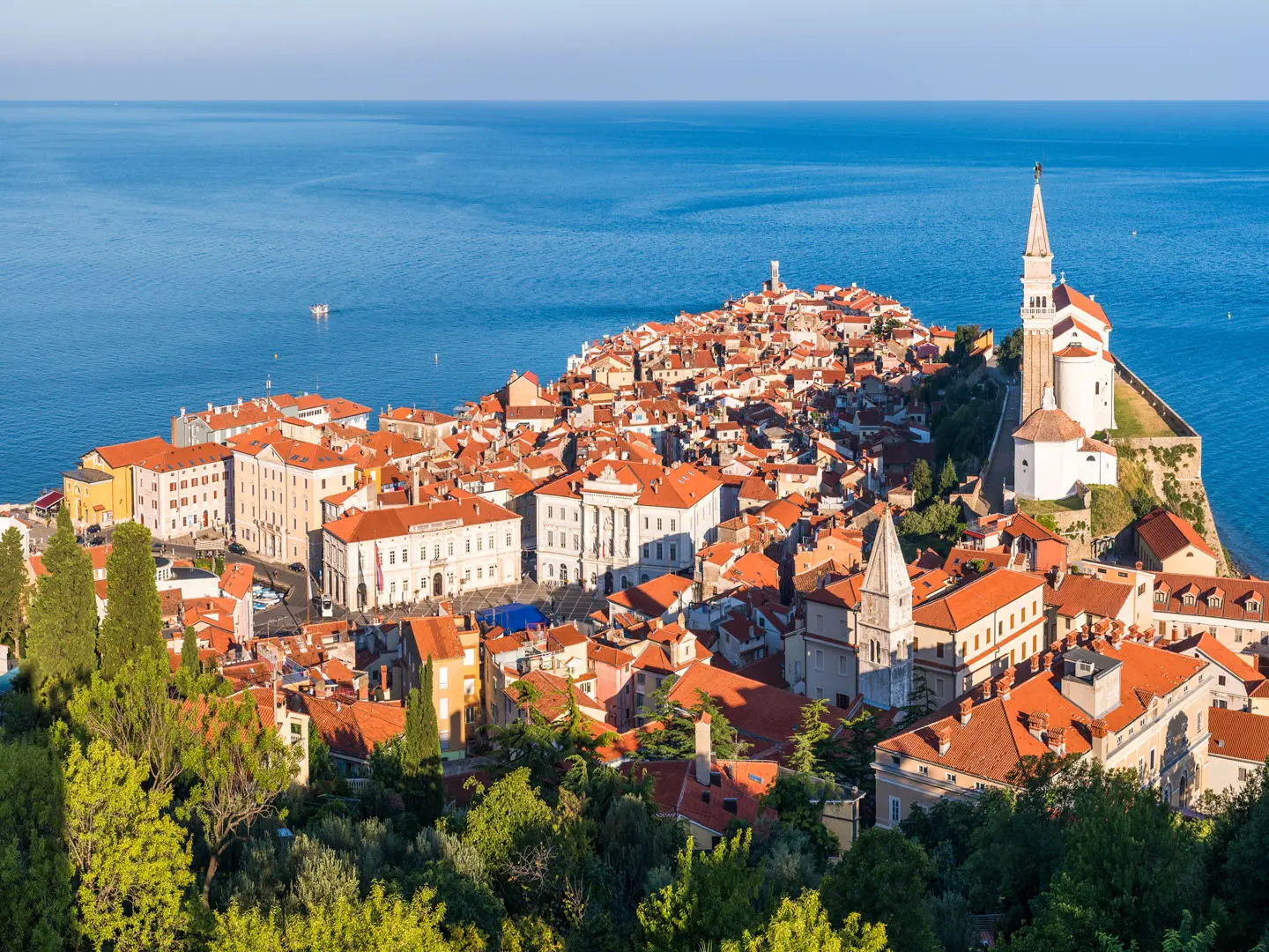
Start in Piran’s Venetian-Gothic old town at Tartini Square, then leave the seafront towards Fiesa, passing the two Fiesa lakes and the easy coastal path. The route continues by Pacug towards Strunjan, with options to include the Strunjan salt pans, Stjuza lagoon, Cape Strunjan and Moon Bay depending on your exact finish. It is a point-to-point walk; most walkers return by bus rather than retracing the route. The listed line is a half-day outing, though stops for swimming, viewpoints, the salt pans or cafés can turn it into a full day. The same stretch of coast forms the Adriatic finish of the long-distance European Long-Distance Path E6, which ends at Strunjan and Piran. For a much longer Slovenian mountain objective, compare it with the Bohinj to Triglav Trail.
Strunjan Landscape Park and Piran salt history
Strunjan Landscape Park was established on 2 February 1990 by the municipalities of Izola and Piran. It protects the only state-level protected area in Slovenia that includes the sea, as well as the longest natural coastline in the Gulf of Trieste. The Strunjan salt pans behind the coast have more than 700 years of continuous tradition and are tied to the historic Piran salt trade, which helped build the wealth of Piran.
Notable highlights
- Strunjan flysch cliffs (up to 80 m): The cliff path follows the highest flysch cliffs on the Adriatic, with layered rock above the sea and views back along the coast.
- Moon Bay / Mesečev zaliv: A crescent pebble beach below the cliffs between Cape Strunjan and Cape Ronek, reached by the cliff path and a common photo stop.
- Strunjan salt pans: The northernmost and smallest still-working salt pans in the Mediterranean, where traditional salt harvesting has continued for more than 700 years.
- Stjuza lagoon: Slovenia’s only sea lagoon, with sheltered water, bird habitat and wooden observation points below the cliffs.
- Fiesa lakes: Two small lakes beside the sea east of Piran, one natural and one artificial, on the easy Fiesa–Piran section.
- Piran old town: The walk starts in the compact Venetian-Gothic centre around Tartini Square before leaving past the Minorite monastery.
Challenges to expect
This is an easy coastal walk, but it is not completely flat. The climb out of Piran towards Fiesa uses stairs and switchbacks, and some sections mix dirt paths, a one-lane road and narrow flysch cliff path. In midsummer the route can be hot, exposed and busy, so carry water and start early. Navigation is straightforward, but decide in advance whether you are finishing at Strunjan, the salt pans or adding Moon Bay.
HikeList Score
Piran to Strunjan Coastal Walk scored 69/100 on HikeList's trail-quality metrics.
See score breakdownHide breakdown
- Ideal length 55
- Balanced challenge 64
- Scenery & wildness 98
- Varied terrain 52
- Accommodation 57
- Food & support 68
- Path quality 71
- Season flexibility 89
Computed from length, challenge, scenery & wildness, terrain variety, accommodation, food & support, path quality and season flexibility.
 Slovenia
Show more data Show less
- Coastal
- Paved
- Dirt
- Hotels
- Family Friendly
- Pet Friendly
- Restrooms
- Picnic Areas
Photos from hikers
Taken on the trail by people who've reviewed Piran to Strunjan Coastal Walk.
Reviews
How would you rate Piran to Strunjan Coastal Walk?
Tap a star to start your review — you could be the first.