Pembrokeshire Coast Path
How would you rate Pembrokeshire Coast Path?
Tap a star to share your experience and help other hikers.
Pembrokeshire Coast Path: A Complete Hiking Guide
HikeList Score
Pembrokeshire Coast Path scored 90/100 on HikeList's trail-quality metrics.
See score breakdownHide breakdown
- Ideal length 88
- Balanced challenge 100
- Scenery & wildness 74
- Varied terrain 100
- Accommodation 100
- Food & support 88
- Path quality 87
- Season flexibility 100
Computed from length, challenge, scenery & wildness, terrain variety, accommodation, food & support, path quality and season flexibility.
The Pembrokeshire Coast Path is a 299 km (186 mile) point-to-point National Trail through Pembrokeshire Coast National Park in south-west Wales. Most walkers take 12–15 days; the official guidebook pace is 12 days at about 24 km per day. It is moderate walking underfoot, but challenging over the full route because of near-constant ascent and descent, narrow cliff-top paths, many stiles and exposed coastal weather. It suits fit hikers who want a long coastal thru-hike with beaches, harbours and wildlife.
Route Overview
The route runs between St Dogmaels / Poppit Sands in the north and Amroth in the south, and can be walked in either direction. Key places on or near the path include Newport, Fishguard, St Davids, Solva, Broad Haven, Marloes, the Milford Haven estuary, Tenby and Saundersfoot. The trail passes 58 beaches and 14 harbours, mixing cliff-top walking with coves, estuaries, lanes and occasional beach crossings. It is a point-to-point hike, so plan accommodation village by village rather than expecting a loop. For another Welsh coastal trail, compare the Anglesey Coastal Path; for a hillier inland Welsh route, see the Beacons Way.
History of the Pembrokeshire Coast Path
The route was surveyed by naturalist Ronald Lockley after Pembrokeshire Coast National Park was designated in 1952. His 1953 report was adopted, and the path officially opened in 1970 as Wales’s first National Trail. Construction took about 17 years and involved more than 100 footbridges and hundreds of stiles. The Pembrokeshire Coast Path now also forms part of the longer Wales Coast Path.
Notable highlights
- St Davids and St Davids Head: The trail passes near St Davids, the UK’s smallest city. Nearby St Davids Head gives rugged coastal walking, Iron Age remains and views towards Ramsey Island.
- Skomer, Skokholm and Ramsey: These offshore islands hold internationally important seabird colonies, including puffins, Manx shearwaters and guillemots. They can be watched from parts of the coast or visited on nearby boat trips.
- Marine wildlife: Grey seals are a major draw, with pups in coves in autumn. Atlantic puffins, porpoises and dolphins are also regularly seen offshore.
- Tenby: Near the southern end, Tenby is a walled medieval harbour town with pastel Georgian houses and beaches. It makes a useful and memorable stop on the final sections.
- Geology and prehistory: The coast includes folded cliffs, sea stacks and arches such as the Green Bridge of Wales. The route also passes a landscape with Neolithic cromlechs and Iron Age promontory forts.
Challenges to expect
The main difficulty is cumulative: roughly 11,000 m of ascent and descent over the full path, despite a highest point of only 175 m at Pen yr Afr on Cemaes Head. Expect constant short climbs, steps, stiles, narrow cliff-top sections and exposed weather. Winter can be blustery and muddy, while summer is the busiest season.
HikeList Score
Pembrokeshire Coast Path scored 90/100 on HikeList's trail-quality metrics.
See score breakdownHide breakdown
- Ideal length 88
- Balanced challenge 100
- Scenery & wildness 74
- Varied terrain 100
- Accommodation 100
- Food & support 88
- Path quality 87
- Season flexibility 100
Computed from length, challenge, scenery & wildness, terrain variety, accommodation, food & support, path quality and season flexibility.
 United Kingdom
 Wales
WalesShow more data Show less
- Coastal
- Cliff Top
- Beaches
- Estuaries
- Heath
- Grass
- Dirt
- Rocky
- Paved
- Sand
- B&Bs
- Inns
- Hotels
- Hostels
- Bunkhouses
- Campsites
- Glamping
- Self Catering
- Family Friendly
- Dog Friendly On Leash
- Restrooms
- Established Campsites
- Picnic Areas
- Visitor Center
- Public Transport Access Points
Download Our Full Guide to Pembrokeshire Coast Path FREE!
Get our comprehensive guide to this hike for free. Save it for later reading or print out at home.

In these collections
Photos from hikers
Taken on the trail by people who've reviewed Pembrokeshire Coast Path.
Pembrokeshire Coast Path: The Complete Guide
 i
Image by John Disandolo
i
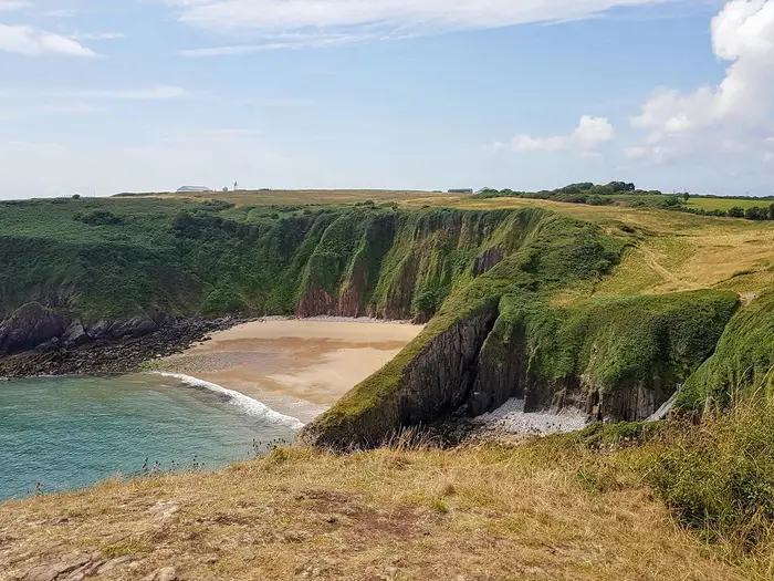
Image by John Disandolo The Pembrokeshire Coast Path is one of Britain’s great coastal long-distance walks: 299 km / 186 miles from St Dogmaels (Llandudoch) on the Teifi estuary to Amroth on Carmarthen Bay. It stays close to the edge of Pembrokeshire’s National Park coastline, linking cliff paths, beaches, harbours, headlands and small coastal towns.
This is a route of constant variety rather than high mountains. The path crosses places such as Cemaes Head (Pen yr Afr), Strumble Head (Pen Caer), St Davids (Tyddewi), Solva (Solfach), Marloes, Stackpole, Tenby (Dinbych-y-pysgod) and Saundersfoot before the final approach to Amroth.
It suits walkers who want a well-waymarked National Trail with strong public transport support, plenty of possible section breaks and memorable coastal walking every day. It can be tackled as a full 12-15 day thru-hike, or broken into shorter trips using towns, buses and rail-linked sections along the route.
Do not mistake “coastal” for easy. The full trail has around 11,000 m of cumulative ascent and descent, with repeated short climbs, steps, stiles, exposed cliff edges, muddy sections after rain and weather that can change quickly off the sea.
This guide covers stages, daily planning, accommodation, food, transport, terrain and the common mistakes to avoid.
Stage-by-Stage Guide
Distances below are approximate and depend on current diversions, tide options and where accommodation is available. On several remote headland stages, the practical end point for walking and the place where you sleep may differ, so book beds and any bus or taxi links before fixing daily mileage.
Stage 1: St Dogmaels (Llandudoch) to Newport (Trefdraeth) — 25 km
The opening stage is one of the most committing on the whole trail. From the official northern terminus at the slipway just north of St Dogmaels, the path follows the Teifi estuary towards Poppit Sands before climbing into the high, exposed cliff country of Cemaes Head (Pen yr Afr).
This is where the Coast Path reaches its highest point, at about 175 m on Pen yr Afr. The walking is not technical, but the repeated climbs, narrow clifftop sections and exposure make this a hard first day, especially in wind or rain.
Key landmarks include Poppit Sands, Cemaes Head, Ceibwr Bay, the Witches’ Cauldron near Ceibwr Bay and the approach towards Newport and the Nevern estuary. The coast here feels wilder than the modest altitude suggests, with big sea views and long stretches where services are limited.
Planning notes
- Food and water: St Dogmaels has little accommodation and limited hiker infrastructure, so most walkers start from Cardigan (Aberteifi) and carry enough food and water for the day. Do not rely on regular facilities between the start and Newport.
- Accommodation: Newport (Trefdraeth) is a practical overnight stop with more choice than the remote coast to the north. Book ahead in peak season.
- Transport and access: The northern start is reached via Cardigan, with the 405 Poppit Rocket serving St Dogmaels and Poppit Sands in season. Timetables should be checked before travelling, especially outside May to September.
- Navigation: Waymarking is generally good, but the first day has enough headlands, coves and field paths to justify carrying OS Explorer OL35 or an equivalent offline map.
- Warnings: This is a tough first stage with exposed, unguarded cliffs. In poor visibility or strong winds, give cliff edges a wide berth and avoid pushing on late in the day.
Stage 2: Newport (Trefdraeth) to Fishguard (Abergwaun) — 19 km
This stage links Newport with Fishguard by way of Parrog, Cwm-yr-Eglwys, Pwllgwaelod and Dinas Head (Pen Dinas). It is shorter than the opening day but still has plenty of coastal ascent and descent.
The Dinas Head section is the highlight, with a compact but energetic circuit of cliff and headland walking. Cwm-yr-Eglwys, with the ruined church of St Brynach, is one of the most memorable small coastal stops on the northern half of the route.
The approach to Fishguard and Goodwick (Wdig) brings a more settled feel after the open coast. This is a useful resupply and transport point before the remoter Strumble Head section.
Planning notes
- Food and water: Newport and Fishguard are the safest places for full supplies. Carry enough for the headland section, as intermediate facilities can be seasonal or limited.
- Accommodation: Fishguard and Goodwick offer a broader range of accommodation than the headlands west of town.
- Transport and access: Fishguard Harbour is on the West Wales rail network. The 405 Poppit Rocket links the Cardigan–Newport–Fishguard corridor in season.
- Navigation: Around Dinas Head, stay with the coast path waymarks rather than cutting between local paths unless deliberately shortening the day.
- Warnings: Expect muddy or slippery clifftop paths after rain and take care on narrow unguarded sections.
Stage 3: Fishguard (Abergwaun) to Pwll Deri — 15 km
This is a shorter but more remote day, moving west from Fishguard and Goodwick towards Strumble Head (Pen Caer) and Pwll Deri. The coastline becomes rugged and exposed, with fewer settlement breaks than the distance might suggest.
Strumble Head is the main feature of the day. Its lighthouse on Ynys Meicel and the surrounding headland are among the best mainland points on the route for watching seals, porpoises and migrating birds.
Pwll Deri is a dramatic place to finish walking, but it is not a large service hub. Many itineraries depend on pre-booked accommodation, a transfer, or a return link to Fishguard or another base.
Planning notes
- Food and water: Stock up in Fishguard or Goodwick. Do not assume food or water will be available once the route leaves the town.
- Accommodation: Accommodation is thin around Strumble Head and Pwll Deri. Book early and be clear whether the night’s lodging is actually on the trail or requires transport.
- Transport and access: The 404 Strumble Shuttle serves the Fishguard–Strumble Head–St Davids corridor in season. This should be checked before travelling.
- Navigation: The coast path is waymarked, but this is an exposed headland day where an offline map is important if mist or heavy rain comes in.
- Warnings: Wind is the main issue. Avoid walking close to cliff edges in gusty conditions and allow more time than the modest distance implies.
Stage 4: Pwll Deri to Whitesands Bay (Traeth Mawr) / St Davids (Tyddewi) — 26 km
This is a long and varied stage across the north side of the St Davids peninsula. It is often split in official sectioning, but many end-to-end walkers combine it because accommodation works better around St Davids.
The route passes Trefin, Porthgain and Abereiddy before continuing towards Whitesands Bay. Porthgain’s former industrial harbour and Abereiddy’s Blue Lagoon are major landmarks, and the walking alternates between clifftop traverses, small coves and open headland.
Whitesands Bay is the coastal end point for many walkers, while St Davids sits just inland and is the usual overnight base. If finishing at the bay, allow for the extra logistics of reaching accommodation in St Davids.
Planning notes
- Food and water: Trefin, Porthgain and Abereiddy are the key places to plan around, but opening times can be seasonal. Carry enough food and water for a full long day.
- Accommodation: St Davids has good accommodation choice compared with the exposed coast. Book well ahead in summer.
- Transport and access: The 404 Strumble Shuttle and St Davids-area coastal buses are useful for splitting or shortening this stage in season. Timetables should be checked before travelling.
- Navigation: Keep a close eye on the waymarks around small harbours, quarry areas and beach approaches where local paths can be confusing.
- Warnings: This is one of the longer days in the 15-stage schedule. Fatigue, wind and late finishes are more likely than any technical difficulty.
Stage 5: Whitesands Bay (Traeth Mawr) / St Davids (Tyddewi) to Solva (Solfach) — 21 km
This stage rounds the St Davids peninsula, combining exposed headland walking with one of the route’s most important cultural stops. St Davids, Britain’s smallest city, lies just inland with its cathedral and Bishop’s Palace, while the coast gives views towards Ramsey Island (Ynys Dewi).
St Davids Head (Penmaen Dewi) is the wildest part of the stage, with open coastal walking and archaeological interest. The route then continues by St Non’s and Porthclais before reaching Solva, a sheltered drowned-valley harbour.
Although the distance is moderate, the stage is rarely flat. Expect the usual Pembrokeshire pattern of short climbs and descents into small inlets.
Planning notes
- Food and water: St Davids is the main resupply point. Carry enough for the headland and south-coast sections, as facilities on the coast itself are not continuous.
- Accommodation: Solva is a popular overnight stop, with accommodation also available in and around St Davids. Book ahead during holidays.
- Transport and access: The 403 Celtic Coaster serves the St Davids peninsula in season, and St Davids is also linked into the wider coastal bus network. This should be checked before travelling.
- Navigation: The route around the peninsula is well waymarked, but headland paths can feel indistinct in poor visibility. Do not shortcut across exposed cliff-top ground without a mapped right of way.
- Warnings: The western headlands are very exposed to weather. Strong winds can make progress slow even on clear days.
Stage 6: Solva (Solfach) to Broad Haven (Aber Llydan) — 19 km
This stage follows the coast eastwards across St Brides Bay, passing Newgale (Niwgwl) and Nolton Haven before reaching Broad Haven. It is a classic mid-route day: not excessively long, but still shaped by the trail’s constant rises and drops.
Newgale is the standout landmark, a long storm-pebble-backed sweep of beach on St Brides Bay. The coast then continues through smaller bays and cliff paths towards Broad Haven.
Broad Haven is a practical overnight halt, with Little Haven nearby on the following stage. This is a useful place to reset before the Marloes and Dale peninsula sections, where accommodation becomes thinner.
Planning notes
- Food and water: Solva and Broad Haven are the dependable planning points. Newgale and Nolton Haven may help, but do not depend on every facility being open, especially outside the main season.
- Accommodation: Broad Haven has accommodation and is a common stop on full-route itineraries. Book early in summer.
- Transport and access: Coastal bus services can be useful along this part of the route in season, but exact services and times should be checked before travelling.
- Navigation: Beach and bay sections can make the way ahead look obvious, but keep following National Trail acorns where the path leaves the shore.
- Warnings: Storm beaches and sandy sections can slow progress. Clifftop paths may be muddy after rain.
Stage 7: Broad Haven (Aber Llydan) to Marloes / Martin’s Haven — 18 km
This stage crosses into a quieter part of the coast, passing Little Haven, St Brides and Marloes before finishing around Marloes or Martin’s Haven. The walking mixes cliff paths, small coastal settlements and broad sea views towards the offshore islands.
The Marloes peninsula is the main draw. Marloes Sands is one of the great beaches of the route, with views towards Gateholm, Skokholm (Ynys Sgogwm) and Skomer (Ynys Sgomer).
Martin’s Haven is also the departure point for boats to Skomer. If planning an island trip, allow an extra day rather than trying to force it into a full walking stage.
Planning notes
- Food and water: Broad Haven is the main place to start fully supplied. Marloes and Martin’s Haven are smaller, so carry what is needed for the day.
- Accommodation: The Marloes and Martin’s Haven area has noticeably thinner accommodation than the larger resorts. Book well ahead or arrange transport to a bed elsewhere.
- Transport and access: The 400 Puffin Shuttle serves the St Davids–Marloes/Martin’s Haven corridor in season. This should be checked before travelling.
- Navigation: The path around the peninsula is well signed, but there are many tempting local paths to viewpoints and beaches. Stay with the coast path if time is tight.
- Warnings: This is exposed coastal walking with limited bail-out options between settlements. Carry waterproofs and an extra layer even in settled weather.
Stage 8: Marloes / Martin’s Haven to Dale — 16 km
This is a shorter stage around the Marloes and Dale peninsula, but it should not be dismissed as an easy filler day. The route remains coastal, exposed and indented, with excellent views towards Skomer, Skokholm and the entrance to Milford Haven Waterway.
Dale is a small but important overnight halt before the long inland-feeling leg to Neyland. The stage also passes the area around The Gann near Dale, where tide timing can affect the line taken.
The walking is varied rather than high, with headlands, shoreline sections and transitions around small inlets. It is a good day for keeping the schedule flexible if the previous day has been lengthened or if an island boat trip has been added.
Planning notes
- Food and water: Start with supplies from Marloes or wherever accommodation is based. Do not rely on frequent services on the peninsula.
- Accommodation: Dale has accommodation, but capacity is limited compared with larger towns. Book ahead, especially in the main walking season.
- Transport and access: Seasonal coastal buses can be useful in the Marloes and Dale area. Exact routes and times should be checked before travelling.
- Navigation: Pay attention near The Gann and around tidal or shoreline options. If the coast path uses a tide-dependent line, use the signed or mapped alternative when necessary.
- Warnings: The Gann near Dale needs tide awareness. This should be checked before travelling.
Stage 9: Dale to Neyland — 26 km
This is one of the longest days in the 15-stage schedule and has a different character from the open headland stages. The route works inland around the Milford Haven / Daugleddau waterway, passing Milford Haven (Aberdaugleddau) before continuing to Neyland.
The walking includes wooded estuary edges, quieter lanes and more settled sections as the path follows the shape of the waterway. It can feel slower than the headline distance suggests because the route is less direct than it looks on a map.
The Sandy Haven crossing is the key logistical issue on this leg. If the tide does not allow use of the crossing, a road detour is required.
Planning notes
- Food and water: Dale, Milford Haven and Neyland are the main planning points. Carry enough to avoid depending on small intermediate services.
- Accommodation: Neyland is a practical stopping point, with Milford Haven also providing options earlier in the day. Book in advance if relying on a specific finish.
- Transport and access: Milford Haven has a railway station on the West Wales lines. Neyland is also useful for road access and for arranging transfers.
- Navigation: Estuary walking involves more turns, lanes and built-up edges than the open cliff sections. Follow waymarks carefully through settlements and around the waterway.
- Warnings: The Sandy Haven tidal crossing must be timed correctly or avoided by the road detour. This should be checked before travelling.
Stage 10: Neyland to Pembroke (Penfro) / Angle — 26 km
This is another long stage, continuing through the Milford Haven / Daugleddau section via Pembroke Dock (Doc Penfro), Pembroke and onwards towards Angle. Many walkers split this day or use transport to reach accommodation, because the practical overnight choices shape the itinerary.
The stage has more estuary, town-edge and lane walking than the wilder northern coast. Pembroke Dock and Pembroke provide useful services, rail access and the chance to break the day before the more remote Angle peninsula.
Angle is the natural coastal objective, but accommodation around Angle can be limited. Pembroke is often the more practical base if a shorter walking day or better transport link is needed.
Planning notes
- Food and water: Neyland, Pembroke Dock and Pembroke are the main places to resupply. Carry enough for the onward section to Angle.
- Accommodation: Pembroke and Pembroke Dock offer more practical options than the remoter coast. Angle accommodation should be booked well ahead.
- Transport and access: Pembroke Dock and Pembroke have railway stations. The 387/388 Coastal Cruiser serves the Angle peninsula in season. This should be checked before travelling.
- Navigation: Urban and estuary-edge walking needs more attention than open clifftop sections. Watch for waymarks at road crossings, quaysides and path junctions.
- Warnings: The length is the main challenge. If carrying a full pack, consider splitting the day or using public transport to avoid an overlong finish.
Stage 11: Angle to Freshwater West / Castlemartin — 16 km
The route leaves Angle for a more remote and exposed stretch of coast, heading towards Freshwater West and Castlemartin. The distance is moderate, but services are sparse and the coast can feel isolated.
Freshwater West (Aberllydan) is one of Pembrokeshire’s major west-facing beaches, with a wilder feel than the resort beaches further south. The surrounding section is open and weather-dependent, with little shelter in poor conditions.
This is a day to treat as a self-sufficient stage. The next section towards Bosherston is affected by the Castlemartin Range, so forward planning matters before leaving Angle.
Planning notes
- Food and water: Carry a full day’s food and water from Angle or your accommodation base. Do not assume reliable facilities at Freshwater West or Castlemartin.
- Accommodation: Accommodation is thinner around Angle, Freshwater West and Castlemartin than in the main towns. Book ahead or arrange transport to a nearby base.
- Transport and access: The 387/388 Coastal Cruiser is the key seasonal bus for the Angle peninsula. Timetables should be checked before travelling.
- Navigation: The path is waymarked, but remote sections require an offline map and enough battery if using a phone for navigation.
- Warnings: Exposure and lack of services are the main issues. In strong winds, keep well back from unguarded cliff edges.
Stage 12: Freshwater West / Castlemartin to Bosherston / Broad Haven South — 16 km
This is one of the most important stages to plan properly because the coast path passes the Castlemartin military firing range area. The spectacular Green Bridge of Wales and Stack Rocks lie inside this range area, and the cliff path can be closed during live firing.
When open, this is a memorable limestone coast stage, with sea arches, stacks and wide views before the route reaches the Bosherston and Broad Haven South area. The Bosherston Lily Ponds and the Stackpole landscape mark a change into a softer, more sheltered section of the south coast.
If the range is closed, the official diversion must be used. Do not assume access to the cliffs simply because the weather is good or because other parts of the coast path are open.
Planning notes
- Food and water: Carry enough for the whole stage. Services around Freshwater West, Castlemartin, the range edge and the open coast are limited.
- Accommodation: Bosherston and Broad Haven South can work as overnight bases, but accommodation should be booked in advance. Some walkers may need transport to lodging nearby.
- Transport and access: Road access exists at the main settlements, but public transport options should be checked before travelling.
- Navigation: Follow all range signs, closure notices and official diversion waymarks. Do not enter closed range land.
- Warnings: Castlemartin Range closures are a serious planning issue. Check firing times and the current official diversion before travelling.
Stage 13: Bosherston / Broad Haven South to Manorbier (Maenorbŷr) — 17 km
This stage moves through one of the most attractive southern sections of the route, linking Broad Haven South, Stackpole Quay, Barafundle Bay, Freshwater East and Manorbier. It combines beaches, wooded and estate edges, limestone cliffs and compact coastal villages.
Barafundle Bay is the standout scenic stop, reached on foot from Stackpole Quay. The route then continues eastwards through a sequence of coves and cliff paths before reaching Manorbier, with its sandy bay below the Norman castle.
The terrain is varied rather than difficult, but the repeated changes between beach, cliff and village paths can make progress uneven. Allow time for beach approaches and for navigating around local paths near Stackpole and Manorbier.
Planning notes
- Food and water: Bosherston, Stackpole Quay, Freshwater East and Manorbier are the logical planning points, but opening times may be seasonal. Carry enough to be independent.
- Accommodation: Manorbier is a practical overnight stop, though capacity is smaller than Tenby. Book ahead in the main season.
- Transport and access: Road access is available at the main villages. Rail and larger-scale transport options become more useful again from Penally and Tenby on the following stage.
- Navigation: In the Stackpole area, take care to stay on the Coast Path rather than following estate or beach access paths unless intentionally detouring.
- Warnings: After rain, cliff paths and steps can be slippery. Beaches and sandy paths can slow walking with a full pack.
Stage 14: Manorbier (Maenorbŷr) to Tenby (Dinbych-y-pysgod) — 16 km
This stage links Manorbier with Tenby via Lydstep and Penally (Penalun). It is a shorter day by full-route standards, but still has typical Pembrokeshire undulations and a mix of cliff, bay and resort-edge walking.
Manorbier’s castle and bay make a strong start to the day. Approaching Tenby, the route becomes more settled, with views towards Caldey Island (Ynys Bŷr) and the beaches around the town.
Tenby is one of the most useful overnight stops on the entire trail. Its accommodation, food options and rail station make it a good place to recover before the final stage to Amroth.
Planning notes
- Food and water: Manorbier, Penally and Tenby are the key places to plan around. Carry enough for the day, as smaller coastal facilities can be seasonal.
- Accommodation: Tenby has plentiful accommodation compared with most other stages, but it is busy in holiday periods and should still be booked ahead.
- Transport and access: Penally and Tenby have railway stations. Southern coastal bus services, including the Tenby Coaster, may help with shorter day walks in season.
- Navigation: The approach into Tenby involves more built-up and beach-edge walking. Keep following the National Trail waymarks through resort areas.
- Warnings: This is an easier stage to underestimate because of the nearby towns. Wet steps, beach sections and short climbs still add time.
Stage 15: Tenby (Dinbych-y-pysgod) to Amroth — 11 km
The final stage is short, but it is still proper coast path walking rather than a flat promenade finish. From Tenby the route continues through the settled south coast via Saundersfoot and Wiseman’s Bridge before reaching Amroth.
Saundersfoot provides a useful halfway break, with harbour and resort facilities. The finish is at the bridge and old boundary stone just east of Amroth Castle, at the eastern end of Amroth beach where Pembrokeshire meets Carmarthenshire.
At very low tides, a submerged prehistoric forest is sometimes visible on the sands at Amroth. The official end point is easy to miss if attention drifts after the final beach and village approach, so identify it before setting off.
Planning notes
- Food and water: Tenby, Saundersfoot and Amroth are all useful for food and drink, though opening hours still vary by season.
- Accommodation: Tenby and Saundersfoot offer the widest choice near the end of the route. Amroth has a quieter finish-village feel and should be booked ahead if staying there.
- Transport and access: From Amroth, the 351 bus links to Kilgetty for rail connections or to Tenby. Kilgetty and Tenby are the main rail options for leaving the southern end. Current timetables should be checked before travelling.
- Navigation: Stay with the waymarks through Saundersfoot, Wiseman’s Bridge and the final approach to Amroth. The trail finishes at the eastern end of Amroth beach, not in central Tenby or Saundersfoot.
- Warnings: The short distance can encourage a late start, but onward transport from Amroth still needs planning because there is no railway station at the trailhead.
Recommended Itinerary
The 15-day itinerary below is the most practical full-route plan for independent walkers using normal coastal accommodation hubs. It follows the route north-to-south from St Dogmaels (Llandudoch) to Amroth, but it works equally well in reverse.
Distances are approximate. Tidal detours, path diversions and accommodation locations can change the real walking distance, so check official mapping before booking fixed nights.
Standard 15-day itinerary
| Day | From | To | Approx. distance | Why this stage makes sense | Services/accommodation notes |
|---|---|---|---|---|---|
| 1 | St Dogmaels (Llandudoch) | Newport (Trefdraeth) | 25 km | A full first day over the northern cliffs, including the high ground around Cemaes Head (Pen yr Afr). It gets the remote northern start done in one committed stage and finishes in a useful overnight village. | St Dogmaels has little or no lodging, so most walkers stay the previous night in Cardigan (Aberteifi) and travel to the start. Newport has more practical accommodation options than the smaller places passed en route. |
| 2 | Newport (Trefdraeth) | Fishguard (Abergwaun) | 19 km | A more moderate day after the opening stage, with the Dinas Head (Pen Dinas) section before reaching a larger service town. | Fishguard and Goodwick (Wdig) are important transport and accommodation points. This is a sensible place to pause, resupply or adjust plans. |
| 3 | Fishguard (Abergwaun) | Pwll Deri | 15 km | A shorter but exposed stage towards Strumble Head (Pen Caer), where weather can make progress slower than the distance suggests. | Accommodation is thinner around Strumble Head and Pwll Deri than in Fishguard, so this night needs booking early. If beds are not available, use the coastal bus network or a taxi to link back to Fishguard or onward lodging. |
| 4 | Pwll Deri | Whitesands Bay / St Davids (Tyddewi) | 26 km | One of the longer northern stages, continuing across remote headland country towards the St Davids peninsula. It keeps the itinerary moving while reaching a major accommodation base. | St Davids is the practical overnight hub rather than relying solely on Whitesands Bay. The 404 Strumble Shuttle, 403 Celtic Coaster and 400 Puffin Shuttle can be useful in season, but timetables should be checked before travelling. |
| 5 | Whitesands Bay / St Davids (Tyddewi) | Solva (Solfach) | 21 km | A solid coastal day around the St Davids peninsula, with good options for starting from or returning to St Davids depending on where accommodation is booked. | St Davids has broad lodging choice and services; Solva is a popular overnight stop but should still be booked ahead in busy periods. |
| 6 | Solva (Solfach) | Broad Haven (Aber Llydan) | 19 km | A manageable stage along St Brides Bay, passing Newgale (Niwgwl) and finishing in a useful coastal settlement. | Broad Haven and nearby Little Haven give more accommodation choice than the smaller coves. This is a good stage for walkers wanting a slightly easier day before the Marloes peninsula. |
| 7 | Broad Haven (Aber Llydan) | Marloes / Martin's Haven | 18 km | Keeps the day moderate while moving onto the wilder Marloes peninsula, where onward lodging becomes more limited. | Accommodation around Marloes and Martin's Haven is noticeably thinner than in the larger resorts. Book early, especially if planning boat trips from Martin's Haven. |
| 8 | Marloes / Martin's Haven | Dale | 16 km | A shorter peninsula stage that avoids overloading the next two long Milford Haven / Daugleddau waterway days. | Dale is a small but important overnight point before the long inland-waterway section. If accommodation is full, transport may be needed to reach a bed elsewhere. |
| 9 | Dale | Neyland | 26 km | One of the longest stages, following the coast and estuary edges towards Neyland. It is less straightforward than the distance alone suggests because tidal crossings affect the route. | Tidal crossings near Dale, including The Gann, and at Sandy Haven require planning or use of the road detour. Check tide times before committing to this day. Neyland has transport links nearby, and some walkers use Milford Haven (Aberdaugleddau), Pembroke Dock (Doc Penfro) or Pembroke (Penfro) as practical lodging alternatives. |
| 10 | Neyland | Pembroke (Penfro) / Angle | 26 km | Another long stage through the Milford Haven / Daugleddau waterway section, with accommodation logistics often dictating the exact stopping point. | Angle has thinner accommodation than the larger towns. Many walkers use Pembroke or Pembroke Dock as overnight bases and arrange a bus or taxi connection where needed. Rail is available at Pembroke Dock and other West Wales line stations nearby. |
| 11 | Angle | Freshwater West / Castlemartin | 16 km | A shorter stage after two long days, moving onto the exposed south-west coast. | Beds and services are limited around Angle, Freshwater West and Castlemartin, so do not leave this night loose. The 387/388 Coastal Cruiser can be useful in season; check current timetables before travelling. |
| 12 | Freshwater West / Castlemartin | Bosherston / Broad Haven South | 16 km | A key limestone-coast stage past the Castlemartin coast towards the Stackpole and Bosherston area. | The section past the Green Bridge of Wales and Stack Rocks lies within the Castlemartin military firing range and can close during live firing. Check firing times and the official diversion before booking or setting out. |
| 13 | Bosherston / Broad Haven South | Manorbier (Maenorbŷr) | 17 km | A compact but varied south-coast stage linking the Stackpole area with Manorbier. | Accommodation is more spread out than in the resort towns, so the exact overnight point should be fixed in advance. Manorbier is also useful because it sits before the final approach to Tenby. |
| 14 | Manorbier (Maenorbŷr) | Tenby (Dinbych-y-pysgod) | 16 km | A moderate penultimate stage into one of the best-served towns on the route. | Tenby has a wide choice of accommodation, food and onward transport, making it the easiest place near the southern end to recover, resupply or add a spare night. |
| 15 | Tenby (Dinbych-y-pysgod) | Amroth | 11 km | A deliberately short final day through Saundersfoot and Wiseman's Bridge to the southern terminus at Amroth. | Amroth has no railway station. Leave by bus towards Kilgetty or Tenby, then connect with rail where required. Check current bus times before travelling. |
Slower variant: 16+ days
A slower schedule suits walkers carrying full packs, anyone wanting time for weather delays, and those who prefer to keep exposed coastal days shorter. The simplest approach is to keep the 15-day structure but add one or more extra nights at strong service hubs such as Fishguard (Abergwaun), St Davids (Tyddewi), Broad Haven (Aber Llydan) or Tenby (Dinbych-y-pysgod).
The most useful places to slow down are the remote or logistically awkward sections: Strumble Head (Pen Caer), the Marloes and Dale peninsula, the Dale-to-Neyland tidal section, the Neyland-to-Angle area, and the Castlemartin coast. Where accommodation is thin, splitting a walking day may require a seasonal coastal bus or taxi link rather than a perfectly placed overnight stop.
Faster variant: 12–14 days
A faster itinerary suits fit long-distance walkers who are comfortable averaging around 24 km per day on repeated switchback coastal terrain. This is a serious pace on the Pembrokeshire Coast Path because the cumulative ascent, steps, stiles, wind exposure and cliff-edge walking make progress slower than on flatter trails.
For a 12-day plan, expect to combine some of the shorter standard stages and rely on longer days between established towns. Do not assume that every combined stage has convenient accommodation at the ideal stopping point; check official mapping, bus links and bed availability before booking.
A 14-day plan is often the more realistic faster option: keep the difficult logistics around Dale, Neyland, Angle and Castlemartin intact, and save time by combining easier or better-served sections near the southern end or where transport links allow. In winter, a faster plan is less forgiving because coastal buses are much reduced and weather can make cliff-top walking slower.
Planning the Route
How many days to allow
Most end-to-end walkers should plan on 12–15 walking days, with 14–15 days a sensible pace for anyone carrying their own kit, wanting shorter afternoons, or building in time for weather and transport. A 12-day itinerary is possible, but it means regularly walking around 24 km / 15 miles per day on a route where the repeated climbs, steps and exposed headlands make distances feel longer than they look on paper.
The path is better planned as an endurance route than a fast coastal stroll. The daily height gain is spread across constant short ascents and descents, so a modest-mileage day can still be tiring, particularly around the northern cliffs, the St Davids peninsula, Marloes, Dale and the Castlemartin coast.
A rest or half-day is easiest to justify at St Davids (Tyddewi), Tenby (Dinbych-y-pysgod), or another larger overnight base where accommodation, food and onward transport are less constrained. In poor weather, having a spare day also makes it easier to avoid exposed cliff sections in high winds.
Direction: St Dogmaels to Amroth or Amroth to St Dogmaels
The route is straightforward to walk in either direction. The National Trail section order runs north to south, from St Dogmaels (Llandudoch) to Amroth, and this is a logical way to follow the official sequence of places.
Many guidebooks and walking companies also offer the route south to north, from Amroth to St Dogmaels, because the prevailing wind is more likely to be behind you. That can matter on open clifftops, but transport and accommodation availability usually matter more than direction.
Whichever way you walk, remember that neither trailhead has a railway station. St Dogmaels is normally reached via Cardigan (Aberteifi), while Amroth is normally linked out by bus towards Kilgetty or Tenby (Dinbych-y-pysgod).
Let accommodation shape the itinerary
Daily stages on the Pembrokeshire Coast Path are dictated as much by beds as by mileage. Towns and resorts such as Newport (Trefdraeth), Fishguard (Abergwaun), St Davids (Tyddewi), Solva (Solfach), Broad Haven (Aber Llydan), Tenby (Dinbych-y-pysgod) and Saundersfoot give the most flexibility.
The harder planning comes around the more remote headlands and peninsulas, especially Strumble Head (Pen Caer), the Marloes/Dale area, Angle, and the Castlemartin coast. Accommodation is thinner here, and some walkers will need to use buses or taxis to sleep away from the exact line of the path.
St Dogmaels itself has little or no accommodation, so most walkers use Cardigan (Aberteifi) for the first or last night. This should be factored in before booking the first stage, especially if arriving by public transport.
Pressure points to plan carefully
| Section / area | Why it needs planning | Practical approach |
|---|---|---|
| St Dogmaels (Llandudoch) / Cardigan (Aberteifi) | The official terminus is not in a major accommodation centre. | Stay in Cardigan and use local transport to reach or leave the trailhead. |
| Strumble Head (Pen Caer) | Remote coastline with fewer overnight options. | Book early or plan a bus/taxi link back to Fishguard (Abergwaun), Goodwick (Wdig), or another base. |
| Marloes, Martin’s Haven and Dale | Attractive but accommodation can be limited; island boat trips can also tempt walkers into adding time. | Reserve beds early and consider a half-day if visiting Skomer (Ynys Sgomer) or Skokholm (Ynys Sgogwm). |
| Dale to Neyland / Milford Haven waterway | One of the longer planning stretches, partly around the Milford Haven / Daugleddau waterway. | Do not assume every walker will want to complete it as one full day; split, bus or taxi if needed. |
| Neyland to Pembroke / Angle | Another long planning stretch where accommodation location affects the day. | Pembroke (Penfro), Pembroke Dock (Doc Penfro) or Angle may be used depending on bookings and transport. |
| The Gann and Sandy Haven | Tidal crossings can affect the line of the route. | Check tide times and be ready to use the road detour. This should be checked before travelling. |
| Freshwater West to Broad Haven South / Castlemartin coast | The path past the Green Bridge of Wales and Stack Rocks crosses the Castlemartin military firing range. | Check firing times and the official diversion before committing to the day. This should be checked before travelling. |
Shortening, extending and section hiking
The route is very practical to walk in sections. The coastal bus network is one of the biggest advantages of this trail, especially between May and September, when services such as the 405 Poppit Rocket, 404 Strumble Shuttle, 403 Celtic Coaster, 400 Puffin Shuttle, 387/388 Coastal Cruiser and Tenby Coaster help link day walks, accommodation bases and trailheads.
In winter, bus coverage is much reduced, so section hiking becomes more dependent on rail-linked towns, local buses, taxis or two-car arrangements. Seasonal timetables should always be checked before booking accommodation or committing to a point-to-point day.
Rail is most useful on or near the southern half of the route, with stations including Fishguard Harbour, Milford Haven (Aberdaugleddau), Pembroke Dock (Doc Penfro), Tenby (Dinbych-y-pysgod), Penally (Penalun) and Kilgetty. These make it relatively easy to break the trail into long weekends or week-long blocks.
Shorter itineraries usually work best by choosing one coast section and walking from a fixed base, rather than trying to compress the whole National Trail. Good bases include larger settlements with buses, food and accommodation, rather than remote headlands with limited services.
Food, water and resupply
Food planning is straightforward in the larger towns and resorts, but should not be left to chance on the quieter peninsulas. Carry lunch and spare snacks before committing to remote sections around Strumble Head (Pen Caer), Marloes, Dale, Angle and Castlemartin.
Water should be topped up whenever reliable services are available. The path regularly passes villages, beaches and harbours, but there are exposed clifftop stretches where there may be no convenient public tap, shop or café for several hours.
Do not rely on every small coastal place having an open shop, pub or café outside the main season. Opening hours can be limited, and winter walking needs more self-sufficiency.
Navigation and route finding
The Pembrokeshire Coast Path is a waymarked National Trail, using the acorn symbol and Wales Coast Path roundel, so navigation is usually uncomplicated in clear weather. The more serious issue is not finding the general direction, but making safe decisions on narrow, unguarded clifftop paths in wind, rain or poor visibility.
Carry proper mapping rather than relying only on signs. The relevant Ordnance Survey Explorer maps are OL35 North Pembrokeshire and OL36 South Pembrokeshire; a current guidebook or strip map is also useful for stage planning and diversions.
Expect occasional route changes, especially where erosion, weather damage, military closures or tidal alternatives affect the line. Check current notices before travelling and again locally if conditions are unsettled.
Weather, tides and closures
Weather is a route-planning issue on this trail. High winds can make exposed cliff sections unpleasant or unsafe, and rain can turn grassy cliff paths, steps and stiles slippery.
Tides only affect specific points rather than the whole route, but they matter at The Gann near Dale and at Sandy Haven. If the timing is wrong, use the road detour rather than trying to force the crossing.
The Castlemartin Range closure is the other major fixed constraint. If the section past the Green Bridge of Wales and Stack Rocks is closed for live firing, follow the official diversion; do not plan this day without checking the range status first.
Booking style: independent or organised
Independent walkers can plan the route easily if accommodation is booked early and transport links are checked carefully. This gives the most flexibility, but it also means managing the awkward gaps around remote peninsulas.
Self-guided packages are a practical option for walkers who want accommodation and luggage transfer arranged in advance. Companies such as Macs Adventure, Contours, Celtic Trails, Mickledore and Absolute Escapes package the full trail over roughly 11–16 nights, often with daily baggage transfer.
Wild camping is not generally permitted, so the route should not be planned as a casual wild-camp trail. Use campsites, hostels, bunkhouses, inns, B&Bs or other booked accommodation instead.
Towns, Villages and Overnight Stops
Accommodation on the Pembrokeshire Coast Path is uneven. The main towns and resorts have a good mix of B&Bs, guesthouses, inns, hotels, campsites and self-catering, while the remote headlands and military-range sections can leave long gaps between beds.
Book the thinner sections first, then fit the easier towns around them. This is especially important around Strumble Head (Pen Caer), the Marloes and Dale peninsula, Angle, and the Castlemartin coast.
Wild camping is not generally permitted, so a full-route plan should be built around booked accommodation, campsites or a self-guided package with lodging and luggage transfer.
Cardigan (Aberteifi) and St Dogmaels (Llandudoch)
St Dogmaels (Llandudoch) is the northern trailhead, with the official start at the slipway beside the Teifi estuary. It is the correct place to begin or finish the National Trail, but it has little or no accommodation, so most walkers use Cardigan (Aberteifi) for the first or last night.
Cardigan is the practical base for pre-walk logistics: reach the area by train to Haverfordwest or Fishguard, then bus to Cardigan, with the 405 Poppit Rocket linking Cardigan, St Dogmaels and Poppit Sands in season. Timetables should be checked before travelling, particularly outside May to September.
Food and supplies are best handled in Cardigan before setting out. Do not assume there will be full walker services at St Dogmaels itself.
Newport (Trefdraeth)
Newport (Trefdraeth) is the first major overnight stop when walking north to south, after the exposed opening day over Cemaes Head (Pen yr Afr). It is one of the better places to stop on the northern coast, with more accommodation choice than the smaller coves and headlands nearby.
The village works well as a first-night target because the St Dogmaels to Newport stage is a demanding start, with steep coastal ground and the path’s highest point early in the route. Newport also gives access to the Nevern estuary and Parrog area before the next stage towards Dinas Head (Pen Dinas) and Fishguard.
The 405 Poppit Rocket serves the Cardigan–St Dogmaels–Newport–Fishguard corridor in season, making Newport useful for section walking or for shortening the first stage. Food and evening meal options are more reliable here than in the smaller places immediately north and south, but opening days still need checking.
Fishguard (Abergwaun) and Goodwick (Wdig)
Fishguard (Abergwaun) and Goodwick (Wdig) form one of the most useful resupply and transport hubs on the whole path. They sit after the Newport to Fishguard stage and before the rougher, more remote walking out towards Strumble Head (Pen Caer).
Accommodation is generally easier to find here than on the headlands to either side. This is a sensible place to build in a shorter day, collect supplies, or reset logistics before the Strumble section.
Fishguard Harbour is one of the rail stations on or near the route. The 405 Poppit Rocket links Fishguard with Newport and Cardigan in season, while the 404 Strumble Shuttle links Fishguard, Strumble Head and St Davids. Check current rail and bus times before committing to a same-day connection.
Pwll Deri and Strumble Head (Pen Caer)
Pwll Deri and Strumble Head (Pen Caer) are among the most exposed and least serviced parts of the northern half of the route. The standard staging often uses Pwll Deri as an overnight point or stage end, but accommodation is limited compared with Fishguard, St Davids or Newport.
This is a section to book early. If no suitable bed is available, walkers commonly need to adjust the stage, use a bus where available, or arrange a taxi to reach accommodation off the immediate coast.
Food and shops should not be relied on along this stretch. Carry enough for the day, including water and bad-weather layers, as there are long clifftop sections with little shelter.
Trefin (Trefín), Porthgain and Abereiddy
Trefin (Trefín), Porthgain and Abereiddy sit between the Strumble coast and the St Davids peninsula. They are useful intermediate stopping points for walkers who do not want a long push from Pwll Deri towards Whitesands Bay (Traeth Mawr) or St Davids (Tyddewi).
Accommodation and food options are more limited than in St Davids, but these places can help split one of the longer northern stretches into more manageable days. Porthgain and Abereiddy are also common pause points because the route passes notable coastal features, including the former harbour setting at Porthgain and the Blue Lagoon near Abereiddy.
Do not assume late food or easy resupply in the smaller villages. Book beds and evening meals ahead, especially outside the main summer season.
St Davids (Tyddewi) and Whitesands Bay (Traeth Mawr)
St Davids (Tyddewi) is one of the key overnight bases on the trail. The coast path passes Whitesands Bay (Traeth Mawr) and St Davids Head (Penmaen Dewi), while the city itself sits just inland, so walkers often use St Davids accommodation rather than trying to stay directly on the shore.
This is one of the better-serviced parts of the route, with a wider choice of lodging than the surrounding headlands. It is also a natural place for a rest day, especially if visiting the cathedral area or building in time for the St Davids peninsula.
The 403 Celtic Coaster serves the St Davids peninsula, and the 400 Puffin Shuttle links St Davids with Marloes and Martin’s Haven in season. These buses are particularly useful for section walkers, rest-day logistics or recovering from a missed connection, but seasonal timetables should be checked before travelling.
Solva (Solfach)
Solva (Solfach) is a strong overnight stop between St Davids and the long beach section towards Newgale (Niwgwl), Nolton Haven and Broad Haven (Aber Llydan). It sits on a sheltered harbour and is one of the more practical villages on this part of the coast.
Accommodation is generally more available than in the smaller bays, though it should still be booked well ahead in summer. Solva also works well for walkers who want to avoid making the St Davids to Broad Haven stretch too long.
Food options are more dependable here than on the open coast immediately east and west, but opening hours vary by season. Carry day food before leaving for Broad Haven, as the route soon returns to exposed coastal walking.
Newgale (Niwgwl) and Nolton Haven
Newgale (Niwgwl) and Nolton Haven are useful intermediate points between Solva and Broad Haven (Aber Llydan). They are not as robust as overnight hubs as Solva or Broad Haven, but they can help split the day if accommodation is available.
Newgale is a major beach stop on St Brides Bay, but it should not be treated as a guaranteed full-service resupply point. Check accommodation, food and onward transport before planning to end a stage here.
These stops are most useful for slower itineraries, bad-weather flexibility, or walkers building a shorter day after the St Davids peninsula.
Broad Haven (Aber Llydan) and Little Haven
Broad Haven (Aber Llydan) is one of the main overnight stops on St Brides Bay and a practical stage end after Solva. Little Haven lies close by and can also be used for accommodation depending on availability.
This area usually offers more walker infrastructure than the smaller coves to the west. It is a sensible place to resupply, dry kit and prepare for the next section towards St Brides, Marloes and Martin’s Haven, where lodging becomes more limited.
Broad Haven also works well for section walking because it sits on a natural break in the route. As with all coastal villages, check seasonal opening for food and transport before relying on it.
Marloes and Martin’s Haven
Marloes and Martin’s Haven are important overnight or stage-end points on the western peninsula, but accommodation is noticeably thinner than in the larger towns and resorts. This is one of the places where beds should be secured early.
Martin’s Haven is also the departure area for boats to Skomer (Ynys Sgomer), so accommodation and transport can be affected by visitor demand in the main season. Walkers adding an island trip should build in extra time rather than trying to combine everything with a full walking day.
Food and supplies are limited compared with Broad Haven, St Davids or Tenby. Carry enough food for the walking stage and confirm evening meal arrangements before arrival.
Dale
Dale is the practical overnight stop after the Marloes and Martin’s Haven section and before the route turns inland around the Milford Haven / Daugleddau waterway. It is a key planning point because the following Dale to Neyland stage is one of the longest in the standard itinerary.
Accommodation is limited compared with the main towns, so book early or be prepared to use transport to reach a bed elsewhere. This is not a section to leave to chance during summer.
The onward route involves tidal considerations around The Gann and Sandy Haven, with road detours required if the crossings cannot be timed. Tide times and the practical implications for the day should be checked before travelling.
Milford Haven (Aberdaugleddau)
Milford Haven (Aberdaugleddau) is one of the larger service points on or near the southern half of the path. It is useful for accommodation, resupply and public transport while the trail follows the Milford Haven / Daugleddau waterway rather than open clifftop coast.
Milford Haven has a railway station on the West Wales lines, making it valuable for joining, leaving or splitting the trail. It can also help reduce pressure on the long Dale to Neyland and Neyland to Pembroke / Angle stages.
Walkers using Milford Haven as a staging point should check how their accommodation connects with the actual line of the path and the day’s tidal crossings. A short transfer or adjusted stage may be more practical than forcing a long day to fit a fixed booking.
Neyland
Neyland is a common stage end after the long route round from Dale. It is also a useful pivot before the next long leg towards Pembroke (Penfro), Pembroke Dock (Doc Penfro) or Angle.
The standard itinerary gives Dale to Neyland and Neyland to Pembroke / Angle as two of the longest days, so many walkers split these stages or use buses and taxis to reach accommodation. This is a good area to plan conservatively rather than assuming fast progress.
Food and lodging should be checked before arrival. If staying elsewhere, build transport time into the day rather than treating Neyland as a simple walk-through point.
Pembroke Dock (Doc Penfro) and Pembroke (Penfro)
Pembroke Dock (Doc Penfro) and Pembroke (Penfro) are among the most useful overnight bases on the southern half of the route. They provide more accommodation and transport options than the more exposed coast towards Angle and Castlemartin.
Pembroke Dock has a railway station, and the area is a practical place to break the demanding Neyland to Angle section. Pembroke can also be used as a lodging base when accommodation on the coast is scarce.
These towns are good places to resupply before the quieter Angle and Freshwater West / Castlemartin sections. Check how your chosen accommodation fits the route line, as staying in town may require a short approach, bus or taxi connection.
Angle
Angle is a key overnight stop on the Angle peninsula and one of the places where accommodation can be tight. It is less forgiving than the larger towns if beds are full, so book well ahead.
The 387/388 Coastal Cruiser services are useful for the Angle peninsula in season. They can help with section walking, shortening a stage or reaching accommodation away from the immediate path, but winter provision is much reduced and must be checked.
Food and resupply are more limited than in Pembroke, Pembroke Dock or Tenby. Carry enough for the day and confirm evening meal options before committing to an overnight stop.
Freshwater West (Aberllydan) and Castlemartin
Freshwater West (Aberllydan) and Castlemartin sit before one of the most logistically sensitive parts of the trail. Accommodation is thin, and the onward route towards the Green Bridge of Wales, Stack Rocks and Broad Haven South can be affected by Castlemartin military firing range closures.
This section must be checked before travelling. During live firing, the cliff path through the range is closed and walkers must follow the official diversion.
Do not rely on finding food or supplies at short notice here. Treat the area as a booked-ahead stop or use nearby transport to reach accommodation elsewhere.
Bosherston, Broad Haven South and Stackpole Quay
Bosherston, Broad Haven South and Stackpole Quay form a useful cluster after the Castlemartin coast. They are natural stopping or pause points before the route continues past Barafundle Bay and towards Freshwater East.
Accommodation is more limited than in the resort towns, but this area can work well as an overnight if booked early. It is also a good place to slow the itinerary after the firing-range section, especially if previous days have been adjusted by closures or weather.
Food options should be checked in advance. Carry supplies if continuing through to Manorbier (Maenorbŷr) or using a longer stage.
Freshwater East
Freshwater East is a useful intermediate stop between Bosherston / Broad Haven South and Manorbier (Maenorbŷr). It can help shorten the southern coast stages if accommodation is available.
It is not as strong a transport or service hub as Tenby (Dinbych-y-pysgod), Pembroke Dock or Milford Haven. Treat it as a pre-booked overnight rather than a place to improvise.
For walkers on a faster itinerary, Freshwater East may simply be a passing point. For slower itineraries, it can make the run into Manorbier more comfortable.
Manorbier (Maenorbŷr)
Manorbier (Maenorbŷr) is a practical overnight stop before the approach to Tenby (Dinbych-y-pysgod). It sits on a natural stage break and is usually a more convenient place to stop than trying to stretch all the way from Bosherston / Broad Haven South to Tenby in one day.
Accommodation should still be booked ahead, particularly in the main holiday season. Food and evening meal options need checking, as smaller coastal villages do not always keep walker-friendly hours outside summer.
The following day to Tenby is a manageable stage in the standard itinerary, with Penally (Penalun) also available on or near the route and a railway station there for transport flexibility.
Penally (Penalun) and Tenby (Dinbych-y-pysgod)
Tenby (Dinbych-y-pysgod) is the main southern resort hub and one of the easiest places on the trail to find accommodation, food and onward transport. It is a very practical final major overnight stop before the short last stage to Amroth.
Penally (Penalun), just before Tenby on the north-to-south route, has a railway station and can be useful if Tenby accommodation is full or if a shorter day is needed. Tenby itself also has a railway station on the West Wales lines.
This is a good place to sort final-day transport, especially if finishing at Amroth and returning via bus to Kilgetty or Tenby. Book accommodation early in busy periods, as Tenby’s popularity extends well beyond long-distance walkers.
Saundersfoot and Wiseman’s Bridge
Saundersfoot is the main settlement between Tenby and Amroth and can be used as a final overnight stop for walkers who want a very short finishing day. It has more services than the smaller places immediately east and west.
Wiseman’s Bridge is closer to the end of the trail and is more of a passing or shorter-stage option. Accommodation and food should be checked before planning to stop there.
The Tenby Coaster is useful in this southern coastal area in season. As elsewhere on the path, current timetables should be checked before relying on a bus connection.
Amroth
Amroth is the southern terminus of the Pembrokeshire Coast Path, at the bridge and old boundary stone just east of Amroth Castle. It is a good place to finish the walk, but it is not a railhead.
For onward travel, use the 351 bus to Kilgetty for rail connections, or travel back towards Tenby. Confirm current bus and rail times before booking onward trains, especially outside the main season.
Accommodation may be useful for a relaxed final night, but many walkers finish and transfer out the same day. If doing so, leave enough time for the final Tenby to Amroth stage and any bus connection from the finish.
Getting to the Start
The official northern start of the Pembrokeshire Coast Path is the slipway just north of St Dogmaels (Llandudoch), beside the Teifi estuary near Cardigan (Aberteifi). Do not confuse this with Poppit Sands, where an older trail plaque stood about 2.5 km further along the coast.
For most walkers, Cardigan (Aberteifi) is the practical staging point for the start, with the final approach made by bus or taxi to St Dogmaels (Llandudoch).
By train
There is no railway station at St Dogmaels (Llandudoch). The usual public-transport approach is to travel by train to Haverfordwest or Fishguard, then continue by bus towards Cardigan (Aberteifi) and St Dogmaels (Llandudoch).
West Wales rail services connect through the regional rail network, with changes commonly made at Swansea, Carmarthen or Whitland depending on the route. Current rail and onward bus timings should be checked before travelling, especially if arriving late in the day.
| Step | Practical route |
|---|---|
| 1 | Train to Haverfordwest or Fishguard |
| 2 | Bus onward to Cardigan (Aberteifi) |
| 3 | 405 Poppit Rocket to St Dogmaels (Llandudoch) / Poppit Sands |
Fishguard Harbour is also on the West Wales rail network, but it is not at the trailhead. Allow enough time for the bus connection, as missing the final link can mean needing a taxi or an extra night before starting.
By bus
The key service for the northern start is the 405 Poppit Rocket, which links Cardigan (Aberteifi), St Dogmaels (Llandudoch), Poppit Sands, Newport (Trefdraeth) and Fishguard (Abergwaun). It is one of Pembrokeshire’s coastal walkers’ buses and is particularly useful for both reaching the start and splitting early stages.
These coastal bus services run mainly May to September, with reduced provision in winter. Timetables change seasonally, so plan the full journey with Traveline Cymru and check the current 405 Poppit Rocket timetable before booking accommodation or train tickets.
If buses do not line up with rail arrivals, a pre-booked taxi from Cardigan (Aberteifi), Fishguard (Abergwaun) or Haverfordwest may be the simplest way to reach the slipway at St Dogmaels (Llandudoch). This should be checked before travelling.
By car
Driving to the start is possible, but it creates the usual problem of a long point-to-point walk: the finish is 299 km away at Amroth, which also has no railway station. Unless someone is collecting the vehicle, a car left near the northern start means arranging a return by a combination of bus, rail and possibly taxi at the end.
Long-stay parking arrangements at or near St Dogmaels (Llandudoch) are not something to assume. If leaving a vehicle for the full walk, arrange this directly with accommodation or a local parking provider before travelling.
Many walkers avoid this complication by using public transport to reach Cardigan (Aberteifi) and starting from there by bus or taxi. This is usually cleaner than trying to retrieve a car after finishing at Amroth.
From the nearest airport
Flying is rarely the most straightforward way to reach the northern trailhead, as St Dogmaels (Llandudoch) has no airport or railway station. The practical onward route is to reach the West Wales rail network, travel to Haverfordwest or Fishguard, and continue by bus via Cardigan (Aberteifi) to St Dogmaels (Llandudoch).
If arriving by air, build in a generous buffer for the rail-and-bus connection to the coast. The final bus link is seasonal and can be limited outside summer, so this should be checked before travelling.
Where to stay before starting
St Dogmaels (Llandudoch) has little or no accommodation, so most walkers spend the night before starting in Cardigan (Aberteifi). This also makes the logistics easier: arrive by public transport, stay in town, then take the 405 Poppit Rocket or a taxi to the slipway at St Dogmaels (Llandudoch) in the morning.
Booking ahead is sensible, particularly in summer and on weekends. The first north-to-south stage to Newport (Trefdraeth) is a full coastal day with the high cliffs of Cemaes Head (Pen yr Afr) early on, so starting well-rested and not rushed by transport delays matters.
Getting Home from the Finish
The Pembrokeshire Coast Path finishes at Amroth, at the bridge and old boundary stone just east of Amroth Castle. There is no railway station at the trailhead, so most walkers leave by bus or taxi to Kilgetty or Tenby (Dinbych-y-pysgod), then continue by rail.
If finishing late in the day, do not assume there will be an onward bus. Bus and train times should be checked before travelling, especially outside the main May–September coastal bus season.
By train
Amroth has no railway station. The usual rail options are:
| Railhead | How to reach it from Amroth | Notes |
|---|---|---|
| Kilgetty | 351 bus or taxi | Practical rail connection from the finish. |
| Tenby (Dinbych-y-pysgod) | 351 bus or taxi | Better if staying overnight or wanting more accommodation and services before travelling on. |
Kilgetty and Tenby are on the West Wales rail lines. Longer journeys normally involve changes at Whitland, Carmarthen and/or Swansea, depending on destination and timetable.
Build in a margin between the bus from Amroth and the train connection. This is particularly important at the end of a long final walking day from Tenby to Amroth, when delays from weather, tiredness or café stops can easily affect onward travel.
By bus
The key onward bus from Amroth is the 351, which links the finish with Kilgetty and Tenby (Dinbych-y-pysgod). This is the main public-transport link for walkers completing the trail southbound.
Pembrokeshire’s coastal bus network is extremely useful for walkers, but services are seasonal and reduced in winter. Plan with Traveline Cymru and check the current 351 timetable before committing to a same-day train or long onward journey.
If the final stage is being walked from Tenby to Amroth, one practical option is to leave luggage in Tenby, walk to the finish, then return by bus to Tenby for the night. This avoids trying to make a late long-distance rail connection from a small coastal village.
By car/taxi
If a car has been left in Amroth, check parking arrangements locally before relying on them for a multi-day hike. Amroth is a small finish village, not a transport hub.
Taxis are useful if the 351 timetable does not work, if finishing late, or if travelling in winter when coastal services are more limited. Book ahead where possible, especially at weekends, in school holidays or after an evening finish.
For walkers who started at St Dogmaels (Llandudoch), returning all the way to the northern trailhead by public transport is possible but not quick: travel first from Amroth to Kilgetty or Tenby, then use the West Wales rail network and buses back towards Cardigan (Aberteifi) and St Dogmaels. This should be planned as a full onward travel day rather than an afterthought.
From the nearest airport
Flying is not the natural way to leave the Pembrokeshire Coast Path finish. Amroth has no direct airport link, so the practical first step is still to reach Kilgetty or Tenby by bus or taxi, then continue by rail towards larger interchange points such as Carmarthen or Swansea.
Airport-specific onward routes and transfer times depend on current rail and coach timetables. This should be checked before travelling.
Where to stay at the finish
Staying overnight near the finish is often the least stressful option, particularly after the final Tenby-to-Amroth stage or if bus times are limited. Amroth itself is a quiet beach village, so accommodation should be booked ahead rather than left to chance.
For a wider choice of beds, food and onward transport, look at Saundersfoot or Tenby (Dinbych-y-pysgod). Tenby is especially convenient if you want to finish the walk, return from Amroth by bus, stay the night, and take the train the following morning.
Which Direction Should You Walk?
The Pembrokeshire Coast Path can be walked comfortably in either direction. The HikeList stage order follows the National Trail section order from St Dogmaels (Llandudoch) to Amroth, but many guidebooks and walking-holiday operators favour the reverse, Amroth to St Dogmaels, largely because the prevailing wind is more likely to be behind you.
There is no meaningful difference in total difficulty. This is a switchback coastal trail with around 11,000 m of ascent and descent, so every major dip to a cove or beach is paid for whichever way you walk.
North to south: St Dogmaels (Llandudoch) to Amroth
Walking north to south has the advantage of matching the official section order used by the National Park and many online route descriptions. It also gives a strong sense of travelling down the Pembrokeshire coast from the Teifi estuary to Carmarthen Bay.
The main drawback is that the route starts hard. The opening stretch from St Dogmaels (Llandudoch) towards Newport (Trefdraeth) takes you quickly onto the high, exposed northern cliffs around Cemaes Head (Pen yr Afr), the highest point on the path. For a full-distance walk, that means carrying fresh legs but often a full pack into one of the tougher early stages.
Transport is slightly awkward at the start because St Dogmaels (Llandudoch) has no railway station and very little accommodation. Most walkers stay in Cardigan (Aberteifi), then use local transport towards St Dogmaels/Poppit Sands; this should be checked before travelling. Finishing at Amroth is relatively straightforward, with onward bus links towards Kilgetty or Tenby for rail connections.
The psychological finish is pleasant rather than dramatic: Tenby (Dinbych-y-pysgod), Saundersfoot and Amroth give a softer final run through the busier south coast resorts. The last stage from Tenby to Amroth is short by full-trail standards, which can make for a relaxed final day.
South to north: Amroth to St Dogmaels (Llandudoch)
South to north is a very practical choice and is often preferred. The key advantage is weather: with the usual prevailing wind more likely to come from the south-west or west, walking towards St Dogmaels often gives a better chance of having the wind behind rather than in your face. On such an exposed clifftop route, that can make a real difference over 12–15 days.
This direction also gives a gentler opening if you stage it from Amroth to Tenby, then onwards through Manorbier (Maenorbŷr), Freshwater East and the Stackpole coast. The wildest northern cliffs, including Cemaes Head (Pen yr Afr), are saved for the end rather than tackled immediately.
Transport at the start is manageable because Amroth can be reached by bus from Kilgetty or Tenby, both of which are useful southern transport hubs. The finish is less convenient: St Dogmaels (Llandudoch) has little accommodation, so most walkers end the trail and continue to Cardigan (Aberteifi) for the night or onward travel. This should be planned before booking the final stage.
Scenically, south to north gives a satisfying build-up. The route moves from the more developed southern coast through the Castlemartin, Milford Haven / Daugleddau and St Davids sections before ending on the high northern cliffs above the Teifi estuary.
Recommendation
For most full-distance walkers, Amroth to St Dogmaels (Llandudoch) is the better direction. It gives the best chance of favourable wind, starts more gently, and lets the coastline grow wilder as the walk progresses.
Choose St Dogmaels (Llandudoch) to Amroth if matching the official north-to-south section order matters, or if finishing with an easier transport exit via the Tenby/Kilgetty side is more convenient. Either way, book the St Dogmaels/Cardigan end carefully, as accommodation and onward transport are more limited there than on the southern coast.
Accommodation Along the Route
Accommodation is workable for the full Pembrokeshire Coast Path, but it is not evenly spread. The main towns and resort villages have a strong choice of B&Bs, guesthouses, inns, hotels, hostels, bunkhouses, campsites, glamping and self-catering, while the exposed headlands and smaller peninsulas can leave long gaps between beds.
For most walkers, the best strategy is to build the itinerary around the reliable overnight hubs, then use buses, taxis or luggage-transfer arrangements to deal with the awkward sections. Booking ahead is strongly advised for a continuous 12–15 day walk, especially in spring and summer, during school holidays, at weekends, and anywhere near the remoter headlands.
Best overnight bases
The strongest accommodation choices are generally in Newport (Trefdraeth), Fishguard (Abergwaun), St Davids (Tyddewi), Solva (Solfach), Broad Haven (Aber Llydan), Tenby (Dinbych-y-pysgod) and Saundersfoot. These are the easiest places to plan around if you want a classic inn-to-inn or B&B-to-B&B walk.
St Dogmaels (Llandudoch) is the official northern trailhead, but it has little or no accommodation. Most walkers starting or finishing at the northern end stay in Cardigan (Aberteifi) and use local transport to reach St Dogmaels or Poppit Sands.
The thinnest accommodation areas are around Strumble Head (Pen Caer), the Marloes/Dale peninsula, Angle and the Castlemartin coast. These sections need particular care: do not assume there will be a bed at the exact end of a stage.
| Place | Accommodation level | Best for | Notes |
|---|---|---|---|
| Cardigan (Aberteifi) | Good | Start or finish logistics for St Dogmaels | The practical base for the northern terminus, as St Dogmaels itself has little or no lodging. |
| St Dogmaels (Llandudoch) | None | Official trailhead only | Plan to stay in Cardigan (Aberteifi) before or after the walk. |
| Newport (Trefdraeth) | Good | First full overnight stop; B&B/inn walking | One of the stronger northern bases and a natural stop after the Cemaes Head section. |
| Fishguard (Abergwaun) / Goodwick (Wdig) | Good | Resupply, transport links and flexible staging | A useful larger hub before or after the Strumble Head (Pen Caer) section. |
| Pwll Deri / Strumble Head (Pen Caer) area | Limited | Shortening the Fishguard–St Davids stretch | Accommodation is thin around this exposed headland. Book early or use transport back to a larger base. |
| Trefin / Porthgain / Abereiddy area | Limited | Breaking the long north St Davids peninsula section | Useful if available, but not a place to leave unbooked on a continuous itinerary. |
| St Davids (Tyddewi) / Whitesands Bay | Good | Rest day, resupply and flexible staging | One of the best accommodation bases on the trail, with good options for walkers tackling St Davids Head (Penmaen Dewi) and the surrounding coast. |
| Solva (Solfach) | Good | Comfortable overnight stop between St Davids and Newgale/Broad Haven | A strong village base on the western section. |
| Broad Haven (Aber Llydan) / Little Haven | Good | St Brides Bay staging | Good choice compared with the smaller settlements either side. |
| Marloes / Martin’s Haven | Limited | Skomer-side staging and the Marloes peninsula | Accommodation can be scarce; book early or consider a transfer if the stage end does not match available beds. |
| Dale | Limited | Breaking the Marloes–Milford Haven side of the route | A useful but limited overnight point before the longer Milford Haven / Daugleddau waterway section. |
| Milford Haven (Aberdaugleddau) / Neyland | Limited | Splitting the long inland waterway stages | Practical for stage planning, but check availability before fixing daily distances. |
| Pembroke (Penfro) / Pembroke Dock (Doc Penfro) | Limited | Alternative lodging for the Neyland–Angle area | Often used to make the long Dale–Neyland and Neyland–Angle legs more manageable; a bus or taxi may be needed depending on the day’s route. |
| Angle | Limited | Overnight before Freshwater West and Castlemartin | One of the more constrained areas. Secure a bed before committing to the stage. |
| Freshwater West / Castlemartin | Limited | Castlemartin coast staging | Accommodation is thin, and the Castlemartin Range section can be closed during live firing. Check access before travelling. |
| Bosherston / Broad Haven South | Limited | Stackpole and Barafundle Bay section | Useful for breaking the south Pembrokeshire coast, but do not rely on last-minute availability. |
| Manorbier (Maenorbŷr) | Limited | Final approach to Tenby | A practical overnight stop before the easier southern resort section. |
| Tenby (Dinbych-y-pysgod) | Good | Rest day, finish logistics and broad accommodation choice | One of the strongest bases near the southern end, with good transport options compared with smaller villages. |
| Saundersfoot | Good | Final night before or after Amroth | A good resort base close to the southern terminus. |
| Amroth | Limited | Official finish or start only | Accommodation may be possible, but many walkers use Saundersfoot, Tenby or onward transport after finishing. |
Booking strategy
For a full end-to-end walk, accommodation should normally be booked before travel rather than arranged day by day. The path is popular, the coast has a strong holiday season, and some of the best stage ends are small villages with limited stock.
The most important nights to secure early are the awkward gaps: Pwll Deri and Strumble Head (Pen Caer), Marloes or Martin’s Haven, Dale, Angle, Freshwater West, Castlemartin, and Bosherston or Broad Haven South. If these beds are not available, adjust the stage plan before booking the rest of the route.
In the larger hubs, there is more flexibility, but not unlimited flexibility. Newport (Trefdraeth), Fishguard (Abergwaun), St Davids (Tyddewi), Solva (Solfach), Broad Haven (Aber Llydan), Tenby (Dinbych-y-pysgod) and Saundersfoot are still worth booking ahead during busy periods.
Using transfers to solve gaps
The Pembrokeshire Coast Path works well as an inn-to-inn walk, but the neatest itinerary is not always the one that ends every day beside a convenient bed. The Dale–Neyland and Neyland–Angle legs are among the most awkward because of distance, tidal considerations and the routing around the Milford Haven / Daugleddau waterway.
A short taxi or coastal bus link can make the accommodation plan far easier, particularly around the Marloes/Dale peninsula, Angle and Castlemartin. This is a normal part of planning the route, not a sign that the itinerary has failed.
Self-guided walking companies such as Macs Adventure, Contours, Celtic Trails, Mickledore and Absolute Escapes package the full trail with pre-booked accommodation and daily luggage transfer. This is the simplest option if you want to walk with a daypack and avoid stitching together difficult overnight gaps yourself.
Camping and budget options
Hostels, bunkhouses, campsites and glamping are part of the accommodation mix, but they are not evenly spaced along the whole coast. Campers still need to plan stage ends carefully, especially on the remote headlands and around the Castlemartin coast.
Wild camping is not generally permitted. If camping, use established campsites and check opening dates before relying on them, particularly outside the main season.
Camping and Wild Camping
Camping is a realistic way to walk the Pembrokeshire Coast Path, but it needs more planning than simply carrying a tent and stopping where convenient. The route passes towns, resorts and villages with a mix of campsites, glamping and other accommodation, but there are also long, exposed headland sections where overnight options are noticeably thinner.
The full trail is demanding with camping kit: around 11,000 m of cumulative ascent and descent, many steps and stiles, narrow clifftop paths and frequent exposure to wind. A lighter camping setup is strongly preferable, and daily distances may need shortening compared with a B&B-based itinerary.
Campsites on or near the route
Campsites and camping-style accommodation are most practical around the established coastal hubs: Newport (Trefdraeth), Fishguard (Abergwaun), St Davids (Tyddewi), Solva (Solfach), Broad Haven (Aber Llydan), Tenby (Dinbych-y-pysgod), Saundersfoot and the busier holiday areas of the south coast. These are the places where resupply, pubs, shops, buses and alternative indoor accommodation are most likely to line up with a walking stage.
The harder sections for a camping itinerary are the remote headlands and peninsulas: Strumble Head (Pen Caer), the Marloes and Dale area, Angle, and the Castlemartin coast. These stretches can leave you with awkward gaps between legal overnight stops, so camping locations should be booked before committing to daily stages.
Do not assume every village has a campsite, shop or food service. St Dogmaels (Llandudoch) has little or no accommodation, so many walkers use Cardigan (Aberteifi) before or after the northern terminus; camping availability around the start should be checked before travelling.
| Part of the route | Camping practicality | Planning notes |
|---|---|---|
| St Dogmaels (Llandudoch) to Newport (Trefdraeth) | Moderate | A tough opening stage over Cemaes Head (Pen yr Afr). Check overnight options around Cardigan, St Dogmaels and Newport before setting out. |
| Newport (Trefdraeth) to Fishguard (Abergwaun) | Good to moderate | More settlement access than the wild headlands, but still exposed and up-and-down. |
| Fishguard (Abergwaun) to St Davids (Tyddewi) via Strumble Head (Pen Caer) | More difficult | Remote, rugged and exposed. Overnight stops are less frequent, so this section needs careful booking. |
| St Davids (Tyddewi) to Broad Haven (Aber Llydan) | Generally good | St Davids, Solva and Broad Haven are useful camping or services hubs, though exact sites and opening periods should be checked. |
| Broad Haven to Dale / Marloes / Martin’s Haven | Moderate to difficult | Attractive for campers but accommodation is thinner around the Marloes and Dale peninsula; book ahead in season. |
| Dale to Neyland and Pembroke / Angle | Difficult in places | Longer inland and estuary-side stages, with tidal crossings affecting timing. Many walkers split stages or use buses/taxis to reach lodging. |
| Angle to Bosherston / Broad Haven South | Difficult | Remote coast, Freshwater West, Castlemartin and firing-range restrictions make this a section to plan carefully. Check closures before travel. |
| Bosherston / Broad Haven South to Tenby (Dinbych-y-pysgod) | Moderate to good | More holiday infrastructure appears as the path moves towards Manorbier, Penally and Tenby. |
| Tenby (Dinbych-y-pysgod) to Amroth | Good | Short final stage with better access to services around Tenby, Saundersfoot and Amroth. |
Wild camping
Wild camping is not generally permitted on the Pembrokeshire Coast Path. Treat all land beside the path, including clifftops, farmland, dunes, beaches and access land within the National Park, as private or protected unless you have explicit permission to camp there.
Do not plan a thru-hike around informal cliff or beach camps. Apart from the permission issue, much of the coast is exposed, unguarded and vulnerable to erosion, with important wildlife areas for seabirds, seals and coastal habitats.
If a landowner, campsite or local operator offers a legal camping option, check exactly where tents are allowed, whether facilities are open, and whether late arrival is possible. This should be checked before travelling, especially outside the main walking season.
Water and resupply for campers
Reliable water planning matters on this route. The path repeatedly leaves settlements for exposed clifftop and headland sections, and water should not be assumed between villages, harbours and campsites.
Refill whenever passing a known service point, especially before Strumble Head (Pen Caer), the Marloes and Dale peninsula, Angle, Freshwater West and the Castlemartin coast. Do not rely on untreated streams, beach outlets or livestock water sources.
Food resupply is easiest in the larger hubs such as Newport (Trefdraeth), Fishguard (Abergwaun), St Davids (Tyddewi), Solva (Solfach), Broad Haven (Aber Llydan), Tenby (Dinbych-y-pysgod) and Saundersfoot. On remote stages, carry enough food for the full day and for the evening if the campsite has no shop or nearby pub.
Fires, stoves and low-impact camping
Open fires are unsuitable on this coast. Use a camping stove only where it is permitted, preferably within an established campsite, and take particular care in dry, windy weather.
Keep to established paths and pitches, avoid camping on dunes or cliff edges, and never disturb livestock, seabirds or seal haul-out areas. Pack out all litter, food waste and hygiene products, and leave no trace of the stop.
Camping close to cliff edges is a bad idea even where a pitch looks tempting. The route is exposed to sudden coastal weather, poor visibility and high winds, and many cliff sections are unguarded.
Seasonal considerations
Summer gives the widest choice of campsites and transport, but it is also the busiest period, so popular areas around St Davids, Broad Haven, Tenby and Saundersfoot should be booked early. Spring and autumn can be excellent for a camping itinerary, but check site opening dates and facilities.
Winter camping is possible only with a robust plan. The path can be muddy, windy and very exposed, many coastal buses are reduced or suspended, and some accommodation or campsite facilities may be closed.
The Castlemartin Range section near the Green Bridge of Wales and Stack Rocks can close during live firing. Camping plans must not rely on passing through this section on a fixed day without checking range access and the official diversion before travel.
Food, Water and Resupply
Food planning on the Pembrokeshire Coast Path is mostly straightforward in the main towns and resorts, but it becomes much more serious on the remote headlands and peninsula stages. The route is not a wilderness trail, yet several days pass long stretches of cliff, beach and lane with no guaranteed shop or café between overnight stops.
The most reliable resupply points are the larger places on or near the route: Cardigan (Aberteifi) for the St Dogmaels (Llandudoch) end, Newport (Trefdraeth), Fishguard (Abergwaun) / Goodwick (Wdig), St Davids (Tyddewi), Milford Haven (Aberdaugleddau), Pembroke Dock (Doc Penfro), Pembroke (Penfro), Tenby (Dinbych-y-pysgod) and Saundersfoot. Smaller coastal villages often have pubs, cafés or seasonal beach services, but opening hours can be short, weather-dependent or summer-only.
Practical food strategy
Carry breakfast and hill food for every day unless your accommodation specifically provides packed lunches. Even on stages that pass villages, it is unwise to assume that a café will be open when you arrive, particularly outside the main holiday season.
A sensible routine is to buy the next day’s lunch and snacks the evening before in the larger overnight stops. On remote legs, carry a full day’s food from the start, including enough calories for delays caused by wind, mud, tide timing, firing-range diversions or missed buses.
Pubs and inns are useful for evening meals in many villages, but should not be treated as guaranteed resupply. Book evening meals ahead where accommodation is isolated, and check Sunday and bank-holiday opening before relying on pub food.
Water planning
Start each day with filled bottles from your accommodation. Reliable refill opportunities are most likely in towns, cafés, pubs and accommodation; there is no need to carry water for multiple days, but there are plenty of stretches where you should not expect a refill for several hours.
For most stages, 1.5–2 litres is a practical starting amount for cool or mild conditions. Carry more in hot, windy weather, on exposed clifftop stages, and on the longer Dale–Neyland and Neyland–Angle days.
Natural water should be treated as a last resort. The route follows a lowland coast with beaches, harbours, farmland, estuaries and settlements; seawater is unusable, and streams or standing water should be filtered and disinfected if used at all. Do not rely on finding clean untreated water on the path.
Where food and water are easiest or limited
| Section | Food availability | Water availability | Notes |
|---|---|---|---|
| St Dogmaels (Llandudoch) / Cardigan (Aberteifi) to Newport (Trefdraeth) | Stock up before starting, ideally in Cardigan. Do not rely on early-route services being open. | Fill before leaving. Carry enough for a full exposed day. | St Dogmaels has little accommodation, so many walkers stay in Cardigan before or after the trail. The first day over Cemaes Head (Pen yr Afr) is a poor place to be under-provisioned. |
| Newport (Trefdraeth) to Fishguard (Abergwaun) | Newport and Fishguard are useful resupply stops. Intermediate options should be treated as limited. | Refill in Newport and Fishguard; carry enough between them. | The Dinas Head (Pen Dinas) section feels more settled than the wild northern start, but cafés and pubs can still keep seasonal hours. |
| Fishguard (Abergwaun) to Pwll Deri | Food is limited once beyond Fishguard / Goodwick (Wdig). Carry lunch and snacks. | Fill in Fishguard or Goodwick; do not count on refills on the headland. | This is a short stage in distance, but Strumble Head (Pen Caer) is remote and exposed. |
| Pwll Deri to Whitesands Bay / St Davids (Tyddewi) | Limited between overnight stops, with small coastal places such as Trefin, Porthgain and Abereiddy not always dependable for resupply. St Davids is the key service centre. | Carry enough from the start; refill where businesses are open. | If splitting the official sections via Porthgain, check food options before committing to the stop. |
| Whitesands Bay / St Davids (Tyddewi) to Solva (Solfach) | St Davids and Solva are the main practical food points. Beach and harbour services may be seasonal. | Fill in St Davids; top up only where open. | A packed lunch is still recommended despite the more popular nature of this part of the coast. |
| Solva (Solfach) to Broad Haven (Aber Llydan) | Food is more likely at Solva, Newgale (Niwgwl), Broad Haven and nearby coastal villages, but hours vary. | Refill at accommodation or open cafés/pubs. | Newgale is a useful mid-stage target, but do not make it your only food plan outside peak season. |
| Broad Haven (Aber Llydan) to Marloes / Martin’s Haven | Start with a full day’s food unless you have checked current village services. | Fill before leaving Broad Haven. Carry enough for the day. | The Marloes peninsula becomes more remote, especially around Martin’s Haven and the Skomer (Ynys Sgomer) departure area. |
| Marloes / Martin’s Haven to Dale | Limited and seasonal. Carry lunch and snacks. | Fill before leaving; refill only where businesses are open. | Shorter mileage does not mean easy resupply. The peninsula has little margin if cafés or pubs are closed. |
| Dale to Neyland | Food options are limited for much of the day; carry a full day’s supply. | Start full and carry extra if warm. | One of the longer stages, with tidal crossings and possible detours. Plan food and water around the slowest likely version of the day. |
| Neyland to Pembroke Dock (Doc Penfro) / Pembroke (Penfro) / Angle | Resupply is best around Neyland, Pembroke Dock and Pembroke. Angle is more limited. | Fill in the towns; carry enough if continuing to Angle. | Many walkers split this part or use transport to reach lodging. Do food shopping before leaving the larger towns. |
| Angle to Freshwater West / Castlemartin | Limited. Carry a full day’s food. | Fill before leaving Angle; do not rely on beach facilities. | Exposed coast and sparse services. Freshwater West should not be treated as a dependable resupply point. |
| Freshwater West / Castlemartin to Bosherston / Broad Haven South | Limited and affected by the Castlemartin Range area. Carry food for the day. | Start with full bottles. | Check Castlemartin firing-range closures before travel; diversions can change timing and water needs. |
| Bosherston / Broad Haven South to Manorbier (Maenorbŷr) | Food is limited between villages; carry lunch. | Fill before leaving; refill only where businesses are open. | Stackpole, Barafundle Bay and Broad Haven South are walking highlights, not places to rely on for full resupply. |
| Manorbier (Maenorbŷr) to Tenby (Dinbych-y-pysgod) | Manorbier and Tenby give better food options, with Tenby the major resupply point. | Fill in Manorbier and again in Tenby. | This is one of the easier resupply sections, but still check off-season opening in smaller places such as Lydstep and Penally (Penalun). |
| Tenby (Dinbych-y-pysgod) to Amroth | Tenby and Saundersfoot are the best food stops; Amroth has limited end-of-trail services. | Fill in Tenby; top up in Saundersfoot if needed. | Short final stage, but transport timing may mean carrying food for after the finish. |
Seasonal and closure issues
Summer brings the best chance of open cafés, beach kiosks and pub kitchens, but also the greatest demand, so booking evening meals can still matter. In winter and shoulder seasons, many coastal businesses reduce hours or close on certain days.
Sunday trading can be restrictive in rural villages, especially for small shops and pubs serving food. If walking over a Sunday or bank holiday, buy supplies in advance in a larger town rather than assuming the next village will be open.
Before leaving each overnight stop, check the next day’s food and water opportunities with your accommodation, and confirm current opening times directly where a particular café, pub or shop is essential to the plan. This should be checked before travelling.
Terrain, Conditions and Difficulty in Practice
The Pembrokeshire Coast Path is not difficult because of altitude or technical ground. It is difficult because it repeats the same coastal pattern for nearly 300 km: drop to a beach, cove, harbour or stream valley, climb back to the clifftop, cross an exposed headland, then do it again.
Underfoot, most of the route is straightforward walking on grass, earth, rocky cliff path, sand, dunes, steps, paved promenades and short lane sections. There is no mountain terrain and no scrambling, but the path is often narrow, unguarded and close to steep coastal drops, so conditions matter more than the map profile suggests.
The real physical challenge: cumulative ascent
The path’s high point is only about 175 m at Pen yr Afr on Cemaes Head, but the full route gains and loses around 11,000 m in total. That ascent is spread across hundreds of short climbs rather than a few big hills, which makes pacing harder than on a route with obvious mountain passes.
The official-style stages of 15–26 km can feel significantly longer than their distance on paper. A 16 km day with repeated steps and cliff descents may take more effort than a much flatter inland walk of the same length.
Steps are a defining feature: the route includes more than 3,700 steps across roughly 270 flights. Strong knees and controlled descending matter as much as uphill fitness, especially when carrying a full pack.
Surfaces underfoot
| Terrain type | Where it affects the walk | Practical implications |
|---|---|---|
| Grass and earth clifftop paths | Much of the open coast | Fast in dry weather, slippery and tiring after rain |
| Narrow rocky cliff paths | Headlands and more rugged coastal sections | Usually non-technical, but care is needed near drops, in wind or poor visibility |
| Steps and steep little climbs | Repeatedly along coves, beaches and valley mouths | Slow progress; trekking poles can help on descents |
| Sand, dunes and storm beaches | Beaches including major bays such as Whitesands Bay and Newgale, plus other coves | Harder on the calves and slower than firm path; storm-pebble sections can be awkward |
| Wooded estuary edges | Around the Milford Haven / Daugleddau waterway | Often more sheltered, but can be damper underfoot after rain |
| Quiet lanes and inland diversions | Around estuaries, tidal crossings and some settled areas | Easier navigation, but less scenic and still tiring at the end of a long day |
| Paved sections and resort promenades | Towns and resorts such as Tenby, Saundersfoot and harbour areas | Easier walking, though hard surfaces can be wearing on feet |
Mud is most likely after sustained rain, particularly on shaded or enclosed sections and where earth paths are churned by regular use. The route is not a bog walk, but waterproof footwear with good grip is sensible outside prolonged dry spells.
Exposure, cliffs and weather
Much of the route follows unguarded clifftop. The waymarking is generally strong, but waymarks do not reduce the seriousness of wind, poor visibility or a moment’s inattention near an edge.
High winds are one of the main practical hazards. Gusts can make exposed headlands such as Cemaes Head, Strumble Head, St Davids Head and the more open southern cliffs feel very different from the same ground in calm weather.
In mist, heavy rain or low cloud, keep well back from cliff edges and avoid cutting corners on narrow trods. The safest line is the signed National Trail, not a worn informal path closer to the drop.
Beaches, coves and tidal complications
The trail passes more than 50 beaches and 14 harbours, so walking is frequently shaped by the coast at close range. Most beach sections are simple in good conditions, but soft sand, shingle and storm-pebble banks slow progress and use different muscles from firm path.
Two tidal crossings on the Dale to Neyland leg, plus The Gann near Dale and Sandy Haven, need proper tide timing or a road detour. These are not just scenic details: getting the timing wrong can lengthen the day and affect onward accommodation or transport plans. This should be checked before travelling.
Stiles, gates and rhythm
The route includes frequent stiles as well as many stepped sections. None of this is technically difficult, but it breaks walking rhythm and adds effort over a long day.
A lightly packed bag makes a noticeable difference on stile-heavy and step-heavy days. Walkers using luggage transfer still need to carry waterproofs, warm layers, food, water, navigation and any tide or closure information for the day.
Road walking and inland sections
This is predominantly a coastal path, not a road walk, but there are occasional quiet lanes and inland diversions. These are most noticeable around tidal estuaries and along the Milford Haven / Daugleddau waterway, where the coastline becomes more intricate and settlement increases.
The Dale–Neyland and Neyland–Pembroke / Angle stages are among the longest in the standard itinerary and include less of the simple “clifftop to cove” rhythm than the open-coast days. Many walkers treat these as logistics-heavy stages rather than the easiest part of the trail.
Areas that feel tougher in practice
| Section / area | Why it can feel harder |
|---|---|
| St Dogmaels (Llandudoch) to Newport (Trefdraeth) via Cemaes Head | A demanding opening with high, exposed cliffs and the path’s high point at Pen yr Afr |
| Newport (Trefdraeth) to Fishguard (Abergwaun), including Dinas Head | Repeated coastal undulations and exposed headland walking |
| Fishguard (Abergwaun) to St Davids (Tyddewi) via Strumble Head and the St Davids peninsula | Remote-feeling headlands, wind exposure and long stretches between larger settlements |
| Solva (Solfach) to Broad Haven (Aber Llydan) and on towards Marloes | Classic switchback coast with beaches, coves and repeated descents and climbs |
| Dale to Neyland and Neyland towards Pembroke (Penfro) / Angle | Long practical stages, estuary walking, tidal considerations and accommodation logistics |
| Freshwater West to Broad Haven South | Exposed limestone coast and the Castlemartin Range closure issue around the Green Bridge of Wales and Stack Rocks |
| Tenby (Dinbych-y-pysgod) to Amroth | Shorter final distance, but still includes coastal ups and downs before the finish |
The Castlemartin Range section can be closed during live firing, affecting the route past the Green Bridge of Wales and Stack Rocks. Check firing times and the official diversion before committing to that day’s plan.
Seasonal conditions
Spring is often one of the best seasons for walking conditions, with wildflowers and breeding seabirds adding interest, though rain and wind can still make clifftops slippery and exposed. Paths may be damp after unsettled weather, so do not assume spring means dry ground.
Summer usually gives the longest days and the best chance of linking stages comfortably, but exposed sections can still be windy and there is limited shade on open headlands. Carry enough water between settlements, especially on remote sections such as Strumble Head, the Marloes / Dale peninsula, Angle and the Castlemartin coast.
Autumn can be excellent, with grey-seal pups along parts of the coast, but weather windows become more important. Wet grass, mud, stronger winds and shorter daylight all make ambitious stage lengths less forgiving.
Winter is walkable, but it is the hardest season in practice. Expect blustery weather, muddier paths, shorter days and reduced coastal bus options; many walkers will need shorter stages, firmer accommodation plans and more conservative turnaround decisions.
How hard is it, really?
For a fit day walker on a short section, the Pembrokeshire Coast Path is usually moderate: clear waymarking, no technical climbing and frequent villages or beaches on many stretches. For an end-to-end walker, it is a serious endurance route because the climbs, steps, exposure and cumulative foot fatigue repeat day after day.
The safest expectation is to plan it as a hilly long-distance trail at sea level, not as an easy seaside walk. Conservative daily distances, reliable waterproofs, grippy footwear and flexibility around tide, weather and range closures will make the route far more manageable.
Weather and Best Time to Walk
Best walking window
The easiest practical window for the Pembrokeshire Coast Path is May to September. This is when the seasonal coastal walkers’ buses normally give the best coverage, making it much easier to shorten stages, return to accommodation, or manage awkward sections around Strumble Head (Pen Caer), the St Davids peninsula, Marloes, Angle and the south coast.
Spring, summer and autumn are all realistic for a full end-to-end walk. Spring brings wildflowers and breeding seabirds; autumn brings grey-seal pups; summer gives the longest daylight and the simplest logistics, but also the highest pressure on accommodation in places such as Newport (Trefdraeth), St Davids (Tyddewi), Solva (Solfach), Tenby (Dinbych-y-pysgod) and Saundersfoot.
Winter is walkable, but it is not the best season for a full continuous itinerary unless you are experienced, flexible and well equipped. Expect blustery exposed headlands, muddy cliff paths, shorter daylight and much-reduced coastal bus options.
Seasonal planning summary
| Season | What it means for hikers |
|---|---|
| Spring | A strong choice for the trail: generally practical for long-distance walking, with wildflowers and breeding seabirds. Book accommodation ahead on the thinner remote sections, especially around Strumble Head (Pen Caer), the Marloes/Dale peninsula, Angle and the Castlemartin coast. |
| Summer | The simplest season logistically, with long daylight and the best chance of using the seasonal coastal buses. Accommodation demand is highest, especially in resort towns and around St Davids (Tyddewi), Tenby (Dinbych-y-pysgod) and Saundersfoot. Exposed clifftops still require windproof and waterproof kit. |
| Autumn | Often a good walking season, with grey-seal pups along parts of the coast. Days shorten, weather can become more unsettled, and late-season bus and accommodation availability should be checked before travelling. |
| Winter | Possible, but demanding. The route is low-level, so snow is not the main planning issue; wind, rain, mud, poor visibility and short daylight are more important. Many coastal bus services are reduced or stop outside the main season, so winter itineraries need conservative stages and firmer backup plans. |
Wind, rain and poor visibility
The path may never rise above about 175 m at Pen yr Afr on Cemaes Head, but it is a very exposed coastal trail. High wind is one of the main safety factors, particularly on narrow, unguarded clifftop sections and open headlands such as Cemaes Head, Strumble Head (Pen Caer), St Davids Head (Penmaen Dewi), the Marloes peninsula and the Castlemartin coast.
Rain quickly changes the character of the route. Grass, earth and rocky cliff paths can become muddy or slippery, and the many steps and stiles become more tiring over a full day. In poor visibility, take extra care at cliff edges and do not rely on being able to see the next headland or settlement clearly.
Stormy weather can make some beach, storm-beach and exposed headland sections unpleasant or unsafe even though the route is waymarked. Build enough flexibility into a multi-day itinerary to wait out a bad day rather than forcing progress along unguarded clifftops in high winds.
Daylight and daily distance
Daylight matters because several practical stages are long and committing. The Dale to Neyland and Neyland to Pembroke (Penfro) / Angle legs are around 26 km each in the standard staging pattern, and delays from mud, wind, tide timing or diversions can make them feel significantly longer.
In summer, the longer days make these stages easier to manage. In autumn and winter, start early, carry a headtorch and avoid planning maximum-distance days where the only bailout depends on a reduced bus service.
Accommodation and transport by season
Accommodation is most straightforward in the main walking season, but the popular towns and resorts can book up well ahead. The most awkward overnight planning is not in Tenby (Dinbych-y-pysgod) or St Davids (Tyddewi), but on the quieter headlands and peninsulas where beds are naturally thinner: Strumble Head (Pen Caer), Marloes/Dale, Angle and the Castlemartin coast.
The coastal walkers’ buses are a major advantage of this trail, but they are seasonal. Services such as the 405 Poppit Rocket, 404 Strumble Shuttle, 403 Celtic Coaster, 400 Puffin Shuttle, 387/388 Coastal Cruiser and the Tenby Coaster run mainly from May to September, with reduced provision in winter. Timetables should be checked before travelling.
Closures, tides and non-weather timing issues
The section past the Green Bridge of Wales and Stack Rocks on the Castlemartin coast can close during live firing on the military range. Check range firing times and the official diversion before walking the Freshwater West to Broad Haven South section.
There are also tidal crossings on the Dale to Neyland leg, including The Gann near Dale and Sandy Haven. These require tide timing or a road detour, regardless of season. This should be checked before travelling.
Safety Notes
Emergency help and communications
In an emergency in the UK, call 999 or 112 and ask for the appropriate emergency service. On clifftop and coastal incidents, give the clearest possible location: nearest named place, direction of travel, National Trail waymark location if visible, and any obvious landmark such as a beach, harbour, headland or road access point.
Do not rely on having continuous mobile signal, especially on the more remote headlands around Strumble Head (Pen Caer), the Marloes/Dale peninsula, Angle and the Castlemartin coast. Carry a charged phone, a power bank, and an offline map or paper mapping rather than depending only on live navigation.
Cliffs, wind and poor visibility
Much of the Pembrokeshire Coast Path is unguarded clifftop. Keep back from cliff edges, avoid walking on the seaward side of fences or waymarks, and take particular care where the path is narrow, muddy or slippery after rain.
High winds are a serious hazard on exposed headlands. If gusts make balance difficult, slow down, keep well inland of the edge, or use an inland diversion or transport rather than forcing a cliff section.
Mist, heavy rain and low cloud can make cliff-edge navigation more difficult even though the trail is well waymarked. In poor visibility, use a map as well as waymarks and do not shortcut across cliff-top grass where the edge may be hidden.
Tides, beaches and water safety
Two tidal crossings on the Dale–Neyland leg, including The Gann near Dale and Sandy Haven, must be timed with the tide or avoided by road detour. Check tide times before setting off on those stages; if the timing is wrong, take the detour rather than attempting a crossing.
The route also passes beaches, storm beaches, coves and harbours. Avoid walking close to the waterline when surf, swell or a rising tide could cut off an exit, and take care on wet rocks, boulders and seaweed.
Whitesands Bay (Traeth Mawr) and Newgale (Niwgwl) are well-known surf beaches, but swimming or entering the sea is separate from the walking route and should only be considered where conditions and local safety arrangements are suitable. This should be checked before travelling.
Castlemartin Range closures
The section between Freshwater West and Broad Haven South passes the Castlemartin military firing range near the Green Bridge of Wales and Stack Rocks. It is sometimes closed during live firing.
Check the current firing times and the official diversion before walking this section. Do not enter a closed range or ignore warning signs, flags or barriers.
Road walking and inland diversions
Although the trail is primarily coastal path, there are occasional quiet lanes and inland diversions, especially around tidal estuaries. On roads without a pavement, stay alert, make yourself visible, and take particular care on bends, narrow lanes and in poor weather.
If using a road detour around a tidal crossing, allow extra time and avoid rushing. The safest option may be to use a bus or taxi connection if daylight, weather or fatigue is against you.
Weather, heat, cold and fatigue
The route is not high mountain ground, but it is physically demanding: the full trail has around 11,000 m of cumulative ascent and descent, with constant short climbs, descents, steps and stiles. Fatigue is a real safety issue on longer days, particularly on the Dale–Neyland and Neyland–Angle stages.
In warm weather, carry enough water for exposed sections where services may be limited. In cold, wet or windy conditions, carry waterproofs and warm layers even for a day walk; the coast can feel much colder on open headlands than in sheltered towns.
Winter walking is possible but brings muddier paths, stronger winds, shorter daylight and reduced coastal bus options. Start early, keep stages conservative and have an exit plan.
Livestock and dogs
Where the path crosses farmland or enclosed grazing, pass livestock calmly, give animals space and close gates behind you. Keep dogs under close control, especially near livestock, cliff edges and wildlife areas.
Never put yourself between cattle and calves, and do not try to force a route through animals if they are blocking a narrow path. Wait, pass widely if safe, or turn back and find an alternative.
Solo hiking
Solo walkers should be realistic about daily distances and exposure. Tell someone the planned stage, expected finish point and any bus or taxi fallback, especially before remote sections such as Strumble Head (Pen Caer), the Marloes/Dale peninsula, Angle and the Castlemartin coast.
Carry enough food, water and warm clothing to wait safely if delayed. If conditions deteriorate, use the nearest safe exit rather than continuing along exposed cliff path simply to complete a planned stage.
Check before setting off each day
Before leaving accommodation or a transport stop, check:
- Weather forecast, especially wind strength and visibility.
- Tide times for The Gann, Sandy Haven and any beach-level walking planned that day.
- Castlemartin Range firing times if walking between Freshwater West and Broad Haven South.
- Current path diversions or closures.
- Bus or taxi options if the stage needs to be shortened.
- Daylight available, particularly outside summer.
- Food and water availability before remote headlands.
- Phone charge, offline maps and emergency contact plan.
Gear Recommendations
The Pembrokeshire Coast Path is not a technical mountain route, but it is hard on kit. Expect repeated short climbs and descents, narrow unguarded cliff paths, muddy grass after rain, steps, stiles, beaches, lanes and very exposed weather. Gear should be chosen for long daily mileage, coastal wind and wet ground rather than altitude.
Footwear
Waterproof trail shoes or lightweight walking boots suit most inn-to-inn walkers. The path is generally moderate underfoot, but there are enough muddy cliff sections, rocky paths, steps and wet grass to make grip more important than outright speed.
Boots are the safer choice if carrying a camping pack, walking in winter, or wanting more support on the many descents and stiles. Fast walkers and day-section hikers may prefer grippy trail shoes, but they should still cope with mud and slick rock after rain.
Avoid smooth-soled trainers. The route includes narrow cliff-edge sections where poor grip in wind or rain is a genuine safety issue.
Waterproofs and warm layers
Carry full waterproofs even in summer: a waterproof jacket with a proper hood and waterproof trousers or overtrousers. The coast is exposed, and wind-driven rain can make a mild day feel much colder on headlands such as Cemaes Head (Pen yr Afr), Strumble Head (Pen Caer), St Davids Head (Penmaen Dewi) and the Castlemartin coast.
A warm mid-layer is essential year-round. Add hat and gloves outside high summer, and in winter treat the route like a wet, windy UK hill walk rather than a beach path.
Pack spare dry layers in a dry bag or liner. Accommodation-based walkers can usually dry kit overnight, but consecutive wet days are common enough that key insulation and electronics should be protected inside the pack.
Navigation and route information
The path is well waymarked with National Trail acorns and Wales Coast Path roundels, but do not rely on waymarks alone. Carry either the official Ordnance Survey mapping — OS Explorer OL35 for North Pembrokeshire and OL36 for South Pembrokeshire — or a dedicated trail map/guide, plus an offline map on a phone.
A compass remains sensible for poor visibility on exposed clifftops and headlands. The route is usually obvious, but mist, heavy rain and high wind can make junctions, diversions and inland links harder to follow.
Keep key route checks available offline: tidal crossing information for The Gann near Dale and Sandy Haven, and current access information for the Castlemartin Range section near the Green Bridge of Wales and Stack Rocks. These should be checked before travelling.
Water and food carry
Do not assume every day has frequent shops or cafés. Towns and resorts such as Newport (Trefdraeth), Fishguard (Abergwaun), St Davids (Tyddewi), Solva (Solfach), Broad Haven (Aber Llydan), Tenby (Dinbych-y-pysgod) and Saundersfoot are useful resupply points, but the more remote headland sections require a full day’s food and water.
Be especially conservative around Strumble Head (Pen Caer), the Marloes/Dale peninsula, Angle and the Castlemartin coast, where services and accommodation are thinner. Carry enough water for the full stage, and more in warm weather or when walking long legs such as Dale to Neyland or Neyland to Pembroke (Penfro) / Angle.
A simple lunch, emergency snacks and an extra high-energy item are worth carrying even on shorter days. Bus links are very useful for splitting stages, but seasonal services are reduced outside the main May–September period, so a missed connection can turn into a longer day than planned.
Trekking poles
Trekking poles are strongly recommended for many full-route walkers. The cumulative ascent and descent is around 11,000 m, with thousands of steps and frequent short climbs out of coves and valleys.
Poles reduce strain on knees during repeated descents and help with balance on muddy grass. Use them carefully on narrow cliff-edge sections, and stow them where they become awkward on stiles, steps or busy paths.
Electronics and power
Carry a power bank if using a phone for maps, accommodation details, bus timetables or tide checks. Long stages, cold wind and poor signal can drain batteries quickly.
Download maps, booking details and transport information before each stage. Mobile coverage should not be treated as guaranteed on remote headlands or around deeply cut coves.
A headtorch is sensible for the full route and essential outside high summer. Delays caused by weather, tide timing, diversions or slow going on steps can push walkers into low light.
Sun, wind and insects
The path is very exposed, so sun protection matters even when temperatures are modest. Carry a sun hat or cap, sunglasses and sunscreen for long clifftop sections and beaches.
A buff or lightweight neck gaiter is useful in wind, spray and strong sun. Insect repellent is worth considering in warmer months, especially around sheltered valleys, wooded estuary edges and still, humid areas.
If walking inn-to-inn
Keep the daypack compact but weatherproof. A good inn-to-inn load includes waterproofs, warm layer, food, water, navigation, first-aid basics, phone, power bank, headtorch and dry bags for spare clothing and electronics.
If using luggage transfer, do not put critical safety items in the transferred bag. Waterproofs, insulation, medication, route notes, tide information and valuables should stay with you throughout the day.
Footwear comfort is more important than heavy-duty durability for accommodation-based walkers, provided the sole has reliable grip. The repeated ups and downs are more likely to cause blisters and sore knees than the absolute height of the route suggests.
If camping
Wild camping is not generally permitted, so plan around campsites, hostels, bunkhouses or other booked accommodation. Campsites and beds are thinner around some remote headlands, so reservations matter as much as the tent itself.
Choose a tent and sleep system that can handle wet, windy coastal conditions. Keep pack weight low: the route’s constant climbs, steps and stiles make an overloaded camping pack particularly punishing.
Use waterproof packing throughout. A pack liner, dry bags for sleeping kit and a separate dry bag for electronics are more useful here than carrying extra spare clothing that becomes dead weight.
Campers should be more conservative with food and water than inn-to-inn walkers, especially on the Strumble Head (Pen Caer), Marloes/Dale, Angle and Castlemartin sections. Do not depend on finding evening supplies in small or seasonal settlements without checking opening times in advance.
If fast-packing or section hiking
Fast walkers can travel light, but should not strip out waterproofs, warm layers, navigation or emergency food. The main risk is not technical terrain; it is being caught on an exposed clifftop in wind, rain or poor visibility with too little kit.
For bus-assisted day sections, carry the relevant coastal bus timetable offline and allow for reduced winter services. The Poppit Rocket, Strumble Shuttle, Celtic Coaster, Puffin Shuttle, Coastal Cruiser and Tenby Coaster can make excellent section-walking tools, but current timetables should be checked before travelling.
Trail shoes are often suitable for fast day sections in settled weather. In wet periods, winter, or on longer remote stages, grip and weather protection are more important than saving a few grams.
Budget and Costs
There is no fee to walk the Pembrokeshire Coast Path and no permit cost for the National Trail itself. The budget is driven almost entirely by accommodation, food, transport to and from Pembrokeshire, local buses or taxis, and any luggage-transfer or self-guided package.
Prices vary significantly between low season, school holidays and peak summer, especially in St Davids (Tyddewi), Tenby (Dinbych-y-pysgod), Saundersfoot and the smaller coastal villages. Check current prices before booking, particularly if walking in July, August or on bank-holiday weekends.
Main cost items
| Cost item | What to budget for |
|---|---|
| Trail access | £0 — there is no walking fee for the path. |
| Accommodation | The largest cost. Options include B&Bs, guesthouses, inns, hotels, hostels, bunkhouses, campsites, glamping and self-catering. Availability is much thinner around Strumble Head (Pen Caer), the Marloes/Dale peninsula, Angle and the Castlemartin coast, where prices and transfer needs can rise if beds are scarce. |
| Food | Towns and resorts such as Newport (Trefdraeth), Fishguard (Abergwaun), St Davids (Tyddewi), Solva (Solfach), Broad Haven (Aber Llydan), Tenby (Dinbych-y-pysgod) and Saundersfoot give the most choice. Remote headland days need packed lunches and carried snacks. |
| Transport to/from the trail | Neither St Dogmaels (Llandudoch) nor Amroth has a railway station. Reaching the north usually means rail to Haverfordwest or Fishguard, then bus via Cardigan (Aberteifi) and the 405 Poppit Rocket. Leaving Amroth usually means bus to Kilgetty or Tenby for rail. Check current rail and bus fares before travelling. |
| Local buses | Pembrokeshire’s coastal buses are extremely useful for section-walking and for avoiding expensive taxi shuttles. Key services include the 405 Poppit Rocket, 404 Strumble Shuttle, 403 Celtic Coaster, 400 Puffin Shuttle, 387/388 Coastal Cruiser and Tenby Coaster. They run mainly May–September, with much reduced winter provision. |
| Taxis | Useful where accommodation is off-route, buses are not running, or tidal/route constraints make a day awkward. Expect taxis to matter most on the remoter sections around Strumble Head (Pen Caer), Marloes/Dale, Angle and Castlemartin. This should be checked before travelling. |
| Luggage transfer | Optional for independent walkers and commonly included in self-guided packages. It can make the route much easier, but adds a daily cost and requires fixed overnight bookings. Check current prices before booking. |
| Self-guided packages | Companies such as Macs Adventure, Contours, Celtic Trails, Mickledore and Absolute Escapes package the full route with pre-booked accommodation and daily luggage transfer. These cost more than arranging everything independently but reduce planning time and accommodation risk. |
Budget approach
A lower-cost trip means using campsites, hostels or bunkhouses where available, carrying some food, and planning stages around coastal buses rather than taxis. This works best in the main bus season and with early booking, because wild camping is not generally permitted and remote sections do not always have cheap accommodation exactly where the walking day ends.
Cardigan (Aberteifi) is usually a more practical first or last base than St Dogmaels (Llandudoch), which has little or no lodging. On the longer or thinner sections, such as Dale to Neyland and Neyland to Angle, a budget walker may still need to pay for a bus or taxi link to reach an affordable bed.
Mid-range approach
Most end-to-end walkers should budget for a mix of B&Bs, guesthouses, inns and occasional hotels, with bought lunches or pub meals where available. This is the most realistic independent style for a 12–15 day crossing, especially if walking without camping gear.
Book early for Newport (Trefdraeth), St Davids (Tyddewi), Solva (Solfach), Broad Haven (Aber Llydan), Marloes, Dale, Angle, Bosherston, Manorbier (Maenorbŷr), Tenby (Dinbych-y-pysgod) and Saundersfoot. The cost is usually less about the walking distance and more about where a bed can be found at the right point on the coast.
Comfortable approach
A higher-budget trip uses better rooms, private bathrooms where available, luggage transfer, occasional taxis, and possibly a self-guided operator. This is the easiest way to handle the route’s awkward accommodation gaps and the repeated climbs without carrying a full pack.
It is also the safest option for walkers with fixed dates in peak season, when the smaller coastal settlements can book out quickly. Self-guided packages are particularly useful if walking the full path and wanting the logistics of Cardigan (Aberteifi), St Dogmaels (Llandudoch), Amroth, luggage transfers and remote overnights handled in one itinerary.
Where costs can unexpectedly rise
Remote stages are the main budget risk. Strumble Head (Pen Caer), the Marloes/Dale peninsula, Angle and the Castlemartin coast have fewer services than the larger towns, so a missing room can mean a taxi transfer or a longer day.
Weather and tides can also affect costs. The tidal crossings near Dale, The Gann and Sandy Haven may require timing, waiting or taking a road detour; the Castlemartin Range section near the Green Bridge of Wales and Stack Rocks can close during live firing. Check tide times, firing-range notices and transport options before committing to non-refundable bookings.
Winter can be cheaper for accommodation, but the saving may be offset by reduced coastal bus services and a greater reliance on taxis. In summer, accommodation is usually the pressure point, so booking beds before transport is often the better order of planning.
Luggage Transfer, Guided Tours and Support Services
Luggage transfer
Daily luggage transfer is one of the most useful paid extras on the Pembrokeshire Coast Path. The route is not technically difficult, but the repeated climbs, steps, stiles and exposed cliff sections make a heavy pack noticeably harder over 12–15 days.
Most walkers using baggage support arrange it as part of a self-guided walking holiday. Companies such as Macs Adventure, Contours, Celtic Trails, Mickledore and Absolute Escapes package the full trail or shorter sections, typically combining pre-booked accommodation with daily luggage transfer between overnight stops.
Independent walkers can still use local taxi transfers or accommodation-arranged lifts where available, but this needs more organisation. It is especially worth planning ahead for the thinner accommodation areas around Strumble Head (Pen Caer), the Marloes/Dale peninsula, Angle and the Castlemartin coast, where overnight options are fewer and luggage logistics can be less straightforward.
Luggage transfer is usually unnecessary for day walkers, short section walkers returning to the same base by bus, or strong backpackers staying at campsites and carrying all gear. It is strongly recommended for walkers staying in B&Bs, inns and guesthouses who want to keep daily loads to waterproofs, food, water, first aid kit and navigation.
Before booking, check:
| Point to check | Why it matters |
|---|---|
| Exact collection and drop-off points | Some overnight stops are away from the coast path, especially where beds are limited. |
| Bag weight and size limits | Operators often restrict luggage weight; excess bags may be refused or charged extra. |
| Coverage of remote stages | Strumble Head (Pen Caer), Marloes, Dale, Angle and Castlemartin need particular attention. |
| Direction of travel | Packages may run St Dogmaels (Llandudoch) to Amroth or Amroth to St Dogmaels. |
| Seasonal availability | Coastal services are busier in spring, summer and early autumn; winter arrangements can be more limited. |
| Current prices | Costs vary by operator, itinerary length and number of walkers, so confirm current prices before booking. |
Self-guided walking holidays
Self-guided packages are the easiest supported way to walk the whole Pembrokeshire Coast Path. They suit walkers who want to walk independently each day but avoid the work of finding accommodation, arranging luggage movement and solving the awkward gaps between trailheads and overnight bases.
Typical packages cover either the full route over roughly 11–16 nights or shorter sections based around hubs such as Newport (Trefdraeth), Fishguard (Abergwaun), St Davids (Tyddewi), Solva (Solfach), Broad Haven (Aber Llydan), Tenby (Dinbych-y-pysgod) and Saundersfoot. Longer itineraries give more time for the repeated ascent and descent; shorter ones are better suited to fit walkers comfortable with long coastal days.
These packages are particularly useful because the trail does not always finish each day in a place with plentiful beds. The Dale–Neyland and Neyland–Angle legs are long, and many walkers use a split, transfer, bus or taxi to make those sections work with available accommodation.
Book well ahead for peak holiday periods and for any itinerary using smaller places on the remote headlands. St Dogmaels (Llandudoch) has little or no lodging, so packages commonly use Cardigan (Aberteifi) for the first or last night.
Guided options
Fully guided end-to-end trips are less essential on this route than on remote mountain treks. The path is a well-waymarked National Trail, with National Trail acorn waymarks and Wales Coast Path roundels, and most competent long-distance walkers can navigate it independently with a map, guidebook and sensible weather judgement.
A guided trip may still suit walkers who want a set itinerary, group support, local interpretation, or reassurance on exposed clifftop sections and awkward logistics. Availability, group size, inclusions and prices vary, so current details should be checked directly with the operator before booking.
For many walkers, a self-guided package with luggage transfer provides the best balance: independent walking during the day, but with accommodation and bags handled in the background.
Taxis, buses and ad-hoc support
Taxis are useful for filling gaps where accommodation is away from the coast path, for shortening a long day, or for getting around bad weather, injury or a missed tide window. They are particularly helpful on the more logistical middle and southern sections around the Milford Haven / Daugleddau waterway, Angle and the Castlemartin coast.
The seasonal coastal bus network is one of the best support systems on the route. Services including the 405 Poppit Rocket, 404 Strumble Shuttle, 403 Celtic Coaster, 400 Puffin Shuttle, 387/388 Coastal Cruiser and the Tenby Coaster help walkers split the point-to-point trail into day sections or return to a fixed base.
These buses run mainly May–September, with reduced provision in winter. Timetables, operating dates and connections should be checked before travelling, especially if using buses to reach St Dogmaels (Llandudoch), leave Amroth, or avoid carrying a full pack.
When to book support ahead
Book support early if walking the full trail in high season, relying on luggage transfer, or staying in accommodation rather than camping. The most constrained areas are not the larger towns, but the remote headlands and peninsulas where beds, taxis and baggage options are fewer.
Support should also be planned carefully around the Castlemartin Range section near the Green Bridge of Wales and Stack Rocks, where the path can close during live firing, and around tidal crossings near Dale and at Sandy Haven. Diversions, tide timing and transport back-up should be checked before travelling.
Shorter Hikes and Best Sections
The Pembrokeshire Coast Path is especially good for section walking because many of the best headlands, villages and beaches sit on natural day-stage breaks. Distances below use the practical stage hubs from the full route; allow for extra mileage where tidal detours, temporary diversions or accommodation transfers are needed.
Coastal walkers’ buses are a major advantage, particularly from May to September. In winter, services are much reduced, so any plan depending on the 405 Poppit Rocket, 404 Strumble Shuttle, 403 Celtic Coaster, 400 Puffin Shuttle, 387/388 Coastal Cruiser or Tenby Coaster should be checked before travelling.
Best Short Sections at a Glance
| Best for | Start and finish | Approx. distance | Why choose it | Transport and planning notes |
|---|---|---|---|---|
| Best single day walk | Newport (Trefdraeth) to Fishguard (Abergwaun) | 19 km | A compact, varied section with Newport, the Nevern estuary, Cwm-yr-Eglwys, Dinas Head (Pen Dinas) and the approach to Fishguard. It gives a strong taste of the north Pembrokeshire coast without committing to one of the longest days. | The 405 Poppit Rocket links Cardigan, St Dogmaels, Newport and Fishguard seasonally. Fishguard also gives onward transport options, including rail from Fishguard Harbour. |
| Best weekend section | Newport (Trefdraeth) to Pwll Deri, overnighting around Fishguard / Goodwick (Wdig) | 34 km over 2 days | Day one takes in Dinas Head and Cwm-yr-Eglwys; day two moves onto the more remote Strumble Head (Pen Caer) coast and Pwll Deri. This is a good choice for fit walkers wanting wild clifftop walking without taking a full week off. | Fishguard is the practical overnight hub. Use the 405 Poppit Rocket for Newport/Fishguard access and the 404 Strumble Shuttle for the Strumble Head / St Davids side when running. End-of-day bus links should be checked before travelling. |
| Best 3–5 day section | Fishguard (Abergwaun) to Broad Haven (Aber Llydan) | 81 km over about 4 days | One of the strongest continuous extracts of the trail: Strumble Head, Porthgain, Abereiddy and the Blue Lagoon, Whitesands Bay, St Davids Head (Penmaen Dewi), St Davids (Tyddewi), Solva (Solfach) and Newgale (Niwgwl). It has remote coast, harbour villages and major highlights in a manageable short-holiday length. | Start with rail/bus access at Fishguard. The 404 Strumble Shuttle, 403 Celtic Coaster and 400 Puffin Shuttle are useful for splitting or reaching accommodation, but seasonal timetables matter. Broad Haven has accommodation, but onward public transport should be planned with Traveline Cymru. |
| Best for big scenery | Freshwater West / Castlemartin to Bosherston / Broad Haven South | 16 km | A dramatic limestone section including the Castlemartin coast, the Green Bridge of Wales, Stack Rocks and the Bosherston / Stackpole area. It is one of the most visually striking shorter days on the southern half of the path. | This section crosses the Castlemartin military firing range area, and the coast path is closed during live firing. Range times and official diversions must be checked before travelling. Public transport is less straightforward than around Tenby or Fishguard; the 387/388 Coastal Cruiser and local taxis may be needed. |
| Best for beginners | Tenby (Dinbych-y-pysgod) to Amroth | 11 km | The shortest listed stage and a practical first taste of the National Trail. It still has the normal coastal-path demands — steps, changing surfaces and exposed weather — but the distance and logistics are more forgiving than the northern headlands. | Tenby has rail access. From Amroth, use the 351 bus to Kilgetty for rail connections or back towards Tenby. Check current bus times before relying on a same-day return. |
| Best for public transport | Fishguard (Abergwaun) to Whitesands Bay / St Davids (Tyddewi) | 41 km over 2 days | Strong scenery with unusually useful bus options for a remote coast: Fishguard to Pwll Deri, then onwards past the St Davids peninsula towards Whitesands Bay. It works well as a two-day linear walk with St Davids as the practical base. | Fishguard Harbour is on the rail network. The 404 Strumble Shuttle covers the Fishguard–Strumble Head–St Davids corridor, while the 403 Celtic Coaster is useful around the St Davids peninsula. Services are seasonal and should be checked before travelling. |
| Best for villages and accommodation | Whitesands Bay / St Davids (Tyddewi) to Broad Haven (Aber Llydan) | 40 km over 2 days | A sociable, easier-to-book section linking St Davids, Solva, Newgale, Broad Haven and nearby Little Haven. It is a good choice if accommodation, meals and shorter transfer options matter more than the wildest possible coastline. | St Davids, Solva and Broad Haven are among the better accommodation hubs on the route. The 400 Puffin Shuttle operates on the St Davids–Marloes / Martin’s Haven corridor, but exact stops and seasonal times should be checked with Traveline Cymru. |
| Best if camping | Manorbier (Maenorbŷr) to Amroth, via Tenby (Dinbych-y-pysgod) and Saundersfoot | 27 km over 2 days | The southern resort coast is a more practical choice than the remote headlands if planning around formal campsites, hostels, glamping or other budget accommodation. It also gives easy access to Tenby and the final miles to Amroth. | Wild camping is not generally permitted, so use formal sites or booked accommodation only. Tenby, Penally (Penalun) and Kilgetty are on or near the rail network, and Amroth has the 351 bus link to Kilgetty or Tenby. Campsite availability should be checked before travelling. |
Choosing the Right Short Section
For the most rugged clifftop walking, favour the northern coast between St Dogmaels (Llandudoch), Newport, Fishguard and Pwll Deri. This includes the path’s high point at Pen yr Afr on Cemaes Head, but the days are more demanding and accommodation is thinner at the most remote points.
For the best balance of scenery, villages and logistics, the St Davids to Broad Haven stretch is hard to beat. It combines major trail highlights with useful accommodation hubs and seasonal bus support.
For the easiest short break by rail, use the southern end around Tenby, Saundersfoot and Amroth. It is less remote, but it is the simplest part of the path for short linear walks with public transport at one or both ends.
Highlights and Points of Interest
The Pembrokeshire Coast Path is not a route with one single scenic climax. Its interest changes steadily: high, exposed cliffs in the north; small harbours and island views around St Davids (Tyddewi); the long, quieter sweep around the Milford Haven / Daugleddau waterway; then limestone arches, beaches, castles and resort towns towards Amroth.
For planning extra time, the most rewarding pauses are usually St Davids (Tyddewi), the Marloes / Martin's Haven area, Stackpole / Bosherston, and Tenby (Dinbych-y-pysgod). These give access to major wildlife, historic and coastal sites without needing to stray far from the route.
| Highlight | Why it matters | Planning note |
|---|---|---|
| Cemaes Head (Pen yr Afr) | Highest and wildest cliffs on the path, above the Teifi estuary | Comes early on the St Dogmaels (Llandudoch) to Newport (Trefdraeth) stage |
| Newport (Trefdraeth) and Nevern estuary | Attractive harbour village setting beneath Carningli | Pentre Ifan cromlech is inland, so allow extra time if visiting |
| Dinas Head (Pen Dinas) and Cwm-yr-Eglwys | Classic headland walking and the ruined storm-wrecked church of St Brynach | Sits naturally between Newport (Trefdraeth) and Fishguard (Abergwaun) |
| Strumble Head (Pen Caer) | Remote headland, lighthouse and strong wildlife interest | One of the key places for watching seals, porpoises and migrating birds |
| Porthgain and Abereiddy's Blue Lagoon | Industrial harbour remains and a flooded slate quarry | Good place to slow down on the St Davids peninsula |
| St Davids (Tyddewi) and St Davids Head (Penmaen Dewi) | Cathedral city, Bishop's Palace, wild headland and island views | A strong candidate for a rest day or short-stage break |
| Skomer (Ynys Sgomer), Skokholm (Ynys Sgogwm) and Ramsey (Ynys Dewi) | Internationally important seabird islands | Boats run from Martin's Haven and St Justinians; timings should be checked before travelling |
| Marloes Sands and the Marloes peninsula | Wild beach, geology and island views | Particularly rewarding if time allows a slower day around Martin's Haven |
| Green Bridge of Wales and Stack Rocks | Major limestone sea arch and seabird stacks | Inside the Castlemartin Range; closures during live firing must be checked before travel |
| Stackpole, Barafundle Bay and Bosherston Lily Ponds | National Trust estate, celebrated beach and freshwater lakes | One of the best southern sections for lingering |
| Manorbier (Maenorbŷr) | Sandy bay below a Norman castle | Good cultural stop before the busier Tenby coast |
| Tenby (Dinbych-y-pysgod) and Caldey Island (Ynys Bŷr) | Walled harbour town, beaches and boat trips to a monastic island | Worth extra time near the end of the trail |
Northern cliffs: St Dogmaels (Llandudoch) to Fishguard (Abergwaun)
The first major scenic section is also one of the toughest. From the Teifi estuary, the path rises towards Cemaes Head (Pen yr Afr), where Pen yr Afr reaches about 175 m and marks the highest point on the entire Coast Path. The height is modest by mountain standards, but the cliffs feel remote, exposed and much wilder than the figure suggests.
Near Ceibwr Bay, the Witches' Cauldron (Pwll y Wrach) is one of the most memorable geological features of the northern coast: a collapsed sea cave close to the route. This section rewards clear weather, but the cliff edge is unguarded and should be treated with care in wind or poor visibility.
Newport (Trefdraeth) is one of the most attractive overnight stops on the northern half, with the Nevern estuary, Parrog and the inland backdrop of Carningli. If ancient sites are a priority, Pentre Ifan cromlech lies inland in the Preseli foothills and is one of Britain's finest Neolithic burial chambers; it is not directly on the Coast Path, so it needs extra time or onward transport.
Between Newport (Trefdraeth) and Fishguard (Abergwaun), Dinas Head (Pen Dinas) gives a compact version of what makes the route special: a projecting headland, open sea views and sheltered coves either side. Cwm-yr-Eglwys is a memorable stop here, with the ruined storm-wrecked church of St Brynach close to the shore.
Strumble Head (Pen Caer) and the St Davids peninsula
West of Fishguard (Abergwaun) and Goodwick (Wdig), the path becomes quieter and more rugged around Strumble Head (Pen Caer). The 1908 lighthouse on Ynys Meicel is the landmark, but the headland is also one of the best mainland wildlife-watching points on the route, especially for seals, porpoises and migrating birds.
Porthgain is a small former slate- and brick-exporting harbour with industrial remains that make it more than just a food-and-water stop. Nearby Abereiddy's Blue Lagoon, a flooded slate quarry, is another distinctive feature of this coast and a good reason not to rush the St Davids peninsula stages.
St Davids (Tyddewi) is the strongest cultural stop on the whole trail. Britain's smallest city sits just inland from the coast, with its medieval cathedral and Bishop's Palace in a hollow; most end-to-end walkers benefit from building in time here rather than treating it as a quick resupply point.
The coast around St Davids Head (Penmaen Dewi) is wilder again, with Iron Age remains and views towards Ramsey Island (Ynys Dewi). Whitesands Bay (Traeth Mawr), one of Pembrokeshire's major surfing beaches, is close by and often works as a practical stage end or start when using St Davids as a base.
Solva (Solfach), Newgale (Niwgwl) and St Brides Bay
Solva (Solfach) is one of the prettiest harbour villages on the route, set in a sheltered drowned-valley inlet. It is a useful place to slow down, especially after the exposed walking around St Davids (Tyddewi) and before the longer open beaches and headlands to the south.
Newgale (Niwgwl) is a very different coastal scene: a two-mile sweep on St Brides Bay, backed by a storm-pebble ridge and known as a surfing beach. The walking here feels more open and linear than the tight northern switchbacks, but weather still matters because the coast remains exposed.
Broad Haven (Aber Llydan) and Little Haven are practical, attractive coastal stops before the route turns towards St Brides, Marloes and Martin's Haven. This is a good area to adjust stages if accommodation availability makes the standard day lengths awkward.
Islands, seabirds and the Marloes peninsula
The offshore islands are among the major natural highlights of the Pembrokeshire coast. Skomer (Ynys Sgomer), Skokholm (Ynys Sgogwm) and Ramsey (Ynys Dewi) are internationally important seabird sanctuaries, with Atlantic puffins, Manx shearwaters, guillemots and razorbills among the key species.
Boat trips run from Martin's Haven and St Justinians, so extra time is needed if an island visit is a priority. Sailing times, availability and weather conditions should be checked before travelling, and an island day may not combine neatly with a full walking stage.
Marloes Sands and the Marloes peninsula are worth unhurried time even without a boat trip. The beach is wild and geology-rich, with views to Gateholm, Skokholm (Ynys Sgogwm) and Skomer (Ynys Sgomer), and it has also been used as a filming location for Snow White and the Huntsman.
Milford Haven / Daugleddau and the quieter middle miles
The sections around Dale, Milford Haven (Aberdaugleddau), Neyland, Pembroke Dock (Doc Penfro) and Pembroke (Penfro) are less about continuous open cliff scenery and more about the long reach of the Milford Haven / Daugleddau waterway. The route includes wooded estuary edges, quieter lanes and more settled stretches, so it feels very different from the exposed headlands to the north and south.
This is also a practical part of the walk rather than just a scenic one. Stage lengths can be awkward around Dale to Neyland and Neyland to Pembroke / Angle, and tidal crossings near Dale and at Sandy Haven affect planning. Tide times and any required road detours should be checked before travelling.
Castlemartin coast, Stackpole and Bosherston
From Angle towards Freshwater West (Aberllydan), Castlemartin, Bosherston and Broad Haven South, the route returns to open, dramatic coast. Freshwater West (Aberllydan) is a major beach on this southern arc, while the limestone coast beyond holds some of the path's most recognisable landforms.
The Green Bridge of Wales and Stack Rocks are among the route's great natural landmarks: a limestone sea arch and seabird stacks on the Castlemartin coast. They lie inside the Castlemartin military firing range, and the cliff path is sometimes closed during live firing. Range firing times and the official diversion must be checked before travel.
Stackpole is another area where extra time pays off. The National Trust estate includes Stackpole Quay, Barafundle Bay and the Bosherston Lily Ponds, combining a small harbour, one of Pembrokeshire's most celebrated beaches and freshwater lakes within a compact area.
Manorbier (Maenorbŷr), Tenby (Dinbych-y-pysgod) and the southern finish
Manorbier (Maenorbŷr) is a rewarding cultural stop before the final approach to Tenby. The sandy bay sits below a well-preserved Norman castle, and the village is associated with Gerald of Wales, the medieval chronicler.
Tenby (Dinbych-y-pysgod) is the major historic town near the southern end of the trail. Its walled medieval core, harbour, pastel Georgian houses and golden beaches make it the obvious place to spend extra time before the final day to Amroth. Boat trips also run to Caldey Island (Ynys Bŷr), a monastic island offshore; current sailings should be checked locally.
The final miles pass Saundersfoot and Wiseman's Bridge before reaching Amroth. Saundersfoot is a busy sandy resort and harbour, while Amroth is a quieter beach village at the official southern terminus. At very low tides, a submerged prehistoric forest is sometimes visible on the sands, making the finish more interesting than a simple end marker.
Common Mistakes and Planning Tips
| Common mistake | Why it causes problems on this route | Better plan |
|---|---|---|
| Treating the path as a flat seaside walk | The Pembrokeshire Coast Path rarely climbs high, but the repeated drops to coves and climbs back to the cliff tops add up to about 11,000 m of ascent and descent. The steps, stiles and short, steep pulls make some modest-distance days feel much harder than they look on paper. | Plan by ascent and terrain, not distance alone. Keep early stages conservative unless fitness is already proven over consecutive hilly days. |
| Booking accommodation too late on the remote sections | Beds are plentiful in larger hubs such as Newport (Trefdraeth), Fishguard (Abergwaun), St Davids (Tyddewi), Solva (Solfach), Broad Haven (Aber Llydan), Tenby (Dinbych-y-pysgod) and Saundersfoot, but much thinner around Strumble Head (Pen Caer), the Marloes/Dale peninsula, Angle and the Castlemartin coast. | Book the whole route before committing to travel dates, especially in spring and summer. If a stage has no suitable bed at the walking endpoint, use a coastal bus or taxi link rather than forcing an over-long day. |
| Assuming St Dogmaels (Llandudoch) is an easy overnight base | The official northern terminus is at the slipway near St Dogmaels, but the village has little or no accommodation. | Use Cardigan (Aberteifi) for the first or last night and connect to St Dogmaels/Poppit Sands by local transport, including the 405 Poppit Rocket when operating. |
| Forgetting that neither trailhead has a railway station | St Dogmaels and Amroth are both off the rail network, so a simple train-to-start / train-from-finish plan does not work. | For St Dogmaels, travel via Cardigan from Haverfordwest or Fishguard, then use the local bus connection towards St Dogmaels/Poppit Sands. From Amroth, use the 351 bus towards Kilgetty or Tenby for rail connections. Timetables should be checked before travelling. |
| Relying on coastal buses without checking the season | The Pembrokeshire coastal walkers’ buses are extremely useful for section walking and for reaching accommodation, but many services run mainly May to September and are reduced in winter. | Build the itinerary around current Traveline Cymru and local coastal bus timetables. Key services include the 405 Poppit Rocket, 404 Strumble Shuttle, 403 Celtic Coaster, 400 Puffin Shuttle, 387/388 Coastal Cruiser and the Tenby Coaster, but current days and times should be checked before travelling. |
| Planning the Dale–Neyland and Neyland–Angle legs as ordinary days | These are among the longest practical stages, each around 26 km in the sample itinerary, and they include the more inland Milford Haven / Daugleddau waterway sections. Accommodation logistics can make them awkward. | Consider splitting these stages, using Pembroke (Penfro) or another reachable base where appropriate, or arranging a bus or taxi connection to lodging. Do not leave these two days to chance. |
| Ignoring tide-dependent crossings | The Dale–Neyland leg includes tidal crossings, and The Gann near Dale plus Sandy Haven require the right tide or a road detour. Mis-timing them can add time and distance to an already long section. | Check tide times while planning the stage, not on the morning of departure. If the timing does not fit the walking day, plan the road detour or adjust the overnight stop. This should be checked before travelling. |
| Not checking the Castlemartin firing range | The Freshwater West–Broad Haven South section past the Green Bridge of Wales and Stack Rocks crosses the Castlemartin military firing range area. The cliff path can be closed during live firing. | Check firing times and the official diversion before walking the Angle–Freshwater West–Castlemartin–Bosherston/Broad Haven South part of the route. This should be checked before travelling. |
| Assuming waymarking removes the need for navigation | The path is well waymarked with National Trail acorns and Wales Coast Path markers, but exposed cliff-top weather, poor visibility, diversions and inland links can still make navigation important. | Carry current mapping, such as OS Explorer OL35 for North Pembrokeshire and OL36 for South Pembrokeshire, or an up-to-date strip map/guidebook. A phone GPX is useful, but should not be the only navigation tool. |
| Using an old GPX or guidebook without checking diversions | The headline distance is 299 km / 186 miles, but the actively maintained route is longer once tidal detours and diverted sections are included. Temporary closures and range diversions can also change the day. | Treat GPX files as planning aids, not absolute instructions. Check National Park and National Trail route notices before departure and allow time margins on days with tidal or range constraints. |
| Underestimating wind and exposure | Much of the path is unguarded clifftop, often narrow and exposed. High winds, poor visibility and wet grass or mud can make otherwise straightforward sections feel serious. | Check the forecast daily and be prepared to shorten, delay or reroute exposed headland stages. In poor conditions, keep well back from cliff edges and avoid pressing on simply to protect a pre-booked schedule. |
| Carrying too little food or water between hubs | The route passes many beaches and small coastal settlements, but remote headlands and peninsula sections should not be treated as guaranteed resupply points. | Start each day with enough water and lunch to reach the next reliable overnight hub. This matters particularly around Strumble Head (Pen Caer), Marloes/Dale, Angle and the Castlemartin coast. |
| Assuming wild camping will solve accommodation gaps | Wild camping is not generally permitted on the Pembrokeshire Coast Path, and the route passes through a National Park, farmland, settlements and sensitive coastal habitats. | Use booked campsites, bunkhouses, hostels, B&Bs or inns. If camping, reserve legal sites in advance and plan how to reach them without adding an unrealistic road walk at the end of the day. |
| Packing as if the route is technical rather than relentless | The path has no mountain scrambling or technical ground, but the cumulative effort over 12–15 days is substantial. Over-heavy packs quickly become a problem on the repeated climbs and steps. | Keep kit light but weatherproof. Many self-guided operators offer luggage transfer; walkers not using it should be disciplined about pack weight and avoid carrying “just in case” extras that are not needed for a coastal National Trail. |
| Trying to complete the full path too quickly | The National Park gives 10–15 days and many walkers use 12–15 days or longer. Compressing the route leaves little flexibility for weather, tides, firing-range closures or tired legs. | For a first full traverse, a 14–15 day schedule is more forgiving than an aggressive 10–12 day plan. Add a rest or buffer day if travelling in a less settled season or relying heavily on public transport. |
| Treating winter like summer | The path is walkable in winter, but conditions are often blustery and muddy, and many coastal bus services are reduced or suspended. Short daylight also makes long stages less forgiving. | In winter, shorten stages, confirm transport carefully, and expect slower progress on wet cliff paths and steps. Accommodation and food arrangements should be checked before travelling. |
| Choosing direction without considering logistics | The route is commonly described north-to-south from St Dogmaels to Amroth, but it is also walked south-to-north. Some guidebooks and operators prefer Amroth to St Dogmaels because the prevailing wind is more often behind the walker. | Choose direction based on accommodation availability, transport plans and preferred guidebook layout. If walking north-to-south, expect the high cliffs of Cemaes Head (Pen yr Afr) early; if walking south-to-north, finish with the wilder northern coast. |
Final Advice
The Pembrokeshire Coast Path is best for walkers who enjoy long coastal days, constant short climbs and exposed clifftop walking rather than technical terrain. It is well waymarked and never mountainous, but the cumulative ascent, steps, stiles, wind and repeated descents into coves make the full route a genuine endurance walk.
The main thing to plan carefully is not navigation; it is logistics. Book accommodation early on the thinner sections around Strumble Head (Pen Caer), the Marloes/Dale peninsula, Angle and the Castlemartin coast, and check coastal bus timetables before building an itinerary around them, especially outside May to September.
Two practical checks are essential before travelling: Castlemartin Range firing times for the Freshwater West to Broad Haven South section, and tide timings for the crossings near Dale, including The Gann, and at Sandy Haven. If either is missed, expect a diversion or a changed day rather than a minor inconvenience.
The route works exceptionally well as a section hike. The coastal bus network, rail access along the southern half and the number of natural stage towns make it easy to walk in blocks, and this is often the most enjoyable way to take in the coast without rushing.
For a full thru-hike, allow enough days to absorb poor weather and hard terrain. A 12-day schedule is possible for strong walkers, but 14–15 days is a more forgiving pace, especially if using accommodation rather than camping and needing to fit around available beds.
The most rewarding stretches are the wilder headlands and island-facing coasts: Cemaes Head (Pen yr Afr), Strumble Head (Pen Caer), St Davids Head (Penmaen Dewi), the Marloes peninsula, and the limestone coast around Stackpole and Barafundle Bay. These are also the places where weather, exposure and remoteness matter most.
Treat the path as a serious long-distance coastal trail, not a beach-to-beach holiday walk. Carry proper waterproofs, footwear with grip, enough food and water for the quieter headlands, and a navigation backup even though the acorn waymarks are generally reliable. In high winds, poor visibility or on muddy cliff-edge sections, caution is part of the plan rather than a fallback.
Starting from St Dogmaels, the path follows the rugged and undulating coast past Poppit Sands. It offers panoramic views across Cardigan Bay before reaching the dramatic cliffs at Cemaes Head. The route continues over remote headlands, passing the bays of Ceibwr and the Witches’ Cauldrons, before dropping to the idyllic village of Newport. Expect steep ascents and descents with clifftop walking throughout the day.
Leaving Newport, this section features high-level walking above dramatic coastal scenery, traversing Dinas Head and overlooking secluded coves along the way. The route descends into the quaint hamlet of Cwm-yr-Eglwys, then continues along exposed cliffs and inland through hamlets like Pwllgwaelod before reaching the port town of Fishguard, rich with maritime history.
The trail from Fishguard resumes with a wild clifftop section, passing Strumble Head and its iconic lighthouse. Expect a more remote and quiet landscape with abundant birdlife, passing the dramatic cliffs at Penbwchdy and several hidden coves before reaching the tranquil area of Pwll Deri, famous for its far-reaching views and unspoiled surroundings.
Departing Pwll Deri, the path continues along a remote and craggy coastline. Hikers traverse steep-sided headlands, passing the twin villages of Trefin and Porthgain—renowned for its historic harbor—before finally arriving in the sheltered bay at Abercastle. This day includes rugged and exposed stretches, with numerous small coves and dramatic cliffs.
From Abercastle, the route hugs the coast past the ancient burial chamber at Carreg Samson and continues to Whitesands Bay, a favorite among surfers. After rounding St David’s Head, rich in archaeological remains, the path veers southeast towards St Davids—the UK’s smallest city—where the celebrated cathedral marks the end of the stage. Expect exposed terrain with numerous short climbs.
Leaving St Davids, the trail meanders through the wild landscape surrounding St Non’s, following headlands and sandy coves. After passing untouched coastal stretches and the inlet at Porthclais, the route continues over high cliffs and tranquil bays, ending in the charming harbor village of Solva, known for its colorful cottages and riverside setting.
From Solva, hikers ascend grassy cliffs above St Brides Bay, passing through rolling farmland and tiny hamlets. The route leads on to Newgale, where an expansive sandy beach meets the path, and continues along low cliffs and heath towards Broad Haven. Expect a mix of open ridge walking and gentle descents, with striking sea views throughout.
The route leaves Broad Haven along sandy beaches and through nature reserves, passing the coastal villages of Little Haven and St Brides. This stage features the wild, windswept peninsula of Marloes, home to striking geology and wildlife. The day ends at Marloes, close to the renowned Marloes Sands, after a rewarding day of varied terrain and scenic headlands.
Depart Marloes to traverse the Gann Estuary, an area rich in birdlife. The path skirts the coast, occasionally diverting inland due to tidal estuaries or mudflats, before looping around the peninsula to the lively sailing hub of Dale. Highlights include open headlands, marshlands, and panoramic views across Milford Haven Waterway.
The trail leads from Dale along the Milford Haven Waterway, through woodland and maritime landscapes past Mullock and Llanstadwell. The path continues through heritage areas and small settlements, finishing in Neyland. This largely flat stage includes a mix of open shoreline and managed paths through developed communities with excellent views of the waterway.
Leaving Neyland, the trail crosses areas of reclaimed land and follows the southern shore of the waterway, past the industrial heritage of Pembroke Dock. After heading around Pembroke Castle and the tranquil mill ponds, the path heads west through secluded bays, woodlands, and rural countryside, concluding at the quiet village of Angle near the peninsula’s tip.
From Angle, the path traverses the scenic headlands and fossil-rich cliffs of the south Pembrokeshire coast, visiting West Angle Bay and following remote pathways over sand dunes and past coastal defense sites. The day ends at Freshwater West, famed for its wild beach and impressive surf, with few settlements along this rugged, open section.
Continuing from Freshwater West, this dramatic section leads over exposed clifftops and past secluded coves, including the beautiful Barafundle Bay. Hikers pass the historic Stackpole Estate, traverse wooded valleys and limestone headlands, before finishing at the peaceful sands of Broad Haven South, surrounded by the wild reserve of Bosherston Lakes.
Leaving Broad Haven South, the path winds around limestone cliffs, through ancient woodland and past the Church Door Cove and Shrinkle Haven. The route visits the unique beach at Manorbier and its Norman castle, then continues to Freshwater East, a secluded village set above a sweeping bay.
From Freshwater East, the coastal path leads over undulating headlands and sandy inlets, offering breathtaking views towards Caldey Island. The route skirts the coastal village of Lydstep and passes cliffs teeming with birdlife before finishing in historic Tenby, renowned for its pastel harbor, medieval walls, and golden beaches.
The final segment departs the lively streets of Tenby, following the coastline through Saundersfoot—a bustling village with a sandy beach and harbor—before climbing wooded slopes and passing through the Amroth Coast Marine Conservation Zone. The path ends at the seaside village of Amroth, completing the renowned Pembrokeshire Coast Path with coastal views to the horizon.
Useful Links
Hand-picked external resources for planning and researching the Pembrokeshire Coast Path — official trail sites, maps and GPX downloads, baggage transfer and local information. Each link opens in a new tab.
Official & reference
-
 Pembrokeshire Coast Path – National Park Authority pembrokeshirecoast.wales
The official trail site from the Pembrokeshire Coast National Park Authority, the body that manages the path. Covers planning, trail facts, current diversions, safety, accessibility and over 200 circular walks.
-
 Pembrokeshire Coast Path – National Trails nationaltrail.co.uk
The official National Trails page for the path, with route descriptions, an interactive map of accommodation and services, and practical planning resources for the full 299 km route.
-
 Pembrokeshire Coast Path – Wikipedia en.wikipedia.org
Encyclopaedic overview of the trail's history (surveyed by Ronald Lockley, opened 1970 as Wales's first National Trail), route, geology, wildlife and statistics.
Maps & GPX
-
 Pembrokeshire Coast Path – LDWA ldwa.org.uk
The Long Distance Walkers Association record for the path, with an elevation profile, current closures/diversions and downloadable route files (GPX, MemoryMap, Tracklogs) for navigation.
-
 Pembrokeshire Coast Path GPX & map – GPS-Routes gps-routes.co.uk
Free downloadable GPX file for the whole 299 km route, plus a printable OS map and a mobile GPS map with location tracking, alongside route highlights and nearby facilities.
-
 Pembrokeshire Coast Path directory – Walking Englishman walkingenglishman.com
A walker's reference hub for the trail with downloadable GPX and Google Earth (KMZ) files for the complete route, plus a trail overview and links to planning resources.
Planning & logistics
- Walkalongway luggage transfer nationaltrail.co.uk
A long-established baggage-transfer service (listed on the official National Trails site) that moves your luggage between accommodation along the whole Pembrokeshire Coast Path so you can walk with a day pack.
Local area & national parks
-
 Wales Coast Path – Pembrokeshire section walescoastpath.gov.uk
The official Natural Resources Wales page for the Pembrokeshire stretch of the wider Wales Coast Path, with route context, things to do and public-transport information for the area the trail crosses.
External links are provided for convenience and are not affiliated with HikeList. Always check official sources for the latest trail conditions before you set out.
Reviews
How would you rate Pembrokeshire Coast Path?
Tap a star to start your review — you could be the first.