Parenzana Trail
How would you rate Parenzana Trail?
Tap a star to share your experience and help other hikers.
Parenzana Trail: Istria’s Railway Greenway
HikeList Score
Parenzana Trail scored 81/100 on HikeList's trail-quality metrics.
See score breakdownHide breakdown
- Ideal length 93
- Balanced challenge 90
- Scenery & wildness 78
- Varied terrain 64
- Accommodation 74
- Food & support 88
- Path quality 71
- Season flexibility 76
Computed from length, challenge, scenery & wildness, terrain variety, accommodation, food & support, path quality and season flexibility.
The Parenzana Trail is a 123 km cross-border greenway from Trieste in Italy to Porec in Croatia, via Slovenia, following the former Parenzana narrow-gauge railway. Walkers should allow about 6 days. It is moderate: gradients are gentle, but the distance, gravel/macadam surface and summer heat make it a stamina route. It suits hikers who want Istrian hill towns, tunnels, viaducts and coast rather than technical mountain walking. See more routes in Croatia, including the Adriatic Long-Distance Trail.
Route Overview
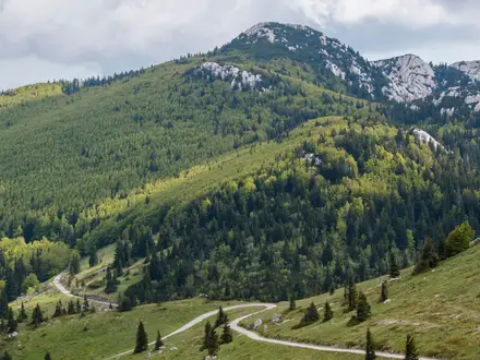
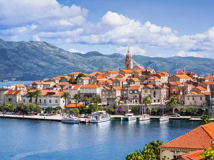
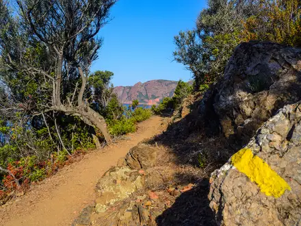
This is a point-to-point trail, starting in Trieste, passing Muggia, then crossing Slovenia through Koper, Izola, Portoroz, Piran and the Secovlje salt pans before entering Croatia. Buje is the main hub for the Croatian section, after which the route links Groznjan, Zavrsje, Oprtalj, Livade, Motovun, Vizinada, Karojba and Porec. The Croatian share is the longest part of the route and includes the well-known Groznjan–Motovun hill-town section. The trail is waymarked with yellow Parenzana signs and uses mostly traffic-free former railway formation, with some on-road links. If you prefer coastal island walking, compare the Cres Island Coastal Path.
From narrow-gauge railway to greenway
The Parenzana was a 760 mm narrow-gauge railway opened on 1 April 1902 between Trieste and Porec, then Parenzo. It carried wine, olive oil, salt from the Piran and Secovlje pans, agricultural produce, mail and passengers, linking coastal ports with inland Istrian villages. The railway closed on 31 August 1935. From 1996, the abandoned formation was gradually cleared and revived, with cross-border support in Italy, Slovenia and Croatia, as the recreational “Route of Health and Friendship”.
Notable highlights
- Groznjan (artists’ hill town): A medieval hilltop town known for galleries, studios and its summer jazz tradition. The Kalcini tunnel near Groznjan is the trail’s highest point at about 293 m.
- Motovun (Mirna valley viewpoint): A walled Istrian hill town above the Mirna valley, strongly associated with the surrounding truffle forests. It is one of the most memorable stops on the Croatian section.
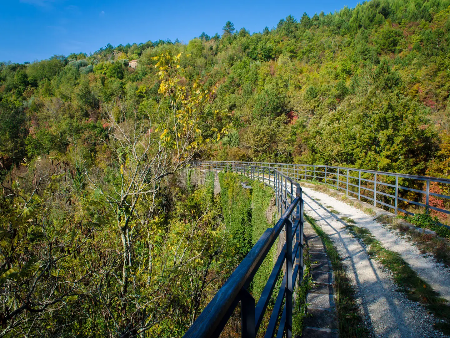
- Tunnels and viaducts (railway engineering): The route’s signature features include nine tunnels totalling about 1,530 m, plus 11 bridges and 6 viaducts. A light is useful because the tunnels are unlit.
- Secovlje Salt Pans (Slovenian wetland): Historic salt pans dating to Roman times, where sea salt is still harvested by hand. They add a flat, open coastal contrast before the route turns inland.
- Former stations and Livade museum (railway heritage): The old line served 35 stations, and several station buildings survive. Livade is a key waypoint for understanding the Parenzana’s railway story.
Challenges to expect
The Parenzana is not technically hard: it follows an old railway grade, with gentle gradients and no exposed mountain ground. The challenge is cumulative distance, long gravel/macadam sections underfoot, some paved and on-road links, and heat in summer. Spring and autumn are best. Winter can mean mud, slippery surfaces and unsettled weather. Carry a light for the unlit tunnels.
HikeList Score
Parenzana Trail scored 81/100 on HikeList's trail-quality metrics.
See score breakdownHide breakdown
- Ideal length 93
- Balanced challenge 90
- Scenery & wildness 78
- Varied terrain 64
- Accommodation 74
- Food & support 88
- Path quality 71
- Season flexibility 76
Computed from length, challenge, scenery & wildness, terrain variety, accommodation, food & support, path quality and season flexibility.
 Croatia
Show more data Show less
- Forest
- Hilly
- Gravel
- Paved
- Hotels
- Guesthouses
- Family Friendly
- Pet Friendly
- Restrooms
- Water Sources
- Campsites
- Picnic Areas
Photos from hikers
Taken on the trail by people who've reviewed Parenzana Trail.
Start your journey in the hilltop town of Buje, known for its historical architecture and views across the Istrian landscape. The route heads south on gravel and dirt tracks, winding through olive groves and vineyards before reaching the charming village of Grožnjan. Grožnjan is famed for its vibrant artist community, narrow cobbled streets, and ancient city walls. Along the way, you’ll pass through quiet countryside with several small hamlets. This section features multiple scenic viaducts and the first of several old railway tunnels.
Depart from Grožnjan and follow the former railway embankment through forested landscapes and open fields. This section includes several significant tunnels and viaducts as you traverse the rolling terrain of northern Istria. The trail gradually descends towards the Mirna River valley, ending the day in Livade. Livade is renowned for its truffles and is an ideal place to sample local cuisine or join a truffle hunting tour. Expect well-marked paths, lush vegetation, and the peaceful ambiance of rural Istria throughout the hike.
From Livade, the Parenzana Trail ascends toward the picturesque hilltop town of Motovun, one of Istria's most iconic and scenic destinations. The route winds uphill on former railway gradients, passing through dense forests and across the Mirna River. The approach to Motovun rewards hikers with panoramic views over the valley and distant vineyards. After reaching Motovun, take time to explore its historic fortifications and sample local wines. This section is shorter but involves a steady climb.
Begin the day descending from Motovun and follow the gentle curves of the old railway as it crosses valleys and woodlands en route to Vižinada. The trail leads through several old railway tunnels and scattered rural settlements, offering scenic breaks and resting points. Vižinada, perched on a ridge, marks the end of this segment and provides a welcoming stop with local eateries and a quiet, traditional village atmosphere. Expect a mix of shaded sections and sun-exposed stretches.
Leave Vižinada and travel through the scenic Istrian interior on dirt and gravel tracks, passing vineyards, orchards, and wheat fields. The day features gentle undulations and plenty of rural scenery, leading past small villages and isolated farmsteads. The route is straightforward, with intermittent shade and some exposed areas. Nova Vas serves as a convenient overnight location with accommodation options and basic amenities.
The final leg of the Parenzana Trail takes you further south and west toward the Adriatic coastline. The route transitions from the rural heartland to increasingly coastal landscapes, passing fields and patches of forest before reaching the city outskirts of Poreč. The trail ends near the waterfront, where you can explore the historic core of Poreč and its UNESCO-listed Euphrasian Basilica. This section is relatively easy, providing a fitting, scenic finish to your journey.
Reviews
How would you rate Parenzana Trail?
Tap a star to start your review — you could be the first.