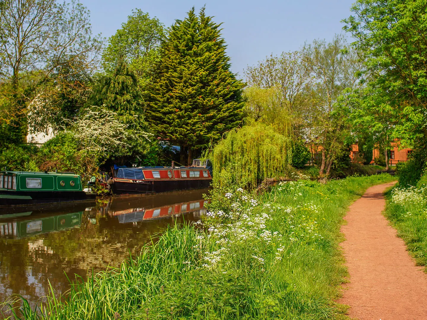
Millennium Way
How would you rate Millennium Way?
Tap a star to share your experience and help other hikers.
Millennium Way: A 100-mile Walk across the Heart of England
HikeList Score
Millennium Way scored 86/100 on HikeList's trail-quality metrics.
See score breakdownHide breakdown
- Ideal length 100
- Balanced challenge 90
- Scenery & wildness 59
- Varied terrain 94
- Accommodation 100
- Food & support 88
- Path quality 80
- Season flexibility 89
Computed from length, challenge, scenery & wildness, terrain variety, accommodation, food & support, path quality and season flexibility.
The Millennium Way is a 161 km waymarked point-to-point walk across the rural English Midlands, from Pershore in Worcestershire to Middleton Cheney in Northamptonshire. It is a moderate lowland route: no mountains or serious climbs, but enough distance, stiles, field paths and navigation to feel like a proper long-distance hike. Fit walkers may finish in about 5 days; 7 days is a more comfortable plan, and 10 days suits a slower pace. See more routes in England.
Route Overview
Most descriptions run west to east from Pershore Bridge, Pershore, but the Millennium Way is waymarked in both directions. The route crosses Worcestershire, Warwickshire, Solihull in the West Midlands, Northamptonshire, and briefly clips Oxfordshire near the eastern end. Key places include Stoulton, Inkberrow, Coughton, Henley-in-Arden, Hockley Heath, Meriden, Kenilworth, Warwick, Royal Leamington Spa, Long Itchington, Chipping Warden and Middleton Cheney. Meriden is the northernmost point, not the finish: the path turns south and south-west from there. Use the towns and villages for accommodation planning; no verified transport details are provided in the brief. For other UK trail ideas, compare the Amber Valley Route and Ashby Canal Trail.
A Millennium community trail
The Millennium Way was conceived by members of the 41 Club, the National Association of ex-Round Tablers' Clubs, as a community legacy project to mark the year 2000. It links the Heart of England using existing public rights of way, deliberately keeping road walking low. In 2012 the project was expanded with 44 circular day walks, each incorporating a section of the main long-distance route.
Notable highlights
- Meriden (northernmost point): A Warwickshire village traditionally regarded as the geographic centre of England. The Millennium Way turns south here, so it is not the route’s endpoint.
- Inkberrow: A black-and-white Worcestershire village widely associated with Ambridge in BBC Radio 4’s The Archers. The Old Bull pub on the village green inspired the fictional pub.
- Kenilworth Castle: An imposing red-sandstone ruin near the route, remodelled by Robert Dudley, Earl of Leicester, who entertained Queen Elizabeth I here in 1575. It is now an English Heritage site.
- Henley-in-Arden: A historic Warwickshire market town with a long high street of timber-framed Tudor and Georgian buildings, set in the old Forest of Arden.
- Coughton Court: A Tudor manor house and National Trust property near the route, linked with the Throckmorton family and the 1605 Gunpowder Plot.
- Royal Leamington Spa: A Regency spa town on the River Leam, useful as a more urban rest or overnight stop mid-route.
Challenges to expect
Expect lowland rather than mountain difficulty: the highest point is about 191 m and total ascent is around 1,050 m. The real work is the 161 km distance, repeated stiles, muddy field paths in wet or winter conditions, and navigation across farmland and rights of way. Accommodation is in B&Bs, inns, pubs and hotels; there are no official huts or route campsites. HS2 construction has caused temporary diversions in the Northamptonshire/Oxfordshire area into 2026.
HikeList Score
Millennium Way scored 86/100 on HikeList's trail-quality metrics.
See score breakdownHide breakdown
- Ideal length 100
- Balanced challenge 90
- Scenery & wildness 59
- Varied terrain 94
- Accommodation 100
- Food & support 88
- Path quality 80
- Season flexibility 89
Computed from length, challenge, scenery & wildness, terrain variety, accommodation, food & support, path quality and season flexibility.
 United Kingdom
 England
Show more data Show less
- Farmland
- Forest
- Canal
- Urban
- Dirt
- Gravel
- Paved
- B&Bs
- Inns
- Pubs
- Hotels
- Family Friendly
- Pet Friendly
- Restrooms
- Water Sources
- Campsites
- Picnic Areas
Download Our Full Guide to Millennium Way FREE!
Get our comprehensive guide to this hike for free. Save it for later reading or print out at home.
Photos from hikers
Taken on the trail by people who've reviewed Millennium Way.
Millennium Way: The Complete Guide
 i
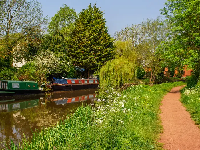
Image by david hughes
i
Image by david hughes The Millennium Way is a 100-mile lowland crossing of the rural Midlands, linking Pershore Bridge in Worcestershire with Middleton Cheney in Northamptonshire. It suits walkers who want villages, field paths, old woodland, canals and historic towns rather than high ground or mountain weather.
The route threads through the Heart of England: Inkberrow and the Forest of Arden, Henley-in-Arden, Meriden, Kenilworth, Warwick, Royal Leamington Spa and the canal country around Long Itchington. Along the way are on-or-near-route landmarks including Coughton Court, Kenilworth Castle and Warwick Castle.
This is a moderate walk because of its length, not its altitude. Expect many stiles, farm tracks, field-edge rights of way, muddy going after rain and navigation that needs more attention than a simple waymarked ridge or towpath route.
The trail can be walked as a fit five-day challenge, a typical seven-day itinerary or a more relaxed ten-day journey, and it also works well in shorter sections. Accommodation planning matters, especially in smaller villages, because there are no official trail huts or dedicated route campsites.
This guide covers stages, daily planning, accommodation, food, transport, terrain and the common mistakes to avoid.
Stage-by-Stage Guide
Stage 1: Pershore to Inkberrow — 23 km
The route begins at Pershore Bridge on the edge of Pershore, beside the River Avon, then leaves the market town for quiet Worcestershire farmland. This is a typical opening Millennium Way stage: low-level, rural and not technically difficult, but with enough field paths, stiles and wayfinding to make progress slower than the distance alone suggests.
Underfoot, expect a mix of pasture, arable field edges, minor lanes and unsurfaced rights of way. After rain, the farmland sections can be muddy and greasy, particularly where paths cross cultivated ground or pass through gateways used by livestock.
The main settlements on this stage are Pershore, Stoulton, North Piddle and Inkberrow. Pershore is the best place to start with supplies, as food and water options become more limited once the route is out in the countryside. Do not rely on finding water between villages; carry enough for the full stage unless a planned stop has been checked in advance.
Inkberrow makes a natural first overnight stop. It is one of the route’s best-known villages, with black-and-white timbered buildings around the green and the Old Bull, the 16th-century pub associated with the inspiration for Ambridge and The Bull in The Archers. Accommodation is limited compared with larger towns, so beds should be booked ahead.
For public transport, Pershore railway station is at Pinvin, about 3 miles / 5 km from Pershore Bridge, so a taxi, local bus or extra walk is needed to reach the start. Transport from Inkberrow is more limited and should be checked before travelling, especially for Sunday or evening arrivals.
Navigation is mainly across lowland public rights of way rather than obvious upland tracks. Watch for the 41 Club Millennium Way discs at field exits, lane junctions and around farm boundaries; missing a stile or field-edge turn can add unnecessary distance.
Stage 2: Inkberrow to Henley-in-Arden — 24 km
This stage carries the route east through the rolling, well-wooded farmland of the old Forest of Arden. It is one of the more characterful rural sections of the walk, with a mixture of hedged fields, small woods, lanes and villages rather than big views or dramatic terrain.
The route passes near Alcester and Coughton, and near Studley before continuing towards Henley-in-Arden. Coughton Court, a Tudor manor house and National Trust property linked to the Gunpowder Plot, lies near the route and can be built into the day if time, opening arrangements and accommodation plans allow. This should be checked before travelling.
Terrain remains moderate, but the constant changes between fields, stiles, lanes and woodland edges make navigation more involved than on a single clear trail. Wet conditions can slow this stage noticeably, particularly on field paths through clayey farmland and churned gateways.
Food and drink options should be planned around the villages and any intended detour, rather than assumed en route. Inkberrow and Henley-in-Arden are the most reliable planning points at either end of the day; anything in between should be checked before setting out.
Henley-in-Arden is a good overnight halt, with the advantages of a historic market town and more services than the smaller villages. Its long street of Tudor and Georgian buildings also makes it one of the most attractive stage ends on the Millennium Way.
Road access exists at the main settlements, but public transport for intermediate pick-ups should be checked before travelling. This is a sensible section to pre-book accommodation and any taxi connection, rather than leaving arrangements until late in the day.
Stage 3: Henley-in-Arden to Meriden — 22 km
From Henley-in-Arden the route continues through Warwickshire countryside towards Hockley Heath and then Meriden, reaching the northernmost point of the Millennium Way. This is a transitional stage: still rural and wooded in character, but with more edge-of-settlement walking as the route approaches the Solihull area and the wider West Midlands fringe.
Expect the familiar pattern of field paths, hedgerows, small woodland sections, quiet roads and village approaches. The walking remains low-level, with no serious climbs, but the accumulation of stiles and field navigation can be tiring over a full day.
Hockley Heath is a key place on the line of the route before the walk continues to Meriden. Meriden is traditionally regarded as the geographic centre of England, marked by an old cross on the green, and is an important waypoint because the Millennium Way turns south from here rather than continuing east.
Food and water planning should focus on Henley-in-Arden, Hockley Heath and Meriden. Do not assume frequent facilities between them; opening times and availability should be checked before committing to a schedule.
Meriden is a practical stage end, but accommodation should be booked ahead. As with several points on this route, the village works best for walkers who have arranged the overnight stop before arrival rather than hoping for walk-in availability.
For transport and road access, Meriden is a sizeable village with road connections, but specific bus options and timings should be checked before travelling. This is also a logical place for section walkers to break the route, as the northward arc of the walk ends here.
Navigation matters around Hockley Heath, Meriden and the approaches to built-up areas, where paths, lanes and edge-of-town rights of way can feel less intuitive than open countryside. Keep checking waymarks at junctions and do not rely solely on the general eastward direction, as the route begins to change alignment towards the south.
Stage 4: Meriden to Kenilworth — 18 km
This shorter stage heads south from Meriden towards Kenilworth. The reduced distance makes it a useful recovery day in a seven-day itinerary, especially after the longer rural days from Inkberrow and Henley-in-Arden.
The walking is still typical lowland Midlands terrain: farmland paths, hedgerows, lanes and occasional edge-of-settlement sections. There are no major climbs, but wet ground and stiles can still make the day feel more demanding than the profile suggests.
The main practical focus is Kenilworth at the end of the day. Kenilworth Castle, the dramatic red-sandstone ruin associated with Robert Dudley and Queen Elizabeth I, lies near the route and is one of the major historic highlights of the Millennium Way. Allow extra time if visiting the castle, and check opening arrangements before travelling.
Carry food and water from Meriden unless a specific stop has been planned. Facilities between the main settlements should not be assumed, and rural pubs or shops can have limited opening hours.
Kenilworth has a better choice of accommodation than the smaller village stops and is a sensible overnight halt. Even so, booking ahead remains important, particularly at weekends or during busy local events.
Public transport details for this stage should be checked before travelling. Warwick and Royal Leamington Spa have rail stations further along the route, but walkers ending at Kenilworth should confirm current onward options in advance.
Navigation is generally straightforward if waymarks are followed carefully, but take care where the route passes through field systems and around the approaches to Kenilworth. Urban-edge paths can be more confusing than remote countryside because there are more footpath junctions, roads and local paths competing for attention.
Stage 5: Kenilworth to Royal Leamington Spa via Warwick — 16 km
This is the most urban and historic stage of the standard seven-day itinerary. It links Kenilworth, Warwick and Royal Leamington Spa, with more surfaced walking, town approaches and parkland or riverside character than the wider rural stages.
Kenilworth Castle is close to the start of the day, while Warwick brings the route near Warwick Castle and the county town on the River Avon. The stage then continues to Royal Leamington Spa, an elegant Regency spa town on the River Leam and one of the most comfortable overnight stops on the route.
Terrain is easier underfoot than the muddier farm stages, though there may still be field paths and green corridors between the towns. The main challenge is not exposure or height, but staying on the correct line through built-up edges, road crossings and local path networks.
Food, water and services are much more readily planned on this stage than elsewhere on the Millennium Way. Kenilworth, Warwick and Royal Leamington Spa all provide better resupply opportunities than the smaller villages, although opening times should still be checked if walking early, late or on a bank holiday.
Accommodation is strongest at the end of the stage in Royal Leamington Spa, with Warwick also a realistic overnight alternative depending on how the itinerary is split. This section is a good place to schedule a lighter day, laundry, a late start or an easier resupply.
Warwick and Royal Leamington Spa both have railway stations, making this one of the easiest parts of the route for section walkers. It is also a useful access point for anyone joining or leaving the Millennium Way mid-route.
Navigation deserves attention through Warwick and Royal Leamington Spa, where waymarks can be missed among street furniture, road junctions and local paths. A map or GPS track is particularly useful here, not because the terrain is difficult, but because the route is less visually obvious than a countryside track.
Stage 6: Royal Leamington Spa to Chipping Warden via Long Itchington — 30 km
This is the longest stage in the seven-day schedule and needs an early start, especially outside midsummer. The route leaves Royal Leamington Spa and returns to quieter south-east Warwickshire countryside, passing through or near Long Itchington before continuing towards Chipping Warden.
The stage includes canal-towpath walking near Long Itchington, associated with the Grand Union / Oxford Canal corridor, giving a change from the field-and-stile pattern of much of the route. Towpaths are usually easier to follow than cross-field paths, but they can still be muddy, narrow or slippery after rain.
Away from the canals, expect more lowland farmland, field edges, pasture, minor roads and frequent transitions between rights of way. Over 30 km, small delays at stiles, muddy fields or navigation checks add up, so this is not a day to underestimate simply because the elevation is modest.
Food and water planning is important. Royal Leamington Spa is the obvious place to leave fully supplied, while Long Itchington is the key intermediate settlement. Any intended pub, shop or café stop should be checked before setting out, as a closed service on this long day can leave a large gap.
Chipping Warden is a practical end point for the stage, but accommodation options are more limited than in the larger towns. Some walkers may need a pre-booked taxi or bus connection to an off-route bed; this should be arranged before walking the stage.
Public transport and road access should be checked before travelling, especially if using Chipping Warden as a section break. The long distance makes this a poor stage for improvising a late change of plan unless transport has already been researched.
Navigation is mixed: canal sections are generally linear, but the rural approaches and exits require care. In wet or winter conditions, allow extra time for mud and short daylight, and avoid planning this as a rushed day at the end of a long itinerary.
Stage 7: Chipping Warden to Middleton Cheney — 18 km
The final stage crosses the eastern end of the Millennium Way towards Middleton Cheney, a large village near the Oxfordshire border and a few miles east of Banbury. It is a shorter day than Stage 6, but it still needs careful planning because the route finish has no railway station.
The terrain remains lowland and agricultural, with field paths, farm tracks, hedgerows, lanes and the usual sequence of stiles and waymarked rights of way. Conditions can be slow after rain, and muddy fields are a realistic issue even though the stage is not hilly.
This is the section where current route status matters most. HS2 railway construction has caused temporary diversions on the Northamptonshire/Oxfordshire section into 2026, so the official Millennium Way site should be checked before walking the eastern end.
Food and water options should be treated as limited between Chipping Warden and Middleton Cheney unless specific facilities have been checked. Carry enough for the full day, particularly if walking on a Sunday, bank holiday or in winter.
Middleton Cheney is the official eastern end of the waymarked route and a sensible finish for a through-walk. Accommodation may be available in or near the village, but many walkers will find the Banbury area more practical for onward travel and a wider choice of beds.
Banbury is the nearest railhead, about 6 miles / 10 km from Middleton Cheney, on the Chiltern Main Line between London Marylebone and Birmingham. The 500 bus links Banbury and Middleton Cheney; current times should be checked before travelling, and a taxi backup is worth considering if finishing late.
Navigation should not be rushed on the last day. Follow current diversion notices where present, keep checking waymarks at field boundaries and road crossings, and allow enough time to reach Middleton Cheney before any planned bus or taxi connection.
Recommended Itinerary
The Millennium Way is usually easiest to plan as a 7-day walk, using the larger villages and towns for overnight stops. The stages below are practical groupings rather than official fixed stages, and accommodation should be booked ahead, especially in smaller villages.
GPS recordings of the full route can be slightly longer than the branded 100-mile / 161 km distance, so treat daily distances as approximate and check official mapping before booking.
Standard 7-day itinerary
| Day | From | To | Approx. distance | Why this stage makes sense | Services/accommodation notes |
|---|---|---|---|---|---|
| 1 | Pershore | Inkberrow | 23 km | A steady opening day from the River Avon at Pershore into rural Worcestershire, passing through or near smaller settlements such as Stoulton and North Piddle before reaching a recognised overnight village. | Pershore has town services before starting. Pershore railway station is at Pinvin, about 5 km from Pershore Bridge, so allow for a taxi, bus or extra walking. Inkberrow has village facilities, but beds should be booked ahead. |
| 2 | Inkberrow | Henley-in-Arden | 24 km | A full but manageable day through Forest of Arden country, with Coughton and the Alcester/Studley area giving useful intermediate reference points before the historic market town of Henley-in-Arden. | Henley-in-Arden is one of the stronger overnight stops on the western half of the route. Accommodation is more realistic here than in the smaller countryside settlements, but advance booking is still sensible. |
| 3 | Henley-in-Arden | Meriden | 22 km | This stage continues across well-wooded Warwickshire farmland and passes through the Hockley Heath area before reaching Meriden, the route’s northernmost point. | Meriden is a logical overnight halt before the route turns south. Village accommodation and food options should be checked before travelling. |
| 4 | Meriden | Kenilworth | 18 km | A shorter day after three moderate stages, useful for managing fatigue, field conditions and navigation across rights of way before reaching a larger town. | Kenilworth gives better accommodation and food choice than the smaller villages. The shorter mileage also leaves time for route-finding delays or a visit to Kenilworth Castle if wanted. |
| 5 | Kenilworth | Royal Leamington Spa via Warwick | 16 km | The shortest stage, linking three well-served towns and giving a useful lighter day through the more urban/edge-of-town middle section of the walk. | Kenilworth, Warwick and Royal Leamington Spa all have stronger services than most of the route. Warwick and Royal Leamington Spa have rail stations, making this the easiest place to start, finish or pause a section walk. |
| 6 | Royal Leamington Spa | Chipping Warden via Long Itchington | 30 km | The hardest day in the standard itinerary, mainly because of distance. It covers the south-east Warwickshire section, including canal towpaths near Long Itchington, before pushing on towards Chipping Warden. | This is the key stage to review carefully. If 30 km is too long, consider splitting the day with an overnight or transfer around Long Itchington or nearby settlements. Accommodation may require a taxi or bus off-route. |
| 7 | Chipping Warden | Middleton Cheney | 18 km | A moderate final day into Northamptonshire, ending at the waymarked eastern finish in Middleton Cheney. | Middleton Cheney has no railway station. Banbury, about 10 km away, is the nearest railhead, with the 500 bus linking Banbury and Middleton Cheney. HS2 construction has caused temporary diversions on the eastern section into 2026; check the official route notices before walking this final stage. |
Slower variant: 8–10 days
A slower schedule suits walkers who prefer shorter days, are carrying heavier packs, are walking in winter mud, or want time for places such as Henley-in-Arden, Kenilworth, Warwick and Royal Leamington Spa.
The most obvious place to add a night is between Royal Leamington Spa and Chipping Warden, as the standard Day 6 is around 30 km. Long Itchington is the main named intermediate settlement on that section, but accommodation availability may require a short taxi or bus off-route.
Additional splits can also be made on the western half between Pershore, Inkberrow and Henley-in-Arden, where field paths, stiles and wet ground can make progress slower than the map suggests. Use the official route mapping and current accommodation availability to set the exact stopping points.
Faster variant: 5 days
The 41 Club promotes the full route as a 5-day challenge, but this is best reserved for fit walkers who are comfortable with long, consecutive lowland days and confident navigation across farmland rights of way.
A 5-day plan means combining some of the standard stages, so daily distances will be substantially longer than the table above. This is more realistic with light luggage, pre-booked accommodation or support transport, and settled ground conditions.
Do not assume every village has suitable accommodation at the right point for a fast schedule. Check official mapping, diversion notices and all overnight logistics before booking.
Planning the Route
The Millennium Way is best planned around accommodation and transport rather than terrain. The walking is lowland, but the route uses many field paths, stiles, lanes and rights of way, so daily progress can be slower than the map suggests, especially after rain.
Most walkers should allow around 7 days. The 41 Club promotes a 5-day version for fit walkers and a more relaxed 10-day plan, but the practical choice depends on how far you are prepared to walk between villages with beds and onward transport.
Choosing a pace
A 7-day schedule gives a sensible long-distance rhythm, but it is not completely even. The Royal Leamington Spa to Chipping Warden leg is the obvious pressure point at about 30 km, while the Kenilworth to Royal Leamington Spa stage via Warwick is much shorter and easier to use as a recovery day.
A 5-day walk should be treated as a challenge itinerary. It suits strong walkers who are comfortable with long lowland days, repeated stiles, muddy field crossings and limited time for sightseeing or delays.
A 10-day walk is often the better option if you want shorter days, time in places such as Henley-in-Arden, Kenilworth, Warwick or Royal Leamington Spa, or more flexibility around winter daylight. It may, however, require more careful accommodation planning because not every small village on or near the line has suitable overnight options.
Using the main stage towns
The route is not divided into fixed official multi-day stages. The following towns and villages work as practical overnight anchors because they sit at useful intervals and have better service potential than the smaller rural settlements.
| Stage style | Typical overnight points | Planning notes |
|---|---|---|
| Standard 7-day walk | Pershore, Inkberrow, Henley-in-Arden, Meriden, Kenilworth, Royal Leamington Spa, Chipping Warden, Middleton Cheney | A good default structure, but book village accommodation ahead and check the long Royal Leamington Spa to Chipping Warden day carefully. |
| Faster 5-day walk | Larger towns and selected villages along the line | Requires long daily distances and reliable accommodation positioning. Do not assume late booking will work in the smaller villages. |
| Slower 10-day walk | More frequent stops using villages, towns and possible off-route beds | More comfortable walking days, but may need taxis or buses where there is no convenient bed directly on the route. |
Accommodation planning matters most on the rural sections west of Henley-in-Arden and east of Royal Leamington Spa, where the line passes through smaller villages and farmland. Pershore, Henley-in-Arden, Kenilworth, Warwick, Royal Leamington Spa and the Banbury area offer stronger bases than many of the intervening settlements.
There are no official trail huts or dedicated route campsites. If camping or non-standard accommodation is part of the plan, suitable sites must be arranged independently and current availability should be checked before travelling.
West to east or east to west
The route is waymarked in both directions, so either direction is possible. West to east is the most common approach, starting at Pershore Bridge and finishing at Middleton Cheney.
The main practical difference is transport. Pershore railway station is at Pinvin, about 3 miles / 5 km from Pershore Bridge, so the start normally needs a taxi or local bus connection. At the eastern end, Middleton Cheney has no station; Banbury is about 6 miles / 10 km away and is linked by the 500 bus.
Section hiking
Section hiking is very practical on this route. The official Millennium Way material also includes many shorter circular day walks, which makes it easier to sample the corridor without committing to the full point-to-point journey.
Warwick and Royal Leamington Spa are especially useful for car-free section walking because both have railway stations. Pershore and Banbury also work as railheads for the western and eastern ends, though both require onward local transport to or from the actual trail endpoints.
For rural sections, plan the exit before starting the day. Some villages are small, buses may be limited, and a pre-booked taxi can be the simplest way to connect the path with accommodation or a station.
Food, water and daily supplies
Do not plan this as a wilderness route, but do not assume every village will provide food at the right time of day. The safest approach is to start each day with enough water and food to finish the stage, then treat pubs, cafés and shops as useful additions rather than guaranteed fallbacks.
Larger places such as Pershore, Henley-in-Arden, Kenilworth, Warwick, Royal Leamington Spa and the Banbury area are the best points for resupply and evening meals. In smaller villages, opening hours and food availability should be checked before travelling, particularly on Sundays, Mondays and winter weekdays.
Navigation and route changes
The Millennium Way is waymarked with 41 Club discs, but it is not a National Trail and should not be walked on waymarks alone. Carry mapping or a reliable GPX track, and expect navigation to take attention across field edges, farm tracks, stiles and rights of way through working countryside.
Mud can obscure paths and make field crossings slower after rain. In crops or pasture, stay alert for the next stile, gate or marker rather than simply following the most obvious worn line.
There is an important live planning issue on the eastern end: HS2 construction has caused temporary diversions on the Northamptonshire/Oxfordshire section into 2026. Check the official Millennium Way site for current diversion notices before walking towards Chipping Warden and Middleton Cheney.
Weather and season planning
Spring, summer and autumn are the most comfortable seasons. Summer gives long daylight for the bigger stages, while spring and autumn can be excellent if field conditions are reasonable.
Winter is possible because the route is lowland, but short days and mud change the character of the walk. Build in more time, avoid over-ambitious mileage, and expect slow going on farm paths and field margins after wet weather.
What to book first
Book accommodation before fine-tuning the daily mileage. The stage towns and villages, rather than the gradients, are what shape the walk.
Next, arrange start and finish transport: Pershore station to Pershore Bridge at the western end, and Middleton Cheney to Banbury at the eastern end. Finally, check the official route updates, especially for the HS2-affected eastern section, and carry enough food, water and navigation backup for each day’s rural walking.
Towns, Villages and Overnight Stops
Accommodation on the Millennium Way is concentrated in the towns and larger villages. There are no official trail huts or dedicated route campsites, so a multi-day walk needs booking around settlements, with a short taxi or local bus off-route on some stages if the preferred stopping point has no suitable bed.
For a 7-day itinerary, the most practical overnight anchors are Pershore, Inkberrow, Henley-in-Arden, Meriden, Kenilworth, Royal Leamington Spa and the Chipping Warden / Banbury area. Village rooms and pub accommodation can be limited, especially away from Warwick and Royal Leamington Spa, so book ahead rather than assuming availability at the end of the day.
| Place | Best use for walkers | Overnight practicality |
|---|---|---|
| Pershore | Start town and pre-walk overnight | Good |
| Inkberrow | End of a practical first stage | Useful village stop; book ahead |
| Henley-in-Arden | Strong mid-route overnight | Good |
| Meriden | Northern turning point and stage stop | Useful; book ahead |
| Kenilworth | Major overnight and section-walk base | Good |
| Warwick / Royal Leamington Spa | Best serviced middle section | Very good |
| Chipping Warden | Late-route stage stop | Limited; plan carefully |
| Middleton Cheney | Finish village | Finish logistics; Banbury area often more practical |
Pershore
Pershore is the western start town, with the route beginning at Pershore Bridge over the River Avon on the edge of town. It is the natural place to stay the night before starting if travelling in from elsewhere.
As a market town, Pershore is one of the better places on the route for pre-walk food, basic supplies and a comfortable first-night base. Accommodation is more realistic here than in the smaller villages immediately east of the start.
Pershore railway station is at Pinvin, about 3 miles / 5 km from Pershore Bridge, on the Cotswold Line between London Paddington, Worcester and Hereford. A taxi or local bus is needed to close the gap to the start; this should be checked before travelling, particularly for early starts or Sunday travel.
Stoulton
Stoulton comes early on the west-to-east walk between Pershore and Inkberrow. For most walkers it is a waypoint rather than an overnight stop.
Do not plan a first stage around finding extensive services here. Carry enough food and water from Pershore unless specific local opening times have been checked in advance.
North Piddle
North Piddle is another small village on the first day’s walking between Pershore and Inkberrow. It is useful for navigation and pacing, but not a dependable overnight base for a long-distance itinerary.
Services in small Midlands villages can be sparse or have limited hours. Treat Pershore and Inkberrow as the practical service points on this section unless pre-arranged accommodation or food has been booked nearby.
Inkberrow
Inkberrow is the main overnight target at the end of the typical first stage from Pershore. It is a useful stop because it breaks the opening section at a sensible distance before the route continues into the more wooded Forest of Arden country.
The village has pub and village accommodation potential, including the well-known Old Bull, the 16th-century pub associated with the inspiration for Ambridge and “The Bull” in The Archers. Rooms and dinner options should be booked ahead, as this is not a large town with unlimited capacity.
Inkberrow is one of the smaller overnight anchors on the route. If accommodation is full, be prepared to use a taxi or bus to reach a bed off-route; this should be checked before travelling.
Alcester area
The route passes near Alcester after Inkberrow and before Coughton / Henley-in-Arden. Alcester is therefore more of a nearby service and fallback option than a guaranteed on-trail overnight point.
It can be useful when accommodation directly on the line is unavailable, but any detour, taxi arrangement or public transport connection needs checking before booking. Do not assume that a bed in Alcester will sit directly on the waymarked route.
Coughton
Coughton sits on or near the route corridor between the Alcester area and Henley-in-Arden. It is best known to walkers for Coughton Court, the Tudor National Trust property linked to the Throckmorton family and the Gunpowder Plot.
For overnight planning, Coughton is more useful as a landmark and possible break point than as a primary stage end. Accommodation and food options should be checked in advance if planning to stop here, otherwise Henley-in-Arden is the stronger target.
Studley area
Studley is near the route rather than a core overnight stop on the standard 7-day breakdown. It may be useful as an off-route services option if accommodation between Inkberrow and Henley-in-Arden is tight.
Any use of Studley should be planned deliberately, with the extra distance or taxi transfer accounted for. This should be checked before travelling.
Henley-in-Arden
Henley-in-Arden is one of the best overnight towns on the Millennium Way. It comes at the end of the typical second stage from Inkberrow and gives a practical base before the route heads towards Hockley Heath and Meriden.
As a historic Warwickshire market town, Henley-in-Arden is a stronger bet for accommodation, food and evening facilities than the smaller villages on either side. It is a sensible place to book a proper overnight rather than relying on a marginal rural stop.
Walkers should still book ahead, especially at weekends. The long, built-up main street can make it easy to find food and lodging compared with the surrounding countryside, but availability is still finite.
Hockley Heath
Hockley Heath lies between Henley-in-Arden and Meriden on the west-to-east route. It is a useful place to break up the day and may work for food or transport planning, depending on current services.
Most 7-day itineraries continue beyond Hockley Heath to Meriden rather than staying here. If using it as a stop, check accommodation and onward connections before committing.
Meriden
Meriden is the northernmost point of the Millennium Way and a logical overnight stop on a 7-day itinerary. The route reaches the village, traditionally regarded as the geographic centre of England, then turns south towards Kenilworth.
It is a practical staging point because it keeps the Henley-in-Arden to Kenilworth section manageable over two days. Accommodation should be booked ahead, as Meriden is not in the same category as Warwick or Royal Leamington Spa for depth of choice.
Food and pub options may be sufficient for an overnight, but opening days and serving times matter on a village stop. Check before travelling, particularly outside peak season.
Kenilworth
Kenilworth is a strong overnight base and one of the easiest places on the route to plan around. It sits after Meriden and before Warwick / Royal Leamington Spa, making it a natural stage end on the standard 7-day schedule.
Accommodation, pubs and town services are more dependable here than in the smaller rural sections. It is also a good place to slow the itinerary if wanting time for Kenilworth Castle, which lies near the route.
Kenilworth works well for section walkers because it sits between the better-connected urban stretch around Warwick and Royal Leamington Spa and the quieter countryside to the north and east. Local transport details should still be checked before travelling.
Warwick
Warwick lies on the route between Kenilworth and Royal Leamington Spa. It is not the usual end point in the 7-day breakdown, but it is one of the most useful service towns on the whole walk.
As the county town, Warwick is a good place for food, accommodation overflow, resupply and public transport. It is also a natural stopping point for walkers who want a shorter day from Kenilworth or time near Warwick Castle and the River Avon.
Warwick has a railway station, making it one of the better access points for section walking. If splitting the trail into weekends or shorter blocks, Warwick and Royal Leamington Spa are among the simplest places to enter or leave the route.
Royal Leamington Spa
Royal Leamington Spa is the strongest mid-route overnight stop and the usual end of the Kenilworth-to-Leamington stage via Warwick. It is a good place for a rest, laundry, resupply and a more comfortable hotel or B&B night before the longer eastern stages.
The town has a railway station, giving straightforward section-walking access compared with the rural villages. It is also one of the best places to adjust plans if weather, mud or fatigue has slowed progress.
Food and accommodation choice is better here than almost anywhere else on the route. Booking is still sensible, but Royal Leamington Spa gives more flexibility than the village stages.
Long Itchington
Long Itchington lies on the long stage east of Royal Leamington Spa towards Chipping Warden. It is a useful intermediate village, particularly because this part of the walk includes canal-towpath sections near the Grand Union / Oxford Canal corridor.
For many walkers, Long Itchington is a lunch or refreshment target rather than an overnight stop. If the Royal Leamington Spa to Chipping Warden day feels too long, it may be worth investigating accommodation in or near Long Itchington, but this should be checked before travelling.
This is a key place to think practically about food and water. The following countryside sections can feel slow in wet conditions, especially on field paths.
Priors Marston area
The route passes near Priors Marston on the eastern half of the walk. It is better treated as a nearby village or orientation point than a guaranteed service stop.
Do not build an itinerary around finding accommodation here unless it has been booked in advance. If using the area to shorten the long Royal Leamington Spa to Chipping Warden stage, arrange the logistics before setting out.
Chipping Warden
Chipping Warden is the usual late-route overnight target in the 7-day itinerary, reached after the long stage from Royal Leamington Spa via Long Itchington. It sets up a final day to Middleton Cheney.
This is a much smaller and more limited overnight proposition than Royal Leamington Spa, Warwick or Kenilworth. Book accommodation well ahead and have a fallback plan, as some walkers may need a taxi or bus to an off-route bed.
The eastern end of the Millennium Way has been affected by HS2 construction diversions into 2026. Check the official Millennium Way site for current diversion notices before walking the Chipping Warden to Middleton Cheney section.
Middleton Cheney
Middleton Cheney is the official eastern finish, a large village a few miles east of Banbury near the Oxfordshire border. It is a sensible place to finish the walk, but not necessarily the most practical place to stay afterwards.
There is no railway station at Middleton Cheney. Banbury, about 6 miles / 10 km away, is the nearest railhead and is linked with Middleton Cheney by the 500 bus; current times should be checked before travelling.
For accommodation after finishing, the Banbury area is often the more practical choice because it gives better onward rail access. If staying in Middleton Cheney itself, book ahead and do not assume late-day food or transport will be available without checking.
Getting to the Start
The Millennium Way starts at Pershore Bridge, on the edge of Pershore in Worcestershire, where the route leaves the market town by the medieval bridge over the River Avon. The path is waymarked in both directions, but most end-to-end walkers start here and walk west to east towards Middleton Cheney.
By train
The nearest railway station is Pershore, although it is actually at Pinvin, about 3 miles / 5 km from Pershore Bridge. It is on the Cotswold Line between London Paddington, Worcester and Hereford.
From the station, allow for a separate transfer into Pershore and onward to the bridge. A taxi is the simplest option, especially with a full pack or if arriving early or late; a local bus may also cover the gap into Pershore. Current times and taxi availability should be checked before travelling.
Do not treat Pershore station as being at the trailhead. Walking from the station to the bridge adds an extra road-based approach before the first proper stage, which matters if continuing the same day to Inkberrow.
By bus
Local buses can be useful for the short link between Pinvin, Pershore station and Pershore, but services may be limited compared with city routes. This should be checked before travelling, particularly on Sundays, bank holidays or if planning to start walking immediately after arrival.
If using buses to reach the start, aim to arrive in Pershore itself rather than simply at the railway station. The actual start is Pershore Bridge, so build in time to get from the town centre or bus stop to the bridge before beginning the route.
By car
Pershore is the practical road-access point for the western end of the walk. If being dropped off, Pershore Bridge is the relevant start point rather than Pershore station.
For drivers walking the full point-to-point route, parking is the main complication. The Millennium Way finishes at Middleton Cheney, not back in Pershore, so leaving a car at the start means arranging a return journey from the Banbury / Middleton Cheney area at the end.
Long-stay parking arrangements in Pershore should be checked locally before committing to a plan. Accommodation providers may be able to advise on parking for guests, but this should be arranged in advance rather than assumed.
From the nearest airport
There is no airport-specific access built into the route. For walkers arriving from outside the UK, the simplest onward planning is usually to connect into the rail network and reach Pershore station on the Cotswold Line, then take a taxi or local bus into Pershore and the bridge.
If arriving via London, the relevant rail terminus for Pershore is London Paddington. Airport-to-rail transfers, train times and any engineering works should be checked before travelling.
Where to stay before starting
Pershore is the best place to stay before starting, as it puts you close to Pershore Bridge and avoids adding the 3-mile / 5-km station transfer to the first walking day. The town has the most useful pre-start services on this end of the route compared with the smaller villages immediately east.
Accommodation on and near the Millennium Way is a mix of B&Bs, inns, pubs with rooms and hotels. There are no official trail huts or dedicated route campsites, so book the first night and any village overnights ahead, especially if following a fixed day-by-day schedule.
If arriving late by train, pre-booking a taxi from Pershore station at Pinvin is sensible. Starting the next morning from Pershore Bridge is logistically cleaner than trying to combine a late arrival, transfer and the first stage to Inkberrow.
Getting Home from the Finish
The Millennium Way finishes at Middleton Cheney, a large Northamptonshire village a few miles east of Banbury. There is no railway station at the finish, so most walkers leave by bus or taxi to Banbury, then continue by train.
Before arranging a fixed pick-up, check the official Millennium Way site for current HS2 diversion notices on the eastern section into 2026. Diversions may affect the exact walking line into the finish area.
By train
Banbury is the nearest railhead, about 6 miles / 10 km from Middleton Cheney. It is on the Chiltern Main Line, with rail links towards London Marylebone and Birmingham.
To use the train, take the 500 bus or a taxi from Middleton Cheney to Banbury station. Build in a buffer between reaching the village and any booked train, as the final day still involves field paths and rights of way where mud, stiles and navigation can slow progress.
If finishing late in the day, avoid relying on a tight same-evening rail connection. Either pre-book a taxi to Banbury or stay locally and travel the following morning.
By bus
The 500 bus links Middleton Cheney with Banbury. This is the key public-transport connection from the finish for car-free walkers.
Bus times are timetable-dependent and may be limited in the evening, on Sundays or on bank holidays. This should be checked before travelling, especially if the final stage from Chipping Warden is being walked in one push.
If the last useful bus is missed, the practical fallback is a taxi to Banbury. Do not assume that a late finish in Middleton Cheney will still allow an easy onward public-transport journey.
By car/taxi
For a lift or taxi pick-up, Middleton Cheney is a straightforward finish compared with a remote trailhead, but it is still worth agreeing a precise meeting point in advance. The route ends in the village, not at a railway station or dedicated long-distance trail terminus.
A taxi to Banbury is the simplest onward option for most walkers. Pre-booking is sensible if arriving in the evening, walking on a Sunday, or needing to meet a specific train.
If leaving a car near the finish, check parking rules locally and avoid blocking residential streets, farm access or village facilities. Long-stay parking arrangements in Middleton Cheney should be checked before travelling.
From the nearest airport
The finish is best treated as a Banbury rail-and-road transfer rather than an airport-linked trailhead. From Middleton Cheney, travel first to Banbury by bus or taxi, then connect onwards by rail.
Airport choice and onward connections will depend on where the journey is starting or ending, so check current rail and coach routes before booking flights. Allow extra time for the Middleton Cheney–Banbury transfer when planning any same-day airport connection.
Where to stay at the finish
Middleton Cheney is a village finish, so accommodation should not be left to chance. The Banbury area is the more practical base for onward travel because it has the nearest railway station and the main transport links away from the route.
If finishing after a long final day from Chipping Warden, staying in or near Banbury can be easier than forcing a late journey home. Village accommodation and taxi availability should be booked ahead, particularly at weekends and during busy local periods.
Which Direction Should You Walk?
The Millennium Way is waymarked in both directions, so walking east to west is entirely feasible. In practice, the standard and most common direction is west to east, from Pershore Bridge to Middleton Cheney, and that remains the best default for most walkers.
| Factor | West to east: Pershore to Middleton Cheney | East to west: Middleton Cheney to Pershore |
|---|---|---|
| Route convention | The usual direction, with the main route starting at Pershore Bridge | Less common, but supported by waymarking |
| Public transport | Train to Pershore station at Pinvin, then taxi or local bus to Pershore Bridge; finish by bus or taxi to Banbury | Train to Banbury, then 500 bus or taxi to Middleton Cheney; finish with taxi or local bus from Pershore to Pershore station |
| Scenery flow | Avon-side Pershore, Forest of Arden country, Meriden, then Kenilworth, Warwick, Royal Leamington Spa and the canal sections before the Northamptonshire finish | Starts with the quieter eastern farmland and works back through the canal and Warwickshire towns before finishing in Pershore |
| Gradient | No meaningful advantage; this is lowland walking with gentle ascent spread across the route | No meaningful advantage |
| Accommodation planning | Fits the common Pershore–Inkberrow–Henley-in-Arden–Meriden–Kenilworth–Royal Leamington Spa–Chipping Warden–Middleton Cheney stage pattern | The same overnight stops can be used in reverse, but village accommodation still needs booking ahead |
| Finish feel | A quiet village finish, with onward travel usually via Banbury | A more defined market-town finish at Pershore, close to Pershore Abbey and the River Avon bridge |
Transport: no direction is perfect
Both ends need a final connection rather than offering a station directly on the trail. Pershore station is at Pinvin, about 3 miles / 5 km from Pershore Bridge, so the western end normally needs a taxi, local bus or extra road walk.
At the eastern end, Middleton Cheney has no railway station. Banbury is the nearest railhead, about 6 miles / 10 km away, with the 500 bus linking Banbury and Middleton Cheney. Current bus times should be checked before travelling, especially if finishing late in the day.
For car-free walkers, west to east is slightly more natural because it follows the usual route direction, but east to west can be attractive if it is easier to manage the Middleton Cheney–Banbury connection at the start rather than at the end.
Terrain and weather do not strongly favour either direction
There is no mountain pass, long ridge or major climb that is easier one way. The route’s difficulty comes from distance, field paths, many stiles, muddy ground after rain and day-to-day navigation across rights of way, not from steep ascent.
Wind direction is rarely a decisive planning factor on this hedge-lined, lowland Midlands route. Underfoot conditions matter more: after wet weather, field-edge and farm paths can be slow whichever way you walk.
Accommodation flow
The common west-to-east pattern works well because it links plausible overnight stops such as Inkberrow, Henley-in-Arden, Meriden, Kenilworth, Royal Leamington Spa and Chipping Warden. The longer Royal Leamington Spa to Chipping Warden stage remains a key planning point in either direction.
Reverse walkers can use the same settlements, but the practical issue is unchanged: there are no trail huts or dedicated route campsites, and some nights may require a short taxi or bus off-route. Beds in smaller villages should be booked ahead.
Scenery and finish
West to east gives a logical progression from Pershore and the River Avon into the timber-framed villages and wooded farmland of the old Forest of Arden, then through the central Warwickshire towns before the quieter eastern finish near Banbury. It feels like the intended crossing of the Heart of England.
East to west has one clear psychological advantage: Pershore makes a more satisfying final place than Middleton Cheney for walkers who like to finish in a market town. If the final-night setting matters more than following the usual direction, that is a good reason to reverse the route.
Recommendation
Walk the Millennium Way west to east from Pershore Bridge to Middleton Cheney unless transport or accommodation availability points strongly the other way. It is the most common direction, matches the route’s standard start, and works well with the usual stage sequence. Reverse it only if Banbury-to-Middleton Cheney access is easier at the start, or if finishing in Pershore is more appealing.
Accommodation Along the Route
The Millennium Way is a workable inn-to-inn walk, but it is not a trail with a continuous chain of official overnight facilities. Accommodation is concentrated in the towns and larger villages, with thinner provision on the rural stretches between them.
There are no official trail huts or dedicated route campsites. Most walkers should plan around B&Bs, village inns, pubs with rooms and hotels, using taxis or local buses where a stage end does not line up neatly with a bed.
Best overnight bases
The strongest accommodation choices are in Pershore, Henley-in-Arden, Kenilworth, Warwick, Royal Leamington Spa and the Banbury area near the eastern finish. These are the easiest places to build a comfortable multi-day itinerary around.
The more awkward stops are the smaller villages, especially Inkberrow, Meriden, Chipping Warden and Middleton Cheney. They can work as overnight stops, but availability is more limited and should be booked before committing to daily mileages.
A practical 7-day west-to-east itinerary usually uses Pershore, Inkberrow, Henley-in-Arden, Meriden, Kenilworth, Royal Leamington Spa and Chipping Warden as overnight points before finishing at Middleton Cheney. If accommodation is full in one of the smaller villages, adjust the stage length or arrange a short transfer off-route.
| Place | Accommodation level | Best for | Notes |
|---|---|---|---|
| Pershore | Good | Start night, first-stage preparation | Market town start point with the best pre-walk choice at the western end. Pershore railway station is at Pinvin, about 3 miles / 5 km from Pershore Bridge, so allow for a taxi or local bus if arriving by train. |
| Stoulton / North Piddle | Limited | Emergency or shortened first day only | Small rural settlements; do not rely on these as primary overnight stops without arranging accommodation in advance. |
| Inkberrow | Limited | Standard night 1 on a 7-day itinerary | A useful village stop after Pershore, but choice is not comparable with the larger towns. Book ahead, especially if walking on a fixed schedule. |
| Coughton / Studley area | Limited | Breaking the Inkberrow–Henley-in-Arden section | Useful if shortening the second day, but accommodation planning may require looking near rather than directly on the line. This should be checked before travelling. |
| Henley-in-Arden | Good | Reliable overnight base, resupply and pub/inn stop | One of the stronger mid-route bases, well placed after the Forest of Arden section. Good for walkers who prefer town facilities to a small-village overnight. |
| Hockley Heath | Limited | Alternative stop before Meriden | Can help split the Henley-in-Arden to Meriden leg, but do not assume a wide choice of walker-friendly rooms. Book before setting the itinerary. |
| Meriden | Limited | Northern turning point, standard night 3 | A logical overnight on the 7-day schedule, but accommodation is more constrained than in Henley-in-Arden, Kenilworth or Leamington Spa. |
| Kenilworth | Good | Comfortable mid-route base | One of the most useful overnight towns on the route, with better accommodation choice and easier logistics than the smaller villages. |
| Warwick | Good | Alternative to Royal Leamington Spa or short-stage stop | A strong accommodation option on the Kenilworth–Royal Leamington Spa section. Useful if adding time for Warwick or avoiding a longer day into Leamington. |
| Royal Leamington Spa | Good | Rest night, town facilities, transport links | The best mid-to-late route base for comfort and services. A good place to pause, reset kit and start the longer rural stage towards Chipping Warden. |
| Long Itchington | Limited | Breaking the long Leamington Spa–Chipping Warden day | A useful planning point on the canal-side section, but accommodation should be arranged in advance if used as an overnight stop. |
| Priors Marston area | Limited | Possible off-route or adjusted-stage overnight | The route passes near rather than using it as a main service centre. Treat any stay here as a planned diversion, not an assumed trail stop. |
| Chipping Warden | Limited | Standard night 6 before the final day | A practical final overnight village on the 7-day plan, but limited choice makes advance booking important. HS2-related diversions on the eastern section should also be checked before travelling. |
| Middleton Cheney | Limited | Finish night only if booked | The route ends here, but it is not the strongest accommodation base. Many walkers will continue by bus or taxi to the Banbury area for wider choice. |
| Banbury area | Good | Post-walk night, rail departure, fallback for final stages | The nearest main railhead to the finish, about 6 miles / 10 km from Middleton Cheney. The 500 bus links Banbury and Middleton Cheney; current times should be checked before travelling. |
Booking strategy
Book the small-village nights first, then build the rest of the itinerary around them. Inkberrow, Meriden and Chipping Warden are the stops most likely to determine whether a 7-day schedule works cleanly.
Friday and Saturday nights need particular care, especially in the smaller places where a single fully booked inn or B&B can force a stage change. In the larger towns, there is more choice, but prices and availability can still vary by date.
If walking during spring, summer or early autumn, book ahead rather than relying on same-day availability. The route is lowland and accessible, so it can attract section walkers and weekend walkers as well as through-hikers.
Using taxis and off-route stays
Taxis are a practical tool on this route. They can solve awkward gaps where the path reaches a small village with limited accommodation, or where a preferred overnight base is a few miles away from the line.
This is especially useful around the rural eastern stages between Royal Leamington Spa, Long Itchington, Chipping Warden and Middleton Cheney. It can also help if the Pershore start or Banbury finish needs linking to railway stations.
Do not leave transfer arrangements until late in the day. Rural taxi availability can be limited, and evening pickups from small villages are best arranged in advance.
Luggage and camping
The Millennium Way suits walkers carrying a light overnight pack between booked rooms. Do not assume a dedicated luggage-transfer system; if baggage movement is needed, arrange it privately with accommodation providers or local taxi firms. This should be checked before travelling.
Camping is not the natural format for this trail. There are no official route campsites or hut-style stopping points, so a camping itinerary would need separate planning around general campsites near the corridor rather than the waymarked route itself.
Camping and Wild Camping
The Millennium Way is better suited to B&Bs, inns and hotels than to a tent-based itinerary. There are no official trail huts or dedicated route campsites on the 41 Club route, and overnight planning should not assume that a campsite will be available at the end of each walking day.
Commercial campsites may exist in the wider countryside near parts of the corridor, but they are not a built-in part of the route and may require a taxi, bus link or extra road walking. Opening seasons, tent pitches and one-night walker availability should be checked before travelling.
Does the route suit camping?
Camping is possible only with careful planning. The route crosses lowland farmland, villages, canal sections and edge-of-town areas, so it does not offer the simple “walk until dusk and pitch” style of upland routes.
A full camping load also makes the walk more tiring than the modest elevation profile suggests. The Millennium Way has many stiles, field-edge paths and muddy rights of way, all of which are slower and more awkward with a heavier pack.
For most walkers, camping works best as a mixed strategy: use booked accommodation in the key towns and villages, and only camp where a lawful, pre-arranged pitch is available nearby.
| Camping consideration | Practical implication on this route |
|---|---|
| Official trail campsites | None on the route |
| Wild camping | Not generally permitted without landowner permission |
| Best planning approach | Book accommodation or pre-arrange legal camping off-route |
| Heavy packs | Expect slower progress over stiles, muddy fields and farm paths |
| Water | Use village services and accommodation; do not rely on untreated field, canal or river water |
Wild camping and landowner permission
Wild camping is not generally legal in England without the landowner’s permission, and the Millennium Way gives little practical scope for discreet, lawful wild camping. Much of the route is across working farmland, private fields, woodland edges and rights of way where access is for passage, not overnight stays.
Do not pitch in fields, woods, canal verges, near farm buildings, on village greens or beside paths without permission. If a landowner grants permission, arrive late, leave early, keep the tent footprint small and leave no trace.
Fires should not be lit. Use a small stove only where permitted by the landowner or campsite, and take extra care in dry summer conditions around crops, hedgerows and woodland.
Where to look for camping options
If planning a camping itinerary, start by checking the wider areas around the main stage towns and larger villages rather than assuming pitches exist on the line of the path. Pershore, Inkberrow, Henley-in-Arden, Kenilworth, Warwick, Royal Leamington Spa, Long Itchington, Chipping Warden, Middleton Cheney and the Banbury area are the most logical places to investigate for services, transport links or off-route accommodation options.
Some stages may require a short taxi or bus connection to reach a legal pitch. This should be built into the day’s distance and timing, especially after longer stages such as Royal Leamington Spa to Chipping Warden.
Water and resupply for campers
There is no wilderness water strategy on this walk. Plan to fill bottles from accommodation, cafés, pubs, shops or other legitimate public services in settlements.
The route passes rivers and canals, but that water should not be treated as a dependable drinking source. Agricultural run-off, livestock, boat traffic and lowland water quality make it unsuitable unless properly treated in an emergency.
Carry enough water between villages, particularly in warm weather when field sections and road walking can feel exposed. Campers should also allow for cooking water if staying somewhere without facilities.
Seasonal issues
Spring and autumn are often the most practical seasons for walking with a tent, but wet ground can make field paths slow and campsites muddier. In winter, short daylight hours and heavy lowland mud make a camping schedule harder to manage.
Summer gives longer days, but water planning becomes more important and any stove use must be handled cautiously around dry grass, crops and hedgerows. Always follow campsite rules, local fire warnings and landowner instructions.
Food, Water and Resupply
The Millennium Way is a lowland village-to-village walk, not a wilderness route, but resupply still needs planning. Many kilometres cross farmland, field edges and quiet lanes where there may be no shop, café or reliable water point between settlements.
Food is easiest at the larger towns on or near the route: Pershore, Henley-in-Arden, Kenilworth, Warwick, Royal Leamington Spa and the Banbury area beyond Middleton Cheney. Inkberrow, Meriden, Long Itchington, Chipping Warden and Middleton Cheney are useful overnight or stopping points, but village services can be limited and opening hours change.
Do not plan each day around an assumed pub lunch unless it has been checked in advance. Rural pubs may close between lunch and evening service, may not serve food every day, and Sunday or Monday hours can be especially restrictive.
How much food to carry
For most stages, carry a full day’s walking food: breakfast or packed breakfast if leaving before cafés open, lunch, snacks and emergency calories. This is particularly important on the more rural stages between Pershore and Henley-in-Arden, and again from Royal Leamington Spa towards Chipping Warden and Middleton Cheney.
If staying in B&Bs, pubs or hotels, ask about packed lunches when booking. On this route that can be more reliable than depending on a midday shop in a small village.
Water
There are no official trail huts, regular trail taps or dedicated walker water points on the Millennium Way. The most dependable refills are at accommodation, cafés, pubs and other staffed businesses when open.
The route crosses or follows water in places, including the River Avon, the River Leam and canal sections near Long Itchington, but these should not be treated as routine drinking-water sources. Lowland rivers, canals, ditches and farm streams may be affected by agricultural runoff, livestock and boat traffic; if used in an emergency, water should be filtered or treated.
In warm weather, start each day with enough water to reach the next known open settlement. For a typical day, most walkers should carry at least 1.5–2 litres, and more on the 30 km Royal Leamington Spa to Chipping Warden stage or in hot conditions.
| Section | Food availability | Water availability | Notes |
|---|---|---|---|
| Pershore to Inkberrow | Good at Pershore before starting; limited across the rural middle of the stage through small villages such as Stoulton and North Piddle; Inkberrow has village pub/inn options, including the Old Bull, but food times should be checked. | Fill up before leaving Pershore. Refills are most likely from open pubs, cafés or accommodation, not from the path itself. | Carry lunch and snacks from the start unless a confirmed stop has been planned. |
| Inkberrow to Henley-in-Arden | Services are possible at the stage ends, with other opportunities only where the route passes near larger settlements such as Alcester, Coughton or Studley. This should be checked before travelling. | Refill before leaving Inkberrow and again at any confirmed staffed stop. Natural water is not a dependable option. | A rural Forest of Arden stage: assume gaps between food stops. |
| Henley-in-Arden to Meriden | Henley-in-Arden is one of the better resupply points. Hockley Heath and Meriden may offer village services, but exact options and hours should be checked. | Start with a full carry from Henley-in-Arden. Refill where cafés, pubs or accommodation are open. | Useful stage for a planned pub or café stop, but only if opening times fit the walking day. |
| Meriden to Kenilworth | Food is easiest at Meriden and Kenilworth; the intervening countryside has limited dependable resupply. | Fill at Meriden before departure and at Kenilworth on arrival. | Shorter than some other stages, but still carry enough food and water for several hours without services. |
| Kenilworth to Royal Leamington Spa via Warwick | This is the easiest section for food and drink, with Kenilworth, Warwick and Royal Leamington Spa all providing town facilities. | Regular refills are most realistic here, using cafés, pubs and other open businesses. | Good section for a lighter food carry, though evening and Sunday hours still need checking. |
| Royal Leamington Spa to Chipping Warden via Long Itchington | Start with supplies from Royal Leamington Spa. Long Itchington is the key mid-stage village, but onward options towards Chipping Warden are more limited. | Carry a full water load from Royal Leamington Spa and refill at a confirmed stop in Long Itchington if available. | This is the longest typical stage, around 30 km, so do not under-cater. |
| Chipping Warden to Middleton Cheney | Limited village-based food options; Middleton Cheney marks the end of the waymarked route, with wider resupply and transport links in the Banbury area. | Fill before leaving Chipping Warden. Refill opportunities should be treated as limited until the finish. | Check current route information before this eastern end, as HS2 works have caused diversions into 2026. |
Terrain, Conditions and Difficulty in Practice
The Millennium Way is moderate because it is long, intricate and often slow underfoot, not because it is steep or technically difficult. The route crosses lowland Midlands farmland, old woodland, canalsides, quiet lanes and town edges, with a high point of only about 191 m and roughly 1,050 m of ascent across the full walk.
There are no mountains, exposed ridges, scrambling sections or sustained rocky ground. The main practical challenges are cumulative distance, mud, repeated stiles, field navigation and keeping concentration through a patchwork of public rights of way.
Underfoot: fields, lanes, woodland and towpaths
Expect a varied lowland surface rather than a built trail. Much of the route uses arable and pasture field paths, field-edge tracks and farm access routes, interspersed with short sections of woodland, canal towpath, quiet country lanes and more surfaced walking around Kenilworth, Warwick and Royal Leamington Spa.
Field paths can be slow after rain, especially where the line crosses cultivated ground or follows gateways used by farm vehicles. In dry summer conditions the same sections are straightforward, but rutted ground, long grass and uneven field margins can still make progress slower than the map distance suggests.
The canal-towpath sections near Long Itchington are generally easier to follow and less navigationally demanding than the open-field sections, though they can still be muddy in wet weather. Surfaced town and lane sections help with pace, but they also mean harder impact underfoot during a multi-day walk.
Mud, crops and seasonal growth
Mud is the biggest condition-related factor on this route. Winter and prolonged wet spells can turn field paths into heavy going, especially around gateways, livestock areas and low-lying farmland. Waterproof boots or robust trail shoes with a proper tread are more useful than lightweight road-style footwear.
In spring and early summer, vegetation can narrow field-edge paths and obscure trodden lines. In late summer and autumn, crop height and recently harvested fields can make rights of way less obvious across arable land, so the waymarks should be backed up by a map or GPS track.
This is a year-round lowland walk, but winter makes it materially harder: shorter daylight, wetter fields and slower navigation can turn otherwise modest stages into long days. Summer brings easier surfaces, though exposed field walking can feel hot and water stops need planning between villages.
Stiles, gates and livestock fields
The route has very many stiles. This is one of the defining practical features of the Millennium Way and should not be underestimated, particularly over consecutive days or when carrying a full overnight pack.
Stiles slow the average pace, add repeated knee and hip movement, and can be awkward for dogs. The trail is generally suitable for walkers who prefer lowland countryside to hill country, but it is not a step-free or stile-light route.
Pasture fields are common, so livestock may be encountered. Keep dogs under close control, leave gates as found and give animals space, especially in enclosed fields where the right of way crosses open pasture rather than following a boundary.
Climbs, descents and exposure
Climbs are short and gentle by upland standards. The route rolls through the former Forest of Arden country and low ridge-and-farmland landscapes, but there is no single major ascent and no named summit objective.
The total ascent of about 1,050 m is spread across the full 100 miles, so the elevation rarely feels severe. The harder days are the longer ones, especially where field conditions are wet or where repeated route-finding interrupts rhythm.
There is no serious exposure. Wind and weather can still matter on open fields and ridges, but this is not a route where walkers need mountain skills, scrambling ability or specialist technical equipment.
Road and urban walking
Some road walking is part of the character of the route. Most lane sections are on quiet country roads between farms and villages, but normal road awareness is needed where verges are narrow or visibility is limited.
The route also includes urban and edge-of-town walking through and around Kenilworth, Warwick and Royal Leamington Spa. These sections are generally easier underfoot and useful for services, but they require attention at road crossings and through built-up areas where waymarks can be easier to miss among street furniture.
Navigation difficulty
The Millennium Way is waymarked in both directions with distinctive 41 Club discs, but it is not a National Trail and should not be treated as a route where waymarks alone are always enough. Field paths, field corners, gates, hedge gaps and farm tracks can create uncertainty, particularly where the walked line is faint.
Navigation is usually straightforward with a map, route description or GPS track, but small mistakes can be time-consuming because the route frequently links minor rights of way. The most important skill is careful lowland navigation: checking field exits, matching boundaries and resisting the temptation to follow a clearer farm track when the public footpath leaves it.
Temporary diversions connected with HS2 construction have affected the eastern Northamptonshire/Oxfordshire section into 2026. The official Millennium Way site should be checked before walking the eastern end, as diversions can change both the line and the practical feel of a stage.
What makes it feel harder than the profile suggests
The profile looks gentle, but several factors add up over a multi-day walk:
| Factor | Practical effect |
|---|---|
| Many stiles | Slows progress and adds repeated physical effort, especially with a pack |
| Muddy field paths | Can reduce pace significantly after rain or in winter |
| Field navigation | Requires concentration across arable land, pasture and farm tracks |
| Long lowland stages | Fatigue comes from distance rather than steep climbing |
| Mixed surfaces | Switching between soft fields, lanes, towpaths and town pavements can be tiring |
For most fit walkers, the route is best thought of as a steady endurance walk. It is easier than a mountainous trail in terms of terrain and exposure, but harder than a simple canal or rail-trail walk because of the number of fields, stiles and navigational decisions.
Weather and Best Time to Walk
The Millennium Way is a lowland Midlands route, so weather planning is less about altitude and exposure and more about underfoot conditions, daylight and the cumulative effect of long field-path days. There are no mountains on the route and the high ground is only about 191 m, but wet weather can still make progress slow across arable fields, pasture, stiles and farm tracks.
Best months
Spring, summer and autumn are the most practical seasons. Late spring to early autumn gives the best balance of usable daylight, easier navigation across fields and a greater chance that paths are firm rather than waterlogged.
Summer is the simplest season for long days, particularly if walking the route in a 5- to 7-day schedule. The long stage from Royal Leamington Spa to Chipping Warden is much easier to manage when there is plenty of daylight, especially if field paths are overgrown or navigation takes longer than expected.
Autumn can be excellent, but rain quickly affects the going. Expect heavier mud on field edges, ploughed sections and gateways, and allow more time than the daily distances suggest.
Winter walking
The Millennium Way is realistic in winter for experienced walkers who are comfortable with short days, mud and slower navigation. It is not a mountain route, but winter conditions can make it feel significantly harder than the elevation profile suggests.
The main winter issue is underfoot: field paths can be very muddy after rain, and repeated stiles, gateways and livestock areas can become slippery and slow. Waterproof boots or shoes with dependable grip are more important here than lightweight summer footwear.
Short daylight is the other limiting factor. A 7-day itinerary includes several 20 km-plus days, so winter walkers should start early, carry a headtorch and avoid relying on optimistic timings. Section-walking is often a better winter approach than trying to force a full continuous crossing into short days.
Seasonal trail conditions
| Season | What to expect | Planning advice |
|---|---|---|
| Spring | Improving daylight, but fields and gateways may still be wet or churned up. Vegetation begins to grow along field edges and rights of way. | Good season for the full route, but keep waterproofs and mud-capable footwear. Allow extra time after prolonged rain. |
| Summer | Long daylight and generally easier scheduling. Some field paths can be hard and fast; others may be overgrown along hedges and crop margins. | Best season for a tight 5- to 7-day schedule. Carry enough water between settlements and protect against sun on open farmland. |
| Autumn | Often good walking, with cooler days and quieter paths, but rain can quickly turn lowland paths muddy. | A strong option for a full walk if daylight is still sufficient. Build in time for slower field crossings. |
| Winter | Mud, short days, colder starts and a higher chance of poor visibility or awkward navigation across fields. | Possible, but better suited to experienced walkers or shorter sections. Carry a headtorch and do not underestimate the long stages. |
Rain, wind, fog and storms
Rain has the biggest practical impact on this route. Much of the Millennium Way uses field-edge paths, farm tracks, pasture and quiet lanes, so wet spells affect pace, comfort and navigation more than safety in steep terrain.
Wind is rarely the defining hazard because the route is not high or exposed, but open farmland can feel bleak in poor weather. A proper waterproof shell and warm layer are still sensible even in milder months, as there are stretches between villages where shelter is limited.
Fog and low cloud are not mountain problems here, but mist can make cross-field navigation more awkward. Carrying a reliable map, route notes or GPS track is useful in any season, especially where rights of way leave one field corner and reappear at another.
Thunderstorms are most relevant in summer. On open farmland, avoid lingering on exposed ground during lightning and use village stops, pubs or transport options sensibly if conditions deteriorate.
Heat and water
Summer heat can be surprisingly tiring on a lowland route because many sections cross open fields, lanes and canal towpaths rather than shaded upland terrain. The route passes through or near regular settlements, but water availability still needs planning between overnight stops.
Do not assume every small village has an open shop, pub or café at the time of passing. Check opening times before each day, especially on Sundays and bank holidays, and carry enough water for the full stage if services are uncertain.
Insects, ticks and vegetation
Insects are not a major route-defining issue, but warmer months bring the usual lowland countryside irritations around long grass, woodland edges, livestock fields and canal sections. Lightweight long trousers can help on overgrown paths and through nettles or brambles.
Ticks are possible in English countryside habitats, including grass and woodland margins. Check skin and clothing after walking through long vegetation, particularly in spring, summer and early autumn.
Accommodation and seasonal availability
There are no official trail huts or dedicated route campsites on the Millennium Way, so the season matters most for booking beds rather than for route access. Accommodation is concentrated in towns and larger villages such as Pershore, Inkberrow, Henley-in-Arden, Kenilworth, Warwick, Royal Leamington Spa and the Banbury area.
Village inns and B&Bs should be booked ahead, especially if walking a fixed 7-day itinerary with limited flexibility. If a planned overnight has little accommodation, be ready to use a short taxi or bus link off-route.
Route checks before setting out
There is no general seasonal closure pattern for the Millennium Way, but temporary diversions can affect rights of way. HS2 construction has caused diversions on the Northamptonshire/Oxfordshire end of the route into 2026, so the official Millennium Way site should be checked before walking the eastern section towards Middleton Cheney.
Safety Notes
The Millennium Way is a lowland countryside walk, not a mountain route, but its safety issues are real: long days, muddy field paths, many stiles, livestock, short road sections and route-finding across farmland. Most problems are avoided by starting each day with a realistic plan, carrying the right kit and checking current route information before leaving accommodation.
Emergency help
In an emergency in the UK, call 999 or 112 and ask for the appropriate service. On this route that will usually mean ambulance, police or fire and rescue rather than mountain rescue.
Give your location as clearly as possible: nearest village, road, bridge, canal, farm track or grid reference if available. A mapping app with offline maps, a paper map or a GPS device can make this much easier in open farmland where paths and field boundaries look similar.
Mobile signal should not be treated as guaranteed. The route crosses rural Worcestershire, Warwickshire and Northamptonshire as well as towns such as Kenilworth, Warwick and Royal Leamington Spa, so coverage may vary between open country, woodland, low ground and built-up areas. Download maps and route notes before setting off each day.
Navigation and diversions
The route is waymarked with Millennium Way discs, but it follows a long chain of public rights of way rather than a single engineered trail. Expect field-edge paths, stiles, farm tracks, canal towpaths, lanes and town-edge sections where waymarks can be missed, hidden by growth or confusing at junctions.
Carry a map or offline route line and check it regularly rather than waiting until you are lost. This is especially important in arable country, where the correct line across or around a field may not be obvious.
There have been HS2 construction diversions on the eastern Northamptonshire/Oxfordshire section into 2026. Check the official Millennium Way site for current diversion notices before walking the eastern end towards Chipping Warden and Middleton Cheney.
Roads, lanes and town edges
The Millennium Way includes quiet country lanes and urban or edge-of-town walking around places such as Kenilworth, Warwick and Royal Leamington Spa. Walk facing oncoming traffic where there is no pavement, take extra care on bends and crests, and avoid wearing headphones at road sections.
In poor visibility, at dusk or in winter, a small light and reflective detail on clothing or pack are sensible. The route is often walked in sections, so some walkers will also be joining or leaving the trail by taxi, bus stop or station approach roads.
Livestock, dogs and farmland
This is working agricultural countryside. Keep to rights of way, close gates as found, avoid blocking gateways and give farm machinery plenty of room.
Cattle, sheep and horses may be present in fields. Move calmly, give animals space and do not get between cows and calves. If walking with a dog, keep it under close control and follow local signs; around livestock, a lead is usually the safest choice.
Many stiles make the route slower than the map distance suggests. Fatigue near the end of a long day is a common cause of slips, especially when climbing wet timber stiles or squeezing through overgrown field boundaries.
Weather, mud and exposure
There are no high mountains on the Millennium Way, but open farmland can still be exposed to wind, rain, sun and cold. In bad weather there may be little shelter between villages, and long wet grass can soak footwear and trousers quickly.
Field paths can become muddy and slow after rain, particularly in winter. Waterproof footwear, a shell layer and spare warm layer are sensible outside settled summer weather. In winter, short daylight hours make conservative stage planning important.
In hot weather, open fields and lanes can feel exposed, with limited shade between settlements. Carry enough water for the whole stage, refill where available in towns and villages, and avoid relying on finding an unplanned shop or pub at exactly the right point.
Rivers, canals and water edges
The route begins near the River Avon at Pershore Bridge, passes through river towns such as Warwick and Royal Leamington Spa, and includes canal towpath walking near Long Itchington. These are normal lowland walking environments, but care is still needed near water.
Towpaths and river edges can be slippery after rain, frosty in winter or narrow where vegetation encroaches. Keep children and dogs close beside canals, locks and bridges, and do not step onto lock structures or wet edges unnecessarily.
Solo walking
Solo walkers should leave a day plan with someone reliable, including the intended start, finish and any likely bail-out town or village. This is particularly useful on the longer rural stages, such as the Royal Leamington Spa to Chipping Warden day in a 7-day itinerary.
Carry a charged phone, power bank, basic first-aid kit, food, water and an extra layer even on apparently easy days. The route is not remote in the mountain sense, but a twisted ankle in a muddy field several kilometres from the next village can still become a serious problem.
Daily safety checklist
Before setting off each morning, check:
- Weather and daylight for the whole stage, not just the start town.
- Current route updates, especially HS2-related diversions on the eastern end.
- Accommodation or transport at the finish, including any taxi, bus or rail connection.
- Food and water availability, as not every village stop should be assumed to have open services.
- Battery level and offline maps on phone or GPS.
- Road-walking visibility, especially for early starts, late finishes or winter days.
- Escape options, such as the nearest larger settlement if progress is slower than expected.
The safest approach is to treat the Millennium Way as a long-distance walk made up of many small navigation and access decisions. None is difficult in isolation, but over 100 miles they require steady attention.
Gear Recommendations
The Millennium Way is not a mountain route, but it is a long lowland walk with many stiles, farm tracks, field-edge paths and muddy rights of way. Gear should prioritise comfortable day-after-day walking, reliable waterproofing and navigation across farmland rather than high-altitude kit.
Footwear
Waterproof walking shoes or lightweight boots are usually the best choice. The route crosses arable and pasture farmland, so even gentle terrain can become slow and slippery after rain, especially in winter and early spring.
Boots are useful if you prefer ankle support or are walking with a heavier pack. Trail shoes can work well in dry summer conditions, but they should have a grippy sole and enough protection for rutted field paths, gravel tracks and repeated stile crossings.
Gaiters are worth considering in wet months. They help keep mud, wet grass and field debris out of socks, particularly on long farmland sections between villages.
Waterproofs and layers
Carry a proper waterproof jacket and, outside settled summer weather, waterproof trousers. Much of the route is exposed farmland and quiet lane walking, with limited shelter between settlements.
A warm mid-layer is still useful even though the high point is only about 191 m. Long days, wind across open fields and slower progress through mud can make the walk feel colder than the modest elevation suggests.
In summer, a light fleece or synthetic layer is usually enough for stops and evenings. In winter, add warmer gloves, a hat and an extra insulating layer, especially if walking shorter daylight hours or waiting for buses, taxis or accommodation check-ins.
Navigation
Do not rely on waymarking alone. The Millennium Way is waymarked in both directions, but it follows a complex network of public rights of way across fields, villages, lanes, canal towpaths and urban edges around places such as Kenilworth, Warwick and Royal Leamington Spa.
Carry at least one reliable offline navigation method: a printed map/route notes, an offline mapping app, or a GPS device with the route loaded. A paper backup is sensible because farm paths, field exits and stile lines can be easy to miss when crops are high or signs are obscured.
Before walking the eastern end towards Middleton Cheney, check the official Millennium Way site for current HS2 construction diversions. Temporary changes on the Northamptonshire/Oxfordshire section may affect the line of the route into 2026.
A phone power bank is strongly recommended for multi-day walkers using digital mapping. The trail passes through several towns and villages, but long rural sections are not the place to discover that a navigation phone is flat.
Water and food carry
A 1.5–2 litre water capacity is sensible for most walkers. The route is lowland and village-based, but not every section has guaranteed shops, pubs or public taps exactly when needed.
Carry lunch and snacks for the day unless a stop has been deliberately planned. Some stages pass through or near useful settlements, but village services can have limited opening hours, and accommodation may not always be directly on the line.
On longer practical stages, particularly Royal Leamington Spa to Chipping Warden via Long Itchington, start with enough food and water to be self-sufficient for several hours. This avoids depending on a pub, shop or bus connection that may not fit the walking schedule.
Trekking poles
Trekking poles are optional rather than essential. There are no big climbs, but poles can help on muddy field paths, slippery grass, ploughed margins and long road or track sections where steady rhythm matters.
Walkers who use poles should be ready to collapse or carry them frequently. The route has many stiles and gates, where poles can become awkward if left extended.
Inn-to-inn hikers
Most multi-day walkers will be carrying a light inn-to-inn pack rather than camping equipment. Aim for a compact load with waterproofs, spare socks, warm layer, navigation, charger, toiletries and one change of evening clothing.
Pack everything inside a dry bag or rucksack liner. Even on a lowland route, wet grass, rain and muddy field edges can soak kit quickly.
Because some overnights may require a short taxi or bus off-route, carry a small power bank and keep booking details accessible offline. Do not assume every village has late-opening food or accommodation services.
Campers
Camping is not the natural fit for this route. There are no official trail huts or dedicated route campsites, and overnights need planning around towns, villages and any general campsites near the corridor.
Anyone intending to camp should identify and book legal overnight options before setting off. This should be checked before travelling.
If camping, keep the shelter system lightweight and weatherproof rather than expedition-heavy. The walking challenge is cumulative distance, stiles and muddy rights of way, so a large pack will make the route noticeably harder.
Fast and section hikers
Fast walkers and section hikers can go lighter, especially when starting and finishing at rail-served towns such as Warwick or Royal Leamington Spa. Even so, carry waterproofs, offline navigation, water, snacks and a charged phone on every section.
A small first-aid kit with blister care is more useful than technical mountain equipment. The repeated hard surfaces, field edges and long lowland mileage can be harder on feet than the elevation profile suggests.
For winter section walks, add a head torch. Short days, slow mud and awkward field navigation can turn a planned daylight finish into a dusk arrival.
Seasonal extras
In spring and autumn, expect wet grass, soft ground and changeable temperatures. Waterproof footwear, spare socks and a warm layer are more important than shaving every gram.
In summer, carry sun protection, a hat and enough water for exposed field sections. Insect repellent can also be useful around farmland, woodland edges and canal sections.
In winter, plan for mud, short daylight hours and slower progress. Add a head torch, warmer gloves, hat, waterproof trousers and a more generous safety margin for navigation and transport connections.
Budget and Costs
All costs should be planned in pounds sterling (£). There is no permit or trail fee for walking the Millennium Way itself, but this is not a hut-to-hut or campsite-based route: accommodation, food, taxis and public transport are the main budget items.
Prices in rural inns, B&Bs and hotels change considerably by season, day of week and availability, so current prices should be checked before booking.
Main cost drivers
| Cost item | What to budget for on this route |
|---|---|
| Accommodation | B&Bs, village inns, pubs with rooms and hotels in or near the stage towns. Pershore, Inkberrow, Henley-in-Arden, Kenilworth, Warwick, Royal Leamington Spa and the Banbury area are the key overnight bases. |
| Food | Pub meals, café stops where available, and shop-bought lunches. Do not assume every small village has reliable all-day food options. |
| Transport to/from route | Rail to Pershore station at Pinvin, then bus or taxi to Pershore Bridge; return from Middleton Cheney via the 500 bus to Banbury station, or by taxi. |
| Local taxis | Useful for the gap between Pershore station and the start, the finish at Middleton Cheney, and any nights where accommodation is off-route. |
| Camping | Do not plan this as a dedicated campsite trail. There are no official trail huts or route campsites, so any camping-based itinerary needs separate research and may require off-route travel. |
| Luggage transfer | No standard trail-wide luggage system should be assumed. If needed, arrange private taxi transfers or accommodation-to-accommodation help in advance. |
| Attractions | Optional entry fees may apply for nearby attractions such as Coughton Court, Kenilworth Castle or Warwick Castle. Check current prices before building them into the itinerary. |
Budget approach
The cheapest practical way to walk the Millennium Way is usually to keep the itinerary flexible around lower-cost rooms, carry packed lunches, use public transport at the start and finish, and avoid frequent taxi transfers.
This approach works best for section walkers, or for through-walkers willing to stay slightly off-route where cheaper accommodation is available. It is harder in the smaller villages, where the number of beds can be limited and late booking may leave only more expensive options.
Camping should not be treated as the default budget solution. The route has no official campsite chain or trail huts, and any camping plan needs to be checked night by night before travelling.
Mid-range approach
A typical independent through-walk will be mid-range: B&Bs or pub rooms most nights, a pub meal in the evening, packed lunches from shops where practical, and occasional taxis for station links or off-route accommodation.
This is the most realistic planning model for the 7-day itinerary. It gives enough flexibility to use the established overnight towns, especially Kenilworth, Warwick, Royal Leamington Spa and the Banbury area, while keeping daily logistics manageable.
Accommodation should still be booked ahead, particularly in the smaller overnight stops such as Inkberrow, Henley-in-Arden, Meriden, Chipping Warden or nearby alternatives. Availability, rather than distance alone, may determine the final cost.
Comfortable approach
A more comfortable budget allows for hotels or higher-standard inns, private rooms throughout, restaurant meals in the larger towns, and taxis whenever public transport is awkward.
This suits walkers who want shorter admin days and less uncertainty, especially around the start from Pershore station, the finish at Middleton Cheney, or stages where a bed is not directly on the line. It also gives more scope to spend time in Kenilworth, Warwick or Royal Leamington Spa without rushing accommodation choices.
Transport costs
Car-free access is possible, but the end points add small extra costs beyond the main rail tickets. Pershore station is at Pinvin, about 3 miles / 5 km from Pershore Bridge, so budget for a taxi or local bus unless walking the extra distance.
At the eastern end, Middleton Cheney has no station. Banbury, about 6 miles / 10 km away, is the nearest railhead, with the 500 bus linking Banbury and Middleton Cheney. Bus times and fares should be checked before travelling, especially for weekends and bank holidays.
Warwick and Royal Leamington Spa have stations, which helps if section-walking or shortening the route. Rail fares vary widely depending on ticket type and booking time, so compare advance and flexible fares before fixing the itinerary.
Taxis and off-route nights
Some stages may need a short taxi or bus off-route to reach available accommodation. This is most likely where village beds are limited or already booked.
For solo walkers, taxis can become a noticeable part of the budget. Groups can reduce the per-person cost by sharing transfers, but should still pre-book where possible, as small rural taxi firms may have limited availability.
Packages and luggage transfer
The Millennium Way is best planned as an independent walk rather than a packaged trail. There is no official hut network, no standard campsite system, and no route-wide luggage service that should be assumed when budgeting.
Walkers wanting baggage moved should contact accommodation providers or local taxi firms in advance. This should be checked before travelling, and any luggage arrangement should be confirmed directly before the walk.
Luggage Transfer, Guided Tours and Support Services
The Millennium Way is best treated as a largely self-supported lowland trail. It is waymarked and passes through towns and villages, but it is not a National Trail and does not have the same obvious support infrastructure as routes with established baggage-transfer networks.
Luggage transfer
There is no official luggage-transfer system built into the route. Walkers who want to avoid carrying a full pack should arrange transfers privately, usually by speaking to accommodation hosts and local taxi firms along the line of the walk.
This is most useful on the longer or more rural stages, especially where accommodation is off-route or limited. It is less necessary if staying in larger places such as Henley-in-Arden, Kenilworth, Warwick, Royal Leamington Spa or the Banbury area, where transport options are generally easier to arrange.
Before relying on baggage movement, check three things with every overnight stop:
- whether the accommodation can receive luggage before check-in;
- whether there is a secure place for bags if arriving late;
- whether a local taxi firm can collect and deliver bags at the times needed.
Prices will depend on distance, waiting time and whether the transfer is part of a passenger journey. Confirm current prices before booking.
Self-guided walking packages
The route suits an independent self-guided approach: book accommodation, carry the official route information or GPX, and arrange taxis only where required. The 41 Club’s official Millennium Way information is the key route resource, especially because temporary HS2 construction diversions affect the eastern Northamptonshire/Oxfordshire section into 2026.
A packaged self-guided holiday may be possible through a walking-holiday company on a bespoke basis, but this should be checked before travelling. If using an operator, make sure the itinerary is for the 41 Club’s Pershore-to-Middleton-Cheney Millennium Way, not another trail of the same name.
A useful package, where available, should include:
- pre-booked accommodation in or near the stage towns;
- luggage movement between overnight stops;
- taxi links where beds are off-route;
- up-to-date diversion notes for the eastern end;
- clear joining and leaving instructions for Pershore and Middleton Cheney.
Guided walking
A guide is not normally essential on the Millennium Way. The challenge is endurance, field-path navigation, stiles, mud and rights-of-way detail rather than mountain terrain.
Guided support may still suit groups, charity challengers, less confident navigators or walkers attempting the route quickly over five long days. Anyone arranging a guided walk should check that the guide is familiar with Midlands rights-of-way walking and current route diversions, particularly near the eastern end.
Taxi, rail and bus support
Taxi planning matters more on this route than formal trekking support. Several overnight stops are villages or smaller settlements where accommodation can be limited, so a short taxi or bus connection may be needed at the start or end of a walking day.
Key transport points to plan ahead are:
| Location | Practical use |
|---|---|
| Pershore / Pinvin | Pershore railway station is at Pinvin, about 3 miles / 5 km from Pershore Bridge, so most car-free walkers need a taxi or local bus to reach the start. |
| Warwick and Royal Leamington Spa | Both are useful mid-route rail access points for section walkers, rest days or early exits. |
| Middleton Cheney / Banbury | Middleton Cheney has no railway station. Banbury, about 6 miles / 10 km away, is the nearest railhead, with the 500 bus linking Banbury and Middleton Cheney. |
Bus and train times should be checked before travelling, especially for weekends, bank holidays and evening arrivals. Taxis should be booked ahead where a day ends in or near a smaller village rather than a large town.
Shorter Hikes and Best Sections
The Millennium Way is well suited to section walking because it passes through a chain of villages and several larger towns rather than crossing remote country. The main limitation is logistics: some rural starts and finishes need a taxi, local bus or lift, and bus times should be checked before travelling.
The official 41 Club route also has 44 circular day walks of around 3–10 miles. These are useful if you want a taste of the Millennium Way without arranging a point-to-point walk.
| Best for | Suggested section | Approx. distance | Why choose it | Transport notes |
|---|---|---|---|---|
| Best day walk | Kenilworth to Royal Leamington Spa via Warwick | 16 km | Short by Millennium Way standards, with strong facilities and major historic interest around Kenilworth, Warwick and Royal Leamington Spa. | Warwick and Royal Leamington Spa have railway stations. Access to Kenilworth should be checked before travelling. |
| Best weekend section | Henley-in-Arden to Kenilworth via Meriden | 40 km over 2 days | A manageable two-day crossing from historic Henley-in-Arden through the northern turn of the route at Meriden, then south to Kenilworth. | Transport at each end should be checked before travelling. Book accommodation at or near Meriden early, as rural options can be limited. |
| Best 3–5 day section | Pershore to Royal Leamington Spa | About 103 km over 5 days | The strongest self-contained chunk of the western and central route, taking in Pershore, Inkberrow, Forest of Arden country, Henley-in-Arden, Meriden, Kenilworth, Warwick and Royal Leamington Spa. | Pershore station is at Pinvin, about 5 km from Pershore Bridge, so allow for a taxi, bus or extra walk. Royal Leamington Spa has a station. |
| Best countryside section | Inkberrow to Henley-in-Arden | 24 km | A classic rural Midlands stage through well-wooded Forest of Arden country, with Coughton Court near the route and a strong finish in Henley-in-Arden. | Rural public transport is limited; check bus times or arrange taxi links before committing. |
| Best for beginners | Kenilworth to Royal Leamington Spa via Warwick | 16 km | The shortest of the practical day stages, with frequent places to stop, easier bail-out options than the rural legs, and plenty of accommodation nearby. | Warwick and Royal Leamington Spa are the most useful railheads on this section. |
| Best for public transport | Warwick to Royal Leamington Spa, or the full Kenilworth–Royal Leamington Spa stage | Up to 16 km | The easiest section to build around known rail access, with Warwick and Royal Leamington Spa both served by railway stations. | Start at Warwick if Kenilworth access is awkward. This gives a shorter walk than the full Kenilworth–Royal Leamington Spa stage. |
| Best for villages and accommodation | Pershore to Henley-in-Arden via Inkberrow | 47 km over 2 days | Good for a rural village-and-market-town experience, with Pershore, Inkberrow and Henley-in-Arden giving sensible overnight structure. | Pershore has rail access via Pinvin, about 5 km from the bridge. Transport from Henley-in-Arden should be checked before travelling. |
| Camping | Not a recommended camping-first section | — | There are no official trail huts or dedicated route campsites on the Millennium Way. The route is better planned around B&Bs, inns, pubs with rooms and hotels. | Any campsite use would need off-route planning and advance booking; do not assume camping is available at the end of each stage. |
Best day walk: Kenilworth to Royal Leamington Spa
This is the most practical single-day section for many walkers because it is short, service-rich and easy to shorten. The route links Kenilworth, Warwick and Royal Leamington Spa, with Kenilworth Castle and Warwick Castle on or near the line and a comfortable finish in the Regency spa town of Royal Leamington Spa.
The full stage is around 16 km, so it is a good choice for a first Millennium Way outing or a bad-weather day when the longer field-path stages would be slow. Warwick and Royal Leamington Spa have railway stations, and Warwick can be used as a shorter starting point if access to Kenilworth is inconvenient.
Best weekend section: Henley-in-Arden to Kenilworth
Henley-in-Arden to Kenilworth gives two moderate days: Henley-in-Arden to Meriden at about 22 km, then Meriden to Kenilworth at about 18 km. It samples the route’s central character well, moving from historic Warwickshire market-town country through Meriden, traditionally regarded as the centre of England, before turning south towards Kenilworth.
This section works best with accommodation planned around Meriden. Public transport at the rural end points should be checked before travelling, and a taxi may be the simplest way to connect to wider rail services.
Best 3–5 day section: Pershore to Royal Leamington Spa
For a longer section without committing to the full 100 miles, Pershore to Royal Leamington Spa is the strongest five-day option. It follows the first five practical stages: Pershore to Inkberrow, Inkberrow to Henley-in-Arden, Henley-in-Arden to Meriden, Meriden to Kenilworth, and Kenilworth to Royal Leamington Spa.
This gives about 103 km of walking and includes many of the route’s best-known places: Pershore and the River Avon, Inkberrow, the Forest of Arden countryside, Henley-in-Arden, Meriden, Kenilworth, Warwick and Royal Leamington Spa. It also avoids the current HS2-related diversion issue on the eastern Northamptonshire/Oxfordshire end.
Pershore station is at Pinvin, around 5 km from Pershore Bridge, so plan the start carefully. Royal Leamington Spa is one of the easiest places on the route to finish by rail.
Best countryside section: Inkberrow to Henley-in-Arden
Inkberrow to Henley-in-Arden is the best single rural stage for walkers who want the old Forest of Arden feel: rolling farmland, hedgerows, woodland patches and historic villages. Coughton Court lies near the route, and Henley-in-Arden gives one of the best town finishes on the Millennium Way.
At about 24 km, this is a full day rather than a gentle stroll. Expect field paths, stiles and potentially muddy going after rain. Transport at both ends should be checked before travelling.
Best section for public transport
The Warwick and Royal Leamington Spa area is the simplest part of the route to arrange without a car, because both towns have railway stations. A practical plan is to walk from Warwick to Royal Leamington Spa, or to include the full Kenilworth to Royal Leamington Spa stage if access to Kenilworth works on the day.
For the full route ends, car-free access is possible but less direct. Pershore station is at Pinvin, about 5 km from Pershore Bridge, while the eastern finish at Middleton Cheney is linked to Banbury by the 500 bus; current bus and train times should be checked before travelling.
Best section for camping
There is no standout camping section because the Millennium Way has no official trail campsites, huts or dedicated overnight camping infrastructure. It is primarily a B&B, inn, pub-with-rooms and hotel route.
If camping is essential, plan it as an off-route accommodation search rather than assuming a campsite will be available at each stage end. Confirm current availability and walking distance from the route before booking.
Highlights and Points of Interest
The Millennium Way is strongest as a village, market-town and historic-house walk rather than a high-viewpoint trail. There is no single mountain-style summit or famous panorama; the interest builds through old Midlands settlements, low wooded farmland, river towns and short canal sections.
For walkers with spare time, the best places to slow down are Pershore, Henley-in-Arden, Kenilworth, Warwick and Royal Leamington Spa. Coughton Court, Kenilworth Castle and Warwick Castle are the major heritage attractions on or near the line, but opening times, admission prices and any access arrangements should be checked before travelling.
| Place / section | Why it stands out | Planning note |
|---|---|---|
| Pershore and the River Avon | The route begins at Pershore Bridge, the medieval bridge over the River Avon, on the edge of a Georgian Worcestershire market town. The tower of Pershore Abbey is nearby. | A good place to arrive early rather than treating the start as just a trailhead. |
| Inkberrow | A black-and-white timbered village with a green and the 16th-century Old Bull pub, linked with Ambridge and The Bull in BBC Radio 4’s The Archers. | One of the most characterful early villages and a natural overnight point on a 7-day schedule. |
| Forest of Arden country | Rolling, well-wooded farmland between Inkberrow and Hockley Heath, associated with Shakespeare and As You Like It. | This is classic Millennium Way terrain: fields, hedges, stiles, lanes and pockets of old woodland rather than dramatic scenery. |
| Coughton Court | A Tudor manor house and National Trust property near the route, long associated with the Throckmorton family and linked to the 1605 Gunpowder Plot. | Treat it as a near-route visit rather than assuming it is simply passed through the grounds. Check opening before relying on it as a stop. |
| Henley-in-Arden | A historic Warwickshire market town with one of England’s longest streets of timber-framed Tudor and Georgian buildings. | One of the best overnight towns for anyone wanting food, character and services together. |
| Meriden | A Warwickshire village traditionally regarded as the geographic centre of England, marked by an old cross on the green. | The route reaches its northernmost point here, then turns south. |
| Kenilworth Castle | A dramatic red-sandstone ruin near the route, remodelled by Robert Dudley, Earl of Leicester, who entertained Queen Elizabeth I here in 1575. | Managed by English Heritage; allow extra time if visiting rather than just walking past the area. |
| Warwick | The county town on the River Avon, below Warwick Castle, one of England’s finest medieval fortresses. | A major highlight and a practical place to pause, resupply or adjust plans. |
| Royal Leamington Spa | An elegant Regency spa town on the River Leam. | A comfortable mid-route overnight or rest stop, especially before the longer south-east Warwickshire stage. |
| Grand Union / Oxford Canal towpaths near Long Itchington | Quiet canalside walking with locks and narrowboats in south-east Warwickshire. | A welcome change of pace after long stretches of field and village walking. |
Historic towns and villages
Pershore gives the walk a strong start, with the River Avon bridge and Abbey tower providing the first clear sense of place. It is worth leaving enough time here for a proper start rather than stepping straight from transport onto the trail.
Inkberrow is one of the most memorable villages on the route because its local interest is unusually specific. The black-and-white buildings, village green and Old Bull pub give context to its association with Ambridge and The Bull from The Archers.
Henley-in-Arden is another place where extra time pays off. Its long historic street makes it more than a simple resupply stop, and it sits well for walkers breaking the route into practical overnight stages.
Meriden is a smaller highlight but an important one for route identity. The village is traditionally regarded as the centre of England, and it marks the northernmost point of the Millennium Way before the line turns south.
Warwick and Royal Leamington Spa form the most urban and service-rich part of the walk. Warwick brings the stronger medieval setting, while Royal Leamington Spa offers the Regency spa-town contrast and makes a comfortable place to stop before continuing towards Long Itchington and Chipping Warden.
Castles, manors and major heritage stops
Coughton Court, Kenilworth Castle and Warwick Castle are the three standout built heritage attractions along this corridor. They are the places most likely to justify altering a day’s timing or adding extra time to a stage.
Coughton Court is a Tudor manor house and National Trust property near the route, with strong associations to the Throckmorton family and the Gunpowder Plot. Kenilworth Castle is the major ruin of the walk, notable for its red sandstone and Elizabethan history. Warwick Castle is the biggest fortress highlight, sitting above the county town and the River Avon.
These sites should be planned deliberately rather than treated as guaranteed quick diversions. Opening days, entry times and current prices can change, so check before building a walking day around them.
Countryside, rivers and canals
The most enjoyable countryside is often in the former Forest of Arden landscape between Inkberrow and Hockley Heath. Expect a lowland pattern of farmland, hedgerows, stiles, field edges and old woodland rather than open upland walking.
The River Avon features at both Pershore and Warwick, giving two of the route’s clearest river-town settings. Later, the canal towpaths near Long Itchington add a different texture, with locks and narrowboats replacing the usual field-path rhythm.
The scenery is gentle rather than spectacular, but that is central to the character of the route. Its best moments come from the cumulative detail: timber-framed villages, old lanes, wooded field margins, market-town streets and short waterside sections.
Common Mistakes and Planning Tips
| Common mistake | Why it matters on the Millennium Way | Better plan |
|---|---|---|
| Booking the wrong “Millennium Way” | Several unrelated trails share the same name, including routes outside the English Midlands. This guide is for the 41 Club’s Pershore Bridge to Middleton Cheney route only. | When downloading maps, GPX files or accommodation notes, check that the route runs through places such as Inkberrow, Henley-in-Arden, Meriden, Kenilworth, Warwick, Royal Leamington Spa and Middleton Cheney. |
| Treating “100 miles” as an exact walking distance | The branded length is 161 km / 100 miles, but full-route GPS tracks measure closer to 166 km / 103 miles. That difference is enough to affect a tight final day, train connection or accommodation arrival time. | Build in margin each day, especially if following a GPX track rather than measuring from the headline distance. Avoid booking evening travel that depends on finishing at a best-case pace. |
| Underestimating a lowland route | There are no mountains, but there are many stiles, field-edge paths, farm tracks and rights-of-way junctions. Mud after rain can make progress much slower than the elevation profile suggests. | Plan by expected walking time, not just ascent. In wet weather or winter, shorten stages where possible and allow extra time for navigation, stiles and slow fields. |
| Relying only on waymarks | The route is waymarked in both directions with Millennium Way discs, but field paths, farm boundaries and urban-edge sections can still be confusing. Waymarks can also be missed where vegetation, gates or new fencing intervene. | Carry an offline map or GPX as well as using the waymarks. Pay particular attention at field exits, lane crossings and around the larger towns such as Kenilworth, Warwick and Royal Leamington Spa. |
| Using an outdated GPX near the eastern end | HS2 construction has caused temporary diversions on the Northamptonshire/Oxfordshire section into 2026. A saved line may not match the current legal or practical route. | Check the official Millennium Way site for current diversion notices before walking the eastern end towards Chipping Warden and Middleton Cheney. This should be checked before travelling. |
| Leaving accommodation too late | There are B&Bs, inns, pubs with rooms and hotels in and near the main settlements, but there are no official trail huts or dedicated route campsites. Some stages may require a short bus or taxi off-route for a bed. | Book village accommodation ahead, especially around smaller overnight stops such as Inkberrow, Meriden, Chipping Warden and Middleton Cheney. Have a fallback taxi number or nearby town option where accommodation is limited. |
| Assuming camping is simple | The route is not set up like a trail with official campsites at stage ends. General campsites may exist in the wider corridor, but they should not be assumed to sit conveniently on the line. | If camping, plan each night individually and confirm location, access and opening dates before committing to the itinerary. Otherwise use the towns and larger villages as the backbone of the schedule. |
| Planning the 7-day version too rigidly | The common 7-day schedule includes a longer Royal Leamington Spa to Chipping Warden day of about 30 km via Long Itchington. On muddy field paths, that is a demanding lowland day. | Consider splitting or adjusting the long day if accommodation and transport allow. If keeping the 7-day plan, start early, carry enough food and water, and avoid relying on a late arrival for onward transport. |
| Assuming every village has supplies when needed | The walk passes many settlements, but small villages do not guarantee an open shop, café or pub at the time of arrival. Sunday, bank holiday and evening opening can be limited. | Check food options and opening times for each day before setting out. Carry lunch, snacks and enough water for the full stage whenever the next reliable shop or pub is uncertain. |
| Misjudging access at the start and finish | Pershore railway station is at Pinvin, about 3 miles / 5 km from Pershore Bridge. Middleton Cheney has no railway station; Banbury is about 6 miles / 10 km away, with the 500 bus linking Banbury and Middleton Cheney. | Plan the first and last mile logistics before booking trains. Allow time for the taxi or local bus from Pershore station to the bridge, and check the current 500 bus timetable for the finish. |
| Treating Meriden as the end of the walk | Meriden is the route’s northernmost point, not the finish. The trail turns south from there towards Kenilworth, Warwick, Royal Leamington Spa and finally Middleton Cheney. | When section-walking, label stages carefully and avoid assuming the “centre of England” stop marks a natural endpoint for the whole trail. |
| Ignoring the effect of stiles on dogs and groups | The route is generally accessible as a lowland countryside walk, but the many stiles can slow dogs, tired walkers and larger groups. | Build in extra time if walking with a dog or a group. Check that accommodation accepts dogs before booking, and expect some lifting or careful handling at stiles. |
| Walking with road shoes after wet weather | Field paths and farm tracks can become muddy and slippery, particularly outside summer. Canal and surfaced sections do not represent the whole route. | Wear footwear suitable for wet farmland rather than assuming dry towpaths and lanes. In winter or after rain, gaiters and spare socks are more useful than shaving weight from the kit list. |
Final Advice
The Millennium Way is best suited to walkers who want a substantial English lowland journey without mountain terrain. It works particularly well as a first long-distance walk, provided you are comfortable with consecutive days of field paths, stiles, lanes and rights-of-way navigation.
The main planning task is not technical terrain, but logistics. Book village accommodation ahead, especially away from the larger stops such as Pershore, Henley-in-Arden, Kenilworth, Warwick, Royal Leamington Spa and the Banbury area. There are no official trail huts or dedicated route campsites, and some itineraries may need a short bus or taxi link off-route.
The most rewarding walking is the mix of old Forest of Arden countryside, timber-framed villages, historic towns and quiet canal sections. The route is at its strongest when treated as a slow cross-section of the Midlands: farmland, market towns, woodland edges, castles, canals and village greens rather than dramatic high ground.
For most walkers, a 7-day thru-hike is a satisfying way to complete the full line, but the Millennium Way is also very strong as a section hike. Warwick and Royal Leamington Spa stations make the middle of the route easy to split, while Pershore and Banbury provide practical rail access at either end with local onward transport.
Before setting off, check the official Millennium Way site for current route notes, especially HS2-related diversions on the eastern Northamptonshire/Oxfordshire section into 2026. Also make sure any guide, GPX file or booking refers to the 41 Club Pershore-to-Middleton Cheney Millennium Way, as several unrelated trails share the same name.
Go prepared for mud, slow field crossings and repeated stile work, even though the hills are gentle. With realistic daily distances, booked beds and up-to-date diversion information, this is a highly achievable and quietly rewarding 100-mile walk through the Heart of England.
Reviews
How would you rate Millennium Way?
Tap a star to start your review — you could be the first.