Margaret Island Walking Loop
How would you rate Margaret Island Walking Loop?
Tap a star to share your experience and help other hikers.
Margaret Island Walking Loop: Easy Danube Park Walk
HikeList Score
Margaret Island Walking Loop scored 53/100 on HikeList's trail-quality metrics.
See score breakdownHide breakdown
- Ideal length 55
- Balanced challenge 50
- Scenery & wildness 28
- Varied terrain 52
- Accommodation 57
- Food & support 81
- Path quality 71
- Season flexibility 63
Computed from length, challenge, scenery & wildness, terrain variety, accommodation, food & support, path quality and season flexibility.
The Margaret Island Walking Loop is an easy, flat 5.3 km circuit around Margitsziget, a car-free park island in the Danube between Margaret Bridge and Árpád Bridge in central Budapest. It is a 1-day urban walk, usually taking about 1 to 1.5 hours at a leisurely pace, with paved promenades, gravel sections and a rubberised runners-only perimeter track. This route suits walkers, runners, families, wheelchair users and stroller users looking for a low-effort green route in Hungary.
Route Overview
This is a loop with no fixed direction. The most common start and finish is the southern entrance by Margaret Bridge (Margit híd), though you can also begin at the northern end by Árpád Bridge (Árpád híd). Follow the outer perimeter promenade past the Musical Fountain, tree-lined Danube avenues, the Dominican Convent ruins, the Art Nouveau Water Tower and open-air theatre, then continue towards the Japanese Garden and Rose Garden before closing the circuit. The island has been car-free since the 1980s; only a single bus line and taxis are permitted. For other Budapest-area walks, compare the Gellért Hill Trail, or look beyond the city to the Börzsöny Mountains Trail.
Margaret Island history
Margaret Island was originally known as Insula leporum, the Island of Rabbits or Hares. In the Middle Ages it became a religious centre after King Béla IV, having survived the 1241 Mongol invasion, founded a Dominican convent here and placed his daughter Margaret — later St Margaret of Hungary — in it as a child. Several convents and monasteries stood on the island until the Ottoman wars of the 16th century. It was declared a public park in 1908.
Notable highlights
- Musical Fountain (Zenélő szökőkút): A large synchronised fountain near the southern entrance, with choreographed water, light and music shows in the warmer months. It is a natural landmark for starting or finishing the loop.
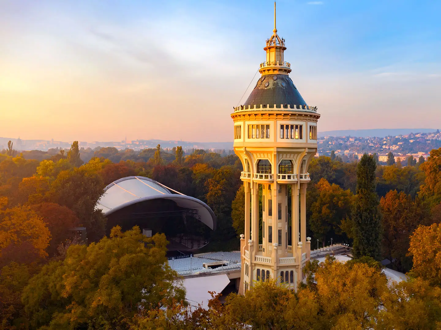
- Water Tower (Víztorony): An octagonal Art Nouveau tower built in 1911, about 57 m tall, and a UNESCO-protected monument. It stands beside the open-air theatre and acts as the island’s main visual landmark.
- Dominican Convent ruins: The remains of the 13th-century convent founded by Béla IV, where Princess Margaret lived and died. They add the island’s clearest medieval stop to an otherwise easy park walk.
- St Michael’s Church: A reconstructed Romanesque chapel on the site of the island’s earliest recorded church. Its tower holds Budapest’s oldest bell, found beneath a storm-felled walnut tree in 1914.
- Japanese Garden: A landscaped corner with a thermal-fed fish pond, bridges, rock arrangements and a small waterfall. It is one of the quietest detours off the main perimeter.
- Rose Garden: A formal flower garden best in summer bloom, making a short and easy side visit from the loop.
Challenges to expect
This is a very easy urban route: elevation gain is negligible, the high point is only about 105 m above sea level, and navigation is simple on the island perimeter. Expect paved and gravel surfaces, plus a rubberised track reserved for runners. The main limitations are seasonal: the gardens and Musical Fountain are best in late spring and summer, while year-round walking means dressing for ordinary Budapest weather and medium rainfall.
HikeList Score
Margaret Island Walking Loop scored 53/100 on HikeList's trail-quality metrics.
See score breakdownHide breakdown
- Ideal length 55
- Balanced challenge 50
- Scenery & wildness 28
- Varied terrain 52
- Accommodation 57
- Food & support 81
- Path quality 71
- Season flexibility 63
Computed from length, challenge, scenery & wildness, terrain variety, accommodation, food & support, path quality and season flexibility.
 Hungary
Show more data Show less
- Urban
- Paved
- Gravel
- Hotels
- Wheelchair Accessible
- Stroller Accessible
- Family Friendly
- Pet Friendly
- Restrooms
- Water Sources
- Picnic Areas
Photos from hikers
Taken on the trail by people who've reviewed Margaret Island Walking Loop.
Reviews
How would you rate Margaret Island Walking Loop?
Tap a star to start your review — you could be the first.