Sighișoara Medieval Trail
How would you rate Sighișoara Medieval Trail?
Tap a star to share your experience and help other hikers.
Sighișoara Medieval Trail: Citadel Walk Guide
HikeList Score
Sighișoara Medieval Trail scored 65/100 on HikeList's trail-quality metrics.
See score breakdownHide breakdown
- Ideal length 55
- Balanced challenge 64
- Scenery & wildness 59
- Varied terrain 64
- Accommodation 74
- Food & support 81
- Path quality 65
- Season flexibility 63
Computed from length, challenge, scenery & wildness, terrain variety, accommodation, food & support, path quality and season flexibility.
The Sighișoara Medieval Trail is an approximate 5.5 km self-guided loop around the UNESCO-listed citadel of Sighișoara in Transylvania, Romania. It is an easy one-day town walk, not a backcountry hike: expect cobbled lanes, paved streets, defensive walls, guild towers and the covered Scholars’ Stair. It suits families, first-time visitors and hikers wanting a short heritage route with cafés, museums and accommodation close by. The only real effort is the hill climb to the Church on the Hill.
Route Overview
Begin and end at the Clock Tower / main gate on Citadel Square (Piața Cetății), the obvious entrance from the lower town. As this is not an official waymarked trail, there is no fixed direction: a practical loop threads the upper citadel’s cobbled streets, the Clock Tower, Vlad Dracul House, Monastery Church, guild towers and surviving walls, then climbs the 176-step Scholars’ Stair to the Church on the Hill and Saxon cemetery before dropping back towards the lower town. No transfer is needed because it is a compact loop. For longer Romanian hiking after Sighișoara, compare the Carpathian Ridge Trail or the Bucegi Plateau Circuit.
History of Sighișoara Citadel
Sighișoara, also known as Schäßburg in German and Segesvár in Hungarian, was founded by Transylvanian Saxons and is first documented in 1280. In the 14th and 15th centuries, the hilltop town was fortified with walls and guild-built towers against Ottoman raids, becoming a craft and trading centre. It is traditionally cited as the birthplace of Vlad III the Impaler. The Historic Centre of Sighișoara was inscribed on the UNESCO World Heritage List in 1999 as a well-preserved, still-inhabited medieval fortified town.
Notable highlights
The Clock Tower (Turnul cu Ceas, 64 m): The mid-14th-century gate tower dominates the citadel and once housed the town council. It now contains the history museum, with a figurine clock and a viewing gallery over the red rooftops.
The Covered Staircase / Scholars’ Stair (176 steps): This roofed wooden stairway was built in 1642 so pupils could reach the hilltop school in poor weather. It is the walk’s clearest physical climb.
The Church on the Hill (Biserica din Deal): A Gothic Saxon church on the citadel’s highest point, first documented in 1345. The adjoining Saxon cemetery adds a quieter, more contemplative stop above the town.
The Vlad Dracul House: A 15th-century house on Citadel Square traditionally identified as the birthplace of Vlad III the Impaler. It links the town walk to the historical figure behind the Dracula legend.
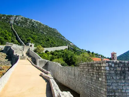
The guild towers and walls: Nine of the original 14 towers survive, once maintained by craft guilds including shoemakers, tailors, tanners and tinsmiths. The roughly 900 m defensive wall still defines the upper town.
The living citadel: Sighișoara is a continuously inhabited medieval citadel, so the route passes homes, guesthouses, lanes and squares rather than a closed museum site.
Challenges to expect
This is an easy urban walk, but the medieval surface matters: cobbles are uneven and can be slippery when wet or icy. The main effort is the climb up the hill and the 176-step covered Scholars’ Stair. Navigation is simple in the compact citadel, but it is not waymarked as a trail, so use signed landmarks, a town map or a guided walking tour. For rougher mountain terrain, see the Bâlea Lake to Bâlea Waterfall hike.
HikeList Score
Sighișoara Medieval Trail scored 65/100 on HikeList's trail-quality metrics.
See score breakdownHide breakdown
- Ideal length 55
- Balanced challenge 64
- Scenery & wildness 59
- Varied terrain 64
- Accommodation 74
- Food & support 81
- Path quality 65
- Season flexibility 63
Computed from length, challenge, scenery & wildness, terrain variety, accommodation, food & support, path quality and season flexibility.
 Romania
Show more data Show less
- Urban
- Hills
- Cobblestone
- Paved
- Hotels
- Guesthouses
- Family Friendly
- Pet Friendly
- Restrooms
- Water Sources
- Picnic Areas
Photos from hikers
Taken on the trail by people who've reviewed Sighișoara Medieval Trail.
Reviews
How would you rate Sighișoara Medieval Trail?
Tap a star to start your review — you could be the first.