Maas Valley Trail (Maasroute)
How would you rate Maas Valley Trail (Maasroute)?
Tap a star to share your experience and help other hikers.
Maas Valley Trail (Maasroute): RivierPark Maasvallei Hiking Guide
HikeList Score
Maas Valley Trail (Maasroute) scored 86/100 on HikeList's trail-quality metrics.
See score breakdownHide breakdown
- Ideal length 93
- Balanced challenge 90
- Scenery & wildness 58
- Varied terrain 100
- Accommodation 100
- Food & support 88
- Path quality 84
- Season flexibility 89
Computed from length, challenge, scenery & wildness, terrain variety, accommodation, food & support, path quality and season flexibility.
The Maas Valley Trail is the 137 km RivierPark Maasvallei long-distance walk: a fully waymarked, cross-border loop through Flemish and Dutch Limburg. Filed under Belgium, it follows both banks of the Maas/Meuse through floodplains, dykes, river meadows and gravel-pit lakes. Plan on 6 moderate days of mostly flat walking, with the challenge coming from daily distance, muddy floodplain sections and ferry logistics rather than climbing. It suits hikers who want a lowland thru-hike with villages, wildlife and easy accommodation access.
Route Overview
This is a circular route, not a point-to-point walk. There is no single fixed start: designated access points include Thorn, Kessenich, Aldeneik, Elen, Stokkem and Stevensweert, with station approach routes from Maastricht and Sittard. Belgian-side starts such as Maaseik or Dilsen-Stokkem are common. The loop links places including Kinrooi, Kessenich, Maaseik, Stokkem, Leut, Maasmechelen, Oud-Rekem, Thorn, Stevensweert, Echt-Susteren, Stein, Elsloo/Meers and Maastricht, crossing the Maas by ferries and bridges. It is signposted both ways, so you can walk clockwise or anticlockwise. For a longer river-themed Belgian walk, compare the GR 126 Semois & Meuse Rivers; for a broader cross-border route, see the GR 12 Amsterdam to Paris Trail.
A Border River Rewilded
The Maas/Meuse has long been a frontier and trade route, with towns such as Maaseik, Stevensweert and Thorn developing as river ports and fortified settlements. In the 20th century, large-scale gravel extraction reshaped much of the valley. Since the late 1990s, and especially through restoration work from around 2007, worked-out pits and riverbanks have been turned into the cross-border RivierPark Maasvallei, where the river is allowed to behave more naturally again.
Notable highlights
- RivierPark Maasvallei: A cross-border river-nature park along the Maas/Meuse on the Belgian-Dutch border. The walk threads its floodplains, old river arms and nature reserves, and was voted Best Hiking Route of the Benelux in 2021.
- The wild Grensmaas: This border section of the Maas is managed as a more freely meandering, gravel-bedded river. For hikers, it gives the route its open floodplain character and frequent river views.
- Flooded gravel pits and nature reserves: Former extraction pits now form lakes with reed, young riparian woodland and bird-rich reserves such as Negenoord-Kerkeweerd, Hochterbampd and Koningssteen.
- Beavers and returning wildlife: Rewilding has brought beaver and otter back to the river corridor, alongside waterbirds and large free-roaming grazers that help keep the floodplain open.
- Maaseik: A historic Maas-side town with an arcaded market square, traditionally associated with Jan and Hubert van Eyck.
- Ferry crossings of the Maas: Small passenger and cycle ferries, plus bridges, link the Belgian and Dutch banks and make it practical to shorten or vary the loop.
Challenges to expect
The walking is gentle and low, with little elevation gain, but 6 days of roughly 23 km stages still require endurance. Expect mostly unpaved dirt, gravel, grassy dyke tops and meadow tracks, with some paved village sections. Floodplain paths can be muddy after rain, and the Maas can flood; signed high-water alternatives exist. Ferries may affect timing, and there are no huts, so book village accommodation or campsites ahead in busy periods.
HikeList Score
Maas Valley Trail (Maasroute) scored 86/100 on HikeList's trail-quality metrics.
See score breakdownHide breakdown
- Ideal length 93
- Balanced challenge 90
- Scenery & wildness 58
- Varied terrain 100
- Accommodation 100
- Food & support 88
- Path quality 84
- Season flexibility 89
Computed from length, challenge, scenery & wildness, terrain variety, accommodation, food & support, path quality and season flexibility.
 Belgium
Show more data Show less
- River Valley Lowland
- Floodplains
- Dykes
- River Meadows
- Lakeshores
- Riparian Forest
- Dirt
- Gravel
- Grass
- Paved
- Hotels
- B&Bs
- Guesthouses
- Campsites
- Family Friendly
- Pet Friendly
- Restrooms
- Water Sources
- Campsites
- Picnic Areas
Download Our Full Guide to Maas Valley Trail (Maasroute) FREE!
Get our comprehensive guide to this hike for free. Save it for later reading or print out at home.
Photos from hikers
Taken on the trail by people who've reviewed Maas Valley Trail (Maasroute).
Maas Valley Trail (Maasroute): The Complete Guide
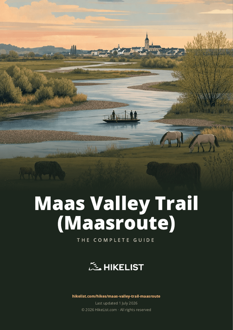
The Maas Valley Trail is a 137 km waymarked loop through RivierPark Maasvallei, the cross-border river park shared by Belgian and Dutch Limburg. It follows both banks of the Maas (Meuse) between Maastricht and the Thorn / Maasbracht area, linking river towns, ferry crossings, old meanders and open floodplain reserves.
This is a lowland long-distance walk rather than a mountain challenge. The appeal is in the broad river landscape: gravel banks, grassy dykes, reed-fringed lakes, young riparian woodland, and reserves grazed by Galloway cattle and Konik horses.
It suits walkers who want a well-signed, flexible multi-day route with plenty of village access and almost no climbing. Maastricht, Maaseik, Thorn, Stevensweert, Elsloo and Oud-Rekem give the route enough historic interest to balance the long, quiet sections beside the Grensmaas.
The walking is moderate because the days are still substantial, typically around 22–23 km on a six-day schedule. Mud, exposed floodplain weather, ferry timings and high-water diversions matter more here than ascent or technical terrain.
This guide covers stages, day planning, accommodation, food, transport, terrain and the common mistakes to avoid.
Stage-by-Stage Guide
The stages below are a practical six-day split, not fixed official etappes. The Maas Valley Trail is waymarked in both directions and has many access points, so distances can be regrouped around accommodation, ferries and public transport.
Stage 1: Maastricht to Berg aan de Maas / Meeswijk
This is a long opening day out of Maastricht into the open river landscape of the Grensmaas. The route leaves the city environment and works north through Maas-side villages including Borgharen, Itteren, Oud-Rekem, Uikhoven and Leut before finishing around Berg aan de Maas or Meeswijk.
Underfoot, expect a mix of paved village sections, gravel, grass and unpaved floodplain paths. The walking is not steep, but it is exposed to wind and rain once away from Maastricht, and low-lying sections can be muddy after wet weather.
Oud-Rekem is the main characterful village on this stage, while the river itself provides the key interest: open floodplain, young riverside woodland, grazing areas and views across the Belgian–Dutch border landscape. Free-roaming Galloway cattle and Konik horses may be present in nature areas; keep at least 25 m away and keep dogs on a lead.
Food and water are easiest to organise in Maastricht before setting off. The smaller villages along the stage may have services, but opening hours should not be relied on for a full day’s food; carry lunch and enough water from the start.
Accommodation is best planned carefully at the end of the stage because Berg aan de Maas and Meeswijk are smaller than Maastricht or Maaseik. Look on both banks of the river when booking, and check whether reaching the booked accommodation depends on a ferry or bridge.
For transport, Maastricht is the strongest access point on the whole route, with rail access and a signed station approach route. In the middle of the stage, public transport is thinner and cross-border buses may be less convenient than the map suggests; this should be checked before travelling.
Navigation is generally straightforward because the trail is marked with hexagonal white RivierPark Maasvallei signs in both directions. Pay attention where village streets, dyke paths and floodplain tracks meet, and do not confuse the walking route with the LF Maasroute cycling route.
Ferry logistics matter on this stage. Crossings such as Jung II between Uikhoven and Geulle and Haol Euver II between Meeswijk and Berg aan de Maas can be useful for changing bank or shortening the day, but sailing times vary with river levels and should be checked before travelling.
Stage 2: Berg aan de Maas to Grevenbicht / Roosteren
This stage follows the Dutch side of the central Maas valley through Stein, Elsloo, Meers and Urmond before finishing around Grevenbicht or Roosteren. It is a varied lowland day, with river terraces, village edges and open Maas-side ground rather than continuous riverside promenade walking.
The terrain remains moderate: mostly easy gradients, but with a mixture of harder surfaces and unpaved paths. After rain, expect mud on grassy or floodplain sections, especially where the route leaves surfaced lanes.
Elsloo and Meers are the main cultural highlights. Elsloo sits on the river terrace and is associated with one of the region’s older settlement areas, with Elsloo Castle and a watermill in the village landscape.
Food and water can be arranged more easily than on some Belgian-bank stretches because the stage passes several named villages. Even so, do not plan the day around a single café or shop without checking opening times, especially outside weekends or high season.
Accommodation at Grevenbicht or Roosteren should be booked ahead, with Stein, Elsloo or nearby villages as possible alternatives if the preferred end point is full. There are no huts or walkers’ refuges, so every overnight stop depends on village lodging, campsites or guesthouses.
For access and bailout, this central part of the route is served less directly than Maastricht. Sittard and Susteren are the useful railheads for the wider area, but the link from the trail to a station or bus stop should be checked before travelling.
Navigation is usually uncomplicated, but this is a stage where it is easy to lose time at junctions between village streets, cycleways and river paths. Follow the hexagonal walking signs rather than faster-looking cycle route signs.
The main practical warning is high water. If the Maas is up, floodplain paths may be closed or unusable; follow the blue-edged high-water alternative signs rather than trying to stay on the low route.
Stage 3: Grevenbicht / Roosteren to Maaseik
This is a slightly shorter stage on the standard six-day split, making it a useful day for a later start, extra time in villages or recovery after two longer days. The route continues through the river corridor via Elen and Heppeneert to Maaseik.
The walking is still flat and non-technical, but the surface mix remains important. Expect hard tracks, village paving and softer riverside ground, with mud likely after wet weather.
Elen and Heppeneert provide the main intermediate village points before the route reaches Maaseik. The approach to Maaseik gives a stronger sense of arrival than the smaller-stage finishes, as Maaseik is one of the principal towns on the trail.
Maaseik is the best resupply and overnight point on this stage. It has the advantage of being a proper town rather than a small river village, so it is the sensible place to plan evening food, breakfast supplies and accommodation.
There may be limited options between the start and Maaseik, so carry enough food and water for the full walking day unless current services have been checked. In warm weather, the open floodplain can feel more tiring than the elevation profile suggests.
Accommodation should be booked in Maaseik or close by. This is one of the more practical overnight stops on the loop and a good place to reset gear, dry footwear and adjust plans if ferry or water-level conditions are changing.
Public transport is generally thinner here than at Maastricht or the Dutch rail towns. Local buses operate on both sides of the border, but exact cross-border connections and evening services should be checked before travelling.
Navigation is helped by the consistent waymarking, but take care at cross-border and riverbank transitions where several local walking loops may overlap. Stay with the long-distance hike signs and use the high-water alternative if directed by conditions on the ground.
Stage 4: Maaseik to Thorn
This stage links two of the most rewarding town stops on the route: Maaseik and Thorn. It heads north through Aldeneik, Kessenich and Kinrooi before finishing at Thorn, the white town of Dutch Limburg.
The day is typical Maasvallei walking: low gradients, mixed surfaces and regular shifts between village edges, river meadows, gravelly tracks and wetland-influenced nature areas. There is no technical difficulty, but the distance is still a full day with limited shelter in open sections.
Aldeneik gives an early village stop after Maaseik, while Kessenich and Kinrooi break up the middle of the stage. Approaching Thorn, the landscape includes the broad northern Maas setting and nature-development areas shaped by old gravel extraction, reed, lakes and young riparian woodland.
Thorn is the main highlight and the natural overnight target. Its lime-white brick houses and compact historic centre make it one of the most distinctive stops on the route.
Maaseik is the best place to buy food before leaving. Intermediate services may be limited or seasonal, so carry lunch and water rather than depending on finding something open in Kessenich or Kinrooi.
Accommodation in Thorn should be reserved in advance, especially in busy periods. If Thorn is full, look at nearby settlements on the route, but check how that affects the following day’s distance before booking.
Public transport access exists in the wider area but is not as simple as starting or ending in Maastricht. Bus timings should be checked before committing to a stage break at one of the smaller villages.
Navigation is generally clear, but this is a stage where high-water planning matters. Low routes beside the Maas and around wetland areas can be affected by river levels; use the blue-edged high-water variant when signed.
Stage 5: Thorn to Stevensweert / Ohé en Laak
This is one of the most varied cultural stages on the northern part of the loop. From Thorn, the route continues through Wessem and Maasbracht before reaching Stevensweert and Ohé en Laak.
The walking remains easy underfoot in terms of ascent, but expect a regular alternation between village surfaces, dyke or riverside paths and open lowland tracks. Some sections may feel more built-up around Wessem and Maasbracht, while the Stevensweert and Ohé en Laak area brings the route back into a strong river-island setting.
Koningssteen, outside Thorn, is one of the notable nature-development sites associated with this part of the Maas valley and forms a natural border with Belgium. Later in the stage, Stevensweert and Ohé en Laak sit on an “island in the Maas” between the Border Meuse and the Old Meuse.
Stevensweert is the main historical highlight. It was turned into a bastioned Spanish fortress town in 1633 and still retains its star-shaped fortification layout, which makes it a worthwhile overnight stop rather than just a place to pass through.
Food and water are best organised in Thorn before setting out, with Wessem, Maasbracht and Stevensweert providing the most obvious service points during the day. Opening hours still need checking, particularly outside the main visitor season.
Accommodation is available in and around the Maas villages, with Stevensweert or Ohé en Laak the natural end points for this stage. Book ahead, as options can be limited compared with larger towns.
Road access is reasonable around the named villages, but public transport should be planned rather than assumed. For onward rail links, Susteren and Sittard serve the wider central area, but the practical connection from the stage end should be checked before travelling.
Navigation is not difficult, but pay attention where local paths, cycle routes and river crossings overlap. Ferries and bridges can alter the feel and length of the day, so check crossing information before setting off if using a variation.
The main warnings are livestock, mud and water levels. Keep clear of free-roaming grazers, expect soft ground after rain, and do not attempt low floodplain paths when the signed high-water alternative is in use.
Stage 6: Stevensweert / Ohé en Laak to Maastricht
The final stage is the longest in this six-day split and closes the loop back towards Maastricht via the Echt-Susteren area and the central Maas bank. It is best treated as a full walking day, even though the route is flat.
Terrain is again lowland river-valley walking rather than hill country. The effort comes from distance, changing surfaces and exposure, with long open sections where wind, rain or heat can slow progress.
This stage is less about a single marquee village and more about completing the river circuit through the central Maas landscape. Expect a continuation of floodplain, dyke, river meadow, former gravel-pit scenery, wetland edges and village links before the route returns to Maastricht.
Food and water require more discipline than on shorter days. Start with enough for several hours, and do not rely on finding frequent services between the smaller settlements unless current opening times have been checked.
Accommodation is simplest at the end in Maastricht, where there is a much broader choice than in most villages on the loop. If shortening the stage, book carefully around available lodging and check how the revised split connects with public transport.
For transport, Maastricht is the key finish point, with rail access and a signed station approach route. Susteren and Sittard are useful railheads for the wider central section, but any side connection from the trail should be checked before travelling.
Navigation into Maastricht should remain clear if the waymarks are followed, but fatigue can make junction errors more likely late in the day. Keep following the white hexagonal RivierPark Maasvallei signs and avoid being drawn onto the similarly named cycling route.
High water is the main route-specific risk on the final stage. The Maas genuinely floods, and low paths may be inaccessible; follow the blue-edged high-water alternative whenever flood conditions affect the normal line.
Recommended Itinerary
The six-day plan below is the most practical default for the Maas Valley Trail: it keeps most days around 20–26 km, uses established river towns and villages for overnight stops, and leaves enough time for ferry, mud and high-water logistics. The route is waymarked in both directions and can be started from any access point, but Maastricht is the simplest planning base because of its rail access and signed station approach route.
Distances are approximate. If accommodation availability forces a different overnight stop, check official mapping before booking.
Standard 6-day itinerary
| Day | From | To | Approx. distance | Why this stage makes sense | Services/accommodation notes |
|---|---|---|---|---|---|
| 1 | Maastricht | Berg aan de Maas / Meeswijk, via Borgharen, Itteren, Oud-Rekem, Uikhoven and Leut | 24 km | A logical first day from the best-connected start point, moving out of Maastricht into the cross-border river landscape and onto the Belgian and Dutch banks. The stage introduces the ferry-and-river logistics that define the route, so check current ferry sailings before setting off. | Maastricht has the broadest range of accommodation and transport. Overnight options are more village-based around Berg aan de Maas and Meeswijk, so book ahead rather than assuming late availability. |
| 2 | Berg aan de Maas | Grevenbicht / Roosteren, via Stein, Elsloo, Meers and Urmond | 22 km | A steady lowland day through the central Maas valley, with useful settlements at intervals and no major climbing. Elsloo, Meers and the river terraces give this stage more village character than some of the open floodplain sections. | Stein, Elsloo, Meers, Urmond, Grevenbicht and Roosteren give useful options for food, accommodation or public-transport escape points nearby, but exact services should be checked before travelling. |
| 3 | Grevenbicht / Roosteren | Maaseik, via Elen and Heppeneert | 20 km | The shortest day in the standard schedule, useful after two longer opening stages or if conditions underfoot are muddy. Finishing in Maaseik makes sense because it is one of the larger historic towns on the route and a practical overnight stop. | Maaseik is a strong resupply and accommodation point for the Belgian-bank section. The approach through smaller villages means accommodation should still be booked in advance. |
| 4 | Maaseik | Thorn, via Aldeneik, Kessenich and Kinrooi | 23 km | A well-balanced day linking Maaseik with Thorn, with river-nature sections, former gravel-pit landscapes and Belgian Limburg villages en route. Thorn is one of the most obvious overnight targets on the northern part of the loop. | Thorn has visitor infrastructure, but it is a popular destination, so accommodation can fill in busy periods. If stopping earlier around Aldeneik, Kessenich or Kinrooi, check exact lodging availability before committing to the stage split. |
| 5 | Thorn | Stevensweert / Ohé en Laak, via Wessem and Maasbracht | 22 km | This stage keeps the northern loop manageable and links Thorn with the Maas villages around Wessem, Maasbracht and Stevensweert. It also positions the final day for the longer closing stage back towards Maastricht. | Thorn, Wessem, Maasbracht, Stevensweert and Ohé en Laak are the key settlement options. Stevensweert and Ohé en Laak are practical overnight bases before the final day, but book ahead. |
| 6 | Stevensweert / Ohé en Laak | Maastricht, closing the loop via the Echt-Susteren and central Maas bank | 26 km | The longest day of the standard plan, but still within a typical fit-walker range on this flat route. Start early, especially if ferry timings, wet floodplain paths or high-water diversions could slow progress. | Maastricht gives the easiest finish for onward rail travel and a wide choice of accommodation. If 26 km is too long, split the final section by arranging an extra village overnight and check official mapping before booking. |
Slower variant: 7–8 days
A slower itinerary suits first-time multi-day walkers, families, dog walkers, anyone carrying camping gear, and hikers who want more margin for muddy floodplain paths or high-water alternatives. It also makes sense in shorter daylight months within the main walking season.
Rather than trying to force exact short stages, add one or two extra nights in the larger settlement clusters already on the route. Useful places to consider include Stein / Elsloo / Meers, Maaseik, Thorn, Stevensweert / Ohé en Laak and the Echt-Susteren area. Exact distances between revised overnight stops should be checked on official mapping before booking.
This variant is also the safest choice if ferry operation is uncertain. Small foot and cycle ferries are part of the route experience, but sailing times can change with river levels, and high water may require the signed blue-edged alternative.
Faster variant: 4–5 days
A faster schedule is only sensible for strong walkers who are comfortable with long, flat days and who can keep moving on gravel, grass, dyke-top paths and paved village sections. The route has little ascent, but 137 km still becomes a demanding walk when compressed into fewer days.
A five-day plan usually means reshaping the six standard stages into longer blocks of roughly the same overall daily effort, using towns such as Maaseik, Thorn, Stevensweert / Ohé en Laak or Maastricht as anchors where accommodation and onward transport are more realistic. A four-day plan is a fast-hiker itinerary and leaves little spare time for ferry delays, mud, heat or high-water diversions.
For any faster variant, fix accommodation first and then check the exact stage distances on official mapping before booking. Do not rely on being able to find a late bed in the smaller Belgian-bank villages.
Planning the Route
Choose a start point that fits your transport
The Maas Valley Trail is a loop rather than a point-to-point trail, so the best start is usually the place with the easiest transport and accommodation for you. Maastricht is the most straightforward choice for many walkers, with rail access and a signed station approach route, but Oud-Rekem, Maaseik, Stokkem, Thorn and Stevensweert are also practical access points.
Because the route is waymarked in both directions, there is no fixed “correct” direction. Choose clockwise or anticlockwise according to accommodation availability, ferry timings and where you want the longer days to fall.
How many days to allow
Six days is the most natural plan for a complete circuit. That gives stages of roughly 20–26 km, which suits a fit walker who is comfortable with long lowland days and can handle muddy floodplain sections if the weather turns.
Strong walkers can compress the route into fewer days, but this makes the walk more about mileage than the river landscape. There is little climbing, yet long flat days on grass, gravel and hard surfaces can still be tiring, especially with wet ground, headwinds or ferry delays.
A slower seven- or eight-day plan is better if you want shorter days, more time in Maaseik, Thorn, Stevensweert or Maastricht, or more flexibility around ferries and high water. It also reduces the risk of arriving late in smaller villages where services may be limited.
Let accommodation shape the stages
Daily stages are not fixed official etappes, and the route has many access points. In practice, overnight stops should be planned around the larger towns and villages with accommodation: Maastricht, Maaseik, Thorn, Stevensweert, Stein and nearby Maas villages are among the more useful bases.
There are hotels, B&Bs, guesthouses and campsites along and around the route, but no mountain huts or trail refuges. Book ahead in the busy season, especially where the Belgian-bank stretches have fewer obvious overnight options.
A typical six-day structure uses overnight areas such as Berg aan de Maas / Meeswijk, Grevenbicht / Roosteren, Maaseik, Thorn and Stevensweert / Ohé en Laak before returning to Maastricht. Treat these as planning anchors rather than compulsory stages; adjust them to available beds and ferry crossings.
Some route “ambassador” hosts offer lodging and luggage help. Availability, prices and luggage-transfer arrangements should be checked before travelling.
Shortening, extending and varying the walk
The loop is easy to adapt because it follows both banks of the Maas and has multiple crossings. Small foot-and-cycle ferries, including links such as Uikhoven–Geulle and Meeswijk–Berg aan de Maas, let you shorten or vary sections, while bridges also give options for changing banks.
Do not build a tight itinerary around a ferry without checking the current sailing times. Ferry operation can change with season, weather and river level, and operators post updates locally and online.
Extending the walk is simplest by adding extra nights in the main towns or by using local walking networks in RivierPark Maasvallei. Avoid confusing this walking route with the LF Maasroute / EuroVelo 19 cycling route, which follows the same river but is a different, much longer bike itinerary.
Section hiking
Section hiking is practical, particularly from Maastricht and the Dutch rail-access points serving the southern and central parts of the valley. Sittard and Susteren are useful for reaching parts of the route, while Genk is the nearest Belgian station.
Away from the main railheads, local buses run through Arriva on the Dutch side and De Lijn on the Belgian side. Services are thinner in the middle of the route, so day sections should be planned around actual bus times rather than assumed village connections. This should be checked before travelling.
Public-transport bikes listed through the Arriva and De Lijn apps can help with linking accommodation, stations and trail access points, but they should be treated as a useful extra rather than the backbone of a hiking plan.
Food and water planning
This is a village-to-village lowland trail, not a wilderness route, so food planning is mainly about opening hours and spacing rather than carrying multiple days of supplies. Do not assume every village has an open shop or café when you pass through.
Carry enough water and food for the day, especially on longer floodplain stretches between overnight stops. In hot weather the open Maas meadows and dyke tops can feel exposed, with limited shade in places.
Navigation and maps
Navigation is usually straightforward: the long-distance walk is marked with white hexagonal RivierPark Maasvallei logo signs and is signposted in both directions. A separate high-water alternative is marked with blue-edged hexagonal signs.
Carry a map or offline route on your phone even though the waymarking is strong. The printed hiking map for the 137 km cross-border route is sold for about EUR 6; confirm current availability and price before travelling.
The most important navigation decision is not usually finding the path, but choosing the correct version of it when river levels are high. If the floodplain route is closed or under water, follow the blue-edged high-water alternative rather than trying to push through.
Weather, river levels and ground conditions
The key planning variable is the Maas itself. This is a genuine floodplain walk, and sections through uiterwaarden, river meadows and former gravel-pit landscapes can become muddy or inaccessible after heavy rain or high water.
Check the current “Dry Feet” / high-water status before setting out and again during unsettled weather. A safe plan allows time to switch to the high-water alternative, change banks, or adjust a day around a ferry that is not running.
Spring, summer and autumn are the main walking seasons. Waterproof footwear is useful after rain, while sun protection and extra water matter in summer because parts of the route are open and low-lying.
Dogs, grazing animals and access behaviour
Dogs are allowed but should be kept on a lead. Parts of the route pass through grazed nature reserves with free-roaming Galloway cattle and Konik horses.
Keep at least 25 m from the animals and do not try to feed or approach them. This is especially important with dogs, in narrow path sections and near young animals.
What matters most to plan in advance
The main planning priorities are accommodation, ferry timings, river levels and transport connections. Navigation is well supported by waymarking, and the physical difficulty is moderate, but the logistics can still catch out walkers who leave details until the day.
Before travelling, check:
- accommodation availability in your chosen overnight villages;
- current ferry sailing times and any river-level restrictions;
- the “Dry Feet” / high-water status and whether the blue-edged alternative is needed;
- bus and rail times for your start, finish or section-hike access;
- food options and opening hours where your day depends on village services.
Towns, Villages and Overnight Stops
The Maas Valley Trail is village-based: there are no huts, refuges or mountain-style shelters, so each overnight needs to be arranged in a town, village, campsite, B&B, guesthouse or hotel. Accommodation is generally easiest around the larger places such as Maastricht, Maaseik, Thorn, Stevensweert and Stein, while some Belgian-bank stretches are thinner and should be booked ahead in the busy season.
A typical 6-day plan uses overnight stops around Berg aan de Maas / Meeswijk, Grevenbicht / Roosteren, Maaseik, Thorn and Stevensweert / Ohé en Laak before returning to Maastricht. Because the route is a signed loop, these are not fixed stages: ferries, bridges and local transport can be used to shorten, lengthen or rearrange days.
| Route area | Best use for hikers | Planning notes |
|---|---|---|
| Maastricht | Start/end base; easiest rail access | Signed station approach route; good place to add a night before or after the walk |
| Berg aan de Maas / Meeswijk | Practical first overnight area | Ferry link between the Dutch and Belgian banks; check ferry times before relying on it |
| Grevenbicht / Roosteren | Useful central overnight | Works well after the Stein, Elsloo, Meers and Urmond stretch |
| Maaseik | Strong Belgian-bank overnight | Historic town and a sensible resupply/rest point before the northern stages |
| Thorn | Key overnight and route highlight | Book ahead in busy periods; useful before the Stevensweert / Maasbracht section |
| Stevensweert / Ohé en Laak | Final-night base for a 6-day itinerary | Good staging point before the longer closing leg back towards Maastricht |
Maastricht
Maastricht is the most practical start and finish point for many walkers, especially if arriving by train. The route has a signed station approach, making it easier than most access points for a car-free start.
It is also the safest place to build in a buffer night at the beginning or end of the hike. Accommodation is available in and around the city, and it is the best place on the route to sort last-minute food, cash, maps and transport connections before entering the smaller river villages.
If starting elsewhere on the loop, Maastricht still works as a useful rail access point for reaching the southern part of the route. Local buses are operated on the Dutch side by Arriva; exact services and times should be checked before travelling.
Borgharen and Itteren
Borgharen and Itteren sit on the early river-valley section north of Maastricht. They are useful as short breaks or access points rather than obvious overnight bases on a standard 6-day schedule.
Do not assume that food, shops or accommodation will be available exactly when needed in these smaller villages. If planning a very short first day from Maastricht, any lodging or meal stop here should be arranged in advance.
Oud-Rekem, Herbricht, Uikhoven and Leut
These Belgian-bank villages form the southern cross-border section between Maastricht and the Berg aan de Maas / Meeswijk area. Oud-Rekem is one of the common access points to the official loop, so it can work as an alternative start if accommodation or transport fits.
This stretch is one of the places where planning matters more than the map suggests. Belgian-bank village accommodation can be thinner, and small food stops may be limited or seasonal; book beds and check opening times rather than arriving late and hoping for options.
Uikhoven is important because of the Jung II foot-and-cycle ferry between Uikhoven and Geulle. Ferry times vary and can be affected by river conditions, so check the current sailing status before building a day around this crossing.
Meeswijk and Berg aan de Maas
Meeswijk and Berg aan de Maas sit opposite each other across the Maas and make a logical first overnight area on a 6-day itinerary from Maastricht. The Haol Euver II foot-and-cycle ferry links Meeswijk with Berg aan de Maas, giving walkers a useful way to cross between the Belgian and Dutch banks.
This is a practical staging point rather than a place to leave arrangements vague. Accommodation should be booked ahead, and evening food should be checked when reserving, especially outside peak visitor periods.
The ferry is a major logistical detail here. Check sailing times and river-level updates before travelling, and have a fallback plan if high water or operating hours affect the crossing.
Stein, Elsloo and Meers
Stein, Elsloo and Meers sit on the Dutch side of the central Maas section and are useful for breaking up the second day. Stein is one of the named accommodation areas on the route, while Elsloo and Meers are also worthwhile stops for hikers interested in the older river-terrace villages and Maas-valley scenery.
This cluster can be used either as an overnight alternative to Berg aan de Maas / Meeswijk or as a shorter-stage option before continuing towards Grevenbicht or Roosteren. It is a good area to consider if the standard 22 km day feels too long or if accommodation is unavailable farther along.
Sittard is one of the Dutch rail access points serving the central part of the route, but onward local transport needs to be planned separately. This should be checked before travelling.
Urmond and Nattenhoven
Urmond and Nattenhoven come between the Stein / Elsloo / Meers area and Grevenbicht / Roosteren. For most walkers they are en-route villages rather than primary overnight stops.
They can be useful for adjusting the day if weather, mud or ferry timing slows progress. As with the smaller Maas villages, food and lodging should not be assumed without checking in advance.
Grevenbicht and Roosteren
Grevenbicht and Roosteren are practical overnight targets at the end of the second stage in the standard 6-day plan. They sit well for continuing towards Elen, Heppeneert and Maaseik the next day.
This is a sensible place to stop if walking the route in balanced daily distances. Accommodation and evening meals should be arranged before arrival, as this is not a route where every village has late-opening hiker services.
Susteren is one of the Dutch stations serving the wider central/northern part of the trail area. Connections between the station, the route and nearby villages should be checked before travelling.
Elen and Heppeneert
Elen and Heppeneert are Belgian-bank villages on the approach to Maaseik. They are useful intermediate stops on the Grevenbicht / Roosteren to Maaseik stage, particularly if the river paths are muddy or progress is slower than expected.
For overnight planning, Maaseik is the more dependable target. If using Elen or Heppeneert to split the day, arrange accommodation and food in advance rather than treating them as guaranteed service points.
Maaseik and Aldeneik
Maaseik is one of the strongest overnight bases on the Belgian side of the loop. It works naturally as the end of the third stage and the start of the fourth, and is a good place to resupply, eat properly and reset before the Kessenich, Kinrooi and Thorn section.
Accommodation is available in and around Maaseik, with the usual mix of hotels, B&Bs and guesthouses found along the route. Book ahead in busy periods, especially if walking a fixed 6-day itinerary where missing a bed would disrupt the next stage.
Aldeneik lies just beyond Maaseik on the route towards the northern river villages. It is more of an onward walking section than a main logistics base, but it can be relevant if choosing accommodation just outside Maaseik itself.
For public transport on the Belgian side, local buses are operated by De Lijn. Genk is the nearest Belgian rail station named for access to the wider route area; exact onward connections should be checked before travelling.
Kessenich and Kinrooi
Kessenich and Kinrooi sit between Maaseik and Thorn on the Belgian side of the northern loop. They are useful for pacing the day and for potential short-stage planning, but should not be treated as guaranteed full-service hiking stops.
If accommodation is available here, it can help reduce the Maaseik-to-Thorn day or create a more relaxed itinerary. Any overnight, evening meal or shop stop should be confirmed in advance.
Thorn
Thorn is one of the key overnight stops on the route and a natural end point for the Maaseik stage. It is also one of the trail’s main cultural highlights, known as het witte stadje, the white town.
For hikers, Thorn’s main value is practical as well as scenic: it breaks the northern loop cleanly before the Wessem, Maasbracht and Stevensweert section. Accommodation is part of the route’s village-based lodging mix, but booking ahead is strongly recommended in the busy season.
Thorn is a good place to check the next day’s ferry, bridge and high-water situation before setting out. If river levels are up, follow the blue-edged high-water alternative rather than trying to push through floodplain paths.
Wessem and Maasbracht
Wessem and Maasbracht lie on the stage between Thorn and Stevensweert / Ohé en Laak. They are useful mid-stage places for food, rest or an itinerary adjustment, depending on what is open and where accommodation has been arranged.
Maasbracht is in the northern Thorn / Maasbracht area of the loop, so it can also work as an alternative stopping point if Thorn or Stevensweert is full. Availability, meal options and onward transport should be checked before travelling.
Stevensweert and Ohé en Laak
Stevensweert and Ohé en Laak are among the most useful overnight bases in the northern part of the trail. They sit on the island-like area between the Border Meuse and the Old Meuse, making them a logical final-night stop before the longer closing stage back towards Maastricht.
Stevensweert is also a route highlight because of its historic fortress layout. From a planning perspective, however, its main advantage is that it gives the final day a clear starting point and avoids trying to cover too much from Thorn in one push.
Accommodation should be booked ahead. If using local buses or arranging luggage transfer with a route ambassador host, confirm the details before travelling.
Echt-Susteren area
The Echt-Susteren area is relevant on the closing section of the loop from Stevensweert / Ohé en Laak back towards Maastricht. It is also important because Susteren is one of the Dutch rail stations serving the trail area.
This area can be useful if the final 26 km day needs to be shortened, split or exited by public transport. Exact accommodation, bus links and walking access between the route and station should be checked before travelling.
General booking notes for all stops
Carry enough food and water to cover the gaps between villages, especially on Sundays, public holidays or outside the main visitor season. The route is lowland and village-based, but that does not mean every settlement has a shop, café or evening meal option when a walker arrives.
Some ambassador hosts along the Maas Valley Trail offer lodging and luggage help. These can be useful for lighter walking days, but arrangements should be made directly and confirmed before the trip.
Before finalising overnight stops, check three things together: accommodation availability, ferry operating times and the current high-water status. A good-looking stage on paper can change quickly if a ferry is not running or the signed floodplain route is under water.
Getting to the Start
The Maas Valley Trail has no single fixed start point. It is a waymarked loop, signed in both directions, so the most practical start is usually the place with the best transport and accommodation for your itinerary.
Common access points include Maastricht, Oud-Rekem, Maaseik, Stokkem, Thorn and Stevensweert. Maastricht is the simplest rail-based start because there is a signed station-approach route.
By train
Maastricht is the easiest starting point for most walkers using public transport. The route can be reached from Maastricht station via the signed approach route, avoiding the need for a taxi at the beginning of the walk.
Other useful Dutch rail stations for joining or leaving parts of the loop are Sittard and Susteren. On the Belgian side, Genk is the nearest Belgian station, with onward local transport needed to reach the Maas villages.
| Rail station | Best use |
|---|---|
| Maastricht | Most straightforward full-loop start; signed approach route to the trail |
| Sittard | Useful for the central Dutch Limburg side of the route |
| Susteren | Useful for the Echt-Susteren / central Maas bank area |
| Genk | Nearest Belgian rail access, with onward bus or taxi required |
Train and onward bus times should be checked before travelling, especially if starting outside Maastricht or arriving late in the day.
By bus
Local buses serve the area, but coverage is thinner in the middle of the route than at the main rail hubs. In the Netherlands, buses are operated by Arriva; in Belgium, by De Lijn. Their apps are also useful for checking public-transport bike options where relevant.
Bus planning needs extra care because this is a cross-border river route. A village that looks close on the map may be on the opposite bank, and the most direct walking connection may depend on a bridge or a small foot/cycle ferry.
If starting at Oud-Rekem, Maaseik, Thorn, Stevensweert or another village access point, check the final bus leg carefully and have a backup plan for late arrivals. This should be checked before travelling.
By car
Driving is possible because the loop has many access points in towns and villages, but there is no single official start car park for the whole trail. Choose a start town with accommodation and suitable public parking, then walk the loop back to the same place.
Maastricht, Maaseik, Thorn and Stevensweert are practical candidates because they are established towns or villages on the route. If leaving a vehicle for several days, confirm overnight and long-stay parking rules locally before setting off. This should be checked before travelling.
A car is less useful once the walk has begun, unless using it for section hiking. For section hikes, the simplest plan is often to park at a rail-linked town such as Maastricht, Sittard or Susteren, then use bus, taxi or a second vehicle to manage the return.
From the nearest airport
There is no airport trailhead for this route, and the walk is best treated as a rail-and-local-transport journey. International arrivals should aim for the airport with the most convenient onward rail connection to Maastricht, Sittard, Susteren or Genk.
Do not assume there will be a direct shuttle to the trail. For Belgian-bank starts or smaller Maas villages, expect a train-plus-bus journey or a pre-booked taxi for the final leg. This should be checked before travelling.
Where to stay before starting
Maastricht is the most convenient overnight base before a full-loop start because it has rail access and a signed approach to the trail. It also avoids beginning the first walking day with uncertain local bus connections.
Maaseik, Thorn, Stevensweert, Stein and other Maas villages can also work well if they fit your stage plan, but accommodation is more limited in some stretches. There are no trail huts or refuges, so book village lodging ahead in busy periods.
If starting away from Maastricht, choose accommodation close to the waymarked route or arrange a short taxi transfer in advance. For Belgian-bank stages and smaller villages, availability and transport links should be checked before travelling.
Getting Home from the Finish
Because the Maas Valley Trail is a loop, there is no single fixed finish. You finish back at the access point where you began, whether that is Maastricht, Oud-Rekem, Maaseik, Thorn, Stevensweert or another village on the route.
For most walkers, the simplest homeward plan is to choose a start/finish with good transport rather than treating the end as a separate logistics problem. Maastricht is the easiest public-transport finish; smaller Maas villages can work well, but buses, taxis and ferry links need more planning.
By train
Maastricht is the strongest rail option on the route and has a signed station-approach route, making it the most convenient place to finish if travelling by public transport. Finishing in Maastricht avoids needing a final bus or taxi from a riverside village.
Sittard and Susteren are useful Dutch railheads for the central and northern parts of the loop. They are not the same as finishing directly on the trail unless your itinerary is planned around nearby access points, so allow time for a local bus, taxi or onward connection.
Genk is the nearest Belgian station for the Belgian side of the RivierPark Maasvallei. It is more useful for walkers finishing or breaking the route on the Belgian bank, but the final connection from riverside villages should be checked before travelling.
If finishing late in the day, do not assume that a village-to-station bus connection will still be running. Check current train and bus times before setting out for the final stage, especially if ending anywhere other than Maastricht.
By bus
Local buses are operated by Arriva on the Dutch side and De Lijn on the Belgian side. Their apps are the most practical tools for checking current village connections and, where relevant, public-transport bike options.
Bus coverage is thinner in the middle of the route than at the main rail towns. Villages such as Maaseik, Thorn, Stevensweert, Oud-Rekem, Stein, Elsloo, Roosteren and the surrounding Maas settlements may be manageable by bus, but services are timetable-dependent and can be limited in the evening or at weekends.
Small foot-and-cycle ferries and bridges can help connect the two banks of the Maas and may shorten the journey to a better transport point. Ferry sailing times vary with river levels, and operators post updates separately; this should be checked before travelling.
By car/taxi
A loop makes car logistics straightforward: park at your chosen access point, walk the circuit, and return to the same place. This is a major advantage over point-to-point long-distance routes.
If using a taxi, arrange it in advance when finishing in smaller villages or outside normal daytime hours. Maastricht, Maaseik and the larger towns are more practical places to end without a pre-booked transfer than quieter riverside access points.
Do not build a final-day plan that depends on an unconfirmed ferry, a last bus or a taxi being immediately available in a small village. If timing is tight, finish at Maastricht or stay locally and travel the next morning.
From the nearest airport
No airport is directly part of the trail logistics. The practical approach is to travel between the airport and one of the rail or bus hubs used for the route, especially Maastricht, Sittard, Susteren or Genk.
Airport-to-trail transfers depend on the airport chosen and current public-transport timetables. This should be checked before travelling, particularly for late arrivals or early departures.
Where to stay at the finish
If finishing in Maastricht, accommodation and onward travel are easiest to combine. It is the best finish for walkers who want a simple final evening and a train out the next day.
Elsewhere on the loop, accommodation is in towns and villages rather than trail refuges. Hotels, B&Bs, guesthouses and campsites are found in and around places such as Maaseik, Thorn, Stevensweert and Stein, but availability can be thinner on some Belgian-bank stretches.
Staying overnight at the finish is often sensible if the final stage is long, the weather has slowed progress, river levels have forced use of the high-water alternative, or the last connection is uncertain. Book ahead in the busy season and confirm arrival times with the accommodation.
Which Direction Should You Walk?
The Maas Valley Trail is waymarked in both directions, so there is no mandatory or technically better direction. It is also a loop with many access points, which means the bigger planning decision is usually where to start, not whether to walk clockwise or anticlockwise.
For most independent walkers, Maastricht is the simplest start and finish. It has rail access and a signed station-approach route, making it easier to arrive without a car and to finish the loop with onward transport already in place.
Following the six-day order from Maastricht
The most practical plan is to start in Maastricht and follow the route north through the Maas villages towards Maaseik, Thorn, Stevensweert and Ohé en Laak before closing the loop back towards Maastricht. This works well because the walk begins and ends at the strongest transport hub on the route.
This direction gives a clear sense of progression: from the southern access at Maastricht into the Grensmaas floodplains, then through the Belgian-bank villages and the historic Maas towns, before returning through the central Maas bank. It also places Thorn, Stevensweert and Ohé en Laak late in the journey, which gives the northern part of the loop a strong final-third feel before the long return to Maastricht.
Accommodation planning is still the limiting factor. The Belgian-bank stretches can be thinner for lodging, so the best direction may simply be the one that matches available beds in Oud-Rekem, Maaseik, Thorn, Stevensweert, Stein or nearby villages. There are no huts or trail refuges, so reservations should shape the itinerary more than compass direction.
Walking the reverse direction
Walking the loop in reverse is equally valid. The signs are in place both ways, the terrain remains low and non-technical, and there are no climbs that become meaningfully easier or harder in one direction.
The reverse direction can be useful if accommodation is easier to secure in that order, or if ferry timings and public transport connections suit a particular day better. It also brings the northern highlights earlier, including Thorn, Stevensweert and the Maas-side villages around Maaseik, before the route works back towards the southern Grensmaas and Maastricht.
The main drawback is psychological rather than practical. If starting in Maastricht, the reverse direction may put some of the most distinctive historic stops early, leaving the finish to depend more on the satisfaction of closing the loop than on a single landmark village.
Transport, ferries and high water
Because this is a loop, transport is easiest when the start and finish are the same place. Maastricht is the cleanest choice for that, while Sittard, Susteren and Genk can help with access to other parts of the route if section-walking or joining mid-loop.
Direction can matter when a day depends on a small foot-and-cycle ferry, such as Jung II or Haol Euver II. Ferry sailing times vary with river level and should be checked before travelling; operators may post updates online. In high water, follow the blue-edged high-water alternative rather than trying to force the floodplain route.
Weather does not create a strong directional argument. The route is exposed in places on open floodplain, dyke tops and river meadows, so wind and rain affect comfort, but there is no prevailing-wind pattern that makes one direction consistently better.
Recommendation
Start and finish in Maastricht unless there is a specific reason not to. Walk the loop in the standard six-day order via Berg aan de Maas / Meeswijk, Grevenbicht / Roosteren, Maaseik, Thorn and Stevensweert / Ohé en Laak if accommodation is available.
Choose the reverse direction only when it gives better lodging, ferry or public-transport logistics. On this route, practical bookings and river conditions matter far more than direction, gradient or scenery sequence.
Accommodation Along the Route
The Maas Valley Trail is a village-to-village walk, not a hut route. Expect hotels, B&Bs, guesthouses and campsites in and around the Maas towns and villages, with the strongest options in larger places such as Maastricht, Maaseik, Thorn, Stevensweert and Stein.
There are no mountain huts, trail refuges or official stage shelters. Overnight planning is therefore one of the main logistics of the route, especially because the neat six-day itinerary creates several stage ends in smaller river villages where choice can be thin.
Best Overnight Pattern
A practical six-day inn-to-inn plan is to overnight around:
- Berg aan de Maas / Meeswijk
- Grevenbicht / Roosteren
- Maaseik
- Thorn
- Stevensweert / Ohé en Laak
- Maastricht
This keeps most days around 20–26 km and uses villages or towns that sit naturally on the loop. The awkward points are the smaller overnight clusters: if beds are full, you may need to adjust the stage, cross the Maas by ferry or bridge where available, or use a short bus or taxi transfer to accommodation nearby.
Accommodation by Place
| Place | Accommodation level | Best for | Notes |
|---|---|---|---|
| Maastricht | good | Start/end night; easiest place to build in a buffer | Strongest base on the route, with rail access and a signed station approach route. Useful if arriving late or finishing with onward travel. |
| Oud-Rekem / Uikhoven / Leut / Meeswijk | limited | Breaking the first long section on the Belgian bank | The Belgian-bank stretches can be thinner for lodging. Book ahead rather than assuming a room will be available in the exact village. |
| Berg aan de Maas / Stein / Elsloo / Meers | good | First or second overnight, depending on direction | Stein is one of the named accommodation centres along the trail. The smaller surrounding villages are useful but may have fewer options. |
| Grevenbicht / Roosteren | limited | Natural overnight between Stein/Elsloo and Maaseik | A practical stage break, but not a place to leave booking until the last minute. This should be checked before travelling. |
| Elen / Heppeneert | limited | Shortening the approach to Maaseik | Useful only if you want to split the day differently. Availability should be checked before building an itinerary around either village. |
| Maaseik | good | Reliable mid-route overnight | One of the best Belgian-side bases, with town services and a natural stop after the Grevenbicht/Roosteren section. |
| Aldeneik / Kessenich / Kinrooi | limited | Breaking the Maaseik–Thorn stage | Useful for a slower itinerary, but do not rely on last-minute availability along this stretch. |
| Thorn | good | Overnight before the Stevensweert / Maasbracht section | A strong and attractive stage stop, but likely to need advance booking in busy periods. |
| Wessem / Maasbracht | limited | Adjusting the Thorn–Stevensweert day | Helpful if you want a shorter day or need to reshape stages. Accommodation availability should be checked before travelling. |
| Stevensweert / Ohé en Laak | good | Final overnight before closing the loop towards Maastricht | Stevensweert is one of the named accommodation centres. It works well for the standard six-day division. |
| Echt-Susteren area | limited | Escape, shortening or public-transport adjustment | Useful if weather, high water or tired legs force a change of plan. Check lodging and onward transport before relying on it. |
Booking Strategy
Book ahead in spring, summer and autumn, particularly for weekends and holiday periods. The route is not remote, but several stage ends are small settlements where a handful of rooms can decide whether the itinerary works.
Maastricht, Maaseik, Thorn and Stevensweert are the safest anchors for a pre-booked itinerary. The thinner sections are the smaller Belgian-bank villages and the intermediate Dutch-bank villages between larger towns.
If accommodation is unavailable exactly at a stage end, the loop layout gives some flexibility. Ferries and bridges can help you swap banks or shorten a day, but ferry operation depends on river levels and current sailing times, so this should be checked before travelling.
Luggage Transfer and Inn-to-Inn Walking
The route works well for inn-to-inn walkers who are comfortable with 20 km-plus days and pre-booked village accommodation. It is not suitable for a hut-to-hut style approach where beds can be found spontaneously at fixed trail shelters.
Some RivierPark Maasvallei “ambassador” hosts along the route offer lodging and luggage help. Availability, luggage arrangements and any costs should be confirmed directly before booking.
Taxi transfers can solve awkward gaps if the only available bed is off-route, or if high water forces use of the signed alternative. Local buses also serve parts of the valley via Arriva on the Dutch side and De Lijn on the Belgian side, but timetables and connections should be checked before building them into a walking day.
Camping and Wild Camping
Camping is possible on the Maas Valley Trail, but this is not a wilderness camping route. The practical model is village-to-village walking, using established campsites, hotels, B&Bs or guesthouses in and around the Maas towns rather than informal pitches in the floodplain.
There are campsites in and around route towns and villages such as Maastricht, Maaseik, Thorn, Stevensweert and Stein. Availability is not evenly spread, so a camping itinerary needs to be planned around confirmed overnight stops rather than assumed at the end of each walking day.
Campsites and booking
For a tent-based itinerary, start by checking campsite options around the main overnight clusters used by most walkers: Maastricht, Berg aan de Maas / Meeswijk, Grevenbicht / Roosteren, Maaseik, Thorn and Stevensweert / Ohé en Laak. These places sit close to the natural six-day breakdown, but exact daily distances may need adjusting to match where camping is actually available.
Book ahead in the busy season, especially where the route uses thinner Belgian-bank stretches. Some parts of the loop have plenty of villages but not necessarily a campsite at the right distance, so it is worth checking opening dates, minimum-stay rules and whether walkers with small tents are accepted before committing to a stage plan.
There are no mountain huts or trail refuges on the route. If campsites are full or closed, the realistic alternatives are village accommodation, shortening or lengthening the day, or using local transport to reach a bed.
Wild camping
Do not plan this route around wild camping. The trail crosses a managed cross-border river-nature park, nature reserves, grazed floodplains, village edges and working river landscapes, so informal pitching is rarely appropriate and may not be permitted.
Rules can differ between the Belgian and Dutch sides of the Maas, and local restrictions may apply inside nature reserves such as Negenoord-Kerkeweerd and Koningssteen. If considering anything outside an established campsite, obtain clear local permission first. This should be checked before travelling.
Even where a quiet meadow looks empty, the route often passes through floodplain land that may flood, be used for grazing, or sit within protected river-nature management. Free-roaming Galloway cattle and Konik horses are present on parts of the route; camping near livestock or blocking access through grazing areas is not suitable.
Is the route good for camping?
The Maas Valley Trail can work well for lightweight campers who are happy to use official campsites and adjust stages around them. The walking is low and non-technical, but daily distances of around 22–26 km mean a heavy camping pack still makes the route noticeably harder.
Camping is most practical near the larger or more visitor-focused settlements on the loop, including Maastricht, Maaseik, Thorn, Stevensweert and Stein. The Belgian-bank sections can require more careful planning because accommodation and services may be thinner.
A flexible itinerary helps. Ferries and bridges can sometimes be used to shorten or vary the loop, but ferry sailing times vary with river level and should be checked before relying on them to reach an overnight stop.
Water, food and campsite logistics
Carry enough drinking water between villages and refill from accommodation, cafés, shops or official campsite facilities where available. Do not rely on the Maas, former gravel-pit lakes, stream channels or floodplain water as drinking sources.
Food resupply is best handled in the towns and larger villages on the route. A camping plan should include where evening meals and breakfast supplies will come from, because some quieter village stretches may have limited services close to the trail.
After rain, floodplain paths can be muddy, and the Maas genuinely floods. Campsites and riverside access points can be affected by high water, so check the current high-water status and follow the blue-edged high-water alternative when required.
Leave No Trace and local restrictions
Use established campsites, keep to marked paths in sensitive areas, and leave gates and grazing zones as found. Keep at least 25 m from Galloway cattle and Konik horses, and do not camp, cook or stop for long breaks close to the herds.
Open fires should not be used in the river-nature park or on informal ground. If a campsite allows barbecues or stoves, follow its current rules and any seasonal fire restrictions.
Pack out all rubbish, including food waste, and avoid washing dishes or using soap in the river, lakes or channels. This is a managed floodplain and wetland landscape, so low-impact camping behaviour matters more than on a conventional roadside touring route.
Food, Water and Resupply
The Maas Valley Trail is a village-to-village lowland route, not a wilderness food-carry. You pass or finish near regular settlements throughout the loop, including Maastricht, Oud-Rekem, Stein / Elsloo, Maaseik, Thorn, Wessem / Maasbracht and Stevensweert, so resupply is generally straightforward if planned around towns rather than floodplain sections.
The practical issue is timing. Much of the walking is through open river meadow, dyke, gravel-pit and nature-reserve terrain where there may be no shop, café or tap for several hours. Do not assume every small village has an open shop, and do not rely on rural cafés or restaurants being open all day, every day.
Food planning
Maastricht and Maaseik are the safest places on the route to do a proper food shop. Thorn, Stevensweert, Stein / Elsloo, Wessem / Maasbracht and other larger villages are useful overnight or meal stops, but current shop and restaurant opening times should be checked before travelling.
For a typical six-day itinerary, carry lunch and snacks each morning even when the stage passes villages. This avoids being caught out by Sunday closures, seasonal hours, lunchtime breaks or a café that is closed outside the main tourist season.
There are no mountain huts, trail refuges or guaranteed on-trail catering points. Accommodation is in towns, villages, B&Bs, hotels, guesthouses and campsites, so evening meals and breakfasts should be arranged when booking, especially on thinner Belgian-bank stretches.
Water planning
Start each day with enough water to cover the whole stage, particularly in warm weather. The route is low and easy underfoot, but the floodplain can be exposed to sun and wind, and the standard stages are often around 20–26 km.
Tap water is the dependable option: fill bottles at accommodation, cafés or restaurants where possible. Public drinking-water points are not supplied as a route fact here, so they should not be relied on without checking locally.
The Maas, old meanders, gravel-pit lakes and wetland channels are not ideal drinking sources. If natural water is used in an emergency, it should be filtered and treated; avoid floodwater, stagnant water and water close to livestock or busy riverbank areas.
Sunday, seasonal and rural closures
Both Belgium and the Netherlands use EUR, and card payment is common in towns, but small rural stops may have limited hours. Sundays and public holidays are the main risk for food shopping, especially outside Maastricht and Maaseik.
Ferry timing can also affect resupply: if a planned crossing is not running because of river level or seasonal hours, the day may become longer or need rerouting. Carrying spare food gives useful flexibility when ferries, weather or the signed high-water alternative change the day’s plan.
| Section | Food availability | Water availability | Notes |
|---|---|---|---|
| Maastricht to Berg aan de Maas / Meeswijk | Best stocked at Maastricht before starting. Small settlements include Borgharen, Itteren, Oud-Rekem, Uikhoven and Leut, but individual shop/café hours should be checked. | Fill before leaving Maastricht and again at accommodation or hospitality stops where available. | Do not rely on food in the open floodplain sections. Ferry timing may affect where you finish or cross. |
| Berg aan de Maas to Grevenbicht / Roosteren | Resupply and meals are more likely around Stein / Elsloo / Meers, Urmond / Nattenhoven and the overnight villages, but check current opening times. | Start with a full day’s water and top up in villages when possible. | A packed lunch is sensible, as services may not sit exactly on the waymarked line. |
| Grevenbicht / Roosteren to Maaseik | Limited small-village options before Maaseik via Elen and Heppeneert. Maaseik is the key food stop at the end of the stage. | Carry enough from the start; refill at cafés/accommodation if available. | Treat Maaseik as a major resupply point for the next stage. |
| Maaseik to Thorn | Stock up in Maaseik before leaving. Intermediate places include Aldeneik, Kessenich and Kinrooi, but availability should be checked before travelling. Thorn is a useful end-of-day services stop. | Fill in Maaseik and plan on carrying water through the river and nature-reserve sections. | Sunday and seasonal hours matter on this stage; carry lunch rather than relying on a midday stop. |
| Thorn to Stevensweert / Ohé en Laak | Food is most likely around Thorn, Wessem / Maasbracht and Stevensweert, but check opening hours. | Refill at accommodation or hospitality stops; do not depend on lakes or river channels as drinking sources. | This stage passes attractive settled areas but still includes stretches where there may be no immediate service. |
| Stevensweert / Ohé en Laak to Maastricht | Start with food from the overnight stop or arrange breakfast/lunch in advance. Maastricht is the reliable full resupply point at the end of the loop. | Carry enough water for the longest day in the standard schedule, then refill in villages only where available. | At around 26 km on the typical six-day plan, this is a day to leave with both lunch and spare snacks. |
Terrain, Conditions and Difficulty in Practice
The Maas Valley Trail is physically moderate rather than technically difficult. There is almost no sustained climbing, no mountain terrain and no meaningful high point; the route’s roughly 480 m of cumulative ascent is spread over 137 km, mostly on low river terraces, dyke tops and gentle bluffs near Maastricht and Elsloo.
What makes the walk harder in practice is the combination of long lowland days, changeable floodplain conditions and river logistics. A dry summer stage can feel straightforward; the same section after rain or during high water can be slower, muddier and require the signed high-water alternative.
Path surfaces and underfoot conditions
Expect a mix of dirt, gravel, grass and paved village sections. Older descriptions of the route indicate roughly two-thirds harder surface and one-third lighter or unpaved walking, so footwear needs to cope with both firm lanes and wet floodplain tracks.
The most typical soft ground is in the uiterwaarden — the open floodplains beside the Maas — where grassy paths, river meadows, old channels and nature-reserve tracks can become muddy after rain. Former gravel-pit areas and reed-fringed reserves may also hold moisture, especially outside the driest months.
There is no rocky or technical terrain in the mountain sense. The route is a lowland river walk, so balance, scrambling and exposure to steep drops are not major issues; steady pacing and keeping feet dry are more important than technical hill skills.
Road walking, villages and hard surfaces
The trail links many Maas villages and towns, including Maastricht, Oud-Rekem, Maaseik, Thorn, Stevensweert, Stein, Elsloo and others, so paved sections are part of the experience. These are useful for accommodation, food and transport access, but they can make long days tiring on the feet.
A comfortable pair of walking shoes or lightweight boots is usually more suitable than heavy mountain boots, provided they handle mud well. In wet periods, waterproof footwear is useful; in dry summer weather, many walkers will prefer breathable shoes with good grip.
Floodplain walking and high water
The Maas genuinely floods, and this is the key condition that separates this route from a simple flat towpath-style walk. When river levels are up, some low floodplain paths may be wet, muddy or unsuitable, and the route provides a separately waymarked high-water alternative using blue-edged hexagonal signs.
Do not try to force the normal floodplain route during high water. Check the current high-water or “Dry Feet” status before setting out, and follow the blue-edged alternative when it is in use. This should be checked before travelling.
Ferry timings also affect how hard the route feels. Small foot-and-cycle ferries such as Jung II and Haol Euver II help link the Belgian and Dutch banks, but sailing times can change with river levels. Current ferry operation should be checked before travelling.
Exposure to weather
Although the route is low, it is often open. Dyke tops, river meadows, gravel-bedded Maas sections and restored floodplain reserves can leave walkers exposed to wind, rain and sun with limited shelter between villages.
In warm weather, long open stretches can feel hotter than the map suggests, especially on firm tracks and paved approaches. In wet or windy weather, the absence of climbs does not make the day effortless: sustained exposure across flat ground can be draining over 20 km-plus stages.
Livestock and nature reserves
Several parts of RivierPark Maasvallei pass through or alongside grazed nature reserves with free-roaming Galloway cattle and Konik horses. These animals help keep the floodplain open, but they should be treated as large livestock, not as attractions to approach.
Keep at least 25 m away, do not feed them, and give herds plenty of space on narrow paths. Dogs should be kept on a lead, particularly in grazed reserves and around wildlife-rich wetland areas.
Climbs, descents and pacing
There are no major climbs or descents to manage, and the route’s height gain is negligible compared with upland long-distance trails. The modest relief comes from river terraces, dyke lines and the gentle Limburg bluffs near Maastricht and Elsloo rather than from any pass or summit.
Because the walking is flat, the main pacing mistake is underestimating distance. Six days still means regular stages of about 20–26 km, and hard surfaces, mud or ferry waits can make those kilometres slower than expected.
Seasonal differences
Spring, summer and autumn are the practical walking seasons. Spring can bring fresh greenery and active floodplain wildlife, but soft ground and higher water levels are more likely after wet weather.
Summer usually gives the easiest underfoot conditions, though open floodplain sections can be hot and exposed. Autumn can be excellent for walking, but rain can quickly turn grassy and dirt sections muddy.
Winter is not the main recommended season for this route. Short days, wet ground and greater high-water disruption can make planning less reliable.
What makes it easy — and what does not
The route is easier than many long-distance walks because it is waymarked in both directions, has no technical ground and passes through regular towns and villages. It is a good first multi-day walk for hikers who can handle consecutive long days.
It becomes harder when daily distances are packed too tightly, when accommodation gaps force longer stages, when ferries are not running as expected, or when high water pushes walkers onto alternatives. Treat it as a logistics-and-endurance walk, not a climbing challenge.
Weather and Best Time to Walk
The Maas Valley Trail is best planned for spring, summer or autumn. It is a lowland river walk rather than a mountain route, but weather still matters: the path spends long stretches on open floodplain, grassy dyke tops and riverside tracks where rain, wind and river levels can affect both comfort and logistics.
The main issue is not altitude or snow; it is water underfoot. Floodplain paths can be muddy after rain, and the Maas can genuinely flood. When river levels are up, follow the signed high-water alternative, marked with blue-edged hexagonal signs, rather than trying to force the normal route through inundated ground.
Best season
Spring and autumn are the most balanced seasons for most walkers: cooler conditions for 20–26 km days, greener floodplain scenery and generally more comfortable walking than in hot summer weather. Rain can still make unpaved sections muddy, so waterproof footwear and a flexible plan remain useful.
Summer gives the longest daylight and the easiest margin for ferry timing, long stages and café or village stops. It is also the season when exposed floodplain walking can feel hottest, with limited shade in open river meadows and on dyke tops. Carry enough water between villages and avoid assuming that every small settlement will solve a midday resupply problem.
| Season | Practical implications for hikers |
|---|---|
| Spring | Good walking season, but expect wet grass, soft tracks and possible high-water diversions after rain or raised river levels. |
| Summer | Long daylight helps with 22–26 km stages and ferry logistics; open floodplain sections can feel exposed in heat or thunderstorms. Book accommodation ahead in busy periods. |
| Autumn | Often a good choice for cooler long-distance walking; mud, rain and shorter daylight become more important as the season advances. |
| Winter | Possible in principle because the route is flat and low, but it is not the ideal season for a six-day thru-hike. Short daylight, wet ground, ferry uncertainty and high-water logistics make planning less reliable. |
Rain, mud and high water
After sustained rain, expect the unpaved parts of the route to be slow and messy, especially through floodplain meadows, old meanders and riverside nature reserves. A route that is easy in dry weather can take noticeably longer when grass, dirt and gravel sections are saturated.
High water is the key safety and route-finding issue. The official high-water alternative exists for flood periods and should be treated as part of the route, not as a last resort. Check the current Dry Feet / high-water status before setting out, and re-check it during a multi-day walk if the weather turns wet.
Wind, heat and storms
The Maasvallei is open country in many places, so wind and rain can be tiring even on a flat route. Waterproofs should be accessible rather than buried in luggage, and an extra layer is useful for ferry waits, exposed dyke sections and village stops.
In summer, the lack of climbing can make the route feel deceptively easy on paper, but long paved or gravel stretches in open sun can still be draining. Start early on hot days, carry sufficient water, and be prepared to shorten or reshuffle a stage using bridges, ferries or public transport where practical.
Thunderstorms are most relevant because the route crosses open floodplain and dyke-top ground. If storms are forecast, avoid committing to long exposed sections late in the day and build in options to stop in towns or villages such as Maastricht, Maaseik, Thorn, Stevensweert or Stein.
Daylight and stage planning
The standard six-day plan includes several stages around 22–26 km, so daylight matters even though the trail is not technically difficult. In spring and summer there is a generous margin for breaks, ferry timing and minor detours. In late autumn and winter, the same distances leave less room for slow muddy ground or missed crossings.
Because the route is a loop with many access points and can be walked in either direction, poor weather does not have to ruin the whole itinerary. Stages can often be shortened, swapped or adjusted using Maas crossings, village accommodation and public transport, but this should be planned before the day starts rather than improvised at dusk.
Ferries and seasonal logistics
Small foot-and-cycle ferries are part of the appeal of the Maas Valley Trail, but they are also weather- and river-level dependent. Sailing times can change, and operators post updates separately, so current ferry information should be checked before travelling and again before any stage that relies on a crossing.
There are no mountain huts or trail refuges, so accommodation is in villages and towns. In the busier walking season, book ahead, especially on thinner Belgian-bank stretches where options may be fewer. In quieter or winter periods, do not assume every lodging, campsite or service is open without checking directly.
Safety Notes
The Maas Valley Trail is not a mountain route, but it does have real lowland hazards: high water, muddy floodplain paths, open-weather exposure, livestock and river-crossing logistics. Treat it as a long-distance hike rather than a village stroll, especially on 20 km-plus days.
Emergency help and navigation
The emergency number in both Belgium and the Netherlands is 112. The route is cross-border, so be ready to give your location clearly, including the nearest village, river bank or access point.
Mobile coverage is generally less of a concern than on remote upland routes because the trail stays close to Maas villages and towns, but signal should not be relied on everywhere in floodplain woodland, reed-fringed lakes or low river corridors. Carry an offline map or GPX and enough battery to navigate if signs are missed.
The trail is waymarked in both directions with white hexagonal RivierPark Maasvallei signs. During flood periods, follow the blue-edged high-water alternative rather than trying to stay on the main floodplain line.
High water, mud and river safety
The Maas genuinely floods, and this is the main safety issue on the route. Low-lying paths across floodplains, old meanders and river meadows can become muddy, slippery or impassable after rain or when river levels rise.
Check the current high-water status before setting off each day. If the signed high-water alternative is in use, take it; do not attempt to walk through flooded sections or improvise along river edges.
Do not enter floodwater to test depth or save distance. Moving water, submerged holes, soft banks and hidden debris make even shallow-looking flooded paths unsafe.
Small foot and cycle ferries, including crossings such as Uikhoven–Geulle and Meeswijk–Berg aan de Maas, are part of the route’s flexibility but depend on operating times and river conditions. Check current ferry sailing information before relying on a crossing, and have a bridge or route-shortening alternative in mind.
Livestock and dogs
Parts of the RivierPark Maasvallei are grazed by free-roaming Galloway cattle and Konik horses. Keep at least 25 m away, never feed them, and give groups with young animals a wide berth.
Dogs should be kept on a lead. This is especially important in grazed reserves, near nesting or reed-bed areas, and wherever paths pass close to cattle or horses.
If livestock blocks the path, wait or make a calm, wide detour where access rules allow. Do not push through a herd, wave poles, shout or let a dog approach animals.
Weather exposure and daily distance
The route is flat, but long open sections across dyke tops, meadows and floodplain can feel exposed in wind, rain, heat or cold. There is little climbing, so the main physical risk is underestimating distance and spending too long in poor weather.
In warm weather, carry enough water between villages and start early if covering a full 22–26 km stage. Shade can be limited in open river sections.
In cold, wet or windy conditions, waterproofs and an insulating layer are still needed. Muddy unpaved stretches slow progress and can make a nominally easy stage take longer than expected.
Roads, villages and mixed-use paths
The route includes paved village sections and links between floodplain paths, dykes and access points. Expect occasional road walking, street crossings and shared-use stretches with cyclists, especially near towns, ferries and bridges.
Walk facing traffic where there is no pavement, use crossings where available, and take extra care at the start and end of the day when tiredness makes road sections easier to misjudge.
Solo hiking
Solo hiking is reasonable on this trail because it passes frequent settlements and has many access points, but the middle of a long stage can still feel quiet, especially in poor weather or outside the busy season. Share the day’s intended finish point with someone, and keep a realistic exit option in mind using nearby villages, buses, stations or ferry/bridge crossings.
Accommodation is in villages rather than huts, so do not assume there will be a staffed refuge or guaranteed indoor stop between booked nights.
Before setting off each day
Check the following every morning:
- Current high-water status and whether the blue-edged alternative should be used.
- Ferry sailing times and any river-level disruption for planned crossings.
- Weather forecast, especially wind, heavy rain, heat and thunderstorms.
- Day distance to the booked overnight stop or transport exit.
- Water and food availability before leaving the last sizeable village.
- Offline map/GPX, phone battery and emergency contact plan.
- Dog lead, if walking with a dog, and readiness to pass free-roaming grazers calmly.
Gear Recommendations
The Maas Valley Trail is not a mountain route, but it is still a 137 km multi-day walk through exposed river country. Gear choices should prioritise comfortable distance walking, wet grass and mud, changeable weather, navigation back-up, and the ability to adapt when ferries or floodplain sections are affected by Maas water levels.
Footwear
Lightweight waterproof walking shoes or low-cut boots are usually the best fit for this route. The trail has long hard-surface sections through villages, dyke tops and gravel tracks, but also unpaved floodplain paths that can become muddy after rain.
Full mountain boots are not normally necessary unless ankle support is needed or the forecast is persistently wet. In dry summer conditions, grippy trail shoes can work well, but choose soles that cope with wet grass, gravel and slick mud rather than road-running tread.
Gaiters are worth considering in spring, autumn or after heavy rain. They are more useful here for wet grass, mud splashes and nettly floodplain edges than for serious rough ground.
Waterproofs and Layers
Carry a proper waterproof jacket even in settled weather. Much of the route crosses open floodplain, dyke and riverside terrain with limited shelter, so a short shower can become a long, exposed walk to the next village.
Waterproof trousers are sensible outside high summer, especially if walking long days of 20–26 km. A light windproof or softshell layer is also useful on dyke tops and ferry approaches, where the route can feel more exposed than the flat profile suggests.
For spring and autumn, pack a warm mid-layer for early starts, ferry waits and cooler evenings in villages. The low altitude does not remove the need for insulation when wind and rain combine across open river meadows.
Navigation and Route Information
The route is waymarked in both directions with hexagonal white RivierPark Maasvallei signs, and the high-water alternative uses blue-edged hexagonal signs. Even so, carry independent navigation: an offline map app, GPX track, or the printed hiking map sold by the park for about EUR 6.
A phone-only set-up should include offline mapping and a charged power bank. This is especially important if using apps for buses, public-transport bikes, ferry information or accommodation details during the day.
Before setting out each morning, check the current high-water status and ferry operation. If floodplain paths are closed or under water, follow the signed high-water alternative rather than trying to improvise through wet river meadows.
Water and Food Carry
There are towns and villages throughout the loop, but services are not evenly spaced and should not be treated like mountain huts. Start each day with enough water for the full stage, especially on warmer days across open floodplain and dyke sections.
For most walkers, 1.5–2 litres is a sensible baseline in mild conditions, with more needed in hot weather. Do not rely on finding drinkable water in nature reserves, beside former gravel pits or along quiet riverbank stretches.
Carry lunch or substantial snacks each day. Maastricht, Maaseik, Thorn, Stevensweert, Stein and other larger places have better service options than smaller Maas villages, but opening days and hours can vary; this should be checked before travelling.
Trekking Poles
Trekking poles are optional rather than essential. The route has almost no climbing, so they are not needed for ascent, but they can help with long-distance rhythm, muddy floodplain paths and tired legs late in 22–26 km stages.
Poles are also useful if carrying camping gear. Use rubber tips on paved village sections and hard dyke surfaces to reduce noise and wear.
Sun, Insect and Nature-Reserve Protection
Pack sun cream, sunglasses and a brimmed cap in late spring and summer. The trail’s open river landscape gives less shade than woodland walking, and reflected light from water, gravel and pale tracks can be tiring over a full day.
Insect repellent is useful around reedbeds, wet meadows, old meanders and still water near former gravel pits. Long trousers or lightweight leg covering are also practical where grassy paths pass through nature reserves.
Some sections pass areas grazed by Galloway cattle and Konik horses. Keep at least 25 m away, carry a short lead if walking with a dog, and avoid food stops close to herds.
For Inn-to-Inn Hikers
Inn-to-inn walkers can keep the pack light because the route sleeps in villages rather than huts. A 20–30 litre daypack is usually enough for waterproofs, spare layer, food, water, navigation, first aid and evening essentials.
There are no trail refuges, so accommodation should be booked ahead, particularly on thinner Belgian-bank stretches and in the busier season. Some ambassador hosts along the route offer lodging and luggage help; current options and prices should be checked before booking.
Bring normal village-to-village travel items: comfortable off-trail footwear, a small wash kit, charging cables and a payment card or cash in euros. Both Belgium and the Netherlands use EUR.
For Campers
Camping is possible only as a planned village-and-campsite itinerary, not as a hut-to-hut or wild remote route. Campsites exist in and around the Maas villages and towns, but locations, opening periods and availability should be checked before travelling.
Keep the camping kit compact: lightweight tent, sleeping bag and mat, stove if needed, and a pack that remains comfortable on 20 km-plus days over mixed hard and muddy surfaces. The flat profile makes the carrying easier than in hill country, but the distance still punishes overloaded packs.
Avoid planning informal pitches in floodplain nature reserves. The Maas genuinely floods, and low riverside ground can be unsuitable or inaccessible when levels rise.
For Fast and Section Hikers
Fast walkers and section hikers should still carry wet-weather gear, water, food and navigation even if starting from a station, bus stop or ferry-linked village. The route is well signed, but a missed ferry or high-water diversion can turn a short plan into a longer day.
A small running-style pack or light daypack works well for strong walkers covering extended stages. Prioritise blister care, spare socks, a power bank and enough calories for long, flat kilometres where the effort comes from repetition rather than climbing.
If linking sections by public transport, keep the kit compact enough for buses and trains via Maastricht, Sittard, Susteren or Genk, and check current bus and ferry timings before setting off.
Budget and Costs
The Maas Valley Trail is a eurozone walk throughout: use EUR in both Belgian and Dutch Limburg. The main costs are accommodation, meals, public transport to and from the chosen access point, any ferry crossings, and optional luggage help.
There are no mountain huts or trail refuges on this route, so costs depend heavily on whether you camp, use village B&Bs and guesthouses, or choose hotels in larger places such as Maastricht, Maaseik and Thorn. Current accommodation, meal, ferry and transport prices should be checked before booking.
Trail-specific costs
The only fixed route-specific item to budget for is the printed RivierPark Maasvallei hiking map, which costs about EUR 6. Check current availability and price before travelling.
The waymarked route itself can be followed independently using the hexagonal RivierPark Maasvallei signs, with the blue-edged high-water alternative used when river levels are up. Ferries and public transport are separate costs where used.
Budget approaches
| Approach | Best for | Cost-control tactics | Watch-outs |
|---|---|---|---|
| Budget | Walkers happy to keep arrangements simple | Use campsites where they fit the stage plan, self-cater, start at a rail-served access point, carry your own luggage, use buses instead of taxis | Campsite coverage is not continuous, and village accommodation can be thin on some Belgian-bank stretches |
| Mid-range | Most independent thru-hikers | Mix B&Bs, guesthouses and modest hotels; buy lunches locally; use public transport for access and exits | Book ahead in busy periods, especially around smaller villages where choice is limited |
| Comfortable | Walkers wanting private rooms, shorter days or more flexibility | Stay in hotels or higher-standard guesthouses, eat out most evenings, use taxis for awkward transfers, arrange luggage help where available | Costs rise quickly if taxis or luggage transfers are needed repeatedly |
Accommodation costs
Accommodation is the biggest variable. Maastricht and larger towns generally give more choice, while smaller Maas villages can have fewer beds and less price competition. Book ahead in spring, summer and early autumn, and do not assume a room will be available on arrival.
Camping is the cheapest style where it fits the itinerary, but site locations, seasonal opening and availability need checking stage by stage. A camping plan may require altering the standard six-day division or using local transport to reach a suitable overnight stop.
B&Bs, guesthouses and hotels are the most practical option for many walkers. They reduce carried weight and simplify bad-weather days, but they make the trip more sensitive to availability, especially on the thinner Belgian-bank sections.
Food and drink
Food costs depend on how much is bought in cafés, restaurants and accommodation. A lower-cost plan means self-catering breakfast and lunch where possible, then using village shops and simple evening meals.
A mid-range plan usually means breakfast at the accommodation, a bought packed lunch or bakery stop, and dinner in the overnight village. Carry enough food and water for open floodplain stretches, as services are not continuous along the riverbank.
Transport, ferries and taxis
Transport costs are usually manageable because the route is a loop. Starting at Maastricht is convenient for rail access, with other useful stations at Sittard, Susteren and Genk for section-walkers or alternative access.
Local buses are run by Arriva on the Dutch side and De Lijn on the Belgian side. Their apps also show public-transport bike options, which can be useful for short access links or section logistics.
Small foot-and-cycle ferries such as Jung II between Uikhoven and Geulle and Haol Euver II between Meeswijk and Berg aan de Maas can affect both cost and timing. Check current sailing times and fares before travelling, as operation changes with river levels and operators post updates online.
Taxis are best treated as a contingency rather than a routine part of the budget. They can be useful if accommodation is off-route, a ferry is not running, or a stage needs shortening, but fares should be agreed before booking.
Luggage transfer and packages
Some ambassador hosts along the Maas Valley Trail offer lodging and luggage help. Treat this as an arrangement to confirm directly with the host rather than assuming a continuous, route-wide luggage-transfer system.
If booking a self-guided package, compare exactly what is included: accommodation, luggage movement, route notes, emergency support, ferry information and any public-transport transfers. Current package prices should be checked before booking.
Luggage Transfer, Guided Tours and Support Services
Luggage transfer
There is no hut-to-hut infrastructure on the Maas Valley Trail, so luggage support is arranged through village accommodation rather than through mountain-style refuges. Some RivierPark Maasvallei “ambassador” hosts offer lodging and luggage help, which is the most relevant support option for walkers who want to carry only a daypack.
Book accommodation first, then ask each host whether they can forward a bag to the next overnight stop or receive one from the previous host. This is especially worth arranging early on thinner Belgian-bank stretches, where accommodation choice is more limited than in larger places such as Maastricht, Maaseik, Thorn and Stein.
Agree the details in writing before travelling: collection point, delivery point, bag size, delivery time, phone number and what happens if high water changes the walking route. The trail crosses between Belgium and the Netherlands, but both countries use EUR, so payments and small local charges are straightforward.
A luggage-transfer plan is useful if walking the full 137 km in six days, because daily stages are commonly around 20–26 km. It is less necessary for strong walkers with a light overnight pack, and unnecessary for day-walkers using the many access points, ferries, bridges and public-transport links to split the route into shorter sections.
Self-guided walking packages
The route is well suited to independent self-guided walking: it is waymarked in both directions with hexagonal RivierPark Maasvallei signs, has a signed high-water alternative, and passes through regular villages and towns. Many walkers can build their own package by booking accommodation, carrying the official map or digital route, and arranging luggage directly with hosts where needed.
If booking through a walking-holiday company, expect the useful inclusions to be accommodation reservations, daily route notes or GPX files, luggage transfer and emergency contact support. Check exactly which overnight villages are used, whether ferry timings are built into the itinerary, and what the company does when the Maas is high and the blue-edged high-water alternative must be followed.
Current package availability, dates and prices should be checked before booking. Avoid any itinerary that confuses this walking route with the LF Maasroute / EuroVelo 19 cycling route, which follows the Maas on a much longer cycle route and is not the same trail.
Guided options
A guide is not essential for most competent walkers on this route. The walking is lowland, non-technical and clearly signed, so the main planning challenges are daily distance, accommodation spacing, ferry operation and high-water conditions rather than navigation or mountain safety.
Guided support may still suit groups, first-time multi-day walkers, or anyone wanting interpretation of the RivierPark Maasvallei landscape, river restoration, grazing reserves and historic towns such as Maaseik, Thorn and Stevensweert. Availability of guided walks or private guiding should be checked locally before travelling.
Taxi transfers and local back-up
Taxis are most useful as a contingency rather than a daily necessity: for shortening a long stage, reaching accommodation away from the path, returning to a rail station, or dealing with a missed ferry or flood-related diversion. Pre-booking is sensible, especially in smaller Maas villages where taxis should not be assumed to be waiting.
For planned access and exit, public transport is usually the better first option where it fits the itinerary. Maastricht, Sittard and Susteren serve the Dutch side by rail, Genk is the nearest Belgian station, and local buses run via Arriva in the Netherlands and De Lijn in Belgium. Timetables, taxi availability, ferry operation and high-water status should all be checked before travelling.
Shorter Hikes and Best Sections
The Maas Valley Trail is easy to break into shorter trips because it is a loop with many access points, waymarked in both directions. The main limitation is not terrain but logistics: some villages have thinner public transport, ferries can be affected by river levels, and accommodation is unevenly spread, especially on quieter Belgian-bank stretches.
Use the sections below as practical building blocks rather than fixed official stages. Ferry times, bus connections and the high-water status should be checked before travelling.
| Best for | Start–end | Approx. distance | Why choose it | Transport notes |
|---|---|---|---|---|
| Best single day | Thorn to Stevensweert / Ohé en Laak, via Wessem and Maasbracht | 22 km | Strong mix of river-nature and historic villages: Thorn, Koningssteen near Thorn, the Maasbracht / Wessem area, and Stevensweert on the island in the Maas. | Local Arriva buses serve the Dutch Limburg side; Susteren is one of the useful railheads for the central part of the route. Exact bus links should be checked before travelling. |
| Best easier day for beginners | Grevenbicht / Roosteren to Maaseik, via Elen and Heppeneert | 20 km | One of the shorter standard day sections, with flat river-valley walking and a proper town finish in Maaseik. Still a full walking day, but less demanding than the 24–26 km stages. | Public transport is bus-dependent at both ends, using Arriva on the Dutch side and De Lijn on the Belgian side. Sittard and Susteren are the nearest useful rail access points for the central Dutch side. |
| Best weekend section | Maaseik to Stevensweert / Ohé en Laak, via Thorn | 45 km over 2 days | A compact two-day trip linking Maaseik, Aldeneik, Kessenich, Kinrooi, Thorn, Wessem / Maasbracht and Stevensweert. It gives a strong sample of the cross-border Maas villages without needing to commit to the full loop. | No rail station sits directly at Maaseik, Thorn or Stevensweert, so plan buses carefully and allow time for cross-border connections. This should be checked before travelling. |
| Best 3-day section | Maastricht to Maaseik, via Oud-Rekem, Berg aan de Maas, Stein / Elsloo / Meers and Grevenbicht / Roosteren | 66 km over 3 days | The best short thru-hike sample: a rail-access start in Maastricht, ferries and river crossings, old Maas villages, Elsloo / Meers, and a historic finish in Maaseik. | Maastricht has the easiest rail access and a signed station-approach route. The Maaseik finish is bus-based, with De Lijn connections on the Belgian side; check current timetables before booking. |
| Best 4–5 day option | Maastricht to Thorn, or Maastricht to Stevensweert / Ohé en Laak | 89 km to Thorn; 111 km to Stevensweert / Ohé en Laak | Good for walkers who want most of the route’s character without closing the full loop. Continuing beyond Maaseik adds Thorn, Koningssteen, Wessem / Maasbracht and the Stevensweert island landscape. | Start at Maastricht by rail. Finish transport becomes more local and bus-based the farther north you end, so check Arriva and De Lijn options before fixing accommodation. |
| Best for public transport | Maastricht to Grevenbicht / Roosteren | 46 km over 2 days | The most practical short section for walkers relying on trains: Maastricht is the clearest rail-access start, and the route then works north through the southern and central Maas valley. | Maastricht, Sittard and Susteren serve the southern and central parts of the route. Final links from Grevenbicht / Roosteren may require local bus or taxi planning. |
| Best for villages and accommodation | Maaseik to Stevensweert / Ohé en Laak, via Thorn | 45 km over 2 days | This is the neatest village-led short break, using route places with recognised visitor infrastructure: Maaseik, Thorn and Stevensweert / Ohé en Laak. | Book ahead in busy periods. There are hotels, B&Bs, guesthouses and campsites in and around Maas towns and villages, but no huts or trail refuges. |
Best short day walk: Thorn to Stevensweert / Ohé en Laak
This is the most rewarding one-day sample for walkers who want both scenery and settlement history. Thorn gives a strong start, Koningssteen brings in the rewilded river-nature character, and Stevensweert adds one of the route’s most distinctive village finishes with its old fortress layout.
At around 22 km, it is not a short stroll. For a genuinely shorter outing, use the local RivierPark hiking network or a ferry / bridge crossing to make a smaller circuit; the exact distance should be planned from the current map.
Best weekend: Maaseik to Stevensweert / Ohé en Laak
This two-day section works well because the overnight structure is simple: Maaseik to Thorn, then Thorn to Stevensweert / Ohé en Laak. It links several of the route’s strongest cultural stops while staying within normal weekend walking distances.
Accommodation should be booked before travel, especially in busy periods. Transport is less straightforward than at Maastricht, so check Belgian and Dutch bus options before deciding which direction to walk.
Best 3–5 day version
For three days, Maastricht to Maaseik is the cleanest choice. It starts with the best rail access on the whole route, then follows the Maas through Borgharen, Itteren, Oud-Rekem, Stein / Elsloo / Meers and Grevenbicht / Roosteren before finishing in Maaseik.
With four days, continue from Maaseik to Thorn for about 89 km total from Maastricht. With five days, continue to Stevensweert / Ohé en Laak for about 111 km total, leaving only the final return leg to Maastricht unused.
Using ferries to shorten the route
Small foot-and-cycle ferries such as Jung II between Uikhoven and Geulle and Haol Euver II between Meeswijk and Berg aan de Maas let walkers switch banks and build shorter variations. They are useful for turning a long linear day into a shorter cross-river outing.
Ferry operation varies with season, weather and river level. Check current sailing times before travelling, and follow the signed blue-edged high-water alternative when the floodplain route is affected by high water.
Camping-friendly sections
Camping is possible only as a planned village-to-village trip, not as a hut-to-hut style walk. Campsites exist in and around Maas villages and towns such as Maastricht, Maaseik, Thorn, Stevensweert and Stein, but locations and opening periods should be checked before booking a section.
The most practical camping short break is likely to be one of the accommodation-led sections above, especially Maaseik to Stevensweert / Ohé en Laak or Maastricht to Maaseik, provided pitches are available at the right points. Do not rely on finding an informal overnight stop in the floodplain.
Highlights and Points of Interest
The Maas Valley Trail is strongest where river nature, village history and small cross-border crossings overlap. There are no summit viewpoints on this lowland route; the best views are broad, open ones from dyke tops, gravel banks and floodplain paths, especially where the Grensmaas has room to braid and meander.
River nature and wildlife
| Highlight | Why it matters | Planning note |
|---|---|---|
| RivierPark Maasvallei | The whole route threads this cross-border river-nature park, linking both banks of the Maas through Belgian and Dutch Limburg. The long-distance hike was voted Best Hiking Route of the Benelux in 2021. | Treat the park as the main attraction rather than just the corridor between towns; the quieter floodplain sections are a major part of the walk. |
| The Grensmaas | This free-flowing, gravel-bedded border stretch of the Maas gives the trail much of its character. River-restoration work has allowed the Maas to meander again, creating open floodplains, gravel bars, young woodland and wetland edges. | Paths close to the river can be muddy after rain and may be inaccessible in high water. Follow the blue-edged high-water alternative when required. |
| Negenoord-Kerkeweerd | Former gravel workings and riverbanks have become a nature reserve of water, reed, young riparian woodland and bird-rich habitat. | A good place to slow down if wildlife and wetland scenery are priorities. Keep to marked paths through grazed areas. |
| Koningssteen | Near Thorn, this is one of the oldest Grensmaas nature-development sites and forms a natural border with Belgium. Expect lakes, reed, riverbank habitats and grazing landscapes rather than built heritage. | It pairs well with extra time in Thorn, giving a strong nature-and-village contrast in the same part of the route. |
| Galloway cattle, Konik horses, beavers and otters | Free-roaming Galloway cattle and Konik horses help keep the floodplain open. Beaver and otter have returned as part of the river’s recovering ecosystem. | Keep at least 25 m from large grazers, never try to pass through a herd at close range, and keep dogs on a lead. Wildlife watching is best treated as a possibility, not a guaranteed sighting. |
Towns, villages and historic stops
Maaseik
Maaseik is one of the best places on the route to allow extra time, especially if the six-day itinerary uses it as an overnight stop. The town sits on the Belgian side of the Maas and has an arcaded market square that makes it a natural pause after the quieter river sections from Elen and Heppeneert.
Maaseik is also traditionally associated with Jan and Hubert van Eyck, the early Netherlandish painters. For walkers, its main value is the combination of services, historic centre and a clear change of pace from floodplain walking.
Thorn
Thorn, known as ‘het witte stadje’ or the white town, is one of the most distinctive built highlights of the whole trail. Its lime-white brick houses and compact historic core make it worth more than a quick resupply stop.
The town was once an independent principality ruled for centuries by a princess-abbess and canonesses. If time is limited, Thorn is one of the strongest candidates for a longer lunch break or an early finish, particularly because nearby Koningssteen adds a major nature stop to the same area.
Stevensweert and Ohé en Laak
Stevensweert and Ohé en Laak sit on an ‘island in the Maas’ between the Border Meuse and the Old Meuse. This is one of the most interesting cultural landscapes on the northern part of the loop, where river geography and military history meet.
Stevensweert was turned into a bastioned Spanish fortress town in 1633 and still keeps its star-shaped fortification layout. Walkers interested in historic village form should allow time to look around rather than treating it only as an overnight staging point.
Elsloo and Meers
Elsloo and Meers give the route a different feel from the open floodplain sections. Elsloo is a protected Maas-valley village with Elsloo Castle, a watermill and one of the region’s oldest settlement sites on the river terrace.
This area is also where the route’s modest relief becomes more noticeable, with gentle Limburg river bluffs rather than true hills. It is a good section for walkers who want a mix of village architecture, river-terrace landscape and easy lowland walking.
Oud-Rekem, Leut and the Belgian-bank villages
The Belgian-bank villages such as Oud-Rekem, Uikhoven, Leut and Meeswijk give the southern half of the loop much of its cross-border character. They are useful not only as places to pause, but also as reminders that the Maas is the route’s central organising feature rather than a boundary walked on only one side.
Accommodation and services can be thinner on some Belgian-bank stretches than in the larger Dutch towns. If one of these villages is being used for an overnight stop, booking ahead is sensible in the busy season.
Ferries and river crossings
The Maas ferries are part of the experience as well as a practical tool. Small foot-and-cycle ferries such as Jung II between Uikhoven and Geulle, and Haol Euver II between Meeswijk and Berg aan de Maas, link the Belgian and Dutch banks and can help shorten or vary the loop.
They are especially useful for walkers building custom stages from the many access points rather than following a fixed six-day split. Sailing times and operation can change with river levels, so current ferry information should be checked before travelling.
Where to spend extra time
For historic towns, prioritise Maaseik, Thorn and Stevensweert. For river restoration, wetland and wildlife, allow time around the Grensmaas floodplains, Negenoord-Kerkeweerd and Koningssteen.
For a balanced itinerary, the strongest pauses are the places where services, scenery and interest coincide: Maaseik for town facilities and heritage, Thorn for the white-town historic core plus nearby nature, and Stevensweert for the island setting and fortress layout.
Common Mistakes and Planning Tips
The Maas Valley Trail is straightforward underfoot, but many planning errors come from treating it as an effortless riverside stroll. The route is low and well waymarked, yet it still involves six long days, cross-border logistics, ferries, floodplain conditions and village-by-village accommodation planning.
| Common mistake | Practical fix |
|---|---|
| Confusing the walking route with the LF Maasroute / EuroVelo 19 cycle route | Use the walking route name: Lange AfstandsWandeling RivierPark Maasvallei. The hike is a 137 km waymarked loop through RivierPark Maasvallei, not the 480 km Maastricht–Rotterdam cycling route. |
| Assuming the loop has one official start and finish | Start from whichever access point best suits transport and accommodation: Maastricht, Oud-Rekem, Maaseik, Stokkem, Thorn and Stevensweert are all practical options. The route is marked in both directions, so clockwise and anticlockwise plans both work. |
| Underestimating the daily distance because the route is flat | Plan for the cumulative effect of repeated 20–26 km days. The trail has little ascent, but long floodplain sections, grassy paths, mud after rain and exposed dyke walking can make the days feel slower than the profile suggests. |
| Leaving accommodation until late | Book village accommodation ahead, especially in the busier season and on thinner Belgian-bank stretches. There are hotels, B&Bs, guesthouses and campsites, but no huts, trail refuges or guaranteed walk-in stops. |
| Assuming every village will solve food and drink needs | Treat food planning village by village rather than assuming constant services. Carry enough water and snacks for each stage, particularly where the day passes through small river settlements rather than larger towns such as Maastricht, Maaseik or Thorn. |
| Ignoring ferry timings | Check current ferry sailing times before building a stage around a river crossing. Small foot-and-cycle ferries such as Jung II and Haol Euver II are useful for linking banks, shortening the loop or varying stages, but sailing can change with river levels. This should be checked before travelling. |
| Forgetting the Maas genuinely floods | Check the live high-water / “Dry Feet” status before setting out and use the blue-edged high-water alternative when needed. Do not force a floodplain line if the signed alternative is in use; the main route deliberately crosses low river meadows and wetland areas. |
| Relying only on waymarks | The hexagonal RivierPark Maasvallei signs are a major strength of the route, but carry the official map, a current GPX or offline mapping as backup. This is especially useful around villages, ferry links, high-water variants and places where signs may be missed after a long day. |
| Planning stages as if the six-day split is fixed | The route has many access points and can be regrouped. The common six-day plan works well for fit walkers, but sections can be shortened or reshaped using ferries, bridges and public transport from places such as Maastricht, Sittard and Susteren. |
| Assuming public transport is equally strong everywhere | Rail access is good at Maastricht, Sittard and Susteren, with Genk the nearest Belgian station, but bus coverage is thinner in the middle. Check Arriva and De Lijn times before relying on a bus to rescue an over-long day or reposition between banks. |
| Treating the border as a major complication | The route crosses between Belgian and Dutch Limburg, but both countries use EUR and the walk is designed as a cross-border trail. The practical issue is not currency or border formalities; it is making sure accommodation, buses and ferries line up on both sides. |
| Getting too close to grazing animals | Parts of the route pass through nature reserves with free-roaming Galloway cattle and Konik horses. Keep at least 25 m away, keep dogs on a lead and give animals room on narrow paths or gates. |
| Packing for pavement only | Expect a mix of paved village sections, gravel, grass and unpaved floodplain paths. Waterproof footwear or at least shoes with reliable grip are sensible after rain, when river meadows and dirt tracks can become muddy. |
| Ignoring exposure despite the easy profile | Open floodplains and dyke tops offer little shelter from wind, rain or sun. Check the forecast, carry a waterproof layer, and in warm weather start with enough water for the longer open sections. |
| Overlooking Sunday or seasonal closures | Shops, cafés, ferries and local services may not operate as conveniently every day or season. Do not build a plan that depends on a single unverified stop being open; opening times and ferry operation should be checked before travelling. |
Best planning habits for this route
Build the itinerary around where you will sleep first, then fit the walking days around those bookings. Maastricht, Maaseik, Thorn, Stevensweert, Stein and nearby villages give useful anchors, but availability varies.
Check three things shortly before departure: ferry operation, high-water status and public transport times. These are the details most likely to affect whether a planned stage works smoothly on the day.
Carry both digital and physical navigation. The official printed hiking map is inexpensive, and offline mapping is valuable when using high-water alternatives or when a ferry change forces a route adjustment.
Keep the plan flexible enough to use bridges, ferries or buses if weather, mud or accommodation availability changes the day. The loop format is an advantage: it allows shorter sections, alternative starts and easy section-hiking without needing to commit to one rigid end-to-end itinerary.
Final Advice
The Maas Valley Trail is best suited to walkers who want a well-waymarked, lowland multi-day route with village comforts rather than remote mountain logistics. It is a strong choice for a first long-distance hike, for mixed-ability groups with enough stamina for 20 km-plus days, and for walkers who enjoy river landscapes, nature reserves and historic Limburg towns.
The walking is not technically difficult, but it should not be treated as a casual stroll. The main planning task is managing the river: check ferry sailing times, check the current high-water status, and be ready to follow the blue-edged high-water alternative when the floodplain route is affected. This should be checked before travelling.
Accommodation is the other key constraint. There are no huts or trail refuges, so overnight stops depend on hotels, B&Bs, guesthouses and campsites in and around towns such as Maastricht, Maaseik, Thorn, Stevensweert and Stein. Book ahead in busy periods, especially where the Belgian-bank villages have fewer options.
The most rewarding sections are where the route feels least urban: the Grensmaas floodplains, the former gravel-pit reserves, and the open grazing areas with Galloway cattle and Konik horses. Keep at least 25 m from the animals, keep dogs on leads, and expect muddy paths after rain.
As a full thru-hike, the route works well over six days because the loop has a clear rhythm and returns to the start without long transfer logistics. It is equally good as a section hike: Maastricht, Sittard, Susteren and Genk give wider access to the area, while ferries and bridges make it easy to shorten, vary or split stages.
Carry the official route information or printed map, but do not rely on signs alone for daily logistics. The route is waymarked in both directions, yet ferries, flood conditions and village accommodation can change the practical shape of a day. Plan those details first, then enjoy the walking: this is one of the most accessible cross-border long-distance routes in the Benelux when treated with proper river-valley respect.
Reviews
How would you rate Maas Valley Trail (Maasroute)?
Tap a star to start your review — you could be the first.