Lingepad
How would you rate Lingepad?
Tap a star to share your experience and help other hikers.
Lingepad: Dutch River Walking from Leerdam to Nijmegen
HikeList Score
Lingepad scored 74/100 on HikeList's trail-quality metrics.
See score breakdownHide breakdown
- Ideal length 81
- Balanced challenge 50
- Scenery & wildness 58
- Varied terrain 100
- Accommodation 91
- Food & support 68
- Path quality 92
- Season flexibility 76
Computed from length, challenge, scenery & wildness, terrain variety, accommodation, food & support, path quality and season flexibility.
The Lingepad is an easy, 98 km Dutch long-distance walking route from Leerdam to the German border near Wyler / Nijmegen. Plan on 4–5 days across flat Betuwe river country: Linge orchards, polders, dykes, Waal floodplains and one short wooded ridge near Berg en Dal. It suits walkers who want a lowland thru-hike with villages and ordinary lodging rather than technical terrain. For more Dutch walking ideas, see our Netherlands hiking guide.
Route Overview
The Lingepad is a point-to-point route, walked west to east from Leerdam on the river Linge towards Geldermalsen, Tiel, the Waal floodplains and finally Berg en Dal, Nijmegen and the German border near Wyler. Some descriptions continue over the border towards Kleve, linking with the European E8. The route was once a standalone langeafstandswandelpad and is now signed as part of the Grote Rivierenpad (LAW 6) with white-red LAW blazes. Geldermalsen is the main transport hub noted on the route; otherwise, logistics are based around overnight stops in Betuwe towns and villages.
History of the Lingepad
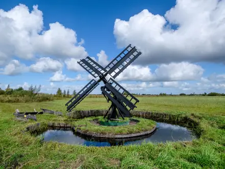
The Lingepad is named after the river Linge, which it follows out of Leerdam before the route turns towards the larger Waal landscape further east. It was laid out as a Dutch long-distance path and has since been merged with the Oeverloperpad into the Grote Rivierenpad (LAW 6). Much of the walk crosses the Betuwe, the Netherlands’ fruit-growing heartland, where orchards, old river ridges and dyke systems reflect a long history of agriculture and river defence.
Notable highlights
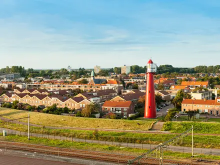
- Leerdam, the Glasstad: The start town is known for its glassmaking heritage on the Linge, shaped by the glass industry and river trade.
- Acquoy leaning church tower: This tilted church tower is a well-known Betuwe landmark, often nicknamed the region’s “Leaning Tower of Pisa”.
- Betuwe fruit blossom: In spring, especially around April, the route passes through orchard country with white and pink blossom along the old river ridges.
- Waal floodplains: From Tiel, the walk follows the broader Waal landscape, with open uiterwaarden, grazing land and wide river views.
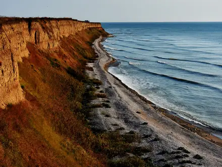
- Duivelsberg and the Nijmegen stuwwal: The route’s only real climb reaches the wooded push-moraine ridge near the German border, with views over the Ooijpolder and WWII associations from Operation Market Garden.
Challenges to expect
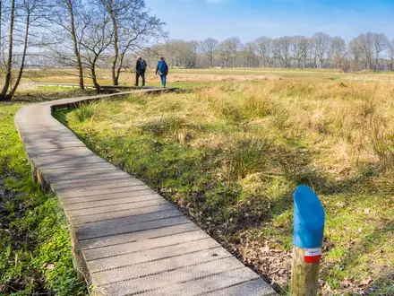
This is an easy trail, but not a short day walk: the full route is 98 km and typical stages are around 20–31 km. Expect exposed dyke and floodplain walking, some paved rural lanes, and muddy or wet lowland paths in winter or after rain. Navigation is straightforward on white-red LAW waymarks, now part of Grote Rivierenpad (LAW 6), but confirm current routing before departure.
HikeList Score
Lingepad scored 74/100 on HikeList's trail-quality metrics.
See score breakdownHide breakdown
- Ideal length 81
- Balanced challenge 50
- Scenery & wildness 58
- Varied terrain 100
- Accommodation 91
- Food & support 68
- Path quality 92
- Season flexibility 76
Computed from length, challenge, scenery & wildness, terrain variety, accommodation, food & support, path quality and season flexibility.
Show more data Show less
- Lowland
- River Valley
- Polder
- Floodplain
- Forested Ridge
- Dyke Paths
- Unpaved Field Tracks
- Rural Lanes
- Paved Sections
- Hotels
- Guesthouses
- B&Bs
- Family Friendly
- Pet Friendly
- Restrooms
- Picnic Areas
In these collections
Photos from hikers
Taken on the trail by people who've reviewed Lingepad.
Start in Leerdam, the Glasstad on the Linge, and follow the lowland river valley through Betuwe villages towards Geldermalsen, a central town and transport hub.
Continue through the Betuwe orchard landscape and Linge-valley villages, reaching Tiel, where the route begins to follow the Waal more closely than the Linge.
Walk east through the Waal floodplain landscape, with open uiterwaarden, dykes and grazing land around Ochten, Kesteren, Dodewaard and nearby villages.
A long final stage continues towards Zetten, Nijmegen, Beek-Ubbergen and Berg en Dal, finishing at the German border near Wyler after the wooded Duivelsberg / stuwwal section.
Reviews
How would you rate Lingepad?
Tap a star to start your review — you could be the first.