Leicestershire Round
How would you rate Leicestershire Round?
Tap a star to share your experience and help other hikers.
Leicestershire Round: A 100-Mile County Circuit
HikeList Score
Leicestershire Round scored 86/100 on HikeList's trail-quality metrics.
See score breakdownHide breakdown
- Ideal length 97
- Balanced challenge 100
- Scenery & wildness 88
- Varied terrain 94
- Accommodation 66
- Food & support 68
- Path quality 80
- Season flexibility 89
Computed from length, challenge, scenery & wildness, terrain variety, accommodation, food & support, path quality and season flexibility.
The Leicestershire Round is a waymarked, circular long-distance footpath in the East Midlands of England. It makes a wide circuit of Leicestershire around Leicester, covering about 161 km over 7–10 days. This is a moderate lowland walk: no technical ground, but plenty of cumulative distance, undulating ridges, field crossings, stiles and mud after rain. It suits hikers who want a self-guided county loop linking Charnwood Forest, farmland, river valleys, canal towpaths and historic sites.
Route Overview
Because it is a loop, the Leicestershire Round can be started anywhere. The commonly cited trailhead is Bradgate Park / Newtown Linford on the north-west side of Leicester, and the route is often described clockwise from Newtown Linford through Charnwood Forest. It links field paths, green lanes, bridleways, quiet roads and short canal sections, passing places such as Beacon Hill, Burbage Common, Bosworth Battlefield, High Cross, Foxton Locks, the Langton Hills and Burrough Hill. Nearby market towns including Loughborough, Hinckley, Lutterworth, Market Harborough, Melton Mowbray and Oakham help with staged walking logistics. For more East Midlands walking, compare the Ashby Canal Trail and Amber Valley Route.
How the Leicestershire Round Was Created
The Leicestershire Round was devised by members of the Leicestershire Footpath Association and opened in 1987 to mark the association’s centenary. The LFA traces its history to 1850 and was formally re-established on 10 June 1887. Rather than creating a new path from scratch, the route stitched together existing public rights of way — field paths, green lanes and bridleways, many long used by local walkers — into a single circuit showing varied corners of the county.
Notable highlights
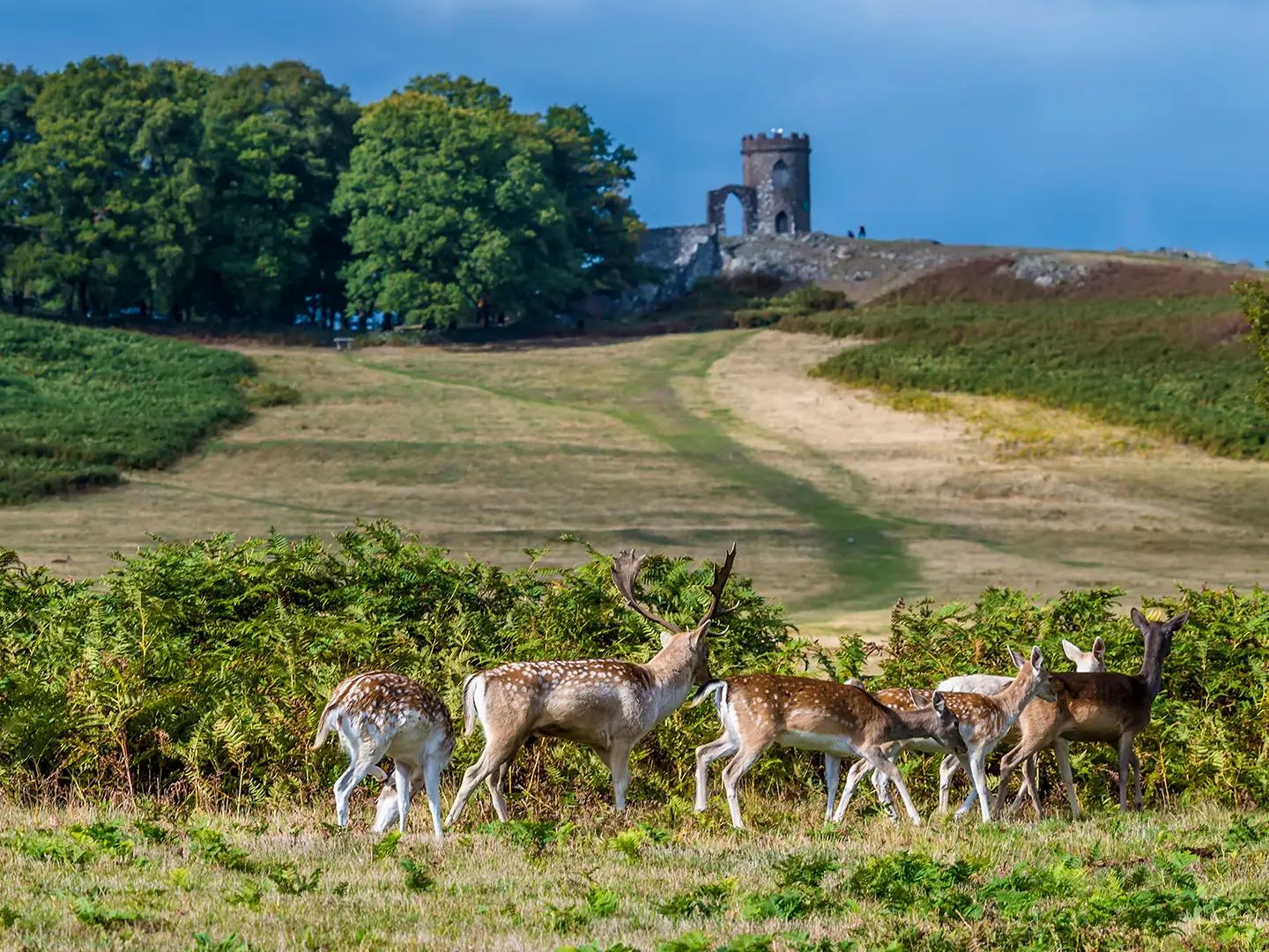
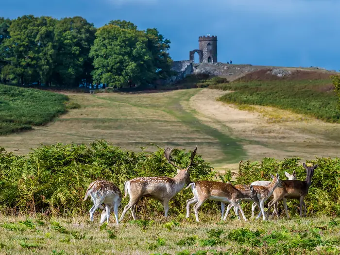
- Bradgate Park & Charnwood Forest: A rugged volcanic upland area on the north-west of the loop, with ancient woodland, deer and the ruins of Bradgate House, birthplace of Lady Jane Grey.
- Beacon Hill (248 m): The high point of the walk and the second-highest point in Leicestershire, with rocky outcrops and wide county views.
- Bosworth Battlefield: The site of the 1485 Battle of Bosworth Field, where Richard III was killed and Henry VII founded the Tudor dynasty.
- Foxton Locks: A well-known staircase of ten locks on the Grand Union Canal, with canal-side facilities and the remains of a Victorian inclined-plane boat lift.
- Burrough Hill: A preserved Iron Age hillfort on a prominent east Leicestershire ridge, now a country park with open grassland and far-reaching views.
- High Cross: The junction of the Roman Fosse Way and Watling Street, traditionally regarded as the central point of Roman Britain.
Challenges to expect
Expect a long but non-technical lowland walk. The main effort is cumulative: around 161 km and about 2,100 m of ascent over repeated hills, ridges and field crossings. Waymarking uses the Leicestershire Round “circle of brown arrows” symbol, but it can be patchy at field boundaries, so carry OS Explorer maps 233, 234 and 246 or the LFA guidebook. Winter and wet spells can make field paths muddy or waterlogged.
HikeList Score
Leicestershire Round scored 86/100 on HikeList's trail-quality metrics.
See score breakdownHide breakdown
- Ideal length 97
- Balanced challenge 100
- Scenery & wildness 88
- Varied terrain 94
- Accommodation 66
- Food & support 68
- Path quality 80
- Season flexibility 89
Computed from length, challenge, scenery & wildness, terrain variety, accommodation, food & support, path quality and season flexibility.
 United Kingdom
 England
Show more data Show less
- Forest
- Hills
- Farmland
- River Valley
- Dirt
- Gravel
- Paved
- Hotels
- Campsites
- Family Friendly
- Pet Friendly
- Campsites
- Picnic Areas
Download Our Full Guide to Leicestershire Round FREE!
Get our comprehensive guide to this hike for free. Save it for later reading or print out at home.

Photos from hikers
Taken on the trail by people who've reviewed Leicestershire Round.
Leicestershire Round: The Complete Guide
 i
Image by Nicola
i
Image by Nicola The Leicestershire Round is a 100-mile county circuit for walkers who want a proper long-distance route without committing to mountain terrain. Starting conventionally at Newtown Linford and Bradgate Park, it makes a wide clockwise loop around Leicester through Charnwood Forest, High Leicestershire, the Welland valley and the National Forest.
Its character changes steadily rather than dramatically: volcanic outcrops and deer park at Bradgate, open ridges and big farmland in the east, canal walking at Foxton Locks, then quieter villages, battlefield country and young woodland on the western arc. Market towns and larger villages sit close enough to make section-walking realistic, but the route still feels rural for long stretches.
This is a strong first self-guided long-distance walk for capable hikers, and a satisfying county round for experienced walkers linking the stages into a week or so. It also works well as a series of day walks, especially because the loop can be joined at many points rather than only at the traditional start.
The challenge is not technical difficulty, but consistency. Expect repeated field paths, stiles, gates, muddy ground after rain, patchy waymarking at some boundaries and enough cumulative distance to make good planning matter.
This guide covers stages, walking days, accommodation, food, transport, terrain and the common mistakes to avoid.
Stage-by-Stage Guide
Distances are approximate and follow the standard 10-stage breakdown of the Leicestershire Round. The route is waymarked, but it is still a rights-of-way walk across fields, lanes and village paths, so carry OS mapping or the current Leicestershire Footpath Association guidebook rather than relying on waymarks alone.
Stage 1: Newtown Linford to Mountsorrel — approx. 13 km
This is the most immediately upland-feeling stage of the Round, beginning at Newtown Linford and climbing through Bradgate Park towards Old John. The route crosses ancient parkland, rough grass, bracken and Charnwood Forest country before passing the Woodhouse Eaves and Swithland area towards Mountsorrel.
Underfoot, expect a mix of park tracks, woodland paths, field paths and lanes. The Charnwood ground is more rugged than much of the rest of the route, though still non-technical; after rain, the woodland and field sections can be muddy.
The key early landmarks are Bradgate House ruins, Old John and the open Charnwood views from the high ground. The waymarked route also passes through the Beacon Hill and Broombriggs area, giving some of the best viewpoints of the whole circuit, although it does not need to tag Beacon Hill’s summit.
Food and water are most dependable at the start or in the larger villages, but opening hours should not be assumed. Carry enough water for the full stage, especially if starting early or walking outside the main visitor season.
Mountsorrel gives the first practical stopping point. Accommodation directly on the line may be limited, so nearby larger centres such as Loughborough may be needed; this should be checked before travelling.
Public transport access is better around the Leicester and Loughborough side of the county than on some later rural stages, but Newtown Linford has no railway station. Bus links to Bradgate Park and onward rural services should be checked before travelling.
Navigation is generally straightforward through Bradgate Park, but care is needed where the route leaves obvious visitor paths and moves between woodland, village edges and field boundaries. Dogs should be kept under close control in Bradgate Park and anywhere livestock is present.
Stage 2: Mountsorrel to Frisby on the Wreake — approx. 18 km
This stage leaves the Charnwood edge and begins the longer eastward sweep of the Round. The route passes through or near Rearsby before reaching Frisby on the Wreake, with the walking becoming more typical of lowland Leicestershire: field paths, village lanes, hedgerows and gently rolling farmland.
Conditions are usually easy but can be slow after wet weather. The repeated field crossings and gateways are more tiring than the modest height gain suggests, and waymarking can be less obvious at field margins.
The main landscape feature is the transition towards the Wreake valley. Views are generally broader and lower than on Stage 1, with the route settling into rural villages and pasture rather than rocky Charnwood ground.
Food, water and toilets should be planned conservatively. Rearsby and Frisby on the Wreake are useful settlements, but walkers should not rely on guaranteed daytime food stops without checking opening times.
Accommodation at Frisby on the Wreake itself may be sparse. For a continuous walk, book ahead or be prepared to use a taxi or bus to lodging in a larger nearby town; this should be checked before travelling.
Road access is possible at the villages, making this a realistic day-walk section. Rural bus services may be limited, and current times should be checked before committing to a linear day.
The main navigational issue is staying on the correct public rights of way across farmland. Keep checking the map where several tracks, field edges or village paths meet, as the line is not always obvious on the ground.
Stage 3: Frisby on the Wreake to Somerby — approx. 16 km
From Frisby on the Wreake, the route continues east through quieter countryside towards Twyford and Somerby. This is a rural linking stage with a strong field-path character and fewer major visitor landmarks than the Charnwood and Foxton sections.
The walking is undulating rather than steep, with a mixture of pasture, arable fields, green lanes and short road or lane sections. Mud can be a significant nuisance after rain, particularly on field exits, gateways and churned farm tracks.
Twyford is the main intermediate place, and Somerby makes a natural end point before the higher ground around Burrough Hill on the next stage. Views open gradually across High Leicestershire, especially where the route reaches ridges between villages.
Food and water availability should be treated as limited. Carry lunch and enough water from the start unless current village services have been checked in advance.
Somerby is a small rural stopping point rather than a major trail base. Accommodation may need to be arranged off-route, with taxis or local buses used if necessary; this should be checked before travelling.
Public transport access is likely to be more limited than around Leicester, Loughborough or Market Harborough. This stage is still feasible as a day walk, but rural services should be checked carefully before travelling.
Navigation is mostly across open farmland, so the usual lowland issues apply: indistinct trods, missing or hidden waymarks, and multiple field-edge options. A map and compass or reliable offline mapping is strongly advised.
Stage 4: Somerby to Hallaton — approx. 19 km
This is one of the stronger scenic stages on the eastern arc of the Round. It links Somerby with Burrough on the Hill, Tilton on the Hill, the Launde Abbey area and Hallaton, crossing rolling High Leicestershire countryside.
The terrain is repeatedly up and down rather than difficult. Expect grassy field paths, ridge walking, lanes, bridleways and tracks; in wet spells, the clay and pasture sections can become heavy underfoot.
Burrough Hill is the major highlight: an Iron Age hillfort on a prominent rise, with ramparts, open grassland and wide views. Later, the route passes near Launde Abbey, set in remote wooded country close to the Rutland edge.
This is a relatively long day in the standard schedule, so start with enough food and water. Tilton on the Hill and Hallaton are the main named places, but opening hours and facilities should be checked before travelling.
Hallaton is a useful stage end, but accommodation can be limited in villages on this side of the route. Book early, or plan transport to a larger base if walking the Round continuously.
Road access exists at villages along the way, but public transport should not be assumed to be frequent. For section-walkers, check both outward and return journeys before setting off.
Navigation requires attention around Burrough Hill, field corners and the more remote lanes and tracks near Launde. In poor visibility or fading light, the rolling fieldscape can make small path errors easy.
Stage 5: Hallaton to Foxton — approx. 16 km
This stage crosses the south-eastern part of the loop from Hallaton towards the Langtons and Foxton. It gives a classic mix of Leicestershire ridge-and-vale walking, with views over the Welland valley and a very different finish at the Grand Union Canal.
Paths are mainly field rights of way, tracks and quiet lanes. The walking is not technically hard, but it can be sticky and slow in wet conditions, especially through cultivated fields and around gateways.
The Langton Hills and Welland valley are the main landscape features, with wide pastoral views on clearer days. The stage ends at Foxton, where the famous staircase locks on the Leicester line of the Grand Union Canal are a major landmark.
Foxton Locks is one of the better-known visitor points on the whole route, so food and drink may be more realistic here than on remoter stages, but seasonal opening and individual business hours should still be checked. Carry enough water to reach Foxton without needing an intermediate refill.
Foxton is a practical stage end, though accommodation directly on the route may still be limited. Market Harborough is one of the larger nearby towns on the route’s fringe and may be useful for accommodation or transport logistics.
Public transport options around the Market Harborough side of the loop can be useful, but rural services and onward connections vary. This should be checked before travelling.
Navigation is generally easier where the route reaches the canal environment, but the field sections before Foxton still need care. Take particular care not to be drawn onto the wrong field edge where paths converge around villages.
Stage 6: Foxton to Bruntingthorpe — approx. 13 km
This is one of the shorter standard stages, leaving the canal-side setting of Foxton and heading west through Fleckney towards Bruntingthorpe. It is a good section for easing the daily distance after the longer eastern stages.
The terrain is lowland and agricultural, with field paths, tracks, lanes and village approaches. There is no difficult climbing, but muddy fields and overgrown summer field edges can affect pace.
Foxton Locks is the obvious start-of-day highlight if staying nearby, with the canal, lock staircase and inclined-plane earthworks close to the route. After leaving Foxton, the interest becomes quieter and more practical: village links, open fields and the gradual turn towards the southern arc of the county loop.
Food and water should be planned carefully. Fleckney is the main intermediate settlement, but current shops, pubs or cafés should be checked before relying on them.
Bruntingthorpe is a rural stage end, and accommodation may be thinly spread. Continuous walkers may need to arrange a taxi or bus to lodging in a larger village or town; this should be checked before travelling.
Road access is possible at Foxton, Fleckney and Bruntingthorpe, making this a manageable section-walk. Public transport frequency in rural areas can be limited, so check timings in both directions.
Navigation is typical of the Round’s field sections. The waymarking helps, but field-boundary turns and village exits are the places most likely to cause uncertainty.
Stage 7: Bruntingthorpe to Frolesworth — approx. 14 km
This stage continues across the southern part of the circuit, passing the Bitteswell and Lutterworth area before reaching Frolesworth. It is a modest-distance day, but still needs the same care with rural logistics as the longer stages.
The route is mainly on field paths, bridleways, green lanes and short stretches of quiet road. The walking is gently rolling and non-technical, though wet ground can make progress slower than the distance suggests.
The main interest is the progression across open south Leicestershire countryside, with villages acting as the key reference points. Bitteswell and the edge of Lutterworth are the most useful places for services and access near the line.
Carry food and water unless current facilities have been checked. Larger nearby settlements may offer more options than the smaller stage-end villages, but this should not be left to chance on the day.
Frolesworth is a small end point, so accommodation should be arranged well in advance. If no suitable lodging is available nearby, plan a transfer to Lutterworth or another larger base; this should be checked before travelling.
Road access is useful around this stage, but bus options may be limited or infrequent. Section-walkers should check the Leicestershire Round by Bus information and current timetables before travelling.
Navigation is mostly straightforward with mapping, but field exits and lane crossings need attention. After harvest, paths across arable fields can be less visible until walked in again.
Stage 8: Frolesworth to Barwell — approx. 18 km
This stage turns the Round north-west, linking Frolesworth with Sharnford, High Cross, Burbage Common and Barwell. It has several historically and logistically useful points, and is one of the longer standard days.
The walking is mixed: field paths, tracks, quiet lanes and common-edge paths. The route remains lowland, but the distance and repeated changes of surface make it a full day rather than a stroll.
High Cross is the standout landmark, marking the meeting of the Fosse Way and Watling Street at Venonae, traditionally regarded as the central point of Roman Britain. Burbage Common provides a change of character before the route reaches the more settled western side of the county.
Food and water should be carried from the start, with any planned stops checked in advance. Sharnford, the Burbage Common area and Barwell may offer opportunities, but services and opening hours can vary.
Barwell is a more practical stage end than several smaller villages on the route. Accommodation may still require planning in advance, with Hinckley also relevant as a nearby larger town on the route’s fringe.
Road access is comparatively useful on this side of the loop, and Hinckley is one of the named rail-access towns for the wider route area. Exact bus and rail connections should be checked before travelling.
Navigation needs care around High Cross, road and lane intersections, and the transition into more built-up edges near Barwell. The mix of rights of way and local paths can be less obvious than the open countryside sections.
Stage 9: Barwell to Shackerstone — approx. 18 km
This is the main western-stage highlight of the Round, taking the route through Market Bosworth and the Bosworth Battlefield area before reaching Shackerstone. It combines settlement, history and National Forest countryside.
The terrain is varied but still moderate: field paths, lanes, tracks, village paths and woodland or young-woodland sections. In wet weather, expect mud on field paths and softer ground through wooded areas.
Market Bosworth is the principal place on the stage, and Bosworth Battlefield is the major historic landmark, associated with the 1485 battle in which Richard III was killed and Henry Tudor won the crown. The route then continues towards Shackerstone, a quiet canal-side village with the Battlefield Line heritage railway nearby.
Food and water planning is easier than on some remoter eastern stages, particularly around Market Bosworth, but nothing should be assumed without checking current opening times. Carry enough water for the full stage if walking outside normal daytime hours.
Shackerstone is a small village, and accommodation may be limited. Market Bosworth or other nearby towns may be more practical for lodging, but transfers should be arranged ahead.
Public transport and road access are useful for section-walkers, especially around Market Bosworth, but rural onward services may still be limited. This should be checked before travelling.
Navigation is generally manageable, but take care around the battlefield area, village exits and woodland paths where multiple local tracks may branch. The route can feel more complex where heritage sites, local paths and rights of way overlap.
Stage 10: Shackerstone to Newtown Linford — approx. 18 km
The final stage completes the northern-western arc from Shackerstone back to Newtown Linford and Bradgate Park. It passes through the Ashby Canal and National Forest landscape, then heads via Thornton and Thornton Reservoir towards the Charnwood edge.
Expect a varied lowland finish: canal-side walking, field paths, tracks, lanes and reservoir-side or woodland-influenced sections. Surfaces are generally easy, but wet weather can still make fields and unsurfaced tracks muddy.
Shackerstone and the Ashby Canal give the stage a quiet opening, with the National Forest adding young woodland and restored landscape character. Thornton Reservoir is the key later landmark before the route closes the loop back towards Newtown Linford.
Food and water should be planned before leaving Shackerstone. Thornton and Newtown Linford are the main named places later in the day, but current facilities should be checked rather than assumed.
Newtown Linford is the conventional finish as well as the start. Accommodation directly at the finish may be limited, and many walkers will use Leicester, Loughborough or another nearby town for the final night or onward travel; this should be checked before travelling.
There is no railway station at Newtown Linford. Leicester and Loughborough are the main rail-access options for the start and finish area, with bus or taxi links needed; current bus times should be checked before travelling.
Navigation remains important to the end, particularly where the route leaves canal or reservoir-side sections and returns to field rights of way. Do not let the final-day familiarity of Charnwood reduce attention at field boundaries and village edges.
Recommended Itinerary
Standard 10-day itinerary
The most practical default is the 10-stage clockwise itinerary used by the Leicestershire Footpath Association guidebook pattern: roughly 10 miles / 16 km per day, with a few shorter and longer days. It keeps daily distances moderate, which suits the repeated field paths, stiles, muddy sections and occasional waymarking checks better than trying to treat the Round as a fast, lightweight trail.
Accommodation is the main constraint. Several stage ends are villages rather than accommodation hubs, so book early and be prepared to use taxis or local buses to reach beds in larger nearby towns such as Loughborough, Melton Mowbray, Market Harborough, Lutterworth, Hinckley, Narborough or Oakham where appropriate. Rural bus times and accommodation availability should be checked before travelling.
| Day | From | To | Approx. distance | Why this stage makes sense | Services/accommodation notes |
|---|---|---|---|---|---|
| 1 | Newtown Linford | Mountsorrel | 13 km | A manageable opening day through Bradgate Park, Old John and the Charnwood Forest edge, without making the first day too long. Useful if travelling to the start in the morning. | Newtown Linford has no railway station, so most walkers need a bus, taxi or lift from Leicester or Loughborough. Mountsorrel is close to the larger Loughborough accommodation area if village beds are unavailable. |
| 2 | Mountsorrel | Frisby on the Wreake | 18 km | A fuller lowland day moving east through the Wreake-side section of the route. The distance is typical of the longer standard stages but still reasonable on non-technical terrain. | Accommodation directly on the line can be limited. Melton Mowbray is one of the larger towns on the route’s fringe for overflow accommodation or transport links. |
| 3 | Frisby on the Wreake | Somerby | 16 km | A balanced day into the more open High Leicestershire landscape, keeping the next hillier section to Hallaton separate. | Somerby is a village stage end, so secure accommodation before committing to a continuous itinerary. If using off-route lodging, arrange return transport in advance. |
| 4 | Somerby | Hallaton | 19 km | One of the longer stages, taking in the Burrough Hill area and the approach towards Launde and the Rutland edge. The distance is best tackled with an early start in poor weather or winter-short daylight. | Hallaton is a village, not a major service centre. Beds and evening food should be arranged ahead; otherwise use pre-booked transport to a larger nearby base. |
| 5 | Hallaton | Foxton | 16 km | A sensible mid-route day through the Langton Hills and Welland valley towards Foxton Locks, with enough time to deal with field navigation and enjoy the canal section. | Foxton is close to the Market Harborough side of the loop, which is useful for rail access, restocking and accommodation if village options are full. |
| 6 | Foxton | Bruntingthorpe | 13 km | A shorter day after the eastern arc, useful for recovery, laundry or a late start from Market Harborough. | Bruntingthorpe is a rural stage end. Check accommodation and food options before booking the day; off-route transport may be needed. |
| 7 | Bruntingthorpe | Frolesworth | 14 km | Another moderate day across the southern part of the circuit, keeping the approach to High Cross and Burbage Common for the following stage. | Frolesworth is small, so do not assume there will be convenient beds or evening meals. Lutterworth is one of the larger nearby accommodation centres. |
| 8 | Frolesworth | Barwell | 18 km | A longer but logical stage crossing the High Cross area and continuing towards the western side of the county loop. | Barwell is better placed for the Hinckley side of the route than the more rural previous stops. Check local transport if staying off-route. |
| 9 | Barwell | Shackerstone | 18 km | A substantial day through the Market Bosworth and Bosworth Battlefield area before reaching the quieter Ashby Canal side of the route. | Market Bosworth is the key settlement on this side of the loop for accommodation and services. Shackerstone is smaller, so book ahead or plan transport. |
| 10 | Shackerstone | Newtown Linford | 18 km | A final full day across the National Forest side of the circuit, passing Thornton Reservoir before returning to Bradgate Park / Newtown Linford. | Newtown Linford remains transport-dependent, with no station at the finish. Arrange onward travel to Leicester or Loughborough before setting off for the final day. |
Slower variant: 11–12 days
A slower itinerary suits walkers using B&Bs and inns, anyone carrying more than a light pack, and those who want more margin for mud, navigation at field boundaries and short winter daylight. The simplest approach is to keep the 10-stage structure but split one or two of the 18–19 km days using accommodation or transport in nearby towns.
The most obvious candidates to shorten are the longer standard days: Mountsorrel to Frisby on the Wreake, Somerby to Hallaton, Frolesworth to Barwell, Barwell to Shackerstone and Shackerstone to Newtown Linford. Exact split points depend on available beds, bus times and taxi arrangements, so check official mapping and accommodation before booking.
A slower schedule also works well for section-walking. Because the route loops around Leicester and passes near several market towns, many walkers complete it as separate day walks rather than as a continuous expedition.
Faster variant: 7–8 days
A faster itinerary is realistic for fit walkers who are comfortable with repeated 20 km-plus days on field paths and lanes. The terrain is not technical, but the cumulative distance, mud after rain and frequent gates and stiles make this harder than the modest height gain suggests.
A practical 8-day version can be made by linking two pairs of shorter stages, for example combining Foxton to Bruntingthorpe with Bruntingthorpe to Frolesworth, and linking another moderate stage where accommodation works. This creates some longer days while avoiding a complete reshaping of the route.
A 7-day version requires several linked stages and careful accommodation planning. Use the 10 standard stage distances as the base, then check official mapping before booking, because small changes to start points, lodging locations or transport can add meaningful distance at the end of a long day.
Choosing the right pace
Choose the 10-day itinerary if this is a first self-guided long-distance walk or if accommodation is being booked directly around the stage ends. Choose 11–12 days if reliable beds require off-route transfers, or if the walk is being used as a relaxed county circuit rather than a mileage challenge.
Choose 7–8 days only if long lowland days are already comfortable. On the Leicestershire Round, the limiting factor is usually logistics and underfoot conditions rather than altitude.
Planning the Route
Choosing a pace
The most straightforward plan is the Leicestershire Footpath Association’s 10-section split, with daily walks of roughly 10 miles / 16 km. That suits most walkers because the route is a long, cumulative lowland circuit rather than a technically difficult trail: the fatigue comes from repeated field crossings, stiles, gates, mud and navigation at field edges.
Fit walkers commonly compress the Round into 7–8 days, but this makes the logistics sharper. Longer days are possible on paper, yet the route is not always fast underfoot after rain, and accommodation is not evenly spaced along the line.
A slower 10-day schedule is usually the better choice for a first continuous round. It leaves more margin for muddy ground, short winter-equivalent daylight in spring or autumn, transport links to overnight stops, and time at places such as Bradgate Park, Burrough Hill, Foxton Locks and Bosworth Battlefield.
How staging really works
The official-style 10-day pattern uses village-to-village sections, but not every stage end should be treated as a guaranteed overnight base. This is a rural county loop, not a hostel trail, and beds directly on the route can be sparse.
Plan the walking stages first, then check where accommodation actually exists. In several places it may be easier to stay in or near larger settlements on the route’s fringe, such as Loughborough, Melton Mowbray, Market Harborough, Hinckley, Lutterworth or Oakham, using a taxi or local bus to bridge the gap.
This matters most on the quieter eastern and southern arcs between Frisby on the Wreake, Somerby, Hallaton, Foxton, Bruntingthorpe and Frolesworth. These sections are attractive walking country, but they should not be planned on the assumption that every village has accommodation, evening food or a shop.
Walking clockwise, anti-clockwise or in sections
The conventional start is Newtown Linford / Bradgate Park, walked clockwise, and that is the simplest way to follow most guidebook descriptions. Because the route is a loop, it can also be joined at any convenient point.
Anti-clockwise walking is possible, but expect more checking at junctions if using written directions designed for the standard direction. On a route with patchy waymarking at some field boundaries, that extra attention matters.
Section hiking is very practical. The Round circles Leicester rather than crossing remote upland, and rail or bus access is available around the wider ring through places such as Leicester, Loughborough, Market Harborough, Melton Mowbray, Hinckley and Narborough. Rural buses are limited and timetables change, so the day’s return journey should be checked before travelling.
The LFA publishes a “Leicestershire Round by Bus” guide, which is useful for building day-walk sections. Treat it as a planning aid rather than a substitute for checking current services.
Shortening, extending and bailing out
The route is a fixed circular waymarked trail, so there is no obvious official “short” version of the Leicestershire Round. The cleanest way to shorten it is to walk selected sections over separate days rather than trying to cut corners across the county.
Bail-out planning is still worthwhile. The Round passes many villages, but a village is not the same as a transport hub, and a missed rural bus can turn into an expensive taxi or a long wait. Before each day, identify the realistic end point, the nearest useful road access, and the transport option back to your accommodation.
Extensions are optional rather than necessary. The waymarked route already passes the main on-route highlights, but note that Bardon Hill is not on the Leicestershire Round, and the route passes through the Beacon Hill area rather than necessarily visiting the actual summit.
Accommodation planning
Book accommodation before committing to a continuous itinerary, especially for a 7–8 day version. The limiting factor is more likely to be bed availability than walking fitness.
Expect a mix of B&Bs, inns or pubs with rooms, small hotels and occasional campsites. There are no purpose-built trail hostels on the route.
When accommodation is off the line, build the transfer into the day’s plan. A short taxi ride can make an otherwise awkward stage work, but it should be arranged in advance in the quieter rural sections.
Food and water
Do not assume every village on the route has reliable food, a shop or an open pub. Carry lunch, snacks and enough water for the full walking day unless a specific resupply point has been checked.
This is especially important when linking stages into longer days. A 10-mile guidebook section may be comfortable with minimal resupply, but a compressed itinerary can leave long gaps between dependable services.
Evening meals should be planned alongside accommodation. If staying in a small village or at accommodation away from a town, check food availability before booking or be ready to travel out.
Navigation and mapping
The Leicestershire Round is waymarked with its own symbol on discs and finger-posts, and it is shown as a Recreational Route on Ordnance Survey maps. The waymarking is useful, but it should not be the only navigation tool.
Carry proper mapping and either the current LFA guidebook or a reliable digital route. OS Explorer mapping at 1:25,000 is the right level of detail for field paths, rights of way, woodland edges and village exits.
Navigation is usually simple, but attention is needed at field boundaries, across farmland and where paths leave lanes or tracks. After crops, hedge growth or local diversions, the line on the ground can be less obvious than the line on the map.
Ground conditions and timing
The best planning window is spring, summer or autumn. The route is lowland and non-technical, but it crosses plenty of fields, green lanes and unsurfaced tracks, which can become muddy or waterlogged after rain.
Wet conditions slow the walk more than the height gain suggests. Stiles, gates, livestock fields and ploughed or saturated ground can make a moderate day feel longer, particularly on the more open agricultural sections.
In hot weather, the same lowland character creates a different issue: long exposed farmland stretches can feel tiring if water stops have not been planned. Carry enough for the day rather than relying on casual refills.
Transport logistics
Newtown Linford has no railway station, so a full continuous walk normally starts with travel via Leicester or Loughborough, then onward by bus, taxi or lift to Bradgate Park. This should be arranged before the first day rather than left to chance.
For section walkers, the strongest transport strategy is to build days around the towns and stations on the route’s fringe, then use buses or taxis to reach the actual path. Market Harborough, Melton Mowbray, Hinckley and Narborough can also be useful depending on the section.
Current rail and bus times should be checked before travelling, especially for weekends, bank holidays and rural evening services.
Towns, Villages and Overnight Stops
The Leicestershire Round is not a trail with a neat chain of walker-focused overnight stops. Accommodation is mixed and thinly spread, with most dependable options in market towns and larger villages on or near the loop rather than at every stage end.
The standard 10-section itinerary uses village endpoints such as Mountsorrel, Frisby on the Wreake, Somerby, Hallaton, Foxton, Bruntingthorpe, Frolesworth, Barwell and Shackerstone. These work well as walking targets, but not all are equally strong overnight bases, so book beds before fixing your daily distances.
For a continuous walk, expect to use a mixture of B&Bs, inns or pubs with rooms, small hotels and occasional campsites. Taxis or local buses may be needed to reach beds in Loughborough, Melton Mowbray, Market Harborough, Hinckley, Lutterworth, Oakham or Leicester; rural bus times should be checked before travelling.
Newtown Linford / Bradgate Park
Newtown Linford is the conventional start and finish for a clockwise circuit, beside Bradgate Park on the north-west edge of Leicester. It is a practical trailhead for day one, but it is not a major accommodation hub, so many walkers use Leicester or Loughborough for pre-walk and post-walk beds.
There is no railway station at Newtown Linford. The nearest main rail access is Leicester, with bus access towards Bradgate Park, or Loughborough; current bus times should be checked before travelling.
Do not treat Bradgate Park itself as a resupply point for a long day. Start with food and water already sorted, particularly if leaving early or finishing late.
Woodhouse Eaves
Woodhouse Eaves sits on the first section through Charnwood Forest, between Bradgate Park, the Beacon Hill area and Mountsorrel. It can be useful for a shorter first day or for section walkers arranging pick-ups in the Charnwood area.
Accommodation and food options should be checked in advance rather than assumed. For a continuous itinerary, Mountsorrel or an off-route stay in Loughborough will usually be easier to plan around.
Swithland
Swithland comes early in the loop, still within the Charnwood Forest part of the walk. It is more useful as a passing village or section-walk access point than as a guaranteed overnight stop.
Any pub, shop, accommodation or bus option should be checked before travelling. This is a good example of why the Leicestershire Round rewards pre-booking rather than turning up and hoping for a bed.
Mountsorrel
Mountsorrel is the first standard stage endpoint, about 13 km from Newtown Linford. It is one of the more practical early stopping points because it is a larger settlement than the small Charnwood villages immediately before it.
It is still sensible to book accommodation ahead. If beds on or close to the route are full, Loughborough is the most obvious larger off-route base for this north-western part of the circuit, with rail access on the Midland Main Line.
Rearsby
Rearsby lies on the second stage between Mountsorrel and Frisby on the Wreake. It is best thought of as a mid-stage village rather than a primary overnight target.
Services can be useful if available, but opening times and food options should be checked before relying on them. It may also work as a section-walk access point if local bus or taxi arrangements suit the day.
Frisby on the Wreake
Frisby on the Wreake is the standard end of the second stage, reached after roughly 18 km from Mountsorrel. It is a logical overnight target in walking terms, but accommodation directly in small villages on this route can be limited.
Book before committing to this as a night stop. If nothing suitable is available, Melton Mowbray is one of the larger nearby market-town options on the route’s fringe, with rail access.
Twyford
Twyford lies between Frisby on the Wreake and Somerby on the third stage. It is a useful named point for pacing the day, but not a place to assume a full set of walker services.
Any food, pub, shop, accommodation or public transport option should be checked before travelling. Carry enough supplies to reach Somerby or your arranged overnight base.
Somerby
Somerby is the standard third-stage endpoint, about 16 km from Frisby on the Wreake. It is a sensible place to aim for if accommodation is secured, especially before the more open High Leicestershire country around Burrough Hill and Tilton on the Hill.
Beds and evening food should not be left to chance. Melton Mowbray can be useful as an off-route fallback for this part of the loop if transport can be arranged.
Burrough on the Hill / Burrough Hill
Burrough on the Hill and nearby Burrough Hill sit on the eastern side of the circuit, after Somerby. The hillfort is one of the major landmarks on the route, but it is not primarily an overnight-planning location.
Use it as a pacing and rest point rather than a guaranteed service stop. Food, water and transport arrangements should be made before leaving Somerby or the previous overnight base.
Tilton on the Hill
Tilton on the Hill sits on the high eastern arc between Burrough on the Hill and the Launde Abbey / Hallaton area. It can help split a longer day, but it should not be treated as a certain place for accommodation without a booking.
This is one of the more rural-feeling parts of the Round. Check pub, food, bus and taxi options before travelling, and carry enough provisions for the full stage.
Launde / Launde Abbey
The route passes near Launde Abbey on the Rutland edge between Tilton on the Hill and Hallaton. It is a useful landmark in a relatively quiet stretch, but it should not be relied on as a casual resupply or overnight stop unless arrangements have been made in advance.
For accommodation planning, Hallaton is the next standard stage endpoint, while Oakham is one of the larger nearby bases on the Rutland side. Transport between the route and off-route accommodation should be arranged ahead.
Hallaton
Hallaton is the standard end of the fourth stage, around 19 km from Somerby. It is a strong walking target before the route turns towards the Langtons and Foxton.
As with other village endpoints, accommodation availability can be limited. If Hallaton beds are unavailable, Market Harborough, Oakham or Melton Mowbray may be more practical off-route bases, depending on taxi or bus options.
Church Langton / the Langtons
Church Langton and the Langtons sit on the south-eastern section between Hallaton and Foxton. They are useful for breaking up the day across the Langton Hills and Welland valley area.
Do not assume shops, cafés, pubs or accommodation will line up with your walking hours. Check services before travelling, especially if using the Langtons as a lunch stop or section end.
Foxton / Foxton Locks
Foxton is the standard fifth-stage endpoint, about 16 km from Hallaton. Foxton Locks are one of the clearest landmarks on the whole route and make this a natural place to stop or meet support.
Accommodation on the line still needs pre-booking. Market Harborough, with rail access, is the key nearby town to consider if Foxton itself is full or if a restock is needed.
Food and visitor facilities around major attractions can be useful but may not match early starts, late finishes or winter-style hours. This should be checked before travelling.
Fleckney
Fleckney lies on the route between Foxton and Bruntingthorpe. It can be useful for section walkers and for breaking up the southern part of the circuit.
Accommodation and food availability should be checked ahead. For a continuous walk, do not rely on Fleckney as an unplanned overnight unless a bed has been booked.
Bruntingthorpe
Bruntingthorpe is the standard sixth-stage endpoint, reached after roughly 13 km from Foxton. In walking terms it works well as a shorter stage end, but in accommodation terms it needs care.
Book ahead or plan a transfer to a larger nearby base. Lutterworth, via the Bitteswell side of the route, is the most practical larger-town option named for this sector, but transport should be checked before travelling.
Bitteswell / Lutterworth
The route passes near Bitteswell, with Lutterworth the larger nearby town for accommodation and services on the southern arc. This is a useful place to look if Bruntingthorpe or Frolesworth has no suitable beds.
Lutterworth is better suited to restocking and evening logistics than the smaller villages, but it is not a rail-linked trailhead in the route information. Check bus and taxi options before building it into an itinerary.
Frolesworth
Frolesworth is the standard seventh-stage endpoint, about 14 km from Bruntingthorpe. It is a reasonable walking target, but a thin place to rely on without confirmed accommodation.
If no bed is available, use Lutterworth or another nearby larger settlement as a transfer base. This should be arranged before the day starts, as rural transport options may be limited.
Sharnford / High Cross
Sharnford and High Cross sit on the next stage towards Barwell. High Cross is an important route landmark at the meeting of the Fosse Way and Watling Street, but it is not an accommodation centre.
Sharnford may be useful for access or a break if services line up, but this should be checked before travelling. Narborough is a rail option on the route’s fringe for this southern-western side of the loop.
Burbage Common
Burbage Common comes before the route reaches Barwell on the western side of the circuit. It is more useful as a green-space landmark and section-walk access point than as an overnight stop.
For beds, food and transport, look towards Barwell or nearby Hinckley rather than expecting services at the common itself. Hinckley has rail access and is one of the practical off-route bases for this part of the walk.
Barwell
Barwell is the standard eighth-stage endpoint, about 18 km from Frolesworth. It is one of the more practical western-side stopping points because it sits close to the larger Hinckley area.
Accommodation should still be booked ahead. If staying off-route in Hinckley, arrange the transfer and check public transport times before relying on them.
Market Bosworth
Market Bosworth lies between Barwell and Shackerstone, close to the Bosworth Battlefield section. It is one of the more attractive places on the western side of the loop for a slower itinerary or a rest-style overnight.
Although it is a market town on the route, accommodation can still be limited compared with larger towns such as Hinckley. Book beds and evening food ahead, especially at weekends or in busy holiday periods.
Bosworth Battlefield
Bosworth Battlefield is a major landmark beside the western section of the Round. It is a worthwhile pause in the day between Barwell, Market Bosworth and Shackerstone, but it is not the main place to plan overnight logistics.
Use Market Bosworth, Shackerstone or Hinckley for accommodation planning instead. Any visitor facilities or food options at the battlefield should be checked before travelling.
Shackerstone
Shackerstone is the standard ninth-stage endpoint, about 18 km from Barwell. It is a quiet canal-side village near the Ashby Canal and the Battlefield Line heritage railway, making it a good final-night target before returning to Newtown Linford.
Beds directly in or near the village may be sparse. Book ahead, and have a taxi or bus fallback if accommodation is only available off-route.
Thornton / Thornton Reservoir
Thornton and Thornton Reservoir lie on the final stage back towards Newtown Linford. They are useful landmarks for pacing the last day, but not primary overnight bases.
Do not plan on major resupply here unless current services have been checked. For section walking, this area may work as a pick-up or drop-off point with pre-arranged transport.
Leicester
Leicester is not on the Round, but it is the main practical hub for the start at Newtown Linford and Bradgate Park. It is useful for rail access, pre-walk accommodation and post-walk travel.
The start has no railway station, so walkers commonly use Leicester and then bus or taxi towards Bradgate Park. Current bus times should be checked before travelling.
Loughborough
Loughborough is a useful north-western base for the Charnwood Forest, Newtown Linford and Mountsorrel side of the loop. It has rail access on the Midland Main Line and a wider accommodation base than the small villages on the route.
It is particularly useful if early-stage beds are unavailable or if arriving by public transport the day before starting. Transfers to and from the trail should be planned rather than assumed.
Melton Mowbray
Melton Mowbray is one of the main market-town bases on the route’s fringe, with rail access. It is useful for the northern and eastern stages around Frisby on the Wreake, Somerby and the High Leicestershire section.
Use it as an accommodation and resupply fallback when village beds are full or impractical. Check taxi and bus options before booking, as the walking route itself stays in rural country.
Market Harborough
Market Harborough is a key rail-connected base for the south-eastern arc around Hallaton, the Langtons and Foxton. It is often more practical for accommodation and food shopping than relying on small village stops every night.
If using Market Harborough for an overnight, factor in the transfer to or from the route. Rural bus times and taxi availability should be checked before travelling.
Hinckley
Hinckley is a practical western-side base for the Barwell, Burbage Common and Market Bosworth area. It has rail access and is likely to be more dependable for accommodation than the smaller villages on the route.
It works well as an overflow option if Barwell, Market Bosworth or Shackerstone accommodation does not line up with your itinerary. Arrange transport to and from the trail in advance.
Narborough
Narborough is a rail option on the route’s fringe, useful for section access on the southern-western side of the loop. It is not one of the standard overnight endpoints, but it can help with public-transport planning.
If using it to start or finish a section, check the onward bus, taxi or walking connection before travelling. Do not assume rural links will fit a long walking day without planning.
Oakham
Oakham, in Rutland, is one of the larger accommodation options near the eastern edge of the circuit. It can be useful when planning nights around Launde Abbey, Hallaton or the Rutland-edge part of the route.
It is an off-route base, so the main issue is transfer logistics. Book accommodation first, then confirm how you will get between Oakham and the trail before fixing the day’s mileage.
Getting to the Start
The conventional trailhead is at Newtown Linford / Bradgate Park, on the north-west edge of Leicester. The Leicestershire Round is a loop, so it can be joined anywhere, but walkers following the standard clockwise circuit normally begin here and climb through Bradgate Park towards Old John.
By train
Newtown Linford does not have a railway station. The most practical rail approach is to travel to Leicester, then continue by local bus or taxi to Bradgate Park / Newtown Linford.
Loughborough is also a useful railhead, especially for walkers staying north of Leicester before starting. Leicester and Loughborough are both on the Midland Main Line, giving the simplest access from elsewhere in the country before the final local transfer.
If starting at another point on the circuit rather than at Newtown Linford, stations on the wider fringe of the route include Market Harborough, Melton Mowbray, Hinckley and Narborough. This is often useful for section-walkers, but for the traditional start Leicester remains the main rail gateway.
By bus
There are bus links from Leicester towards Bradgate Park / Newtown Linford, but rural and edge-of-city services can be limited, especially early, late, on Sundays and on public holidays. This should be checked before travelling.
The Leicestershire Footpath Association publishes a “Leicestershire Round by Bus” guide for reaching sections of the route by public transport. It is particularly useful for day-walkers and for anyone planning to join or leave the loop away from Newtown Linford, but current timetables should still be checked before relying on it.
A taxi from Leicester or Loughborough is the simplest fallback if bus times do not line up with a walking start, accommodation check-in, or an early-morning departure.
By car
Drivers should aim for Newtown Linford / Bradgate Park on the north-west edge of Leicester. Because the route is circular, returning to the same point after the full walk is straightforward in theory, but leaving a vehicle for 7–10 days needs planning.
Do not assume that visitor parking at Bradgate Park is suitable for overnight or long-stay use. Parking rules, charges, opening hours and any overnight restrictions should be checked with the Bradgate Park authority before travelling.
For a continuous walk, a safer plan may be to stay locally the night before and arrange parking through accommodation, or to park in Leicester or Loughborough and use a bus or taxi to the trailhead. This should be checked before booking.
From the nearest airport
For walkers flying in, the practical approach is to travel onward to Leicester or Loughborough first, then use local bus or taxi connections to Newtown Linford / Bradgate Park. Airport-to-rail and airport-to-bus links vary by arrival time, so this should be checked before travelling.
A pre-booked taxi can remove uncertainty if arriving late or carrying multi-day hiking kit, but confirm the fare and pick-up point before booking.
Where to stay before starting
Accommodation directly on or beside the line at Newtown Linford can be limited, so book early if the plan is to sleep close to the trailhead. This is a rural county route rather than a hostel-based trail.
Leicester and Loughborough are the most practical pre-walk bases for transport, with local bus or taxi access to Bradgate Park. Staying in one of these also gives more flexibility if arriving by train the day before.
If starting the loop in sections rather than continuously, the market towns around the circuit — including Melton Mowbray, Market Harborough, Hinckley, Lutterworth and Oakham — can work as bases for different legs, usually with a bus or taxi transfer to the path. Current public transport and taxi availability should be checked before committing to a stage plan.
Getting Home from the Finish
The Leicestershire Round is a loop, so a full circuit finishes back at Newtown Linford / Bradgate Park. This is convenient if a car has been left at the start, but less straightforward by public transport because Newtown Linford has no railway station and rural bus services can be limited.
If finishing late in the day, do not rely on being able to improvise onward travel from the village. Check current bus times before the final day, or pre-book a taxi to Leicester or Loughborough.
By train
There is no railway station at Newtown Linford or Bradgate Park. The nearest practical railheads are Leicester and Loughborough, both on the Midland Main Line.
Leicester is the most useful onward hub for many walkers, with bus access to Bradgate Park noted for the start logistics. Loughborough is also a practical rail option, particularly if staying or travelling north from the Charnwood side of the route.
The final connection from Newtown Linford to either station will normally need to be by bus or taxi. Timetables and station connections should be checked before travelling, especially on Sundays, public holidays and after an evening finish.
By bus
Newtown Linford / Bradgate Park can be reached by bus from Leicester, but rural services are limited and timetable-dependent. The Leicestershire Footpath Association publishes a “Leicestershire Round by Bus” guide for public-transport access to sections of the route, which is useful if you are planning to finish at a different point on the loop.
For a continuous end-to-end circuit, check the last suitable bus from the Bradgate Park / Newtown Linford area before setting out on the final day from Shackerstone. If the available bus times do not line up with your walking pace, arrange a taxi in advance rather than risking a long wait or a missed connection.
By car/taxi
Because the route is circular, the simplest car plan is to park at or near the Newtown Linford / Bradgate Park start and return to the same place at the end. Parking rules, charges and opening arrangements for Bradgate Park should be checked before travelling.
A taxi is the most flexible option for reaching Leicester or Loughborough stations after finishing. This is particularly sensible if completing the last 18 km stage from Shackerstone to Newtown Linford late in the afternoon, or if walking outside the main bus-service window.
If section-walking the Leicestershire Round, taxis are also useful for linking rural finish points such as Shackerstone, Barwell, Frolesworth, Bruntingthorpe, Foxton, Hallaton or Somerby with larger towns on the route fringe. Book ahead where possible; rural availability can be limited at short notice.
From the nearest airport
Airport transfers are not a major part of the usual logistics for this county loop, and the route information does not give a specific airport connection. The practical approach is to travel by rail to Leicester or Loughborough, then use bus or taxi for the final link to Newtown Linford / Bradgate Park.
Airport choice, rail links and onward bus times should be checked before travelling.
Where to stay at the finish
Newtown Linford / Bradgate Park is the conventional finish, but accommodation on the exact line of the route should not be assumed. The Leicestershire Round is a rural walk rather than a trail with dedicated walker hostels, and beds are more reliable in the larger nearby towns.
For the finish, Leicester and Loughborough are the most practical bases because they also give onward rail access. If returning to a car at Newtown Linford, staying locally or nearby can make sense after a full final stage, but accommodation should be booked in advance.
If finishing by public transport, an overnight stop is worth considering when the final day ends late, when walking in poor weather, or when onward rail connections depend on catching a limited rural bus. Confirm current prices, availability and transport links before booking.
Which Direction Should You Walk?
The Leicestershire Round is conventionally walked clockwise from Newtown Linford / Bradgate Park, and that remains the simplest choice for most hikers. The LFA guidebook divides the route into ten daily sections in this order, starting with Newtown Linford to Mountsorrel and finishing with Shackerstone back to Newtown Linford.
Because this is a circular trail, there is no compulsory start point. You can join the loop at any village or transport-accessible town on or near the route, but walking clockwise keeps the planning aligned with the standard stage order and with how many route descriptions are structured.
Clockwise from Newtown Linford: the standard option
Clockwise gives an immediate start through Bradgate Park, Old John and the Charnwood Forest edge before the route moves on towards Mountsorrel, the Wreake valley, High Leicestershire, Foxton, the southern arc, Bosworth and the National Forest side of the county.
This direction works well if using the common ten-section structure:
| Direction | Practical effect |
|---|---|
| Clockwise | Matches the conventional Newtown Linford start and the standard section order |
| Clockwise | Easier to follow with guidebook-style notes and day-by-day planning |
| Clockwise | Starts with one of the route’s strongest scenic sections through Bradgate Park and Charnwood Forest |
| Clockwise | Finishes by returning to the recognised trailhead at Newtown Linford / Bradgate Park |
The main drawback is that the route’s most dramatic high ground comes very early. Old John and the Charnwood ridge are encountered at the start rather than saved for the finish.
Anti-clockwise: when it makes sense
Walking anti-clockwise from Newtown Linford is perfectly possible, but it is less traditional. It reverses the standard stage sequence, so route notes, accommodation plans and section logistics need a little more care.
The strongest reason to go anti-clockwise is the scenery progression. Starting towards Thornton, Shackerstone, Market Bosworth and the western side of the loop leaves Charnwood Forest, Mountsorrel, Swithland, Woodhouse Eaves, Bradgate Park and Old John for the final stages. For some walkers, that makes a more satisfying finish.
Navigation may require more attention in reverse. The route is waymarked, but waymarking can be patchy at field boundaries, and many walkers’ plans will be based on the clockwise order. Carry OS mapping, the current guidebook or a reliable GPX whichever way you walk.
Transport and accommodation
Direction makes little difference to transport if completing the full loop from Newtown Linford, as the start and finish are the same. Newtown Linford has no railway station, so access normally relies on Leicester, Loughborough or local bus/taxi arrangements. Current bus times should be checked before travelling.
For accommodation, clockwise is usually easier to plan because it follows the established sequence of section ends: Mountsorrel, Frisby on the Wreake, Somerby, Hallaton, Foxton, Bruntingthorpe, Frolesworth, Barwell and Shackerstone before returning to Newtown Linford. Beds are thinly spread in places, so the limiting factor is often availability rather than walking direction.
Section-walkers should choose direction stage by stage according to buses, trains, parking and accommodation. The LFA’s “Leicestershire Round by Bus” guide is useful for this style of walking, but rural services are limited and timetables change.
Climbs, wind and walking difficulty
There is no major climbing advantage in either direction. The Leicestershire Round is undulating rather than mountainous, with repeated low ridges, field paths, stiles and lanes rather than long sustained ascents.
Weather is not a strong directional factor. As the route forms a wide loop around Leicestershire, exposed sections face different directions over the course of the walk. Mud, wet grass and field conditions after rain will matter more than wind direction.
Recommendation
Walk clockwise from Newtown Linford / Bradgate Park unless there is a specific transport or accommodation reason to do otherwise. It is the traditional direction, best matches the standard ten-section planning, and gives the least friction for a first continuous circuit.
Choose anti-clockwise only if the appeal of finishing through Charnwood Forest and Bradgate Park outweighs the extra planning work of reversing the standard route structure.
Accommodation Along the Route
Accommodation is the main logistical constraint on the Leicestershire Round. This is a rural county loop rather than a developed tourist trail, so there are no purpose-built trail hostels and no continuous chain of walker-focused accommodation at every stage end.
Most walkers use a mix of B&Bs, pubs or inns with rooms, small hotels and occasional campsites. The best choice is usually in the larger towns on or near the loop — especially Loughborough, Melton Mowbray, Market Harborough, Hinckley, Lutterworth and Oakham — rather than in the small villages where the waymarked route actually finishes many of its day sections.
Booking strategy
Book ahead if walking the route continuously. Several traditional stage ends are small villages, and beds directly on the line can be sparse or absent, so a flexible plan using taxis or local buses is often easier than trying to sleep exactly where each day’s walking stops.
Weekend pressure can matter in the better-known spots around Bradgate Park, Foxton Locks, Market Bosworth and the larger market towns. Rural pub rooms and B&Bs may also have limited check-in times, limited evening meals, or close on quieter days, so confirm food, arrival time and transport before committing to a stage plan.
The route can work as an inn-to-inn walk, but it needs planning. It is much easier if you are willing to detour or transfer to nearby towns for some nights, then return to the trail the next morning.
Where accommodation is easiest
The strongest accommodation bases are generally off the exact line or on the route fringe. Loughborough is useful for the north-western side near Charnwood Forest and Mountsorrel; Melton Mowbray and Oakham can help with the eastern arc; Market Harborough is useful near the Foxton and Langtons area; Lutterworth helps with the southern sections; Hinckley is useful on the western side around Barwell and Burbage Common.
These towns are also more practical if you want rail or bus access, shops, evening food and taxi availability. Rural villages are more atmospheric as overnight stops, but less reliable for a continuous multi-day itinerary.
| Place | Accommodation level | Best for | Notes |
|---|---|---|---|
| Newtown Linford / Bradgate Park | Limited | Start/finish night; early start into Charnwood Forest | Conventional start and finish of the loop. Beds in the immediate area can be limited, so Leicester or Loughborough may be simpler bases. |
| Loughborough | Good | North-western sections; access to Mountsorrel / Charnwood Forest | One of the stronger practical bases near the route, with rail access and a better choice of accommodation than the villages. |
| Mountsorrel | Limited | End of the first standard stage | A useful on-route stop, but do not assume plentiful rooms. Book ahead or use nearby Loughborough if needed. |
| Frisby on the Wreake | Limited | Wreake valley stage break | Small village stage end. Accommodation and evening food should be checked before travelling. |
| Melton Mowbray | Good | Eastern arc support base | Not listed as a stage end in the standard 10-day breakdown, but one of the main nearby market towns for beds, food and transport. |
| Somerby | Limited | Break before Burrough Hill / High Leicestershire | Rural stage end with limited accommodation options. A transfer may be needed if rooms are unavailable. |
| Hallaton | Limited | South-east stage break before the Langtons and Foxton | Useful on the route, but small enough that advance booking is important. |
| Oakham | Good | Rutland-edge / eastern-route support base | A practical nearby town for accommodation when village options around Launde, Tilton on the Hill or Hallaton do not work. |
| Market Harborough | Good | Foxton, the Langtons and the Welland valley | One of the best accommodation bases for the south-eastern part of the loop, especially if using buses or taxis to connect with the trail. |
| Foxton | Limited | Foxton Locks and canal section | Popular area, but do not rely on plentiful rooms in the village itself. Market Harborough is the stronger fallback. |
| Bruntingthorpe | Limited | Southern rural stage break | Small village stage end. Check accommodation, food and onward transport before fixing the itinerary. |
| Lutterworth | Good | Southern sections near Bitteswell, Bruntingthorpe and Frolesworth | Useful larger-town base for the southern arc where village accommodation is thin. |
| Frolesworth | Limited | Stage break between Bruntingthorpe and High Cross / Sharnford | Rural stop with limited services. Many walkers may need a taxi or bus link to a larger base. |
| Barwell | Limited | Western-side stage break near Burbage Common | On the route’s western arc. Nearby Hinckley gives a stronger accommodation and transport base. |
| Hinckley | Good | Western sections around Barwell, Burbage Common and the approach to Market Bosworth | A practical town base with better accommodation choice than the smaller route villages. |
| Market Bosworth | Limited | Bosworth Battlefield and western side of the loop | A useful and attractive overnight area, but book ahead rather than assuming availability. |
| Shackerstone | Limited | Final standard stage before returning to Newtown Linford | Small village stage end near the Ashby Canal. Check accommodation and food carefully before planning to overnight here. |
Taxis, buses and luggage
Taxi transfers are a practical way to solve awkward gaps, especially where a stage ends in a village with little or no accommodation. The usual pattern is to finish walking at the planned point, transfer to a larger town for the night, then return to the same point the next morning.
Local buses can also help, and the Leicestershire Footpath Association publishes a Leicestershire Round by Bus guide for section access. Rural services can be limited, particularly in the evenings, on Sundays and outside school or commuter times, so current timetables should be checked before travelling.
There is no dedicated hostel network on this route. If luggage transfer is important, arrange it directly with accommodation providers, local taxi firms or a private baggage service, and confirm that bags can be carried between the exact overnight stops before booking the whole walk.
Camping and Wild Camping
Camping is possible on the Leicestershire Round, but it is not the easiest way to tackle the route. This is a lowland county circuit through villages, farmland, country parks and managed visitor sites rather than a trail with regular walkers’ campsites at stage ends.
Most continuous walkers will find B&Bs, inns and small hotels simpler to plan. If camping, treat it as a campsite-to-campsite itinerary that may require short detours, taxis or buses, rather than expecting a pitch at every official 10-mile section break.
Campsites on or near the route
There is no established chain of trail campsites on the Leicestershire Round, and no purpose-built trail hostels. Occasional campsites and touring sites may be available in the wider area, but their location, opening season, walker policy and facilities should be checked before travelling.
The most practical places to search for camping or off-route accommodation are around the larger settlements on or near the loop, including Loughborough, Melton Mowbray, Market Harborough, Hinckley, Lutterworth and Oakham. Smaller stage-end villages such as Frisby on the Wreake, Somerby, Hallaton, Bruntingthorpe, Frolesworth and Shackerstone should not be assumed to have camping within walking distance.
If planning to camp the whole route, book or confirm pitches before committing to daily distances. Rural bus services can be limited, so a campsite several miles off-route may be awkward to reach without a taxi.
Wild camping legality and reality
Wild camping is not a legal right on this route. In England, camping on private land normally requires the landowner’s permission, and the Leicestershire Round crosses a great deal of enclosed farmland, grazing land, field edges and managed estates.
Do not plan to pitch discreetly in fields, woods, parkland or beside the canal without permission. Apart from the legal issue, this route has frequent villages, livestock, field boundaries, public rights of way and managed visitor areas, so there are few genuinely suitable or low-impact places for an unauthorised camp.
Country parks and managed sites are also not fallback camping areas. Places such as Bradgate Park, the Beacon Hill area, Burrough Hill, Foxton Locks, Bosworth Battlefield and Thornton Reservoir should be treated as day-use landscapes unless official camping is specifically available and permitted. This should be checked locally.
Is the route well suited to camping?
The Leicestershire Round is only moderately suited to camping. The walking itself is not technical, but a full camping load makes the repeated stiles, gates, muddy field paths and undulating ridges more tiring than the profile suggests.
Camping works best for hikers who are prepared to:
- plan each night in advance rather than improvise;
- use campsites that may sit off the exact route;
- carry enough food and water between villages;
- accept occasional transport links to reach a pitch;
- keep daily stages flexible if a campsite is not close to the guidebook section end.
For many walkers, a mixed approach is more practical: camp where a suitable site lines up well, and use inns, B&Bs or small hotels where camping options are thin.
Water and supplies for campers
Do not rely on natural water as a camping supply. The route passes rivers, canal sections, reservoirs and wet lowland ground, including the Wreake, the Welland, the Grand Union Canal at Foxton and Thornton Reservoir, but these are not dependable sources of safe drinking water.
Carry enough water between confirmed refill points, especially if cooking at camp. Villages on the route may have pubs, shops or cafés in places, but opening times and availability vary and should be checked before travelling.
A water filter is useful as backup, but it should not replace proper planning. Agricultural runoff, canal water, livestock and lowland drainage make untreated water a poor choice on this route.
Fires, stoves and low-impact camping
Open fires are not appropriate on the Leicestershire Round. Much of the route crosses farmland, woodland edges, country parks, towpath, heath, grassland and managed conservation landscapes where fire risk, landowner permission and damage to ground vegetation are serious concerns.
Use a camping stove only where camping is permitted and it is safe to do so. In dry summer weather, even stove use should be handled carefully and kept well clear of grass, crops, bracken, leaf litter and wooden structures.
Low-impact practice matters particularly on this route because much of it follows public rights of way through working land. Keep to the path, leave gates as found, avoid blocking access, camp only with permission, remove all litter and never leave food waste where it can affect livestock or wildlife.
Seasonal considerations
Spring, summer and autumn are the main camping seasons, but each has practical drawbacks. Spring and autumn can bring muddy, waterlogged paths and cold nights; summer gives longer daylight but can mean busier country parks, limited shade across open farmland and greater demand for campsites.
After prolonged rain, field paths and gateways can become heavy going, especially with a loaded pack. In autumn, shorter days make it more important to know exactly where the night’s pitch is before setting out.
The safest planning assumption is simple: camp only where permission or an official pitch is secured, carry water between reliable refill points, and have a backup accommodation or transport option for every stage.
Food, Water and Resupply
The Leicestershire Round passes many villages, but it is still a rural lowland route rather than a serviced trail. Food and drink are easiest at accommodation, in larger villages and by making short trips into nearby market towns such as Loughborough, Melton Mowbray, Market Harborough, Hinckley, Lutterworth and Oakham. Beds and services directly on the line can be sparse, so food planning should be tied to where each night is booked.
Do not assume every village has an open shop, pub or café when you arrive. Rural opening hours, Sunday trading, pub kitchen times and seasonal closures can make otherwise easy-looking stages awkward. This should be checked before travelling, especially if walking continuously rather than day-walking from a base.
Food planning
For most stages, carry a full packed lunch and enough snacks to finish the day without buying anything en route. The 10-stage schedule keeps daily distances moderate, but several sections cross open farmland and small villages where a missed pub opening or closed shop can leave a long gap.
The most straightforward approach is to buy breakfast and lunch supplies the evening before, either at your overnight stop or by using a bus, taxi or short detour to a larger town. If linking two guidebook stages into a longer day, carry food for the full distance from the start, not just to the next village.
Pubs, cafés and village shops may be available in some settlements, but they should be treated as useful bonuses unless opening times have been checked. Bank holidays and Sundays need particular care.
Water planning
Reliable drinking water is best obtained from accommodation, pubs, cafés, shops and other staffed facilities when open. Start each day with enough water for the whole stage unless a definite refill has been arranged.
A sensible starting load for typical spring or autumn conditions is around 1.5–2 litres per person, with more in hot weather or when walking faster 7–8 day itineraries. The route is low-level, but exposed farmland, towpath and ridge sections can still feel dry in summer.
The Round passes or approaches the Wreake, the Welland, the Grand Union Canal at Foxton, Thornton Reservoir and other lowland watercourses, but these should not be treated as normal drinking-water sources. Agricultural run-off, livestock and canal traffic make natural water unreliable; if used in an emergency it should be filtered and treated.
Section-by-section resupply notes
| Section | Food availability | Water availability | Notes |
|---|---|---|---|
| Newtown Linford to Mountsorrel | Best planned at Newtown Linford / Bradgate Park start or Mountsorrel finish. Possible services around Woodhouse Eaves and Swithland should be checked before relying on them. | Fill before leaving Newtown Linford or at accommodation. Refill only from open businesses or staffed facilities. | A short first stage, but do not assume food within Bradgate Park or Charnwood-side villages will match your walking schedule. |
| Mountsorrel to Frisby on the Wreake | Plan food at Mountsorrel and for the end at Frisby on the Wreake. Reaysby is the main named intermediate village on this section. | Carry enough water for the full stage unless a definite stop has been checked. | The Wreake valley gives water on the map, but river water is not a planned drinking source. |
| Frisby on the Wreake to Somerby | Carry lunch from Frisby on the Wreake. Twyford and Somerby may offer opportunities, but opening times should be checked. | Start full; use accommodation or open village businesses for potable water. | A rural farmland day where a closed village service can leave a long gap. |
| Somerby to Hallaton | Stock up before leaving Somerby. Burrough on the Hill, Tilton on the Hill and the Launde Abbey area break up the route, but food availability should be checked. | Carry sufficient water from Somerby. Refill only from confirmed staffed stops. | This is one of the longer standard stages and crosses quieter country on the Rutland edge. |
| Hallaton to Foxton | Carry food from Hallaton unless services have been checked in the Langtons or at Foxton. | Start with enough water for the day; refill at open facilities only. | Foxton Locks is a major point on the route, but do not rely on visitor-area facilities without checking current opening times. |
| Foxton to Bruntingthorpe | Plan food before leaving Foxton. Fleckney is the key named settlement before Bruntingthorpe. | Fill at the start and treat any refill as dependent on open local services. | A shorter stage, but still worth carrying lunch rather than timing the day around a pub or shop. |
| Bruntingthorpe to Frolesworth | Carry a full day’s food from Bruntingthorpe. Bitteswell / Lutterworth is near the route rather than a guaranteed on-line resupply. | Start full. If using Lutterworth-area services, plan the detour and water refill in advance. | Lutterworth is the obvious larger resupply option nearby, but access and opening times should be checked before travelling. |
| Frolesworth to Barwell | Carry lunch and snacks from Frolesworth. Sharnford / High Cross and Burbage Common lie on this southern arc, with Barwell at the end. | Carry enough water for the stage, especially in warm weather. | If accommodation or resupply is arranged off-route around Hinckley or nearby settlements, factor in the time and transport. |
| Barwell to Shackerstone | Barwell and Market Bosworth are the main places to plan food; Bosworth Battlefield lies between Market Bosworth and Shackerstone. | Fill at Barwell or your accommodation. Refill at open businesses or visitor facilities only. | This is a useful section for a proper resupply if staying in or near Market Bosworth, but check shop and pub hours. |
| Shackerstone to Newtown Linford | Carry food from Shackerstone for the final day. Thornton and Thornton Reservoir are on the route before the return to Newtown Linford. | Start with a full carry; do not rely on reservoir or canal water. | The final leg is rural and around 18 km, so finish-day optimism should not replace normal food and water planning. |
Larger resupply options
For a continuous 7–10 day walk, the safest resupply strategy is to use the larger towns on the fringe of the loop rather than hoping every on-route village has what is needed. Loughborough, Melton Mowbray, Market Harborough, Hinckley, Lutterworth and Oakham are the practical names to consider when booking accommodation, arranging taxis or using local buses.
Because rural bus services can be limited, transport for off-route supermarket runs should be planned before the stage begins. Current bus times and shop opening hours should be checked before travelling.
Terrain, Conditions and Difficulty in Practice
The Leicestershire Round is a moderate lowland long-distance walk, not a technical hill route. Its difficulty comes from doing around 100 miles / 161 km on mixed public rights of way: repeated field crossings, small climbs, stiles, gates, muddy tracks and occasional patchy waymarking at field boundaries.
There is no exposed mountain ground, no scrambling and no sustained steep descent. Fit walkers will usually find the terrain straightforward; less experienced walkers are more likely to be tested by cumulative foot fatigue, wet fields and the concentration needed to keep the line through farmland.
Underfoot: what the walking is actually like
Most of the route is on field paths, green lanes, bridleways, unsurfaced tracks and quiet lanes, with a short canal towpath section at Foxton. Surfaces change often, so footwear needs to cope with both muddy rights of way and firmer lanes.
| Terrain type | Where it is most noticeable | Practical effect |
|---|---|---|
| Field paths and pasture | Across High Leicestershire, the Welland valley and much of the southern and western arc | Easy gradients, but can be slow when wet, churned or overgrown; expect frequent gates, stiles and boundary crossings. |
| Green lanes, bridleways and unsurfaced tracks | Scattered throughout the route | Usually straightforward, but can become rutted, puddled or greasy after rain. |
| Parkland, woodland and rougher upland paths | Bradgate Park, Charnwood Forest, the Beacon Hill / Broombriggs area and the return through the National Forest side | More varied and sometimes stonier underfoot, but still non-technical. |
| Quiet lanes | Used in places to link rights of way and villages | Faster going, though harder on feet over a long day; take care on bends and narrow verges. |
| Canal towpath | Around Foxton Locks on the Grand Union Canal | Generally easy walking and navigation, though it is only a short part of the whole trail. |
The Charnwood Forest section near the start gives the roughest-feeling walking, with volcanic outcrops, bracken, woodland and the climb through Bradgate Park to Old John. It is still a walking route rather than a rocky fell path, but it feels more upland than much of the rest of the circuit.
Beyond this, the character becomes more agricultural: open ridges, large fields, pasture, river valleys and village-to-village rights of way. These sections can look simple on the map but often take longer than expected because of stiles, gates, crops, uneven field edges and the need to check the direction at boundaries.
Climbs, descents and effort
The total ascent is roughly 2,100 m over the full circuit, spread across many small climbs rather than concentrated into major hill days. The highest ground the waymarked route reliably crosses is around Old John in Bradgate Park, about 210–212 m, with further high ground around the Charnwood ridge and Burrough Hill.
In practice, the route feels undulating rather than hilly. The climbs are usually short, but they recur throughout the walk, especially across Charnwood Forest, High Leicestershire, the Langton Hills and the approach to Burrough Hill.
The 10-section schedule keeps daily effort moderate. Compressing the route into 7–8 days makes the walk noticeably harder because the same stiles, field crossings and mud are packed into longer days.
Mud, wet ground and seasonal conditions
Mud is the main condition that changes the difficulty of the Leicestershire Round. After rain, field paths, green lanes and low-lying sections in river and canal country can become slow, slippery or waterlogged.
Spring can bring softer ground and fast-growing vegetation on field paths. Summer usually gives the easiest underfoot conditions, but the open farmland sections across High Leicestershire and the southern arc can feel exposed to sun and wind because there is often little shelter between villages.
Autumn is a good season for the route, especially in Bradgate Park, Charnwood and the wooded western sections, but wet weather can quickly make the agricultural parts heavy going. If walking outside the main spring-to-autumn season, expect shorter daylight, colder starts and a higher chance of persistent mud.
Waterproof boots or robust trail shoes with good grip are more useful than lightweight road-style footwear. Gaiters are worth considering after prolonged rain, particularly for walkers completing several consecutive days.
Wayfinding and field boundaries
The Leicestershire Round is waymarked with its brown-and-green circular arrow symbol and is shown on Ordnance Survey mapping as a Recreational Route. Even so, waymarking can be patchy at field boundaries, and the route often changes direction through farmland where the trodden line is not obvious.
Carry OS mapping, the current LFA guidebook or a reliable GPX, rather than relying only on waymarks. Navigation is rarely difficult in a mountain sense, but small errors across fields can waste time and add unwanted road walking to the day.
Pay particular attention when leaving villages, crossing large fields, or reaching a junction of several rights of way. These are the places where the route is most likely to feel less clear on the ground.
Stiles, gates, livestock and working farmland
This is a working countryside route, so expect regular stiles, gates, fences and enclosed fields. These features are part of the physical difficulty: none is individually hard, but over a 100-mile walk they add fatigue and slow the pace.
Pastoral sections may include livestock. Keep to the right of way, leave gates as found and give animals space, especially in confined fields. Dogs should be kept under close control wherever livestock or deer are present, including in parkland such as Bradgate Park.
What makes it easier or harder in real life
The route is easier when walked in dry conditions on the standard 10-stage schedule, with accommodation or transport already arranged near each day’s end. It is harder after rain, when muddy fields and rutted tracks make the mileage feel longer.
The most demanding days are not necessarily the highest. A flatter stage with wet ploughed fields, repeated stiles and uncertain waymarking can be more tiring than a clearer ridge walk in Charnwood.
Overall, the Leicestershire Round is best treated as a sustained countryside endurance walk. Good navigation habits, grippy footwear and realistic daily distances matter more than technical hill skills.
Weather and Best Time to Walk
The Leicestershire Round is best planned for spring, summer or autumn. It is a lowland route with no exposed mountain terrain, but its field paths, green lanes and unsurfaced tracks can become slow, slippery and tiring after prolonged rain.
The main weather issue is not altitude; it is mud, wet grass, wind across open farmland, and short daylight outside the main walking season. The route crosses Charnwood Forest, High Leicestershire, the Welland valley, canal towpath near Foxton and the National Forest, so underfoot conditions can vary noticeably from one section to the next.
Best months
| Season | What to expect | Practical verdict |
|---|---|---|
| Spring | Longer days, improving ground, fresh growth on field paths and woodland sections. Wet spells can still leave clayey paths muddy. | One of the best times to walk, especially for section-hikers. Waterproof footwear is still sensible. |
| Summer | Long daylight and generally the easiest logistics for a 7–10 day itinerary. Field margins can be overgrown and shade is limited on open ridges and farmland. | Best for continuous walkers who want maximum daylight, but carry enough water and sun protection. |
| Autumn | Often a good walking season, with quieter paths and attractive colour in Bradgate Park, Charnwood and the National Forest. Rain can quickly soften field paths. | Another strong choice, especially early autumn. Later autumn needs more care with daylight and mud. |
| Winter | Short days, cold wind on open ground, more mud and possible waterlogged sections after rain. Snow is not a defining feature of the route, but frost, ice and poor visibility can affect progress. | Realistic for experienced lowland walkers as day sections, but less attractive for a continuous end-to-end unless accommodation and daylight are planned carefully. |
Rain, mud and underfoot conditions
This is a public-rights-of-way walk through working countryside, so expect muddy gateways, churned field edges, slippery stiles and wet grass after rain. The route is moderate rather than technical, but repeated wet field crossings can make the mileage feel harder than the numbers suggest.
Waterproof boots or trail shoes with strong grip are useful outside dry summer conditions. Gaiters are worth considering in spring, autumn and winter, particularly on the farmland sections and around field boundaries where waymarking can also be less obvious.
Heat, sun and water
In summer, the open sections across High Leicestershire and the south and east of the loop can feel exposed. There is no mountain heat risk, but long field stages with limited shade can still be tiring, especially if walking 16–19 km days with a pack.
Carry enough water between villages and do not assume every small village has a shop or pub open when needed. Opening times and services should be checked before travelling, particularly on Sundays and bank holidays.
Wind, fog and storms
The route reaches only modest heights, with the highest ground around Old John in Bradgate Park and the Charnwood ridge area, but exposed ridges and open farmland can be windy. A light waterproof layer is useful even in settled weather.
Fog or low cloud is most likely to be a navigation problem on open farmland, in large fields, and where waymarks are missing or partly hidden at boundaries. Carry OS mapping or a reliable offline map, and do not rely only on waymarks in poor visibility.
Thunderstorms are a summer consideration on any open countryside route. If storms are forecast, avoid being caught on exposed ridges, hillforts or open fields, and be prepared to shorten the day or wait in a village.
Daylight and itinerary planning
A 10-day schedule keeps daily distances mostly around 13–19 km, which is manageable in spring, summer and early autumn. Faster 7–8 day itineraries need longer walking days and are much easier to manage when daylight is generous.
In winter, the same distances require earlier starts and firmer pacing. The route is section-walkable all year, but a continuous winter circuit leaves less margin for mud, navigation delays and transport connections at the end of the day.
Accommodation and seasonal demand
Accommodation is thinly spread directly on the line, so weather season should be considered alongside booking logistics. Summer weekends, bank holidays and attractive villages near places such as Bradgate Park, Foxton Locks and Market Bosworth can be busier; book ahead rather than assuming a same-day room will be available.
In quieter months, availability can be better in some towns but rural pubs, B&Bs and transport links may have reduced hours or fewer options. Current opening times, room availability and bus services should be checked before travelling.
Insects and ticks
Ticks are a sensible precaution on this route because it passes through woodland, long grass, field margins and deer-park country. Wear long trousers or use repellent if walking through dense vegetation, and check skin and clothing at the end of the day.
Summer can also bring nettles, brambles and overgrown field edges. Lightweight long trousers are often more practical than shorts on sections with narrow paths through crops, hedges or rough grass.
Seasonal closures and winter practicality
No seasonal closure is inherent to the Leicestershire Round as a public-rights-of-way route. Temporary diversions, park notices, forestry works or access restrictions can still occur locally, so current route information should be checked before travelling.
Winter completion is possible, but it is not the most efficient season for a first continuous round. For most walkers, late spring to early autumn gives the best balance of daylight, ground conditions and logistics.
Safety Notes
The Leicestershire Round is a moderate lowland route, not a mountain walk, but it still needs sensible daily planning. The main risks are cumulative fatigue, mud, livestock, navigation errors at field boundaries, short sections on lanes and exposure to weather across open farmland and ridges.
In an emergency in the UK, call 999 or 112 and ask for the appropriate service. Give a clear location using a grid reference, GPS coordinates, nearby village, road crossing, canal bridge, country park or named feature where possible.
Navigation and mobile signal
The route is waymarked with the Leicestershire Round symbol, but waymarking can be patchy at field edges, gates and junctions. Carry OS mapping, the LFA guidebook or a reliable offline map/GPX, and check the next few turns before leaving each village.
Mobile reception should not be treated as guaranteed, especially on rural stretches between villages and in dips, wooded sections and enclosed valleys. Download maps and accommodation details before setting off, and keep enough battery for navigation and emergency calls.
Road walking and crossings
The Round uses field paths, bridleways, green lanes, quiet lanes, unsurfaced tracks and short towpath sections. Road walking is not the defining hazard of the route, but you should expect intermittent lane sections and road crossings around villages, farm access points and historic crossings such as High Cross.
Walk facing oncoming traffic where there is no pavement, use verges carefully, and be especially visible in poor light, rain or harvest traffic periods. A small rear light or reflective detail is useful if a stage runs later than planned.
Livestock, fields and deer parks
Much of the route crosses working farmland. Keep dogs under close control, close gates behind you, give cattle and horses space, and avoid getting between cows and calves.
In Bradgate Park, deer are part of the landscape but should not be approached, fed or crowded for photographs. Keep a respectful distance and follow any local signs in the park.
Weather exposure, heat and cold
There is no exposed mountain terrain, but the open ridges of High Leicestershire, the Langton Hills and the Welland valley can feel very exposed in wind, rain or hot sun. Shade and shelter may be limited between villages.
Carry waterproofs even in settled weather, and in summer start early on longer stages, take sun protection and carry more water than seems necessary. In colder months or on wet spring and autumn days, muddy fields and slow going can make a 16–19 km stage take longer than expected.
Mud, wet ground and fatigue
After rain, field paths, gateways, green lanes and towpaths can become muddy or waterlogged. Waterproof footwear with good grip is more useful here than lightweight road-style shoes, particularly on consecutive days.
The route’s difficulty is cumulative rather than technical. Blisters, sore knees and tired decision-making are more likely hazards than cliffs or scrambles, so keep stages realistic, eat regularly and do not leave the longest section of the day too late.
Water safety
The route follows or passes near water at points including the Wreake, the Welland, the Grand Union Canal at Foxton, the Ashby Canal and Thornton Reservoir. These are not major technical obstacles on the walk, but wet banks, towpath edges and reservoir margins can be slippery.
Take extra care around locks and canal edges at Foxton, especially in wet weather, low light or when the area is busy. Do not enter the water to retrieve dropped items.
Solo walking
Solo walking is realistic on the Leicestershire Round, but the quieter rural sections can have long gaps between services. Leave a rough plan with someone, including the day’s start and finish points, and check in when safely off the route.
If relying on buses, taxis or accommodation pick-ups, confirm the end-of-day plan before setting out. Rural public transport can be limited and this should be checked before travelling.
Daily checks before setting off
Before each stage, check:
- the weather forecast, including wind, rain and heat;
- the day’s distance and likely mud or slow field sections;
- where the next food, water and toilet stops are likely to be;
- accommodation or transport arrangements at the end of the stage;
- map/GPX availability offline and phone battery level;
- any local diversions, path closures or access notices;
- daylight remaining, especially on 18–19 km stages.
Gear Recommendations
The Leicestershire Round is a lowland county walk, not a mountain route, but gear still matters. The main demands are mud, long field crossings, repeated stiles and gates, exposed farmland, patchy waymarking at field boundaries and the need to be self-sufficient between rural villages.
Footwear
Choose footwear for wet fields rather than high altitude. Waterproof walking shoes or lightweight boots with a reliable tread are the safest all-round choice, especially after rain when field paths, green lanes and unsurfaced tracks can become muddy or waterlogged.
Trail shoes can work well in dry summer conditions, particularly for fast or section walkers, but they need good grip. Full heavy mountain boots are usually unnecessary, though some walkers will prefer ankle support for a continuous 7-10 day circuit.
Gaiters are useful in spring and autumn, and after prolonged rain. They help with wet grass, churned field margins and muddy sections without adding much weight.
Waterproofs and Layers
Carry a proper waterproof jacket on every stage. Much of the route crosses open farmland, ridges and parkland, where there is little shelter once rain arrives.
Waterproof trousers are strongly recommended for continuous walkers and for anyone walking outside dry summer spells. They are particularly useful on overgrown field paths and wet grass, even when the rain has stopped.
A light fleece or insulated layer is enough for most conditions, but do not rely on the route’s modest height to stay warm. Charnwood Forest, the Langton Hills and the more open eastern sections can feel exposed in wind and rain.
Navigation
Do not rely solely on waymarks. The Leicestershire Round is signed with its own waymark discs, but signs can be patchy at field boundaries, lane junctions and across open farmland.
Carry at least one reliable navigation method:
| Navigation item | Why it matters on this route |
|---|---|
| LFA Leicestershire Round guidebook | Route-specific directions and OS 1:25,000 mapping extracts. Check the current edition before buying. |
| OS mapping | Explorer sheets 233, 234 and 246 cover the core loop; additional sheets may be needed depending on how the full circuit is navigated. |
| Offline GPX/app | Useful for confirming field exits, small path turns and diversions. Download maps before walking. |
| Compass and paper backup | Sensible on a 100-mile rural route where phone batteries, signal and weather can all cause problems. |
A power bank is strongly recommended if using a phone for navigation, accommodation details, taxis or bus times. This is especially important for section walkers using public transport to join and leave the route.
Water and Food Carry
Carry enough water to be comfortable between villages. Around 1.5-2 litres is sensible for most days, with more in hot summer weather, especially across the open ridges and farmland of High Leicestershire.
Do not assume every village has an open shop, café or pub when needed. The route passes through useful settlements, but services are rural and opening hours vary, so food and refill options should be checked before travelling.
For most stages, carry lunch and snacks from the start of the day. Continuous walkers should also keep an emergency meal or high-energy backup in the pack in case accommodation is off-route, evening food options are limited, or a stage takes longer than expected.
Trekking Poles
Trekking poles are optional rather than essential. They are useful for continuous walkers managing cumulative fatigue over 100 miles, and for anyone who wants extra stability on muddy field paths and undulating ridges.
Poles are less useful on stiles, narrow paths and short road sections, so choose collapsible poles if carrying them. Rubber tips are helpful where the route uses quiet lanes or firmer tracks.
Camping Gear
There are no purpose-built trail hostels on the Leicestershire Round, and accommodation is mixed and sometimes sparse. Campers should plan around booked campsites or other lawful overnight arrangements rather than expecting frequent on-route camping options.
Keep camping kit light. The route is not mountainous, but carrying full camping gear over repeated field crossings, stiles and muddy paths quickly becomes tiring.
A practical camping setup should include:
- a lightweight tent or shelter suitable for wet grass and rain;
- a warm sleeping bag and mat for spring or autumn nights;
- a stove only where it is permitted and useful for the planned overnight stops;
- dry bags or a pack liner, as wet fields and rain are common issues;
- enough food to cover evenings where shops or pubs are not close to the overnight stop.
Gear for Different Walking Styles
| Walking style | Best gear approach |
|---|---|
| Inn-to-inn walkers | Keep the pack compact: waterproofs, warm layer, navigation, water, lunch, snacks, power bank and basic first aid. Footwear and socks matter more than spare clothing. |
| Campers | Prioritise low weight and waterproof packing. Campsites and suitable overnight stops are not frequent enough to improvise casually, so route planning is as important as the camping kit itself. |
| Fast or section hikers | Trail shoes may be suitable in dry conditions, but carry waterproofs, offline mapping, food and enough water. Public transport plans, phone battery and daylight are the main logistics risks. |
Seasonal Extras
Spring and autumn are prime walking seasons but can be muddy. Add gaiters, waterproof trousers, spare socks and a warmer mid-layer.
Summer brings easier underfoot conditions, but exposed farmland and canal sections can be hot with little shade. Carry sun cream, sunglasses or a brimmed cap, extra water and insect repellent if needed.
Winter is outside the usual recommended season for a full circuit, but day sections are possible. Expect short daylight, saturated fields and colder winds, and carry a head torch if there is any chance of finishing late.
Budget and Costs
The Leicestershire Round is usually a moderate-cost UK long-distance walk rather than an expensive expedition. There are no hut fees or specialist permits to budget for, so the main costs are accommodation, food, transport to stage starts, and occasional taxis where the route and available beds do not line up neatly.
Prices vary significantly by season, day of week and whether you need single occupancy. Treat the figures below as planning allowances only and confirm current prices before booking.
Typical cost allowances
| Cost item | Practical guidance | Indicative allowance |
|---|---|---|
| Accommodation | B&Bs, inns, pubs with rooms and small hotels are the main options. Beds directly on the line can be sparse, so some nights may require a bus or taxi to towns such as Loughborough, Melton Mowbray, Market Harborough, Hinckley, Lutterworth or Oakham. | Roughly £50–£120+ per person per night, depending on room type and occupancy. Single rooms can cost more per person. |
| Campsites | There are occasional campsites, but not a continuous campsite network designed around the route. Camping can reduce costs on some stages, but it should not be assumed for every night. | Usually the cheapest overnight option where available; check locations and prices before building an itinerary around camping. |
| Food | Budget for packed lunches and snacks, plus pub or café meals where available. Do not assume every village has a full shop or evening food. | Around £15–£30 per day for a frugal packed-food approach; £30–£55+ per day with pub meals and café stops. |
| Transport to/from the walk | Newtown Linford / Bradgate Park has no railway station. Leicester and Loughborough are the main rail approaches, with onward bus or taxi; other useful fringe stations include Market Harborough, Melton Mowbray, Hinckley and Narborough. | Rail and bus costs depend on origin and booking time. Rural bus times should be checked before travelling. |
| Local taxis | Often useful for reaching accommodation away from the line, filling gaps in rural bus services, or returning to a parked car during section walks. | Get quotes locally before relying on taxis for a stage plan. Costs can add up quickly if used most days. |
| Maps and guidebook | The LFA guidebook is the key route publication and has been priced at around £9.95. OS mapping is also advisable, especially where waymarking is patchy at field boundaries. | Allow for the current guidebook price and either paper OS maps or a digital mapping subscription. Confirm current prices before buying. |
| Luggage transfer | The Leicestershire Round is not a trail with an obvious built-in baggage-transfer network. Walkers normally carry their own kit or arrange ad hoc transfers with taxis or accommodation providers. | This should be checked before travelling. |
| Guided or self-guided packages | The route is most commonly planned independently using the LFA guidebook, OS mapping, public transport and pre-booked accommodation. Package availability is not something to rely on. | This should be checked before travelling. |
Budget, mid-range and comfortable approaches
| Approach | What it looks like | Likely spend |
|---|---|---|
| Budget | Section-walk the route from home or a base using buses and trains; carry packed food; use campsites or the cheapest available rooms where a continuous walk is planned. | Lowest-cost option, but harder for a continuous 7–10 day walk because accommodation is thinly spread. Allow roughly £55–£90 per walking day when paid accommodation is needed. |
| Mid-range | Pre-book B&Bs, inns or small hotels; eat a mix of packed lunches and pub meals; use occasional taxis to reach accommodation. | A realistic continuous-walk budget is often around £90–£150 per person per day, plus travel to and from the route. |
| Comfortable | Private rooms throughout, more flexible taxi use, sit-down meals most days, and fewer compromises on where to stay. | Around £150–£220+ per person per day is a sensible planning allowance, with higher costs possible for single occupancy or late booking. |
For a full 10-section itinerary, accommodation will normally be the largest single cost. A walker staying in paid accommodation for most nights should budget for nine or more nights if not returning home between stages, with extra contingency for taxis where the stage end and the nearest suitable bed do not match.
Ways to keep costs under control
The cheapest way to complete the Leicestershire Round is often as a series of day walks rather than as one continuous trip. The loop circles Leicester and passes near several market towns, so many sections can be reached by public transport, although rural services are limited and times must be checked carefully.
Book accommodation before committing to daily distances. The nominal 10-section split is useful, but beds may sit off-route or in nearby towns, so a slightly different itinerary can reduce taxi costs.
Carry lunches and spare snacks on rural stages. Pub or café stops are useful where they exist, but relying on them every day can increase both cost and risk if opening hours do not suit the walking schedule.
If leaving a car near Newtown Linford / Bradgate Park or using car shuttles for section walks, check parking rules, charges and closing times before travelling.
Luggage Transfer, Guided Tours and Support Services
The Leicestershire Round is best treated as a self-guided, lightly supported walk rather than a heavily serviced national trail. It passes close to useful towns, but much of the route is rural and accommodation is thinly spread, so support usually means pre-booked taxis, accommodation lifts, buses and careful staging rather than a formal trail package.
Luggage transfer
Do not assume there is a dedicated end-to-end baggage-transfer network for the Leicestershire Round. Walkers wanting bags moved each day should arrange this directly with accommodation providers or local taxi firms, especially where overnight stops are off the route.
This is most useful on a continuous 7–10 day walk, where carrying full overnight kit across repeated field paths, stiles and muddy lanes can become tiring. It is less important for section-walkers, who can use Leicester and the surrounding market towns as bases and walk with a daypack.
When booking accommodation, ask specifically whether the property can:
- accept bags before check-in;
- hold luggage after checkout;
- arrange or recommend a local taxi;
- provide a lift to or from the trail if the bed is off-route;
- handle wet boots and outdoor clothing.
Prices for luggage moves and short road transfers vary by distance and operator. Confirm current costs, pick-up times and bag limits before booking.
Taxi transfers and off-route accommodation
Taxis are often the most practical support service on this route. Beds directly on the line can be sparse, particularly between smaller villages, so a short taxi transfer can make an itinerary much easier to book.
Useful larger places near the circuit include Loughborough, Melton Mowbray, Market Harborough, Hinckley, Lutterworth and Oakham. These are better accommodation bases than many of the smaller overnight-stage villages, but using them may mean arranging lifts at the start or end of the walking day.
The conventional start at Newtown Linford / Bradgate Park has no railway station. Leicester and Loughborough are the main rail access points for the north-west side of the loop, while Market Harborough, Melton Mowbray, Hinckley and Narborough can be useful for joining or leaving other sections. Rural bus services are limited and timetables should be checked before travelling.
Self-guided packages
Most walkers plan the Leicestershire Round independently using the Leicestershire Footpath Association guidebook, OS mapping and pre-booked accommodation. A self-guided package is only really necessary if you want someone else to build the itinerary, reserve beds and coordinate transfers.
If using a walking-holiday company for a bespoke arrangement, check that the itinerary follows the Leicestershire Round itself rather than simply linking nearby towns by different paths. Also check how off-route accommodation transfers are handled, as this can affect both cost and daily timing.
Before paying a deposit, ask for a written outline covering:
- daily start and finish points;
- accommodation locations and whether they are on or off the route;
- luggage-transfer arrangements;
- taxi or bus transfers included in the price;
- maps, guidebook or GPX support supplied;
- what happens if a rural bus is not running on the required day.
Guided walking
Regular guided departures are not a defining feature of the Leicestershire Round. The route is waymarked and moderate rather than technical, so most competent walkers will not need a guide if they are comfortable with rights-of-way navigation.
A guide may still be worthwhile for groups, charity walks, less confident navigators or walkers who want local interpretation at places such as Bradgate Park, Burrough Hill, Foxton Locks, High Cross and Bosworth Battlefield. Any guided arrangement should be booked as a private or group service, with current availability checked before making travel plans.
Public transport as support
Because the route loops around Leicester, public transport is useful for section-walking. The Leicestershire Footpath Association publishes a “Leicestershire Round by Bus” guide for reaching sections, which is particularly helpful if walking the route over weekends or separate days.
For a continuous end-to-end circuit, buses are best treated as a backup rather than the main support system. Rural services may be infrequent, may not suit walking-day timings and can change by season or operator. Check current bus and rail times before travelling, especially for Sunday or bank-holiday stages.
What to book ahead
For a continuous walk, book accommodation first, then arrange transfers around the beds available. This matters more on the Leicestershire Round than on busier long-distance trails because there are no purpose-built trail hostels and small villages may have limited or no overnight options.
Book or confirm in advance:
- all overnight accommodation;
- any off-route taxi transfers;
- luggage moves, if not carrying everything;
- evening meals in small villages where pub or shop options may be limited;
- first and final transport to Newtown Linford / Bradgate Park;
- any bespoke guiding or group support.
Independent day-walkers need far less support, but should still plan transport carefully. For many sections, the limiting factor is not the walking difficulty but getting to and from the trailhead at the right time.
Shorter Hikes and Best Sections
The Leicestershire Round is well suited to section-walking. The official 10-day structure keeps most days around 13–19 km, so the route can be broken into single days, weekends or a gradual county circuit completed over several months.
Transport is easiest where sections can be linked to Leicester, Loughborough, Melton Mowbray, Market Harborough, Hinckley or Narborough. Rural buses are useful but limited, and the LFA’s Leicestershire Round by Bus guide is worth using alongside current timetables.
| Best for | Start – end | Approx. distance | Why choose it | Transport notes |
|---|---|---|---|---|
| Best single day | Newtown Linford – Mountsorrel | 13 km | The classic opening stage: Bradgate Park, Old John, Charnwood Forest, Woodhouse Eaves, Swithland and the Beacon Hill/Broombriggs area. It gives the strongest sense of the Round’s upland character in a short day. | Newtown Linford has no station; access is usually via Leicester and bus to Bradgate Park. Mountsorrel onward travel is by local bus or taxi towards Leicester/Loughborough. This should be checked before travelling. |
| Best weekend section | Hallaton – Bruntingthorpe, via Foxton | 29 km | A compact two-day walk through the Langton Hills and Welland valley, with Foxton Locks as the main mid-section highlight. It works well as two moderate days: Hallaton to Foxton, then Foxton to Bruntingthorpe. | Market Harborough is the most useful railhead on this side of the route, but the trailheads are rural. Plan bus/taxi links in advance and check Sunday services carefully. |
| Best 3-day section | Frisby on the Wreake – Foxton | 51 km | A strong east-side traverse with High Leicestershire ridges, Somerby, Burrough Hill, Launde Abbey nearby, Hallaton, the Langtons and Foxton Locks. This is one of the best sections for open views and historic stops without committing to the full loop. | Melton Mowbray is useful for access to the eastern arc, while Market Harborough is useful at the Foxton end. Accommodation directly on the line is limited, so taxis to nearby towns may be needed. |
| Best for scenery | Newtown Linford – Frisby on the Wreake | 31 km | Combines the Charnwood Forest section with the gentler Wreake-side country beyond Mountsorrel and Rearsby. It is the best short sample of the route’s contrast between rocky parkland, woodland, villages and lowland field paths. | Works as a long day for fit walkers or an easier two-day walk with a stop around Mountsorrel. Use Leicester or Loughborough for wider transport connections; local bus links should be checked before relying on them. |
| Best for beginners | Foxton – Bruntingthorpe | 13 km | One of the shorter official stages, with a clear focal point at Foxton Locks and a manageable distance for walkers testing the route. It still needs normal navigation across field paths and lanes. | Market Harborough is the nearest major rail option on this part of the loop, with onward local transport or taxi needed. Do not assume frequent rural buses. |
| Best for public transport | Newtown Linford – Mountsorrel | 13 km | The most practical short section for walkers using Leicester or Loughborough as a base, while still including several of the route’s headline landscapes. | Leicester gives access to Bradgate Park by bus, and Loughborough is another useful railhead for the north-west side of the loop. Current bus times should be checked before travelling. |
| Best for villages and accommodation | Hallaton – Foxton | 16 km | A good village-to-village stage across the south-east of the route, passing through the Langton Hills towards Foxton Locks. It is also close enough to Market Harborough to make off-route accommodation more realistic. | Beds directly on the trail can be sparse. Consider staying in or near Market Harborough and using taxi or bus links to the route; confirm accommodation and transport before booking. |
Camping and shorter trips
Camping is not the easiest way to section-walk the Leicestershire Round. There are occasional campsites in the wider area, but the route is not built around regular trail campsites and there are no purpose-built long-distance walking hostels.
No single camping section can be recommended without checking current campsite locations, opening dates and access from the path. Campers should plan each night around a confirmed legal pitch, and should be ready to leave the route by taxi or local bus if needed. This should be checked before travelling.
Highlights and Points of Interest
The Leicestershire Round is strongest as a landscape-and-history walk rather than a single-destination trail. Its best stops are spread around the loop: Charnwood’s rocky uplands at the start and finish, the open hill country of the east, canal heritage at Foxton, Roman and medieval sites on the southern and western arcs, and the National Forest edge before the return to Bradgate Park.
Key highlights at a glance
| Highlight | Where it fits on the clockwise route | Why allow extra time |
|---|---|---|
| Bradgate Park, Bradgate House and Old John | Newtown Linford start / final return | Medieval deer park, house ruins linked to Lady Jane Grey, and the highest ground the waymarked route reliably crosses |
| Charnwood Forest and Beacon Hill area | Newtown Linford to Mountsorrel | Rugged volcanic outcrops, ancient woodland, bracken heath and some of the most varied walking on the route |
| Broombriggs Country Park | Early section near the Beacon Hill area | Viewpoints across the Charnwood landscape; a worthwhile pause on the first day |
| Burrough Hill | Somerby / Burrough on the Hill section | Iron Age hillfort, open grassland and far-reaching views across High Leicestershire |
| Launde Abbey | Between Tilton on the Hill and Hallaton | Historic abbey setting in quiet wooded countryside on the Rutland edge |
| The Langton Hills and Welland valley | Hallaton to Foxton area | Rolling ridge-and-vale walking with wide views over the south-east of the county |
| Foxton Locks | Foxton | Major canal landmark: ten staircase locks and the earthworks of the Victorian inclined-plane boat lift |
| High Cross, Venonae | Near Sharnford on the southern arc | Crossing point of the Fosse Way and Watling Street, traditionally regarded as central Roman Britain |
| Market Bosworth and Bosworth Battlefield | Western side of the loop | Market town and the landscape of the 1485 battle where Richard III was killed |
| Shackerstone and the Ashby Canal | Western / north-western arc | Quiet canal-side village, heritage railway interest and a former medieval castle mound |
Bradgate Park and Old John
Bradgate Park gives the walk its most memorable opening. From Newtown Linford the route climbs through the 800-acre medieval deer park, passing the ruins of Bradgate House, known as the birthplace of Lady Jane Grey, before reaching the upland around Old John.
Old John is the route’s best early viewpoint and the highest ground the waymarked Round reliably crosses, at roughly 210–212 m. It is worth allowing time here rather than treating the first kilometres as a warm-up, especially in clear weather when the Charnwood ridges and surrounding lowland are laid out well.
Charnwood Forest, Broombriggs and the Beacon Hill area
The first section between Newtown Linford, Woodhouse Eaves and Mountsorrel crosses the most rugged-feeling country on the Round. Charnwood Forest brings ancient woodland, bracken heath and Precambrian volcanic outcrops — a marked contrast to the field paths and rolling farmland that dominate much of the rest of the circuit.
The route passes through the Beacon Hill area and the viewpoints of Broombriggs Country Park. Beacon Hill itself is Leicestershire’s second-highest hill, but the waymarked Round skirts below rather than tagging the actual summit, so walkers aiming specifically for the summit should check the map and allow for a short off-route variation.
High Leicestershire and Burrough Hill
The eastern arc through Somerby, Burrough on the Hill and Tilton on the Hill is classic High Leicestershire: open, undulating, exposed in poor weather and often rewarding in clear conditions. This is where the Round feels most spacious, with broad views over ridges and pasture rather than enclosed woodland.
Burrough Hill is the standout stop here. The Iron Age hillfort occupies a prominent promontory at around 210 m, with surviving ramparts, open grassland and long views across east Leicestershire. It is one of the best places on the whole route to pause for lunch or to wait out a passing shower before continuing across the higher ground.
Launde Abbey and the Rutland edge
Between Tilton on the Hill and Hallaton the route passes near Launde Abbey, an Elizabethan house on the site of a medieval Augustinian priory. Its appeal is as much the setting as the building: remote, wooded countryside on the edge of Rutland, away from the busier western side of the county.
Any visit beyond the path itself should be planned rather than assumed. Access arrangements, facilities and opening times should be checked before travelling.
The Langton Hills and the Welland valley
The south-eastern leg towards Hallaton, the Langtons and Foxton gives some of the Round’s best ridge-and-vale walking. The Langton Hills and the Welland valley provide wide pastoral views, with the route shifting between open farmland, village approaches and rolling high ground.
This is a good part of the trail to avoid rushing. The walking is not technically difficult, but the repeated rises, field crossings and potentially muddy ground can slow progress, and the views are a major part of the appeal.
Foxton Locks and the Grand Union Canal
Foxton Locks is the most distinctive industrial-heritage site on the Round. The route meets the Leicester line of the Grand Union Canal here, where ten locks arranged as two flights of five raise boats by about 23 m / 75 ft.
The earthworks of the Victorian inclined-plane boat lift sit alongside the locks, adding a second layer of canal history. Foxton is one of the best places on the route to build in a longer stop, but visitor facilities and any site-specific opening arrangements should be checked before travelling.
High Cross, Venonae
Near Sharnford the route reaches High Cross, associated with Venonae and the crossing of the Fosse Way and Watling Street. It is traditionally regarded as the central point of Roman Britain and is one of the clearest historical markers on the southern arc of the walk.
The site is a short, specific point of interest rather than a long stop. It is still worth marking on the map in advance, as the surrounding walking is otherwise largely rural and easy to pass through without appreciating the Roman-road context.
Market Bosworth and Bosworth Battlefield
The western side of the loop brings the Round close to Market Bosworth and Bosworth Battlefield. This is the historic landscape of the 1485 Battle of Bosworth Field, where Richard III was killed and Henry Tudor won the crown.
Market Bosworth is also one of the more attractive market-town stops associated with the route. For walkers breaking the trail into sections, this part of the loop is a strong candidate for extra time because it combines practical town services with one of the county’s most important historic sites.
Shackerstone, the Ashby Canal and the National Forest edge
Shackerstone gives the final northern arc a quieter canal-side character. The route touches the Ashby Canal and passes near a village known for the Battlefield Line steam railway and the mound of a former medieval castle.
Beyond Shackerstone the walk moves through the young woodlands of the National Forest before returning towards Charnwood and Newtown Linford. This final stretch is less about one big landmark and more about the transition from canal and village country back into the wooded, rolling landscape that frames the start and finish of the Round.
Common Mistakes and Planning Tips
The Leicestershire Round is forgiving in technical terms, but it catches out walkers who treat it as a simple string of village strolls. The main risks are logistical: beds, buses, food, mud, field navigation and stage length.
| Common mistake | Practical fix |
|---|---|
| Leaving accommodation until late | Book beds before fixing the day-by-day plan. This is a rural county loop, not a hostel trail, and accommodation directly on the line can be sparse. Be ready to use nearby market towns such as Loughborough, Melton Mowbray, Market Harborough, Hinckley, Lutterworth or Oakham, with taxis or local buses where needed. |
| Assuming every stage-end village has full services | Treat food and water planning as part of each day’s route plan. Villages such as Somerby, Hallaton, Foxton, Bruntingthorpe, Frolesworth, Barwell and Shackerstone are useful stage points, but do not assume shops, pubs or cafés will be open when you arrive. Opening times and Sunday service should be checked before travelling. |
| Underestimating the route because it is lowland | The walking is non-technical, but the full circuit is about 100 miles / 161 km with roughly 2,100 m of ascent. Repeated field paths, stiles, gates, muddy sections and undulating ridges make long days slower than the map distance suggests. The LFA’s 10-section structure is a sensible starting point; only combine stages if long field-walking days are already comfortable. |
| Planning over-ambitious 7-day itineraries | Fit walkers can compress the Round into 7–8 days, but this leaves little margin for mud, navigation delays or transport links to off-route accommodation. A 9–10 day plan is usually more robust, especially for a first self-guided long-distance walk. |
| Relying only on waymarks | The Leicestershire Round is waymarked, but signs can be patchy at field boundaries and junctions. Carry the LFA guidebook, OS mapping or a reliable offline map/GPX, and check direction changes carefully when leaving villages, crossing farmland or moving between field edges. |
| Using out-of-date route information without a backup | Rights of way, temporary diversions and waymark condition can change. Use current mapping and check the latest LFA route information before setting off. Any GPX file should be treated as an aid, not the sole navigation source. |
| Misjudging mud and ground conditions | After rain, field paths, green lanes and unsurfaced tracks can become slow, slippery or waterlogged. Waterproof boots or trail shoes with proper grip are more useful than lightweight road-style footwear, particularly outside high summer. Build extra time into days across farmland and river-valley sections. |
| Forgetting that Newtown Linford has no railway station | The conventional start at Newtown Linford / Bradgate Park is not rail-served. Plan access via Leicester or Loughborough, then onward by bus, taxi or lift. Rural bus times are limited and should be checked before travelling. |
| Treating the circular route as transport-free | The loop returns to Newtown Linford, which helps continuous walkers, but section-walkers still need careful end-of-day transport planning. The LFA publishes a “Leicestershire Round by Bus” guide, but timetables change; check current services for each section rather than assuming a convenient return bus. |
| Aiming for the wrong high point | The waymarked Round passes through the Beacon Hill area but does not necessarily tag Beacon Hill’s summit, and Bardon Hill is not on the route. Do not navigate by assuming either summit is part of the line. The highest ground reliably crossed by the route is around Old John / Bradgate Park and the Charnwood ridge. |
| Carrying too little between reliable resupply points | Services are better around the larger towns and more limited in the quiet middle sections. Start each day with enough water and food to finish the stage without depending on a pub, tearoom or shop being open. This matters especially if walking on Sundays, bank holidays or in the shoulder seasons. |
| Ignoring short road and lane sections | Most of the route is on public rights of way, tracks and field paths, but there are also quiet lanes and village approaches. Wear visible clothing in poor light, keep to verges where available, and avoid planning finishes that require unlit lane walking after dusk. |
| Not allowing for seasonal daylight | Spring, summer and autumn are the best seasons, but autumn itineraries need realistic start times. Eighteen or nineteen kilometre stages over muddy fields can take longer than expected, so avoid relying on a late start followed by a tight bus connection or a walk to off-route accommodation. |
A good Leicestershire Round plan is built around logistics first: where to sleep, how to reach or leave each stage, where food can realistically be obtained, and how much navigation support is needed. Once those are fixed, the walking itself is straightforward, varied and well suited to either a continuous circuit or a series of day walks.
Final Advice
The Leicestershire Round is best suited to walkers who want a self-guided long-distance route without mountain terrain, but with enough distance, navigation and day-after-day stamina to feel like a proper undertaking. It is a particularly good first 100-mile walk for confident lowland hikers, and a strong choice for section-walkers based around Leicester, Loughborough, Melton Mowbray, Market Harborough, Hinckley, Lutterworth or Oakham.
The main thing to plan carefully is not the terrain, but the logistics. Accommodation is thinly spread in places, especially away from the larger towns and villages, so book beds early and be prepared to use taxis or local buses to reach overnight stops. Rural bus services can be limited, so all public transport links should be checked before travelling.
Navigation is usually straightforward, but do not rely on waymarks alone. The Leicestershire Round symbol is useful, yet field-edge paths, crop growth, stiles, gates and muddy rights of way can make the line less obvious in places. Carry current OS mapping, the LFA guidebook or a reliable GPX, and expect slower progress after wet weather.
The most rewarding sections are the varied corners of the county rather than one single summit: Bradgate Park and the Charnwood Forest edge, Burrough Hill and High Leicestershire, the Welland-side country around the Langtons, Foxton Locks, High Cross, Bosworth Battlefield and the quieter western arc towards Shackerstone and Thornton. The route’s appeal is its steady change of character across the full loop.
As a continuous walk, 7–10 days works well for hikers who enjoy the rhythm of a full circuit and can manage the accommodation planning. As a section hike, it is arguably even easier to fit around real life, with the market towns and Leicester-area transport links making it practical to complete over several weekends or day walks.
The final recommendation is simple: treat it as a real long-distance walk, not just a string of country strolls. Good footwear, mud-ready clothing, daily food planning and firm overnight arrangements matter more here than technical kit. Walk it clockwise from Newtown Linford if following the conventional guidebook flow, but take advantage of the loop format if transport or accommodation makes another joining point more practical.
Reviews
How would you rate Leicestershire Round?
Tap a star to start your review — you could be the first.