Munkebu Hut Trail
How would you rate Munkebu Hut Trail?
Tap a star to share your experience and help other hikers.
Munkebu Hut Trail: Lofoten’s Hard Day Hike to Munken
HikeList Score
Munkebu Hut Trail scored 74/100 on HikeList's trail-quality metrics.
See score breakdownHide breakdown
- Ideal length 55
- Balanced challenge 80
- Scenery & wildness 88
- Varied terrain 94
- Accommodation 58
- Food & support 65
- Path quality 98
- Season flexibility 63
Computed from length, challenge, scenery & wildness, terrain variety, accommodation, food & support, path quality and season flexibility.
The Munkebu Hut Trail is a hard 12 km out-and-back day hike in the Lofoten Islands, northern Norway, starting at Sørvågen on Moskenesøya. It climbs from near sea level to the DNT Munkebu hut and, for most hikers, on to the Munken north summit at about 775 m. Expect steep rock, boggy ground, lakeside sections and a chained rock step. It suits fit hikers with sure footing, mountain clothing and a full summer day available.
Route Overview
Start from the signposted Munkebu/Hermannsdalstinden trailhead car park in Sørvågen, reached by the E10, bus from Leknes/Svolvær, or via the Bodø–Moskenes ferry. The route begins on the west side of Sørvågvatnet, then climbs past Stuvdalsvatnet over boggy and rocky ground marked by cairns. A steep chained rock step leads towards the higher Tridalsvatnet/Kjølvatna lakes and the plateau around Munkebu hut. From the hut, a steep, often muddy 20–30 minute climb reaches the Munken north top. Return the same way: this is not a loop. For other Norwegian mountain routes, compare Dronningruta (Queen’s Route) and Besseggen Ridge.
Munkebu and the DNT hut network
Munkebu, or Munkebuhytta, is a small self-service cabin of the Norwegian Trekking Association, maintained locally by Lofoten Turlag. It has long served as a mountain base for Moskenesøya peaks including Munken, Hermannsdalstinden and Veinestinden. The approach from Sørvågen, close to Å at the end of the Lofoten road, has become one of the area’s best-known hiking routes and sees heavy summer use.
Notable highlights
- Munken north summit (~775 m): The normal hiking turnaround gives a broad panorama over Reinefjorden, Hermannsdalstinden, nearby islands and the Norwegian Sea. The higher south summit is an exposed scramble for experienced climbers, not the standard hiking objective.
- Munkebu hut (~405 m): A small self-service DNT cabin set among tarns high on Moskenesøya. It requires a special key from Sørvågen and has reportedly been closed since 2025, so verify status before relying on it.
- The chained rock step: This short, steep rock band is fitted with fixed chains and is the crux of the route. It is manageable in dry conditions but very slippery when wet.
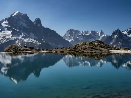
- Stuvdalsvatnet and the lake chain: The trail links Sørvågvatnet, Stuvdalsvatnet and the higher Tridalsvatnet/Kjølvatna lakes, adding varied lakeside terrain to the climb.
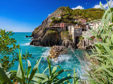
- Reinefjorden and coastal Lofoten views: As height is gained, the route opens to classic Lofoten scenery: steep mountains dropping towards fishing villages, fjords and sea.
Challenges to expect
This is a strenuous mountain day, not a short hut stroll. Expect about 900 m of total ascent if continuing to Munken, plus rocky descents, boggy ground and exposed slabs. The chained step needs care, especially in rain. Weather can change quickly, so carry windproof and waterproof layers. Do not count on Munkebu for shelter or water unless you have confirmed opening, key access and booking. For a different Norwegian summit objective, see Gaustatoppen Summit Trail.
HikeList Score
Munkebu Hut Trail scored 74/100 on HikeList's trail-quality metrics.
See score breakdownHide breakdown
- Ideal length 55
- Balanced challenge 80
- Scenery & wildness 88
- Varied terrain 94
- Accommodation 58
- Food & support 65
- Path quality 98
- Season flexibility 63
Computed from length, challenge, scenery & wildness, terrain variety, accommodation, food & support, path quality and season flexibility.
 Norway
Show more data Show less
- Mountain
- Rocky
- Lakeside
- Wetland
- Rock
- Dirt
- Boardwalk
- Huts
- Wild Camping Spots
- Pet Friendly
- Water Sources
- Campsites
- Shelters
Photos from hikers
Taken on the trail by people who've reviewed Munkebu Hut Trail.
Reviews
How would you rate Munkebu Hut Trail?
Tap a star to start your review — you could be the first.