Kintyre Way
How would you rate Kintyre Way?
Tap a star to share your experience and help other hikers.
Kintyre Way: A Complete Hiking Guide
HikeList Score
Kintyre Way scored 93/100 on HikeList's trail-quality metrics.
See score breakdownHide breakdown
- Ideal length 96
- Balanced challenge 100
- Scenery & wildness 90
- Varied terrain 100
- Accommodation 92
- Food & support 88
- Path quality 87
- Season flexibility 89
Computed from length, challenge, scenery & wildness, terrain variety, accommodation, food & support, path quality and season flexibility.
The Kintyre Way is a 161 km waymarked long-distance trail through the Kintyre peninsula in Argyll and Bute, south-west Scotland. It runs point-to-point from Tarbert on Loch Fyne to Machrihanish on the Atlantic coast and is usually walked in 6–7 days. The route is moderate overall, with forest tracks, quiet lanes, moorland, coastal sections and a rough, boggy final stage. It suits hikers wanting a quieter Scottish Great Trail with sea views, village accommodation and manageable daily stages.
Route Overview
Most walkers take the Kintyre Way north to south, starting at Tarbert harbour and finishing at Machrihanish Bay. The official seven sections are Tarbert to Claonaig, Claonaig to Clachan, Clachan to Tayinloan, Tayinloan to Carradale, Carradale to Campbeltown, Campbeltown to Southend, and Southend to Machrihanish. The route zig-zags across the peninsula rather than simply following one coast, linking the sheltered Kilbrannan Sound side with the more exposed Atlantic west. Because it is a linear point-to-point trail, plan onward travel from Machrihanish or Campbeltown before you start. For other Scottish coastal routes, compare the Arran Coastal Way and Ayrshire Coastal Path.
History of the Kintyre Way
The Kintyre Way was launched in late summer 2006 as a tourism initiative for the Kintyre peninsula. It originally ran from Tarbert to Southend, before being extended by roughly 13 miles to Machrihanish so the route could include more of the south-west coast. The trail is now recognised by NatureScot as one of Scotland’s Great Trails. The annual Kintyre Way Ultra has been run since 2007.
Notable highlights
- Tarbert: The trail starts in this fishing and yachting village around a sheltered Loch Fyne harbour, overlooked by the ruins of Tarbert Castle.
- Skipness Castle: A substantial 13th-century castle near the early stages, with views across the Kilbrannan Sound towards Arran; a seafood cabin operates in the grounds in summer.
- Isle of Arran views: The jagged Arran skyline is a constant landmark across the Kilbrannan Sound on much of the eastern side of the route.
- Saddell Abbey and Saddell Bay: A ruined 12th-century Cistercian monastery and nearby beach, known for late-medieval carved grave slabs and a link to Paul McCartney and Wings’ “Mull of Kintyre”.
- Campbeltown: Kintyre’s main town and a historic whisky centre, home to Springbank and Glen Scotia distilleries.
- Machrihanish Bay: The trail finishes by the long Atlantic surf beach near the Mull of Kintyre, after the wild, boggy Southend-to-Machrihanish stage.
Challenges to expect
The Kintyre Way is not high-altitude, but it still accumulates about 3,140 m of ascent over 161 km. Expect mixed surfaces: gravel forest tracks, dirt and grassy paths, minor roads, shoreline sections and rough boggy ground in the southern hills. The west coast is more exposed to Atlantic weather, and the final Southend-to-Machrihanish stage is hard going in wet conditions. Midges can be an issue in summer. For a rougher northern coastal feel, see the Assynt Coastal Path.
HikeList Score
Kintyre Way scored 93/100 on HikeList's trail-quality metrics.
See score breakdownHide breakdown
- Ideal length 96
- Balanced challenge 100
- Scenery & wildness 90
- Varied terrain 100
- Accommodation 92
- Food & support 88
- Path quality 87
- Season flexibility 89
Computed from length, challenge, scenery & wildness, terrain variety, accommodation, food & support, path quality and season flexibility.
Show more data Show less
- Coastal
- Forest
- Moorland
- Hills
- Beaches
- Gravel
- Dirt
- Grass
- Paved
- Boggy
- Hotels
- Guesthouses
- Campsites
- Wild Camping Spots
- Family Friendly
- Dog Friendly On Leash
- Established Campsites
- Shelters
- Picnic Areas
- Potable Water Sources
Download Our Full Guide to Kintyre Way FREE!
Get our comprehensive guide to this hike for free. Save it for later reading or print out at home.
In these collections
Photos from hikers
Taken on the trail by people who've reviewed Kintyre Way.
Kintyre Way: The Complete Guide
 i
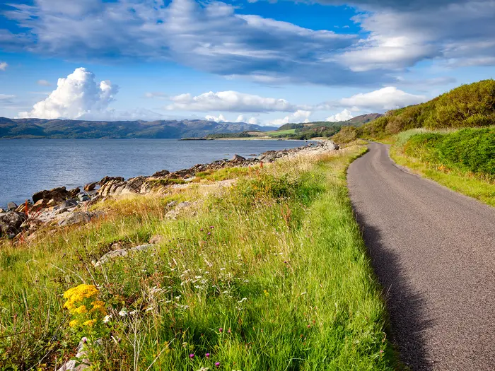
Image by Dmitry Naumov
i
Image by Dmitry Naumov The Kintyre Way is a quieter Scottish Great Trail, running 161 km across the remote Kintyre peninsula from the fishing harbour of Tarbert on Loch Fyne to the Atlantic surf beach at Machrihanish. It suits walkers who want sea views, village stops and a less crowded long-distance route, but still expect full multi-day planning.
The route repeatedly crosses between the peninsula’s two coasts, giving it a clear split personality. The eastern side has sheltered bays, Loch Fyne, Kilbrannan Sound and frequent views to Arran; the west is more exposed, with Atlantic beaches and views towards Islay, Jura, Gigha and, in clear weather, Northern Ireland.
Along the way the trail links ruined Tarbert Castle, 13th-century Skipness Castle, Carradale, Saddell Abbey and Campbeltown, Kintyre’s main service town and historic whisky centre with Springbank and Glen Scotia distilleries. The finish at Machrihanish Bay feels properly earned after the wild ground south of Southend.
This is not a high-altitude route, but it is physically demanding: expect about 3,140 m of ascent, mixed surfaces and several long days, including the 34 km Carradale–Campbeltown stage. The final Southend–Machrihanish stage is rough, boggy and exposed hill walking, and can take 8–9 hours in poor conditions; summer midges and Scottish access-rights wild camping are both part of the practical picture.
The main logistical sting is that Kintyre has no railway. Access is by Scottish Citylink or West Coast Motors coach, CalMac ferry, or Loganair flight between Glasgow and Campbeltown, and return travel from Machrihanish or Campbeltown should be arranged before setting off.
This guide covers the stages, itinerary choices, accommodation, food and resupply, transport, terrain, weather, gear, budget, shorter sections and common mistakes.
Stage-by-Stage Guide
Stage distances on the Kintyre Way vary slightly between guidebooks, GPX files and mapping platforms. The figures below use the stage distances in this guide; if booking transfers, taxis or accommodation around a precise mileage, check the current official route information before travelling.
The route is waymarked in both directions with blue Kintyre Way marker posts, but several stages cross remote moorland and forestry where an OS map and GPX file are strongly recommended. OS Landranger 62 and 68, or OS Explorer 356 and 357, cover the route.
Stage 1: Tarbert to Claonaig — 18.5 km
This opening stage leaves Tarbert harbour on stone steps and climbs steeply past Tarbert Castle, so the day starts with effort rather than a gentle warm-up. After the castle and Tarbert Millennium Cairn, the route crosses higher moorland and forest roads before descending through a wooded glen towards Skipness and the east coast.
Underfoot, expect a mixture of gravel paths, forest track, grassy moorland and some road walking. The moorland can be boggy in places, particularly after wet weather, but navigation is generally straightforward if the waymarks are followed from the harbour information board and castle signs.
The main optional stop is Skipness, a short detour from the waymarked route. Skipness Castle, St Brendan's Church and Kilbrannan Chapel make this one of the most rewarding cultural diversions on the early trail, and the first big views across Kilbrannan Sound to Arran open up from the high ground.
Tarbert is the last full-service place before the route becomes more limited, with shops, places to eat, a bank and an ATM. Between Tarbert and Skipness there are no services; at Skipness there is a small village shop and the seasonal Skipness Seafood Cabin, which usually operates from late May to early October. Opening times should be checked before relying on it for a meal.
Accommodation at Claonaig is very limited, with most options in the wider Crossaig area rather than a large village centre. Some walkers continue to Clachan if they cannot secure a bed, but that creates a much longer day and should not be treated as a casual extension.
Road access is possible at Tarbert, Skipness and Claonaig, with the stage ending near the Claonaig ferry terminal on the B8001. There is no railway on the peninsula; any bus, taxi or ferry connection for this stage should be checked before travelling.
Stage 2: Claonaig to Clachan — 20.5 km
This is one of the more remote and exposed early stages. From Claonaig the route follows the B842 for around a mile before turning uphill onto broad track and then crossing open heather and bilberry moorland towards Loch Ciaran.
The walking is rougher than Stage 1, with boggy ground, wet moorland path, forest track and a steep descent on a wooden walkway into Clachan. It is not technically high, but the sense of exposure is greater than the distance suggests, especially in mist, rain or wind.
The main landmark is the prehistoric standing stone near Loch Ciaran. Dun Skeig Hill Fort lies south-east of Clachan and is a possible detour for walkers with time and energy at the end of the day.
There are no shops, cafés or facilities between Claonaig and Clachan. Carry all food and enough water from the previous resupply point; moorland streams may be present, but any natural water should be filtered or treated.
Clachan has a small selection of B&B accommodation at the stage end. Availability is limited, so this is a stage where booking ahead matters.
Road access is available at Claonaig via the B842 and at Clachan near the A83 corridor. Local public transport and taxi options are limited on the peninsula and should be checked before travelling.
Navigation needs more care here than on the first day. Follow the right turn off the B842 after leaving Claonaig, bear left near Loch Ciaran, and pay close attention to waymarkers through the forestry and on the descent. An OS map is strongly recommended in poor visibility.
Stage 3: Clachan to Tayinloan — 15.7 km
Stage 3 is a shorter and generally gentler coastal day, following the west side of Kintyre towards Tayinloan. The route uses shoreline, shingle, woodland path, farm tracks and some sections beside or near the A83.
The walking is mainly flat to undulating, but the foreshore sections can be slower than the map distance implies. Pebbles, shingle and wet grass make this a stage where footwear still matters despite the lower height gain.
Clachan church is worth noting at the start, with carved stone statues of Clan Alasdair chiefs inside. Further on, the route passes prehistoric sites including the Ballochroy standing stones and burial cist, the remains of an Iron Age fort at Seal Point, Correchrevie burial cairn and a World War Two lookout shelter.
The views now switch to the Atlantic side, with Gigha, Islay and Jura visible across the water in good conditions. Rhunahaorine survey pillar is a useful viewpoint, and Tayinloan is the ferry point for Gigha if a side trip has been planned.
Food and water are limited but better than on Stage 2. Clachan has a filling station with limited supplies, while Tayinloan has a well-stocked village shop and is the key resupply point at the end of the stage. Ferry Farm near Tayinloan offers B&B and café facilities.
Tayinloan has a small but useful accommodation choice, with additional camping possibilities in the nearby Muasdale area. Book ahead in summer, as there are few easy fallback options without transport.
Road access is good by Kintyre standards because this stage stays close to the A83 corridor, and the Gigha ferry terminal is at Tayinloan. Any bus times, ferry times or taxi pickups should be checked before travelling.
Avoid Rhunahaorine Point from late March to June because of tern nesting. Some beach and stream sections can be affected by tide or water levels, and cyclists are better using the A83 rather than attempting the pebbly shoreline sections.
Stage 4: Tayinloan to Carradale — 26.3 km
This is the first of the two notably long Kintyre Way stages. It begins with a coastal section from Tayinloan before climbing sharply inland into open country, forestry and wind-farm terrain around Deucheran Hill.
The day has a much hillier feel than Stage 3. Expect sandy shore near the start, clear paths, forest tracks, open hill ground and a forestry descent, with a significant climb after the initial coastal walking.
The route passes through the Loch na Naich designated area and close to turbines in the wind-farm landscape. Later, Cnoc na Gabhar, also known as Deer Hill, gives one of the best panoramas of this part of the trail, with views over the east Kintyre coast, the Arran mountains and Ailsa Craig.
There are no reliable food or water stops between Tayinloan and Carradale. Leave Tayinloan with a full day’s food and enough water for a long, exposed stage.
Carradale is a natural overnight stop, with several accommodation options, a hotel with food and bar, B&Bs, campsites near the village and local shops. It is also one of the more useful places to recover before the longest stage of the route.
Road access is available at Tayinloan on the A83 and at Carradale on the east side of the peninsula. Public transport and taxis are limited and should be checked before travelling, especially if using Carradale as a start or finish for section-walking.
The waymarking is generally good, but the wind-farm and forestry tracks can be confusing in poor visibility because several tracks may look similar. Carry mapping and GPX, and do not underestimate the time needed for the climb and the distance.
Stage 5: Carradale to Campbeltown — 34.1 km
Carradale to Campbeltown is the longest stage of the Kintyre Way and should be planned as a full hillwalking day. It combines coastal walking, farmland paths, extensive forestry tracks, the glen of the Ifferdale Burn, the area above Loch Lussa and a final road descent into Campbeltown.
The distance is the main challenge, but the stage also has substantial ascent and long sections without services. The surfaces are mostly walkable rather than technically difficult: coastal path, farm paths, forest track, glen path and minor road.
A useful way to reduce the pressure is to split the stage at Ifferdale Farmhouse Bunkhouse in Saddell Glen, around 10 miles north of Campbeltown. Walkers not comfortable with a 34 km day should strongly consider this rather than forcing the full stage.
The Saddell Abbey detour is reached by turning left at the B842. The ruined 12th-century Cistercian monastery, carved medieval grave slabs and nearby Saddell Bay are among the best historic stops on the route, but the detour adds time to an already long stage.
Loch Lussa is another key landmark, and the area is noted for ospreys and cuckoos in spring and summer. The final descent into Campbeltown is on minor road, which can feel hard underfoot late in the day.
There are no shops between Carradale and Campbeltown. Ifferdale Bunkhouse can provide accommodation and limited food arrangements, but this should be booked and checked in advance. Carry plenty of food and at least 2 litres of water from Carradale.
Campbeltown is the major service stop of the whole trail, with supermarkets, hotels, B&Bs, restaurants, cafés and pubs. It is also the key transport hub on the peninsula, served by road links and flights to Campbeltown from Glasgow; onward buses, flights or taxis should be checked before travelling.
Navigation is mostly on clear tracks and waymarked paths, but fatigue is a real factor. Start early, especially if adding the Saddell detour, and keep a reserve of time for the final road miles into town.
Stage 6: Campbeltown to Southend — 25.3 km
Stage 6 leaves Campbeltown along the shore of Campbeltown Loch before following quiet coastal roads and shoreline sections towards Southend. It is less remote than Stage 7 but still a long day, with much of the route on minor road and exposed coastal ground.
The surfaces include esplanade, road, clifftop paths, grassy shoreline tracks and sandy beach. The single-track road known in parts as The Leerside undulates between coastal viewpoints and secluded bays, so it is not a flat promenade walk.
Davaar Island lies off Campbeltown and can be reached via the Dhorlin shingle causeway only around low tide. The island is known for its caves, including the cave painting of the Crucifixion by Archibald MacKinnon, but tide times must be checked carefully before attempting the detour.
Other landmarks include Kildalloig Bay, Corphin Bridge, Glen Hervie, the Duke of Argyll Memorial Cross and Dunaverty. Dunaverty is a scheduled historic site associated with the 1647 Dunaverty Massacre, also known as Blood Rock.
Campbeltown is the place to stock up before leaving. Near Southend, the Putt Stop café at Dunaverty Golf Course can be a useful lunch or late-stage stop, but opening should be checked before relying on it. Southend has limited services, including a hotel and limited pub provision.
Accommodation in Southend consists of a hotel and some B&B options. As with the smaller Kintyre villages, book ahead rather than assuming space will be available on arrival.
Road access is straightforward at Campbeltown and Southend, with the route using roads for much of the day. Public transport or taxi options for starting or leaving at Southend should be checked before travelling.
The key warning on this stage is tidal. Some sections south of Polliwilline can be impassable at high tide, and a high-tide alternative of around 2 miles runs inland via Macharioch. This matters if leaving Campbeltown late or spending time on the Davaar Island detour.
Stage 7: Southend to Machrihanish — 26.4 km
The final stage is the roughest and most serious walking on the Kintyre Way. It leaves Southend on farm tracks and then commits to boggy moorland, rough hill ground and exposed terrain before descending to Machrihanish Bay.
This is not a stage to treat as an easy finish. The climb onto Amid Hill is steep and boggy, the crossing towards the shoulder of Remuil Hill can be wet and pathless in places, and the descent towards Ballygroggan Farm requires careful navigation.
Dunaverty Rock is passed early in the stage, reflecting the earlier route finish before the Kintyre Way was extended to Machrihanish. The reward comes late, when the Atlantic and Machrihanish Bay open up on the descent to the long surf beach at the finish.
There are no facilities on the stage. Southend has limited services, so stock up in Campbeltown the previous day if necessary and leave Southend with all food and water needed for a full, exposed day.
At the finish, Machrihanish has a shop at or near the route end and accommodation including a hotel and bunkhouse-type option. Campbeltown is about 8 km away by road and may be the more practical overnight base, with taxi or bus connections available; this should be checked before travelling.
Road access exists at Southend and Machrihanish, but the moorland middle of the stage has no easy escape points. Do not start unless the forecast, daylight and navigation competence are suitable.
Navigation is the main issue. Some waymarkers on the final stage have sunk into peat bogs or are difficult to spot, so carry OS Explorer 356 and a GPS or GPX file. In poor visibility this stage is suitable only for experienced hillwalkers; novice walkers should not attempt it in bad weather.
Recommended Itinerary
Distances on the Kintyre Way vary slightly between mapping sources, so use the figures below for planning rather than for time-critical logistics. Check current official mapping before booking accommodation, especially where a long day depends on reaching a specific overnight stop.
Standard 7-day itinerary
This is the most practical schedule for most walkers because it follows the seven recognised stages and keeps the main overnight stops in Tarbert, Claonaig or nearby, Clachan, Tayinloan, Carradale, Campbeltown, Southend and Machrihanish.
| Day | From | To | Approx. distance | Why this stage makes sense | Services/accommodation notes |
|---|---|---|---|---|---|
| 1 | Tarbert | Claonaig | 18.5 km | A manageable opening day from the Loch Fyne side of the peninsula, giving time for travel to Tarbert if arriving the previous day. | Tarbert has the best start-of-route services, including food shops, hotels, B&Bs, bunkhouse and camping. Claonaig has very limited accommodation, so book ahead or plan alternatives near Skipness/Crossaig. The Claonaig–Lochranza CalMac ferry can be used for an overnight on Arran in summer; this should be checked before travelling. |
| 2 | Claonaig | Clachan | 20.5 km | A moderate second day, continuing south through a quieter section before reaching a small but useful service stop. | Clachan has limited B&B-style accommodation and the Clachan Filling Station shop for basic provisions. It is on the West Coast Motors bus route, which can be useful for section walkers or contingency plans. |
| 3 | Clachan | Tayinloan | 15.7 km | The shortest day of the standard itinerary, useful after two moderate days and a good chance to manage laundry, resupply or a slower morning. | Tayinloan has limited accommodation and a well-stocked village shop. Ferry Farm B&B/café and Big Jessie’s Tearoom are noted local options. The CalMac ferry to Gigha gives a possible side trip or overnight alternative, subject to current sailings. |
| 4 | Tayinloan | Carradale | 26.3 km | The mileage increases here, but Carradale is a strong overnight target and one of the better intermediate stops on the route. | Carradale has several B&Bs, a hotel, campsite at Carradale Bay, community shop and post office, and places to eat. Book ahead in busy periods, as this is the natural stop before the longest stage. |
| 5 | Carradale | Campbeltown | 34.1 km | This is the longest day on the standard itinerary and should be treated as a full hill-walking day, not a casual transfer between villages. Allow an early start and realistic pace. | Campbeltown is the main service centre on the peninsula, with supermarkets, restaurants, pubs, banks, hotels, guesthouses and bunkhouse accommodation. The coastal section near Waterfoot/Dippen Bay can be affected at very high tide; the A83 road is the alternative. Ifferdale Farm bunkhouse, about 9 km from Carradale, is the key split option if this stage is too long. |
| 6 | Campbeltown | Southend | 25.3 km | A substantial but more straightforward day after resupply in Campbeltown, with some road walking and a village finish. | Southend has limited accommodation, including hotel and B&B options, plus The Putt Stop for meals. There is a bus connection back towards Campbeltown, useful if accommodation is tight. |
| 7 | Southend | Machrihanish | 26.4 km | The final stage is not the longest, but it is often the hardest: rough, boggy and exposed, particularly in poor weather. Keep this day flexible if conditions are bad. | Machrihanish has limited accommodation, holiday lets and Machrihanish Holiday Park. The finish is about 8 km by road from Campbeltown, with bus or taxi options for onward travel. Arrange onward transport before setting off, as there is no railway on the peninsula. |
Slower 8-day itinerary
This is the best option for walkers who want a more forgiving schedule, are using accommodation rather than camping, or do not want to tackle the 34 km Carradale–Campbeltown stage in one push. It keeps the rest of the route close to the standard itinerary but splits the longest day at Ifferdale.
| Day | From | To | Approx. distance | Why this stage makes sense | Services/accommodation notes |
|---|---|---|---|---|---|
| 1 | Tarbert | Claonaig | 18.5 km | Keeps the first day moderate and avoids compressing the northern stages. | Claonaig accommodation is scarce; arrange Skipness/Crossaig options or the summer ferry to Lochranza before committing to dates. |
| 2 | Claonaig | Clachan | 20.5 km | A steady day to a small service stop. | Limited accommodation and basic provisions at Clachan; book ahead. |
| 3 | Clachan | Tayinloan | 15.7 km | A shorter day that gives useful recovery time before the longer east-coast stages. | Tayinloan has limited beds, a shop and ferry access to Gigha. |
| 4 | Tayinloan | Carradale | 26.3 km | A longer but logical day, ending in the best-served intermediate village before the high ground south of Carradale. | Carradale has B&Bs, hotel, campsite, shop and food options. |
| 5 | Carradale | Ifferdale | About 9 km | Turns the longest standard stage into a short positioning day, useful for tired legs or poor weather windows. | Ifferdale Farm bunkhouse is the key accommodation option for this split. Availability should be checked before booking the wider itinerary. |
| 6 | Ifferdale | Campbeltown | About 25 km | Completes the broken Carradale–Campbeltown section without the pressure of a 34 km day. | Campbeltown has the route’s strongest resupply and accommodation choice. This is the best place to fix gear issues, restock food and reorganise luggage. |
| 7 | Campbeltown | Southend | 25.3 km | Keeps the southern approach intact while avoiding back-to-back very long days. | Southend accommodation is limited; book ahead or use bus/taxi links to Campbeltown if necessary. |
| 8 | Southend | Machrihanish | 26.4 km | Leaves a full day for the rough, boggy final stage, which should not be rushed. | Machrihanish has limited services; most onward travel runs via Campbeltown. |
Faster 6-day itinerary
A 6-day schedule is only for fit, experienced walkers who are comfortable with long days, rough ground and limited bailout options. The cleanest compression is to combine the Claonaig–Clachan and Clachan–Tayinloan stages, but that creates a long second day and removes the easiest recovery day in the standard schedule.
| Day | From | To | Approx. distance | Why this stage makes sense | Services/accommodation notes |
|---|---|---|---|---|---|
| 1 | Tarbert | Claonaig | 18.5 km | Keeps the opening day controlled before the first compressed section. | Claonaig remains the main accommodation weakness; solve this before booking the rest of the route. |
| 2 | Claonaig | Tayinloan | About 36.2 km | Combines two shorter stages into one long day. This is the main reason the 6-day itinerary is not suitable for most walkers. | Clachan is the mid-stage service point, with basic provisions at the filling station. Tayinloan accommodation is limited, so a late arrival must be planned carefully. |
| 3 | Tayinloan | Carradale | 26.3 km | A long but standard stage to a well-served village. | Carradale is a practical overnight stop with shop, eating options and accommodation. |
| 4 | Carradale | Campbeltown | 34.1 km | The longest stage remains unavoidable unless using Ifferdale, so this is the hardest day in a fast schedule. | Start early and carry enough food and water for a full day. Campbeltown is the best resupply point on the trail. |
| 5 | Campbeltown | Southend | 25.3 km | A substantial day after the longest stage, with a village finish and possible transport back to Campbeltown if needed. | Southend beds are limited; book early or arrange a taxi/bus fallback. |
| 6 | Southend | Machrihanish | 26.4 km | Finishes on the roughest and most exposed stage, so this day needs good weather judgement despite the fixed schedule. | Machrihanish has limited accommodation and onward transport is normally via Campbeltown. Build in contingency if travelling out the same day. |
Which itinerary to choose
Most walkers should use the 7-day itinerary unless accommodation availability forces a change. It balances the route well, but the Carradale–Campbeltown and Southend–Machrihanish days still require proper hill-walking fitness.
Choose the 8-day itinerary if carrying full camping kit, walking in wet weather, travelling with a mixed-ability group, or wanting a safer margin on the long Carradale–Campbeltown section. It is also the better schedule if using luggage transfer, as shorter walking days reduce pressure at accommodation check-in points.
Choose the 6-day itinerary only if long-distance mileage is already comfortable. It offers little spare time for delays, midges, bad weather, transport disruption or the rough final stage.
Planning the Route
How many days to allow
Most walkers should plan the Kintyre Way as a seven-day walk, matching the official seven waymarked stages. That gives a logical overnight pattern between the main villages and keeps the route manageable without needing complicated transfers every day.
A six-day itinerary is possible, and some organised walking holidays use it, but it suits fit walkers who are happy with long days and limited recovery time. A 7–10 day plan is more forgiving, especially if adding side trips such as Skipness Castle, Gigha from Tayinloan, or Davaar Island from Campbeltown.
The route is not best treated as a fast trail unless daily mileage is already comfortable. The two main pressure points are the long Carradale to Campbeltown stage and the rough Southend to Machrihanish finish, where slow ground can matter more than map distance.
Accommodation shapes the itinerary
Accommodation is the single biggest planning constraint on the Kintyre Way. The stage ends are not just convenient stopping points; they are largely dictated by where beds, campsites and services exist on a remote peninsula.
Book early, particularly for Easter, summer and school-holiday periods. Claonaig, Tayinloan and Southend are the tightest pinch-points, and walkers not camping may need taxi transfers where local accommodation is full or unavailable.
| Place | Planning notes |
|---|---|
| Tarbert | Best-served start point, with hotels, B&Bs, camping and a well-stocked Co-op. |
| Claonaig | Very limited accommodation and no facilities; many walkers need a taxi transfer to Clachan or Tarbert, or to pre-arranged local accommodation. |
| Clachan | Limited options, with provisions at Clachan Filling Station. |
| Tayinloan | Small choice of accommodation; village shop and food options near the Gigha ferry jetty. |
| Carradale | One of the better-served smaller villages, with accommodation and the Carradale Community Shop. |
| Campbeltown | Main service hub, with the widest choice of accommodation, shops and onward transport. |
| Southend | Minimal services and limited accommodation; book before committing to the final stage. |
| Machrihanish | Finish point with holiday accommodation, including Machrihanish Holiday Park; onward travel usually needs arranging via Campbeltown. |
Stage planning and where to be cautious
The first three stages are a reasonable build-up, with Tarbert to Claonaig, Claonaig to Clachan and Clachan to Tayinloan giving relatively manageable days. They still need proper timing because services are thin once away from Tarbert.
The middle and southern stages need more care:
| Stage | Approx. distance | Main planning issue |
|---|---|---|
| Tayinloan to Carradale | 26.3 km | A long day with fewer easy bailout options. Start early and carry food. |
| Carradale to Campbeltown | 34.1 km | Longest stage; allow a full day. A local West Coast Motors bus between Carradale and Saddell can reduce some road walking if the timetable works. |
| Campbeltown to Southend | 25.3 km | Long but generally less technical than the final day. Accommodation in Southend is the key constraint. |
| Southend to Machrihanish | 26.4 km | The hardest stage: boggy moorland, open ground, steep sections and sparse waymarking. Treat it as a proper hill day. |
The final Southend to Machrihanish stage should not be left as an afterthought. In wet weather the boggy ground slows progress, and in mist the open moorland requires confident navigation rather than simple waymark-following.
Shortening, extending and section hiking
Section hiking is very practical on this route. Scottish Citylink service 926 stops at Tarbert, Clachan, Tayinloan and Campbeltown, which gives useful entry and exit points without needing a car.
West Coast Motors local services also help with access to places such as Claonaig, Carradale and Machrihanish, though timetables must be checked before relying on them. A common shorter trip is the southern section from Carradale or Campbeltown towards Machrihanish.
The easiest ways to shorten the route are to start at Clachan, Tayinloan or Carradale, or to finish at Southend or Campbeltown instead of taking on the rough final leg to Machrihanish. This is a sensible option in poor weather or if accommodation at Machrihanish is difficult.
Good extensions include the detour to Skipness Castle in the early stages or a Gigha day trip from Tayinloan by CalMac ferry. From Campbeltown, Davaar Island is reachable on foot only at low tide, so tide times must be checked before adding it.
Transport must be arranged before starting
There is no railway on the Kintyre peninsula, so transport planning matters more here than on many UK long-distance trails. The main public transport spine is Scottish Citylink service 926, operated by West Coast Motors, running Glasgow to Campbeltown via Tarbert.
For the start, Tarbert is normally reached by coach from Glasgow, or by CalMac ferry connections such as Tarbert–Portavadie. Summer ferry links involving Lochranza on Arran can also be useful for more creative approaches.
The finish needs particular attention. Machrihanish is west of Campbeltown, with an infrequent local bus link and taxis the more reliable fallback; this should be checked before travelling. From Campbeltown, onward options include Citylink coach back to Glasgow or Loganair flights between Campbeltown and Glasgow.
Avoid finishing the final stage late in the day without a booked transfer or accommodation. Many walkers will find an overnight in Campbeltown the simplest way to remove stress from the final day.
Food, water and resupply
Resupply is straightforward in Tarbert and Campbeltown but more limited elsewhere. Between the smaller villages, carry enough food for the day rather than assuming cafés or shops will be open.
Useful service points include Clachan Filling Station, the village shop at Tayinloan, Carradale Community Shop and food options at Southend. Opening times vary, especially outside the main season, so this should be checked before travelling.
Water planning is important on the longer and more exposed sections. Carry adequate water, especially if camping or walking the remote southern stages, where refill opportunities may be limited.
Camping, baggage and access
Scotland’s access rights make wild camping a realistic option, provided the Scottish Outdoor Access Code is followed. Camp discreetly, stay only briefly, avoid enclosed or sensitive ground, and leave no trace.
Formal camping options include sites around Carradale, Southend and Machrihanish, with Muasdale also available off-route on the west coast. Wild campers should still plan around food, water and weather rather than assuming every stage will produce an easy pitch at the right time.
Baggage transfer can make the Kintyre Way much more comfortable, especially on the 34 km Carradale to Campbeltown day and the boggy final stage. Broonie Bags is a dedicated Kintyre Way luggage-transfer operator, with pricing arranged by request; Kintyre Way Baggage Transfer is another option.
Navigation and weather planning
The Kintyre Way is waymarked in both directions, but a map and offline navigation are still needed. The relevant Ordnance Survey mapping includes Landranger 62 and 68, and Explorer 356, 357 and 362 for the southern section.
Most stages are straightforward in clear weather, but the Southend to Machrihanish stage crosses open moorland where waymarks can be widely spaced. Carry a map and compass or downloaded GPX, and do not depend on mobile signal.
May, early June, September and early October are the most comfortable planning windows for many walkers. July and August bring the highest midge pressure, especially in forestry and still conditions, while winter means short days, wetter ground and a more serious final stage.
Towns, Villages and Overnight Stops
Accommodation is the main constraint on the Kintyre Way. Tarbert and Campbeltown have proper town-level services, Carradale is the best mid-route stop, and several stage ends are small settlements where beds, food and shop opening hours need planning in advance.
The route is linear and there is no railway on the Kintyre peninsula. West Coast Motors / Scottish Citylink buses are the main public transport link, with CalMac ferries and Loganair flights to Campbeltown also useful for wider travel plans. Timetables, opening hours and accommodation availability should be checked before travelling, especially on Sundays and outside the main season.
| Place | Route position | Overnight usefulness | Services summary |
|---|---|---|---|
| Tarbert | Start | Excellent trailhead stop | Good accommodation, Co-op, food, pubs, buses |
| Skipness | Short detour near Claonaig | Poor as an overnight | Castle, seasonal seafood cabin, basic shop, very limited beds |
| Claonaig | End of Stage 1 | Difficult but possible | Ferry terminal, minimal services, wild camping or pre-booked self-catering |
| Clachan | End of Stage 2 | Limited but practical | Filling station shop, limited B&Bs, bus stop |
| Tayinloan | End of Stage 3 | Modest but useful | B&B/cafe, tearoom, village shop, ferry to Gigha, bus stop |
| Carradale | End of Stage 4 | Best mid-route stop | Hotel, B&Bs, shop/Post Office, food, harbour village |
| Saddell | Between Carradale and Campbeltown | Not a service stop | Abbey and bay; no village shop or pub |
| Campbeltown | End of Stage 5 | Essential major stop | Broad accommodation, supermarkets, pharmacy, banks, restaurants, buses, taxis, airport |
| Southend | End of Stage 6 | Important before final stage | Limited accommodation, cafe, shop, pub |
| Machrihanish | Finish | Useful if pre-booked | Limited accommodation, pub, infrequent Mon–Sat bus to Campbeltown (no Sunday service) |
Tarbert
Tarbert is the northern trailhead and the best place to arrive the night before starting. It is a working fishing and yachting village on Loch Fyne, with Tarbert Castle above the harbour and far better services than most later stops.
Accommodation is strong for a trailhead village, with hotels, B&Bs and Tarbert Holiday Park, including glamping pods. It is a sensible place to book a comfortable first night, sort kit and avoid starting the first stage after a long journey.
For supplies, Tarbert has a well-stocked Co-op supermarket plus other food shops. This is the best pre-walk resupply point before Campbeltown, so buy breakfast, lunch food and any missing basics here rather than expecting large shops in the smaller villages.
Food and drink options include pubs and restaurants around the harbour, with local seafood such as langoustines, scallops and mussels commonly available. West Coast Motors / Scottish Citylink buses link Tarbert with Glasgow via Inveraray and with Campbeltown; Tarbert Cars can also be useful for local taxi arrangements on 07930 884851.
Skipness
Skipness is not on the main overnight line of the Kintyre Way, but it is a worthwhile short detour near Claonaig. The village sits on Kilbrannan Sound, with views across to Arran, and is best treated as a half-hour diversion rather than a dependable service stop.
Skipness Castle is the main reason to go. The 13th-century castle is a Historic Environment Scotland site, and the grounds also host Skipness Seafood Cabin in season, serving local seafood, smoked salmon, cakes and light food from late May to early October, roughly 11am–7pm. Opening dates and hours should be checked before relying on it for a meal.
Accommodation in Skipness is very limited. Skipness Estate has self-catering cottages, but these are holiday lets rather than casual one-night walker accommodation. There is no pub or hotel in the village.
The Skipness Shop can help with basic supplies, but do not treat Skipness as a full resupply point. It works well as a castle, view and lunch detour if timing and season line up.
Claonaig
Claonaig is the end of Stage 1, around 18.5 km from Tarbert. It is a small settlement with a CalMac ferry terminal for the seasonal crossing to Lochranza on Arran.
This is one of the trickiest overnight points on the route. There is no pub and no hotel, so accommodation must be planned before setting off from Tarbert. Nearby self-catering options such as Skipness Cottages may work if booked in advance, but availability should not be assumed.
Many walkers either wild camp around this section or arrange a pre-booked stay nearby. Scotland’s access rights allow responsible wild camping under the Land Reform Act, but camps should be small, discreet, away from buildings and livestock, and leave no trace.
Claonaig is not a place to arrive hungry without a plan. Carry food from Tarbert unless accommodation has arranged meals or supplies.
Clachan
Clachan is the end of Stage 2, around 20.5 km from Claonaig, and lies on the west side of Kintyre close to the B8001. It is a small village, but it is a workable overnight if accommodation is secured early.
Accommodation is limited, with Balinakill Country House and Kirkland House noted as B&B options. There is no pub in the village itself, so evening food arrangements should be checked when booking.
The key practical stop is Clachan Filling Station, whose shop is the main resupply point between Tarbert and Tayinloan. Do not assume late opening or Sunday opening; check hours before relying on it for dinner or the next day’s lunch.
Clachan is on the West Coast Motors bus route linking Campbeltown and Tarbert. That makes it one of the more useful places for joining, leaving or shortening a section, provided the timetable fits.
Tayinloan
Tayinloan is the end of Stage 3, around 15.7 km from Clachan, making this the shortest day on the standard itinerary. It sits on the west coast and has a CalMac ferry terminal for the year-round ferry to the Isle of Gigha.
Services are modest but useful. Ferry Farm offers B&B and a cafe, Big Jessie’s Tearoom is by the jetty, and the village shop is well stocked for a small settlement. Together, these make Tayinloan a practical place to top up food and take a less pressured afternoon.
Accommodation is still limited, so book well ahead. There is one B&B in Tayinloan, with additional B&B options back in Clachan, but the small number of beds means flexibility can disappear quickly in summer.
Some fit walkers combine Clachan to Carradale into one very long day of roughly 42 km, but that is a major undertaking and removes a useful recovery stop. Most walkers are better served by overnighting in Tayinloan before the longer moorland crossing to Carradale.
Carradale
Carradale is the end of Stage 4, around 26.3 km from Tayinloan, and is the strongest mid-route stop before Campbeltown. It is an east-coast village on Kilbrannan Sound with a sandy bay, harbour and better walker infrastructure than the smaller settlements to the north.
Accommodation includes the Carradale Hotel, with rooms, restaurant and bar, plus guesthouses and B&Bs such as Carradales. Campsites and responsible wild camping options nearby can also help when rooms are full.
The Carradale Community Shop and Post Office is the main resupply point in this part of the route. Food and drink options include the Carradale Hotel and the Carradale Network Centre tearoom, though seasonal and community-run opening hours should be checked.
This is a sensible place for a rest day or at least an easier morning. The next stage to Campbeltown is the longest of the route at around 34.1 km and crosses rough hill terrain, so starting well fed and properly supplied matters.
Saddell
Saddell sits between Carradale and Campbeltown and is a scenic and historic passing point rather than a practical village stop. It lies about 4 miles south of Carradale on the B842, close to the Stage 5 line.
Saddell Abbey is a ruined 12th-century Cistercian monastery with notable late-medieval carved grave slabs. Saddell Bay is nearby, with views to Arran and a well-known connection to Paul McCartney & Wings’ Mull of Kintyre video; an Antony Gormley cast-iron figure stands on the beach.
There is no village shop or pub at Saddell itself. Saddell Castle and Saddell House are Landmark Trust holiday properties, not normal nightly B&B stops for passing walkers.
Carry food and water through this section unless specific arrangements have been made. Saddell is worth time for the abbey and bay, but it should not be built into the day as a resupply point.
Campbeltown
Campbeltown is the end of Stage 5, around 34.1 km from Carradale, and the major service hub of the Kintyre Way. After the long crossing from Carradale, it is the natural place to rest, resupply and reset before the final two stages.
Accommodation choice is much broader than elsewhere on the route. Options include Dellwood Hotel, Craigard House Hotel, Grammar Lodge Guest House, The Backpackers Bunkhouse and multiple B&Bs. Summer demand can be high, so book well in advance rather than relying on finding a room after arrival.
This is the best resupply point on the whole trail. Campbeltown has supermarkets, a pharmacy, banks, ATMs, outdoor gear and a proper range of restaurants, pubs and cafes. It is the place to replace missing kit, buy food for the final stages and sort any transport changes.
Campbeltown is also Kintyre’s whisky centre, with Springbank, Glen Scotia and Glengyle distilleries. Distillery tours make a good rest-day activity, but Springbank tours in particular should be booked ahead.
Transport links are strongest here. Scottish Citylink 926 / West Coast Motors buses run to Glasgow, and Loganair operates flights between Campbeltown Airport and Glasgow. A seasonal CalMac summer ferry between Ardrossan and Campbeltown has run in some past years but has not operated recently, so its current status should be checked before relying on it. Local taxis include Fona Taxi on 01586 554001, Tavies Taxis on 01586 551122 and Roy’s Taxis on 01586 554625.
Davaar Island is a possible side trip from Campbeltown via the tidal causeway known as the Dhorlin. It is accessible on foot only at low tide, and tide times must be checked before attempting it.
Southend
Southend is the end of Stage 6, around 25.3 km from Campbeltown, near the southern tip of Kintyre. It is a small but important overnight before the rough final day to Machrihanish.
Accommodation is limited, with a few B&Bs, one hotel, a campsite and self-catering nearby at Dunaverty Rock. Book ahead, as there are few fall-back options if beds are full.
Food and drink are available, but opening hours matter. The Putt Stop cafe/tearoom serves hearty lunches and is popular with walkers, there is a small village shop, and there is a pub serving meals. Check seasonal hours before depending on any single option.
The Campbeltown to Southend stage crosses exposed ground above the coast and is a full walking day. Southend is the right place to stop before the final Southend to Machrihanish section, which is rougher, boggier and more committing underfoot.
Machrihanish
Machrihanish is the finish of the Kintyre Way, on the Atlantic side of the peninsula overlooking Machrihanish Bay. The setting is rewarding, but services and onward transport are limited, so finish-day logistics need arranging before leaving Southend.
The final stage from Southend is around 26.4 km and has the toughest underfoot conditions of the whole route. It crosses wild, boggy and remote ground, which is slower in wet weather. Allow a full day and do not plan tight onward connections.
Accommodation includes Machrihanish Holiday Park, with camping and caravan options, plus a small number of B&Bs and self-catering stays. The Old Clubhouse is the main food and drink stop and the traditional place to mark the end of the walk.
The only bus from Machrihanish is the infrequent West Coast Motors 442 to Campbeltown, which runs Monday to Saturday with no Sunday service. Campbeltown is the nearest transport hub, around 8 km north-east, so pre-book a taxi or arrange collection before the final stage if the bus does not fit. Do not assume there will be an easy onward option after a long, wet finish.
Booking and resupply strategy
Book Claonaig, Clachan, Tayinloan, Carradale, Southend and Machrihanish well ahead. These are small places with limited beds, and a single closure or full B&B can force a major change to the itinerary.
Use Tarbert, Carradale and Campbeltown as the main resupply anchors. Clachan and Tayinloan can be useful for top-ups, but their shops and cafes should be treated as limited rural services with opening hours to check.
Responsible wild camping is a useful back-up where accommodation is sparse, particularly around the more remote northern and southern sections. Midges can be a serious nuisance in summer, so carry a head net or repellent if camping.
Broonie Bags runs baggage transfer along the Kintyre Way. This can make the longer stages, especially Tayinloan to Carradale and Carradale to Campbeltown, significantly easier, but bookings and collection points should be arranged in advance.
Getting to the Start
The Kintyre Way starts in Tarbert, Argyll and Bute, at the head of Tarbert Harbour near the Visitor Information Centre on Harbour Street, PA29 6UB. The start information board is close to the harbour, with Tarbert Castle above the village; the trail begins a short distance beyond the Visitor Information Centre.
This is a remote, linear route on a peninsula with no railway. Public transport access is mainly by long-distance coach, with ferry and flight options useful for some itineraries.
By train
There is no train to Tarbert, Campbeltown or anywhere on the Kintyre peninsula. The practical rail approach is to travel to Glasgow, then continue by coach.
From Edinburgh, take a train from Edinburgh Waverley to Glasgow Queen Street in roughly 50 minutes, then transfer to Glasgow Buchanan Bus Station for the coach to Tarbert. Buchanan Bus Station is about a 10-minute walk from Queen Street, or a short taxi ride with a heavy pack.
Allow a full travel block rather than relying on tight connections. Coach and rail times should be checked together before booking onward accommodation in Tarbert.
By bus
The main public transport route to the start is Scottish Citylink service 926, operated in partnership with West Coast Motors, from Glasgow Buchanan Bus Station to Tarbert (Loch Fyne). The coach continues beyond Tarbert to Campbeltown.
Typical journey time from Glasgow to Tarbert is about 3 hours 10 minutes. Services run several times daily, with departures broadly from early morning to late afternoon, but this should be checked before travelling.
The 926 stops en route at places including Dumbarton, Loch Lomond, Arrochar, Rest and Be Thankful, Inveraray, Lochgilphead and Ardrishaig before reaching Tarbert. In Tarbert, the stop is West Loch Hotel, close to the trail start.
After Tarbert, the same service continues through parts of the peninsula including Kennacraig, Clachan, Tayinloan, Glenbarr, Bellochantuy and Campbeltown. This is useful for section hikers, delayed starts or bailing out from the northern half of the route.
Advance booking through Citylink is strongly recommended in summer and at weekends. Timetables, stopping points and luggage rules should be checked before travelling.
West Coast Motors also runs local services on the peninsula, including connections between Lochgilphead and Campbeltown and services towards Skipness and Kilberry. These can help with section-walking logistics, but rural services can be infrequent and should not be assumed without checking the current timetable.
A ferry approach is possible via CalMac’s Portavadie–Tarbert ferry, mainly useful for walkers coming from Cowal, Dunoon or linking from the Cowal Way. The crossing takes about 25 minutes and is normally a turn-up-and-go service, but sailing times, fares and maintenance closures should be checked before travelling.
By car
Tarbert is reached from Glasgow by road via the A82 along Loch Lomond and the A83 through Rest and Be Thankful and Inveraray. In good conditions, the drive from Glasgow is roughly 2 hours 40 minutes to 3 hours; from Edinburgh, allow about 3 hours.
Parking options in Tarbert include Campbeltown Road car park, a council car park with 30 spaces, free 24-hour access and motorhome spaces. Harbour Street car park near the start is operated by Tarbert Harbour Authority, and there is also village street parking near the harbour where permitted.
For multi-day parking, check local signage and ask locally before leaving a vehicle for the duration of the walk. A linear walk also needs an end-of-route plan: many drivers either arrange a vehicle shuttle, leave a second car near Campbeltown or Machrihanish, or book a taxi transfer back from the southern end.
Taxi contacts that may be useful for transfers include Tarbert Cars on 07930 884851, and Campbeltown-based operators Fona Taxi on 01586 554001, Tavies Taxis on 01586 551122 and Roy’s Taxis on 01586 554625. Pre-booking is advisable, especially for early starts, late finishes or Sunday travel.
From the nearest airport
The nearest major airport for the start is Glasgow Airport (GLA). From the airport, take the Glasgow Airport Express bus into the city for Buchanan Bus Station, then continue to Tarbert on the Citylink 926.
Allow around 3.5–4 hours from Glasgow Airport to Tarbert by public transport, depending on connections. This should be checked before travelling, especially if arriving on an evening flight.
Loganair operates flights from Glasgow Airport to Campbeltown Airport, but this is not at the start of the Kintyre Way. Campbeltown Airport is at Machrihanish, near the finish, about 5 km west of Campbeltown town.
Flying to Campbeltown can still work if a transfer is arranged north to Tarbert before starting, or if walking the Kintyre Way in reverse from Machrihanish towards Tarbert. Flights are around 45 minutes, with a weekday service of roughly two flights each way per day (Monday to Friday) and no weekend flights; schedules and fares should be checked before booking.
Loganair uses small aircraft on this route, so walkers with large rucksacks should check hold baggage allowance and weight limits when booking. Local taxis from Campbeltown and Machrihanish can help with airport transfers.
Where to stay before starting
Tarbert is the best place to stay before beginning the Kintyre Way. Accommodation is close to the harbour start, and staying locally removes the risk of missing the first stage because of a delayed coach or ferry connection.
Options in Tarbert include the Anchor Hotel on the harbour, Starfish Rooms in the village centre, Knap Guest House, West Loch House, Dunivaig B&B and Kirkland House B&B. Several are used to walkers and are within easy reach of Harbour Street.
Book ahead for June to September, particularly for weekends. Tarbert is small, and arriving without accommodation is a poor strategy at the start of a multi-day trail.
Getting Home from the Finish
The Kintyre Way finishes at Machrihanish Bay, west of Campbeltown. The official finish is by an information board beside a small beach overlooking Scart Isle, with Machrihanish village roughly 300 m away by minor road.
Machrihanish is not a transport hub. Plan the exit before starting the final Southend–Machrihanish stage, especially if walking on a Sunday or if a late finish is possible.
By train
There is no railway on the Kintyre peninsula. Do not plan on catching a train directly from Machrihanish, Campbeltown or Tarbert.
For most walkers using public transport, the rail connection comes later in Glasgow. Scottish Citylink coaches from Campbeltown terminate at Glasgow Buchanan Bus Station, from where Glasgow Queen Street and Glasgow Central stations provide onward rail connections across Scotland and England.
By bus
The bus exit has two parts: first from Machrihanish to Campbeltown, then from Campbeltown to Glasgow or Tarbert.
| Leg | Operator / route | Typical journey | Key planning point |
|---|---|---|---|
| Machrihanish to Campbeltown | West Coast Motors route 442 | About 9–16 minutes | Infrequent; Monday–Saturday only; no Sunday service |
| Campbeltown to Glasgow | Scottish Citylink / West Coast Motors route 926 | About 4 hours 5 minutes | Up to 5 services per day, including Sundays; book ahead in busy periods |
| Campbeltown to Tarbert | Scottish Citylink / West Coast Motors route 926 | About 1 hour | Useful if returning to the start to collect a car |
West Coast Motors route 442 links Machrihanish and Campbeltown, but it is a limited local service and does not operate on Sundays. Current times should be checked before committing to a same-day connection.
From Campbeltown, the 926 coach is the main public-transport exit from Kintyre. It runs north via Tarbert, Kennacraig, Tayinloan, Glenbarr, Lochgilphead, Inveraray and Loch Lomond to Glasgow Buchanan Bus Station.
The last Campbeltown departure towards Glasgow is typically around 17:00, but this should be checked before travelling. If the final stage takes longer than expected, or if weather slows progress over the rough ground into Machrihanish, staying locally or using a taxi to Campbeltown may be the safer plan.
Bookings and current timetables are available from Scottish Citylink and West Coast Motors. Timetable-dependent details should also be checked through Traveline Scotland before travel.
By car/taxi
Machrihanish is about 8 km by road from Campbeltown. A taxi is the simplest way to leave the finish if the bus does not line up, if finishing late, or if arriving on a Sunday.
Campbeltown taxi firms serving the Machrihanish run include:
| Taxi firm | Telephone |
|---|---|
| Tavies Taxis | 01586 551122 |
| Roy's Taxis | 01586 554625 |
| Fona Taxi | 01586 554001 |
The taxi ride is around 7 minutes. Expect roughly £8–£15 for the Machrihanish–Campbeltown run, but confirm the fare with the operator before booking.
If driving out from Campbeltown, the main road route to Glasgow follows the A83 north via Tarbert, Lochgilphead, Inveraray and Loch Lomond. The drive is approximately 215 km and around 3 hours 30 minutes in good conditions.
Long-stay or overnight parking is available in Campbeltown if arranging a car-based trip around the finish. Vehicle hire is also available locally through operators such as Kintyre Hire and Campbeltown Motor Company; availability should be checked before travelling.
From the nearest airport
Campbeltown Airport, also known as Machrihanish Airport, is very close to Machrihanish village — about 1 km away. This makes flying out a realistic option for walkers who want the fastest exit from the peninsula.
Loganair operates flights from Campbeltown to Glasgow. The flight time is about 40 minutes, with a weekday-focused service of around two flights per weekday and roughly 11 flights per week.
Typical departures are around 09:05 and 18:10, but flight times change and should be checked before booking accommodation or transport to the airport. Fares vary; budget roughly £70–£130 one way and book ahead, as aircraft are small and seats are limited.
Arriving at Glasgow Airport gives onward flight connections, or bus/taxi links into Glasgow city centre. Glasgow Airport is about 13 km from the city centre.
CalMac ferries are useful elsewhere around Kintyre and the islands, but they are not a practical mainland exit from the Kintyre Way finish. There is no direct CalMac ferry from Machrihanish or Campbeltown to the mainland.
Where to stay at the finish
Staying overnight is often the most relaxed option after the final Southend–Machrihanish stage, particularly if weather, boggy ground or a late finish could jeopardise onward transport.
Machrihanish has limited but useful accommodation. Options include The Ugadale Hotel in the village, Machrihanish Holiday Park with camping pods, caravans and touring pitches, and a small number of B&Bs and guesthouses. Book well ahead in summer.
The Old Clubhouse in Machrihanish is a practical post-finish food and drink stop. It is also useful if waiting for a taxi or being collected.
Campbeltown has more accommodation choice and is usually better for catching an early coach or flight. Options include The Royal Hotel Campbeltown, plus a wider range of B&Bs and guesthouses near the town centre and harbour.
Which Direction Should You Walk?
The standard direction for the Kintyre Way is north to south, from Tarbert to Machrihanish. The official seven stages are numbered this way, and self-guided walking holidays normally follow the same direction.
The route is waymarked in both directions, so a south-to-north walk is perfectly possible. For most independent hikers, however, Tarbert to Machrihanish gives the better combination of transport, stage build-up and finish.
North to south: Tarbert to Machrihanish
Starting in Tarbert is the most straightforward approach from Glasgow and the Central Belt. Scottish Citylink route 926 serves Tarbert directly from Glasgow Buchanan Bus Station, with a journey of around 3 to 3.5 hours and typically up to about five buses per day depending on season. Current timetables should be checked before booking accommodation around arrival times.
The walking also builds well in this direction. The first three stages — Tarbert to Claonaig, Claonaig to Clachan, and Clachan to Tayinloan — are shorter than the big middle days, so the route gives legs time to settle before the longer and more committing sections.
| Direction advantage | Why it matters |
|---|---|
| Easier start logistics | Tarbert is directly served by long-distance coach from Glasgow. |
| Better stage progression | Shorter northern stages come before the long Tayinloan–Carradale and Carradale–Campbeltown days. |
| Stronger scenic build | The route moves from sheltered Kilbrannan Sound and Arran views towards the wilder Atlantic coast. |
| More satisfying finish | Machrihanish Bay gives a dramatic beach finish after crossing the peninsula. |
The scenery also develops naturally from north to south. Early days follow the more sheltered side of Kintyre, with views across the Kilbrannan Sound to Arran and optional interest around Skipness. The route then works through forest, moorland, Carradale, Saddell and the high ground towards Campbeltown before turning towards the exposed western side of the peninsula.
The finish at Machrihanish Bay is one of the route’s strongest arguments for walking south. After the rough, boggy Southend-to-Machrihanish stage, arriving at a long Atlantic surf beach feels like a proper end point. Tarbert is an attractive harbour village, but it is a gentler and less dramatic place to finish.
South to north: Machrihanish to Tarbert
Walking south to north is viable, but it is not the best default choice. The main complication is getting to Machrihanish at the start: Campbeltown is the real southern transport hub, and Machrihanish is around 8 km away, requiring a local West Coast Motors bus or taxi.
A reverse walk can make sense if the travel plan naturally brings you into Campbeltown first. Loganair flights run between Glasgow and Campbeltown on weekdays, with a flight time of about 45 minutes. A seasonal Ardrossan–Campbeltown CalMac ferry has operated in some past summers but has not run in recent years, so its current status should be checked before building a south-to-north start around it. Flight, ferry and bus details should be checked before travelling.
The drawback is that the toughest ground comes immediately. In reverse, the rough and exposed Machrihanish-to-Southend section is tackled on day one, before most walkers have settled into the rhythm of a long-distance trail. The long Campbeltown–Carradale section also arrives early.
Finishing in Tarbert has practical advantages because onward coach travel is straightforward. Psychologically, though, it is usually less rewarding than ending on the Atlantic coast at Machrihanish.
Wind, weather and climbing
Kintyre is exposed to Atlantic weather, and prevailing winds in Scotland are often south-westerly. That gives south-to-north walkers a modest theoretical advantage on the exposed west-coast sections, where the wind may be more often behind them rather than in their face.
This advantage should not be overstated. Conditions on the peninsula are variable, the eastern Kilbrannan Sound sections are more sheltered, and a single windy day can matter more than the overall prevailing pattern. For most walkers, transport and stage structure are more important than wind direction.
There is no major pass where one direction is clearly easier. The Kintyre Way is undulating rather than mountainous, with around 3,140 m of cumulative ascent and a high point of about 354 m on the high forest and moorland tracks between Carradale and Campbeltown. The total climbing is broadly the same either way; the bigger difference is when the hardest days arrive.
Accommodation and baggage flow
North to south gives the cleanest accommodation rhythm because the route begins with shorter stages through Tarbert, Claonaig, Clachan and Tayinloan before the longer carries and more limited options further south. Accommodation is still sparse in places, so bookings should be made well ahead whichever direction is chosen.
Campbeltown is the key service stop and transport hub on the southern half of the trail. Reaching it after the long Carradale–Campbeltown stage works well north to south, as it provides a proper town stop before the final push through Southend to Machrihanish.
Baggage transfer is also possible on the route, with companies such as Broonie Bags serving Kintyre Way walkers. Availability, coverage and current prices should be confirmed before booking.
Recommendation
Walk the Kintyre Way north to south, from Tarbert to Machrihanish, unless a specific travel plan makes the reverse direction clearly easier. Tarbert is the most practical start, the stages build more sensibly, and Machrihanish Bay gives the strongest finish.
Choose south to north only if arriving via Campbeltown suits flights, ferry timing or a wider itinerary. It remains a valid and waymarked option, but it front-loads the roughest terrain and gives a less satisfying end to the walk.
Accommodation Along the Route
Accommodation on the Kintyre Way is uneven. Tarbert, Carradale and Campbeltown have the best choice, while Claonaig, Clachan, Tayinloan and Southend have few beds and need early booking.
This is not a trail where failed accommodation plans are easy to fix on the day. The peninsula has no railway, distances between settlements are significant, and several stages finish in small villages with limited services.
Accommodation summary by overnight stop
| Place | Accommodation level (good/limited/none) | Best for | Notes |
|---|---|---|---|
| Tarbert | Good | Pre-trail night; stocking up before Stage 1 | Hotels, guesthouses and B&Bs, including Anchor Hotel, Starfish Rooms, Knap Guest House and Dunivaig. Stonefield Castle Hotel is a higher-end option outside Tarbert, about 3 km (2 miles) north off the A83. Tarbert also has a Co-op for supplies. |
| Claonaig | Limited | End of Stage 1 | Very few options. Skipness Cottages in the wider Claonaig/Skipness area are self-catering. Wild camping is a realistic option under Scottish access rights. There are no shops at Claonaig itself. |
| Clachan | Limited | End of Stage 2 | Small village with few options. Kirkland House appears in Kintyre Way accommodation listings. Balinakill Country House is exclusive-use self-catering and is not a normal individual walker stop. Clachan Filling Station is useful for basic supplies. |
| Tayinloan | Limited | End of Stage 3 | Small choice of accommodation, plus a village shop for food top-ups. Tayinloan is also the departure point for the CalMac ferry to Gigha. Ferry Farm and Big Jessie’s Tearoom are nearby. |
| Carradale | Good | End of Stage 4; natural mid-route hub | One of the better overnight stops between Tarbert and Campbeltown, with more places to eat and sleep. Options include Drumfearne Guesthouse & Tearoom, Dunvalanree Hotel and accommodation around Torrisdale Castle Estate. Carradale Community Shop is useful for resupply. Check the current status of Carradales Luxury Guest House before relying on it. |
| Campbeltown | Good | End of Stage 5; main service stop | Best service base on the route after Tarbert. Campbeltown Backpackers has 16 beds, self-catering facilities, showers, a lounge and secure indoor gear storage; typical rates are around £18–£35 per person per night, but current prices should be checked before booking. There are also hotels, B&Bs, shops, supermarkets and pharmacies. |
| Southend | Limited | End of Stage 6 | Few options. Dunaverty self-catering cottage is on both the Kintyre Way and Kintyre 66 routes. Some walkers avoid an overnight here by basing themselves in Campbeltown and arranging transport. |
| Machrihanish | Limited | Finish night | Machrihanish Holiday Park has camping and touring pitches, timber wigwams, lodges and caravan accommodation. There are also some B&Bs in Machrihanish village. Campbeltown is about 8 km east by road, so a taxi or West Coast Motors bus back to Campbeltown is a practical finish-day fallback. |
Best places to stay
Tarbert is the strongest place to stay before starting the trail. It has the best pre-walk choice, proper food supplies and several walker-friendly options close to the route start.
Carradale is the most useful mid-route overnight hub. It comes after the long Tayinloan–Carradale stage and offers more accommodation and food options than the smaller villages to the north and south.
Campbeltown is the key service stop. It is the best place to resupply, wash kit, sort footwear or use a rest day before the southern stages. The backpackers’ hostel makes it particularly useful for solo walkers and those keeping costs down.
Where accommodation is tight
Claonaig is the most awkward early stop. Accommodation is very limited, there are no shops, and many walkers either wild-camp or arrange a taxi transfer to and from Tarbert or another base.
Clachan and Tayinloan both work as overnight stops, but they need booking well ahead. Do not assume there will be a spare room on arrival, especially in summer or at weekends.
Southend is another pinch point. If no suitable accommodation is available, staying a second night in Campbeltown and using transport to manage the Campbeltown–Southend–Machrihanish section can be more practical than forcing an unsuitable booking.
Booking ahead and seasonal pressure
Book the limited stops first: Claonaig, Clachan, Tayinloan and Southend. Once those are secured, Tarbert, Carradale, Campbeltown and Machrihanish are easier to build around.
June to August is the busiest period, and popular B&Bs and the Campbeltown Backpackers can fill quickly. Weekend pressure is also a factor on the northern stages, where shorter sections attract walkers using Tarbert, Claonaig, Clachan and Tayinloan.
Accommodation with self-catering facilities can be especially useful on this route. Food options vary by village, and carrying breakfast, lunch supplies and an emergency meal reduces the risk of arriving after a small local outlet has closed.
Inn-to-inn walking, luggage transfer and packages
The Kintyre Way can be walked inn-to-inn, but it rewards early planning. The route has enough accommodation to make it work, yet the gaps at Claonaig, Clachan, Tayinloan and Southend mean a flexible, last-minute approach is risky.
Luggage transfer makes the long days more manageable, especially the Tayinloan–Carradale stage and the Carradale–Campbeltown stage. Broonie Bags and Kintyre Way Baggage Transfer operate on the route; booking terms, coverage and current prices should be checked before travelling.
Self-guided operators such as Absolute Escapes, EasyWays and Contours Walking Holidays offer Kintyre Way packages with accommodation booking and luggage transfer included. These are useful for walkers who want the limited overnight stops secured in advance rather than coordinating each booking separately.
Camping and wild camping
Camping is a practical part of the accommodation mix on the Kintyre Way. Machrihanish Holiday Park is the clearest formal camping option at the finish, with pitches and other accommodation types overlooking Machrihanish Bay.
Wild camping is permitted across most of Scotland under access rights, provided it is done responsibly. It can be particularly useful around Claonaig and on the quieter southern parts of the route, but summer midges can make sheltered, damp camps uncomfortable.
Even if camping, do not rely on finding food at every stage end. Claonaig has no shop, and the smaller villages have limited opening hours and limited choice, so carry enough food to cover a missed resupply.
Camping and Wild Camping
The Kintyre Way can be walked as a camping route, but it is not a simple campsite-to-campsite trail. There are useful established sites at the start, at Carradale and at Machrihanish, but the middle and southern sections often require either wild camping or using indoor accommodation.
The route suits self-sufficient walkers who are comfortable choosing legal, low-impact pitches and carrying water between services. It is less convenient for anyone expecting a formal campsite every night, especially around the long Carradale–Campbeltown stage and the rough final approach to Machrihanish.
Campsites on or near the route
| Place | Relevance to the Kintyre Way | Camping notes |
|---|---|---|
| Tarbert Holiday Park | Start area | About 2.5 miles south of Tarbert village and on the Kintyre Way route. Tent pitches are available, making it a practical pre-walk night before setting off. Open roughly 1 January–15 December; check current dates before booking. |
| Carradale Bay Caravan Park | End of Stage 4 | The clearest established campsite on the eastern side of the route. It takes tents, caravans and motorhomes and has hot showers, toilets, laundry, washing-up facilities and drinking water. Book ahead in summer. Contact: 01583 431665 / [email protected]. |
| Southend area | End of Stage 6 area | A small campsite/caravan park area exists near Southend, with limited facilities in the wider village area. Do not rely on full campsite services here without checking locally first. This should be checked before travelling. |
| Machrihanish Holiday Park / Camp Kintyre | Finish | Directly at the route’s end in Machrihanish. Tent pitches include non-electric grass pitches, electric pitches and serviced pitches; pods/wigwams are also available. Facilities include heated showers and toilets, shop, laundry and washing area. Touring and camping usually run roughly late March to late October; current prices and dates should be checked before booking. Contact: [email protected] / 01586 810366. |
| Muasdale Holiday Park | Off-route west coast option | Useful only if using an alternative west-coast variant or deliberately detouring from the standard route. It has a small number of tent pitches, showers and toilets, and a village store nearby. Check opening dates directly. |
Carradale Bay and Machrihanish are the strongest campsite anchors for a camping itinerary. Tarbert Holiday Park is useful before starting, but it does not solve the long gaps later in the walk.
Wild camping legality in Scotland
Wild camping is permitted in Scotland under the Land Reform (Scotland) Act 2003, provided it is done responsibly under the Scottish Outdoor Access Code. On the Kintyre Way, this means small-scale, lightweight camping on suitable unenclosed ground, normally for no more than two or three nights in one place.
Access rights do not give permission to camp in gardens, crop fields, enclosed farmland, close to buildings, on working farmyards, or where camping would obstruct access or disturb residents. The route crosses private farmland, managed forestry, open moorland and coastal ground, so pitch selection matters.
Arrive late, leave early, keep tents discreet, and move on if asked by a land manager. Do not camp on forestry plantation floors, beside houses, on golf-course land, or in places where stock, machinery or vehicles need access.
Practical wild-camping reality on Kintyre
The Kintyre Way looks campable on the map, but flat dry ground is not guaranteed. The southern and inland sections include peat, bog, rough moorland, forestry tracks and drainage ditches, particularly around the wind-farm and moorland country between Carradale and Campbeltown.
Coastal ground is generally more forgiving. Shoreline pitches are often flatter, better drained and breezier, which also helps reduce midge pressure.
Good wild-camping prospects include:
- Between Skipness and Claonaig — shoreline and grassy coastal spots, with possible shingle beach camping near the Claonaig ferry area. Do not rely on toilet provision at Claonaig; this should be checked before travelling.
- Rhunahaorine Point / Tayinloan area — grassy coastal ground near the beach, with open west-coast views.
- Coastal ground north and south of Carradale — sheltered east-coast pitches may be possible, especially where there is beach access and a nearby burn.
- Small cove outside Carradale — a possible coastal pitch before reaching the formal campsite.
- Loch Lussa area — possible in places, but expect boggy ground and severe midges in still summer conditions.
- Innean Bay between Campbeltown and Southend — a notable off-route beach option reached by a descent of around 20 minutes, and a useful way to break up the Campbeltown–Southend / Southend–Machrihanish end of the route.
The harder camping sections are Stage 5 from Carradale to Campbeltown, Stage 6 approaching Southend through road and farmland sections, and Stage 7 from Southend to Machrihanish. Wild camping is possible, but these stages demand more flexibility and better judgement than the earlier coastal days.
Water for campers
Burns are common across Kintyre, especially in the moorland and forest sections, but all untreated water should be filtered, boiled or chemically treated. Sheep and deer grazing upstream are common, and clear water is not automatically safe.
Useful tap points include Tarbert harbour, Clachan filling station, Tayinloan post office/convenience store, Carradale Bay Caravan Park and Machrihanish Holiday Park. Cafés, pubs and other staffed stops may refill bottles if asked politely, but opening hours should not be assumed.
Carry at least 2 litres before the long moorland sections, particularly Carradale–Campbeltown and Southend–Machrihanish. On these stages there are fewer reliable roadside taps, and wet ground does not necessarily mean convenient drinking water.
To protect water sources, camp and toilet at least 30 metres from burns, lochs and watercourses. Never wash food, soap, sunscreen or insect repellent directly into streams.
Midges, clegs and seasonal issues
Midges can be a serious nuisance on Kintyre from May to September, especially in still, damp conditions around woodland, lochs and low inland ground. The Lussa Loch and forested sections are particularly vulnerable.
Coastal camping is often more comfortable because sea breezes reduce midge numbers. A tent with fully sealed mesh is essential in summer, and a head net plus effective repellent such as DEET or Smidge is strongly recommended.
Clegs, or horseflies, can also be troublesome in summer. Long sleeves, prompt tent pitching and avoiding still, humid, sheltered spots all help.
Fire rules and stove use
Use a camping stove rather than an open fire. Open fires are not permitted near forests, farmland, peaty ground, or within 30 metres of roads or buildings, and they should not be lit during high fire-risk conditions.
This matters on the Kintyre Way because the hill and moorland sections include extensive peat. Peat can smoulder underground and spread unseen, even when a surface fire appears to be out.
Do not cut live wood or collect fuel from woodland edges or farmland. Driftwood may be available on some shore sections, but a stove is still the responsible default.
Leave No Trace on the Kintyre Way
Pack out all litter, including food scraps, teabags, fruit peel and used hygiene products. Burial is not a substitute for carrying waste out.
Avoid damaging heather, moss, dunes, machair-like grassland, peat crusts or wet ground when choosing a pitch. If a site is already worn or muddy, move elsewhere rather than enlarging the scar.
Keep noise low near farms, villages and holiday parks. Leave every pitch unmarked: no flattened vegetation, no fire rings, no litter, and no polluted burns.
Food, Water and Resupply
The Kintyre Way needs more food and water planning than its modest height profile suggests. Services are clustered in Tarbert, Clachan, Carradale and Campbeltown, with smaller or seasonal options at Tayinloan, Southend and Machrihanish. Several stages have no shop, café or reliable tap between the start and finish.
Do not assume rural shops, tearooms or cafés will be open when you arrive. Sunday closures, seasonal hours and early-afternoon closing are a real planning issue, especially if walking a long stage at a steady pace.
Main resupply points
Tarbert is the best provisioning point at the start, with a well-stocked Co-op, other food stores, cafés, pubs, fish and chips and hotel restaurants. Stock up properly here before leaving, particularly if staying at or near Claonaig, where there are no shops.
Clachan has Clachan Filling Station, a small but useful shop with basic provisions, snacks and ice creams. It also has toilets and a water refill point, making it an important stop after the first two stages.
Tayinloan is limited. The village shop/post office has had an uncertain recent status, so do not rely on it without checking before setting off. Big Jessie's Tearoom by the ferry car park may provide breakfast rolls and café food, but rural hours can vary.
Carradale is a good village stop, with Carradale Community Shop and Post Office, the Glen Bar, Carradale Hotel and a tearoom near the Network Centre. The community shop is closed on Sundays, which can affect a standard seven-day itinerary.
Campbeltown is the main full resupply on the route. It has Tesco on Main Street, a Co-op at Rieclachan, pharmacies including Boots, food shops, pubs, restaurants, distilleries and a coin-operated launderette. Treat Campbeltown as the place to reset food, fuel snacks and water planning before the final two stages.
Southend has limited but useful services: Muneroy Tearoom within the Muneroy Store/newsagents, a hotel, a small campsite/caravan park and a standpipe/tap near the caravan park. The tearoom can close early, so late arrivals should not depend on it for a meal.
Machrihanish has finish-line food options rather than a major resupply. The Old Clubhouse pub is close to the trail finish, Machrihanish Holiday Park has facilities for campers, and Machrihanish Dunes golf hotel has restaurant options.
Stage-by-stage food and water table
| Section | Food availability | Water availability | Notes |
|---|---|---|---|
| Tarbert to Claonaig | Stock up in Tarbert. No shops or cafés directly on the stage. Skipness Seafood Cabin is a seasonal detour near Skipness Castle, usually operating spring to September and closed Saturdays. | Carry enough from Tarbert. Burns are crossed, but wild water should be filtered or treated. No reliable tap at Claonaig. | Claonaig is essentially a ferry terminal area, not a service village. Carry evening food if staying or camping there. |
| Claonaig to Clachan | No shops until Clachan. | Small burns, including Larchmor Burn and Allt Mòr, may provide wild water with filtration. Refill at Clachan Filling Station. | Clachan Filling Station is the key resupply and water point at the end of the stage. |
| Clachan to Tayinloan | Limited at Tayinloan. Big Jessie's Tearoom may be open; the village shop status should be checked before travelling. | Fill at Clachan before leaving. Burns are available en route, but treat water. | Do not build the plan around Tayinloan as a guaranteed shop stop. |
| Tayinloan to Carradale | No resupply en route. Carradale has a community shop, pubs and tearoom options. | Natural burns en route. Refill in Carradale at accommodation, campsite or local services. | This is a 26 km-plus stage with no food stop. Carry a full day of food, and account for the Carradale shop being closed on Sundays. |
| Carradale to Campbeltown | Longest stage. Beinn an Tuirc Distillery café on Torrisdale Estate may provide light lunches, home baking, soup and hot drinks when open. Campbeltown has full supermarket and meal options. | Start full from Carradale. The distillery may top up bottles when open. Burns are present, but long forest and moorland sections can make water access awkward. | Carry a full day's food and at least 2 litres of water; up to 3 litres is sensible in warm or dry conditions. Do not rely on the distillery café without checking seasonal opening. |
| Campbeltown to Southend | No shops between Campbeltown and Southend. Southend has Muneroy Tearoom/Store, but hours can be limited. | Fill in Campbeltown. Burns occur on the route. A standpipe/tap is available near the Southend caravan park. | Leave Campbeltown fully supplied. Aim to reach Southend in reasonable time if relying on the tearoom. |
| Southend to Machrihanish | No food or drink resupply en route. Food at the finish includes the Old Clubhouse pub and options linked to Machrihanish Holiday Park or Machrihanish Dunes. | Carry enough from Southend. Clear burns on the higher moorland sections may provide water, but filter or purify it. | This is the roughest, most remote stage. Carry at least 2 litres; up to 3 litres is prudent in dry, warm or windy weather. |
The main food gaps
The first major gap is Tarbert to Clachan, split over two stages via Claonaig. Unless using the seasonal Skipness Seafood Cabin detour, there is no food stop until Clachan, so carry lunch, dinner and breakfast as required by the itinerary.
The second awkward section is Clachan to Carradale. Tayinloan may provide café food, but its shop situation should not be treated as dependable. If Tayinloan services are closed, food bought at Clachan may need to last through to Carradale.
The longest single-day food gap is Carradale to Campbeltown, at about 34 km. Beinn an Tuirc Distillery café is useful when open, but walkers should still carry a full day of food.
The final two days, Campbeltown to Southend to Machrihanish, total more than 50 km with only limited services at Southend. Buy the food needed for both stages in Campbeltown unless Southend opening hours have been checked.
Water strategy
Kintyre has plenty of burns and streams, but that does not remove the need to carry water. Forestry sections, moorland, warm spells and slow progress over boggy ground can make the gap between usable water points feel much longer than the map suggests.
A filter or purification tablets are strongly recommended for the whole route. Treat burn water, avoid stagnant or heavily disturbed water, and do not rely on lochs being easy or sensible places to collect drinking water.
As a working baseline, carry at least 2 litres on remote stages. On Carradale to Campbeltown and Southend to Machrihanish, carrying up to 3 litres is sensible in warm, dry or windy conditions, or if walking slowly with a heavy pack.
Useful planned refill points include Clachan Filling Station, Carradale services, Campbeltown, the Southend caravan park standpipe/tap, and Beinn an Tuirc Distillery when the café is open. Seasonal or private-business refill opportunities should always be checked before travelling.
Sunday and seasonal planning
Carradale Community Shop is closed on Sundays, which is the closure most likely to disrupt a standard itinerary. If arriving in Carradale on a Sunday, buy extra food earlier or arrange meals through accommodation or pubs in advance.
Skipness Seafood Cabin is seasonal and closed on Saturdays. Beinn an Tuirc Distillery café is also seasonal, while Tayinloan and Southend tearoom hours can vary or end early in the day.
Campbeltown is the safest resupply point for reliable opening, with Tesco and Co-op normally offering seven-day shopping. Exact supermarket, café and pub hours should still be checked before travelling, particularly outside the main walking season.
Terrain, Conditions and Difficulty in Practice
The Kintyre Way is moderate in overall grade, but that label hides a wide spread of conditions. It is not a high-altitude route — the route high point is around 354 m — yet the cumulative ascent of about 3,140 m, the long daily distances and the rough final stage make it a serious multi-day walk.
The route changes surface often. Expect gravel forest tracks, grassy and dirt moorland paths, minor roads, coastal paths, pebble and sand beaches, farmland edges, boggy hill ground and a short amount of rough rocky terrain near the end.
What makes the route harder than it looks
The main difficulty is not technical climbing. It is the combination of distance, wet ground, exposure and time on feet.
In practice, the hardest factors are:
- Long stages: Tayinloan to Carradale, Carradale to Campbeltown, Campbeltown to Southend and Southend to Machrihanish are all substantial days, with Carradale to Campbeltown the longest at about 34.1 km.
- Boggy ground: wet moorland and rough hill pasture slow the pace, especially after rain.
- Road walking fatigue: around a quarter of the route is on tarmac, mostly quiet minor roads, but hard surfaces become tiring late in the day.
- Exposure: the west-facing and upland sections catch Atlantic weather, with little shelter on open moorland and ridges.
- Stage 7: Southend to Machrihanish is in a different category from the rest of the route, with steep climbs, rough boggy ground, exposed coastal terrain and more demanding navigation.
A fit walker used to Scottish hill paths should find stages 1–6 manageable with sensible pacing. Stage 7 needs proper hillwalking judgement, good visibility if possible, and the ability to navigate when the line on the ground is faint.
Main path surfaces
| Surface | Where it occurs | Practical impact |
|---|---|---|
| Gravel and hardcore forest tracks | Stages 1, 2, 4 and 5 | Usually straightforward underfoot, but can be dusty in dry weather and churned or busy where forestry work is active. |
| Grassy and dirt moorland paths | Stages 1, 2, 4 and especially 7 | Often slower than the map suggests; can become waterlogged, indistinct or slippery. |
| Tarmac roads | Stages 3, 5, 6 and 7 | Mostly quiet single-track roads, but tiring on feet. The A83 section near Clachan needs particular care. |
| Beach and shoreline | Stages 3, 5, 6 and coastal parts of 7 | Sand and pebbles slow progress; rough shoreline requires concentration. The Waterfoot to Dippen Bay shore on Stage 5 can be affected by very high tide. |
| Farmland paths and fields | Across the route | Mud, cattle-poached ground, gates, stiles and livestock are routine. |
| Rocky or loose ground | Mainly Stage 7 | Not sustained scrambling, but steep, uneven and exposed enough to require care in wet or windy conditions. |
Stage-by-stage terrain notes
| Stage | Terrain in practice | Main cautions |
|---|---|---|
| Tarbert to Claonaig | Climbs out of Tarbert past the castle area into forestry, then uses grassy paths, forest tracks, boardwalks, minor roads and a bracken-prone descent towards Skipness and Claonaig. | Sharp ascents early on; slippery constructed or raised sections when wet; a knee-testing descent; bracken can hide the lower path in summer. |
| Claonaig to Clachan | A more remote-feeling day through farmland, open moorland and Achaglass Forest, with grassy tracks, moorland trods and forest road. | Exposed moorland, intermittent path lines and wet grassy sections. Mist can make waymarkers harder to pick out. |
| Clachan to Tayinloan | The flattest and lowest stage, using coastal paths, beaches, muddy woodland path and a road section. | The A83 stretch near the start is the main hazard, with faster traffic. Pebble beach walking is slower than firm path. |
| Tayinloan to Carradale | Starts by the shore, then climbs inland through open country, forestry and wind-farm access tracks around the Deucheran Hill area before descending towards Carradale. | A long day rather than a technical one. The climb inland feels remote and exposed, particularly in wind or low cloud. |
| Carradale to Campbeltown | The longest stage, mixing rough shore, farmland, extensive forestry, Loch Lussa-side tracks and a long minor-road finish into Campbeltown. | About 34.1 km with roughly 670 m of ascent. Forestry roads may have logging traffic. The final road section is hard work after a long day. |
| Campbeltown to Southend | Mostly quiet tarmac minor road, with grassy tracks, shoreline sections and sandy beach giving some relief. | Lower-gradient than the previous day, but the amount of road walking can be tiring. |
| Southend to Machrihanish | The roughest stage: farm and vehicle tracks give way to open moorland, boggy hillside, faint paths, exposed ridge ground, rocky and grassy slopes, pebbly descent and a final tarmac approach. | The hardest day on the route. Expect steep climbs, bog, faint line, exposed drops in places and more serious navigation demands, especially in mist. |
Bog, mud and wet ground
Boggy ground is the most consistent underfoot problem on the Kintyre Way. It is not limited to one isolated patch: wet ground occurs on the moorland above Tarbert, on the higher sections between Claonaig and Clachan, and heavily on the final Southend to Machrihanish stage.
After prolonged rain, off-road sections become slower and more energy-sapping. Even in summer, sheltered hollows and moorland dips may remain wet. Waterproof boots or trail shoes with reliable grip are important, and gaiters are useful on the boggier days.
The final stage is the main reason not to underestimate the route. Southend to Machrihanish includes rough boggy moorland, hillside pasture, mossy woodland, faint path lines and ground that can be both wet and uneven for long periods.
Road walking and traffic
Around 25% of the Kintyre Way is on tarmac. Most of this is on quiet minor roads, but it still affects pacing, footwear comfort and fatigue.
The key traffic caution is Stage 3, where the route uses a section of the A83 near Clachan. This is a faster road than the minor lanes elsewhere, so high-visibility clothing and alert walking are sensible, particularly in poor light or rain.
Stage 5 finishes with a long minor-road approach into Campbeltown, and Stage 6 is predominantly on tarmac. These sections are not technically difficult, but they can be hard on feet, knees and hips after previous long days.
Climbs, descents and cumulative ascent
The Kintyre Way never reaches mountain height, but the climbing adds up. The route gains about 3,140 m in total, with repeated rises from coast to hill and back again.
The climb out of Tarbert on Stage 1 gives an early warning that this is not a flat coastal trail. Stage 2 climbs onto open moorland above Claonaig, while Stage 4 makes a more sustained inland pull towards the wind-farm country around the Deucheran Hill area.
Stage 5 is demanding because of its length and repeated ascent and descent, with about 670 m of climbing. Stage 7 is steeper and rougher still, with around 826 m of ascent over Amid Hill, the Remuil Hill/Binnean area and exposed coastal high ground.
Descents also matter. The Stage 1 descent towards Skipness and Claonaig can be hard on knees, and the final-stage descents over rocky, grassy or pebbly ground need care when wet.
Exposure, wind and visibility
The peninsula is narrow, and the route repeatedly crosses between sheltered eastern waters and the more exposed Atlantic west. Wind and rain from the south-west can affect any stage, but the most exposed sections are the Stage 2 moorland, the Stage 4 high ground near the wind farm, and the Stage 7 coastal ridge.
Low cloud changes the character of the walk. On moorland, the blue waymarker posts can be difficult to see until close by, and the path may be intermittent. A map, compass and reliable offline GPX are strongly advisable, particularly for Stage 7.
The final stage should not be treated as a simple coastal walk. In mist, strong wind or driving rain, the combination of bog, faint trods, exposed ground and steep drops makes it a serious hillwalking day.
Livestock, gates, stiles and field edges
The route crosses working farmland throughout Kintyre. Cattle and sheep are common, and field entrances, kissing gates and stiles are a normal part of the walk.
Mud is often worst around gates, troughs and cattle-poached field corners. Stage 7 in particular has multiple stiles and rough grazed ground, which adds time and interrupts rhythm.
Dogs should be kept under close control around livestock. Where cattle are present, give animals space and avoid getting between cows and calves.
Beaches, shoreline and tidal ground
Beach walking is a real part of the route rather than just scenery. Stage 3 includes long pebbly and sandy stretches, while Stage 6 uses shoreline sections near the south of the peninsula.
The rough shore between Waterfoot and Dippen Bay on Stage 5 needs extra attention. It can be very slow underfoot and may be impassable at very high tide, in which case the A83 is the alternative. Tide times should be checked before relying on that shoreline section.
Seasonal conditions
Spring is often a good balance of daylight and fewer midges, but the ground may still be wet from winter. Stage 7 can remain heavy going even after a dry spell.
Summer brings the longest days, but also bracken, midges and heat on open tracks. Bracken can obscure lower paths, especially on the descent sections of Stage 1. Midges are most troublesome in still, humid conditions, particularly in forestry, boggy ground and at dawn or dusk.
Autumn can give good walking conditions, but daylight becomes a planning constraint on the longest stages. Mud builds in farmland as the ground softens, and a late finish on Stage 5 or Stage 7 is best avoided.
Winter is not a sensible choice for inexperienced walkers. Short days, saturated ground, wind, poor visibility and the rough final stage make the route much more serious than its modest height suggests.
Weather and Best Time to Walk
Best months for the Kintyre Way
The best windows are May to early June and September to early October. These periods give the best balance of usable daylight, lower midge pressure, less competition for accommodation and a better chance of dry, settled walking weather.
May and early June are especially good for long stages: days are long, May is the driest month on the southern Kintyre figures, and midges are usually not yet at their July–August peak. Do not treat this as a dry-weather trail, though — even May averages around 71 mm of rain over 17 days at Campbeltown.
September and early October can also be excellent. Midges are dropping off, daylight is still adequate for a seven-day itinerary, and calm high-pressure spells can bring clear views across the Kilbrannan Sound and the Atlantic side of the peninsula. October is more changeable, with shorter days and a higher chance of wet ground.
July and August are the warmest and brightest months, but they are also peak midge season and a busy accommodation period. They are perfectly walkable months if accommodation is booked early and midge protection is taken seriously.
Seasonal planning at a glance
| Season | Practical verdict |
|---|---|
| April | Walkable, with improving daylight and lower insect pressure. Expect cold rain, wind and wet ground after winter. Easter can create an accommodation spike, so book well ahead. |
| May–early June | Usually the best overall period: long days, comparatively drier conditions and midges not yet at their worst. Still pack for heavy rain and wind. |
| Late June–August | Warmest period, but still cool by many hiking standards. Peak midge season, especially in forest, boggy moorland and sheltered places at dawn and dusk. Accommodation in small stops can be tight. |
| September–early October | A strong second-best window. Midges ease, temperatures remain manageable and the trail is usually quieter. Expect wetter ground as autumn progresses. |
| Late October | Possible for experienced walkers with flexible plans. Shorter days, heavier rain and seasonal accommodation closures become more limiting. |
| November–March | Not recommended for most walkers. The peninsula is very wet, windy and dark in winter; some accommodation closes, and the boggy southern stages can become much harder. |
Rain, wind and daylight
Kintyre is a wet west-coast route. Campbeltown averages about 1,439 mm of rain a year, with rain in every month; November is the wettest month, averaging around 174 mm over 21 days.
Wind matters as much as rain. The Atlantic-facing west coast around Machrihanish Bay is exposed to prevailing south-westerlies, while the Kilbrannan Sound side is generally more sheltered. Strong wind can make the final Southend–Machrihanish stage slower, colder and more tiring than its distance suggests.
Temperatures are rarely extreme, but the route can feel colder than the thermometer suggests in wind and rain. February is the coldest month, with average highs around 9°C, while August is the warmest, with average highs around 16°C. Summer can still mean waterproofs, gloves and a warm layer.
Daylight is a major planning factor. Around the summer solstice there are roughly 17.5 hours of daylight; around the winter solstice this drops to about 7 hours. This is one reason the long Carradale–Campbeltown stage is far more practical in the main walking season than in winter.
Underfoot conditions by season
Forest tracks, quiet lanes and many coastal sections are generally manageable in most seasons, though they can still be wet and slippery. The main problems come on open moorland, boggy ground and exposed hill sections.
The Southend–Machrihanish stage needs particular respect. It is rough, boggy, exposed and harder to navigate in mist; after prolonged rain it can become slow going, and in poor visibility the waymarkers can be harder to follow.
The Claonaig–Clachan section and the open high ground between Carradale and Campbeltown can also feel remote and exposed in bad weather. Carry a reliable map, GPX or navigation app backup, and do not rely only on following posts in low cloud.
Snow is possible from December to February, especially on higher moorland sections, but it rarely lies for long on the low coastal parts. Ice can still be a hazard on tracks and minor roads. Frost can sometimes firm up boggy ground, but this is inconsistent and should not be relied on for planning.
Midges and ticks
Midges are a real issue on the Kintyre Way. The peninsula sits in one of Scotland’s worst midge regions, and the combination of west-coast humidity, boggy moorland and sheltered forest creates ideal conditions.
The midge season typically runs from late May to early September, peaking in July and August. The worst conditions are warm, humid, overcast and calm, especially around dawn and dusk. Wind and direct sunshine reduce them, so exposed Atlantic sections can sometimes be easier than still forest tracks.
Use a proven repellent such as Smidge, carry a head net if camping or walking in peak season, and check the Smidge midge forecast before each stage. Campsites and wild-camping spots near still, sheltered, wet ground can be unpleasant in peak midge conditions.
Ticks are also present in bracken and long grass, particularly from spring to autumn. Use repellent, keep legs covered where practical, check skin at the end of each day and remove ticks promptly.
Accommodation and seasonality
Most walkers should plan the Kintyre Way between April and October. Many organised walking holidays operate within this window, and accommodation availability is generally better than in winter.
Small overnight stops have limited capacity, especially around Claonaig, Tayinloan and Southend. Book well ahead for Easter, July and August, and do not assume a bed will be available on arrival.
From November to March, some B&Bs and small hotels close or reduce availability, although Campbeltown has more year-round options. Winter opening should be checked before travelling.
Forecasts to check before each stage
Use the Met Office forecast for local conditions; Campbeltown’s postcode area is PA28. The Mountain Weather Information Service is useful for the hillier, more exposed ground in south-west Scotland, including the Kintyre hills.
Check the forecast the evening before each stage, not only at the start of the trip. Atlantic fronts can change conditions quickly, and a fine morning can become a wet, windy afternoon, particularly on the west-facing and upland sections.
For summer trips, also check the Smidge Midge Forecast. On this trail, insect conditions can affect where it is sensible to stop, eat, camp or take breaks as much as the weather forecast itself.
Safety Notes
The Kintyre Way is not a high mountain route, but it is remote, long and exposed in places. The main risks are poor weather, boggy ground, limited mobile signal, long stages, road walking and the rough final crossing from Southend to Machrihanish.
Emergency help and mobile signal
In an emergency in the UK, call 999 or 112. For mountain rescue in Scotland, call 999 and ask for Police; for coastal incidents, ask for the Coastguard.
There is no dedicated mountain rescue team based on Kintyre, and response times can be long on the peninsula. Treat the remoter stages as committing days rather than casual low-level walks.
Mobile coverage is patchy across the route and absent for long stretches. Signal is generally best in Tarbert and Campbeltown, but it should not be relied on between villages, especially on the Claonaig–Clachan stage and the Southend–Machrihanish stage.
Do not depend on a single phone app for navigation. Carry an offline map, spare battery power and a paper map/compass backup; solo walkers should strongly consider a PLB or satellite communicator.
Remote and demanding stages
The longest day is Carradale to Campbeltown, at about 34 km, crossing high forest and moorland tracks in the wind-farm country of the Kintyre hills. Start early, carry enough food and water, and have a realistic cut-off plan if progress is slower than expected.
The Southend to Machrihanish stage is the most serious section of the trail. It is about 26.4 km, with rough boggy ground, steep sections, exposed moorland, limited facilities and no mobile signal for much of the day.
Navigation on this final stage can become difficult in mist, particularly when Atlantic cloud rolls in from the west and waymarkers are harder to see. Around the Binnean area the route passes close to steep ground and cliffs; this section should not be attempted in deteriorating weather unless you are confident with map and compass navigation.
Weather exposure
Kintyre is exposed to Atlantic weather, especially on the west side of the peninsula. Rain, low cloud and strong winds can occur in any walking season, and there is no guaranteed settled-weather window.
Hypothermia is a real risk in wet, windy conditions, even in summer. Carry waterproofs, warm layers, hat and gloves, and avoid relying on village stops for shelter during the more remote stages.
In warmer weather, do not underestimate water needs on the longer days, particularly Tayinloan to Carradale and Southend to Machrihanish. The route has long stretches without services.
Bog, burns and slippery ground
The route can be very boggy during and after wet weather. This is especially true on the southern hills and the final stage, where the path may be unclear on the ground.
There are multiple burn crossings on the Southend–Machrihanish stage, with stiles and footbridges provided, but burns can rise after heavy rain. If water levels are high or crossings look unsafe, turn back or wait rather than forcing a crossing.
Foreshore sections on the Kilbrannan Sound side can be slippery on kelp, wet rock and seaweed. Take care where the route uses shoreline or rough coastal ground.
Road walking
The Kintyre Way uses minor roads, quiet lanes and sections close to the B842 and A83. Many of these roads have no pavements.
Walk facing oncoming traffic where safe, step well onto the verge on bends, and use a headtorch or reflective item in poor visibility. Take particular care near Campbeltown and anywhere the route runs close to faster road traffic.
Davaar Island detour
Davaar Island near Campbeltown is an optional detour, not part of the main Kintyre Way. It is reached on foot by The Dhorlin tidal causeway and is only safe for a limited period around low tide.
Only cross up to three hours either side of low tide, and check Campbeltown tide tables before setting out. The tide rises quickly and walkers can be stranded; the causeway surface is uneven and can be slippery.
Livestock, ticks and midges
Kintyre is a working farming landscape. Keep dogs on a lead near sheep and cattle, close gates behind you, and give cows with calves a wide berth; if cattle threaten a dog walker, release the lead and move away calmly.
Ticks are a risk from April to October in woodland, moorland and rough grass. Use repellent, check skin daily, remove ticks promptly with a tick tool, and seek medical advice if a bullseye rash or flu-like symptoms develop.
Midges can be severe from mid-May to mid-September, especially in wooded areas, humid still weather and around camps at dawn and dusk. Carry repellent and consider a head-net if camping.
Drinking water
Do not assume wild water is safe to drink. Burns and streams should be filtered, treated or boiled before use.
Carry enough water between settlements, especially on the longer and more remote stages. Campbeltown is the key service point on the route, but several days have long gaps without reliable facilities.
Solo hiking precautions
Much of the Kintyre Way is quiet, and long stretches may have few other walkers. Solo hikers should leave a stage-by-stage itinerary with someone reliable and agree check-in points before starting.
Campbeltown is the main contact and service hub on the route. If the forecast is poor, the final stage from Southend to Machrihanish is the day that most needs a conservative decision.
Check before setting off each day
- Weather forecast, including wind, rain and low cloud for Argyll and south-west Scotland.
- Any current Kintyre Way route updates or condition notices.
- Tide times if planning the Davaar Island detour.
- Phone charge, offline maps and battery bank.
- Paper map and compass, especially before the final stage.
- Food and water for the full day, not just to the next village.
- Expected finish time shared with a reliable contact.
- Road-walking visibility if starting early, finishing late or walking in poor weather.
Gear Recommendations
The Kintyre Way is not a high-altitude trail, but it is a wet, exposed and often rough 161 km route. Gear choices should be based on boggy moorland, forest tracks, shoreline walking, long service gaps and Atlantic weather rather than on summit height.
Footwear
Waterproof walking boots are the safest choice for a full end-to-end walk. The route includes rough moorland, wet grass, boggy sections, steep ascents and descents, and a hard-going final stage from Southend to Machrihanish when wet.
Choose boots with proper ankle support and a waterproof leather or Gore-Tex-style membrane. They must be broken in before starting; blisters are much harder to manage on a remote peninsula route with long stages and limited services.
Gaiters are strongly recommended, especially from Carradale onwards and for the Southend–Machrihanish stage. Short gaiters may be enough for inn-to-inn walkers in settled weather, but longer waterproof gaiters are a better choice for campers or anyone walking after heavy rain.
Light trail shoes are not a good default for the full route. They may work for experienced fast walkers on dry northern sections, but they are a poor choice for the rough southern moorland and the boggy final stage.
Waterproofs and Layers
Carry full waterproofs: jacket and trousers. The west coast sections and open moorland can be hit by fast-changing Atlantic weather, and wind is a serious factor on exposed ground.
A practical layering system is:
- moisture-wicking base layer
- fleece or light insulated mid layer
- full waterproof shell
- spare warm layer for stops, evenings or poor weather
Do not leave waterproofs behind in summer. Kintyre can be warm and bright, but exposed coastal and moorland stages still need windproof, waterproof protection.
Navigation
The Kintyre Way is waymarked with blue posts carrying the Kintyre Way logo, with distance markers at one-mile intervals. Do not rely on waymarking alone: marker visibility and path clarity vary, and the final Southend–Machrihanish stage has faint paths and difficult navigation in poor visibility.
Carry mapping for the whole route. The most relevant OS Explorer sheets are 356 for Kintyre South and Campbeltown, and 357 for Kintyre North and the Tarbert area. OS Landranger 62 and 68 are useful broader-scale backups.
A phone with offline mapping and the route GPX is highly recommended, but mobile signal is unreliable on remote moorland and forest sections. Download maps before each stage and carry a compass, especially for the southern hills and the final stage in mist.
Water and Food Carry
Most stages link villages, but there are long stretches without shops, cafés or reliable taps. Carry at least 1.5–2 litres of water on the longer moorland and forest days, particularly Tayinloan–Carradale and Carradale–Campbeltown.
Natural water is common in the hills, but it should be filtered or treated. Livestock grazing on moorland above the route makes a lightweight filter a sensible item for campers or anyone carrying minimal water.
Food planning matters most on the long and remote days. Carry a full day’s food plus emergency snacks for Carradale–Campbeltown and Southend–Machrihanish. Campbeltown is the main resupply point; smaller places such as Tayinloan and Carradale have more limited services, so opening days should be checked before relying on them.
Trekking Poles
Trekking poles are worth carrying on this route. They help with balance on boggy and uneven moorland, reduce knee strain on long descents, and are particularly useful on the rough hillside descent and heather on the Southend–Machrihanish stage.
Collapsible poles suit inn-to-inn walkers using a daypack. Campers carrying heavier loads will benefit from sturdier poles, especially on wet grass, minor road verges and uneven shoreline sections.
Electronics and Power
Carry a power bank, especially if using a phone for navigation. A 10,000–20,000 mAh model is appropriate for most walkers, depending on how many days pass between charging opportunities.
Keep the phone in a waterproof case or dry bag and do not rely on signal for route-finding or emergencies. Offline maps, a saved GPX, paper mapping and a compass give a safer backup system.
Midges, Ticks and Sun Protection
Midges can be a serious nuisance from May to September, especially in sheltered, damp areas and around camping spots. A midge head net and a Scottish midge repellent such as Smidge are strongly recommended for summer walkers.
Ticks are present in heather and bracken. Gaiters help reduce exposure, but regular tick checks are still needed; carry a proper tick removal tool.
Sun protection is still needed on clear days. Open coastal and moorland sections give long exposure, so pack sun cream, sunglasses and a brimmed cap or hat in spring, summer and early autumn.
Pack Size by Walking Style
| Walking style | Practical pack size | Route-specific notes |
|---|---|---|
| Inn-to-inn with luggage transfer | 20–30 L daypack | Enough for waterproofs, warm layer, lunch, 2 L water, first aid, map/GPS, phone, emergency snack and poles. Companies such as Broonie Bags provide baggage transfer, so sleeping and camping kit can stay out of the daypack. |
| Self-supported camping | 65–75 L | Needed for tent, sleeping bag, mat, stove, food and extra clothing. Use a waterproof liner or robust dry bags; a pack cover alone is not enough in sustained rain. |
| Fast or section hiking | Small running vest or light daypack, depending on stage | Only suitable with proper emergency kit. Even on a single stage, carry waterproofs, warm layer, water, food, navigation, phone, power backup and an emergency bivvy or shelter. |
Camping Gear
Campers need a tent that can handle Scottish wind and rain. A lightweight backpacking tent is suitable; a weak summer festival tent is not.
Use at least a three-season sleeping bag. For spring or autumn, a warmer bag is sensible, and a lightweight insulated mat will make wet, cool nights more manageable.
Carry a lightweight stove and plan fuel before leaving the larger service points. Do not rely on small villages having suitable canisters in stock; this should be checked before travelling.
Wild camping is allowed under Scottish access rights, but it must be low-impact. Camp discreetly, leave no trace, avoid damaging ground, and do not light fires in forestry areas.
Seasonal Extras
Spring: expect wet ground and cold conditions on higher moorland. Add warmer layers, gloves and a hat, and be prepared for poor visibility.
Summer: carry midge protection, sun protection and full waterproofs. Lighter clothing is fine while moving, but an extra warm layer is still useful for exposed stops and evenings.
Autumn: waterproofs and insulation become more important as days shorten and weather windows narrow. A head torch is advisable for late finishes on the longer stages.
Winter: this is outside the normal recommended walking season for most hikers. The route should only be attempted with full winter-appropriate clothing, strong navigation skills and a conservative bad-weather plan.
Budget and Costs
All costs below are in pounds sterling (£) and are per person unless stated otherwise. Prices on Kintyre vary by season, room availability and booking lead time, so confirm current prices before booking transport, accommodation and baggage services.
The biggest cost variable on the Kintyre Way is accommodation. The route has no railway and only limited village services between Tarbert and Campbeltown, so a low-budget trip needs more advance planning than on a trail with frequent towns.
Typical accommodation costs
| Option | Likely cost | Practical notes |
|---|---|---|
| B&B / guesthouse | £60–£110 pppn | The most common option for walkers. Tarbert, Carradale and Campbeltown have the most realistic choice. |
| Hotel | £80–£120 pppn | Limited across the peninsula; Campbeltown has the main hotel options. |
| Backpackers / bunkhouse | £20–£35 pppn | Campbeltown has a backpackers bunkhouse; check current rates direct. |
| Campsite pitch | About £14–£18 pp if two share a pitch | Based on pitches around £27–£36 for two people. Seasonal opening applies. |
| Wild camping | Free | Legal under Scottish access rights when done responsibly under the Scottish Outdoor Access Code. |
| Self-catering cottage | From around £62 per property per night | More useful for rest days or a base, less convenient for a linear through-walk. |
Accommodation is sparse on the early and middle stages. Claonaig, Clachan and Tayinloan have very limited provision, with only a small number of B&B rooms in places such as Clachan and Tayinloan, so booking ahead is essential in summer.
Carradale Bay Caravan Park is a useful camping option around the Carradale stage, with pitches typically around £33–£36 per pitch for two people. Machrihanish Holiday Park near the finish has pitches from around £27 per night for two people and wigwam pods from around £35; its published 2025 season runs from 22 March to 22 October.
Wild camping can keep costs low, but it is not a substitute for planning. Good weather, midge conditions, water availability and the rough, boggy ground south of Campbeltown all affect how practical it feels on the day.
Food and resupply budget
A walker using shops for breakfast, lunch and snacks can budget around £15–£20 per day. A walker eating pub meals and buying packed lunches should allow around £25–£40 per day.
Typical rural pub mains are around £12–£18, with bar meals sometimes lower. Campbeltown is the best-value resupply point because it has the widest choice of supermarket, pubs, cafes and takeaways.
| Place | Food and resupply notes |
|---|---|
| Tarbert | Co-op supermarket, pubs and cafes; stock up before starting. |
| Clachan | Clachan Filling Station has basic supplies. |
| Tayinloan | Ferry Farm and Big Jessie's Tearoom, but options are limited. |
| Carradale | Community Shop and Post Office, plus some pub/cafe options. |
| Campbeltown | Main full-service town on the route; best resupply point. |
| Southend | The Putt Stop may be useful for lunch, but check seasonal opening. |
| Machrihanish | Limited facilities; the holiday park has some services. |
Carry lunch and snacks on the Tarbert–Claonaig and Tayinloan–Carradale stages, where mid-stage food options are very limited. The long Carradale–Campbeltown stage also needs a proper food plan because it is around 34 km.
Optional Campbeltown distillery visits at Springbank or Glen Scotia should be treated as extra spending. Allow roughly £10–£20 if planning a tour, and check availability and current prices direct.
Transport to and from the route
There is no railway to Kintyre. Most walkers use the Scottish Citylink / West Coast Motors 926 coach between Glasgow and Tarbert or Campbeltown, with local taxi links where needed.
| Transport item | Likely cost | Notes |
|---|---|---|
| Glasgow–Tarbert coach | Check current single fare | The 926 Glasgow–Campbeltown service stops at Tarbert; journey time to Tarbert is about 3 hours. |
| Glasgow–Campbeltown coach | Advance return around £29 | Journey time is about 4 hours; check citylink.co.uk before booking. |
| Loganair Glasgow–Campbeltown flight | From about £46–£66 one-way | Fares vary by direction, date and availability. Campbeltown Airport at Machrihanish is very convenient for the finish. |
| Machrihanish–Campbeltown taxi | Fare to be agreed locally | Machrihanish is about 8 km from Campbeltown; a taxi is the practical option for many walkers. |
| CalMac ferries | Varies by route | Useful for some approaches or side trips, but not required for the through-route. |
Useful local taxi contacts include Fona Taxi, Tavies Taxis and Roy's Taxis in Campbeltown, and Tarbert Cars in Tarbert. Taxi fares should be checked before travelling, especially if relying on a pickup after the final Southend–Machrihanish stage.
Baggage transfer and organised packages
Broonie Bags provides specialist baggage transfer for the Kintyre Way. Pricing is quote-based, so contact the operator direct; as a planning placeholder, allow roughly £100–£150 for a week of luggage transfer.
Self-guided walking packages are a higher-cost but lower-admin option. Contours Walking Holidays lists Kintyre Way itineraries from about £774 per person for shorter versions, around £1,026 per person for a 7-night full-route package, and around £1,141 for an 8-night version. Packages usually include accommodation and luggage transfer, but meals and travel to/from the trail are generally additional.
Absolute Escapes also offers self-guided Kintyre Way itineraries, with accommodation, baggage transfers and route information included. Current package pricing and any solo supplement should be checked before booking.
Example total budgets for 7 days / 7 nights
| Style | Likely total | What it assumes |
|---|---|---|
| Budget camping / wild camping | £175–£300 | Mostly wild camping or shared campsite pitches, supermarket food, coach travel, minimal taxis. |
| Mid-range independent | £750–£1,100 | B&Bs at about £65–£90 pppn, pub meals and packed lunches, coach or flight access, optional luggage transfer. |
| Comfortable independent | £1,000–£1,400+ | Better B&Bs or hotels, more meals out, taxis where useful, possible flights and baggage transfer. |
| Self-guided package | About £900–£1,100+ | Accommodation and luggage transfer included; food, drink and transport to/from Kintyre extra. |
The cheapest version of the Kintyre Way is realistic only for walkers happy to camp and carry food. For B&B walkers, limited accommodation in Claonaig, Clachan, Tayinloan and Carradale means availability often matters more than chasing the lowest price.
Luggage Transfer, Guided Tours and Support Services
The Kintyre Way is straightforward to walk independently, but support services are useful because the peninsula is remote, there is no railway, and accommodation is sparse on some stages. The main decisions are whether to carry a full pack, use baggage transfer between overnight stops, or book a self-guided walking holiday that handles accommodation and daily logistics.
Support is most valuable on the longer and rougher days, particularly Tayinloan to Carradale, Carradale to Campbeltown, and Southend to Machrihanish. It is less necessary for fit walkers who are camping, carrying their own kit and comfortable arranging buses, taxis and accommodation directly.
Luggage transfer for independent walkers
Broonie Bags is the dedicated Kintyre Way baggage-transfer service. It moves bags from one accommodation stop to the next so walkers can carry only a daypack, with a maximum bag weight of 18 kg per bag.
Prices are arranged case by case, so current rates should be confirmed when booking. Wild camping can be accommodated by prior discussion, but this needs planning in advance rather than assuming a courier can meet an improvised camp location.
Pack baggage properly for courier handling. Broonie Bags asks that poles and loose items are not attached to the outside of bags; everything should be stored inside the bag.
Kintyre Way Baggage Transfer also offers stage-to-stage baggage transfers, people transfers from remote stages back to accommodation, accommodation booking, and airport transfers from Glasgow and Edinburgh airports with luggage to Tarbert accommodation. Current availability and details should be checked before travelling.
| Service | Best for | Key points |
|---|---|---|
| Broonie Bags | Independent walkers with accommodation booked | Dedicated Kintyre Way bag transfer; 18 kg bag limit; bespoke pricing; wild-camping arrangements by prior discussion |
| Kintyre Way Baggage Transfer | Walkers wanting transfers plus help with accommodation or airport logistics | Baggage transfers, people transfers, accommodation booking and airport transfers; check current details before booking |
Self-guided walking holiday packages
Most commercial support on the Kintyre Way is self-guided rather than fully escorted. These packages normally book accommodation, move luggage each day, provide route notes or maps, and offer support if logistics go wrong.
This format suits walkers who want to avoid phoning around small accommodation providers, solo walkers who want a support contact, and anyone unfamiliar with public transport on the Kintyre peninsula. It is a convenience rather than a requirement: the route is waymarked and can be organised independently by experienced walkers.
| Company | Typical Kintyre Way offer | Notes |
|---|---|---|
| Contours Walking Holidays | Full-route Tarbert to Machrihanish packages from 6 nights / 5 walking days to 9 nights / 8 walking days | Season listed as 1 April–31 October. Includes en-suite B&B/hotel/inn accommodation, daily luggage transfers, breakfast, maps and guidebooks, and 24/7 emergency support. Where accommodation is a short distance off-route, a taxi is provided at their expense. Published examples range from about £774 pp to £1,141 pp depending on itinerary length; confirm current prices before booking. |
| Absolute Escapes | Self-guided Kintyre Way walking holidays, commonly the full route over 7 walking days / 8 nights | Includes accommodation, luggage transfer and detailed route notes. Check current dates, inclusions and pricing directly. |
| Macs Adventure | Self-guided Kintyre Way packages of around 7–9 days | Includes accommodation in local hotels, luggage transfer, detailed route information and support. |
| EasyWays Walking Holidays | Kintyre tour of 6 walking days / 7 overnights, from Tarbert south to the Southend area | Includes en-suite accommodation, breakfast, baggage transfer on all stages, guidebook, GPS mapping app, electronic tour pack, travel information and emergency support. Listed from £865 pp based on two sharing; max bag weight 18 kg. Evening meals, packed lunches, travel insurance and transport to/from the route are not included. |
Package prices and availability change, especially in the main walking season, so current details should be checked before booking. June to August needs early planning because accommodation capacity is limited along the peninsula.
Guided walking and escorted options
Fully guided, accompanied walking is not the standard way most people book the Kintyre Way. The usual commercial model is self-guided: the company handles the logistics, but you walk each stage independently.
Anyone wanting an escorted group or private guide should ask the walking-holiday companies directly about current options. This should be checked before travelling.
Taxi transfers and stage support
Taxis are useful on this route because some stages are long and services are spread out. They can help with short off-route accommodation transfers, returning to a base for two-night stays, or reaching Campbeltown for onward coach travel after finishing a section.
Taxi availability should be arranged in advance, especially for early starts, late finishes or remote pick-ups. Do not assume a vehicle will be available at short notice from Southend, Machrihanish or a minor road end.
| Taxi / transfer contact | Area / use |
|---|---|
| Tarbert Cars — 07930 884851 | Tarbert area and northern end transfers |
| Fona Taxi, Campbeltown — 01586 554001 | Campbeltown area transfers |
| Tavies Taxis, Campbeltown — 01586 551122 | Campbeltown area transfers |
| Roy's Taxis, Campbeltown — 01586 554625 | Campbeltown area transfers |
Car hire is available in Campbeltown through Kintyre Hire and Campbeltown Motor Company. This can be useful for non-walking companions or for splitting the route into sections, but a car is less convenient for a linear end-to-end walk unless a driver is supporting the group.
Who should book what?
| Walker type | Sensible support option |
|---|---|
| Independent walker with B&Bs booked | Use Broonie Bags or another Kintyre Way baggage-transfer service and carry a daypack only |
| Walker wanting minimal admin | Book a self-guided package with accommodation, luggage transfers, maps/route notes and support included |
| Solo walker concerned about sparse services | A self-guided package can be worth it for the support contact and pre-arranged accommodation |
| Camper carrying full kit | Luggage transfer is optional; discuss arrangements in advance if using wild-camping pick-ups or drop-offs |
| Section hiker | Use taxis to link awkward stage ends with Campbeltown or Tarbert transport connections |
| Walker ending at Machrihanish | Arrange the onward taxi or transfer to Campbeltown before setting off on the final stage |
Booking priorities
Book accommodation first, then baggage transfer, then any taxi links needed for off-route stays or section breaks. The order matters because luggage couriers and taxis need fixed collection and drop-off points.
For self-guided packages, book as early as possible for the summer peak. Most operator seasons focus on April to October, with fewer practical options outside that window.
For independent trips, give baggage-transfer providers the full itinerary: overnight stops, accommodation names, mobile number, bag count and any special arrangements for camping. Reconfirm key transfers shortly before travel, particularly if the plan relies on a taxi after a long stage or on onward transport from Campbeltown.
Shorter Hikes and Best Sections
The Kintyre Way works well as a section hike because several stage ends sit on the main transport spine of the peninsula. Tarbert, Clachan, Tayinloan and Campbeltown are served by Scottish Citylink on the Glasgow–Campbeltown corridor, while Claonaig, Carradale, Southend and Machrihanish rely on West Coast Motors local buses with more limited timetables.
Always check Traveline Scotland before committing to a one-day itinerary, especially at weekends. Some local services are infrequent, and the Campbeltown–Carradale route via Peninver, Ugadale, Saddell and Torrisdale has no Sunday service.
| Best for | Section | Approx. distance | Why choose it | Transport notes |
|---|---|---|---|---|
| Best day walk | Tarbert to Skipness / Claonaig area | ~18.5 km | Castle start, forestry, moorland, woodland descent and Arran views | Start at Tarbert; return options from Skipness/Claonaig are limited and must be checked |
| Best weekend | Tarbert to Clachan | ~39 km | A strong two-day introduction to the northern Kintyre Way | Citylink serves Tarbert and Clachan; Claonaig has more limited local links |
| Best 3–4 day section | Tarbert to Tayinloan | ~55 km | The best self-contained northern section, including the Kilbrannan Sound and west-coast walking | Citylink at Tarbert, Clachan and Tayinloan makes logistics simpler |
| Best beginner section | Clachan to Tayinloan | ~15.7 km | Shorter, gentler and largely coastal, with big views | Both ends are on the Citylink corridor |
| Best scenic long day | Tayinloan to Carradale | ~26.3 km | Coast, open country, forestry, Deucheran Hill area and views into Carradale | Citylink to Tayinloan; West Coast Motors from Carradale to Campbeltown |
| Best heritage section | Carradale to Campbeltown | ~34.1 km | Saddell Abbey, Saddell Bay, Saddell Castle and Campbeltown heritage | Long day; local bus shortcuts may help reduce road walking |
| Best for experienced walkers | Southend to Machrihanish | ~26.4 km | Wild, exposed final stage to the Atlantic finish | Bus links exist at both ends via Campbeltown, but conditions and navigation matter more than convenience |
Best Day Walk: Tarbert to Skipness / Claonaig
For a single day on the Kintyre Way, the opening stage from Tarbert is the most practical choice. It begins at Tarbert harbour, climbs past the ruins of Tarbert Castle, then uses forestry and open moorland before dropping through old oak and birch woodland towards the Skipness and Claonaig area.
The appeal is the variety: a proper village start, hillier ground without high altitude, and views across the Kilbrannan Sound to Arran. Skipness Castle is a worthwhile detour, and the Skipness Seafood Cabin operates seasonally in the castle grounds.
The main caution is transport. Tarbert is well connected by the Glasgow–Campbeltown coach service, but buses from Skipness or Claonaig back towards Tarbert are limited, so the return journey should be planned before setting out.
Best Weekend Section: Tarbert to Clachan
A two-day walk from Tarbert to Clachan gives a compact version of the northern Kintyre Way without taking on the rougher southern stages. The usual breakdown is Tarbert to Claonaig, then Claonaig to Clachan, for about 39 km in total.
This section gives a good feel for the route: coastal views, Arran across the Kilbrannan Sound, woodland, moorland and small village stops. It is still a proper long-distance walking weekend rather than a gentle stroll, but the daily distances are more manageable than the longest central and southern stages.
Clachan has B&B accommodation and a Citylink stop on the Glasgow–Campbeltown service. That makes it one of the cleanest end points for walkers returning to Tarbert, Campbeltown or Glasgow without retracing the route on foot.
Best 3–4 Day Section: Tarbert to Tayinloan
The northern section from Tarbert to Tayinloan is the best short version of the Kintyre Way for most walkers. It covers the first three stages, about 55 km, and is long enough to feel like a proper trail journey while keeping logistics relatively straightforward.
The first two stages stay mostly on the Kilbrannan Sound side, with Arran views, woodland, moorland and castle interest. The third stage from Clachan to Tayinloan changes character as the route crosses to the Atlantic side and follows easier coastal ground, with sandy and pebbly beaches and views towards Islay, Jura and Gigha.
This is also one of the better options for walkers using public transport. Tarbert, Clachan and Tayinloan are all on the Citylink corridor, and Tayinloan is a practical place to finish and return towards Tarbert, Campbeltown or Glasgow.
Best Section for Beginners: Clachan to Tayinloan
Clachan to Tayinloan is the gentlest official stage and the easiest section to recommend to newer walkers. At about 15.7 km, it is shorter than most other Kintyre Way days and is much less committing than the long Carradale–Campbeltown or Southend–Machrihanish stages.
The walking is mainly coastal and relatively forgiving by the standards of the route. It still needs normal hillwalking preparation, waterproofs and navigation, but it avoids the roughest southern ground.
Transport is another advantage. Both Clachan and Tayinloan are served by the Scottish Citylink Glasgow–Campbeltown service, making this one of the simplest linear day walks on the route.
Best Section for Scenery: Tayinloan to Carradale
Tayinloan to Carradale is one of the strongest scenic days on the trail, but it is not a short one. The stage is about 26.3 km and suits fit walkers who are comfortable with a full day on mixed surfaces.
The day opens with coastal walking from Tayinloan before climbing through open countryside and forestry towards the Deucheran Hill wind-farm area. The second half descends through Brackley Glen and forested ground, with excellent views towards Arran and down into Carradale.
Carradale is a good overnight stop, with a fishing-village feel, sandy bay, harbour, hotel, pub and B&Bs. Transport is less convenient than the Citylink-served stops, but West Coast Motors links Carradale with Campbeltown; check current times before relying on an evening connection.
Best Section for Villages, Food and Accommodation
For a village-based overnight, Tayinloan to Carradale is the strongest choice. Carradale has the best combination of walking interest, coastal character and end-of-day facilities outside the larger service centre of Campbeltown.
The opening stage from Tarbert is also good for a food-focused day if the seasonal Skipness Seafood Cabin fits the timing. Do not assume it will be open outside its operating season; this should be checked before travelling.
For the widest range of services, Campbeltown is the key stop on the whole route. It is the main town on Kintyre and the natural base for breaking, shortening or restarting the southern half of the trail.
Best Heritage Section: Carradale to Campbeltown
Carradale to Campbeltown is the best section for history and heritage, but it is also the longest stage of the Kintyre Way at about 34.1 km. It should be treated as a demanding full day, especially if time is allowed for detours and stops.
The stage takes in the Saddell area, with Saddell Abbey, Saddell Bay and Saddell Castle among the main points of interest. Campbeltown then adds its own heritage, including its whisky associations and historic Picture House cinema.
There are two practical cautions. Part of the coastal path near Waterfoot is affected by high tide, with an alternative road route available, so tide times should be checked before setting out. Walkers can also use the West Coast Motors 300/445 service from Carradale towards Saddell to reduce some road walking, but the timetable is limited and there is no Sunday service.
Best Southern Short Break: Carradale to Machrihanish
The southern section from Carradale to Machrihanish covers about 86 km over the final three stages. It is a good option for walkers who want the wilder end of the trail, but it is more committing than the northern section.
Carradale to Campbeltown is the longest day on the route, Campbeltown to Southend is a substantial moorland-and-farm stage, and Southend to Machrihanish is rough, boggy and exposed. The final day is for experienced walkers with proper navigation skills, particularly in poor visibility.
Campbeltown is the key logistics base for this section. Carradale, Southend and Machrihanish have bus links to Campbeltown, but services are more limited than the main Citylink corridor, so daily plans need checking carefully.
Best Options for Public Transport
The easiest section-hiking choices are those that start and finish on the Citylink corridor: Tarbert, Clachan, Tayinloan and Campbeltown. For that reason, Clachan to Tayinloan is the simplest short day, while Tarbert to Tayinloan is the most convenient multi-day section.
Carradale, Claonaig, Southend and Machrihanish are still usable by public transport, but they depend on local West Coast Motors services. These are less frequent, and Sunday travel can be restrictive on some routes.
Taxi support can help close gaps, especially for early starts, missed buses or one-way day walks. Local operators include Tarbert Cars, Fona Taxi Campbeltown, Tavies Taxis and Roy’s Taxis; availability and prices should be checked before booking.
Best Options for Camping
Camping is possible under Scotland’s access rights, and no permit is required for responsible wild camping. This can make shorter sections more flexible, but it should not be used as a substitute for planning in the more remote parts of the route.
For a first camping section, the northern route from Tarbert to Tayinloan is the safer choice because it has better exit points and more frequent transport access. The southern stages are longer, rougher and more exposed, especially Southend to Machrihanish.
Summer midges can be a real nuisance on still, damp evenings. A head net, repellent and the ability to move camp if conditions are poor are worth carrying.
Highlights and Points of Interest
The Kintyre Way is strongest on coastal views, quiet villages and layered west-coast history rather than big-mountain drama. The best extra-time stops are Tarbert, Carradale, Campbeltown, Southend and Machrihanish, with several worthwhile short diversions if the weather, daylight and transport plans allow.
Route-order highlights
| Where | Why it matters | Extra-time value |
|---|---|---|
| Tarbert | Harbour village on Loch Fyne, overlooked by Tarbert Castle | Worth arriving early for the castle and harbour before starting Stage 1 |
| Skipness Castle | 13th-century castle with roof views across Kilbrannan Sound to Arran | Good short detour; summer seafood cabin may make it a useful lunch stop |
| Kilbrannan Sound | Long east-coast views to the Isle of Arran on Stages 1–5 | Best appreciated in clear weather from higher ground |
| Saddell Abbey and Saddell Bay | Medieval abbey ruins, carved grave slabs and Paul McCartney connection | One of the most rewarding historic stops on the east coast |
| Carradale | Fishing harbour, sandy bay and practical overnight village | Good place to slow the itinerary or add a rest afternoon |
| Campbeltown | Main service town, whisky distilleries, cinema and Davaar Island side trip | Strongest rest-day option on the route |
| Dunaverty Rock and Southend | Dramatic coastal history, early-Christian sites and views towards Ireland in clear weather | Best for walkers interested in Kintyre’s older history |
| Mull of Kintyre | Exposed southern tip and lighthouse, off the main route | Worth considering from Southend only in suitable weather |
| Machrihanish Bay | Long Atlantic beach and wildlife watching near the finish | Good place to linger after the final rough stage |
Tarbert and Tarbert Castle
Tarbert is more than a convenient starting point. The trail begins at the harbour, where fishing boats and yachts sit below the steep ground at the head of East Loch Tarbert, an inlet of Loch Fyne.
Tarbert Castle crowns the hill above the village and gives the route an immediate sense of history. The stone castle has 13th-century origins, was expanded by Robert the Bruce in 1325, and later gained a Tower House under James IV in 1494.
Stage 1 climbs past the castle, so there is no need for a major detour. It is still worth allowing time before setting off, as the early height gives views out towards the Kilbrannan Sound and the Isle of Arran.
Skipness Castle and the Arran view
Skipness Castle is one of the best early-route diversions. The substantial 13th-century fortified tower house is reached by a gentle path from near the route, and walkers can climb to the roof for views across the Kilbrannan Sound to Arran.
In summer, Skipness Seafood Cabin operates in the castle grounds and can turn this into one of the most memorable lunch stops on the northern half of the walk. Seasonal opening should be checked before relying on it for food.
Skipness village also has a shop, which is useful given the relatively sparse services on parts of the peninsula. Check current opening hours before planning a resupply around it.
Kilbrannan Sound, Arran and island views
For much of the east-coast side of the Kintyre Way, the dominant view is across the Kilbrannan Sound to the mountains of Arran. In clear conditions, Arran’s jagged skyline gives the route a constant visual anchor through the early and middle stages.
Good viewpoints come early above Tarbert, then again around the Carradale area. Deer Hill, also known as Cnoc na Gabhar, above Carradale gives a broad panorama over the east coast of Kintyre, the Arran mountains and Ailsa Craig.
The west side of the peninsula brings a different outlook. From suitable points, walkers may see Gigha, Islay and Jura; farther south, clear weather can open views towards Rathlin Island and the Northern Irish coast.
Beinn an Tuirc Gin Distillery
Beinn an Tuirc Gin Distillery sits on the Torrisdale Castle Estate, near the Carradale side of the route. It is named after Beinn an Tuirc, Kintyre’s highest hill, although the Kintyre Way crosses the high forest and moorland country rather than summiting the hill itself.
The distillery has operated since 2017, uses copper pot stills, and is powered by the estate’s own hydro-electric scheme. Tours, tastings and the Kintyre Gin School can make this a good cultural stop for walkers building a slower itinerary around Carradale or Torrisdale.
Opening is seasonal and tour places can vary, so this should be checked before travelling.
Saddell Abbey and Saddell Bay
Saddell is one of the most important historic points on the east coast of the route. Saddell Abbey is a ruined Cistercian monastery founded around 1160 by Somerled, Lord of Kintyre, and is especially valued for its late-medieval carved stone grave slabs and effigies.
A dozen stones from the 14th to 16th centuries are displayed under a purpose-built shelter at the entrance. The carving tradition here became associated with the Kintyre School, one of the notable medieval stone-carving traditions of western Scotland.
Nearby Saddell Bay and Saddell Castle also have a strong modern cultural link through Paul McCartney and Wings’ Mull of Kintyre. For walkers with time on the east coast, Saddell is a more rewarding stop than its small size suggests.
Carradale and Deer Hill
Carradale is a natural mid-route pause: a working east-coast fishing village with a harbour, lobster pots, nets and moored boats. It also has practical services, including accommodation, places to eat and a shop, making it one of the better places to avoid a rushed itinerary.
Carradale Bay is a sandy beach backed by wooded hills and is a good place for a swim, a long break or a quieter rest afternoon. If staying overnight, the extra climb to Deer Hill, Cnoc na Gabhar, is worthwhile for the Arran and Ailsa Craig views.
Carradale Golf Club is a nine-hole course with views to Arran. Non-golfers still gain from the same coastal setting: this is one of the most attractive village-and-bay combinations on the Kintyre Way.
Campbeltown: whisky, services and Davaar Island
Campbeltown is the main service hub of the trail and the obvious place for a rest day. It has shops, a supermarket, restaurants and a wider accommodation choice than the smaller villages.
The town is also central to Kintyre’s whisky history. Campbeltown was once home to around 30 distilleries; today Springbank and Glen Scotia keep that tradition visible, with tours and tastings available at times. Booking ahead is advised, especially in busier seasons.
The historic Campbeltown Picture House is another worthwhile town stop. For many walkers, though, the standout side trip is Davaar Island, reached only when the shingle causeway known as the Dhorlin is exposed at low tide.
Davaar’s cave contains a life-sized Crucifixion painting created in 1887 by local art teacher Archibald MacKinnon. Tide times must be checked carefully before attempting the walk; this is not a casual detour to squeeze in without planning.
Dunaverty Rock, St Columba’s Footprints and Keil Caves
Between Campbeltown and Southend, Dunaverty Rock adds a dramatic historical edge to Stage 6. The rocky promontory above Dunaverty Bay was the site of the medieval MacDonald stronghold of Dunaverty Castle, now with little masonry remaining.
The site is also known as Blood Rock, linked to the Battle of Dunaverty in 1647, when the MacDonald garrison holding the castle — said to number around 300 — was massacred by the besieging Covenanter army after surrendering. In clear weather, there are views south to Ailsa Craig, Sanda and, at times, Ireland and Rathlin Island.
Near Southend, Keil Point holds one of Kintyre’s most atmospheric early-Christian sites. St Columba’s Footprints are carved into a rocky outcrop and are traditionally associated with Columba’s arrival in Scotland from Ireland around 563 AD.
St Columba’s Chapel stands in ruins nearby, with the Keil Caves close at hand. This cluster of sites makes Southend more than just an overnight stop before the final stage.
Mull of Kintyre detour
The Mull of Kintyre is not directly on the Kintyre Way, but it is the major off-route landmark for walkers staying in or near Southend. The road approach leads towards the gap, followed by a walk of about 2.5 km down to the lighthouse.
Mull of Kintyre Lighthouse was completed in 1788 and is one of Britain’s oldest lighthouses. On a clear day, Northern Ireland lies only around 12 miles, or 20 km, away, with Rathlin Island and the Antrim coast visible.
This detour is exposed and can be foggy or unpleasant in poor weather. It is best treated as an optional add-on, not something to force into a tight final-stage schedule.
Machrihanish Bay and the Atlantic finish
Machrihanish Bay gives the Kintyre Way a strong coastal finish after the rough, boggy and exposed Southend-to-Machrihanish stage. Westport Beach stretches north of Machrihanish for over six miles and is frequently hit by Atlantic surf.
The area is one of Scotland’s better-known surfing locations and also has notable links golf, including Machrihanish Golf Club and Machrihanish Dunes Golf Club. For walkers, the beach is the main reward: open, windswept and unmistakably Atlantic.
Machrihanish Seabird and Wildlife Observatory sits close to the finish. Almost 200 bird species have been recorded there, with seabirds and passing migrants especially notable after autumn storms.
Wildlife to watch for
Kintyre’s wildlife interest comes from the meeting of woodland, moor, farmland and coast. Offshore, there is a chance of seeing seals, otters, porpoises, dolphins, basking sharks in season and minke whales.
Birdlife can include golden eagles, peregrine falcons, kestrels, buzzards, hen harriers and barn owls, with herons and swans around shorelines. The Machrihanish observatory is the most focused birdwatching stop near the route.
In woodland and rougher inland areas, red squirrels, roe deer, sika deer and red deer may be seen. Largiebaan Scottish Wildlife Trust reserve on the west coast adds another wildlife focus for walkers with enough time to explore beyond the strict stage schedule.
Common Mistakes and Planning Tips
The Kintyre Way is usually straightforward to follow, but the planning traps are real: thin accommodation, limited public transport, long stages and exposed moorland. The route is far easier when accommodation, food carries and exit transport are fixed before the first day.
Mistake: booking accommodation too late
Accommodation is not evenly spread along the route. Tarbert, Carradale and Campbeltown offer the broadest choice, while Claonaig, Tayinloan, Southend and Machrihanish have much thinner supply.
Claonaig has no facilities in the village itself, so walkers commonly need collection or transfer to accommodation in Clachan or Tarbert. Tayinloan is also a weak point: availability is limited and the village hotel/general store may not be operating, so current options should be checked before travelling.
Fix: book the thin-supply stops first, then build the rest of the itinerary around them. In July, August and around Easter, book months ahead if using B&Bs, hotels or guesthouses. If camping, remember that Scottish access rights allow responsible wild camping, but this is not a substitute for planning food, water and onward transport.
Mistake: underestimating the two longest days
The official seven-stage itinerary includes two demanding days. Tayinloan to Carradale is around 23–26 km depending on source, with open moorland and forestry over the Deucheran Hill / wind-farm area and no mid-stage services. Carradale to Campbeltown is about 34 km and can take 7–10 hours, making it one of the toughest days of the walk.
The Carradale to Campbeltown stage combines coast, farmland, forest tracks, Loch Lussa and a long road section into Campbeltown. Cumulative fatigue matters: the route is not high-altitude, but the full trail still has roughly 3,140 m of ascent.
Fix: start early on Stages 4 and 5, carry enough food and water, and avoid planning fixed evening commitments in Campbeltown on the same day as the 34 km stage. Many walkers will find 10 hours a realistic allowance for Carradale to Campbeltown, especially with a full pack.
Mistake: assuming every village has a shop or café
Several stage ends are small settlements, not service hubs. Claonaig has no facilities. Clachan has a filling station/convenience store rather than a supermarket. Carradale has a community shop and post office, but opening hours and range are limited.
Tayinloan is particularly important to check in advance, as the main village facilities may be closed and the ferry-jetty café/accommodation options are limited. Southend has food options such as The Putt Stop, but it is not a major resupply point. Campbeltown is the only proper town on the route with multiple shops and a supermarket.
Fix: leave Campbeltown, Carradale, Clachan and other known supply points with the next stage already covered. Carry lunch, emergency snacks and enough water capacity for long service-free sections. On open moorland, natural water should be filtered or treated.
Mistake: leaving finish transport until the end
Machrihanish is the finish, but it is not a major transport hub. Most onward journeys require getting back to Campbeltown first, roughly 8 km away.
West Coast Motors Route 442 links Campbeltown and Machrihanish, but it is not frequent. Some local services in Kintyre also vary by day, season or school timetable, so current times must be checked before travelling.
From Campbeltown, onward options include Scottish Citylink coaches to Glasgow, Loganair flights to Glasgow and road travel via the A83. The final Southend to Machrihanish stage can take 7–9 hours, so a same-day connection out of Kintyre is risky.
Fix: arrange the finish before starting the trail. A night in Machrihanish or Campbeltown after the final stage is often the safest plan, especially if walking with a full pack or in poor weather.
Mistake: treating Southend to Machrihanish as an easy victory lap
The final stage is one of the hardest parts of the Kintyre Way. Southend to Machrihanish is about 26.4 km, with rough, boggy, exposed ground and significant ascent across wild moorland.
Navigation can be awkward in mist. Some waymarkers on the final stage may be hard to see in boggy ground, and there are pathless or faint sections across sloping moorland. In wet, windy or low-cloud conditions this is serious hillwalking terrain, not a gentle coastal finish.
Fix: treat the last day like a remote Scottish hill day. Carry full waterproofs, warm layers, map, compass and a loaded GPX track. Check the forecast before leaving Southend and be prepared to delay or alter plans if visibility and wind make the moorland unsafe.
Mistake: relying only on the blue waymarkers
The Kintyre Way is waymarked, and the blue markers are useful for most of the route. They are not enough on their own.
Forest-road sections, especially between Carradale and Campbeltown, make wrong turns easy if you stop paying attention. The final Southend to Machrihanish stage is a bigger concern, with boggy ground, faint lines and waymarkers that may be difficult to spot.
Fix: carry offline navigation as standard. Load a current GPX route on a phone or GPS device, and carry paper mapping as a backup. OS Explorer 1:25,000 sheets 356 and 357 cover the Kintyre area, but current sheet coverage should be checked before buying or relying on them.
Mistake: ignoring the Carradale Bay tide issue
There is a short tidal hazard at the start of the Carradale to Campbeltown stage. The shore section leaving Carradale Bay can be impassable at very high tide, and route information at Carradale warns walkers to check tide times.
Fix: check tide times before starting Stage 5. If the shore is not passable, use the B842 alternative rather than trying to force the coastal line.
Mistake: adding Davaar Island without a proper tide plan
Davaar Island near Campbeltown is a popular detour, but it is not part of the main route and it is tide-dependent. The Dhorlin causeway is submerged at high tide and is only walkable around low tide.
The crossing takes time, and the tide can return quickly. A rough guess is not enough.
Fix: only visit Davaar Island with current tide times and enough daylight. Do not squeeze it into the end of a long Carradale to Campbeltown day unless the tide window, weather and energy levels all make sense.
Mistake: assuming Citylink serves every stage village
Scottish Citylink is useful for reaching and leaving Kintyre, but it does not solve every stage logistics problem. Citylink serves Tarbert, Clachan, Tayinloan and Campbeltown, but not Claonaig, Carradale, Southend or Machrihanish.
Those smaller places depend on local West Coast Motors buses, taxis or accommodation transfers. Frequencies can be limited, and some services are affected by school-day patterns.
Fix: check the exact bus timetable for each village where a lift or escape route matters. For awkward stages, arrange accommodation transfers or taxis in advance rather than expecting to find transport on arrival.
Mistake: packing for a low-level walk rather than Atlantic weather
The Kintyre Way is not a high mountain route, but the west coast and southern hills are exposed to Atlantic weather. Strong south-westerly winds, driving rain and low cloud can make the open ground towards Machrihanish cold and difficult to navigate.
Summer has a different problem: midges. Damp, sheltered and boggy areas can be bad from late May to early September, with July and August usually the worst months.
Fix: carry proper waterproofs, warm layers and dry-bagged spare clothing even in summer. In midge season, pack repellent such as Smidge or a DEET-based alternative, and consider a head net if camping or walking slowly through boggy ground. Check the Scottish Midge Forecast and the weather forecast before each day.
Mistake: carrying too much because baggage transfer was not considered
A full camping pack makes the long stages, boggy ground and forest climbs harder. This is especially noticeable on Tayinloan to Carradale, Carradale to Campbeltown and Southend to Machrihanish.
Fix: if walking inn-to-inn, consider baggage transfer. Broonie Bags offers luggage transfer on the Kintyre Way, and other Kintyre Way baggage services may be available; current service details should be checked when booking. Self-guided packages from walking holiday companies can also help with the accommodation and transport pinch points.
Final Advice
Who the Kintyre Way suits best
The Kintyre Way is best for walkers who want a quieter Scottish Great Trail and are happy with solitude, long views and limited services. It is not a high-altitude route, but it is still a serious multi-day walk: long stages, mixed surfaces, cumulative ascent and remote moorland make fitness and judgement more important than technical hill skills.
It suits independent hikers who can plan accommodation, food and transport carefully rather than relying on frequent facilities. Dogs can be taken, but must be kept under close control around livestock and on working land.
The main thing to plan carefully
Transport and accommodation are the two issues to settle before setting off. Kintyre has no railway, the route is linear, and Machrihanish does not give a simple direct public-transport escape back to Glasgow; most walkers need to get from Machrihanish to Campbeltown first.
The Citylink 926 coach serves Glasgow, Tarbert, Clachan, Tayinloan and Campbeltown, and should be booked in advance. Timetables, local taxis, ferry links and Loganair flights between Glasgow and Campbeltown should all be checked before travelling, especially if finishing on a Sunday, arriving late, or walking outside the main season.
Accommodation should also be booked early for Easter and summer. Claonaig, Tayinloan and Southend are the places where limited bed space can most easily dictate the shape of an itinerary.
The most rewarding part
The route’s strength is the way it keeps crossing the peninsula rather than following one coast. The eastern side gives repeated views across the Kilbrannan Sound to Arran, while the western and southern sections open towards the Atlantic, with views towards Gigha, Islay, Jura, Rathlin Island and Ireland in clear weather.
The finish is especially satisfying because it has to be earned. After the rough Southend to Machrihanish stage, the descent to Machrihanish Bay and the official end near the beach overlooking Scart Isle give the route a proper sense of arrival.
Thru-hike or section hike?
A full thru-hike is the most natural way to walk the Kintyre Way. The point-to-point geography, the seven-stage structure and the limited public transport all favour a continuous journey from Tarbert to Machrihanish.
Section hiking is still practical if planned around the better-served points. Tarbert, Clachan, Tayinloan and Campbeltown work best as entry and exit points because they sit on the main coach corridor; walking from one fixed base is possible, but usually requires significant daily transport planning.
For a shorter, wilder taste of the trail, the southern part from Carradale or Campbeltown towards Machrihanish captures much of the higher, rougher and more exposed character. Any such plan needs careful transport and accommodation arrangements rather than assumption.
Final warning
Do not underestimate the final stage from Southend to Machrihanish. At about 26.4 km, with boggy moorland, steep ground, exposed Atlantic weather and navigation that becomes much harder in mist, it is the toughest day of the route and is best treated as a full hill day.
Start early, carry enough food and water, and check the forecast before leaving Southend. There are no services en route, and poor visibility on the high ground can turn an already demanding stage into a slow and tiring finish.
Campbeltown is the key final service hub before the southern stages: stock up, charge devices and settle onward transport there. In summer, pack proper midge protection, particularly for still, damp conditions on the boggier inland sections.
Start at Tarbert on Loch Fyne and head into north Kintyre on the first official waymarked section. Skipness is a short detour off Claonaig on some variants.
Continue south from Claonaig towards Clachan, with the eastern side of Kintyre giving views across the Kilbrannan Sound towards Arran.
A shorter official section linking Clachan and Tayinloan, mixing village-to-village walking with the route’s typical tracks, paths and quiet lanes.
Walk from Tayinloan to the east-coast fishing village of Carradale, a natural overnight stop with a sandy bay and harbour.
A long section from Carradale to Campbeltown, the peninsula’s main town and the key service stop on the route.
Leave Campbeltown for Southend, with the option to visit Davaar Island only at low tide if conditions and timing allow.
The final official section crosses wild, boggy hill country before reaching Machrihanish on the Atlantic coast.
Useful Links
Hand-picked external resources for planning and researching the Kintyre Way — official trail sites, maps and GPX downloads, baggage transfer and local information. Each link opens in a new tab.
Official & reference
-
 The Kintyre Way (official website) thekintyreway.com
The official site run by the Kintyre Way charity, with the seven graded waymarked stages, downloadable maps, accommodation, baggage and transport pages. The primary planning resource for the trail.
-
 Kintyre Way - Wikipedia en.wikipedia.org
Encyclopaedic overview of the 161 km route from Tarbert to Machrihanish, its status as one of Scotland's Great Trails, and the annual Kintyre Way ultramarathon. Good neutral background before you commit.
Maps & GPX
-
 Kintyre Way - The Walking Englishman (map and GPX) walkingenglishman.com
Route description with an interactive map, full statistics and downloadable GPX and Google Earth files for the whole trail, plus the relevant Ordnance Survey map references for navigation.
Planning & logistics
- Kintyre Way transport links (official) thekintyreway.com
The official trail's getting-there page covering Citylink/West Coast Motors buses, CalMac ferries, Glasgow-Campbeltown flights, taxis and car hire - essential for planning travel to and from this linear point-to-point route.
- Broonie Bags - Kintyre Way baggage transfer brooniebags.uk
A dedicated point-to-point baggage transfer service for the Kintyre Way, letting you walk each stage with just a daypack while your luggage is moved to the next overnight stop.
Local area & national parks
-
 Visit Campbeltown & Kintyre - Wild About Argyll wildaboutargyll.co.uk
The official Argyll & the Isles tourism guide to the Kintyre peninsula, covering Tarbert, Campbeltown, the Mull of Kintyre, distilleries, beaches and attractions along and around the route.
External links are provided for convenience and are not affiliated with HikeList. Always check official sources for the latest trail conditions before you set out.
Reviews
How would you rate Kintyre Way?
Tap a star to start your review — you could be the first.