Karkonosze Ridge Trail
How would you rate Karkonosze Ridge Trail?
Tap a star to share your experience and help other hikers.
Karkonosze Ridge Trail: Poland’s High Border Traverse
HikeList Score
Karkonosze Ridge Trail scored 81/100 on HikeList's trail-quality metrics.
See score breakdownHide breakdown
- Ideal length 63
- Balanced challenge 84
- Scenery & wildness 85
- Varied terrain 89
- Accommodation 83
- Food & support 88
- Path quality 84
- Season flexibility 76
Computed from length, challenge, scenery & wildness, terrain variety, accommodation, food & support, path quality and season flexibility.
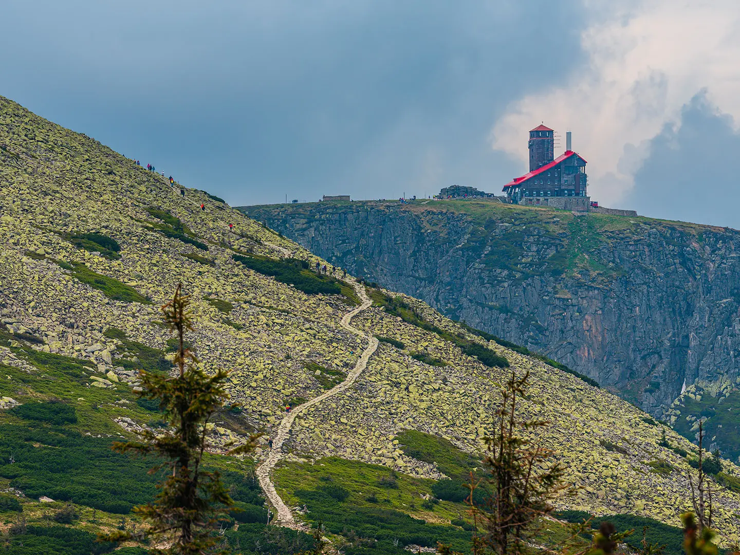
The Karkonosze Ridge Trail is a 36 km, 2-day hard point-to-point traverse of the Giant Mountains on the Polish-Czech border in Lower Silesia, Poland. It suits fit hikers who want a compact hut-to-hut mountain route: high ridge walking, around 1,500 m of ascent, exposed weather, rocky and boggy ground, and big views from Szrenica to Śnieżka. It is not technical, but the open ridge above the treeline makes it more serious than its modest altitude suggests.
Route Overview
Most hikers walk west to east from Szklarska Poręba to Karpacz, following the red-blazed Main Sudetes Trail and, on the central border ridge, the Polish-Czech Friendship Trail. The line climbs via Szrenica, passes Śnieżne Kotły, Schronisko pod Łabskim Szczytem and Przełęcz Karkonoska with Schronisko Odrodzenie, then crosses the lake-and-hut area around Wielki Staw, Mały Staw, Samotnia and Strzecha Akademicka. The final section reaches Równia pod Śnieżką, Dom Śląski and Śnieżka before descending to Karpacz. Both trailheads have bus and rail links, and chairlifts at Szklarska Poręba-Szrenica and Karpacz-Kopa can shorten steep approaches. For a higher, steeper Polish mountain objective, compare the Kościelec Trail.
History of the Karkonosze Ridge
The Karkonosze were used from the Middle Ages by treasure-seekers, miners, glassmakers, charcoal-burners and shepherds, whose wooden shelters later became the forerunners of today’s schroniska. By around 1800 these huts were attracting early hikers, and many had become mountain hostels by the late 19th century. The ridge is tied to the folklore of Krakonoš, Rübezahl or Liczyrzepa, the mountain spirit, and is now protected by national parks on both sides of the border.
Notable highlights
- Śnieżka summit (1,603 m): The high point of the traverse and the highest peak of the Sudetes, shared by Poland and the Czech Republic. The summit has the disc-shaped Polish meteorological observatory, St Lawrence’s Chapel and broad views in clear weather.
- Szrenica (1,362 m): The western gateway summit above Szklarska Poręba, reached early on the route and served by a chairlift. Its PTTK hut is a natural first stop before the exposed ridge walking begins.
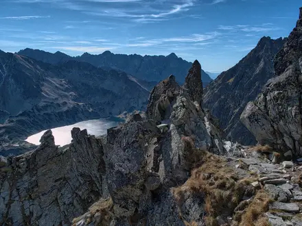
- Śnieżne Kotły: A pair of post-glacial cirques on the western ridge, with steep rock walls and small lakes below. They are among the most striking viewpoints on the traverse.
- Wielki Staw and Mały Staw: Two glacial tarns below the central ridge. Mały Staw sits beside Samotnia, a historic hut and one of the best-known sights in the Karkonosze.
- Polish-Czech Friendship Trail: Much of the central route follows this border watershed path, giving views into both Poland and the Czech Republic. It is the defining ridge section of the walk.
- Ridge schroniska: Staffed mountain huts such as Odrodzenie, Samotnia, Strzecha Akademicka and Dom Śląski provide food and beds along or just below the route.
Challenges to expect
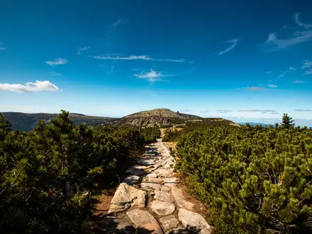
Expect a long, exposed high ridge with fast-changing weather, strong wind potential and little shelter above the treeline. The surface mixes stone slabs, rock, gravel, dirt and boardwalk, with mud or snow possible in shoulder seasons. Navigation is generally straightforward on red waymarks and signed junctions, but winter conditions are serious: snow, ice, avalanche risk in cirques and seasonal trail closures. If you prefer a shorter Polish peak day, see the Giewont Summit Trail or the Five Lakes Valley Trail.
HikeList Score
Karkonosze Ridge Trail scored 81/100 on HikeList's trail-quality metrics.
See score breakdownHide breakdown
- Ideal length 63
- Balanced challenge 84
- Scenery & wildness 85
- Varied terrain 89
- Accommodation 83
- Food & support 88
- Path quality 84
- Season flexibility 76
Computed from length, challenge, scenery & wildness, terrain variety, accommodation, food & support, path quality and season flexibility.
 Poland
Show more data Show less
- Mountain
- Ridge
- Alpine Tundra
- Rock
- Dirt
- Gravel
- Paved
- Mountain Huts
- Hotels
- Guesthouses
- Family Friendly
- Pet Friendly
- Restrooms
- Water Sources
- Campsites
- Shelters
Photos from hikers
Taken on the trail by people who've reviewed Karkonosze Ridge Trail.
The first day of the Karkonosze Ridge Trail starts in Szklarska Poręba and ascends steadily to the main ridge, passing through forested lower slopes and then opening up to panoramic mountain views. Early on, you’ll reach Szrenica Peak, with its hut and observation point, before traversing the scenic western ridge. The route then winds past the dramatic granite formations of Śląskie Kamienie and Czeskie Kamienie, and continues along the exposed ridge toward Schronisko Odrodzenie. Expect a mix of rocky and dirt paths, with several ascents and descents, and exposure to wind in open sections.
The second day leads from Schronisko Odrodzenie across the high central ridge, passing above the beautiful glacial lakes of Wielki Staw and Mały Staw. Key highlights include stops at Strzecha Akademicka and Samotnia Huts, where you can rest beside the picturesque lakes. The route then rises steeply towards the summit of Śnieżka, the highest point on the trail, followed by a gradual descent via Dom Śląski hut and the scenic ridge path toward Karpacz. The footing ranges from rocky alpine paths to well-trodden gravel trails, with significant elevation change and potentially variable weather underlining the challenge of this final section.
Reviews
How would you rate Karkonosze Ridge Trail?
Tap a star to start your review — you could be the first.