Hohe Tauern Panorama Trail
How would you rate Hohe Tauern Panorama Trail?
Tap a star to share your experience and help other hikers.
Hohe Tauern Panorama Trail: 270 km Across Salzburger Land
HikeList Score
Hohe Tauern Panorama Trail scored 83/100 on HikeList's trail-quality metrics.
See score breakdownHide breakdown
- Ideal length 81
- Balanced challenge 80
- Scenery & wildness 98
- Varied terrain 71
- Accommodation 66
- Food & support 88
- Path quality 98
- Season flexibility 76
Computed from length, challenge, scenery & wildness, terrain variety, accommodation, food & support, path quality and season flexibility.
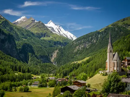
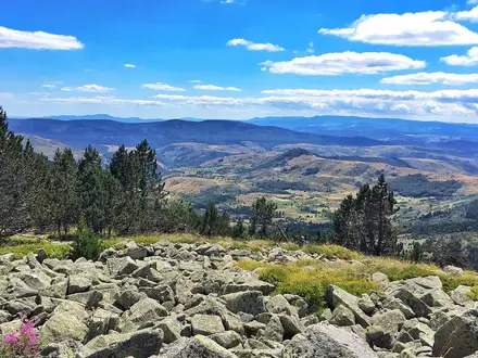
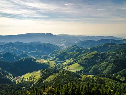
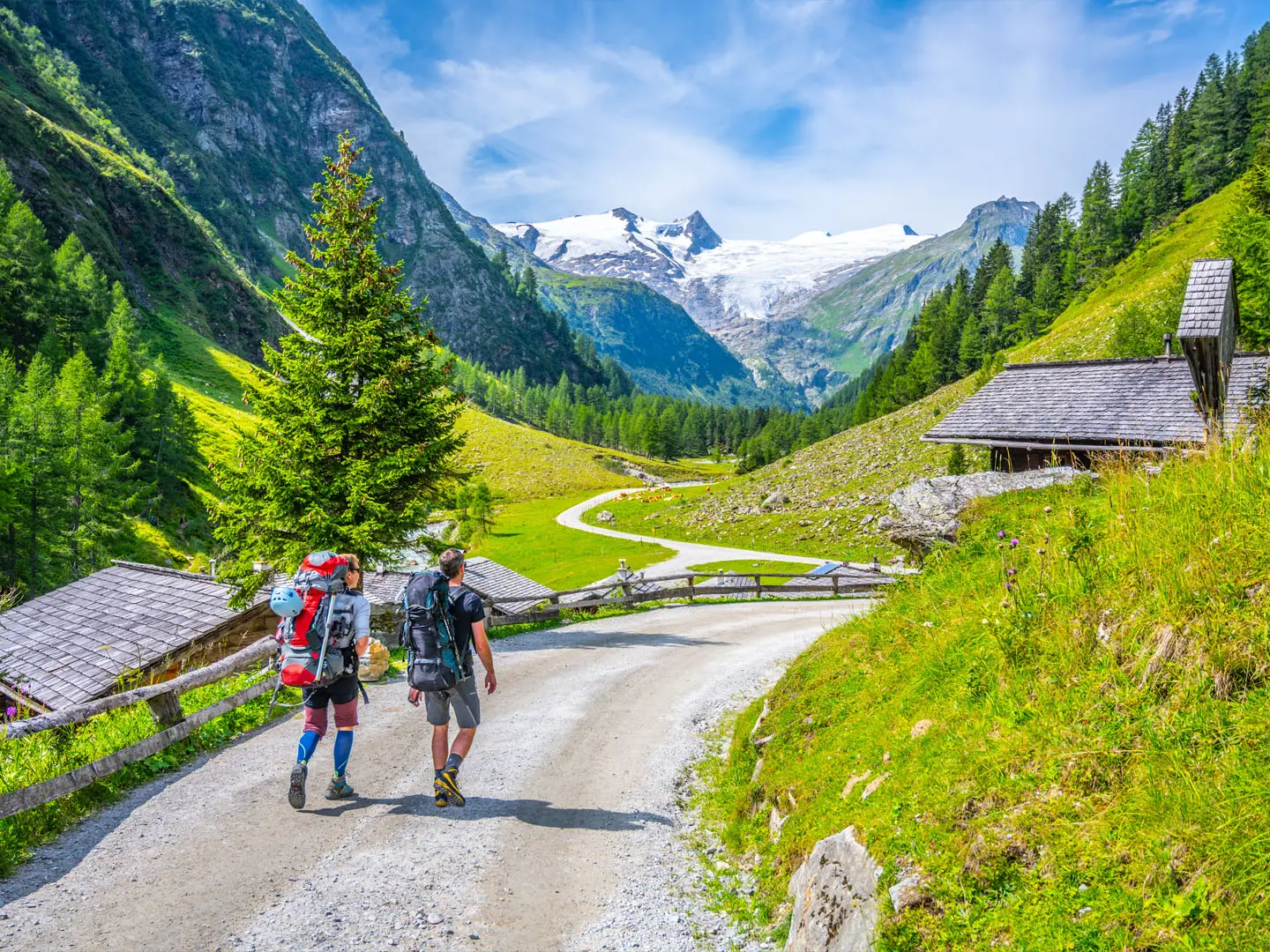
The Hohe Tauern Panorama Trail is a 270 km, 17-day waymarked thru-hike in Austria, crossing the Hohe Tauern National Park holiday region of Salzburger Land. It runs along the sunny northern side of the Hohe Tauern, with glacier-clad 3,000 m peaks across the Salzach valley. Rated hard for the full traverse, it suits fit hikers with sure-footedness, sturdy boots and some alpine experience who want an inn-to-inn and hut-to-hut Alpine route without carrying camping gear.
Route Overview
This point-to-point trail starts at the foot of the Krimml Waterfalls in western Salzburger Land and finishes in Hüttschlag in the Großarl valley. The route heads east along the lower Kitzbühel Alps and through the Gasteinertal, passing or linking key places including Krimml, Neukirchen am Großvenediger, Bramberg am Wildkogel, Mittersill, Zell am See, the Schmittenhöhe, Bruck an der Großglocknerstraße, Rauris and Bad Gastein. Mountain railways, hiking shuttles, luggage transfer and a central booking service make logistics easier. For a shorter nearby option, compare the Gastein Valley Trail; for a bigger Austrian crossing, see the Alpe-Adria Trail.
How the Hohe Tauern Panorama Trail Developed
The trail was developed by Trail Angels after being commissioned by the Hohe Tauern National Park holiday region in spring 2020. The original aim was to link the Krimml Waterfalls over the Kitzbühel Alps ridge to Lake Zell, with the route becoming bookable in February 2021 despite the COVID-19 pandemic. After strong early interest, it was extended beyond the Schmittenhöhe to the mountaineering village of Hüttschlag, creating today’s 17-stage route.
Notable highlights
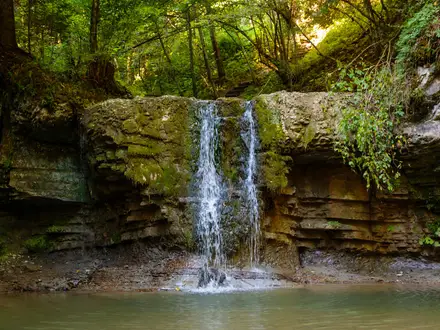
- Krimml Waterfalls (trail start): The hike begins at the foot of the Krimml Waterfalls, where the Krimmler Ache drops 380 m in three tiers. It is a dramatic start before the route climbs into the wider Hohe Tauern landscape.
- Schmittenhöhe above Zell am See: This panoramic peak above Lake Zell was the original finish of the shorter trail. It remains a major high-level viewpoint, reached by trail or cable car.
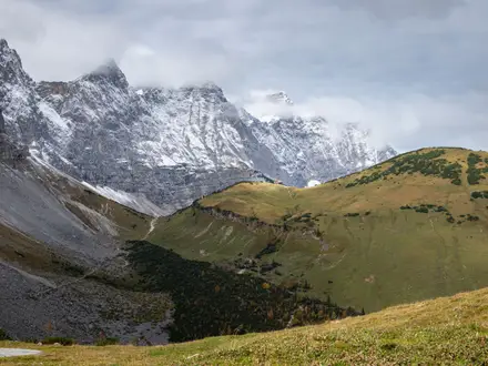
- Hohe Tauern National Park views: Much of the route faces the largest national park in the Alps, with views towards glaciated summits including the Großvenediger and Großglockner.
- Gamskarkogel (2,467 m): An optional detour on the final stage above Bad Gastein, this grass-covered summit is crowned by the historic Bad Gasteiner Hütte.
- Großarl and Hüttschlag: The trail finishes in the Großarltal, known for its alpine meadows. Hüttschlag is a designated Austrian mountaineering village, giving the route a fitting mountain finish.
Challenges to expect
Expect a sustained Alpine walk rather than a technical climb. The full route has about 13,800 m of ascent, with many stages gaining roughly 700–870 m. Paths are mostly mountain footpaths, alpine pasture tracks, forest trails and valley paths, but higher stages can be exposed and require sure-footedness. Snow may linger into early summer. If you want another demanding Austrian mountain route, compare the Eagle Walk (Adlerweg) or the Carnic High Trail.
HikeList Score
Hohe Tauern Panorama Trail scored 83/100 on HikeList's trail-quality metrics.
See score breakdownHide breakdown
- Ideal length 81
- Balanced challenge 80
- Scenery & wildness 98
- Varied terrain 71
- Accommodation 66
- Food & support 88
- Path quality 98
- Season flexibility 76
Computed from length, challenge, scenery & wildness, terrain variety, accommodation, food & support, path quality and season flexibility.
Show more data Show less
- Mountainous
- Forest
- Dirt
- Gravel
- Rocky
- Hotels
- Huts
- Family Friendly
- Pet Friendly
- Restrooms
- Water Sources
- Campsites
- Shelters
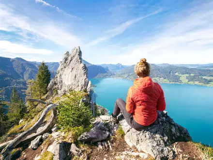
Photos from hikers
Taken on the trail by people who've reviewed Hohe Tauern Panorama Trail.
The trail starts at the base of the Krimml Waterfalls, Austria’s highest, and follows the cascading river valley through forested trails and alpine meadows. Passing scenic viewpoints, the route descends gradually toward the Pinzgau area, offering impressive vistas of the Hohe Tauern mountains before arriving in the welcoming town of Neukirchen am Großvenediger.
Climbing from Neukirchen, the trail ascends through mixed woodland and open pastures toward the Wildkogel area. Panoramic ridgeline sections provide vast alpine views, while the descent leads through flower-dotted meadows to reach the alpine village of Bramberg am Wildkogel.
Leaving Bramberg, the path moves along the valley base parallel to the Salzach River. Expect easy riverside walking punctuated by lush forests and rural farmlands before a gradual climb to Hollersbach, a serene gateway to Hohe Tauern National Park.
The trail continues via quiet woodland tracks and alpine slopes toward Mittersill. This day highlights gentle ridges and views into neighboring valleys, finishing in the bustling alpine town of Mittersill with its cultural sites and amenities.
Today’s path includes mixed terrain, with forest trails opening to rolling meadows as you follow the base of the Hohe Tauern mountain range. Views of glaciers and high summits characterize the approach to Uttendorf, a quiet alpine settlement set beneath towering peaks.
The route leads through scenic forest paths and gentle ascents, then descends toward the blue waters of Lake Zell. Expansive lake and mountain views accompany you as you approach the lively resort town of Zell am See, known for its alpine atmosphere and amenities.
Departing Zell am See, the trail follows riverside tracks and gentle country roads. Passing through open meadows and small villages, the day culminates in Niedernsill, offering a more relaxed stage and opportunities to explore rural Austrian culture.
Rolling farmland and dense woodlands set the scene as you travel toward the village of Taxenbach. Expect sections of rocky paths and moderate climbs, with glimpses of the higher Tauern summits as you traverse into more remote landscapes.
This stage takes you deeper into the Rauris Valley, passing historic villages and alpine pastures. Enjoy sightings of golden eagles or marmots, and discover remnants of the region’s mining history before arriving in the traditional mountain town of Rauris.
The final section features a challenging ascent along high-gradient switchbacks through wild and rugged alpine scenery. Crossing scenic passes and remote valleys, you descend toward Hüttschlag, where the tranquil mountain setting provides a fitting conclusion to the panoramic journey.
Reviews
How would you rate Hohe Tauern Panorama Trail?
Tap a star to start your review — you could be the first.