Hiidenkierros Loop
How would you rate Hiidenkierros Loop?
Tap a star to share your experience and help other hikers.
Hiidenkierros Loop: Hiidenportti’s Gorge Day Hike
HikeList Score
Hiidenkierros Loop scored 80/100 on HikeList's trail-quality metrics.
See score breakdownHide breakdown
- Ideal length 55
- Balanced challenge 100
- Scenery & wildness 78
- Varied terrain 100
- Accommodation 76
- Food & support 66
- Path quality 98
- Season flexibility 89
Computed from length, challenge, scenery & wildness, terrain variety, accommodation, food & support, path quality and season flexibility.
The Hiidenkierros Loop is a 5 km waymarked circular day-walk in Hiidenportti National Park, Kainuu, eastern Finland, near Vuokatti. Starting at Palolampi, it suits hikers wanting a half-day route: allow about 1.5–2.5 hours. Difficulty is moderate, with uneven forest path, rocky outcrops, stairs and rope handrails around the gorge, though the park describes it as suitable for beginners and family groups. For more Finnish routes, start with the Finland hiking guide or compare Oulanka National Park Trail.
Route Overview
The loop starts and finishes at the Palolampi guidance point, GPS address Hiidenportintie 86, Sotkamo. Follow the violet/purple paint blazes and guide signs from Palolampi through forest and mire terrain. The route reaches Hiidenportti gorge after about 1.3–1.5 km, crosses it via wooden stairs, then continues to the Porttilampi lean-to before looping back. A shorter 3 km option skips the Porttilampi detour. Palolampi has a campfire site, cooking shelter, well and rental cottage; Porttilampi is the main snack stop. If comparing other Finnish national-park walks, see the Hetta-Pallas Trail and Leivonmäki National Park Trail.
Hiisi, Old Bedrock and Kainuu Backwoods Heritage
Hiidenportti means “Hiisi’s Gate”. In Finnish mythology, Hiisi is a forest demon, later linked with the Devil; local legend says a Hiisi on nearby Vuokatti hurled boulders at Sotkamo church when its bells rang. The dark ponds below the gorge are said to be Hiisi’s eyes. The gorge is also a geological fracture in bedrock around 1,900 million years old. Human history remains in traces of tar-burning, slash-and-burn agriculture and logging, with Kovasinvaara croft preserving that backwoods heritage.
Notable highlights
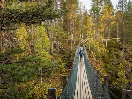
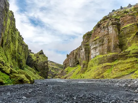
Hiidenportti gorge (about 1 km long): The park’s signature feature is a fracture valley in ancient bedrock, with sheer rock walls dropping up to 20 m and dark ponds below. The route crosses the gorge area by wooden stairs.
Porttilampi lean-to (laavu): An open-fronted shelter and campfire site roughly midway round the full loop. It is the natural rest stop; the 3 km short option misses this detour.
Kovasinvaara heritage croft: A deserted wilderness farmstead in a traditional managed meadow landscape. Information boards explain slash-and-burn cultivation and life in the Kainuu backwoods.
Palolampi: The trailhead pond and service point has a cooking shelter, well and campfire ring. It is the practical start and finish for the loop.
Old-growth forest and mires: The route passes pine and spruce forest and wet mire sections on duckboards. The park is known for taiga and old-forest birds such as red-flanked bluetail and red-breasted flycatcher.
Challenges to expect
Expect moderate, uneven ground rather than a technical hike. The forest path has rocky outcrops, wet mire sections on duckboards, steep rocky sections near the gorge, wooden stairs and rope handrails; some stairs are noted as being in poor condition in places. It is not suitable for prams. Early summer can bring heavy insects, while winter walking needs skis or snowshoes because of deep snow.
HikeList Score
Hiidenkierros Loop scored 80/100 on HikeList's trail-quality metrics.
See score breakdownHide breakdown
- Ideal length 55
- Balanced challenge 100
- Scenery & wildness 78
- Varied terrain 100
- Accommodation 76
- Food & support 66
- Path quality 98
- Season flexibility 89
Computed from length, challenge, scenery & wildness, terrain variety, accommodation, food & support, path quality and season flexibility.
 Finland
Show more data Show less
- Forest
- Mires
- Gorge
- Rocky Outcrops
- Natural Forest Path
- Rocky
- Wooden Stairs
- Duckboards
- Lean Tos
- Campfire Sites
- Designated Camping
- Rental Cottage
- Rental Hut
- Family Friendly
- Pet Friendly
- Restrooms
- Campsites
- Shelters
- Picnic Areas
Photos from hikers
Taken on the trail by people who've reviewed Hiidenkierros Loop.
Reviews
How would you rate Hiidenkierros Loop?
Tap a star to start your review — you could be the first.