Green Velo Trail
How would you rate Green Velo Trail?
Tap a star to share your experience and help other hikers.
Green Velo Trail: Poland’s Long-Distance Cycling Route
HikeList Score
Green Velo Trail scored 84/100 on HikeList's trail-quality metrics.
See score breakdownHide breakdown
- Ideal length 80
- Balanced challenge 90
- Scenery & wildness 66
- Varied terrain 100
- Accommodation 92
- Food & support 88
- Path quality 84
- Season flexibility 89
Computed from length, challenge, scenery & wildness, terrain variety, accommodation, food & support, path quality and season flexibility.
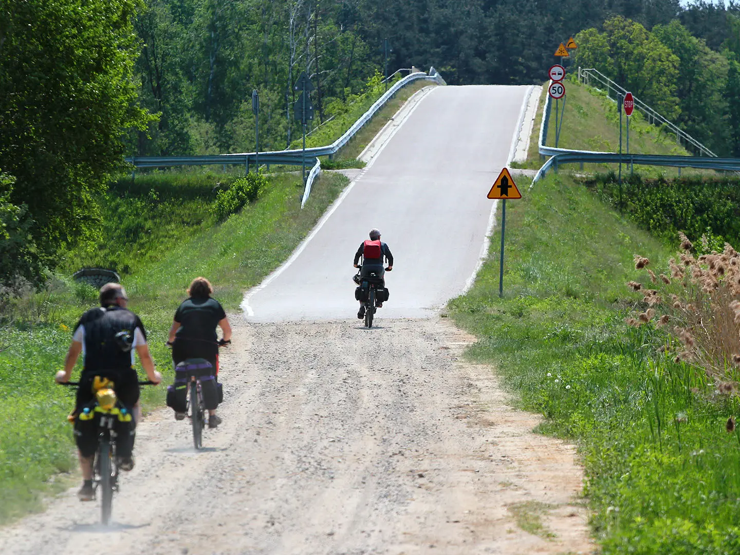
The Green Velo Trail is not a hiking trail: it is Poland’s longest consistently waymarked cycle route, running about 1,885 km across eastern Poland from Elbląg to Końskie. Most riders take around 2–3 weeks end to end, though it is often ridden in shorter regional sections. Difficulty is moderate overall: the terrain is mostly flat or gently rolling, with hillier riding in Roztocze, Podkarpackie and Świętokrzyskie. It suits self-supported touring and bikepacking riders on gravel or touring bikes.
Route Overview
Green Velo is a north-to-south, point-to-point bike-touring route starting in Elbląg near the Vistula Lagoon and finishing at Końskie in Świętokrzyskie. It crosses five eastern voivodeships: Warmian-Masurian, Podlaskie, Lubelskie/Lublin, Podkarpackie/Subcarpathian and Świętokrzyskie. Key places include Frombork, Lidzbark Warmiński, the Masurian and Suwałki lake districts, Augustów, Tykocin, Białowieża, the Bug River borderlands, Zamość, Roztocze, the Sandomierz area and Sielpia. The route is fully signed with Green Velo waymarks and has frequent MOR Cyclist Service Areas. Walkers planning side trips may want the Białowieża Forest Trails or Kampinos National Park Trail instead.
How the Green Velo Trail Was Created
Green Velo was built between 2013 and 2015 under the EU-backed “Cycle Routes in Eastern Poland” programme. It was co-financed by the European Regional Development Fund and the five eastern voivodeships, with the aim of linking less-visited eastern regions into one coherent long-distance cycling corridor. The result is a signed touring route through lake districts, forests, marshes, river valleys, historic towns and borderland landscapes, rather than a mountain or wilderness hiking trail.
Notable highlights
- Białowieża Forest: A UNESCO World Heritage site and one of Europe’s last major remnants of primeval lowland forest, straddling the Belarus border. It is also linked to Europe’s largest free-roaming herd of European bison; walkers can compare dedicated options on the Białowieża Forest Trails.
- Zamość: A preserved Renaissance “ideal city” founded by Jan Zamoyski and planned by Italian architect Bernardo Morando. It is one of the major cultural stops on the Lublin/Roztocze part of the route.
- Biebrza and Narew marshes: Large wetland national parks known for birdwatching, especially wading and migratory birds. Expect flat, open landscapes rather than demanding climbs.
- Suwałki and Masurian lake districts: The northern part of Green Velo passes through glacial lakeland, the Augustów Primeval Forest and the historic Augustów Canal.
- Bug River borderlands: A culturally layered frontier area with Orthodox and Catholic shrines, including Kodeń, and towns such as Chełm and Włodawa.
- MOR rest stops: Around 228–230 purpose-built Cyclist Service Areas are spaced roughly every 8–10 km, with shelters, benches, bike racks, bins and information boards.
Challenges to expect
The main challenge is distance, not altitude. The full main route is about 1,885 km with roughly 11,000–11,400 m cumulative ascent, mostly spread over lowland and rolling terrain. Expect easy-going asphalt much of the time, plus gravel and bumpy forest tracks. The south is hillier, especially Roztocze, Podkarpackie and Świętokrzyskie. Ride April/May to October; it is not a winter route.
HikeList Score
Green Velo Trail scored 84/100 on HikeList's trail-quality metrics.
See score breakdownHide breakdown
- Ideal length 80
- Balanced challenge 90
- Scenery & wildness 66
- Varied terrain 100
- Accommodation 92
- Food & support 88
- Path quality 84
- Season flexibility 89
Computed from length, challenge, scenery & wildness, terrain variety, accommodation, food & support, path quality and season flexibility.
 Poland
Show more data Show less
- Forest
- Marsh
- Lake District
- River Valleys
- Rolling Hills
- Paved
- Gravel
- Forest Tracks
- Cycle Paths
- Guesthouses
- Agritourism Farms
- Hotels
- Campsites
- Family Friendly
- Pet Friendly
- Restrooms
- Water Sources
- Campsites
- Shelters
- Picnic Areas
Photos from hikers
Taken on the trail by people who've reviewed Green Velo Trail.
Start your journey in the historic city of Elbląg, heading north through lowland farmlands and passing through quaint villages. The route is mostly paved with a few forest sections, bringing you to the town of Braniewo, close to the Baltic coast.
Travel west along the Vistula Lagoon, enjoying coastal views before reaching the medieval town of Frombork, known for its impressive cathedral and ties to Copernicus. Expect mostly flat terrain.
Head southeast through agricultural countryside and hamlets, then traverse forested areas before approaching the Gothic architecture of Orneta.
Continue through rolling hills and picturesque rural landscapes, entering the historic town of Lidzbark Warmiński with its 14th-century castle and charming old town.
Enjoy gentle undulating paths through forests and fields, crossing streams and passing traditional Warmian villages before finishing in Bartoszyce.
Journey southeast towards the Masurian Lake District, encountering more forested terrain and rural settlements before arriving in Kętrzyn, renowned for its historic churches and nearby Wolf's Lair.
Follow trails weaving through lakes and woodlands in the heart of the Masuria region, arriving at Giżycko on the banks of Lake Niegocin, a hub for water activities and relaxation.
Set out southwards, meandering between numerous lakes and forests, with some picturesque open farmland. End the day in the lively town of Ełk.
Travel east towards the gateway of Podlaskie, crossing rivers and passing forest reserves. Augustów is a resort town surrounded by lakes and connected by historic canals.
Head north through the Augustów Forest nature area, with trails flanked by pine and birch, reaching Suwałki, a cultural center with access to Suwałki Landscape Park.
Travel scenic trails into Wigry National Park, a haven for wildlife and pristine lakes. Explore wooden bridges and boardwalks amidst wetlands.
Exit the wetlands and stretch out westwards over flat, open countryside. Continue towards Białystok, capital of Podlaskie, a city of diverse heritage and architectural gems.
Head south from Białystok, entering deeply forested regions. The route leads through rural villages and approaches the ancient Białowieża Forest.
Enjoy a brief but spectacular walk into Białowieża, traversing UNESCO-protected woodland, mixed forests, and open clearings renowned for their biodiversity.
Venture west, leaving the forest behind and crossing scenic agricultural lands and gentle hills, concluding the day in the town of Siemiatycze on the Bug River.
Cross the Bug River and meander through rolling rural terrain, interspersed with forests and wetlands, heading south to Radzyń Podlaski.
Journey southwest across a varied landscape of farmland, small woods, and rivers, ending in Lublin, a vibrant city with a fascinating old town.
Head southeast, skirting forest edges and passing through traditional villages. The day concludes in Zamość, a UNESCO-listed Renaissance city renowned for its unique square and fortifications.
Continue west over undulating hills and through forest corridors, passing the Vistula River’s scenic banks before ascending into the medieval town of Sandomierz.
Traverse meadows, river valleys, and patches of forest as you approach the foothills of the Świętokrzyskie Mountains, ending the day in the regional hub of Kielce.
The final stretch leads north through hilly terrain and thick forests, concluding the adventure in Końskie, marking the southern end of the Green Velo Trail.
Reviews
How would you rate Green Velo Trail?
Tap a star to start your review — you could be the first.