GR223 (Cami de Cavalls)
How would you rate GR223 (Cami de Cavalls)?
Tap a star to share your experience and help other hikers.
GR223 (Camí de Cavalls): Menorca Coastal Loop Guide
HikeList Score
GR223 (Cami de Cavalls) scored 88/100 on HikeList's trail-quality metrics.
See score breakdownHide breakdown
- Ideal length 97
- Balanced challenge 100
- Scenery & wildness 74
- Varied terrain 100
- Accommodation 74
- Food & support 88
- Path quality 98
- Season flexibility 76
Computed from length, challenge, scenery & wildness, terrain variety, accommodation, food & support, path quality and season flexibility.
The GR223 (Camí de Cavalls) is a 185 km circular coastal trail around Menorca in the Balearic Islands, Spain. Most walkers take 7–10 days, with very fit hikers covering it in about 7 days. It is moderate overall: there is little altitude gain, but the rocky surface, exposed coast, limited shade and lack of water sources make planning essential. It suits hikers who want a Mediterranean thru-hike with beaches, cliffs, pine woodland and regular town or resort accommodation rather than huts.
Route Overview
The route conventionally starts and finishes in Maó (Mahón) and circumnavigates Menorca as a closed loop, not a point-to-point trail. It is officially divided into 20 numbered sections in the Camí de Cavalls 360 scheme, so it can be walked end to end or split into shorter day walks. Key places include Es Grau, S’Albufera des Grau natural park, Cap de Favàritx, Cap de Cavalleria, Fornells, Cala Pregonda, Cala del Pilar, the Ciutadella area, Cala Macarella, Cala Galdana, Son Bou, Cala en Porter and Punta Prima. For another Spanish coastal walk, compare the Camí de Ronda or the longer Camino del Norte.
History of the Camí de Cavalls
The Camí de Cavalls means “Way of the Horses” in Catalan. It was an ancient bridle path used to patrol Menorca’s coast on horseback and link watchtowers and fortifications. The route is documented from 1330, when King James (Jaume) II of Mallorca required Menorcan settlers to keep an armed horse to help guard the island. After long periods of disuse and closures by private landowners, it was restored as a continuous public right of way around 2010–2011 and designated GR223.
Notable highlights
- S’Albufera des Grau natural park: Menorca’s largest wetland and the core of the island’s UNESCO Biosphere Reserve. The trail reaches this lagoon, woodland and dune landscape near Es Grau, with good birdlife potential.
- Cap de Favàritx lighthouse: A stark lighthouse set above dark slate cliffs. It is one of the most distinctive northern-coast landscapes on the loop.
- Cap de Cavalleria: The northernmost point of Menorca, with a lighthouse and exposed headland views over the Mediterranean and the island’s north coast.
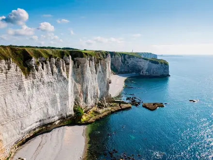
- Cala Macarella and Macarelleta: Two well-known south-coast coves with turquoise water, white limestone cliffs and Aleppo pines. They are among the most memorable swimming stops on the GR223.
- Cala Galdana and Cala Mitjana: Popular beaches set in pine-clad ravines on the south coast. They give a useful contrast to the rougher northern sections.
- Son Bou: Menorca’s longest beach, with roughly 2.4 km of sand on the south coast.
Challenges to expect
Do not underestimate the GR223 because its highest point is only about 135 m. The full loop is long, frequently rocky and technical underfoot, with exposed clifftop sections, ravines, dune crossings and beaches. Shade is limited, especially in summer, and there are no water sources on the trail, so carry enough between towns and resorts. There are no huts or refuges; if you want hut-based mountains in Spain, see Carros de Foc.
HikeList Score
GR223 (Cami de Cavalls) scored 88/100 on HikeList's trail-quality metrics.
See score breakdownHide breakdown
- Ideal length 97
- Balanced challenge 100
- Scenery & wildness 74
- Varied terrain 100
- Accommodation 74
- Food & support 88
- Path quality 98
- Season flexibility 76
Computed from length, challenge, scenery & wildness, terrain variety, accommodation, food & support, path quality and season flexibility.
 Spain
SpainShow more data Show less
- Coastal
- Forest
- Ravines
- Dunes
- Beaches
- Rocky
- Sand
- Limestone
- Sandstone
- Hotels
- Apartments
- Family Friendly
- Pet Friendly
- Restrooms
- Water Sources
- Campsites
- Picnic Areas
Download Our Full Guide to GR223 (Cami de Cavalls) FREE!
Get our comprehensive guide to this hike for free. Save it for later reading or print out at home.
In these collections
Photos from hikers
Taken on the trail by people who've reviewed GR223 (Cami de Cavalls).
GR223 (Cami de Cavalls): The Complete Guide
 i
Image by Migue Photos
i
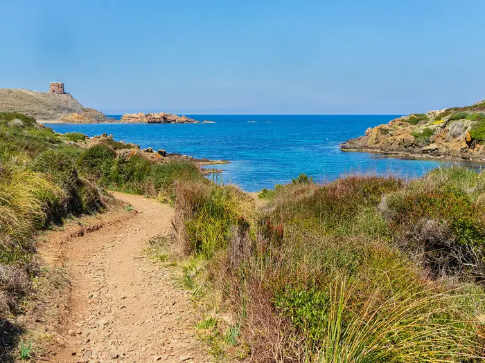
Image by Migue Photos The GR223 Camí de Cavalls is Menorca’s complete coastal circuit: 185 km of waymarked path linking Maó (Mahón), Ciutadella, fishing villages, resort bays, wild headlands and quiet coves. It suits walkers who want a Mediterranean long-distance trail with sea views almost every day, but without the simplicity of a hut-to-hut route.
The north coast, the Tramuntana, gives the walk its wilder edge: dark rock, exposed cliffs, red-sand bays such as Cala Pregonda, and stark lighthouse country around Cap de Favàritx and Punta Nati. The south coast, the Migjorn, softens into pine-backed ravines, white-sand coves, longer beaches and more frequent resort bases.
This is not a mountain trek — the high point is only around 135 m — but it is still a proper multi-day hike. Rough limestone and slate, beach and dune crossings, heat, limited shade and long dry sections make the daily effort more demanding than the map profile suggests.
Planning matters on the Camí de Cavalls because there are no huts or refuges, wild camping is illegal, and there are no water points or shops between towns. Accommodation clusters in places such as Maó, Es Grau, Ciutadella, Cala Galdana, Son Bou and Punta Prima, while some northern stage ends need taxis, buses or operator support.
This guide covers stages, walking days, accommodation, food and water, transport, terrain and the common mistakes to avoid.
Stage-by-Stage Guide
The stages below group the GR223’s 20 short official sections into a practical 9-day circuit. Distances are approximate and daily planning should be built around accommodation and transport availability, not just kilometres: there are no huts, wild camping is illegal, and there are no water points or shops on the trail between towns.
Stage 1: Maó (Mahón) to Es Grau — 10 km
The opening stage leaves Maó (Mahón) eastwards and makes a relatively short first day to Es Grau. It is a useful warm-up before the wilder Tramuntana coast begins in earnest, with the route moving from the island capital towards the low coastal landscapes around S’Albufera des Grau.
Underfoot, expect coastal paths, tracks and typical Menorcan stony ground rather than sustained climbing. The route is low-lying, but the sun exposure can still be significant, especially outside the shaded patches.
The key feature is the approach to S’Albufera des Grau Natural Park, Menorca’s largest wetland and a core area of the UNESCO Biosphere Reserve. The mix of lagoon, dunes, woodland and coastal terrain makes this one of the more varied short stages on the circuit.
Food and water should be taken from Maó (Mahón), as the GR223 has no reliable on-trail supplies between settlements. Es Grau has village services, but opening hours can be seasonal, so do not rely on arriving late without food.
Accommodation is available in Maó (Mahón) and can also be arranged in or around Es Grau, but capacity is much smaller than in the island capital. Book ahead if using Es Grau as the first overnight stop.
Maó (Mahón) is the main transport hub for the loop, with the airport nearby and ferry access to the harbour. Es Grau has road access and may have bus links depending on season, but bus timetables are infrequent and seasonal; this should be checked before travelling.
Navigation is straightforward if the GR red-and-white markings are followed carefully out of the urban area and into the coast-and-wetland section. Carry a map or offline route file as a backup, particularly where paths and local tracks meet near settlements.
Stage 2: Es Grau to Arenal d'en Castell — 22 km
This is the first longer day on the north-east coast, combining the official sections from Es Grau to Cap de Favàritx and onwards to Arenal d'en Castell. It gives an early taste of the Tramuntana coast: open, rocky, exposed and much wilder than the resort-based south.
The terrain becomes rougher after Es Grau, with stony coastal path, low scrub and exposed headlands. There is little shade, and the walking can feel slower than the distance suggests because of the uneven surface.
Cap de Favàritx is the defining landmark of the day. The lighthouse sits above dark slate cliffs and a stark headland that looks and feels very different from the pine-backed coves later in the route.
There are no shops or water points on the trail between Es Grau and Arenal d'en Castell. Start with enough water for the full stage, plus food, particularly in warm weather when the combination of rock, wind and sun can be dehydrating.
Arenal d'en Castell is a more practical overnight halt than many of the isolated north-coast coves, with resort accommodation in season. Services can be seasonal, so accommodation and evening food should be booked or checked in advance.
Road access exists at the stage ends and around the Cap de Favàritx area, but public transport to coastal trailheads can be limited outside peak periods. Use current TMSA/e-bus timetables and do not assume a late bus will be available.
The GR waymarking is generally reliable, but the open headland terrain makes it important to stay with the marked line rather than following informal tracks towards the coast. In strong wind or poor visibility, the exposed clifftop and headland sections require extra care.
Stage 3: Arenal d'en Castell to Binimel·là — 20 km
This stage continues west along the Tramuntana coast, passing the Cala Tirant area and walking near Fornells before reaching Binimel·là. It is a practical but increasingly remote section, with the landscape becoming more rugged as the route approaches the central north coast.
The path mixes rocky coastal walking with rougher stony sections, low garrigue and stretches near beaches and coves. Although there is no major altitude, repeated small rises and uneven ground make progress tiring.
Cala Tirant and the area near Fornells are the main named places on or near this stage. The coast here is more open and wind-exposed than the sheltered south-coast barrancs, with long views along the northern shore.
Carry all food and water needed for the day. There are no reliable supplies between towns on the GR223, and services near beaches or resorts can be seasonal.
Arenal d'en Castell and the Fornells area are more realistic accommodation bases than Binimel·là for many walkers. Binimel·là itself is not a dependable overnight hub, so this stage often needs a pre-arranged taxi, transfer, or a carefully timed link from nearby accommodation.
Road access around the north coast is more limited than around the main towns. Bus connections to coastal trailheads are seasonal and infrequent; this should be checked before travelling, especially if planning to end the day at Binimel·là rather than return to a base.
Navigation is usually simple on the marked GR line, but do not underestimate the consequences of a missed turn on a coast with few settlements. An offline map is strongly recommended for linking the path with any transfer pick-up point.
Stage 4: Binimel·là to Cala Morell — 24 km
This is the hardest day in the 9-stage itinerary and includes the most demanding part of the whole GR223: the official Binimel·là to Els Alocs section. It is a long, wild north-coast stage with few escape options, rough ground and sustained exposure.
The terrain is rocky, technical and slow in places, with rugged coastal path, stony traverses, coves and exposed headlands. This is not difficult because of height gain — the route remains low — but because the surface is uneven, the shade is limited and the day is long.
Cala Pregonda is one of the major highlights, with reddish sand and offshore rock formations. Cap de Cavalleria, Menorca’s northernmost point and its 1857 lighthouse, is reached by a short spur off the main GR223 near this part of the route; allow extra time and water if adding it.
The stage also links the remote north-coast points of Els Alocs and Algaiarens before reaching Cala Morell. Cala Morell is known for its coves and the nearby prehistoric necropolis of rock-cut burial caves.
This stage must be treated as a full self-sufficient day. There are no water points or shops on the trail between settlements, and the remote north coast gives little margin for running short of water.
Accommodation at Binimel·là and some intermediate north-coast points is limited or absent, and Cala Morell has fewer options than Ciutadella. Many walkers arrange transfers to and from a larger base, or use a self-guided operator with baggage transfer and road pick-ups.
Public transport is the main logistical weakness of this stage. Buses to north-coast trailheads can be seasonal and sparse, and taxis or pre-booked transfers are often the more reliable solution; this should be checked before travelling.
Navigation is generally by GR markings, but the remoteness makes a paper map or offline GPS particularly important. Avoid starting late, especially in hot weather, and do not rely on finding shade, shops or help at intermediate coves.
Stage 5: Cala Morell to Ciutadella — 12 km
This is a shorter stage across the north-west corner of Menorca, useful after the rougher day from Binimel·là. It links Cala Morell with Punta Nati and then continues towards Ciutadella, the natural halfway base on the loop.
The walking remains exposed and rocky, with limestone coastal terrain and little shade. The stage is shorter, but the surface can still be hard on feet, particularly after several consecutive days on stony path.
Punta Nati is the main landmark, a bleak lighthouse headland between Cala Morell and Ciutadella. The approach to Ciutadella then brings a clear shift from remote coastal walking into one of Menorca’s main historic towns.
Carry water and food from Cala Morell or from wherever the day begins, as there are no on-trail supplies between settlements. Ciutadella has full town services, making it a sensible place to restock, do laundry and reset gear.
Accommodation is straightforward in Ciutadella compared with the north coast. It is also one of the best places on the route for a rest day or for joining/leaving the loop.
Ciutadella is a major island transport hub and has ferry links as well as bus connections towards inland towns and Maó (Mahón). Bus frequency and onward coastal services still vary by season, so current timetables should be checked before fixing a section-hike plan.
Navigation is not complex, but the transition into built-up areas can make waymarks easier to miss than on open coast. Follow the GR markings carefully into Ciutadella rather than improvising through roads and local paths.
Stage 6: Ciutadella to Cala en Turqueta — 26 km
This is one of the longest days in the 9-stage schedule, taking the GR223 from Ciutadella around the south-west coast via Cap d'Artrutx and onwards towards Cala en Turqueta. It marks the transition from the Tramuntana coast to the gentler Migjorn side of the island.
The walking includes coastal path, resort-fringe sections, sandy areas and limestone terrain. The south coast is generally greener and more sheltered than the north, but the day is long and still exposed in places.
Cap d'Artrutx is the main western landmark on this stage. Later, the route passes the south-coast beach area around Son Saura before reaching Cala en Turqueta, one of the best-known white-sand coves on the island.
Food and water planning is critical because the stage is long and there are no guaranteed supplies on the trail between settlements. Resort or beach services may exist seasonally, but should not be treated as part of the safety plan.
Cala en Turqueta is not a reliable accommodation hub. Many walkers adjust this stage by arranging a transfer, staying in Ciutadella, or continuing the itinerary through accommodation bases such as Cala Galdana where that better fits bookings.
Road access to beaches and resorts may help with transfers, but public transport to trailheads is seasonal and can be infrequent. Any plan to finish specifically at Cala en Turqueta should be backed by a confirmed pick-up or current bus timetable.
Navigation is usually easy on the GR, but there can be more paths, beach access routes and resort tracks on this side of the island. Stay with the red-and-white waymarks and use an offline map where the GR crosses or skirts developed areas.
Stage 7: Cala en Turqueta to Sant Tomàs — 18 km
This is the classic south-coast cove stage, linking Cala en Turqueta with Cala Macarella, Macarelleta, Cala Galdana, Cala Mitjana and onwards to Sant Tomàs. It is shorter than the previous day but can be slow because of beach crossings, rocky path and repeated dips into coves and barrancs.
The terrain is a softer contrast to the north: limestone cliffs, Aleppo pines, sandy coves and wooded ravines. Shade is better in places than on the Tramuntana coast, but exposed beach and clifftop sections still become hot.
Cala Macarella and Macarelleta are among the most photographed coves on the GR223, with white sand, turquoise water and pine-backed limestone. Cala Galdana and Cala Mitjana add more sheltered south-coast scenery before the route continues towards Sant Tomàs.
Carry enough water from the start, as the GR223 has no dependable on-trail water between towns. Cala Galdana is a major practical point on this stage, but services and opening hours can vary by season.
Accommodation is available at Cala Galdana and Sant Tomàs, making this part of the route easier to organise than the remote north. Sant Tomàs is a sensible overnight stop if the day is kept to the listed 18 km.
Road access and seasonal buses are more practical around the larger south-coast resorts than on the wild north, but they still require timetable checks. This should be checked before travelling if using Cala Galdana or Sant Tomàs as a section start or finish.
Navigation is generally clear, but take care not to follow informal beach paths or access tracks away from the GR. The repeated descents and climbs in and out of coves are modest in height but cumulative after several days’ walking.
Stage 8: Sant Tomàs to Binissafúller — 22 km
This stage continues east along the Migjorn coast, passing Son Bou and Cala en Porter before reaching Binissafúller. It is a varied south-coast day of beach, dune, ravine and resort-edge walking.
The terrain includes sandy stretches, limestone path, pine woodland and barranc landscapes. Sand and dunes can make progress slower than expected, especially in heat or wind, even though the route has no mountain climbing.
Son Bou is a major landmark as Menorca’s longest beach, with the remains of an early-Christian basilica nearby. Cala en Porter provides another named coastal settlement before the route continues east towards Binissafúller.
Food and water should be planned from Sant Tomàs, with no assumption of reliable supplies between settlements. Son Bou and Cala en Porter have services in season, but opening hours and availability change, so carry enough to complete the stage independently.
Accommodation is more concentrated in resort areas such as Son Bou and around the south coast than on the remote north. Binissafúller is smaller, so book ahead or plan a transfer if suitable accommodation is not available at the stage end.
Road access is generally better around the south-coast resorts, but public transport remains seasonal and infrequent outside the main hubs. Check TMSA/e-bus timetables before relying on a bus to or from Binissafúller, Son Bou or Cala en Porter.
Navigation can be slightly fiddly where the GR passes near beaches, resort paths and local access tracks. Keep checking the red-and-white GR markings and avoid being drawn along promenade or beach routes that are not the signed trail.
Stage 9: Binissafúller to Maó (Mahón) — 21 km
The final stage closes the loop, continuing from Binissafúller through Punta Prima and Cala de Sant Esteve before returning past the harbour mouth into Maó (Mahón). It is a substantial last day, but logistically easier than the remote northern stages because it ends in the island capital.
The walking remains coastal, with a mix of rocky path, low scrub, beach or cove sections and developed edges near settlements. Exposure to sun and wind is still a factor, so the final day should not be treated as a simple urban stroll.
Punta Prima is the main south-east coastal point on the way back towards Maó (Mahón). The approach via Cala de Sant Esteve and the harbour mouth gives a fitting finish to the closed circuit around one of the Mediterranean’s largest natural harbours.
Carry food and water from Binissafúller unless definite services are being used en route. Punta Prima has resort services in season, but the standard GR223 rule still applies: do not depend on finding water between towns.
Accommodation is plentiful by route standards once back in Maó (Mahón), and the city is the best place to end the walk, clean gear and connect with onward transport. Punta Prima can also work as a nearby overnight base if splitting the final approach.
Maó (Mahón) has the strongest transport options on the island, including access to the airport and ferry harbour. There is no train on Menorca; buses connect the main hubs and seasonal coastal routes fill some gaps, but timetables should still be checked before travelling.
Navigation into Maó (Mahón) requires attention where coastal path, roads and harbour approaches meet. Follow the GR waymarks rather than simply aiming for the city centre, as the official finish approaches from Cala de Sant Esteve past the harbour mouth.
Recommended Itinerary
The most practical thru-hike is a 9-day circuit from Maó (Mahón), following the GR223 eastwards through Es Grau and around the island. This keeps the daily distances mostly in the 18–24 km range, with one longer south-coast day and one demanding north-coast day.
Distances below use the grouped stage distances for this guide. For accommodation-led variations, especially where a day ends away from a major resort, check official mapping before booking.
Standard 9-day itinerary
| Day | From | To | Approx. distance | Why this stage makes sense | Services/accommodation notes |
|---|---|---|---|---|---|
| 1 | Maó (Mahón) | Es Grau | 10 km | A short opening day out of the island capital, giving time to arrive, buy supplies and start steadily. It also places you at the edge of S'Albufera des Grau for the wilder north-east coast. | Maó has the best start-point services. Es Grau is a small coastal village; book accommodation ahead and carry everything needed for the walk, as there are no on-trail water points between settlements. |
| 2 | Es Grau | Arenal d'en Castell | 22 km | A proper first full day, taking in the exposed north-east coast and the Cap de Favàritx area before reaching a more established resort base. | Arenal d'en Castell is a more practical overnight stop than the remote headlands. Bus access to coastal trailheads is seasonal and infrequent; this should be checked before travelling. |
| 3 | Arenal d'en Castell | Binimel·là | 20 km | This stage links the resort north coast with the wilder Tramuntana sections, passing the Cala Tirant/Fornells area before approaching Cala Pregonda country. | Accommodation and services are easier around Fornells/Arenal d'en Castell than at smaller coastal points. Binimel·là logistics can be thin, so arrange the overnight stay, taxi or operator transfer before committing to this stage end. |
| 4 | Binimel·là | Cala Morell | 24 km | The hardest day of the standard schedule: it includes the rugged north-coast terrain around the official Binimel·là → Els Alocs section, the most demanding part of the GR223. Start early and expect slow progress on rocky ground. | There is little or no accommodation around Els Alocs/Algaiarens, so most walkers need a pre-arranged plan rather than relying on finding services at the end of each official section. Carry a full day’s water and food. |
| 5 | Cala Morell | Ciutadella | 12 km | A shorter recovery day after the wild north, with Punta Nati and the approach into Ciutadella making it a natural halfway reset. | Ciutadella is one of the best bases on the loop, with the widest choice of accommodation and services after Maó. This is a good place for laundry, resupply and a rest afternoon. |
| 6 | Ciutadella | Cala en Turqueta | 26 km | A long but logical day leaving the west of the island and turning onto the south coast, combining the Cap d'Artrutx and Cala en Turqueta sections. | Cala en Turqueta is a cove rather than a major town base. Many itineraries need a transfer or carefully chosen accommodation nearby; this should be checked before travelling. |
| 7 | Cala en Turqueta | Sant Tomàs | 18 km | A classic south-coast day through the best-known coves, including the Cala Macarella/Macarelleta and Cala Galdana area, then on towards the more settled Migjorn coast. | Cala Galdana is the main service point on this stretch and can also be used to split the day. Sant Tomàs is a practical overnight base, but book ahead in busy periods. |
| 8 | Sant Tomàs | Binissafúller | 22 km | This stage continues along the gentler south coast via Son Bou and Cala en Porter, mixing beach, ravine and low coastal path. | Services are concentrated in resorts and villages, not on the path between them. Binissafúller is not as substantial a base as Maó or Ciutadella, so check accommodation and any onward transfer before booking. |
| 9 | Binissafúller | Maó (Mahón) | 21 km | The final day rounds the south-east coast via Punta Prima and Cala de Sant Esteve before returning past the harbour mouth into Maó. | Maó is the natural finish for onward airport, ferry and bus connections. There is no train on Menorca; use buses or taxis, checking current timetables before relying on public transport. |
Slower 10-day variant
This suits walkers who want to reduce the pressure on the toughest northern terrain. The most useful extra day is usually inserted around Binimel·là, Els Alocs and Algaiarens, but this only works if transfers are arranged because accommodation is very limited or absent at some northern section ends.
| Day | From | To | Approx. distance | Why this stage makes sense | Services/accommodation notes |
|---|---|---|---|---|---|
| 1 | Maó (Mahón) | Es Grau | 10 km | Easy start from the conventional trailhead. | Book Es Grau ahead; carry water from Maó. |
| 2 | Es Grau | Arenal d'en Castell | 22 km | Full north-east coastal day via the Cap de Favàritx area. | Arenal d'en Castell is a practical overnight base. |
| 3 | Arenal d'en Castell | Binimel·là | 20 km | Positions you before the roughest north-coast section. | Binimel·là logistics need advance planning. |
| 4 | Binimel·là | Els Alocs | Check official mapping before booking | Splits the most demanding official section out as its own day, avoiding a very long push through the roughest terrain. | Do not assume accommodation at Els Alocs. A taxi, base-stay or baggage-transfer operator may be needed. |
| 5 | Els Alocs | Cala Morell | Check official mapping before booking | Completes the wild north-west coast via the Algaiarens area with more time for slow rocky walking. | Arrange the start transfer back to Els Alocs if staying elsewhere overnight. Carry all food and water. |
| 6 | Cala Morell | Ciutadella | 12 km | Shorter day into the main western town. | Good resupply and accommodation choice in Ciutadella. |
| 7 | Ciutadella | Cala en Turqueta | 26 km | Long south-west transition day. | Plan the overnight or transfer from Cala en Turqueta carefully. |
| 8 | Cala en Turqueta | Sant Tomàs | 18 km | Allows time for the major south-coast coves and Cala Galdana area. | Cala Galdana can be used as an alternative split point if accommodation works better. |
| 9 | Sant Tomàs | Binissafúller | 22 km | Steady Migjorn coast stage via Son Bou and Cala en Porter. | Check the exact overnight base before committing to Binissafúller. |
| 10 | Binissafúller | Maó (Mahón) | 21 km | Final south-east stage back to Maó. | Maó is the best finish for onward transport. |
Faster 7-day variant
A 7-day circuit is realistic only for fit walkers who are comfortable with long days on rocky, exposed coastal path and who can start early in heat. It is a performance itinerary rather than the most relaxed way to experience the route.
| Day | From | To | Approx. distance | Why this stage makes sense | Services/accommodation notes |
|---|---|---|---|---|---|
| 1 | Maó (Mahón) | Arenal d'en Castell | 32 km | Combines the Maó → Es Grau and Es Grau → Arenal d'en Castell stages to make immediate progress along the north-east coast. | Long first day; arrive rested and start with full supplies. Accommodation is more practical at Arenal d'en Castell than on the intervening headlands. |
| 2 | Arenal d'en Castell | Binimel·là | 20 km | Keeps the second day moderate before the hardest northern terrain. | Arrange Binimel·là accommodation or transfer in advance. |
| 3 | Binimel·là | Ciutadella | 36 km | Combines the rugged Binimel·là → Cala Morell stage with the shorter approach into Ciutadella. This is the crux of the fast schedule. | Only suitable with an early start, excellent water planning and secure accommodation in Ciutadella. There are no trail services between towns. |
| 4 | Ciutadella | Cala en Turqueta | 26 km | Long west-to-south transition, keeping the fast itinerary on schedule. | Cala en Turqueta requires careful overnight or transfer planning. |
| 5 | Cala en Turqueta | Sant Tomàs | 18 km | Shorter day through the major south-coast coves after two demanding days. | Cala Galdana is the key service point on this section. |
| 6 | Sant Tomàs | Binissafúller | 22 km | Maintains steady progress across the south coast. | Check the exact overnight base and any local transport before booking. |
| 7 | Binissafúller | Maó (Mahón) | 21 km | Completes the loop back into Maó. | Finish in Maó for airport, ferry and island bus links. Current transport timetables should be checked before travelling. |
Planning the Route
The GR223 is straightforward to follow on paper but needs careful logistical planning. The route is a closed loop, so the walking line is flexible; the limiting factors are accommodation, water, food and transport rather than navigation or altitude.
Most walkers should allow 8–10 days unless they are fit, efficient and comfortable with long rocky coastal days. A 7-day circuit is realistic for strong hikers, but it leaves little margin for heat, slow terrain, beach stops or awkward transfers at remote northern trailheads.
Choosing how many days to walk
The official Camí de Cavalls 360 scheme divides the trail into 20 short sections, each designed as a manageable stage. Independent walkers usually combine these into longer days because many official section ends are not convenient overnight stops.
A slower itinerary is usually better than a faster one on this route. The low altitude can be misleading: rough limestone and slate, beach crossings, exposed headlands and repeated small ravine climbs make progress slower than the profile suggests.
| Time available | Best suited to | Planning implications |
|---|---|---|
| 7 days | Very fit hikers travelling light | Long days, early starts, little margin for heat or transport delays |
| 8–10 days | Most independent walkers | Better balance of distance, accommodation and recovery |
| 10+ days | Walkers wanting shorter days or beach/rest time | Easier pacing, but more accommodation bookings and transfers may be needed |
| Section hiking | Walkers based in towns or resorts | Practical, but bus and taxi links must be checked carefully |
Let accommodation shape the stages
There are no huts or refuges on the Camí de Cavalls, and wild camping is illegal in Menorca. Overnight planning therefore needs to be built around towns, resorts, hotels, apartments, guesthouses and the few campsites available around the island.
Maó (Mahón), Ciutadella, Es Grau, Arenal d'en Castell, Cala Galdana, Sant Tomàs, Son Bou, Binissafúller and Punta Prima are more practical bases than the remote section ends on the north coast. The hardest planning pinch is the Tramuntana side, especially around Binimel·là, Els Alocs and Algaiarens, where accommodation at or near the trail is limited or absent.
For this reason, many walkers use a town base for one or more northern stages and link the path by taxi, bus or a self-guided operator. This is often more realistic than trying to sleep exactly where each official section ends.
A practical stage-planning approach
Start by deciding whether the walk will be a full continuous circuit or a series of linked sections from accommodation bases. Then mark the places where sleeping, eating and transport are realistic before fixing daily distances.
The brief 20-section official structure is useful for understanding the route, but it should not be treated as a ready-made accommodation itinerary. The more practical multi-day approach is to combine sections into walking days between viable hubs, while keeping the rougher northern terrain shorter where possible.
The Binimel·là to Cala Morell part of the route deserves particular attention. It includes the wildest northern walking, passes near Cala Pregonda, Els Alocs and Algaiarens, and contains the most demanding official section, Binimel·là → Els Alocs. Plan this day conservatively, especially in warm weather.
Walking clockwise or anti-clockwise
Maó (Mahón) is the conventional start and finish, with the route leaving eastwards towards Es Grau and returning from Cala de Sant Esteve. Because the GR223 is a loop, it can equally be joined at Ciutadella or at a coastal resort if that fits accommodation or flights better.
Starting in Maó and walking the official order puts the wilder Tramuntana coast early in the trip and the gentler Migjorn coast later. Starting from Ciutadella can work well for section hikers or for anyone splitting the island into northern and southern halves, but transport links to the chosen trailheads should be checked before booking.
Shortening, extending and section hiking
The route is easy to shorten in concept because it is a loop with multiple road-accessible coastal settlements. In practice, shortening a day depends on whether there is a bus, taxi or accommodation option at the point where you want to stop.
Ciutadella is the natural halfway base, and Maó and Ciutadella are the main transport hubs. This makes partial circuits and section hikes realistic, especially if using buses for the more accessible resort sections and taxis for the remoter gaps.
Bus services on Menorca are seasonal and often infrequent, with beach routes varying by time of year. Do not assume that an official section end has a convenient same-day bus connection; current TMSA/e-bus timetables and taxi availability should be checked before travelling.
The easiest way to extend the itinerary is to add rest days in Maó, Ciutadella, Cala Galdana, Sant Tomàs or another coastal base. The short spur to Cap de Cavalleria can also be added near the northern sections if conditions and timing allow.
Food and water planning
Water is one of the most important planning issues on the GR223. There are no water points or shops on the trail between towns, so each day must be supplied from the start point or from a confirmed settlement en route.
Carry enough water for the full stage, not just the mapped distance. Heat, reflected sun from pale limestone, exposed headlands and slow rocky ground can all increase consumption sharply.
Food needs similar planning. Some days pass through resorts or towns, but remote northern sections and beach-heavy stretches should be treated as self-sufficient walking days unless services have been checked in advance.
Navigation and mapping
The Camí de Cavalls is waymarked as GR223 with red-and-white GR markings, and navigation is generally uncomplicated. Even so, a proper map or offline route file is strongly recommended because missed turns near beaches, resort edges, access tracks and private-land boundaries can waste time.
The Editorial Alpina “Menorca: Camí de Cavalls GR223” map is a sensible planning map for the full circuit. Offline mapping is useful, but it should not replace carrying enough water, food and sun protection for delays.
Weather and seasonal planning
Spring and autumn are the best planning windows. The route has very little shade, and peak summer heat can make long stages unpleasant or unsafe unless started very early and planned around reliable water and accommodation.
Wind and exposure matter on the Tramuntana coast, while the Migjorn coast is generally more sheltered and greener, with barrancs and pine-backed coves. Even though the high point is low, the route should be treated as an exposed coastal trek rather than a casual beach path.
What must be booked or checked before travelling
Accommodation should be booked ahead, especially where the route passes through smaller coastal settlements or remote northern areas. A self-guided package with baggage transfer can simplify the awkward accommodation and transport gaps.
Before committing to dates, check:
- accommodation availability at each intended overnight stop;
- bus timetables for any planned trailhead transfers;
- taxi options for remote starts or finishes;
- seasonal beach-bus services;
- current access notes affecting any section of the coast;
- food and water availability in each settlement;
- forecast heat, wind and storm conditions.
The route does not require mountaineering logistics, but it does require disciplined day-by-day planning. The walkers who enjoy it most are usually those who treat every stage as a self-sufficient coastal walk, then use Menorca’s towns and resorts to make the overnight logistics work.
Towns, Villages and Overnight Stops
Accommodation planning is one of the main constraints on the GR223. There are no huts or refuges on the Camí de Cavalls, wild camping is illegal in Menorca, and several official section ends are beaches, capes or remote coves rather than villages.
Most walkers therefore build the itinerary around coastal towns and resort bases, then use taxis, seasonal buses or a self-guided operator with transfers to deal with the thinner northern sections. Do not assume there will be water, food or shops between settlements; carry everything needed for the walking day.
Maó (Mahón)
Maó is the conventional start and finish of the loop, with the GR223 leaving the city eastwards towards Es Grau and returning from Cala de Sant Esteve past the harbour mouth. It is the most practical place to arrive, organise supplies, recover after travel and spend the first or final night.
Accommodation choice is strongest here compared with the smaller coastal stops: hotels, apartments and guesthouses are all realistic options. Food shops, restaurants and other town services make Maó the best place to buy fuel, sun protection, blister supplies and walking-day food before committing to the coast.
Menorca Airport is around 4.5 km from Maó, and ferries also serve Maó. There is no train on Menorca, but the island bus network radiates from the main hubs; current airport, bus and ferry arrangements should be checked before travelling.
Es Grau
Es Grau is the first natural overnight stop if walking the loop in short stages, and it sits beside S’Albufera des Grau Natural Park. It is a useful place to break the opening Maó to north-east coast section, especially for walkers easing into the route rather than starting with a long first day.
Facilities are more limited than in Maó, so accommodation should be booked ahead and food plans kept simple. Treat Es Grau as a village stop rather than a full resupply town, and leave with enough water and food for the next stage.
The onward route towards Cap de Favàritx and Arenal d’en Castell is exposed and has no dependable on-trail resupply. Any bus or taxi plan involving Es Grau should be checked against current seasonal timetables.
Cap de Favàritx
Cap de Favàritx is an important route point and one of the most distinctive landscapes on the north-east coast, but it is not a normal overnight base. The lighthouse and headland sit in an exposed area, and walkers should treat this as a section marker or possible access point rather than a place to find services.
There are no shops or accommodation to rely on here. If splitting the Es Grau to Arenal d’en Castell stretch around Cap de Favàritx, arrange transport in advance and check current access and timetable details before travelling.
Arenal d’en Castell
Arenal d’en Castell is one of the more useful north-coast resort bases and appears as a practical overnight stop on many itineraries. It works well after the long north-east stage from Es Grau, and before continuing west towards Cala Tirant and Binimel·là.
Accommodation is resort-based, with hotels and apartments more likely than rural lodgings. Food and café options are seasonal, so walkers outside the main holiday period should not assume everything is open.
This is also one of the places where transport planning matters. Seasonal beach buses may help with access, but services on Menorca can be infrequent and should be checked before travelling; taxis often fill the gaps.
Cala Tirant and Fornells
Cala Tirant is an official GR223 section end, while Fornells is nearby and is the more obvious service base for many walkers. This area is useful for breaking the north coast before the wilder Tramuntana sections towards Binimel·là, Cala Pregonda, Els Alocs and Algaiarens.
Fornells/Arenal d’en Castell is one of the north-side accommodation clusters noted for the route, so it can be a practical base even when the exact section end has little to offer. Book ahead, especially if walking in spring or autumn when some resort services may be reduced.
Use this stop to reset water and food. The route westwards becomes more remote, and the official section structure includes places that are not dependable overnight stops.
Binimel·là, Cala Pregonda and Cap de Cavalleria
Binimel·là is a stage end in some multi-day itineraries and sits close to Cala Pregonda, one of the north coast’s most recognisable coves. Cap de Cavalleria is reached by a short spur off the main route near this part of the coast, but it is a detour rather than a standard overnight stop.
This is not a straightforward accommodation hub. Unless a specific booking or transfer has been arranged, do not plan to finish here expecting normal town facilities.
The following stretch, especially the official Binimel·là to Els Alocs section, is the hardest part of the GR223 for many walkers. Carry a full day’s water and food, and arrange transport or accommodation logistics before setting out.
Els Alocs and Algaiarens
Els Alocs and Algaiarens are important section points on the wild north-west coast, but they are not towns. The brief for this route specifically flags the northern section ends around Els Alocs and Algaiarens as having little or no accommodation.
Most walkers handle this area by staying elsewhere and using taxis, seasonal buses or an organised baggage-transfer itinerary to link the stage ends. This is the part of the trail where assuming a neat village-to-village schedule causes problems.
There are no huts, no wild-camping option and no on-trail resupply. Build a robust plan before entering this section, and check current transport options before travelling.
Cala Morell
Cala Morell is a useful north-west overnight stop after the exposed northern coast, and it also gives access to the prehistoric necropolis near the cove. It works well as a staging point before the shorter onward walk via Punta Nati towards Ciutadella.
Accommodation is more limited than in Ciutadella, so booking ahead matters. Food options should be treated as seasonal and modest rather than guaranteed full resupply.
Transport may be possible by bus or taxi depending on season and timetable. If using Cala Morell to shorten or split the northern stages, check current services before relying on them.
Punta Nati
Punta Nati is a lighthouse headland between Cala Morell and Ciutadella, not a service stop. It is useful as a landmark on the approach to the west of the island, but walkers should not plan to find accommodation, shops or water here.
The practical choice is usually to continue to Ciutadella, or to arrange a pick-up if splitting the section. Any transport plan should be agreed in advance.
Ciutadella
Ciutadella is the natural halfway base on the loop and one of the best places on the island for a rest night. The GR223 arrives from Punta Nati and then continues south towards Cap d’Artrutx and the south-coast coves.
Accommodation, food and town services are far stronger here than on the remote northern coast. It is the best place to wash kit, replace supplies, adjust bookings and recover before the long south-west stage.
Ferries serve Ciutadella, and the island bus network links the main hubs, including Ciutadella and Maó via inland towns. There is no rail network; check current bus and ferry details before fixing a section-hiking plan.
Cap d’Artrutx
Cap d’Artrutx is an official section end between Ciutadella and Cala en Turqueta. It is more useful as a route waypoint or resort-area staging point than as a must-stop destination.
If using it to split the long Ciutadella to south-cove day, make sure accommodation and transport are arranged rather than assumed. Facilities in coastal resort areas can be seasonal.
This section is where many walkers begin the transition from the built-up west into the famous white-sand coves of the Migjorn coast. Carry enough water for the full day, as beach names on the map should not be treated as resupply points.
Son Saura, Cala en Turqueta, Cala Macarella and Macarelleta
These south-coast coves are highlights of the route, but they are not dependable overnight or resupply bases for a long-distance walker. Cala en Turqueta is used as a stage end in the sample itinerary, yet that does not mean normal town accommodation is available at the beach itself.
Most hikers either continue to an established resort base, arrange a transfer, or use an operator itinerary to bridge this section. Do not rely on beach kiosks, seasonal facilities or informal camping; wild camping is illegal.
The south coast can feel gentler than the north, with pine and limestone coves, but the logistics still require care. Start with enough water and food to reach the next confirmed town or resort stop.
Cala Galdana and Cala Mitjana
Cala Galdana is one of the most useful south-coast bases on the GR223, with resort accommodation and access to the surrounding coves. Cala Mitjana lies nearby on the route and is a highlight rather than a full service base.
This is a sensible overnight stop for walkers who do not want to force a long stage from the western coves to Sant Tomàs. Hotels, apartments and guesthouses are more realistic here than at the smaller beaches, but availability and seasonal opening should still be checked before booking.
Cala Galdana can also work as a transport link point for section walkers. Bus services to beach resorts on Menorca are seasonal and infrequent, so current timetables need checking before relying on them.
Sant Tomàs
Sant Tomàs is a practical south-coast overnight stop between Cala Galdana and Son Bou. It appears as a stage end in the sample nine-day itinerary and is a logical place to break the Migjorn coast.
Accommodation is resort-based and should be booked ahead. Food and café options are likely to vary by season, so carry enough supplies if walking outside the busiest holiday months.
From Sant Tomàs, the route continues towards Son Bou, Menorca’s longest beach. Treat the walk as a self-contained day: there are no guaranteed shops or water sources between towns.
Son Bou
Son Bou is another important south-coast base, with resort accommodation and access to Menorca’s longest beach. It is a practical overnight option if splitting the Sant Tomàs to Cala en Porter part of the route.
The beach and nearby early-Christian basilica make it a worthwhile stop, but the main value for hikers is logistical: a bed, food options and a defined place to restart the next stage. As with other coastal resorts, seasonal closures can affect services.
Bus access may be available seasonally, but frequencies can be limited. Check current timetables before using Son Bou as the start or end of a section walk.
Cala en Porter
Cala en Porter is a useful south-coast resort stop between Son Bou and Binissafúller. It can help shorten the longer south-east section if a walker does not want to continue all the way to the next planned overnight.
Accommodation and food options are resort-based and seasonal. Book ahead and avoid assuming late-evening arrivals will be easy, especially outside peak summer.
For section hikers, Cala en Porter may be a practical access point if current buses or taxis line up with the walking plan. This should be checked before travelling.
Binissafúller
Binissafúller is used as a stage end in the sample itinerary between Sant Tomàs and Maó. It is a useful south-east coast stopping point before the final day via Punta Prima and Cala de Sant Esteve back to Maó.
Accommodation may be more limited than in the larger hubs, so walkers should have a confirmed booking or transfer plan. Do not arrive expecting the depth of services found in Maó or Ciutadella.
This is a good place to prepare for the final leg of the loop. Carry food and water for the day, as the GR223 continues through coastal settlements and coves but does not provide reliable on-trail resupply between them.
Punta Prima
Punta Prima is one of the named accommodation clusters on the route and is a practical alternative overnight stop on the south-east coast. It lies before the final official sections through Cala de Sant Esteve to Maó.
As a resort base, it can offer hotels or apartments and food options in season. Availability and opening dates should be checked before booking, particularly in spring and autumn.
Punta Prima is also useful for walkers who want to shorten the final return to Maó. Seasonal buses or taxis may help with access, but current transport details should be checked before travelling.
Cala de Sant Esteve
Cala de Sant Esteve is the final official section end before the GR223 returns to Maó. It is close to the finish in practical itinerary terms, but it is not normally the main place to overnight unless a specific booking has been arranged nearby.
Most walkers continue into Maó to finish the loop, use the city’s accommodation and connect with onward transport. If ending a section here rather than in Maó, organise pick-up or onward travel in advance.
The final approach passes back towards Maó harbour. Do not let the short remaining distance distort planning: carry enough water for the day and avoid relying on unplanned services until back in town.
Getting to the Start
The conventional start and finish of the GR223 is Maó (Mahón), where the route leaves the city eastwards towards Es Grau. Because the Camí de Cavalls is a closed loop, it can also be joined at Ciutadella or at coastal resorts on the route, but Maó is the simplest starting point for most walkers arriving by air or ferry.
By train
There is no train network on Menorca, so there is no railhead for the Camí de Cavalls. Any journey involving rail will need to connect with a ferry or flight to the island from mainland Spain or Mallorca.
By bus
Menorca’s bus network links the main island hubs, including Maó and Ciutadella, with inland towns such as Alaior, Es Mercadal and Ferreries. Seasonal beach buses also serve many coastal access points and can be useful for joining or leaving individual GR223 stages.
For starting in Maó, use the island bus network to reach the city, then begin the first section towards Es Grau. Services to trailheads and beaches are often infrequent, seasonal and limited to a few departures a day, so do not build a tight walking itinerary around buses without checking current timetables. This should be checked before travelling.
Taxis are important on this route, especially for awkward stage ends on the north coast and for walkers using Maó, Ciutadella or another town as a base. They are often the practical fallback where buses do not line up with walking times.
By car
A car is not needed to start the GR223 from Maó, and for a full circuit it can be more of a parking problem than a walking aid. If arriving with a vehicle, plan where it can legally and safely remain for 7–10 days while the loop is walked. Long-stay parking arrangements in Maó should be checked before travelling.
Driving can be useful for section-walking, but it does not remove the need for transport planning: many days are linear unless a second vehicle, taxi or bus connection is arranged. Some northern sections have limited services at or near the stage ends, so car-based walkers should avoid assuming that every official section has straightforward public transport back to the start.
Menorca can also be reached by ferry to Maó or Ciutadella from mainland Spain, including Barcelona and València, and from Mallorca. Current ferry schedules, vehicle carriage and arrival-port logistics should be checked before booking onward accommodation.
From the nearest airport
The nearest airport is Menorca (Maó) Airport, around 4.5 km from Maó. This makes Maó the most straightforward place to start the Camí de Cavalls after flying in.
From the airport, continue into Maó by bus or taxi, then either stay overnight before beginning the first stage or go directly to the trail if arrival time allows. Airport-to-town services and late-arrival options should be checked before travelling, especially outside the main holiday season.
For walkers joining the loop elsewhere, Maó remains the main arrival point by air, with onward travel by island bus, taxi or pre-arranged transfer. This is particularly relevant if starting at Ciutadella, Cala Galdana, Son Bou, Punta Prima or another resort rather than at the conventional Maó start.
Where to stay before starting
Maó is the best pre-walk base for a standard start. It has the clearest transport access, sits directly on the loop, and avoids needing a transfer before the first walking day to Es Grau.
Staying in Maó also gives time to buy food, organise water capacity and check bus or taxi arrangements for later stages. This matters on the GR223 because there are no water points or shops on the trail between towns, and some northern stage ends have little or no accommodation.
Es Grau can be used for a shorter first walking day if accommodation is available, but most walkers will find Maó more practical for arrival logistics. Ciutadella is the natural alternative if starting the loop on the west side, especially for those arriving by ferry there or splitting the walk into sections.
Getting Home from the Finish
The GR223 is a closed loop, so the standard finish is back in Maó (Mahón), the island’s main transport hub. That makes the end of the walk much simpler than many point-to-point routes: accommodation, taxis, buses, the airport and the ferry port are all based around the same city area.
If you joined the loop at Ciutadella or a coastal resort instead, your “finish” logistics will be different and should be planned around local bus seasonality or a pre-booked taxi.
By train
There is no railway on Menorca, so there is no train station at Maó or anywhere else on the island.
Onward travel is by bus, taxi, hire car, flight or ferry. Any itinerary that depends on a rail connection will need to start after reaching mainland Spain or Mallorca.
By bus
Maó is one of the two main bus hubs on Menorca, along with Ciutadella. The islandwide bus network, including TMSA/e-bus services, links Maó with key inland towns such as Alaior, Es Mercadal and Ferreries, and with Ciutadella on the west side of the island.
Buses are useful if you are staying elsewhere after finishing, travelling towards Ciutadella for a ferry, or returning to an accommodation base. However, Menorca’s bus services are timetable-dependent, seasonal and often infrequent, with some beach and trailhead routes running only at certain times of year.
Check current timetables before relying on a same-day connection, especially outside the main holiday season or if finishing late. If the final walking day runs long, a taxi or an overnight stay in Maó is usually the safer plan.
By car/taxi
Taxis are the most flexible option from Maó at the end of the route, particularly for the airport, ferry port, late finishes or onward accommodation away from the main bus lines. They are also useful if you have left luggage at a hotel or need to connect with a flight at a fixed time.
Pre-booking is sensible if finishing in the evening, travelling early the next morning, or ending outside central Maó. Current availability and fares should be checked before travelling.
If using a hire car, Maó is the easiest place on the island to organise collection or return, but parking and rental-office arrangements vary by provider and season. This should be checked before travelling.
By ferry
Maó has ferry connections with mainland Spain and Mallorca, and Ciutadella is also a ferry port. Ferries from Menorca run to ports including Barcelona, València and Mallorca, but sailing days, times and operators vary by season.
If departing by ferry from Ciutadella rather than Maó, allow time to cross the island by bus or taxi. Do not plan a tight same-day connection from the trail finish unless the bus, taxi and ferry timings have all been checked in advance.
From the nearest airport
The nearest airport is Menorca Airport, near Maó, about 4.5 km from the city. This is the most straightforward departure point after completing the Camí de Cavalls.
For most walkers, the practical options are a taxi from Maó or a local bus connection where the timetable works. Flight-day transport should be checked before booking a tight departure, particularly if finishing the walk on the same day.
If the final stage from Binissafúller to Maó is walked on departure day, leave a generous buffer for heat, rough coastal path, stops in Maó and onward transport to the airport. Staying overnight in Maó before flying is the more reliable option.
Where to stay at the finish
Maó is the best place to stay at the end of the hike. It has the strongest mix of accommodation, onward transport, airport access and ferry connections, and avoids depending on a late bus after the final stage.
An overnight stop is particularly sensible if finishing in the afternoon or evening, travelling outside peak season, or catching an early flight or ferry the next day. Book ahead in busy periods, as Menorca’s accommodation demand can be high around the main holiday months.
Which Direction Should You Walk?
The standard direction is the official numbered order: start in Maó (Mahón), leave eastwards towards Es Grau, follow the Tramuntana north coast to Ciutadella, then return along the Migjorn south coast via Cala Galdana, Son Bou, Punta Prima and Cala de Sant Esteve back into Maó. In practical terms, this is an anti-clockwise circuit.
Because the GR223 is a closed loop, the route can be walked in either direction and can also be joined at Ciutadella or at a coastal resort. Direction does not change the overall distance, total ascent or the need to pre-plan water, food, accommodation and transfers.
Standard direction: Maó to Es Grau, then north first
Walking in the official order has the cleanest planning logic. The official 20 sections run this way, the place order is intuitive, and the first day from Maó to Es Grau is short, which gives a manageable start after arriving on the island.
It also puts the wilder, harder Tramuntana coast early in the walk. The sections through Cap de Favàritx, Binimel·là, Cala Pregonda, Els Alocs, Algaiarens and Cala Morell are more rugged, exposed and remote, with rougher going and fewer accommodation options at some stage ends. Many walkers prefer tackling this while legs are fresh, then using Ciutadella as a natural halfway reset before the gentler south coast.
The scenery progression is strong in this direction: stark north-coast rock, lighthouses and remote coves first; Ciutadella at halfway; then the white-sand coves, pine-backed barrancs and resorts of the south on the return to Maó. The final official section also has a satisfying finish, arriving from Cala de Sant Esteve past the harbour mouth into Maó.
Reverse direction: Maó to Cala de Sant Esteve, then south first
Walking clockwise is perfectly possible, but it is less aligned with the official section numbering. It starts with the south-east and south coast before reaching Ciutadella, then leaves the toughest Tramuntana terrain for the second half.
The main appeal is a gentler opening. The Migjorn coast has more resort-based services in places such as Punta Prima, Binissafúller, Son Bou, Sant Tomàs and Cala Galdana, so the first few days may feel easier to organise than the remote north. The trade-off is psychological: the roughest and most exposed sections around Binimel·là, Els Alocs and the north coast come later, when fatigue may be higher.
Reverse direction can make sense if accommodation availability, baggage transfer arrangements or transport to a chosen start point work better that way. It is also useful for section-hikers joining from Ciutadella or another resort rather than starting in Maó.
Does direction affect difficulty?
Not significantly. The Camí de Cavalls is low-lying, with a high point of only around 135 m, and there is no mountain pass where one direction gives a clearly easier ascent. The effort comes from rough, rocky ground, repeated small ups and downs, heat, exposure and long waterless stretches.
The north coast remains the harder part whichever way it is walked. Section 6, Binimel·là to Els Alocs, is the most demanding official section, and the surrounding Tramuntana stages need careful timing, water and transport planning in either direction.
Wind, sun and exposure
No direction removes the exposure. The route has very little shade, especially on open headlands, beaches and rocky coastal sections, so start times and water-carrying matter more than whether the loop is walked clockwise or anti-clockwise.
The north coast is more exposed and wind-affected, while the south coast is generally more sheltered and wooded in places. Check the local forecast before committing to long exposed stages, especially on the Tramuntana coast.
Transport and accommodation flow
Maó is the simplest conventional start and finish because it is close to Menorca Airport and has ferry access. Starting and finishing there also avoids the need for an end-of-walk transfer across the island.
Accommodation logistics are the bigger issue than direction. There are no huts or refuges, wild camping is illegal, and some northern section ends around Els Alocs and Algaiarens have little or no accommodation. In both directions, walkers often need to base in a town and use buses, taxis or a baggage-transfer operator to link awkward stages.
Bus services to trailheads are seasonal and infrequent, so any plan that depends on public transport should be checked before travelling.
Recommendation
Walk the GR223 in the official anti-clockwise direction from Maó to Es Grau unless accommodation or transport availability clearly favours the reverse. It matches the official section order, gives a sensible short first day, tackles the wilder north coast early, uses Ciutadella as a natural halfway point, and finishes strongly back into Maó via Cala de Sant Esteve and the harbour mouth.
Accommodation Along the Route
The GR223 is a town- and resort-based walk, not a hut-to-hut route. There are no mountain refuges or trail shelters on the Camí de Cavalls, and wild camping is illegal in Menorca, so every night needs to be planned around hotels, guesthouses, apartments or campsites in settlements near the coast.
This works well for inn-to-inn walkers, but only if the itinerary is built around real accommodation hubs rather than simply following the 20 official section ends. Maó (Mahón), Ciutadella, Cala Galdana, Son Bou and Punta Prima are the most useful bases; the north coast has the awkward gaps, especially around Binimel·là, Els Alocs and Algaiarens.
Where to stay
| Place | Accommodation level | Best for | Notes |
|---|---|---|---|
| Maó (Mahón) | Good | Start/finish nights, airport/ferry logistics, spare night before or after the loop | The strongest base at the eastern end of the island and the conventional start/finish of the GR223. Useful if arriving late or if transport connections need a buffer. |
| Es Grau | Limited | First short stage from Maó, access to S'Albufera des Grau | A small coastal village rather than a major resort. Book ahead if using it as the first overnight stop. |
| Cap de Favàritx | None | Day-walk endpoint only | An exposed lighthouse/headland section, not an overnight base. Use Es Grau, Arenal d'en Castell or transport links depending on the itinerary. |
| Arenal d'en Castell / Cala Tirant / Fornells area | Good | North-east and north-coast staging | One of the most practical areas for breaking the early Tramuntana coast. Fornells is near the route and often used as a base with transfers to/from trailheads. |
| Binimel·là | Limited | Start or end of a hard north-coast day only if accommodation/logistics are secured | This is where planning becomes more delicate. Do not assume there will be a convenient bed, meal or shop at the stage end; transfers may be needed. |
| Els Alocs / Algaiarens | None | Remote section logistics, taxi or transfer pick-up/drop-off | These official section ends sit in one of the thinnest parts of the route for accommodation. Many walkers avoid overnighting here and use a town base plus taxi, bus where available, or a baggage-transfer operator. |
| Cala Morell | Limited | North-west staging before Ciutadella | A useful intermediate stop between the wild north coast and Ciutadella, but with far less choice than the island’s main towns. Book ahead. |
| Ciutadella | Good | Halfway base, rest day, resupply, western transport hub | The natural mid-route anchor. It is the best place to reset after the Tramuntana coast and before the south-coast coves. |
| Cap d'Artrutx | Limited | Breaking the long western/south-western arc | Can help avoid an overlong day out of Ciutadella, but check current availability and transport before building the itinerary around it. |
| Cala en Turqueta / Cala Macarella / Macarelleta | None | Beach and cove section, not overnight planning | These are iconic coves, not reliable accommodation hubs. Most walkers link this section using Ciutadella, Cala Galdana or pre-arranged transfers. |
| Cala Galdana | Good | South-coast base, Cala Macarella/Mitjana area, easier accommodation logistics | One of the most useful resort stops on the Migjorn coast. A practical place to split the south-coast stages. |
| Sant Tomàs | Limited | Intermediate south-coast overnight | Useful for keeping daily distances manageable between Cala Galdana and Son Bou/Binissafúller. Check opening dates and availability before relying on it. |
| Son Bou | Good | South-coast staging, easier resort logistics | A practical accommodation cluster on the southern coast and a useful stop before continuing towards Cala en Porter and Binissafúller. |
| Cala en Porter | Limited | Breaking the Son Bou–Binissafúller section | Can be useful as a shorter-stage option, but should be booked and checked in advance. |
| Binissafúller | Limited | Final south-east staging before Maó | A possible penultimate stop on a 9-day itinerary, but not as strong a base as Maó or Punta Prima. Transfers may make planning easier. |
| Punta Prima | Good | South-east coast base, final approach to Maó | One of the better accommodation clusters near the last official sections before the route turns back towards Cala de Sant Esteve and Maó. |
| Cala de Sant Esteve | Limited | Short final link into Maó | Close to the final approach, but most walkers will find Maó the more practical overnight base. |
Booking strategy
Accommodation should be booked before starting the full loop. The route has no huts, no legal wild-camping fallback and several places where the path reaches coves, headlands or minor settlements rather than full service towns.
The biggest risk is not the total distance, but being forced into an overlong day because the intended overnight stop has no suitable accommodation. This is particularly important on the north coast between Arenal d'en Castell, Binimel·là, Els Alocs, Algaiarens and Cala Morell.
Resort areas can also be seasonal. Opening dates, minimum stays and current availability should be checked before travelling, especially outside the main holiday period or when walking at weekends and public-holiday periods.
Using taxis, buses and baggage transfer
Transfers are a normal part of planning the Camí de Cavalls. Because accommodation is unevenly spaced, walkers often sleep in a stronger base and use a taxi, seasonal bus or organised transfer to reach the next day’s start point.
This is most useful around the Tramuntana coast, where some official section ends have little or no accommodation. It also helps if combining the official 20 short sections into 7–10 longer walking days.
The island has no train network. Buses link the main hubs and seasonal beach services reach some trailheads, but services can be infrequent and seasonal; current timetables should be checked before relying on them. Taxis or self-guided operators with baggage transfer are the simplest way to remove awkward gaps.
Best approach for inn-to-inn walkers
The route is very suitable for an inn-to-inn style trip if the itinerary is built around accommodation hubs rather than strict section endpoints. A practical plan usually uses Maó, the Fornells/Arenal d'en Castell area, Cala Morell or Ciutadella, Cala Galdana, Son Bou or Sant Tomàs, and Punta Prima or Binissafúller.
Carry overnight gear only if every night is already arranged. Carrying camping equipment does not solve the accommodation problem, because wild camping is not permitted and there are no GR huts along the route.
Camping and Wild Camping
Wild camping is illegal in Menorca, so the GR223 should not be planned as a bivvying or wild-camping route. There are also no refuges, huts or official trail shelters on the Camí de Cavalls, and the path crosses protected coastal landscapes, private land and sensitive habitats within the Menorca UNESCO Biosphere Reserve.
For most walkers, this is a town- and resort-based hike using hotels, apartments, guesthouses and occasional campsites rather than a tent-to-tent route.
Campsites and practical camping options
Camping is only a realistic option where an authorised campsite or campground lines up with the day’s walking. The route has a handful of camping possibilities near coastal towns and resorts, but they are not evenly spaced around the island and should not be assumed at every stage end.
The most practical areas to investigate for campsite-based planning are the established service hubs on or near the route, including Maó (Mahón), Es Grau, the Fornells / Arenal d'en Castell area, Ciutadella, Cala Galdana, Son Bou and Punta Prima. Availability, opening dates and whether walkers with small tents are accepted should be checked before travelling, especially outside the main holiday season.
A pure camping itinerary is difficult because several northern Tramuntana sections are remote and thin on services. The area around Binimel·là, Els Alocs and Algaiarens is particularly awkward for accommodation planning, and walkers often need to use buses, taxis, baggage-transfer companies or self-guided operators to link stages from a better-served base.
Wild camping and bivvying
Do not wild camp on the GR223. Sleeping on beaches, dunes, clifftops, in garrigue or in woodland may look tempting on a coastal trail, but it is not a legal or responsible way to walk the Camí de Cavalls.
This matters especially on the north coast, where long remote sections pass through exposed, fragile terrain, and around protected areas such as S'Albufera des Grau Natural Park. The same applies to the popular south-coast coves around Cala en Turqueta, Cala Macarella, Macarelleta, Cala Galdana and Cala Mitjana, where heavy visitor pressure makes discreet camping particularly damaging.
If a local accommodation provider, campsite or landowner offers a specific authorised place to camp, use only that arrangement and confirm the conditions directly. Otherwise, plan to sleep in booked accommodation.
Water, food and camping weight
There are no water points or shops on the trail between towns. Carrying camping kit does not remove the need to carry a full day’s water and food between service points, and on hot, exposed sections this can make pack weight a serious issue.
This is one of the main reasons the GR223 is poorly suited to independent camping. The route is low-lying, but the rocky surface, lack of shade and repeated coastal undulations become much harder with a heavy pack.
Fire, stoves and low-impact practice
Open fires should not be used. Menorca’s dry coastal vegetation, pine woodland and exposed garrigue create a real fire risk, particularly in warm, windy weather.
Use cooking equipment only where it is allowed by an authorised campsite or accommodation provider. Local fire restrictions and campsite rules can change with season and weather; this should be checked before travelling.
Even when staying in formal accommodation, apply strict low-impact habits on the trail:
- carry all litter out to the next town or resort;
- never camp or rest overnight on dunes, beaches or in protected vegetation;
- stay on the marked GR223 where possible, especially in fragile coastal areas;
- do not pollute coves, barrancs or wetlands with soap, food waste or toilet waste;
- respect gates, private land and any seasonal access notices.
Best approach for campers
The most reliable way to include camping on the Camí de Cavalls is to use authorised campsites for selected nights and book conventional accommodation for the gaps. This works better than trying to force every stage to end at a campsite.
A sensible camping-based plan should be built around confirmed campsites first, then adjusted with buses or taxis where the spacing does not work. Current bus timetables are seasonal and infrequent, so any campsite-to-trailhead transfers should be checked before relying on them.
Food, Water and Resupply
The GR223 is a town- and resort-based walk, not a hut-to-hut route. Food is straightforward in Maó (Mahón), Ciutadella and the larger coastal resorts, but the path itself has no shops or water points between settlements.
Plan each walking day as a self-contained stage: leave with lunch, snacks and enough water for the full distance to the next reliable settlement. This matters most on the Tramuntana north coast, where the path is wilder, rockier, more exposed and much thinner on services.
Food strategy
Maó (Mahón) and Ciutadella are the best places for a proper resupply and are the natural points to stock up for several days of snacks, lunches and emergency food. Resort bases such as Es Grau, Arenal d'en Castell, Cala Galdana, Son Bou and Punta Prima are useful for meals and daily supplies, but opening times can be seasonal.
Do not rely on isolated coves, beaches or lighthouse areas for food. Places such as Cap de Favàritx, Cala Pregonda, Els Alocs, Algaiarens, Punta Nati, Cala en Turqueta and the more remote beach sections should be treated as no-resupply terrain unless a specific service has been checked before travelling.
For early starts, buy breakfast and lunch supplies the evening before. Small coastal shops, cafés and beach businesses may open late, close outside the main holiday season, or have reduced Sunday and public-holiday hours. This should be checked before travelling.
Water strategy
There are no reliable water points on the trail between towns. Refill at accommodation, cafés, restaurants or shops before leaving each settlement, then assume there is nothing until the next serviced place.
Filtering natural water is not a dependable plan on this route. The GR223 is a low coastal path with beaches, dunes, scrub, ravines and wetlands, but no guaranteed potable natural sources; any unmarked water should be treated as unsuitable unless a local authority or land manager clearly marks it as drinkable.
On typical 18–26 km combined stages, carry a full day’s water from the start, plus a reserve. In warm weather and on exposed northern sections, this usually means several litres per person rather than a token bottle. Electrolytes or salty snacks are useful because long, shadeless sections can be hot even outside peak summer.
Section-by-section resupply notes
| Section | Food availability | Water availability | Notes |
|---|---|---|---|
| Maó (Mahón) → Es Grau | Good in Maó; village services at Es Grau. No food on the trail between them. | Fill in Maó and again at Es Grau. No water points on the path. | Shorter than most stages, but still exposed in places. Start with enough for the full walk. |
| Es Grau → Arenal d'en Castell | Food at Es Grau and Arenal d'en Castell; do not expect anything around Cap de Favàritx. | Fill before leaving Es Grau; next reliable refill is at the end. | S'Albufera des Grau and Cap de Favàritx are not resupply points. Carry lunch and all water. |
| Arenal d'en Castell → Binimel·là | Best supplies are at Arenal d'en Castell and around the serviced north-coast bases such as Cala Tirant/Fornells. Binimel·là should not be treated as a reliable resupply without checking. | Fill at the start or in serviced settlements only. No on-trail water. | This stage enters more remote Tramuntana terrain. Carry enough food to finish the day even if the end point has no open services. |
| Binimel·là → Cala Morell | Very limited. Do not rely on Cala Pregonda, Els Alocs or Algaiarens for food. Services at Cala Morell should be checked before travelling. | Carry all water from the start or from the last serviced base. No water points between settlements. | One of the key no-resupply stretches. The official Binimel·là → Els Alocs section is the most demanding part of the route. |
| Cala Morell → Ciutadella | Limited at Cala Morell unless checked; excellent resupply in Ciutadella. No food around Punta Nati. | Start full; refill properly in Ciutadella. | A shorter day on many itineraries, but still exposed and dry. Ciutadella is the best halfway restock point. |
| Ciutadella → Cala en Turqueta | Excellent resupply in Ciutadella. Do not rely on the coves or beaches for food. | Fill in Ciutadella and carry all water for the day. | Cala en Turqueta is an iconic beach, not a resupply town. If ending there, onward transport or accommodation logistics need to be arranged separately. |
| Cala en Turqueta → Sant Tomàs | Limited at the start. Cala Galdana is the main serviced point on this stretch; Sant Tomàs has resort services, season dependent. | Refill only where services are open, especially at Cala Galdana or Sant Tomàs. No natural water should be relied on. | The south coast is more sheltered in places, but the beach and cove sections still require a full carry between resorts. |
| Sant Tomàs → Binissafúller | Supplies are most likely at serviced resort areas such as Sant Tomàs and Son Bou. Anything at smaller places farther on should be checked before relying on it. | Fill at Sant Tomàs/Son Bou or other confirmed services. No guaranteed water between settlements. | A longer Migjorn stage with beaches, dunes and ravines. Carry lunch and enough water to reach a confirmed end-point service. |
| Binissafúller → Maó (Mahón) | Limited at the start unless checked; Punta Prima has resort services; Maó has full resupply. | Fill before setting off; refill only in serviced places such as Punta Prima or Maó. | The final approach via Cala de Sant Esteve and Maó harbour should still be planned as a dry walking section between settlements. |
Practical carrying advice
Most walkers do not need to carry several days of food because the loop returns regularly to towns and resorts. The safer approach is to carry each day’s lunch, high-energy snacks and an emergency reserve, then eat evening meals in the overnight base.
The northern stages need the most conservative planning. If accommodation or transfers place the overnight stop away from a serviced town, buy food before the transfer and do not assume the trailhead has a shop, café or drinking water.
In spring and autumn, services are generally more useful than in winter but still less predictable than in peak summer resort season. Current opening hours, bus links and any planned reliance on beach businesses should be checked before travelling.
Terrain, Conditions and Difficulty in Practice
The GR223 is low in altitude but not easy underfoot. The highest point is only around 135 m and there is no mountain section, yet the route still accumulates about 3,072 m of ascent through repeated coastal undulations, ravine drops and short climbs out of coves.
The main difficulty is the combination of rough surface, heat, exposure and long waterless stretches. A fit walker may find the gradients modest, but tired feet, loose rock, sand and a heavy water carry make the route feel harder than its profile suggests.
Path surfaces
Expect a mixed coastal surface rather than a smooth promenade-style path. Much of the route uses rocky and stony clifftop trail, with sections over slate and limestone, low garrigue, exposed headlands, sandy beaches and dune systems.
Rocky sections are often uneven and tiring rather than technically difficult. They demand concentration, especially late in the day when foot placement becomes less precise. Lightweight trail shoes can work for some walkers, but footwear needs enough grip and underfoot protection for repeated stone and sharp limestone.
Beach and dune crossings can slow progress more than the map suggests. Sand is physically draining, particularly when carrying several litres of water, and it can turn an otherwise straightforward section into a harder walking day.
Within Maó (Mahón), Ciutadella and the coastal resorts, the surface becomes firmer and more built-up for short periods. These sections are useful for services, but they are not the defining terrain of the route; the real work is on the natural coastal path between settlements.
North coast versus south coast
The Tramuntana north coast is the harder half of the loop. It is wilder, rockier, more exposed and more remote, with dark rock, red sand, isolated coves and longer stretches where there is little shelter or support.
The section from Binimel·là to Els Alocs is the most demanding official section. Walkers combining official sections into longer days should treat the north coast with respect, especially the longer stage from Binimel·là towards Cala Morell, which links several rough and remote stretches.
The Migjorn south coast is generally gentler and greener, with Aleppo pine woodland, white-sand coves and shaded barrancs. It is still not a soft walk throughout: there are repeated drops into and climbs out of ravines, beach crossings, rocky links between coves and exposed sections where shade is limited.
Climbs, descents and exposure
There are no sustained mountain climbs, and Monte Toro is inland and not on the GR223. The effort comes from repetition: short descents to beaches and coves, climbs back to clifftops, rolling headlands and ravine crossings.
Clifftop and headland sections require sensible footwork and attention to the waymarked line. Cap de Favàritx, Punta Nati and the northern headlands feel particularly exposed compared with the more sheltered wooded south.
The route is waymarked with red-and-white GR markings, which reduces navigational complexity. Even so, waymarking does not remove the need for a proper map or offline navigation, especially where the path crosses open rocky ground, beaches, dunes or resort edges.
Shade, heat and waterless walking
Shade is one of the biggest practical limitations on the Camí de Cavalls. Some southern barrancs and pine-clad sections offer relief, but many clifftop, scrub, beach and dune sections are fully exposed.
There are no water points or shops on the trail between towns. Each day needs enough water from the start or from known settlements, and this makes pack weight noticeably higher than on a route with frequent fountains or refuges.
Spring and autumn are the most practical walking seasons. Peak summer heat makes the lack of shade and water much more serious, particularly on the open north coast and on long beach or dune sections.
Mud, wet ground and slippery rock
Mud and bog are not major planning issues on this coastal route. The terrain is more often dry, stony, sandy or rocky than wet underfoot.
After rain, limestone, slate and compacted stone can become slippery, and ravine paths may take longer than expected. The route should still be judged primarily as a rough, dry-weather coastal walk where heat and exposure are usually more significant than mud.
Fields, gates and access
The path sometimes passes through low Mediterranean scrub and farmland inland of the coast, but this is not a route dominated by livestock fields or repeated stile crossings. The main access issue is logistical rather than technical: some remote section ends have little or no accommodation or services.
Private-land or seasonal access notes should be checked before travelling, especially when relying on bus or taxi links to remote trailheads.
What makes it feel harder than “moderate”
The moderate grade is accurate for a reasonably fit walker, but it can be misleading if judged only by altitude. The route is long, rocky, exposed and service-light, with no huts or on-trail water and no easy way to reduce the physical effect of heat.
The hardest days are usually those that combine several of the following: rough north-coast rock, long gaps between towns, beach or dune walking, a full water carry, and limited shade. Shorter daily stages make the GR223 much more forgiving; compressing the loop into around seven days turns it into a significantly tougher endurance walk.
Weather and Best Time to Walk
The best walking windows for the GR223 are spring and autumn, when the route is generally more manageable for long days on exposed coastal path. The key weather issue is not altitude or cold: the high point is only around 135 m. The real challenge is sun, heat, wind exposure and the complete lack of water or shops between towns.
Peak summer is the least suitable period for a full circuit. Much of the Camí de Cavalls crosses open clifftops, garrigue, beaches and dunes with very little shade, and rocky ground radiates heat. If walking in hot conditions, stages need very early starts, generous water capacity and realistic escape plans to towns or roadheads.
Best months
| Period | Practical verdict for hikers |
|---|---|
| April–May / early June | One of the best windows. Long enough days for 7–10 day itineraries, better walking temperatures than high summer, and more daylight for rough northern stages. Accommodation and transport still need checking, especially around smaller resorts and trailheads. |
| September–October / early November | Also a strong choice. Heat is usually less of a barrier than in peak summer, but days shorten into autumn, so long stages such as Ciutadella to Cala en Turqueta or Binimel·là to Cala Morell need disciplined starts. Current transport and accommodation availability should be checked before travelling. |
| High summer | Possible for short sections or beach-based day walks, but poor for a full thru-hike unless the walker is very heat-adapted. Shade is limited, water is absent between settlements, and exposed rocky sections become much harder. |
| Winter | Realistic in principle because this is a low-level coastal route, not a mountain trek. The constraints are shorter daylight, wind and rain exposure, fewer resort services, and seasonal or infrequent buses. This should be checked before travelling. |
Heat, sun and water
The Camí de Cavalls has no reliable on-trail water points or shops between towns, so weather planning and water planning are the same thing. Carry enough for the full stage, including delays on rocky ground, beach crossings and navigation pauses.
The north coast between areas such as Binimel·là, Cala Pregonda, Els Alocs and Cala Morell is especially exposed and remote. The south coast has more pine woodland and barrancs, but it still includes long hot sections across beaches, dunes, limestone and open headlands.
A wide-brimmed hat, high-factor sun cream, sunglasses and lightweight long sleeves are not optional extras for warm-weather itineraries. Start early and avoid building an itinerary that forces the longest, roughest stages into the hottest part of the day.
Wind, rain and trail surface
Menorca’s coastal exposure matters more than the route’s modest altitude. On the Tramuntana coast, wind can make exposed headlands and clifftop sections feel more committing, especially where the path is rocky and uneven.
After rain, expect slower progress on stone, slate, limestone and compacted coastal paths. Sandy sections and dunes can also become tiring underfoot, while wet rock increases the importance of proper footwear. The route is well waymarked, but poor weather can still make remote northern sections feel much longer than their distance suggests.
Snow is not a normal planning concern for this walk. Fog is less central to planning than heat, wind and rain, but any low visibility on exposed coast makes map/GPS backup useful alongside the GR red-and-white waymarks.
Daylight and stage timing
Most walkers combine the official 20 short sections into 7–10 walking days, which creates several full days of 18–26 km on rough coastal terrain. In spring and early autumn this is usually more comfortable than in late autumn or winter, when daylight becomes a tighter constraint.
Plan the hardest northern stages with a margin rather than assuming road-walking pace. Section 6, Binimel·là to Els Alocs, is the most demanding official section, and the wider Binimel·là–Cala Morell part of the coast should not be underestimated in poor weather or heat.
Seasonal services and accommodation
The weather season also affects logistics. There are no huts or refuges on the GR223, wild camping is illegal, and accommodation is town- and resort-based. Some coastal areas, particularly on the northern side, have little or no accommodation at section ends, so stages often depend on taxis, buses or baggage-transfer/self-guided operators.
Bus services to trailheads are seasonal and infrequent, and beach buses do not run with the same frequency year-round. Timetables, trailhead access and any seasonal access notes should be checked before travelling, especially outside the main holiday season.
Safety Notes
The GR223 is low-lying, but it should not be treated as an easy beach walk. The main risks are heat, dehydration, rough rocky ground, exposed clifftops and long gaps between services, especially on the Tramuntana north coast.
For emergencies in Spain, call 112. Before each stage, know the nearest road access, village or resort, and do not assume a quick bus escape from remote trailheads.
Heat, sun and water
There are no water points or shops on the trail between towns. Carry all water and food needed for the full day, with extra margin for delays, heat and slower progress on rocky ground.
Shade is limited on many open headlands, beaches, dunes and garrigue sections. A sun hat, sunglasses, high-factor sunscreen and long sleeves are practical safety kit, not optional extras.
Spring and autumn are the sensible walking seasons. In peak summer, the combination of heat, glare, exposed path and no on-trail water can make even moderate distances unsafe.
Rough ground, cliffs and navigation
The Camí de Cavalls is waymarked with red-and-white GR markings, but the surface is often stony, uneven and tiring. Proper walking shoes or boots are strongly recommended, particularly on the rocky northern sections.
Take extra care on exposed clifftops, headlands and rough coastal traverses. Stay on the marked line, avoid shortcutting around coves or cliff edges, and be cautious in strong wind.
Carry an offline map or GPX track as well as following the waymarks. Beach exits, resort edges and rocky sections are places where walkers can miss the continuation of the path.
Remote northern sections
The Tramuntana coast is the wildest and most committing part of the loop. The Binimel·là to Els Alocs section is the most demanding official section, and the area around Els Alocs and Algaiarens has little or no accommodation at some section ends.
Plan these stages conservatively, especially if walking solo. Start early, carry enough water, and have a realistic onward transport or accommodation plan before leaving the previous base.
Mobile coverage should not be relied on continuously in remote coves, ravines and headlands. Download maps, save taxi and accommodation contacts offline, and keep enough phone battery for navigation and emergencies.
Weather exposure
The route has no mountain terrain, but it is highly exposed to sun, wind and coastal weather. Check the local forecast before setting off, especially for long open sections around headlands such as Cap de Favàritx, Cap de Cavalleria and Punta Nati.
In spring and autumn, carry a light warm layer and waterproof shell. Cooler wind on exposed coast can feel very different from sheltered resort areas.
Swimming and beach sections
The route passes many beaches and coves, but swimming should be treated as a bonus, not part of the safety plan. Only enter the sea if conditions are calm and you are confident getting back out; remote coves may have no immediate help nearby.
Do not use swimming as a substitute for carrying water. Sea water, beach showers and seasonal facilities cannot be relied on for drinking water.
Roads, farmland and access
Some approaches into towns, resorts and trailheads involve roads or urban edges. Where there is no pavement, stay visible, keep to the safest side of the road and take extra care at bends and access tracks.
The path also passes through areas of farmland and private land where the public route has been restored. Keep to the marked trail, close gates as found, and give any animals space if encountered.
Solo hiking
Solo walking is feasible on the GR223, but it requires disciplined planning. Share the day’s route and expected finish point with someone, especially before the remote northern stages.
Avoid starting long stages late in the day. A headtorch, backup battery and offline navigation are sensible even on a well-marked coastal trail.
Check before setting off each day
- Water and food for the full stage, with no reliance on intermediate shops or taps.
- Current weather forecast, including heat, wind and storms.
- Accommodation booked for the night; there are no huts or refuges, and wild camping is illegal.
- Bus times or taxi options if using transport to link stages. Services are seasonal and infrequent, so this should be checked before travelling.
- Offline map or GPX, charged phone and backup power.
- Sun protection, proper footwear and a light layer for exposed sections.
- Any stage-specific access notes, especially around remote northern trailheads.
Gear Recommendations
The GR223 is low-lying, but it is not a soft beach walk. Gear choices should be built around rough limestone and slate underfoot, long exposed coastal sections, strong sun, limited shade and the total absence of water or shops between towns.
Footwear
Wear proper walking shoes or lightweight boots with a grippy sole and good underfoot protection. The path is often rocky, stony and uneven, especially on the Tramuntana north coast, and thin-soled trainers become tiring over multi-day distances.
Waterproof boots are not essential for most spring and autumn itineraries, but secure footing is. A breathable shoe with a protective toe rand and a sole that grips on rock, dust and loose stones is usually more useful than heavy mountain footwear.
Gaiters are optional. They can help keep sand, grit and dry scrub debris out of shoes on dune and beach crossings, but they are not a core requirement.
Water and Food Carry
Carry enough water for the whole stage before leaving each town or resort. There are no reliable water points or shops on the trail between settlements, so do not plan to refill at coves, beaches or remote section ends.
For warm conditions, capacity matters more than saving a few grams. Most walkers should carry several litres per person on full-day stages, with extra margin for the longer, exposed days and for the wilder northern sections around Binimel·là, Els Alocs, Algaiarens and Cala Morell.
Food planning is similar: carry lunch and snacks for the day from the last town, resort or supermarket. Remote beaches and section ends should not be treated as resupply points unless a specific open service has been checked before travelling.
Sun, Heat and Exposure
Sun protection is essential kit on the Camí de Cavalls. Pack a wide-brimmed hat or cap, high-SPF sunscreen, sunglasses and light long-sleeved clothing for exposed headlands, beach crossings and shadeless garrigue.
The route is best suited to spring and autumn, but even then the combination of rock, glare, wind and limited shade can be draining. A light neck cover or sun hoodie is useful for walkers who burn easily.
In peak heat, gear will not compensate for poor timing. Start early, carry more water than usual and avoid committing to long exposed stages without a realistic exit plan.
Waterproofs and Warm Layers
This is not a mountain route, but a lightweight waterproof jacket still belongs in the pack. Coastal weather can change, and the exposed headlands leave little shelter when wind or rain arrives.
A light insulating layer is enough for most walkers outside winter conditions. Early starts, windy lighthouse sections and evenings in coastal towns can feel cooler than the daytime walking suggests.
Waterproof trousers are optional rather than essential for a typical spring or autumn trip. Fast walkers with a minimal kit may prefer a compact rain shell and quick-drying legwear instead.
Navigation
The GR223 is waymarked with red-and-white GR flashes, but do not rely on waymarks alone. Carry offline mapping on a phone or GPS device, especially where the route passes through rocky ground, dunes, resort edges and wilder northern sections.
The recommended paper map is Editorial Alpina’s Menorca: Camí de Cavalls GR223. A paper backup is sensible because phone batteries drain faster when using navigation, taking photos and checking transport links.
A power bank is strongly recommended for thru-hikers and anyone using digital maps all day. Keep maps downloaded before leaving accommodation, as remote coves and headlands should not be assumed to have dependable mobile data.
Trekking Poles
Trekking poles are useful but not mandatory. They help with balance on loose rock, rough clifftop path, sandy sections and the repeated short ups and downs through barrancs on the south coast.
Poles are particularly worthwhile for walkers carrying several litres of water or anyone with knee issues. Rubber tips are considerate on hard surfaces through towns and resorts.
Camping and Overnight Gear
Do not plan this as a wild-camping route. Wild camping is illegal in Menorca, and there are no huts or refuges on the GR223.
Campers must use legal campsites or other booked accommodation, mainly around towns and resorts. Only carry camping gear if the overnight plan is confirmed, as hauling a tent, stove and sleeping kit around the loop adds weight without solving the main accommodation gaps on the wilder northern sections.
If using campsites, check current opening dates, facilities and whether a stove is appropriate before travelling. Seasonal operation is common in coastal areas.
Insect Protection
Insects are not the main gear issue on this route, but a small repellent can be useful for susceptible walkers, particularly around wetlands, pine areas and still evenings. It does not need to dominate the packing list.
Gear by Walking Style
| Walking style | Route-specific gear priorities |
|---|---|
| Inn-to-inn hikers | Keep the pack light, but do not cut water capacity, sun protection, navigation or a waterproof shell. A small daypack works well if accommodation and baggage transfer are arranged. |
| Campers | Only carry camping kit for legal, booked campsite nights. There are no refuges, wild camping is illegal, and some northern section ends have little or no accommodation, so logistics matter more than ultralight gear choices. |
| Fast hikers and section walkers | Prioritise light footwear with rock protection, high water capacity, offline navigation and a power bank. Check bus and taxi options before committing to a point-to-point day, as trailhead transport is seasonal and infrequent. |
Budget and Costs
All costs on the GR223 are in euros (€). Exact prices change by season, booking lead time and location, so current accommodation, transport and package prices should be checked before booking.
The main budget point is that the Camí de Cavalls is not a hut-to-hut trail. There are no refuges on the route and wild camping is illegal in Menorca, so most walkers pay for town or resort accommodation each night.
Main cost drivers
| Cost | What to budget for |
|---|---|
| Accommodation | Hotels, apartments and guesthouses in places such as Maó (Mahón), Es Grau, Arenal d'en Castell, Ciutadella, Cala Galdana, Son Bou, Punta Prima and other coastal resorts. Availability is thinner on some northern stages. |
| Food and water | There are no shops or water points between towns, so each walking day needs pre-bought food and enough water. Resort meals and café stops can raise costs quickly. |
| Local transport | Menorca has no train. Buses link the main hubs and some trailheads, but services are seasonal and infrequent. Taxis are often needed for awkward stage starts or finishes. |
| Island access | Flights arrive at Menorca Airport near Maó; ferries serve Maó and Ciutadella from mainland Spain and Mallorca. Prices vary substantially. |
| Baggage transfer | Many self-guided operators can arrange luggage movement, useful where accommodation is not available at a section end. This adds cost but simplifies logistics. |
| Campsites | A handful of campsites can reduce accommodation costs where they fit the route, but they do not create a continuous camping itinerary and must not be confused with wild camping. |
Budget approach
A lower-cost trip usually means carrying your own pack, using buses where timetables work, self-catering from towns and booking the simplest available accommodation well ahead. This is easiest where stages end in established bases such as Maó (Mahón), Ciutadella, Cala Galdana, Son Bou or Punta Prima.
The limiting factor is accommodation spacing. Around parts of the Tramuntana north coast, including the Binimel·là, Els Alocs and Algaiarens area, there may be little or no practical accommodation at the official section end, so a cheap itinerary can still require taxi transfers or a base in a larger town.
Campsites may help on selected nights, but they are not a full-route solution. Wild camping is illegal, so do not build a budget around sleeping out on beaches, coves or clifftops.
Mid-range approach
A typical independent mid-range plan uses hotels, apartments or guesthouses, carries a day pack or light overnight pack, and mixes buses with occasional taxis. This is often the most realistic way to walk the route in 7–10 days without making every stage fit perfectly around bus times.
Self-catering breakfasts and packed lunches help control costs because there are no reliable places to buy food or water between towns. Evening meals are usually taken in the overnight town or resort.
Comfortable approach
A more comfortable GR223 budget allows for pre-booked accommodation in the most convenient locations, taxis where buses do not line up, and luggage transfer. This is especially useful on the more remote northern sections, where walking the path is straightforward but linking starts and finishes can be awkward.
Self-guided packages are widely relevant on this trail because they can combine accommodation booking, baggage transfer and stage logistics. Package prices vary by operator, season, room type and itinerary length, so compare inclusions carefully and confirm current prices before booking.
Transport costs to consider
Getting to the route usually means flying into Menorca Airport, about 4.5 km from Maó, or arriving by ferry into Maó or Ciutadella. If starting in Maó, onward transfer needs are minimal; if joining the loop at Ciutadella or a coastal resort, allow extra budget for bus or taxi connections.
For daily logistics, buses can keep costs down, but they should not be treated as guaranteed stage transport without checking current timetables. Services to beach trailheads are seasonal and may run only a few times a day. Taxis fill the gaps, particularly for early starts, remote northern access points and stage ends without nearby accommodation.
Practical budgeting advice
Book accommodation before committing to daily stages. On this route, beds and transfers usually determine the itinerary more than the walking difficulty.
Carry enough cash or card flexibility for unexpected taxis, extra water and food, especially when walking the north coast. Missing a bus or finding a closed service point can turn into a same-day transport cost.
For the most accurate budget, price the trip in this order: accommodation first, then island travel, then local transfers, then food, then luggage transfer or package support if needed.
Luggage Transfer, Guided Tours and Support Services
The GR223 is very workable as an independent walk, but support services can make the logistics much easier. There are no huts or refuges, wild camping is illegal, and some northern section ends have little or no accommodation, so baggage transfer, accommodation booking and taxi link-ups are often more useful here than on a hut-to-hut trail.
Luggage transfer
Luggage transfer is a sensible option if walking the full loop with hotel, apartment or guesthouse accommodation. The path is low-lying, but the rocky surface, heat, lack of shade and need to carry all food and water between towns make a heavy overnight pack noticeably harder.
Baggage services normally move a main bag between pre-booked accommodation, leaving you to walk with a daypack. Exact luggage limits, collection times, delivery windows and prices vary by operator and season, so these should be checked before booking.
Luggage transfer is most useful for:
- walkers completing the full 185 km loop over 7–10 days;
- anyone walking in warmer months, when water weight becomes significant;
- walkers using accommodation hubs rather than staying directly at every section end;
- the northern Tramuntana stages, where services and accommodation are thinner;
- groups wanting predictable daily logistics without relying on buses.
It is less necessary if you are section-hiking from one or two bases, or if you are travelling very light and are comfortable carrying your overnight kit. Because the route starts and finishes in Maó (Mahón), some walkers also leave non-walking luggage at their first or final accommodation, but this should be arranged directly in advance.
Self-guided packages
Many self-guided walking-holiday operators run the Camí de Cavalls with accommodation, baggage transfer and route information included. These packages typically combine the official 20 short GR223 sections into longer walking days, often matching the common 7–10 day circuit format.
A self-guided package suits walkers who want to walk independently but do not want to manage every hotel, taxi and luggage movement themselves. It is particularly helpful where the trail reaches places such as Binimel·là, Els Alocs or Algaiarens, where accommodation at or near the section end is limited.
Before booking, check exactly what is included:
| Item to check | Why it matters on the GR223 |
|---|---|
| Accommodation locations | Some stage ends have little or no lodging, so transfers may be part of the plan. |
| Luggage transfer rules | Bag limits, pick-up times and delivery arrangements vary. |
| Trailhead transfers | Useful where buses are infrequent or seasonal. |
| Daily distances | Some itineraries use the official 20 sections; others combine them into longer days. |
| Meals and packed lunches | There are no shops or water points on the trail between towns. |
| Emergency support | Valuable on remote, exposed northern stages. |
| Season of operation | Bus links, resort services and accommodation availability change through the year. |
Self-guided support does not remove the need for careful day planning. You still need to carry enough water, food, sun protection and navigation for each section.
Guided walks
A guided trip is not essential for navigation, as the Camí de Cavalls is a waymarked GR route with red-and-white markings. However, guided options can suit walkers who prefer a fixed group schedule, arranged transfers, local interpretation and a guide managing day-to-day decisions.
Guided trips are most useful for first-time Mediterranean long-distance walkers, groups with mixed experience, or anyone concerned about the exposed northern coast and long service-free stretches. They can also be a good fit outside peak resort periods, when some transport and accommodation logistics need more coordination.
Check group size, daily distances, what happens in bad weather or extreme heat, and whether the itinerary covers the full loop or selected highlights only. Prices and departure dates vary by operator and season, so current details should be checked before booking.
Taxi transfers and section support
Taxis are an important back-up on the GR223 because Menorca has no train network and bus services to trailheads are seasonal and infrequent. They are especially useful for linking accommodation hubs with awkward stage starts or finishes, or for shortening a day if heat, fatigue or injury becomes an issue.
Taxi planning is most relevant around the less-served northern stages, including the Binimel·là, Els Alocs and Algaiarens area. It can also help when staying in larger bases such as Maó (Mahón), Ciutadella, Fornells, Cala Galdana, Son Bou or Punta Prima while walking nearby sections.
Do not assume taxis will be waiting at remote coves or trailheads. Book ahead where possible, agree the pick-up point clearly, and allow for weak phone signal or limited road access in quieter coastal areas. Current availability and prices should be checked locally before relying on a taxi transfer.
When support services are worth it
For a strong, experienced walker using town accommodation and carrying minimal kit, the GR223 can be done independently without a package. The main requirements are advance accommodation booking, current bus checks, and a realistic plan for food and water each day.
Support services become more valuable if walking the full loop in a tight 7-day schedule, travelling outside the busiest resort period, or wanting to avoid heavy luggage on rough, hot coastal terrain. On this route, the biggest benefit is not navigation assistance but logistics: moving bags, bridging accommodation gaps and making remote stage access reliable.
Shorter Hikes and Best Sections
The GR223 is easy to sample because it is a closed coastal loop with official short sections, but logistics vary sharply. Sections ending in Maó (Mahón), Ciutadella and established resorts are much easier than remote Tramuntana trailheads such as Binimel·là, Els Alocs and Algaiarens.
For any shorter itinerary, plan the walk around water, heat and transport rather than distance alone. There are no water points or shops on the trail between towns, bus services to coastal trailheads are seasonal and infrequent, and taxis are often the practical link for one-way walks. This should be checked before travelling.
| Best for | Start → end | Approx distance | Why choose it | Transport and logistics |
|---|---|---|---|---|
| Best easy day walk | Maó (Mahón) → Es Grau | 10 km | A manageable first taste of the GR223, leaving the island capital and reaching Es Grau beside S'Albufera des Grau Natural Park, with lagoon, dunes and woodland close to the route. | Maó is the island’s main hub. Es Grau is a village endpoint, but onward bus or taxi arrangements should be checked before setting out. Carry all water for the walk. |
| Best scenic day if you can arrange transport | Binimel·là → Els Alocs | Official short section, roughly 5–14 km | This is the most demanding official section and one of the wildest parts of the Tramuntana coast, with rugged northern terrain and Cala Pregonda near Binimel·là. Choose it for raw coastal scenery rather than convenience. | Do not treat this as a casual beach walk: the north coast is exposed, rocky and remote. Els Alocs has little or no accommodation, so a pre-arranged taxi, operator transfer or onward plan is usually needed. |
| Best weekend section | Maó (Mahón) → Arenal d'en Castell, via Es Grau and Cap de Favàritx | About 32 km | A strong two-day introduction to the north-east coast: S'Albufera des Grau, the stark lighthouse landscape of Cap de Favàritx, and a finish at a resort area rather than a remote cove. | Works well with a night at or near Es Grau. Maó is straightforward as a start point; Arenal d'en Castell generally needs a seasonal bus or taxi link. Check current timetables before booking. |
| Best 3–5 day section | Ciutadella → Maó (Mahón) along the south coast | About 87 km in the 4-day grouping | The most practical multi-day sampler for many walkers: historic Ciutadella, the famous south-coast coves around Cala en Turqueta, Cala Macarella, Macarelleta, Cala Galdana and Cala Mitjana, then Son Bou, Punta Prima and the final approach to Maó harbour. | Accommodation planning is easier on the Migjorn coast than on the wildest north, using hubs such as Ciutadella, Cala Galdana, Son Bou, Punta Prima and Maó. Exact stage breaks depend on availability and should be booked ahead. |
| Best for iconic beach scenery | Cala en Turqueta → Cala Galdana | Official short section, roughly 5–14 km | This section links some of the best-known south-coast scenery, including Cala Macarella and Macarelleta, with white sand, limestone cliffs and Aleppo pine woodland. | Very popular in season and exposed to heat despite the greener setting. Use early starts in warm weather and check seasonal access and transport options before relying on buses. |
| Best for public-transport-based section hiking | Cala Morell → Ciutadella | About 12 km | A short north-west stage finishing in one of Menorca’s main transport and accommodation hubs, with Punta Nati and the approach to Ciutadella giving a satisfying point-to-point walk. | Ciutadella is one of the best places on the island for onward connections. Cala Morell access is more dependent on seasonal services or taxis, so the outward leg should be arranged in advance. |
| Best for villages and accommodation | Sant Tomàs → Binissafúller | About 22 km | A useful south-coast linking stage through a more settled part of the island, taking in Son Bou and Cala en Porter before reaching Binissafúller. It suits walkers who want a GR223 day without the remoteness of the northern headlands. | Resort-based accommodation and taxis make this more manageable than the wilder Tramuntana sections, but do not assume frequent buses between every beach or resort. Check current timetables and carry food and water for the full day. |
Camping and hut-based shorter hikes
There is no hut-to-hut version of the Camí de Cavalls. The GR223 has no refuges, and wild camping is illegal in Menorca.
A camping-based shorter hike is only realistic if legal campsites and transport line up with the section being walked. A handful of campsites exist on the island, but they do not create a continuous trail-camping network, so availability, location and access should be checked before travelling.
Highlights and Points of Interest
The GR223 is at its best when planned as more than a line to be completed. Several places justify a slower day, an early finish or a short detour, especially where accommodation and transport allow.
Maó (Mahón) harbour
Maó is the conventional start and finish of the loop, and its harbour is one of the route’s defining landmarks. The final official section approaches from Cala de Sant Esteve past the harbour mouth into the island capital, giving a clear sense of closing the circuit.
It is also the most practical place to add time before or after the hike, with the island’s airport nearby and the widest range of services on the route. If travel plans allow only one buffer night, Maó is the easiest place to use it.
S'Albufera des Grau Natural Park
S'Albufera des Grau is entered near Es Grau early in the walk and is one of the most important natural areas on the route. It contains Menorca’s largest wetland, with lagoon, dunes and woodland, and forms the core of the island’s UNESCO Biosphere Reserve.
This is a worthwhile place to slow down rather than treat as a simple first-stage passage. It gives an immediate contrast to the later exposed headlands: softer ground, wetland habitat and a more sheltered feel before the route turns into the rougher north-east coast.
Cap de Favàritx
Cap de Favàritx is one of the most distinctive landscapes on the GR223: a stark lighthouse headland above dark, near-black slate cliffs. The scenery here feels very different from the white limestone coves of the south coast, and it is a key reason to avoid rushing the Es Grau to Arenal d'en Castell stretch.
The headland is exposed, so it is better appreciated in settled weather and with enough water already carried. There are no on-trail services between towns, so do not rely on being able to resupply at the viewpoint itself.
Cala Pregonda and the wild Tramuntana coast
Cala Pregonda, near Binimel·là, is one of the north coast’s signature bays, known for reddish, almost Martian-looking sand and offshore rock stacks. It sits within the more demanding Tramuntana half of the route, where the coastal path is rougher, rockier and more exposed.
This section rewards walkers who have time in hand. The terrain around Binimel·là, Cala Pregonda and towards Els Alocs is among the wildest on the loop, but it is also where logistics become thinner, with little or no accommodation at some section ends and no water or shops on the trail.
Cap de Cavalleria
Cap de Cavalleria is the northernmost point of Menorca, with an 1857 lighthouse on the island’s tallest cliffs. It is reached by a short spur off the GR223 near the northern sections, so it should be planned as a detour rather than assumed to be on the main line.
It is a strong candidate for extra time if the day’s distance, heat and transport arrangements allow. The headland is exposed, and walkers should be realistic about adding it to an already long northern stage.
Cala Morell and its prehistoric necropolis
Cala Morell is a useful north-western staging point and a memorable stop in its own right. The cove setting is backed by a prehistoric necropolis of Bronze and Iron Age rock-cut burial caves, giving the walk a cultural highlight as well as a coastal one.
Because the following stretch towards Punta Nati and Ciutadella is shorter in many itineraries, Cala Morell can work well as a place to spend extra time without distorting the whole schedule. It is also a logical point to pause after the rougher northern coast.
Punta Nati
Between Cala Morell and Ciutadella, Punta Nati brings a bleaker, more open limestone landscape and a dramatic lighthouse headland. It is especially associated with sunsets, though timing a sunset visit needs care if onward transport or accommodation is not close by.
This is not a place to underestimate exposure. Carry water for the full section and avoid planning around late-day light unless the exit plan is certain.
Ciutadella
Ciutadella is the natural halfway base on the loop and the main place on the western side of the island to build in a rest or resupply day. Its old town, Gothic cathedral and harbour make it the most rewarding urban stop after Maó.
For many walkers, Ciutadella is the best point to reset before the south coast: laundry, food, accommodation choice and transport links are all more realistic here than on the thinner northern stage ends. It is also a good place to adjust the itinerary if heat, blisters or transport timings have started to affect the plan.
Cala en Turqueta, Cala Macarella and Macarelleta
The south-west coves are the postcard section of the Camí de Cavalls. Cala en Turqueta, Cala Macarella and Macarelleta combine white sand, turquoise water, limestone cliffs and Aleppo pines, and are among the most photographed beaches in the Balearics.
They are also places where a walking schedule can easily slow down. If swimming, photography or a longer break is a priority, avoid compressing this part of the south coast into an over-ambitious day; the rocky path and repeated short ups and downs still take energy.
Cala Galdana and Cala Mitjana
Cala Galdana and Cala Mitjana show the more sheltered Migjorn character of the route, with beaches set in pine-clad ravines, or barrancs. After the darker, more exposed north coast, this section feels greener and more enclosed.
Cala Galdana is one of the more practical south-coast bases, while Cala Mitjana is a highlight of the walking itself. Extra time here is best used for a slower stage rather than simply as a transit stop.
Son Bou
Son Bou is Menorca’s longest beach, with about 2.5 km of sand, and provides one of the broadest open coastal stretches on the south coast. The remains of an early-Christian basilica nearby add a historical point of interest to what might otherwise be treated as a straightforward beach stage.
The sand can make progress feel slower than the map suggests, particularly in heat. Plan water and sun protection carefully, as the south coast can still be very exposed despite its gentler appearance.
The route’s own history
The Camí de Cavalls is not just a modern coastal trail. Its name means “Way of the Horses”, and it was first documented in 1330, when King James/Jaume II of Mallorca required Menorcan settlers to keep an armed horse to patrol and defend the coast and link watchtowers and fortifications.
The path later fell into disuse and was partly closed by landowners. Popular protest from 1996, led by the Coordinadora per la Defensa del Camí de Cavalls, helped drive its restoration, and it reopened as a continuous public right of way and GR223 after works were completed around 2010–2011.
Where to spend extra time
| If you want… | Best places to prioritise |
|---|---|
| Wetland and biosphere-reserve scenery | S'Albufera des Grau near Es Grau |
| Stark north-coast geology and lighthouse views | Cap de Favàritx, Punta Nati, Cap de Cavalleria spur |
| The wildest, most rugged coastal walking | Binimel·là, Cala Pregonda and the Tramuntana coast towards Els Alocs |
| Historic towns and practical rest days | Maó (Mahón) and Ciutadella |
| Archaeology and cultural interest | Cala Morell necropolis, Son Bou basilica remains |
| Classic turquoise coves and swimming stops | Cala en Turqueta, Cala Macarella, Macarelleta, Cala Galdana and Cala Mitjana |
Cap de Cavalleria is the main highlight here that requires a deliberate short spur off the GR223. The other listed places are on or directly adjacent to the route, but timings, heat and bus access should still be checked before travelling.
Common Mistakes and Planning Tips
The GR223 is straightforward to follow, but it is easy to plan it too casually. Most problems come from treating it like a resort-to-resort beach walk rather than a full 185 km coastal circuit with exposed terrain, limited services and awkward stage logistics.
| Common mistake | Why it matters on the Camí de Cavalls | Better plan |
|---|---|---|
| Underestimating the route because the high point is only around 135 m | The effort comes from rough rock, loose stones, sand, heat, exposure and repeated short ups and downs, not from mountains. The total ascent is still about 3,072 m over the loop. | Train for long walking days on uneven ground, not just flat distance. Allow time for slower progress on the Tramuntana coast, especially around the rougher northern stages. |
| Assuming water will be available on the path | There are no water points or shops on the trail between towns. Hot, shadeless sections can make a normal day’s water carry inadequate. | Start each stage with all the water needed until the next definite settlement or resort. In warm weather, carry a larger reserve than would be needed on a shaded inland trail. |
| Planning food around beach names rather than real services | Many places on the map are coves, headlands or section ends, not dependable supply points. A cala is not the same as a village with a shop. | Buy food before leaving Maó (Mahón), Ciutadella, Fornells/Arenal d'en Castell, Cala Galdana, Son Bou, Punta Prima or other known resort bases. Shop and restaurant opening should be checked before travelling, especially outside the main season. |
| Expecting huts, refuges or legal wild camping | The GR223 is town- and resort-based. There are no trail huts or refuges, and wild camping is illegal in Menorca. | Book accommodation for every night before starting, or use a self-guided operator with accommodation and baggage transfer. Do not build an itinerary around camping unless using a legal campsite. |
| Booking the official 20 sections without checking where it is possible to sleep | The Camí de Cavalls 360 scheme divides the route into short official sections, but some section ends, especially on the north coast around Els Alocs and Algaiarens, have little or no accommodation. | Treat the official sections as route units, not necessarily overnight stops. Base some nights in towns or resorts and use buses, taxis or baggage-transfer arrangements to bridge awkward gaps. |
| Compressing the route into seven days without allowing for terrain | Fit walkers can complete the circuit in about seven days, but that means long stages over rocky coast, sand, dunes and exposed headlands. | Most independent walkers should plan 8–10 days unless already comfortable with consecutive 20–26 km coastal days. Keep the wild northern coast more conservative than the gentler southern resort sections. |
| Relying on buses without checking the timetable | Menorca has no train. The bus network links Maó and Ciutadella with inland hubs, and seasonal beach buses serve many trailheads, but services can be infrequent and seasonal. | Check current TMSA/e-bus timetables before fixing stage starts, accommodation or rest days. Have a taxi option for remote trailheads and for northern link-ups. |
| Choosing peak summer dates for a full thru-hike | The route has very little shade and long exposed sections. Heat can turn moderate distances into hard, slow days. | Spring and autumn are the best walking seasons. If walking in hotter months, start early, shorten stages, carry more water and avoid leaving the longest exposed sections until midday. |
| Wearing light beach footwear | The path includes sharp, uneven rock, stony clifftops, sandy crossings and rough coastal tracks. Thin soles become tiring quickly. | Use proper walking shoes or boots with grip and enough sole protection for repeated rocky days. Sandals may be useful off-trail, but should not be the main footwear for the loop. |
| Trusting waymarks alone | The GR red-and-white markings are generally good, but coastal paths, resort edges, road crossings and beach exits can still cause hesitation. | Carry a current map or offline navigation as well as following the waymarks. The Editorial Alpina Menorca: Camí de Cavalls GR223 map is a sensible paper backup. |
| Forgetting that the north and south coasts feel very different | The Tramuntana coast is wilder, rockier and more exposed; the Migjorn coast is generally softer, greener and more resort-linked, with barrancs and pine woodland. | Do not judge the whole route from the first easy or resort-heavy stage. Save energy and water for the northern stages, particularly the demanding Binimel·là to Els Alocs section. |
| Assuming every highlight is exactly on the main line | Most major sights sit on or beside the GR223, but Cap de Cavalleria is a short spur off the main route near the northern sections. | Add time and water for detours rather than treating them as free extras. If a day is already long, keep optional spurs flexible. |
| Not checking the forecast for exposed coastal days | The route crosses open headlands, clifftops, dunes and beaches with little shelter. Bad weather or strong sun has a bigger effect where there are few escape points or services. | Check the forecast each evening and adjust start times, water carry and taxi/bus plans accordingly. This is especially important on the remote Tramuntana coast. |
| Arriving without a first-night and last-night plan in Maó | The loop starts and finishes at Maó (Mahón), close to the island airport, but the final walking day still needs fitting around accommodation, onward flights or ferries. | Book Maó accommodation around the start and finish if timings are tight. Do not assume a late finish can be combined comfortably with onward travel the same day. |
A good GR223 plan is built around water, beds and transport first, then daily distance. Once those three are secure, the waymarked walking is much easier to manage.
Final Advice
The GR223 is best suited to reasonably fit walkers who want a coastal long-distance route with straightforward navigation, town-based accommodation and varied Mediterranean terrain. It is not a hut-to-hut trek, a wild-camping route or an easy beach path: the low altitude can be misleading, because the rocky surface, heat, exposure and lack of on-trail services make the cumulative effort significant.
The single most important planning point is logistics between towns. There are no water points or shops between settlements, no refuges, and wild camping is illegal, so each day needs a booked bed, enough food and plenty of water from the start. Northern stages around Binimel·là, Els Alocs and Algaiarens need particular care, as accommodation and transport options are thinner than around Maó (Mahón), Ciutadella and the south-coast resorts.
For the strongest walking experience, the Tramuntana coast is the defining part of the route: Cap de Favàritx, Cala Pregonda, the remote northern coves and the section towards Els Alocs show the Camí de Cavalls at its wildest. The Migjorn coast is gentler and more sheltered, with famous coves such as Cala en Turqueta, Cala Macarella, Macarelleta, Cala Galdana and Cala Mitjana, but it can feel busier and more resort-linked in season.
A full thru-hike gives the route its natural shape: a complete circuit of Menorca, starting and finishing in Maó (Mahón), with a clear contrast between the rough north and the softer south. Section-hiking also works well because the official route is split into 20 short sections, but it depends heavily on seasonal buses, taxis or pre-arranged transfers. Current bus timetables and any access notes should be checked before travelling.
Spring and autumn are the most sensible seasons for most walkers. In peak summer, the combination of rough limestone, little shade and no water between towns can turn moderate distances into a serious heat-management problem. Proper footwear, sun protection and conservative water planning matter more here than altitude or technical mountain skills.
The best recommendation is to plan the Camí de Cavalls as a practical coastal expedition, not a casual island stroll. Book accommodation early, treat every stage as self-sufficient between settlements, and allow enough time to enjoy the coves without rushing the harder northern terrain.
Setting out from Mahon, the trail winds northeast along the coastline, passing the Port of Maó and following secluded paths through low Mediterranean scrub. The route skirts cliffs and inlets before entering the Albufera des Grau Natural Park, a highlight for its birdlife and wetland scenery. Arrival in the tranquil village of Es Grau marks the end of a mostly gentle first day.
Leaving Es Grau, the path ventures northward into pine woods and sand dunes, with the coastal landscape becoming wilder as you approach the rocky northeastern tip of Menorca. The section culminates at the dramatic Favàritx Lighthouse, offering panoramic coastal views amid a striking black slate landscape.
Traveling from the rugged headlands of Favàritx, the trail moves west towards Arenal d'en Castell, passing remote coves and beaches. This stretch features a mixture of rocky and sandy paths, traversing scenic inlets and the marshy areas near Addaia. Spend the evening in the lively resort town of Arenal d'en Castell.
This leg crosses undulating farmland and sections of pine forest before following the coast into Fornells Bay, famous for water sports and seafood. Expect picturesque beaches and several birdwatching spots en route. Fornells provides plentiful options for rest and fresh local cuisine at day’s end.
The route from Fornells to Binimel·là crosses some of the most remote and wild terrain of the GR223. The path alternates between rocky trails and sandy coastal stretches, with little development and vast open views. Highlights include Platja de Cavalleria and the red sands of Cala Pregonda, before reaching the rustic beach area of Binimel·là.
One of the longer and most challenging days, this stage covers a rugged stretch of the north coast, with little shade or settlement. The trail ascends and descends over headlands and past untouched coves, finally reaching Cala Morell and its dramatic cliffs and archaeological sites.
This day’s hike follows the northwestern coast, transitioning from wild landscapes into cultivated farmland and the outskirts of Ciutadella. Passing through beaches such as Algaiarens, the trail eventually enters the historic streets of Ciutadella, Menorca’s second-largest city and a hub for culture and dining.
Heading south from Ciutadella, the route becomes more wooded and shaded, winding through forested ravines and visiting several of Menorca’s famous turquoise coves, including Cala Turqueta and Cala Macarella. The day ends at the resort and bay of Cala Galdana, an excellent base for supplies and relaxation.
This stage runs through wooded valleys, rising up to cliff-top pathways and passing hidden beaches like Cala Mitjana and remote caves. The terrain undulates before emerging at Son Bou, Menorca’s longest sandy beach and the location of important archaeological remains.
The final day traverses the island’s southern coastline, passing sandy beaches, farmland, and scenic cliffs. The trail visits charming seaside villages such as Binibeca and Punta Prima before turning inland for the last approach to Mahon, completing the circumnavigation of Menorca.
Reviews
How would you rate GR223 (Cami de Cavalls)?
Tap a star to start your review — you could be the first.