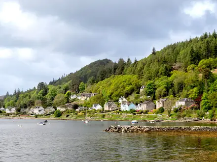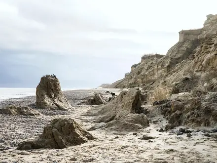
GR121 (Basque Coast Trail)
How would you rate GR121 (Basque Coast Trail)?
Tap a star to share your experience and help other hikers.
GR121 Basque Coast Trail: Gipuzkoa’s Cliff-Top Thru-Hike
HikeList Score
GR121 (Basque Coast Trail) scored 87/100 on HikeList's trail-quality metrics.
See score breakdownHide breakdown
- Ideal length 93
- Balanced challenge 80
- Scenery & wildness 78
- Varied terrain 94
- Accommodation 100
- Food & support 88
- Path quality 80
- Season flexibility 89
Computed from length, challenge, scenery & wildness, terrain variety, accommodation, food & support, path quality and season flexibility.
The GR-121 Talaia ibilbidea is a demanding 92 km, 6-day point-to-point hike along the Gipuzkoa coast in the Basque Country, northern Spain. It runs from Hondarribia on the French border to Saturraran beach, Mutriku, following the Bay of Biscay over cliff tops, green headlands, beaches and fishing towns. It is not technical, but it is hard on the legs: every stage climbs and drops repeatedly into bays. For another northern Spanish coastal journey, compare it with the Camino del Norte.
Route Overview
The route starts in Hondarribia, crosses the Jaizkibel headland to Pasaia, then continues over Monte Ulia into Donostia-San Sebastián. From there it heads west via Orio, Zarautz, Getaria, Zumaia, Deba and Mutriku, finishing at Saturraran beach on the Gipuzkoa/Bizkaia border. This is a town-to-town coastal trail, not a loop, with hotels, pensiones, hostels and holiday lets at or near stage ends. It forms part of the E9 European Coastal Path and is waymarked with GR red-and-white blazes. If you want a softer Mediterranean comparison, see the Camí de Ronda; for a longer pilgrimage option, see the Camino Francés.
Watchtowers, Whaling Ports and Elcano
“Talaia” means watchtower, and the trail takes its name from the lookout towers once used along this coast to spot whales and guard against raiders and pirates. Gipuzkoan ports including Mutriku, Getaria and Zumaia were active whaling, shipbuilding and trading harbours. Getaria is also the birthplace of Juan Sebastian Elcano, the Basque navigator who completed the first circumnavigation of the globe after Magellan’s death.
Notable highlights
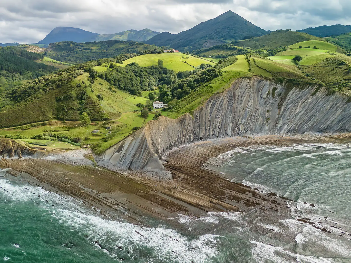
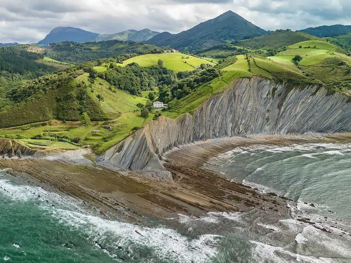
- Flysch cliffs of the Basque Coast Geopark: Between Zumaia, Deba and Mutriku, the trail crosses a UNESCO Global Geopark where near-vertical layered rock strata record around 60 million years of marine deposition, including the Cretaceous–Paleogene boundary.
- Itzurun beach, Zumaia: This on-route beach is backed by dramatic flysch cliffs and was used as a Dragonstone filming location in Game of Thrones Season 7.
- Pasaia: A historic fishing port set in a narrow inlet, with the route using the short ferry link between Pasai Donibane and Pasai San Pedro.
- Jaizkibel: A long heather-and-gorse headland rising from the sea east of Pasaia, associated with old whale-lookout and coastal-defence towers.
- Donostia-San Sebastián and Monte Ulia: The trail crosses wooded Monte Ulia before descending into the city around La Concha bay.
- Getaria and the txakoli coast: Getaria is a fishing village known for its “Mouse” islet, its link to Juan Sebastian Elcano and the steep vineyards producing txakoli wine.
Challenges to expect
Expect a physically demanding coastal walk rather than a high-mountain trek. The difficulty comes from repeated steep climbs and descents into successive bays, including stepped sections, grass and earth tracks, woodland, quiet lanes and town pavement. The Gipuzkoan coast is notably wet, so mud and slippery paths are possible; winter walking is not recommended. Waymarking is GR red-and-white, but daily effort is sustained.
HikeList Score
GR121 (Basque Coast Trail) scored 87/100 on HikeList's trail-quality metrics.
See score breakdownHide breakdown
- Ideal length 93
- Balanced challenge 80
- Scenery & wildness 78
- Varied terrain 94
- Accommodation 100
- Food & support 88
- Path quality 80
- Season flexibility 89
Computed from length, challenge, scenery & wildness, terrain variety, accommodation, food & support, path quality and season flexibility.
 Spain
SpainShow more data Show less
- Coastal
- Cliff Top
- Farmland
- Forest
- Dirt
- Grass
- Paved
- Hotels
- Guesthouses
- Hostels
- Holiday Lets
- Family Friendly
- Pet Friendly
- Restrooms
- Water Sources
- Campsites
- Picnic Areas
Download Our Full Guide to GR121 (Basque Coast Trail) FREE!
Get our comprehensive guide to this hike for free. Save it for later reading or print out at home.
Photos from hikers
Taken on the trail by people who've reviewed GR121 (Basque Coast Trail).
GR121 (Basque Coast Trail): The Complete Guide
 i
Image by Mazur Travel
i
Image by Mazur Travel The GR-121 Basque Coast Trail is a tough, rewarding coastal traverse of Gipuzkoa, running west from Hondarribia (Fuenterrabía) on the French border to Saturraran beach near Mutriku (Motrico). It is a 92 km point-to-point walk of sea cliffs, fishing ports, green headlands and hard-working Basque coastal towns, waymarked as the GR-121 Talaia ibilbidea and forming part of the E9 European Coastal Path.
This is not a high mountain route, but it rarely feels flat. The path climbs onto Jaizkibel, crosses Monte Ulia into Donostia-San Sebastián, then keeps rising and dropping through Orio, Zarautz, Getaria, Zumaia, Deba and Mutriku as each bay and headland arrives in turn.
The rewards are very real: the narrow inlet of Pasaia (Pasajes), La Concha bay in Donostia-San Sebastián, Getaria’s txakoli slopes and the flysch cliffs of the Basque Coast UNESCO Global Geopark between Zumaia, Deba and Mutriku. Itzurun beach at Zumaia adds one of the route’s most recognisable coastal scenes.
The walk suits fit independent hikers who want a well-connected multi-day coast route but are prepared for wet ground, slippery steps and nearly 2,900 m of cumulative ascent. Accommodation and public transport are good in the towns, but the open headland sections need proper planning and the Pasaia bay crossing depends on the small Donibane–San Pedro ferry.
This guide covers stages, daily planning, accommodation, food, transport, terrain and the common mistakes to avoid.
Stage-by-Stage Guide
The official GR-121 Talaia ibilbidea is divided into six stages. The distances are modest on paper, but the profile is repeatedly steep: most days climb out of one bay, traverse a headland, then drop hard into the next coastal town. In wet weather, allow extra time for mud, stone steps and slippery descents.
Stage 1: Hondarribia to Pasai Donibane — 22 km, about 743 m ascent
This is the longest and most demanding official stage, and it sets the tone for the whole route. From Hondarribia (Fuenterrabía), the trail leaves the Bidasoa estuary and climbs onto the Jaizkibel headland, traversing the seaward side of the ridge before descending to Pasai Donibane (Pasajes de San Juan).
The walking is classic Basque coast terrain: open headland paths, grassy and earthy tracks, sections through gorse and heather, and repeated climbs and descents above the Bay of Biscay. The GR-121 does not climb the 547 m summit of Jaizkibel / Allerru; the route’s high point is lower, roughly 400–450 m on the headland traverse. Even so, this is the biggest day of ascent on the trail.
Jaizkibel is the main landmark, with its old whale-lookout and coastal-defence towers reflecting the “Talaia” watchtower history of the route. On a clear day, this stage gives some of the broadest coastal views of the entire walk, with the French border area behind and the Pasaia inlet ahead.
There are services at Hondarribia and at the stage end in Pasai Donibane, but the open headland section should be treated as a carry-what-you-need day. Take enough water and food for the full crossing, especially in warm weather or if rain slows the going.
Accommodation is available in or near Pasaia (Pasajes), with wider choice back towards Hondarribia, Irun and Donostia-San Sebastián if needed. Because this is the first night on the official itinerary and Pasaia is smaller than Donostia-San Sebastián, booking ahead is sensible.
Public transport and road access are strongest at the start and finish rather than on the headland itself. Hondarribia is close to San Sebastián / Hondarribia airport and the wider Irun–Donostia transport corridor. Pasai Donibane connects to the next stage via the small bay ferry to Pasai San Pedro; current ferry times should be checked before travelling.
Navigation is generally by red-and-white GR waymarks, but mist, heavy rain and multiple headland tracks can make progress less obvious than the waymarking suggests. Carry a map or GPX track and avoid relying only on phone signal. The main warning on this stage is physical rather than technical: it is long, exposed to weather, and can be very muddy after rain.
Stage 2: Pasai San Pedro to Donostia-San Sebastián — 11 km, about 333 m ascent
Stage 2 begins on the west side of Pasaia bay at Pasai San Pedro (Pasajes de San Pedro), reached from Pasai Donibane by the regular small motorboat ferry. This is not a footbridge connection, so the ferry is part of the practical route plan. Sailing times should be checked before relying on an early start.
The stage is shorter than the first day but still has a real climb over Monte Ulia before dropping into Donostia-San Sebastián. Underfoot, expect a mix of coastal path, woodland trail, stone or stepped sections and town pavement as the route enters the city.
Pasaia itself is one of the most memorable places on the trail: a narrow, rock-walled inlet with historic fishing villages on either side. The route also passes near the Albaola maritime museum area before the climb towards Monte Ulia. From the ridge, the reward is the approach to Donostia-San Sebastián and the city’s shell-shaped La Concha bay.
Food and water are straightforward at both ends of the stage. Pasai San Pedro and Donostia-San Sebastián have services, but the Monte Ulia crossing should still be treated as a self-sufficient section rather than a café-to-café walk.
Donostia-San Sebastián has the widest accommodation choice on the route, including hotels, guesthouses, hostels and holiday lets. It is also one of the busiest places on the Basque coast, so summer beds should be booked well ahead.
Transport access is excellent at the Donostia-San Sebastián end. The city is the regional hub, with Renfe trains, the EuskoTren Topo line and frequent buses. This makes Stage 2 one of the easiest stages to use for section-walking, late arrivals or a rest-day break.
Navigation can become fiddly where the route passes through built-up areas and parkland approaches, so watch for GR marks at junctions rather than simply following the most obvious path. After rain, woodland steps and compacted earth on Monte Ulia can be slippery.
Stage 3: Donostia-San Sebastián to Orio — 16 km, about 405 m ascent
Leaving Donostia-San Sebastián, the route moves quickly from urban walking back into the coast’s repeated headland-and-bay rhythm. This is a medium-length stage, but the ascent is still significant and should not be treated as an easy stroll out of the city.
The terrain mixes town pavement, coastal paths, lanes, farmland and wooded or grassy sections. As on the rest of the GR-121, the difficulty comes from the constant undulation rather than altitude: climbs away from sea level are followed by descents that can be awkward when wet.
The main character of this stage is the transition from the resort city to smaller coastal settlements and rural slopes. Views open back towards Donostia-San Sebastián in clear conditions, while the walking westwards gives a quieter feel than the city approach on Stage 2.
Food and water are reliable in Donostia-San Sebastián and Orio, but intermediate services should not be assumed. Carry enough for the walking day before leaving the city, especially if starting late or walking outside the main summer season.
Orio has accommodation at or near the stage end, but the choice is more limited than in Donostia-San Sebastián. Book ahead in summer and during local holiday periods.
Public transport along this part of the coast is generally strong, with buses and coastal rail connections serving the wider corridor. Exact stop locations and live times should be checked before travelling, particularly if planning to shorten the day or return to Donostia-San Sebastián.
Navigation is usually straightforward on the GR waymarks, but pay attention when leaving the urban edge of Donostia-San Sebastián and where lanes and local paths intersect. Expect mud on shaded or grassy sections after rain, and take care on steep, stepped descents into low points.
Stage 4: Orio to Zumaia — 16 km, about 454 m ascent
Stage 4 is one of the most varied days on the route, linking Orio, Zarautz, Getaria and Zumaia. It combines resort seafronts, fishing-village character, vineyard and farmland slopes, lanes and coastal paths.
The day is not exceptionally long, but it has more than 450 m of ascent and several changes of surface. The repeated climbs away from the coast are tiring, especially if the previous stages have left the legs heavy. Mud is common after rain, particularly away from paved promenades and town streets.
Zarautz provides a useful mid-stage focus and a natural place to break the day if accommodation or transport plans require it. Getaria is the cultural highlight: a fishing village associated with Juan Sebastián Elcano, with views towards the “Mouse” islet of Mount San Antón and the surrounding txakoli vineyard slopes.
Food and water options are best in the towns: Orio at the start, Zarautz and Getaria on the way, and Zumaia at the end. This is one of the easier stages for resupply, but the hillier stretches between towns still require water on hand.
Accommodation is available in Zarautz, Getaria and Zumaia, with Zumaia the official stage end. Zarautz and Zumaia are busy resort towns in summer, so advance booking is important.
Zarautz and Zumaia have stations or stops on the coastal public transport network, and buses also serve this corridor. This makes Stage 4 flexible for section-hikers or for splitting the official day. Live EuskoTren, Lurraldebus or Pesa times should be checked before relying on a connection.
Navigation can be more distracting here because the route passes through popular towns and along sections where local walking paths, pavements and access roads overlap. Follow the GR red-and-white waymarks carefully when leaving Zarautz and Getaria, rather than assuming the coast road or promenade always matches the trail.
Stage 5: Zumaia to Deba — 14 km, about 626 m ascent
This is a short but hard stage, with the largest ascent figure after the Jaizkibel day. The route crosses the Basque Coast UNESCO Global Geopark between Zumaia and Deba (Deva), an area known for its dramatic flysch cliffs and layered rock strata.
The walking is physically demanding because the path repeatedly climbs and drops above coves and cliff-backed sections. Surfaces include earth, grass, stone steps and lanes, and the ground can be greasy after rain. The stage is not technical, but the combination of steep gradients, exposed coastal weather and slippery footing makes it a serious day.
At Zumaia, the route passes Itzurun beach, backed by the flysch cliffs and known to many visitors as a “Dragonstone” filming location from Game of Thrones. Beyond Zumaia, the geology becomes the dominant feature: near-vertical layers record around 60 million years of marine deposition, including the Cretaceous–Paleogene boundary.
Food and water should be organised in Zumaia before leaving. Deba has services at the end, but the exposed geopark section should be treated as a self-contained walking day unless current, on-route options have been checked locally.
Deba has accommodation and public transport links, making it a practical overnight stop before the final stage. As with the rest of the coast, summer demand can be high, so beds should be booked ahead.
Zumaia and Deba both have stations or stops on the coastal transport network, which makes this stage relatively easy to access or exit compared with the open headland sections. Live train and bus times should be checked before travelling.
Navigation requires care where cliff-top paths, access tracks and local routes intersect. Stay on the marked GR route and do not be tempted onto informal cliff-edge trods. The main warnings are exposure, mud and slippery descents; in poor weather, allow more time than the short distance suggests.
Stage 6: Deba to Saturraran (Mutriku) — 9 km, about 358 m ascent
The final official stage is the shortest and is rated easier than the earlier days, but it still includes a meaningful 358 m of ascent. From Deba, the route continues west through the final part of the geopark coast towards Mutriku (Motrico) and the finish at Saturraran beach on the Gipuzkoa/Bizkaia border.
The terrain remains coastal rather than mountainous: paths, lanes, woodland or farmland edges, and descents towards the sea. After rain, the same Basque coast issues apply — mud, slippery steps and wet grass can make a short day slower than expected.
Mutriku is the main place of interest near the finish, a historic whaling and shipbuilding port just east of Saturraran. The final arrival at Saturraran gives a clear endpoint at a sheltered cove on the provincial border.
Food and water should be carried from Deba unless current services on the way have been checked. Mutriku has services near the end of the route, but Saturraran itself should not be relied upon as a full-service finish without checking in advance.
Accommodation is available in or near Mutriku, with wider onward options depending on transport plans. If finishing late in the day, arrange the night or onward travel before starting from Deba.
Public transport is available along much of the coast, with buses and the wider coastal network serving towns such as Deba and the Mutriku area. The exact best departure point from Saturraran or Mutriku depends on current timetables and should be checked before travelling.
Navigation is usually uncomplicated on the final stage, but pay attention where the GR leaves Deba and where local paths and lanes converge near Mutriku and Saturraran. The day is short, but do not underestimate the cumulative fatigue from the previous five stages: wet descents and tired legs are the main risk at the end of the route.
Recommended Itinerary
Standard 6-day itinerary
The official Gipuzkoa Natura itinerary divides the GR-121 Talaia ibilbidea into six stages. This is the best default plan for most independent walkers: the distances look modest, but the repeated climbs and descents, wet ground and stepped coastal paths make the route more tiring than a flat 92 km coast walk.
| Day | From | To | Approx. distance | Why this stage makes sense | Services/accommodation notes |
|---|---|---|---|---|---|
| 1 | Hondarribia (Fuenterrabía) | Pasai Donibane (Pasajes de San Juan) | 22 km | The hardest opening day crosses the Jaizkibel headland, with the route traversing below the summit ridge and reaching the trail’s high point at roughly 400–450 m. Keeping this as a standalone day is sensible: it has the biggest single-day climb, around 743 m, and little scope for casual shortening once committed to the headland. | Stay in Hondarribia before starting if arriving late. There is no accommodation on the open Jaizkibel section, so carry food and water for the day. Overnight at or near Pasai Donibane/Pasaia. |
| 2 | Pasai San Pedro (Pasajes de San Pedro) | Donostia-San Sebastián | 11 km | A shorter recovery stage after Jaizkibel, crossing the Pasaia inlet by the small Pasai Donibane–Pasai San Pedro ferry before climbing over Monte Ulia into Donostia-San Sebastián. The short distance also gives time for late arrival, ferry timing and any lingering fatigue from day 1. | The Pasaia bay ferry is part of the practical link between stages; check current sailing times before relying on it. Donostia-San Sebastián has the widest accommodation and transport options on the route, but it is busy and should be booked well ahead in summer. |
| 3 | Donostia-San Sebastián | Orio | 16 km | This is a moderate coastal stage out of the city and back onto headlands, lanes and coastal paths. It is long enough to feel like a proper walking day without forcing a second consecutive very hard stage. | Donostia-San Sebastián is the best place to resupply before leaving. Orio has stage-end services and accommodation, but availability should still be checked before booking the whole itinerary. |
| 4 | Orio | Zumaia | 16 km | The route links Orio, Zarautz, Getaria and Zumaia, making this one of the more service-rich stages. The distance is manageable, but the day still includes the typical Gipuzkoan pattern of climbs and drops into successive coastal towns. | Zarautz, Getaria and Zumaia give more flexibility than the open headland stages. Zarautz and Zumaia are popular resort towns, so summer accommodation needs early booking. |
| 5 | Zumaia | Deba (Deva) | 14 km | This short-looking stage is one of the most physically important days, with around 626 m of ascent and the flysch coast of the Basque Coast UNESCO Global Geopark between Zumaia and Deba. Keeping it separate avoids rushing the best geological section of the route. | Zumaia is a useful overnight and resupply point before the flysch cliffs. Deba has accommodation and onward transport options, making it a practical final overnight before the last stage. |
| 6 | Deba | Saturraran, near Mutriku (Motrico) | 9 km | The final stage is the shortest and easier by the official grading, though it still climbs and drops before finishing at Saturraran beach on the Gipuzkoa/Bizkaia border. It works well as a short finish day, especially if onward travel is needed. | Saturraran itself is the trail finish, just west of Mutriku. Plan accommodation or transport from Mutriku/Saturraran in advance; live bus and train connections should be checked before travelling. |
Slower variant: 7 days or more
A slower itinerary is less about splitting every stage exactly in half and more about using the coastal towns and public transport to reduce pressure. There is no accommodation on the open headland sections themselves, so the main fixed point is day 1 over Jaizkibel, which most walkers should still treat as a full Hondarribia–Pasai Donibane stage.
The simplest slower approach is to keep the official six walking stages and add an extra night in Donostia-San Sebastián, Zarautz or Zumaia. Donostia-San Sebastián suits anyone wanting a recovery buffer after Jaizkibel and Monte Ulia; Zarautz or Zumaia suits walkers who want more time around Getaria, Itzurun beach and the flysch coast.
| Day | From | To | Approx. distance | Why this stage makes sense | Services/accommodation notes |
|---|---|---|---|---|---|
| 1 | Hondarribia (Fuenterrabía) | Pasai Donibane (Pasajes de San Juan) | 22 km | Keep the Jaizkibel crossing as a single planned stage rather than underestimating it. It is long, exposed and has the largest official ascent figure. | Book both Hondarribia and Pasaia-area accommodation ahead. Carry what is needed for the headland section. |
| 2 | Pasai San Pedro (Pasajes de San Pedro) | Donostia-San Sebastián | 11 km | A deliberately short day over Monte Ulia, useful after the hard opening stage. | Check the Pasai Donibane–Pasai San Pedro ferry times. Donostia-San Sebastián is the easiest place on the route for rest-day logistics. |
| 3 | Donostia-San Sebastián | Donostia-San Sebastián, Zarautz or another chosen overnight | Check official mapping before booking | Use this as a rest day, partial walking day or transport-assisted day depending on accommodation availability and weather. This is the most flexible point in the itinerary because public transport is strongest around Donostia-San Sebastián and the central coastal towns. | Do not assume a split point has suitable accommodation until it is booked. Transport times and any coastal-path diversions should be checked before travelling. |
| 4 | Continue to Orio | Orio | Check official mapping before booking | Rejoin or complete the Donostia-San Sebastián–Orio stage without forcing a long day after a rest or partial day. | Orio is a practical overnight stop on the standard route. |
| 5 | Orio | Zumaia | 16 km | A manageable service-rich stage via the Zarautz/Getaria coast. | Zarautz and Zumaia are busy in summer; book ahead. |
| 6 | Zumaia | Deba (Deva) | 14 km | Keep the flysch section as its own day to avoid rushing a steep and important part of the route. | Deba is the natural overnight before the final stage. |
| 7 | Deba | Saturraran, near Mutriku (Motrico) | 9 km | A short final day leaves time for onward travel from the Mutriku/Saturraran area. | Check onward transport before committing to the final-day timing. |
Faster variant: 5 days
A five-day itinerary suits fit walkers who are comfortable with longer days on wet, undulating coastal terrain. The safest way to shorten the route is to combine one of the shorter later stages, not to underestimate the opening Jaizkibel day.
The most logical compression is to combine Zumaia–Deba and Deba–Saturraran into one long final day of roughly 23 km. This makes the last day much harder than the official final stage alone, with the flysch coast followed by the approach to Mutriku and Saturraran, so it is best kept for strong walkers in settled weather.
| Day | From | To | Approx. distance | Why this stage makes sense | Services/accommodation notes |
|---|---|---|---|---|---|
| 1 | Hondarribia (Fuenterrabía) | Pasai Donibane (Pasajes de San Juan) | 22 km | Keep the demanding Jaizkibel stage intact rather than adding extra distance. | No accommodation on the headland. Plan food, water and the overnight stop in Pasaia. |
| 2 | Pasai San Pedro (Pasajes de San Pedro) | Donostia-San Sebastián | 11 km | A short day after Jaizkibel, with the ferry crossing and Monte Ulia before entering the city. | Check ferry times. Donostia-San Sebastián is the key accommodation and transport hub. |
| 3 | Donostia-San Sebastián | Orio | 16 km | A standard mid-route day that keeps the faster itinerary from becoming overloaded too early. | Resupply in Donostia-San Sebastián before leaving. Overnight in Orio. |
| 4 | Orio | Zumaia | 16 km | A well-serviced coastal stage through the Zarautz/Getaria/Zumaia section. | Book Zumaia well ahead in summer. This is the last overnight before the longer combined finish. |
| 5 | Zumaia | Saturraran, near Mutriku (Motrico), via Deba | 23 km | Combines the official Zumaia–Deba and Deba–Saturraran stages. This is a strenuous finish because the Zumaia–Deba section has around 626 m of ascent before the final stage continues to Saturraran. | Start early and do not rely on finding services on exposed sections. Plan transport or accommodation from Mutriku/Saturraran before setting out. |
A more aggressive four-day schedule is not recommended for most walkers. It would require combining already hilly stages on terrain that is often muddy and slippery, leaving little margin for ferry timing, bad weather or accommodation constraints.
Planning the Route
The GR-121 Talaia ibilbidea is easiest to plan as a town-to-town coastal walk using the official six-stage structure. The stages are not arbitrary: they follow the natural breaks created by Pasaia, Donostia-San Sebastián, Orio, Zumaia, Deba and Mutriku/Saturraran, where accommodation and transport are available at or near the route.
Most walkers should allow the full 6 days. The route is not long on paper, but the repeated climbs and descents into bays make the daily effort higher than the kilometre totals suggest, especially in wet conditions. Fit walkers can combine shorter stages, but doing so turns the walk into a much more physical outing and reduces the margin for ferry timings, muddy ground and transport connections.
Choosing a 6-day, faster or slower itinerary
The official 6-day itinerary is the most balanced plan and suits walkers who want manageable days with time for poor weather, town logistics and the more scenic coastal sections. It also avoids making the first day over Jaizkibel even harder by adding extra distance.
A faster itinerary is possible because some stages are short, particularly Pasai San Pedro (Pasajes de San Pedro) to Donostia-San Sebastián and Deba (Deva) to Saturraran. The obvious candidates for combining are the shorter urban/coastal days, not the tougher headland days. Be cautious about merging stages that already include substantial ascent, especially Zumaia to Deba.
A slower itinerary can work well if accommodation is arranged carefully in the coastal towns. Donostia-San Sebastián, Zarautz and Zumaia are useful places to pause, but they are also busy in summer, so booking ahead matters more than on quieter inland trails.
| Stage | Official section | Planning notes |
|---|---|---|
| E01 | Hondarribia (Fuenterrabía) to Pasai Donibane (Pasajes de San Juan) | Long, demanding start over the Jaizkibel headland; allow a full day and do not underestimate the ascent. |
| E02 | Pasai San Pedro to Donostia-San Sebastián | Shorter stage over Monte Ulia; linked to E01 by the Pasaia bay ferry between Pasai Donibane and Pasai San Pedro. |
| E03 | Donostia-San Sebastián to Orio | A useful middle-distance day with town logistics at both ends. |
| E04 | Orio to Zumaia | Can be planned with Zarautz and Getaria as useful intermediate coastal towns. |
| E05 | Zumaia to Deba | One of the key planning days: the flysch coast is spectacular, but the stage has significant ascent and exposed, slippery coastal terrain. |
| E06 | Deba to Saturraran, near Mutriku (Motrico) | Short final stage, but still includes climbing before the finish at Saturraran beach. |
Accommodation strategy
Accommodation planning should come before fine-tuning the daily mileage. The route depends on towns and villages at stage ends: Hondarribia, Pasaia (Pasajes), Donostia-San Sebastián, Orio, Zarautz, Getaria, Zumaia, Deba and Mutriku all have options such as hotels, pensiones, hostels/albergues or holiday lets.
There is no accommodation on the open headland sections themselves, so each day needs a clear start and finish. In summer, book Donostia-San Sebastián, Zarautz and Zumaia well ahead, as these are busy resort towns as well as trail stops.
If staying in Mutriku rather than directly at Saturraran, plan the final walking and onward transport accordingly. The route finish is at Saturraran beach on the Gipuzkoa/Bizkaia border, just west of Mutriku, not in the centre of a large transport hub.
Food and water planning
This is a coastal town-to-town hike, not a remote expedition, but do not treat every hour as serviced. Carry enough food and water for the full day whenever the route crosses open headlands, cliff-top paths, farmland or woodland between settlements.
The first stage over Jaizkibel and the Zumaia–Deba section through the Basque Coast UNESCO Global Geopark deserve particular attention. Services can be limited once committed to those coastal sections, and wet or slippery paths can slow progress.
Shop, café and restaurant opening times vary by season and day of the week. This should be checked before travelling, especially if planning early starts, late finishes or walking outside the main summer period.
Transport and section hiking
Section hiking is practical on the GR-121 because the Gipuzkoa coast has strong public transport. Donostia-San Sebastián is the main regional hub, with Renfe trains, the EuskoTren Topo line and frequent buses; the San Sebastián / Hondarribia airport lies between Hondarribia and Irun.
The EuskoTren Topo / Donostia–Bilbao line and Lurraldebus / Pesa coaches serve coastal towns including Zarautz, Zumaia and Deba, making it realistic to walk individual stages, shorten a day, or leave the route if weather deteriorates. Live train and bus times should be checked before relying on them.
The main non-walking link built into the route is the Pasaia bay ferry between Pasai Donibane and Pasai San Pedro. It is a regular year-round motorboat crossing, but current sailing times should be checked before travelling, particularly if connecting E01 and E02 on the same day.
Weather, mud and timing
Late May to the end of September is the most reliable walking window. Winter is not recommended on this wet, exposed coast, where mud, slippery steps and cliff-top weather can turn otherwise straightforward paths into slow going.
Build flexibility into the plan if walking in spring or autumn. The route has no technical mountain ground, but repeated climbs on wet earth, grass, stone steps and tarmac can be tiring, and descent speed often drops sharply after rain.
Weather planning matters more than altitude planning. The high point is on the Jaizkibel traverse at roughly 400–450 m, and the GR-121 does not cross the 547 m summit of Allerru, but the exposure to Bay of Biscay weather is still a serious practical factor.
Navigation and route changes
The GR-121 is waymarked with red-and-white GR blazes and also forms part of the E9 European Coastal Path. Even so, carry an offline map or GPX track, especially for town exits, headland junctions and poor-visibility coastal sections.
Coastal paths can be affected by maintenance works or local diversions. Any current diversions should be checked before relying on a fixed GPX line, particularly on the cliff and flysch sections between Zumaia, Deba and Mutriku.
Towns, Villages and Overnight Stops
The GR-121 is easiest to plan as a town-to-town coastal walk. Accommodation and food are concentrated in the ports, resorts and inland-edge towns at or near the official stage ends; the exposed headlands and cliff sections have no overnight services, so each day needs a definite end point.
Summer demand is high in Donostia-San Sebastián, Zarautz and Zumaia, and advance booking is strongly advised. If section-hiking, the coastal public transport network makes it practical to base yourself in one town for several stages, but live train, coach and ferry times should be checked before travelling.
Hondarribia (Fuenterrabía)
Hondarribia is the eastern trailhead, on the Bidasoa estuary opposite Hendaye in France. It is a practical place to arrive the day before starting, especially because the first stage over Jaizkibel is the longest official day and has the most ascent.
Accommodation is available in town, with the usual mix of hotels, pensiones/guesthouses and other visitor lodging. Food, cafés and shops should be dealt with here before setting out, as the route quickly climbs onto the Jaizkibel headland where there are no settlement services.
Transport access is strong for a trailhead: Donostia-San Sebastián is the regional hub, and San Sebastián / Hondarribia airport lies between Hondarribia and Irun. Bus and rail connections in this area should be checked before travelling, particularly if arriving late or starting early.
Jaizkibel (headland)
Jaizkibel is not an overnight stop; it is the open headland crossed on the demanding first stage from Hondarribia towards Pasaia. The GR-121 traverses the seaward flank at roughly 400–450 m and does not go over the 547 m summit of Allerru.
There is no accommodation on the headland section itself, so the day should be planned as a full commitment between Hondarribia and Pasaia. Carry food and water from Hondarribia, and allow extra time in wet weather: the coastal paths, grass and steps can be slippery after rain.
The practical reason to know Jaizkibel in advance is pacing. The stage has repeated climbing and descending before the route reaches Pasai Donibane, so it is not a casual first day despite the modest altitude.
Pasai Donibane (Pasajes de San Juan)
Pasai Donibane is the official end of the first stage, set on the eastern side of the narrow Pasaia inlet. It is a useful overnight stop if following the six-day itinerary, because it breaks the hard Hondarribia–Pasaia stage before the shorter continuation over Monte Ulia to Donostia-San Sebastián.
Accommodation is available in Pasaia, though choice is more limited than in Donostia-San Sebastián. Food and cafés are available in the settled harbour area, but walkers should not assume late-opening services without checking locally.
The key logistical point is the Pasaia bay ferry. The next stage starts from Pasai San Pedro on the opposite side of the inlet, and the regular Pasai Donibane–Pasai San Pedro motorboat links the two sides year-round. Current sailing times should be checked before travelling, especially for early starts.
Pasai San Pedro (Pasajes de San Pedro)
Pasai San Pedro is the western side of the Pasaia inlet and the starting point for the official second stage to Donostia-San Sebastián. For most thru-hikers it functions as a transition point rather than a separate overnight stop, because it is directly linked to Pasai Donibane by the small ferry.
It is still a useful place for a coffee, food stop or regroup before climbing towards Monte Ulia. The Albaola maritime museum is on this side of Pasaia, close to the trail corridor, and may be worth factoring in if walking a shorter day.
Do not plan this section as though there is a bridge between the two Pasaia villages. The ferry is part of the normal trail logistics, and its current operating pattern should be checked before travelling.
Monte Ulia
Monte Ulia is the wooded coastal ridge between Pasaia and Donostia-San Sebastián. It is not an overnight stop, but it is the main physical feature of the short second stage.
There is no reason to carry multi-day food over Monte Ulia, as Donostia-San Sebastián is close at hand, but water and snacks are still sensible. Wet steps and muddy woodland paths can slow the descent into the city.
For planning purposes, this stage is often a recovery day after Jaizkibel. It can also be used to create a shorter first itinerary if accommodation works better in Donostia-San Sebastián than in Pasaia.
Donostia-San Sebastián
Donostia-San Sebastián is the largest and most useful service centre on the GR-121. It is the official end of stage 2 and start of stage 3, and the best place on the route for rest-day logistics, replacement kit, wider accommodation choice and onward transport.
Accommodation ranges from hotels to hostels and guesthouse-style options, but the city is busy in summer and should be booked well ahead. Food options are extensive compared with the smaller ports, making this the easiest place to resupply or adjust plans.
Transport links are the strongest on the route. Donostia-San Sebastián is served by Renfe trains, the EuskoTren Topo line and frequent buses, and it is the main hub for reaching the start, joining the route mid-way or leaving early.
Orio
Orio is the official end of stage 3 from Donostia-San Sebastián and the start of stage 4 towards Zumaia. It is a practical overnight stop for walkers keeping to the six-stage schedule, especially after the repeated climbs and descents west of the city.
Accommodation is available in or around the town, but the range is smaller than in Donostia-San Sebastián, Zarautz or Zumaia. Book ahead in the main walking season, and avoid relying on finding a bed on arrival.
Food and basic town services make Orio a sensible evening stop and morning resupply point. Coastal buses and the wider EuskoTren/Lurraldebus network serve this part of Gipuzkoa; exact routes and times should be checked before travelling.
Zarautz
Zarautz lies between Orio and Getaria on the stage to Zumaia. It is not an official stage end in the six-day itinerary, but it is one of the best-known resort towns on this stretch and a useful alternative overnight if shortening or rebalancing stages.
Accommodation is available, but summer demand is high and advance booking is important. Food, cafés and shops are generally easier to manage here than on the open vineyard, farmland and headland sections either side.
Zarautz has public transport connections on the coastal corridor, including rail or coach options. It is a good place to leave or rejoin the trail if the weather, fatigue or accommodation availability forces a change of plan.
Getaria
Getaria sits on the coast between Zarautz and Zumaia. It is a practical intermediate stop on stage 4 and can work as an overnight alternative if Orio–Zumaia feels too long or if accommodation in Zumaia is full.
The village has accommodation, food and cafés, though capacity is more limited than in the larger resort towns. Book ahead in the main season rather than treating it as a guaranteed fallback.
For hikers, Getaria is useful because it breaks up a stage with several surfaces and coastal undulations. It is also one of the more memorable places on the route, with Mount San Antón, fishing-port character and surrounding txakoli vineyards, but logistics should come first: check onward transport times before relying on it for a section start or finish.
Zumaia
Zumaia is the official end of stage 4 and start of stage 5, and one of the most important overnight stops on the western half of the trail. It is also the gateway to the flysch cliff section towards Deba.
Accommodation is available, but Zumaia is busy in summer and should be booked well ahead. Food, cafés and shops make it a sensible place to resupply before the more geologically dramatic and physically demanding Zumaia–Deba stage.
Zumaia has coastal public transport links, including station or coach access on the wider EuskoTren and Lurraldebus/Pesa network. Current times should be checked before using it as a base for day-walking or as an exit point.
Itzurun (beach, Zumaia)
Itzurun is an on-route beach at Zumaia, backed by the flysch cliffs. It is not an overnight stop in its own right; use Zumaia for accommodation and services.
The beach is a useful landmark when planning the start or finish of the Zumaia section. It is also a place where walkers often slow down, because the cliffs are one of the route’s headline features, but tide-style logistics are not the issue here: the practical concern is wet, slippery coastal ground and allowing enough time for the stage to Deba.
Deba (Deva)
Deba is the official end of stage 5 from Zumaia and the start of the final stage to Saturraran near Mutriku. It is the main overnight base before completing the walk.
Accommodation is available in town, and booking ahead is sensible in the walking season. Food and cafés should be used here before the final day, which is shorter but still includes ascent and coastal terrain.
Deba has public transport links on the coastal corridor, including station or coach access. This makes it a useful bail-out point after the flysch section, or a convenient starting point for walkers completing only the final stage.
Mutriku (Motrico)
Mutriku is the historic port just east of the route finish at Saturraran and the practical end-of-walk service town. Although the official finish is at the beach, Mutriku is the place to look for accommodation, food and onward transport nearby.
Accommodation is available in or around Mutriku, but capacity is not unlimited. If finishing late in the day, book a bed in advance rather than assuming onward travel will line up neatly with the walk.
The final stage from Deba to Saturraran is the shortest official day, but it still crosses the coastal edge of the Basque Coast UNESCO Global Geopark and includes ascent. Keep enough food and water from Deba or Mutriku depending on direction and timing.
Saturraran (beach)
Saturraran is the western terminus of the GR-121 on the Gipuzkoa/Bizkaia provincial border, just beyond Mutriku. It is a finish point rather than a full-service trail town.
Plan onward travel via Mutriku or the coastal transport network rather than assuming services at the beach itself. Bus and coach times should be checked before travelling, particularly if finishing outside the main daytime window.
If arranging a pickup, Saturraran works as the endpoint; if using public transport, build in time to reach Mutriku or the appropriate stop. Accommodation planning should normally focus on Mutriku, Deba or another connected coastal town rather than Saturraran itself.
Getting to the Start
The GR-121 Talaia ibilbidea starts in Hondarribia (Fuenterrabía), on the Bidasoa estuary opposite Hendaye in France. The practical transport hub for most walkers is Donostia-San Sebastián, which has Renfe trains, the EuskoTren Topo line and frequent bus services, with onward public transport or taxi access to Hondarribia.
By train
Hondarribia is best approached by rail via Donostia-San Sebastián, then continuing by bus or taxi to the start. Donostia-San Sebastián is the main regional hub and is served by Renfe trains and the EuskoTren Topo line.
The coastal rail network is also useful later in the walk, particularly for reaching or leaving stage towns such as Zarautz, Zumaia and Deba, but for the start itself plan around onward local transport from Donostia-San Sebastián or the border area near Hondarribia. Live rail and onward connection times should be checked before travelling.
By bus
Bus is often the simplest public-transport option for reaching Hondarribia from Donostia-San Sebastián. Lurraldebus and Pesa services operate across the Gipuzkoa coast and link the main towns used by walkers on the GR-121.
Timetables, stopping points and evening/weekend frequency can change, so check current services before booking accommodation or committing to a late arrival. If arriving after the last useful bus, a taxi from Donostia-San Sebastián or from the airport area may be the fallback.
By car
Driving to Hondarribia is possible, but it is not usually the neatest solution for this route because the GR-121 is a point-to-point walk finishing at Saturraran beach near Mutriku, well west of the start. Leaving a car in Hondarribia means returning by public transport or taxi at the end of the hike.
No specific long-stay parking arrangement is built into the route. If travelling by car, check current parking rules, maximum stay limits and any hotel parking options in Hondarribia before travelling.
From the nearest airport
The nearest airport is San Sebastián / Hondarribia airport (EAS), located between Hondarribia and Irun. It is the most convenient airport for starting directly in Hondarribia, with the final transfer likely to be by local bus or taxi.
For wider flight choice, many walkers will still need to route via Donostia-San Sebastián or another larger transport hub, then continue by train or bus within the Basque Country. Airport transfer options, fares and operating times should be checked before travelling.
Where to stay before starting
Hondarribia is the natural place to stay the night before starting. It has a mix of hotels, pensiones, guesthouses, hostels/albergues and holiday lets, and staying in town avoids adding a morning transfer before the demanding first stage over Jaizkibel to Pasai Donibane (Pasajes de San Juan).
Book ahead in the main walking season, especially if starting during summer weekends or holiday periods. There is no accommodation on the open Jaizkibel headland itself, so begin the first stage with accommodation already arranged at the next stop or nearby.
Getting Home from the Finish
The GR-121 finishes at Saturraran beach, just west of Mutriku (Motrico) on the Gipuzkoa/Bizkaia border. Do not plan onward travel as if the trail ended at a large transport hub: the practical choices are to move first to Mutriku, or back to a rail-served coastal town such as Deba (Deva), then continue towards Donostia-San Sebastián or along the Donostia–Bilbao corridor.
Timetables are the key planning point here. Check current EuskoTren, Lurraldebus and Pesa times before committing to a same-day flight or long-distance connection, especially if finishing late, walking in poor weather, or visiting outside the main summer season.
By train
The practical railhead for the finish is Deba (Deva), the previous stage town on the route and one of the coastal towns served by the narrow-gauge EuskoTren Donostia–Bilbao line. From Deba, trains give access back east towards Donostia-San Sebastián and west along the coastal rail corridor.
Saturraran itself is a beach finish, not a railway terminus. Allow time to get from Saturraran or Mutriku to a suitable station before booking onward travel. The exact local bus or taxi connection should be checked before travelling.
Donostia-San Sebastián is the main regional hub for onward travel, with Renfe trains, EuskoTren services and frequent buses. If the end of the walk needs to connect with national rail, coach or airport travel, routing via Donostia-San Sebastián is usually the simplest plan.
By bus
Lurraldebus and Pesa coaches serve the Gipuzkoa coastal towns, including the wider Mutriku/Saturraran finish area and towns such as Zarautz, Zumaia and Deba. Buses can be useful either for reaching a rail station or for travelling directly towards Donostia-San Sebastián, depending on the day’s timetable.
Do not assume late-evening frequency from Saturraran or Mutriku. If finishing the final Deba–Saturraran stage in the afternoon, check the last practical bus before setting out from Deba, and have a fallback plan if the weather or muddy paths slow progress.
For section-hikers, the bus and rail network along the coast makes it realistic to stop short at Deba, Zumaia, Zarautz or another served town rather than force a late finish at Saturraran. Live timetables should be checked before relying on this.
By car/taxi
Saturraran is the most awkward point on the route to leave without checking local transport in advance. A pre-booked taxi from the finish, or from Mutriku, is the cleanest option if there is an evening train, coach or flight to catch.
If using a parked car, the simplest arrangement is usually to leave it at or near the finish and use public transport to reach Hondarribia before starting, or to park in a better-connected town and return there by taxi or bus after the walk. Parking rules and local access at Saturraran and Mutriku should be checked before travelling.
For groups, a taxi from Saturraran or Mutriku to Deba station can be more practical than waiting for a limited bus, particularly in poor weather or outside peak season. Book ahead rather than assuming a taxi will be waiting at the beach.
From the nearest airport
The airport named for this route is San Sebastián / Hondarribia airport (EAS), located between Hondarribia and Irun. From the finish, plan to travel first from Saturraran or Mutriku to a coastal rail or bus connection, then continue towards Donostia-San Sebastián and the airport area.
Because the finish is at the opposite end of the trail from Hondarribia, same-day flight departures need a cautious buffer. Build in time for the short transfer away from Saturraran, the coastal train or coach journey, and any connection through Donostia-San Sebastián or Irun. This should be checked before travelling.
Where to stay at the finish
Mutriku is the natural overnight stop at the end of the GR-121, with accommodation in or near the historic port and within reach of Saturraran. Deba is also a practical option if onward rail travel the next morning is more important than staying beside the actual finish.
Staying overnight is sensible if the final stage is walked late in the day, if bus times are limited, or if an onward connection would be tight. It also avoids ending the hike with a rushed road transfer after several days of wet, steep coastal walking.
Accommodation in the coastal towns can be busy in summer, especially along the resort stretch of the Gipuzkoa coast, so book ahead rather than relying on turning up at the finish.
Which Direction Should You Walk?
The standard direction is westbound, from Hondarribia (Fuenterrabía) to Saturraran beach near Mutriku (Motrico). This is the direction used by the official GR-121 Talaia ibilbidea stage sequence, and it is the most straightforward choice for planning around the published six-stage itinerary.
Walking eastbound is perfectly possible, as the route is point-to-point and waymarked with GR red-and-white blazes. However, it is less natural for logistics because the stage descriptions, psychological build-up and most route planning material are oriented from the French border towards the Gipuzkoa/Bizkaia border.
Westbound: Hondarribia to Saturraran
Westbound gives the route a strong opening: the first stage climbs from Hondarribia onto the Jaizkibel headland, the highest and one of the most physically demanding sections of the trail. It is a hard start, with around 743 m of ascent on the Hondarribia–Pasai Donibane stage, but many walkers prefer to tackle it while fresh.
The scenery also develops well in this direction. After Jaizkibel and the Pasaia (Pasajes) inlet, the route crosses Monte Ulia into Donostia-San Sebastián, then works west through Orio, Zarautz, Getaria and Zumaia before reaching the flysch cliffs of the Basque Coast UNESCO Global Geopark between Zumaia, Deba and Mutriku.
The finish at Saturraran has a clear end-point feel: a sheltered cove on the Gipuzkoa/Bizkaia provincial border, just beyond Mutriku. It is quieter and less urban than finishing in Hondarribia, but it gives the walk a satisfying coast-to-border conclusion.
Transport is workable in this direction. Hondarribia is close to San Sebastián / Hondarribia airport and the Irun–Donostia transport corridor, while the coastal towns towards the finish are served by combinations of EuskoTren, Lurraldebus and Pesa services. Live bus and train times from Mutriku/Saturraran should be checked before travelling.
Eastbound: Saturraran to Hondarribia
Eastbound starts with the shorter Deba–Saturraran section in reverse, so the opening day can feel gentler than beginning with Jaizkibel. The trade-off is that the hardest and highest-feeling headland walking comes at the end, with the long Pasaia–Hondarribia stage over Jaizkibel left for tired legs.
This direction can make sense if accommodation availability, onward travel or a desire to finish in Hondarribia is driving the plan. Hondarribia has good onward access towards Irun, Donostia-San Sebastián and the nearby airport, which may suit some itineraries better than finishing at Saturraran.
The Pasaia bay ferry remains a planning point in either direction. The GR-121 does not use a footbridge between Pasai Donibane (Pasajes de San Juan) and Pasai San Pedro (Pasajes de San Pedro); it uses the small year-round motorboat across the inlet. Current sailing times should be checked before travelling.
Does one direction make the walking easier?
Not significantly. The total ascent is essentially the same whichever way you walk, and the GR-121 is hard because of repeated climbs and descents into successive bays rather than one single mountain pass.
Westbound front-loads the major Jaizkibel effort. Eastbound saves that same effort for the end. For most hikers, having the longest headland stage early is the better bargain.
There is no dependable direction advantage for wind or weather planning. This is a wet, exposed Bay of Biscay coast, and slippery mud, stone steps and cliff-top paths matter more than compass direction. Check the forecast before each stage, especially outside the most reliable late-May-to-September window.
Accommodation flow
The official westbound stages finish at or near useful overnight bases: Pasai Donibane / Pasai San Pedro, Donostia-San Sebastián, Orio, Zumaia, Deba and Mutriku/Saturraran. The same towns work in reverse, but westbound is easier to match to the official itinerary and stage numbering.
In summer, Donostia-San Sebastián, Zarautz and Zumaia can be busy, so direction should not be chosen until beds are available. If accommodation forces a different split, the strong coastal transport network makes it practical to shorten or reposition stages in either direction.
Recommendation
Walk the GR-121 westbound from Hondarribia to Saturraran unless transport or accommodation strongly favours the reverse. It follows the official stage order, gives the route its best natural progression, tackles Jaizkibel while legs are fresh, and finishes cleanly at the Gipuzkoa/Bizkaia border.
Accommodation Along the Route
The GR-121 works well as an inn-to-inn walk. The official stage ends are all in or near coastal settlements with hotels, pensiones, guesthouses, hostels/albergues or holiday lets, so camping is not normally needed.
The main planning issue is not remoteness between nights, but demand. Donostia-San Sebastián, Zarautz and Zumaia are busy coastal destinations in summer, and weekends can be tight across the whole route. Book well ahead for late May to September, especially if walking as a group or wanting private rooms.
There is no accommodation on the open headland sections themselves, including Jaizkibel and Monte Ulia. Each day should be planned around reaching a town or village, rather than expecting isolated trail-side lodging.
| Place | Accommodation level | Best for | Notes |
|---|---|---|---|
| Hondarribia (Fuenterrabía) | Good | Start night before the hike | Sensible place to stay before tackling the long first stage over Jaizkibel. Book ahead in the main walking season. |
| Jaizkibel headland | None | Walking only | No practical overnight stop on the open headland. Carry what is needed for the day. |
| Pasai Donibane (Pasajes de San Juan) / Pasai San Pedro (Pasajes de San Pedro) | Limited | End of stage 1 / start of stage 2 | The stage break is split by the small Pasaia bay ferry between Donibane and San Pedro. Accommodation choice is more limited than in Donostia-San Sebastián, so reserve early or be prepared to use nearby transport options. Ferry times should be checked before travelling. |
| Donostia-San Sebastián | Good | Easiest major overnight base | The strongest accommodation hub on the route and the most flexible place for rest days, late arrivals or public transport links. Also one of the busiest and most expensive-feeling stops in peak season, so advance booking matters. |
| Orio | Limited | Official stage stop between Donostia and Zumaia | A useful overnight to keep the official six-day rhythm. Choice is more limited than in the larger resort towns, so do not leave booking late. |
| Zarautz | Good | Alternative or extra stop | A resort town with a broader range of accommodation than smaller villages. Useful if shortening or reshaping the Orio–Zumaia section, but summer demand is high. |
| Getaria | Limited | Alternative scenic stop | A smaller fishing village on the route. Works well for walkers wanting to break the coast between Orio, Zarautz and Zumaia, but accommodation should be booked early. |
| Zumaia | Good | Official stage stop and flysch section base | One of the key overnight towns before the Zumaia–Deba flysch cliffs. Busy in summer, so secure a bed well ahead. |
| Deba (Deva) | Limited to good | Official stage stop before the final day | Practical overnight before the shorter final stage to Saturraran. Availability can still tighten in the main season. |
| Mutriku (Motrico) | Limited | Finish-area overnight | The practical town base near the trail finish at Saturraran. Useful if not leaving the area immediately after finishing. |
| Saturraran beach | None as a main base | Finish point | Treat Saturraran as the end of the walk, not as the main overnight hub. Use Mutriku or onward transport after finishing. |
Best overnight pattern
The simplest plan follows the official stage structure:
- Hondarribia
- Pasai Donibane / Pasai San Pedro area
- Donostia-San Sebastián
- Orio
- Zumaia
- Deba
- Mutriku or onward travel after Saturraran
This keeps daily distances manageable and avoids combining too many of the route’s repeated climbs and descents. Fit walkers can combine some of the shorter coastal stages, but doing so reduces accommodation flexibility and can make late-day arrivals awkward in wet or slippery conditions.
Booking strategy
For summer, weekends and holiday periods, book every night before setting off. This is especially important in Donostia-San Sebastián, Zarautz and Zumaia, where normal seaside demand overlaps with walkers using the GR-121.
If walking outside the busiest period, there may be more flexibility, but the smaller stops are still not places to assume unlimited same-day availability. Orio, Getaria, Deba and Mutriku should be treated as limited-choice stops unless accommodation has already been secured.
Luggage transfer and taxi options
The route is well suited to light inn-to-inn walking because overnight stops are frequent and the coast has strong public transport links. If using luggage transfer, arrange it directly with accommodation providers or local operators and confirm prices, pick-up times and coverage before booking the trip.
Taxi transfers can also help if a chosen overnight stop is full or if a walker wants to sleep in a larger town and return to the trail the next morning. Availability, fares and practical pick-up points should be checked before travelling, particularly around the smaller villages and the Saturraran finish.
Camping and Wild Camping
Camping is not the natural fit for the GR-121 Talaia ibilbidea. The route is short enough to walk with light luggage, stage ends are in towns or coastal villages, and the practical accommodation pattern is hotels, pensiones, hostels/albergues and holiday lets rather than a continuous chain of walker-focused campsites.
There may be formal campsites on or near parts of the Gipuzkoa coast, especially around the resort towns, but they should be checked and booked town by town before committing to a camping itinerary. Do not assume there will be a convenient legal pitch at every stage end.
Is wild camping allowed?
Do not plan the GR-121 as a wild-camping route. Wild-camping rules in Spain can vary by autonomous community, municipality, land status and protected-area designation, and the Basque coast includes farmland, resort areas, beaches, cliff-top paths and the Basque Coast UNESCO Global Geopark between Zumaia, Deba and Mutriku.
If camping outside a formal campsite is being considered, local rules must be checked with the relevant municipality or land manager before travelling. Permission from the landowner is essential on private land, and camping on beaches, cliff tops, protected geological areas or near settlements should not be assumed to be permitted.
Fires should be treated as off limits. Use a stove only where it is legal and safe to do so, and follow any local seasonal fire restrictions.
Practicality by section
| Section | Camping practicality |
|---|---|
| Hondarribia (Fuenterrabía) to Pasai Donibane (Pasajes de San Juan) | The long Jaizkibel stage is exposed, wet underfoot after rain and has no accommodation on the open headland. A legal overnight pitch should be arranged before setting out; do not rely on finding somewhere discreet on the ridge. |
| Pasai San Pedro (Pasajes de San Pedro) to Donostia-San Sebastián | This is a short stage over Monte Ulia into a major city. It is better treated as an accommodation stage rather than a camping stage. |
| Donostia-San Sebastián to Orio | The route mixes coast, lanes and settled areas. Any camping plan needs a pre-arranged formal site or local permission. |
| Orio to Zumaia, via Zarautz and Getaria | This is the most developed resort stretch, with busy summer demand in Zarautz and Zumaia. Book any formal camping or indoor accommodation well ahead. |
| Zumaia to Deba (Deva) | This stage crosses the flysch coast of the Basque Coast UNESCO Global Geopark. Avoid informal camping on cliffs, beaches, coves or sensitive geological areas. |
| Deba to Saturraran / Mutriku (Motrico) | The final stage is short, so most walkers will finish and leave by public transport or stay in Mutriku rather than camp. Check any campsite options around the finish before travelling. |
Water and supplies for campers
Carry enough water for the full walking day, especially on the headland and cliff-top sections where services are not guaranteed between towns. The safest approach is to refill in accommodation, cafés, bars or shops in places such as Hondarribia, Pasaia, Donostia-San Sebastián, Orio, Zarautz, Getaria, Zumaia, Deba and Mutriku.
Do not rely on streams or untreated surface water on this route. The coast is wet, but that does not make natural water sources suitable for drinking.
Leave No Trace on the Basque coast
Keep camping impact to an absolute minimum, even when using formal sites. Pack out all rubbish, avoid trampling vegetation on cliff edges and headlands, and never leave food waste near paths, beaches or viewpoints.
Toileting must be handled carefully on this busy coastal trail. Use public toilets, cafés or accommodation wherever possible; if no facility is available, follow accepted low-impact practice well away from paths, water and settlements, and pack out toilet paper.
The GR-121 is a popular, waymarked coastal route through working landscapes, towns and sensitive coastal scenery. A light-pack accommodation itinerary is usually simpler, more reliable and more respectful than trying to force a wild-camping plan onto the trail.
Food, Water and Resupply
The GR-121 is not a wilderness route, but it is a route of long open coastal sections between serviced towns. Food and water are straightforward at the stage towns, yet once the path commits to Jaizkibel, Monte Ulia or the flysch coast between Zumaia and Deba, there may be no reliable place to buy anything until the next settlement.
Plan each day as a self-contained walking stage: leave with breakfast dealt with, carry lunch or substantial snacks, and start with enough water for the full section. This matters most on the longer and hillier stages, especially Hondarribia (Fuenterrabía) to Pasai Donibane (Pasajes de San Juan) and Zumaia to Deba (Deva).
Food resupply
Food is easiest in the larger towns and resort stops: Hondarribia, Donostia-San Sebastián, Zarautz, Zumaia, Deba and Mutriku. Smaller stage places such as Orio, Getaria and the Pasaia (Pasajes) villages are still coastal settlements rather than isolated hamlets, but opening hours should not be assumed, especially outside the main summer season.
Buy supplies the evening before if the next morning starts early. Sunday, public-holiday and off-season opening can be limited, and small shops may close for part of the day. This should be checked before travelling if the itinerary depends on a specific shop, café or supermarket.
Bars and cafés are part of the normal food pattern on this coast, but do not rely on finding one on the cliff-top or headland sections. For the walking day itself, carry a packed lunch, snacks and enough calories for repeated climbs and descents rather than treating the route like a flat seaside promenade.
Water
The safest water plan is to fill at accommodation, cafés, bars or public facilities in towns and villages, then carry enough until the next settlement. Do not rely on finding drinkable water on the open headlands or along the exposed coastal paths.
The Gipuzkoan coast is wet, but that does not make untreated streams or run-off a dependable drinking source. If natural water is used, it should be filtered or treated, and availability should still be treated as uncertain.
In warm weather, many walkers will want at least 1.5–2 litres from the start of a normal stage, with more for hot days, slower walkers or anyone combining stages. The route’s modest altitude can be misleading: repeated climbs, stone steps and humid coastal conditions increase fluid needs.
Stage-by-stage resupply planning
| Section | Food availability | Water availability | Notes |
|---|---|---|---|
| Hondarribia (Fuenterrabía) to Pasai Donibane (Pasajes de San Juan) | Stock up in Hondarribia before leaving. Do not expect reliable food once committed to the Jaizkibel headland. | Fill before departure; carry enough for the full stage. Natural water should not be relied on. | The longest official stage, with around 743 m of ascent. Carry lunch and extra snacks. |
| Pasai San Pedro (Pasajes de San Pedro) to Donostia-San Sebastián | Food is easiest at the Pasaia end and in Donostia-San Sebastián. Limited need for a major resupply on this shorter stage. | Fill before leaving Pasai San Pedro; refill in Donostia-San Sebastián. | The stage crosses Monte Ulia, so carry water before climbing rather than waiting for the city approach. |
| Donostia-San Sebastián to Orio | Donostia-San Sebastián is the best place to buy food before this stage. Orio is the next stage-end resupply point. | Fill in Donostia-San Sebastián and carry enough to Orio. | A 16 km day with repeated coastal climbing; take lunch unless deliberately planning a short café-based day. |
| Orio to Zumaia via Zarautz and Getaria | This is one of the better resupplied parts of the route, with coastal towns on or near the line of travel. | Refill in settlements rather than relying on the coast path. | Useful stage for topping up snacks and next-day supplies, especially before the hillier Zumaia–Deba section. |
| Zumaia to Deba (Deva) | Buy food in Zumaia before leaving. Do not assume food is available on the flysch coast section before Deba. | Start full from Zumaia; carry enough to Deba. Treat or avoid natural sources. | Shorter in distance but demanding, with around 626 m of ascent and exposed coastal terrain through the Basque Coast UNESCO Global Geopark. |
| Deba (Deva) to Saturraran, near Mutriku (Motrico) | Deba is the practical place to buy food before the final stage. Mutriku is the main settlement near the finish area. | Fill in Deba and carry enough to Saturraran/Mutriku. | The final stage is shorter, but still includes climbing; do not start without water just because the distance is modest. |
Practical resupply tips
- Carry the next day’s breakfast if leaving before cafés or shops open.
- Keep an emergency snack reserve for delays, ferry timing at Pasaia, bad weather or a slower-than-expected muddy section.
- In summer, book accommodation and plan evening meals in advance in busy places such as Donostia-San Sebastián, Zarautz and Zumaia.
- If section-hiking by public transport, buy food before boarding or before leaving the town centre; station and stop facilities should not be assumed.
- Check current opening hours before relying on any specific shop, bar or restaurant, particularly on Sundays, public holidays and outside the late-May-to-September main walking season.
Terrain, Conditions and Difficulty in Practice
The GR-121 Talaia ibilbidea is hard because it is repetitive, not because it is technically difficult. The route rarely reaches mountain height, with its high point around 400–450 m on the seaward flank of Jaizkibel, but it climbs and drops into one bay after another for six days.
Underfoot, expect a changing mix of earth and grass paths, gravel tracks, stone steps, tarmac lanes, town pavements, coastal woodland paths and open headland tracks. After rain, the earth, grass and stepped sections can become muddy, greasy and slow, which is a major part of the route’s real-world difficulty.
What the walking feels like
This is a coastal hill walk rather than a beach promenade. The trail crosses green headlands such as Jaizkibel and Monte Ulia, descends into fishing ports and resort towns, then climbs out again on paths, lanes and steps.
The climbs are not huge individually, but they accumulate quickly. The official stage ascents add up to about 2,919 m over 91.8 km, which is a substantial amount for a route with a maximum altitude well below the summit of Jaizkibel / Allerru.
Descents deserve as much respect as the climbs. Wet stone steps, grass slopes and muddy woodland paths can be tiring on knees and slow with a full pack, especially late in the day.
Surfaces and footing
The main surfaces are:
| Surface | Where it matters in practice |
|---|---|
| Earth and grass tracks | Common on headlands and open coastal slopes; can become muddy and slippery after rain. |
| Stone steps and stepped paths | Frequent on climbs and descents into bays and towns; tiring with a loaded rucksack. |
| Gravel tracks and quiet lanes | Easier going, but still part of the rolling coastal profile. |
| Tarmac and town pavement | Found in and around Hondarribia, Pasaia, Donostia-San Sebastián, Orio, Zarautz, Getaria, Zumaia, Deba and Mutriku. |
| Coastal woodland paths | Often shaded and damp, so footing can stay slick after wet weather. |
There is no need to plan for scrambling, via ferrata-style terrain or high mountain navigation. The difficulty comes from persistent ascent and descent, damp ground, exposed coastal weather and the need to manage energy across consecutive days.
Exposure and cliff-top walking
Several sections follow exposed coastal ground above the Bay of Biscay. In clear, settled weather these headlands make the route straightforward to follow and rewarding; in wind, rain or low cloud they can feel much more serious.
The flysch coast between Zumaia, Deba and Mutriku is one of the most distinctive parts of the route, but it is still a walking route rather than technical rock terrain. Stay on the waymarked GR line, especially near cliff edges and eroded coastal ground.
Stage-by-stage difficulty in practice
| Stage | Practical terrain notes |
|---|---|
| Hondarribia (Fuenterrabía) to Pasai Donibane (Pasajes de San Juan) | The hardest opening day for many walkers: about 22 km and roughly 743 m of ascent over Jaizkibel. The GR stays below the 547 m summit of Allerru, but the long headland traverse is still a demanding start. |
| Pasai San Pedro (Pasajes de San Pedro) to Donostia-San Sebastián | Shorter at about 11 km, but still hilly, with around 333 m of ascent over Monte Ulia before descending into Donostia-San Sebastián. The Pasaia bay ferry links Pasai Donibane and Pasai San Pedro between stages; current sailing times should be checked before travelling. |
| Donostia-San Sebastián to Orio | A mid-length coastal stage of about 16 km with roughly 405 m of ascent. Expect a mix of urban exit, lanes, headland walking and repeated undulation. |
| Orio to Zumaia | Around 16 km with about 454 m of ascent. The walking passes through coastal farmland and vineyard slopes around the Getaria/Zumaia coast, with more climbs and descents than the modest distance suggests. |
| Zumaia to Deba (Deva) | One of the more physical later stages: about 14 km but roughly 626 m of ascent. The flysch coast and cliff-top terrain make this a stage where wet or windy conditions can significantly increase effort. |
| Deba to Saturraran / Mutriku (Motrico) | The shortest final stage at about 9 km and around 358 m of ascent. It is officially easier than the preceding stages, but it is not flat and should not be treated as a simple beach walk. |
Mud, rain and seasonal conditions
The Gipuzkoan coast is very wet, and that shapes the walk. Even outside winter, rain can leave woodland paths, earth tracks and stone descents slippery for hours or longer.
Late May to the end of September is the most reliable walking window. Spring and autumn can be excellent, but waterproofs and footwear with proper grip are still important; summer reduces the chance of prolonged mud but does not remove it.
Winter walking is not recommended on this wet, exposed coast. Shorter daylight, saturated ground, stronger weather and slippery steps make the route much harder than the altitude suggests.
Road walking, towns and farmland
There is a meaningful amount of hard-surface walking through towns, resort areas and quiet lanes. This makes resupply and transport easier, but it also means feet can take a pounding over consecutive days, especially when combined with steep descents.
The rural sections include farmland slopes, vineyard country and coastal woodland rather than remote wilderness. No special technical equipment is needed, but gates, local path furniture and signed field boundaries should be treated with the usual care: follow the red-and-white GR waymarks, leave everything as found and avoid cutting corners across private land.
What makes it easier or harder
The route becomes easier if stages are kept to the official six-day structure, especially for walkers carrying full overnight kit. Fit walkers can combine shorter stages, but the ascent figures make the route more tiring than the map distance alone suggests.
The main factors that make the GR-121 harder are wet ground, repeated stepped descents, exposed headlands in poor weather, and cumulative fatigue from climbing out of every bay. The main factors that make it manageable are good waymarking, frequent towns, public transport options along much of the coast and the absence of technical mountain terrain.
Weather and Best Time to Walk
The most practical walking window for the GR-121 Talaia ibilbidea is late May to the end of September. This gives the best balance of usable daylight, open services in the coastal towns and a lower risk of the prolonged wet, slippery conditions that make this route harder than its modest altitude suggests.
This is not a high-mountain route, but it is a very wet and exposed coastal walk. The main weather problems are rain, wind, low cloud or fog on the headlands, and slippery ground rather than snow or altitude.
Best months
| Period | Planning verdict |
|---|---|
| Late May–June | One of the best periods for a full 6-day walk: within the reliable season, before the busiest summer accommodation period. |
| July–August | Walkable, but book well ahead in Donostia-San Sebastián, Zarautz and Zumaia. Carry sun protection and enough water for exposed headland sections. |
| September | Still within the main recommended window and often a good choice for an end-to-end walk, with less pressure than peak summer. |
| Winter | Not recommended for a thru-hike on this wet, exposed coast. Shorter days, wind, rain, mud and slippery steps reduce safety margins. |
Rain, mud and slippery paths
Expect wet ground at any time of year. The Gipuzkoan coast is very rainy, and the GR-121 uses a mix of earth tracks, grass, gravel, stone steps and tarmac; after rain, the earth and stepped sections can be slick.
This matters most on the longer, more physical stages: Hondarribia (Fuenterrabía) to Pasai Donibane (Pasajes de San Juan) over Jaizkibel, and Zumaia to Deba (Deva) through the flysch coast. Both include repeated climbs and descents where wet footing can slow progress significantly.
Waterproofs and footwear with reliable grip are more important here than ultralight summer-only kit. Even in the main season, plan for a wet day rather than assuming dry coastal walking.
Wind, fog and exposed headlands
The exposed sections over Jaizkibel, Monte Ulia and the open flysch coast between Zumaia, Deba and Mutriku (Motrico) can feel much more serious in strong wind or poor visibility. The route is waymarked, but clifftop paths and repeated descents into bays are slower and less forgiving when visibility drops.
If high winds, storms or persistent fog are forecast, it is sensible to shorten a day, wait in town, or use the coastal public transport options rather than forcing a full stage. Live transport times and any coastal-path diversions should be checked before travelling.
Heat and sun
Summer heat is usually less of a defining hazard than rain and slippery ground, but the trail is physically demanding because it climbs and drops all day. In sunny weather, the headlands, vineyard slopes and tarmac approaches can be tiring, especially on the 16 km stages between Donostia-San Sebastián, Orio, Zarautz, Getaria and Zumaia.
Start early in July and August, carry enough water between towns, and use sun protection. Do not underestimate the effort just because the high point is only around 400–450 m on the Jaizkibel traverse.
Daylight and stage timing
The official itinerary divides the route into 6 stages, but several days still need an early, steady start. The first stage from Hondarribia to Pasai Donibane is about 22 km with around 743 m of ascent, and the cumulative climb-and-drop profile makes progress slower than a flat coastal distance suggests.
Outside the late May–September window, shorter daylight leaves less room for delays caused by mud, navigation pauses, ferry timing at Pasaia (Pasajes), or weather. The small Pasai Donibane–Pasai San Pedro (Pasajes de San Pedro) ferry runs year-round, but current sailing times should be checked before relying on it.
Accommodation and seasonal pressure
Weather is not the only seasonal factor. Donostia-San Sebastián, Zarautz and Zumaia are busy in summer, so accommodation should be booked well ahead for July and August.
There is no accommodation on the open headland sections themselves, so each day needs to be planned around the towns and villages at or near the stage ends. In poor weather, having flexible bookings or a realistic public-transport escape option is especially useful.
Safety Notes
The GR-121 is not technical mountain terrain, but it is a hard coastal walk with repeated climbs and descents, exposed headlands and frequently wet ground. Most safety issues come from slippery paths, tired legs late in the day, weather exposure and getting caught out on the longer open sections between towns.
Emergency help
The emergency number in Spain is 112. Use it for mountain, medical, police or fire emergencies.
Mobile reception should not be treated as guaranteed on the headlands and cliff-top sections. Carry the route offline on a charged phone, take a power bank, and make sure someone knows the day’s intended stage and expected finish point, especially if walking solo.
Weather and exposure
The Gipuzkoa coast is very wet, and winter walking is not recommended on this route. Rain makes earth paths, grass, stone steps and steep descents slippery, particularly on the Jaizkibel headland, Monte Ulia and the flysch coast between Zumaia and Deba (Deva).
Wind and poor visibility can make the open headlands feel much more serious than their modest altitude suggests. If strong winds or heavy rain are forecast, shorten the stage using public transport where possible, or delay the walk rather than committing to a long exposed section.
In summer, the route can still be physically demanding because many climbs are open and repeated. Carry enough water before leaving towns, use sun protection, and avoid underestimating the shorter stages: the official ascent figures are substantial for a coastal trail.
Cliffs, beaches and wet ground
Keep back from cliff edges, especially on the flysch coast between Zumaia, Deba and Mutriku (Motrico), where the scenery can distract from footing. Do not leave the waymarked trail to get closer to unstable edges or viewpoints.
After rain, expect mud, slick grass and slippery stone steps. Trekking poles are useful for the repeated descents into bays, and footwear should have reliable grip rather than smooth-soled travel shoes.
Beaches and coves such as Itzurun and Saturraran are part of the coastal setting, but the GR-121 should be treated as a land-based hiking route. Do not use the shoreline as an alternative line unless it is clearly part of the waymarked route and conditions are safe.
Road and town sections
The route includes quiet lanes, town pavement and approaches through coastal settlements. Stay alert around traffic when entering and leaving places such as Donostia-San Sebastián, Orio, Zarautz, Getaria, Zumaia, Deba and Mutriku, particularly in wet weather or low light.
On narrow lanes, walk facing oncoming traffic where there is no pavement, and use a light or reflective item if starting early or finishing late.
Stage-specific caution points
- Hondarribia (Fuenterrabía) to Pasai Donibane (Pasajes de San Juan): the first stage over Jaizkibel is the hardest single day on the official itinerary, with about 743 m of ascent over roughly 22 km. Start early, carry enough food and water, and avoid committing to it in poor weather.
- Pasaia (Pasajes): the link between Pasai Donibane and Pasai San Pedro (Pasajes de San Pedro) uses the small bay ferry, not a footbridge. Current sailing times should be checked before travelling.
- Pasai San Pedro to Donostia-San Sebastián: Monte Ulia is shorter than Jaizkibel but still has steep, wooded and coastal sections where wet steps and mud can slow progress.
- Zumaia to Deba: this is one of the most committing-feeling stages because it crosses the flysch coast and has about 626 m of ascent in roughly 14 km. Treat it as a serious walking day, not a short seaside stroll.
- Deba to Saturraran: the final stage is shorter and officially easier, but it still includes about 358 m of ascent before the finish near Mutriku and Saturraran.
Solo walking
The GR-121 is well waymarked with red-and-white GR markings and passes through a string of towns, so it is suitable for experienced solo walkers who are comfortable with independent navigation. The main solo risk is not remoteness in a wilderness sense, but a slip or injury on a wet, quiet headland section with no immediate help nearby.
Solo hikers should avoid late starts on the longer stages, carry a basic first-aid kit, keep a charged phone accessible, and have a realistic bail-out plan using the coastal towns and public transport where available.
Check before setting off each day
Before leaving accommodation, check:
- the day’s weather forecast, especially wind, rain and visibility;
- daylight available for the full stage, allowing for slower progress on mud and steps;
- current ferry times across Pasaia bay if crossing between Pasai Donibane and Pasai San Pedro;
- live train or bus options if planning a shorter day or possible bail-out;
- any coastal-path diversions or closures;
- water and food carried for the open sections between towns;
- phone battery, offline map/GPX and power bank;
- accommodation or onward transport at the end of the stage.
Gear Recommendations
The GR-121 Talaia ibilbidea is not high mountain terrain, but it is hard on kit because of the repeated climbs and descents, wet coastal weather, mud, stone steps and long sections on tarmac or pavement. Pack for a physical, exposed coastal walk rather than a technical alpine route.
Footwear
Prioritise grip over stiffness. The most important feature is a sole that holds well on wet earth, grass, stone steps and muddy descents, especially after rain on the Jaizkibel headland, Monte Ulia and the flysch coast between Zumaia and Deba (Deva).
Waterproof trail shoes work well for many inn-to-inn walkers because the route mixes paths, lanes and town surfaces. Lightweight walking boots are a sensible choice if carrying a heavier pack, if ankle support matters, or if walking in wetter spring or autumn conditions.
Avoid smooth-soled travel trainers. The trail’s modest altitude can be misleading: the repeated steep drops into bays and climbs back out make poor grip tiring and risky.
Waterproofs and Layers
A proper waterproof jacket should be carried on every stage. The Gipuzkoan coast is wet and exposed, and showers can turn stepped paths and grassy tracks slippery quickly.
Waterproof trousers are strongly recommended in spring and autumn, and still useful in summer if a wet forecast is expected. A pack cover or dry bags are worthwhile because accommodation is mainly in towns, with no shelter or lodging on the open headland sections themselves.
Carry a warm layer even in the main late May to September walking window. Sea wind on cliff-top paths can feel cool, particularly after rain or when stopping for food.
Navigation
The GR-121 is waymarked with red-and-white GR blazes, but do not rely on waymarks alone. Carry an offline map or GPX track on a phone or GPS device, especially for junctions around town edges, lanes, vineyard and farmland slopes, and any temporary coastal-path diversions.
A paper backup or downloaded map is sensible for the more open sections, including Jaizkibel and the Zumaia–Deba–Mutriku coast. Check current route information before travelling, as coastal paths can be affected by weather damage or local diversions.
Water and Food Carry
Carry enough water for each stage before leaving town. The route repeatedly crosses open headlands and coastal slopes where services should not be assumed between settlements.
A capacity of around 1.5–2 litres is a practical baseline for most walkers in mild conditions; carry more in hot summer weather or if moving slowly. Refill in towns and villages such as Donostia-San Sebastián, Orio, Zarautz, Getaria, Zumaia, Deba and Mutriku rather than expecting reliable water on the exposed sections.
Food carry can be light if staying in accommodation and eating in towns, but pack lunch and snacks each morning. The shorter official stages still include steep ascent, and the harder days can feel much longer than their kilometre count suggests.
Trekking Poles
Trekking poles are useful on this route. They help on the repeated stepped descents, muddy drops into bays and long climbs back onto the headlands.
They are especially worthwhile for the first stage over Jaizkibel and the Zumaia–Deba stage, which has substantial ascent for its distance. Rubber tips are considerate on town pavements and tarmac sections.
Power and Electronics
A small power bank is sensible if using a phone for navigation, transport checks, weather updates and photos. Although the route passes through towns regularly, a long wet day with GPS running can drain a battery faster than expected.
Keep electronics in a waterproof pouch or dry bag. Coastal rain and damp clothing can be as much of a problem as direct downpours.
Sun, Wind and Seasonal Extras
Pack sun protection in summer: hat, sunglasses and high-factor sunscreen. The route has exposed cliff-top, beach and headland sections, and sea breeze can disguise strong sun.
In spring and autumn, add a warmer mid-layer and consider light gloves or a warm hat for windy starts and wet descents. Winter walking is not recommended on this wet, exposed coast.
Inn-to-Inn Hikers
Most walkers should keep the pack compact and light. Accommodation is available in or near the main stage towns, so a large expedition load is unnecessary.
A good inn-to-inn kit focus is: grippy footwear, waterproof jacket, spare dry layer, water, lunch, navigation, power bank and dry bags. Booked accommodation reduces the need to carry heavy overnight equipment, but it does not remove the need to be self-sufficient on the open sections between towns.
Campers
Camping is not the natural logistics model for this route. The trail is built around coastal towns and villages, with no accommodation on the open headland sections, and no specific camping facilities or rules should be assumed from the route itself.
Anyone planning to camp should check current local regulations and available campsites before travelling. Do not rely on being able to pitch freely on headlands, farmland, beaches or protected coastal areas.
If camping is arranged legally, keep the load as light as possible. The route’s repeated climbs and descents make heavy camping packs noticeably harder than the overall altitude suggests.
Fast and Section Hikers
Fast walkers and section hikers can travel very light, especially where using public transport from coastal towns. Even so, do not strip the kit down to road-running levels: carry waterproofs, water, food, navigation and a warm layer.
Trail-running shoes with aggressive grip can work well in dry or mixed conditions, but smooth road shoes are a poor choice after rain. For single-stage days, check return transport before setting out and carry enough battery to manage navigation and timetable changes.
Budget and Costs
All costs on the GR-121 are in euros (€). The route is not a hut-to-hut trail with fixed refuges, so the budget is driven mainly by town accommodation, meals and any transport used to reach Hondarribia (Fuenterrabía) or leave Saturraran near Mutriku (Motrico).
Exact prices vary sharply by season, especially in Donostia-San Sebastián, Zarautz and Zumaia. Summer weekends and holiday periods can move the route from a modest coastal walk to an expensive accommodation itinerary, so current prices should be checked before booking.
Main cost drivers
| Cost | What to budget for | Planning notes |
|---|---|---|
| Accommodation | Hostels/albergues, pensiones, guesthouses, hotels or holiday lets | The biggest variable. Book well ahead in Donostia-San Sebastián, Zarautz and Zumaia in summer. There is no accommodation on the open headland sections. |
| Food | Breakfasts, picnic lunches, café stops and evening meals | Stage ends are towns or villages, so a cheaper supermarket/picnic approach is usually possible. Carry food and water before the longer headland sections rather than relying on services mid-stage. |
| Public transport | Access to Hondarribia, exit from Mutriku/Saturraran, and any skipped stages | Donostia-San Sebastián is the main hub, with Renfe, EuskoTren and buses. EuskoTren and Lurraldebus/Pesa services make partial itineraries practical. Check live times and fares before travelling. |
| Pasaia bay ferry | Short crossing between Pasai Donibane (Pasajes de San Juan) and Pasai San Pedro (Pasajes de San Pedro) | This is part of the stage break between E01 and E02. Budget a small fare and verify current sailing times. |
| Taxis | Short transfers, bad-weather bailouts, or reaching/leaving Saturraran | Useful if finishing late at Saturraran or if accommodation is in Mutriku rather than directly at the beach. Current local taxi fares should be checked before relying on this option. |
| Luggage transfer | Optional bag movement between overnight stops | Not a standard fixed cost on the trail. If using an agency or hotel-arranged transfer, check availability and current prices before booking. |
| Guided or self-guided packages | Accommodation, route notes, luggage transfer and support | Package prices depend on inclusions, season and room type. Compare carefully against booking accommodation and transport independently. |
Budget approaches
Lowest-cost approach: use hostels, albergues or simple pensiones where available, buy picnic lunches, keep restaurant meals limited, and use public transport rather than taxis. This approach needs early booking because the cheapest beds are the first to disappear in the busier coastal towns.
Mid-range approach: stay in pensiones, guesthouses or modest hotels, eat a mix of supermarket lunches and casual restaurant meals, and keep a small reserve for the Pasaia ferry, urban transport and the occasional taxi. This is the most realistic independent budget style for the six-stage itinerary.
Comfortable approach: book private hotel rooms in each stage town, eat most evening meals in restaurants, and allow for taxis, luggage transfer or agency support. This approach is much more sensitive to peak-season pricing in Donostia-San Sebastián, Zarautz and Zumaia.
Accommodation budgeting by place
The standard route uses overnight stops in or near Hondarribia, Pasai Donibane or Pasai San Pedro/Pasaia, Donostia-San Sebastián, Orio, Zumaia, Deba (Deva) and Mutriku/Saturraran. Zarautz and Getaria can also matter if stages are split differently.
Donostia-San Sebastián is the main budget pressure point. Zarautz and Zumaia can also be expensive or full in summer because they are coastal resort towns, not just trail stops. Orio, Deba and Mutriku may offer better-value options, but choice can be narrower, so leaving bookings late is still risky.
If combining stages into fewer walking days, accommodation costs may fall, but the savings can be offset by longer days, more food carried and a higher chance of needing transport if weather, mud or fatigue slow the walk. The GR-121 is only 92 km, but the repeated climbs and descents make over-ambitious cost-saving itineraries less attractive than they look on paper.
Food and daily spending
There is no need to budget for remote mountain refuges or expedition-style resupply. The route passes through regular coastal towns and villages, and most walkers can keep costs down by buying breakfast supplies and picnic food before setting out.
Restaurant spending is the easiest discretionary cost to control. Donostia-San Sebastián, Zarautz, Getaria and Zumaia offer plenty of temptation, but a simple trail budget should prioritise packed lunches and enough snacks for the wet, slippery headland sections where progress can be slower than expected.
Transport costs
Public transport is one of the financial advantages of this route. Donostia-San Sebastián is the practical hub for arrival, departure and mid-route changes, with Renfe trains, the EuskoTren Topo/Donostia–Bilbao line and frequent buses serving the wider coast.
Hondarribia is close to San Sebastián / Hondarribia airport and Irun, while the western end can be left via Mutriku/Saturraran using local transport connections. EuskoTren and Lurraldebus/Pesa services also make it possible to shorten the walk or return to a base town, but live timetables and fares should be checked before travelling.
Do not forget the Pasaia ferry between Pasai Donibane and Pasai San Pedro. It is a small cost, but it is part of the route logistics rather than an optional sightseeing extra.
Camping, luggage and package costs
This is best budgeted as a town-to-town accommodation walk, not as a wild or remote camping route. The stage pattern is built around settlements with hostels, pensiones, hotels and holiday lets, and there is no accommodation on the open headland sections themselves. Any campsite-based plan should be checked carefully against actual locations, season and transport before committing.
Luggage transfer can make the repeated climbs and descents easier, but costs and availability are not standardised. The same applies to self-guided or guided packages: compare what is included, especially accommodation standard, luggage movement, route support and any transport from Saturraran or Mutriku at the end.
Luggage Transfer, Guided Tours and Support Services
Luggage transfer
The GR-121 Basque Coast Trail is not a remote hut-to-hut route with an obvious, route-wide baggage-transfer system. Accommodation is in coastal towns and villages such as Hondarribia (Fuenterrabía), Pasaia (Pasajes), Donostia-San Sebastián, Orio, Zarautz, Getaria, Zumaia, Deba (Deva) and Mutriku (Motrico), so luggage help is usually arranged through hotels, local taxis or a walking-holiday operator rather than a dedicated trail courier.
If walking the full six-day itinerary and wanting bags moved each day, ask accommodation in advance whether they can arrange a local taxi transfer to the next overnight stop. This is most important on stages where the day finishes away from a larger transport hub, especially around Pasai Donibane (Pasajes de San Juan) / Pasai San Pedro (Pasajes de San Pedro), Deba and Mutriku / Saturraran.
Do not assume that every hotel or guesthouse will handle bag forwarding at short notice. Summer demand is high in Donostia-San Sebastián, Zarautz and Zumaia, and reception hours can be limited in smaller pensiones and hostels. Confirm collection time, delivery address, luggage size and payment method when booking.
A lighter alternative is to base yourself in one or two coastal towns and use public transport to walk selected sections with a daypack. The coast has strong transport links, with EuskoTren, Renfe, Lurraldebus and Pesa services serving many of the towns on or near the route. Live timetables should be checked before travelling.
Self-guided walking packages
Self-guided packages are a sensible option for walkers who want the GR-121 arranged as a point-to-point holiday but do not want to manage accommodation, luggage moves and local transport themselves. A typical package, where available, would normally include pre-booked accommodation, route notes or GPS files, luggage transfer and local support contact details.
For this trail, check carefully that any package follows the GR-121 Talaia ibilbidea rather than a more general Basque Coast walking holiday. The official route runs from Hondarribia to Saturraran near Mutriku and includes the Pasaia bay ferry between Pasai Donibane and Pasai San Pedro, the Monte Ulia approach to Donostia-San Sebastián, and the flysch coast between Zumaia, Deba and Mutriku.
Before booking, ask the operator to clarify:
- whether the itinerary covers all six official stages or combines shorter days;
- whether luggage transfer is included every walking day;
- how the Pasaia ferry crossing is handled;
- whether transfers are included at the start in Hondarribia and at the finish near Saturraran;
- what happens if weather, mud or coastal-path diversions affect a stage;
- whether the route materials use current GR-121 waymarking and local diversions.
Prices and departure dates vary by season, accommodation standard and group size. Current details should be checked when booking.
Guided walking
A fully guided GR-121 trip is useful for walkers who prefer local route management, help with Basque/Spanish logistics, or interpretation of the flysch cliffs of the Basque Coast UNESCO Global Geopark. It can also suit groups who want private transport at the beginning or end of stages.
For independent hikers with good navigation skills, a guide is not usually necessary. The route is waymarked with GR red-and-white blazes and passes through regular towns, with public transport available along much of the coast. The main challenge is physical rather than technical: repeated climbs and descents, wet ground, slippery steps and exposed coastal paths.
If booking a guide, make sure the programme is designed for walkers rather than general sightseeing. Daily stage length, ascent, luggage arrangements, bad-weather alternatives and the final transfer from Saturraran or Mutriku should all be agreed in advance. This should be checked before travelling.
Taxi transfers and bail-out options
Taxis are the most flexible support option on this route, especially for moving luggage, shortening a wet stage, returning to accommodation, or linking Saturraran with Mutriku after the final day. They are also useful if a planned bus or train connection does not fit the walking schedule.
Book taxis ahead where timing matters, particularly early starts, late arrivals and luggage transfers between smaller places. In bigger towns such as Donostia-San Sebastián, Zarautz, Zumaia and Deba, services are easier to arrange, but availability still varies with season and local demand.
Public transport is the better first choice for many section walkers. Donostia-San Sebastián is the main regional hub, and the EuskoTren coast line plus Lurraldebus / Pesa coaches make it practical to skip, shorten or rejoin stages in several places. Do not rely on memory or old timetables: live train and bus times should be checked before travelling.
Support planning by walking style
| Walking style | Best support approach | Notes |
|---|---|---|
| Full six-day walk, carrying own kit | Book accommodation early; use public transport only for start/end logistics | The simplest independent option if travelling light. |
| Full route with luggage transfer | Arrange hotel-to-hotel taxi or book a self-guided package | Confirm each transfer before starting the walk. |
| Short break or section-hike | Base in a coastal town and use trains/buses to reach stages | Works well because several route towns have good transport links. |
| Group or less experienced walkers | Consider a guide or private transfers | Useful for managing weather, timing and end-of-day logistics. |
| Wet-weather contingency | Keep taxi numbers and live transport apps handy | Mud and slippery descents can slow the official stages significantly. |
What to book ahead
Accommodation should be the first priority, especially in Donostia-San Sebastián, Zarautz and Zumaia during summer. Once overnight stops are fixed, arrange any luggage transfer or taxi support around those addresses.
The Pasaia bay ferry between Pasai Donibane and Pasai San Pedro is part of the route connection between the first two stages. Current sailing times should be checked before travelling, particularly if walking to a tight schedule.
If using a walking-holiday company, private guide or luggage arrangement, confirm what is included in writing before departure. Pay particular attention to luggage limits, missed-connection procedures, emergency contact details and how support works on the final Deba to Saturraran stage.
Shorter Hikes and Best Sections
The GR-121 is easy to shorten because most stages finish in or near coastal towns, with Donostia-San Sebastián as the main transport hub and EuskoTren, Lurraldebus and Pesa services covering much of the coast. The main planning point is not distance but ascent: even short sections often include repeated climbs and descents on wet, stepped coastal paths.
Live train, bus and ferry times should be checked before travelling, especially if relying on a late connection or the Pasai Donibane–Pasai San Pedro bay ferry.
| Best for | Section | Approx. distance | Why choose it | Transport notes |
|---|---|---|---|---|
| Best day walk | Zumaia to Deba | 14 km | The strongest single-day sample of the trail: Itzurun beach, the flysch cliffs and the Basque Coast UNESCO Global Geopark. | Zumaia and Deba are among the coastal towns served by rail or bus links. Check current EuskoTren and coach times. |
| Beginners / shorter day | Pasai San Pedro to Donostia-San Sebastián | 11 km | A shorter official stage over Monte Ulia into Donostia, with coast, woodland and a clear urban finish. Still expect ascent and slippery paths after rain. | Useful because Donostia is the regional hub. If starting from Pasai Donibane, use the small bay ferry to Pasai San Pedro; sailing times should be checked. |
| Best weekend | Hondarribia to Donostia-San Sebastián | 33 km over 2 days | The classic eastern opening: Jaizkibel, Pasaia, the bay ferry, Monte Ulia and the finish in Donostia. It gives the most complete short version of the GR-121’s coast-and-headland character. | Start in Hondarribia and finish in Donostia. Overnight around Pasaia. The ferry between Pasai Donibane and Pasai San Pedro is part of the link between the two stages. |
| Best 3–5 day section | Donostia-San Sebastián to Saturraran, near Mutriku | 55 km over 4 days | A practical longer section using official stages 3–6, taking in Orio, Zarautz, Getaria, Zumaia, Deba, Mutriku and the final cove at Saturraran. | Donostia is the easiest starting hub. Zarautz, Zumaia and Deba have coastal rail or bus links; Mutriku/Saturraran can be reached or left by coastal bus services. Check live times. |
| Best for scenery | Zumaia to Saturraran, near Mutriku | 23 km over 2 days | The most concentrated scenic section: Itzurun beach, the flysch cliffs between Zumaia and Deba, then the final approach towards Mutriku and Saturraran. | Zumaia and Deba are useful transport points. Saturraran/Mutriku is served by coastal buses rather than being the simplest rail finish. |
| Best for villages and accommodation | Donostia-San Sebastián to Zumaia | 32 km over 2 days | Good if beds, food stops and town logistics matter: Donostia, Orio, Zarautz, Getaria and Zumaia all sit on or near the route. | Stronger public transport than the more exposed headland sections. Book ahead in Donostia, Zarautz and Zumaia in summer. |
| Best for public transport flexibility | Donostia-San Sebastián to Deba | 46 km over 3 days | A manageable multi-day section with several coastal towns where shortening, stopping or leaving the route is easier than on Jaizkibel or the final approach to Saturraran. | Donostia is the hub; Zarautz, Zumaia and Deba are among the better-served coastal points. Check current EuskoTren, Lurraldebus and Pesa options. |
Best day walk: Zumaia to Deba
Zumaia to Deba is the best single-day choice if the aim is to see the GR-121 at its most distinctive. The stage is about 14 km, but it includes around 626 m of ascent, so it should not be treated as an easy beach walk.
This section passes Itzurun beach at Zumaia and crosses the flysch cliffs of the Basque Coast UNESCO Global Geopark. It is a high-value day for geology, coastal views and the sense of walking a rugged Atlantic shoreline.
Zumaia and Deba are practical start and finish points because both are served by coastal public transport. Check current EuskoTren and bus times before committing to a one-way day walk.
Best beginner option: Pasai San Pedro to Donostia-San Sebastián
Pasai San Pedro to Donostia-San Sebastián is the most sensible shorter introduction to the route. At about 11 km, it is much shorter than the Hondarribia–Pasai Donibane stage and still gives a proper GR-121 experience over Monte Ulia.
The route is not flat: the official stage includes around 333 m of ascent. After rain, expect muddy or slippery sections, especially on shaded paths and steps.
If starting from Pasai Donibane, the small year-round ferry crosses Pasaia bay to Pasai San Pedro. Ferry times should be checked before travelling.
Best weekend: Hondarribia to Donostia-San Sebastián
For a two-day version, Hondarribia to Donostia-San Sebastián is the strongest choice. It combines the demanding Jaizkibel traverse on day one with the shorter Monte Ulia stage into Donostia on day two.
The distance is roughly 33 km across the two official stages: about 22 km from Hondarribia to Pasai Donibane, then about 11 km from Pasai San Pedro to Donostia. The Pasaia bay ferry links the two sides of the inlet between the stages.
This is a hard weekend rather than a gentle one, mainly because the first day has substantial ascent and repeated coastal undulations. It suits fit walkers who want the dramatic eastern headlands without committing to the whole 92 km trail.
Best 3–5 day section: Donostia-San Sebastián to Saturraran
Donostia-San Sebastián to Saturraran works well as a four-day hike using the final four official stages. The total distance is about 55 km, with stage ends at Orio, Zumaia, Deba and Saturraran near Mutriku.
This section gives a balanced version of the trail: resort town, fishing villages, txakoli country around Getaria, Itzurun beach, the flysch cliffs, Deba, Mutriku and the finish at Saturraran. It also avoids the long, tough opening stage over Jaizkibel.
Transport is relatively practical at the Donostia end and at several intermediate towns. The finish at Saturraran/Mutriku requires a little more attention to bus planning, so onward travel should be checked before booking the final night.
Best for scenery: Zumaia to Saturraran
Zumaia to Saturraran is the most concentrated scenic section of the GR-121. It covers about 23 km across the final two official stages: Zumaia to Deba and Deba to Saturraran.
The first of these stages is the headline stretch through the flysch cliffs, while the second continues towards Mutriku and the sheltered cove at Saturraran. The combined ascent is still significant, so many walkers will prefer to split it over two days rather than force it into one long day.
Zumaia and Deba are useful public transport points. Saturraran is near Mutriku, where coastal bus connections make onward travel possible, but times should be checked before travelling.
Best for villages, food and accommodation
Donostia-San Sebastián to Zumaia is the easiest short section to plan around towns. Over about 32 km, it links Donostia, Orio, Zarautz, Getaria and Zumaia, giving more options for beds and food than the more open headland sections.
This is a good choice if the walking still matters but evening logistics matter more. It also works well in summer, provided accommodation is booked well ahead in the busy resort towns, especially Donostia, Zarautz and Zumaia.
Best for public transport
Donostia-San Sebastián to Deba is the most flexible multi-day public-transport section. It covers about 46 km over three official stages and passes through or near several well-served coastal towns.
This section is useful for walkers who may need to shorten a day, leave the route early or build the hike around fixed train and bus times. Donostia is the clearest hub, while Zarautz, Zumaia and Deba are among the more useful coastal transport points.
Camping and very low-cost versions
Camping is not the natural way to plan the GR-121 from the information available for this route. The official stage structure is built around towns and villages, and there is no accommodation on the open headland sections themselves.
Do not assume wild camping is permitted or practical on this coast. If planning a camping-based version, identify legal campsites or permitted overnight options in advance; this should be checked before travelling.
For most short versions, booking simple accommodation in stage towns is the more reliable approach. Summer demand is high in Donostia-San Sebastián, Zarautz and Zumaia, so low-cost beds should be reserved early.
Highlights and Points of Interest
The GR-121 is strongest as a sequence of contrasting coastal stages: high, rough headlands; working fishing ports; resort towns; vineyard slopes; and the geological drama of the flysch coast. If time allows, the places below are the most worthwhile points to slow down, build in a longer lunch stop, or add an extra night.
Hondarribia (Fuenterrabía) and the Bidasoa estuary
Hondarribia is more than a convenient start point. The walled coastal town sits on the Bidasoa estuary opposite Hendaye in France, giving the opening stage a clear borderland feel before the route climbs onto Jaizkibel.
It is a sensible place to arrive early, especially if travelling in the afternoon or evening before starting the hike. From here the first day is long and physical, so the town is best enjoyed before setting off rather than squeezed into the morning.
Jaizkibel headland
Jaizkibel is the first major wild section of the GR-121 and one of the defining landscapes of the trail. The path crosses the seaward flank of the headland above the Bay of Biscay, through heather-and-gorse slopes and past old whale-lookout and coastal-defence towers.
This is also the highest part of the route, reaching roughly 400–450 m, but the GR-121 does not climb the 547 m summit of Allerru. The interest here is the long coastal traverse, the sense of exposure and the repeated views down towards the sea, rather than a summit objective.
Because this section comes on the demanding Hondarribia to Pasai Donibane stage, it is worth starting early in settled weather. In wet conditions, the combination of mud, grass and stepped descents can slow progress significantly.
Pasaia (Pasajes): Pasai Donibane and Pasai San Pedro
Pasaia is one of the most distinctive stops on the route: a historic fishing port set inside a narrow, rock-walled inlet. The GR-121 reaches Pasai Donibane (Pasajes de San Juan), then continues from Pasai San Pedro (Pasajes de San Pedro) on the far side of the bay.
The crossing is made by the small regular motorboat ferry, not by a footbridge. It runs year-round, but current sailing times should be checked before travelling, especially if linking stages tightly or walking out of season.
The route also passes the Albaola maritime museum, making Pasaia a good place to spend extra time if maritime history is of interest. It is one of the best cultural pauses on the eastern half of the trail.
Monte Ulia and the approach to Donostia-San Sebastián
Monte Ulia gives the second stage its main walking interest, with a wooded coastal ridge leading towards Donostia-San Sebastián. It is a shorter stage than the first, so there is more room to take time over the descent into the city.
The arrival into Donostia-San Sebastián is one of the most memorable urban moments on the GR-121. The route drops into the elegant resort city beside La Concha, the famous shell-shaped bay, and this is the obvious place to schedule a rest afternoon or full extra night.
Orio, Zarautz and the Urola coast
West of Donostia-San Sebastián, the route becomes a rhythm of coastal towns, farmland slopes, vineyard country and headland paths. Orio and Zarautz are practical stage points, but they also mark the transition from city approach to the more open Urola coast.
This section is useful for hikers who want flexibility: the towns along this part of the coast are better connected than the open headlands, so it is easier to shorten, pause or rejoin the walk here than on the more exposed sections.
Getaria: Elcano, txakoli and Mount San Antón
Getaria is one of the best places on the GR-121 to linger over lunch or an overnight stop. The fishing village is the birthplace of Juan Sebastián Elcano, who completed the first circumnavigation of the globe after Magellan’s death.
It is also closely associated with txakoli, the local white wine produced from steep coastal vineyards. Offshore, Mount San Antón — commonly known as the ‘Mouse’ islet — gives Getaria one of the most recognisable profiles on the Gipuzkoa coast.
Zumaia and Itzurun beach
Zumaia is an important turning point in the character of the walk. It is a practical stage town, but also the gateway to the most famous geological scenery on the route.
Itzurun beach lies on the route and is backed by dramatic flysch cliffs. It is widely known as one of the filming locations used as ‘Dragonstone’ in Game of Thrones Season 7, but the real reason to allow time here is the rock architecture itself.
Flysch cliffs of the Basque Coast UNESCO Global Geopark
The stretch between Zumaia, Deba and Mutriku is the geological highlight of the GR-121. The trail crosses around 13 km of near-vertical layered rock strata within the Basque Coast UNESCO Global Geopark, recording about 60 million years of marine deposition, including the Cretaceous–Paleogene boundary.
This is not just a scenic finale: it is one of the sections that most rewards unhurried walking. The official Zumaia to Deba stage is also one of the harder days, with repeated climbing and descending, so build in time for both the terrain and the views.
Deba (Deva), Mutriku (Motrico) and Saturraran
Deba is the final full stage town before the route turns towards Mutriku and the Gipuzkoa/Bizkaia border. The closing stage is shorter than the others, but still includes climbing and descending rather than an easy flat finish.
Mutriku is a historic whaling and shipbuilding port, making it a fitting final town on a route shaped by the sea. The trail then finishes at Saturraran beach, a sheltered cove just west of Mutriku on the provincial border.
Best places to allow extra time
| Place | Best for | Planning note |
|---|---|---|
| Hondarribia | Walled old town, estuary setting, relaxed start | Arrive the day before if starting the full first stage early |
| Pasaia | Historic fishing port, bay ferry, maritime museum | Check the Pasai Donibane–Pasai San Pedro ferry times before relying on a tight connection |
| Donostia-San Sebastián | La Concha bay, city break, rest day | The most obvious extra-night stop on the route |
| Getaria | Fishing village, Elcano history, txakoli vineyards, Mount San Antón | A good place to slow down between the resort towns and the flysch coast |
| Zumaia / Itzurun | Flysch cliffs, beach, Game of Thrones filming location | Worth extra time before the harder Zumaia–Deba section |
| Mutriku / Saturraran | Historic port and coastal finish | Better appreciated if the final day is not treated only as a transport exit |
Common Mistakes and Planning Tips
The GR-121 Talaia ibilbidea is straightforward to follow in concept, but many problems come from treating it as an easy seaside promenade. The route is well connected and well waymarked, yet the repeated climbs, wet ground, busy accommodation towns and one ferry link need deliberate planning.
| Common mistake | Why it matters on this route | Better plan |
|---|---|---|
| Underestimating the ascent | The trail is only about 92 km, but the official stage ascents add up to roughly 2,919 m. The first stage over Jaizkibel alone has about 743 m of climbing, and Zumaia–Deba has about 626 m. | Plan by ascent and terrain, not just distance. Treat the official “Difícil” stage ratings seriously, especially after rain. |
| Assuming “coastal” means easy underfoot | The path uses cliff-top tracks, grass, earth, stone steps, woodland paths, lanes and tarmac. Mud and slippery stepped descents are common on this wet coast. | Wear footwear with good grip and expect slower progress than the kilometres suggest. Poles are useful if normally used on wet steps and repeated descents. |
| Booking accommodation too late | Overnight options are concentrated in towns and villages such as Hondarribia (Fuenterrabía), Pasaia (Pasajes), Donostia-San Sebastián, Orio, Zarautz, Zumaia, Deba (Deva) and Mutriku (Motrico). Donostia-San Sebastián, Zarautz and Zumaia are especially busy in summer. | Book well ahead for the main summer season. Do not rely on finding accommodation on the open headland sections; there is none there. |
| Forgetting the Pasaia ferry link | The break between Pasai Donibane (Pasajes de San Juan) and Pasai San Pedro (Pasajes de San Pedro) is crossed by the small bay ferry, not by continuing straight on foot over a bridge on the trail line. | Check the current Pasai Donibane–Pasai San Pedro ferry times before travelling, especially if arriving late in the day or starting early the next morning. |
| Planning the first day too casually | Hondarribia to Pasai Donibane is one of the hardest days: about 22 km with the long Jaizkibel traverse and the biggest official ascent of the route. | Start early, carry enough food and water for the open headland, and avoid making this the day for a late arrival at the trailhead. |
| Confusing Jaizkibel’s summit with the GR-121 high point | The route crosses the seaward flank of Jaizkibel at roughly 400–450 m. It does not climb Allerru, the 547 m summit. | Do not add the summit unless deliberately making a separate variation. Navigation and timing should be based on the GR-121 line, not the mountain summit. |
| Combining stages without checking the climb-and-drop profile | Fit walkers can shorten the six-day schedule, but the coast repeatedly drops into bays and climbs back out. Two short-looking stages can become a hard day when combined. | If combining days, use the stage ascents as well as distance. The public transport links along much of the coast make it easier to adjust the plan than to force an over-long day. |
| Relying only on red-and-white waymarks | The GR waymarking is helpful, but coastal paths can be affected by diversions, weather damage or confusing urban exits through towns. | Carry an offline map or GPX as a backup, and check for current route diversions before setting out. Use the official Gipuzkoa Natura route information where possible. |
| Not checking live transport for the finish | The trail ends at Saturraran beach near Mutriku, on the Gipuzkoa/Bizkaia border. It is not the same as finishing at a major rail hub. | Plan the exit before starting the walk. Coastal buses and nearby rail connections are useful, but live EuskoTren, Renfe, Lurraldebus and Pesa times should be checked before travelling. |
| Treating every settlement as a guaranteed resupply stop | The route passes towns and villages, but the open sections between them have limited services, and smaller places may have variable opening hours. | Buy food before leaving larger stops and carry enough for the next stage. Shop, café and restaurant opening times should be checked before travelling, especially on Sundays, holidays and outside peak season. |
| Starting in poor weather without adapting the plan | The Gipuzkoan coast is wet and exposed. Rain makes the mud, grass and stone steps much slower, and exposed headlands such as Jaizkibel and Monte Ulia can feel more serious in bad conditions. | Check the forecast daily. If conditions are poor, use the strong coastal transport network to delay, shorten or rejoin the route rather than pushing on regardless. |
| Choosing winter as if it were a normal walking season | Winter is not recommended for this route because of the wet, exposed coastal terrain. | Aim for spring, summer or autumn, with late May to the end of September the most reliable window. Even then, pack for rain and slippery ground. |
| Misreading the final stage as a rest day only | Deba to Saturraran is the shortest official stage, but it still has around 358 m of ascent before the finish near Mutriku. | Keep proper walking shoes, food and weather protection available until the end. Do not plan tight onward travel from Saturraran unless the day’s transport has been checked. |
Final Advice
The GR-121 Basque Coast Trail suits walkers who are comfortable with repeated climbing, wet ground and long coastal days, rather than those looking for an easy seaside stroll. Its highest point is modest, but the cumulative ascent is the real test: the route climbs and drops into bay after bay, with slippery steps, muddy paths and exposed cliff-top sections after rain.
The main planning priority is accommodation and transport. Book ahead in Donostia-San Sebastián, Zarautz and Zumaia in the busy season, and do not assume there will be places to stay on the open headland sections. Check current public transport times before travelling, especially if using the trail as a section hike or leaving from Mutriku (Motrico) / Saturraran at the end.
The Pasaia (Pasajes) bay crossing between Pasai Donibane (Pasajes de San Juan) and Pasai San Pedro (Pasajes de San Pedro) is part of the route logistics, not a detail to leave to chance. The regular motorboat normally links the two sides of the inlet year-round, but sailing times should be checked before travelling.
The route is rewarding both as a six-day thru-hike and as a series of shorter sections. The good coastal transport links make section hiking practical, while walking it continuously gives a stronger sense of the changing Gipuzkoa coast: Jaizkibel and Monte Ulia in the east, the town-and-vineyard coastline around Orio, Zarautz and Getaria, then the flysch cliffs of the Basque Coast UNESCO Global Geopark between Zumaia, Deba (Deva), Mutriku and Saturraran.
For most walkers, the most memorable stretch is the western half from Zumaia onwards, where Itzurun beach and the flysch coast give the trail its most distinctive geology. The hardest single day for many will still be the opening stage over Jaizkibel from Hondarribia (Fuenterrabía), because it is long, exposed and has the biggest official ascent of the route.
Late May to September is the most sensible window. Outside that period, the wet Basque coast can make the route unnecessarily awkward, and winter walking is not recommended. Carry proper waterproofs, expect mud even outside bad weather, and treat the GR red-and-white waymarks as a guide rather than a substitute for a map or offline navigation.
The GR-121 is best approached as a serious coastal hike with excellent services nearby, not as a lightweight promenade route. Plan the overnights, check ferry and transport details, allow time for the climbs, and it becomes one of the most satisfying multi-day coastal walks in northern Spain.
The longest and hardest official stage, crossing the Jaizkibel headland to Pasaia. Approx. 7h05, with 743 m ascent and 783 m descent; rated Difficult.
A shorter coastal stage over Monte Ulia before descending into Donostia-San Sebastián. Approx. 3h25.
Leaves the city and continues west along the Gipuzkoa coast towards Orio. Approx. 4h55.
A coastal stage via the Zarautz and Getaria area before reaching Zumaia. Approx. 5h05.
The route enters the Basque Coast Geopark section, with notable flysch coast scenery between Zumaia and Deba. Approx. 4h45.
The final official stage to Saturraran beach near Mutriku on the Gipuzkoa/Bizkaia border. Approx. 2h55; rated easier at 2/5.
Reviews
How would you rate GR121 (Basque Coast Trail)?
Tap a star to start your review — you could be the first.