Glyndŵr’s Way
How would you rate Glyndŵr’s Way?
Tap a star to share your experience and help other hikers.
Glyndŵr’s Way: A Quiet National Trail Across Mid-Wales
HikeList Score
Glyndŵr’s Way scored 93/100 on HikeList's trail-quality metrics.
See score breakdownHide breakdown
- Ideal length 96
- Balanced challenge 100
- Scenery & wildness 81
- Varied terrain 100
- Accommodation 100
- Food & support 88
- Path quality 92
- Season flexibility 89
Computed from length, challenge, scenery & wildness, terrain variety, accommodation, food & support, path quality and season flexibility.
Glyndŵr’s Way is a 217 km National Trail through remote Powys in mid-Wales, usually walked in about 9 days. It runs from Knighton to Welshpool in a broad horseshoe across sheep-farming hills, moorland, reservoirs and quiet valleys. The grade is moderate, but the repeated ascent and descent — around 7,600 m in total — makes it demanding over consecutive days. It suits walkers who want solitude, Welsh history and upland navigation rather than big summits.
Route Overview
The trail starts at the Town Clock in Knighton, on the Wales–England border, and finishes by the Montgomery Canal in Welshpool. Although it feels loop-like on the map, Glyndŵr’s Way is a point-to-point route; an optional 47 km link on the Offa’s Dyke Path can return you to Knighton and make a longer circular walk of about 264 km. The main line passes Felindre, Abbeycwmhir, Llanidloes, Llyn Clywedog, Dylife, Machynlleth, Llanbrynmair, Lake Vyrnwy, Meifod and Welshpool. For other Welsh walks, compare the mountain-focused Beacons Way, the Anglesey Coastal Path, or the short Aber Falls Walk.
Owain Glyndŵr and the Route’s Millennium Designation
Glyndŵr’s Way is named after Owain Glyndŵr, the early-15th-century Welsh prince and folk hero who led a rebellion against King Henry IV. Machynlleth, near the route’s midpoint, is closely tied to that story: Glyndŵr held a parliament there in 1404, and the town’s Parliament House commemorates the event. The trail was designated a National Trail in 2000, marking both the new millennium and the 600th anniversary of Glyndŵr’s 1400 rebellion.
Notable highlights
- Abbeycwmhir (Abbey Cwmhir): Ruins of a 12th-century Cistercian abbey, once intended to be one of the largest in England and Wales. It is also traditionally associated with the burial of Llywelyn ap Gruffudd, the last native Prince of Wales.
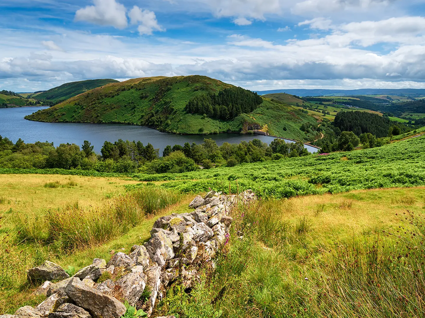
- Llyn Clywedog reservoir: A large reservoir on the River Clywedog, created by a dam completed in the late 1960s. The trail follows scenic shoreline near Llanidloes.
- Dylife: A tiny former lead-mining village high in the hills. Its industrial remains and exposed setting make it one of the route’s most atmospheric stops.
- Machynlleth – Owain Glyndŵr / Parliament House: Historic mid-point town where Glyndŵr summoned his parliament in 1404. The Parliament House and clock tower give the walk a strong cultural anchor.
- Lake Vyrnwy (Llyn Efyrnwy): A Victorian reservoir behind a striking masonry dam, now also an RSPB nature reserve. It comes in the later stages of the route.
- Powis Castle, Welshpool: A medieval castle near the finish, known for red-stone walls and terraced gardens, now cared for by the National Trust.
Challenges to expect
Do not underestimate the climbing: Glyndŵr’s Way has no major mountains, but it is relentlessly hilly, with little flat walking and about 7,600 m of ascent overall. High moorland can be boggy and occasionally pathless, so map-and-compass skills are useful in mist. Accommodation is sparse in places and should be booked ahead. In mid-winter, daylight is short and ground is usually wetter.
HikeList Score
Glyndŵr’s Way scored 93/100 on HikeList's trail-quality metrics.
See score breakdownHide breakdown
- Ideal length 96
- Balanced challenge 100
- Scenery & wildness 81
- Varied terrain 100
- Accommodation 100
- Food & support 88
- Path quality 92
- Season flexibility 89
Computed from length, challenge, scenery & wildness, terrain variety, accommodation, food & support, path quality and season flexibility.
 United Kingdom
 Wales
WalesShow more data Show less
- Moorland
- Upland Mire
- Heath
- Rolling Hills
- Woodland
- Forest
- River Valleys
- Firm Tracks
- Field Paths
- Minor Roads
- Pathless Fields
- Boggy Moorland
- B&Bs
- Pubs/Inns
- Hotels
- Hostels
- Bunkhouses
- Self Catering
- Campsites
- Glamping
- Family Friendly
- Dog Friendly On Leash
- Restrooms
- Potable Water Sources
- Established Campsites
- Picnic Areas
Download Our Full Guide to Glyndŵr’s Way FREE!
Get our comprehensive guide to this hike for free. Save it for later reading or print out at home.
In these collections
Photos from hikers
Taken on the trail by people who've reviewed Glyndŵr’s Way.
Glyndŵr’s Way: The Complete Guide
 i
Image by Helen Hotson
i
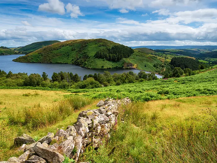
Image by Helen Hotson Glyndŵr's Way is a quiet, demanding National Trail through the heart of mid-Wales, running 217 km from Knighton (Tref-y-Clawdd) to Welshpool (Y Trallwng). It suits walkers who want solitude, Welsh history and long upland days more than busy summits or frequent café stops.
The route makes a broad horseshoe through Powys, pushing west across the Cambrian Mountains to Machynlleth before turning back through the Radnorshire and Montgomeryshire hills. Along the way are sheep-farming ridges, open moorland, reservoir shorelines, conifer forest, woodland and quiet valleys.
Its historical thread is Owain Glyndŵr, the last native Prince of Wales, with Machynlleth forming the trail’s natural centrepiece. Abbeycwmhir (Abaty Cwm-hir), Llyn Clywedog, Dylife, Foel Fadian, Lake Vyrnwy (Llyn Efyrnwy) and Powis Castle near Welshpool give the walk its strongest anchors.
This is not a high-mountain route, but it is harder than its modest elevations suggest. Around 7,200 m of ascent, sparse accommodation, boggy moorland and occasional pathless ground mean you need fitness, forward planning and map-and-compass confidence in poor visibility.
This guide covers stages, days, accommodation, food, transport, terrain and common mistakes.
Stage-by-Stage Guide
The stages below follow the widely used 9-day itinerary from Knighton (Tref-y-Clawdd) to Welshpool (Y Trallwng). It is a practical plan rather than the only way to walk Glyndŵr's Way: accommodation availability often dictates where each day ends, especially away from the four larger service towns.
Distances and ascent figures should be treated as approximate. The trail is well waymarked as a National Trail, but open moorland, forestry junctions and misty uplands still require proper map-and-compass navigation.
Stage 1: Knighton to Felindre (24 km / 15 miles)
Glyndŵr's Way starts at the Town Clock in Knighton town centre, where it meets the Offa's Dyke Path on the Wales–England border. The day begins with a climb out of town through woodland and farmland, then contours around Garth Hill before heading into quiet Radnorshire pasture.
The main upland section is Beacon Hill Common, close to 500 m and crossed by old drove roads. In clear weather this is a fine, open start to the trail; in mist it can be confusing, with multiple tracks and exposed ground requiring close attention to the map.
Llangunllo is the useful stop on the day. The Greyhound, sometimes listed as the New Inn, can be a lunch stop, but opening times should be checked before relying on it. A detour south of the route leads towards the Battle of Pilleth site, associated with Owain Glyndŵr's 1402 victory over Henry IV's forces.
Felindre is a very small village with virtually no services and no shop. Accommodation is limited: Brandy House Farm, right on Glyndŵr's Way, is the main walker option, with self-catering cottages, glamping pods, a caravan and a couple of camping pitches. The status of the village's Wharf Inn should be checked before travelling, as small rural pubs here open and close.
Carry lunch and water from Knighton unless planning around Llangunllo. There is no dependable resupply between Llangunllo and Felindre, and streams should not be assumed safe to drink untreated because the route passes through sheep and cattle country.
There is no rail access at Felindre. Road access is by rural lanes, so lifts, taxis or baggage-transfer arrangements need to be planned in advance. The main warning on this stage is navigation on Beacon Hill Common in poor visibility, plus the lack of end-of-day services if accommodation or food has not been booked.
Stage 2: Felindre to Abbeycwmhir / Abaty Cwm-hir (25 km / 15.5 miles)
This is a full day of two substantial up-and-down sections divided by the River Ithon valley. The route climbs through high pasture, passes Garreg Lwyd wind farm and crosses the ancient earthwork of Castell y Blaidd, or Wolf's Castle, where open views reward the effort.
The wilder section is Ysgwd Ffordd, an exposed moorland crossing that can be boggy and indistinct in places. Waymarking is generally good through the farmland, but the moor needs more care, particularly in low cloud or heavy rain.
Llanbadarn Fynydd is passed en route and is the practical halfway service point. The New Inn pub is useful for food and drink, but opening times should be checked before depending on it.
Abbeycwmhir is a tiny hamlet with major historical interest but few practical services. The ruined 12th-century Cistercian abbey is traditionally linked with the burial of Llywelyn ap Gruffudd, the last native Prince of Wales, and was attacked and burned by Owain Glyndŵr's forces in 1401.
Accommodation options include the Happy Union Inn and Laurel Bank B&B. The Happy Union is the village pub but does not serve food, so arrange an evening meal with accommodation where possible or carry food in from earlier in the day. There is no shop in Abbeycwmhir.
Public transport options are limited at the end of the stage, and onward travel should be arranged before arrival if not staying locally. The key planning risks are the exposed boggy ground on Ysgwd Ffordd and the absence of evening food unless it has been arranged in advance.
Stage 3: Abbeycwmhir / Abaty Cwm-hir to Llanidloes (25 km / 15.5 miles)
This is one of the hardest southern stages, with around 900 m of ascent and a constant pattern of dips and rises. The walking moves through high farmland, forestry, wind farm country around Llandinam, watery valleys and older woodland.
Underfoot conditions can be tiring after rain. Expect muddy field paths, forestry tracks and repeated short climbs rather than one obvious mountain ascent; the cumulative effort is the challenge.
As the route approaches Llanidloes, Llyn Clywedog begins to appear in the distance, marking the transition towards the Cambrian Mountains. Llanidloes is the first proper town since Knighton and is a major recovery and resupply point.
Llanidloes has a Co-op supermarket on Llangurig Road, a Spar on Long Bridge Street, plus pubs, cafés and restaurants. The historic centre, including its 16th-century market hall, makes this one of the more comfortable overnight stops on the trail.
Accommodation choices include The Unicorn Hotel, The Mount Inn, The Trewythen and other local options. It is still worth booking ahead, as the town can fill during local events and busy summer periods.
There is no rail station listed for Llanidloes in the trail brief, so this is primarily a road-access stage end. Use Llanidloes to stock up before the more remote Cambrian Mountain stages ahead; do not leave town short of food, water capacity or essential supplies.
Stage 4: Llanidloes to Dylife (23 km / 14.5 miles)
The stage leaves Llanidloes by crossing the River Severn near its headwaters, then moves through woodland and pasture towards the Clywedog valley. Bryntail Lead Mine ruins provide the first major landmark, close to the Clywedog Dam.
The trail passes beneath the Clywedog Dam, the tallest mass-concrete dam in Britain, then follows the southern shore of Llyn Clywedog. This is one of the most scenic sections of the route, with reservoir views and frequent sightings of red kites and buzzards overhead.
After the reservoir, the route climbs onto the Roman road associated with the ancient Sarn Helen route and follows it north towards Staylittle (Penffordd-las). Staylittle has a small shop and some accommodation, but no pub; it can be a useful alternative overnight if Dylife is full.
Beyond Staylittle the walking continues over exposed moorland and Roman road terrain to Dylife. The hamlet sits high in the Cambrian Mountains at around 420 m and has a strong former lead-mining character, with spoil heaps, ruins and wide upland views.
Dylife has no shop. The key accommodation is Y Star Inn, also written as The Star Inn, a 17th-century drover's inn with rooms and food. It is the only accommodation option at Dylife, so book well ahead and check meal arrangements when booking.
Stock up fully in Llanidloes and carry enough water for the day. The Roman road can be clear underfoot, but it is exposed; in mist, the moorland around Dylife demands map-and-compass confidence. There is no rail access at Dylife, and road access is remote.
Stage 5: Dylife to Machynlleth (23 km / 14.5 miles)
This is the most remote and dramatic stage of the southern half. From Dylife the route returns to the Roman road, then climbs onto open moorland towards Glaslyn, an isolated glacial lake at about 480 m and an important breeding-bird site.
The trail then reaches the shoulder of Foel Fadian, the high point of Glyndŵr's Way at around 510 m. The path traverses the flank rather than necessarily visiting the true summit, but this is still the highest and most exposed ground on the whole trail.
In clear conditions, views extend north towards Cadair Idris and south across Plynlimon and the Cambrian Mountains, with possible long views towards Cardigan Bay. In cloud, this becomes a serious navigation stage, particularly around Glaslyn and Foel Fadian.
The descent from Foel Fadian is gradual but can be boggy. The route passes over Rhiw Goch before dropping into farmland and the Dulas valley, then on into Machynlleth.
Machynlleth is the trail's midpoint and a major practical reset. It has cafés, pubs, restaurants, supermarkets, outdoor gear shops, a post office and cash machines. Historically, it is central to the route's story: Owain Glyndŵr held his parliament here in 1404, and Parliament House stands just off the main street.
Accommodation options include Toad Hall, Maenllwyd Guest House, The White Lion Hotel and other B&Bs. Machynlleth railway station is on the Cambrian Line, with Transport for Wales services towards Shrewsbury and Aberystwyth, making it the most useful join-or-leave point on the trail.
Carry proper bad-weather gear even if the forecast looks settled. This stage is not long by distance, but the combination of exposure, boggy ground and high moorland makes it one of the days where poor visibility can most affect progress.
Stage 6: Machynlleth to Llanbrynmair (25 km / 16 miles)
North of Machynlleth the trail changes character. The hills are generally lower than the Cambrian Mountain crossing, but the walking remains rolling and tiring rather than easy.
The route initially leaves Machynlleth through Forge, including some road walking, before climbing onto moorland above the Dyfi valley. Views look back towards the Dyfi estuary and Cadair Idris, then the trail follows a long ridge above the Afon Twymyn valley with views into the Dyfi hills and the Tarrens.
The latter part of the day descends through farmland into Llanbrynmair. Compared with Stage 5 it is a quieter, more domesticated day, but still long enough to require an early start and steady pacing.
Llanbrynmair is a small village with limited services. The Wynnstay Arms and Wynnstay House B&B are established walker options, and a café may operate in the village, but this should be checked before travelling.
No shop should be relied on in Llanbrynmair, so buy food in Machynlleth before leaving. Carry lunch, snacks and enough water for the day.
The village lies near the Cambrian railway corridor, with Caersws or Cemmaes Road the nearest station options, and rural bus services are limited. Public transport and taxis should be planned in advance. Navigation is generally reasonable, but the moorland above the Dyfi valley still needs attention in mist.
Stage 7: Llanbrynmair to Llanwddyn / Lake Vyrnwy (28 km / 18 miles)
This is the longest stage in the 9-day itinerary and one of the toughest in the northern section. The route leaves Llanbrynmair northwards, passes under the railway line and climbs steeply at first, with views back into the valley.
The day becomes wilder around Pen Coed, a lonely bracken-covered moor associated with untamed wild ponies. Expect boggy ground in places and a much more remote feel than the villages at either end suggest.
The trail then descends into Cwm Nant yr Eira, the Valley of the Snowy Brook, before entering Dyfnant Forest. This large conifer plantation can be wet and muddy, and navigation requires care at forest-track junctions where waymarks may be less obvious.
The reward is the first view of Lake Vyrnwy (Llyn Efyrnwy), with the Victorian reservoir and its 33-arched dam appearing after the forest. Llanwddyn is the village at the dam end of the lake; the original village was flooded during the reservoir's 1880s construction, with a Victorian model village built for displaced residents.
Accommodation around Llanwddyn includes Gorffwysfa B&B, Lake Vyrnwy Hotel & Spa about a mile from the dam, and options in the wider area such as Riverbend Caravan Park. Book early, as this is a key overnight point with limited capacity for walkers.
Food options include the Old Barn café, the Artisans café at Coed y Capel car park, Dafarn Newydd Stores in Llanwddyn village and the Lake Vyrnwy Hotel restaurant. Check opening times before relying on cafés or shops, especially outside high season.
RSPB Lake Vyrnwy Nature Reserve has bird hides and is known for peregrine falcons and a wide range of birdlife. The practical warning on this stage is simple: it is long, remote in the middle, and Dyfnant Forest demands concentration rather than casual waymark-following. A GPS can be useful, but should not replace map and compass.
Stage 8: Llanwddyn / Lake Vyrnwy to Meifod (24 km / 15 miles)
This is a gentler, more pastoral day following the River Vyrnwy downstream. After the exposed and forested walking of Stage 7, the route has a noticeably lower-level Welsh Marches character.
The stage includes several river sections and passes small villages including Pont Llogel, Pontrobert and Dolanog. Part of the route coincides with the Ann Griffiths Walk, which commemorates the Welsh Methodist hymn-writer Ann Griffiths of Dolanog.
Terrain is generally easier than previous stages, with more valley-floor walking and fewer major climbs. Paths can still be muddy after wet weather, and riverside sections should not be treated as a guaranteed source of untreated drinking water.
Meifod is an attractive village in the Vyrnwy valley and a practical overnight before the final stage. It has a community shop and café, along with accommodation such as the Kings Head Inn and Gwyndy Cottage.
Accommodation in Meifod is limited enough that booking ahead remains important. The Kings Head Inn is a popular walker stop, so do not assume late availability in summer.
Navigation is easier than on the moorland stages, with generally good waymarking and more settled valley scenery. Public transport details are not a strong feature of this stage; if leaving the trail at Meifod, onward travel should be checked before travelling.
Stage 9: Meifod to Welshpool / Y Trallwng (18 km / 11 miles)
The final stage is the shortest, but it still includes one last proper hill. From Meifod the route climbs through Broniarth Hill woods, loops around Llyn Du and then crosses farmland towards Y Golfa.
Y Golfa, at around 340 m, is the final summit of Glyndŵr's Way. In clear conditions it gives broad views over the Severn valley and into England, making it a fitting last high point before the descent to Welshpool.
After Y Golfa the route drops through the parkland of Llanerchydol Hall and into Welshpool. The walking becomes easier underfoot as the trail approaches the town.
Glyndŵr's Way finishes beside the Montgomery Canal near the town centre, with the finish stone in a small canal-side garden. The route also links here with the Severn Way regional trail.
Welshpool has full town services: shops, supermarkets, pubs, restaurants, cash machines and accommodation. Powis Castle, a red-stone medieval castle with terraced gardens cared for by the National Trust, lies close to town and is the obvious post-walk visit if time allows.
Welshpool railway station is on the Cambrian Line, with Transport for Wales services towards Shrewsbury and onward national connections. The Welshpool & Llanfair Light Railway also has its town terminus at Raven Square as an optional detour.
Navigation is generally straightforward, though the Y Golfa section still needs attention in poor weather. The main practical warning is not to underestimate the final climb simply because the day is shorter; tired legs and wet farmland can still slow the finish.
Recommended Itinerary
Standard 9-day itinerary
The 9-day schedule is the standard way to walk Glyndŵr's Way. It is not just a neat division of distance: on several sections, the overnight stops are dictated by where accommodation exists, especially between Knighton, Llanidloes, Machynlleth and Welshpool.
Distances are approximate and should be checked against official mapping before booking accommodation. The route has about 7,200 m of total ascent, so the daily figures can feel harder than they look on paper.
| Day | From | To | Approx. distance | Why this stage makes sense | Services/accommodation notes |
|---|---|---|---|---|---|
| 1 | Knighton (Tref-y-Clawdd) | Felindre | 24 km / 15 miles | A long opening day through the border hill country. Felindre is the practical stopping point before the trail continues into much quieter country. | Knighton has full start-of-walk services, including shops, pubs, cafés, accommodation and the Heart of Wales line station. Felindre has very limited services and no shop; accommodation may require careful booking or a local transfer. |
| 2 | Felindre | Abbeycwmhir (Abaty Cwm-hir) | 25 km / 15.5 miles | This stage continues through remote Radnorshire hills and ends at the natural overnight point near the abbey ruins. | Abbeycwmhir is a tiny hamlet with minimal services. The Happy Union Inn and local B&B options should be arranged well ahead; evening meals are not something to leave to chance. No shop. |
| 3 | Abbeycwmhir (Abaty Cwm-hir) | Llanidloes | 25 km / 15.5 miles | A demanding but useful stage because Llanidloes is the first proper town since Knighton and the best service stop before the Cambrian Mountains. | Llanidloes has pubs, cafés, shops, a small supermarket, cash machines and a wider choice of accommodation. It is a good place to resupply before the more isolated Llanidloes–Dylife–Machynlleth section. |
| 4 | Llanidloes | Dylife | 23 km / 14.5 miles | The route passes Llyn Clywedog and climbs into exposed Cambrian Mountains terrain. Dylife is the key overnight stop on this upland stretch. | Dylife is extremely isolated. Y Star Dylife is the main accommodation and food option; book early, as there is no shop and little fallback nearby. |
| 5 | Dylife | Machynlleth | 23 km / 14.5 miles | This is one of the defining upland days, crossing the trail's high point around Foel Fadian before descending to Machynlleth. | Machynlleth is the major mid-route town, with supermarkets, cafés, pubs, restaurants, pharmacy, cash machines and the Cambrian Line station. It is the best place for resupply, laundry and a rest night. |
| 6 | Machynlleth | Llanbrynmair | 25 km / 16 miles | The route leaves Machynlleth and heads into quieter Dyfi Valley hill country. Llanbrynmair is the practical overnight halt before the long push towards Lake Vyrnwy. | Llanbrynmair has limited village services. The Wynnstay Arms is the main walker pub/B&B, with other accommodation limited; do not assume late booking flexibility. |
| 7 | Llanbrynmair | Llanwddyn / Lake Vyrnwy (Llyn Efyrnwy) | 28 km / 18 miles | The longest stage of the standard itinerary and often the hardest distance-wise. The length is driven by sparse accommodation between Llanbrynmair and Llanwddyn. | The route passes Llangadfan, where the Cann Office Hotel is a useful on-route stop for food, accommodation or a split-stage plan. Llanwddyn/Lake Vyrnwy has limited accommodation, including Lake Vyrnwy Hotel & Spa and Gorffwysfa; no general shop. |
| 8 | Llanwddyn / Lake Vyrnwy (Llyn Efyrnwy) | Meifod | 24 km / 15 miles | After Lake Vyrnwy, the route follows gentler country around the River Vyrnwy, though it remains a full walking day. | Meifod is a small village with limited services. The Kings Head Inn is the main walker pub/B&B; book ahead and check meal availability. |
| 9 | Meifod | Welshpool (Y Trallwng) | 18 km / 11 miles | A shorter final day, giving a more forgiving finish after the longer middle stages. The route ends beside the Montgomery Canal near Welshpool town centre. | Welshpool has full market-town services, including supermarkets, cafés, pubs, hotels, B&Bs and the Cambrian Line station for trains towards Shrewsbury. Powis Castle is close to the finish if time allows. |
Slower 11–12 day variant
A slower itinerary suits walkers who prefer shorter days, want more recovery time, or are less comfortable stacking long hill stages back-to-back. It is also useful if the 9-day accommodation pattern is already full, although extra stops still need careful checking.
The most sensible split is the long Llanbrynmair to Llanwddyn day:
| Split stage | From | To | Approx. distance | Why it helps | Services/accommodation notes |
|---|---|---|---|---|---|
| 7a | Llanbrynmair | Llangadfan | 18 km / 11 miles | Breaks up the longest day of the standard itinerary and reduces the pressure before Lake Vyrnwy. | Llangadfan has the Cann Office Hotel on the route, with accommodation and walker services. No shop; book meals and beds in advance. |
| 7b | Llangadfan | Llanwddyn / Lake Vyrnwy (Llyn Efyrnwy) | 17 km / 10.5 miles | Gives a shorter approach to Lake Vyrnwy and makes the northern section less rushed. | Llanwddyn accommodation is limited, so the split only works if both Llangadfan and Llanwddyn beds line up. Check official mapping before booking. |
Another possible way to ease the route is to break the Abbeycwmhir to Llanidloes stage with a stop around Llanbadarn Fynydd. Accommodation there is very limited, so this should be checked before travelling and should not be assumed as a reliable last-minute option.
An 11-day plan is usually the most practical slower version. A 12-day or longer schedule can work well for walkers who want a rest night in Machynlleth or prefer shorter mileage throughout, but the final shape will depend heavily on available beds.
Faster 7–8 day variant
A faster itinerary is possible, but it is only suitable for fit, experienced long-distance walkers who are comfortable with consecutive 30 km-plus days, repeated ascent and remote ground. The route may not have high mountains, but fatigue builds quickly because there is little flat walking.
The easiest compression is usually near the end, where the shorter Meifod to Welshpool stage can be combined with part of the previous day to finish in 8 days. A 7-day schedule is much less forgiving and may be impractical once accommodation availability is taken into account.
For most walkers, the 9-day itinerary is the best balance between distance, services and recovery. Faster plans should still be built around confirmed accommodation first, not around mileage alone.
Planning the Route
Start by booking accommodation, not by drawing the perfect itinerary
Accommodation is the main constraint on Glyndŵr's Way. The route passes through very few sizeable settlements, and only Knighton, Llanidloes, Machynlleth and Welshpool have a meaningful range of services.
Between these towns, overnight stops are often small villages, farm stays, B&Bs or one pub with rooms. In several places there may be only one realistic option, so the available bed often decides the stage rather than the other way round.
For spring and summer trips, book as early as possible; 3–6 months ahead is sensible for popular dates. If a key stop such as Felindre, Abbeycwmhir or Dylife is full, the whole itinerary may need to shift.
| Overnight area | Planning implication |
|---|---|
| Felindre | Very limited accommodation and no shop. Brandy House Farm, on the trail, is the main walker option. Book early. |
| Abbeycwmhir / Abaty Cwm-hir | Sparse accommodation. The Happy Union pub does not serve food, so arrange an evening meal with accommodation in advance where possible. |
| Dylife | No shop, and Y Star Dylife is the key accommodation option. This is one of the most important bookings on the route. |
| Llanbrynmair | Small village with limited options; do not assume spare beds will be available. |
| Llanwddyn / Lake Vyrnwy / Llyn Efyrnwy | The Lake Vyrnwy Hotel is the main accommodation option, with some B&Bs around the lake. Still book ahead. |
| Meifod | Small village with limited accommodation before the final day to Welshpool. |
Self-guided walking companies such as Contours, Celtic Trails, Macs Adventure, Wales Walking Holidays and Embark Walking Holidays offer packaged itineraries with accommodation and luggage transfer. These can be a practical choice on this trail because the accommodation pattern is awkward and rural.
How many days to allow
Most walkers should plan on 9 walking days. This is the standard full-route pace used by many walking-holiday operators and gives a demanding but realistic rhythm across the hills.
An 8-day schedule is possible for fit, experienced walkers, but it leaves little margin for bad weather, boggy ground or navigation delays. The climbs and descents are relentless, and long mileage days feel harder here than the map distance suggests.
A slower 10–12 day plan is more comfortable physically, but not always easier logistically. Extra nights require suitable accommodation in the right places, and there are not many villages where a shorter day can simply be inserted.
Machynlleth is the best place to slow the journey down. It is a natural midpoint, has rail access, and works well for a rest, resupply or split between two separate trips.
Faster, slower or standard pace?
The standard 9-day plan is the best balance for most independent walkers. It keeps daily stages long enough to reach accommodation, but not so long that the route becomes a race across difficult upland ground.
Going faster mainly suits walkers who are already comfortable with repeated 14–16 mile hill days, carrying all food needed between sparse services. It also reduces flexibility if mist, rain or tired legs slow progress on the open moorland.
Going slower is appealing, especially in autumn or for walkers wanting more time in Machynlleth or around Lake Vyrnwy. The limiting factor is not the walking but the availability of legal, bookable overnight stops.
Shortening the route
Glyndŵr's Way is not especially easy to shorten mid-route. Public transport access is limited away from the larger towns, and several rural sections have no simple exit by train.
The most practical shortened version is Knighton to Machynlleth, using Machynlleth as the finish. This covers the southern wing and ends at a town with strong rail connections on the Cambrian Line.
Llanidloes can also be useful for leaving or joining the route, but it has no railway station. Bus connections run to places such as Newtown and Machynlleth, and current timetables should be checked before travelling.
Extending the route
The obvious extension is to continue from Welshpool back to Knighton via the Offa's Dyke Path. This creates a full circular walk of about 264 km / 164 miles and adds around 47 km / 29 miles to the journey.
Allow roughly 2–3 extra walking days for this link, depending on pace and accommodation. It is most useful for walkers who want to avoid arranging a point-to-point return from Welshpool.
Day walks and shorter circular walks using parts of the National Trail are also possible from places such as Knighton and Welshpool. These are more straightforward than trying to section-hike the remote middle of the trail.
Section hiking practicality
Section hiking is possible, but Glyndŵr's Way is less convenient for this than many other National Trails. The route crosses remote parts of mid-Wales where rail access is concentrated at the ends and at Machynlleth.
The three clearest access points are:
| Access point | Use |
|---|---|
| Knighton / Tref-y-Clawdd | Start of the trail, on the Heart of Wales line between Shrewsbury and Swansea. |
| Machynlleth | Best midpoint split, on the Cambrian Line between Shrewsbury and Aberystwyth / Pwllheli. |
| Welshpool / Y Trallwng | Finish of the trail, on the Cambrian Line with onward travel via Shrewsbury. |
Llangynllo station, about 10 km from Knighton, can be useful for the early stages. Beyond that, rural buses and taxis may be needed to make section plans work.
Between Machynlleth and Welshpool, public transport access to the route is especially limited. Anyone planning short sections should expect careful timetable work and some taxi use.
Transport planning
Arrange return transport before travelling, particularly if finishing on a Sunday, late in the day or outside the main walking season. Welshpool has Cambrian Line trains towards Shrewsbury, which is the main onward hub for many walkers.
Knighton is reached by the Heart of Wales line from Shrewsbury. Services are not as frequent as on main intercity routes, so allow margin for missed connections and check current timetables before booking accommodation around arrival time.
A taxi between Knighton and Welshpool can be a useful fall-back for awkward arrival or departure times. Typical fares are around £50 for the roughly 50-minute journey, but prices and availability should be confirmed before travelling.
Food and water planning
Food planning matters on this trail. There are long stretches with no shop, and some overnight villages have only a pub or no reliable food service at all.
Carry enough food to cover the next stage whenever leaving Knighton, Llanidloes, Machynlleth or Welshpool. Emergency rations are sensible throughout the walk, not just on the moorland days.
Do not rely on village pubs or cafés being open every day or serving food in the evening. Small rural businesses may have limited or seasonal hours, so call ahead when a meal is essential.
Carry full water capacity when leaving settlements. Natural water is present in the hills and moorland, but it should be treated before drinking.
Navigation planning
Glyndŵr's Way is a waymarked National Trail, using dragon waymarks, and much of the route is straightforward in clear weather. Even so, signs can be missing, damaged, overgrown or easy to miss at field edges and farm tracks.
Map-and-compass competence is important, especially in mist on the open moorland. The section between Dylife and Machynlleth, including Foel Fadian, is the most obvious place where poor visibility can make navigation more serious.
Use a proper map as well as a phone or GPS device. The Cicerone guidebook Walking Glyndwr's Way is the standard trail guide, and Harvey produces dedicated National Trail mapping for Glyndŵr's Way at 1:40,000.
Downloaded mapping or GPX files are strongly recommended, because mobile signal cannot be assumed in remote valleys and upland sections. Apps such as OS Maps or Komoot are useful only if the route and base maps are available offline.
Weather and season
March to October is the practical walking season. This is when most walkers and walking-holiday operators treat the route as viable, although conditions can still be wet, windy and boggy at any time.
April and May can be good months for planning because accommodation demand is often lower than in high summer. June to August has longer daylight but books up fastest, especially at the sparse overnight stops.
September and October remain popular, but days shorten quickly and weather windows become more important. Build in enough daylight for slow going on wet ground and for navigation checks on open hills.
Winter is not recommended for most walkers. Short daylight, wetter ground, closed accommodation and exposed moorland make the logistics and safety margin much harder.
Permits, access and camping
No permit is needed to walk Glyndŵr's Way, and there is no trail fee. It is a public National Trail.
Wild camping is not a legal right in Wales. If camping away from a formal site, permission should be sought from the landowner, and this is not something to rely on as a solution to the route's accommodation gaps.
Formal campsites, bunkhouses and glamping options exist in some areas, but they are not evenly spaced enough to remove the need for careful planning. Treat camping stops with the same caution as B&Bs: check availability, opening dates and food access before setting off.
Towns, Villages and Overnight Stops
Accommodation is one of the main planning constraints on Glyndŵr's Way. The full-service towns are well spaced, but several overnight stops are small villages or isolated upland settlements with only one realistic place to sleep.
Book the critical rural nights before fixing trains or luggage transfer. Pub opening hours, evening meals, bus times and shop hours should be checked before travelling, especially outside the main March–October walking season.
Knighton (Tref-y-Clawdd)
Knighton is the start of Glyndŵr's Way, with the trail beginning at the Town Clock in the town centre. It is also an Offa's Dyke Path trail town, so it is well used to walkers and makes the best place to stay the night before setting off.
Accommodation is good by Glyndŵr's Way standards, with B&Bs, farmhouse accommodation, self-catering, camping and a hotel. Even here, summer weekends can be busy, so book ahead rather than assuming a bed will be available on arrival.
The town has a useful range of independent shops on Broad Street, including a butcher, baker, bookshop and outdoor outfitter. There is no large supermarket in the town centre, so any specialist trail food or camping supplies should be sorted before arrival if needed.
Knighton has cafés, pubs and small places to eat, plus the Offa's Dyke Centre with a free exhibition, café and walker information point. The railway station is on the Heart of Wales Line, with services to Shrewsbury and Swansea; it is around 5–10 minutes on foot from the town centre.
Felindre
Felindre is the first typical overnight stop, about 24 km from Knighton on a standard 9-day itinerary. It is a small village rather than a service centre, so this is a night to plan carefully.
There is no shop in Felindre. Carry food from Knighton for the day and do not rely on being able to buy provisions after arrival.
Accommodation is very limited, with farmhouse-style B&B accommodation used by walkers and evening meals sometimes arranged by the host. There is no useful public transport, so if the village accommodation is full, the walking day can become awkward without a pre-arranged lift or taxi.
Abbeycwmhir (Abaty Cwm-hir)
Abbeycwmhir is a quiet hamlet and a common second overnight stop, reached after another long rural stage from Felindre. Its main landmark is the ruined 12th-century Cistercian abbey, traditionally linked with Llywelyn ap Gruffudd, the last native Prince of Wales.
Services are limited. There is no dedicated village shop, though basic provisions may be available locally through the pub/post office arrangement; do not treat this as a full resupply point.
The Happy Union Inn is the key village pub and accommodation option, with other nearby options including B&B, self-catering and occasional camping arrangements. Capacity is small, so Abbeycwmhir should be booked early.
There is no public transport in the village. Llandrindod Wells, on the Heart of Wales Line, is about 8 miles / 13 km away and can be useful for joining or leaving the route, but onward transport needs arranging.
Llanidloes
Llanidloes is the first proper resupply town after Knighton and one of the most useful overnight stops on the route. It sits at the end of the third typical walking day and is the best place in the first half of the trail to restock, wash kit and reset plans.
Shops include a Co-op on Llangurig Road, a Spar on Long Bridge Street, plus a greengrocer, bakery, organic food shop, bookshop and other independent stores. There is also an ATM in town.
Food options are much better than in the smaller villages, with several pubs, cafés and restaurants. Accommodation is varied, including hotels, B&Bs, farmhouse B&Bs, self-catering, camping/glamping and bunkhouses.
Llanidloes has no railway station. Limited buses connect with places including Machynlleth and Welshpool, and current timetables should be checked before travelling.
Llyn Clywedog and Staylittle (Penffordd-las)
The route leaves Llanidloes for a more remote section around Llyn Clywedog and on towards Staylittle and Dylife. Llyn Clywedog is a large reservoir on the River Clywedog and gives a notable change of scenery, but it is not a reliable service stop.
Staylittle / Penffordd-las is a tiny upland settlement passed en route. Treat it as having minimal or no services and carry what is needed from Llanidloes.
This part of the trail is a good example of why Glyndŵr's Way needs forward planning. A missed shop or closed pub is not easily solved once on the open upland sections.
Dylife
Dylife is one of the most important bookings on the whole trail. It is a tiny former lead-mining village high in the Cambrian Mountains, commonly used as the overnight stop between Llanidloes and Machynlleth.
There are no shops and no public transport. Road access is by narrow mountain roads, so taxis or support pickups should be arranged well in advance if needed.
Y Star Inn (The Star Inn), a 17th-century drover's inn dating from around 1640, is the key overnight option in Dylife, with en-suite rooms and food. It is the only realistic accommodation in the village, so if it is full there is no easy fallback on foot.
Book this night well ahead, particularly in peak season. Do not leave the Llanidloes–Dylife–Machynlleth section unplanned unless prepared for a major route adjustment.
Machynlleth
Machynlleth is the trail's midpoint town and the strongest service stop on Glyndŵr's Way. It is also a natural place for a rest day or for splitting the trail into two separate trips.
The town has a wide range of food and shopping, including independent food shops, cafés, takeaways and pubs. Full resupply is straightforward here, and there is an ATM.
Accommodation includes hotels, guesthouses, B&Bs and self-catering. Options are better than in the rural stages, but summer demand still makes advance booking sensible.
Machynlleth station is on the Cambrian Line, with Transport for Wales services towards Shrewsbury, Birmingham International and Aberystwyth. The station is around 5 minutes' walk from the town centre, making Machynlleth the best rail access point for section walkers.
The Owain Glyndŵr Centre / Parliament House is the key historic stop in town. If time allows, Machynlleth is the best place on the route to pause rather than simply arrive late and leave early.
Llanbrynmair
Llanbrynmair is the usual overnight after the stage from Machynlleth. It is a small village, but it has more practical value than many places on the northern half of the trail because of its shop and pub accommodation.
The village shop opposite the pub is a rare and useful resupply point on this side of the route. Use it rather than assuming the next village will have equivalent services.
The Wynnstay Arms Hotel is the main pub, food and accommodation option, with meals and walker-friendly rooms. Wynnstay House B&B is another local accommodation option, but overall capacity remains limited.
There is no railway station in Llanbrynmair. The A470 runs through the village and there may be bus connections, but current timetables should be checked before travelling; rail access is via off-route stations such as Machynlleth or Caersws.
Lake Vyrnwy / Llanwddyn (Llyn Efyrnwy)
Lake Vyrnwy / Llyn Efyrnwy is a memorable but logistically awkward overnight stop. The trail reaches the reservoir and dam after a long day from Llanbrynmair, often one of the longest days in a 9-day schedule.
There is no village shop in Llanwddyn and no café at the RSPB reserve. Carry lunch and spare food, and do not arrive expecting a normal village centre.
Accommodation is limited. Lake Vyrnwy Hotel & Spa is the major option, with food available to non-guests as well as residents, while Gorffwysfa B&B offers a more modest walker-friendly alternative in the area.
This can be one of the more expensive overnight stops, especially if staying at the hotel. Book early, and check meal availability before arrival if not staying on site.
There is no public transport to Llanwddyn. Taxi access is possible from places such as Llanfyllin, but this should be arranged in advance.
Meifod
Meifod is a small Powys village in the Vyrnwy valley and the usual final overnight before Welshpool. It works well as a staging point because the last day into Welshpool is shorter than most earlier days.
The village has a small shop, but it should be treated as limited supplies rather than a full resupply. Stock up earlier if specific food is needed for the final stage.
The Kings Head Inn is the main pub and accommodation stop, with rooms, food and walker camping noted on the National Trail accommodation register. Gwyndy Cottage is another accommodation option in the village.
Meifod has no railway station. Bus connections to Welshpool may be available, but current timetables should be checked before relying on them.
Welshpool (Y Trallwng)
Welshpool is the finish of Glyndŵr's Way, beside the Montgomery Canal near the town centre. It is a full-service market town and a straightforward place to finish, stay overnight or travel home.
Shops are plentiful compared with the rest of the route, including Aldi, Tesco, Morrisons, Boots, Poundland, B&M and independent stores. There are ATMs throughout town.
Food and drink options include long-established pubs, hotels and cafés, with plenty of choice for a post-trail meal. Accommodation includes hotels, B&Bs and caravan parks in the surrounding area, with the Royal Oak Hotel a well-known central option.
Welshpool station is on the Cambrian Line, with Transport for Wales services towards Shrewsbury, Birmingham International and Machynlleth. The station is about 5 minutes' walk from the town centre.
Powis Castle is close to Welshpool and can be added before or after the finish if time allows. The Montgomery Canal towpath also makes an easy low-effort walk from the finish area.
Getting to the Start
Glyndŵr's Way starts at the Town Clock in the centre of Knighton (Tref-y-Clawdd), Powys, on the Wales–England border. The most straightforward approach for most walkers is by train via Shrewsbury, then onto the Heart of Wales Line.
Arriving the evening before the first walking day is strongly advised. The typical first stage to Felindre is around 24 km, and morning public transport from many UK cities is unlikely to leave enough daylight for a comfortable start.
By train
Knighton station is on the Heart of Wales Line between Shrewsbury and Swansea, operated by Transport for Wales. The station is just inside Shropshire, with the Wales–England border crossing the station car park; from there it is a short walk into Knighton town centre and the Town Clock trailhead.
Shrewsbury is the key interchange. Most walkers travelling from England, south Wales or further afield will change there for the Heart of Wales Line.
| Journey | Typical route | Approximate time |
|---|---|---|
| Shrewsbury to Knighton | Direct on the Heart of Wales Line | 50–53 min |
| London Euston to Knighton | London Euston → Shrewsbury → Knighton | Fastest about 3 hr 39 min; often 4–5 hr |
| Birmingham New Street to Knighton | Birmingham → Shrewsbury → Knighton | About 2 hr |
| Cardiff Central to Knighton | Cardiff → Shrewsbury → Knighton | About 3 hr 45 min |
Services on the Heart of Wales Line are sparse by mainline standards. On weekdays there are usually several trains each way, with fewer on Saturdays and very limited Sunday services. This should be checked before travelling.
Knighton station is unstaffed. Buy tickets in advance online or on board where permitted, and check current train times with Transport for Wales or National Rail before committing to accommodation or a first-day walking plan.
By bus
Bus access to Knighton is limited and mainly local. Routes serving the town include connections from Hereford and Leominster via Presteigne, plus limited rural services using stops such as Brookside Square and Ffrydd Road.
These buses are not usually the best way to reach the start from outside the immediate area. Rural Powys bus services can change, and some services are infrequent or tied to specific days. This should be checked before travelling.
Traveline Cymru is the best place to check current bus options. If arriving late or making a local connection, taxis are more reliable than assuming an onward rural bus will fit the walking schedule.
Local taxi operators serving Knighton include Knighton Taxis and Radnor & Kington Taxis. Pre-booking is sensible, especially for evening arrivals, Sundays or transfers involving outlying accommodation.
By car
Knighton sits at the junction of the A488 and A4113 in southern Powys. Approximate driving times are around 1 hour from Shrewsbury, 45 minutes from Hereford, 1 hr 45 min from Birmingham or Cardiff, and about 2 hours from Bristol.
For a point-to-point walk, there are two practical car strategies:
- Park in Knighton, walk to Welshpool, then return by train via Shrewsbury to collect the car.
- Park in Welshpool, take the train to Knighton before starting, then finish at the car.
The return rail journey between Welshpool and Knighton requires a change at Shrewsbury and depends on the Heart of Wales Line timetable. This should be checked before travelling, especially on Sundays.
Long-stay parking options in Knighton include Bowling Green Lane car park, with Norton Arms car park also serving the town centre. Knighton railway station has a small car park by the station building.
Powys County Council manages the town car parks. Overnight parking and current charges should be checked with the council before relying on any car park for a multi-day walk; quoted overnight charges can change.
From the nearest airport
Knighton is remote, and no airport is close to the trailhead. Birmingham Airport is often the most practical choice for international or long-distance arrivals because it links easily by rail to Birmingham New Street, then Shrewsbury and Knighton.
| Airport | Approximate drive to Knighton | Practical onward travel |
|---|---|---|
| Cardiff Airport | 1 hr 30–45 min | Hire car or connection via Cardiff Central |
| Birmingham Airport | About 1 hr 35 min | Rail to Birmingham New Street, then Shrewsbury and Knighton |
| Bristol Airport | About 2 hr | Usually easiest by hire car |
| Manchester Airport | About 2 hr | Rail via Manchester Piccadilly and Shrewsbury |
From Birmingham Airport, allow roughly 3 hours of rail travel from the airport terminal to Knighton, depending on connections. Current rail times should be checked before booking flights, as the final leg on the Heart of Wales Line is infrequent.
Where to stay before starting
Knighton is accustomed to walkers because Glyndŵr's Way starts here and the Offa's Dyke Path also passes through the town. Staying in Knighton the night before gives time to eat, organise supplies and make an early start from the Town Clock.
Accommodation includes hotels, guesthouses, campsites and self-catering options, but booking ahead is still wise in the main walking season. Named options in and around Knighton include The Knighton Hotel, Offa Dyke House, Panpwnton Campsite and Cefnsuran.
Campers should check opening dates, facilities and prices before travelling. Panpwnton Campsite is a small walker-friendly option with toilets and hot showers, but current availability and charges should be confirmed before booking.
If accommodation in Knighton is full, nearby alternatives may require a taxi transfer. Do not assume late-evening public transport will be available in this part of Powys.
Getting Home from the Finish
Glyndŵr's Way finishes beside the Montgomery Canal in Welshpool (Y Trallwng), close to the town centre where it meets the Severn Way. Welshpool is one of the easier places on the route to leave by public transport, but services are still rural by UK standards and onward connections should be checked before travelling.
By train
Welshpool station is on the Cambrian Line, operated by Transport for Wales, with direct trains east to Shrewsbury. The station is roughly a 5-minute walk from the town centre, so it is straightforward to reach on foot from the canal finish.
The key rail link is Welshpool to Shrewsbury: direct, no changes, around 23 minutes, with trains approximately every 2 hours. From Shrewsbury there are onward connections towards Chester, Manchester, Liverpool, Bristol and London Euston via Crewe or Birmingham.
Typical onward rail options include:
| Route | Typical journey | Notes |
|---|---|---|
| Welshpool to Shrewsbury | ~23 minutes | Direct Cambrian Line service; roughly every 2 hours |
| Welshpool to Birmingham New Street | ~1 hour 35–39 minutes | Usually 1 change at Shrewsbury |
| Welshpool to Knighton | Via Shrewsbury and the Heart of Wales Line | Useful for car retrieval, but infrequent and needs careful planning |
The first Welshpool departure is around 06:46 and the last is around 21:00, arriving in Shrewsbury at about 21:23. These times are timetable-dependent: check Transport for Wales or National Rail before booking onward trains, especially around Sundays, bank holidays and engineering works.
Welshpool station is unstaffed, with card-only ticket machines on the platform. There is no waiting room or toilets at the station, so if you have time before a train, it is usually better to wait in the town centre and walk down shortly before departure.
Build in a buffer if connecting to long-distance trains or flights. The Cambrian Line is a single-track rural railway in places, and delays or cancellations can have a bigger knock-on effect than on high-frequency urban routes.
By bus
Bus is useful for some local and mid-Wales movements, but it is not as simple as leaving by train. Traveline Cymru is the best journey planner for current Welsh bus timetables, and all bus connections should be checked before relying on them.
The X75 TrawsCymru Connect service, operated by Celtic Travel, links Shrewsbury, Welshpool, Newtown, Llanidloes and Rhayader. This can be useful if you need to reach Llanidloes or another mid-Wales point after finishing, but timings may not line up neatly with a walking finish.
Welshpool also has local town buses, including route 88, operated by Owen's of Oswestry, on a Welshpool town circular via Borfa Green. This is mainly of local use rather than a long-distance exit from the trail.
National Express runs coaches between Welshpool and London, via Birmingham Coach Station and Marble Arch, with around 2 services daily. The Welshpool to London journey is about 6 hours 5 minutes, with fares commonly around £18–£40 depending on when you book; confirm the exact stop and current timetable before travelling, as the coach stop is not at the railway station.
By car/taxi
If a car is waiting in Welshpool, the finish is conveniently close to the town centre. Long-stay parking is available in Welshpool town centre, though current charges and time limits should be checked before leaving a vehicle for several days.
If the car is back at Knighton (Tref-y-Clawdd), there are two realistic options:
| Option | Practicality |
|---|---|
| Train via Shrewsbury | Welshpool to Shrewsbury is easy, but the onward Heart of Wales Line to Knighton is infrequent, with about 4 trains per day each way |
| Taxi from Welshpool to Knighton | Roughly 50 minutes and about £50; often simpler for 2 or more walkers |
A taxi from Shrewsbury to Knighton is a longer and more expensive fallback, roughly 40 miles and typically around £60–£90. This is best treated as a contingency rather than the main plan.
Local taxi firms in Welshpool include Manafon Taxis, Amber Cabs and Silver Service Executive Travel. There is no single fixed booking platform, so call ahead, especially for early morning, late evening or Sunday travel.
From the nearest airport
Birmingham Airport is the most practical airport for most walkers leaving Welshpool. The rail journey is about 1 hour 35 minutes, usually via Shrewsbury and onward to Birmingham International.
Manchester Airport is also reachable from Shrewsbury, typically taking around 2–2.5 hours in total from the Shrewsbury connection. Cardiff Airport is possible via Cardiff Central but more indirect, at roughly 3 hours from Welshpool. Bristol Airport is less convenient, generally involving rail to Bristol Temple Meads followed by onward coach or bus.
For flights, do not plan a tight same-day connection from the trail. A late finish, a missed 2-hourly train or Cambrian Line disruption can quickly remove the margin needed for airport check-in.
Where to stay at the finish
Staying in Welshpool after finishing is often the most sensible plan, particularly if you arrive late in the day or want to avoid rushing for a 2-hourly train. Welshpool has more accommodation and services than many earlier trail stops, with pubs, restaurants, shops and a Sainsbury's in town.
Town-centre and nearby options include The Westwood Park Hotel, The Royal Oak Hotel on Broad Street, Stone House B&B on Mount Street and Buttington Country House B&B just outside town. Walker-friendly accommodation near the trail includes Tynllwyn Farm, Old School B&B, Long Mountain B&B and Severn Farm B&B.
Tynllwyn Farm is around 1 mile out and is specifically used by Glyndŵr's Way walkers, with pick-up/drop-off and baggage transfer available. These services should be arranged in advance, not assumed on arrival.
If there is time after finishing, Powis Castle is close to Welshpool and makes a practical final-afternoon visit before an overnight stay or onward journey. Check National Trust opening times before planning around it.
Which Direction Should You Walk?
Standard direction: Knighton to Welshpool
Glyndŵr's Way is best walked from Knighton (Tref-y-Clawdd) to Welshpool (Y Trallwng). This is the official and most common direction: the trail starts at the Town Clock in Knighton and finishes beside the Montgomery Canal near Welshpool town centre.
The National Trail waymarking is also set up for this direction. The acorn markers and Glyndŵr's Way dragon logos on gates, stiles and posts are much easier to follow when travelling from Knighton to Welshpool; in reverse, signs can be missed because many are effectively facing the other way.
That matters on this route more than on a busy lowland trail. Glyndŵr's Way crosses remote, boggy and sometimes indistinct upland ground, especially through the Cambrian Mountains around Dylife and Foel Fadian, where relying on backwards-facing waymarks is a poor plan in mist or poor visibility.
Direction comparison
| Direction | Main advantages | Main drawbacks |
|---|---|---|
| Knighton → Welshpool | Official direction; waymarks face you; guidebooks and common itineraries are structured this way; better rail options at the finish; strongest historical progression | The harder upland sections arrive in the first half, so fitness needs to be there from the start |
| Welshpool → Knighton | A gentler opening day if using the typical 9-day stages; may suit a specific accommodation or transport constraint | Harder navigation; poorer rail options at the finish; less natural historical arc; commercial logistics usually need more self-organisation |
Transport is easier if you finish in Welshpool
Transport is one of the strongest reasons to walk the standard direction. Knighton is on the Heart of Wales Line between Shrewsbury and Swansea, with a modest service pattern of roughly 4–5 trains per day. Timetables should be checked before travelling.
Welshpool is on the Cambrian Line between Shrewsbury and Aberystwyth, with a much more useful service pattern for finishing a long walk. There are typically around a dozen trains on Monday to Saturday, with fewer on Sundays, and direct trains to Shrewsbury take under 30 minutes. Current Transport for Wales timetables should always be checked before booking onward travel.
For most walkers arriving and leaving via Shrewsbury, this makes the logistics cleaner: accept the limited train choice at the start, then finish somewhere with more frequent onward services. Reversing the route leaves the most awkward rail connection until the end, when delays, sore feet or a slower-than-planned final day are least welcome.
The route makes more sense historically from Knighton
Walking from Knighton gives the route a clear narrative. It begins on the Wales–England border, close to Offa's Dyke country, then moves through the Radnorshire hills to Abbeycwmhir (Abaty Cwm-hir), with its links to Llywelyn ap Gruffudd.
The trail then builds towards the Cambrian Mountains, Dylife and Foel Fadian before reaching Machynlleth, where Owain Glyndŵr held his parliament in 1404. In the standard direction, Machynlleth feels like a natural mid-route landmark rather than a place passed too early.
The finish at Welshpool also works well psychologically. The trail ends beside the Montgomery Canal, with Powis Castle close to the town, giving a more satisfying finale than simply arriving at the limited rail services of Knighton in reverse.
Scenery and terrain progression
There is no simple claim that the climbs are easier in one direction. Glyndŵr's Way is relentlessly hilly either way, with around 7,200 m of total ascent, and the effort comes from repeated ups and downs rather than one major mountain pass.
The standard direction does, however, place much of the rougher and more remote terrain in the first half. The sections through Llyn Clywedog, Dylife and Foel Fadian come before Machynlleth, when most walkers are still fresher and more mentally sharp.
The northern half from Machynlleth towards Lake Vyrnwy, Meifod and Welshpool remains demanding, but it generally feels like a gradual unwinding from the most exposed Cambrian ground. In reverse, the biggest, boggiest upland sections come later, when fatigue and minor navigation errors can become more costly.
Weather and wind
There is no strong directional wind advantage on Glyndŵr's Way. Mid-Wales is exposed to south-westerly Atlantic weather, and the most weather-sensitive sections around Dylife and Foel Fadian sit near the middle of the route whichever way you walk.
In practical terms, direction matters less than timing, daylight and navigation readiness. In poor weather, the standard direction still has the advantage that waymarks are easier to pick up, especially across open moorland and upland pasture.
Accommodation and luggage logistics
Accommodation is sparse in places, so the best direction is often the one that matches available beds. Even so, the standard 9-day flow is normally planned from Knighton to Welshpool, and walking-holiday packages and luggage-transfer arrangements are generally built around that sequence.
Reversing the trail is possible, but it usually needs more careful self-organisation. The typical shorter final day from Meifod to Welshpool becomes the opening day in reverse, while longer and more remote stages fall later in the walk.
If accommodation availability forces a reverse itinerary, book every night before committing to travel. Do not assume that villages on the map have spare beds, food or easy onward transport.
What about making it circular?
Walkers who want a self-contained route can continue from Welshpool back to Knighton on the Offa's Dyke Path link. This adds about 47 km / 29 miles, creating a circular walk of roughly 264 km / 164 miles.
This extension works most naturally after walking Glyndŵr's Way in the standard direction. It also returns you to Knighton without having to rely on end-to-end public transport between the two trailheads.
Recommendation
Walk Knighton to Welshpool unless there is a strong reason not to. It is the official direction, the waymarks face you, the guidebook and common itineraries work that way, transport is better at the finish, and the historical and scenic progression is stronger.
The reverse direction is viable for experienced, well-equipped navigators with a carefully booked itinerary, but it is not the best choice for most walkers. On a remote National Trail where accommodation is sparse and navigation can be demanding, the standard direction removes several avoidable complications.
Accommodation Along the Route
Accommodation is one of the main planning constraints on Glyndŵr's Way. The trail crosses remote parts of Powys where villages are small, beds are few, and some stages are effectively shaped by where accommodation exists rather than by ideal walking distances.
Inn-to-inn walking is perfectly workable, but it needs early booking. For a full 9-day itinerary, aim to secure the bottleneck nights first — especially Felindre, Abaty Cwm-hir, Dylife and Llyn Efyrnwy — before committing to travel dates.
Best Overnight Stops and Accommodation Availability
| Place | Accommodation level | Best for | Notes |
|---|---|---|---|
| Knighton / Tref-y-Clawdd | Good | Pre-walk night, food, rail access, final kit checks | Strongest choice at the start, with pubs, B&Bs, hotels, self-catering and camping. Options include The Red Lion, Knighton Hotel, The Horse and Jockey Inn, Offa Dyke House, Watson's Ale House, The Old Malt Store and Panpwnton Camp Site. |
| Felindre | Limited | Standard Day 1 stop | A hamlet with essentially one main walker option on the trail: Brandy House Farm, with cottages, glamping pods, a caravan and hikers' camping pitches. Book this before fixing the rest of the itinerary. |
| Abbeycwmhir / Abaty Cwm-hir | Limited | Standard Day 2 stop | A small village with only a few beds, including Happy Union Inn and Laurel Bank B&B. Woodhouse Farm Bunkhouse, between Abbeycwmhir and Llanidloes, can help if splitting or reshaping stages. |
| Llanidloes | Good | Restock, easier accommodation, camping, bunkhouse options | One of the better-served towns on the route. Options include the Unicorn Hotel, The Coach and Horses B&B, Plasnewydd Bunkhouse, Dol-Llys Farm Caravan & Camping, Glyngynwydd Cottages and other self-catering/B&B choices. |
| Ty Capel / Clywedog area | Limited | Splitting the Llanidloes–Dylife section | Ty Capel B&B overlooks Clywedog Reservoir and is useful if the standard stage is too long or Dylife availability forces a different plan. |
| Staylittle / Penffordd-las | Limited | Groups, stage adjustment | The Lodge at Staylittle sleeps large groups, while Hafren Forest Hideaway B&B offers another option in the area. Useful for breaking up the remote central section. |
| Dylife | Limited | Essential central overnight, if available | The route's critical accommodation bottleneck. Y Star Inn Dylife is the only on-trail inn and has 4 en-suite bedrooms. If it is full, walkers usually need to camp locally where available or arrange transport to/from Machynlleth or Llanidloes. |
| Machynlleth | Good | Midpoint reset, restaurants, supermarket, rail access | One of the strongest accommodation bases on the trail. Options include The White Lion Hotel, Plas Dolguog Hotel, Wynnstay Hotel, Maenllwyd Guest House, Toad Hall hostel, Brynllwydwyn B&B, Gwersyllfa Glyndŵr Campsite and Llwyn Lodgings and Campsite. |
| Llanbrynmair | Limited | Standard Day 6 stop | A small village but workable with advance booking. Options include Wynnstay Arms Hotel, The Old School House B&B and Little Meadow Park. The Old School House also offers walker services such as collection/drop-off and onward luggage help. |
| Llanwddyn / Lake Vyrnwy / Llyn Efyrnwy | Limited | Reservoir overnight, higher-comfort stay | Beds are scarce and can be taken by non-walkers, especially weekends. Options include Lake Vyrnwy Hotel & Spa, Gorffwysfa, Rhiwlas Farm B&B/Cottage and some off-trail alternatives such as Cyfie Farm. |
| Llangadfan / Cann Office area | Limited | Splitting the Llanwddyn–Meifod section | Cann Office Hotel can be useful for reshaping the long Lake Vyrnwy to Meifod day. Check exact transfer and walking logistics before booking. |
| Meifod | Limited | Standard Day 8 stop | A small village with modest choice. Options include Kings Head Hotel, Sunny Lea Cabin and Campsite, Bank House B&B, TAN Y GRAIG B&B and Gwyndy Cottage. TAN Y GRAIG offers collection/drop-off service. |
| Welshpool / Y Trallwng | Good | Finish night, onward rail, food, recovery | Good end-of-route choice with hotels, B&Bs, bunkhouse/camping and self-catering. Options include Royal Oak Hotel, Tresi-Aur, The Railway Inn at Forden, Moors Farm B&B and Cottage, Severn Bunkhouse and Camping, Lake Farm Retreats and Tynllwyn Farm. |
The Main Accommodation Bottlenecks
Dylife is the key pressure point. Y Star Inn Dylife is a traditional drover's inn with 4 en-suite bedrooms, food and ales, but it is the only on-trail accommodation at this point. Book it as soon as dates are known; if it is full, the alternatives are roughly a full stage away in either direction at Llanidloes or Machynlleth.
Felindre is another early bottleneck because Brandy House Farm is effectively the main overnight option on the trail. Abbeycwmhir is less severe, but still has only a small number of beds, so it should not be left until late.
Llanwddyn and Lake Vyrnwy can also be awkward. Lake Vyrnwy Hotel & Spa is the prominent option, but it is a high-end hotel and can fill with weekend guests, events and non-walking visitors. Smaller B&Bs and nearby off-trail options should be booked early if using this as the Day 7 stop.
Llanbrynmair and Meifod are manageable with planning, but neither has a large surplus of accommodation. A single closure, private booking or fully booked B&B can force a transfer or a changed stage.
Where the Choice Is Strongest
Knighton, Llanidloes, Machynlleth and Welshpool are the easiest places to find a bed. These are also the most practical stops for food, resupply, laundry, drying kit and dealing with transport changes.
Machynlleth is the most useful midpoint reset. It has a broad range of hotels, guesthouses, hostel-style accommodation, campsites, pubs, cafés, restaurants and a supermarket, as well as rail access on the Cambrian Line.
Llanidloes is the best-serviced town before the remote Clywedog–Staylittle–Dylife section. It is a sensible place to make sure food, batteries, waterproofing and onward accommodation arrangements are all in order.
Booking Strategy
Book accommodation many weeks ahead; 2–3 months is a sensible minimum for a spring, summer or early autumn through-walk. For bank holiday weekends, school holidays or small-group trips, book earlier.
A practical sequence is:
- Secure Dylife first.
- Secure Felindre and Abbeycwmhir.
- Secure Llanwddyn / Lake Vyrnwy and Meifod.
- Fill in the stronger towns: Knighton, Llanidloes, Machynlleth and Welshpool.
- Only then book trains and any luggage transfer.
Some rural pubs and B&Bs reduce opening days or close for part of the winter. Evening meals are especially important to check in the smaller stops, because there may be no alternative within walking distance. This should be checked before travelling.
Camping, Bunkhouses and Budget Options
Camping exists, but it is not evenly spaced enough to make this an effortless campsite-to-campsite trail. Known options include Panpwnton Camp Site at Knighton, Dol-Llys Farm Caravan & Camping near Llanidloes, Gwersyllfa Glyndŵr Campsite and Llwyn Lodgings and Campsite around Machynlleth, Sunny Lea Cabin and Campsite at Meifod, and Severn Bunkhouse and Camping near Welshpool.
Bunkhouse and hostel-style options can reduce costs and help groups. Useful examples include Plasnewydd Bunkhouse near Llanidloes, Woodhouse Farm Bunkhouse between Abbeycwmhir and Llanidloes, Toad Hall in Machynlleth and Severn Bunkhouse near Welshpool.
There are also self-catering cottages and higher-comfort stays at several points, particularly around Llanidloes, Machynlleth, Lake Vyrnwy and Welshpool. These can work well for groups or rest nights, but they may not suit a one-night through-walk unless short stays are accepted.
Luggage Transfer, Packages and Off-Trail Transfers
Luggage transfer makes Glyndŵr's Way much easier, especially because the route is hilly, often wet underfoot and has long days between services. Silver Sherpa offers luggage transfer for the full length of Glyndŵr's Way; contact the operator directly for current prices and arrangements.
Walking holiday companies such as Contours and Wales Walking Holidays can package accommodation and luggage transfer for self-guided walkers. Wales Walking Holidays lists a 9-day/10-night self-guided package from around £1,150 per person based on two sharing as of 2025; confirm current prices before booking.
Some individual accommodation providers also help with walker logistics. The Old School House in Llanbrynmair and TAN Y GRAIG B&B in Meifod offer collection/drop-off services, which can be useful where beds are slightly off-route or when reshaping stages.
Taxi or accommodation transfers can solve awkward gaps, but they should be arranged before arrival rather than treated as a fallback on the day. In the more remote middle stages, mobile signal, late opening hours and the small number of local vehicles can all make last-minute plans unreliable.
Camping and Wild Camping
Glyndŵr's Way is a realistic camping route, but it is not a simple campsite-to-campsite trail in the way some busier National Trails can be. There are useful small campsites and informal camping options near several stage ends, but provision is uneven and the Lake Vyrnwy / Llanwddyn area needs particular care.
The route suits experienced backpackers who can carry light camping kit over repeated steep climbs and long days. With around 7,200 m of ascent over 217 km, a heavy tent, full cooking kit and excess food will make the walk significantly harder.
Formal and informal campsites on or near the route
Many camping options on Glyndŵr's Way are small, seasonal or informal. Book ahead where possible, especially in July and August, and contact small sites before relying on them as a stage finish.
| Place on route | Camping option | Practical notes |
|---|---|---|
| Knighton (Tref-y-Clawdd) | Panpwnton Farm Campsite, Knighton, Powys LD7 1TN; 07503 186166 | Small family-run site with toilets and hot showers. Dog-friendly. Useful for a pre-walk night. Listed at £10 per person per night; confirm current prices before booking. |
| Knighton area | Bankfield, Knighton, Powys LD7 1HY; 07947 637245 | Informal field camping with landowner permission rather than a conventional campsite. Arrange in advance. |
| Felindre | Trevland, Felindre, Knighton, Powys LD7 1YL; 01547 510211 | Useful Stage 1 finish. WC, shower and meals available. Dogs by prior arrangement. |
| Abbeycwmhir (Abaty Cwm-hir) | Home Farm / Abbeycwmhir camping at the abbey ruins | Informal camping within the 12th-century Cistercian abbey ruins. Small outbuilding with loo, washbasin and shower, plus a tap in the field. The owner asks for a small donation to the air ambulance; the amount should be checked on arrival. Ring ahead to confirm availability. |
| Llanidloes | Dol Llys Camping Site, on the banks of the River Severn; 01686 412694 | Working-farm campsite by the Severn. Llanidloes is a useful resupply town with shops, cafés and pubs, making this one of the better camping stops on the trail. |
| Machynlleth | Gwersyllfa Glyndŵr Campsite, Brynglas, Glaspwll, Machynlleth, Powys SY20 8TY; 07940 756070 | Walker- and cyclist-focused site about half a mile south of Machynlleth, at the junction of Glyndŵr's Way and the Wales Coast Path. Grass field, mountain views, no marked pitches and car-free. A bothy is available. No dogs. Contact to confirm prices and seasonal opening. |
| Near Machynlleth | Gwerniago Camping Site, Pennal, Machynlleth, Powys SY20 9JX; 01654 791227 | Near the Machynlleth section rather than a guaranteed on-trail stop. Check access and availability before planning a stage around it. |
| Near Machynlleth | Llwyn Lodgings and Campsite, Penegoes, Machynlleth SY20 8NH; 07850 209734 / 01654 703733 | Orchard campsite, tents only, with 10 pitches. Check distance from the trail and booking requirements before using it as an overnight stop. |
| Llanbrynmair | Cringoed Holiday Park | Family-run caravan and camping site in Llanbrynmair, a useful overnight point between Machynlleth and Lake Vyrnwy. Check current touring and tent availability before travelling. |
| Llanwddyn / Lake Vyrnwy (Llyn Efyrnwy) | Lake Vyrnwy Campsite, Brynfedwen, Llanwddyn, Powys SY10 0LS | Closed in 2026 and hoping to reopen in 2027. This is significant because camping provision around Llanwddyn is limited. Check lakevyrnwycampsite.co.uk before planning around it. |
| Meifod | Sunny Lea Cabin and Campsite, Meifod, Powys SY22 6YA; 01938 500909 / 07977 414038 | Right on Glyndŵr's Way. Small camping field with 3 tent spaces, plus 2 small glamping cabins. Book ahead because capacity is very limited. |
Where camping is awkward
The most awkward camping gap is around Llanwddyn / Lake Vyrnwy, especially while Lake Vyrnwy Campsite is closed. Walkers using the standard Llanbrynmair to Llanwddyn to Meifod sequence may need to book a B&B or other indoor accommodation at Llanwddyn, adjust stages, or arrange permitted camping privately.
The Abbeycwmhir to Llanidloes section also needs care because formal provision is limited and the Abbeycwmhir option is informal. Do not assume it will be available without phoning ahead.
Dylife is a remote hamlet and should not be treated as a reliable camping stop unless accommodation has been arranged in advance. For many campers it works better as a place passed through between Llanidloes and Machynlleth rather than as the intended overnight point.
Wild camping: law and practical reality
There is no general legal right to wild camp in Wales without the landowner's permission. Camping without permission is normally a civil trespass issue, but that does not make it a right, and walkers should not assume access land or open moorland automatically allows camping.
Glyndŵr's Way does not pass through Eryri (Snowdonia) or Bannau Brycheiniog (Brecon Beacons), where some high-level wild camping has long been tolerated in practice. This route crosses Powys farmland, upland pasture, forestry, reservoir country and open moorland, much of it working sheep-farming land.
Wild camping is possible in practical terms, and discreet backpackers do use it on the remoter moorland sections. The correct approach is to seek permission where feasible, avoid enclosed farmland and livestock areas, and never rely on wild camping as a guaranteed legal option.
A Wild Camping (Wales) Bill was progressing through the Senedd with cross-party support as of 2026. If passed, it could change the legal position for open mountain and moorland in Wales. This should be checked before travelling.
Best sections for a discreet backpacking camp
The more open parts of the Cambrian Mountains between Llanidloes, Dylife and Machynlleth offer the best prospects for a low-impact backpacking camp, because the route spends more time away from villages and enclosed farmland. These sections are also exposed and can be boggy, so camp spots may be fewer than the map suggests.
The upland sections between Llanbrynmair and Llanwddyn can also be suitable in practical terms, but this is precisely where planning matters because formal campsite provision is thin. A stream above Llangadfan has been used by walkers as a wild camp location, while the moorland above Dolanog can work if water is carried up.
Farmland sections between villages are much less suitable. Livestock, gates, field boundaries, houses and limited flat ground make discreet camping harder and increase the chance of causing a problem.
Water for campers
Water is one of the main camping challenges on Glyndŵr's Way. The route is not a high-mountain wilderness with clean upland streams throughout; much of it crosses agricultural land where watercourses may be affected by sheep, cattle and farm runoff.
Use village and campsite water where available, and carry enough for the next overnight stop. Any water taken from streams, rivers or upland runnels should be treated with a reliable filter or purification method before drinking.
On some high moorland sections, water may need to be carried up from the last reliable source. This is especially relevant on elevated ground above Dolanog and other stretches where a tempting map stream may be dry, inaccessible or contaminated.
Fires, stoves and cooking
Do not light open fires on Glyndŵr's Way. This applies on farmland, enclosed land, near woodland and in any discreet wild-camping situation on open ground.
Use a camping stove only, keep it stable, and avoid scorching grass or peat. In dry weather, even small stove accidents can damage pasture, heath or moorland.
Pack out all fuel canisters and food waste. Do not leave gas canisters at campsites, farms or informal camp spots unless the site specifically provides a disposal point.
Leave No Trace on this route
Low-impact camping matters particularly on Glyndŵr's Way because much of the route crosses private working land. A single poorly chosen camp can damage relations between walkers and landowners.
Follow these rules wherever camping, including at informal permitted sites:
- Camp only with permission where required, and keep well away from houses, farm buildings and livestock.
- Arrive late and leave early if using a discreet backpacking pitch.
- Keep groups small and stay one night only unless a landowner or campsite has agreed otherwise.
- Pack out all litter, food scraps, used toilet paper and hygiene products.
- Bury human waste 15–20 cm deep and at least 50 m from water, paths, gates, buildings and grazing pressure points; pack out toilet paper.
- Leave gates as found and avoid blocking tracks, gateways or field access.
- Keep dogs under close control at all times in sheep country, and do not take dogs to sites that prohibit them, including Gwersyllfa Glyndŵr Campsite.
Seasonal camping considerations
The practical camping season is broadly March to October, matching the usual walking season for the trail. Spring and autumn can be excellent, but expect wet ground, cool nights and exposed camps on the higher moorland.
June to August brings the longest daylight, which helps on 23–28 km camping stages, but midges can be a nuisance on damp moorland and near sheltered water. A head net is a small but worthwhile addition to a camping kit.
Winter camping is possible only for well-equipped walkers with strong navigation skills, but it is a poor choice for most people on this trail. Short daylight, wetter fields, boggier moorland and sparse services make December to February significantly harder.
Food, Water and Resupply
Glyndŵr's Way needs more food planning than many UK National Trails. The dependable resupply towns are Knighton (Tref-y-Clawdd), Llanidloes, Machynlleth and Welshpool (Y Trallwng); between them, services are sparse, sometimes seasonal and often dependent on rural pub opening hours.
Carry a packed lunch on every stage unless food has been arranged in advance. On several days there is no shop, cafe or reliable pub between overnight stops, and a pub marked on a map should not be treated as a food plan unless its opening times have been checked before travelling.
Main resupply points
Knighton (Tref-y-Clawdd) is the best place to buy the first day’s food before leaving the Town Clock. It has cafes, pubs, convenience stores and a Co-op supermarket.
Llanidloes is the main resupply point for the first half of the trail, with shops, a supermarket/Co-op, cafes, pubs and an ATM. Stock up properly here before the remote Cambrian Mountains section towards Dylife and Machynlleth.
Machynlleth is the strongest mid-route resupply point, with supermarkets, high-street shops, cafes, pubs and restaurants. It is the obvious place to replenish food, replace snacks and arrange packed lunches for the next stages.
Welshpool (Y Trallwng) has full town services at the finish, including supermarkets, cafes, pubs, restaurants and ATMs.
Food availability by section
| Section | Food availability | Water availability | Notes |
|---|---|---|---|
| Knighton → Felindre | Good in Knighton. Bwlch-y-sarnau has the Glyndŵr's Way Cafe at the Community Centre, a seasonal 24/7 honesty-box stop with tea and coffee facilities. Treat Felindre as having no reliable food purchase option. | Fill in Knighton. Bwlch-y-sarnau has an outdoor water tap. Filter any natural water. | Stock up before leaving Knighton. The Bwlch-y-sarnau facility is a useful safety net in spring–autumn, but should not replace carrying food. |
| Felindre → Abbeycwmhir | The New Inn at Llanbadarn Fynydd can be useful, but opening days and lunchtimes must be checked. Abbeycwmhir has the Happy Union pub, but it does not serve food; basic provisions may be available through the landlord’s post office / provisions service. | Carry from your overnight stop. Streams may be available but must be treated. | Some B&Bs in Abbeycwmhir may provide evening meals if booked in advance. Do not arrive assuming food will be available. |
| Abbeycwmhir → Llanidloes | No services until Llanidloes. Carry all food for the stage. | Carry enough from Abbeycwmhir. Filter streams if used. | This is one of the clear no-resupply days. Llanidloes is the reward and the next major stock-up point. |
| Llanidloes → Dylife | Possible limited food at Staylittle, but this should be checked before travelling. Y Star Inn at Dylife offers accommodation, breakfast and evening meals. No shop at Dylife. | Carry from Llanidloes. The Glaslyn plateau area is the best upland natural water source on the route, but water still needs treating. | Book food at Dylife in advance and check arrival-time arrangements. This is the start of the most remote food section. |
| Dylife → Machynlleth | No services between Dylife and Machynlleth. Carry a packed lunch from Dylife. | Carry 2–3 litres from Dylife. Filter natural water only if needed and available. Tap water and full services in Machynlleth. | The Foel Fadian and approach to Machynlleth sections are exposed; in warm weather, start with more water rather than relying on streams. |
| Machynlleth → Llanbrynmair | No mid-stage services. Llanbrynmair has a village shop/general store, the Wynnstay Arms pub and a cafe. | Fill in Machynlleth. Filter streams if used. | Buy lunch in Machynlleth before leaving. Llanbrynmair is better served than most intermediate villages, but opening times still matter. |
| Llanbrynmair → Llanwddyn / Lake Vyrnwy | No dependable services until Lake Vyrnwy. The Cann Office Hotel at Llangadfan may offer food and drink; check before relying on it. Llanwddyn has Artisans Coffee Shop and the Lake Vyrnwy Hotel. | Carry from Llanbrynmair. Filter streams if needed. Refill at services in Llanwddyn / Lake Vyrnwy. | This is a long stage. At Lake Vyrnwy, check cafe and hotel opening times, especially early week and outside summer. |
| Llanwddyn → Meifod | No reliable food at Dolanog. Meifod has a village shop and a pub serving food. | Carry from Llanwddyn. Filter streams if used. | Buy anything needed for the final day in Meifod, particularly if leaving early or walking on a Sunday. |
| Meifod → Welshpool | No services until Welshpool. Full food options in Welshpool. | Carry from Meifod. Refill in Welshpool at the finish. | The final stage is shorter than most, but still starts with no mid-stage food option. |
Critical food gaps
The most important gaps to plan around are:
- Abbeycwmhir → Llanidloes: no food until Llanidloes, so carry breakfast, lunch and emergency snacks as needed.
- Llanidloes → Dylife → Machynlleth: about two days with only Y Star Inn at Dylife as a food option. Carry two days of trail food from Llanidloes unless meals and packed lunches have been arranged.
- Machynlleth → Llanbrynmair → Llanwddyn: Llanbrynmair has services, but the two-stage stretch to Lake Vyrnwy is long and rural. Carry enough from Machynlleth to cover closures or missed opening hours.
- Meifod → Welshpool: no food until the finish, so leave Meifod with lunch and snacks.
Opening hours, Sundays and seasonal closures
Rural mid-Wales pubs often do not open at lunchtime from Monday to Wednesday, and some close entirely on Monday or Tuesday. A nine-day itinerary that starts on a Monday can hit early-week closures more than once.
Sunday trading hours are shorter, and village shops may close on Sunday afternoon or all day. Outside the main walking season, especially October to March, expect fewer cafes, pubs and visitor facilities to be open.
Book evening meals with accommodation wherever possible, and ask for packed lunches when staying in villages without shops. This is especially important at Abbeycwmhir, Dylife, Llanbrynmair and Llanwddyn.
Water strategy
Water should be taken from villages, accommodation, cafes and pubs at either end of each stage wherever possible. Most B&Bs, hostels and pubs will fill bottles for staying guests, and the main towns all have normal tap-water access through accommodation and food outlets.
Natural water is present in many valleys, but Glyndŵr's Way crosses sheep and cattle country throughout. Streams, rivers and ditches should be treated as contaminated by agricultural runoff and filtered and/or purified before drinking.
Do not plan to drink directly from Llyn Clywedog or Lake Vyrnwy (Llyn Efyrnwy). They are reservoirs and scenic landmarks, not practical refill points; access to the water edge is restricted in places.
In July and August, upland streams can dry out completely. A filter is useful, but it cannot help where there is no flowing water, so start the remote stages carrying enough for the day.
How much to carry
For most stages, start with 2–3 litres of water, more in hot weather or if walking slowly with a heavy pack. The exposed sections around Dylife, Foel Fadian and the approach to Machynlleth have limited shade and should be treated conservatively.
Carry a water filter plus purification tablets as backup. Filtering alone is sensible for most flowing sources, but tablets add resilience if the water source is poor, slow-moving or visibly affected by livestock.
Food planning should be based on a full day away from shops: breakfast if not provided, a packed lunch, high-energy snacks and an emergency meal or spare calories. Between Llanidloes and Machynlleth, and again between Machynlleth and Lake Vyrnwy, carry more than the minimum because missed opening hours can quickly become a real problem.
Terrain, Conditions and Difficulty in Practice
Glyndŵr's Way is not technically difficult in the mountaineering sense: there are no sustained rocky ridges, scrambles or high summits. Its difficulty comes from cumulative effort: repeated climbs and descents, wet upland ground, faint field paths, exposed moorland and long days with few easy bail-out options.
Most walkers should expect a route that feels tougher than its highest point suggests. Foel Fadian is only around 510 m, but the full trail involves about 7,200 m of ascent, with very little sustained flat walking.
Path surfaces underfoot
The trail uses a broad mix of surfaces. Much of the walking is on firm farm tracks, old drove roads, minor lanes and clear paths, but these are regularly interrupted by rough grazing, pathless fields, boggy moorland and wet forest tracks.
The southern sections through Radnorshire are often a mix of high farmland, open common and old upland tracks. The central Cambrian Mountains section, especially around Dylife, Glaslyn and Foel Fadian, has the roughest and wettest upland feel. The northern stages add conifer forest, rolling farmland and reservoir-side walking around Lake Vyrnwy / Llyn Efyrnwy.
This is not a route where lightweight trail shoes are the obvious choice in wet weather. Waterproof boots, gaiters and trekking poles are sensible for most end-to-end walkers, especially after rain or outside high summer.
Mud, bog and wet ground
Boggy ground is one of the defining practical challenges of Glyndŵr's Way. Some short stretches are permanently wet, and after prolonged rain even tracks and field paths can become muddy and slow.
The wettest sections are usually on the upland moors rather than in the valleys. The approach from Dylife towards Foel Fadian crosses broad, exposed moorland that can be boggy even in otherwise dry conditions. The Staylittle / Penffordd-las to Aberhosan area, with heather moorland and spongy ground, can also be slow going.
Further north, the Pencoed area and parts of Dyfnant Forest can be wet underfoot. Forest tracks may look straightforward on the map, but in damp conditions some paths can hold water and feel more like drainage lines than walking tracks.
Long grass is another issue. Even when the ground is not deeply boggy, wet vegetation can soak boots and trousers quickly, particularly in early morning or after rain.
Climbs, descents and daily effort
The climbs are not usually technical, but they are frequent. Ascents and descents are often moderate rather than severe, yet the repeated pattern of valley-to-hill-to-valley walking becomes tiring over a nine-day itinerary.
Several stages have sharp up-and-down walking through farmland and wooded slopes. The final approach to Welshpool still includes demanding ground, including Broniarth Hill and the Y Golfa area, so the route does not simply ease into the finish.
The hardest day for many walkers is the Llanbrynmair to Llanwddyn / Lake Vyrnwy stage. It is a long day with three major climbs and descents and roughly 1,200 m / 4,000 ft of ascent, plus moorland and forest approaches. It should not be treated as a gentle late-route stage.
Moorland and exposed sections
The most exposed walking is on the high commons and moorland sections, where bad visibility can make progress slow. Beacon Hill Common early in the route reaches nearly 500 m and can feel very different in mist, wind or heavy rain from its height on the map.
The Dylife to Machynlleth stage is the key upland section. It passes close to Glaslyn, crosses high moorland near Foel Fadian and can be slow underfoot, especially in wet conditions. Navigation and pacing matter here more than speed.
Open moorland also appears north of Machynlleth around Bryn Wg and later around Pencoed. These areas are not high by mountain standards, but they are exposed, sparsely settled and unforgiving in poor visibility.
Road walking and lanes
Glyndŵr's Way includes several road and lane sections, mostly on quiet minor roads through valleys, between farms, and approaching or leaving towns. These can be useful for making steady progress when the surrounding ground is wet.
Notable road walking includes the exit from Machynlleth and the descent through the Afon Dulas valley into Machynlleth. Road walking is not excessive for a National Trail, but there is more tarmac than some walkers expect on a remote upland route.
Take care with tired legs late in the day: minor roads may be quiet, but they are often narrow and can have limited verges.
Farmland, livestock, gates and stiles
This is working sheep-farming country, and much of the route crosses fields, rough grazing and farm tracks. Sheep are common throughout, with cattle also encountered in fields.
Field paths vary greatly. Some are obvious and well walked; others are faint across rough pasture or disappear into pathless ground between gates. In poor visibility, a field path can be as awkward to follow as a moorland line.
Expect many gates, stiles and fence crossings. Waymarks are usually attached to gates, stiles and posts using the National Trail acorn symbol, but traditional stiles remain on older sections and can slow progress, particularly with a heavy pack.
Forest and plantation walking
Conifer plantations appear in several places, with Dyfnant Forest the most significant forest section in the northern half of the trail. These sections can provide welcome shelter from wind and rain, but they are not always easy walking.
Broad forestry tracks may be firm, but side paths can be muddy, shaded and slow to dry. Forest junctions can also be disorienting, especially where tracks look similar, so map or GPS checks are useful before committing to a turning.
Reservoirs, rivers and easier ground
The trail has gentler stretches beside water, especially around Llyn Clywedog and Lake Vyrnwy / Llyn Efyrnwy. These sections generally offer firmer, more straightforward walking than the open moorland, though ground near reservoir margins can still be uneven.
Stage 8 includes walking in the Afon Efyrnwy valley and around Lake Vyrnwy, and is often less severe than the preceding Llanbrynmair to Llanwddyn stage. River crossings on this route are by bridges rather than fords, so water depth is not a major route-planning issue.
Navigation in practice
Glyndŵr's Way is a waymarked National Trail, but it should not be treated as a waymark-only walk. Moorland, forestry and pathless fields all require active navigation, particularly in mist.
A paper map and compass skills are important on the high and open sections. A GPX track on a phone or GPS device is a useful backup, but batteries, weather and signal limitations should be planned for.
The most important places to stay alert are Beacon Hill Common, the Dylife to Foel Fadian area, long moorland crossings, forestry junctions and faint field paths across rough grazing. In these places, a missed line can cost time and energy quickly.
Stage-by-stage terrain notes
| Section | Terrain and practical difficulty |
|---|---|
| Knighton / Tref-y-Clawdd to Felindre | Drove roads, high farmland and Beacon Hill Common. Generally good underfoot on tracks, but exposed on the common and more serious in mist. |
| Felindre to Abbeycwmhir / Abaty Cwm-hir | Farmland, valley walking and two notable up-and-down sections. Field paths can be faint or muddy after rain. |
| Abbeycwmhir to Llanidloes | High farmland, forestry, sharp climbs and descents, with some road walking near Llanidloes. A varied day rather than technically difficult. |
| Llanidloes to Dylife | Llyn Clywedog shoreline followed by increasingly remote moorland towards Dylife. Conditions become wetter and more exposed with height. |
| Dylife to Machynlleth | The highest and most remote section, passing Glaslyn and the Foel Fadian shoulder. Boggy moorland, exposure and navigation make this one of the key test pieces of the trail. |
| Machynlleth to Llanbrynmair | Road walking out of Machynlleth, then lower moorland around Bryn Wg. Usually more straightforward than the previous stage, but still hilly. |
| Llanbrynmair to Llanwddyn / Lake Vyrnwy | A very demanding stage with three major climbs and descents, Pencoed common and approaches to Dyfnant Forest. Allow generous time. |
| Llanwddyn / Lake Vyrnwy to Meifod | A generally easier mix of reservoir, river-valley, forest and farmland walking. Forest paths can be wet in poor conditions. |
| Meifod to Welshpool / Y Trallwng | River Vyrnwy valley farmland, rolling fields, Broniarth Hill, Y Golfa and parkland near the finish. Still hilly enough to matter on tired legs. |
Seasonal conditions
Spring, summer and autumn are the normal walking seasons. Late spring and early summer often give the best balance of daylight, improving ground conditions and active wildlife, though high moorland can still be wet.
Summer and early autumn usually give the firmest moorland conditions, but long grass, heat and limited shade on open sections can still affect progress. Carrying enough water between settlements remains important, as the route is remote in places.
Autumn can be excellent in settled weather, but farmland and field paths become muddier after rain and later in the season. Fallen leaves can also make wooded descents slippery.
Winter is much more serious than the route's modest altitude suggests. Short daylight, wetter bogs, mist, wind and occasional snow make the exposed moorland sections harder to manage, and a full winter end-to-end walk is not recommended for most walkers.
Weather and Best Time to Walk
Glyndŵr's Way is best treated as a three-season walk. The practical walking window is May to September, with June the strongest single choice for long daylight, open accommodation and the best odds of drier ground.
Rain is possible in every month. Powys has a temperate maritime climate shaped by Atlantic westerlies, and the Cambrian Mountains receive frequent rain because they face those prevailing winds directly. Waterproofs, warm layers and a windproof shell belong in the pack even in midsummer.
Best months
| Period | What to expect | Planning advice |
|---|---|---|
| Late April | Walkable in good conditions, with improving daylight, but winter-wet ground can linger. Accommodation may be patchy. | Viable for flexible walkers, but check accommodation and recent weather before committing. |
| May | A strong month: longer days, spring growth, generally improving ground and fewer walkers than high summer. | Late May is one of the best times if beds can be secured. Tick checks become important. |
| June | Probably the best all-round month: long daylight, accommodation open, firmer moorland and moderate temperatures. | Still carry full wet-weather kit; exposed uplands can feel cold in wind. |
| July–August | Warmest period, with average highs around 21°C in Powys and the driest conditions likely. Long days help with 23–28 km stages. | Book accommodation well ahead, especially around bank holiday periods. Heatwaves are uncommon but possible, so carry enough water between sparse services. |
| September | Excellent conditions in many years: pleasant temperatures, fewer walkers, early autumn colour and most accommodation still operating. | Daylight is shorter than midsummer, and mist becomes more likely on higher ground. |
| October | Increasingly wet, muddy and boggy, with daylight falling to roughly 10.5 hours. Some seasonal accommodation and pub hours may reduce. | Still possible for experienced walkers, but less forgiving. Check opening times and build in shorter days where possible. |
Months to avoid for a full thru-hike
November to February is not recommended for the full route. Around the winter solstice there are only about 8 hours of daylight, which is a poor match for the long, hilly stages and sparse overnight stops.
Winter also brings saturated moorland, deeper mud, low cloud, wind chill, frost and possible snow or ice on the higher Cambrian sections. The pathless and boggy ground around Dylife, Foel Fadian and the route towards Machynlleth becomes much harder to navigate and physically slower.
Accommodation is the other major winter problem. Some B&Bs, guesthouses and pubs along the trail close or reduce hours outside the main walking season, and the route does not have towns at easy intervals. This should be checked before travelling, but as a general rule winter makes Glyndŵr's Way logistically awkward as well as weather-exposed.
March and November sit in the caution zone. A section walk may be realistic in settled weather, but a continuous end-to-end walk needs careful checking of ground conditions, daylight and accommodation availability.
Rain, mud and trail surface
There is no genuinely dry season on Glyndŵr's Way. Powys averages around 160 rainy days per year, and even the drier months can produce prolonged wet spells.
The wettest practical problem is underfoot rather than overhead. After rain, field paths, sheep-grazed hillsides and open moorland become muddy and boggy; some sections remain wet even in summer. The high and remote middle of the route, particularly Llanidloes to Dylife to Machynlleth, is the key area to watch.
Gaiters are worth carrying for most walkers. Waterproof boots or shoes with reliable grip are more useful here than lightweight footwear that performs poorly in peat, wet grass and rutted farm tracks.
Wind, exposure and fast-changing conditions
The most exposed part of the route is the Cambrian Mountains section, roughly Days 4–5: Llanidloes to Machynlleth via Dylife and Foel Fadian. Dylife sits high on an exposed plateau at about 450 m, and Foel Fadian, the trail's high point, reaches about 510 m.
Shelter is limited on this section. Trees are sparse across much of the open upland, and wind-driven rain can arrive quickly from the west. A mild day in the valleys can feel much colder on the tops once wind chill is added.
On unsettled summer days, plan to cross the highest ground early rather than leaving exposed moorland for late afternoon. Check a reliable forecast, such as BBC Wales weather or met.no, for the Llanidloes, Dylife and Machynlleth area before setting out on these stages.
Mist, low cloud and navigation
Hill fog is a serious planning factor on Glyndŵr's Way, especially in spring and autumn, though it can occur at any time of year. Foel Fadian is often in cloud, and valley mist can linger after cool nights.
In poor visibility, the route between Dylife and Machynlleth is the section where navigation matters most. Waymarking is not a substitute for map-and-compass competence on open or pathless moorland. GPS is useful, but batteries, rain and poor signal make a paper map and compass essential backup.
If low cloud is forecast for the high middle section, expect slower progress and build in extra time. The route has few escape options and limited shelter once committed to the upland crossing.
Daylight and stage length
The standard itinerary includes several long days of around 23–28 km, with little flat walking. Daylight length therefore matters as much as temperature.
| Month / period | Approximate daylight in mid-Wales | Effect on the walk |
|---|---|---|
| June solstice | ~17 hours | Best margin for long stages, navigation delays and poor weather. |
| May / July | ~15–16 hours | Very comfortable for most itineraries. |
| April / August | ~13–14 hours | Still workable, but early starts help on longer stages. |
| September | ~12 hours | Good, but delays in mist or mud matter more. |
| October | ~10.5 hours | Demanding for long stages; plan carefully. |
| December solstice | ~8 hours | Unsuitable for the standard long-stage thru-hike. |
Temperatures by season
Powys temperatures are generally moderate, but the hills are often colder and windier than the valley towns. Average daytime highs range from about 8–9°C in winter to 21°C in July and August.
| Month | Average high / low |
|---|---|
| January | 8°C / 2°C |
| February | 9°C / 2°C |
| March | 11°C / 3°C |
| April | 13°C / 5°C |
| May | 17°C / 8°C |
| June | 19°C / 10°C |
| July | 21°C / 12°C |
| August | 21°C / 12°C |
| September | 19°C / 10°C |
| October | 15°C / 7°C |
| November | 11°C / 5°C |
| December | 9°C / 3°C |
Do not plan clothing from valley temperatures alone. On exposed moorland, wind and rain can make a 15°C day feel cold, and dry spare layers should be protected inside the pack.
Ticks and summer walking
Ticks are present across Wales in the rough grassland, bracken, woodland edges and sheep-grazed moorland found throughout this route. They are most active from roughly March to October, with higher risk in late spring to early summer and again in early autumn.
This is not a reason to avoid the trail, but it is a practical health consideration. Wear long trousers where vegetation is high, tuck trousers into socks if walking through bracken or long grass, use a DEET-based repellent if suitable, and check the whole body each evening. Remove any tick promptly with a tick tool.
Practical recommendation
For most walkers, the best choice is June, followed closely by late May and September. These periods give the best balance of daylight, open accommodation, manageable temperatures and tolerable ground conditions.
For July and August, secure beds early because accommodation is sparse along the trail. For April, October and the shoulder months, check recent weather, accommodation opening and pub hours before finalising the itinerary. For November to February, choose day walks or short sections instead of a full end-to-end attempt.
Safety Notes
Glyndŵr's Way is not a technical mountain route, but it is a remote, hilly National Trail with long stretches between services. The main safety issues are isolation, changeable upland weather, navigation in mist, livestock, narrow lanes and limited phone reception.
Emergency help
In an emergency in the UK, call 999 or 112. For mountain rescue in Wales, call 999 and ask for Police; the police coordinate mountain rescue assistance.
Across much of mid-Wales, police and ambulance are the first point of contact and help may take time to reach remote upland sections. Give a clear location using an OS grid reference, GPS coordinates or the nearest identifiable road, farm, village, reservoir or summit feature.
Mobile signal and communication
Mobile reception is patchy across mid-Wales. Knighton, Llanidloes, Machynlleth and Welshpool generally offer better coverage, but many villages and upland sections have poor or no signal.
Do not assume that being on high ground will mean better reception; the Foel Fadian area and moorland above Dylife can still have unreliable signal. Download offline maps before each stage and carry a charged power bank.
Traditional phone kiosks are scarce, and those that remain may require card or account details rather than coins. Treat a mobile as useful backup, not the only safety system.
Remote sections
The most committing sections are the central Cambrian Mountains stages: Llanidloes to Dylife and Dylife to Machynlleth. These have long stretches of roughly 20–25 km with no real services, and Dylife itself is tiny with no guaranteed daily supplies.
Start these days with enough food, water and warm clothing to cope with delays. If the weather is poor, navigation is uncertain or the party is already tired, reassess before committing to the open moorland.
Each morning, tell someone your planned route and expected arrival time. Accommodation hosts on remote long-distance trails are often alert to late arrivals, but this only helps if they know when to expect you.
Navigation in mist and open country
The trail is waymarked, but waymarks are not a substitute for navigation skills. On open moorland around the Cambrian Mountains and Foel Fadian, paths can be faint, boggy or absent, and low cloud can make the line difficult to follow.
Carry proper mapping and know how to use a compass. A GPX track on a phone or handheld GPS is strongly recommended, but it should sit alongside offline maps and a battery plan rather than replace basic navigation.
In mist, slow down and check position frequently. If unsure, stop early and relocate from a known feature rather than continuing in the hope that the next marker will appear.
Weather exposure, heat and cold
Mid-Wales weather can change quickly. Rain, mist, hail and strong wind can arrive even in summer, and the high open sections above Dylife and towards Foel Fadian feel much more serious in poor visibility.
Carry waterproofs and a warm layer every day, regardless of the forecast. Spring conditions can still be cold enough for snow on high ground, while autumn brings shorter daylight and wetter, boggier terrain.
In hot weather, the risk is different rather than absent: long climbs, exposed pasture and limited services make dehydration a real issue. Start with enough water, use sun protection, and avoid relying on untreated streams as a drinking supply.
Road walking
Glyndŵr's Way includes significant road walking, particularly on some early sections and on approaches to villages. Many lanes are narrow, with little or no pavement or usable verge.
Walk in single file where visibility is limited, face oncoming traffic where practical, and wear bright or high-visibility clothing in poor light. Traffic is often light but can still be fast on single-track rural roads.
Livestock and dogs
This is working sheep-farming country, so livestock is present throughout the route. Sheep are usually not the main hazard; more caution is needed around cattle, especially cows with calves.
Never get between a cow and its calf. Move calmly and steadily through cattle fields, give animals as much space as possible, and do not run unless there is no other option.
If cattle approach aggressively while walking with a dog, release the dog immediately rather than trying to pick it up or hold it close. The dog can usually move away faster than the walker, reducing the risk to both.
Water safety
Streams and rivers on this route often run through sheep or cattle pasture and may pass farmyards. Natural water should be filtered or treated before drinking.
Carry enough clean water for the whole day, especially on the Llanidloes–Dylife and Dylife–Machynlleth stages. Do not plan a stage on the assumption that every stream is safe, accessible or flowing strongly.
Solo hiking
Glyndŵr's Way is suitable for experienced, self-reliant walkers, but solo hikers should take the route’s isolation seriously. On some days it is possible to meet very few people between leaving one village and reaching the next.
Solo walkers should share a daily itinerary with someone off-trail and check in on arrival. The remote moorland stages are the key point at which to judge whether solo walking matches your navigation skills, fitness and confidence in poor weather.
Daily checks before setting off
| Check | Why it matters on Glyndŵr's Way |
|---|---|
| Weather forecast | Mist, rain, wind or hail can make the open Cambrian Mountains sections much harder. |
| Offline maps and GPX | Mobile data is unreliable; download mapping before leaving accommodation. |
| Route and exits | Know the nearest road, village or accommodation point if the day has to be shortened. |
| Food and water | Services are sparse, especially around Dylife and the central uplands. |
| Waterproofs and warm layer | Conditions can turn cold and wet even outside winter. |
| First-aid kit | Carry blister treatment, plasters, antiseptic, a bandage and pain relief. |
| Arrival plan | Tell someone where you are heading and when you expect to arrive. |
Gear Recommendations
Glyndŵr's Way is not a high mountain route, but its gear demands are serious: long daily distances, repeated climbs and descents, boggy moorland, exposed upland and long gaps between services. Pack for a wet, remote hill walk every day, not for a lowland National Trail stroll.
Footwear: choose boots, not trail shoes
Stiff, waterproof walking boots with ankle support are strongly recommended for this route. Glyndŵr's Way crosses rough sheep pasture, wet moorland, pathless ground and steep field edges; low-cut trail shoes are a poor choice for most walkers, especially over a 9-day itinerary.
Waterproof leather or Gore-Tex-style boots are the most practical option for inn-to-inn walkers and campers alike. They should be properly worn in before reaching Knighton (Tref-y-Clawdd), as typical days of 23–28 km leave little margin for foot problems.
Gaiters are well worth carrying, and for many walkers they will be essential. Boggy ground can be deeper than it first appears, particularly on the upland sections around Llyn Clywedog, Dylife, Foel Fadian and the more remote moorland stretches.
Pack a proper blister kit: blister plasters, foot tape, spare socks and basic foot-care supplies. The route's repeated climbing and descending is hard on heels, toes and arches even when the overall altitude looks modest.
Waterproofs and layers
A waterproof jacket and waterproof trousers should be treated as core kit, not bad-weather extras. Mid-Wales weather can change quickly, and exposed sections around Dylife, Foel Fadian and the higher moorland can become wet and cold in minutes.
Choose a seam-sealed waterproof jacket with a full-length zip so it can be pulled on quickly over a pack strap system. Waterproof trousers should be easy to put on without unpacking the rucksack.
A warm mid-layer is needed even in summer. A fleece or lightweight insulated layer is usually enough for inn-to-inn walkers, while spring and autumn walkers should carry warmer layers for early starts, lunch stops and exposed ridges.
Merino or other technical base layers work well for a multi-day walk because they dry reasonably quickly and manage odour better than cotton. Avoid cotton layers for walking days; once wet, they stay cold.
Carry a warm hat and gloves in spring and autumn, and consider them useful even in summer if poor weather is forecast for the higher ground. Sun cream is also relevant in summer, as several upland sections have limited shade.
Navigation: map and compass are essential
Do not rely on a phone alone for navigation. Reception can be patchy along Glyndŵr's Way, and mist can make the route easy to lose on open hill and moorland.
Carry a paper map and know how to use it with a compass. The waymarking is helpful, but it is not a substitute for navigation skills on boggy or pathless upland, especially if visibility drops.
Useful mapping options include:
| Option | Best for | Notes |
|---|---|---|
| Harvey Glyndŵr's Way National Trail Map, 1:40,000 | Most thru-hikers | Lightweight, waterproof strip map covering the whole route; listed at £16.50, but confirm current price before buying. |
| OS Explorer maps 201, 214, 215, 216, 239 and OL23 | Maximum detail | Excellent 1:25,000 mapping, but six sheets add bulk unless pages are copied or carried selectively. |
| A-Z Adventure Atlas | Booklet-style OS mapping | Useful if preferred over folding sheets. |
| OS Maps app, Komoot or GPX file | Supplementary digital navigation | Download offline mapping before each stage and carry a power bank. |
| Cicerone guidebook by Paddy Dillon | Route notes and planning | Useful alongside map, compass and GPS. |
A GPS track is useful, particularly through confusing fields or open moorland, but it should support rather than replace paper navigation. Keep the phone in airplane mode when possible to preserve battery.
Water and food carry
Water capacity is a major gear consideration on this trail. It is possible to walk for many hours without a reliable refill point, and streams often run through sheep or cattle pasture, so untreated water should not be assumed safe.
Leave villages with enough water for the full day. For most walkers, 2 litres is the minimum; 3 litres is more sensible on long or exposed stages such as Llanidloes to Dylife and Dylife to Machynlleth, especially in warm weather.
A lightweight water filter or purification tablets are useful for campers and a sensible emergency backup for anyone walking independently. Inn-to-inn walkers should still fill bottles fully each morning and take opportunities to refill when they arise.
Food carry follows the same logic. Shops and cafés are not frequent enough to depend on casually, so carry lunch, high-energy snacks and emergency rations for the whole day, particularly across the moorland and reservoir sections.
Trekking poles
Trekking poles are strongly recommended on Glyndŵr's Way, even for walkers who do not normally use them. They help with balance on steep descents, repeated valley climbs and rough field paths.
They are also useful for testing boggy ground before committing weight to a step. This is particularly valuable on open moorland where the firm line is not always obvious.
Rucksack and packing approach
Pack weight matters because the trail climbs and descends relentlessly over about 7,200 m of total ascent. A heavy bag will be felt more on Glyndŵr's Way than on flatter long-distance routes.
| Walking style | Sensible pack | Route-specific advice |
|---|---|---|
| Inn-to-inn with luggage transfer | 20–30 litres | Carry waterproofs, warm layer, water, lunch, map, compass, first aid, power bank and emergency food. Do not strip the daypack too far; some stages are remote. |
| Inn-to-inn without luggage transfer | 45–55 litres | Keep overnight kit minimal and waterproofed. The repeated ascents make excess clothing and duplicate items costly. |
| Camping | 60–70 litres | Use a lightweight tent and compact sleep system. Dry bags or a full pack liner are important in wet Welsh weather. |
| Fast or section hiking | 20–35 litres | Travel light, but still carry full waterproofs, navigation kit, water capacity and emergency supplies. Speed should not reduce self-sufficiency. |
If using luggage transfer, the daypack still needs to be suitable for a full hill day. The trail has remote stretches where a warm layer, waterproof trousers or spare food may be needed long before the next village.
Camping-specific kit
Camping is possible in places along the route, but carrying camping gear adds a lot of effort on a hilly trail. A lightweight setup is the most important decision: tent, sleeping bag, mat and cooking kit should be compact and reliable rather than overbuilt.
Most campsite stops are low-level compared with the exposed moorland, so a standard lightweight backpacking tent is usually appropriate. For spring and autumn, use at least a 3-season sleeping bag; in summer, a 2-season bag may be adequate in settled conditions.
Campers should pack a stove and enough food for any stage where shops are sparse. A pack liner or dry bags are strongly recommended so sleeping kit stays dry during prolonged rain.
Power, phone and emergency planning
Carry a charged mobile phone, charging cable and a power bank. Signal can be absent for hours, so battery life matters even when the phone cannot be used for calls.
Download maps, GPX files and accommodation details before leaving each overnight stop. It is also sensible to agree a daily check-in plan with someone off-trail, especially on the more isolated sections around Dylife, Llyn Clywedog, Glaslyn and the uplands before Machynlleth.
A head torch is useful throughout the season and increasingly important in autumn, when shorter days leave less margin for delays. Carry spare power or fresh batteries.
First aid, ticks and small essentials
The most important medical item is a blister kit. Add antiseptic wipes, plasters, a small bandage, pain relief and any personal medication needed for a full day away from services.
A tick removal tool is worth carrying from spring to autumn. The route crosses upland grass, heather and sheep country where ticks can be present.
Insect repellent is useful in summer, especially around boggy ground, woodland edges and still evenings near campsites. A light buff or neck covering can help with sun, wind and insects without adding much weight.
Seasonal adjustments
| Season | Gear emphasis |
|---|---|
| Spring, March–May | Full waterproofs, warm hat and gloves, reliable mid-layer and dry spare socks. Conditions can feel wintery on exposed upland even when valleys are mild. |
| Summer, June–August | Sun cream, insect repellent, good water capacity and breathable layers. Do not leave waterproof trousers behind. |
| Autumn, September–October | Warmer layers, head torch, gloves and earlier starts. Shorter daylight makes delays on rough ground more consequential. |
Mid-winter is a poor fit for most walkers because of short daylight and wetter, boggier ground. Anyone attempting sections outside the main March–October season should pack for colder hill conditions and be confident navigating in poor visibility.
Budget and Costs
Glyndŵr's Way is not an expensive trail because of entry fees or specialist transport; the main cost is accommodation. Beds are sparse in several villages, so prices are less flexible than on busier UK National Trails and the cheapest option is often whichever place still has availability.
All prices below are in GBP (£) and should be checked before booking, especially accommodation, rail fares, taxis and luggage transfer.
Typical total budgets
These estimates assume a 9-day walk with 9 nights on or near the route, excluding travel to your first main rail hub and any rest days.
| Style | Accommodation | Food and drink | Likely total |
|---|---|---|---|
| Budget camping / bunkhouse | £10–£30 per person per night where available | £15–£25 per day, mostly self-catered | £200–£350 excluding transport |
| Mid-range B&B / pub rooms | £65–£90 per person per night, often with breakfast | £30–£45 per day with pub meals | £800–£1,100 excluding transport |
| Comfortable inns / better guesthouses | £90–£120+ per person per night | £35–£50 per day | £1,100–£1,500+ excluding transport |
| Self-guided package | Usually included in package price | Often breakfast included; lunches/dinners vary | roughly £1,150–£1,461+ per person |
The budget end is only realistic if campsites, bunkhouses or low-cost rooms line up with the stages you want to walk. Glyndŵr's Way has long rural sections where there may be no cheap bed at the natural stopping point.
Accommodation costs
Accommodation is the biggest variable. Expect a mix of B&Bs, guesthouses, pubs/inns, farm stays, a few hotels, campsites and occasional bunkhouse-style options.
| Accommodation type | Typical cost | Planning notes |
|---|---|---|
| Campsites | around £10 per person per night | Available in some places, but not reliably at every stage end. Check opening dates and whether walkers are accepted before committing to a camping itinerary. |
| Bunkhouses / hostel-style beds | about £20–£30 per person per night | Sparse on this route. Useful where available, but not enough to build a whole low-cost itinerary without careful planning. |
| Basic B&B / single or double rooms | roughly £35–£60+ depending on room and occupancy | Some of the cheapest rooms may be near the start or off-route rather than exactly at the stage end. |
| Typical rural B&B / farmhouse B&B | about £50–£80 per person per night | Often the practical mid-range choice, especially where village services are limited. |
| Pub-inn / hotel rooms | about £80–£120+ per person per night | More likely to offer dinner, which matters in isolated stops such as Dylife. |
| Upper-end guesthouses / hotels | about £100–£150+ per person | Most likely in larger stops such as Llanidloes, Machynlleth and Welshpool. |
Book well ahead, particularly for the quieter middle sections. If the only on-route accommodation is full, the fallback is often an off-route B&B plus a taxi or arranged transfer, which quickly adds to the cost.
Food and resupply costs
Food costs depend heavily on whether accommodation provides breakfast and packed lunches. A realistic independent budget is about £20–£30 per day if carrying much of your own food, or £30–£50 per day if using cafés and pubs whenever available.
| Item | Typical cost |
|---|---|
| Pub main meal | about £12–£18 |
| Pub or restaurant evening meal in larger towns | about £14–£20 |
| Packed lunch | about £8–£12 |
| Self-catered day food | about £15–£25 per day |
Knighton (Tref-y-Clawdd), Llanidloes, Machynlleth and Welshpool (Y Trallwng) are the key places for proper resupply. Machynlleth is the most important mid-route stock-up point before the northern half.
Do not assume every village has a working shop or pub. Felindre, Abbeycwmhir (Abaty Cwm-hir), Dylife, Llanbrynmair and Llanwddyn / Lake Vyrnwy (Llyn Efyrnwy) all need particular care: services are limited, seasonal or dependent on opening hours. Carry emergency food and check meal availability with accommodation before arrival.
Transport to and from the trail
Train is usually the most practical way to reach and leave Glyndŵr's Way. Most walkers connect through Shrewsbury.
| Journey | Typical cost | Notes |
|---|---|---|
| Shrewsbury to Knighton | around £12.90 one way anytime; advance fares may be cheaper | Heart of Wales line, Transport for Wales. Services are limited, so check times carefully. |
| Birmingham to Shrewsbury | from about £15 advance | Useful for walkers travelling from the Midlands or connecting from longer-distance rail services. |
| Welshpool to Shrewsbury | about £5–£8 one way; cheaper off-peak fares may appear | Cambrian Line, Transport for Wales. Short journey and a straightforward exit from the finish. |
| Both trail-end rail legs via Shrewsbury | roughly £30–£50 total | Depends on origin, booking time and ticket type. |
Knighton has rail access on the Heart of Wales line, while Welshpool has rail access on the Cambrian Line. Services are more limited than on mainline routes, so build some slack into arrival and departure plans.
Taxis and off-route transfers
Budget for occasional local taxis if accommodation is away from the line of the trail. On some stages there may be little or no accommodation exactly where the day naturally ends.
A typical short rural transfer might add around £10–£25, but this depends on distance, availability and time of day. This should be checked before travelling, and taxis should be booked in advance rather than assumed on arrival.
Walking-holiday operators usually include path-to-accommodation transfers where needed. Independent walkers should ask each accommodation whether they offer pick-up or drop-off, and what it costs.
Luggage transfer costs
Luggage transfer is useful on Glyndŵr's Way because the trail is hilly, boggy in places and often remote. It also allows walkers to carry less food and spare kit on long days.
Silver Sherpa, based in Welshpool, offers luggage transfer in mid-Wales from about £20 per day for 1–2 bags under 20 kg, with extra bags around £5 each. Check that the service covers the exact Glyndŵr's Way stages and accommodation addresses before booking.
Self-guided walking packages usually include luggage transfer. For independent bookings, add luggage transfer as a separate line in the budget rather than treating it as a minor extra.
Self-guided walking packages
A self-guided package costs more than arranging everything independently, but it can be good value on this particular trail because accommodation, luggage transfer and off-route logistics take time to organise.
| Operator / option | Typical price |
|---|---|
| Full trail, 9 walking days / 10 nights | from about £1,150–£1,260 per person |
| Full trail with extra nights or a slower schedule | about £1,338–£2,035 per person depending on duration |
| Knighton to Machynlleth section | from about £750 per person |
| Machynlleth to Welshpool section | from about £625 per person |
| Short-break options | from about £485 per person |
Packages commonly include accommodation, luggage transfer and a walk pack with maps or route notes. Food beyond breakfast varies by operator and accommodation, so check what is included before comparing prices.
Maps, guidebooks and small extras
Allow a modest extra budget for navigation resources. A Cicerone guidebook is typically about £15–£18, while Harvey or Ordnance Survey mapping is usually around £8–£15 per sheet. An OS app subscription is another option, typically around £35 per year.
The official National Trail also provides free downloadable accommodation and route information, but printed mapping remains sensible for Glyndŵr's Way because sections of moorland can be boggy, vague and difficult in mist.
Where costs can catch walkers out
The biggest hidden cost is not food or transport, but lack of choice. If the one convenient B&B or pub is full, a more expensive room or a taxi transfer may be the only workable alternative.
Dylife is particularly isolated, with no shop and effectively one pub option for non-campers staying there. Llanwddyn / Lake Vyrnwy can also push costs up if the available accommodation is at the comfortable end of the range.
Carry enough cash or card flexibility for rural services, packed lunches, taxis and unexpected meal changes. Opening hours and availability change, so confirm current prices, meals and transfers when booking.
Luggage Transfer, Guided Tours and Support Services
Glyndŵr's Way is a strong candidate for support services. The route is not technically mountainous, but it is relentlessly hilly, with roughly 7,200 m of ascent, long rural stages and sparse accommodation in places such as Felindre, Abbeycwmhir, Dylife and Llanbrynmair.
Independent walkers can complete the trail without paid support if they are happy to carry a full pack and organise accommodation directly. For many walkers, however, luggage transfer or a self-guided package makes the difference between a demanding but enjoyable walk and an over-heavy nine or ten days.
Luggage transfer for independent walkers
Silver Sherpa is the main standalone luggage-transfer option to consider for Glyndŵr's Way. It is based in mid-Wales and can assist walkers on Glyndŵr's Way, alongside the nearby long-distance routes it is best known for, including Offa's Dyke Path, the Severn Way and the Shropshire Way. Confirm that it covers your exact Knighton to Welshpool stages and accommodation when you enquire.
This suits walkers who want to book their own B&Bs, inns or campsites but carry only a day-pack on the trail. It is particularly useful on the hillier middle stages around Llanidloes, Dylife, Machynlleth and Llanbrynmair, where a full pack makes the repeated climbs noticeably harder.
Silver Sherpa also offers station-to-accommodation transfers, which can be useful if arriving by rail into Knighton or linking transport around the route. Public pricing is not normally listed, so contact the operator directly for a quote and check current availability before fixing accommodation.
Self-guided walking-holiday packages
Self-guided operators arrange the practical parts of the walk while leaving you to walk independently each day. Packages usually include accommodation, luggage transfer, route notes or maps, and sometimes transfers to and from the path where accommodation is off-route.
These packages are most useful for first-time long-distance walkers, solo walkers who want a simpler plan, and anyone travelling a long way who cannot afford accommodation gaps. They are also sensible on Glyndŵr's Way because bed spaces are thinly spread and stage lengths are often dictated by where it is possible to sleep.
| Operator | Typical Glyndŵr's Way options | What is usually included | Guide prices |
|---|---|---|---|
| Contours Walking Holidays | Full trail over 10–12 nights; short break from the Llanidloes to Llanbrynmair area; north and south section options | Accommodation, luggage transfer, custom holiday pack with maps and route notes; dog-friendly options on selected routes | Full trail about £1,220–£1,461 pp; 4-night short break about £485 pp |
| Celtic Trails Walking Holidays | Knighton to Machynlleth; full Knighton to Welshpool trail; Machynlleth to Welshpool; longer Knighton loop using the Offa's Dyke Path return | Accommodation, breakfast, luggage transfers, personal transfers where needed, maps, route notes, itinerary and meal recommendations | About £625–£2,035 pp depending on route length and nights |
| Let's Go Walking | Full trail at standard or leisurely pace; Knighton to Machynlleth; Machynlleth to Welshpool | En-suite guest houses and small hotels, luggage transfer, route guidance and guidebook | Standard full-trail option about £1,526 pp sharing; solo price about £2,615 pp |
| Embark Walking Holidays | Full 135-mile walk; 162-mile circular option with Offa's Dyke Path return; shorter Knighton–Machynlleth and Machynlleth–Welshpool sections | Accommodation close to the path, breakfast, luggage transfer, transfers when accommodation is off-route, route materials | From about £630 pp for shorter sections; from about £1,180 pp for the full walk; supplements for solo/single rooms and rest days |
| Wales Walking Holidays | Full trail over 10 or 11 days; 6-night sections between Knighton–Machynlleth or Machynlleth–Welshpool | Accommodation booking, luggage transfer, detailed route books and maps | Contact for current pricing |
| Byways Breaks | Flexible route planning for Welsh National Trails | Accommodation booking and baggage transfer support | Contact for current pricing |
Prices, inclusions and season dates change, so check current details directly before booking. Some operators list availability across much of the year, while others focus on the main walking season; Embark, for example, runs Glyndŵr's Way trips from April to September.
Guided tours
Glyndŵr's Way is mainly served by self-guided walking-holiday companies rather than regular fully guided group departures. The trail is waymarked, but the remote moorland, occasional pathless ground and poor-visibility navigation make it a poor choice for walkers who expect constant on-trail support unless a private guide or bespoke guided trip is arranged.
Anyone wanting a guide should ask specialist walking-holiday companies whether they can arrange a private or tailored departure. This should be checked before travelling, especially outside the main March–October walking season.
Taxi and accommodation transfers
Taxi transfers matter more on Glyndŵr's Way than on busier National Trails because some accommodation sits away from the line of the path. This is most relevant on remote stages around Dylife, the Lake Vyrnwy area and other sparsely served sections where the nearest bed may not be directly on the route.
Several self-guided operators include transfers to and from the trail when accommodation is off-route. Independent walkers should ask accommodation providers at the time of booking whether pick-up or drop-off is available; rural B&Bs and farm stays may be able to help, but this should never be assumed.
Local taxi firms are available in larger trail towns such as Llanidloes, Machynlleth, Welshpool and Knighton. There is no single dedicated trail-wide taxi service, so onward transfers should be arranged locally and in advance, especially for Sunday travel, evening arrivals or remote pick-ups.
What to book ahead
Book accommodation first, then lock in luggage transfer or package support around the confirmed overnight stops. On Glyndŵr's Way, the limiting factor is often not the walking distance but the availability of beds in the right place.
Prioritise early booking for Felindre, Abbeycwmhir, Dylife, Llanbrynmair and the Lake Vyrnwy/Llanwddyn area. These are the sections where a lack of rooms can force a change of itinerary, a taxi transfer, or a longer day than planned.
Self-guided packages should be booked as early as possible because operators are working with the same limited rural accommodation stock. Standalone luggage transfer should also be arranged early for peak summer dates and for any itinerary that includes off-route accommodation.
Shorter Hikes and Best Sections
Glyndŵr's Way works well as a section hike because Knighton (Tref-y-Clawdd), Machynlleth and Welshpool (Y Trallwng) are all on the rail network. The practical difficulty is the ground between them: villages are small, accommodation is thinly spread, and several attractive access points need taxis rather than regular public transport.
For most walkers, the cleanest split is either the wilder southern half from Knighton to Machynlleth, or the more varied northern half from Machynlleth to Welshpool. Machynlleth is the key midpoint because it has rail access, shops, pubs and accommodation.
Best Short Sections at a Glance
| Best for | Start → Finish | Approx. distance | Why choose it | Transport notes |
|---|---|---|---|---|
| Best day walk | Dylife → Machynlleth | ~23 km / 14 miles | Foel Fadian, remote moorland, Dylife mining heritage and big clear-day views | Machynlleth is on the Cambrian Line; Dylife normally needs a taxi or arranged drop-off |
| Shorter day taster | Aberhosan → Machynlleth | ~15 km / 9.5 miles | A shorter way to sample the Foel Fadian side of the trail | Finish at Machynlleth station; arrange access to Aberhosan in advance |
| Best weekend | Llanidloes → Machynlleth | ~46 km / 29 miles over 2 days | Llyn Clywedog, Dylife, Foel Fadian and the most dramatic upland section | Llanidloes is reached by bus from Newtown; Machynlleth has Cambrian Line trains |
| Best 3-day short break | Llanidloes → Llanbrynmair | ~46 miles / 74 km over 3 walking days | A compact crossing of the central Cambrian section, including Llyn Clywedog, Dylife, Foel Fadian and Machynlleth | Bus to Llanidloes via Newtown; Llanbrynmair has limited Cambrian Line services |
| Best 4–5 day section | Machynlleth → Welshpool | ~104 km / 65 miles | Forest, Lake Vyrnwy, the River Vyrnwy, Meifod, Powis Castle and an easier rail finish | Rail at both ends; rural onward links remain limited |
| Best 5-day wild section | Knighton → Machynlleth | ~113 km / 70 miles | The remoter half of the National Trail, with Abbeycwmhir, Llanidloes, Llyn Clywedog, Dylife and Foel Fadian | Rail at Knighton and Machynlleth; book accommodation well ahead |
| Best for beginners | Machynlleth → Llanbrynmair | ~25 km / 16 miles | A long but manageable linear introduction with Dyfi Valley views and less exposure than Dylife | Rail at Machynlleth; Llanbrynmair station has limited services |
| Best for easy logistics | Meifod → Welshpool | ~18 km / 11 miles | A gentler final stage with wooded and parkland walking, Powis Castle nearby and a proper town finish | Welshpool has frequent Cambrian Line services; arrange access to Meifod |
Best Day Walk: Dylife to Machynlleth
The standout one-day linear walk is Dylife to Machynlleth, about 23 km / 14 miles. It crosses Foel Fadian, the highest point of Glyndŵr's Way at about 510 m, and gives the strongest sense of the trail's remote Cambrian Mountain character.
Dylife is a tiny former lead-mining village with industrial remains and a high, exposed feel. In clear weather the views extend towards Cadair Idris, Cardigan Bay and the Berwyn Mountains, making this the most dramatic single stage of the route.
This is not a casual stroll. The ground is upland, exposed and can be boggy, so carry full waterproofs, map and compass, and avoid starting late in poor visibility.
Transport is the main catch. Machynlleth has a station on the Cambrian Line, but Dylife has no regular bus service, so most walkers need a taxi, lift or arranged drop-off; this should be checked before travelling. A shorter version from Aberhosan to Machynlleth gives a roughly 15 km / 9.5 mile taster with an easier finish at the railway town.
Best Weekend Section: Llanidloes to Machynlleth
For a two-day hillwalking weekend, Llanidloes to Machynlleth is the strongest choice. It covers roughly 46 km / 29 miles and concentrates many of the trail's best upland features into two demanding days.
The first day runs from Llanidloes towards Dylife, climbing away through the Llyn Clywedog area and into wilder country. The second day continues over the Foel Fadian section to Machynlleth, finishing in the historic town associated with Owain Glyndŵr's 1404 parliament.
Dylife is the obvious overnight point, but facilities are very limited: The Star is the key pub/inn and there are no shops. Book ahead and check current opening and accommodation arrangements before committing to this itinerary.
Llanidloes can be reached by bus from Newtown, which is on the Cambrian Line. Machynlleth has direct rail access on the same line, making this one of the simplest high-quality weekend sections to complete without a car.
Best 3-Day Short Break: Llanidloes to Llanbrynmair
Llanidloes to Llanbrynmair makes a strong three-day version of Glyndŵr's Way, covering about 46 miles / 74 km. It takes in Llyn Clywedog, Dylife, Foel Fadian and Machynlleth before continuing north-east towards Llanbrynmair.
This is a compact but still demanding short break. Expect long days, repeated climbing and sections where navigation matters, especially in poor weather around the higher Cambrian ground.
The transport pattern is workable but not effortless. Use Newtown and the Cambrian Line for access to Llanidloes by bus, and note that Llanbrynmair has a station but limited services; train times should be checked before travelling.
Best 4–5 Day Section: Machynlleth to Welshpool
The northern half, from Machynlleth to Welshpool, is about 104 km / 65 miles and usually fits into four or five walking days. It is a good choice for walkers who want a substantial section without taking on the full National Trail.
The character is more varied than the southern half: hills above Machynlleth, Llanbrynmair, Dyfnant Forest, Lake Vyrnwy / Llyn Efyrnwy, the River Vyrnwy, Meifod and the approach to Welshpool. The finish also gives access to Powis Castle and the Montgomery Canal area.
This section generally has slightly better village infrastructure than the south, though it is still rural mid-Wales rather than a service-rich trail. Lake Vyrnwy / Llanwddyn has limited accommodation, so do not assume there will be beds available without booking.
Machynlleth and Welshpool both sit on the Cambrian Line and are the easiest rail anchors on the whole route. Rural bus and taxi links may still be needed for intermediate starts, finishes or accommodation transfers; Traveline Cymru is the best journey planner for these connections.
Best Wild 5-Day Section: Knighton to Machynlleth
Knighton to Machynlleth is the classic southern section, around 113 km / 70 miles. It is the better choice for experienced walkers who want the lonelier, hillier and more self-reliant side of Glyndŵr's Way.
This section includes the Wales–England border country above Knighton, Abbeycwmhir, Llanidloes, Llyn Clywedog, Dylife and Foel Fadian. It also has fewer services, so accommodation availability can dictate daily distances more than the map does.
Knighton is on the Heart of Wales line, with infrequent services, while Machynlleth is on the Cambrian Line. The early southern section has few easy escape points, although Llangunllo station lies close to the route north of Knighton and can be useful for short trips or bail-out planning.
Best Beginner-Friendly Options
Glyndŵr's Way is not an ideal first long-distance hill route, but there are manageable tasters. The easiest short option from a town base is the Machynlleth and Parc Circular, about 5.75 km / 3.6 miles, which gives a gentle morning walk from Machynlleth.
For a more serious linear introduction, Machynlleth to Llanbrynmair is the best choice. It is still a full day at about 25 km / 16 miles, but it has rail access near both ends and avoids the most exposed Dylife-to-Foel-Fadian section.
Another useful introductory walk is Llangunllo to Knighton, about 12 km / 7.5 miles. Take the Heart of Wales line from Knighton to Llangunllo and walk back through lanes, grassy tracks and Llangunllo village on the infant River Lugg; train times are limited and should be checked carefully.
Best Circular and Linear Day Walks
The National Trail has several shorter circular and linear walks that work well if the full route is too much. These are especially useful from Knighton, Machynlleth and the northern valleys.
| Walk | Distance | Character | Practical notes |
|---|---|---|---|
| Knighton Circular | 11.9 km / 7.4 miles | Offa's Dyke borderland, steep woodland sections and a strong trailhead taster | Starts near Knighton; good for walkers based at the start town |
| Llangunllo to Knighton | 12 km / 7.5 miles | Lanes, grassy tracks and quiet border-country walking | Uses the Heart of Wales line; services are infrequent |
| Dylife Circular | 17.7 km / 11 miles | Remote moorland, Glaslyn, old lead-mining remains, a Roman fortlet and big views | A full upland day for experienced walkers only |
| Machynlleth and Parc Circular | 5.75 km / 3.6 miles | The shortest option, including the Roman Steps | Best for a gentle half-day from Machynlleth |
| Machynlleth and Rhiwlwyfen Circular | 10.4 km / 6.5 miles | Forested hills and clear waymarking | Convenient from Machynlleth town |
| Cemmaes Road to Machynlleth | 14.6 km / 9 miles | Dyfi valley villages and old mills | Bus recommended; check times before travelling |
| Cemmaes Road to Llanbrynmair | 11.75 km / 7.25 miles | Grassy bracken paths and peaceful tracks | Useful northern linear day with rural transport planning |
| Dolanog Circular | 9.5 km / 6 miles | Moderate climb with a riverside return beside the Vyrnwy | Starts at Dolanog car park |
| Vyrnwy Circular | 11.25 km / 7 miles | Wooded river route with a more strenuous return path | Useful Lake Vyrnwy / Llyn Efyrnwy day option |
Best for Public Transport
The most practical rail-based sections are Knighton to Llangunllo, Llangunllo to Knighton, Machynlleth to Llanbrynmair, and any section finishing at Welshpool. Knighton and Llangunllo are on the Heart of Wales line, while Machynlleth, Llanbrynmair and Welshpool are on the Cambrian Line.
The Heart of Wales line is scenic but infrequent, with around five trains a day at Knighton and fewer at Llangunllo. The Cambrian Line is generally more useful at Machynlleth and Welshpool, while Llanbrynmair has limited services.
For bus connections, especially around Llanidloes, Newtown, Cemmaes Road and rural accommodation links, use Traveline Cymru before booking. Do not build a tight itinerary around assumed rural buses.
Best for Villages and Accommodation
Meifod to Welshpool is the easiest short section for a comfortable finish, at about 18 km / 11 miles. The walking is gentler than the central Cambrian stages and the approach to Welshpool brings better town facilities, including shops, restaurants, hotels and frequent trains.
For a two-day version, combine Llanwddyn / Lake Vyrnwy to Meifod with Meifod to Welshpool. This gives a good northern finale with reservoir, river-valley and parkland character, plus the option to visit Powis Castle near the end.
Accommodation still needs care. Lake Vyrnwy / Llanwddyn has limited places to stay and may require taxi planning, while Meifod is a smaller village rather than a major service centre.
Best Camping Approach
Glyndŵr's Way is not a route where camping logistics can be left until the day. Campsites and glamping options exist on or near parts of the trail, but they are not frequent enough to make every stage straightforward.
The most sensible camping-led shorter section is usually the northern half from Machynlleth to Welshpool, because village infrastructure is generally better than on the remote southern stages. Even there, overnight stops around Llanbrynmair, Lake Vyrnwy / Llanwddyn and Meifod should be fixed before the route is booked.
For a wilder camping-style trip on the Llanidloes to Machynlleth section, plan around confirmed accommodation or camping options at Dylife and do not rely on finding shops or services there. This should be checked before travelling.
Highlights and Points of Interest
Glyndŵr's Way is not a trail of single headline summits. Its appeal builds through border history, empty moorland, quiet river valleys, reservoirs, ruined religious sites and towns tied closely to Owain Glyndŵr’s story. The best extra time is usually spent in Knighton, Llanidloes, Machynlleth, Lake Vyrnwy and Welshpool, with shorter pauses at Abbeycwmhir, Llyn Clywedog and Dylife.
Knighton (Tref-y-Clawdd): the border start
The official start is the Town Clock on Broad Street in Knighton, a 19th-century clocktower in the town centre. Knighton’s Welsh name, Tref-y-Clawdd, means “the town on the dyke”, a reference to Offa’s Dyke and the town’s position on the Wales–England border.
This is one of the most meaningful starts on any Welsh long-distance trail. Glyndŵr's Way leaves a border town where the Offa's Dyke Path also passes through, so the opening miles have a strong sense of moving from border country into the interior of mid-Wales.
Knighton is also a practical highlight. It has pubs, cafés and shops, and is the last reliable service centre before the first remote day into the hills.
Abbeycwmhir (Abaty Cwm-hir): Cwmhir Abbey ruins
Abbeycwmhir is one of the most important historical pauses on the route. The ruins of Cwmhir Abbey, a Cistercian house founded in 1143, sit in a hidden valley by the Clywedog brook.
The abbey was planned on a remarkable scale. Its nave would have been 242 ft / 74.5 m long, exceeded in Britain only by the cathedrals of Durham and Winchester, though it was never fully completed.
Its history is closely tied to Welsh national identity. Llywelyn ap Gruffudd, Llywelyn the Last, was brought here for burial after his death in 1282, and a modern grave slab within the ruins commemorates him. Owain Glyndŵr’s forces later burned the abbey in 1401–02, and it never recovered before its dissolution under Henry VIII in 1535.
The Hall at Abbey-Cwm-Hir is separate from the abbey ruins but adds another point of interest in the village: a Grade II* listed Victorian Gothic Revival building dating from 1834.
Llanidloes: market town, Severn headwaters and resupply
Llanidloes is the first sizeable town on the route and one of the best places to slow down. It stands on the River Severn, still a small upland river here, long before it becomes one of Britain’s great waterways.
The half-timbered market hall in the centre is a National Trust property and one of the last historic market halls in Wales still standing in a street. The town also has a strong industrial background, particularly in textile weaving and lead mining.
For walkers, Llanidloes is a major logistical highlight as well as a cultural one. It has shops, pubs, cafés, a pharmacy and a supermarket, making it the best resupply point in the first half of Glyndŵr's Way.
Llyn Clywedog: reservoir, dam and lead-mining remains
North-west of Llanidloes, the trail reaches Llyn Clywedog, one of the first major landscape set-pieces of the walk. Glyndŵr's Way skirts the western side of the reservoir and passes directly beneath the dam.
The dam is the tallest mass concrete dam in Britain, 72 m / 236 ft high, and was completed in 1967. The reservoir regulates the flow of the River Severn, helping with flood control in winter and maintaining minimum flow in summer.
The Look Out viewing platform above the dam gives broad views over the water and surrounding hills. Caffi Clywedog at the dam is a useful refreshment stop, but opening times should be checked before relying on it.
Below the dam, the Bryntail Lead Mine ruins add an industrial layer to the landscape. This is one of the best places on the first half of the route to combine a scenic break with local history.
Staylittle (Penffordd-las), Glaslyn and heather moorland
Around Staylittle, the trail begins to feel more exposed and upland. The country northwards towards the Cambrian watershed is known for extensive heather moorland, with rougher, wilder walking than the earlier border and farming sections.
The wider area includes Glaslyn Nature Reserve, Montgomeryshire Wildlife Trust’s largest reserve, covering 216.5 ha / 540 acres. Its habitats include heather moorland, blanket bog, an exposed upland lake, scree, crags and deep ravines.
Late spring and summer bring the strongest natural interest. Cottongrass can whiten the bogs in June and July, while purple heather follows from late July. The uplands support red grouse, short-eared owl, meadow pipit, skylark, wheatear and ring ouzel.
Dylife: former lead-mining village in the Cambrian Mountains
Dylife is one of the most atmospheric places on Glyndŵr's Way. It is now a tiny settlement high in the Cambrian Mountains, but in the 19th century it was a busy lead-mining village with a population of more than 1,000.
Mining in the area has Roman-era origins, with the major industrial phase from the early 19th century. Production peaked in 1862 at 2,571 tons of lead ore, before final closure in 1901.
The remaining buildings, open moorland and industrial traces make Dylife feel far larger in history than it is in population. The Star Inn / Y Star, dating from 1640, is a key walker-friendly pub and guesthouse in this remote part of the route.
Nearby points of interest include the Roman fortlet at Penycrocbren and the gorge of the Afon Twymyn west of Dylife, where Ffrwd Fawr / Llaethant falls add drama to the landscape.
Foel Fadian: the high point of the trail
Foel Fadian is the highest point on Glyndŵr's Way, reached between Dylife and Machynlleth. The official National Trail figure is 510 m, making it modest by mountain standards but significant in exposure and remoteness.
The approach uses old routeways and open moorland on the high Cambrian watershed. There is no infrastructure here, and in poor visibility this is one of the places where map-and-compass competence matters.
In clear weather, it is one of the best viewpoints on the whole trail. Views can run along the Dulas valley towards Machynlleth and the sea, north towards Cadair Idris on the Snowdonia horizon, and south across the rolling uplands of the Cambrian Mountains. The flanks of Pumlumon Fawr, source area of the River Severn and River Wye, are also visible nearby.
Machynlleth: Owain Glyndŵr’s parliament town
Machynlleth is the historical centrepiece of the route and the natural place to spend extra time. In 1404, Owain Glyndŵr called a parliament here, with representatives from across Wales and dignitaries from France, Castile and Scotland. It is remembered as the first and only recognised Welsh Parliament, and Glyndŵr was crowned Prince of Wales here.
Parliament House, or Senedd-Dŷ, stands on Maengwyn Street. The Grade I listed building is believed to incorporate 15th-century elements and houses an exhibition on Glyndŵr’s life and times through the Owain Glyndŵr Centre. Opening days and times should be checked before planning a visit around it.
The town’s Victorian clock tower is another clear landmark, and the town itself is a major mid-trail service point. Walkers will find a supermarket, cafés, pubs, restaurants, accommodation and Tourist Information, as well as rail access on the Cambrian Line.
Lake Vyrnwy (Llyn Efyrnwy): dam, tower and nature reserve
Lake Vyrnwy is one of the most dramatic man-made landscapes on Glyndŵr's Way. Built between 1881 and 1888 by Liverpool Corporation Waterworks, it was created to supply Liverpool with clean water and was the first large stone-built dam in the UK.
The reservoir flooded the old hamlet of Llanwddyn. In drought years, remnants of the submerged village can sometimes be seen, adding a sombre historical edge to an otherwise beautiful lakeside setting.
The Gothic-style stone straining tower near the dam gives the lake its distinctive, almost castle-like profile. The reservoir is also a major nature site: a National Nature Reserve, SSSI, Special Protection Area and Special Area of Conservation, managed by the RSPB and Hafren Dyfrdwy.
Birdwatching can be excellent. Species associated with the area include peregrine falcon, pied flycatcher, common redstart, siskin, willow tit and wood warbler, with hides placed around the lake.
Llanwddyn is a comfortable overnight point compared with the more isolated moorland stages. The hotel and tearoom make it a good place to recover before the final northern sections.
Meifod and the northern farming country
After the reservoir country, the route changes character again into rolling green farmland and quieter river valleys. Meifod is a gentle, low-key highlight after the rougher upland walking earlier in the trail.
St Tysilio’s Church is the main point of interest in the village. The area has early Christian associations and was once linked to the royal court of the princes of Powys.
This part of the route also connects with the memory of Ann Griffiths, the Welsh-language religious poet born near here at Dolwar Fach in the Tanat Valley. The Ann Griffiths walk through the area reflects her importance in Welsh literary and religious history.
Powis Castle (Castell Powis): post-walk detour from Welshpool
Powis Castle is close enough to Welshpool to make an excellent end-of-walk detour. It is a medieval red-stone castle built around 1200 by Gruffydd ap Gwenwynwyn, a Welsh prince, making it an unusual Welsh-built Marcher castle rather than a Norman foundation.
The castle is now cared for by the National Trust. Its Grade I listed terraced gardens are the main reason to allow extra time: four 150-metre terraces, Baroque Italianate design, and huge clipped yews more than 300 years old.
Inside, the Clive Museum holds a major collection of South Asian artefacts associated with the era of Robert Clive. Admission and seasonal opening vary, so current prices and times should be checked before travelling.
Welshpool (Y Trallwng): canal-side finish
Glyndŵr's Way finishes beside the Montgomery Canal in Welshpool. After days of hills, farms and moorland, the flat canal-side setting makes a gentle final contrast.
The Montgomery Canal dates from the late 18th century and runs through the town. Its towpath gives a pleasant short walk after the formal end of the trail.
Welshpool also has several worthwhile post-trail stops. The Welshpool & Llanfair Light Railway is a 2 ft 6 in narrow-gauge steam heritage railway, opened in 1903, with a 16-mile round trip to Llanfair Caereinion. Powysland Museum, in a restored waterside warehouse, covers the archaeology and social history of Montgomeryshire and is free to visit.
Best places to allow extra time
| Place | Why linger | Practical note |
|---|---|---|
| Knighton (Tref-y-Clawdd) | Border history, Offa’s Dyke connections, official Town Clock start | Useful final services before the remote opening stage |
| Abbeycwmhir (Abaty Cwm-hir) | Cistercian ruins, Llywelyn ap Gruffudd associations, quiet valley setting | Best appreciated with time to look around rather than rushing through |
| Llanidloes | Historic market hall, River Severn, strong resupply options | Best resupply point in the first half of the route |
| Llyn Clywedog | Dam, reservoir views, Bryntail Lead Mine ruins | Refreshment stops and opening times should be checked before relying on them |
| Dylife | Former lead-mining village, exposed Cambrian setting, walker-friendly pub | A key overnight in a sparse accommodation section |
| Foel Fadian | Highest point and major viewpoint | Exposed; save time and energy for navigation in poor visibility |
| Machynlleth | Owain Glyndŵr’s parliament, services, rail access | Strongest candidate for a rest or half-day stop |
| Lake Vyrnwy (Llyn Efyrnwy) | Victorian reservoir, dam, RSPB nature reserve | Good overnight choice before the final northern stages |
| Powis Castle / Welshpool | Castle gardens, Montgomery Canal, museum and heritage railway | Ideal as a post-trail add-on before leaving by rail |
Common Mistakes and Planning Tips
Glyndŵr's Way is not technically extreme, but it punishes casual planning. The biggest problems are not cliffs or high summits; they are scarce beds, long hilly days, limited food stops, unreliable resupply and navigation across quiet upland country.
Mistake: leaving accommodation until late
Beds are thin on the ground, especially on the southern half of the trail around Felindre, Abbeycwmhir and Dylife. Walkers used to busier National Trails can be caught out by how few B&Bs, pubs and bunkhouses there are between the main towns.
Fix: book every night before travelling, not day by day. Some places require a two-night minimum stay, so be ready to use a taxi shuttle back to the path if that is the only workable option. Campsites and small rural providers may need to be phoned directly rather than booked online.
Mistake: assuming each village has a shop or pub meal
Many settlements on Glyndŵr's Way are hamlets, not service villages. Felindre has no shop, and its Wharf Inn has opened and closed over the years, so its current status should be checked before travelling rather than assumed. Abbeycwmhir has no shop, and The Happy Union pub does not serve food.
Staylittle (Penffordd-las) has a small shop but no pub. Dylife has no shop; Y Star Inn Dylife reopened in July 2025 after a four-year closure, but opening hours should be checked before relying on it. Around Lake Vyrnwy / Llanwddyn there are cafés near the dam, and Dafarn Newydd shop and petrol station in Llanwddyn village, about 1 mile from the dam.
Fix: treat Llanidloes, Machynlleth and Welshpool as the main stock-up points. When leaving any town with a supermarket, carry enough food for the next 1–2 days, including lunch and an emergency evening meal.
Mistake: underestimating the ascent because the high point is modest
Foel Fadian, the highest point, is only about 510 m, so the trail can look easier than it is. The real difficulty is the repeated climbing: roughly 7,200–7,600 m of total ascent over the full route, often on steep sheep-farming hills with very little flat walking.
Fix: judge each stage by ascent and ground conditions, not just distance. A 24 km day on Glyndŵr's Way can feel much harder than the same distance on a flatter National Trail.
Mistake: planning stages that are too long
The standard 9-day itinerary averages about 24 km per day, with sustained daily climbing. The Llanbrynmair to Llanwddyn stage is around 28 km and is one of the tougher days, especially if ground is wet or daylight is short.
Fix: do not copy mileage targets from easier long-distance paths. Build in time for boggy ground, navigation pauses, locked gates, tired legs and late arrivals. A rest day in Machynlleth is sensible for many full-route walkers.
Mistake: trusting the mapped distance too literally
The official trail distance is about 217 km / 135 miles, but real walking can be longer once field edges, pathless moorland, detours and accommodation approaches are included. Small wiggles add up over nine days.
Fix: avoid planning to arrive exactly at check-in or evening-meal deadlines. Leave a buffer on longer stages, especially before remote overnight stops where there may be no alternative food nearby.
Mistake: relying only on waymarks or a phone app
Glyndŵr's Way is waymarked, but waymarks can be missing, obscured or misleading. Navigation can become genuinely difficult in mist on the moorland between Dylife and Machynlleth, particularly around Foel Fadian and the boggy plateau near Glaslyn.
Fix: carry proper mapping at 1:25,000 scale, such as the Harvey National Trail Map or OS Explorer mapping, plus a compass. A phone GPS is useful, but it should not be the only navigation tool on this route.
Mistake: using an old guidebook or stale GPX without checking changes
Businesses on this trail open and close, and route diversions can change the day on the ground. Older notes may still list services whose status has since changed, such as the Wharf Inn at Felindre, or miss recent changes such as Y Star Inn Dylife reopening.
Fix: check the official National Trail website for current diversions before setting off. Phone accommodation, pubs, cafés and campsites directly if a meal, bed or resupply point is essential to the plan.
Mistake: not carrying enough water
Water resupply is unreliable between towns. Streams often run through farmland, sheep pasture and farmyards, and should not be treated as safe drinking water without filtering or boiling. In dry summer weather, smaller streams may be absent when needed.
Fix: fill bottles whenever leaving a town or reliable accommodation. Carry 2–3 litres on longer remote sections, especially the high moorland stage from Dylife towards Machynlleth, and treat any wild water before drinking.
Mistake: ignoring Sunday and seasonal closures
Rural Powys services often keep short Sunday hours, and some village shops, cafés and pubs may not open at all. Many B&Bs and guesthouses operate mainly from March to October, with fewer options in winter.
Fix: check the exact opening days for any food stop or overnight stay that matters. This is especially important if a long stage finishes on a Sunday, or if walking outside the main March–October season.
Mistake: treating winter as just a quieter version of summer
Mid-winter brings short daylight, wetter ground and much boggier going. Snow or ice can make exposed upland sections more serious, and accommodation choices may be very limited.
Fix: for most walkers, plan Glyndŵr's Way in spring, summer or autumn. If walking off-season, check every bed, food stop and transport connection before committing, and carry equipment suitable for cold, wet upland conditions.
Mistake: misreading start and finish transport
Knighton (Tref-y-Clawdd) is on the Heart of Wales line between Shrewsbury and Swansea, but services are sparse: typically 4–5 trains per weekday and fewer on Sundays. Welshpool (Y Trallwng) has better onward options on the Cambrian Line, but finishing late can still reduce same-day connections.
Car logistics can also be awkward. The drive between Knighton and Welshpool is about 50 minutes by taxi, with fares around £50, while the rail journey can take about 3 hours via Shrewsbury.
Fix: plan the end-to-end transport before booking accommodation. Do not assume a Sunday evening finish in Welshpool will connect neatly with onward travel; timetables and fares should be checked before travelling.
Mistake: expecting a busy, polished National Trail
Glyndŵr's Way is one of the least-walked UK National Trails. On some days there may be no other walkers, and paths through bracken, rough grassland and moorland can feel faint compared with busier routes.
Fix: be ready for a self-reliant trail. Carry navigation, food, water, waterproofs and enough spare time to solve small problems without depending on passing walkers or nearby services.
Final Advice
Glyndŵr's Way is best treated as a self-reliant upland walk, not a serviced village-to-village ramble. It suits reasonably fit walkers who actively want solitude, Welsh history, rough farming country and long, hilly days with few distractions.
It is not the best first multi-day hike for anyone who depends on frequent cafés, easy bail-out points, constant phone signal or obvious paths all day. The trail is waymarked, but the remote, boggy moorland sections still demand confident navigation, especially in poor visibility.
Plan accommodation first
Accommodation is the single planning detail that can make or break the route. Beds are sparse between the main towns of Knighton (Tref-y-Clawdd), Llanidloes, Machynlleth and Welshpool (Y Trallwng), and daily stages are often dictated by where it is actually possible to sleep.
Dylife is the critical pinch point, with Y Stâr, Dylife as the key accommodation option on the standard line of the route. Book well ahead, particularly for bank holidays, school holidays and settled summer weather.
A complete accommodation plan should be in place before arriving at Knighton. Glyndŵr's Way is not a trail to start with a vague idea of finding a bed each evening.
Full thru-hike or section hike?
For most walkers, the 9-day thru-hike is the cleanest way to experience the route. It follows the natural rhythm of the trail, fits the usual accommodation pattern, and gives the full horseshoe journey from the border country at Knighton through Machynlleth to Welshpool.
Section hiking is possible, and the National Trail supports shorter linear and circular day walks. The limitation is transport: rail access is useful at Knighton, Machynlleth and Welshpool, but mid-trail public transport is sparse, so each section needs careful logistics.
Machynlleth is the most practical halfway access point, as it sits on the Cambrian Line and lies close to the emotional centre of the route through Owain Glyndŵr's 1404 parliament site. Experienced long-distance walkers can also make a larger circular journey by returning from Welshpool to Knighton along the Offa's Dyke Path link, creating a route of about 264 km / 164 miles.
The most rewarding sections
The remote crossing between Dylife and Machynlleth is the classic upland highlight. Foel Fadian, at about 510 m, is the highest point on the trail and gives a real sense of the Cambrian Mountains' scale when the weather is clear.
Machynlleth is the historical hinge of the walk, with Parliament House anchoring the Owain Glyndŵr story. Abbeycwmhir (Abaty Cwm-hir), Lake Vyrnwy (Llyn Efyrnwy) and the approach to Welshpool add quieter rewards that suit the character of the trail: history, water, woodland, farmland and long views rather than dramatic summit drama.
Final warnings
Do not underestimate the cumulative effort. Glyndŵr's Way has no high mountains, but around 7,200 m of ascent over consecutive days makes it tiring in a way that is easy to misjudge from the map.
Carry full waterproofs every day, even in summer, and expect mud or boggy ground after rain. Spring through early autumn is the sensible season; mid-winter brings short daylight, wetter ground and reduced accommodation options.
Carry enough food for the day. Knighton, Llanidloes, Machynlleth and Welshpool are the main reliable resupply points, so lunch and snacks should usually be bought before setting out each morning.
A map and compass, or a fully downloaded offline GPX with backup power, should be treated as essential rather than optional. Glyndŵr's Way rewards walkers who come prepared: the solitude, low hiker numbers and deep Welsh character are exactly what make it special.
The first section begins in the bustling market town of Knighton, quickly entering pastoral hills as the trail winds north. You'll skirt undulating farmland, pass ancient woodlands, and trace sections of the English–Welsh border. The route offers early panoramic views and introduces a few sharp ascents and descents before reaching the tranquil village of Felindre.
Leaving Felindre, the route climbs into open moorland dotted with sheep, offering expansive views over the Radnorshire countryside. It then descends into hidden valleys, travels through isolated forests, and passes the remote settlement of Abbeycwmhir, renowned for its Cistercian abbey ruins. The day ends in the small village of Llanbadarn Fynydd.
This section traverses a mix of farmland and woodland, steadily gaining height onto heather moors before dropping down to cross the River Ithon. The trail continues through rolling countryside and rural hamlets before reaching Llanidloes, a pleasant market town and the first significant settlement since Knighton.
Departing Llanidloes, the trail ascends alongside the River Severn, eventually leading into upland terrain with far-reaching views. This is a relatively remote and strenuous segment, passing by the atmospheric Llyn Clywedog reservoir and the abandoned mining village of Dylife, nestled high in the Cambrian Mountains.
This day takes hikers up across remote and exposed hills, with challenging but rewarding ascents and dramatic views across mid-Wales. The trail then descends gradually into the Dyfi Valley, ending in Machynlleth, a historic town once the seat of Owain Glyndŵr’s parliament.
The trail crosses the River Dyfi and climbs back into isolated uplands of the Cambrian Mountains. The section alternates between forest plantations, moorland, and farms, with occasional boggy ground. It continues east to the small and quiet village of Llanbrynmair.
This stage leads through tranquil valleys and remote terrain, offering sustained solitude and occasional stretches of woodland. It climbs towards the imposing dam and scenic reservoir of Lake Vyrnwy, concluding the day beside its edge at the small village of Llanwddyn.
Following the shoreline of Lake Vyrnwy for a stretch, the path then climbs over forested hills and crosses the rural heartland of Powys. The route gradually descends into the lush valley of the River Vyrnwy and finishes the day in the charming village of Meifod.
The final section takes walkers through undulating farmland and past several small hamlets. The path follows scenic ridgelines and descends gradually towards Welshpool, a vibrant town near the border with England and the official endpoint of Glyndŵr’s Way.
Useful Links
Hand-picked external resources for planning and researching the Glyndŵr’s Way — official trail sites, maps and GPX downloads, baggage transfer and local information. Each link opens in a new tab.
Official & reference
-
 Glyndŵr's Way – National Trail (official) nationaltrail.co.uk
The official National Trail website for the route, with an interactive map showing accommodation, transport and attractions, plus stage route descriptions and shorter circular/linear walk ideas. The authoritative planning hub for the trail.
-
 Glyndŵr's Way – Wikipedia en.wikipedia.org
Encyclopaedic overview of the 217 km horseshoe route from Knighton to Welshpool via Machynlleth, covering its history, National Trail designation and the towns and habitats it passes. Good neutral background before you plan.
Maps & GPX
-
 Walking Englishman – Glyndŵr's Way (maps & GPS files) walkingenglishman.com
Detailed route page with a free downloadable GPX track and Google Earth KMZ file, route statistics and maps. A reliable free source of GPS data for the whole trail.
-
 Glyndŵr's Way collection on komoot komoot.com
Interactive komoot collection breaking the trail into nine day stages, each with mapping, elevation profiles, distances and timings. Handy for route planning and offline navigation via the komoot app.
-
 LDWA – Glyndŵr's Way / Llwybr Glyndŵr ldwa.org.uk
Long Distance Walkers Association entry with an interactive route map, accurate distance and ascent figures, and guidebook/map listings. Downloadable GPX and other route files are available to LDWA members.
Planning & logistics
-
 Silver Sherpa – luggage transfer, mid-Wales silversherpa.uk
A mid-Wales / Shropshire baggage-transfer service that explicitly covers the full length of Glyndŵr's Way, moving your bags between accommodation each day so you can walk with a light pack.
-
 Contours – Glyndŵr's Way self-guided walking holiday contours.co.uk
Self-guided packages for the trail with pre-booked accommodation, daily luggage transfer and a custom route pack, in full-length itineraries or shorter section breaks. Useful if you want the logistics arranged for you.
Local area & national parks
-
 Visit Mid Wales – Glyndŵr's Way & the region visitmidwales.co.uk
Official Mid Wales tourism page for the trail and the Powys area it crosses, with links to towns such as Knighton, Llanidloes, Machynlleth and Welshpool plus nearby attractions, accommodation and things to do.
External links are provided for convenience and are not affiliated with HikeList. Always check official sources for the latest trail conditions before you set out.
Reviews
How would you rate Glyndŵr’s Way?
Tap a star to start your review — you could be the first.