Gellért Hill Trail
How would you rate Gellért Hill Trail?
Tap a star to share your experience and help other hikers.
Gellért Hill Trail: Budapest’s Short Summit Walk
HikeList Score
Gellért Hill Trail scored 71/100 on HikeList's trail-quality metrics.
See score breakdownHide breakdown
- Ideal length 55
- Balanced challenge 100
- Scenery & wildness 59
- Varied terrain 71
- Accommodation 74
- Food & support 68
- Path quality 80
- Season flexibility 63
Computed from length, challenge, scenery & wildness, terrain variety, accommodation, food & support, path quality and season flexibility.
The Gellért Hill Trail is a short urban walk on the Buda side of Budapest, Hungary: 2.5 km out and back, usually 1–1.5 hours with viewpoint stops, and moderate because of the steady climb. It ascends Gellért Hill, a 235 m dolomite hill above the Danube, to the Citadella fortress and Liberty Statue. It suits hikers wanting a quick city hike with stairs, parkland paths, wooded slopes and wide views over Buda, Pest and the Danube bridges.
Route Overview
Most walkers start near Gellért Square and Hotel Gellért beside Liberty Bridge, or at the St Gellért Monument staircase opposite Elizabeth Bridge. Both approaches climb through parkland and wooded slopes on paved paths, stone steps, gravel and dirt to the summit area around the Citadella and Liberty Statue. The listed route is a direct 2.5 km out-and-back, but the hill has interconnecting paths, so it is easy to ascend one way and descend by another small loop. Alternative back routes can also start from Móricz Zsigmond körtér. For longer countryside hiking after Budapest, compare the nearby Börzsöny Mountains Trail, the Badacsony Volcano Trail or Bükk National Park Trail.
History of Gellért Hill
Gellért Hill is named after Saint Gellért, an 11th-century Venetian bishop and missionary to Hungary who, according to legend, was martyred here in 1046 during a pagan rebellion. The summit Citadella was built by the ruling Habsburgs after the 1848–49 Hungarian War of Independence, with construction beginning around 1851 and finishing in 1854. The Liberty Statue was erected in 1947; after 1989, its Soviet-era elements and inscriptions were altered or removed.
Notable highlights
- Liberty Statue (Szabadság-szobor, 14 m): A bronze figure holding a palm leaf crowns the summit and is visible across Budapest. It was erected in 1947 and later recast as a broader monument to freedom.
- Citadella: This Habsburg fortress was completed in 1854 on the top of Gellért Hill. Its exterior viewpoints remain the main reward of the climb, though the interior is under renovation to 2026.
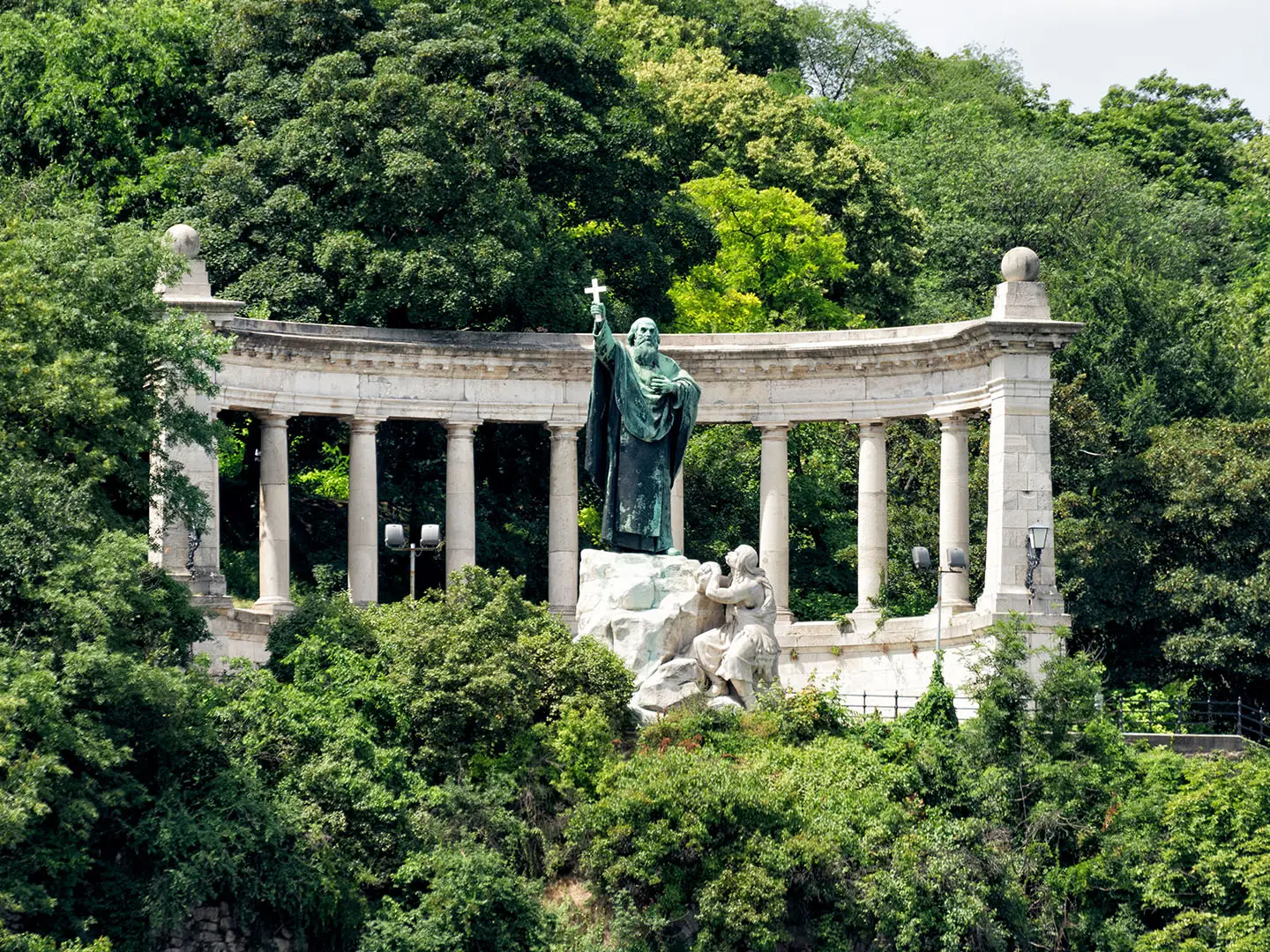
- St Gellért Monument: A 1904 statue by Gyula Jankovits shows the bishop holding a crucifix above a semicircular colonnade and artificial waterfall. It is a useful landmark on the Elizabeth Bridge side of the hill.
- Cave Church (Sziklatemplom): A church built into a natural cave near the Gellért Baths and associated with the Pauline order. It is close to the lower approach, but a small admission applies.
- Panoramic viewpoints: Terraces along the climb look over Parliament, Buda Castle, the Danube bridges and both sides of the city. These viewpoints are the main reason to take the slower, scenic ascent.
- Thermal baths and parkland: The walk passes wooded slopes and gardens above thermal springs that feed the Gellért and Rudas baths. It feels more like a city hike than a remote trail.
Challenges to expect
The walk is short, but the ascent is steady and sometimes steep, with staircases, stone steps, gravel, dirt and uneven rocky sections. Upper parts have limited shade in summer, so start early in hot weather. Wet surfaces can make the steps and gravel paths less secure. Navigation is low-stress because this is an urban hill, but choose your descent carefully if you want the direct out-and-back rather than a small loop.
HikeList Score
Gellért Hill Trail scored 71/100 on HikeList's trail-quality metrics.
See score breakdownHide breakdown
- Ideal length 55
- Balanced challenge 100
- Scenery & wildness 59
- Varied terrain 71
- Accommodation 74
- Food & support 68
- Path quality 80
- Season flexibility 63
Computed from length, challenge, scenery & wildness, terrain variety, accommodation, food & support, path quality and season flexibility.
 Hungary
Show more data Show less
- Urban
- Forest
- Paved
- Dirt
- Rocky
- Hotels
- Hostels
- Family Friendly
- Pet Friendly
- Restrooms
- Picnic Areas
Photos from hikers
Taken on the trail by people who've reviewed Gellért Hill Trail.
Reviews
How would you rate Gellért Hill Trail?
Tap a star to start your review — you could be the first.