Dynjandi Waterfall Trail
How would you rate Dynjandi Waterfall Trail?
Tap a star to share your experience and help other hikers.
Dynjandi Waterfall Trail: Short Westfjords Waterfall Hike
HikeList Score
Dynjandi Waterfall Trail scored 74/100 on HikeList's trail-quality metrics.
See score breakdownHide breakdown
- Ideal length 55
- Balanced challenge 100
- Scenery & wildness 98
- Varied terrain 71
- Accommodation 45
- Food & support 52
- Path quality 98
- Season flexibility 63
Computed from length, challenge, scenery & wildness, terrain variety, accommodation, food & support, path quality and season flexibility.
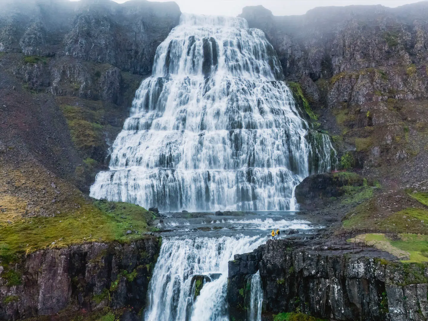
The Dynjandi Waterfall Trail is a short, steep 2 km out-and-back walk in Arnarfjordur, in Iceland’s Westfjords, climbing from the Road 60 car park to Dynjandi, also called Fjallfoss. It is a one-day visit, usually taking 1 to 1.5 hours if you stop at the smaller cascades. Rated moderate, it suits hikers who are comfortable on rocky steps and short climbs, but it is not wheelchair-accessible. For more routes in the country, see our Iceland hiking routes.
Route Overview
The walk starts and ends at the paved Dynjandi car park beside the Westfjords Way / Road 60 in Arnarfjordur. From the toilets and picnic area, the stepped path climbs beside the Dynjandisá river, passing six named cascades below the main fall: Hæstahjallafoss, Strompgljúfrafoss, Göngumannafoss, Hrísvaðsfoss, Hundafoss and Bæjarfoss. The standard out-and-back reaches the base of Dynjandi; a steeper continuation gives access towards a higher viewpoint near the top. There is no shop or café on site, and camping is no longer allowed at Dynjandi. It pairs well with other Westfjords walks such as the Bolafjall Viewpoint Trail and the multi-day Hornstrandir Trek, or compare it with mainland Iceland's tallest cascade on the Glymur Waterfall Trail.
Dynjandi history and protection
Dynjandi means “thundering” or “resounding”, a fitting name for the fan-shaped main fall. It is also known as Fjallfoss, meaning “mountain fall”. Dynjandi and the other waterfalls of the Dynjandisá river were designated a protected natural monument in 1981, helping preserve the moss, river and cascades. The stepped path used by walkers today was laid by local volunteers in 1996. Above the falls, Dynjandisheiði carried one of the first car-accessible roads towards Ísafjörður.
Notable highlights
- Dynjandi / Fjallfoss (about 100 m): The main fall is the largest waterfall in the Westfjords, dropping in a broad fan shape from about 30 m wide at the top to about 60 m at the base.
- Six cascades below Dynjandi: The approach passes Hæstahjallafoss, Strompgljúfrafoss, Göngumannafoss, Hrísvaðsfoss, Hundafoss and Bæjarfoss, making the short climb feel like a chain of viewpoints rather than a single stop.
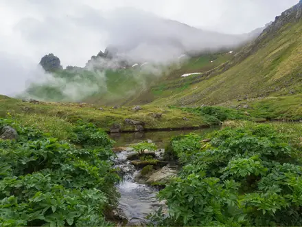
- Arnarfjordur views: As you gain height, the path opens out over Arnarfjordur, a large Westfjords sea fjord backed by steep mountains.
- Cliff-top viewpoint: A steeper continuation lets walkers climb close to the top of Dynjandi, with a view down the full cascade and back over the fjord.
- Protected natural monument: Dynjandi and the Dynjandisá falls have been protected since 1981, so stay on the built path to avoid damaging moss and riverbank vegetation.
Challenges to expect
The distance is short, but the path is genuinely steep and stepped, with rocky, gravel and dirt sections. Expect slippery footing when wet or in waterfall spray, and bring a layer even in summer: Westfjords days are often cool, windy and changeable. Road 60 access to Dynjandi is typically closed or impassable in winter. Fit children can manage it, but the trail is not suitable for wheelchairs or limited mobility.
HikeList Score
Dynjandi Waterfall Trail scored 74/100 on HikeList's trail-quality metrics.
See score breakdownHide breakdown
- Ideal length 55
- Balanced challenge 100
- Scenery & wildness 98
- Varied terrain 71
- Accommodation 45
- Food & support 52
- Path quality 98
- Season flexibility 63
Computed from length, challenge, scenery & wildness, terrain variety, accommodation, food & support, path quality and season flexibility.
 Iceland
Show more data Show less
- Mountainous
- Coastal
- Rocky
- Gravel
- Dirt
- Family Friendly
- Pet Friendly
- Restrooms
- Picnic Areas
Photos from hikers
Taken on the trail by people who've reviewed Dynjandi Waterfall Trail.
Reviews
How would you rate Dynjandi Waterfall Trail?
Tap a star to start your review — you could be the first.