Falls of Bruar Circular Walk
How would you rate Falls of Bruar Circular Walk?
Tap a star to share your experience and help other hikers.
Falls of Bruar Circular Walk: Short Gorge and Waterfall Route
HikeList Score
Falls of Bruar Circular Walk scored 82/100 on HikeList's trail-quality metrics.
See score breakdownHide breakdown
- Ideal length 57
- Balanced challenge 100
- Scenery & wildness 85
- Varied terrain 89
- Accommodation 91
- Food & support 68
- Path quality 98
- Season flexibility 63
Computed from length, challenge, scenery & wildness, terrain variety, accommodation, food & support, path quality and season flexibility.
The Falls of Bruar Circular Walk is a 2.5 km loop on the Bruar Water near Blair Atholl, Highland Perthshire, Scotland. Starting at the House of Bruar car park just off the A9, it takes about 1 to 1.5 hours. The walk is moderate: short, but steep in places, with stone steps, rocky woodland paths and sheer drops along the gorge. It suits walkers wanting a quick waterfall route with strong viewpoints rather than a long day out. Related routes include Aber Falls Walk and Beinn Eighe Mountain Trail.
Route Overview
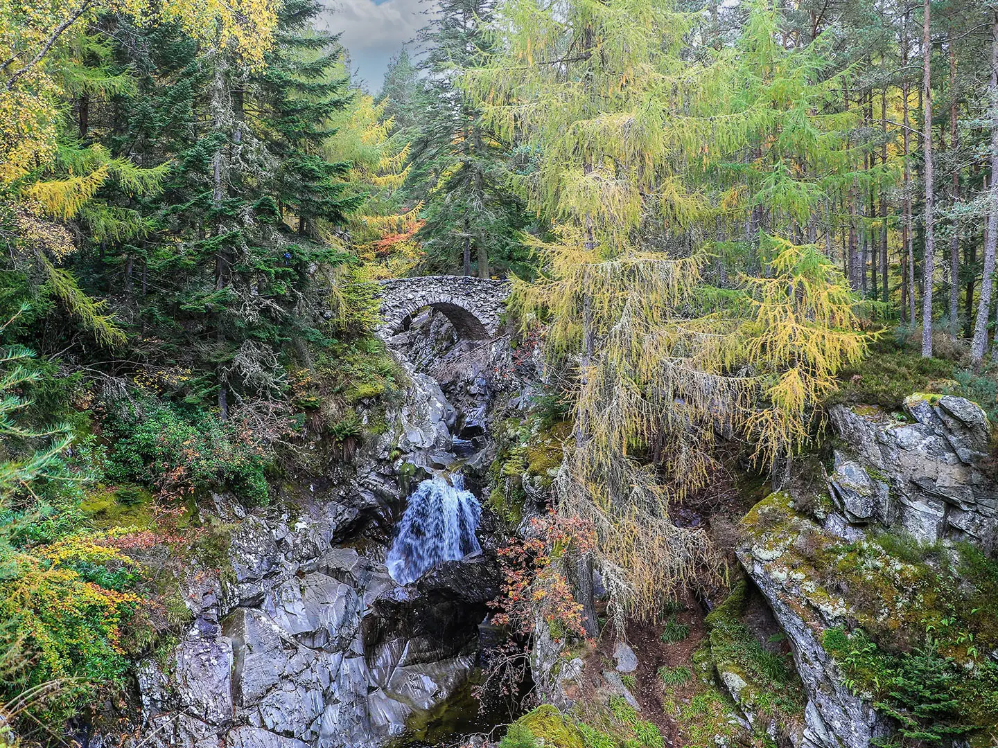
The route starts and ends at the House of Bruar car park, where there are visitor facilities, restrooms and a picnic area. From the car park, the path follows the Bruar Water upstream into the wooded gorge. A shorter waymarked option turns back at the Lower Bridge, but the full circular walk continues climbing to the Upper Bridge above the falls. From there, the return follows the opposite bank back down through the gorge. The two stone bridges give the main views over the Lower and Upper Falls of Bruar, with distant views towards the Cairngorms from the upper section. Access is straightforward by road via the A9; no permit or fee is required.
Robert Burns and the Planting of Bruar Gorge
Robert Burns visited the Falls of Bruar in September 1787, when the gorge stood in bare open moorland. He wrote the 11-verse poem 'The Humble Petition of Bruar Water to the Noble Duke of Atholl', asking John Murray, the 4th Duke of Atholl, to plant trees around the falls. After Burns’s death in 1796, the Duke laid out paths, bridges and viewpoints and planted roughly 120,000 larch and Scots pine, earning the nickname 'Planter John'. Much of the original planting was felled during WWII, with later replanting using conifers and native trees.
Notable highlights
- Upper and Lower Falls of Bruar (about 60 m total drop): The two main waterfalls on the Bruar Water are the centrepiece of the walk, dropping through a steep wooded gorge with smaller cascades and deep pools.
- Lower and Upper stone bridges: These arched bridges span the gorge and give the best head-on viewpoints over the falls and rocky channel below.
- Bruar Gorge and natural arch: The narrow gorge was cut after glacial retreat and includes rock outcrops, plunge pools and a natural rock arch.
- Scots pine and larch woodland: The wooded setting is central to the walk’s character and traces back to the planting inspired by Burns’s poem.
- Robert Burns literary connection: The route is directly tied to Burns’s 1787 visit and the poem that led to the landscaping and tree planting.
- Cairngorms views: From the upper part of the loop, the path opens enough for distant views towards the Cairngorms.
Challenges to expect
The walk is short, but it gains about 130 m and feels steeper than its distance suggests. Expect gravel, dirt and rocky woodland paths, stone steps and inclines beside the gorge. Surfaces can be muddy or slippery after rain, when the falls are often at their most dramatic. Sheer drops line parts of the gorge edge, so children and dogs need close supervision.
HikeList Score
Falls of Bruar Circular Walk scored 82/100 on HikeList's trail-quality metrics.
See score breakdownHide breakdown
- Ideal length 57
- Balanced challenge 100
- Scenery & wildness 85
- Varied terrain 89
- Accommodation 91
- Food & support 68
- Path quality 98
- Season flexibility 63
Computed from length, challenge, scenery & wildness, terrain variety, accommodation, food & support, path quality and season flexibility.
 United Kingdom
 Scotland
Show more data Show less
- Forest
- Gorge
- Waterfalls
- Gravel
- Dirt
- Rocky
- Stone Steps
- Hotels
- B&Bs
- Self Catering
- Family Friendly
- Pet Friendly
- Restrooms
- Picnic Areas
Photos from hikers
Taken on the trail by people who've reviewed Falls of Bruar Circular Walk.
Reviews
How would you rate Falls of Bruar Circular Walk?
Tap a star to start your review — you could be the first.