European Long-Distance Path E6
How would you rate European Long-Distance Path E6?
Tap a star to share your experience and help other hikers.
European Long-Distance Path E6: Slovenia’s North-to-Adriatic Traverse
HikeList Score
European Long-Distance Path E6 scored 87/100 on HikeList's trail-quality metrics.
See score breakdownHide breakdown
- Ideal length 85
- Balanced challenge 84
- Scenery & wildness 88
- Varied terrain 94
- Accommodation 92
- Food & support 88
- Path quality 80
- Season flexibility 89
Computed from length, challenge, scenery & wildness, terrain variety, accommodation, food & support, path quality and season flexibility.
The European Long-Distance Path E6 in Slovenia is a 350 km point-to-point thru-hike from Radlje ob Dravi on the Austrian border to Strunjan on the Adriatic. Allow about 15 days. It is a hard, sustained walk rather than a technical alpine route: the challenge is the length, around 10,000 m of ascent, and some demanding sections over Pohorje, Snežnik and the Dinaric karst. It suits fit, well-prepared hikers who want a full cross-section of Slovenian landscapes.
Route Overview
Walked north to south, the Slovenian E6 starts at Radlje ob Dravi/Radlpass in the Drava valley, then crosses the Pohorje massif via the Kope/Mala Kopa area before passing Slovenj Gradec, Mozirje, Trojane, Moravče, Janče, Jevnica and Grosuplje. It continues through Turjak, Mačkovec, Loški Potok, Snežnik, Ilirska Bistrica and the Brkini hills, then reaches Slavnik, Hrastovlje, Kubed, Šmarje pri Kopru, Koper and Strunjan. At Mačkovec it crosses the European Long-Distance Path E7; at Strunjan it meets the E12 coastal path. For a shorter Drava-valley option, compare the Drava River Trail.
Ciglar’s Trail and Slovenia’s first E-path
In Slovenia the E6 is also known as Ciglarjeva pot, or Ciglar’s Trail, after Dr Milan Ciglar, a Slovenian forester who championed and helped lay out the country’s section of the European footpaths. It was the first European long-distance trail to be waymarked in Slovenia. The wider E-path network is coordinated by the European Ramblers’ Association as a symbol of cross-border walking and cooperation, and in 2025 Slovenia hosted the main celebration of the E6’s 50th anniversary, with the central event at Radlje ob Dravi.
Notable highlights
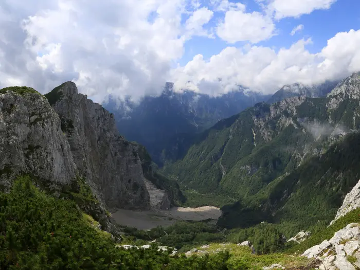
- Pohorje massif: A broad, forested mountain plateau crossed soon after the start, with spruce woods, peat bogs, highland meadows and ski areas such as Kope. Hikers interested in Pohorje’s bog landscape can also look at the Lovrenc Lakes Trail.
- Snežnik (1,796 m): The trail’s high point and Slovenia’s highest non-alpine summit, set on a vast forested karst plateau. The area is known for beech-and-fir wilderness and brown bear habitat.
- Slovenj Gradec: A historic Koroška town with a cultural reputation, reached in the northern third of the route. It is one of the more useful settlement stops on the early section.
- Brkini hills and Dinaric karst: Sparse limestone hill country between Snežnik and the coast. Expect quieter walking, karst terrain and a more remote feel than the central Slovenian hills.
- Hrastovlje and the Church of the Holy Trinity: A small Istrian village near the end of the route, known for its fortified medieval church and the celebrated 15th-century “Dance of Death” fresco.
- Adriatic finish at Strunjan and Koper: The final section descends through Slovenian Istria towards the sea, with vineyards, olive groves, Koper and the Strunjan coast nearby.
Challenges to expect
The E6 is demanding mainly because it is long: 350 km with roughly 10,000 m of cumulative ascent. Terrain is mostly walkable, but the route strings together forest ridges, rolling hills, karst plateaus, quiet roads and exposed coastal sections. Snow can linger on Snežnik and higher Pohorje ground into spring, while the karst and coast can be hot in high summer. Use the waymarks, but carry reliable mapping.
HikeList Score
European Long-Distance Path E6 scored 87/100 on HikeList's trail-quality metrics.
See score breakdownHide breakdown
- Ideal length 85
- Balanced challenge 84
- Scenery & wildness 88
- Varied terrain 94
- Accommodation 92
- Food & support 88
- Path quality 80
- Season flexibility 89
Computed from length, challenge, scenery & wildness, terrain variety, accommodation, food & support, path quality and season flexibility.
 Slovenia
Show more data Show less
- Forest
- Hills
- Karst
- Coastal
- Dirt
- Gravel
- Paved
- Huts
- Guesthouses
- Hotels
- Tourist Farms
- Family Friendly
- Pet Friendly
- Restrooms
- Water Sources
- Campsites
- Shelters
Download Our Full Guide to European Long-Distance Path E6 FREE!
Get our comprehensive guide to this hike for free. Save it for later reading or print out at home.
Photos from hikers
Taken on the trail by people who've reviewed European Long-Distance Path E6.
European Long-Distance Path E6: The Complete Guide
 i
Image by Jan Piotr
i
Image by Jan Piotr Slovenia’s E6, Ciglarjeva pot, is a full north-to-south crossing of the country from Radlje ob Dravi on the Austrian border to Strunjan on the Adriatic. It links the Drava valley, the Pohorje massif, central Slovenian hill country, the Snežnik karst plateau and Slovenian Istria in one long, varied traverse.
The walking is not technically alpine, but it is never casual. Over roughly 350 km and about 10,000 m of ascent, the route moves between forest ridges, highland meadows, quiet lanes, limestone karst, dry valleys, vineyards, olive groves and coastal paths.
Its strongest days come in the contrasts: spruce woods and peat bogs on Pohorje, the cultural stop of Slovenj Gradec, the broad wilderness around Veliki Snežnik, and the open Istrian hills around Slavnik. Near the end, Hrastovlje, Koper and the sea at Strunjan give the trail a very different finish from its northern mountain start.
This is a route for fit, self-reliant long-distance walkers who can handle 12–15 consecutive days, long daily stages and uneven services. Accommodation and resupply are manageable, but the remote karst section and seasonal hut openings need planning rather than improvisation.
This guide covers stages, walking days, accommodation, food, transport, terrain and the common planning mistakes to avoid.
Stage-by-Stage Guide
The stage distances below are practical planning figures rather than fixed official sections. The Slovenian E6 has waymarked variants in places and published total distances vary, so always check the current map, GPS line and accommodation location before committing to a day.
Stage 1: Radlje ob Dravi to Mala Kopa / Kope — approx. 24 km
The opening day leaves the Drava valley near the Austrian border and climbs south onto the Pohorje massif. Expect a sustained uphill day from low valley terrain into spruce forest, highland meadows and the broad plateau country that defines the first part of the route.
Underfoot, this is mainly forest path, tracks and some minor-road or ski-area infrastructure as the trail approaches Kope. In poor weather the Pohorje plateau can feel much more remote than the map suggests, and lingering snow is possible into spring on the higher ground.
Start with food and water from Radlje ob Dravi. Mountain-hut and ski-area accommodation around Mala Kopa / Kope may be available, but opening seasons should be checked before travelling, especially outside the main summer period.
Radlje ob Dravi is the key access point for the start, reached by bus and lying on the Maribor–Dravograd regional rail corridor. Navigation is usually helped by Slovenian Knafelc waymarks and E6 markings, but the first day’s climb makes it worth carrying offline mapping rather than relying only on signs.
Stage 2: Mala Kopa / Kope to Slovenj Gradec — approx. 22 km
This stage crosses and then leaves the Pohorje high country, with forested plateau walking giving way to a descent towards Slovenj Gradec. It is less about technical difficulty than maintaining pace over a full mountain day after the previous day’s climb.
The walking is typically on forest paths, gravel or dirt tracks and sections around the Kope ski area before the route drops towards the Koroška town. Wet forest ground can be muddy, and waymarking can be easier to miss where tracks and ski-area roads intersect.
Slovenj Gradec is the main settlement in the northern third of the route and a sensible place to resupply properly. Accommodation options are much better here than on the plateau, with town-based lodging more reliable than depending on upland huts.
Road access is straightforward at Slovenj Gradec, though current public transport times should be checked before travelling. This is also a good place to reassess weather and kit before the longer hill-country stages south.
Stage 3: Slovenj Gradec to Mozirje — approx. 26 km
The route now leaves the Koroška town environment and enters a long traverse of central Slovenian hills. Turiška vas is passed in this section, but much of the day is likely to feel rural, with farmland, woods, ridge tracks and smaller roads linking scattered settlements.
This is a long stage, and the distance matters more than any single climb. Expect a mixed surface day: field paths, woodland tracks, gravel, dirt and some quiet asphalt.
Carry enough food and water from Slovenj Gradec to avoid depending on small places en route. Mozirje is the next significant overnight target, where guesthouse, small-hotel or apartment-style accommodation should be arranged in advance.
Navigation needs attention where the E6 passes between fields, woods and minor roads. If waymarks are obscured by vegetation or forestry work, a downloaded GPS line and paper map are useful backups.
Stage 4: Mozirje to Trojane — approx. 25 km
This is another full day across the rolling central hills, linking Mozirje with Trojane through a landscape of farms, woodland and ridge routes. The walking is not alpine, but the repeated rises and descents build up over the day.
Surfaces are varied, with footpaths, tracks and some quiet asphalt. After rain, forest paths and farm tracks can be muddy, while warm summer days can feel exposed on open agricultural sections.
Leave Mozirje with a full day’s food and water unless specific refreshment stops have been checked. Trojane is the practical end point for this stage, but accommodation availability should be confirmed before booking the rest of the itinerary around it.
Road access is present at both ends, but public transport details are not fixed enough to rely on without checking current timetables. Keep an eye on waymarks at road junctions and where the trail cuts between rural tracks.
Stage 5: Trojane to Moravče — approx. 22 km
The E6 continues through the central Slovenian hills, with a shorter but still substantial stage to Moravče. This is typical linking terrain: wooded slopes, fields, minor roads and ridge-line tracks rather than dramatic high mountains.
The stage suits steady walking but can be slow if the ground is wet or if navigation through minor junctions breaks rhythm. Expect a mixture of gravel, dirt, forest path and quiet asphalt.
Food and water should be topped up before leaving Trojane, as intermediate services cannot be assumed. Moravče is a sensible overnight hub, but guesthouses or tourist-farm accommodation should be booked ahead rather than left to chance.
This section is less remote than the Snežnik and Brkini stages, yet it still rewards self-sufficiency. Public transport or road access options for joining or leaving the trail at Moravče should be checked before travelling.
Stage 6: Moravče to Janče — approx. 24 km
From Moravče the trail continues through the rolling hill country east of Ljubljana, moving between woods, farmland and scattered settlements. Janče makes a useful high-point style overnight target in this central part of the route.
The terrain remains non-technical, but a 24 km day over repeated undulations can still be tiring. Surfaces are mixed, and some road walking on quiet asphalt may be part of the day.
Carry food and water from Moravče, especially in hot weather. Accommodation around Janče is more limited than in larger towns, so this stage should not be planned without a confirmed bed or a clear onward plan.
Navigation is generally a matter of staying alert through many small junctions rather than handling difficult ground. Waymarks should be followed carefully where the trail leaves roads for tracks or enters woodland.
Stage 7: Janče to Grosuplje — approx. 23 km
This stage takes the E6 from Janče towards Grosuplje, passing through the central hills and the Jevnica area on the way. It is a transition from quieter upland and village terrain towards a larger town with better services.
Expect rolling walking on woodland paths, farm tracks, gravel lanes and some asphalt. The terrain is varied rather than severe, but the stage still requires a full day’s effort.
Grosuplje is a good resupply and accommodation stop compared with the smaller hill settlements before it. Food and water should still be carried from the start, as the exact availability of services en route should be checked before travelling.
Public transport is more plausible around larger towns than in the rural middle sections, but current services should be checked rather than assumed. This is also a practical point for section-hikers to start or finish a block of the trail.
Stage 8: Grosuplje to Turjak — approx. 16 km
The day from Grosuplje to Turjak is shorter than most E6 stages and can work as a partial recovery day before the longer, more remote approach to Loški Potok and Snežnik. The route continues through rolling country south of Grosuplje, with woodland, fields and minor roads.
Although the distance is modest, do not treat it as a rest day if weather is poor or if accommodation requires a detour. Some route descriptions in this area involve variants, including lines near Turjak, so check the exact waymarked option being followed.
Grosuplje is the best place to stock up before leaving. Turjak is a smaller overnight target, so accommodation and meals should be arranged in advance.
Navigation deserves attention on this stage because variants and local paths can complicate what looks like a simple day on paper. If using a GPS track, make sure it matches the intended E6 line and current waymarking.
Stage 9: Turjak to Loški Potok — approx. 27 km
This is one of the tougher planning days of the route: long, increasingly quiet and a clear step towards the Dinaric karst. The stage passes the Mačkovec area and moves away from the better-served central settlements into more sparsely populated country.
Expect a mix of forest paths, tracks, minor roads and rougher limestone-influenced terrain. The distance alone makes it demanding, and progress can be slower where waymarking, forestry tracks or wet ground require care.
Carry a full day’s food and more water than on the central-town stages. Services between Turjak and Loški Potok cannot be relied on without checking ahead, and accommodation in Loški Potok should be booked before setting out.
This is a stage where an early start is sensible. Navigation should be treated seriously, with offline mapping, a charged phone or GPS device, and a backup plan if weather or fatigue makes the full distance unrealistic.
Stage 10: Loški Potok to Snežnik mountain hut — approx. 26 km
The route now enters the wildest part of the Slovenian E6, crossing the vast Snežnik karst plateau towards the high point of the trail. Veliki Snežnik rises to 1,796 m and is Slovenia’s highest non-Alpine summit, set within extensive beech-and-fir forest and open karst country.
The terrain is not technical alpine ground, but it is remote, exposed to mountain weather and harder to exit from than the central hill stages. Underfoot, expect forest tracks, rocky karst, limestone ground and paths across high plateau terrain.
Water planning is critical. Karst ground can be dry, and the availability of water at huts or sources should be checked before travelling, particularly in summer.
The Snežnik mountain hut is the obvious overnight point, but hut opening seasons must be checked before relying on it. This area is core brown-bear, wolf and lynx habitat; encounters are unlikely for most walkers, but food should be stored sensibly and quiet solo walking at dawn or dusk calls for extra awareness.
Snow can linger on Snežnik into spring, and thunderstorms are a serious summer consideration on exposed high ground. If conditions are poor, this is not the stage to improvise without a map, extra layers and a realistic escape plan.
Stage 11: Snežnik to Ilirska Bistrica — approx. 22 km
This stage leaves the Snežnik high country and descends towards Ilirska Bistrica. It is a marked change from remote forested karst to a proper town stop, making it one of the more satisfying logistical breaks on the southern half of the route.
The first part can still feel isolated, with beech-and-fir forest, limestone ground and tracks across the karst plateau. The descent reduces the altitude but does not remove the need for careful navigation, especially in poor visibility or after forestry activity.
Start with enough water, as karst terrain can remain dry until nearer the town. Ilirska Bistrica provides a valuable chance to resupply, wash kit and reset before the Brkini and Istrian stages.
Accommodation is more dependable in and around Ilirska Bistrica than in the upland hut stage before it. Road access is also better here, though public transport arrangements should still be checked before travelling.
Stage 12: Ilirska Bistrica to Slavnik / Podgorje — approx. 27 km
This long stage crosses the Dinaric karst and Brkini hill country towards Slavnik and Podgorje. It is one of the quietest sections of the route, with sparse limestone landscapes, dry valleys, sinkholes, woodland and gradually more Mediterranean-feeling terrain as the trail approaches Slovenian Istria.
The walking is varied and can be tiring: tracks, rougher karst paths, gravel, dirt and some quiet roads. Heat can be a major factor in summer, and thunderstorms should be taken seriously on open ground.
Leave Ilirska Bistrica fully supplied. Food and water availability between Ilirska Bistrica and the Slavnik / Podgorje area should be checked before travelling, and extra water capacity is sensible in hot weather.
The endpoint needs planning. Slavnik has a mountain hut and Podgorje is the nearby settlement option, but opening times, meals and beds should be confirmed before booking the stage around them.
Navigation is important across this quieter country, where tracks may branch and waymarks can be spread out. Do not underestimate this day because the high Alpine terrain is already behind you.
Stage 13: Slavnik / Podgorje to Hrastovlje — approx. 18 km
This shorter stage begins in one of the finest viewpoint areas on the Slovenian E6. Slavnik, at 1,028 m, is a grassy free-standing summit above Slovenian Istria, with wide views towards the Gulf of Trieste, the Adriatic and, on clear days, the Julian Alps.
From the Slavnik / Podgorje area the route descends into Istrian karst and village country. Expect rocky paths, tracks, open ground and increasing exposure to sun and heat compared with the forested interior.
Hrastovlje is the key end point, best known for the fortified Church of the Holy Trinity and its 1490 Dance of Death fresco by John of Kastav. It is a small village, so food, water and accommodation should be planned rather than assumed.
This is a shorter day on paper, but it can be hot and dry. Carry enough water from the start and check whether facilities at the Slavnik hut or in Podgorje are open before relying on them.
Stage 14: Hrastovlje to Koper — approx. 20 km
The penultimate full inland stage crosses Slovenian Istria towards Koper, passing through or near villages such as Kubed and Šmarje pri Kopru. The character changes again: vineyards, olive groves, open tracks, minor roads and increasingly coastal light replace the forested karst of Snežnik.
This is not a technically difficult day, but it can be punishing in high summer because shade and water may be limited. Expect a mix of dirt tracks, village lanes, some asphalt and exposed paths.
Stock up before leaving Hrastovlje if possible, but do not rely on small villages for guaranteed supplies without checking. Koper is the major service centre near the finish, with plentiful accommodation, food and transport compared with the previous few stages.
Koper (Capodistria) is also the main transport hub for the coast, with a railway station and trains to Ljubljana. The approach into a larger town requires more attention to road crossings, urban navigation and waymarks that may be easier to miss among local paths and streets.
Stage 15: Koper to Strunjan — approx. 12 km
The final stage is short, but it should still be treated as a real walking day rather than just a transfer to the coast. The E6 leaves Koper and reaches the Adriatic at Strunjan, where it meets the coastal E12.
Terrain is a mix of coastal and Istrian paths, village or urban edges, vineyards, olive groves and exposed sections near the sea. The Strunjan area is known for its protected cliffs and salt-pans, giving a clear coastal finish to the Slovenian traverse.
Food and water are easy to organise from Koper, but carry enough for a hot final morning. Strunjan has access to the coastal transport network, with frequent buses linking Strunjan, Piran, Portorož and Koper; current times should still be checked before travelling.
Some descriptions continue beyond Strunjan towards Piran or Sečovlje near the Croatian border. For the Slovenian E6 stage plan here, Strunjan is the finish, and any continuation should be treated as an optional extension with its own transport and accommodation planning.
Recommended Itinerary
The most practical thru-hike plan is a 15-day north-to-south itinerary from Radlje ob Dravi to Strunjan. Daily stages are long but realistic for a fit walker, with most days in the 22–27 km range and a useful shorter day before the remoter southern section.
Distances are indicative. The official route length is published as 350 km, while GPS tracks and marked-segment totals can be shorter, so exact daily distances should be checked against current mapping before booking accommodation.
Standard 15-day itinerary
| Day | From | To | Approx. distance | Why this stage makes sense | Services/accommodation notes |
|---|---|---|---|---|---|
| 1 | Radlje ob Dravi | Mala Kopa / Kope (Pohorje) | 24 km | A strong opening day that climbs from the Drava valley onto the Pohorje massif, putting the route immediately on high forest and meadow terrain. | Accommodation is typically mountain-hut or highland lodging style on Pohorje. Opening dates should be checked before travelling, especially outside the main summer season. |
| 2 | Mala Kopa / Kope | Slovenj Gradec | 22 km | A manageable second day after the initial climb, descending from the Pohorje area to the main town of the northern section. | Slovenj Gradec is one of the stronger service points on the northern third and is a sensible place to resupply or adjust bookings. |
| 3 | Slovenj Gradec | Mozirje | 26 km | A long linking stage through the central Slovenian hills, keeping momentum before the route’s more awkward middle stages. | Start with food and water organised from Slovenj Gradec. Mozirje is the practical overnight target; accommodation should be booked ahead. |
| 4 | Mozirje | Trojane | 25 km | Another full hill-country day, maintaining the 15-day schedule without overloading the later karst stages. | Services are less predictable than in larger towns. Confirm accommodation and meal availability before committing to the stage. |
| 5 | Trojane | Moravče | 22 km | A slightly shorter day after two longer ones, continuing through rolling central Slovenia rather than forcing an oversized stage. | Moravče works as a logical overnight stop, but bed availability should be checked before travelling. |
| 6 | Moravče | Janče | 24 km | Keeps the route moving across the central hills while avoiding an excessive push into the next major service area. | Treat this as a booked-accommodation stage rather than relying on last-minute options. Carry enough food for the day. |
| 7 | Janče | Grosuplje | 23 km | A useful approach into a larger central-Slovenian town before the route turns towards quieter southern country. | Grosuplje is a sensible resupply and admin stop. It is also a good place to review weather, water and accommodation plans for the next several days. |
| 8 | Grosuplje | Turjak | 16 km | The shortest day of the standard itinerary, deliberately placed as a recovery and buffer stage before the more remote Dinaric karst approach. | Use the shorter day to deal with supplies and bookings. Accommodation in and around smaller settlements should be confirmed in advance. |
| 9 | Turjak | Loški Potok | 27 km | One of the longer stages, taking the route deeper into sparse hill and karst country where easy exit points and services are fewer. | This is not a stage to leave unplanned. Book accommodation ahead and carry sufficient water and food. |
| 10 | Loški Potok | Snežnik mountain hut | 26 km | A demanding mountain-and-karst stage leading into the Veliki Snežnik high country, the highest part of the trail. | Hut opening seasons on Snežnik must be checked before travelling. Snow can linger in spring, and water planning is important on the karst plateau. |
| 11 | Snežnik | Ilirska Bistrica | 22 km | Brings the route down from the Snežnik area to a proper town, giving a natural recovery point after the most committing high-country section. | Ilirska Bistrica is an important overnight and resupply stop before the Brkini and Istrian approach. |
| 12 | Ilirska Bistrica | Slavnik / Podgorje | 27 km | A long stage across the Brkini and towards Slavnik, moving from the Dinaric interior towards Slovenian Istria. | Accommodation may be at or near Slavnik or Podgorje depending on availability. Hut opening and village accommodation should be checked before travelling. |
| 13 | Slavnik / Podgorje | Hrastovlje | 18 km | A shorter day after the long approach from Ilirska Bistrica, with time to descend into Istrian village country. | Hrastovlje is a small village stop rather than a major service hub. Confirm accommodation and food options before booking the stage. |
| 14 | Hrastovlje | Koper | 20 km | A practical final full walking day through Slovenian Istria, finishing in the largest town near the end of the trail. | Koper has the strongest services on the coastal section and is the best place to reset before the final short stage. |
| 15 | Koper | Strunjan | 12 km | A short finishing day to the Adriatic at Strunjan, avoiding the need to rush the coastal finish or onward transport. | Strunjan, Piran, Portorož and Koper are linked by frequent buses, and Koper has rail connections towards Ljubljana. Current times should be checked before travelling. |
Slower variant: 17–20 days
A slower plan suits walkers who want more margin for weather, heat, lingering snow on Snežnik, or the cumulative fatigue of repeated 22–27 km days. It is also the better choice if carrying camping-style loads or if accommodation availability forces shorter hops.
The most useful places to add time are after the Pohorje section, around the central towns, before or after the Snežnik crossing, and on the Istrian coast. Slovenj Gradec, Grosuplje, Ilirska Bistrica and Koper are the most logical rest or resupply points from the standard itinerary.
Several longer stages can potentially be split using intermediate settlements listed on the route, such as Turiška vas, Jevnica, Mačkovec, Podgorje, Kubed or Šmarje pri Kopru. Do not assume accommodation exists or is open in these places; this should be checked before travelling.
Faster variant: 12–14 days
A faster schedule is only sensible for very fit long-distance walkers who are comfortable averaging long days on mixed ground and who have secured accommodation in advance. The official timing range allows 12–15 days, but compressing the route leaves little margin for bad weather, heat or a closed hut.
The easiest time saving is near the end, where the standard itinerary deliberately keeps the Istrian and coastal stages moderate. Strong walkers may also reduce buffer time through the central hills, but exact recombinations should be built from current maps and accommodation availability rather than assumed from the headline distances.
The Snežnik and Brkini section should not be treated as a place to improvise a fast itinerary. Water, hut opening, snow conditions and onward accommodation all need checking before travelling.
Planning the Route
The Slovenian E6 is best planned as a committed north-to-south traverse rather than a route to improvise day by day. The walking is not technical, but the long daily stages, uneven accommodation pattern and remote karst middle section make advance planning important.
Most walkers should allow around 15 walking days. A 12-day schedule is possible only for strong, efficient hikers who are comfortable with repeated long days and limited margin for weather, transport delays or accommodation gaps. Adding one or two rest or buffer days is sensible, especially if walking in early or late season when snow on Pohorje or Snežnik can affect progress.
Choosing a pace
The natural pace is largely dictated by overnight options. On Pohorje and around Snežnik, mountain huts can anchor the stages; elsewhere, guesthouses, tourist farms, small hotels and apartments in towns and villages are the practical targets.
Daily distances commonly fall into the long-but-manageable range, with several stages around 22–27 km. The shorter final approach to the coast should not be treated as a reason to rush the earlier route: the harder planning problems come before the coast, particularly through the Dinaric karst and the Snežnik area.
A slower itinerary is easier where there are towns or road access, such as around Slovenj Gradec, Grosuplje, Ilirska Bistrica, Koper and the Istrian coast. It is harder to split the more sparsely settled stages without arranging transport or accepting a different overnight location off the trail.
Where the planning pressure points are
| Route section | Planning notes |
|---|---|
| Radlje ob Dravi to Slovenj Gradec | The route climbs from the Drava valley onto Pohorje early, so do not underestimate the first days. Hut opening seasons on Pohorje should be checked before travelling. |
| Slovenj Gradec to Grosuplje | This is a more settled part of the route, with towns and villages giving better options for food and accommodation. It is also the easiest part to adjust if a stage needs shortening or transport is required. |
| Grosuplje to Ilirska Bistrica via Turjak, Loški Potok and Snežnik | This is the key logistical section. Accommodation is thinner, distances are longer, and the route crosses remote karst and forest country. Book ahead, carry reliable navigation, and check water and hut availability before committing to each stage. |
| Ilirska Bistrica to Koper via Brkini, Slavnik, Podgorje and Hrastovlje | The walking becomes more open and increasingly Mediterranean, but water and heat can be an issue in high summer. Slavnik has a mountain hut, but current opening times should be checked before travelling. |
| Koper to Strunjan | The finish is the easiest section logistically, with better transport and services on the coast. It is also the simplest place to shorten, pause or extend the walk. |
Accommodation strategy
Accommodation should be booked in advance for the thinner sections rather than left to the evening of arrival. This is especially important around Loški Potok, Snežnik, the Brkini hills and the approach to Slavnik, where options are less frequent and a missed booking can force a long detour or an overlong day.
Mountain huts are part of the practical infrastructure on Pohorje, around Snežnik and at Slavnik, but hut seasons and opening days can change. This should be checked before travelling, particularly outside the main summer period.
In the more populated sections, guesthouses, tourist farms, small hotels and apartments give more flexibility. Even there, it is safer to book ahead if walking in holiday periods or arriving in smaller villages late in the day.
Food and water planning
Food resupply is straightforwardest in the larger towns and on the coast, and weaker through the karst and forested middle of the route. Carry at least one spare meal or substantial emergency food when leaving the better-served towns for the quieter sections.
Water is one of the main practical concerns. The karst terrain around Snežnik, Brkini and the approach towards the coast can be dry, and high summer increases the risk of long, hot stretches without reliable refill points. Water availability should be checked locally before each remote stage, and capacity should be adjusted accordingly.
Do not assume that every village, hut or mapped feature will provide water at the time needed. In the driest sections, starting the day full and carrying more than usual is prudent.
Navigation and route variants
The E6 is waymarked with Slovenian Knafelc markings and European E6 signs, but that does not remove the need for independent navigation. Forest tracks, karst paths, quiet roads and local variants can make the line less obvious than a single-ridge mountain trail.
Carry offline mapping or a GPS track as well as suitable topographic mapping. The official 350 km figure differs from some recorded GPS distances, and individual day distances should be treated as indicative rather than exact. Check the current line, any diversions and the condition of waymarking before relying on a fixed itinerary.
Section hiking and shortening the route
Section hiking is practical, but it is easier in the settled northern, central and coastal parts than in the remote karst middle. Useful break points include Slovenj Gradec, Grosuplje, Ilirska Bistrica and Koper, where services and onward transport are more realistic than in smaller intermediate settlements.
The route can also be shortened by finishing at Koper instead of continuing to Strunjan, or by walking selected blocks such as Pohorje, Snežnik, Slavnik and the Istrian coast. Some descriptions continue beyond Strunjan towards Piran or Sečovlje near the Croatian border; anyone extending the walk should check the current route line and transport options before booking.
Transport planning
The two ends are not equally simple. Radlje ob Dravi is reached by bus and is connected with the Maribor–Dravograd regional rail corridor, with Maribor the main northern transport hub. Timetables at the northern end should be checked carefully before fixing the first night.
The finish is easier. Strunjan, Piran, Portorož and Koper are linked by frequent buses, and Koper has a railway station with trains to Ljubljana. Ljubljana is the national hub for onward connections and is useful when planning a section hike or exit strategy.
Weather and seasonal checks
Late May to early October is the most reliable planning window, but the best month depends on the trade-off between snow risk and heat. Early or late in the season, snow can linger on Snežnik and high Pohorje. In high summer, the karst and coast can be hot, exposed and short of water, with thunderstorms also a consideration.
Before setting out, check three things in particular: hut opening seasons, water availability on the dry karst stages, and the current forecast for Snežnik and the coastal approach. Those checks matter more on this trail than permits or technical mountain equipment.
Towns, Villages and Overnight Stops
Accommodation on the Slovenian E6 is uneven. The practical stage plan depends on a mix of town accommodation, guesthouses, tourist farms and mountain huts, with the most important booking pressure around Pohorje, Snežnik and the Dinaric karst.
Book the remote stages before committing to dates, especially Loški Potok to Snežnik and onwards towards Ilirska Bistrica and the Brkini. Hut opening seasons, meal availability and water supply should be checked before travelling.
Radlje ob Dravi
Radlje ob Dravi is the northern trailhead town in the Drava valley, close to the Austrian border and the Radelj/Radlpass crossing. It is the sensible place to sleep before starting, rather than trying to combine travel to the border with the first long climb onto Pohorje.
Accommodation and food options are those of a small town, so book ahead if arriving late or outside the main walking season. Use Radlje ob Dravi for a final organised shop before the first upland stage.
Transport is awkward but possible: Radlje ob Dravi is reached by bus and lies on the Maribor–Dravograd regional rail line, with Maribor the main northern hub. Current bus and rail times, and the exact starting point near the border, should be checked before travelling.
Pohorje
Pohorje is the broad forested mountain plateau crossed immediately after the start. It is not a single overnight settlement, but it shapes the first part of the route: forest tracks, highland meadows, boggy ground and ski-area infrastructure around Kope.
Accommodation is mainly hut or mountain-area based rather than town based. Do not assume food, water or an open bed away from named huts and settlements; hut opening seasons on Pohorje should be checked before travelling.
Mala Kopa / Kope
Mala Kopa / Kope is the usual first overnight area in the 15-day schedule, reached after the climb from Radlje ob Dravi. It works well as a practical stop because it keeps the first day long but manageable, then leaves a descent and onward walking to Slovenj Gradec.
Accommodation and meals are likely to be tied to the mountain and ski-area services rather than a full village centre. Opening dates can vary by season, so book and confirm food before relying on it.
Public transport details for this specific stop are not supplied. This should be checked before travelling.
Slovenj Gradec
Slovenj Gradec is the main settlement on the northern third of the route and one of the best early places to reset. It sits after the Pohorje crossing and before the route continues south towards Mozirje and the central Slovenian hills.
This is a strong overnight choice, with better accommodation and supply prospects than the surrounding smaller places. It is also a sensible point for laundry, food restocking and adjusting the schedule after the first two mountain days.
Transport links for Slovenj Gradec are not specified here. This should be checked before travelling.
Turiška vas
Turiška vas lies on the route between Slovenj Gradec and Mozirje. It is best treated as an intermediate route point rather than a guaranteed overnight hub.
Use it only for an overnight if accommodation has been arranged in advance. Do not count on shops, cafés or evening meals without checking current services before travelling.
Mozirje
Mozirje is the stage-end town after the long walk south from Slovenj Gradec. It is a useful overnight before the next demanding stage towards Trojane.
As one of the central route towns, it is a good place to look for guesthouse or hotel-style accommodation and to organise food for the following day. Exact shop and restaurant opening times should still be checked, particularly on Sundays, public holidays or outside summer.
Transport options for Mozirje are not specified here. This should be checked before travelling.
Trojane
Trojane is the planned overnight between Mozirje and Moravče. It is important because it breaks a run of long central-Slovenian hill stages into workable walking days.
Do not treat Trojane as a place where a bed and evening meal can simply be found on arrival. Accommodation and food should be booked or confirmed ahead, especially if walking outside the main season.
Public transport details are not supplied. This should be checked before travelling.
Moravče
Moravče is the next practical stage stop after Trojane and before Janče. It sits in the rolling central section, where the walking is less alpine but still accumulates distance and ascent day after day.
It is a useful overnight and resupply point if accommodation is available. Confirm food and shop options before arrival, as relying on small settlements late in the day is a poor strategy on this route.
Transport links for Moravče are not specified here. This should be checked before travelling.
Janče
Janče is used as a stage end between Moravče and Grosuplje. It is a smaller stop than the main towns, so it needs more care in the booking plan.
Treat Janče as an arranged overnight rather than a flexible service hub. Accommodation, evening food and breakfast should all be confirmed before committing to this stage.
Transport options are not specified. This should be checked before travelling.
Jevnica
Jevnica appears on the route between Janče and Grosuplje. For most through-hikers it is more useful as a route waypoint than as a primary overnight stop.
It may be helpful for section planning or shortening a day, but only if accommodation and services are arranged in advance. Do not assume food or shops will be available at the right time.
Grosuplje
Grosuplje is one of the stronger central stops and a good place to recover after the Janče stage. It also precedes the shorter stage to Turjak, which gives useful flexibility in the middle of the itinerary.
This is a practical overnight and resupply town. It is a sensible place to review bookings for the more awkward southern half, especially the Turjak–Loški Potok–Snežnik sequence.
Ljubljana is the national hub for onward connections in central Slovenia, but exact links from the trail should be checked before travelling.
Turjak
Turjak is the stage end after Grosuplje and sets up the longer walk to Loški Potok. The shorter day into Turjak can be useful if the previous week has been tiring or if accommodation timing requires a slower middle section.
Accommodation and food should be confirmed in advance. The route has waymarked variants in this area, including descriptions via Iška near Turjak, so check the exact line being followed before booking non-refundable accommodation.
Transport information for Turjak is not specified. This should be checked before travelling.
Mačkovec
Mačkovec lies between Turjak and Loški Potok in the quieter southern interior. It is not presented as a standard stage stop in the main 15-day schedule.
It may be useful only if deliberately building a shorter day or arranging a private overnight nearby. Services should be checked before travelling, and food should be carried unless a meal is confirmed.
Loški Potok
Loški Potok is a key overnight before the approach to Snežnik. This is where the route begins to feel more remote, with the Dinaric karst and high forested country ahead.
Book accommodation ahead and use the stop to prepare carefully for the next stage. Carry enough food and water for a long, sparsely served day, and do not rely on finding supplies once committed to the Snežnik plateau.
Transport links are not specified. This should be checked before travelling.
Snežnik / Veliki Snežnik
Snežnik is the high-point area of the trail, with Veliki Snežnik reaching 1,796 m. The stage plan uses a mountain hut stop here, which is crucial for making the remote Loški Potok to Ilirska Bistrica crossing manageable.
The hut must be treated as a booked mountain overnight, not as guaranteed accommodation. Opening season, sleeping places, meals and water should all be checked before travelling, particularly in spring or autumn.
Snow can linger on Snežnik into spring, and the surrounding beech-and-fir forests are core brown-bear, wolf and lynx habitat. Walkers should keep food secure, stay on the marked route and avoid arriving late without a confirmed bed.
Ilirska Bistrica
Ilirska Bistrica is the main reset point after the Snežnik stage and before the route turns towards the Brkini and Slavnik. It is one of the most important southern overnight stops.
Use it for accommodation, food restocking and checking the next stages, which can be hot and water-scarce in summer. It is also a logical place to reassess the schedule after the most remote mountain section.
Transport details are not specified here. This should be checked before travelling.
Brkini
The Brkini are a hill region rather than a single village stop. The E6 crosses this quieter limestone country between Ilirska Bistrica, Slavnik and the Istrian coast.
Accommodation is thin and widely spaced compared with the coast and larger towns. Plan this section from confirmed bed to confirmed bed, and carry more water than on the northern town-to-town stages, especially in high summer.
Slavnik
Slavnik is a 1,028 m grassy summit above Slovenian Istria, with a mountain hut. It is a natural overnight or long break point on the stage from Ilirska Bistrica towards Podgorje.
If using the hut, confirm opening, meals and sleeping availability before setting out. The exposed summit position can be hot, windy or storm-prone depending on season, so it is not a place to arrive underprepared.
Podgorje
Podgorje is paired with Slavnik in the stage plan as an alternative or continuation point after the long day from Ilirska Bistrica. It is useful if Slavnik hut arrangements do not fit the schedule, or if the next day to Hrastovlje needs to be positioned differently.
Accommodation and food availability should be checked before travelling. Do not assume that a village stop below a popular summit will have late-opening services for through-hikers.
Transport details are not specified. This should be checked before travelling.
Hrastovlje
Hrastovlje is a small Istrian village and the planned stop after Slavnik / Podgorje. It is best known for the fortified Church of the Holy Trinity and its 1490 Dance of Death fresco, but for hikers its main value is as a well-placed overnight before the approach to Koper.
Accommodation and food should be arranged ahead, as this is not a large service town. If visiting the church matters to the schedule, opening arrangements should also be checked before travelling.
Kubed
Kubed lies on the Istrian approach between Hrastovlje and Šmarje pri Kopru. It is a useful route point, but not a primary overnight in the standard stage plan.
Use Kubed only as a stop if accommodation or a meal has been specifically arranged. In hot weather, do not rely on finding water or open cafés in small Istrian villages without checking first.
Šmarje pri Kopru
Šmarje pri Kopru comes on the final approach towards Koper. By this stage the route is moving through Slovenian Istria, where accommodation becomes easier to find near the coast, but small-village services can still be irregular.
It can be used to shorten the Hrastovlje to Koper day if needed, provided a bed is booked. Otherwise, most through-hikers will continue to Koper for stronger transport, food and accommodation options.
Koper (Capodistria)
Koper is the largest town near the finish and the strongest logistics point on the whole coastal end of the route. It is the planned overnight before the short final walk to Strunjan.
This is the best place near the finish for a full resupply, laundry, a rest night or a comfortable final-route reset. Accommodation choice is much broader than in the inland villages, but booking ahead is still sensible in the coastal season.
Koper has a railway station with trains to Ljubljana. Frequent buses link Koper with Strunjan, Piran and Portorož, making it a practical place to finish a section, skip a damaged day, or return after completing the route.
Strunjan
Strunjan is the Adriatic finish of the Slovenian E6 and the point where it meets the coastal E12. The final stage from Koper is short, so many walkers sleep in Koper and finish at Strunjan the next day.
Accommodation is available in the wider coastal area, with Strunjan, Piran, Portorož and Koper linked by frequent buses. This makes the finish much easier logistically than the start at Radlje ob Dravi.
Some descriptions continue beyond Strunjan towards Piran or Sečovlje near the Croatian border. Decide which finish is being used before booking onward transport or a final night on the coast.
Getting to the Start
The Slovenian E6 starts at Radlje ob Dravi in the Drava valley, close to the Radelj/Radlpass border crossing with Austria. The route heads south from the valley and climbs quickly onto the Pohorje massif, so it is worth arriving the day before rather than trying to combine a long transfer with the first walking stage to Mala Kopa / Kope.
By train
The main northern transport hub is Maribor. From there, use the regional rail corridor towards Dravograd for access into the Drava valley, then plan the final connection to Radlje ob Dravi by local bus or taxi if needed.
Train and onward local transport times should be checked before travelling, especially if arriving late in the day. The start is more awkward than the coastal finish, and missed rural connections can easily force an unplanned night before the trail.
By bus
Radlje ob Dravi is reached by bus, and for most walkers this is the simplest public-transport approach to the start. Expect to route via a larger hub such as Maribor, then continue into the Drava valley by regional service.
Bus frequency, weekend services and holiday timetables should be checked before travelling. If the first stage is planned on the same day as arrival, leave a generous buffer: the opening day is around 24 km and climbs from the valley onto Pohorje.
By car
Driving to Radlje ob Dravi is straightforward in principle, but a car is awkward for a full north-to-south traverse ending at Strunjan on the Adriatic coast. The finish is far from the start, so returning to collect a vehicle will require a cross-country transfer using buses, trains and possibly a taxi.
Long-stay parking at or near the trail start is not something to assume. Arrange parking through pre-walk accommodation in Radlje ob Dravi where possible, or check local options in advance. This should be checked before travelling.
A taxi can be useful for the short final positioning move if public transport only gets you to Radlje ob Dravi but not close to the preferred trail-start point near the Radelj/Radlpass border crossing. Availability and prices should be confirmed locally before relying on this.
From the nearest airport
No airport sits directly at the trailhead. International arrivals will normally need to connect through Slovenia’s wider public-transport network, with Ljubljana functioning as the national hub and Maribor as the practical northern hub for onward travel towards Radlje ob Dravi.
Allow enough time for the airport-to-city transfer, the onward journey to Maribor or the Drava valley, and the final local connection to Radlje ob Dravi. Same-day arrival and immediate walking is not recommended unless the full timetable has been checked carefully before travelling.
Where to stay before starting
The most convenient pre-walk base is Radlje ob Dravi, because it puts you in the valley at the start of the route and avoids a rushed morning transfer before the long climb onto Pohorje. Staying locally also gives time to buy food for the first stage and sort out any taxi or final-positioning details.
If accommodation in Radlje ob Dravi is unavailable, Maribor is the stronger transport base, but it leaves a longer transfer on the morning of day one. In that case, book an early connection and check bus or rail times carefully before committing to the first day’s stage.
Before leaving Radlje ob Dravi, confirm the opening status of the first night’s accommodation around Mala Kopa / Kope. Hut and mountain accommodation on Pohorje can be seasonal, and turning up without a booking is a poor strategy at the start of a 350 km route.
Getting Home from the Finish
The Slovenian E6 finishes at Strunjan on the Adriatic coast. This is one of the easier parts of the route for onward travel: the coastal settlements are linked by frequent buses, and Koper is the main transport hub near the finish, with both bus services and a railway station.
If finishing late in the day, the simplest plan is to stay on the coast and travel the next morning. Strunjan, Piran, Portorož and Koper are close enough to use as practical finish-base options, but current bus and train times should be checked before committing to same-day onward travel.
By train
Strunjan does not have the key onward railway station. Use local bus or taxi connections to Koper, which has a railway station with trains to Ljubljana.
Ljubljana is the national transport hub for onward rail, bus and international connections. For most hikers, the practical rail plan is:
| Step | Route |
|---|---|
| 1 | Strunjan to Koper by local bus or taxi |
| 2 | Koper to Ljubljana by train |
| 3 | Ljubljana onward by train, bus or airport transfer |
Train times from Koper vary by day and season, so avoid planning a tight connection after the final walking day. This should be checked before travelling.
By bus
The finish area is well served by coastal buses. Frequent buses link Strunjan with Piran, Portorož and Koper, making Koper the most useful onward interchange.
This gives several practical options after reaching the sea:
- stay in Strunjan if accommodation is available;
- take a local bus to Piran or Portorož for a wider coastal base;
- continue by bus to Koper for rail and broader onward connections.
Even where services are frequent, evening and out-of-season timetables can be more restrictive. Check the current timetable before deciding whether to leave immediately after finishing or stay overnight.
By car/taxi
A taxi is the simplest way to move from Strunjan to Koper if the timing of buses is awkward, if finishing in the evening, or if travelling with wet kit and tired legs. It is also useful for reaching accommodation in Piran or Portorož after the final stage.
If a car has been left on the coast, Koper is generally the most practical nearby hub because it has rail and bus links as well as access to the coastal settlements. Leaving a vehicle at the northern start in Radlje ob Dravi and returning there from Strunjan is less convenient, as the start end is more awkward and depends on bus and regional rail connections via the Maribor–Dravograd corridor. This should be checked before travelling.
From the nearest airport
For international travel, plan around Ljubljana as the main Slovenian hub rather than trying to make airport logistics directly from Strunjan. The usual sequence is Strunjan to Koper by bus or taxi, then Koper to Ljubljana by train or bus, followed by the onward airport connection.
Do not rely on reaching an airport comfortably on the same day unless the final stage, coastal bus, Koper–Ljubljana connection and onward transfer all line up. Airport transfer times and services should be checked before booking flights.
Where to stay at the finish
Staying overnight at the finish is sensible, especially after a 15-day north-to-south traverse. It removes pressure from the final Koper–Strunjan stage and gives flexibility if the coastal buses or Koper trains do not suit a late finish.
Strunjan is the actual trail finish, while nearby Piran, Portorož and Koper give additional accommodation choices. Koper is the most practical option for an early onward departure because it has the railway station and wider transport connections.
Which Direction Should You Walk?
Standard direction: Radlje ob Dravi to Strunjan
The best default is to walk the Slovenian E6 north to south, from Radlje ob Dravi to Strunjan. This is the standard start-to-finish direction for Ciglarjeva pot and it gives the route its clearest progression: Drava valley, Pohorje, central hills, Snežnik and the Dinaric karst, then Slovenian Istria and the Adriatic.
It is not the easiest possible opening. The first day climbs out of the Drava valley towards Mala Kopa / Kope on Pohorje, so the route starts with a proper mountain-stage effort rather than a gentle warm-up. Fit walkers should manage this, but it is a poor place to begin undertrained or with untested kit.
The advantage is that the hardest-feeling remote country comes after several days of walking. By the time the trail reaches the Loški Potok, Snežnik, Ilirska Bistrica and Brkini section, most walkers have settled into the rhythm of long days and are better prepared for thinner services, karst terrain and more careful water planning.
The finish is also much stronger north to south. Reaching Koper and then Strunjan gives a clear psychological end point at the Adriatic, with vineyards, olive groves and coastal paths replacing the forests and karst of the interior.
Transport: easier to finish in the south
Radlje ob Dravi is the more awkward end of the trail. It is reached by bus, with northern access generally organised through Maribor and the Drava valley transport network. Starting there is manageable because the connection can be planned for a fixed date.
The southern end is more forgiving. Strunjan, Piran, Portorož and Koper are linked by frequent buses, and Koper has a railway station with trains to Ljubljana. Finishing in this better-served coastal area is useful if the final walking day changes because of weather, tiredness or accommodation availability.
Walking in reverse makes the first transfer easier, but leaves the more awkward Radlje ob Dravi connection for the end of the trip. For most independent hikers, that is less convenient.
Terrain and climbs
There is no major technical advantage in either direction. The total ascent remains roughly the same, and the route is hard because of its length, cumulative climbing and long daily stages rather than because one direction has uniquely difficult ground.
North to south does front-load the Pohorje climb from Radlje ob Dravi. Reverse walkers avoid that as an opening climb, but instead begin with the coastal and Istrian hills before moving quickly towards Slavnik, the Brkini, Snežnik and the more remote karst stages.
For pacing, north to south usually makes more sense. It puts the most remote mountain-and-karst section after a week of walking rather than near the beginning.
Weather and seasonal timing
Direction is less important than season. Snow can linger on Snežnik and high Pohorje into spring, while the karst and coast can be hot and water-scarce in high summer.
North to south means Pohorje comes immediately, so early-season walkers must be alert to snow or poor conditions on the high ground. It also means the coast comes at the end, which can be hot if the walk is timed for midsummer.
Reverse walkers should not assume the season becomes easier. They still have to cross Snežnik and Pohorje, and in autumn the northern high ground may come late in the itinerary. Hut opening seasons, water availability and current conditions should be checked before travelling.
Accommodation flow
Accommodation does not become reliably easier in reverse. The route has good service points around Slovenj Gradec, the central towns and the Istrian coast, but supply is thin across the Dinaric karst and around the remoter Snežnik approaches.
North to south gives a practical sequence: Pohorje huts and northern towns first, central settlements through the middle, then the sparse Loški Potok–Snežnik–Ilirska Bistrica–Brkini section, followed by better services towards Koper and Strunjan.
Reverse walkers meet the well-served coast first, then have to deal with the remote karst and Snežnik relatively early. That is workable, but accommodation and water planning need to be tight from the start.
When walking south to north makes sense
A reverse walk can still be sensible if travel plans, accommodation dates or onward connections work better that way. It may also suit hikers deliberately starting on the coast or linking from the E12 at Strunjan.
If walking south to north, plan the remote middle section before committing to dates, and check the final transport away from Radlje ob Dravi. Do not leave the northern-end transfer as an afterthought.
Recommendation
Walk north to south: Radlje ob Dravi to Strunjan. It is the natural direction for the Slovenian E6, gives the best landscape progression, places the remote Snežnik and karst stages after several days of trail fitness, and finishes with the easiest transport options on the Adriatic coast.
Choose south to north only if logistics clearly favour it, and book the remote accommodation and end-of-route transport with extra care.
Accommodation Along the Route
Accommodation on the Slovenian E6 is workable, but it is not evenly spaced. The route mixes mountain huts on Pohorje and around Snežnik with guesthouses, tourist farms, small hotels and apartments in towns and villages.
The easiest places to arrange nights are around Slovenj Gradec, the central towns such as Mozirje, Moravče and Grosuplje, and the Istrian coast around Koper and Strunjan. The most awkward section is the Dinaric karst between Turjak, Loški Potok, Snežnik and Ilirska Bistrica, where settlements and services are more widely spaced and advance planning matters.
Booking strategy
Book the remote and hut-dependent nights first, then build the rest of the itinerary around them. The key pressure points are the Pohorje/Kope night, the Snežnik mountain-hut night, and any overnight stop in the sparsely populated karst country before Ilirska Bistrica.
Mountain huts can have seasonal opening patterns, especially outside the main summer period. Hut opening dates, meal availability and reservation requirements on Pohorje and around Snežnik should be checked before travelling.
In July, August and at summer weekends, reserve earlier for mountain huts and coastal accommodation. Koper, Strunjan, Piran and Portorož are popular coastal bases, so prices and availability can change quickly in peak season.
Can it be walked inn-to-inn?
Yes, but only with flexible expectations. Most nights can be arranged in towns, villages, mountain huts, guesthouses, tourist farms or apartments, but this is not a route with dense accommodation every few kilometres.
Fit walkers following the usual 12–15 day schedule should expect several long days of roughly 22–27 km between practical overnight points. If shorter stages are needed, some days may require off-route accommodation, a taxi transfer or an extra night in a nearby settlement. This should be checked before travelling.
Do not assume a continuous luggage-transfer service along the full Slovenian E6. Private taxi transfers may help around larger towns and the coast, but they should be arranged locally and in advance, especially near the Dinaric karst stages.
Accommodation by main overnight stop
| Place | Accommodation level | Best for | Notes |
|---|---|---|---|
| Radlje ob Dravi | Limited | Start-night before climbing onto Pohorje | Sensible place to sleep before Day 1, as the route starts near the Radelj/Radlpass border crossing and the first stage climbs onto Pohorje. Check availability before fixing travel. |
| Mala Kopa / Kope | Limited | Pohorje mountain night | The first practical high-level overnight area. Accommodation depends on mountain and ski-area services, so opening times and reservations should be checked before travelling. |
| Slovenj Gradec | Good | Restocking, laundry, easier town accommodation | One of the strongest accommodation and service bases in the northern third of the route. A good place to reset after the Pohorje crossing. |
| Mozirje | Good | Town-based overnight after a long stage | A useful central-Slovenian overnight stop with better prospects than the smaller villages between stages. |
| Trojane | Limited | Breaking the route between Mozirje and Moravče | Treat as a practical stop rather than a place with wide choice. Book ahead or check nearby alternatives. |
| Moravče | Good | Central-hills accommodation | One of the more useful overnight points in the middle part of the route. Suitable for walkers wanting a settled village/town stop. |
| Janče | Limited | Ridge/hill-country overnight | Accommodation choice is likely to be narrow compared with the towns. This night should be planned rather than left to arrival. |
| Grosuplje | Good | Services, resupply and transport flexibility | A strong practical stop before the route turns towards Turjak and the quieter karst approach. Good place to solve logistics if the previous stages have run long. |
| Turjak | Limited | Shorter stage from Grosuplje; positioning for the karst | Useful as a staging point before the longer, more sparsely served walk towards Loški Potok. Check options in advance. |
| Loški Potok | Limited | Last settled base before Snežnik | Important planning stop before the high, remote Snežnik section. Do not arrive without a confirmed bed or a clear onward plan. |
| Snežnik mountain hut | Limited | High-point stage and remote mountain overnight | A key accommodation pinch point. Hut opening season, reservations, food and water availability should be checked before travelling. |
| Ilirska Bistrica | Good | Recovery, resupply and services after Snežnik | The main town after the remote Snežnik crossing. A sensible place for a proper rest, supplies and onward-stage planning. |
| Slavnik / Podgorje | Limited | Mountain-hut or village-based night before Istria | Slavnik has a mountain hut and Podgorje is the practical settlement below. Check hut opening and village accommodation before relying on this stop. |
| Hrastovlje | Limited | Shorter Istrian stage and cultural stop | A small village stop near the Church of the Holy Trinity. Useful for pacing, but accommodation should be arranged ahead. |
| Koper | Good | Full services, broad accommodation choice, transport | The strongest accommodation base near the finish, with the best choice of hotels, apartments and services. Also useful if extending to Piran or Sečovlje. |
| Strunjan | Good | Finish-night on the Adriatic | A practical finish base on the coast, with nearby coastal accommodation also available around Piran, Portorož and Koper. Book early in high summer. |
Where to add rest or buffer nights
Slovenj Gradec, Grosuplje, Ilirska Bistrica and Koper are the most practical places to add rest nights because they have stronger services than the small villages and hut stops. Ilirska Bistrica is particularly useful after the Snežnik stage, while Koper is the easiest place to reorganise transport or add a coastal night at the end.
A buffer day is sensible if walking early or late in the season, when lingering snow on Pohorje or Snežnik can affect progress. In high summer, the karst and coastal stages can be hot and water-scarce, so accommodation with an early start and a reliable evening meal becomes more important than shaving distance.
Camping and Wild Camping
Camping is not the simplest way to walk the Slovenian E6. The route has mountain huts on Pohorje and around Snežnik, and guesthouses, tourist farms, small hotels and apartments in the towns, but it does not have a dependable chain of campsites at stage-end intervals.
A camping-based itinerary therefore needs more planning than a hut-and-guesthouse itinerary. Do not assume there will be a legal tent pitch at the end of each 22–27 km day, especially across the Dinaric karst between Loški Potok, Snežnik, Ilirska Bistrica, Brkini and Slavnik.
Campsites and managed camping
No named, continuous campsite network is available from the route information for the Slovenian E6. If planning to camp, identify legal campsites or formal camping places independently for each stage before committing to the itinerary. This should be checked before travelling.
The most practical places to look for managed camping are around larger settlements and tourist areas rather than in the remote hill sections. In route order, the more useful planning hubs are likely to be Radlje ob Dravi, Slovenj Gradec, Mozirje, Grosuplje, Ilirska Bistrica, Koper and the Strunjan coast, but availability and distance from the waymarked trail must be checked before booking.
Mountain huts may be a better solution than carrying a tent for the higher sections. This particularly applies on Pohorje, around Snežnik and on Slavnik, where huts can reduce pack weight and remove the need to find a legal pitch in sensitive or exposed terrain. Hut opening seasons, especially outside peak summer, should be checked before travelling.
Wild camping and legality
Do not treat wild camping as a default option on this route. Local rules, protected-area restrictions and landowner permissions can vary, and the legal position for a specific forest, meadow or protected site must be checked locally before relying on it.
Much of the route crosses farmland, forest, karst plateau and small settlements rather than empty public wilderness. If an overnight stop is not in a recognised campsite, hut or booked accommodation, permission should be obtained from the landowner or the responsible local authority.
Camping is especially inappropriate on or near sensitive protected features. Veliki Snežnik’s summit is a protected botanical reserve, and the wider Snežnik area is important beech-and-fir habitat for brown bear, wolf and lynx. The Strunjan coastal area also includes protected cliffs and salt-pans, so camping should only be in authorised places there.
Does the route suit carrying camping gear?
Camping gear can add flexibility on a 350 km trail with uneven accommodation, but it makes an already hard walk harder. The Slovenian E6 has long daily stages, about 10,000 m of total ascent, forest tracks, rocky karst ground and hot coastal walking, so a heavy pack is a real disadvantage.
A tent is most useful as part of a carefully planned mixed strategy, not as a substitute for booking. Use huts and guesthouses where they exist, and only carry camping equipment if legal overnight options have been identified for the thinly served sections.
The least forgiving section for an unplanned camping approach is the dry karst country around Snežnik, Brkini and the approach to Slovenian Istria. Settlement spacing is wider, water is less reliable, and summer heat can make long, loaded days difficult.
Water planning for campers
Water is the main camping constraint. The karst and coast are specifically water-scarce in high summer, and limestone terrain can mean few dependable surface sources even where the map looks green and wooded.
Campers should plan water around settlements, huts and booked accommodation rather than assuming streams will be available. Carry extra capacity for the Snežnik–Ilirska Bistrica–Brkini–Slavnik part of the walk, and check current water availability before travelling.
On hot days near Slovenian Istria, water needs can rise sharply. The final stages through vineyards, olive groves and exposed coastal paths are shorter than the central mountain days, but heat and limited shade can still make them demanding with a camping load.
Leave No Trace and safety
Keep any authorised camp small, late and low-impact. Pitch only where allowed, avoid meadows in active agricultural use, stay off peat bogs and fragile vegetation on Pohorje, and do not camp on the Snežnik summit reserve or in protected coastal areas.
Do not light fires unless they are explicitly permitted at a managed site. This is particularly important on the dry karst and coastal stages, where heat and drought can increase fire risk.
Store food securely and keep a clean camp, especially in the Snežnik forests, which are core brown-bear habitat. Never leave food waste, and do not cook or store food in a way that attracts wildlife near huts, farms or forest edges.
Pack out all rubbish, including food scraps and toilet paper. Where toilets are not available, follow local guidance and choose a discreet, hygienic location well away from paths, buildings and water sources.
Practical recommendation
For most walkers, the best overnight plan is a mixed accommodation itinerary using huts, guesthouses, tourist farms, hotels and apartments, with camping only where a legal, confirmed option exists. This keeps the pack lighter and avoids relying on uncertain wild-camping permissions in protected, private or water-scarce areas.
If camping is central to the trip, build the route stage by stage around confirmed legal pitches and water points, not around the standard 15-day walking schedule. The Slovenian E6 can be walked with camping equipment, but it rewards careful logistics rather than improvisation.
Food, Water and Resupply
Food and water planning on the Slovenian E6 is uneven rather than consistently difficult. The route passes regular towns and villages in the northern and central sections, but the Dinaric karst around Loški Potok, Snežnik, Brkini and the approach to the coast is much more committing, with longer gaps and fewer reliable services.
Do not plan this trail on the assumption that every village has an open shop, café or restaurant. Rural opening hours can be short, seasonal and affected by weekends or holidays; this should be checked before travelling, especially when relying on a single accommodation, mountain hut or village service.
Resupply strategy
The easiest places to organise proper food resupply are the larger settlements on or near the route: Radlje ob Dravi, Slovenj Gradec, Mozirje, Grosuplje, Ilirska Bistrica, Koper and the coastal towns around Strunjan. These are the natural points to restock for breakfasts, hill lunches and emergency food.
Between those larger places, expect a mix of guesthouses, tourist farms, small village services and mountain huts rather than guaranteed full resupply. Trojane, Moravče, Janče, Turjak, Loški Potok, Podgorje, Hrastovlje and Šmarje pri Kopru are useful stage points, but availability should be treated as local and variable rather than automatic.
Mountain huts on Pohorje, around Snežnik and on Slavnik may be useful for meals and drinks, but hut opening seasons and daily hours must be checked before relying on them. This matters most early or late in the walking season, and on the long stages over high or sparsely populated ground.
Water planning
Water is straightforward in towns, accommodation and staffed huts, but less dependable on the karst. The Snežnik plateau, Brkini and Istrian sections include limestone terrain where surface water can be scarce, and the brief coastal finish can be hot and exposed in summer.
Start each day with enough water to reach the next certain refill point, not just the next mapped village. On ordinary settled stages, many walkers will want capacity for around 2–3 litres; on hot days across the karst and coastal hills, carry more and refill whenever there is a reliable opportunity.
Natural water should not be treated as guaranteed. Springs, streams and farm taps may be seasonal, dry or unsuitable, particularly on limestone ground, so filtering or treating natural water is sensible if you choose to use it. Water availability on the karst should be checked before travelling.
| Section | Food availability | Water availability | Notes |
|---|---|---|---|
| Radlje ob Dravi to Mala Kopa / Kope and Slovenj Gradec | Good at Radlje ob Dravi and Slovenj Gradec; more limited once climbing onto Pohorje. Mountain hut services may be available around Pohorje/Kope, depending on season. | Refill before leaving Radlje ob Dravi and again wherever accommodation or huts are open. Do not assume every upland facility is operating. | Carry lunch and backup food for the Pohorje crossing. Check hut opening times before setting off. |
| Slovenj Gradec to Mozirje, Trojane, Moravče, Janče and Grosuplje | Generally the best-supported inland part of the route, with several towns and stage villages. Full resupply is most realistic in larger places such as Slovenj Gradec, Mozirje and Grosuplje. | Usually easier than the karst sections because the route passes more settlements, but each day still needs a planned refill point. | Rural shops and eating places may keep limited hours. Buy ahead when passing larger towns rather than waiting for a small village. |
| Grosuplje to Turjak, Loški Potok, Snežnik and Ilirska Bistrica | Increasingly limited after Turjak and Loški Potok. The Snežnik stage is one of the key remote sections, with hut reliance possible but not guaranteed unless checked. Ilirska Bistrica is the next major resupply point. | Water becomes more important to plan carefully on the Snežnik karst. Carry enough from Loški Potok or your accommodation to cover the long approach and any uncertainty. | Treat this as a self-sufficient mountain/karst section. Carry a full day’s food, spare snacks and enough water capacity for a long dry stage. |
| Ilirska Bistrica through Brkini to Slavnik / Podgorje and Hrastovlje | Resupply is thinner than in the central towns. Ilirska Bistrica is the key place to stock up before Brkini and Slavnik. Slavnik has a mountain hut, but opening should be checked. | Karst and hill-country water can be scarce, especially in high summer. Refill fully at reliable accommodation or settlements. | Hot weather and long exposed stretches make this section more demanding than the map may suggest. Do not rely on casual cafés or shops being open. |
| Hrastovlje to Šmarje pri Kopru, Koper and Strunjan | Food availability improves markedly towards Koper and the coast. Koper is the strongest resupply and services point near the finish. | Water is easier in towns and coastal settlements, but the Istrian approach can still be hot and dry. | Carry enough water for the exposed inland-to-coast walking, then services become much easier around Koper, Strunjan, Piran and Portorož. |
How much to carry
For most stages, carry the day’s lunch, high-energy snacks and an emergency reserve, even when the stage ends in a town. Daily distances commonly sit around 22–27 km, so a missed shop or closed hut can turn into a long hungry day.
For the remote middle and southern karst stages — especially Turjak to Loški Potok, Loški Potok to Snežnik, Snežnik to Ilirska Bistrica and Ilirska Bistrica towards Slavnik/Podgorje — carry more conservatively. A full day’s food plus extra snacks, and water capacity beyond what would be used on a normal village-to-village walk, is the safer approach.
In high summer, water is the limiting factor rather than food. Heat and thunderstorms are both possible on the karst and coast, so refill early, drink before becoming dehydrated, and avoid starting a long dry section with only a small bottle.
Terrain, Conditions and Difficulty in Practice
The Slovenian E6 is hard in practice because it is long, cumulative and unevenly serviced, not because it involves technical alpine climbing. Underfoot, expect a changing mix of forest paths, field paths, gravel and dirt tracks, rocky karst ground and stretches of quiet asphalt. The route is waymarked, but a 350 km point-to-point crossing with around 10,000 m of ascent still demands reliable navigation, fitness and the ability to keep moving through long, sometimes remote days.
The hardest walking is usually where several factors combine: long daily stages, limited resupply, dry karst terrain, heat, or lingering snow on the higher ground. The path itself is generally walkable for experienced hikers, but the route is not forgiving if accommodation, water or timing has been planned casually.
Terrain by section
| Section | Typical terrain and underfoot conditions | Practical difficulty |
|---|---|---|
| Radlje ob Dravi to Pohorje / Mala Kopa / Kope | A climb out of the Drava valley onto the Pohorje massif, then spruce forest, peat bogs, highland meadows and mountain tracks. | The early ascent makes the first stage a real start, especially with a full pack. Wet ground and boggy sections are more likely on Pohorje than later in the route. |
| Pohorje to Slovenj Gradec and Mozirje | Forested mountain and hill country, with tracks, paths and descents towards larger settlements. | Less technical than alpine terrain, but the walking is still sustained. Long descents and repeated climbs can be tiring even where the path is straightforward. |
| Central Slovenian hills: Trojane, Moravče, Janče, Jevnica, Grosuplje, Turjak | Rolling hill country, farmland, woods, ridge tracks, field paths, gravel and quiet roads. | Navigation and pacing matter more than exposure. Road and track sections can make progress faster, but hard surfaces add foot fatigue on consecutive long days. |
| Turjak to Loški Potok and Snežnik | Increasingly remote Dinaric karst, beech-and-fir forest, limestone ground, sinkholes and dry valleys. | This is one of the more committing parts of the route. Settlements and services are thinner, water is less dependable, and stages need to be planned carefully. |
| Veliki Snežnik and descent to Ilirska Bistrica | Forested karst plateau rising to Veliki Snežnik, the route’s 1,796 m high point. Rocky ground, forest paths and exposed summit conditions are possible. | The highest and most mountain-like section. There is no technical alpine ground, but snow, poor visibility or cold wind can make this significantly harder outside settled summer conditions. |
| Ilirska Bistrica, Brkini, Slavnik and Podgorje | Limestone hill country, Brkini terrain, dry valleys and the climb to Slavnik. | Long, quiet stages and water planning are the main issues. Slavnik is only 1,028 m but can feel exposed in poor weather or heat. |
| Hrastovlje, Kubed, Šmarje pri Kopru, Koper and Strunjan | Istrian paths, tracks, vineyards, olive groves, villages, exposed coastal approaches and more built-up sections near Koper. | The gradient generally eases towards the coast, but heat and sun exposure can make this final section harder than the map suggests, especially in high summer. |
Path surfaces and road walking
This is not a continuous mountain footpath. It links many types of Slovenian walking terrain, so daily rhythm changes often: soft forest tread, gravel forestry tracks, agricultural tracks, field paths, rocky limestone, village lanes and stretches of asphalt.
The quiet asphalt sections are part of the route’s character through the central hills and settled Istrian areas. They are useful for steady progress but can be tough on feet after several 20 km-plus days. Supportive footwear with enough cushioning for road and track walking is more useful than very stiff alpine boots for most hikers, provided it still copes with rocky karst and wet forest ground.
On Pohorje, wetter ground is more likely because of the plateau’s forests, peat bogs and highland meadows. After rain, expect slower progress and mud in forested sections. On the Snežnik karst and in Brkini, the problem often reverses: the ground can be dry, stony and water-scarce.
Climbs, descents and cumulative effort
The route’s ascent is spread across the whole country rather than concentrated into one alpine block. That can make the profile deceptive: many days are not extreme on their own, but the repeated climbing and descending builds fatigue over two weeks.
The first major effort is the climb from the Drava valley onto Pohorje. Later, the route repeatedly crosses ridges and hill systems through central Slovenia before rising again into the Snežnik karst. Veliki Snežnik is the high point and the main altitude-related objective, but the overall difficulty comes from the accumulation of long stages rather than from one single climb.
Daily distances commonly sit around 22–25 km, with some longer practical stages such as Turjak to Loški Potok, Loški Potok to Snežnik, and Ilirska Bistrica to Slavnik / Podgorje. These are the days where distance, terrain and sparse services can combine into a genuinely hard outing.
Rocky ground, exposure and technical difficulty
There is no technical alpine terrain on the Slovenian E6. Hikers should not expect via ferrata-style sections, glacier travel or scrambling as a normal part of the route.
That does not mean the walking is always easy. Limestone karst can be uneven and rocky, especially around Snežnik, Brkini and the approach towards Slavnik. Sinkholes and dry valleys are part of the landscape, so attention to the marked line matters, particularly in forest or poor visibility.
The most exposed-feeling places are the higher and more open ground: Veliki Snežnik, Slavnik and the hot, open Istrian approach to the coast. Exposure here is mainly to weather rather than to steep technical drops: wind, thunderstorms, sun and heat are the practical hazards.
Mud, snow, heat and water scarcity
Late May to early October is the most reliable walking window, but conditions vary sharply between the northern hills, the Snežnik plateau and the coast. Spring and early summer can still bring lingering snow on Snežnik and high Pohorje. This should be checked before travelling, especially if planning an early-season crossing.
In high summer, the karst and coastal stages can be hot and water-scarce. The dry limestone country between Snežnik, Brkini and the coast needs conservative water planning, not just reliance on what appears on a map. Water availability on the karst should be checked before travelling.
Thunderstorms are a summer concern on the karst and coast. On open ground such as Veliki Snežnik or Slavnik, avoid being committed to the summit area in unstable afternoon weather.
Autumn often gives cooler walking, but shorter daylight and hut opening seasons become more important. Hut opening seasons on Pohorje and around Snežnik should be checked before booking a late-season itinerary.
Waymarking, navigation and variants
The route is marked with Slovenian Knafelc waymarks and E6 markings, but a long national traverse should not be treated as a simple follow-the-signs walk. Forest tracks, village lanes, field paths and karst terrain all create places where it is easy to miss a turn.
Carry offline mapping and a current route line, and do not rely on a single distance figure. Published and recorded distances for the Slovenian E6 vary, and waymarked variants exist, so daily mileage can differ from a planned schedule. Current waymarking and diversions should be checked before travelling.
Navigation becomes most consequential in the quieter middle and southern sections, particularly around the Dinaric karst before Ilirska Bistrica and through the Brkini hills. A missed turn here can mean extra distance in country where services and water are limited.
Livestock, fields and access
The route passes through farmland and field paths in the central Slovenian hills and Istria, but gates, stiles and livestock are not the defining difficulty of this trail. The practical point is to move carefully through working rural land, keep to the marked route and close any gates where encountered.
The greater access issue is planning rather than obstacles: accommodation and supplies are uneven, especially across the remote karst stages. Strong walkers may find the terrain manageable, but the route becomes much harder if a long day ends without a booked bed, an open hut or enough water.
Weather and Best Time to Walk
Late May to early October is the most reliable window for the Slovenian E6. Outside that period, the higher ground on Pohorje and around Veliki Snežnik becomes the main constraint, with snow possible or lingering into spring and shorter daylight making the long 22–25 km average stages harder to manage.
The best overall compromise is usually early summer or early autumn: enough daylight for long stages, but less heat on the Dinaric karst, Brkini and Istrian coast than in high summer. July and August are workable for fit walkers, but the dry karst and coastal finish can be hot and water-scarce, and afternoon thunderstorms are a real planning issue.
Seasonal planning at a glance
| Period | Practical implications for hikers |
|---|---|
| Early spring | Not ideal for a full thru-hike. Snow may still affect Snežnik and high Pohorje, and accommodation opening seasons need checking carefully. |
| Late May–June | One of the better windows. Expect more reliable access to the higher sections, longer days and manageable heat, but check snow conditions on Snežnik before committing to the crossing. |
| July–August | Possible, but the hottest period. Start early, carry more water across the karst and Istrian stages, and plan around afternoon thunderstorms. Exposed road, gravel and coastal sections can feel much harder in heat. |
| September–early October | Often the most balanced period for a fit walker: reduced heat, generally practical stage lengths and fewer issues with water demand. Late-season cold or unsettled weather on the high plateaux still needs allowing for. |
| Late autumn–winter | Not a normal thru-hiking season for this route. Snow, short daylight, uncertain hut availability and exposed high ground make the full Radlje ob Dravi–Strunjan traverse unsuitable as a standard long-distance walk. |
Where weather matters most
Pohorje comes early, after the climb from the Drava valley near Radlje ob Dravi. Its forested plateau, highland meadows and peat bog areas can hold snow into spring, and wet ground can make the first two days slower than the distances suggest.
The central Slovenian hills are lower and more settled in character, but the E6 still strings together long days on mixed paths, tracks and quiet asphalt. In warm weather, road and open farmland sections can be tiring; in unsettled weather, navigation and footing on forest tracks become more important.
The Snežnik section is the main mountain-weather checkpoint. Veliki Snežnik reaches 1,796 m, and the surrounding karst plateau is remote, forested and sparsely settled. Do not treat this as a simple hill day if snow, low cloud, storms or strong wind are forecast; accommodation and escape options are thinner here than in the towns.
From Ilirska Bistrica through Brkini, Slavnik, Hrastovlje, Koper and Strunjan, the issue shifts from cold to heat and water. The limestone karst and coastal approach are exposed in places, and high summer can make even modest gradients feel hard near the end of a 350 km walk.
Thunderstorms, heat and daily timing
In high summer, plan to walk the longest and most exposed sections early. This matters especially on the karst, around Slavnik and on the Istrian approach to Koper and Strunjan, where shade and water can be limited.
Afternoon thunderstorms are a particular concern in summer. Build in enough time to be off exposed summits and open ridges before storms develop, especially on Snežnik and Slavnik.
Accommodation and seasonal opening
Accommodation is mixed along the route, and mountain huts on Pohorje and around Snežnik are especially seasonal. Hut opening dates, meal availability and booking arrangements should be checked before travelling.
This is particularly important in late May, early June and from late September onwards. A plan that works in midsummer may not work at the edge of the season if a hut is closed or only open at weekends.
Is winter realistic?
The full Slovenian E6 is not recommended as a winter thru-hike. There is no technical alpine ground in normal conditions, but snow on Pohorje and Snežnik, short days, cold weather, uncertain hut availability and long distances make it a very different undertaking.
Short lower sections may be walkable in winter conditions, but the complete north-to-south route should be planned for the late May to early October window unless you have the equipment, experience and current local information for winter mountain travel.
Safety Notes
Emergency help
The emergency number in Slovenia is 112. Use it for mountain rescue, ambulance, fire and police emergencies.
Carry enough battery to make a call at the end of a long day, not just at the start. A power bank is sensible on the remote middle stages, especially around Loški Potok, Snežnik, the Brkini and the dry karst before the coast.
Navigation and mobile signal
The E6 is waymarked with Slovenian Knafelc markings and E6 signs, but this is still a long, cross-country route with forest tracks, quiet lanes, variants and occasional ambiguous junctions. Do not rely on waymarks alone.
Carry an offline map or GPS track, plus a backup navigation option. Mobile signal should be treated as variable in the forests, on the Snežnik karst plateau and in the more sparsely populated middle section.
Before setting off each morning, check:
- the day’s distance and total ascent;
- whether the next accommodation or hut is open;
- where water can be obtained;
- the weather forecast, especially thunderstorms, heat and high-level wind;
- any current waymarking issues, forestry work or diversions. This should be checked before travelling.
Remote sections and solo walking
The route is not technically alpine, but the safety margin narrows on the longer and emptier stages. The most committing part is the Dinaric karst and Snežnik area, where settlements and services are more widely spaced than in the northern towns or on the coast.
Solo hikers should leave a daily plan with accommodation hosts or a trusted contact, especially before the Loški Potok–Snežnik–Ilirska Bistrica section. Start early enough to avoid finishing remote forest or karst stages in the dark.
Weather: snow, storms and heat
Snow can linger on Snežnik and higher Pohorje into spring. In early or late season, check conditions carefully before committing to the high ground, and carry clothing suitable for cold, wind and wet weather even if the valley forecast looks mild.
High summer brings a different risk: heat, thunderstorms and limited water on the karst and coastal stages. The open limestone country, Slavnik, Slovenian Istria and the approach to Koper and Strunjan can be very exposed in hot weather.
In thunderstorm conditions, avoid lingering on open summits, ridges and exposed grassy tops such as Veliki Snežnik and Slavnik. If storms are forecast, shorten the day, start earlier or wait it out in a settlement or hut.
Water and dehydration
Water planning is one of the main practical safety issues on this route. The karst sections can be dry, and high summer makes the problem worse.
Do not assume that every mapped stream, spring or settlement will provide reliable drinking water. Carry more than usual for the Snežnik, Brkini, Slavnik and Istrian stages, and confirm water availability with huts or accommodation before leaving.
Treat uncertain natural water before drinking. On hot days, plan breaks around shade and resupply rather than trying to cover the full day’s distance on minimal water.
Road walking
Several sections use quiet asphalt roads, lanes and village approaches. These are part of the character of the route, but they still require road awareness.
Use pavements where available. Where there is no pavement, walk where drivers can see you, take particular care on bends and in poor visibility, and consider a bright cover or reflective detail in rain, mist or early starts.
Wildlife and livestock
The forests around Snežnik are habitat for brown bear, wolf and lynx. Keep food packed away, do not approach wildlife, and make normal walking noise in dense forest rather than moving silently through enclosed terrain.
Farmland and highland meadows may also bring livestock. Give animals space, close gates where required, and avoid walking directly between adult animals and young.
Coastal finish and cliffs
Near the Adriatic finish, the route enters a busier coastal environment around Koper, Strunjan and the protected coastal landscape. Stay on marked paths near cliffs, salt-pans and protected areas, particularly in wet weather or fading light.
The final stages are shorter than the mountain and karst days, but heat, traffic, hard surfaces and fatigue after two weeks of walking can still cause mistakes. Keep the same basic safety routine through to Strunjan.
Gear Recommendations
The Slovenian E6 is not a technical mountain route, but the gear needs to cover 350 km of varied ground: forest tracks on Pohorje, long hilly days through central Slovenia, rocky karst around Snežnik and Brkini, and a hot, exposed finish through Slovenian Istria. Pack for self-sufficiency between services rather than for alpine climbing.
Footwear
Choose footwear that can handle repeated 22–27 km days on mixed surfaces: forest paths, gravel and dirt tracks, quiet asphalt, rocky limestone and occasional rougher karst ground. Lightweight boots or robust trail shoes both work, but they should have reliable grip and enough cushioning for long road and track sections.
Waterproof footwear is useful in spring and after wet weather on Pohorje, where forest, peat bogs and highland meadows can hold moisture. In high summer, breathable footwear may be more comfortable on the karst and coast, but it still needs a protective sole for stony limestone ground.
Gaiters are not essential, but low gaiters can help keep grit, grass seeds and forest debris out of shoes on the longer off-road stages.
Waterproofs and warm layers
Carry a proper waterproof jacket throughout the route. Late May to early October is the most reliable walking season, but high summer can still bring thunderstorms, especially over higher and more exposed country.
A waterproof overtrouser or rain skirt is sensible for a full thru-hike, particularly in spring or autumn. For a short Istrian section in settled summer weather it may be less important, but this should be judged against the forecast.
Do not under-pack warm clothing because the route finishes at the Adriatic. The trail crosses high Pohorje and reaches Veliki Snežnik at 1,796 m, where wind, low cloud and lingering spring snow are realistic early or late in the season. A warm mid-layer, hat and gloves are sensible even when the coast is warm.
Navigation
The route is waymarked with Slovenian Knafelc waymarks and E6 markings, but a long-distance hiker should not rely on paint marks alone. Carry offline mapping, a downloaded GPS track and a backup method for navigation.
The official distance and recorded GPS distances vary, and some descriptions include variants or extensions near the coast. Treat daily distances as indicative and check the exact line, hut access and any current diversions before committing to a stage.
Useful navigation kit includes:
| Item | Why it matters on this route |
|---|---|
| Offline phone maps with the E6 track | Essential for forested sections, junctions and variants |
| Power bank | Long days and remote karst stages make battery margin important |
| Paper map or printed stage notes | Sensible backup if a phone fails or weather reduces visibility |
| Compass | Basic backup for open or poorly visible ground, especially around high plateaux |
Planinska zveza Slovenije publishes 1:50,000 topographic sheets covering the route. A dedicated Slovenian guidebook to the E6/Ciglarjeva pot also exists; availability and current editions should be checked before travelling.
Water capacity
Water planning is one of the most important gear decisions on this trail. The route has towns and accommodation hubs, but the Snežnik karst, Brkini and the coastal approach can be dry, hot and widely spaced for services.
Most walkers should have capacity for at least a full long-stage water carry. In high summer, especially between Loški Potok, Snežnik, Ilirska Bistrica, Slavnik, Hrastovlje, Koper and Strunjan, carry extra capacity rather than assuming frequent reliable refills.
A water filter or treatment tablets can be useful as backup, but should not replace proper planning. Water availability on the karst should be checked before travelling, particularly in hot periods.
Food carry
Food supply is good around larger settlements such as Slovenj Gradec, Grosuplje, Ilirska Bistrica, Koper and the coastal towns, but it is thinner across the remote Dinaric karst. Carry enough food for the full day plus an emergency margin when crossing the quieter middle and southern stages.
For hut or guesthouse-based walkers, snacks and lunch food are more important than heavy cooking supplies. Mountain huts and accommodation opening times can change by season, especially on Pohorje and around Snežnik, so meals should be arranged when booking.
Do not assume that every overnight stop has a shop. Where a stage ends at a hut, small settlement or tourist farm, check in advance whether dinner, breakfast and packed lunch are available.
Trekking poles
Trekking poles are strongly recommended for most walkers. The route has around 10,000 m of cumulative ascent and descent, and the repeated long days make joint protection more important than the difficulty of any single climb.
Poles are useful on the climb out of the Drava valley onto Pohorje, the approach to Veliki Snežnik, the descent towards Ilirska Bistrica and the hard-surfaced sections where fatigue builds late in the day.
Sun, heat and insect protection
The final third of the route can be hot and exposed, especially over the karst and through Slovenian Istria. Carry a sun hat, sunglasses, high-factor sun cream and enough water capacity for slower progress in heat.
A lightweight long-sleeved shirt is useful because it gives sun protection without relying only on sun cream. It also helps through forest and scrubby sections.
Insect protection is not a defining gear issue for the whole E6, but a small repellent is worth carrying for forested, boggy or humid sections, especially on Pohorje and in wooded valleys.
Seasonal extras
| Season | Gear implications |
|---|---|
| Late May to early summer | Check for lingering snow on Snežnik and high Pohorje; carry warmer layers and be ready for wet ground |
| High summer | Increase water capacity, sun protection and electrolyte/snack planning; start early on exposed karst and coastal stages |
| Early autumn | Shorter daylight makes a headtorch and battery margin more important; mornings and high ground can be cool |
Microspikes or snow-specific equipment should not be needed in normal summer conditions. If snow is still present on Snežnik or high Pohorje, conditions should be checked before travelling and the stage adjusted if necessary.
Inn-to-inn hikers
For a hut, guesthouse and hotel-based traverse, keep the pack light but not minimal. The route is long enough that excess weight becomes a serious disadvantage, yet the remote stages still require waterproofs, warm layers, navigation, water capacity and food margin.
A practical inn-to-inn pack should include:
- Sleepwear and a compact change of clothes for huts/guesthouses
- Lightweight hut or indoor footwear if desired
- Phone charger, power bank and plug adaptor if needed
- Cash/card arrangements for smaller settlements; current payment options should be checked when booking
- Lunch container or reusable bags for packed food
Do not carry only town-walking gear. The Snežnik and karst stages remain remote hill walking even if every night is booked indoors.
Campers
Camping gear only makes sense if the overnight plan has been checked in advance. Accommodation is mixed and uneven, with huts, guesthouses, tourist farms, small hotels and apartments, but the brief does not establish reliable campsite availability along the full route.
A camper’s load should be deliberately chosen rather than carried as vague insurance. Tent or shelter, sleeping bag, mat and stove add significant weight over 350 km and roughly 10,000 m of ascent.
If camping is part of the plan, check where overnight stays are permitted, where water is available and whether huts or settlements can provide food resupply. This is especially important across the Dinaric karst and before the coastal finish.
In bear, wolf and lynx habitat around Snežnik, keep food and scented items well packed and avoid careless storage around any overnight stop. Specific local wildlife guidance should be checked before travelling.
Fast and section hikers
Fast hikers and section walkers can reduce spare clothing and overnight kit, but should not strip out safety essentials. A short section over Pohorje, Snežnik, Slavnik or the karst can still involve poor weather, heat, navigation errors or a long wait for onward transport.
For single-day sections, carry at minimum waterproof protection, an insulating layer, offline mapping, power bank, headtorch, first-aid basics, water and food beyond the planned finish time. On summer Istrian stages, water and sun protection are the items most often worth carrying more of, not less.
For public-transport-based section hikes, add a battery margin and a warm layer for waiting at the end of the day. The northern end around Radlje ob Dravi is more awkward for transport than the coast, so do not plan gear around a guaranteed quick exit unless the timetable has been checked before travelling.
Budget and Costs
Slovenia uses the euro (€). For the Slovenian E6, budget for around 15 walking days, plus arrival and departure travel and at least some contingency for weather, tiredness or accommodation gaps.
Exact prices for huts, guesthouses, buses, trains and taxis change by season and provider. Confirm current prices before booking, especially on the coast and for mountain huts with limited opening seasons.
Main cost drivers
| Cost | What to budget for | Planning notes |
|---|---|---|
| Accommodation | The largest daily cost for most walkers | A mix of mountain huts, guesthouses, tourist farms, small hotels and apartments. Supply is uneven, with thinner options across the Dinaric karst and around the Snežnik stages. |
| Food | Breakfasts, packed lunches, evening meals and emergency supplies | Resupply is straightforward in larger settlements such as Slovenj Gradec, Grosuplje, Ilirska Bistrica and Koper, but less reliable on remote karst stages. Carry more food than usual before Loški Potok, Snežnik and the Brkini section. |
| Transport | Travel to Radlje ob Dravi and away from Strunjan/Koper | Radlje ob Dravi is the more awkward end and is normally approached by bus, with Maribor as the main northern hub. The coast is easier: buses link Strunjan, Piran, Portorož and Koper, and Koper has trains to Ljubljana. |
| Taxis | Contingency rather than a daily plan | Useful if accommodation is off-route, if a long stage has to be shortened, or if public transport times do not fit. Availability and prices should be checked locally before relying on them. |
| Maps and guide material | Topographic maps, GPS app subscription or guidebook | The route crosses a large part of Slovenia, so do not rely on a single town map or a low-detail overview. Budget for proper offline navigation. |
| Rest days | Extra accommodation and food | A 15-day schedule is demanding. Adding a rest or buffer day increases cost but reduces the risk of forced long days in poor weather. |
Budget approach
The cheapest realistic approach is to use mountain huts where they fit the route, choose simple guesthouses or tourist farms in towns and keep restaurant meals selective. This still needs careful booking, because the cheapest beds may not be in the places required by a 22–25 km daily schedule.
Food costs can be kept down by buying breakfast and lunch supplies in settlements and carrying packed food through the remoter middle stages. Do not assume that every village has a shop or that every hut will be open outside its main season.
A budget plan should still include a transport reserve. If a stage across the karst or around Snežnik becomes impractical because of weather, closure or accommodation availability, a taxi or bus connection may be needed.
Mid-range approach
A mid-range budget is the most practical fit for many independent hikers on this route. It allows a mixture of huts, guesthouses, small hotels and apartments, with some flexibility to stay slightly off-route where accommodation on the line of the trail is limited.
This approach also allows regular hot meals, paid breakfasts where offered, and occasional taxis to bridge awkward gaps. It is particularly useful between Turjak, Loški Potok, Snežnik and Ilirska Bistrica, where accommodation and services are more widely spaced.
Comfortable approach
A more comfortable budget uses private rooms where available, more hotel or apartment nights in larger towns, and greater use of taxis where public transport is inconvenient. This is easiest in better-served places such as Slovenj Gradec, Grosuplje, Ilirska Bistrica, Koper and the coast.
Comfort does not remove the need to plan the remote stages. On the Snežnik and Dinaric karst sections, the issue is not just price but whether there is suitable accommodation in the right place at all.
Camping, luggage transfer and guided options
Do not build the budget around camping unless suitable overnight stops have been identified in advance. Campsite coverage for the full Radlje ob Dravi to Strunjan route is uneven, and this should be checked before travelling.
A route-wide luggage-transfer service should not be assumed. If walking with reduced baggage is essential, ask individual accommodation providers about local taxi options or bag movement between specific nights; this should be arranged before arrival.
Guided or self-guided package availability for the Slovenian E6 varies and is not something to rely on without checking current operators. Most walkers should plan this as an independent long-distance hike, with accommodation, transport and contingency arranged stage by stage.
Practical budgeting advice
Book the scarce nights first, especially around Pohorje huts, Snežnik and the remote karst stages. Coastal accommodation near Koper and Strunjan can also be seasonal and should be checked early for summer dates.
Keep a separate contingency fund for rerouting, transport and an extra night. On a hard 350 km trail with long daily stages, this is not a luxury item; it is part of the cost of completing the route safely.
Luggage Transfer, Guided Tours and Support Services
Luggage transfer
Do not assume a continuous, trail-wide luggage-transfer system on the Slovenian E6. Ciglarjeva pot is a long national traverse with uneven accommodation, mountain-hut nights and several quiet rural sections, rather than a route built around daily baggage couriers.
For most independent walkers, the practical approach is to carry a full walking pack and keep it as light as possible. This is especially sensible across Pohorje, the Snežnik karst plateau and the Brkini, where services are thinner and overnight stops may be widely spaced.
Private transfers may be possible between some road-accessible stops, particularly around larger settlements such as Slovenj Gradec, Grosuplje, Ilirska Bistrica, Koper and the coast. Accommodation owners may also be able to suggest a local taxi or driver for a one-off bag move, but this should be arranged directly in advance rather than left until arrival.
If attempting luggage transfer, plan around the easiest road-accessible overnights and check each handover point before booking accommodation. Mountain-hut stages, including Pohorje, Snežnik and Slavnik, need particular care: hut opening seasons, road access and willingness to receive or hold luggage should all be checked before travelling.
Self-guided walking packages
No standard end-to-end self-guided package should be assumed for the full Radlje ob Dravi to Strunjan traverse. The Slovenian E6 is better suited to independent walkers who are comfortable booking accommodation, carrying gear and using public transport or taxis where needed.
A custom self-guided arrangement may be possible through a Slovenia-based walking specialist or local travel agency, but the itinerary must be built carefully. The key issues are long daily distances, the thin accommodation across the Dinaric karst, hut seasons on Pohorje and Snežnik, and water availability in hot weather.
For a supported version, ask specifically whether the operator can cover the whole Slovenian E6, not just a shorter Istrian, Pohorje or Snežnik walking break. Confirm what is included: accommodation booking, luggage movement, maps or GPS files, emergency contact, taxi transfers, and any changes needed where the marked route has variants.
Guided options
A fully guided thru-hike is likely to be a specialist arrangement rather than an off-the-shelf product. A guide is most useful for groups wanting Slovenian-language support, help with accommodation logistics, or extra confidence across the remote Snežnik and karst sections.
Fit, experienced long-distance walkers should not need a guide for technical reasons. The route is waymarked and has no alpine climbing, but it does demand competent navigation, long days and self-sufficiency when services are sparse.
Guided day walks or shorter supported sections are more realistic around the better-known areas of the route, such as Pohorje, Veliki Snežnik, Slavnik and the Istrian coast. Availability, prices and guide qualifications should be checked directly when booking.
Taxi transfers and public-transport support
Taxis are best treated as a backup or section-hiking tool, not as the backbone of the whole route. They can be useful for reaching accommodation off the line of the trail, shortening a bad-weather day, or connecting to public transport if a stage has to be skipped.
Public transport is helpful but uneven. Radlje ob Dravi is reached by bus and lies on the Maribor–Dravograd regional rail line, with Maribor the main northern hub. The finish is easier: Strunjan, Piran, Portorož and Koper are linked by frequent buses, and Koper has trains to Ljubljana.
For mid-route exits and section hiking, larger towns and transport hubs are the safest planning anchors. Ljubljana is the national hub for onward connections, while Koper works well for the coastal end. Timetables, especially around the northern start and rural sections, should be checked before travelling.
What to book ahead
Book accommodation ahead for the remote middle of the route, particularly around Loški Potok, Snežnik and the karst stages before Ilirska Bistrica and the coast. These are the places where limited beds, hut seasons and long distances can cause real problems.
Any private luggage movement or taxi support should be agreed before the walk starts, with clear pickup and drop-off addresses, dates, phone numbers and contingency plans. Do not rely on arranging daily bag transfers spontaneously along the trail.
For a lightweight supported plan, the most practical compromise is often selective help rather than full support: carry a normal pack, pre-book key accommodation, use taxis only where necessary, and take advantage of the stronger transport network near Koper and Strunjan at the finish.
Shorter Hikes and Best Sections
Distances below use the practical stage breakdown for this guide and are approximate. The Slovenian E6 has waymarked variants and published distance figures vary, so check the exact line, accommodation and transport before committing to a short itinerary.
| Best for | Suggested section | Approx. distance | Why choose it | Transport notes |
|---|---|---|---|---|
| Best day walk | Koper to Strunjan | 12 km | The easiest way to sample the trail’s coastal finish: Koper, Slovenian Istria, vineyards, olive groves and the Adriatic endpoint at Strunjan. | Koper has a railway station with trains to Ljubljana. Frequent buses link Koper, Strunjan, Piran and Portorož. |
| Best weekend section | Radlje ob Dravi to Slovenj Gradec via Mala Kopa / Kope | 46 km over 2 days | A strong northern mountain weekend crossing the Pohorje massif, with spruce forest, highland meadows, peat-bog country and the Kope area before descending to Slovenj Gradec. | Radlje ob Dravi is reached by bus and lies on the Maribor–Dravograd regional rail line. Onward transport from Slovenj Gradec should be checked before travelling. |
| Best 3–5 day section | Ilirska Bistrica to Strunjan | 77 km over 4 days | The most complete short version of the southern E6: Brkini hill country, Slavnik, Hrastovlje, Koper and the final approach to the sea. It gives a clear sense of the karst-to-coast transition without walking the whole country. | The finish is straightforward via Strunjan and Koper. Access to Ilirska Bistrica and any intermediate starts should be checked before travelling. |
| Best scenery | Loški Potok to Ilirska Bistrica via Snežnik | 48 km over 2 days | The high-point section, crossing remote Dinaric karst and reaching Veliki Snežnik at 1,796 m. Expect forested plateau terrain, beech-and-fir wilderness and the most mountain-like feel of the Slovenian E6. | This is a remote section with thinner accommodation and services. Check hut opening seasons around Snežnik, water availability and transport at both ends before travelling. |
| Best for beginners | Koper to Strunjan | 12 km | The shortest and most manageable sample of the route, with good exit options and no need to commit to the longer, harder inland stages. Avoid treating it as trivial in high summer: the Istrian coast can be hot and exposed. | This is also the simplest section for public transport, using Koper railway station and frequent local buses between Koper, Strunjan, Piran and Portorož. |
| Best for villages and accommodation | Hrastovlje to Strunjan via Koper | 32 km over 2 days | A compact Istrian section linking Hrastovlje, Koper and Strunjan, with the Church of the Holy Trinity at Hrastovlje and the Venetian-influenced old town of Koper on or near the route. Accommodation choice improves markedly near Koper and the coast. | Koper and Strunjan are well connected by bus, and Koper has rail links to Ljubljana. Transport to Hrastovlje should be checked before travelling. |
| Best central-hills sample | Trojane to Grosuplje via Moravče and Janče | 69 km over 3 days | A good non-coastal alternative through rolling central Slovenian hills, woods, farmland and ridge tracks, with successive settlements rather than the remoter karst stages. | Ljubljana is the national transport hub for the mid-route area, but local connections for the chosen start and finish should be checked before travelling. |
Camping and short sections
This route is better planned around fixed accommodation than around camping. The usual accommodation pattern is mountain huts on Pohorje and around Snežnik, plus guesthouses, tourist farms, small hotels and apartments in towns and villages.
No camping-led short section stands out as the obvious choice. If camping is part of the plan, identify legal campsites, water and resupply in advance, especially on the dry karst and coastal sections; this should be checked before travelling.
Highlights and Points of Interest
The Slovenian E6 is most rewarding because it changes character repeatedly: Drava valley, Pohorje forest plateau, central Slovenian hills, Dinaric karst, then Istrian coast. The strongest highlights are spread along the route, so extra time is best added at a few key points rather than saved only for the finish.
Pohorje massif and Kope
The first major landscape shift comes immediately after Radlje ob Dravi, where the trail climbs from the Drava valley onto Pohorje. This is a broad, forested mountain plateau rather than sharp Alpine terrain, with spruce woods, peat bogs, highland meadows and ski areas around Mala Kopa/Kope.
It is one of the best early places to slow the pace if the weather is good, partly because the walking sets the tone for the route: long forested ridges, changing surfaces and limited direct escape compared with valley walking. Hut and accommodation opening seasons on Pohorje should be checked before travelling, especially outside the main summer period.
Slovenj Gradec
Slovenj Gradec is the main settlement on the northern third of the route and a natural place to break the journey. It is a historic Koroška town with a strong cultural and artistic reputation, and it offers a useful contrast after the forested Pohorje stages.
For most walkers, this is one of the better early locations for a shorter day, laundry, resupply or a more comfortable overnight stop before the route continues into the central Slovenian hills.
Central Slovenian hills: Mozirje to Grosuplje
Between Mozirje, Trojane, Moravče, Janče, Jevnica and Grosuplje, the E6 moves through rolling central-Slovenian hill country. The interest here is less about single famous viewpoints and more about the cumulative rhythm of farmland, woods, ridge tracks and small settlements.
This part is useful for walkers who prefer steady village-to-village progress rather than remote mountain stages. It is also where the route begins to feel more like a full-country traverse, linking inhabited valleys and ridges before the wilder Dinaric section begins.
Veliki Snežnik and the Snežnik karst plateau
Veliki Snežnik, at 1,796 m, is the high point of the Slovenian E6 and the highest non-Alpine peak in Slovenia. It stands on a vast forested karst plateau in the Dinaric south, with beech-and-fir wilderness, limestone terrain and a much more remote feel than the central hills.
This is one of the defining points of the whole walk and is worth giving time if conditions are clear. The summit is a protected botanical reserve, and the surrounding forest is important habitat for brown bear, wolf and lynx, though sightings should not be expected.
The Snežnik section also needs more practical care than many earlier stages. Snow can linger into spring, the plateau can feel exposed in poor weather, and hut opening times around Snežnik should be checked before travelling.
Dinaric karst and the Brkini hills
South of Snežnik, the route crosses sparse limestone country through the Dinaric karst and Brkini hills before reaching Slovenian Istria. Sinkholes, dry valleys, beech-fir forest and quiet hill country make this the most remote and self-reliant part of the Slovenian E6.
This is not a section to rush without checking accommodation and water. The appeal is the solitude and the sense of crossing a less-populated interior, but the same qualities make planning more important than in the towns or coastal stages.
Ilirska Bistrica
Ilirska Bistrica is the key settlement after Snežnik and before the final approach towards Slavnik and the coast. It makes a practical reset point after the karst plateau, especially for food, rest and onward stage planning.
It is also a useful mental divider on the route: north of here the walk has been dominated by hills, forest and karst wilderness; south of here the landscape begins to turn towards the warmer, drier Istrian finish.
Slavnik
Slavnik, at 1,028 m, is one of the best viewpoints on the Slovenian E6. It is a grassy, free-standing summit above Slovenian Istria, with a mountain hut and wide views over the Gulf of Trieste; in clear weather the outlook can extend towards the Julian Alps and across the Adriatic.
It is a strong candidate for an extra half-day if the weather is settled. As with other huts, opening times should be checked before relying on food or accommodation.
Hrastovlje and the Church of the Holy Trinity
Hrastovlje is one of the most important cultural stops near the end of the route. The small Istrian village is known for the fortified medieval Church of the Holy Trinity, which contains the celebrated 1490 “Dance of Death” fresco by John of Kastav.
This is the clearest historic point of interest on the Slovenian E6 and is worth planning around rather than treating as a quick pass-through. Opening arrangements for the church should be checked before travelling.
Koper (Capodistria)
Koper is the largest town near the finish and the main urban highlight of Slovenian Istria on this route. Its Venetian-influenced old town gives a very different character from the forest and karst stages behind it.
It is also a practical place to pause before the final coastal walk to Strunjan, with better services and onward transport than most earlier trail settlements.
Strunjan and the Adriatic finish
The route reaches the sea at Strunjan, among vineyards, olive groves and the protected Strunjan cliffs and salt-pans. After the long inland traverse from the Austrian border, this final coastal landscape is one of the most satisfying contrasts on the walk.
Some descriptions continue beyond Strunjan towards Piran or Sečovlje near the Croatian border, but Strunjan is the stated end point of the Slovenian E6 where it meets the coastal E12. Anyone adding a coastal extension should check current route details before travelling.
Best places to build in extra time
| Place | Why linger | Practical note |
|---|---|---|
| Slovenj Gradec | Historic Koroška town and the main settlement in the northern third | Good point for rest, resupply and resetting after Pohorje |
| Veliki Snežnik / Snežnik plateau | Highest point of the route, remote karst wilderness and major natural highlight | Weather, snow risk and hut openings should be checked before travelling |
| Slavnik | One of the best viewpoints, with views towards the Gulf of Trieste and, in clear weather, the Julian Alps and Adriatic | Hut opening times should be checked before relying on services |
| Hrastovlje | Fortified Church of the Holy Trinity and the 1490 “Dance of Death” fresco | Check church opening arrangements before planning a visit |
| Koper (Capodistria) | Venetian-influenced old town and the largest town near the finish | Useful final resupply or rest stop before Strunjan |
| Strunjan | Adriatic endpoint, coastal scenery, vineyards, olive groves, cliffs and salt-pans | A natural place to finish slowly rather than rush straight onto transport |
Common Mistakes and Planning Tips
Mistake: treating the Slovenian E6 as a moderate lowland trail
The route has no technical alpine terrain, but it is still a hard long-distance walk: around 350 km, roughly 10,000 m of cumulative ascent and many days in the 22–27 km range. The difficulty comes from repetition, long stages, uneven accommodation spacing and remote karst country, not from scrambling.
Fix: plan it as a serious thru-hike. Most walkers should allow about 15 walking days, with extra time for rest, bad weather or shorter stages where accommodation allows. A 12-day schedule leaves little margin unless fitness, navigation and logistics are already very strong.
Mistake: building the itinerary from one distance figure
The headline distance is 350 km, but recorded GPS tracks and marked segment totals can come out shorter. Day distances can also vary because of waymarked variants and the exact accommodation used.
Fix: keep 350 km as the planning baseline, then check each day against current mapping and the accommodation location actually booked. Do not rely on a single GPX file to decide whether a stage is manageable.
Mistake: leaving the remote middle stages to chance
Accommodation is mixed and uneven. It is easier around Slovenj Gradec, central towns and the Istrian coast, but thinner across the Dinaric karst and around the Snežnik section.
Fix: book the sparse chain in advance, especially around Loški Potok, Snežnik, Ilirska Bistrica, Slavnik / Podgorje and Hrastovlje. Mountain hut opening seasons on Pohorje and around Snežnik should be checked before travelling.
Mistake: assuming every village has food and water
The E6 passes through named settlements, but that does not mean there will always be an open shop, café or reliable water point at the right time of day. This matters most on the dry karst and the hotter approach to the coast.
Fix: carry enough food to bridge gaps between confirmed resupply points, and refill whenever there is a reliable opportunity. Water availability on the karst should be checked before travelling, especially in high summer.
Mistake: underestimating the heat after the mountains
The route starts in the Drava valley, crosses Pohorje and the central hills, then moves into the Dinaric karst, Brkini and Slovenian Istria. The final third can feel very different from the forested northern stages, with exposed limestone, vineyards, olive groves and hotter coastal walking.
Fix: start early on hot days, carry more water on karst and coastal stages, and avoid planning the longest days for the hottest part of the afternoon. High summer also brings thunderstorm risk, so forecasts matter even when the terrain looks non-technical.
Mistake: ignoring lingering snow on the high ground
Late May to early October is the most reliable season, but snow can linger on Snežnik and high Pohorje into spring. Veliki Snežnik is the route’s high point at 1,796 m, and conditions there can be much harsher than on the lower Istrian finish.
Fix: check current mountain conditions before committing to early-season dates. Be prepared to adjust the Snežnik stage if snow, poor visibility or storms make the plateau unsafe.
Mistake: relying only on waymarks
The E6 is waymarked with Slovenian Knafelc marks and E6 signs, but a 350 km route across forests, hill tracks, roads and karst paths should not be navigated by paint alone. Forestry work, local diversions and missed junctions can all cost time.
Fix: carry offline mapping, a current GPX track and suitable topographic maps, and know how to use them. Waymarking and diversions should be checked before travelling.
Mistake: making transport too tight at the start or finish
The finish is relatively straightforward, with frequent buses linking Strunjan, Piran, Portorož and Koper, and rail access from Koper to Ljubljana. The northern end is more awkward: Radlje ob Dravi is reached by bus and lies on the Maribor–Dravograd regional rail line, with Maribor the main northern hub.
Fix: plan the first and last travel days separately from walking days unless the timings are certain. Current bus and rail times should be checked before booking accommodation or onward tickets.
Mistake: treating Koper as the end of the walk
Koper is the largest town near the finish and a useful services hub, but the Slovenian E6 continues to the Adriatic at Strunjan. Some descriptions continue beyond Strunjan towards Piran or Sečovlje, which can cause confusion when comparing itineraries.
Fix: decide in advance whether the goal is the standard Radlje ob Dravi–Strunjan traverse or an extended coastal continuation. Book the final night and onward transport accordingly.
Mistake: overloading the pack because the route is long
A long route encourages overpacking, but the E6 also includes repeated ascent, long daily distances and hot southern stages. Excess weight is punished quickly over 15 days.
Fix: pack for self-sufficiency between services, not for every possible scenario. Prioritise reliable footwear, weather protection, offline navigation, water capacity for karst stages and a sleep system appropriate to the accommodation booked.
Mistake: planning no bad-weather alternatives
The exposed sections on Snežnik, Slavnik and the karst can be unpleasant or risky in storms, while forested stages can become slow in poor visibility. A rigid schedule leaves little room to wait out weather without losing accommodation bookings.
Fix: build in at least one flexible day if walking the full route. If time is limited, identify beforehand where public transport or town accommodation could shorten, pause or restart the route.
Final Advice
The Slovenian E6 is best treated as a serious long-distance traverse, not a casual country walk. It suits fit, experienced walkers who are comfortable linking long 22–25 km days, navigating waymarked but sometimes quiet terrain, and carrying enough food and water for thinly serviced sections.
The single most important planning task is the middle and southern part of the route: Turjak, Loški Potok, Snežnik, Ilirska Bistrica, the Brkini and the approach to Slavnik. Accommodation is more widely spaced here, water can be limited on the karst, and hut opening seasons on Snežnik and Pohorje should be checked before travelling.
The strongest reward is the full north-to-south progression: Pohorje forest and highland meadows, the quieter central hills, the wild Snežnik karst plateau, then the Istrian descent through Slavnik, Hrastovlje, Koper and finally the Adriatic at Strunjan. Veliki Snežnik is the natural high point, but the route’s appeal is the way the landscapes change over two weeks of walking.
A full thru-hike is the most satisfying way to understand Ciglarjeva pot, provided there is enough time for rest, weather delays and transport logistics at either end. Walkers with less time should not dismiss it: the Pohorje section, the Snežnik–Ilirska Bistrica stretch, and the Istrian stages towards Koper and Strunjan all work well as shorter section hikes.
Do not underestimate the route because it avoids technical alpine terrain. The difficulty comes from cumulative distance, around 10,000 m of ascent, variable services, possible lingering snow on higher ground in spring, heat and thunderstorms in summer, and the dry karst before the coast. Carry reliable mapping or GPS, keep daily distances flexible where possible, and confirm current hut, water and transport details before committing to each stage.
The Slovenian E6 leaves the Drava valley at Radlje ob Dravi, near the Radelj pass on the Austrian border, and climbs steadily south onto the Pohorje massif. Spruce forest, peat bogs and highland meadows lead up to the ski area around Kope and Mala Kopa, where mountain huts (planinske koče) provide the first overnight — check hut opening seasons before setting out.
From the western Pohorje heights the trail descends through forest and meadow to Slovenj Gradec, a historic Koroška (Carinthia) town with a strong cultural and artistic reputation. It is the main settlement on the northern third of the route, so it is the natural place to resupply and rest.
A long day of forest ridges, farm tracks and quiet lanes heads south through Turiška vas and over rolling wooded hills to the small town of Mozirje. Daily distances on this trail average over 20 km, so start early and pace yourself.
The route continues across the rolling central-Slovenian hills on a mix of field paths, woodland tracks and quiet asphalt. The stage ends at Trojane, a small roadside settlement on the old pass route between the Savinja country and central Slovenia.
Farmland, woods and ridge tracks carry the trail on through quiet countryside to Moravče. This is gentle but persistent walking, with repeated short climbs between villages rather than any single big ascent.
The E6 crosses the wooded Posavje hill country to Janče, a hilltop village east of Ljubljana known for its orchards. Waymarking uses the Slovenian Knafelc target — a red-ringed white dot — alongside E6 signs, but carry mapping as junctions come thick and fast in this farmed, wooded terrain.
The route drops through Jevnica and works its way across the wooded, rolling country south-east of Ljubljana to Grosuplje. The town has good services and, with the capital's transport hub nearby, this is the easiest place on the route to break the walk into halves.
A shorter day through woods and villages leads to Turjak. Treat it as a recovery stage before the remoter southern half, or push on if you are combining stages to finish faster.
The trail swings into much quieter country, passing Mačkovec — where the E6 crosses the E7, Slovenia's other European long-distance path — and continuing to the scattered settlement of Loški Potok on the edge of the great Dinaric forests. Facilities thin out from here, so plan food and accommodation ahead.
A remote stage leads into the vast forested karst plateau of Snežnik, a beech-and-fir wilderness that is core brown bear, wolf and lynx habitat. The day ends at the mountain hut below Veliki Snežnik; book ahead, check the hut's season and carry plenty of water, as the karst is largely dry.
The trail crosses its high point at Veliki Snežnik (1,796 m), Slovenia's highest non-Alpine summit and a protected botanical reserve, with huge views across the Dinaric ridges. A long descent through forest brings you down to the town of Ilirska Bistrica; snow can linger up here well into spring.
Sparse limestone country in the Brkini hills gives the quietest walking of the route, all sinkholes, dry valleys and long wooded ridges. The stage climbs the grassy, free-standing summit of Slavnik (1,028 m), whose mountain hut looks out over the Gulf of Trieste, before dropping to the village of Podgorje.
The E6 descends from the karst rim into Slovenian Istria, swapping beech forest for vineyards and olive groves. It ends at Hrastovlje, whose small fortified Church of the Holy Trinity holds the celebrated 1490 'Dance of Death' (Mrtvaški ples) fresco by John of Kastav.
Istrian lanes and field paths lead through Kubed and Šmarje pri Kopru, among vines and olives, to Koper (Capodistria), the historic Venetian-influenced port town and the largest settlement near the finish. The coastal country is hot and exposed in high summer, so carry water and sun protection.
A short final leg along the coast brings the Slovenian E6 to its Adriatic finish at Strunjan, where it meets the coastal E12 among the protected Strunjan cliffs and salt-pans. Frequent buses link Strunjan with Piran, Portorož and Koper, and Koper's railway station has trains to Ljubljana for the journey home.
Useful Links
Hand-picked external resources for planning and researching the European Long-Distance Path E6 — official trail sites, maps and GPX downloads, baggage transfer and local information. Each link opens in a new tab.
Official & reference
- E6 in Slovenia (Ciglar's Trail) – European Ramblers' Association (official) era-ewv-ferp.org
The official page from the European Ramblers' Association, which coordinates the E-path network, covering the Slovenian E6 from Radlje ob Dravi to the Adriatic.
- Evropske pešpoti v Sloveniji – Slovenian E-paths commission (official) eupoti.com
The national reference site for the European long-distance paths through Slovenia, run by the Slovenian E-paths commission, with information on the E6 (Ciglarjeva pot) and E7 and their waymarked routes.
Maps & GPX
-
 European Long-Distance Path E6 (Slovenia) – Bergfex tour bergfex.com
Tour page for the Slovenian E6 with an interactive map, elevation profile and route statistics, useful for visualising the full north-to-south traverse.
- E6 in Slovenia – OpenStreetMap route relation openstreetmap.org
The full mapped geometry of the Slovenian E6 as an OpenStreetMap relation — the most complete open dataset of the waymarked line, exportable for GPS use.
Local area & national parks
-
 E6 European long distance path – Wikipedia en.wikipedia.org
Overview of the whole pan-European E6 from northern Finland towards the Balkans, putting the Slovenian section in context within the European Ramblers' Association network.
- European Walking Route E-6 – Visit Grosuplje visitgrosuplje.si
A local official tourism page from one of the on-route towns, describing the E6 through the Grosuplje area in central Slovenia with practical local detail.
External links are provided for convenience and are not affiliated with HikeList. Always check official sources for the latest trail conditions before you set out.
How long is the E6 in Slovenia and how many days does it take?
The Slovenian section of the European Long-Distance Path E6 is officially 350 km from Radlje ob Dravi to Strunjan, though recorded GPS tracks measure it slightly shorter, at around 330 km, depending on variants. Most walkers take 12–15 days, with daily stages averaging a long 22–25 km, so allow extra time for rest days.
Where does the E6 start and finish in Slovenia?
The Slovenian E6 runs north to south from Radlje ob Dravi, near the Radelj pass on the Austrian border in the Drava valley, to Strunjan on the Adriatic coast, where it meets the coastal E12; at Mačkovec in the south it also crosses Slovenia's E7. The wider E6 is one of the European Ramblers' Association's long-distance paths crossing Europe from northern Finland towards the Balkans — this page covers the Slovenian leg.
How hard is the E6 in Slovenia?
It is rated hard, though there is no technical alpine ground: the difficulty comes from 350 km with roughly 10,000 m of cumulative ascent, long daily distances and a remote middle section across the Dinaric karst where villages and water are scarce. It suits fit, self-reliant walkers comfortable with navigation; the karst and coast are hot in high summer and snow can linger on the high ground into spring.
What is the highest point on the Slovenian E6?
Veliki Snežnik at 1,796 m, Slovenia's highest non-Alpine summit, crossed on a vast forested karst plateau in the Dinaric south. The summit is a protected botanical reserve, the surrounding beech-and-fir forest is core brown bear, wolf and lynx habitat, and snow can linger here well into spring.
Is the E6 waymarked in Slovenia?
Yes — it was the first European long-distance trail to be waymarked in Slovenia, signed with the Slovenian Knafelc waymark (a red-ringed white dot) together with E6 markings, and locally named Ciglarjeva pot. Waymarking is generally good, but the route has variants and remote forest stretches, so carry reliable mapping such as the Alpine Association of Slovenia's 1:50,000 sheets or a GPX track.
Where can you stay along the E6 in Slovenia?
Accommodation is mixed and uneven: mountain huts (planinske koče) on Pohorje and around Snežnik, with guesthouses, tourist farms, small hotels and apartments in the towns. Supply is good near Slovenj Gradec, the central towns and the Istrian coast but thin across the Dinaric karst, so book the remote stages ahead and check hut opening seasons before you commit to them.
When is the best time of year to walk the E6 in Slovenia?
Late May to early October is the most reliable window. Earlier or later, snow can linger on Snežnik and the higher Pohorje ground, while high summer brings heat, thunderstorms and scarce water on the karst and the exposed Istrian coast — carry plenty of water on the southern stages whatever the month.
Why is the Slovenian E6 called Ciglarjeva pot?
The trail is named after Dr Milan Ciglar, the Slovenian forester who championed and helped lay out the country's section of the European footpaths, so in Slovenia the E6 is also known as Ciglar's Trail. The E-path network is coordinated by the European Ramblers' Association as a symbol of cross-border walking, and in 2025 Slovenia hosted the central celebration of the E6's 50th anniversary at Radlje ob Dravi.
Reviews
How would you rate European Long-Distance Path E6?
Tap a star to start your review — you could be the first.