Esk Valley Walk
How would you rate Esk Valley Walk?
Tap a star to share your experience and help other hikers.
Esk Valley Walk: North York Moors Source-to-Sea Guide
HikeList Score
Esk Valley Walk scored 87/100 on HikeList's trail-quality metrics.
See score breakdownHide breakdown
- Ideal length 70
- Balanced challenge 100
- Scenery & wildness 88
- Varied terrain 94
- Accommodation 91
- Food & support 88
- Path quality 80
- Season flexibility 89
Computed from length, challenge, scenery & wildness, terrain variety, accommodation, food & support, path quality and season flexibility.
The Esk Valley Walk is a 56 km / 35 mile, usually 3-day, moderate long-distance walk in the North York Moors National Park, England. It starts at Castleton, climbs onto exposed heather moor to find the source of the River Esk, then follows the valley east to Whitby and the North Sea. It suits walkers who want a long weekend route with varied terrain, village accommodation and rail access, but the opening moorland loop needs proper navigation in poor weather.
Route Overview
This is a point-to-point walk from Castleton Moor railway station to Whitby old harbour / West Pier, with an initial moorland loop south of Castleton before the route commits to the Esk Valley. The line runs through Danby Dale, Blakey Ridge and Westerdale to the Esklets, then past Danby Beacon and down-valley via Danby, Lealholm, Glaisdale, Egton Bridge, Grosmont, Sleights, Briggswath and Ruswarp. The Esk Valley Railway links Whitby with Castleton, Danby, Lealholm, Glaisdale, Egton and Grosmont, making section-walking straightforward. For other UK river-valley and coastal routes, see the Amber Valley Route, Annandale Way and Anglesey Coastal Path.
River, moor and railway history
The Esk Valley Walk was devised and waymarked by the North York Moors National Park Authority as an official Regional Route, marked by a leaping-salmon symbol. Its line deliberately links the River Esk’s source with its mouth, passing traces of valley history: the remote Esklets grange associated with Rievaulx Abbey, medieval packhorse crossings such as Beggar’s Bridge, ironstone and railway heritage around Grosmont, and Whitby’s abbey, whaling and jet-working past.
Notable highlights
- The Esklets, source of the River Esk: High on Westerdale Moor, small becks and gills gather to form the infant River Esk. The remote site was once a sheep grange of Rievaulx Abbey and gives the walk its source-to-sea logic.
- Blakey Ridge and the Lion Inn: The high moorland loop crosses exposed heather around Blakey Ridge and passes the isolated 16th-century Lion Inn. This is the wildest, most weather-prone part of the route.
- Danby Beacon and the Moors National Park Centre: Danby Beacon is a former signal-fire and Second World War radar site with wide moorland views. Nearby Danby Lodge is the North York Moors National Park’s main visitor hub.
- Beggar’s Bridge, Glaisdale: This single-arch packhorse bridge over the Esk was built in 1619 and is a scheduled monument and Grade II* listed structure. It is one of the valley’s best-known historic crossings.
- Grosmont and the North Yorkshire Moors Railway: Grosmont is the northern terminus of the heritage railway, with steam locomotives, an engine shed and railway heritage linked to the valley’s ironstone boom.
- Whitby and the abbey: The route ends at Whitby’s old harbour below the ruined clifftop abbey associated with Saint Hild and Bram Stoker’s Dracula. It is a fitting coastal finish after following the Esk to the North Sea.
Challenges to expect
Most of the roughly 1,290 m of ascent comes early on the exposed moorland loop through Danby Dale, Blakey Ridge, Westerdale and the Esklets. Expect boggy ground in places and carry OS maps OL26 and OL27 or GPS, as mist can hide waymarks. Lower Esk Valley sections are gentler but field and woodland paths become muddy after rain. Stepping-stone crossings, including Egton Bridge, may be unsafe or impassable in flood.
HikeList Score
Esk Valley Walk scored 87/100 on HikeList's trail-quality metrics.
See score breakdownHide breakdown
- Ideal length 70
- Balanced challenge 100
- Scenery & wildness 88
- Varied terrain 94
- Accommodation 91
- Food & support 88
- Path quality 80
- Season flexibility 89
Computed from length, challenge, scenery & wildness, terrain variety, accommodation, food & support, path quality and season flexibility.
 United Kingdom
 England
Show more data Show less
- Moorland
- River Valley
- Forest
- Farmland
- Dirt
- Gravel
- Paved
- Hotels
- Guesthouses
- Inns
- Family Friendly
- Pet Friendly
- Restrooms
- Water Sources
- Campsites
- Picnic Areas
Download Our Full Guide to Esk Valley Walk FREE!
Get our comprehensive guide to this hike for free. Save it for later reading or print out at home.
Photos from hikers
Taken on the trail by people who've reviewed Esk Valley Walk.
Esk Valley Walk: The Complete Guide
 i
Image by Helen Hotson
i
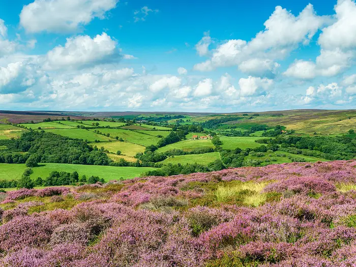
Image by Helen Hotson The Esk Valley Walk is a compact source-to-sea trail through the North York Moors, following the River Esk from its high moorland beginnings to Whitby harbour. At 56 km / 35 miles, it suits a long weekend, a first multi-day walk for fit hikers, or a set of rail-linked day walks.
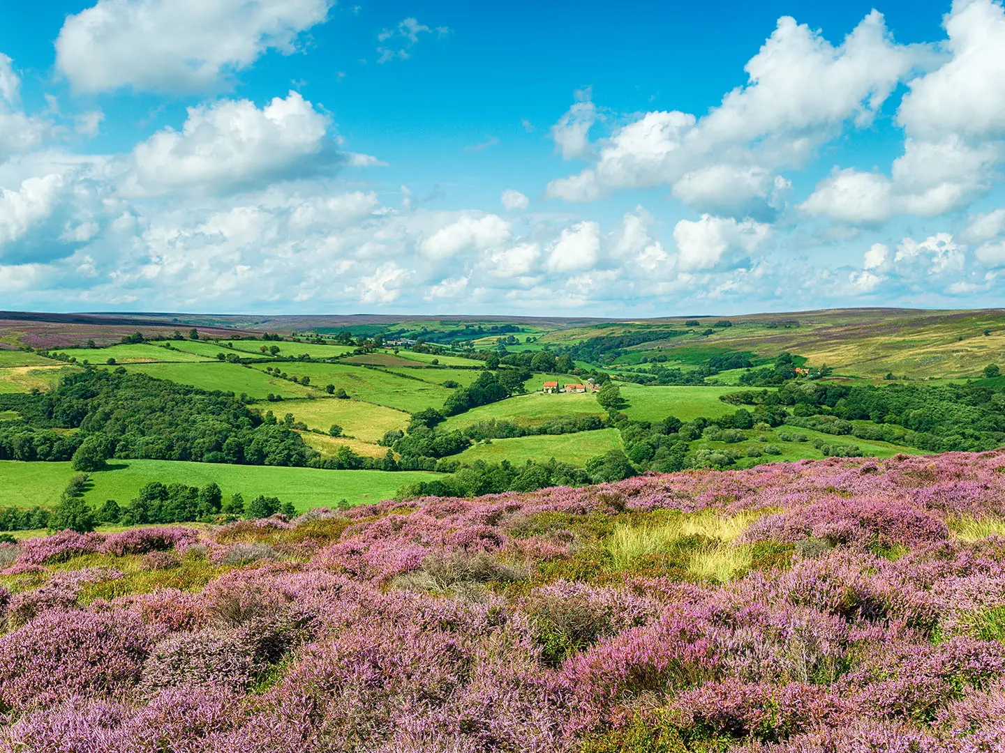
Its character changes sharply. The opening loop from Castleton crosses exposed heather moor around Danby Dale, Blakey Ridge, Westerdale Moor and the Esklets, before the route settles into a greener valley of fields, woods, riverside paths and quiet lanes.
The rewards are practical as well as scenic: a waymarked line, regular village stops, and the Esk Valley Line running through the dale. Highlights include the Esklets, Danby Beacon, Beggar’s Bridge, Egton Bridge stepping stones, Grosmont’s railway heritage and the finish below Whitby Abbey.
This is not a technical route, but it should not be treated as a casual valley stroll. The first day is long, high and exposed, the moor can be boggy, mist makes navigation important, and the stepping stones near Egton Bridge can be impassable when the Esk is high.
This guide covers stages, day planning, accommodation, food, transport, terrain and the common mistakes to avoid.
Stage-by-Stage Guide
Stage 1: Castleton to Castleton via Danby Dale, Blakey Ridge, the Esklets and Westerdale
This is the hardest and most committing stage of the Esk Valley Walk. It is a long moorland loop from Castleton, leaving the valley to cross Danby Dale, Danby Head, Rosedale Head, Blakey Ridge, Westerdale Moor and the Esklets before returning through Westerdale to Castleton.
The stage is around 24 km and includes the highest, most exposed ground of the whole route, reaching about 415 m on the Blakey Ridge / Westerdale Moor / Esklets watershed. This is where the route earns its source-to-sea character: small becks and gills gather around the Esklets to form the infant River Esk.
Underfoot, expect moorland tracks, grass and dirt paths, wet peat and boggy sections, especially after rain. The walking is not technical, but it is much more serious than the lower valley stages because the ground is open, the weather can change quickly and visibility can be poor in mist.
The main landmarks are Danby Dale, the high crossing towards Blakey Ridge, the isolated Lion Inn, the Esklets on Westerdale Moor and the return through Westerdale. The Lion Inn is the key mid-stage landmark and the only clearly defined refreshment stop on the moorland loop; its opening times should be checked before relying on it.
Carry enough food and water for the full day. Castleton has the start and end services for the loop, but the moor itself has no dependable fallback once committed beyond the village and the Lion Inn area.
Accommodation at the end is in or around Castleton, with wider options in nearby Esk Valley villages. Beds in the valley are limited compared with Whitby, so booking ahead is sensible, especially if walking over a weekend or during the main walking season.
Castleton Moor railway station on the Esk Valley Line is the usual access point for the start of the walk. This makes the stage practical as a stand-alone day walk, but train services are limited, so current times should be checked before travelling.
Navigation deserves particular attention on this stage. The Esk Valley Walk is waymarked with the leaping-salmon symbol, but the high moorland loop should not be treated as a waymark-only walk in poor weather. Carry OS mapping for the North York Moors, plus a compass or GPS, and know how to use them.
The main warnings are exposure, boggy ground and poor visibility. Start early enough to complete the loop in daylight, take windproof and waterproof clothing even in settled weather, and avoid underestimating the distance because the route returns to the same village rather than moving on to a new overnight stop.
Stage 2: Castleton to Lealholm
This shorter stage changes the character of the walk. From Castleton the route continues down the Esk Valley through Ainthorpe and Danby, with a climb towards Danby Beacon before heading on towards Lealholm.
At around 12 km, it is a much easier day than the opening moorland loop, though it still includes ascent and open ground around Danby Beacon. The walking becomes more pastoral, using field paths, grass tracks, quieter lanes and sections of valley walking rather than the sustained high moorland of Stage 1.
Danby Beacon is the main high point and view feature of the day. It is a former signal-fire site and Second World War radar station, and it gives wide views over the surrounding moors and valley. Danby Lodge, the North York Moors National Park’s main visitor hub, lies nearby.
Ainthorpe, Danby and Lealholm are the principal settlements on this stage. Food and drink availability is more realistic than on the moorland loop, but village services can be seasonal or limited; opening times should be checked before setting off, and carrying lunch remains sensible.
Lealholm is the natural overnight stop for this three-day itinerary. Accommodation is available in valley villages such as Lealholm, but capacity is limited, so do not leave this stop to chance in busy periods.
Public transport access is strong for a rural route. Castleton Moor, Danby and Lealholm are all on the Esk Valley Line, making this stage straightforward to shorten, section-walk or use as a one-way day walk. Services are sparse, so missed trains can mean a long wait.
Navigation is generally less demanding than on Stage 1, but the route still crosses fields, lanes and open moor-edge ground where signs can be missed. Watch for the leaping-salmon waymarks and the standard yellow footpath and blue bridleway arrows, and keep a map or GPS to hand rather than assuming every junction will be obvious.
Mud is the main underfoot issue after rain, particularly on field paths. Expect livestock in the valley fields and leave all gates as found.
Stage 3: Lealholm to Whitby via Glaisdale, Egton Bridge, Grosmont, Sleights and Ruswarp
The final stage is a longer valley-to-coast day of around 22 km. It follows the lower Esk Valley through Glaisdale, Egton Bridge, Grosmont, Sleights, Briggswath and Ruswarp before finishing at Whitby’s old harbour and West Pier, where the Esk meets the North Sea.
The terrain is gentler than the first stage, but the distance still makes it a full day. Expect a mix of riverside meadows, woodland, field paths, gravel tracks, quiet lanes and some paved sections as the route threads through the settled lower dale.
The first major landmark is Beggar’s Bridge at Glaisdale, a single-arch packhorse bridge over the Esk built in 1619. It is one of the best-known historic crossings in the valley and a useful point for checking progress.
Just before Egton Bridge, the route uses two sets of stepping stones across the River Esk. These are a classic feature of the walk, but they can be impassable when the river is high. Do not attempt the crossing if the stones are covered or the water is fast; river conditions should be checked before travelling after heavy rain.
Grosmont is another key stop, known for the North Yorkshire Moors Railway and its railway heritage. From here the route continues down the valley through Sleights, Briggswath and Ruswarp, gradually becoming more settled as Whitby approaches.
Food and drink options are more frequent than on the moorland stage, with several villages passed before the finish. Even so, do not rely on every stop having suitable opening hours; carry enough food and water to cover a long day if services are closed.
Whitby has the widest choice of accommodation on the route, including hotels, guesthouses, inns, B&Bs, campsites and YHA accommodation. It is still worth booking ahead in peak season, as Whitby is a popular coastal destination as well as the end of the trail.
Rail access is useful throughout this stage. Lealholm, Glaisdale, Egton, Grosmont and Whitby are on the Esk Valley Line, so the day can be split or shortened if needed. Current train times should be checked carefully because services are limited.
Navigation is usually straightforward, but the lower valley has more path junctions, lanes, field edges and settlement edges than the open moor. Keep following the Esk Valley Walk waymarks and be alert where the route leaves villages or changes between riverside paths, woodland and lanes.
The main practical warnings are mud after rain, slippery riverside and woodland paths, the Egton Bridge stepping stones in high water, and fatigue from combining the official Lealholm-to-Grosmont and Grosmont-to-Whitby sections into one longer final day. Leave enough time for the approach into Whitby rather than treating the final stage as an easy half-day.
Recommended Itinerary
Standard 3-day itinerary
This is the most practical long-weekend schedule. It keeps the hardest ground on a single opening day, then uses Lealholm as the main overnight stop before the longer but gentler finish to Whitby.
| Day | From | To | Approx. distance | Why this stage makes sense | Services/accommodation notes |
|---|---|---|---|---|---|
| 1 | Castleton, using the moorland loop via Danby Dale, Blakey Ridge, the Esklets and Westerdale | Castleton | 24 km | This completes the exposed high-moor source section in one day and returns to the same village, avoiding the need to find accommodation on the moor. It is the toughest day: start early, carry proper navigation and allow for boggy going and poor visibility. | Castleton has village accommodation, but beds are limited and should be booked well ahead. Castleton Moor railway station is the usual rail access point. The Lion Inn on Blakey Ridge is a useful refreshment stop on the loop, but opening times should be checked before relying on it. |
| 2 | Castleton | Lealholm | 12 km | A deliberately shorter middle day after the moorland loop. The route moves into the gentler Esk Valley landscape, with field paths, riverside walking and the climb near Danby Beacon. | Accommodation is available in valley villages such as Castleton, Danby and Lealholm, but capacity is limited. Danby and Lealholm are on the Esk Valley Line, giving useful bail-out or section-walking options. |
| 3 | Lealholm | Whitby, via Glaisdale, Egton Bridge, Grosmont, Sleights and Ruswarp | 22 km | A longer final day, but mostly lower-level valley walking compared with Day 1. It links several of the route’s best-known Esk Valley features, including Beggar’s Bridge, the Egton Bridge stepping stones, Grosmont and the approach to the harbour at Whitby. | Lealholm, Glaisdale, Egton, Grosmont and Whitby all have rail access on the Esk Valley Line. Whitby has the widest accommodation choice. The stepping stones near Egton Bridge can be impassable when the River Esk is high; check conditions and be ready to use a safe alternative if needed. |
Slower 4-day variant
This suits walkers who want shorter days, are using the Esk Valley Line for section walking, or prefer to follow the official North York Moors National Park sections more closely. It also gives more flexibility if the moorland weather is poor.
| Day | From | To | Approx. distance | Why this stage makes sense | Services/accommodation notes |
|---|---|---|---|---|---|
| 1 | Castleton, via Danby Dale, Blakey Ridge and Westerdale | Castleton | 15.2 miles | This is the official EVW1 moorland loop and the most committing part of the walk. Keeping it as a standalone day is sensible because the ground is exposed, navigation matters in mist and progress can be slow in boggy conditions. | Stay in or near Castleton before and after the loop. Castleton Moor railway station gives rail access, but Esk Valley Line services are limited and times should be checked before travelling. |
| 2 | Castleton | Lealholm | 7.3 miles | A shorter recovery stage through the upper Esk Valley, with easier walking after the high moorland. | Castleton, Danby and Lealholm are the key service points for this stage. Book village accommodation early. |
| 3 | Lealholm | Grosmont | 5.8 miles | A short valley day through Glaisdale and Egton Bridge, useful for walkers who want time for Beggar’s Bridge, the river crossings and Grosmont’s railway heritage. | Lealholm, Glaisdale, Egton and Grosmont all have stations on the Esk Valley Line. The Egton Bridge stepping stones should not be used when the river is high. |
| 4 | Grosmont | Whitby | 8 miles | A manageable final stage from the lower Esk Valley to the North Sea at Whitby, passing through Sleights, Briggswath and Ruswarp before the harbour finish. | Grosmont and Whitby both have rail access. Whitby has plentiful accommodation, including hotels, guesthouses, inns, B&Bs, campsites and YHA options. |
Faster 2-day variant
A 2-day crossing is possible for fit walkers travelling light, but it makes the first day very long if the moorland loop and the Castleton-to-Lealholm section are combined. It is best reserved for strong walkers in stable weather with accommodation already secured.
| Day | From | To | Approx. distance | Why this stage makes sense | Services/accommodation notes |
|---|---|---|---|---|---|
| 1 | Castleton, via the moorland loop, then onward to Lealholm | Lealholm | About 36 km | This combines the standard first two days, putting the exposed Blakey Ridge, Westerdale Moor and Esklets section first, then continuing down the valley. It is a demanding day and should not be underestimated. | Start early from Castleton or Castleton Moor station. Lealholm accommodation is limited, so book before committing to this schedule. Carry enough food and water for a long day, and check any intended refreshment stops before relying on them. |
| 2 | Lealholm | Whitby | 22 km | This leaves the lower Esk Valley and coastal finish for the second day. The distance is still substantial, but the terrain is generally gentler than the opening moorland. | The Esk Valley Line gives possible exit points at Glaisdale, Egton, Grosmont and Whitby, though services are sparse. Check current train times before travelling. |
Planning the Route
How many days to allow
Three days is the most practical long-weekend schedule for the Esk Valley Walk. It keeps the route manageable without turning the lower valley into a series of very short days, and it uses Castleton, Lealholm and Whitby as clear rail-served staging points.
The key planning point is that the first day is not just another valley stage. The Castleton moorland loop via Danby Dale, Blakey Ridge, the Esklets and Westerdale is the longest and most exposed part of the walk, so it deserves a full day, an early start and a weather forecast worth trusting.
A two-day walk is possible for fit walkers, but it leaves little margin for poor visibility, boggy ground or high water at river crossings. A slower four-section approach is also very workable, especially if using the official North York Moors National Park sections as individual day walks.
| Option | Best for | Practical notes |
|---|---|---|
| 2 days | Strong walkers wanting a fast traverse | Long days, with limited margin if the moorland loop is slow or the Esk is high |
| 3 days | Most multi-day walkers | Natural long-weekend plan: Castleton loop, Castleton to Lealholm, Lealholm to Whitby |
| 4 official sections | Day walkers or a more relaxed schedule | Follows EVW1–EVW4: Castleton loop, Castleton–Lealholm, Lealholm–Grosmont, Grosmont–Whitby |
Natural stages and overnight stops
The route is unusually easy to break up because the Esk Valley Line runs through the dale, with stations at Castleton Moor, Danby, Lealholm, Glaisdale, Egton and Grosmont before Whitby. That makes Castleton, Lealholm, Grosmont and Whitby the most useful planning hubs.
A standard three-day plan is:
| Day | Stage | Approx. distance | Main planning issue |
|---|---|---|---|
| 1 | Castleton moorland loop via Danby Dale, Blakey Ridge, the Esklets and Westerdale, returning to Castleton | 24 km | Exposed moorland, navigation, boggy ground, weather |
| 2 | Castleton to Lealholm | 12 km | Shorter valley day, but still allow for field paths and mud after rain |
| 3 | Lealholm to Whitby via Glaisdale, Egton Bridge, Grosmont, Sleights and Ruswarp | 22 km | River crossings, rail options, final approach into Whitby |
Accommodation is mixed, with hotels, inns, guesthouses and B&Bs in Castleton, Danby, Lealholm, Glaisdale, Egton Bridge, Grosmont and Whitby. Valley beds are limited compared with Whitby, so book the village stops well ahead, particularly if trying to keep to a fixed three-day itinerary.
Whitby has the broadest choice of accommodation, including campsites and YHA accommodation. In the smaller Esk Valley villages, availability can dictate the stage plan more than the walking distances do.
Section hiking and shortening the walk
This is one of the easier North York Moors routes to section-hike. The Esk Valley Line allows most sections to be walked one-way, then linked back by train, which is useful if accommodation is full or if the forecast makes the opening moorland loop unwise.
The four official sections are also practical day-walk units:
| Official section | Route | Approx. distance |
|---|---|---|
| EVW1 | Danby Dale, Blakey and Westerdale loop from Castleton | 15.2 miles |
| EVW2 | Castleton to Lealholm | 7.3 miles |
| EVW3 | Lealholm to Grosmont | 5.8 miles |
| EVW4 | Grosmont to Whitby | 8 miles |
Train services on the Esk Valley Line are limited, with only a handful of trains a day, so do not assume a flexible turn-up-and-go service. Current train times should be checked before travelling, especially for one-way section walks.
Navigation and route-finding
The Esk Valley Walk is waymarked with a leaping-salmon symbol on a white disc, with yellow arrows for footpaths and blue arrows for bridleways. Waymarking helps, but it is not a substitute for navigation on the opening moorland loop.
The section over Danby Dale, Blakey Ridge, Westerdale Moor and the Esklets is high, exposed and can be boggy. In mist, wind or low cloud, carry and know how to use OS mapping, a compass or a reliable GPS route. OS Explorer OL26 and OL27 cover the route; Landranger 94 and 100 are the broader-scale alternatives.
Navigation becomes more straightforward in the lower Esk Valley, where the route follows a mix of field paths, riverside meadows, woodland and quiet lanes. Even there, expect muddy fields after rain and take care at path junctions around villages and field boundaries.
Food, water and resupply
Do not plan the first day as if it were a village-to-village valley walk. The moorland loop is long and exposed, so start with enough food and water for the full day. The Lion Inn on Blakey Ridge is a useful refreshment stop on the high moor, but opening times should be checked before relying on it.
From Castleton onwards, the route passes through or near several valley villages, including Danby, Lealholm, Glaisdale, Egton Bridge and Grosmont, before reaching Whitby. Services vary by place and season, so carry a day’s essentials rather than depending on buying food at every stop.
Water should be carried from the start of each stage. Natural water on the moor and along the valley should not be treated as a guaranteed drinking supply without proper treatment.
Weather, ground conditions and river crossings
Weather matters most on day one. The high moor around Blakey Ridge, Westerdale Moor and the Esklets is exposed, and poor visibility can make the route much slower. If the forecast is bad, it is often better to use the railway to walk a lower valley section and return to the moorland loop in better conditions.
Boggy ground is common on the moor, and the lower fields can be muddy after rain. Waterproof footwear and gaiters are sensible outside dry summer spells.
The route includes stepping-stone crossings at Egton Bridge. These can be impassable when the River Esk is high, so the river level and any local advice should be checked before relying on them after heavy rain.
Transport planning
Castleton Moor railway station is the usual rail arrival point for Castleton and the start of the opening loop. Whitby is the eastern rail terminus, which makes the full walk straightforward to plan without returning to the start on foot.
The railway is also the main safety net for shortening or splitting the walk, with stations at Danby, Lealholm, Glaisdale, Egton and Grosmont. Buses also serve Whitby and the moor-edge villages, but current services should be checked before travelling.
For a fixed itinerary, book accommodation first, then build the walking days around the available valley stops and the current Esk Valley Line timetable. On this route, missed trains and full village accommodation are more likely to cause problems than the walking distance itself.
Towns, Villages and Overnight Stops
Accommodation on the Esk Valley Walk is concentrated in the dale villages and at Whitby. The practical three-day pattern is usually Castleton, Lealholm and Whitby, with Glaisdale, Egton Bridge or Grosmont useful if you want to break the final valley section into shorter days.
Village beds are limited compared with Whitby, so book ahead rather than assuming same-day availability. Food and opening hours in the smaller settlements can be seasonal or limited; carry lunch and snacks, especially for the opening moorland loop, and check pub, café and shop hours before travelling.
| Place | Best use for walkers | Rail access | Overnight practicality |
|---|---|---|---|
| Castleton | Start, pre-walk night, and end of the opening moorland loop | Castleton Moor | Good, but limited beds |
| Danby | Valley stop or section base | Danby | Possible overnight stop |
| Lealholm | Main two-night itinerary stop | Lealholm | Good, but book ahead |
| Glaisdale | Shorter-stage stop in the lower valley | Glaisdale | Possible overnight stop |
| Egton Bridge | Lower valley stop before Grosmont | Egton | Possible overnight stop |
| Grosmont | Section break and rail/heritage railway hub | Grosmont | Good alternative stop |
| Whitby | Finish, recovery night, onward travel | Whitby | Best choice and widest range |
Castleton
Castleton is the usual starting village, with Castleton Moor railway station on the Esk Valley Line the normal arrival point. The first official section is a long moorland loop from Castleton and back again via Danby Dale, Blakey Ridge, the Esklets and Westerdale, so Castleton is also the logical overnight stop after day one.
For a three-day walk, staying in or around Castleton before the route begins is the cleanest arrangement: arrive by rail, sleep locally, then start the long moorland day early. Accommodation is available in the village area, but the choice is limited, so it should be booked well ahead.
Do not treat Castleton as a major resupply town. Check current food, pub and shop options before travelling, and carry enough food for the exposed first day, where services are sparse once you leave the village.
Danby Dale, Danby Head and Rosedale Head
These are moorland and dale waypoints on the opening loop rather than practical overnight stops. They help define the high, exposed character of the first day, but walkers should not plan around services here.
Carry food, water and full bad-weather kit through this section. The moorland can be boggy and navigation matters in mist, so the stopping strategy is simple: leave Castleton prepared and aim to return there, rather than relying on facilities part-way round.
Blakey Ridge and the Lion Inn
Blakey Ridge is one of the most useful planning points on the opening loop because the route passes the isolated Lion Inn. It is a welcome refreshment stop on the high moor, roughly halfway round the Castleton loop.
Opening times, food availability and any booking requirements should be checked before travelling, especially if the day’s plan depends on eating there. In poor weather, treat the inn as a useful stop rather than a substitute for carrying adequate food and warm layers.
This is an exposed ridge-top location, not a village base for the standard Esk Valley Walk itinerary. Most walkers continue over the watershed towards the Esklets and Westerdale before returning to Castleton.
Esklets, Westerdale Moor and Westerdale
The Esklets on Westerdale Moor are the source area of the River Esk and a key point in the route’s source-to-sea logic. This is remote moorland walking, not a service point.
Westerdale comes later on the loop before the route returns to Castleton. It is useful as a landmark and route-confirmation point, but it is not one of the main practical overnight bases described for the trail.
Plan this whole section as a self-sufficient moorland day. In mist, do not rely solely on waymarks; carry OS mapping, compass or GPS and know how to use them.
Ainthorpe and Danby
After the opening loop returns to Castleton, the route continues down the valley through Ainthorpe and Danby. This is where the walk begins to feel more like a settled dale route after the exposed first day.
Danby has Esk Valley Line rail access and is one of the valley villages where accommodation is available. It can work as an overnight or section-walking base, particularly if you want shorter days than the Castleton–Lealholm stage.
Danby Beacon lies on the climb out of the valley near Danby, and Danby Lodge, the North York Moors National Park’s main visitor hub, is nearby. Check current opening hours before building a rest or information stop into the day.
Danby Beacon
Danby Beacon is a route highlight rather than an overnight stop. It sits above the valley near Danby, with wide moorland views and an exposed feel that can be very different from the riverside walking below.
There are no walker logistics to rely on at the beacon itself. Treat it as a high-level landmark between valley settlements, and continue with enough food, water and clothing for the conditions.
Lealholm
Lealholm is the most practical overnight stop for the standard three-day itinerary, sitting at the end of the Castleton to Lealholm stage. It breaks the route cleanly: a shorter valley day after the long moorland loop, followed by the final walk to Whitby.
The village has Esk Valley Line rail access and accommodation, but beds are limited. Book early, especially if walking at weekends or during popular holiday periods.
Food and evening meal options should be checked before arrival. If staying in Lealholm, confirm whether your accommodation provides meals or whether a pub, café or shop will be open when you need it.
Glaisdale
Glaisdale lies in the lower Esk Valley between Lealholm and Egton Bridge. It is a useful stop for walkers who want to split the final Lealholm–Whitby day into shorter sections.
The village has an Esk Valley Line station and accommodation, making it practical for both overnighting and section walking. Beggar’s Bridge, one of the route’s best-known historic crossings, is at Glaisdale and is a useful landmark on this part of the walk.
As with the other valley villages, check current food and pub opening times rather than assuming all services will be available on arrival.
Egton Bridge
Egton Bridge is another useful lower-valley stop, reached after Glaisdale and before Grosmont. Accommodation is available in the village area, and the Esk Valley Line serves Egton.
The route crosses the River Esk on stepping stones just before Egton Bridge. These can be impassable when the river is high, so the crossing should be checked in wet weather or after heavy rain.
Egton Bridge works well if you want a shorter day from Lealholm, or if accommodation in Grosmont or Glaisdale is full. Confirm meal options before booking, as village services are limited.
Grosmont
Grosmont is one of the strongest practical stops in the lower valley. It sits on the Esk Valley Line and is also the northern terminus of the North Yorkshire Moors Railway, making it useful for transport, section walking and a shorter final approach to Whitby.
Accommodation is available in Grosmont, and it makes a good alternative overnight if the Lealholm-to-Whitby day feels too long. It also marks the transition into the final official section towards Whitby.
The village is closely associated with railway heritage and the dale’s 19th-century ironstone boom, but from a walking-planning point of view its main value is simple: it is a rail-served place to sleep, eat and restart. Check current train times and any food opening hours before committing to a schedule.
Sleights, Briggswath and Ruswarp
Sleights, Briggswath and Ruswarp are lower-valley settlements on the approach to Whitby. For most walkers they are route markers and possible rest points rather than planned overnight stops.
Specific accommodation and service details for these villages should be checked before travelling. If the final day is tiring or the weather turns poor, do not assume you can easily rearrange plans here without checking transport and availability.
By this stage the route is close to Whitby, so most itineraries continue to the harbour finish rather than stopping short.
Whitby
Whitby is the finish of the Esk Valley Walk, where the River Esk reaches the North Sea at the old harbour and West Pier below the abbey ruins. It is also the easiest place on the route for accommodation choice.
Hotels, guesthouses, inns, B&Bs, campsites and the YHA at Whitby give far more options than the smaller valley villages. Even so, booking ahead is sensible, particularly if arriving at the end of a weekend or holiday period.
Whitby is the eastern terminus of the Esk Valley Line, and buses also serve the town. Train services on the Esk Valley Line are limited, so check current times before deciding whether to travel home the same day or stay overnight after finishing.
Getting to the Start
By train
Castleton Moor railway station on the Esk Valley Line is the usual arrival point for the Esk Valley Walk. The waymarked route starts from Castleton, and the opening moorland loop begins south of the village before crossing Danby Dale, Blakey Ridge, Westerdale Moor and the Esklets.
The Esk Valley Line runs between Middlesbrough and Whitby, with stations along the dale including Castleton Moor, Danby, Lealholm, Glaisdale, Egton and Grosmont. For most rail journeys, plan to reach Middlesbrough first, then change onto the Esk Valley Line for Castleton Moor.
Services on the Esk Valley Line are limited, with only a handful of trains a day. This matters especially if arriving the same morning as the first walking day: the Castleton loop is the longest and most exposed stage, so a late start can be a poor choice in bad weather or short daylight. This should be checked before travelling.
By bus
Buses serve Whitby and the moor-edge villages, but the railway is generally the simplest public-transport option for reaching Castleton. Bus times, stopping points and Sunday or seasonal services should be checked before travelling.
If a bus connection does not line up with the train, a pre-booked taxi from a nearby rail-served village or from Whitby may be useful. Do not assume that taxis will be waiting at Castleton Moor station, particularly outside busy periods.
By car
Driving to Castleton is possible, but this is a point-to-point walk finishing in Whitby, so leaving a car at the start creates a return-transport problem. The rail line along the Esk Valley makes a one-way walking itinerary much easier: either travel to Castleton by train at the start, or return from Whitby by train at the end.
Long-stay parking arrangements in Castleton should be checked before travelling. If using a car, avoid relying on informal village parking for several days unless the arrangement is clearly permitted.
From the nearest airport
Flying is rarely the most practical way to access this short UK trail. For international or long-distance arrivals, the key onward step is to reach Middlesbrough by public transport, then take the Esk Valley Line to Castleton Moor. Airport-to-rail connections and same-day onward train times should be checked before travelling.
Where to stay before starting
The most convenient pre-walk base is Castleton itself, allowing an early start on the 24 km opening loop over the high moor. This first day is exposed, can be boggy, and needs proper navigation in mist, so starting well-rested and early is strongly preferable.
If Castleton accommodation is full, nearby Esk Valley Line villages such as Danby, Lealholm, Glaisdale, Egton Bridge or Grosmont can work, provided the morning train connection to Castleton Moor is practical. This should be checked before booking, as valley beds are limited and train services are sparse.
Whitby has far more accommodation, but it is at the finish rather than the start. Staying there before the walk only makes sense if the first morning train to Castleton Moor gives enough time for the full moorland loop.
Getting Home from the Finish
The Esk Valley Walk finishes at Whitby’s old harbour / West Pier. Whitby is a practical finish because it is the eastern terminus of the Esk Valley Line, but onward travel still needs planning: rail services through the valley are limited, with only a handful of trains a day.
By train
Whitby railway station is the key departure point from the finish. The Esk Valley Line runs from Whitby to Middlesbrough, calling at valley stations including Ruswarp, Sleights, Grosmont, Egton, Glaisdale, Lealholm, Danby and Castleton Moor.
This makes the finish especially convenient if a car has been left at Castleton Moor, Danby, Lealholm, Glaisdale, Egton or Grosmont, or if the walk has been done in sections. For most end-to-end walkers, the simplest rail plan is to take the train from Whitby back up the Esk Valley Line to the required station, or continue to Middlesbrough for onward connections.
Do not assume there will be a convenient evening train after finishing. Services are sparse, and the final stage from Lealholm to Whitby is long enough that delays, slow muddy paths or time spent in Grosmont can affect whether the last practical train is reachable. Current Esk Valley Line times should be checked before travelling.
If catching a specific train, allow a margin after reaching West Pier rather than planning to arrive at the harbour just before departure. Whitby can also be busy, especially in holiday periods, so leave time to move through town from the harbour finish to the station.
By bus
Buses serve Whitby and the moor-edge villages, but route numbers, frequencies and evening/Sunday provision are timetable-dependent. This should be checked before travelling.
Bus can be useful if staying elsewhere on the coast or if rail timings do not work, but the Esk Valley Line is generally the more natural public-transport link for returning to villages on the route. If relying on a bus after finishing, check the last service in advance and have a taxi or overnight accommodation plan in reserve.
By car/taxi
For drivers, the cleanest logistics are usually to leave the car at a rail-served point and return by train from Whitby. Castleton Moor is the usual arrival station for the start at Castleton, and other useful rail-served points along the route include Danby, Lealholm, Glaisdale, Egton and Grosmont.
A taxi from Whitby can work for late finishes or small groups, but it should be pre-booked if travel is essential that evening. Availability can be limited at busy times and in the evening, and fares will vary with destination and waiting time.
If a lift or taxi is meeting the walker at the end, agree a clear pick-up point in Whitby rather than using the vague instruction “the harbour”. The route finishes around the old harbour / West Pier, but traffic, parking and crowds can make an exact meeting point important.
From the nearest airport
Airport travel is not a core part of the Esk Valley Walk’s logistics. The practical public-transport spine for the route is the Esk Valley Line between Whitby and Middlesbrough, so any airport plan should be built around onward connections to or from those rail links.
Nearest-airport choice and onward public-transport timings are not fixed trail details and should be checked before booking flights. If flying out after the walk, staying overnight in Whitby or Middlesbrough is safer than depending on a late finish, a limited valley train service and same-day airport transfer.
Where to stay at the finish
Whitby has plentiful accommodation compared with the smaller Esk Valley villages, including hotels, guesthouses, inns, B&Bs, campsites and YHA accommodation. It is the best place on the route to build in flexibility at the end of the walk.
Staying overnight in Whitby is strongly worth considering if finishing late in the day, walking in poor weather, or travelling on a day with limited rail or bus services. It also avoids rushing the final riverside and coastal approach from Lealholm through Glaisdale, Egton Bridge, Grosmont, Sleights, Briggswath and Ruswarp.
Whitby is popular, so accommodation should still be booked ahead, particularly at weekends and during holiday periods. If the plan is to take the first practical train out the next morning, choose accommodation with an easy route to Whitby station and check departure times before committing.
Which Direction Should You Walk?
The Esk Valley Walk is best planned in the standard direction: Castleton to Whitby. That follows the route’s source-to-sea logic, starting with the high moorland around the Esklets where the River Esk rises, then tracking the dale downstream to the harbour and West Pier at Whitby.
Walking the route in reverse is possible, especially because the Esk Valley Line serves both ends and several intermediate villages. It is usually less satisfying as a complete trail, because the coastal finish is replaced by a return to Castleton and the hardest, most exposed moorland section comes at the end rather than the beginning.
Standard direction: Castleton to Whitby
This is the most natural direction for the walk. The first day’s moorland loop from Castleton takes in Danby Dale, Blakey Ridge, Westerdale Moor and the Esklets before returning to Castleton, so the route begins at the river’s upland source area before descending gradually into the lower Esk Valley.
It also gives the best scenery progression. The walk opens with wide, exposed heather moorland and finishes with a clear destination at the North Sea, passing through Lealholm, Glaisdale, Egton Bridge, Grosmont, Sleights, Briggswath and Ruswarp before reaching Whitby.
Logistically, this direction works well. Castleton Moor railway station is the usual arrival point for the start, and Whitby has the strongest end-of-walk accommodation choice, onward transport options and facilities. Esk Valley Line services are limited, so train times should be checked before travelling.
The main practical advantage is that the hardest ground comes first. The Castleton moorland loop is the longest and most exposed part of the route, with boggy ground and a need for proper navigation in mist. Once that is complete, the walk becomes gentler, with shorter valley stages and more regular village and rail access.
Reverse direction: Whitby to Castleton
Walking from Whitby to Castleton is feasible, but it changes the character of the route. The opening miles out of Whitby and through the lower valley are gentler, which may appeal if you want an easier first day, but the route then builds towards the exposed high moorland rather than away from it.
The reverse direction is less elegant for a multi-day itinerary because the Castleton moorland loop is circular. A reverse walker either finishes with the long loop from Castleton back to Castleton, or treats Castleton as the end of the linear valley walk and loses the full source-to-sea structure.
Accommodation flow is also less compelling. Whitby has plentiful beds, while the valley villages have more limited accommodation and need booking ahead in either direction. Ending in Castleton is practical by rail, but it does not have the same psychological pull as finishing at the harbour in Whitby.
Weather and navigation considerations
There is no reliable directional advantage for weather. The key issue is not whether you walk east or west, but whether the high moorland day is tackled in suitable conditions. In mist, rain or strong wind, the opening loop over Blakey Ridge, Westerdale Moor and the Esklets needs map, compass or GPS and proper hillwalking kit.
For section walking, direction can sensibly be chosen around train times, weather and accommodation. The Esk Valley Line makes one-way day sections practical between places such as Castleton, Danby, Lealholm, Glaisdale, Egton, Grosmont and Whitby, but the limited service means the timetable should shape the plan.
Recommendation
Walk the Esk Valley Walk Castleton to Whitby unless there is a specific transport or accommodation reason not to. It gives the strongest route logic, puts the wildest moorland early, follows the River Esk downstream through its dale, and ends with the most satisfying finish at Whitby and the North Sea.
Accommodation Along the Route
The Esk Valley Walk works well as an inn-to-inn long weekend, but the accommodation pattern is uneven. Whitby has the strongest choice by far, while the Esk Valley villages have a smaller mix of inns, guesthouses, B&Bs and hotels, so the practical issue is not whether the route can be walked without camping, but whether beds are available in the right village on the right night.
For the standard 3-day plan, the most useful overnight bases are Castleton before and after the opening moorland loop, Lealholm after the middle valley stage, and Whitby at the finish. Danby, Glaisdale, Egton Bridge and Grosmont can also work as overnight stops if the itinerary is adjusted, especially because the Esk Valley Line links the main dale settlements.
Book valley accommodation well ahead, particularly for weekends, school holidays and the main spring-to-autumn walking season. Whitby has more capacity, but it is also a major coastal destination, so late availability cannot be assumed there either.
| Place | Accommodation level (good/limited/none) | Best for | Notes |
|---|---|---|---|
| Castleton | Limited | Start/end of Day 1; night before the walk | The key base for the opening moorland loop, which starts and finishes at Castleton. Castleton Moor railway station is the usual arrival point. |
| Danby | Limited | Alternative valley base; section walking | Useful if adjusting the Castleton–Lealholm stage or using the Esk Valley Line. Danby is also close to Danby Beacon and the Danby Lodge area. |
| Lealholm | Limited | Standard night 2 on a 3-day itinerary | The most practical overnight stop between Castleton and Whitby for the usual long-weekend schedule. Book early, as village beds are limited. |
| Glaisdale | Limited | Shorter final-day split; section walking | A useful stop if breaking the Lealholm–Whitby leg, with the route passing Beggar’s Bridge nearby. |
| Egton Bridge | Limited | Shorter final-day split | Works as a lower-valley overnight if dividing the last stage. The stepping-stone crossings before Egton Bridge can be impassable when the River Esk is high. |
| Grosmont | Limited | Splitting the final section; railway interest | A practical overnight or bail-out point before the final approach to Whitby, with rail access and the North Yorkshire Moors Railway connection. |
| Whitby | Good | Finish night; rest day; public-transport exit | The widest choice on the route, including hotels, guesthouses, B&Bs and YHA accommodation. Demand can still be high in busy periods. |
| High moorland loop: Danby Dale, Blakey Ridge, Esklets and Westerdale Moor | None to rely on | Day-walk terrain only | Treat the first stage as a full day from Castleton back to Castleton. Do not plan the exposed moorland section around finding accommodation en route. |
Best overnight strategy
For most walkers, the cleanest plan is:
- Night before: Castleton or another rail-linked Esk Valley village.
- After Day 1: Castleton, after completing the moorland loop over Danby Dale, Blakey Ridge, the Esklets and Westerdale.
- After Day 2: Lealholm.
- Finish: Whitby.
This keeps the demanding exposed ground on Day 1 self-contained and leaves the remaining days in the gentler, more settled lower Esk Valley. It also avoids needing a bed in the middle of the high moorland section, where accommodation should not be relied upon.
If preferred accommodation is full
The Esk Valley Line is the main safety valve for accommodation planning. Stations at Castleton Moor, Danby, Lealholm, Glaisdale, Egton and Grosmont make it possible to walk a section, take the train to a different overnight base, and return to the trail the next day.
This is especially useful if Lealholm is full, or if a shorter final day is preferred by staying around Glaisdale, Egton Bridge or Grosmont. Current Esk Valley Line times should be checked before booking around this plan, as services are limited.
Taxi transfers may also help with awkward gaps or off-route accommodation, but they should be arranged in advance rather than assumed at the end of the walking day. Availability and fares should be checked before travelling.
Camping, hostels and luggage
The route is primarily straightforward for B&B, inn and guesthouse walkers. Camping options exist in the wider accommodation mix, and Whitby has YHA accommodation, but exact campsite locations, opening seasons and booking rules should be checked before relying on them.
No specific route-wide luggage-transfer arrangement should be assumed. If walking without carrying overnight kit, check directly with accommodation providers or local taxi firms before booking the itinerary.
Camping and Wild Camping
Camping is possible on the Esk Valley Walk, but it is not the simplest way to complete the route. The walk is short, rail-served and passes through a string of villages, so many walkers use inns, B&Bs or guesthouses rather than carrying a full camping load.
The clearest camping option in the route information is at Whitby, where campsites and the YHA exist. Campsite provision elsewhere in the Esk Valley is more variable and should be checked before travelling, especially if planning to camp near Castleton, Danby, Lealholm, Glaisdale, Egton Bridge or Grosmont.
Does the route suit camping?
The route can work for a lightweight camping trip, but it needs more planning than the distance might suggest. The opening Castleton moorland loop is long, exposed, boggy in places and reaches the high ground around Blakey Ridge, Westerdale Moor and the Esklets; carrying heavy camping kit here will make the hardest day noticeably harder.
A practical approach is to avoid moving camp over the first day’s moorland loop if possible. Staying in or near Castleton for the first night, then walking the lower valley stages with a lighter pack, is usually more sensible than trying to find an informal pitch on the high moor.
The lower Esk Valley between Castleton, Lealholm, Glaisdale, Egton Bridge, Grosmont, Sleights, Ruswarp and Whitby is gentler, with more villages and transport options. It is the more realistic part of the walk for anyone using booked campsites, but individual sites, opening dates and availability must be checked before travelling.
Wild camping and permission
Wild camping is not generally permitted in England without the landowner’s permission, and the Esk Valley Walk is entirely within the North York Moors National Park. The route crosses a mix of moorland, farmland, riverside meadows, woodland and village-edge paths, much of it on private land.
Do not assume that access land, open moor or quiet riverside ground gives a right to camp. If an overnight pitch is needed away from a formal campsite, permission should be obtained from the landowner first. Where ownership or local rules are unclear, this should be checked locally before relying on it.
The exposed moorland around Danby Dale, Blakey Ridge, Westerdale Moor and the Esklets is particularly unsuitable for casual camping. It is open, weather-prone, can be boggy, and has limited shelter; in mist or poor weather, finding a discreet, safe and low-impact place to stop is not something to build a plan around.
Water and camp logistics
Formal campsites are the reliable option for water. If using natural water from becks, springs or the River Esk, it should be treated or filtered, and availability should not be assumed on the high moorland section in dry weather.
Carry enough water for the Castleton moorland loop, especially in warm conditions. The route deliberately visits the Esklets, where small becks and gills gather to form the infant River Esk, but that does not make the high-level day a dependable resupply stage.
In the lower valley, the River Esk is often nearby, but riverside camping brings extra responsibilities. Avoid pitching on low ground if heavy rain is forecast, keep well away from watercourses, and never wash, cook or dispose of waste directly in the river or its tributaries.
Fires, stoves and low-impact camping
Open fires are not appropriate on this route. The heather moors, woodland edges and dry grass can be vulnerable to fire, and fires leave lasting scars even when small.
Use a stove only where it is safe and permitted, and never on dry vegetation or peat. In very dry or windy conditions, even stove use may be unsafe on exposed moorland.
Follow strict Leave No Trace practice: arrive late, leave early if camping with permission, keep the pitch small, pack out all litter, and leave no visible sign of the camp. Human waste must be dealt with responsibly and well away from paths, watercourses and farmland.
Seasonal considerations
Spring, summer and autumn are the normal walking seasons for the Esk Valley Walk. In summer, booked campsites and Whitby accommodation can be busy, so arrangements should be made well ahead.
After rain, fields and riverside paths can be muddy, and the Egton Bridge stepping stones can be impassable when the River Esk is high. Camp plans should allow for slower walking, wet kit and the possibility of changing the day’s finish using the Esk Valley Line, whose services are limited and should be checked before travelling.
Food, Water and Resupply
Food and water planning on the Esk Valley Walk is straightforward if treated as a rural North York Moors route rather than a town-to-town trail with guaranteed services. Whitby has the broadest choice at the finish, while the valley villages are useful but limited, with rural opening hours and seasonal variation.
The main planning issue is the opening moorland loop from Castleton. It is the longest and most exposed day in the standard three-day itinerary, and the only named refreshment stop on the route is the Lion Inn on Blakey Ridge, roughly halfway round the loop. Do not rely on it without checking current opening times, especially outside peak season or on shorter winter days.
Resupply by section
| Section | Food availability | Water availability | Notes |
|---|---|---|---|
| Castleton moorland loop via Danby Dale, Blakey Ridge, the Esklets and Westerdale | Start and finish in Castleton. The Lion Inn on Blakey Ridge is the key refreshment stop on the loop; otherwise treat the moorland section as having no dependable food supply. | Fill up before leaving Castleton. Ask for refills at staffed stops where available. Moorland becks and the infant Esk should be treated or filtered if used. | Carry a full day’s food, including lunch and emergency snacks. This is the section where a closed pub, poor weather or slow going can matter most. |
| Castleton to Lealholm via Ainthorpe, Danby and Danby Beacon | Food is more likely in the valley settlements than on the moor, but individual pubs, cafés and village shops should be checked before travelling. | Refill at accommodation or staffed village stops. Natural water is present in the valley landscape but should not be drunk untreated. | A shorter day, but still carry enough food for the whole stage if walking outside reliable opening hours. |
| Lealholm to Whitby via Glaisdale, Egton Bridge, Grosmont, Sleights, Briggswath and Ruswarp | More settlements are passed, and Whitby has the widest choice at the finish. Do not assume every village has an open shop or café when you arrive. | Refill in villages where services are open. The River Esk is close for much of the lower valley, but river water should be filtered or treated and may be unsuitable after heavy rain. | This is a longer final day, so start with lunch and snacks even though the route passes several places. Build in a margin for rural closures. |
How much to carry
For the Castleton moorland loop, start with enough food for the full 24 km day: lunch, high-energy snacks and something spare in case mist, boggy ground or navigation slows progress. Carry at least 1.5–2 litres of water in normal conditions, and more in warm weather, because dependable refill points are limited.
For Castleton to Lealholm, the walking day is shorter, but a self-sufficient packed lunch is still sensible unless a specific pub, café or shop has been checked in advance. A normal day’s water capacity is usually enough if starting full and refilling at accommodation or open village services.
For Lealholm to Whitby, carry food for the day rather than planning around a single hoped-for stop. The route passes Glaisdale, Egton Bridge, Grosmont, Sleights, Briggswath and Ruswarp before reaching Whitby, but rural opening times can be irregular and seasonal.
Drinking water and natural sources
The route follows the River Esk from its moorland source to the sea, and there are becks, gills and river sections along the way. Natural water should be filtered, boiled or chemically treated before drinking. In the lower valley, livestock, farmland runoff and high water after rain make untreated river water a poor choice.
The safest approach is to fill bottles at accommodation each morning and ask for refills at pubs or cafés when they are open. On the first day, do this before leaving Castleton and again at the Lion Inn if using it as a stop.
Opening hours and rural closures
Sunday trading, seasonal hours and midweek closures can affect pubs, cafés and village shops in the Esk Valley. This matters most if walking a strict three-day itinerary, because the first and last days are long enough that a missed food stop can leave a long gap.
Check current opening times before travelling, and book evening meals ahead where accommodation is in a smaller village. In Whitby, food choice is far less of a constraint, but valley stops should be treated as limited rather than guaranteed.
Terrain, Conditions and Difficulty in Practice
The Esk Valley Walk is moderate rather than technical. There is no scrambling or sustained rocky ground, but the route is not uniformly easy: the opening moorland loop is exposed, often wet underfoot and more demanding to navigate, while the lower Esk Valley is gentler but can still be muddy after rain.
Underfoot, expect a mixture of moorland tracks, dirt and grass paths, gravel, field paths, riverside meadows, woodland paths, quiet lanes and occasional paved sections. Boots or robust trail shoes with good grip are preferable, especially for the moorland and field sections after wet weather.
The moorland loop: the hardest terrain
The Castleton loop via Danby Dale, Blakey Ridge, Westerdale Moor and the Esklets is the part that gives the route most of its difficulty. It reaches around 415 m on high heather moorland near the Esklets watershed, where the River Esk rises, and is the most exposed section of the whole walk.
This ground can be boggy and slow, particularly after rain. In clear weather the moorland gives broad lines of sight, but in mist the same openness becomes a navigation problem: paths, tracks and waymarks should not be relied on as the only means of route-finding. Carry OS mapping for the North York Moors, plus a compass or GPS, and know how to use them.
Wind and rain feel much more serious on Blakey Ridge and Westerdale Moor than in the sheltered lower valley. This first loop is also long enough to punish late starts, poor pacing or inadequate layers, so it is best treated as a full hillwalking day rather than a simple valley stroll.
Lower Esk Valley: easier walking, but not flat
After Castleton, the character changes to wooded, pastoral valley walking. The route uses field paths, riverside sections, woodland and quiet lanes through and between places such as Ainthorpe, Danby, Lealholm, Glaisdale, Egton Bridge, Grosmont, Sleights, Briggswath and Ruswarp.
The walking here is generally easier underfoot than the opening moorland loop, with less exposure and more frequent villages. However, it is still a North York Moors route with a total ascent of about 1,294 m across the full trail, so the valley stages should not be treated as flat riverside promenade walking.
The climb near Danby Beacon adds a sharper upland feel to the middle part of the walk. Elsewhere the difficulty is more about accumulated distance, wet grass, mud, field boundaries and short rises and falls rather than any single severe climb.
Mud, water and river crossings
Moorland bog and valley mud are the two main underfoot hazards. The high ground around Westerdale Moor and the Esklets can hold water, while the lower field and riverside sections can become slippery and slow after prolonged rain.
The route includes stepping-stone crossings near Egton Bridge. These are a notable feature of the walk, but they can be impassable when the River Esk is high. Do not assume they will be usable after heavy rain or during flood conditions; the state of the crossings should be checked before travelling if river levels are likely to be raised.
Roads, lanes and hard surfaces
This is primarily an off-road walking route, but it is not entirely soft underfoot. Expect intermittent quiet lanes, gravel and paved sections, particularly through villages and on linking stretches in the lower valley.
The harder surfaces are useful in wet conditions but can be tiring late in the day, especially on the longer Castleton loop and the final stage to Whitby. Footwear should be comfortable on both soft moorland and hard tracks or lanes.
Fields, livestock and boundaries
The lower Esk Valley includes pastoral field walking, so expect normal countryside conditions: grass paths, field edges, gates or other boundaries, and possible livestock. Keep dogs under close control and take particular care around animals, especially where the path passes through enclosed fields.
Wet grass and churned field entrances can be more slippery than they look. Walking poles are useful but not essential; they help on muddy descents, uneven field paths and the stepping-stone approach if conditions are damp.
Seasonal conditions
Spring, summer and autumn are the normal seasons for this route. Spring can bring wet ground and cool, changeable weather on the moors, so waterproofs and warm layers still matter even if the valley feels mild.
Summer gives the longest daylight and the easiest logistics for the long opening loop, but exposed moorland still needs windproof and waterproof clothing. Carry enough water and food between settlements, particularly on the high moorland section.
Autumn can be excellent in settled weather, but shorter days make timing more important. Mist, rain and saturated ground can turn the moorland loop from a moderate walk into a much harder navigation day.
What makes it easier or harder in practice
| Factor | Easier conditions | Harder conditions |
|---|---|---|
| Navigation | Clear weather, visible waymarks, prepared GPX or map route | Mist on Blakey Ridge, Westerdale Moor and the Esklets |
| Underfoot | Dry tracks, firm grass, low river levels | Boggy moorland, muddy fields, flooded stepping stones |
| Exposure | Calm weather and good visibility | Wind, rain and low cloud on the high moorland loop |
| Distance | Three-day itinerary with village stops | Compressing the walk into fewer days, or starting the Castleton loop late |
| Escape options | Using Esk Valley Line stations in the lower valley | Relying on limited train services without checking times |
For most reasonably fit walkers, the Esk Valley Walk is a manageable long-weekend trail. The key is not to underestimate the first day: the lower valley may feel friendly and well connected, but the opening moorland loop needs proper hillwalking judgement, navigation and weather-ready kit.
Weather and Best Time to Walk
The Esk Valley Walk is best planned for spring, summer or autumn. The route is not technically difficult, but weather matters because the first stage crosses exposed high moorland around Danby Dale, Blakey Ridge, Westerdale Moor and the Esklets before the walk settles into the more sheltered lower Esk Valley.
For most walkers, the most reliable planning window is late spring to early autumn, when daylight is long enough for the 24 km opening loop and village accommodation is operating in its main season. Valley beds are limited in places such as Castleton, Danby, Lealholm, Glaisdale, Egton Bridge and Grosmont, so book well ahead for weekends and popular walking periods.
Spring
Spring can be a good time for the route, especially if the moorland section is tackled on a clear, settled day. Expect wet ground on the moors and mud through fields and riverside paths after rain, particularly on the lower valley sections between Castleton, Lealholm, Glaisdale and Grosmont.
The main planning issue is ground condition rather than temperature. The opening loop can be boggy, and mist on the high moorland around Blakey Ridge, Westerdale Moor and the Esklets makes proper navigation essential.
Summer
Summer gives the longest daylight and is the easiest season for a three-day schedule. It is the best time to give the long Castleton moorland loop a comfortable margin, especially if you want time for stops around Blakey Ridge and the Esklets.
Hot weather is less of a problem than exposure: much of the first day is open moorland with limited shelter, while later sections include more woodland, field and riverside walking. Carry enough water for the exposed parts and do not rely on finding services between villages unless already planned.
Summer is also when accommodation pressure is highest, especially at the Whitby end and in the smaller Esk Valley villages. Book early if walking the full route over a weekend.
Autumn
Autumn can be excellent, but the practical risks increase as daylight shortens and rain makes the ground heavier. The lower Esk Valley can become muddy, and the moorland loop is more serious in wind, mist or persistent rain.
Plan the Castleton loop for the clearest forecast available, and avoid starting it late in the day. If the River Esk is high, the stepping-stone crossings near Egton Bridge may be impassable, so the state of the crossings should be checked before travelling.
Winter
The route is realistic in winter only for walkers who are comfortable with short days, exposed moorland navigation and poor-weather decision-making. The high ground around Blakey Ridge, Westerdale Moor and the Esklets can feel much more remote in cold rain, strong wind, fog, snow or ice.
For a first multi-day walk, winter is not the best season for the Esk Valley Walk. The lower valley sections are more forgiving, and the Esk Valley Line makes shorter day walks possible, but the full three-day route needs careful timing and a conservative forecast.
Weather hazards to plan around
- Mist and hill fog: the main risk on the opening moorland loop; carry OS mapping, compass or GPS and know how to use them.
- Wind and exposure: Blakey Ridge, Westerdale Moor and the Esklets are open and can be uncomfortable in poor weather.
- Bog and mud: expect boggy moorland and muddy fields after rain.
- Flooded crossings: the Egton Bridge stepping stones can be impassable when the Esk is high.
- Short daylight: the 24 km first stage needs an early start outside summer.
No seasonal closure applies to the route from the information available, but current diversions and the condition of the stepping-stone crossings should be checked before travelling. Normal tick checks are sensible after walking through moorland, long grass and woodland.
Safety Notes
The Esk Valley Walk is a moderate, waymarked route rather than a technical mountain walk, but it still needs proper hill-walking judgement. The main safety issues are the exposed opening moorland loop, boggy ground, changeable weather, river crossings in the lower valley and the limited public transport fallback if timings go wrong.
Emergency help
In an emergency in the UK, call 999 or 112 and ask for the appropriate service. On the open moor, be ready to give a grid reference or a precise location from a mapping app or GPS device.
Mobile signal should not be relied on everywhere, especially on the higher and more remote moorland sections around Danby Dale, Blakey Ridge, Westerdale Moor and the Esklets. Carry an offline map, spare battery power and a paper map or compass backup if using a phone for navigation.
Moorland exposure and navigation
The first stage from Castleton over Danby Dale, Blakey Ridge, Westerdale Moor, the Esklets and Westerdale is the most serious part of the walk. It is exposed, can be boggy, and needs confident navigation in mist or poor visibility even though the route is waymarked.
Do not treat the leaping-salmon waymarks as a substitute for navigation. In low cloud, heavy rain or snow showers, tracks and trods on the moor can become unclear; OS Explorer OL26 and OL27, or Landranger 94 and 100, cover the route.
Plan this opening loop for a long, stable-weather day. The Lion Inn on Blakey Ridge is a useful landmark and possible refreshment stop, but opening times and services should be checked before travelling.
Weather, heat and cold
The high point is about 415 m on open North York Moors ground, where wind and rain can feel much colder than in the valley. Carry waterproofs, warm layers, hat and gloves outside settled summer conditions.
In warm weather, the open moorland offers limited shade and the lower valley can still feel hot on field and lane sections. Carry enough drinking water for the day, as services are concentrated in villages rather than evenly spaced along the trail.
Rivers, mud and stepping stones
The lower Esk Valley includes riverside paths, meadows and woodland that can become muddy after rain. Footing can be slippery on wet grass, woodland paths, stone, roots and compacted mud.
The stepping stones near Egton Bridge are a specific hazard. They can be impassable when the River Esk is high; do not attempt them in flood or fast water, and check conditions before relying on that crossing.
Keep clear of river edges in spate, particularly where banks are muddy or undercut. The route follows the Esk down the valley, but it is not worth taking risks to stay close to the water in poor conditions.
Roads, lanes and village sections
The route uses some quiet lanes and paved sections as well as paths and tracks. Walk facing oncoming traffic where there is no pavement, take extra care on bends, and make yourself visible in poor light.
Traffic levels are generally a more relevant concern around villages, road crossings and the approach into Whitby than on the moorland tracks. Allow time at the end of the final day so the walk into Whitby is not rushed in fading light.
Livestock and dogs
The valley stages pass through pastoral fields and farmland. Close gates, keep to the signed line and give livestock a wide berth, especially around cattle and sheep with young.
Dogs should be kept under close control, and on a lead where livestock, ground-nesting birds, roads or local signs require it. On open moorland, this is also important for wildlife protection.
Solo walking and fallback options
Solo walkers should be particularly cautious on the opening moorland loop, where the route is more remote and poor visibility can make navigation harder. Leave a route plan and expected finish time with someone reliable.
The Esk Valley Line gives useful fallback points at Castleton Moor, Danby, Lealholm, Glaisdale, Egton, Grosmont and Whitby, but services are limited. Verify current train times before setting off each day and do not assume there will be a late train if you miss one.
Daily safety checks before setting off
Before each stage, check:
- The weather forecast for the North York Moors, especially wind, rain, fog and temperature on the high moor.
- Current Esk Valley Line times if using the railway as a start, finish or escape option.
- Whether any trail diversions are in place. This should be checked before travelling.
- River levels or local conditions before using the Egton Bridge stepping stones.
- That offline mapping, phone battery, waterproofs, warm layers, food and water are adequate for the full day.
- That accommodation or onward transport has been arranged, as village options are limited in places.
Gear Recommendations
The Esk Valley Walk does not need technical mountain equipment, but it does need proper hillwalking kit on the opening moorland loop. Danby Dale, Blakey Ridge, Westerdale Moor and the Esklets are exposed, can be boggy, and are the part of the route where poor visibility matters most.
Footwear
Waterproof walking boots or robust trail shoes with good grip are the best choice. The route mixes moorland tracks, grass paths, dirt, gravel, field edges, woodland and short paved sections, so footwear should cope with both wet ground and harder surfaces.
For the first day’s moorland loop, ankle support and a waterproof membrane are useful in wet conditions. In dry summer weather, experienced walkers may prefer trail shoes, but expect boggy patches on the moor and mud in fields after rain.
Carry blister treatment even on a three-day itinerary. The route is not long by national-trail standards, but wet socks and mixed underfoot conditions can quickly create foot problems.
Waterproofs and warm layers
Pack a proper waterproof jacket and waterproof trousers, not just a showerproof shell. The high ground around Blakey Ridge, Westerdale Moor and the Esklets is open to wind and weather, with limited shelter.
A warm mid-layer should be carried even in spring and summer. The lower Esk Valley can feel sheltered and mild, but the moorland section reaches around 415 m and can be much colder in wind, rain or mist.
A hat and gloves are sensible in spring and autumn. For summer, carry sun protection as well as waterproofs; the moorland sections offer little shade.
Navigation
Do not rely solely on waymarking for the opening loop. The Esk Valley Walk is waymarked with the leaping-salmon symbol, with standard yellow footpath arrows and blue bridleway arrows, but mist on the high moor can make line-finding difficult.
Carry either paper mapping and a compass, a reliable GPS device, or both. Suitable paper maps are OS Explorer OL26 and OL27, or Landranger 94 and 100.
A phone with offline mapping is useful, but it should not be the only navigation tool unless backed up by a power bank and protected from rain. Download the route before travelling, as depending on live signal on the moor is poor practice.
Water and food
Carry more water and food on the Castleton moorland loop than on the lower valley stages. The Lion Inn on Blakey Ridge is a useful refreshment stop on the opening loop, but it should not replace carrying enough food and drink to finish the day if timings, weather or opening hours do not align.
For most walkers, at least 1.5–2 litres of water is a sensible starting point for the longer moorland day, with more in hot weather. The lower valley passes through or near villages such as Danby, Lealholm, Glaisdale, Egton Bridge, Grosmont, Sleights and Ruswarp, but opening times vary and should be checked before travelling.
Carry a packed lunch or substantial snacks each day. This is especially important for section walkers using the Esk Valley Line, as limited train services can make missed connections or late finishes more awkward.
Trekking poles
Trekking poles are optional but useful. They help on boggy moorland, muddy field paths and the longer day into Whitby, and they can make the Egton Bridge stepping stones feel steadier in normal water conditions.
Do not treat poles as a way to force a river crossing. The stepping stones near Egton Bridge can be impassable when the River Esk is high, and the safe choice in flood conditions is to avoid the crossing and use an alternative only where a safe, lawful route is available. This should be checked before travelling after heavy rain.
Power and electronics
A power bank is strongly recommended if using a phone for maps, GPX, photography and train information. The route is rail-friendly, but the Esk Valley Line has limited services, so keeping enough battery to check times and adjust plans is practical rather than optional.
Keep electronics in a waterproof pouch or dry bag. A wet phone on the first day can leave you without navigation, rail information and accommodation contact details for the rest of the walk.
Camping gear
Camping is possible as part of an Esk Valley Walk plan, with campsites and the YHA at Whitby among the broader accommodation options, but village beds and camping options should be booked or checked ahead. Campsite locations, opening dates and facilities can change, so this should be checked before travelling.
Campers should keep weight realistic. The route includes around 1,294 m of total ascent and the first day’s moorland loop is the least forgiving place to carry an overloaded pack.
A lightweight waterproof tent, warm sleeping system, stove where needed, dry bags and a headtorch are the core camping items. Do not assume food resupply will be available exactly where required, especially if splitting the route differently from the standard Castleton, Lealholm and Whitby staging.
Inn-to-inn hikers
Inn-to-inn walkers can keep kit compact, but should not strip it down to town-walking gear. Carry full waterproofs, a warm layer, navigation, first-aid basics, water, food, headtorch and a power bank each day.
A small dry bag for spare socks, gloves and electronics is worthwhile. Dry clothing matters most after the exposed moorland loop, where wet ground and wind can make a modest day feel much harder.
Fast and section hikers
Fast walkers and day-section hikers can travel lighter, but the same navigation and weather rules apply on the high moor. A lightweight waterproof, warm layer, offline map, emergency food and enough water should still be carried.
For rail-based section walking, leave margin around train times. A small power bank, headtorch and spare layer are sensible safeguards if a section takes longer than expected or a limited train service is missed.
Seasonal extras
In spring and autumn, add warmer gloves, hat and an insulating layer for the moorland sections. Short daylight can make a headtorch essential, particularly on the longer Castleton loop or the Lealholm to Whitby day.
In summer, carry sunscreen, sunglasses and a sun hat. Insect repellent can be useful in still, warm conditions around riverside meadows and woodland, especially on the lower Esk Valley stages.
Budget and Costs
The Esk Valley Walk can be done quite cheaply because the start and finish are on the Esk Valley Line and the route passes through rail-served villages. The main cost variable is accommodation: valley beds in places such as Castleton, Danby, Lealholm, Glaisdale, Egton Bridge and Grosmont are limited, while Whitby has far more choice but can be expensive in busy periods.
All figures below are indicative planning ranges in GBP. Accommodation rates, rail fares, food prices and taxi costs change frequently, so current prices should be checked before booking.
Typical 3-day budget
These estimates assume the practical 3-day itinerary of Castleton to Castleton, Castleton to Lealholm, then Lealholm to Whitby. They exclude travel from home to North Yorkshire, but include typical on-route spending.
| Style | Likely approach | Indicative cost per person |
|---|---|---|
| Budget | Carrying kit, simple accommodation where available, supermarket/basic food, using the Esk Valley Line rather than taxis | £120–£250 |
| Mid-range | B&Bs, inns or guesthouses in Castleton/Lealholm or nearby villages, pub meals, rail transfers as needed | £250–£500 |
| Comfortable | Private rooms, more flexible meal choices, possible taxis or luggage help, extra night in Whitby | £450–£800+ |
Solo walkers usually pay more per person for private rooms than two walkers sharing. The cheapest version of the walk depends on whether suitable camping, hostel or budget rooms line up with the chosen overnight stops.
Accommodation costs
The main overnight pressure points are Castleton and Lealholm, because the route’s practical 3-day schedule depends on staying in or near those villages. Castleton is needed after the opening moorland loop, and Lealholm is the natural stop before the longer final day to Whitby.
| Accommodation type | Planning range | Notes |
|---|---|---|
| Campsite pitch | £10–£30 per person/night | Campsites exist in the wider area, but not every route stop has convenient camping. Check location carefully before relying on this option. |
| Hostel-style bed | £25–£55 per person/night | Whitby has a YHA; hostel availability in the valley itself should be checked before travelling. |
| B&B / guesthouse / inn | £70–£140+ per room/night | Commonly the most practical option in the Esk Valley villages. Book early, especially for weekends and holidays. |
| More comfortable hotel or larger Whitby stay | £120–£220+ per room/night | Whitby has plentiful choice, but prices can rise sharply in peak periods. |
A minimum through-walk normally needs two booked nights on route: one in Castleton after the moorland loop and one in Lealholm before the final stage. Many walkers add a night before the start in Castleton or after the finish in Whitby, especially if train times do not suit a same-day arrival or departure.
Food and drink
Food costs depend on how much is bought in pubs and cafés rather than carried. The first day crosses the exposed moorland loop via Danby Dale, Blakey Ridge, the Esklets and Westerdale, so carry enough food and drink for a long day even if planning to stop at the Lion Inn on Blakey Ridge.
| Food style | Planning range |
|---|---|
| Mostly self-catered snacks, packed lunches and simple evening food | £10–£25 per day |
| Mixed approach: packed lunches plus pub/café meals | £25–£50 per day |
| Pub meals, cafés, drinks and little carried food | £50–£80+ per day |
Do not assume every small village has late-opening shops or food service. This is particularly important before the moorland loop and before leaving Lealholm for the longer final stage to Whitby.
Transport costs
The route is unusually rail-friendly for a short long-distance walk. Castleton Moor is the usual arrival station for Castleton, and Whitby is the eastern terminus of the Esk Valley Line; intermediate stations include Danby, Lealholm, Glaisdale, Egton and Grosmont.
Rail is usually the cheapest and simplest way to avoid a car shuttle. However, Esk Valley Line services are limited to a handful of trains a day, so times and fares should be checked before travelling.
Budget for:
- travel from home to the Esk Valley Line;
- the return journey from Whitby;
- any short rail hops if section-walking;
- a taxi contingency if a train is missed or a stage has to be shortened.
Exact rail fares depend on origin, ticket type and booking time. For planning, the key point is not just cost but timing: a missed train can mean a long wait.
Taxis and luggage
Taxis are useful as a fallback rather than a core requirement. The rail line follows much of the dale, so most walkers who carry their own kit can avoid taxi shuttles entirely.
If using taxis for luggage or accommodation transfers, agree the fare in advance. Availability in the smaller valley villages can be limited, especially early, late or at weekends, so taxis should be booked ahead rather than assumed on the day.
There is no need for formal luggage transfer if travelling light. If not carrying overnight kit, ask accommodation providers whether luggage movement can be arranged locally, or use pre-booked taxis; current availability and prices should be checked before booking.
Guided and self-guided packages
The Esk Valley Walk is well waymarked and has strong rail access, so most independent walkers arrange it themselves. A paid package is mainly useful for walkers who want accommodation booked for them, luggage moved, or a more comfortable schedule.
Package availability is less central to this route than on the larger national trails. If considering a self-guided or guided arrangement, check exactly what is included: accommodation standard, luggage movement, maps or GPX, emergency support, and whether transport to Castleton and from Whitby is covered.
Cost-saving tips
- Use the Esk Valley Line instead of arranging a private vehicle shuttle.
- Book Castleton and Lealholm accommodation early; limited beds can force a more expensive or less convenient stay.
- Carry lunches and snacks, particularly for the opening moorland loop.
- Consider section-walking the four official sections by train if accommodation prices are high.
- Avoid assuming Whitby will be cheap because it has more beds; busy weekends and holiday periods can raise prices significantly.
Luggage Transfer, Guided Tours and Support Services
Luggage transfer
The Esk Valley Walk is short enough that many walkers simply carry an overnight pack, especially on a 2–3 day itinerary using Castleton, Lealholm and Whitby as overnight bases. The main exception is the opening moorland loop from Castleton, where a lighter day pack is useful because the stage is longer, more exposed and can be boggy.
Dedicated door-to-door luggage transfer for the Esk Valley Walk is not something to assume in the way it can be on larger National Trails. Availability should be checked before travelling, especially if staying in smaller valley villages where accommodation capacity is limited.
A practical alternative is to base luggage at one accommodation and use the Esk Valley Line to return to it, or to arrange a local taxi transfer between overnight stops. If using accommodation in Castleton, Danby, Lealholm, Glaisdale, Egton Bridge, Grosmont or Whitby, ask before booking whether they can receive bags, store luggage, or help arrange a local taxi.
Self-guided walking packages
Self-guided packages may be available from walking-holiday operators covering the North York Moors, but they should be checked directly before relying on them for this route. A typical package, where offered, would usually include booked accommodation, route notes or GPX, and sometimes baggage movement between stops.
These packages suit walkers who want the valley accommodation arranged for them, particularly because beds in the smaller Esk Valley villages can be limited. They are less necessary for walkers comfortable booking their own accommodation and using the railway for flexible one-way walking.
Before booking, check exactly what is included: luggage transfer, emergency contact arrangements, route notes, maps or GPX, single supplements, rest-day options, and what happens if high water makes the Egton Bridge stepping stones unusable.
Guided walking
The Esk Valley Walk does not normally require a guide for competent hillwalkers, as it is waymarked and has regular rail access through the lower valley. The section where guided support is most useful is the opening moorland loop over Danby Dale, Blakey Ridge, Westerdale Moor and the Esklets, where mist, boggy ground and exposed terrain make navigation more serious.
A guided day on the moorland section may suit walkers who are new to open moorland, visiting in poor weather, or not confident using map, compass or GPS. For the lower valley stages through Lealholm, Glaisdale, Egton Bridge, Grosmont, Sleights, Ruswarp and Whitby, most independent walkers will not need guiding unless they want interpretation of the landscape and local history.
Guided availability, dates and prices vary and should be checked before booking.
Taxi and rail support
The Esk Valley Line is the most useful support service on this route. Stations at Castleton Moor, Danby, Lealholm, Glaisdale, Egton, Grosmont and Whitby make it straightforward to shorten a day, return to a previous base, or walk the official sections as separate day walks.
Services are limited, with only a handful of trains a day, so train times must be checked before travelling. This matters particularly if using the railway as a fallback at the end of a long stage or in poor weather.
Taxis are useful for luggage moves, missed train connections, or accommodation that is not directly beside the route. Book ahead where possible rather than assuming immediate availability in the smaller villages, especially outside busy visitor periods or in the evening.
What to arrange in advance
- Accommodation in the valley villages: Castleton, Danby, Lealholm, Glaisdale, Egton Bridge and Grosmont have fewer beds than Whitby, so book early.
- Any baggage movement: check whether a walking-holiday company, accommodation provider or taxi can move bags between specific stops.
- Rail times: verify current Esk Valley Line timetables before fixing daily plans.
- Taxi transfers: pre-book for early starts, late finishes, luggage moves or remote accommodation.
- Route contingencies: ask locally about any path diversions and the state of the Egton Bridge stepping stones after heavy rain.
Shorter Hikes and Best Sections
The Esk Valley Walk is unusually easy to split because the Esk Valley Line follows much of the dale. The main limitation is frequency: trains are limited, so always check current Esk Valley Line times before fixing a one-way walk.
| Best for | Start → end | Approx. distance | Why this section works | Transport notes |
|---|---|---|---|---|
| Best day walk | Lealholm → Grosmont | 5.8 miles / 9 km | A compact lower-valley stage with Glaisdale, Beggar’s Bridge, Egton Bridge and Grosmont’s railway heritage. Good if you want a proper Esk Valley sample without the exposed moorland loop. | Rail at Lealholm and Grosmont, with Glaisdale and Egton also on the Esk Valley Line. Services are sparse; check times before travelling. |
| Best weekend section | Lealholm → Whitby | 13.8 miles / 22 km | Combines the historic middle dale with the final approach to the North Sea. It can be split at Grosmont, giving one short valley day and one longer finish into Whitby. | Start at Lealholm station, finish at Whitby rail terminus. Grosmont is the obvious rail-served intermediate point. |
| Best 3-day shorter option | Castleton → Whitby, omitting the opening moorland loop | About 21 miles / 34 km | Follows the gentler lower route through Ainthorpe, Danby, Lealholm, Glaisdale, Egton Bridge, Grosmont, Sleights, Briggswath and Ruswarp before finishing at Whitby. This misses the Esklets source section, but suits walkers who want the dale-and-coast experience without the hardest exposed ground. | Start from Castleton Moor station and finish at Whitby. Useful rail-served stops include Danby, Lealholm, Glaisdale, Egton and Grosmont. |
| Best section for scenery | Castleton moorland loop via Danby Dale, Blakey Ridge, the Esklets and Westerdale | 15.2 miles / 24 km | The wildest part of the route: high heather moor, the Blakey Ridge area, the Lion Inn and the Esklets where the River Esk gathers near its source. Choose this for open moorland rather than villages. | Start and finish at Castleton, with Castleton Moor station the usual rail access. This is the section least suited to poor visibility; carry map and compass or GPS. |
| Best for beginners | Castleton → Lealholm | 7.3 miles / 12 km | A manageable introduction to the route after the high moorland loop, with lower-valley walking, Danby Beacon nearby and rail options along the way. It still has typical field paths and muddy ground after rain, but avoids the long exposed source loop. | Castleton Moor, Danby and Lealholm are all on the Esk Valley Line. Check train times before committing to a late finish. |
| Best for public transport | Lealholm → Grosmont | 5.8 miles / 9 km | Short, varied and rail-served at both ends, with extra bail-out possibilities at Glaisdale and Egton if plans change. It is the easiest section to fit around a limited train service. | Use the Esk Valley Line. The Egton Bridge stepping stones can be impassable when the river is high, so check conditions after heavy rain. |
| Best for villages and accommodation | Castleton → Whitby, using Lealholm and/or Grosmont as stops | About 21 miles / 34 km without the opening loop | This lower-valley run links most of the route’s practical overnight places and ends with plentiful choice in Whitby. It is the most flexible part of the walk for shorter itineraries. | Valley accommodation is limited, so book Castleton, Danby, Lealholm, Glaisdale, Egton Bridge or Grosmont well ahead. Rail access makes it easy to shorten or restart a section. |
| Best camping-based option | Grosmont → Whitby | 8 miles / 13 km | A short final stage that ends where known camping and hostel-style options are available in Whitby. It is better treated as a camping-friendly finish than as a fully camping-led valley itinerary. | Start at Grosmont station and finish at Whitby. Specific campsite availability and opening dates should be checked before travelling. |
Choosing between the sections
For one day, Lealholm to Grosmont is the most balanced choice: short enough for relaxed travel, but with several of the route’s best-known valley features. The stepping stones near Egton Bridge are part of the character of this section, but they are not reliable in high water.
For the strongest landscape contrast, choose the Castleton moorland loop on a clear day. It is the most committing day section on the Esk Valley Walk, with exposed ground around Blakey Ridge, Westerdale Moor and the Esklets, and should not be treated as a casual valley stroll.
For an easier long weekend, Lealholm to Whitby is the cleanest option. It keeps the historic valley crossings, Grosmont and the Whitby finish, while avoiding the navigation demands of the opening moorland circuit.
Highlights and Points of Interest
The Esklets and Westerdale Moor
The Esklets are the key natural feature of the walk: the place where small becks and gills gather high on Westerdale Moor to form the infant River Esk. This is what gives the route its source-to-sea structure, and it is worth treating as more than just another moorland waypoint.
The setting is remote, exposed and much rougher than the lower valley. In mist, this area can feel featureless, so any time spent lingering here should be balanced against the need to navigate confidently back towards Westerdale and Castleton.
Blakey Ridge and the Lion Inn
Blakey Ridge is the wildest and highest-feeling part of the route, crossing open heather moorland on the opening loop from Castleton. The high ground around the Blakey Ridge / Westerdale Moor watershed reaches about 415 m, giving broad moorland views in clear weather but little shelter in poor conditions.
The isolated Lion Inn is a notable landmark and a useful refreshment stop roughly halfway round the first day’s moorland loop. Opening times and food service should be checked before relying on it, particularly outside the main walking season.
Danby Dale, Westerdale and Castleton
The first stage makes a full moorland circuit from Castleton, passing through Danby Dale, the high ground around Blakey Ridge and the Esklets, then returning via Westerdale. This section shows the more remote side of the North York Moors before the walk settles into the gentler Esk Valley.
Castleton itself is an important practical base as well as the start of the waymarked walk. Castleton Moor railway station on the Esk Valley Line makes it a straightforward place to begin, finish the opening loop, or split the route into separate days.
Danby Beacon and Danby Lodge
Danby Beacon is one of the best viewpoints on the route, reached on the climb out of the valley near Danby. It is a former signal-fire site and later a Second World War radar station, so it adds historical interest as well as wide moorland views.
Nearby Danby Lodge, the North York Moors National Park’s main visitor hub, is useful if building in extra time around Danby. It is the most obvious place on the route for walkers wanting more context on the landscape, access, wildlife and heritage of the National Park.
Lealholm and the middle Esk Valley
Lealholm is one of the most useful stopping points in the middle of the walk, sitting naturally between the moorland opening day and the lower-valley finish towards Whitby. The surrounding walking is more pastoral than the first day, with field paths, riverside sections, woodland and quieter lanes.
This is a good area to slow the pace if the aim is to enjoy the valley rather than simply cover distance. Accommodation in the smaller Esk Valley villages is limited, so any overnight stop here should be booked well ahead.
Beggar’s Bridge, Glaisdale
Beggar’s Bridge at Glaisdale is one of the best-known historic features on the Esk Valley Walk. The single-arch packhorse bridge crosses the River Esk and dates from 1619; it is both a scheduled monument and a Grade II* listed structure.
It is worth allowing a little extra time here, particularly for walkers interested in the old crossing points and packhorse routes that shaped movement through the dale before modern roads and railways.
Egton Bridge stepping stones
Just before Egton Bridge village, the route uses two sets of stepping stones across the River Esk. They are a classic Esk Valley feature and one of the most memorable river-level moments on the walk.
They should not be treated as guaranteed in all conditions. The stones can be impassable when the river is high, so their state should be checked before relying on them after heavy rain or during flood conditions.
Grosmont and the North Yorkshire Moors Railway
Grosmont is one of the strongest cultural stops on the route, closely tied to the North Yorkshire Moors Railway. It is the northern terminus of the heritage steam railway, with engine sheds and railway heritage connected to the dale’s 19th-century ironstone boom.
For walkers section-hiking the Esk Valley Walk, Grosmont is also a practical break point thanks to its position on the Esk Valley Line. It works well for anyone wanting to combine the walk with extra time around the railway.
Sleights, Briggswath and Ruswarp
Below Grosmont, the route continues down the lower Esk Valley through Sleights, Briggswath and Ruswarp before entering Whitby. This final stretch has a gentler character than the opening moorland: more wooded and pastoral, with the river increasingly close to its tidal end at the coast.
These settlements are useful for pacing the final approach rather than major sightseeing stops on the trail. They also help make the last day feel varied, breaking up the walk between the railway heritage of Grosmont and the coastal finish at Whitby.
Whitby harbour, West Pier and Whitby Abbey
The finish at Whitby is one of the strongest endings of any North York Moors route: the River Esk reaches the North Sea at the old harbour, with the walk ending at West Pier below the ruined clifftop abbey. It gives a clear and satisfying conclusion to the source-to-sea line begun at the Esklets.
Whitby Abbey is associated with Saint Hild and Bram Stoker’s Dracula, and the town has far more services than the smaller valley villages. It is the best place on the route to allow extra time after finishing, especially if onward travel, accommodation or a rest day is being built into the plan.
Common Mistakes and Planning Tips
The Esk Valley Walk is straightforward to follow in good conditions, but several planning errors can make it harder than it looks on paper. Most problems come from treating the whole route like a gentle riverside walk, when the first official section is a high, exposed moorland loop before the valley walking begins.
| Common mistake | Better plan |
|---|---|
| Treating day one as a warm-up | Allow a full walking day for the Castleton moorland loop via Danby Dale, Blakey Ridge, the Esklets and Westerdale. It is the longest and most exposed part of the route. |
| Relying only on waymarks | Carry OS mapping, a compass or a reliable GPS track, especially for the high moorland around Blakey Ridge, Westerdale Moor and the Esklets. |
| Assuming the train makes logistics effortless | Use the Esk Valley Line, but check current times before committing to a schedule. Services are limited to a handful of trains a day. |
| Leaving valley accommodation until late | Book Castleton, Danby, Lealholm, Glaisdale, Egton Bridge or Grosmont beds well ahead, particularly if walking over a weekend. Whitby has more choice, but it is also a busy destination. |
| Assuming every village has guaranteed food | Plan food and water around known stops and opening hours. Do not rely on small villages having shops, pubs or cafés open when you arrive. This should be checked before travelling. |
| Ignoring river conditions at Egton Bridge | The stepping stones near Egton Bridge are part of the classic route, but they can be impassable when the Esk is high. Have time in the day to deal with a safe alternative if needed. |
| Being too exact about the quoted mileage | Treat 56 km / 35 miles as the rounded headline distance. Official section totals and GPS traces vary slightly, so build in margin rather than planning to the minute. |
Do not underestimate the Castleton moorland loop
The opening loop from Castleton is around 24 km in the common 3-day itinerary and includes the highest, wildest ground of the walk. It crosses Danby Dale, Blakey Ridge, Westerdale Moor and the Esklets before returning to Castleton, so it is not a short prelude before the river valley starts.
The ground can be boggy, the route is exposed, and poor visibility can make navigation harder despite the waymarking. Start early, carry proper waterproofs and warm layers, and avoid treating the Lion Inn on Blakey Ridge as a substitute for carrying food and water.
Use the railway, but plan around its limits
The Esk Valley Line is one of the route’s biggest advantages, with stations at Castleton Moor, Danby, Lealholm, Glaisdale, Egton, Grosmont and Whitby. It makes one-way days and section walking very practical.
The mistake is assuming there will always be a convenient train when needed. Services are limited, so train times should be checked before travelling, particularly if finishing late, walking on a Sunday, or using the route as a series of day walks.
Book the small valley stops first
Accommodation is spread through the dale, but the smaller villages do not have unlimited capacity. Castleton, Danby, Lealholm, Glaisdale, Egton Bridge and Grosmont can work well as stage stops, but beds should be arranged before fixing daily distances.
Whitby has a wider range of accommodation, including hotels, guesthouses, B&Bs, campsites and the YHA, but it can be busy. If the route is being walked as a long weekend, secure the valley nights first and then fit the itinerary around them.
Do not rely on waymarks alone
The Esk Valley Walk is waymarked with a leaping-salmon symbol on white discs, with standard yellow footpath arrows and blue bridleway arrows. In the lower valley this is usually enough for confident walkers to stay oriented.
On the moorland loop, waymarks should be backed up with map-and-compass skills or a dependable GPS route. OS Explorer OL26 and OL27 cover the route, while Landranger 94 and 100 are the relevant smaller-scale sheets.
Build food and water margins into each day
The route passes several villages, but that does not mean supplies are always available exactly when needed. Opening days and hours for pubs, cafés and shops can vary, especially outside peak season.
Carry enough food to complete the day without depending on a single stop. This matters most on the moorland loop, where the route is more remote and exposed than the later valley sections.
Check river conditions before committing to the stepping stones
Near Egton Bridge, the route uses stepping-stone crossings over the River Esk. They are a memorable part of the walk in normal conditions, but they are not reliable after heavy rain or when the river is in flood.
Do not arrive at this point with no spare time, no navigation option and a fixed onward train that cannot be missed. If water levels are high, safety takes priority over staying exactly on the line of the waymarked route.
Be flexible with published distances
The Esk Valley Walk is commonly described as 56 km / 35 miles, but the four official sections total a little more than that and GPS measurements can differ. This is normal for long-distance paths, especially where different measurements follow slightly different lines or rounding conventions.
For planning, use the stage distances as working figures rather than exact guarantees. The practical issue is not the small total-distance variation, but whether each day fits daylight, transport, accommodation and your pace on boggy or muddy ground.
Choose stages for logistics, not just mileage
The route can be walked as a 3-day long weekend, split into 2–3 days by fitter walkers, or broken into the four official sections. The common 3-day version balances rail-served overnight points: Castleton to Castleton, Castleton to Lealholm, then Lealholm to Whitby.
Avoid creating a stage plan that looks neat on a map but ends in a place with limited accommodation or an awkward late train. On this route, rail access is excellent by rural long-distance path standards, but it still needs timetable-led planning.
Final Advice
The Esk Valley Walk suits walkers who want a manageable long-weekend route with a real source-to-sea shape, good waymarking and practical rail access. It is a strong choice for reasonably fit hikers taking on an early multi-day trail, provided the opening moorland loop is treated as a proper upland day rather than an easy valley walk.
The main planning priority is day one. The loop from Castleton over Danby Dale, Blakey Ridge, Westerdale Moor and the Esklets is the longest and most exposed part of the route, with boggy ground and poor visibility possible on the high moor. Carry OS mapping for the North York Moors, a compass or reliable GPS, waterproofs and enough food and water to avoid depending on one refreshment stop.
Accommodation also needs early attention. Valley villages such as Castleton, Danby, Lealholm, Glaisdale, Egton Bridge and Grosmont have useful overnight options, but capacity is limited compared with Whitby. Book the village nights first, then arrange transport around those stops.
The most rewarding part of the route is the contrast: the remote Esklets and high heather moorland give the walk its source, while the lower valley gradually becomes gentler through fields, woodland, bridges and railway villages before finishing at Whitby harbour. Do not rush the final day if railway history, Beggar’s Bridge, Egton Bridge, Grosmont and the approach to the coast are part of the appeal.
As a full three-day walk, the Esk Valley Walk works well because the landscape changes continuously and the finish at Whitby feels earned. It is also one of the easier long-distance routes to section-hike, as the Esk Valley Line serves Castleton Moor, Danby, Lealholm, Glaisdale, Egton, Grosmont and Whitby. Services are limited, so current train times should be checked before travelling.
The key warning is water and weather. The moorland can be bleak in mist, fields can be muddy after rain, and the stepping stones near Egton Bridge can be impassable when the River Esk is high. In unsettled conditions, allow flexibility, know the rail escape points and avoid committing to a river crossing that is not safe.
The official opening section is a strenuous moorland loop from Castleton up Danby Dale and over the high heather of Blakey Ridge, passing the isolated 16th-century Lion Inn — the only refreshment stop of the day. The route then finds the Esklets on Westerdale Moor, where becks gather to form the infant River Esk on the site of a former Rievaulx Abbey grange, before returning through Westerdale to Castleton. This is the most exposed, boggiest walking of the route, so save it for a clear day and carry map and compass or GPS.
Committed now to the valley, the Way passes Ainthorpe and Danby, close to the Moors National Park Centre at Danby Lodge, then climbs to Danby Beacon, a former signal-fire site and Second World War radar station with wide moorland views. An easier descent leads to the stone village of Lealholm on the Esk. Railway stations at both ends make this a simple day to walk one-way.
The shortest section follows the wooded middle valley to Glaisdale, where the single-arch Beggar's Bridge of 1619 spans the Esk, then crosses the river on the famous stepping stones at Egton Bridge — impassable when the river runs high, so use the road alternative in flood. The day ends at Grosmont, northern terminus of the North Yorkshire Moors Railway, with steam locomotives and an engine shed to explore. Combine with the previous or next section for a fuller day.
The final section leaves the railway village through the lower dale, passing Sleights, Briggswath and Ruswarp as the Esk broadens towards the sea. The walk finishes at Whitby's old harbour and West Pier, below the clifftop ruins of Whitby Abbey, where the river the route has followed from its source finally meets the North Sea. Whitby's rail and bus connections close the loop back to Castleton via the Esk Valley Line.
Useful Links
Hand-picked external resources for planning and researching the Esk Valley Walk — official trail sites, maps and GPX downloads, baggage transfer and local information. Each link opens in a new tab.
Official & reference
- Esk Valley Walk — North York Moors National Park (official) northyorkmoors.org.uk
The National Park Authority's official page for its leaping-salmon-waymarked Regional Route, with downloadable route guides for the four sections (EVW1–EVW4), maps and practical notes — the definitive source for the walk.
Maps & GPX
-
 Esk Valley Walk — Walking Englishman (maps, GPX and stats) walkingenglishman.com
Independent walker's guide with downloadable GPX and Google Earth files, mapping and distance-and-ascent statistics — handy for loading the full source-to-sea route onto a phone or GPS.
-
 From purple moors to shimmering sea — Komoot collection komoot.com
A Komoot collection breaking the Esk Valley Walk into day stages with interactive maps, elevation profiles and GPX export for planning and navigation.
Planning & logistics
- Esk Valley Railway — timetables and stations (official CRP) eskvalleyrailway.co.uk
The community rail partnership's site for the Middlesbrough–Whitby line that shadows the walk, with timetables and station guides for Castleton Moor, Danby, Lealholm, Glaisdale, Egton, Grosmont and Whitby. Services are sparse, so check times here before planning one-way sections.
Local area & national parks
-
 Esk Valley Walk — LDWA Long Distance Paths database ldwa.org.uk
The Long Distance Walkers Association's entry for the walk: measured distance and ascent, mapping references and publication details, the standard registry record for British long-distance paths.
-
 Esk Valley Walk — Wikipedia en.wikipedia.org
Encyclopaedic overview of the route from Castleton to Whitby, its 415 m moorland high point, the villages along the Esk and its status as a North York Moors Regional Route.
External links are provided for convenience and are not affiliated with HikeList. Always check official sources for the latest trail conditions before you set out.
How long is the Esk Valley Walk?
The headline figure is 56 km (35 miles), though the four official sections add up to slightly more, around 58 km, and GPS measurements put it near 59 km. Most walkers take 3 days, making it a natural long-weekend route. The North York Moors National Park publishes it in four sections — the Castleton moorland loop, then Castleton to Lealholm, Lealholm to Grosmont and Grosmont to Whitby — each walkable as a day out.
Where does the Esk Valley Walk start and finish?
It runs point-to-point from Castleton, high in the Esk Valley — with Castleton Moor station the usual arrival point — to Whitby's old harbour and West Pier on the North Sea. The route first makes a moorland loop south of Castleton to visit the source of the River Esk before committing to the valley. The finish below Whitby Abbey completes the walk's source-to-sea logic.
How hard is the Esk Valley Walk?
It is a moderate route with about 1,290 m of total ascent, most of it on the opening moorland loop over Danby Dale, Blakey Ridge and Westerdale Moor, which is exposed, often boggy and reaches about 415 m. Mist can hide the waymarks up there, so carry OS Explorer OL26 and OL27 or a GPS. The lower valley is much gentler — field paths, riverside meadows and woodland that get muddy after rain, with stepping-stone crossings that can be impassable in flood.
Is the Esk Valley Walk waymarked?
Yes — it is an official North York Moors National Park Regional Route, waymarked with a distinctive leaping-salmon symbol alongside standard yellow footpath and blue bridleway arrows. Waymarking is good in the valley, but on the open moor a map and compass or GPS remain essential in poor visibility. The National Park publishes free downloadable guides for each of the four sections.
Can you walk the Esk Valley Walk using the train?
Yes — this is one of England's most rail-friendly walks. The Esk Valley Line between Middlesbrough and Whitby shadows the route, with stations at Castleton Moor, Danby, Lealholm, Glaisdale, Egton and Grosmont, so every section can be walked one-way with a train back. Services are limited to a handful each day, so check the timetable carefully before setting out.
Where can you stay on the Esk Valley Walk?
Hotels, inns, guesthouses and B&Bs are found in the valley villages — Castleton, Danby, Lealholm, Glaisdale, Egton Bridge and Grosmont — with the widest choice, including a YHA hostel, in Whitby at the finish. Beds in the smaller villages are limited, so book ahead, especially in summer and around Whitby's festival weekends. Campsites also exist along the valley for those under canvas.
When is the best time to do the Esk Valley Walk?
Spring to autumn is the season, with late August and early September a favourite, when the heather turns the moorland loop purple. Summer gives the longest days for the big opening section, while spring and autumn bring quieter paths and softer light in the wooded valley. Winter crossings of the exposed moor need full hill kit and a good forecast.
Where is the source of the River Esk on the walk?
The river rises at the Esklets, high on Westerdale Moor, where several becks and gills gather on the site of a former sheep grange of Rievaulx Abbey. The Esk Valley Walk's opening loop from Castleton deliberately climbs past Blakey Ridge to visit this remote spot before following the river all the way to the sea at Whitby. It is the highest and wildest ground on the route.
Reviews
How would you rate Esk Valley Walk?
Tap a star to start your review — you could be the first.