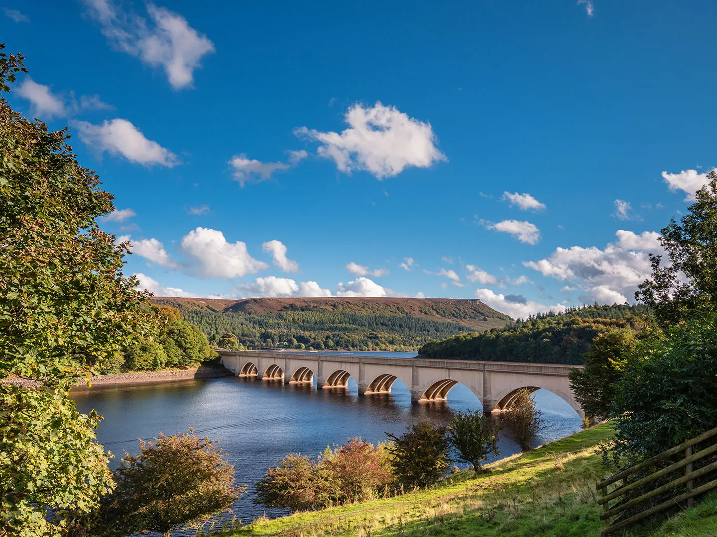
Derwent Valley Heritage Way
How would you rate Derwent Valley Heritage Way?
Tap a star to share your experience and help other hikers.
Derwent Valley Heritage Way: Derbyshire River and Mills Walk
HikeList Score
Derwent Valley Heritage Way scored 86/100 on HikeList's trail-quality metrics.
See score breakdownHide breakdown
- Ideal length 78
- Balanced challenge 100
- Scenery & wildness 79
- Varied terrain 94
- Accommodation 83
- Food & support 88
- Path quality 80
- Season flexibility 89
Computed from length, challenge, scenery & wildness, terrain variety, accommodation, food & support, path quality and season flexibility.
The Derwent Valley Heritage Way is an 88 km waymarked, point-to-point trail in Derbyshire, England, following the River Derwent from Ladybower Reservoir in the Peak District to Derwent Mouth near Shardlow. Allow about 4 days. Difficulty is moderate: the route is mostly low-level river-valley walking, but with roughly 1,002 m of ascent, some steep climbs, mud-prone fields and long paved or roadside sections. It suits walkers who want a practical inn-to-inn route linking Peak District scenery with the Derwent Valley Mills UNESCO World Heritage Site.
Route Overview
Most walkers go north to south, downstream. The route starts at Heatherdene car park on Ladybower Reservoir, north of Bamford, then passes Bamford, Hathersage, Grindleford, Baslow, Chatsworth, Rowsley, Matlock, Cromford, Belper, Duffield, Darley Abbey, Derby, Borrowash and Shardlow before finishing at Derwent Mouth, where the Derwent meets the Trent. The official Derwent Valley Trust route is split into 10 short sections, so it is easy to section-walk. Transport is a strength: the Hope Valley railway serves the start area, the Derwent Valley Line follows much of the middle and lower valley, Derby is a mainline hub, and Shardlow has bus access. For nearby alternatives, compare the Amber Valley Route or the canal-focused Ashby Canal Trail.
Industrial heritage of the Derwent Valley
The Derwent valley was a cradle of the Industrial Revolution. Richard Arkwright built the first successful water-powered cotton-spinning mill at Cromford in 1771, and Jedediah Strutt and others developed mills and model communities at Belper, Milford and Darley Abbey. The Derwent Valley Mills were inscribed as a UNESCO World Heritage Site in 2001. The Heritage Way itself is modern: created in 2003 by the Derwent Valley Trust, planned by Derbyshire Countryside Ranger Rick Jillings, and opened by the Duke of Devonshire at Chatsworth House.
Notable highlights
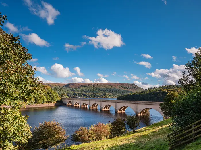
- Ladybower Reservoir: The route starts at Heatherdene beside this large dammed reservoir in the Upper Derwent Valley. The surrounding Derwent dams are also known for their connection with RAF 617 “Dambusters” Squadron training.
- Chatsworth House and park: The trail passes through Chatsworth’s parkland beside the Derwent. Chatsworth is the Derbyshire seat of the Dukes of Devonshire, and the Heritage Way was officially opened here in 2003.
- Derwent Valley Mills World Heritage Site: The path threads the core mill settlements of Cromford, Belper, Milford and Darley Abbey. This UNESCO-listed industrial landscape is central to the route’s character.
- Cromford Mill and Cromford Canal: Richard Arkwright’s Cromford Mill, begun in 1771, was a model for the factory age. The nearby canal towpath adds one of the route’s easier, flatter sections.
- High Tor, Matlock: This limestone cliff rises above the Derwent gorge between Matlock and Matlock Bath. The climb over High Tor is the steepest pull on the Heritage Way and gives its best high-level views.
- Shardlow and Derwent Mouth: The finish is at Derwent Mouth, where the Derwent joins the Trent. Nearby Shardlow is a historic inland canal port on the Trent & Mersey Canal.
Challenges to expect
This is not a mountain route, but it is not completely easy. Expect cumulative ascent over long days, with the sharp climb over High Tor the hardest single pull. Surfaces vary from field and woodland paths to gravel tracks, canal towpaths, pavement and road, including a stretch beside the A6. After heavy rain, riverside and field sections can be muddy or flooded. Waymarking is good, but pay attention through towns and Derby’s Riverside Path.
HikeList Score
Derwent Valley Heritage Way scored 86/100 on HikeList's trail-quality metrics.
See score breakdownHide breakdown
- Ideal length 78
- Balanced challenge 100
- Scenery & wildness 79
- Varied terrain 94
- Accommodation 83
- Food & support 88
- Path quality 80
- Season flexibility 89
Computed from length, challenge, scenery & wildness, terrain variety, accommodation, food & support, path quality and season flexibility.
 United Kingdom
 England
Show more data Show less
- River Valley
- Forest
- Hills
- Urban
- Dirt
- Gravel
- Paved
- Hotels
- Hostels
- Campsites
- Family Friendly
- Pet Friendly
- Restrooms
- Water Sources
- Campsites
- Picnic Areas
Download Our Full Guide to Derwent Valley Heritage Way FREE!
Get our comprehensive guide to this hike for free. Save it for later reading or print out at home.
Photos from hikers
Taken on the trail by people who've reviewed Derwent Valley Heritage Way.
Derwent Valley Heritage Way: The Complete Guide
 i
Image by drhfoto
i
Image by drhfoto The Derwent Valley Heritage Way is a practical, rewarding long-distance walk for hikers who want Peak District scenery without committing to mountain terrain. It follows the River Derwent for 88 km from Heatherdene beside Ladybower Reservoir to Derwent Mouth near Shardlow, linking reservoirs, riverside meadows, mill towns, parkland and city paths.
Its strongest appeal is the way the landscape changes as the river runs south. The opening stages sit close to the gritstone country around Bamford, Hathersage and Baslow, before the route passes Chatsworth, climbs steeply over High Tor, and drops into the historic industrial valley around Cromford, Belper, Milford and Darley Abbey.
This is also one of England’s easier long-distance trails to arrange without a car. The Hope Valley Line serves the start area, the Derwent Valley Line shadows much of the middle route, and Derby gives mainline rail access near the lower end.
The walking is moderate rather than wild: expect good waymarking, frequent towns and plenty of low-level river-valley paths. The main demands are the cumulative 1,002 m of ascent, the pull over High Tor, mud or local flooding after heavy rain, and long paved, urban, towpath and roadside sections, including through Derby and near the A6.
This guide covers stage planning, how many days to allow, accommodation, food, transport, terrain and the common mistakes to avoid.
Stage-by-Stage Guide
The stages below group the route into practical overnight sections using the main valley settlements. Distances are approximate, and published GPX tracks vary slightly, so allow some flexibility when booking onward transport or accommodation.
Stage 1: Heatherdene / Ladybower Reservoir to Baslow — approx. 30 km
This is the longest stage in the five-day schedule and the most upland-feeling part of the Derwent Valley Heritage Way. It begins at Heatherdene beside Ladybower Reservoir, near Bamford, then works south through the northern Derbyshire Peak District before gradually settling into the wider Derwent valley towards Baslow.
The walking is still low-level by Peak District standards, but this stage contains the route’s highest ground near the start, at about 220 m. Expect a mix of reservoir-side and valley paths, field and meadow sections, woodland, tracks and some harder surfaces. After heavy rain, the riverside and field sections can be muddy, and the first day is long enough for wet ground to make a noticeable difference to pace.
Key places on or near the stage include Bamford, Thornhill, Hathersage, Grindleford, Froggatt, Calver and Baslow. Hathersage is the main early settlement, with rail access on the Hope Valley Line, while the route also passes through classic gritstone-edge country before dropping towards the gentler valley around Calver and Baslow.
The main highlights are Ladybower Reservoir at the start and the Peak District scenery around Hathersage and the upper valley. The start area also sits close to the Derwent dams, associated with the RAF 617 Squadron ‘Dambusters’ practice runs, though any museum opening times should be checked before travelling.
Food and water are best planned around the established villages rather than assumed on the trail itself. Bamford, Hathersage, Grindleford, Calver and Baslow are the logical places to look for shops, cafés, pubs or accommodation, but opening days and evening food availability can vary. Carry enough food and water to get through the long first stage without relying on a single stop.
Baslow is a sensible overnight halt, with accommodation in and around the village and in the wider Chatsworth and Peak District area. Hathersage is also a useful fallback for splitting the stage, especially for walkers who prefer shorter days or are starting late from the Hope Valley Line.
Transport access is strong at the start of the route. Heatherdene is close to Bamford station on the Hope Valley Line, with Hathersage also on the same Sheffield–Manchester line. Baslow is linked by local bus services in the Matlock–Chatsworth–Baslow corridor, but current times should be checked before travelling.
Navigation is generally straightforward thanks to the yellow-arrow-on-purple waymarking, but the first stage has more rural junctions and field paths than the later urban sections. Keep a map or GPX available, especially in poor visibility, after diversions, or where paths leave settlements and cross open farmland.
The main warning is distance. This is a 30 km day with the roughest and highest-feeling terrain of the route, so it is not the stage to underestimate with a late start, heavy pack or uncertain accommodation plan.
Stage 2: Baslow to Matlock — approx. 16 km
This is a shorter and more relaxed stage, linking Baslow with Matlock through one of the most attractive heritage sections of the walk. It gives a strong contrast with the first day: less upland in character, more parkland and valley walking, and a major landmark at Chatsworth.
The route threads through Chatsworth parkland beside the Derwent, then continues downstream towards Rowsley and Matlock. Terrain is mostly river-valley walking on paths, tracks and estate-style ground, with the usual chance of mud on riverside and field sections after wet weather.
Chatsworth House and park are the clear highlight of the stage. The route passes through the parkland of the Derbyshire seat of the Dukes of Devonshire, where the Heritage Way was officially opened in 2003. Any current access arrangements or temporary route changes through the estate should be checked before travelling.
Rowsley provides a useful intermediate place before the route continues towards Matlock. The stage finishes in one of the key service towns of the whole trail, making this a straightforward day for food, accommodation and onward transport.
Food and water are usually easiest to plan at Baslow, around Chatsworth, Rowsley and Matlock, rather than assuming every facility will be open when needed. Matlock has the best range at the end of the stage, but walkers arriving on a Sunday evening or out of season should still check meal options in advance.
Accommodation is generally plentiful in Matlock and nearby Matlock Bath, with hotels, guesthouses, B&Bs and other options in the Derwent valley. This is a popular part of Derbyshire, so summer and weekend stays should be booked ahead.
Matlock is on the Derwent Valley Line, giving direct rail access along the middle valley and to Derby. Local buses also link the Matlock–Chatsworth–Baslow area, which makes this stage one of the easier parts of the route to walk as a day section.
Navigation is uncomplicated in broad terms: follow the Derwent valley downstream and pay attention where paths pass through estate, village and riverside ground. Waymarks should be followed carefully where the route leaves parkland or crosses between road, track and river path.
The main practical cautions are wet ground near the river, possible access changes around Chatsworth, and the temptation to treat the short distance too casually. Build in time for Chatsworth and for any slower going on muddy sections.
Stage 3: Matlock to Belper — approx. 19 km
This stage contains the steepest single climb of the Derwent Valley Heritage Way and some of its strongest industrial-heritage walking. From Matlock the route passes Matlock Bath and High Tor, then continues through Cromford, Whatstandwell and Ambergate to Belper.
The climb over High Tor is the main physical feature of the day. It is not the highest point of the whole trail, but it is the sharpest ascent and gives the finest high-level views over the Derwent gorge between Matlock and Matlock Bath. Take extra care if the path is wet, and allow time rather than rushing this section with a heavy pack.
After Matlock Bath, the character changes towards the mill and canal landscape of the Derwent Valley Mills UNESCO World Heritage Site. Cromford Mill and the Cromford Canal are key landmarks, with the canal towpath providing one of the flatter and easier stretches of the route.
The stage continues down the valley through Whatstandwell and Ambergate before reaching Belper. Expect a mixture of riverside paths, canal towpath, field sections, gravel tracks, pavements and some roadside or A6-adjacent walking in the mid-valley.
Food and water can be planned around Matlock, Matlock Bath, Cromford, Ambergate and Belper, with Belper the main end-of-stage service centre. Do not rely on towpath or riverside sections for supplies; carry enough between settlements, especially outside peak visitor hours.
Belper has a good range of accommodation for a long-distance walker, and it is one of the most practical overnight stops on the route. Booking ahead is still sensible, particularly if combining the walk with weekends or holidays in the Peak District and Derwent valley.
Public transport is excellent on this stage. The Derwent Valley Line has stations at Matlock, Matlock Bath, Cromford, Whatstandwell, Ambergate and Belper, making it easy to shorten, bail out, or walk the stage in separate sections.
Navigation is helped by the clear valley line and the railway stations, but the mix of gorge path, canal towpath, riverside path and settlement edges means attention is still needed at junctions. Do not assume the easiest-looking towpath or road is always the signed Heritage Way.
The main warnings are the High Tor climb, slippery ground after rain, and the cumulative fatigue caused by hard surfaces and roadside sections. This is a varied day, not just a flat canal walk.
Stage 4: Belper to Derby — approx. 15 km
This stage follows the lower Derwent through the core mill settlements south of Belper before entering Derby. It is shorter than the earlier days, but the amount of pavement, urban-edge walking and hard surface can make it feel different from the Peak District stages.
From Belper the route passes Milford, Makeney, Duffield, Little Eaton and Darley Abbey before reaching Derby. This is the heart of the Derwent Valley Mills landscape, where mill buildings and model industrial communities are central to the route’s character.
Terrain is a mix of riverside path, village and urban walking, field edges, pavements and roadside sections. The route remains low-level, but after rain the riverside and field portions can still become muddy, while paved sections can be tiring underfoot over a full day.
Belper, Milford and Darley Abbey are the main heritage highlights. The stage also begins the transition into Derby, where the route follows the Derwent through the city on the Riverside Path.
Food and water planning is straightforward compared with more remote trails, with Belper, Duffield and Derby the most obvious service points. Smaller places along the way may have limited or variable options, so this should be checked before travelling if relying on a specific lunch stop.
Derby offers the widest choice of accommodation on the route, from central hotels to guesthouses and other urban options. It is also a useful place for a rest night, late arrival, or joining the route by train.
Transport access is strong. Belper and Duffield are on the Derwent Valley Line, and Derby is a major rail hub with mainline services as well as connections back up the valley. This makes the stage particularly easy to split or walk independently.
Navigation through the more built-up parts requires concentration. Waymarks can be less visually obvious among streets, bridges, pavements and riverside paths than on open countryside sections, so keep checking the map when leaving the river or passing through settlement edges.
The main cautions are hard-surface fatigue, roadside walking and urban navigation rather than exposure or remoteness. Allow extra time for traffic crossings, built-up sections and any short diversions on the Riverside Path.
Stage 5: Derby to Derwent Mouth, near Shardlow — approx. 15 km
The final stage leaves Derby by the River Derwent and follows the lower valley towards Derwent Mouth, where the Derwent flows into the River Trent. It is a low-level closing day with a mix of urban riverside walking, open valley sections and the canal-side heritage of Shardlow near the finish.
The route passes through or near Elvaston and Borrowash before reaching the Shardlow area and Derwent Mouth. The walking is not technically difficult, but the lower riverside sections can be muddy or locally affected after heavy rain, and any riverside diversions should be checked before travelling.
Derby’s Riverside Path is the key feature at the start of the day. The route then returns towards more open country before finishing at the confluence of the Derwent and Trent, a short way from the historic canal port of Shardlow on the Trent & Mersey Canal.
Food and water should be planned carefully because the official finish itself is not a town-centre endpoint. Derby is the obvious place to start fully stocked, with Borrowash and Shardlow the logical settlement options later in the day. Opening times should be checked before travelling, especially if finishing late.
Accommodation is available in Derby and near Shardlow, but the finish at Derwent Mouth is slightly separate from the main services. Many walkers will either stay near Shardlow, return to Derby, or arrange onward travel after completing the route.
Derby is the main transport hub for the stage, with rail connections on the mainline and the Derwent Valley Line. Local buses link Derby and Shardlow, but current timetables should be checked before relying on them for the end of the walk.
Navigation is usually simple in concept — continue downstream to the Trent — but the final approach needs care because the end point is a confluence rather than a large settlement. Keep the official line or GPX to hand, particularly through the Derby edge, around Elvaston and Borrowash, and on the approach to Derwent Mouth.
The main warnings are wet or muddy riverside ground after prolonged rain, urban-edge navigation leaving Derby, and the logistics of finishing away from a railway station. Plan the final transport before starting the day rather than sorting it out at the confluence.
Recommended Itinerary
The most practical through-walk is a 5-day itinerary using Baslow, Matlock, Belper and Derby as overnight stops. This keeps every day manageable except the first, which is the longest and most upland in character, and it makes good use of the rail-served Derwent valley for arrivals, exits and contingency plans.
Distances are approximate. Published mileages for the Derwent Valley Heritage Way vary slightly by mapping source, so check official mapping before booking accommodation or baggage transfers.
Standard 5-day itinerary
| Day | From | To | Approx. distance | Why this stage makes sense | Services/accommodation notes |
|---|---|---|---|---|---|
| 1 | Heatherdene, Ladybower Reservoir | Baslow | 30 km | This is the hardest scheduling day: it gets the more remote Peak District section done in one push and finishes in a useful village hub near Chatsworth. Expect the most open, higher-feeling walking of the route early on, with the trail passing the Hope Valley settlements before dropping towards Baslow. | The start is close to Bamford station on the Hope Valley Line, but the official start is at Heatherdene car park beside Ladybower Reservoir. Accommodation should be booked well ahead in the Peak District; Hathersage, Grindleford, Calver and Baslow are the key overnight/service options along this part of the valley. |
| 2 | Baslow | Matlock | 16 km | A shorter day after the long opening stage, with the route threading Chatsworth parkland and continuing downstream through Rowsley towards Matlock. The reduced distance gives time for Chatsworth or for a steadier pace after Day 1. | Matlock has a good range of accommodation and onward transport. Matlock Bath is also nearby on the route, but accommodation location should be checked carefully against the next day’s start. |
| 3 | Matlock | Belper | 19 km | This stage includes the steep pull over High Tor between Matlock and Matlock Bath, then becomes easier as the route follows the Derwent and the Cromford Canal corridor through the World Heritage Site. It is one of the best-balanced days for scenery, industrial heritage and practical transport links. | Rail access is particularly strong on this section, with stations at Matlock, Matlock Bath, Cromford, Whatstandwell, Ambergate and Belper. Belper is a sensible overnight stop with accommodation and services. |
| 4 | Belper | Derby | 15 km | A shorter, lower-level day through the mill villages and riverside settlements of the lower Derwent, including Milford, Makeney, Duffield, Little Eaton and Darley Abbey before entering Derby. Expect more paved, urban and roadside walking than on the upper stages. | Derby is the easiest overnight stop on the whole route, with extensive accommodation and mainline rail connections. This is also the best place to break the walk if weather, flooding or fatigue affects plans. |
| 5 | Derby | Derwent Mouth, near Shardlow | 15 km | The final stage follows the Derwent out of Derby towards Elvaston, Borrowash and Shardlow, finishing at Derwent Mouth where the Derwent joins the Trent. It is a straightforward closing day, but allow time for onward transport from the finish rather than assuming services are immediately beside the trail. | Shardlow is the practical finish-area settlement. Local buses link Derby and Shardlow, but current times should be checked before travelling, especially for weekends and late finishes. Accommodation near Shardlow is possible, or many walkers return to Derby for rail connections. |
Slower options
A 6-day schedule suits walkers who want to reduce the long first day, allow more time around Chatsworth and Cromford, or avoid arriving tired in the busier Peak District villages. The easiest way to slow the route down is to split Day 1 before Baslow, using one of the Hope Valley or Derwent-side settlements such as Hathersage, Grindleford, Calver or nearby accommodation where available.
The official route is also divided into 10 short sections, making it very suitable for day-walking or a relaxed section-hike. This works especially well from Matlock southwards because the Derwent Valley Line follows the corridor through Matlock, Matlock Bath, Cromford, Whatstandwell, Ambergate, Belper and Duffield to Derby.
Faster options
A 4-day itinerary is realistic for fit walkers who are comfortable with consecutive longer days. The simplest compression is usually to keep the first three days broadly as above, then combine the Belper–Derby and Derby–Derwent Mouth stages into one long final day of about 30 km.
A 3-day completion is possible for very fit walkers, but it turns the route into a distance challenge rather than a relaxed heritage walk. Anyone planning this should check official mapping before booking, as daily distances will be long and accommodation choices need to line up precisely with transport and overnight stops.
Planning the Route
How many days to allow
Most walkers should plan the Derwent Valley Heritage Way over 5 days. That gives sensible overnight stops in the main valley towns, keeps most days moderate, and leaves time for the heritage sites at Chatsworth, Cromford, Belper, Darley Abbey and Derby rather than treating the route as a pure mileage exercise.
A 4-day itinerary is perfectly realistic for fit walkers, but it makes the trip feel more compressed and will usually mean longer days on mixed surfaces, including pavement, towpath and roadside walking. A 6-day itinerary suits walkers who want shorter days, family groups, or anyone using the route as a station-to-station heritage walk.
Completing the route in 3 days is possible for strong walkers, but it is not the best fit for the character of the trail. The Derwent Valley Heritage Way is at its best when there is time to absorb the changing river valley: Peak District reservoir and gritstone country at the top, then the mill villages and urban riverside sections further downstream.
A practical 5-day plan
The route naturally breaks around established places with accommodation and transport, especially Baslow, Matlock, Belper and Derby. These stops also avoid ending days in places where onward transport or beds may be less straightforward.
| Day | Stage | Approx. distance | Planning notes |
|---|---|---|---|
| 1 | Heatherdene / Ladybower Reservoir to Baslow | 30 km | The longest day in this version. Consider shortening if arriving late, if weather is poor, or if carrying full kit. Accommodation in the Hathersage, Baslow and wider Peak District area should be booked early in summer. |
| 2 | Baslow to Matlock | 16 km | A shorter day with Chatsworth parkland and the approach to Matlock. Useful if the first day has been demanding. |
| 3 | Matlock to Belper | 19 km | Includes Matlock Bath, High Tor, Cromford, the Cromford Canal and the mill landscape through the middle Derwent valley. Allow time for the steep pull over High Tor and for slower towpath or muddy field sections after rain. |
| 4 | Belper to Derby | 15 km | A shorter, easier-to-manage day through the lower valley, with more built-up sections and urban-edge walking. |
| 5 | Derby to Derwent Mouth, near Shardlow | 15 km | Plan the finish carefully: Derwent Mouth is not a major transport hub, while nearby Shardlow is linked by local buses to Derby. Current bus times should be checked before travelling. |
This 5-day version deliberately front-loads the hardest mileage. If that 30 km first day is too much, split the upper section by using accommodation around Bamford, Hathersage, Grindleford, Calver or Baslow, depending on availability.
Faster and slower options
For a 4-day walk, the simplest approach is to combine some of the shorter lower-valley days or use longer stages between the main towns. This works best for walkers comfortable with consecutive days over hard surfaces as well as field paths, because the lower route includes pavement, canal towpath, roadside stretches and Derby’s Riverside Path.
For a 6-day walk, shorten the opening day and allow more time around Matlock, Cromford, Belper and Derby. This is the better choice if the World Heritage Site is a major reason for choosing the trail.
The official route is also divided into 10 short sections, which makes it easy to turn the walk into a series of day walks rather than one continuous trip. Sections 1–4 run from Heatherdene to Matlock, sections 5–7 from Matlock to Little Eaton, and sections 8–10 from Little Eaton to Derwent Mouth.
Section-hiking and shortening the route
This is one of the easier long-distance trails in England to section-walk. The Hope Valley Line serves the start area via Bamford and Hathersage, while the Derwent Valley Line follows much of the middle and lower valley through Matlock, Matlock Bath, Cromford, Whatstandwell, Ambergate, Belper and Duffield to Derby.
That rail access means walkers can miss poor-weather days, walk selected sections, or build the route around weekends without complicated transfers. The main exception is the final approach to Derwent Mouth: plan how to return from the Shardlow area to Derby before setting out, and check current bus times.
The route can also be shortened naturally at Matlock, Belper or Derby if time runs out. These are more practical exit points than trying to abandon the walk at a small riverside settlement with limited transport.
Accommodation planning
Accommodation is generally available in the towns and villages along the valley, including Bamford/Hathersage, Baslow, Matlock/Matlock Bath, Cromford, Belper, Derby and near Shardlow. The most important booking pressure is in the Peak District section, especially Hathersage, Baslow and Matlock in summer, at weekends and during school holidays.
Book the first two nights before fixing the rest of the itinerary. Once the route reaches the rail-served middle and lower valley, it becomes easier to adjust plans, but popular accommodation can still fill quickly in good walking weather.
If using campsites, hostels or baggage transfer, availability should be checked before building the stage plan around them. Do not assume every village on the route has suitable overnight options for your preferred budget or style.
Food and water
This is not a remote trail, so food resupply is usually a matter of town-to-town planning rather than expedition logistics. Even so, carry lunch and enough water for each day, particularly on the longer opening stage and on any section through parkland, fields or riverside paths where services may not appear exactly when needed.
Derby, Matlock, Belper and the larger villages make the most reliable resupply points. Smaller places can be useful, but opening hours, Sunday trading and seasonal closures should be checked before relying on them.
Navigation and route-finding
The Derwent Valley Heritage Way is waymarked with a yellow arrow on a purple background, and navigation is generally straightforward. A map or GPS track is still worth carrying because riverside routes are vulnerable to temporary diversions, muddy field edges and confusing urban or roadside junctions.
Relevant Ordnance Survey mapping is OS Explorer OL1, OS Explorer OL24 and OS Explorer 259. The official guidebook and the Derwent Valley Trust route information are useful for matching the 10 official sections to day-walk or public-transport plans.
After heavy rain, pay particular attention to riverside and field sections. Local flooding or path closures can affect a river-valley walk even when the hills themselves are safe.
Transport planning
Car-free planning is a major strength of this route. The start is at Heatherdene beside Ladybower Reservoir, close to Bamford station on the Hope Valley Line, and the middle and lower route are well served by the Derwent Valley Line into Derby.
For a continuous end-to-end walk, the main transport detail is the finish. Derwent Mouth is near Shardlow, not in central Derby, so arrange the onward journey in advance rather than assuming there will be frequent transport at the exact finish point. Train and bus times should be checked before travelling.
If driving, remember that this is a point-to-point walk. Rail and bus links make it more practical to leave a vehicle at one end and return by public transport, but current services, parking rules and any restrictions at the chosen start or finish point should be checked before travelling.
Weather, ground conditions and access
The route is low-level and does not require mountain-style planning, but weather still affects the experience. Rain turns some riverside meadows, field paths and woodland stretches muddy, while paved and towpath sections can feel hard underfoot over consecutive days.
The steepest single effort is the climb over High Tor between Matlock and Matlock Bath. It is not the highest point of the trail, but it is the section where tired legs and poor conditions are most noticeable.
Access through managed landscapes such as Chatsworth park, and any riverside diversions after flooding, should be checked before travelling. The main planning risks are not remoteness or exposure, but accommodation availability, surface conditions, transport timing and keeping daily stages realistic.
Towns, Villages and Overnight Stops
The Derwent Valley Heritage Way is unusually straightforward to plan because it stays close to inhabited valley settlements for most of its length. The main overnight bases are Bamford or Hathersage before the start, Baslow, Matlock or Matlock Bath, Belper, Derby and Shardlow.
Accommodation is generally easier here than on remoter UK long-distance paths, but the Peak District end is busy. Book Hathersage, Baslow and Matlock well ahead for summer weekends and holiday periods, and always check food opening times in smaller villages before relying on them.
| Place | Best use for walkers | Transport notes |
|---|---|---|
| Bamford / Hathersage | Pre-walk night or shortened first day | Hope Valley Line stations at Bamford and Hathersage |
| Baslow | Strong first overnight stop on a 5-day itinerary | Local buses link Matlock, Chatsworth and Baslow |
| Matlock / Matlock Bath | Major mid-route overnight and resupply base | Derwent Valley Line stations |
| Cromford / Whatstandwell / Ambergate | Section-walking access points; possible shorter-stage stops | Derwent Valley Line stations |
| Belper | Good overnight hub before the lower valley | Derwent Valley Line station |
| Derby | Largest accommodation and transport hub on the route | Mainline rail hub |
| Shardlow | Practical finish-area stay near Derwent Mouth | Local buses link Derby and Shardlow |
Heatherdene / Ladybower Reservoir and Bamford
Heatherdene is the official start, beside Ladybower Reservoir in the Upper Derwent Valley. It is a start point rather than an overnight base, so most walkers using public transport should look to Bamford or Hathersage for accommodation before beginning.
Bamford is close to the start area and has a station on the Hope Valley Line between Sheffield and Manchester. This makes it the most convenient rail approach for walkers beginning at Heatherdene, although the final link from the station to the official start needs planning in advance.
Do not assume full services at Heatherdene itself. Carry food and water for the first section, especially if starting early, and check current local transport before travelling.
Hathersage and Grindleford
Hathersage is one of the most useful Peak District bases near the opening part of the trail. It has a Hope Valley Line station and is a practical place to stay if accommodation around Bamford is full or if a later start means shortening the first walking day.
Food and pub options are more dependable here than in the smaller villages between the upper valley and Baslow, but opening times still vary seasonally. Hathersage is also a sensible fallback for walkers who want an easy rail exit early in the route.
Grindleford is another Hope Valley Line access point in the early Peak District section. It is more useful as a section-walking or escape point than as a default overnight stop for the full route, unless accommodation availability or stage planning makes it convenient.
Froggatt, Calver and Baslow
Froggatt and Calver sit on the approach towards Baslow and are useful intermediate settlements rather than obvious main overnight hubs. Services should be checked before relying on them for a meal stop, especially outside peak visitor periods.
Baslow is the key overnight stop at the end of the long opening stage from Heatherdene on a 5-day plan. It is also the best base for walkers wanting to spend time around Chatsworth without pushing on to Matlock the same day.
Accommodation in Baslow and the surrounding Peak District villages can fill quickly in summer. Book ahead, particularly for Friday and Saturday nights, and do not assume late availability.
Local buses link Matlock, Chatsworth and Baslow, which gives useful flexibility if weather, daylight or accommodation availability forces a change of plan. Bus times should be checked before travelling.
Chatsworth and Rowsley
The route passes through Chatsworth parkland beside the Derwent, making this one of the most memorable sections of the walk. It is not primarily an overnight stop, but it is a natural place to slow down if stage timings allow.
Access arrangements through Chatsworth park should be checked before travelling, especially if planning an early, late or out-of-season passage. Baslow and Matlock are the more practical accommodation targets either side of this section.
Rowsley sits between Chatsworth and Matlock and can be useful for breaking up the day. Treat it as a potential refreshment or short-stage point rather than a guaranteed full-service stop unless current facilities have been checked.
Matlock and Matlock Bath
Matlock is one of the best overnight bases on the Derwent Valley Heritage Way. It sits after the Baslow and Chatsworth section and before the route crosses the steepest ground at High Tor and continues towards Cromford.
Accommodation, food and resupply options are generally stronger here than in the smaller villages either side. It is a sensible place to reset gear, dry wet kit and adjust onward stages.
Matlock has a station on the Derwent Valley Line, making it one of the easiest places to join, leave or split the walk. Matlock Bath, just downstream, also has a station and can work as an alternative overnight stop if accommodation or stage lengths suit better.
High Tor lies between Matlock and Matlock Bath and gives the route its steepest single climb. Walkers staying in either place should allow for a short but sharper section than the generally low-level river walking elsewhere on the trail.
Cromford, Whatstandwell and Ambergate
Cromford is an important practical and historic stop after Matlock Bath, with Cromford Mill and the Cromford Canal forming one of the easiest and most significant stretches of the route. It is a good place to pause, and it can also work as an overnight stop where accommodation is available.
Cromford has a station on the Derwent Valley Line, so it is also useful for section-walkers. This is a strong access point for anyone wanting to walk the mill-and-canal section without committing to the full trail.
Whatstandwell and Ambergate are also on the Derwent Valley Line and are valuable bail-out or start points. They are less obvious default overnight bases than Matlock, Cromford or Belper, so accommodation and food should be checked before planning to stop there.
Belper, Milford and Makeney
Belper is the main overnight hub between Matlock and Derby and is a natural stopping point on a 5-day itinerary. It has a station on the Derwent Valley Line and sits within the Derwent Valley Mills World Heritage landscape.
This is one of the better places on the middle route for accommodation, evening food and practical resupply. It is also a good point to shorten or end a section walk because rail access is straightforward.
Milford and Makeney lie downstream of Belper and are part of the same industrial valley setting. They are worth noting on the route, but most walkers should use Belper or Derby for overnight planning unless current accommodation and food options have been checked.
Duffield, Little Eaton and Darley Abbey
Duffield is a useful rail-served village between Belper and Derby, with a station on the Derwent Valley Line. It can work well for section-walkers or for anyone needing to shorten the Belper-to-Derby stretch.
Little Eaton and Darley Abbey are passed on the approach into Derby. They are not usually essential overnight stops because Derby is close and has much broader services, but they can be useful for breaks depending on the day’s timings.
Darley Abbey is part of the lower Derwent industrial landscape and marks the transition into the more urban section. From here, expect more paved and urban riverside walking as the trail enters Derby.
Derby
Derby is the largest service centre on the route and the most flexible overnight base in the lower valley. It has the widest choice of accommodation, food, shops and onward transport.
The city is a mainline rail hub, so it is the easiest place to join or leave the trail from outside Derbyshire. It is also a practical base for walkers completing the final stage to Derwent Mouth as a day walk.
The route follows the River Derwent through Derby on the Riverside Path. This section is more urban and paved than the upper valley, so footwear and expectations should match the terrain: it is convenient and well connected, but not a remote-feeling part of the walk.
Elvaston, Borrowash, Shardlow and Derwent Mouth
Elvaston and Borrowash lie on the final approach towards the lower Derwent and the Trent. They are more useful as waypoints than as primary overnight stops for most walkers.
Shardlow is the practical finish-area village, a short way from Derwent Mouth where the Derwent joins the River Trent. It is the best place to look for accommodation near the end of the walk, rather than expecting services at Derwent Mouth itself.
Local buses link Derby and Shardlow, which helps with finishing logistics. Check current bus times before travelling, especially if completing the final stage late in the day or on a Sunday.
Derwent Mouth is the endpoint, not a service hub. Plan the finish as a short onward walk or transfer to Shardlow, or arrange transport back towards Derby in advance.
Getting to the Start
The Derwent Valley Heritage Way starts at Heatherdene car park beside Ladybower Reservoir, near Bamford in the Upper Derwent Valley. The grid reference for the official start is SK202858.
By train
The most practical rail access is via the Hope Valley Line, which runs between Sheffield and Manchester. Bamford is the closest station to the start area, with Hathersage also nearby and useful if accommodation or services in Bamford are limited.
From Sheffield or Manchester, take the Hope Valley Line to Bamford, then continue to Heatherdene/Ladybower Reservoir. The station is close to the start area but not directly on the trailhead, so allow time either to walk the final approach or arrange a local taxi. This should be checked before travelling.
For walkers coming from London or further north, the simplest approach is usually to connect into Sheffield, then use the Hope Valley Line towards Bamford. Derby is a major rail hub for the lower Derwent valley and for the end of the walk, but it is not the most direct railhead for Heatherdene.
By bus
Bus access to the exact start at Heatherdene is more limited than the rail access to Bamford and Hathersage. If relying on buses for the final approach to Ladybower Reservoir, current routes and times should be checked before travelling.
A common practical solution is to travel by train to Bamford or Hathersage and use a pre-booked local taxi for the final transfer to Heatherdene, especially if starting early, carrying full kit or travelling outside peak daytime hours.
By car
Heatherdene car park is the official start point and sits beside Ladybower Reservoir. It is convenient for being dropped off or for walkers completing the route in sections.
For a full point-to-point walk to Derwent Mouth, leaving a car at Heatherdene for several days is not automatically straightforward. Parking charges, opening hours, overnight rules and long-stay suitability should be checked before travelling.
If using a car, the cleanest logistics are usually either a drop-off at Heatherdene or parking at a rail-served town and using public transport to reach the start. The route finishes near Shardlow/Derwent Mouth rather than looping back to Ladybower, so plan the return journey before committing to a parking location.
From the nearest airport
No airport is directly useful for the trailhead itself. International or domestic arrivals should connect into the rail network and aim for Sheffield or Manchester, then take the Hope Valley Line to Bamford or Hathersage.
Airport rail links, onward train times and late-evening connections should be checked before travelling, particularly if planning to sleep near the start and begin walking the next morning.
Where to stay before starting
Bamford and Hathersage are the most useful overnight bases before starting, as they sit on the Hope Valley Line close to Heatherdene and the Ladybower Reservoir start area. Hathersage generally gives more flexibility if accommodation in Bamford is limited.
Booking ahead is sensible in the Peak District, especially in summer, at weekends and during holiday periods. If arriving late by train, staying in Sheffield or Manchester and travelling to Bamford the next morning can also work, but check early train times before relying on this plan.
Getting Home from the Finish
The Derwent Valley Heritage Way ends at Derwent Mouth, where the River Derwent meets the River Trent, a short way from Shardlow. Treat the finish as a rural edge-of-village endpoint rather than a transport hub: plan the onward journey before the final day, especially if walking the Derby to Derwent Mouth stage late in the afternoon.
By train
For rail travel, the practical hub is Derby. Derby is a mainline station with services on the Midland Main Line and wider connections towards London, Sheffield and the North.
The final stage from Derby to Derwent Mouth is about 15 km, so many walkers either finish the route and return to Derby by bus or taxi, or stay near Shardlow and travel the next morning. If catching a long-distance train on the same day, leave a generous buffer for the walk out from Derby, the time needed to reach transport from Shardlow, and any evening reductions in local services.
Train times should be checked before travelling, particularly for Sundays, bank holidays and late-evening departures.
By bus
Local buses link Derby and Shardlow. This is the most useful public-transport option for returning from the finish area to Derby station or Derby city centre.
Bus times are timetable-dependent and may be limited in the evening or on Sundays. Check the current Derby–Shardlow service before committing to a same-day train connection, and have a taxi backup if finishing late, walking slowly, or travelling outside core daytime hours.
By car/taxi
If a car has been left at the start, returning from Derwent Mouth to Heatherdene or Bamford by public transport will usually mean going via Derby and then using rail connections north through the Derwent Valley and Hope Valley network. This should be planned in advance rather than improvised at the finish.
A taxi is the simplest option from the finish area to Derby, especially with tired legs, poor weather, or a late finish. Pre-booking is sensible because Derwent Mouth itself is not a town-centre pickup point. Shardlow is the nearest practical place to arrange a pickup or to wait under cover if services allow.
From the nearest airport
Airport logistics are usually secondary for this route because Derby has strong rail connections and the trail is straightforward to reach by train. If flying after the walk, plan the transfer around Derby rather than Derwent Mouth, and allow time to get from Shardlow or the finish area back to Derby first.
The nearest-airport choice and current public-transport links should be checked before travelling.
Where to stay at the finish
Accommodation is available near Shardlow, and Derby offers the widest choice of hotels and onward transport. Staying near Shardlow suits walkers who want to finish without rushing for an evening connection, while staying in Derby is more practical for early trains the next morning.
If walking the route over five days, the final day from Derby to Derwent Mouth is short enough for many walkers to complete and still travel home, provided bus or taxi arrangements from Shardlow are in place. For a relaxed finish, or if relying on public transport on a Sunday or bank holiday, booking a final night near Shardlow or in Derby is the safer plan.
Which Direction Should You Walk?
The Derwent Valley Heritage Way is best walked in its official direction: downstream from Heatherdene / Ladybower Reservoir to Derwent Mouth near Shardlow. This follows the logic of the route, starting in the Upper Derwent Valley and tracing the river south through the Derwent Valley Mills World Heritage Site to its meeting with the River Trent.
Reverse walking is entirely possible, and the public transport makes it practical, but it changes the feel of the walk. Instead of gradually moving from Peak District scenery into industrial heritage and the lower valley, you build towards the reservoirs, gritstone-edge country and the higher ground near the start.
Standard direction: Heatherdene to Derwent Mouth
This is the traditional and most natural direction. The route begins beside Ladybower Reservoir, reaches its highest ground early near the Upper Derwent Valley, then broadly follows the river downstream for the rest of the walk.
It also gives the clearest narrative: reservoirs and Peak District villages first, Chatsworth and Matlock next, then Cromford, Belper, Milford, Darley Abbey and Derby before the finish at Derwent Mouth. For a heritage trail, that progression works well because the walk gradually follows the Derwent into the heart of the mill landscape and then out towards the Trent.
Transport is straightforward. The start area is reached via the Hope Valley Line, using Bamford or Hathersage for access to Heatherdene, while the finish can be linked back through Shardlow and Derby. Derby is the strongest rail hub on the route, so ending in the lower valley is convenient for onward travel, though the final leg from Derwent Mouth should be planned in advance.
The walking is marginally more forgiving in this direction because the route starts near its highest section and generally trends downstream. There is still about 1,002 m of cumulative ascent, and the climb over High Tor between Matlock and Matlock Bath remains a proper pull, but the overall profile feels less uphill than the reverse.
Reverse direction: Derwent Mouth to Heatherdene
Walking south-to-north is a good option for hikers who want the scenery to build towards the Peak District. The early miles through Shardlow, Derby and the lower Derwent valley are more urban and low-lying, while the later stages bring Cromford, Matlock, Chatsworth, Hathersage and Ladybower Reservoir.
Transport is also workable in reverse. Derby gives an easy rail approach to the lower end, and the Hope Valley Line provides a useful exit from the upper end via Bamford or Hathersage. Local bus details, especially around Shardlow and the start or finish connection at Derwent Mouth, should be checked before travelling.
The main drawback is that the route trends upstream. The total ascent is not high by long-distance trail standards, but the final part of the walk feels more like a gradual climb into the Peak District rather than an easy downstream journey.
Accommodation flow is similar in both directions because the valley towns are well spaced. The popular Peak District and tourist-centred stops around Hathersage, Baslow and Matlock need early booking in summer whichever way you walk; in reverse, those busier nights simply come later in the itinerary.
Direction comparison
| Factor | Heatherdene to Derwent Mouth | Derwent Mouth to Heatherdene |
|---|---|---|
| Route logic | Follows the River Derwent downstream to the Trent | Walks upstream towards the reservoirs |
| Scenery progression | Peak District first, then mills, Derby and the lower valley | Lower valley first, with a stronger scenic finish |
| Effort | Generally feels easier because the route trends downhill | Gradually gains height towards the Peak District |
| Transport | Good start access via Bamford/Hathersage; strong onward rail from Derby area | Strong rail access into Derby; exit via Bamford/Hathersage |
| Accommodation | Popular Peak District stops come early | Popular Peak District stops come late |
| Finish | Clear geographical finish at Derwent Mouth | More scenic finish near Ladybower, but less faithful to the river’s flow |
Recommendation
Walk the Derwent Valley Heritage Way from Heatherdene to Derwent Mouth unless there is a specific transport or accommodation reason to reverse it. The downstream direction is the official, most intuitive and slightly easier way to experience the trail, with a satisfying finish where the Derwent joins the Trent.
Choose the reverse only if a Peak District finale matters more than following the river’s natural course.
Accommodation Along the Route
Accommodation is one of the easier parts of planning the Derwent Valley Heritage Way. The route stays close to settled valley towns for most of its length, with hotels, inns, guesthouses, B&Bs, some hostels and campsites in or near the main overnight hubs.
The strongest accommodation choices are around Hathersage/Bamford, Baslow, Matlock/Matlock Bath, Belper and Derby. The main pressure points are the Peak District and tourist villages — especially Hathersage, Baslow and Matlock — where summer weekends and school-holiday periods can book up well ahead.
Best overnight stops
For an end-to-end walk, the most practical overnight hubs are usually Baslow, Matlock, Belper and Derby, with Shardlow or nearby accommodation useful at the finish if you do not want to travel away after reaching Derwent Mouth.
A 4–5 day itinerary works well as an inn-to-inn walk because the route passes through regular towns rather than remote country. The main exception is the first day from Heatherdene/Ladybower Reservoir, where accommodation is not at the trailhead itself and most walkers need to use Bamford, Hathersage or Baslow as the practical first-night area, depending on the chosen stage length.
| Place | Accommodation level | Best for | Notes |
|---|---|---|---|
| Heatherdene / Ladybower Reservoir | None | Trail start logistics | The official start is at Heatherdene car park. Plan to stay before the walk in Bamford, Hathersage or another nearby Peak District village rather than at the trailhead itself. |
| Bamford / Hathersage | Good | Pre-walk night; shorter first stage options | Useful for walkers arriving by the Hope Valley Line. Hathersage has a stronger visitor base, but Peak District accommodation should be booked well ahead in summer. |
| Grindleford, Froggatt, Calver | Limited | Breaking up the upper valley | These smaller places can help create shorter stages, but choice is not as broad as in the main hubs. Availability should be checked before building an itinerary around them. |
| Baslow | Good | First main overnight stop; Chatsworth area | A practical stop after the upper Derwent and Peak District section. Popular with visitors to Chatsworth and the Peak District, so book early for weekends and summer. |
| Rowsley | Limited | Alternative between Baslow and Matlock | Can help adjust stage lengths, but it is less of a major accommodation hub than Matlock. This should be checked before travelling. |
| Matlock / Matlock Bath | Good | Strong mid-route base; High Tor and Cromford section | One of the best-served overnight areas on the route, with good rail access on the Derwent Valley Line. A sensible place for restocking, eating out and resetting stage plans. |
| Cromford | Good | Heritage-focused stop; shorter stages | Useful if splitting the Matlock–Belper section. Accommodation exists in the Cromford area, but book ahead if relying on a specific night. |
| Whatstandwell / Ambergate | Limited | Short-stage or section-walk logistics | Rail access makes these useful bailout or section points, but accommodation choice is more limited than in Matlock, Cromford or Belper. |
| Belper | Good | Main lower-valley overnight stop | A practical hub before the Derby stage, with good transport links and enough services for walkers. |
| Milford / Makeney / Duffield | Limited | Adjusting the Belper–Derby stage | These places can suit walkers wanting a shorter day, but they are not the main accommodation centres. Check availability before relying on them. |
| Little Eaton / Darley Abbey | Limited | Short approach into Derby | More useful for local logistics than as standard overnight stops. Derby gives much wider choice nearby. |
| Derby | Good | Final city overnight; transport hub | The broadest accommodation choice on the lower route and the easiest place for onward rail travel. Good for walkers finishing late or splitting the final day to Derwent Mouth. |
| Elvaston / Borrowash | Limited | Shortening the final stage | Possible staging area before Shardlow and Derwent Mouth, but accommodation choice is not as dependable as Derby or Shardlow. This should be checked before travelling. |
| Shardlow | Good | Finish-area overnight | Useful if staying near the end rather than returning to Derby. Derwent Mouth itself is not an accommodation location; Shardlow is the practical nearby base. |
| Derwent Mouth | None | Trail finish | The walk finishes where the Derwent meets the Trent. Plan onward transport or a transfer to Shardlow, Derby or another booked base. |
Booking strategy
Book the Peak District end first. Hathersage, Baslow and Matlock are the most likely places to fill on busy weekends, in summer and during school holidays, and they are also the areas where a full day’s walking leaves fewer convenient alternatives.
Derby is the easiest place to leave flexible because it has the widest range of city accommodation and mainline rail connections. Belper and Matlock are good practical hubs, but specific B&Bs and inns can still fill, especially at weekends.
If walking in 4 days, accommodation location matters because the stages are longer and less forgiving. A 5–6 day schedule gives more scope to use Cromford, Duffield, Shardlow or smaller villages to reduce daily distance.
Luggage transfer and taxi options
The Derwent Valley Heritage Way suits inn-to-inn walking well. Self-guided operators such as Contours offer Derwent Valley Heritage Way itineraries with baggage transfer, which can remove the need to carry more than a daypack.
Taxi transfers can also solve awkward gaps, especially at the start around Heatherdene/Ladybower Reservoir and at the finish near Derwent Mouth. Where accommodation is not exactly on the line of the route, a short transfer from Bamford, Hathersage, Matlock, Belper, Derby or Shardlow may be simpler than forcing an inconvenient stage.
The railway is a major advantage for flexible accommodation planning. Bamford and Hathersage serve the start area, while Matlock, Matlock Bath, Cromford, Whatstandwell, Ambergate, Belper and Duffield give options through the middle and lower valley, with Derby as the mainline hub.
Camping and Wild Camping
The Derwent Valley Heritage Way can be walked with a tent, but it is not a natural wild-camping route. It follows a settled river valley through villages, parkland, farmland, mill towns, Derby and canal-side country, so camping works best when planned around formal campsites rather than improvised overnight stops.
Campsites are available in parts of the valley, particularly around the Peak District and the main tourist towns such as Bamford/Hathersage, Baslow, Matlock/Matlock Bath, Cromford and near the lower valley. Exact opening dates, tent-pitch availability and whether sites accept one-night stays should be checked before travelling, especially in summer and at weekends.
Wild camping legality and practical reality
In England, there is no general right to wild camp without the landowner’s permission. That applies along this route, including the Peak District section near the start, Chatsworth parkland, riverside meadows, farmland, woodland edges and the lower valley around Derby and Shardlow.
Do not assume that quiet-looking fields beside the River Derwent are available for camping. Much of the route crosses private land, working farmland, estate land or managed public access corridors, and the path’s good waymarking does not imply permission to camp.
The practical reality is also poor in many places: the route passes through populated areas, follows roads and urban riverside paths, and uses riverside ground that can be muddy or locally flooded after heavy rain. A discreet legal camp with permission may be possible in some rural sections, but it should be arranged locally in advance rather than treated as a fallback.
Where camping fits best
| Part of the route | Camping practicality |
|---|---|
| Heatherdene / Ladybower to Hathersage / Baslow | The most plausible area for camping logistics, because it is in or near the Peak District and close to popular walking villages. Book ahead in summer. |
| Baslow to Matlock / Matlock Bath | A practical stretch for tent users if a formal campsite is booked near the overnight stop. This is also a popular visitor area, so do not rely on last-minute pitches. |
| Matlock to Belper | Possible with careful planning around established sites, but the route increasingly follows the Derwent Valley Mills corridor, canal towpaths, settlements and farmland. |
| Belper to Derby | Less suited to camping as a trail experience. The walking becomes more urban and transport links make accommodation or section-walking more practical. |
| Derby to Derwent Mouth / Shardlow | Plan around formal accommodation or an established campsite near the finish area. Do not attempt to camp beside the river, canal or fields near Derwent Mouth without permission. |
Because the trail has excellent rail access, many walkers who want to keep costs down may find it easier to mix camping with rail-supported day sections rather than carry full camping kit for the whole 88 km.
Water and food for campers
Do not treat the River Derwent, Ladybower Reservoir, Cromford Canal or other open water as reliable drinking-water sources. Use taps at campsites, accommodation, cafés, pubs and services in the valley towns, and carry enough between stops.
If open water has to be used in an emergency, it should be properly treated, but this is not a route where water planning needs to depend on natural sources. The frequent settlements along the valley make resupply straightforward compared with more remote long-distance trails.
Fires, stoves and low-impact camping
Open fires are inappropriate on this route. The path crosses woodland, farmland, estate land, heritage landscapes and managed public-access areas, and fire scars or escaped fires would be unacceptable.
Use a stove only where it is permitted, preferably on a formal campsite, and follow the site’s own rules. In dry weather, extra care is needed with any cooking equipment, particularly on grassy or wooded ground.
If camping with permission, keep the pitch small and discreet, arrive late, leave early, pack out all litter and avoid damaging riverbanks, walls, hedges, gates or crops. Human waste should not be left beside the river, canal, paths or field margins.
Seasonal considerations
Spring, summer and autumn are the normal walking seasons, but summer is also the busiest period for the Peak District and the Matlock area. Book campsites well ahead around Hathersage, Baslow and Matlock/Matlock Bath.
After prolonged rain, riverside and field sections can become muddy or locally flooded, which makes informal camping beside the Derwent particularly unsuitable. In autumn, shorter daylight hours make it more important to have a booked pitch or accommodation fixed before starting the day.
Food, Water and Resupply
The Derwent Valley Heritage Way is not a remote food-carrying route. It links valley towns and villages for most of its length, with the easiest resupply in the larger overnight hubs: Hathersage, Baslow, Matlock, Belper, Derby and Shardlow.
Do not treat this as meaning food is available at every point on the path. Some sections pass through parkland, riverside meadows, woodland, canal towpath and urban fringe where there may be no immediate shop or café on the line of the route. Rural opening hours, Sunday trading and seasonal café hours should be checked before travelling.
How much food to carry
For most walkers, a packed lunch plus snacks is enough between overnight stops, provided breakfast and evening meals are arranged in advance. Carry more on the longer Heatherdene to Baslow stage, especially if starting early from Ladybower Reservoir before village services are open.
The Derby to Derwent Mouth finish also deserves a little planning. Derby is the last major resupply point, and Derwent Mouth itself is a river confluence rather than a service hub; nearby Shardlow is the practical place to aim for food, drink or onward arrangements.
If relying on pubs or cafés for lunch, check opening days and food-serving times. This is particularly important on weekdays outside summer and on Sundays, when a pub may be open for drinks but not serving meals all day.
Water
Start each day with filled bottles from accommodation. On a moderate low-level route like this, 1–2 litres is usually sufficient between settlements in cool conditions, but carry more in hot weather, on the 30 km Heatherdene to Baslow stage, and if planning long breaks away from villages.
Refills are most reliably obtained from accommodation, cafés, pubs and other staffed services in towns and villages. Do not assume public taps will be available along the route.
Although the walk follows the River Derwent, Ladybower Reservoir, the Cromford Canal and lower river sections towards the Trent, these should not be treated as routine drinking-water sources. Agricultural run-off, urban drainage and industrial-valley land use make untreated natural water a poor choice. If there is no alternative, water should be filtered and treated, but the better plan is to carry enough between settlements.
| Section | Food availability | Water availability | Notes |
|---|---|---|---|
| Heatherdene / Ladybower Reservoir to Baslow | Limited at the start unless pre-arranged; better opportunities as the route passes Bamford, Hathersage, Grindleford, Froggatt and Calver before Baslow. | Fill before leaving accommodation or the start area; refill only where staffed services are open. | Longest typical stage at about 30 km. Carry lunch and snacks rather than depending on a precise café stop. |
| Baslow to Matlock | Good in the main settlements, with Baslow and Matlock the most dependable planning points. | Start full from Baslow; refill in open cafés, pubs or accommodation en route and in Matlock. | The route passes Chatsworth park and Rowsley before Matlock; parkland sections should not be treated as resupply points unless opening times have been checked. |
| Matlock to Belper | Good overall, with Matlock, Matlock Bath, Cromford, Whatstandwell, Ambergate and Belper on or near the valley line. | Reliable at accommodation and open services in the towns and villages. | The Cromford Canal towpath is easy walking but water from the canal is not suitable untreated. Carry enough if walking outside normal opening hours. |
| Belper to Derby | Good at the larger ends of the stage, especially Belper and Derby; smaller places include Milford, Makeney, Duffield, Little Eaton and Darley Abbey. | Fill in Belper; top up only at open staffed services before Derby. | More paved, urban and riverside walking. Derby is the strongest resupply point on the whole route. |
| Derby to Derwent Mouth / Shardlow | Excellent before leaving Derby; more limited after the city, with Elvaston, Borrowash and Shardlow the relevant settlements. | Leave Derby with full bottles; use open services in villages if available. | Derwent Mouth itself has no guaranteed facilities. Plan food, water and transport around Shardlow rather than the exact finish point. |
Terrain, Conditions and Difficulty in Practice
The Derwent Valley Heritage Way is moderate in a practical, cumulative sense rather than because of technical ground. There is no mountain terrain, no scrambling and the high point is only about 220 m, but the full route still includes around 1,002 m of ascent, several long days if walked end-to-end, and a constant change of surfaces.
Its main difficulty is underfoot variety: riverside paths, meadows, woodland tracks, gravel, canal towpath, pavements, urban riverside paths and roadside walking. This is not a remote fell route, but it is also not a consistently smooth leisure path.
Path surfaces
The upper section from Heatherdene and Ladybower Reservoir has the roughest and highest-feeling ground, with Peak District valley walking before the route settles into the Derwent corridor. After that, most of the walk stays low, following the river through fields, parkland, woodland and towns.
Expect a mix of natural and hard surfaces. The Cromford Canal towpath is one of the easier, flatter stretches, while Derby’s Riverside Path and the town approaches bring more paving and urban path walking.
The hard-surface mileage is worth taking seriously. Long paved, towpath and roadside sections can be tiring on feet and knees, especially with a multi-day pack, so cushioned walking shoes or lightweight boots often make more sense than heavy mountain boots in dry conditions.
Mud, wet ground and flooding
Riverside and field sections can become muddy after rain, and parts of the route may be locally affected by flooding when the Derwent is high. This is most relevant on low-lying riverbank, meadow and field paths rather than on the paved urban sections.
After sustained wet weather, allow extra time and expect slower progress through fields and woodland edges. Current riverside diversions after flooding should be checked before travelling.
Spring and autumn usually give good walking conditions, but wet spells can make the valley sections heavy underfoot. Summer generally gives the easiest ground conditions, though paved and roadside stretches can feel hot and exposed in warm weather.
Climbs and descents
The route trends downstream overall, but it is not completely flat. The highest point comes early, near the start above Ladybower Reservoir, and the total ascent builds up through repeated small rises and falls along the valley.
The steepest single climb is High Tor between Matlock and Matlock Bath. This is the one place where the walk briefly feels more like a high-level hill path than a simple river walk, with a sharper pull above the Derwent gorge and the best elevated views of the route.
There are no mountain passes and no technical descents, but pacing still matters. The harder days are usually the longer ones, the muddy ones, or the ones with more hard-surface walking rather than those with the most dramatic height gain.
Roadside and urban walking
A significant part of the Derwent Valley Heritage Way uses pavements, urban riverside paths and roadside sections. There is also a stretch near the A6, so walkers expecting a quiet rural path throughout should adjust expectations.
These sections are straightforward navigationally but can be mentally tiring. Traffic noise, road crossings and hard surfaces are part of the walk, particularly through the busier valley towns and through Derby.
The urban walking is part of the character of the route, linking the river with the mill towns and industrial heritage sites. It also makes logistics easier, with frequent access to stations and services, but it reduces the sense of remoteness.
Fields, parkland and access points
The route includes field, meadow and parkland walking, including through the Chatsworth area. Treat these sections as working countryside: keep to the line of the path, close gates where present, and allow for normal countryside access furniture such as gates and possible stiles.
If step-free access, dog restrictions or mobility issues are important, individual sections should be checked before travelling. Chatsworth park access arrangements should also be checked before relying on them.
How the character changes along the route
| Section | Terrain in practice | Main difficulty |
|---|---|---|
| Heatherdene / Ladybower to Baslow | Higher Peak District valley walking, river and reservoir scenery, fields and woodland | Longest common day stage; rougher early ground and accumulated distance |
| Baslow to Matlock | Parkland and valley paths through the Chatsworth and Rowsley area | Generally moderate, but can be muddy on field and riverside sections |
| Matlock to Belper | High Tor, Cromford, canal towpath, wooded and riverside valley walking | Steep pull over High Tor, then mixed surfaces and possible mud |
| Belper to Derby | Mill villages, riverside paths, pavements and more built-up walking | Hard surfaces and urban navigation rather than height gain |
| Derby to Derwent Mouth | Derby Riverside Path, lower-valley walking and the approach to Shardlow / Derwent Mouth | Flatter but less remote; paved and low-lying riverside sections can still be tiring or wet |
Overall difficulty in real terms
For a reasonably fit walker, the route is accessible and forgiving: it is well waymarked, stays close to towns, and has excellent rail access for shortening days or section-walking. The lack of altitude and technical terrain makes it much easier than a mountain long-distance route of similar length.
What catches some walkers out is the combination of distance, mud and hard surfaces. Waterproof footwear is useful after rain, but in dry weather comfort and cushioning may matter more than ankle support. A map or GPS track remains sensible despite the waymarking, especially where the route threads through towns, parkland and field paths.
Weather and Best Time to Walk
Best season
The Derwent Valley Heritage Way is best planned for spring, summer or autumn. It is a low-level river-valley route rather than a mountain walk, so the main weather issues are not altitude but mud, heavy rain, short daylight, river conditions and slippery paved or towpath sections.
For most walkers, the most dependable window is late spring to early autumn, when daylight is long enough for the larger stages and accommodation, food stops and public transport are easier to combine. Summer is also the busiest period in the Peak District towns, so accommodation around Hathersage, Baslow and Matlock should be booked well ahead.
Seasonal planning at a glance
| Season | What to expect | Planning advice |
|---|---|---|
| Spring | Generally one of the best periods, with improving daylight and softer valley conditions. Field and riverside paths can still be wet after rain. | Good for a 4–6 day walk. Waterproof footwear is useful, especially between the Upper Derwent Valley, the estate and field sections, and the riverside reaches. |
| Summer | Long daylight and the easiest conditions for full-day stages. Paved, urban and roadside sections can feel hot and tiring in warm weather, especially through Derby and on exposed towpaths. | Book Peak District accommodation early. Carry enough water between settlements and expect more people around Chatsworth, Matlock Bath, Cromford and Derby. |
| Autumn | Often a good walking season, with quieter accommodation than high summer and comfortable temperatures. Rain can quickly make riverside fields muddy. | Build in flexibility if using rail stations to section-walk. Check for riverside diversions after sustained wet weather. |
| Winter | Realistic for experienced, well-equipped walkers, but less suitable for a first end-to-end trip. The route is low-level, but daylight is short, paths can be very muddy, and ice can affect paved, towpath and roadside sections. | Shorter station-to-station sections are usually more practical than long day stages. Weather, river levels, transport times and any diversions should be checked before travelling. |
Rain, mud and flooding
Rain is the weather factor most likely to affect the walk. The route follows the River Derwent for much of its length, using riverside paths, meadows, fields, woodland tracks, the Cromford Canal towpath, Derby’s Riverside Path and other low-lying sections.
After heavy or prolonged rain, expect mud-prone field and riverside sections, and the possibility of local flooding or temporary diversions. This matters most if trying to keep to fixed accommodation dates, as a short diversion can add time even where the route remains straightforward.
Waterproof boots or trail shoes with good grip are preferable outside dry summer spells. Lightweight footwear can be comfortable on the long paved and towpath stretches, but it is a poor choice after wet weather if the rural sections are saturated.
Cold, wind, snow and fog
The walk has no mountain ground and the high point is only about 220 m, near the start above Ladybower Reservoir. Even so, the Upper Derwent Valley and the early Peak District section can feel significantly colder and more exposed than the lower valley through Belper, Derby and Shardlow.
Snow is not the defining hazard of this route, but winter snow, ice or freezing fog can still make paths, pavements, canal towpaths and the climb over High Tor slippery. In cold conditions, poles and footwear with secure grip are more useful than heavy mountain kit.
Fog or low cloud is most relevant near Ladybower Reservoir, the Peak District section and higher viewpoints such as High Tor. Navigation is generally helped by waymarking, but a map or offline GPS remains sensible if visibility deteriorates.
Heat and sun
Hot weather is usually more of a fatigue issue than a safety problem, but the Derwent Valley Heritage Way includes long sections of pavement, urban riverside path, canal towpath and roadside walking. These can feel harder in full sun than the map profile suggests.
In warm spells, start early on longer days, especially the longer opening stage from Heatherdene to Baslow if using a 5-day itinerary. Carry water, use shade where available, and do not underestimate the cumulative effect of paved surfaces on feet.
Daylight and itinerary choice
Daylight matters more than ascent on this route. A 4-day schedule leaves less margin for weather delays, muddy going or sightseeing at places such as Chatsworth, Cromford, Belper, Darley Abbey and Derby.
In spring and summer, the route is well suited to the usual 4–6 day end-to-end plan. In late autumn and winter, shorter days make the official shorter sections or station-to-station walking more practical, especially because the Hope Valley Line, Derwent Valley Line and Derby connections give many exit points.
Accommodation and seasonal demand
Accommodation is generally easier here than on more remote long-distance paths because the route stays close to populated valley towns. The main seasonal pressure is in the Peak District and around visitor hubs.
For summer weekends and holiday periods, book ahead around Bamford/Hathersage, Baslow, Matlock and Matlock Bath. Lower down the valley, towns such as Belper, Derby and the Shardlow area usually give more flexibility, but current availability should still be checked before committing to daily distances.
Safety Notes
Emergency help
In an emergency in the UK, call 999 or 112. If an incident happens away from road access, ask for the police and make clear that a walker is injured or lost; mountain rescue can be called out by the police where appropriate.
The Derwent Valley Heritage Way is not a mountain route, but it does pass through rural riverside fields, woodland, parkland and the Peak District edge near Ladybower Reservoir. Carry a charged phone, a power bank on multi-day walks, and an offline map or GPS track rather than relying only on waymarks.
Mobile signal and navigation
Mobile coverage is generally helped by the number of towns and villages on the route, but it should not be assumed in every wooded valley, riverside section or dip near the start of the walk. Download maps before setting off each day and carry the relevant OS mapping or an equivalent offline navigation app.
The route is waymarked with a yellow arrow on a purple background, but waymarks can be missed at field exits, urban junctions and where the path joins roads or towpaths. Pay particular attention around Derby, on the Cromford Canal section, through mill villages, and on paths crossing open fields after rain or mowing.
Roads, pavements and urban walking
This is a river-valley and heritage walk, not a continuously rural trail. Expect substantial pavement, roadside and urban riverside walking, including sections near the A6 and through Derby.
Use pavements where available, face oncoming traffic on narrow lanes where there is no pavement, and be especially cautious at road crossings, village exits and car-park approaches around popular places such as Ladybower Reservoir, Chatsworth, Matlock, Matlock Bath and Cromford. In poor light, a small rear light or reflective detail is useful on roadside sections.
River, canal and reservoir safety
The route repeatedly follows the River Derwent, with additional walking beside Ladybower Reservoir, the Cromford Canal and the lower Derwent towards Derwent Mouth. Keep back from eroded banks, slippery stone edges, weirs, locks and towpath drops, particularly after rain or in winter conditions.
Riverside and field sections can become muddy or locally flooded after heavy rain. Do not enter floodwater to force the route; use signed diversions where provided or re-plan using nearby towns, stations and roads. Any current riverside closures or diversions should be checked before travelling.
Weather, exposure and underfoot conditions
The highest ground is only about 220 m, but the Peak District section near the start and the climb over High Tor can still feel exposed in wind, rain or cold conditions. Carry waterproofs and an extra warm layer even in spring or autumn, especially if walking long stages such as Heatherdene to Baslow.
After wet weather, expect mud on riverside meadows, woodland paths and field margins. Footwear with good grip is more important than heavy mountain boots for most walkers, but smooth-soled trainers are a poor choice after rain.
In hot weather, long paved sections, canal towpath and urban walking through Derby can be tiring. Start early, carry enough water between refreshment stops, and do not assume every village shop or café will be open when needed.
Livestock and parkland
The route crosses farmland and parkland, including Chatsworth park. Give livestock plenty of space, keep dogs under close control, and follow any temporary signs around grazing animals, deer areas, estate work or events.
Close gates behind you unless they are clearly tied open. Avoid walking between cows and calves, and leave the field by the safest available line if cattle become unsettled.
Solo walking
The trail is well suited to solo walkers because it passes frequent settlements and railway stations, but solo hikers should still leave a route plan with someone and agree a check-in time. This is particularly sensible on longer days, in winter light, or when linking rural sections between Heatherdene, Baslow, Matlock and Belper.
If tiredness, bad weather or flooding makes progress unsafe, the railway access down the valley makes it practical to shorten the day from places such as Matlock, Matlock Bath, Cromford, Whatstandwell, Ambergate, Belper, Duffield or Derby. Check current train and bus times before relying on them.
Check before setting off each day
Before leaving accommodation, check:
- the day’s distance and likely finish point, especially if combining official short sections into longer stages;
- the weather forecast, including wind, heavy rain, heat and available daylight;
- current train and bus times if using public transport or keeping an escape option;
- any riverside flooding, path closures or diversions;
- Chatsworth park access if the route through the estate is part of the day;
- food and water availability, as opening hours can vary by village and season;
- phone battery, offline mapping and a backup navigation option.
Gear Recommendations
The Derwent Valley Heritage Way does not need mountain kit, but it does need practical UK walking gear that copes with mixed surfaces: muddy riverside fields, woodland paths, gravel tracks, canal towpath, pavement, urban riverside paths and roadside sections. Pack for a low-level valley route with regular towns, not for remote backpacking.
Footwear
Choose footwear with enough grip for wet grass, field paths and muddy riverside sections after rain. Lightweight walking boots or supportive trail shoes both work well, but very soft road shoes are a poor choice once the route leaves pavement.
Because the trail includes long paved and roadside stretches, comfort underfoot matters as much as grip. If using boots, make sure they are flexible enough for hard surfaces through Derby, along towpaths and on valley roads.
Waterproof socks or a spare dry pair are useful in wet periods, especially where riverside sections are muddy or locally flooded. Gaiters are optional but helpful after prolonged rain.
Waterproofs and layers
Carry a proper waterproof jacket year-round. The early Peak District section near Ladybower Reservoir and Hathersage can feel much more exposed than the lower valley, even though this is not a high mountain route.
Waterproof trousers are worth packing in spring, autumn or any unsettled forecast. A light warm layer should also be carried, particularly for breaks, damp woodland, the approach to High Tor, and cooler starts or finishes.
In summer, a thin fleece or insulated layer is normally enough for most walkers, but do not rely on town proximity as a substitute for weather protection. The route is low-level, yet long wet days on towpaths and field paths can become cold quickly.
Navigation
The route is waymarked with a yellow arrow on a purple background and is generally straightforward, but navigation should not rely on waymarks alone. Urban sections, field-edge paths and diversions after flooding are where mistakes are most likely.
Useful mapping for the route is OS Explorer OL1, OS Explorer OL24 and OS Explorer 259. A phone mapping app with the route loaded is practical, but carry enough battery to use it all day.
A small paper map extract or the official guidebook is sensible if walking longer stages. This is especially useful for linking accommodation, railway stations and the official route where the trail passes through settlements.
Water and food carry
There is no need to carry expedition-level water on this route, as the walk passes through or near regular villages and towns. Still, carry enough for the full stage you are walking, as riverside and parkland sections do not guarantee immediate refills.
Food planning can stay light compared with remote routes. Most inn-to-inn walkers should carry lunch, snacks and an emergency extra, then use towns such as Baslow, Matlock, Belper, Derby and Shardlow for meals and resupply.
For a long first day from Heatherdene to Baslow, or any day walked outside normal shop and café hours, start with all food needed for the day. Opening times should be checked before travelling, particularly on Sundays and public holidays.
Trekking poles
Trekking poles are optional rather than essential. They are most useful on muddy field paths, for balance on wet grass, and on the steep pull over High Tor between Matlock and Matlock Bath.
For walkers who find poles awkward on pavement, a single pole may be a better compromise. Rubber tips are useful on hard surfaces and towpaths.
Power, phone and transport planning
A small power bank is recommended if using phone navigation, train apps or digital accommodation details. The route is unusually easy to section-walk by rail, but missed connections or route changes are much easier to manage with a charged phone.
Save key details offline before setting out: accommodation addresses, station options, the day’s route, and any bus or train times being used. Current train and bus times should be checked before travelling.
Sun, insects and seasonal extras
Sun protection is worthwhile in spring and summer, especially through open parkland, towpath sections and the lower valley into Derby and Shardlow. Carry a hat, sunglasses and sunscreen when the forecast is clear.
Insect repellent can be useful in warm, still weather beside the River Derwent, the Cromford Canal and other damp or wooded sections. It is not usually a defining issue of the route, but it is worth carrying in summer.
After heavy rain, expect mud and possible local flooding on riverside and field sections. In these conditions, choose footwear with better grip, carry waterproof trousers, and allow for slower progress.
Inn-to-inn hikers
Inn-to-inn walkers can keep packs relatively light. A daypack or small overnight pack is usually enough if accommodation is booked in valley towns and luggage is not being carried between every stop.
Prioritise comfortable footwear, waterproofs, spare socks, a warm layer, route navigation, phone power and lunch. Town access reduces the need for heavy food carry, but not the need for all-day weather protection.
Campers
Camping is possible only where a legal overnight pitch has been arranged, using campsites or suitable booked accommodation along the valley. Campsite availability and location should be checked before travelling.
A lightweight tent, sleeping system and stove add noticeable weight on this route because of the paved and roadside walking. Keep the camping load compact and avoid carrying more food and water than needed between settled areas.
Do not assume that every stage finish has convenient camping. The route’s accommodation pattern is stronger for inns, guesthouses, hotels and B&Bs than for spontaneous camping.
Fast and section hikers
Fast walkers and section hikers can go very light, especially when using the Hope Valley Line, Derwent Valley Line and Derby rail links. Even so, carry waterproofs, a warm layer, water, snacks, navigation and a charged phone.
For station-to-station days, check the day’s exit options before starting. The railway access makes escape and shortening stages straightforward in principle, but service times and exact connections should be checked before travelling.
Budget and Costs
The Derwent Valley Heritage Way is usually cheaper to organise than more remote UK long-distance walks because the route stays close to towns, rail stations and ordinary services. Accommodation is the main cost; transport can be kept low by using the Hope Valley Line, the Derwent Valley Line and Derby’s mainline station rather than taxis.
All figures below are planning ranges in GBP. Prices vary sharply by season, day of week and room type, especially around Hathersage, Baslow and Matlock in summer, so check current prices before booking.
Typical daily costs
| Cost item | Budget approach | Mid-range approach | Comfortable approach |
|---|---|---|---|
| Accommodation | £15–£45 per person for camping or hostel-style options where available | £70–£140+ per room for B&Bs, inns, guesthouses and simpler hotels | £140+ per room for better hotels, peak dates or more central locations |
| Food and drink | £10–£20 per day using supermarket food, packed lunches and simple meals | £25–£45 per day with café stops and pub meals | £50+ per day with restaurant meals and more flexible stops |
| Local transport | Low if using trains and buses between Bamford/Hathersage, Matlock, Belper, Derby and Shardlow | Allow extra for occasional short taxi hops | Higher if using taxis to reach accommodation off-route or to simplify the finish |
| Baggage transfer | Usually avoided on a budget | Possible through organised providers; check current prices | Often included in self-guided packages or arranged separately |
| Heritage attractions | Optional | Optional paid entries can add up | Budget extra if visiting sites rather than only walking through the valley |
Whole-walk budget
For a typical 5-day walk with 4 overnight stays, a realistic DIY budget is roughly:
| Style | Likely total, excluding travel to the region | What it assumes |
|---|---|---|
| Budget | £250–£450 | Camping/hostels where possible, simple food, public transport, no baggage transfer |
| Mid-range | £450–£850 | B&Bs or inns, some pub meals, trains and buses, perhaps one taxi |
| Comfortable | £850+ | Private rooms throughout, more flexible meals, taxis where convenient, baggage transfer or package support |
Solo walkers should budget more per person than two people sharing, because many UK rooms are priced by the room rather than strictly per person. A 4-day itinerary may save one night’s accommodation but can require longer walking days; a 6-day itinerary usually feels easier but adds another night’s cost.
Accommodation costs along the route
The most cost-sensitive nights are in the Peak District and tourist towns: Hathersage, Baslow, Matlock and Matlock Bath. These are popular in spring, summer and weekends, so cheaper rooms can disappear early.
Derby generally gives the widest range of accommodation and food choices. Belper, Cromford and the smaller valley settlements can work well, but availability should be checked before fixing a stage plan.
Camping can reduce costs, but it should not be assumed at every stop. The route has some campsites in the wider valley, but locations, opening dates and walker facilities should be checked before travelling.
Transport costs
Public transport is one of the best ways to control the budget on this trail. The start area is served by Bamford and Hathersage on the Hope Valley Line, while Matlock, Matlock Bath, Cromford, Whatstandwell, Ambergate, Belper and Duffield sit on the Derwent Valley Line to Derby.
The finish at Derwent Mouth is a short way from Shardlow, with buses linking Derby and Shardlow. A taxi may be useful at the end of the walk, for accommodation away from the route, or if a missed connection would cause problems; fares should be agreed or checked locally before relying on them.
For section-walkers, rail access can make the route much cheaper than a continuous end-to-end walk, as individual sections can be done from Derby, Sheffield, Manchester or other rail-connected bases without paying for multiple nights away.
Luggage transfer and packages
Baggage transfer is useful but not essential on this route, because the walking is moderate and the towns are frequent. Companies such as Contours offer self-guided Derwent Valley Heritage Way holidays with itineraries and baggage options; current prices and what is included should be checked before booking.
A package will normally cost more than arranging accommodation and transport independently, but it can be worthwhile for walkers who want booked rooms, luggage moved between stops and a fixed itinerary without managing each stage separately.
Optional extras
The route passes major heritage places such as Chatsworth, Cromford Mill, Belper, Darley Abbey and Derby’s riverside museums area. Walking through the valley does not require paying for every attraction, but entry fees, café stops and extra time in these places can noticeably increase the trip cost. Check current opening times and prices before building paid visits into the schedule.
Luggage Transfer, Guided Tours and Support Services
Self-guided packages and baggage transfer
The Derwent Valley Heritage Way is straightforward to arrange independently, but a self-guided package can be useful if you want accommodation, daily route notes and bag movement handled together. Companies such as Contours offer self-guided walking holidays on the route, with itineraries and baggage transfer available as part of the package.
This suits walkers who want to carry only a daypack, particularly on a 4–6 day end-to-end itinerary using overnight stops such as Baslow, Matlock, Belper and Derby. It is also useful in the busier Peak District part of the route, where accommodation around Hathersage, Baslow and Matlock should be booked well ahead in summer.
Prices, available start dates, luggage limits and exact overnight locations vary by operator and season. Confirm current details before booking.
Independent luggage transfer
There is no need to carry camping-weight kit on this trail unless deliberately planning to camp. The route passes through populated valley towns with hotels, inns, B&Bs and guesthouses, so most walkers using accommodation can keep luggage light even without a full walking-holiday package.
If booking accommodation independently and wanting luggage moved between stops, ask each accommodation provider whether they can recommend a local transfer option or taxi firm. This is especially practical between the main overnight hubs on the route: Baslow, Matlock, Belper, Derby and the Shardlow area.
Do not assume that every B&B or inn will accept luggage before check-in, store bags after check-out or liaise with couriers. Arrange this before paying deposits, and check any bag labels, delivery windows and maximum weights.
Guided walking
A guided walk is not essential for navigation on the Derwent Valley Heritage Way. The route is waymarked with the yellow arrow on a purple background, follows a river-valley line, and has frequent railway access for shortening or exiting a day.
Guiding may still suit groups interested in the industrial heritage of the Derwent Valley Mills UNESCO World Heritage Site, especially around Cromford, Belper, Milford, Darley Abbey and Derby. Specialist guided heritage walks or local tours may be available in some of these places, but availability and dates change. This should be checked before travelling.
Taxi transfers and bail-out support
Taxi transfers are most useful for the start and finish logistics, accommodation gaps, or shortening a day in bad weather. The start at Heatherdene / Ladybower Reservoir is near Bamford and Hathersage on the Hope Valley Line, while the middle and lower route has stations at Matlock, Matlock Bath, Cromford, Whatstandwell, Ambergate, Belper and Duffield, with Derby as the mainline hub.
For the finish, Derwent Mouth is near Shardlow rather than at a railway station, so many walkers will want either a pre-booked taxi or a local bus connection towards Derby or Shardlow. Current bus times and taxi availability should be checked before travelling.
When support is unnecessary
Strong walkers with modest luggage can complete the route using public transport and booked accommodation without paying for support services. The railway access is unusually good for a long-distance walk, making it easy to walk station-to-station sections, skip a poor-weather day, or split the official 10 short sections over several visits.
Support becomes more valuable if walking long daily stages, travelling with a group, visiting in peak summer, or wanting the simplicity of one booking covering accommodation and bag movement.
Shorter Hikes and Best Sections
The Derwent Valley Heritage Way is one of the easier long-distance trails in England to break into shorter trips. Rail access is unusually strong: the Hope Valley Line serves the upper end around Bamford and Hathersage, while the Derwent Valley Line follows much of the middle valley through Matlock, Matlock Bath, Cromford, Whatstandwell, Ambergate, Belper and Duffield to Derby.
The official route is also divided into 10 short sections, so it works well for day-walkers and for anyone building the full trail over several visits. Exact current public transport times, route diversions after flooding and access through Chatsworth Park should be checked before travelling.
| Best for | Suggested section | Approx. distance | Why choose it | Transport notes |
|---|---|---|---|---|
| Best day walk | Baslow to Matlock | 16 km | Chatsworth Park, riverside walking, Rowsley and the approach to Matlock; a strong sample of the upper and middle valley without a very long day. | Buses link the Matlock–Chatsworth–Baslow corridor; Matlock has rail on the Derwent Valley Line. |
| Best weekend section | Matlock to Derby | 34 km | A practical two-day heritage section through Matlock Bath, High Tor, Cromford, the Cromford Canal, Belper, Milford, Darley Abbey and Derby. | Excellent rail access at Matlock, Matlock Bath, Cromford, Whatstandwell, Ambergate, Belper, Duffield and Derby. |
| Best 3-day section | Heatherdene / Ladybower Reservoir to Matlock | 46 km | The most varied compact section: Ladybower Reservoir, the Peak District villages, Chatsworth Park and the steep climb over High Tor before reaching Matlock. | Start via Bamford or Hathersage on the Hope Valley Line; finish at Matlock on the Derwent Valley Line. |
| Best 4-day section without walking the whole trail | Heatherdene / Ladybower Reservoir to Derby | 80 km | Covers almost all the route’s strongest scenery and industrial heritage while avoiding the final lower-valley finish to Derwent Mouth. | Start via Bamford or Hathersage; finish at Derby, a mainline rail hub. |
| Best section for scenery | Heatherdene / Ladybower Reservoir to Baslow | 30 km | The most rural and upland-feeling part of the trail, with Ladybower Reservoir, the upper Derwent valley and the Peak District approach towards Chatsworth. | Start from the Bamford area on the Hope Valley Line; Baslow is served by local buses. |
| Best section for beginners | Belper to Derby | 15 km | A manageable length with frequent services, less commitment and a clear downstream line through Milford, Makeney, Duffield, Little Eaton and Darley Abbey. Expect some urban, paved and roadside walking. | Belper, Duffield and Derby are on the Derwent Valley Line; Derby has mainline services. |
| Best for public transport | Matlock to Belper | 19 km | A strong station-to-station stage with multiple bail-out points and key heritage sites including Matlock Bath, High Tor, Cromford, Whatstandwell and Ambergate. | Rail stations at both ends and at several intermediate valley settlements make this the easiest section to shorten. |
| Best for villages and accommodation | Baslow to Matlock | 16 km | Good for walkers wanting a shorter stage with established visitor services, Chatsworth nearby, Rowsley en route and plenty of choice around Matlock. | Baslow uses local buses; Matlock has rail and a broad range of accommodation. |
| Best for camping-based planning | Heatherdene / Ladybower Reservoir to Matlock | 46 km | The upper part of the route gives the best combination of scenery, services and potential camping bases around the Peak District and Matlock area. | Use Bamford or Hathersage for access at the start and Matlock for the finish. Campsite opening dates and exact locations should be checked before travelling. |
Best day walk: Baslow to Matlock
Baslow to Matlock is the neatest single-day taste of the route. At around 16 km, it is long enough to feel like a proper day out but short enough for most reasonably fit walkers, especially with an early start.
This section gives a strong cross-section of the Heritage Way: Chatsworth Park, the Derwent valley around Rowsley and the approach into Matlock. It avoids the very long first stage from Heatherdene while still keeping the walk scenic and distinctive.
Transport is workable without a car. Matlock is on the Derwent Valley Line, and local buses link the Matlock–Chatsworth–Baslow corridor; times should be checked before travelling.
Best weekend: Matlock to Derby
Matlock to Derby, about 34 km, makes a practical two-day trip using Belper as the natural overnight point. The first day, Matlock to Belper, is around 19 km; the second, Belper to Derby, is around 15 km.
This is the best short version for the industrial-heritage theme. It includes High Tor and Matlock Bath, Cromford Mill and the Cromford Canal, then Belper, Milford, Darley Abbey and the approach into Derby.
It is also the easiest weekend to manage by rail. The Derwent Valley Line shadows the route closely, with stations at Matlock, Matlock Bath, Cromford, Whatstandwell, Ambergate, Belper and Duffield before Derby.
Best 3-day section: Heatherdene to Matlock
Heatherdene / Ladybower Reservoir to Matlock is about 46 km using the standard stage grouping of Heatherdene to Baslow, then Baslow to Matlock. Split over three days, it becomes a more comfortable short trip than the demanding 30 km first stage.
This section has the route’s strongest landscape variety. It starts beside Ladybower Reservoir, passes through the Peak District villages and reaches the Chatsworth and Matlock area before the route drops more fully into the mill valley.
For transport, use Bamford or Hathersage on the Hope Valley Line for the start area, then leave from Matlock on the Derwent Valley Line. Accommodation around Hathersage, Baslow and Matlock can be busy in summer and should be booked ahead.
Best for scenery: Heatherdene to Baslow
Heatherdene to Baslow is the most scenic single section, but at around 30 km it is a long day rather than an easy outing. It suits fit walkers who want the upper valley, Ladybower Reservoir and the Peak District character in one push.
For a more relaxed plan, split it around one of the Peak District villages on or near the route, such as Bamford, Hathersage or Grindleford. Accommodation should be arranged in advance, especially in the main walking season.
Best for beginners: Belper to Derby
Belper to Derby is the most straightforward beginner-friendly stage in the standard itinerary, at around 15 km. It has good services, strong transport options and less isolation than the upper valley sections.
The trade-off is that it is not the wildest part of the trail. Expect a mix of riverside paths, village approaches, urban edges, paved surfaces and some roadside walking before the route follows Derby’s Riverside Path.
Best for public transport: Matlock to Belper
Matlock to Belper, around 19 km, is the most forgiving section for public-transport planning. Several railway stations sit on or close to the valley line, so the day can be shortened if weather, mud or timing becomes a problem.
It is also one of the most rewarding heritage sections. High Tor, Matlock Bath, Cromford, the Cromford Canal, Whatstandwell, Ambergate and Belper all sit within this part of the route.
Best for camping-based planning
Camping is possible as part of a Derwent Valley Heritage Way trip, but it needs more planning than a B&B or inn-based itinerary. The route passes through populated valley towns with some campsites, but exact sites, opening seasons and pitch availability should be checked before travelling.
The most practical camping-focused section is Heatherdene / Ladybower Reservoir to Matlock, about 46 km over two or three days. It keeps you in the Peak District and Matlock end of the valley, where walker services are strongest, while still giving a compact and scenic version of the trail.
Highlights and Points of Interest
The Derwent Valley Heritage Way is strongest when treated as a linked sequence of river scenery, Peak District villages and industrial heritage, rather than as a remote countryside trail. The places below are the most worthwhile stops if building in extra time or choosing which sections to walk more slowly.
Ladybower Reservoir and the Upper Derwent Valley
The walk starts at Heatherdene beside Ladybower Reservoir, giving the route its most upland feel almost immediately. This opening section has the highest ground on the trail, at about 220 m, before the route begins its long downstream journey.
Ladybower is also closely associated with the neighbouring Derwent and Howden dams, where RAF 617 Squadron — the “Dambusters” — practised low-level bombing runs for Operation Chastise in 1943. A small museum in one of the dam towers tells the story; opening arrangements should be checked before travelling.
Hathersage and the northern Peak District villages
Early on, the route passes through the gritstone-edge landscape of the northern Derbyshire Peak District, with Hathersage the main village to allow time for. It is a practical stopping point as well as a point of interest, with links to the Robin Hood legend and to Charlotte Brontë’s Jane Eyre.
The sequence through Bamford, Thornhill, Hathersage, Grindleford, Froggatt and Calver gives this part of the walk a strongly Peak District character. This is one of the more scenic rural stretches, before the route becomes increasingly defined by parks, mills, canals, towns and transport corridors downstream.
Chatsworth House and park
Chatsworth is one of the major reasons to avoid rushing the Baslow section. The trail threads through Chatsworth’s parkland beside the Derwent, with the house and estate forming the grandest landscape feature on the route.
Chatsworth is the Derbyshire seat of the Dukes of Devonshire, and the Duke of Devonshire officially opened the Heritage Way here in 2003. If planning to visit the house, gardens or estate facilities rather than simply walk through the park, current access and opening times should be checked before travelling.
High Tor and the Matlock gorge
High Tor is the most dramatic natural feature on the route: a limestone cliff above the Derwent gorge between Matlock and Matlock Bath. It gives the trail its steepest single climb and the best high-level views.
This is the key section for walkers who want the route to feel more like a hill walk. It is not the numerical high point of the Heritage Way — that is near the start above Ladybower — but it is the most memorable ascent.
Matlock, Matlock Bath and Cromford
Matlock and Matlock Bath make a natural place to slow down, split stages or spend an extra night. The landscape tightens here around the Derwent valley, with the High Tor section linking directly into one of the route’s most historically important areas.
Cromford Mill is a major highlight. Begun in 1771 by Sir Richard Arkwright, it was the world’s first successful water-powered cotton-spinning mill and became a model for the factory system. The nearby Cromford Canal gives an easier, flatter towpath section after the steeper walking around High Tor.
Cromford Canal and the Derwent Valley Mills landscape
From Cromford downstream, the walk increasingly follows the story of the Derwent Valley Mills UNESCO World Heritage Site. This is the core identity of the trail: a river valley where water power, mills and workers’ settlements shaped the early factory system.
Belper, Milford and Darley Abbey are the most important mill-village stops along this part of the route. They reward time spent looking beyond the walking line itself, as the heritage interest is spread through streets, riverside settings and former industrial communities rather than concentrated in one single viewpoint.
Belper, Milford and the lower valley villages
Belper is one of the best overnight bases for walkers who want services without leaving the line of the walk. It also sits in the heart of the industrial-heritage section, with Milford and Makeney continuing the mill-valley character downstream.
Duffield and Little Eaton mark the transition towards Derby. The walking here is less wild and includes more built-up, paved and roadside sections, but the continuity of the Derwent and its historic valley remains the main point of interest.
Darley Abbey, Derby and the Riverside Path
Derby is not just a transport hub on this route; it is part of the heritage story. The trail follows the River Derwent through the city on the Riverside Path, passing within reach of Derby Cathedral and the Silk Mill / Museum of Making, one of the world’s earliest factories.
This is the most urban section of the Heritage Way, so expectations should be adjusted accordingly. It is useful for logistics and worthwhile for industrial history, but it is not a quiet rural river walk in the way the upper valley sections are.
Elvaston, Borrowash, Shardlow and Derwent Mouth
After Derby, the route returns towards more open country as it follows the Derwent towards its confluence with the Trent. The finish at Derwent Mouth is geographically satisfying: the point where the River Derwent flows into the River Trent.
Nearby Shardlow is worth allowing time for at the end of the walk. It is one of England’s best-preserved inland canal ports on the Trent & Mersey Canal, making it a more rewarding place to pause than the confluence alone.
Best places to linger
| If you have extra time | Why it is worth it |
|---|---|
| Ladybower Reservoir / Upper Derwent Valley | Reservoir scenery, upland feel and Dambusters history near the start |
| Hathersage | Peak District village, literary and local legend links, useful services |
| Chatsworth | Parkland walking beside the Derwent and one of Derbyshire’s major estates |
| Matlock / Matlock Bath / High Tor | The route’s steepest climb, limestone gorge scenery and strongest viewpoints |
| Cromford | Cromford Mill, Cromford Canal and the clearest introduction to the factory-system heritage |
| Belper, Milford and Darley Abbey | Core Derwent Valley Mills World Heritage Site settlements |
| Derby | Riverside Path, cathedral area and Silk Mill / Museum of Making interest |
| Shardlow | Historic inland canal port close to the finish at Derwent Mouth |
Common Mistakes and Planning Tips
The Derwent Valley Heritage Way is straightforward by long-distance walking standards, but it is easy to plan it badly because it looks flatter, shorter and better-served than it always feels on the ground. The main traps are stage length, accommodation timing, riverside conditions and assuming the railway will solve every logistical problem without checking the details.
| Common mistake | Better planning choice |
|---|---|
| Treating it as an easy riverside stroll throughout | Plan for a moderate walk with mud, field paths, paved miles, roadside sections and about 1,002 m of cumulative ascent. |
| Making the first day too long | The Heatherdene to Baslow stage is around 30 km in the common 5-day schedule, so start early or split the opening section using the Hope Valley villages. |
| Leaving Peak District accommodation too late | Book Hathersage, Baslow and Matlock/Matlock Bath well ahead in summer and at busy weekends. |
| Assuming High Tor is the highest point | High Tor is the steepest climb and a major viewpoint, but the route’s high point is near the start above Ladybower Reservoir. Pace the early Peak District section accordingly. |
| Relying only on waymarks | The route is waymarked with a yellow arrow on a purple background, but carry mapping or a current GPX as backup, especially through towns, riverside paths and field-edge sections. |
| Not checking river and weather conditions after heavy rain | Riverside and field sections can be muddy or locally flooded. Check conditions and be ready to use official diversions if they are in place. |
| Forgetting that the finish is not a station platform | Derwent Mouth is near Shardlow, not in central Derby. Plan the final transport leg in advance, including local bus or taxi options. This should be checked before travelling. |
Do not overpack food — but do not rely on every village either
This is not a remote trail, and the route passes through or near regular towns including Hathersage, Baslow, Matlock, Cromford, Belper and Derby. Most walkers do not need to carry several days of food.
The mistake is assuming every small place on the line will have convenient supplies at the exact time you pass through. Villages such as Froggatt, Calver, Milford, Makeney, Little Eaton and Borrowash should be treated as useful route points rather than guaranteed resupply stops. Opening days and times should be checked before travelling, especially on Sundays and bank holidays.
Build stages around transport and accommodation, not just distance
The official route is divided into 10 short sections, which makes it excellent for day-walking and station-to-station planning. For a continuous walk, the practical overnight hubs are usually the larger valley settlements such as Baslow, Matlock, Belper, Derby and the Shardlow area.
Avoid designing a schedule that ends each day in a small village without checking accommodation, evening food and onward transport. The railway is a major advantage on this route, with Bamford and Hathersage near the start area, Derwent Valley Line stations from Matlock down to Duffield and Derby as a mainline hub, but the final approach to Derwent Mouth still needs separate planning.
Take the paved miles seriously
The Derwent Valley Heritage Way includes long stretches of pavement, urban riverside path, canal towpath and roadside walking, including sections near the A6 and through Derby. These miles can be more tiring on feet than softer hill paths, particularly over consecutive days.
Choose footwear that copes with both mud and hard surfaces. Trail shoes or light boots are often more practical than heavy mountain boots unless conditions are very wet.
Check Chatsworth and riverside access before committing to a tight schedule
The route passes through Chatsworth parkland and follows the River Derwent for long periods. Access arrangements, temporary closures and flood-related diversions can affect timing.
Do not plan a last-train finish with no margin on days that include parkland, urban navigation or low riverside sections after rain. Current access and transport times should be checked before travelling.
Do not underestimate the first and second days
The route starts in the Peak District at Heatherdene beside Ladybower Reservoir and is higher and rougher near the start than later in the valley. Even though the general direction is downstream, the early walking is not simply a flat descent.
In the common 5-day itinerary, Day 1 to Baslow is the longest at around 30 km. Day 2 to Matlock is shorter at around 16 km, but still includes varied valley walking before the route reaches the Matlock area. Fit walkers may compress the trail, but most hikers will enjoy it more with realistic days and time for the heritage sites.
Keep a navigation backup for towns and transitions
Waymarking is generally good, but long-distance routes are easiest to lose where countryside paths meet towns, roads, parks and riverside promenades. The transitions around Matlock and Matlock Bath, the Cromford Canal, Belper, Darley Abbey, Derby and the lower approach towards Shardlow deserve attention.
Carry OS mapping for the relevant sections or a reliable offline map. Published distances vary slightly between sources, so use the 88 km / 55 mile figure for broad planning and expect small differences from GPS tracks on the day.
Plan the finish before starting the walk
Derwent Mouth is a natural geographical finish where the Derwent joins the Trent, but it is not as logistically simple as finishing in Derby. Nearby Shardlow is the practical settlement to plan around.
If finishing by public transport, check current local bus times between the Shardlow area and Derby, or arrange a taxi in advance. Walking into the finish without an onward plan is one of the easiest ways to turn a good final day into an awkward evening.
Final Advice
The Derwent Valley Heritage Way is best suited to walkers who want a well-connected, historically rich long-distance route rather than a remote challenge. It works particularly well for first-time multi-day hikers, families tackling selected sections, and experienced walkers who want a lower-level trail with strong rail access and varied scenery.
The main planning job is not navigation or wilderness logistics, but pacing the stages sensibly. The long first day from Heatherdene to Baslow is a bigger undertaking than the rest of the route, and accommodation in the Peak District towns such as Hathersage, Baslow and Matlock should be booked well ahead in summer.
The most rewarding stretch for many walkers is the middle of the route, where the river, mills, canal towpath and old industrial settlements link together through Cromford, Belper, Milford and Darley Abbey. High Tor adds the sharpest physical bite, while Chatsworth and the Cromford Canal give the route some of its most memorable walking.
This is one of the better English long-distance trails for section-walking. Bamford, Hathersage, Matlock, Matlock Bath, Cromford, Whatstandwell, Ambergate, Belper, Duffield and Derby make it unusually easy to break the route into station-to-station days, shorten poor-weather sections, or return later to complete missing stages.
For a continuous thru-hike, expect a practical mix: riverside paths, field edges, woodland, canal towpath, urban riverside walking and some roadside sections. Waterproof footwear is sensible after rain, and a current map or GPS track is still worth carrying even though the yellow-on-purple waymarking is generally good.
Before setting off, check current train and bus times, any riverside diversions after flooding, and access arrangements through Chatsworth Park. Walked with realistic expectations, the route is an excellent low-level journey down the Derwent: scenic at the top, historically significant through the middle, and highly manageable without a car.
From Heatherdene car park beside Ladybower Reservoir the way heads downstream past Bamford and into Hathersage, then follows the young Derwent through Grindleford, Froggatt and Calver to Baslow, with gritstone-edge Peak District scenery above the river. Paths are riverside fields and woodland with a few short pulls. Bamford and Hathersage stations on the Hope Valley Line make the start easy to reach, and Baslow has inns for the first night.
A gentler day that crosses Chatsworth's parkland beside the Derwent — the Duke of Devonshire opened the trail here in 2003 — before continuing to Rowsley and on into Matlock. The shorter distance leaves time to visit Chatsworth House itself. Walking is mostly parkland, field and riverside path, with buses linking Baslow, Chatsworth and Matlock if plans change.
The route climbs over High Tor, the limestone cliff above the Derwent gorge — the steepest pull on the whole way, with its best viewpoints — then drops through Matlock Bath to Cromford, where Richard Arkwright's 1771 mill began the factory age. The flat Cromford Canal towpath leads on past Whatstandwell and Ambergate to the Strutt mill town of Belper, deep in the Derwent Valley Mills World Heritage Site. Derwent Valley Line stations along the day give easy escape or shortening options.
The longest day, but the flattest: through Milford and Duffield to Little Eaton, then past the UNESCO mill village of Darley Abbey and along Derby's Riverside Path through the city centre. Beyond Derby the way follows the lower Derwent past Borrowash to Derwent Mouth near Shardlow, where the river meets the Trent by the historic canal port. Stations at Duffield, Derby and Borrowash let walkers split this into two shorter days, and some field stretches can be muddy or flooded after heavy rain.
Useful Links
Hand-picked external resources for planning and researching the Derwent Valley Heritage Way — official trail sites, maps and GPX downloads, baggage transfer and local information. Each link opens in a new tab.
Official & reference
- Derwent Valley Heritage Way — Derwent Valley Trust (official) derwentvalleytrust.org.uk
The trust that created and manages the trail, with the route overview from Ladybower Reservoir to Derwent Mouth, the official guidebook and news of any diversions along the way.
- The Route in 10 sections — Derwent Valley Trust (official) derwentvalleytrust.org.uk
The official section-by-section breakdown — ten short stages from 4.5 to 6.8 miles with start and end points — the natural planning tool for day walks or for grouping sections into a multi-day itinerary.
Maps & GPX
-
 Derwent Valley Heritage Way — LDWA Long Distance Paths ldwa.org.uk
The Long Distance Walkers Association's reference page with distance and ascent statistics, the relevant OS Explorer maps (OL1, OL24, 259), current guidebooks and downloadable route files.
-
 Derwent Valley Heritage Way — Walking Englishman walkingenglishman.com
Independent stage-by-stage guide with maps, distance and ascent figures and a free downloadable GPX file of the full route for offline navigation.
Planning & logistics
- Derwent Valley Heritage Way — Derwent Valley Line Community Rail Partnership derwentvalleyline.org.uk
Station-to-station guidance for walking the way using the Derwent Valley Line (Matlock–Cromford–Whatstandwell–Ambergate–Belper–Duffield–Derby) — the key to car-free section walking on the southern two-thirds of the trail.
-
 Derwent Valley Heritage Way self-guided holidays — Contours contours.co.uk
Self-guided itineraries over 4-7 nights with accommodation booking and daily baggage transfer (priced in GBP), useful even as a reference for realistic daily splits and overnight towns.
Local area & national parks
- Derwent Valley Mills World Heritage Site (official) derwentvalleymills.org
The official site for the UNESCO World Heritage landscape the trail threads through — Cromford, Belper, Milford and Darley Abbey — with visiting details for the mills that make this a heritage walk as much as a river walk.
-
 Derwent Valley Heritage Way — Wikipedia en.wikipedia.org
Encyclopaedic overview of the 55-mile route: its 2003 creation by the Derwent Valley Trust, the course of the River Derwent it follows, and the places linked between Ladybower Reservoir and the Trent confluence.
External links are provided for convenience and are not affiliated with HikeList. Always check official sources for the latest trail conditions before you set out.
How long does the Derwent Valley Heritage Way take to walk?
The Derwent Valley Heritage Way is about 88 km (55 miles) and most walkers take around 4 days, with 5 giving a more relaxed pace. The official route is divided into 10 short sections of 4.5 to 6.8 miles, so it also works well as a series of day walks spread over any timescale. Published lengths vary slightly between sources — the official sections sum to just under 53 miles.
Where does the Derwent Valley Heritage Way start and finish?
It runs point-to-point from Heatherdene car park beside Ladybower Reservoir in the Peak District to Derwent Mouth near Shardlow, where the River Derwent joins the Trent. Nearly everyone walks north to south, following the river downstream. The start is close to Bamford station on the Hope Valley Line, and the finish is a short walk from bus stops at Shardlow.
How hard is the Derwent Valley Heritage Way?
It is a moderate, low-level river-valley walk rather than a mountain route, with about 1,000 m of cumulative ascent across its length. The sharpest single climb is over High Tor, the limestone cliff between Matlock and Matlock Bath, and riverside fields can be muddy or locally flooded after heavy rain. There are also long paved stretches, including Derby's Riverside Path and a section near the A6, so cushioned footwear helps.
How is the Derwent Valley Heritage Way waymarked?
The whole route is waymarked in both directions with a yellow arrow on a purple background, managed by the Derwent Valley Trust. Signing is generally good, though extra attention is needed through towns and across Derby city centre. OS Explorer sheets OL1, OL24 and 259 cover the route for those who like a paper backup.
Can you walk the Derwent Valley Heritage Way using public transport?
Yes — it is one of England's easiest long-distance paths to walk car-free. The Hope Valley Line serves Bamford and Hathersage near the start, the Derwent Valley Line follows the middle and lower valley with stations at Matlock, Matlock Bath, Cromford, Whatstandwell, Ambergate, Belper and Duffield into Derby, and Derby itself is a mainline hub. Buses link Baslow and Chatsworth with Matlock, and Shardlow with Derby at the finish.
What is the Derwent Valley Mills World Heritage Site?
It is the UNESCO-inscribed industrial landscape (listed in 2001) along the lower Derwent, where the modern factory system was born. Richard Arkwright's Cromford Mill of 1771 was the first successful water-powered cotton-spinning mill, and the trail passes it along with the mill communities of Belper, Milford and Darley Abbey. The walk doubles as a tour of this heritage corridor.
What is the highest point on the Derwent Valley Heritage Way?
The high point is only about 220 m, reached in the Peak District section near the start above Ladybower Reservoir — the route then trends downhill all the way to the Trent. High Tor at Matlock is the steepest climb and the most dramatic viewpoint, but it is not the trail's highest ground. This low-level profile is what keeps the grading moderate despite the distance.
When is the best time of year to walk the Derwent Valley Heritage Way?
Spring to autumn is best, when riverside paths are drier and the Peak District section is at its greenest. After prolonged rain the Derwent can flood low-lying fields and towpaths in any season, so check conditions and be ready for mud outside high summer. Winter walking is possible but brings short days and the wettest ground.
Reviews
How would you rate Derwent Valley Heritage Way?
Tap a star to start your review — you could be the first.