Crinan Canal Towpath
How would you rate Crinan Canal Towpath?
Tap a star to share your experience and help other hikers.
Crinan Canal Towpath: Easy Argyll Canal Walk
HikeList Score
Crinan Canal Towpath scored 75/100 on HikeList's trail-quality metrics.
See score breakdownHide breakdown
- Ideal length 55
- Balanced challenge 50
- Scenery & wildness 98
- Varied terrain 64
- Accommodation 75
- Food & support 88
- Path quality 98
- Season flexibility 100
Computed from length, challenge, scenery & wildness, terrain variety, accommodation, food & support, path quality and season flexibility.
The Crinan Canal Towpath is a flat, easy 14 km point-to-point walk in Scotland, crossing the Kintyre/Knapdale neck of Argyll from Ardrishaig on Loch Fyne to Crinan on the Sound of Jura. It is a one-day route, usually suited to families, casual walkers and cyclists rather than experienced hikers seeking distance or ascent. The towpath follows the full length of the Crinan Canal, part of National Cycle Network Route 78, with locks, swing bridges, wetland views and straightforward navigation throughout.
Route Overview
Walk either direction between the sea lock and basin at Ardrishaig and the harbour village of Crinan. The usual line follows the canal west via Oakfield, Cairnbaan, Dunardry, Bellanoch and the Moine Mhor edge before reaching Crinan basin and sea lock. It is a linear day walk, but a bus links Ardrishaig and Crinan, making the logistics practical without retracing your steps. The surface is mostly compacted gravel or dirt towpath, with a short minor-road section near Bellanoch/Lochgilphead. If you want a longer island or coast itinerary afterwards, compare it with the Arran Coastal Way, the Ayrshire Coastal Path or another canal walk such as the Ashby Canal Trail.
History of the Crinan Canal
The Crinan Canal was built to give sailing vessels a safer shortcut between the Firth of Clyde and the Inner Hebrides, avoiding the exposed route round the Mull of Kintyre. James Watt surveyed a line in 1771, John Rennie designed the canal, and it opened in 1801. Thomas Telford later helped remodel locks and bridges after water-supply and structural problems. Freight, puffers, horse-towed boats and tourist steamers all used the canal; today Scottish Canals manages it mainly as a leisure waterway.
Notable highlights
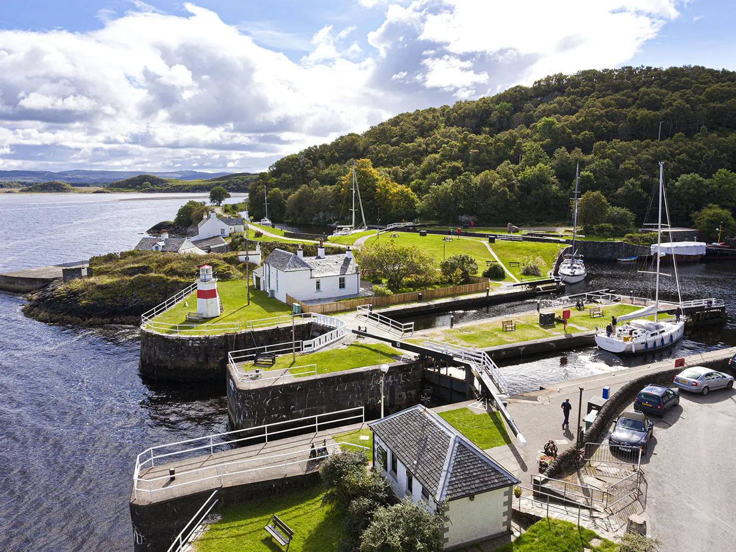
- Ardrishaig sea lock and basin: The canal’s eastern entrance on Loch Gilp and Loch Fyne, with lock gates, the canal office and open views down Loch Fyne. It is a natural start or finish for the walk.
- Cairnbaan and its rock art: A canal-side village with locks and a historic inn. The hillside above has Neolithic/Bronze Age cup-and-ring marked rocks linked to the wider Kilmartin Glen prehistoric landscape.
- Dunardry locks and rolling bridge: This flight of locks marks the western end of the canal’s summit reach. The hand-operated rolling retractable bridge at Lock 11 is an unusual piece of canal engineering.
- Bellanoch and the Moine Mhor: Bellanoch basin and swing bridge sit beside the Moine Mhor National Nature Reserve, a raised bog and wetland area with reedbeds and birdlife.
- Crinan basin and sea lock: The western terminus meets the Sound of Jura at Crinan, a small harbour village with the Crinan Hotel, a sea lock and views towards Jura and Scarba.
- Locks, bridges and wildlife: The 14 km canal has 15 locks and 7 bridges, including six swing bridges and one retractable bridge. The quiet towpath is also good for watching herons, swans, otters and seals near the sea locks.
Challenges to expect
This is an easy walk, not a hill route: ascent is minimal and navigation is simple because the path follows the canal. The main challenges are Scottish west-coast weather, muddy patches after rain, wind on exposed sections and short winter daylight. Expect midges and ticks in summer. There is also a short minor-road section near Bellanoch/Lochgilphead, so take normal care with traffic.
HikeList Score
Crinan Canal Towpath scored 75/100 on HikeList's trail-quality metrics.
See score breakdownHide breakdown
- Ideal length 55
- Balanced challenge 50
- Scenery & wildness 98
- Varied terrain 64
- Accommodation 75
- Food & support 88
- Path quality 98
- Season flexibility 100
Computed from length, challenge, scenery & wildness, terrain variety, accommodation, food & support, path quality and season flexibility.
 United Kingdom
 Scotland
Show more data Show less
- Coastal
- Wetlands
- Gravel
- Dirt
- Hotels
- Campsites
- Wild Camping Spots
- Wheelchair Accessible
- Stroller Accessible
- Family Friendly
- Pet Friendly
- Restrooms
- Water Sources
- Campsites
- Picnic Areas
In these collections
Photos from hikers
Taken on the trail by people who've reviewed Crinan Canal Towpath.
Reviews
How would you rate Crinan Canal Towpath?
Tap a star to start your review — you could be the first.