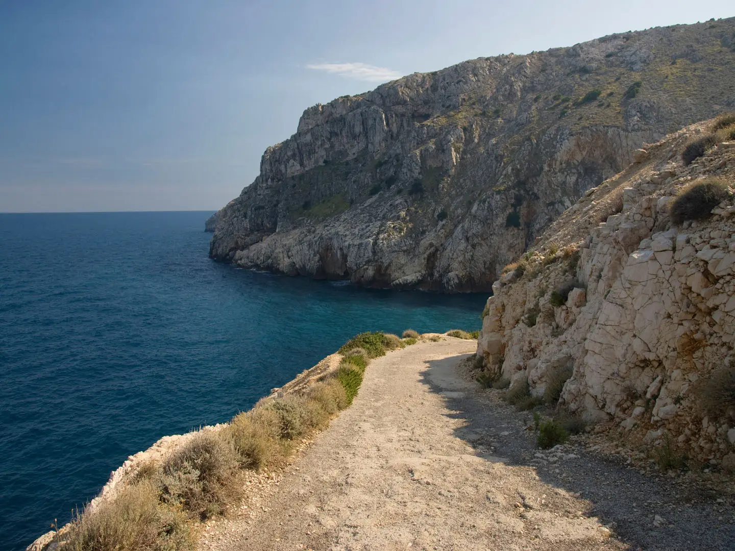
Cres Island Coastal Path
How would you rate Cres Island Coastal Path?
Tap a star to share your experience and help other hikers.
Cres Island Coastal Path: Coastal Karst Walking in Kvarner
HikeList Score
Cres Island Coastal Path scored 83/100 on HikeList's trail-quality metrics.
See score breakdownHide breakdown
- Ideal length 55
- Balanced challenge 100
- Scenery & wildness 88
- Varied terrain 94
- Accommodation 83
- Food & support 74
- Path quality 98
- Season flexibility 76
Computed from length, challenge, scenery & wildness, terrain variety, accommodation, food & support, path quality and season flexibility.
The Cres Island Coastal Path is best understood as an indicative 22.5 km, one-day, moderate coastal walk on Cres in the Kvarner gulf, Croatia — not a single officially named trail. Expect stony karst paths, coves, headlands, olive groves, oak and hornbeam woodland, and villages perched above the Adriatic. It suits fit day hikers who want a point-to-point island walk with sea views, but who are comfortable planning their own line using Cres’s marked local trails rather than following a branded end-to-end route.
Route Overview
There is no verified canonical start, finish or fixed direction for a route specifically called the “Cres Island Coastal Path”. Treat the listed 22.5 km as a longer point-to-point day walk assembled from Cres’s marked coastal and village trails. Genuine coastal options include the Cres Lungomare, the walk towards Cape Gavza and Sv. Salvadur, Valun and Lubenice routes, and coastal loops around Martinšćica. For a real multi-day route, use the Via Apsyrtides: about 149 km over 11 stages across the Cres–Lošinj archipelago, with stages 1–7 on Cres. For other Croatian island hikes, compare the Brač Island Summit Trail and Hvar Island Ridge Trail; for a bigger coastal project, see the Adriatic Long-Distance Trail.
Cres, Apsyrtides and Old Shepherds’ Paths
Cres has been settled since prehistory. In antiquity, the Cres–Lošinj group was known to Greeks and Romans as the Apsyrtides, linked to the myth of Apsyrtus, brother of Medea — the source of the modern Via Apsyrtides name. Lubenice and Beli are ancient cliff and hill settlements, while the Valun Tablet records Glagolitic and Latin script from the 11th century. Much of today’s walking follows old drystone-walled shepherds’ and village paths, later revived as local marked trails and the Via Apsyrtides.
Notable highlights
- Lubenice (378 m): A medieval cliff-top village set high above the sea. A steep path drops towards Sv. Ivan beach and the Blue Grotto sea cave, making this one of Cres’s most memorable coast-to-village walking areas.
- Cres town and the Lungomare: The island’s main town has a compact Venetian-style harbour and an easy seafront promenade. The coastal continuation towards Cape Gavza and Sv. Salvadur is the simplest introduction to Cres coastal walking.
- Valun: A car-free fishing hamlet above a pebble cove, reached on foot or by boat. Its church keeps the Valun Tablet, an important early Croatian inscription in Glagolitic and Latin script.
- Griffon vultures of Cres: Around 70 breeding pairs of Eurasian griffon vultures nest on the island’s sea cliffs. They are protected in coastal ornithological reserves and interpreted at the Beli visitor and eco centre.
- Tramuntana forest: The wooded northern part of Cres around Beli is a sinkhole-pocked oak and hornbeam landscape. It offers cooler, shadier walking than the exposed southern coast.
Challenges to expect
The main difficulty is not technical climbing but distance, rough footing and exposure. Cres coastal paths are often rocky, stony and uneven, with karst limestone underfoot and limited shade on open headlands. Summer heat can make a moderate day feel much harder, while the bura wind can be strong in cooler months. Navigation needs attention: standard Croatian waymarks and local colour-coded trails exist, but there is no branded “Cres Island Coastal Path” to follow.
HikeList Score
Cres Island Coastal Path scored 83/100 on HikeList's trail-quality metrics.
See score breakdownHide breakdown
- Ideal length 55
- Balanced challenge 100
- Scenery & wildness 88
- Varied terrain 94
- Accommodation 83
- Food & support 74
- Path quality 98
- Season flexibility 76
Computed from length, challenge, scenery & wildness, terrain variety, accommodation, food & support, path quality and season flexibility.
 Croatia
Show more data Show less
- Coastal
- Karst
- Forest
- Hills
- Rock
- Stone
- Dirt
- Hotels
- Guesthouses
- Campsites
- Family Friendly
- Pet Friendly
- Water Sources
- Campsites
Photos from hikers
Taken on the trail by people who've reviewed Cres Island Coastal Path.
Reviews
How would you rate Cres Island Coastal Path?
Tap a star to start your review — you could be the first.