Bruges to Damme Canal Trail
How would you rate Bruges to Damme Canal Trail?
Tap a star to share your experience and help other hikers.
Bruges to Damme Canal Trail: Easy Canal Walk
HikeList Score
Bruges to Damme Canal Trail scored 60/100 on HikeList's trail-quality metrics.
See score breakdownHide breakdown
- Ideal length 55
- Balanced challenge 50
- Scenery & wildness 59
- Varied terrain 64
- Accommodation 57
- Food & support 68
- Path quality 71
- Season flexibility 89
Computed from length, challenge, scenery & wildness, terrain variety, accommodation, food & support, path quality and season flexibility.
The Bruges to Damme Canal Trail is an easy, flat 6 km point-to-point day walk in West Flanders, Belgium. It follows the Damse Vaart towpath northeast from Bruges to the small medieval town of Damme, mostly on paved/asphalt path shared with cyclists. Allow about 1.5 hours one way on foot, or make it a relaxed half-day with cafés in Damme and a return by boat or bus. It suits beginners, families, stroller users and wheelchair users on the surfaced sections.
Route Overview
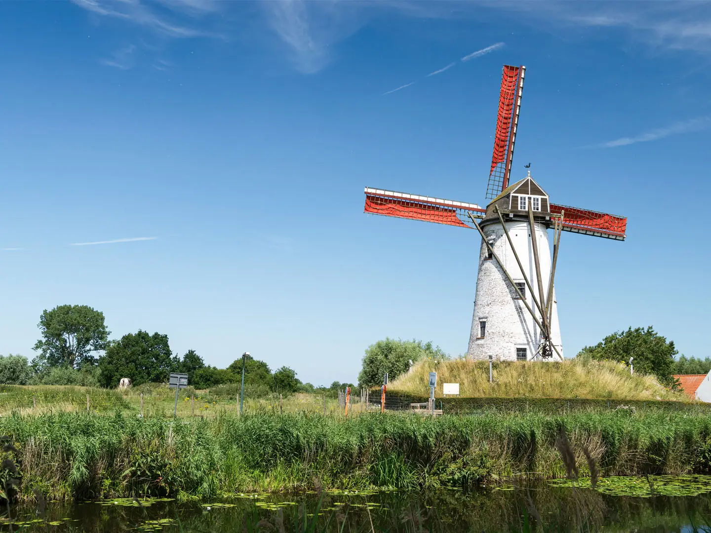
Start at the northeastern edge of Bruges around Dampoort / Noorweegse Kaai, pick up the Damse Vaart canal, and walk the straight towpath towards Damme. The route quickly leaves urban Bruges for open polder farmland, canal-side wetland and the long rows of poplars that define this walk. Near Damme, look for the Schellemolen windmill before entering the village around the Markt, town hall and Onze-Lieve-Vrouwekerk. This is a point-to-point route: many walkers return to Bruges on the Lamme Goedzak canal boat in the warmer months, or by bus. For more time in Bruges, add the Bruges Historic Loop; for a longer Belgian waymarked challenge, compare it with the GR 129 Great Belgium Traverse.
History of the Damse Vaart and Damme
The walk follows the Damse Vaart, a 15 km canal begun in 1810 on Napoleon Bonaparte’s orders to link Bruges with the Scheldt and the sea while avoiding British naval blockades. It was later continued under King William I of the United Netherlands and opened to traffic in 1856, though the intended through-route was never fully realised. Damme was once Bruges’ outer harbour on the Zwin tidal estuary; as the Zwin silted up, the port declined and the quiet canal town remained.
Notable highlights
Historic centre of Bruges (Brugge): The walk starts close to Bruges’ UNESCO-listed old town, known for medieval canals, cobbled streets and the belfry. It is worth arriving early if you want to combine the canal walk with a city wander.
Damse Vaart towpath and poplars: The route’s signature feature is the dead-straight canal lined with long rows of leaning poplar trees. It makes navigation simple and gives the walk its open, avenue-like character.
Schellemolen windmill: This working oil-mill windmill stands on the canal bank just outside Damme. Built in 1867 on an older mill site, it is a clear landmark near the end of the walk.
Damme village: Damme is a small, well-preserved former medieval port with a gothic town hall on the Markt and an easy café stop at the finish. It is also known as the birthplace of poet Jacob van Maerlant.
Onze-Lieve-Vrouwekerk: Damme’s Church of Our Lady is the village’s main landmark, with parts dating from the 13th century. Its tower can be climbed for views across the polders and canal.
Lamme Goedzak canal boat: This paddle-style tourist boat links Damme and Bruges along the canal in the warmer months, roughly May to November. It is the most distinctive return option for walkers.
Challenges to expect
This is a very easy walk, but it is not remote or rugged. The towpath is shared with cyclists, so keep right and stay alert on busy days. The polder landscape is open and exposed, with little shelter from wind or rain. Navigation is straightforward because the canal is dead straight, but the route is point-to-point, so plan your return by boat, bus or on foot.
HikeList Score
Bruges to Damme Canal Trail scored 60/100 on HikeList's trail-quality metrics.
See score breakdownHide breakdown
- Ideal length 55
- Balanced challenge 50
- Scenery & wildness 59
- Varied terrain 64
- Accommodation 57
- Food & support 68
- Path quality 71
- Season flexibility 89
Computed from length, challenge, scenery & wildness, terrain variety, accommodation, food & support, path quality and season flexibility.
 Belgium
Show more data Show less
- Urban
- Wetlands
- Paved
- Gravel
- Hotels
- Wheelchair Accessible
- Stroller Accessible
- Family Friendly
- Pet Friendly
- Restrooms
- Picnic Areas
In these collections
Photos from hikers
Taken on the trail by people who've reviewed Bruges to Damme Canal Trail.
Reviews
How would you rate Bruges to Damme Canal Trail?
Tap a star to start your review — you could be the first.