Bohus Coast Trail
How would you rate Bohus Coast Trail?
Tap a star to share your experience and help other hikers.
Bohus Coast Trail: Kuststigen on Sweden’s West Coast
HikeList Score
Bohus Coast Trail scored 90/100 on HikeList's trail-quality metrics.
See score breakdownHide breakdown
- Ideal length 80
- Balanced challenge 90
- Scenery & wildness 88
- Varied terrain 100
- Accommodation 100
- Food & support 88
- Path quality 84
- Season flexibility 89
Computed from length, challenge, scenery & wildness, terrain variety, accommodation, food & support, path quality and season flexibility.
The Bohus Coast Trail, or Kuststigen, is a 376 km coastal thru-hike through Bohuslän in Västra Götaland County, western Sweden. Its 44 stages usually take around 2–3 weeks as a full walk, with an overall moderate grade: easier and better connected in the south, rougher and more remote in the north. Expect bare granite, forest paths, meadows, fishing villages and archipelago views. It suits hikers who want flexible day walks, short coastal trips or a long point-to-point hike with town-based logistics.
Route Overview
Kuststigen runs from the Gothenburg area / Tjörn north along the Bohuslän coast to Strömstad and the Norwegian frontier, where the wider coastal path continues towards Halden. Sources vary on the exact southern terminus, but the core Bohuslän route is best treated as a 376 km, 44-stage point-to-point trail, with some circular stages. It passes Tjörn, Orust, Uddevalla, Lysekil, Bovallstrand, Hunnebostrand, Bohus-Malmön, Ramsvikslandet, Fjällbacka, Tanum and Strömstad, with the Koster islands near the northern end. Southern stages near Gothenburg and Kungälv are easier by public transport; northern stages are harder to reach without a car. For a more inland west-coast forest route, compare the Bohusleden.
History of Kuststigen
Kuststigen opened in 2007 as part of the cross-border Norway–Sweden project “Kustnära vandringsleder” — Coastal Walking Trails. It forms part of the Nordsjöleden / North Sea Trail and links with Bohusleden and Soteleden at various points. The coastline itself adds older context for hikers: Bronze Age rock art around Tanum, medieval churches, country houses, fishing settlements and granite-quarrying communities all sit close to the walking route.
Notable highlights
- Tanum rock carvings, UNESCO: Thousands of Bronze Age petroglyphs (roughly 1700–500 BC) are spread across around 600 panels near Tanum, inscribed on the UNESCO World Heritage list in 1994. They depict boats, animals, weapons and ritual scenes, and make this one of the strongest cultural stops on the trail.
- Fjällbacka and Kungsklyftan: Fjällbacka is a fishing village below the Vetteberget cliff. The Kungsklyftan ravine climbs from Ingrid Bergman’s Square to a viewpoint over the archipelago and is linked with King Oscar II and Astrid Lindgren’s Ronja the Robber’s Daughter.
- Ramsvikslandet and Bohus-Malmön granite: This section is classic Bohuslän coast: sculpted red-tinged granite, lagoons, white-sand coves and wave-worn rock. It is also a good place to notice the area’s granite-quarrying heritage.
- Bovallstrand, Hunnebostrand and Lysekil: These fishing towns bring harbours, red-and-white wooden boathouses and seafood into the walking day. They also make practical bases for breaking the route into shorter stages.
- Archipelago and swimming: The trail stays close to an open, island-studded coast of bare granite skerries. Sea-bathing spots, broad horizon views, the Koster islands and the Svinesund Bridge shape the northern end.
Challenges to expect
Difficulty changes sharply by stage. Southern sections are generally easier and better served by public transport; northern sections are tougher and often simpler with a car. Underfoot, expect a mix of bare coastal granite, forest paths, pastures, gravel and asphalt. Some granite-cliff sections need careful navigation even though the trail is well signposted with blue waymarking, with orange used on some municipal sections. There is no continuous mountain-hut chain, so book towns, campsites or guesthouses around each stage.
HikeList Score
Bohus Coast Trail scored 90/100 on HikeList's trail-quality metrics.
See score breakdownHide breakdown
- Ideal length 80
- Balanced challenge 90
- Scenery & wildness 88
- Varied terrain 100
- Accommodation 100
- Food & support 88
- Path quality 84
- Season flexibility 89
Computed from length, challenge, scenery & wildness, terrain variety, accommodation, food & support, path quality and season flexibility.
 Sweden
Show more data Show less
- Coastal
- Forest
- Pasture
- Meadow
- Rocky
- Dirt
- Gravel
- Paved
- Hotels
- Hostels
- Guesthouses
- Campsites
- Wild Camping Spots
- Family Friendly
- Pet Friendly
- Restrooms
- Water Sources
- Campsites
- Shelters
- Picnic Areas
Download Our Full Guide to Bohus Coast Trail FREE!
Get our comprehensive guide to this hike for free. Save it for later reading or print out at home.
In these collections
Photos from hikers
Taken on the trail by people who've reviewed Bohus Coast Trail.
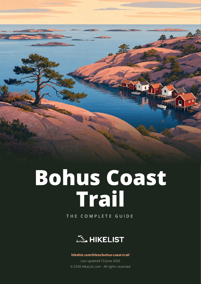
Bohus Coast Trail: The Complete Guide
Kuststigen is Sweden’s Bohus Coast Trail: a 376 km waymarked coastal route through Bohuslän, from the Tjörn / northern Gothenburg archipelago area towards Strömstad and the Norwegian border. It is a walk of granite skerries, fishing villages, island ferries, forest paths, pastures and low coastal headlands rather than high mountains.
The route suits many different plans. Southern stages around Uddevalla, Stenungsund, Tjörn and Orust work well as day walks with public transport, while the northern sections towards Tanum, Strömstad, Koster and Svinesund reward more self-reliant planning.
Expect a trail that changes character quickly. One day may be smooth red-pink granite and sea views at Ramsvikslandet or Stångehuvud; another may link harbour towns such as Lysekil, Smögen, Hunnebostrand, Fjällbacka and Grebbestad by gravel, forest and short road sections.
It is moderate overall, but not uniform. There is no technical climbing and the total ascent is modest, yet wet granite can be slippery, some cliff sections need care, and accommodation, ferries and buses must be planned stage by stage.
This guide covers stages, days, accommodation, food, transport, terrain and common mistakes.
Stage-by-Stage Guide
This 14-stage schedule groups the 44 waymarked Kuststigen stages into practical walking days between coastal accommodation hubs. Distances are approximate, and the exact line should be checked on the official Kuststigen map planner before booking, especially where ferries, island stages or seasonal services are involved.
Stage 1: Uddevalla to Ljungskile — approx. 25 km
The numbered continuous spine begins at Uddevalla and heads south-west into the gentler, better-connected end of Kuststigen. Expect a mixed first day rather than a wild coastal traverse: forest paths, gravel tracks, short asphalt sections, pasture edges and occasional stretches of bare Bohuslän granite.
Uddevalla is the key start-point for this itinerary and has rail access, making it the easiest place to begin the full route. Ljungskile is a practical overnight stop, with accommodation options concentrated in and around the town rather than out on the trail.
Carry food and water from Uddevalla unless accommodation or services have been checked in advance. Do not rely on finding open cafés or shops between the main settlements, particularly outside the summer season.
Navigation is generally straightforward on blue Kuststigen waymarks, but take care leaving the urban edge of Uddevalla, where paths, minor roads and local routes can make the start feel less obvious than later coastal sections. Wet granite and muddy forest sections can be slippery, and any pasture crossings should be treated as livestock areas: keep gates as found and give animals space.
Public transport is strongest at this southern end of the trail, with Västtrafik covering the area. Current train and bus times should be checked before travelling.
Stage 2: Ljungskile to Lyckorna — approx. 22 km
This is a relatively manageable coastal day compared with the longer northern legs, though the distance is still enough to justify an early start if carrying a full pack. The walking continues through a varied Bohuslän mix of woodland, minor roads, open ground and coastal viewpoints, with the sea appearing in sections rather than as a constant shoreline path.
Lyckorna gives this stage a defined coastal finish, but it is smaller than the larger service towns on the route. Accommodation and food options at or near the end should be arranged before setting off; Ljungskile remains the more dependable base in this immediate area.
Carry enough water for the full day. Streams and surface water should not be treated as dependable drinking sources on this route, and there is no hut system providing regular water points.
The blue waymarking is usually reliable, but pay attention where the trail uses short road links or crosses between woodland and settled areas. Road walking is not the main character of the day, but expect some hard-surface walking and plan footwear accordingly.
Västtrafik services cover this part of the coast, making the stage suitable for section walkers. Timetables, especially for weekend or off-season travel, should be checked before travelling.
Stage 3: Lyckorna to Stenungsund — approx. 24 km
This stage continues through the accessible southern section of Kuststigen and works towards Stenungsund, one of the better transport and resupply points on the southern coast. The terrain is moderate overall, with a typical alternation of forest paths, gravel, asphalt and open coastal ground.
Stenungsund is the main practical landmark and end-point. It is a sensible place to restock, wash kit and reset logistics before the route becomes more island-based towards Orust, Skaftö and Lysekil.
Food and water should still be carried from the start, even though Stenungsund has better services at the end of the day. Opening hours in Swedish coastal settlements can be strongly seasonal, so do not plan around an unconfirmed mid-stage stop.
Navigation is usually uncomplicated, but the approach to a larger town can involve road crossings, cycleways, local paths and changes in surface. Follow the blue markers carefully rather than assuming the most obvious shoreline or road line is the route.
Public transport access is good by Kuststigen standards in this southern section, with Västtrafik buses and regional connections feeding the area. Check the current journey planner before committing to a same-day onward transfer.
Stage 4: Stenungsund to Mollösund, Orust — approx. 27 km
This is a longer day onto Orust, ending at Mollösund, the historic fishing community at the island’s western tip. The stage begins in a comparatively well-served area and finishes in a more island-like setting, so it feels like a clear shift from the southern access stages into the classic Bohuslän coast.
Expect a practical mixture of road links, tracks, paths, pastures and sections of rockier coastal walking. The route is not technical, but 27 km on mixed surfaces can be tiring, especially if the day includes warm weather, exposed granite or pack weight.
Mollösund is the key overnight target. Book accommodation, campsite space or other lodging ahead; there is no continuous hut chain on Kuststigen and small coastal settlements can fill quickly in summer.
Carry a full day’s food and water from Stenungsund unless specific open services have been checked. Island settlements may have seasonal opening patterns, and walkers should not rely on late arrivals being able to buy supplies.
Public transport becomes more timetable-dependent once the route moves onto Orust. Västtrafik covers the coast and islands, and the Kolhättan–Svanesund car ferry is one of the important Orust links in the wider Kuststigen area, but current bus and ferry connections should be checked before travelling.
Navigation is generally by blue markers, but be especially attentive at road junctions and where the path leaves built-up areas for quieter lanes or coastal ground. Wet rock, livestock pastures and traffic on narrow roads are the main practical cautions.
Stage 5: Mollösund to Skaftö — approx. 27 km
This stage links the Orust coast with the Skaftö area and keeps the route firmly in Bohuslän’s island-and-skerry landscape. It is another substantial walking day, best treated as a full stage rather than a half-day transfer between villages.
The route character is varied: smooth granite, coastal heath, woodland, village lanes, gravel and asphalt all feature on Kuststigen in this area. Around the Orust coast, Mollösund and nearby island communities give the day its strongest sense of place.
Skaftö is the practical end-point, with Grundsund and Fiskebäckskil forming the main named villages in this part of the route. Accommodation should be booked ahead, particularly in summer when the west-coast fishing villages are busy.
Food and water availability between the named settlements should not be assumed. Carry enough for the full day, and treat any café, shop or harbour service as a bonus unless opening hours have been checked.
Public transport and road access are possible but more fragmented than around Uddevalla, Ljungskile and Stenungsund. Västtrafik remains the main planning tool, but island and bus connections should be checked carefully before relying on them for an evening exit.
Navigation can be more demanding where the route threads between villages, small roads and coastal paths. Blue waymarks are the primary guide; avoid following unmarked shoreline rock simply because it appears to head in the right direction.
Stage 6: Skaftö to Lysekil — approx. 22 km
This is one of the most rewarding settlement stages on the central coast, linking Skaftö’s well-preserved fishing and shipping villages with Lysekil. Grundsund and Fiskebäckskil are the key places to look for on or near this section, both giving a strong sense of the 19th-century coastal heritage of the area.
Terrain is mixed but rarely high: expect village streets, minor roads, coastal paths, woodland sections and stretches of granite. The Skaftö bridge area is part of the wider route setting here, and the day is more about coastal detail than sustained ascent.
Lysekil is a strong overnight and resupply point. It is one of the better bases on Kuststigen, with a wider range of accommodation than the smaller island villages, though summer bookings should still be made early.
Food and water are easiest to organise at the start and finish. Do not assume every village service will be open outside peak season, and carry enough to complete the stage independently.
Public transport is available through the Västtrafik network, with Lysekil acting as a practical access point for section walkers. Current connections should be checked before travelling, especially if linking to island buses or ferries.
Navigation through villages can be more fiddly than in open country. Watch for blue markers on posts, rocks and trees, and take extra care where the route shares lanes with local traffic.
Stage 7: Lysekil to Fiskebäckskil — approx. 24 km
This stage starts in Lysekil and gives access to Stångehuvud Nature Reserve, one of the standout headlands on the trail. The reserve is known for bare pink granite, a lighthouse and open sea views, and it is a section where the coastal rock becomes a major part of the walking rather than just a backdrop.
The terrain is uneven in places, with exposed granite slabs, footpaths, built-up edges and connecting lanes. There is no technical climbing, but wet rock can be polished and slippery, so slow down in rain or after sea mist.
Fiskebäckskil is the end-point in this schedule and has the character of a historic shipping and fishing village. Accommodation at or near Fiskebäckskil should be booked in advance; if staying elsewhere on Skaftö or in Lysekil, the connecting transport should be planned before the walk.
Food and water should be carried from Lysekil. Services at the end may be seasonal or limited, so a packed lunch and enough water for the whole day are the safest plan.
The exact link between Lysekil, Skaftö and Fiskebäckskil should be checked on the Kuststigen map planner and with Västtrafik before travelling. This is an area where local transport choices affect the practicality of a stage, especially for walkers not staying directly at the end-point.
Follow the blue waymarks carefully through Lysekil and around Stångehuvud, where side paths and local walking routes can distract from the through-line. Keep to appropriate paths in the nature reserve and avoid short-cutting over fragile or unsafe rock.
Stage 8: Fiskebäckskil to Smögen — approx. 26 km
This stage moves north towards the Sotenäs coast and ends at Smögen, one of the most recognisable fishing villages on Kuststigen. The day is a substantial link between coastal communities rather than a simple promenade walk.
Expect a varied surface mix: lanes, gravel, woodland, coastal paths and granite. Depending on the exact line used, the wider area includes the approach towards Kungshamn and the Soteleden section of Kuststigen, which carries the route into the Smögen landscape.
Smögen is a major highlight, with Smögenbryggan, red-and-white boathouses and a busy harbour. It is also very popular in summer, so accommodation should be booked early and late arrivals should not rely on finding a room without a reservation.
Food and water are most reliable at the named settlements. Carry enough for the stage and check any intended café or shop stops before setting out, especially outside July and August.
Public transport is possible through Västtrafik but becomes less flexible than the southern coast. A car, pre-arranged lift or carefully timed bus can make this and the following Sotenäs stages easier to manage.
Navigation is generally good where Kuststigen and Soteleden share the coastal line, but pay attention to blue waymarking where local paths, harbour routes and road links intersect. Wet granite, traffic on narrow lanes and busy summer footfall around Smögen are the main cautions.
Stage 9: Smögen to Hunnebostrand — approx. 24 km
This is one of the strongest scenic stages in the Sotenäs area, with Ramsvikslandet / Ramsvik Nature Reserve the main natural highlight. The reserve is known as the “Kingdom of Cliffs”, where broad sheets of red Bohus granite meet the sea, broken by lagoons, white-sand coves, glacial striations and Ice Age giant’s kettles.
The walking can feel more open and rugged than the southern stages. Bare rock, coastal heath, paths, tracks and short road links all occur, and the exposed granite sections deserve care in wet or windy conditions.
Hunnebostrand is a practical and attractive end-point, with harbour and boathouse scenery and a history linked to granite quarrying. It is a useful base for breaking the northern coast into shorter stages.
Carry food and water from Smögen unless specific services have been checked along the way. Ramsvikslandet is a nature-reserve landscape rather than a service corridor, so walkers should plan it as a self-sufficient section.
Public transport exists in the wider Sotenäs area but should be checked carefully through Västtrafik. For a full day across Ramsvik, a car at one end or a pre-planned bus connection can remove a lot of uncertainty.
Navigation is by blue waymarks, but the open rock landscape can make it tempting to drift from the marked line. In poor visibility or rain, stay disciplined with markers and avoid following unmarked slabs towards the sea.
Stage 10: Hunnebostrand to Fjällbacka — approx. 30 km
At around 30 km, this is one of the longest days in the 14-stage schedule and should be treated as a serious full-day walk. It links the granite-quarrying coastal communities around Hunnebostrand and Bovallstrand with Fjällbacka, another major Bohuslän highlight.
The stage is likely to feel more committing because the northern coast has thinner public transport and fewer obvious bail-out options than the south. Terrain remains varied rather than mountainous: coastal rock, forest, gravel, minor roads, open pasture and village sections.
Bovallstrand is the main named settlement between Hunnebostrand and Fjällbacka. Fjällbacka itself sits below the Vetteberget cliff, with Kungsklyftan ravine providing one of the route’s best short detours or end-of-day viewpoints if time, weather and energy allow.
Start with a full supply of food and water. The distance leaves little margin for closed shops or delayed meal stops, and services in smaller fishing towns can be seasonal.
Accommodation in Fjällbacka should be booked well ahead in summer. It is a popular coastal village, and walkers arriving after a long day should not plan to search for lodging on arrival.
Navigation is normally manageable, but fatigue is the main risk on this stage. Keep checking the blue waymarks at road junctions and village exits, and be realistic about pace on granite and mixed surfaces.
Stage 11: Fjällbacka to Grebbestad — approx. 22 km
This is a shorter northern stage after the long approach to Fjällbacka, but it still needs proper planning because services and transport are less dense than on the southern stages. If Kungsklyftan and the Vetteberget viewpoint were not visited the previous evening, they can make a worthwhile start before leaving Fjällbacka.
The walking continues through classic Bohuslän terrain: rock, woodland, lanes, coastal openings and pasture. The sea views are a recurring feature, but the route is not always a continuous shoreline walk.
Grebbestad is the end-point and a practical overnight stop before the route turns towards Tanumshede and the Tanum cultural landscape. Book accommodation in advance, especially during the summer holiday period.
Food and water should be carried from Fjällbacka. Grebbestad has end-of-stage services, but intermediate options should be treated as uncertain unless checked before setting out.
Public transport is available in the wider Tanum coast area through Västtrafik, though connections may be infrequent. Check current bus times before using this stage as a day walk.
Navigation is generally by blue markers, but northern stages can feel quieter and less forgiving if a turn is missed. Road walking, wet rock and livestock pasture are the main practical issues rather than altitude or technical terrain.
Stage 12: Grebbestad to Tanumshede — approx. 18 km
This is a shorter stage by distance, but it is one of the most important cultural days on Kuststigen. The route heads towards Tanumshede and the Tanum rock carvings, a UNESCO World Heritage site with thousands of Bronze Age petroglyphs spread across the landscape.
Terrain is less purely coastal than the Sotenäs and Fjällbacka sections, with more inland-feeling links, gravel, asphalt, paths and pasture ground. The lower distance makes it a good day for spending time at the rock-carving sites rather than treating Tanumshede only as a bed for the night.
Tanumshede is the key service and accommodation point. Arrange lodging ahead, and check opening hours for any visitor facilities or food stops connected with the rock carvings before building the day around them.
Carry water from Grebbestad, especially in warm weather. Even on a shorter stage, exposed rock, road sections and cultural-site wandering can extend the day.
Public transport through the Tanum area is possible via Västtrafik, but timings should be checked before travelling. This stage can suit section walkers because the distance is moderate, but only if the transport works at both ends.
Navigation needs attention where the walking leaves the coast and uses roads or paths through the Tanumshede area. Respect signed access around the World Heritage landscape and do not walk over or touch carved rock panels.
Stage 13: Tanumshede to Strömstad via Kosterhavet — approx. 28 km
This is a long northern stage into the Strömstad area, where Kuststigen becomes more remote and transport planning matters more. The route approaches the landscape of Kosterhavet National Park, Sweden’s first marine national park, with the Koster islands offshore and the Norwegian frontier close to the north.
Expect rougher-feeling walking than on the southern stages, even though the altitude remains low. Bare granite, woodland, gravel, road links and exposed coastal sections can all feature, and wet rock should be taken seriously.
Strömstad is the major northern hub, with a railway station and a wider choice of accommodation than the small coastal settlements before it. It is the natural base for Koster, the Svinesund border link and any final northern Kuststigen stages.
Carry food and water from Tanumshede unless a definite resupply has been planned. This is not a stage on which to depend on chance services, particularly outside the main summer season.
Public transport is thinner in the north, and several northern stages are simpler with a car. Strömstad itself has good onward access compared with the surrounding walking sections, but current Västtrafik rail, bus and ferry times should be checked before travelling.
Route choices around Strömstad affect what is included. The wider northern Kuststigen area includes Björnerödspiggen, Bohuslän’s highest summit at 222 m, near Idefjorden, and the Krokstrand–Svinesund link towards the Norwegian border; walkers wanting those objectives should check the official stage line and allow extra planning rather than assuming they are included in a direct day to Strömstad.
Stage 14: Strömstad to the Koster islands — approx. 22 km exploration / ferry day
This final day is best treated as a Kosterhavet exploration day rather than a conventional point-to-point stage. The Koster islands lie just offshore from Strömstad and offer easy coastal walking in a car-free island setting, with the marine national park giving the day its main character.
The terrain is low but still varied: paths, coastal rock, small roads or tracks, coves and open sea viewpoints. Smooth granite can be slippery when wet, and island weather can feel more exposed than the modest height suggests.
Food and water should be organised before leaving Strömstad unless island services have been checked. Koster has visitor facilities in season, but opening times and availability should not be assumed outside the busy months.
Accommodation can be based in Strömstad or on/near the islands, depending on plans and availability. Book ahead in summer and make sure the last ferry timing works with the intended walk.
The Koster boats and any other island links should be checked with Västtrafik before travelling, as ferry timetables can vary seasonally. Build the day around the ferry schedule, not the other way round.
Navigation on the islands is generally easier than on the rougher northern mainland stages, but walkers should still follow marked paths and local signs, especially within the national park. If the aim is to finish the cross-border coastal route rather than spend the day on Koster, use Strömstad as the base for the Krokstrand–Svinesund direction and check the current Kuststigen stage details before setting out.
Recommended Itinerary
The itinerary below is a practical 14-day end-to-end plan using coastal towns and village bases rather than the official 44-stage breakdown. Distances are approximate and should be checked against the official Kuststigen map planner before booking accommodation, especially where ferries, island links or seasonal services are involved.
Standard itinerary: 14 days
This version suits fit walkers who are comfortable with repeated 22–30 km days on mixed coastal terrain. It works best with accommodation booked in advance, or with a flexible camping plan under Sweden’s allemansrätten where suitable and responsible.
| Day | From | To | Approx. distance | Why this stage makes sense | Services/accommodation notes |
|---|---|---|---|---|---|
| 1 | Uddevalla | Ljungskile | 25 km | A logical start on the numbered spine, beginning from a town with rail access and finishing in another useful southern service base. | Uddevalla and Ljungskile are among the easier places to reach by public transport. Book accommodation before starting rather than relying on walk-up availability. |
| 2 | Ljungskile | Lyckorna | 22 km | A moderate second day that keeps the early itinerary manageable before the longer island and coastal stages. | Services are better in this southern section than farther north, but exact overnight options should still be checked before travelling. |
| 3 | Lyckorna | Stenungsund | 24 km | Reaches Stenungsund, a practical resupply and transport hub before committing to the Orust and island sections. | Stenungsund is one of the stronger public-transport points on the route. Use it to restock and resolve any ferry or bus timing issues ahead. |
| 4 | Stenungsund | Mollösund, Orust | 27 km | A longer day moving onto the Orust part of Kuststigen and finishing at the historic fishing settlement of Mollösund. | Orust logistics can involve ferries and buses depending on the exact line walked. Check Västtrafik times and seasonal changes before booking. |
| 5 | Mollösund | Skaftö | 27 km | Links the western Orust coast towards the Skaftö area, keeping the itinerary moving without skipping the island character of the route. | Accommodation is more village-based here, with fewer large hubs than Stenungsund or Lysekil. Book ahead in summer. |
| 6 | Skaftö | Lysekil | 22 km | A shorter day into Lysekil, giving some recovery after two 27 km stages and placing you in a larger coastal town. | Lysekil is a good place for accommodation, food and any gear or transport adjustments. The Stångehuvud area is a major local highlight. |
| 7 | Lysekil | Fiskebäckskil | 24 km | Keeps the route around the Lysekil and Skaftö coastal villages rather than forcing an overlong push north. | Fiskebäckskil and nearby Grundsund are small village bases; availability can be tight in the main holiday season. |
| 8 | Fiskebäckskil | Smögen | 26 km | A full coastal walking day into one of the best-known Bohuslän harbour villages, with the route entering the Sotenäs section. | Smögen and the Kungshamn area have more accommodation than smaller villages, but summer demand is high. Book early. |
| 9 | Smögen | Hunnebostrand | 24 km | A sensible stage through the granite coast and harbour settlements of Sotenäs without making the previous day too long. | Hunnebostrand is a practical overnight stop before the rougher and more exposed Ramsvikslandet/Fjällbacka stretch. |
| 10 | Hunnebostrand | Fjällbacka | 30 km | The longest day in this schedule, using Hunnebostrand and Fjällbacka as strong coastal bases and passing some of the route’s most dramatic granite country. | Consider splitting this stage if carrying camping kit, walking in poor weather or wanting more time around Ramsvikslandet and Bovallstrand. Check official mapping before booking. |
| 11 | Fjällbacka | Grebbestad | 22 km | A more moderate day after the 30 km stage, moving between two useful northern Bohuslän bases. | Fjällbacka and Grebbestad are both busy in summer. Reserve accommodation and evening food options in advance. |
| 12 | Grebbestad | Tanumshede | 18 km | The shortest standard day, deliberately allowing time for the Tanum rock carvings and a less pressured transfer inland. | Tanumshede is the key stop for the UNESCO-listed rock carvings. Check opening times and local transport before fixing the day’s plan. |
| 13 | Tanumshede | Strömstad, via Kosterhavet area | 28 km | A long final northbound walking day into Strömstad, the main northern town and railhead near the Norwegian frontier. | Strömstad has the best end-of-route services. Check the exact route line, buses and any ferry-dependent sections before committing to this stage. |
| 14 | Strömstad | Koster islands exploration / ferry day | 22 km | A flexible final day for the Koster islands and Kosterhavet National Park rather than a forced road or transfer day. | Ferries and island services can be seasonal or weather-affected. Check Västtrafik and local ferry times before travelling. |
If the objective is to finish specifically at Svinesund on the Norwegian border, allow extra time from the Strömstad area and check the official mapping before booking. The northern Kuststigen network includes the Krokstrand–Svinesund link, but it is better planned as an additional stage rather than squeezed into the 14-day schedule.
Slower variant: 18–21 days
A slower itinerary suits walkers carrying camping gear, those relying entirely on public transport, and anyone who wants time for coastal villages, swimming, nature reserves and the Tanum rock carvings. It is also the better choice in early or late season when daylight, ferries and services are more limited.
Good places to add time include:
- Lysekil — useful for recovery, resupply and the Stångehuvud headland.
- Smögen / Kungshamn — a practical break in the Sotenäs section.
- Hunnebostrand or Bovallstrand — helpful for shortening the long Hunnebostrand–Fjällbacka day.
- Fjällbacka — worth extra time for Kungsklyftan and the village setting below Vetteberget.
- Tanumshede — the best place to slow down for the rock carvings rather than rushing through.
- Strömstad / Koster islands — useful for a weather buffer and ferry-dependent island walking.
For this version, split the 27–30 km days where accommodation, camping or transport allows. Exact break points should be checked on the official Kuststigen map planner before booking, as the route is a network of spine stages and loops rather than one simple continuous line.
Faster variant: 12–13 days
A faster itinerary is only sensible for experienced long-distance walkers who are comfortable with repeated long days on granite, forest path, pasture, gravel and road. It is less suitable if you want to visit the Koster islands, spend proper time at Tanum, or depend on infrequent buses and ferries.
The cleanest way to shorten the trip is to remove the separate Koster exploration day and finish in Strömstad, or to use public transport to simplify one of the more awkward island or village connections. Do not assume that two listed days can simply be combined: several stages are already 24–30 km, and wet granite can make progress slower than the map distance suggests.
For a faster schedule, check each day’s official distance, ferry timing and accommodation availability before booking. The northern stages around Tanum, Strömstad and the island links are the least forgiving places to improvise.
Planning the Route
Decide whether you are walking the spine, the loops, or a practical end-to-end line
Kuststigen is best planned as a coastal network rather than a single, simple trail line. It has a long waymarked spine, several island and coastal loops, and northern stages around Tanum, Strömstad, Koster and Svinesund. The numbered continuous spine begins at Uddevalla, while the wider trail area also includes Tjörn, Stenungsund, Orust and other southern coastal sections.
For a full point-to-point journey, most walkers should plan a practical line between accommodation hubs rather than trying to follow every official stage and loop. The 44 waymarked stages are useful for navigation and day-walk planning, but a continuous hiker will usually combine or split them according to ferries, beds, campsites and transport.
How many days to allow
Allow about two to three weeks for a full end-to-end walk, depending on how many side loops and island stages are included. A strong walker using long days can make a compact itinerary of around 14 days between the main coastal hubs, but this leaves little margin for ferries, weather, rest, or extra time on places such as Ramsvikslandet, Fjällbacka, Tanumshede, Strömstad and the Koster islands.
A more comfortable plan is 16–21 days. This gives room to shorten the longer coastal stages, take a slower day on exposed granite sections, and handle the practical gaps between villages in the north. Kuststigen rewards a slower pace: many of its best sections are headlands, fishing villages, nature reserves and island loops where rushing simply turns the route into a series of transport problems.
Let accommodation and transport shape the stages
Daily distances are not dictated by mountain huts or fixed refuges. They are dictated by coastal towns, villages, campsites, guesthouses, ferries and bus links. This is the main planning difference between Kuststigen and a hut-to-hut trail.
Useful overnight bases include Uddevalla, Ljungskile, Stenungsund, Mollösund, Skaftö, Lysekil, Smögen, Hunnebostrand, Fjällbacka, Grebbestad, Tanumshede and Strömstad. These are practical stage anchors because they sit on or near the route and have better access to accommodation and onward transport than the quieter intervening sections.
In summer, popular harbour villages can be busy and accommodation should be booked ahead. Outside the main season, availability may be lower even where the village itself is easy to reach. Opening dates for campsites, guesthouses and food stops should be checked before travelling.
Section hiking is often the easiest way to walk Kuststigen
Kuststigen is very well suited to section hiking. The southern areas around Uddevalla, Ljungskile, Stenungsund, Tjörn and Orust have better public transport coverage and work well for day walks or weekend sections. This is also the easiest part of the trail for walkers who want to test the terrain before committing to the rougher northern coast.
The northern sections around Sotenäs, Tanum, Strömstad, Koster and Svinesund are more rewarding with careful logistics. Public transport still exists through Västtrafik, but services can be thinner and island links may be seasonal. A car makes some northern day walks and loop stages much simpler, particularly where start and finish points do not line up neatly with frequent buses.
Shortening, extending and building in flexibility
The route is easy to shorten because many stages finish near coastal settlements or transport links. If time is limited, choose a coherent block rather than scattering disconnected highlights. Strong options include the Orust and Lysekil coast, the Sotenäs section through Smögen, Hunnebostrand and Ramsvikslandet, or the northern end around Tanum, Strömstad and Koster.
It is also easy to extend the walk. Extra time can be spent on circular loops, island stages, Stångehuvud, Bohus-Malmön, Ramsvikslandet, Kungsklyftan at Fjällbacka, the Tanum rock carvings, the Koster islands, or the northern link towards Svinesund and the Norwegian border.
Do not treat every optional loop as compulsory on a first end-to-end attempt. The better approach is to decide in advance which side trips matter most, then leave spare time for weather and ferry-dependent stages.
What matters most in planning
Accommodation: this is the key constraint. There is no continuous hut chain, so each night needs a town, village, campsite, booked room, or a legal and responsible wild-camping plan under allemansrätten. Wild camping gives useful flexibility, but it does not remove the need to plan food, water and weather exposure.
Transport: use Västtrafik for trains, buses and ferries along the coast. Uddevalla and Strömstad have railway stations, and Gothenburg is the main rail hub for reaching the southern end. Ferry-dependent stages, including links such as Kolhättan–Svanesund and boats to the Koster islands, should be checked before travelling, especially outside summer.
Food and water: plan around settlements rather than assuming frequent services on the trail. Larger coastal towns are the safest places to resupply, while smaller villages, island stops and seasonal harbour areas may have limited opening hours. Carry enough food and water for the full day, and check refill opportunities when booking accommodation or planning each stage.
Navigation: waymarking is by blue paint and markers on trees, rocks and posts, but the network layout makes pre-planning important. The official Kuststigen map planner is the best tool for checking the exact stage line, loops, diversions and transport links before setting out. A downloaded map is sensible, particularly on the rougher northern stages and on open granite where the walked line may not always feel obvious.
Weather and terrain: the route is low-level, but exposed granite slabs can be slippery when wet and slow underfoot. Wind, rain and short winter daylight affect planning more than altitude. Late spring to early autumn is the most straightforward walking season; winter walking is more realistic on southern stages, but services and ferries are reduced and days are short.
Permits and access: no special hiking permit is part of normal route planning. Sweden’s allemansrätten allows responsible wild camping, but it comes with duties: camp discreetly, avoid private gardens and cultivated land, respect protected areas, and leave no trace. Local restrictions in nature reserves or on islands should be checked on signs and official information before camping.
Towns, Villages and Overnight Stops
Kuststigen is best planned around coastal towns and villages rather than huts. There is no continuous hut chain, so most overnight plans rely on hotels, hostels, guesthouses, B&Bs, campsites or responsible wild camping under allemansrätten.
Summer is the busiest period in the fishing villages and on the islands. Book accommodation ahead, check opening seasons for campsites and guesthouses, and confirm Västtrafik train, bus and ferry times before committing to a stage plan.
Tjörn
Tjörn is part of the southern Kuststigen area rather than a single fixed start town for every walker. It suits shorter coastal sections and day walks, especially if approaching from the Gothenburg side of the coast.
Use Tjörn as a flexible southern-area base rather than assuming it has one obvious through-hike trailhead. Accommodation and food options depend on the exact village or stage chosen, and public transport should be checked in the Västtrafik planner before travelling.
Stenungsund
Stenungsund is one of the stronger practical stops in the southern part of the trail and appears on the through-itinerary between Lyckorna and Orust. It is a sensible overnight base if linking the gentler southern stages before the route heads towards the islands and ferry connections.
Accommodation is easier to plan here than in smaller coastal villages, with town-based lodging options more likely than on the intervening shoreline. It is also one of the better places to organise food, supplies and onward public transport.
Uddevalla
Uddevalla is the key logistical start for the numbered continuous spine of Kuststigen. The first numbered stage heads from Uddevalla towards the Kolhättan ferry, making the town a natural place to arrive the night before starting a longer walk.
It has a railway station and is one of the most practical access points on the route. For a full end-to-end plan, Uddevalla is a good place to do the first proper food shop, finalise transport tickets and begin with booked accommodation rather than trying to start from a smaller village.
Ljungskile
Ljungskile is a useful early overnight stop after the Uddevalla stage. It sits on the southern, better-connected part of the trail and works well for walkers who want to keep the first few days simple with town-based accommodation.
Hotels, guesthouses, hostels and campsites are the types of accommodation to look for in this part of the coast. Food and café opening times should still be checked, especially outside the main summer season, but Ljungskile is a more practical stop than relying on small trail-side settlements.
Lyckorna
Lyckorna is a smaller stop between Ljungskile and Stenungsund and can be useful for splitting or adjusting the early southern stages. It is not the same kind of robust service hub as Uddevalla or Stenungsund.
Treat Lyckorna as a planned overnight only if accommodation has been arranged in advance. For food, do not assume late-opening shops or restaurants outside the summer period; check current options before setting the day’s schedule.
Kolhättan
Kolhättan matters mainly because of the ferry connection across to Svanesund on Orust. It is a route logistics point rather than a main overnight base.
The Kolhättan–Svanesund car ferry is part of the practical link onto Orust, so check the current timetable before planning a tight walking day. If ferry timing is awkward, it is usually better to overnight in a larger place before or after the crossing rather than depend on last-minute options at the ferry point.
Svanesund
Svanesund is the Orust-side landing point from Kolhättan. It is useful for linking the mainland stages with the Orust section of Kuststigen.
It can work as a staging point, but it should not be treated as a guaranteed full-service overnight without checking accommodation and food availability. Walkers carrying a through-hike pack should plan ferry timing, onward distance and the next confirmed bed together.
Mollösund
Mollösund is one of the most important Orust stops, at the western tip of the island. It is a strong candidate for an overnight on the Stenungsund to Mollösund and Mollösund to Skaftö stretch.
Accommodation can be seasonal and popular in summer, so book ahead. The village is also a good place to enjoy a shorter evening after a longer coastal day, but food and restaurant opening times should be checked outside peak season.
Hälleviksstrand
Hälleviksstrand sits on the Orust island section near the route out towards the western coast and nearby islands. It is a useful landmark and possible stopping area when breaking up the Orust stages.
Do not rely on it as a last-minute accommodation stop unless something has been booked. For through-walkers, Hälleviksstrand is best treated as part of a planned Orust day between larger overnight bases such as Mollösund, Skaftö-area villages or other pre-arranged lodging.
Skaftö
Skaftö is an important island stage area reached via the Skaftö bridge, with Grundsund and Fiskebäckskil among the key villages. It makes a good overnight area when linking Orust, Lysekil and the central coast.
Accommodation is likely to be more limited and seasonal than in Lysekil, so plan early in summer. Skaftö is also a useful place to slow the itinerary down, as the villages and coastal paths are well suited to a shorter day rather than pushing immediately onward.
Grundsund
Grundsund is one of the well-known Skaftö fishing and shipping villages on Kuststigen. It is a good overnight candidate if accommodation is available and if the day’s stage is being kept shorter between Mollösund, Skaftö and Lysekil.
Services should be checked before arrival, especially outside the main visitor season. If no suitable room or camping option is available, use Grundsund as a daytime stop and sleep in Fiskebäckskil, Lysekil or another pre-booked Skaftö base.
Fiskebäckskil
Fiskebäckskil is a practical and attractive overnight stop on the Skaftö section and appears as a stage endpoint in the longer itinerary. It is useful for breaking the route before the line towards Smögen and the Sotenäs coast.
Book accommodation ahead, particularly in summer. Food options are likely to be more seasonal than in larger towns, so carry enough for breakfast and the next walking day unless current opening times have been checked.
Lysekil
Lysekil is one of the main coastal towns on Kuststigen and a strong resupply and rest point. It sits between the Skaftö section and the stage towards Stångehuvud and onward coastal walking.
This is one of the better places on the route for hotels, hostels, guesthouses, campsites and food. It is also a sensible location for a rest night, laundry, weather reset or itinerary adjustment before heading north into rougher and less consistently connected stages.
Stångehuvud
Stångehuvud is a nature reserve headland at Lysekil, known for bare pink granite, a lighthouse and open sea views. It is a highlight on the stage leaving Lysekil rather than a normal overnight stop.
Plan to sleep in Lysekil before or after this section, not at Stångehuvud itself. The granite can be slippery when wet, so do not schedule this part too tightly if weather, daylight or ferry and bus connections are limiting factors.
Bohus-Malmön
Bohus-Malmön is an island stage on the northern edge of the Sotenäs part of Kuststigen, with granite quarrying history, coves and coastal heath. It is best planned as a deliberate island day, not as an improvised add-on.
Accommodation and transport arrangements should be checked before travelling, especially where island links or seasonal services are involved. If walking a continuous itinerary, decide in advance whether Bohus-Malmön is an overnight stop, a day loop, or a stage to connect from a mainland base.
Kungshamn
Kungshamn is a useful coastal hub close to the Smögen section and can work as an alternative or supporting base for walkers in Sotenäs. It is practical when accommodation in Smögen is full, expensive or awkwardly timed.
Use it for town services, food planning and stage flexibility, but check the exact connection to the day’s Kuststigen line before booking. In high summer, both Kungshamn and nearby Smögen can be busy, so availability should be secured early.
Smögen
Smögen is one of the major overnight stops on the Sotenäs stretch and appears as a stage endpoint in the longer itinerary. It is well placed between Fiskebäckskil and Hunnebostrand for walkers linking the central coast.
Accommodation, cafés and restaurants are more likely here than in smaller villages, but demand rises sharply in summer. Book ahead and avoid relying on late arrival without a reservation, particularly if walking the long stage in from Fiskebäckskil.
Hunnebostrand
Hunnebostrand is a strong practical base north of Smögen and a good place to divide the Sotenäs coast into manageable days. It sits close to the dramatic Ramsvikslandet / Ramsvik area and is a useful overnight before or after that section.
Accommodation is part of the town-and-village pattern on this coast, with guesthouses, campsites and similar options to check in advance. For food and resupply, it is a better bet than the more exposed nature-reserve sections, but current opening hours should still be checked outside peak season.
Ramsvikslandet / Ramsvik
Ramsvikslandet, often referred to around Ramsvik, is one of the most dramatic walking areas on Kuststigen, with broad sheets of red Bohus granite, coves and lagoons. It is primarily a walking highlight and nature-reserve landscape rather than a conventional town stop.
Plan overnight logistics before entering this section. Depending on the chosen stage plan, most walkers will use Smögen, Hunnebostrand, Bovallstrand or a pre-booked local accommodation option rather than assuming services are available on the granite coast itself.
Bovallstrand
Bovallstrand is a useful northern Sotenäs village and a practical place for breaking the coast between Hunnebostrand, Ramsvikslandet and Fjällbacka. It is especially helpful if the full Hunnebostrand to Fjällbacka day feels too long.
Accommodation and food should be treated as seasonal and checked before booking the stage around it. If no suitable overnight is available, Bovallstrand still works as a daytime service and rest point within a longer planned day.
Fjällbacka
Fjällbacka is one of the key overnight stops in the northern half of the route. It is a practical base before continuing towards Grebbestad and also gives access to Kungsklyftan and the Vetteberget viewpoint.
Accommodation is available in the town-based mix typical of the route, but summer demand can be high. It is worth booking early and using Fjällbacka as a resupply and recovery point before the transport and service pattern becomes thinner further north.
Grebbestad
Grebbestad is a major practical stop between Fjällbacka and Tanumshede. It works well as an overnight before turning inland towards Tanum’s rock carvings or continuing along the northern coastal area.
Accommodation and food options are more dependable here than in smaller villages, though opening seasons still matter. It is a sensible place to check transport, restock food and decide whether to continue on foot, adjust by public transport or use a car for more awkward northern stages.
Tanumstrand
Tanumstrand is a coastal stop in the Tanum area, useful for walkers wanting to stay near the water before or after the Grebbestad and Tanumshede stages. It can help split the northern route where accommodation in the exact endpoint is inconvenient.
Check current lodging, food and transport carefully before building a day around it. The northern stages are generally simpler with a car or well-planned Västtrafik connections, so avoid assuming the same flexibility as around Gothenburg, Stenungsund or Uddevalla.
Tanumshede
Tanumshede is the main inland cultural stop on the route and the base for the Tanum rock carvings area. It appears as a stage endpoint after Grebbestad and is one of the most important overnight choices in the northern section.
Use Tanumshede for accommodation, food planning and a slower visit to the UNESCO-listed Bronze Age rock carvings rather than trying to rush through at the end of a long day. Transport should be checked in advance, especially if using it to rejoin the coast or reposition for the next stage.
Strömstad
Strömstad is the principal northern trail town and a natural end, rest or reset point before Koster, Krokstrand, Björnerödspiggen or the Svinesund border link. It has a railway station, making it one of the best access and exit points on the whole route.
This is one of the strongest places for accommodation, food and onward transport. It is also the best base for planning the Koster islands by ferry, checking weather, and deciding whether to continue towards the Norwegian border or finish the Swedish coastal walk here.
Koster islands
The Koster islands sit offshore from Strömstad in Kosterhavet National Park and are often treated as an exploration or ferry day at the end of the route. They are car-free islands with easy walking, but they require boat logistics.
Check Koster ferry times before booking accommodation or assuming a same-day return. Overnight options and food can be seasonal, so many walkers will find it simplest to base in Strömstad unless a specific island stay has been arranged.
Krokstrand
Krokstrand lies on the northern link towards the Norwegian border and the Svinesund area. It is part of the more remote end of Kuststigen, where transport and services are less straightforward than in the southern coastal towns.
Do not treat Krokstrand as a guaranteed overnight without prior arrangements. Carry food, check Västtrafik options, and plan the day as part of the Strömstad, Idefjorden, Björnerödspiggen and Svinesund logistics rather than as a casual village-to-village stroll.
Svinesund
Svinesund is the border area where the Swedish coastal path links with the cross-border North Sea Trail towards Norway. It is an important endpoint or onward-connection point, not a typical relaxed overnight village stop.
Plan accommodation either before reaching Svinesund or onward across the border only after checking current transport and lodging. If finishing here, arrange the exit carefully; the northernmost stages are more exposed logistically, and a car or pre-planned public transport connection can make the final section much simpler.
Getting to the Start
The first planning decision is where to start. Kuststigen is a coastal network rather than a single, tidy line: the southern area is around Tjörn / the northern Gothenburg archipelago, while the numbered continuous spine begins in Uddevalla, with the first stage leaving towards the Kolhättan ferry and Orust.
For a full end-to-end walk, Uddevalla is the simplest practical start because it has a railway station and sits at the beginning of the numbered spine. If you want to include the southern Tjörn / Stenungsund stages first, allow extra time to link the coastal sections by Västtrafik buses and ferries.
By train
Gothenburg is the main rail hub for reaching the southern Bohuslän coast. From there, use Västtrafik services to reach Uddevalla or other southern access points such as Stenungsund, Tjörn and Orust areas. Current train and connection times should be checked before travelling.
Uddevalla has a railway station and is the most straightforward railhead for starting the continuous numbered route. Strömstad also has a railway station, which is useful for walkers travelling southbound or returning after completing the trail.
By bus
Västtrafik covers the whole coast with a linked journey-planner system for trains, buses and ferries. This is especially useful on the southern and central stages, where public transport is stronger and towns such as Uddevalla, Ljungskile, Stenungsund, Lysekil and the Orust / Skaftö area can be combined into flexible section walks.
For the southern Tjörn / Stenungsund start, expect to use buses rather than a single direct long-distance trailhead connection. Island and coastal links can involve ferries, including the Kolhättan–Svanesund car ferry onto Orust. Ferry and bus timetables, especially seasonal services, should be checked before travelling.
Public transport becomes thinner on the northern stages towards Tanum and Strömstad. It is still possible to plan sections by Västtrafik, but missed connections can be more awkward, so build in more time and avoid relying on the last service of the day.
By car
Driving is useful if you are walking selected day stages or tackling the more remote northern sections, where public transport is less frequent. It is less convenient for a full point-to-point walk unless you arrange a return by train, bus or taxi from Strömstad.
For a continuous northbound walk, parking in Uddevalla before returning from Strömstad by public transport is the most logical car-based plan. Long-stay parking rules, charges and security should be checked locally before leaving a vehicle for multiple days.
For section hiking, many walkers use a car to reach a village, harbour, campsite or nature-reserve access point, then walk a loop or arrange a short bus/taxi return. Do not assume every stage end has convenient all-day parking; this should be checked before travelling.
From the nearest airport
For international arrivals, Gothenburg is the practical gateway city for the southern Bohuslän coast. From Gothenburg, continue by Västtrafik train, bus and ferry connections towards Uddevalla, Stenungsund, Tjörn or Orust depending on your chosen start.
Airport-to-city transfers and onward same-day connections should be checked before booking accommodation. Late arrivals may need an overnight stop in Gothenburg or Uddevalla before starting the trail.
Where to stay before starting
Uddevalla is the best pre-walk base if you are beginning with the numbered continuous spine. It has the key advantage of rail access and puts you directly at the start of the Uddevalla-to-Ljungskile opening stage.
If starting farther south, Stenungsund or the Tjörn area can work better, particularly for walkers treating the southern Kuststigen sections as day walks before joining the main spine. Accommodation and transport links are more seasonal along the coast, so book ahead in summer and check opening dates outside the main holiday period.
There is no continuous hut chain on Kuststigen. Plan the first few nights around towns, campsites, guesthouses or responsible wild camping under allemansrätten, and make sure the next morning’s transport or ferry link is still running before committing to a stage plan.
Getting Home from the Finish
For transport planning, treat Strömstad as the practical finish of the Bohus Coast Trail. The walking route continues towards Svinesund and the Norwegian border as part of the North Sea Trail, and many hikers also add the Koster islands, but Strömstad is the key place to leave the trail because it has a railway station, bus links, accommodation and ferry access.
Timetables on this coast are route- and season-dependent, especially for island ferries and the northern stages. Check current Västtrafik train, bus and ferry times before fixing your final day.
By train
Strömstad has a railway station, making it the simplest public-transport exit point at the northern end of Kuststigen. Västtrafik covers regional trains, buses and ferries along the Bohuslän coast, and Gothenburg is the main rail hub for longer onward journeys.
If your final walking day ends in Strömstad itself, plan the day around the last practical train departure rather than assuming late services. The northern coast is less forgiving than the southern stages for missed connections.
If you finish on the Koster islands, first take the ferry back to Strömstad, then continue by train. Koster ferry times can vary by season, so build in a buffer or stay overnight in Strömstad if the connection is tight.
By bus
Buses are useful for linking smaller northern trail points back to Strömstad, Tanumshede, Grebbestad and other coastal communities, but services are thinner than in the southern part of the trail. Use the Västtrafik journey planner for the exact stop, route and final departure on the day you walk.
This matters most if you finish away from Strömstad, such as around Krokstrand, Svinesund or a northern loop. In those cases, plan the bus connection before starting the final stage, or arrange a taxi/pick-up back to Strömstad.
By car/taxi
A car makes the northern end of the route much easier, particularly for stages around Tanum, Strömstad, Krokstrand and Svinesund. If using two vehicles, Strömstad is the most practical place to leave one because it has services and onward transport.
Taxis can be useful for awkward final-stage logistics, but availability and cost should be checked in advance. Do not rely on finding an immediate taxi at a remote finish point late in the day.
If ending at Svinesund Bridge or continuing briefly into Norway, arrange the return transfer before walking. Public-transport details across the border and towards Halden or Moss are timetable-dependent and should be checked before travelling.
From the nearest airport
Airport choice depends on the onward journey after Strömstad. For most walkers leaving Sweden by public transport, the practical route is to return by train or bus towards Gothenburg, the main transport hub for the coast, then continue onwards from there.
Specific airport connections and transfer times are not fixed trail logistics and should be checked before booking flights. Leave a generous margin if travelling from Strömstad to an airport on the same day, particularly outside the main summer season.
Where to stay at the finish
Staying in Strömstad at the end is often the safest plan. It gives time for the Koster islands, avoids rushing the final stage, and reduces the risk of missing a late train, bus or ferry connection.
Strömstad has the best finish-line mix of accommodation, food, public transport and ferry access at the northern end of Kuststigen. Book ahead in summer, when coastal towns and islands are busy.
If finishing on Koster, check ferry times carefully before committing to a same-day departure from Strömstad. An overnight in Strömstad is the more resilient option if the final day includes island walking, bad weather or a long connection south.
Which Direction Should You Walk?
The default direction: south to north
For a continuous walk, the most natural direction is south to north: start in the Tjörn / Gothenburg-archipelago area, or more commonly at Uddevalla where the numbered continuous spine begins, and work up the coast towards Strömstad, Kosterhavet and the Svinesund border crossing.
Kuststigen is a coastal network rather than a single pilgrimage-style line, so there is no hard “traditional” direction in the way there is on some long-distance trails. Many walkers use it for day stages and loops. But for an end-to-end plan, south-to-north fits the way the route is usually described and gives the cleanest sense of progression along the Bohuslän coast.
Transport and logistics
South-to-north is usually simpler at the start. Gothenburg is the main transport hub for the southern end, and the early stages around Uddevalla, Ljungskile, Stenungsund, Tjörn and Orust are better served by public transport than the remoter northern sections.
Finishing in Strömstad is also practical, as the town has a railway station and onward transport options. If extending to the Koster islands or towards Svinesund, build in extra time and check current ferry and bus times before travelling.
Walking north-to-south can still work well, especially for section hikers using a car or anyone whose accommodation availability dictates the order. It does, however, put some of the more transport-sensitive northern logistics at the beginning of the trip, including stages around Tanum, Strömstad, Koster and the border area.
| Direction | Best for | Main drawback |
|---|---|---|
| South to north | Most continuous walkers; easier start logistics; stronger sense of coastal progression | Northern transport and accommodation still need careful planning near the end |
| North to south | Walkers with a car; trips built around available rooms; anyone wanting the rougher northern coast first | Less natural finish, and the early stages may be harder to organise by public transport |
Scenery and difficulty progression
South-to-north gives the most satisfying build-up. The early and middle sections pass through the more accessible coastal towns and islands, then the route becomes rougher and more remote towards Fjällbacka, Grebbestad, Tanum, Strömstad, Kosterhavet and Björnerödspiggen.
This direction also leaves several of the strongest northern highlights for later: Ramsvikslandet, Fjällbacka and Kungsklyftan, the Tanum rock carvings, Kosterhavet National Park, Björnerödspiggen and the Svinesund border area. That makes the northern finish feel more like a destination than simply the end of the available path.
There is no major climbing advantage either way. The trail stays low overall, and the difficulty comes more from rough granite, slippery rock when wet, exposed cliff sections, road links and stage logistics than from sustained ascent. On wet granite, descents and traverses need care whichever direction you choose.
Wind, weather and exposure
No direction gives a reliable weather advantage on this route. Kuststigen is an exposed coast-and-island trail, so wind, rain and slippery rock matter more than whether you are walking northbound or southbound.
Check the local forecast frequently, especially before exposed granite sections, island stages and ferry-dependent days. In poor weather, the flexible network layout is useful: stages can often be shortened, swapped for a loop, or postponed if transport allows.
Accommodation flow
South-to-north gives a gentler logistical start because the southern and central stages have more frequent towns and better public transport. That helps while settling into a daily rhythm and adjusting stage lengths.
The northern half needs more deliberate planning. There is no continuous hut chain, so book hotels, hostels, guesthouses, campsites or other overnight stops around each stage in advance, especially in the busy summer fishing villages. If walking north-to-south, those more demanding accommodation decisions come immediately.
Recommendation
Walk south to north unless there is a specific reason not to. Starting around Uddevalla / Tjörn / Stenungsund is easier to organise from Gothenburg, the route builds naturally towards the wilder northern coast, and finishing at Strömstad, with optional time on Koster or at Svinesund, gives the clearest psychological endpoint.
Choose north to south only if transport, accommodation availability or a car-based section plan makes it more convenient. The walking itself works both ways, but the overall logistics and route narrative are stronger south-to-north.
Accommodation Along the Route
Kuststigen is a town- and village-based trail, not a hut-to-hut route. Accommodation is concentrated in the coastal settlements, with a mix of hotels, vandrarhem-style hostels, guesthouses, B&Bs and campsites, plus some shelters or overnight cabins in selected places. There is no continuous mountain-hut chain to fall back on, so each night needs to be planned around a settlement, campsite or legally responsible wild-camping option.
For a continuous 14–21 day walk, the easiest approach is to build the itinerary around the main coastal hubs: Uddevalla, Ljungskile, Stenungsund, Lysekil, Smögen, Hunnebostrand, Fjällbacka, Grebbestad and Strömstad. Smaller villages such as Mollösund, Hälleviksstrand, Grundsund, Fiskebäckskil, Bovallstrand and Tanumshede can work well, but they give less margin if everything is full or closed.
Summer needs the most care. The fishing villages and island stages are popular for sea-bathing, harbour life and short breaks, so accommodation can be tight at weekends and during the main holiday period. Outside summer, availability may improve in the larger towns but some campsites, guesthouses, ferries and island services reduce their season; this should be checked before travelling.
Best overnight bases
| Place | Accommodation level | Best for | Notes |
|---|---|---|---|
| Uddevalla | Good | Starting the numbered spine; first or last night for southern/central sections | Practical rail-connected town and the most straightforward place to begin the continuous spine. Useful for stocking up before walking north. |
| Ljungskile | Good | Breaking the early Uddevalla–Stenungsund section | A sensible overnight stop after the long first stage from Uddevalla. Lyckorna nearby is more of a small-stage stop than a major accommodation hub. |
| Lyckorna | Limited | Shortening the Ljungskile–Stenungsund stretch | Works as a planning point, but do not assume the same choice as in the larger towns. Book ahead if aiming to stay here. |
| Stenungsund | Good | Southern access, resupply and accommodation before Orust/Tjörn stages | One of the stronger southern bases, with good public-transport connections compared with the northern coast. |
| Kolhättan / Svanesund | Limited | Ferry logistics onto Orust | Treat these mainly as crossing points around the Kolhättan–Svanesund ferry rather than guaranteed overnight bases. If planning to stop here, this should be checked before travelling. |
| Mollösund | Limited | Western Orust and the Hälleviksstrand/Mollösund area | Attractive but small; summer demand can be high. Reserve accommodation rather than arriving late without a booking. |
| Hälleviksstrand | Limited | Orust island stages and shorter coastal days | Better used as a stage point or local stop than as a place with extensive choice. Check opening periods carefully outside summer. |
| Skaftö / Grundsund / Fiskebäckskil | Limited | Skaftö village walking and the approach to Lysekil | Good for an atmospheric overnight if accommodation is available, but the villages are small. Book early in high season. |
| Lysekil | Good | Rest day, resupply, Stångehuvud and central-route logistics | One of the best accommodation bases on the route. A useful place to pause, reset food supplies or recover from awkward ferry and island timing. |
| Bohus-Malmön | Limited | Island stage and granite-coast walking | Plan this as a deliberate overnight only if accommodation and ferry timing work. Otherwise base the section from a nearby coastal town. |
| Kungshamn / Smögen | Good | Smögenbryggan, Soteleden stages and harbour-based accommodation | Stronger choice than many smaller villages, but also one of the busiest summer areas. Weekend bookings are strongly advised. |
| Hunnebostrand | Good | Breaking the Sotenäs coast and Ramsvikslandet approaches | A practical northern coastal base, especially for avoiding overlong days around Ramsvik and Bovallstrand. |
| Ramsvikslandet / Ramsvik | Limited | Nature-reserve walking and shorter stage planning | This is primarily a landscape section rather than a dependable accommodation hub. Campsites or nearby settlements may be more practical; check current options before relying on an overnight here. |
| Bovallstrand | Limited | Shortening the Hunnebostrand–Fjällbacka section | Useful as a stage break, but with less choice than the larger towns. Book ahead or have a transport fallback. |
| Fjällbacka | Good | Kungsklyftan, Vetteberget and northern coastal stages | One of the key overnight stops between Sotenäs and Tanum. Expect pressure in summer because it is also a popular visitor village. |
| Grebbestad | Good | Fjällbacka–Tanum stages and coastal resupply | A strong base before turning inland towards Tanumshede or continuing along the coast. Summer weekends should be booked in advance. |
| Tanumstrand | Limited | Coastal stop near the Grebbestad/Tanum area | Can help split stages locally, but should not be treated as a large town base. Confirm current accommodation and transport before building a night around it. |
| Tanumshede | Limited | Tanum rock carvings and the inland/cultural stage | Useful for visiting the World Heritage rock carvings and for linking the coast with Tanum logistics. Accommodation is more limited than in Grebbestad or Strömstad. |
| Strömstad | Good | Northern finish, Koster boats and rest days | The strongest northern base and the obvious place to organise the Koster islands or the Svinesund/Norwegian-border link. Has rail access. |
| Koster islands | Limited | Exploration day or island overnight from Strömstad | Treat island accommodation and ferry timing as seasonal planning items. This should be checked before travelling, especially outside the main summer period. |
| Krokstrand / Svinesund | Limited | Northern border extension and North Sea Trail link | Better planned from Strömstad unless a specific local overnight has been booked. Do not assume accommodation at the crossing itself. |
Booking strategy
For an end-to-end walk, book the high-pressure nights first: Smögen/Kungshamn, Fjällbacka, Grebbestad, Strömstad, the Koster islands and the small Orust/Skaftö villages. These are the places where popularity and limited beds can combine badly, particularly in summer.
The larger towns — Uddevalla, Stenungsund, Lysekil and Strömstad — give the most flexibility. They are the best places for rest days, laundry, resupply and catching up if weather, ferries or sore feet disrupt the schedule.
Smaller stage stops need a firmer plan. If a village has only limited accommodation, arrive with a reservation, a known campsite, or a transport option to the next larger town. Do not rely on finding a spare bed late in the day during the summer season.
Camping and shelters
Sweden’s allemansrätten allows responsible wild camping, which gives Kuststigen more flexibility than a purely inn-to-inn route. It is still not a substitute for planning: the coast includes bare granite, pastures, nature reserves, settlements and island sections where a discreet, legal and practical pitch may not appear exactly when needed.
Campsites are part of the accommodation mix along the coast and can be useful for keeping costs down or filling gaps between guesthouses. Opening seasons vary, so check each campsite before depending on it, especially in spring, autumn and winter.
Some shelters or overnight cabins exist along the wider route, but there is no continuous shelter chain. Use them only where current access is clear on the official map planner or local information; this should be checked before travelling.
Inn-to-inn walking and awkward gaps
Kuststigen can work well as an inn-to-inn walk if the itinerary is built around the main towns and larger villages. It is less straightforward than classic hut routes because stages vary, accommodation is unevenly spaced and several sections involve islands, ferries or small coastal settlements.
Public transport helps most in the southern part of the route, where Uddevalla, Ljungskile, Stenungsund and nearby coastal stages are easier to connect. In the north, accommodation gaps and transport logistics can be more awkward, and some stages towards Tanum, Strömstad, Koster and Svinesund are simpler with a car or pre-arranged local transfer.
Do not assume a trail-wide luggage-transfer service. If walking without a full pack, arrange luggage movement directly with accommodation providers, local taxi companies or a walking-holiday operator, and confirm the details before booking non-refundable rooms. Taxi transfers can also solve a full village or an awkward ferry connection, but availability and cost should be checked locally in advance.
Camping and Wild Camping
Camping is a realistic option on the Bohus Coast Trail, but it needs more planning than on a hut-based mountain route. Kuststigen has no continuous hut chain, so a camping itinerary should be built around a mix of formal campsites, coastal towns, occasional shelters or overnight cabins, and carefully chosen wild-camping nights under Sweden’s allemansrätten.
The route passes frequent villages and harbour towns — including Uddevalla, Ljungskile, Stenungsund, Lysekil, Smögen, Hunnebostrand, Fjällbacka, Grebbestad and Strömstad — where campsites and other paid accommodation are most likely to be found. Opening seasons vary, especially outside summer, so campsite availability should be checked before travelling.
Does Kuststigen suit a camping trip?
Yes, but it is not an effortless tent-to-tent trail. The coast has plenty of open ground and forested sections, but much of the character of the route is bare granite, rocky shoreline, pasture, villages, nature reserves and island terrain. That makes camping possible, but not always simple at the end of a long day.
A lightweight tent or tarp system is more practical than a large family tent, especially on rocky stages where level, peg-friendly ground may be limited. Freestanding or semi-freestanding tents are useful on granite sections, though care is still needed to avoid damaging vegetation or placing stones where they should not be moved.
Camping works best for walkers who are flexible: use paid campsites where they fit the stage, wild-camp only where it is clearly responsible, and be ready to continue to the next village if the ground, privacy or local rules are unsuitable.
Wild camping and allemansrätten
Sweden’s right-to-roam, allemansrätten, allows responsible wild camping, but it is not a blanket permission to camp anywhere. On Kuststigen this matters because the route frequently crosses settled coastal areas, animal pastures, nature reserves, popular bathing spots and protected coastal landscapes.
A good wild-camp on this trail should be small, discreet and low-impact. Avoid gardens, cultivated land, enclosed livestock areas, busy harbour fronts, beaches used for bathing, and any place where camping would disturb residents, landowners, wildlife or other visitors.
Protected areas need extra care. Kosterhavet National Park, Stångehuvud Nature Reserve, Ramsvikslandet / Ramsvik Nature Reserve and other local reserves may have specific camping, fire or access rules. These must be checked locally before relying on wild camping in or near them.
Practical camping by section
| Section | Camping practicality | Planning notes |
|---|---|---|
| Tjörn, Stenungsund, Uddevalla and Ljungskile | Moderate | Better public transport and more settlement make paid camping or town accommodation easier to combine with walking. Wild camping may be limited by houses, roads, pasture and private land. |
| Orust, Skaftö, Lysekil and Stångehuvud | Moderate | Island and headland stages can be scenic but exposed and rocky. Check ferry times, campsite seasons and any local reserve rules before committing to a tent itinerary. |
| Sotenäs: Bohus-Malmön, Kungshamn, Smögen, Hunnebostrand, Ramsvikslandet and Bovallstrand | Good with planning | This is one of the most attractive areas for a camping-style trip, but the granite coast, busy summer villages and nature reserves require careful site choice. Formal campsites or booked accommodation are often the simplest option in peak season. |
| Fjällbacka, Grebbestad, Tanumshede and Strömstad | Variable | The northern stages are rougher and more remote in places, so carrying camping gear can add flexibility. Public transport is thinner, and a car can make campsite-based section walking easier. |
| Koster islands and Kosterhavet | Check locally | The islands and national park are sensitive areas. Do not assume wild camping is allowed; check current national park and local rules before planning an overnight stop. |
Water and resupply
Do not treat the coastal setting as a reliable water source. Much of the visible water is sea water, and the rocky skerry landscape does not guarantee convenient fresh water between settlements.
Plan water around villages, campsites, cafés, shops and accommodation stops rather than streams or pools. On warmer summer days, exposed granite sections can feel dry and reflective, so start each stage with enough water to reach the next reliable service point.
Food resupply is easiest in the larger coastal towns and more limited on island or remote northern stages. If camping, carry at least one extra meal beyond the planned stop, especially where the day depends on a ferry, bus connection or seasonal service.
Fires and stove use
Fire rules can change quickly in dry weather, and coastal wind makes even small fires a risk on open granite and heath. Check local fire restrictions before using any open flame.
A camping stove is the more practical option, but it still needs careful handling on dry ground and in windy conditions. In protected areas, use only what is permitted locally; if rules are unclear, do not light a fire.
Seasonal considerations
Late spring to early autumn is the most practical camping season. Summer gives the warmest weather and sea-bathing opportunities, but villages such as Smögen, Fjällbacka and Grebbestad can be busy, and campsites or cabins may need booking ahead.
Outside the main season, accommodation and campsite opening times become less predictable. Winter walking is possible on southern stages, but short daylight, reduced services and colder coastal weather make a camping trip much less forgiving.
Low-impact camping rules for Kuststigen
- Camp late, leave early and keep the camp small.
- Avoid houses, gardens, cultivated ground, livestock fields and busy bathing areas.
- Do not camp on fragile vegetation where the tent will leave a mark.
- In nature reserves and Kosterhavet National Park, check the local regulations first.
- Carry out all rubbish, including food waste and hygiene products.
- Use toilets in towns, campsites and harbours where available; otherwise camp well away from paths, water sources and dwellings.
- Keep noise low, especially near villages and summer cottages.
- Check current fire restrictions before using a stove or lighting any flame.
Camping can make Kuststigen more flexible, particularly on the longer northern stages, but it should not be treated as a substitute for planning. The most reliable approach is to book formal campsites or accommodation for key nights, then use responsible wild camping only where the ground, rules and local setting clearly allow it.
Food, Water and Resupply
Kuststigen is much easier to resupply than a mountain trail, but it is not a continuous serviced corridor. Food and water planning depends heavily on whether the stage ends in a larger coastal town, a small fishing village, an island loop or a quieter northern section.
The safest approach is to treat each day as self-supported between accommodation points: start with breakfast sorted, carry a full day’s lunch and snacks, and refill water before leaving town. Cafés, restaurants and shops are most reliable in the larger hubs such as Uddevalla, Stenungsund, Lysekil, Smögen, Hunnebostrand, Fjällbacka, Grebbestad, Tanumshede and Strömstad, while smaller places and island stages can be seasonal.
Food planning
For a continuous end-to-end walk, plan resupply around the larger towns rather than assuming every village has a year-round shop. The coast is busy in summer, but outside the main visitor season many cafés, harbour restaurants, campsites and small shops reduce hours or close completely.
Carry enough food for the whole walking day, even on stages that finish in a well-known village. A delayed ferry, a missed bus connection or a closed café can quickly turn a short stage into a long hungry one. On the rougher northern stages, carrying an emergency meal is sensible.
If staying in guesthouses, hostels, campsites or B&Bs, check whether breakfast is available and whether there is somewhere nearby to buy an evening meal. Self-catering works well in larger towns, but smaller coastal settlements may offer little beyond seasonal restaurants. This should be checked before travelling.
Water planning
Water refills are most dependable at accommodation, cafés, restaurants, campsites and larger town facilities. Do not assume there will be public drinking-water taps at every harbour, beach or nature reserve.
The trail follows a coastal landscape of granite, sea inlets, lagoons, pastures and forest. Sea water and brackish coastal water are not useful for drinking, and natural freshwater should be treated if used. A filter or purification method is worth carrying if camping or linking quieter stages, but the main plan should still be to refill from safe treated sources in settlements.
For normal spring and autumn conditions, most walkers should start a stage with around 1.5–2 litres of water. In warm summer weather, on exposed granite sections, or where the next reliable refill is uncertain, 2–3 litres is more realistic. There is often little shade on bare rock and headlands, so dehydration can be a bigger issue than the modest elevation suggests.
Resupply by section
| Section | Food availability | Water availability | Notes |
|---|---|---|---|
| Uddevalla – Ljungskile – Stenungsund | Best in the larger towns at the start and end of stages; cafés and food stops may exist en route but should not be relied on. | Refill before leaving each town and at accommodation. | This southern section is generally easier for logistics, with stronger public transport and more settlement access. Still carry lunch and snacks for each full day. |
| Stenungsund – Orust – Mollösund – Hälleviksstrand – Skaftö | Food is more dependent on small coastal communities and seasonal visitor trade. | Refill at accommodation, cafés or campsites where available; public taps are not guaranteed. | Island and ferry-linked stages need tighter planning. Check opening hours and ferry timing before committing to a long day. |
| Skaftö – Grundsund – Fiskebäckskil – Lysekil | Lysekil is the strongest resupply point in this group; the smaller fishing villages are more seasonal. | Refill in Lysekil and at overnight stops. | Do not arrive late in a small village assuming food will be available. Book accommodation and evening meals in advance where possible. |
| Lysekil – Bohus-Malmön – Kungshamn – Smögen – Hunnebostrand | Food is usually easiest around the better-known coastal towns and harbours, especially in summer. | Refill before exposed headland or granite sections; carry extra in hot weather. | Smögen and Hunnebostrand are practical resupply bases, but summer busyness and seasonal opening patterns make advance planning important. |
| Hunnebostrand – Ramsvikslandet/Ramsvik – Bovallstrand – Fjällbacka | Food can be limited between settlements; Fjällbacka is the key end-of-stage service point. | Carry enough water for the full day, especially across exposed granite and nature-reserve terrain. | Ramsvikslandet is one of the more dramatic coastal sections, but it should be treated as a carry-in/carry-out walking day rather than a resupply area. |
| Fjällbacka – Grebbestad – Tanumstrand – Tanumshede | Food is most reliable in the named towns and larger villages; smaller stops may be seasonal. | Refill at accommodation and food stops; do not rely on natural water without treatment. | This section mixes coast and inland cultural stops, including Tanumshede. Carry lunch unless a specific open food stop has been checked. |
| Tanumshede – Strömstad – Koster islands | Strömstad is the main resupply point; Koster island services are more seasonal. | Refill before ferry-dependent or island walking; ask at accommodation or cafés. | The northern end is more remote and transport-dependent. Check ferry times, island opening hours and where the next meal will come from before leaving Strömstad. |
| Strömstad – Krokstrand – Svinesund | Limited compared with the central coastal towns. | Carry a full day’s water unless a reliable refill has been planned. | Treat the border section as self-supported. Public transport and services are thinner here than in the south. |
Practical carry strategy
For a town-to-town itinerary, carry breakfast if accommodation does not provide it, a packed lunch, high-energy snacks and at least one spare meal. Buying food each evening for the next day is usually safer than expecting a morning shop to be open.
For wild camping under allemansrätten, carry more food than the stage distance alone suggests. Campsites, shelters and overnight spots are not a hut network, and there is no guaranteed food service attached to them.
In summer, shop and restaurant access may be better, but demand is higher in places such as Smögen, Fjällbacka, Grebbestad, Strömstad and the Koster islands. Outside summer, quieter villages can feel almost closed. Current opening hours should be checked before travelling.
Terrain, Conditions and Difficulty in Practice
Kuststigen is not difficult because of height gain. It is difficult, on its harder stages, because the walking surface changes often: smooth coastal granite, forest path, pasture, meadow, gravel track and asphalt road can all appear in the same day.
The official grading varies from easy to difficult by stage, and that is a useful warning. A short island loop in settled southern Bohuslän can feel like a relaxed coastal walk, while a longer northern stage over bare rock and quieter headlands can be tiring despite the low elevations.
Path surfaces
The defining surface is Bohuslän granite: bare, rounded, often red-pink rock slabs along the skerry coast. In dry weather these sections are generally straightforward, but they are not the same as a built footpath. Foot placement matters, especially where the rock is polished, sloping or broken by cracks and vegetation.
Between the rocky sections, the route uses forest paths, meadow and pasture paths, gravel tracks and local asphalt roads. Road walking is part of the route rather than an exception, particularly where the trail links villages, ferry points and island communities. Comfortable footwear for hard surfaces is worth considering, not just grippy soles for rock.
Waymarking is by blue markers on trees, rocks and posts. On open granite, keep a closer eye on the next marker than on a woodland path; it is easy to drift off line across broad slabs when visibility is poor or the surface is featureless.
Rock, cliffs and exposed sections
There is no technical climbing on Kuststigen, but some granite-cliff and headland sections are uneven and exposed enough to demand care. The risk is mainly slipping or losing balance on hard rock, not falling on steep mountain terrain.
Places such as Stångehuvud, Ramsvikslandet, Bohus-Malmön and the outer Sotenäs coast are exactly the kind of terrain that makes the trail memorable: wide sheets of granite, coves, low coastal heath and open sea views. They are also the sections where wet rock, wind and tired legs make the walking feel harder than the map profile suggests.
After rain, smooth granite can become slippery. Avoid treating the rock slabs like a dry pavement: shorten stride length, use hands where helpful, and take extra care on descents, sloping slabs and lichen-covered rock.
Climbs, descents and overall effort
The route stays mostly low along the coast. Total ascent is modest for a 376 km trail, and the highest point associated with a Kuststigen stage is Björnerödspiggen at 222 m near Idefjorden in Strömstad municipality.
That said, the effort is not always captured by ascent figures. Repeated small rises over bedrock, short descents to coves, uneven woodland paths and hard road surfaces can be more tiring than a steady hill climb. Long practical days between accommodation hubs — such as the 20–30 km days often used on end-to-end itineraries — are where the moderate rating starts to feel earned.
Mud, wet ground and vegetation
This is not primarily a boggy trail, but forest paths, meadows and pasture sections can be wet or muddy after rain. Low coastal ground can also hold water in hollows between rock slabs.
Waterproof footwear is useful in spring and autumn, while in summer many walkers will prefer lighter shoes with good grip and quick drying. The key requirement is traction on both wet granite and mixed path surfaces.
Pastures, meadows and livestock areas
Kuststigen passes through animal pastures and meadows as well as coastal villages and nature areas. Expect sections where the path is less engineered than a town promenade, with grass, uneven ground and occasional muddy gateways or field edges.
Where gates or fenced pasture boundaries are encountered, leave them as found and keep to the marked line. Dogs should be kept under close control, especially through grazing land and nature reserves.
Road and village sections
The trail is closely tied to coastal communities, so asphalt and gravel access roads are unavoidable. They are useful for logistics, linking places such as Uddevalla, Ljungskile, Stenungsund, Lysekil, Smögen, Hunnebostrand, Fjällbacka, Grebbestad and Strömstad, but they can be hard on feet over a multi-day walk.
Road sections also make the route easier to split. In the south, public transport and ferry links give more options for shortening a day. In the north, where services thin out, a nominally moderate stage can become more demanding simply because there are fewer easy exits.
Seasonal conditions
Late spring to early autumn gives the most practical walking conditions. Summer brings the easiest daylight window and opportunities for sea-bathing, but the fishing villages and harbour areas can be busy, which affects accommodation and the feel of the village sections.
Spring and autumn are quieter and often excellent for walking, but wet rock and muddy woodland or pasture paths become more likely. Carry layers for wind on open headlands; even low coastal terrain can feel exposed when the weather changes.
Winter walking is possible on some southern stages, but short daylight and reduced ferry or service options make planning more restrictive. Any winter or shoulder-season plan should check current transport, ferry times, accommodation opening seasons and trail diversions before travelling.
What makes it easier or harder in practice
Kuststigen is easiest when walked as day stages or short sections using the southern public transport network. The lower mileage, frequent settlements and ability to stop early reduce the consequences of wet rock, tired feet or changing weather.
It becomes harder when treated as a continuous 2–3 week walk. The challenge is then less about altitude and more about cumulative distance, accommodation spacing, mixed surfaces, road fatigue and the need to carry enough food and water between services.
The northern stages towards Tanum, Strömstad, Koster and Svinesund feel more committing. They are still not technical mountain terrain, but transport is thinner, some island or loop stages depend on ferry links, and the coast is rougher and more remote in places. A car-based section plan or carefully checked Västtrafik connections can make a significant difference.
Weather and Best Time to Walk
The best walking window for the Bohus Coast Trail is late spring to early autumn. This gives the best balance of usable daylight, open coastal services and workable conditions on the granite, forest paths, pastures and road sections.
The route stays low, so altitude is not the main weather issue. The practical problems are wind on exposed headlands, rain on smooth granite, reduced visibility on open coastal sections and the seasonal availability of ferries, campsites and accommodation.
Season-by-season
| Season | What it means for hikers |
|---|---|
| Late spring | A strong time for stage walking before the coastal villages are at their busiest. Check accommodation and ferry timetables if using island or loop stages. |
| Summer | The most convenient season for a full traverse: long daylight, sea-bathing weather and the liveliest coastal towns. It is also the busiest period in places such as Lysekil, Smögen, Fjällbacka, Grebbestad and Strömstad, so accommodation should be booked ahead. |
| Early autumn | Often a good quieter alternative, with fewer crowds than high summer. Services can begin to thin out, especially on island links and in smaller coastal settlements, so transport and overnight stops need checking carefully. |
| Winter | Possible on some southern stages, especially where public transport is better, but not ideal for a full route. Daylight is short, ferries and services reduce, and wet, icy or stormy conditions can make bare granite and exposed coast sections unpleasant or hazardous. |
Rain, wind and slippery rock
Kuststigen includes long stretches of bare, smooth Bohuslän granite, including exposed cliff and headland sections. These can be straightforward in dry weather but noticeably more awkward when wet, especially where the route crosses sloping rock rather than soil path.
After rain, allow more time than the map distance suggests. A stage that looks moderate on paper can feel slower when the surface is slick, visibility is poor or wind is pushing across open skerry coast. Shoes with reliable grip are more important here than heavy mountain boots.
Wind matters more than height on this trail. Open coastal sections around headlands, islands and granite reserves can feel exposed even though the route is mostly low, so carry a windproof layer even in the warmer season.
Daylight and stage length
Summer daylight makes the longer 20–30 km stage combinations much easier to manage. In the shoulder seasons, start earlier and be realistic about pace on rougher northern sections, especially where a bus, ferry or booked accommodation depends on arriving at a fixed time.
In winter, short daylight is a major limitation. Southern day stages near Uddevalla, Ljungskile, Stenungsund, Tjörn and Orust are the most realistic options, while the remoter northern stages towards Tanum, Strömstad, Koster and Svinesund are better left for a season with more light and stronger transport options.
Services, ferries and accommodation by season
The weather season and the logistics season are closely linked on this route. The coast is well set up for summer visitors, but there is no continuous hut chain, so hikers rely on hotels, hostels, guesthouses, campsites, shelters, overnight cabins or responsible wild camping under allemansrätten.
Book ahead in the busy summer villages, particularly around Lysekil, Smögen, Hunnebostrand, Fjällbacka, Grebbestad and Strömstad. Outside the main season, do not assume that every campsite, café, guesthouse or island service is operating.
Several island and loop stages depend on ferries, including links such as Kolhättan–Svanesund and the Koster boats. Current Västtrafik timetables, seasonal ferry operation, accommodation opening dates and any trail diversions should be checked before travelling.
Safety Notes
Emergency help
For emergencies in Sweden, call 112. This is the number for ambulance, fire, police and mountain/rescue assistance where required.
When calling, give the nearest named place or stage point — for example Uddevalla, Lysekil, Ramsvikslandet, Fjällbacka, Tanumshede, Strömstad or Koster — plus the trail name, Kuststigen. On island or ferry-linked stages, be clear which island or harbour you are on.
Navigation and remoter sections
Kuststigen is waymarked in blue, but it is a coastal network rather than one simple line. It includes a continuous spine, northern sections and circular loops, so it is possible to follow the wrong branch if walking on autopilot.
Carry the official map planner offline or a downloaded map for the day’s stage. Check the route before leaving each morning, especially around junctions, island loops and places where Kuststigen links with other trails.
The southern stages near Uddevalla, Ljungskile, Stenungsund, Tjörn and Orust are generally easier to leave by public transport. The northern stages around Sotenäs, Tanum, Strömstad, Koster and the Svinesund area are more self-reliant, with thinner transport and fewer easy bail-out options.
Mobile signal and solo walking
Do not plan on mobile signal solving every problem. Coverage is more dependable around towns and villages, but gaps can occur on remoter coastal, forest and island sections.
Solo walkers should leave a simple plan with someone else: intended stage, expected finish point and accommodation or transport plan. Carry enough battery for navigation and emergency use, and keep a power bank dry.
Granite, cliffs and slippery rock
The main underfoot hazard is not altitude but bare Bohuslän granite. Smooth rock slabs, coastal headlands and granite-cliff sections can be awkward when wet, icy or covered with sea spray.
Take particular care on exposed rocky sections such as Stångehuvud, Ramsvikslandet, Bohus-Malmön, Koster and other open skerry-coast stages. Trail shoes or boots with reliable grip are more important here than heavy mountain footwear.
Avoid shortcuts down rock faces or across wet slabs. If the marked line looks exposed in poor weather, slow down rather than trying to maintain a schedule.
Weather exposure, heat and cold
Much of the trail stays low, but open coastal terrain can be windy and exposed. Forest sections give shelter, while granite headlands, islands and harbour approaches may offer very little protection from wind, rain or sun.
In summer, the rock can reflect heat and many open sections have limited shade, so carry enough water for the full stage. In spring and autumn, conditions can feel colder than expected on exposed headlands, especially if wind and rain arrive together.
Winter walking is possible on some southern stages, but daylight is short and services and ferries may be reduced. This should be checked before travelling.
Road walking and traffic
Kuststigen includes stretches of gravel and asphalt road as it links villages, ferries, bridges, harbours and trail sections. Use pavements where available, and on narrow roads stay visible and walk facing oncoming traffic where there is no separate footway.
A small light or reflective item is useful outside high summer, particularly if finishing late into a town or walking road sections near dusk.
Livestock and pastures
The route passes through animal pastures and meadows. Close gates behind you, give animals space and avoid walking between adult animals and their young.
Dogs should be kept under close control wherever livestock may be present. If cattle become unsettled, leave the area calmly by the safest available route.
Water, swimming and coastal edges
The route often runs close to the sea, with coves, lagoons, harbours and smooth wave-worn rock. Swimming is part of the appeal in warm weather, but treat it separately from the walking day: cold water, slippery entry points and wind can make easy-looking places risky.
Do not walk close to wet coastal edges in strong wind or poor visibility. On ferry-linked or island stages, check the last boat or bus before committing to the route.
Check before setting off each day
Before starting each stage, check:
- the day’s route on the official Kuststigen map planner, including any diversions;
- Västtrafik buses, trains and ferries, especially seasonal island services and the final connection of the day;
- weather, wind and daylight for exposed granite and island sections;
- water and food availability between towns;
- accommodation or campsite opening times if not already booked;
- battery level, offline maps and a backup way to navigate;
- whether the stage includes road walking, pastures, ferries or a long gap between exit points.
The trail is moderate overall, but stage difficulty varies sharply. Treat each day as its own walk rather than assuming the next section will match the previous one.
Gear Recommendations
Kuststigen is not a high mountain route, but it is hard on footwear and clothing because it mixes smooth granite, forest paths, pastures, gravel, asphalt and exposed coastal headlands. Pack for wet, windy and changeable coastal walking rather than for altitude.
The biggest gear mistake is treating the route as a simple seaside promenade. Many stages are easy, but the rougher granite sections, especially when wet, need proper walking shoes, reliable waterproofs and navigation that does not depend on a phone signal alone.
Footwear
Choose footwear with good grip on wet rock. The bare Bohuslän granite can be smooth and slippery after rain, and some cliff and headland sections are uneven even though there is no technical climbing.
Lightweight walking shoes or trail shoes suit many day stages and inn-to-inn walkers carrying a small pack. For the longer northern stages, wet weather, or camping loads, sturdier walking shoes or light boots give more support on rough rock, forest paths and mixed road sections.
Expect some asphalt and gravel as well as natural trail. Very stiff mountain boots are usually unnecessary, but thin-soled trainers are a poor choice for multi-day walking on granite.
Waterproofs and warm layers
Carry a proper waterproof jacket on every stage. The trail is low-level, but it is exposed to coastal weather, and shelter can be limited on open granite, islands and headlands.
Waterproof trousers are useful for full-day stages in unsettled weather, especially if continuing regardless of rain. A windproof layer is also valuable, as conditions can feel cool on exposed coastlines even when the temperature is mild inland.
A light insulated layer or warm fleece belongs in the pack outside high summer. Spring and autumn walkers should be particularly conservative with layers, as daylight is shorter and services are less frequent than in peak season.
Navigation and trail information
The route is waymarked in blue on trees, rocks and posts, but navigation still matters. Kuststigen is a coastal network with a long spine, northern sections and circular loops, so it is easy to join the wrong branch if relying only on occasional waymarks.
Carry the official Kuststigen map planner information on a phone and save the relevant stage details before setting out. A downloaded map is strongly recommended, together with enough battery capacity for a full day of navigation.
Trail diversions, ferry timings and seasonal links should be checked before travelling. This is especially important around island stages, the Kolhättan–Svanesund ferry, the Koster boats and the more fragmented northern sections near Tanum and Strömstad.
Water and food carry
There is no continuous hut chain or guaranteed refreshment point between stages. Towns and villages such as Uddevalla, Ljungskile, Stenungsund, Lysekil, Smögen, Hunnebostrand, Fjällbacka, Grebbestad and Strömstad are useful resupply bases, but services are not evenly spaced along the walking day.
Carry enough water for the whole stage unless a definite refill point is known. This matters more on exposed granite and island sections in summer, where heat and reflected sun can make the walking feel drier than the map suggests.
Pack lunch and emergency snacks for each day. In busy summer fishing villages there may be food options, but opening hours and seasonal closures should not be assumed, particularly outside the main holiday period.
Trekking poles
Trekking poles are optional rather than essential. They can help on longer days, forest paths, wet ground and when carrying camping equipment.
On bare granite, pole tips can skate if placed carelessly. Rubber tips are useful on rock and asphalt, and many fast walkers will prefer to keep poles stowed on the smoother cliff sections.
Camping gear
Campers need a self-contained setup. Sweden’s allemansrätten allows responsible wild camping, but Kuststigen has no continuous hut network to fall back on, so shelter, sleep system, stove arrangements and water planning need to be treated seriously.
A lightweight tent that handles wind is more useful than an ultraminimal shelter with poor stability. Coastal campsites and village accommodation can reduce the need to wild camp, but they should be booked or checked in advance, especially in summer.
Do not rely on shelters or overnight cabins being available at the right point on a long-distance itinerary. Where using campsites, guesthouses or hostels, confirm opening seasons before setting out.
Power, phone and documents
A power bank is strongly recommended for anyone using the Västtrafik app, digital ferry information, accommodation bookings and the official map planner. This is particularly important on multi-day sections where navigation, transport and booking details may all be on the same device.
Carry a charging cable that suits Swedish accommodation and transport use, and keep the phone dry in a waterproof pouch or dry bag. A small paper note of key accommodation addresses, ferry connections and emergency contacts is sensible backup.
Sun, insects and coastal exposure
Sun protection is important on open granite, boardwalks and island sections. A cap, sunglasses and sunscreen are useful from late spring through early autumn, especially around Ramsvikslandet, Stångehuvud, Bohus-Malmön, the Koster islands and other exposed coastal areas.
Insect protection is worth carrying in the warmer months, particularly for still evenings near woodland, meadows and sheltered coastal inlets. Long sleeves can be more useful than relying only on repellent.
Seasonal extras
For late spring and summer, prioritise sun protection, water capacity and footwear that grips dry and wet rock. A swimming kit may be worth carrying if using the trail as a relaxed coastal section walk, but it should not replace proper bad-weather gear.
For autumn, add warmer layers, gloves or a hat, and a headtorch. Shorter daylight makes delays more consequential, especially on northern stages with thinner public transport and fewer immediate exit options.
Winter walking is mainly a southern-stage option for most hikers. If walking then, expect short daylight, reduced ferry and service patterns, colder coastal wind and a greater need to check transport before travelling.
Gear approach by hiker type
Inn-to-inn hikers: keep the pack compact but do not strip out waterproofs, warm layers or food. Accommodation is town- and village-based, so the key is carrying enough for each full stage rather than a heavy expedition load.
Campers: carry a complete sleep and cooking system, and plan water and food more carefully. Wild camping is possible when done responsibly, but the route’s mix of villages, nature reserves, open rock and island sections means suitable overnight spots should not be assumed at the end of every day.
Fast and section hikers: light trail shoes, a small day pack and digital navigation work well on many southern and circular stages. Even for a short day, carry a waterproof, warm layer, food, water and enough phone battery to handle navigation and public transport changes.
Budget and Costs
Sweden uses the Swedish krona (SEK, kr), not the euro. On Kuststigen, the main budget variable is not trail fees but how often you sleep indoors in coastal towns rather than camping.
There is no continuous mountain-hut chain, so costs are built stage by stage: accommodation in places such as Uddevalla, Ljungskile, Stenungsund, Lysekil, Smögen, Hunnebostrand, Fjällbacka, Grebbestad and Strömstad; food and resupply; Västtrafik trains, buses and ferries; and occasional taxis where public transport is thin.
Current prices should be checked before booking, especially in summer, when fishing villages and island bases can be busy.
Budget styles
| Style | How it works on Kuststigen | Main cost controls |
|---|---|---|
| Budget | Wild camping under allemansrätten where suitable, mixed with campsites or occasional hostel/vandrarhem nights. Supermarket food and public transport. | Keep indoor nights limited, avoid taxis, carry food between smaller northern settlements, check campsite opening seasons. |
| Mid-range | Hostels, guesthouses, B&Bs and campsites, with some self-catering and some café or restaurant meals. | Book key overnight stops early, especially Lysekil, Smögen, Fjällbacka, Grebbestad, Strömstad and island stages. |
| Comfortable | Hotels or better guesthouses in the main coastal towns, restaurant meals, more flexible use of taxis and ferries. | Highest cost in peak summer and in popular harbour villages; build in a larger buffer for short transfers. |
Accommodation costs
Accommodation is the largest cost for most walkers. The route is town- and village-based, with hotels, hostels, guesthouses, B&Bs, campsites and some shelters or overnight cabins rather than a simple hut-to-hut tariff.
Budget walkers can reduce costs substantially by camping responsibly, but this requires more carrying weight and careful planning around water, food and suitable overnight spots. Campsites are the practical compromise: cheaper than hotels, with showers and facilities, but they may be seasonal. This should be checked before travelling.
For a full 14–21 day traverse, calculate accommodation by listing each planned overnight village and checking current rates directly. Do not assume that every stage end has multiple cheap beds available, particularly in the northern coastal sections and around popular summer destinations such as Smögen, Fjällbacka, Grebbestad, Strömstad and Koster.
Food and drink
Self-catering is the easiest way to control costs. The trail passes several usable resupply towns, including Uddevalla, Stenungsund, Lysekil, Smögen, Hunnebostrand, Fjällbacka, Grebbestad, Tanumshede and Strömstad, but services are less continuous than on an urban trail.
Restaurant and café meals will raise the budget quickly in the harbour villages. A sensible mid-range plan is to carry breakfast and walking food, use shops where available, and save restaurant meals for larger overnight stops.
On the rougher and more remote northern stages, carry enough food to avoid relying on a single shop, café or seasonal service being open.
Transport costs
Västtrafik covers the coast with trains, buses and ferries through one journey-planner app. Uddevalla and Strömstad have railway stations, and Gothenburg is the main rail hub for reaching the southern stages.
Transport costs depend heavily on how the route is divided. A continuous end-to-end walk generally needs travel to the start, travel back from Strömstad, and occasional local transfers. Section-hikers may spend more overall on repeated return journeys, even if each trip is short.
Ferry-linked stages need extra attention. The Kolhättan–Svanesund ferry onto Orust, Koster boats, and other island links can affect both cost and timing. Current fares and seasonal timetables should be checked before travelling.
Taxis and car shuttles
The southern end is much easier to manage by public transport. Northern stages around Tanum and Strömstad are more awkward and are often simpler with a car.
If relying on taxis for remote starts, missed buses or accommodation shuttles, add a separate contingency budget. Taxi use can quickly become one of the biggest costs on the trail, especially if used repeatedly rather than as a backup.
Luggage transfer and packages
Kuststigen is best treated as an independent walking route rather than a packaged hut-to-hut trail. There is no continuous hut chain to anchor daily luggage movement.
If baggage transfer is needed, arrange it privately through accommodation providers or local taxis where available. Prices, availability and whether luggage can be stored or moved between specific villages should be checked before booking.
Guided or self-guided commercial packages, where available, are likely to cost more than planning the walk independently, but may simplify accommodation and transport on awkward sections. Availability should be checked for the exact dates and section being walked.
Luggage Transfer, Guided Tours and Support Services
Kuststigen is best planned as an independent, town-to-town coastal walk rather than a fully serviced trekking route. There is no continuous mountain-hut chain and luggage transfer should not be assumed between every stage, especially on the northern sections around Tanum, Strömstad, Koster and Svinesund.
Luggage transfer
Treat baggage movement as something to arrange locally, not as a route-wide built-in service. The practical approach is to contact each hotel, hostel, guesthouse or campsite before booking and ask whether they can hold bags, send them on, or arrange a local taxi transfer to the next stop.
This is most realistic between established coastal bases such as Uddevalla, Ljungskile, Stenungsund, Lysekil, Smögen, Hunnebostrand, Fjällbacka, Grebbestad, Tanumshede and Strömstad. It is less reliable for island stages, circular loops and quieter sections where accommodation and transport are thinner.
For a full 14–21 day walk, do not build an itinerary that depends on daily bag transfer unless every leg has been arranged in advance. If carrying full kit is not desirable, a better model is to base yourself for two nights in a town and use Västtrafik buses, trains or ferries to walk nearby stages with a daypack.
Self-guided walking packages
Kuststigen suits self-guided walking, but route-wide self-guided packages with accommodation and baggage handling should not be assumed. The trail is a coastal network with a long spine, northern sections and several circular day loops, so many organised itineraries are likely to focus on selected areas rather than the full Uddevalla–Strömstad/Svinesund route.
If booking a package, check exactly what is included: accommodation standard, luggage movement, ferry tickets, route notes, GPX/map support, emergency contacts and any transfers at the start or end of stages. Also check whether the itinerary follows official Kuststigen stages or a practical accommodation-based version, as these are not always the same.
A self-guided package is most useful for walkers who want hotels or guesthouses pre-booked in summer, do not want to solve ferry and bus logistics each day, or prefer to avoid carrying camping gear. Independent hikers with flexible dates, a light pack and comfort using the Västtrafik app can usually arrange the route themselves.
Guided walking
Guided walking is more likely to be useful for short sections, nature-focused days or cultural stops than for the whole long-distance trail. The Tanum rock carvings, Kosterhavet National Park, Stångehuvud, Ramsvikslandet and the Koster islands are the kinds of places where a local guide can add context, but availability and languages should be checked before travelling.
For the full route, guided end-to-end departures should not be relied on unless booked as a bespoke trip. Kuststigen is well waymarked in blue, and most experienced walkers will not need a guide for navigation, but a guide can simplify transport-heavy days or mixed walking-and-ferry itineraries.
Taxis, ferries and public transport as support
Västtrafik is the main support system for the route. It covers trains, buses and ferries along the coast in one journey-planner app, with railway stations at Uddevalla and Strömstad and stronger public transport in the southern stages around Gothenburg, Stenungsund, Tjörn and Orust.
The northern stages are more awkward without a car, and taxis can be useful for positioning at remote trailheads, shortening a long day, or returning to accommodation after a one-way stage. Taxi availability, waiting times and prices vary by town and season; this should be checked before travelling.
Ferry-dependent stages need particular care. The Kolhättan–Svanesund crossing onto Orust, the Koster boats and other island links can affect both walking time and baggage plans, and some services are seasonal. Check current timetables before booking accommodation or arranging transfers.
When support is worth paying for
Support services are most valuable if you are walking in the busy summer season, want fixed indoor accommodation every night, or are linking the full coast in one continuous journey. They are also useful for walkers who want to include island stages without carrying overnight gear.
They are usually unnecessary for day walks, weekend loops, or short sections based from towns such as Lysekil, Smögen, Fjällbacka or Strömstad. In those cases, a daypack, the official trail map planner and Västtrafik logistics are usually enough.
What to arrange before setting off
- Accommodation for each night, especially in summer fishing villages and island areas.
- Any luggage transfer or taxi movement, agreed directly with the accommodation or local operator.
- Ferry times for island or cross-water stages.
- Start/end transport for one-way days using Västtrafik.
- Current trail diversions and stage details on the official Kuststigen map planner.
- A fallback plan for northern stages, where public transport is thinner and services may be less frequent.
Shorter Hikes and Best Sections
Kuststigen is especially easy to shorten because it is a coastal network rather than a single rigid line. The most practical plans use towns and ferry points as start/finish points, then link one or more signed stages with Västtrafik buses, trains and ferries.
Distances below are approximate and follow the practical hub-to-hub stage groupings used on this guide. The official Kuststigen map planner may split the same ground into shorter stages or local loops, so check current stage notes, diversions, ferry times and accommodation opening dates before booking.
Best day walk: Koster islands from Strömstad
| Plan | Details |
|---|---|
| Start / finish | Strömstad – Koster islands – Strömstad |
| Approx. distance | Up to about 22 km of island walking, depending on how much of the islands you link together |
| Best for | A car-free day, coastal scenery, Kosterhavet National Park and an easy northern add-on |
| Transport | Ferry from Strömstad to the Koster islands; check current boat times before travelling, especially outside summer |
The Koster islands are the strongest single-day choice at the northern end of Kuststigen. They give a very different feel from the mainland stages: car-free lanes and footpaths, small island settlements, open sea views and the protected waters of Kosterhavet National Park.
This is a good option if the full northern continuation towards Svinesund is too awkward logistically. Base in Strömstad, take the ferry out and return the same day, allowing enough margin for the last boat back.
Best weekend section: Lysekil to Smögen via Fiskebäckskil
| Plan | Details |
|---|---|
| Start / finish | Lysekil to Smögen, overnighting around Fiskebäckskil or Skaftö |
| Approx. distance | About 50 km over 2 days |
| Best for | A compact weekend with granite coast, fishing villages and good overnight options |
| Transport | Västtrafik covers the area, but bus and ferry connections should be checked before fixing start and finish times |
This two-day section gives a strong sample of central Bohuslän without committing to the remoter northern logistics. Leaving Lysekil, the route can include the bare pink granite of Stångehuvud Nature Reserve before continuing through the Skaftö area, with Fiskebäckskil and Grundsund among the most attractive village stops on this part of the coast.
Finishing in Smögen adds one of the best-known harbour settings on the trail, with Smögenbryggan and the red-and-white boathouse waterfront. Accommodation is concentrated in the coastal villages, but summer demand is high, so book early.
Best 3–5 day section: Lysekil to Fjällbacka
| Plan | Details |
|---|---|
| Start / finish | Lysekil to Fjällbacka, via Fiskebäckskil, Smögen and Hunnebostrand |
| Approx. distance | About 104 km over 4 days |
| Best for | A serious short trek with many of the trail’s headline coastal landscapes |
| Transport | More straightforward than the far-northern stages, but still requires planning; Västtrafik times and any ferry links should be checked carefully |
For hikers wanting more than a weekend, Lysekil to Fjällbacka is one of the most rewarding condensed versions of Kuststigen. It links Stångehuvud, Skaftö, Smögen, Hunnebostrand and the dramatic Sotenäs coast into a continuous multi-day walk.
The walking is still moderate rather than mountainous, but the granite sections can be uneven and slippery when wet. Treat the 30 km Hunnebostrand to Fjällbacka day as a longer stage and either start early or split it if accommodation and transport allow.
Best section for scenery: Smögen to Hunnebostrand via Ramsvikslandet
| Plan | Details |
|---|---|
| Start / finish | Smögen to Hunnebostrand |
| Approx. distance | About 24 km |
| Best for | Smooth red granite, open skerry coast, coves, lagoons and classic Bohuslän sea views |
| Transport | Possible by Västtrafik, but this part of the coast is easier with careful timetable planning or a car |
This is the most concentrated scenic stage for walkers who want the granite-skerry coast at its most dramatic. The Soteleden section of Kuststigen passes through the Ramsvik / Ramsvikslandet area, often described as the ‘Kingdom of Cliffs’, where broad sheets of red Bohus granite run down towards the sea.
Although the distance is manageable for a fit day walker, the rock underfoot can slow progress. Avoid rushing this stage in wet weather, when bare granite becomes noticeably more slippery.
Best for beginners: Ljungskile to Lyckorna
| Plan | Details |
|---|---|
| Start / finish | Ljungskile to Lyckorna |
| Approx. distance | About 22 km |
| Best for | A first full Kuststigen stage with better southern logistics than the remote northern coast |
| Transport | Southern stages are generally better served by Västtrafik; check the current bus/train options for both ends |
This is still a full day rather than a short stroll, but it sits in the more accessible southern part of the trail, where public transport and services are better than in the north. It suits walkers who want to try the terrain, waymarking and logistics before committing to several days.
For an easier outing, use one of the signed circular day loops in areas such as Uddevalla, Stenungsund, Tjörn, Orust, Lysekil, Sotenäs, Tanum or Strömstad instead of a through-stage. Loop lengths vary by area and should be checked on the official map planner before travelling.
Best for public transport: Uddevalla to Stenungsund
| Plan | Details |
|---|---|
| Start / finish | Uddevalla to Stenungsund, via Ljungskile and Lyckorna |
| Approx. distance | About 71 km over 3 stages |
| Best for | Walkers relying on public transport rather than a car |
| Transport | Uddevalla has a railway station, Gothenburg is the main hub for the southern coast, and the wider area is covered by Västtrafik |
The southern stages are the simplest choice for a car-free Kuststigen trip. Uddevalla is the start of the numbered continuous spine, and the route southwards/westwards towards Stenungsund uses a part of the coast with stronger transport coverage than the Tanum and Strömstad sections.
This section also works well as separate day walks. If doing it in one block, check that each overnight stop has accommodation open on the dates needed; Kuststigen has no continuous hut chain.
Best for villages and accommodation: Lysekil to Hunnebostrand
| Plan | Details |
|---|---|
| Start / finish | Lysekil to Hunnebostrand, via Fiskebäckskil and Smögen |
| Approx. distance | About 74 km over 3 days |
| Best for | Coastal villages, harbours, guesthouses, campsites and easier resupply |
| Transport | Västtrafik links the coastal towns and villages, but exact connections should be checked before booking |
This is the best short section for hikers who want regular village stops rather than a wilder, more self-sufficient route. Lysekil, Fiskebäckskil, Grundsund, Smögen and Hunnebostrand all give practical places to plan meals, accommodation and transport around.
It is also a good choice outside peak summer, when some small seasonal services may be reduced. Confirm current accommodation opening dates before relying on a village stop.
Best for camping and a wilder feel: Smögen to Fjällbacka
| Plan | Details |
|---|---|
| Start / finish | Smögen to Fjällbacka, via Hunnebostrand and Ramsvikslandet |
| Approx. distance | About 54 km over 2 days, or more comfortably over 3 shorter days if logistics allow |
| Best for | Combining legal responsible wild camping with access to coastal towns and resupply |
| Transport | Northern and central sections become easier with a car; if using public transport, check Västtrafik times carefully |
Sweden’s allemansrätten allows responsible wild camping, making this a viable section for experienced walkers carrying overnight gear. The appeal is the mix: exposed granite coast and nature-reserve scenery, but with Smögen, Hunnebostrand and Fjällbacka as practical anchors.
Choose campsites or discreet legal wild-camping spots with care, avoid private plots and sensitive ground, and leave no trace. There is no hut network to fall back on, so bad-weather plans and food resupply need to be arranged in advance.
Best cultural short section: Grebbestad to Tanumshede
| Plan | Details |
|---|---|
| Start / finish | Grebbestad to Tanumshede |
| Approx. distance | About 18 km |
| Best for | Adding the Tanum rock carvings to a shorter Kuststigen trip |
| Transport | Public transport is thinner than in the south; check Västtrafik connections before committing to a one-way walk |
This is the most obvious short section for walkers who want Kuststigen’s strongest cultural stop. Tanumshede is the gateway to the Tanum rock carvings, a UNESCO World Heritage site with thousands of Bronze Age petroglyphs spread across the area.
It works well as a single day if transport lines up, or as part of a longer northern itinerary continuing towards Strömstad, Koster and Svinesund.
Highlights and Points of Interest
Kuststigen is strongest where the walking combines open granite coast, compact fishing villages and short cultural detours. If time is limited, the most distinctive stretches are around Lysekil and Stångehuvud, the Sotenäs coast through Smögen, Hunnebostrand, Ramsvikslandet and Bovallstrand, the Fjällbacka–Tanum area, and the northern end around Strömstad, Kosterhavet and Svinesund.
Natural highlights and viewpoints
Ramsvikslandet / Ramsvik Nature Reserve is one of the trail’s defining landscapes. Expect broad, smooth sheets of red Bohus granite running down towards the sea, with lagoons, white-sand coves, Ice Age giant’s kettles and glacial striations. It is a good place to slow down rather than treating the stage as a simple point-to-point transfer.
Stångehuvud Nature Reserve, reached from Lysekil, gives a compact version of the classic Bohuslän coast: bare pink granite, a lighthouse and open sea views close to town. It is especially useful for walkers who want a dramatic coastal section without committing to the rougher, more remote northern stages.
Bohus-Malmön adds an island stage of sculpted granite, coves and coastal heath. Its quarrying history also makes the rock landscape feel different from the smoother skerry sections elsewhere on the route.
Kosterhavet National Park and the Koster islands are the main northern add-on for walkers ending in Strömstad. Kosterhavet is Sweden’s first marine national park, with car-free islands, rich sealife and easy walking. Ferry times and seasonal services should be checked before travelling.
Björnerödspiggen, near Idefjorden in Strömstad municipality, is the highest summit reached on a Kuststigen stage. At 222 m it is not a big mountain by Scandinavian standards, but the viewing tower makes it a worthwhile northern viewpoint.
Fishing villages and coastal towns
Mollösund, at the western tip of Orust, is one of the best village stops in the southern half of the trail. The surrounding stages also take in the island-fringed coast around Hälleviksstrand and the crossing towards Tjörn via Björholmen.
Fiskebäckskil and Grundsund, on Skaftö, are well-preserved 19th-century shipping and fishing villages. They make good places to break the walk if you want a shorter day around the Skaftö stages rather than pushing straight on towards Lysekil.
Smögen is the best-known harbour stop on the route, with Smögenbryggan, red-and-white boathouses and a busy waterfront. It is memorable, but also one of the more popular places in summer, so accommodation and restaurant plans should not be left late.
Hunnebostrand and Bovallstrand are practical as well as attractive. Both are granite-quarrying fishing towns with harbours and boathouses, and they work well as bases for dividing the Sotenäs and northern coast into more manageable sections.
Fjällbacka sits below the Vetteberget cliff and is one of the most rewarding places to pause. The Kungsklyftan ravine climbs from Ingrid Bergman’s Square to an archipelago viewpoint, and the village is a strong base before continuing towards Grebbestad and Tanumshede.
Cultural and historic stops
The Tanum rock carvings at Tanumshede are the most important cultural site on Kuststigen. This UNESCO World Heritage site has thousands of Bronze Age petroglyphs, dating roughly from 1700–500 BC, spread across around 600 rock panels and depicting boats, animals, weapons and ritual scenes. It is worth allowing proper time here rather than passing through at the end of a long walking day.
Kungsklyftan in Fjällbacka is both a natural feature and a cultural landmark, associated with King Oscar II and Astrid Lindgren’s Ronja the Robber’s Daughter. The ravine is a short but memorable climb and gives one of the most accessible archipelago viewpoints on the route.
The granite-quarrying coast is a repeated theme through places such as Bohus-Malmön, Hunnebostrand and Bovallstrand. The old quarrying settlements and worked stone give these stages a different character from the purely fishing-focused villages.
Svinesund Bridge and the Norwegian border mark the northern cross-border connection. From here the Swedish coastal path links into the North Sea Trail towards Halden and Moss, making it a meaningful finish point for walkers interested in the wider long-distance trail network.
Best places to spend extra time
| Area | Why linger | Practical note |
|---|---|---|
| Lysekil and Stångehuvud | Easy access to open granite headland walking, sea views and town services | Good for adding a shorter scenic day without complex logistics |
| Skaftö: Fiskebäckskil and Grundsund | Attractive 19th-century coastal villages and harbour scenery | Useful for breaking the route before or after Lysekil |
| Smögen, Hunnebostrand, Ramsvikslandet and Bovallstrand | The strongest mix of iconic harbour, granite coast and dramatic nature reserve | Summer accommodation should be booked ahead |
| Fjällbacka and Kungsklyftan | Ravine walk, Vetteberget viewpoint and a compact fishing village setting | Worth scheduling before the Tanum section rather than rushing through |
| Tanumshede | The UNESCO rock carvings are the trail’s key historic site | Allow enough time away from the walking schedule |
| Strömstad and Kosterhavet | Gateway to Koster islands, marine national park walking and the northern end of the route | Ferry times and seasonal services should be checked before travelling |
Common Mistakes and Planning Tips
Treating Kuststigen as one simple, linear trail
Kuststigen is a coastal network, not just a single line from south to north. It includes a long spine, northern sections around Tanum, Strömstad and Koster, and several circular day loops, so published stage counts and southern starting points can vary.
Fix: plan from the official Kuststigen map planner, not from a single downloaded line. Be clear whether you are walking the continuous Uddevalla–Sotenäs spine, adding the northern Strömstad/Koster sections, or using selected loops as day walks.
Confusing Kuststigen with Bohusleden
Kuststigen and Bohusleden are different trails. Kuststigen follows the Bohuslän coast, islands, granite headlands and fishing villages; Bohusleden is the more inland forest route.
Fix: check that bookings, GPX files, maps and stage notes refer to Kuststigen and its blue waymarking. Do not mix Bohusleden distances, stage numbers or transport assumptions into a Kuststigen itinerary.
Using the 14-day itinerary as if it were the official stage list
A two-week plan groups sections into practical walking days between accommodation hubs. It does not match the official 44-stage breakdown exactly, and some days are long once road sections, ferry timing and village access are added.
Fix: use the day-by-day plan as a framework, then rebuild each day against current map data, accommodation availability and transport. If walking end to end, allow slack days rather than forcing every stage into a fixed sequence.
Underestimating northern transport logistics
Public transport is strongest around Gothenburg, Stenungsund, Tjörn, Uddevalla and the southern stages. Further north, especially around Tanum, Strömstad, island stages and some loops, buses and ferries are thinner and a car can make logistics much easier.
Fix: check Västtrafik train, bus and ferry times before booking accommodation. For section hiking, plan the return journey first, then choose the walking stage; do not assume there will be a convenient evening bus from every village or trailhead.
Forgetting that ferries can control the day
Several parts of the route depend on ferry links, including the Kolhättan–Svanesund crossing onto Orust and boats to island stages such as Koster. Some island and ferry services are seasonal or run reduced timetables outside the main summer period.
Fix: treat ferry times as fixed points in the itinerary. Build in waiting time, check the final sailing of the day, and avoid planning a tight connection after a long granite or forest section. This should be checked before travelling.
Leaving accommodation too late
There is no continuous hut chain on Kuststigen. Accommodation is town- and village-based, with hotels, hostels, guesthouses, B&Bs and campsites concentrated in places such as Uddevalla, Ljungskile, Stenungsund, Lysekil, Smögen, Hunnebostrand, Fjällbacka, Grebbestad and Strömstad.
Fix: book ahead, especially in summer when fishing villages and coastal campsites are busy. If relying on allemansrätten for responsible wild camping, still identify legal, low-impact fallback areas and carry enough food and water to reach them without depending on a late shop or restaurant.
Assuming every harbour village has full services
Many Bohuslän villages are seasonal. A place that looks substantial on the map may not have reliable evening meals, grocery shopping or open facilities outside peak season, and opening hours can be limited on Sundays or in the shoulder months.
Fix: resupply in the larger hubs and carry a full day’s food between them where needed. Check current opening hours for shops, campsites, cafés and restaurants before committing to a stage.
Planning days only by distance and ascent
The total ascent is modest for a 376 km route, but the walking is not always fast. Bare granite, uneven rock, forest paths, pasture edges, gravel roads and short cliffy sections can make a 22–30 km day feel longer than the profile suggests.
Fix: judge each day by terrain as well as kilometres. Wet granite can be slippery, and exposed rock sections should not be rushed. Shorten stages in poor weather or where accommodation, ferry timing or public transport makes a long day risky.
Relying only on blue waymarks
Kuststigen is waymarked in blue and is generally well signed, but the network includes loops, links, island stages and alternative local sections. It is easy to follow the wrong branch if walking on autopilot.
Fix: carry the official map app or current offline mapping as well as watching the waymarks. Check trail diversions before setting out, and be especially attentive where a circular loop meets the main line.
Using outdated GPX files or old stage descriptions
Because Kuststigen is a network with ferries, local links and occasional route changes, old GPS tracks can send walkers onto outdated variants or miss newer signed sections.
Fix: download current mapping shortly before departure and compare it with the official route planner. If a waymark and an old GPX disagree, stop and check rather than continuing blindly.
Treating exposed coastal stages like sheltered woodland walks
The route stays low, but many sections cross open granite, headlands and skerry coast where wind, rain, sun and slippery rock matter. The difficulty can change quickly between an easy village path and a rougher coastal section.
Fix: pack for exposed coastal weather: waterproofs, an extra layer, sun protection and footwear with grip on wet rock. In bad weather, choose the easier southern stages or a shorter loop rather than forcing a long exposed day.
Planning winter or shoulder-season trips like summer trips
Winter walking is possible on some southern stages, but daylight is short and ferries, accommodation and visitor services may reduce. A summer-style itinerary with late finishes, island detours and flexible meals becomes much less forgiving.
Fix: keep winter and early/late season days shorter, start early, and check transport, ferry and accommodation opening dates before booking. Southern stages with stronger public transport are usually easier to manage outside the main season.
Forgetting that Sweden uses kronor, not euros
Accommodation, transport, ferries and food are priced in Swedish kronor, not euros.
Fix: budget in SEK and confirm current prices before booking. This is particularly important when comparing campsites, guesthouses and ferry-dependent side trips such as Koster.
Final Advice
Kuststigen is best suited to walkers who want a flexible coastal route rather than a self-contained hut-to-hut thru-hike. It works particularly well as a series of day walks, long weekends or one-week sections based around places such as Lysekil, Smögen, Hunnebostrand, Fjällbacka, Grebbestad and Strömstad.
A full end-to-end walk is possible, but it needs more planning than the modest height gain suggests. The key task is not navigation or fitness; it is stitching together accommodation, ferries, buses and resupply between coastal towns, especially north of Sotenäs and around island stages. There is no continuous hut chain, so book each night deliberately or plan responsible wild camping under allemansrätten.
For most walkers, the route is better tackled in sections. The southern stages are easier to combine with public transport, while the northern coast rewards more self-reliant hikers and is often simpler with a car. Västtrafik covers the region, but ferry times, seasonal services and onward bus links should be checked before travelling.
The most rewarding walking is where the trail feels most distinctively Bohuslän: red granite slabs, fishing harbours, coves and open skerry views around Stångehuvud, Bohus-Malmön, Smögen, Ramsvikslandet, Fjällbacka and the Koster area. Tanumshede adds the strongest cultural stop, with the World Heritage rock carvings making a worthwhile break from the coast.
Do not underestimate the footing. The route is not technical, but wet granite, exposed rock sections and uneven coastal paths can slow progress and make long days feel harder than the kilometre count implies. Carry enough food and water for quieter stages, keep a reliable offline map, and check the official Kuststigen map planner for current stage details and diversions before setting out.
For hikers who enjoy independent logistics, coastal villages and varied day-to-day route choices, Kuststigen is one of Sweden’s most distinctive long coastal walks. Treat it as a network to shape intelligently, rather than a rigid single line, and it becomes far easier — and more enjoyable — to complete.
Start the trail with a scenic segment leaving the city of Uddevalla, soon entering wooded landscapes and winding along coastal inlets. The route passes Saltkällan and follows natural shoreline paths with expansive views over the bays before reaching the small town of Ljungskile, known for its maritime atmosphere and charming waterfront.
Leaving Ljungskile, traverse tranquil woodlands and rural farmland along gentle terrain, with the route following gravel paths and secondary roads. The day concludes at the coastal enclave of Lyckorna, featuring historic villas and gardens ideal for an overnight rest.
Continue north following beautiful shoreline, mixed woodland, and open meadows. Cross several small bridges and pass fishing villages before reaching the vibrant town of Stenungsund, where supplies and amenities are readily available for hikers.
Departing Stenungsund, the route takes in open archipelago views and passes isolated coves, moving towards the iconic island community of Mollösund. Expect a combination of rocky paths and coastal lanes, finishing in a village renowned for its historic harbor.
From Mollösund, travel north by ferry or bridge to continue across the southern islands and wild cliffs. The route skirts picturesque bays and traverses open heath before reaching the island of Skaftö, offering panoramic vistas of the surrounding sea.
On this section, hike from Skaftö and approach Lysekil via a short ferry crossing or bridge. Traverse through granite landscapes and coastal paths, entering Lysekil with its lively harbor, old town district, and beach access.
Leave Lysekil heading north, enjoying some of the most dramatic granite outcrops and open sea views. The trail continues to Fiskebäckskil, another traditional fishing village, with several options for rest and dining.
The route runs along the inner archipelago and wild coastline, featuring occasional forested slopes and open marshland. Finish the day on Smögen, famous for its colorful boathouses, bustling boardwalk, and vibrant harbor life.
Travel northeast through rocky terrain and pine forests, occasionally crossing open meadows. Reach the charming coastal town of Hunnebostrand, known for its granite history and scenic seaside setting.
This longer stretch heads through peaceful coastal nature reserves and several small fishing villages. The trail meanders in and out of forest and along low coastal cliffs, ending in Fjällbacka—a town set dramatically between granite mountains and the sea.
Head north along coastal trails with stunning sea views, skirting archipelago islands and rocky headlands. Arrive at Grebbestad, a lively harbor town known for seafood and local markets, ideal for resupply.
From Grebbestad, veer slightly inland through forested paths and farmland towards Tanumshede. Visit the famous Bronze Age Tanum rock carvings, a UNESCO World Heritage Site, for a unique cultural highlight.
Journey north through the wild and protected lands near Kosterhavet National Park, Sweden’s first marine national park. The section features a mix of forest, marsh, and rugged coastline before bringing you to Strömstad, the trail’s endpoint near the Norwegian border.
Dedicate your final day to exploring Strömstad’s coastal attractions or taking a ferry to the Koster Islands for hiking and wildlife-spotting in the national park. Enjoy easy walks, tranquil scenery, and well-marked paths before concluding your adventure.
Useful Links
Hand-picked external resources for planning and researching the Bohus Coast Trail — official trail sites, maps and GPX downloads, baggage transfer and local information. Each link opens in a new tab.
Official & reference
- Kuststigen – official trail site (West Sweden Trails) kuststigen.westswedentrails.se
The official Kuststigen website, run by West Sweden Trails and the West Coast Foundation (Västkuststiftelsen). It breaks the 376 km route into its 44 stages and includes an interactive planning map with facilities, accommodation and trail features.
-
 Kuststigen – Wikipedia (Swedish) sv.wikipedia.org
Encyclopedia overview of the trail: its blue-blazed waymarking, the 25 stages from Uddevalla to Sotenäs, the Krokstrand–Svinesund section and the dozen circular loops, useful for understanding the overall structure of the route.
Maps & GPX
-
 Bohuskusten signature trail – Swedish Tourist Association (STF) swedishtouristassociation.com
The Swedish Tourist Association's stage-by-stage guide to the southern Bohuslän coast (Gustafsberg–Lysekil), with distances, water/food notes, Västtrafik transport tips and links to the Naturkartan interactive map for navigation.
Planning & logistics
-
 Getting to the islands by public transport – Visit West Sweden vastsverige.com
Practical guide to reaching the Bohuslän coast and archipelago (Tjörn, Orust, Koster and points between Gothenburg and Strömstad) via Västtrafik trains, buses and ferries, with the relevant ferry routes and the journey-planner app.
-
 Bohuslän self-guided walking holiday – The Natural Adventure thenaturaladventure.com
An 8-day self-guided island-hopping walk along the Bohuslän coast with booked accommodation, a navigation app, 24/7 support and a luggage transfer on the Marstrand–Smögen leg, for hikers who want a packaged version of the southern coast.
Local area & national parks
- Hike the Coastal Trail, Kuststigen – Visit West Sweden vastsverige.com
The official West Sweden tourist board's guide to the trail, with terrain and difficulty notes plus highlighted stops (Strömstad, Fjällbacka, Lysekil, Tjörn) and accommodation suggestions for planning where to break the walk.
-
 Kosterhavet National Park – Sweden's National Parks sverigesnationalparker.se
Official site for Sweden's first marine national park, near the trail's northern end at Strömstad and the Koster islands. Covers getting there, things to do and the protected coastal/marine environment hikers will pass.
External links are provided for convenience and are not affiliated with HikeList. Always check official sources for the latest trail conditions before you set out.
How long is the Bohus Coast Trail (Kuststigen)?
The full trail is 376 km, divided into 44 stages along the Bohuslän coast of western Sweden. Walked end to end it usually takes two to three weeks, but the stage structure — which includes around a dozen circular loops — makes it equally good for day walks and shorter coastal trips.
Where does the Bohus Coast Trail start and finish?
The route runs along the west coast between the Gothenburg area in the south and Svinesund at the Norwegian border in the north, taking in Tjörn, Orust, Uddevalla, Lysekil, Hunnebostrand, Fjällbacka and Strömstad along the way. It forms part of the wider North Sea Trail network, whose coastal paths continue across the border into Norway. Most walkers pick selected stages rather than tackling the whole line in one go.
How hard is the Bohus Coast Trail?
It is moderate overall, but difficulty varies noticeably from stage to stage, ranging from easy strolls to more demanding days. The southern sections are generally easier and better connected by public transport, while the north is rougher and more remote. The coast is low-lying — the high point is only about 125 m — yet the bare granite slabs need care, particularly in wet weather.
Is Kuststigen waymarked?
Yes — Kuststigen is marked in blue on trees, rocks and posts, with orange used on some municipal sections. Signage is good throughout, and the official planning map breaks the route into its 44 stages with facilities and accommodation shown, which helps on the more remote granite-cliff stretches.
When is the best time to hike the Bohus Coast Trail?
Spring to autumn is the prime window for the Bohus Coast Trail. Summer brings sea-bathing in the archipelago's coves and the liveliest fishing-village harbours, while spring and autumn are quieter on the paths. Coastal weather can change quickly, so pack for wind and rain in any season.
Can you wild camp on the Bohus Coast Trail?
Yes — Sweden's right of public access (allemansrätten) allows considerate wild camping along much of the route, though special rules apply in nature reserves. There are also campsites, simple shelters and plenty of guesthouses, hostels and hotels in the towns. Carry enough water for each stage, as refills are essentially limited to harbours and accommodation stops.
Are dogs allowed on Kuststigen?
Yes, the trail is dog-friendly, but Swedish law requires dogs to be kept under very strict control — effectively as if on a lead — from 1 March to 20 August to protect wildlife. Keep a generous distance from grazing cattle and horses in the pasture sections, and expect formal leash requirements in nature reserves.
How do you get to the Bohus Coast Trail by public transport?
The southern stages are the easiest to reach, with Västtrafik trains, buses and ferries linking the Gothenburg area to Tjörn, Orust and the coastal towns. Västtrafik buses serve many stage starts and ends, which makes day-walking individual sections straightforward. Further north the connections thin out, and stage ends around Tanum and Strömstad can be simpler to manage with a car.
Reviews
How would you rate Bohus Coast Trail?
Tap a star to start your review — you could be the first.