Arctic Circle Trail
How would you rate Arctic Circle Trail?
Tap a star to share your experience and help other hikers.
Arctic Circle Trail: Greenland’s Classic Wilderness Trek
HikeList Score
Arctic Circle Trail scored 79/100 on HikeList's trail-quality metrics.
See score breakdownHide breakdown
- Ideal length 96
- Balanced challenge 84
- Scenery & wildness 66
- Varied terrain 100
- Accommodation 58
- Food & support 65
- Path quality 98
- Season flexibility 76
Computed from length, challenge, scenery & wildness, terrain variety, accommodation, food & support, path quality and season flexibility.
The Arctic Circle Trail is a 165 km point-to-point trek in West Greenland, running from Kangerlussuaq to Sisimiut entirely north of the Arctic Circle. Allow 8-10 days. It is hard: remote, self-supported tundra walking with bog, river crossings, sparse waymarking, no resupply and no mobile coverage between the trailhead towns. Although mis-filed here under Sweden, this is a Greenland route suited to experienced hikers who can navigate, camp and carry all food and fuel.
Route Overview
Most hikers walk east to west, starting at inland Kangerlussuaq and finishing in the coastal town of Sisimiut; the route is reversible. The first ~17 km out of Kangerlussuaq follows a gravel road, then the trail becomes rough, narrow single-track across tundra, low rocky hills, bogs and lake country. Key places include Hundesø, Katiffik at the east end of Lake Amitsorsuaq, the Canoe Centre, Ikkattooq, Eqalugaarniarfik, Innajuattoq, Nerumaq and Kangerluarsuk Tulleq before the approach to Sisimiut beneath Nasaasaaq. There are no villages, shops, roads or resupply points between the two towns.
History of the Arctic Circle Trail
The Arctic Circle Trail was established in 1998 as Greenland’s first and best-known long-distance hiking trail. It links Kangerlussuaq, a former US air base known as Bluie West-8 or Sondrestrom, with Sisimiut on the west coast. Despite its reputation, use remains low at typically no more than about 1,500 hikers per season. A dirt/ATV road built near the western end, completed around 2021, altered the final stages and has prompted alternative southern routing in places.
Notable highlights
Lake Amitsorsuaq and the Canoe Centre: This long lake valley is the trail’s signature feature. Free communal canoes at the Canoe Centre can let walkers paddle instead of walking part of the shore route.
Muskox and reindeer: These are among Greenland’s iconic land mammals and are commonly seen on the tundra. Arctic fox and Arctic hare are also present.
Arctic Circle wilderness: The whole route lies north of the Arctic Circle, with no roads or settlements between Kangerlussuaq and Sisimiut. In high summer, expect near-24-hour daylight.
Innajuattoq hut: One of the route’s most memorable shelters, set above a lake beneath cliffs. Like the other huts, it is basic, unmanned and first-come first-served.
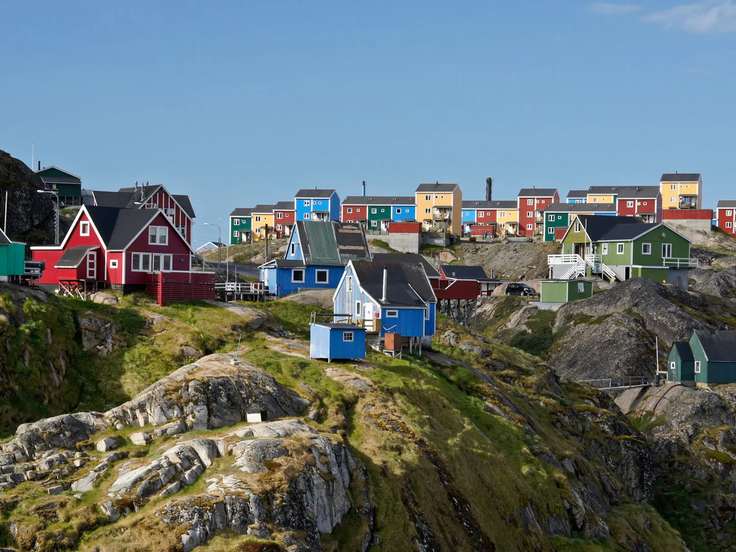
Arrival at Sisimiut beneath Nasaasaaq: The trek ends in Greenland’s second-largest town below the distinctive Nasaasaaq, or Sugarloaf, peak. The summit is a popular optional side ascent, not part of the main trail.
Challenges to expect
Do not underestimate the modest altitude: the high point is only about 450 m, but the walking is hard. Expect wet tundra, boggy single-track, unbridged river crossings, changeable weather and sections where cairns are hard to follow. A map/GPS and tent are essential. If comparing Nordic routes such as Abisko to Kebnekaise or the Jämtland Triangle, note that this trail has no resupply or mobile coverage between towns.
HikeList Score
Arctic Circle Trail scored 79/100 on HikeList's trail-quality metrics.
See score breakdownHide breakdown
- Ideal length 96
- Balanced challenge 84
- Scenery & wildness 66
- Varied terrain 100
- Accommodation 58
- Food & support 65
- Path quality 98
- Season flexibility 76
Computed from length, challenge, scenery & wildness, terrain variety, accommodation, food & support, path quality and season flexibility.
 Sweden
Show more data Show less
- Arctic Tundra
- Glacial Outwash Valleys
- Low Rocky Hills
- Lakes
- Boggy Ground
- Gravel Road
- Single Track
- Rock
- Bog
- Huts
- Wild Camping Spots
- Pet Friendly
- Water Sources
- Campsites
- Shelters
Photos from hikers
Taken on the trail by people who've reviewed Arctic Circle Trail.
Begin the trek by departing from Kangerlussuaq, initially following wide gravel tracks and open terrain before gradually entering Arctic tundra. The landscape is marked by glacial outwash plains and sparse vegetation. The day concludes at Hundesø, a small lake with several decent wild camping spots nearby.
Set out from Hundesø and traverse rolling hills dotted with lakes and tarns. The path is generally well-marked, with river crossings and occasional boggy ground. The day’s hike ends at Katiffik Hut, the first of several basic shelters along the route.
Follow the trail westward, crossing open expanses and occasional rocky ground. The day's highlight is reaching the eastern end of Lake Amitsorsuaq, where you'll find the Canoe Center, a hut situated beside the vast, clear waters of the lake.
Travel along the northern shoreline of Lake Amitsorsuaq, which can be slow-going due to uneven ground and boggy patches. If available, canoes at the Canoe Center allow for paddling portions of the lake. The section ends at Ikkattooq Hut, located in a sheltered area just beyond the lake.
Begin the day with some steeper ascents through rugged hills offering expansive views over the tundra. The route leads past small lakes and streams, finishing at the Eqalugaarniarfik Hut, set amidst low hillside terrain.
This stage features a mix of rocky passes and wide open valleys. The landscape here is drier and rockier, with stretches of boulder fields. Innajuattoq I Hut serves as a basic but welcome refuge at the end of the day.
The trail for this day is relatively short, crossing a scenic plateau dotted with lakes, mosses, and occasional rocky sections. This easier leg brings you to Innajuattoq II Hut, beautifully set beside a lake and offering tranquil views.
A longer day across variable terrain, including wetlands, tundra, and several river crossings. The route runs through wide, open landscapes with mountain views before reaching Nerumaq Hut, nestled beside a freshwater stream.
Cross green valleys and skirt low ridges as you get closer to the coast. This stage involves both gentle climbs and easy river crossings. Arrive at Kangerluarsuk Tulleq Hut, with proximity to the fjord and sweeping coastal tundra vistas.
The final stretch leads over rolling hills and rocky promontories toward Sisimiut. As you approach town, the landscape transitions from wilderness to the outskirts of Greenland’s second-largest settlement, where your Arctic journey concludes.
Reviews
How would you rate Arctic Circle Trail?
Tap a star to start your review — you could be the first.