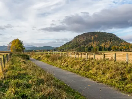
The Bluestack Way
How would you rate The Bluestack Way?
Tap a star to share your experience and help other hikers.
The Bluestack Way: Donegal’s Wild Foothill Trail
HikeList Score
The Bluestack Way scored 86/100 on HikeList's trail-quality metrics.
See score breakdownHide breakdown
- Ideal length 70
- Balanced challenge 100
- Scenery & wildness 90
- Varied terrain 94
- Accommodation 83
- Food & support 81
- Path quality 80
- Season flexibility 89
Computed from length, challenge, scenery & wildness, terrain variety, accommodation, food & support, path quality and season flexibility.
The Bluestack Way is a 65 km National Waymarked Trail in County Donegal, north-west Ireland, usually walked in 3 days. This moderate point-to-point route crosses the foothills of the Bluestack Mountains between Donegal Town and Ardara, with Glenties as the main intermediate town. It suits hikers who want a short Irish thru-hike with bog roads, wet moorland, forest tracks, quiet lanes and a remote upland feel without technical scrambling.
Route Overview
The route is most commonly walked north-west from Donegal Town’s Diamond to Ardara’s Diamond, though it can be walked either way. From Donegal Town it follows the River Eske towards Lough Eske and Ardnamona Woods, then climbs into the Bluestack foothills around Letterfad and Disert. The wildest ground is the open moorland between Binbane, Cloghmeen Hill and Meenawannia bog before the trail reaches Glenties. The final section follows the Owenea River valley into Ardara. It is a linear trail, so plan end-to-end logistics rather than expecting a loop. Waymarking uses standard Irish National Waymarked Trail yellow arrows and the yellow walking-man symbol. For longer Irish waymarked walks, compare the Dingle Way or Beara Way.
History of the Bluestack Way
The Bluestack Way was proposed by the local Bluestack Environmental Group and opened in 2000. It was partly funded by the EU Peace and Reconciliation Fund, with construction work carried out by FAS Community Employment Scheme workers. The route has also been put forward as a possible link in the International Appalachian Trail’s extension through Ireland, because the Bluestack Mountains share ancient geology with the Appalachians from the time of Pangaea.
Notable highlights
- Lough Eske (lake and woodland): Reached early after Donegal Town, Lough Eske sits below the Bluestacks and gives the walk its first major lake-and-woodland scenery around Ardnamona Woods.
- The Bluestack Mountains (wild foothills): The Way threads through the lower slopes and moorland of the Croaghgorm range rather than climbing the summits, giving big open country without technical mountain ground.
- Disert (upland pilgrimage site): A remote mountain graveyard, ruined church and holy well in the trail’s most isolated section; it is one of the strongest historical and atmospheric points on the route.
- Owenea River valley (riverside finish): The approach to Ardara follows grassy riverside walking beside the Owenea, a noted salmon and trout river, for a gentler final stretch.
- Glenties and Ardara (Donegal trail towns): Glenties and Ardara provide food and lodging; Ardara is also known for Donegal tweed and hand-knitting. For a very different west-coast walking option, see the Great Western Greenway.
Challenges to expect
Expect wet ground, exposed moorland and changeable Donegal weather. The hardest section is the remote high moorland between Disert/Binbane and Cloghmeen Hill, where poor visibility can make navigation more serious; a bad-weather road alternative exists. Around 31% of the route is on local roads. No permit or fee is required, but dogs are not permitted.
HikeList Score
The Bluestack Way scored 86/100 on HikeList's trail-quality metrics.
See score breakdownHide breakdown
- Ideal length 70
- Balanced challenge 100
- Scenery & wildness 90
- Varied terrain 94
- Accommodation 83
- Food & support 81
- Path quality 80
- Season flexibility 89
Computed from length, challenge, scenery & wildness, terrain variety, accommodation, food & support, path quality and season flexibility.
 Ireland
Show more data Show less
- Moorland
- Bog
- Hills
- Forest
- River Valley
- Dirt
- Grass
- Paved
- Hotels
- Hostels
- Campsites
- Family Friendly
- Pet Friendly
- Restrooms
- Water Sources
- Campsites
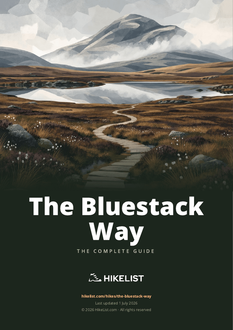
Download Our Full Guide to The Bluestack Way FREE!
Get our comprehensive guide to this hike for free. Save it for later reading or print out at home.
Photos from hikers
Taken on the trail by people who've reviewed The Bluestack Way.
The Bluestack Way: The Complete Guide
The Bluestack Way is a short but properly wild long-distance walk across inland County Donegal, linking Donegal Town (Dún na nGall) with Ardara (Ard an Rátha). It suits walkers who want a three-day Irish trail with real remoteness, wet upland ground and a clear sense of crossing country rather than just following lanes between villages.
The route begins gently, leaving The Diamond in Donegal Town for the River Eske, Lough Eske (Loch Iascaigh) and Ardnamona Woods beneath the Bluestack Mountains / Croaghgorm (Na Cruacha Gorma). From there it becomes rougher and lonelier, threading bog roads, forest tracks, riverside paths and quiet public roads through the foothills.
The heart of the walk is the high moorland crossing between Binbane and the col below Cloghmeen Hill, the route’s exposed crux at a little over 400 m. Disert, the Owenroe River and the Meenawannia boglands give the middle day its remote Donegal character before the Way drops towards Glenties (Na Gleannta).
This is not a technical mountain route, and it does not climb the Bluestack summits, but it still asks for proper hillwalking judgement. Expect boggy ground, changeable Atlantic weather, limited services in the middle section, roughly one-third of the route on quiet roads, and the need to pre-book key overnight stops.
This guide covers stages, daily planning, accommodation, food, transport, terrain and the common mistakes to avoid.
Stage-by-Stage Guide
The stage distances below are practical planning splits, not fixed official daily sections. They work because they use the main service points on the route: Donegal Town, the Disert / Bluestack Centre area, Glenties and Ardara. The middle of the Way is remote, wet and exposed, so accommodation and onward transport should be arranged before setting off.
Stage 1: Donegal Town to Disert / Bluestack Centre area — approx. 23 km
The Bluestack Way starts at The Diamond in the centre of Donegal Town (Dún na nGall), then leaves town towards the River Eske and Lough Eske (Loch Iascaigh). This is the gentlest and most varied stage of the walk, moving from town streets and quiet roads into lake, woodland and valley country on the eastern side of the Bluestack Mountains / Croaghgorm (Na Cruacha Gorma).
Early walking is the most accessible of the route, with riverside sections, lanes and woodland around Lough Eske and Ardnamona Woods. The scenery becomes steadily quieter after the lake, with the route heading into the Eglish Valley / Eanymore River area and on towards Drimarone and Disert.
Lough Eske is the main scenic highlight of the stage, with the lake sitting below the Bluestacks and Ardnamona Woods adding one of the best wooded sections of the whole route. Disert is the historical focus near the end of the day: a remote upland pilgrimage site with an ancient mountain graveyard, ruined church and holy well.
Food and drink should be bought in Donegal Town before leaving. Once beyond the town, services are limited and should not be relied upon for lunch or supplies. Carry enough water for the day; natural water on the route should be treated if used.
The usual end point for this stage is the Disert / Bluestack Centre area around Drimarone. The Bluestack Centre community hostel serves this part of the route and should be booked ahead, as there are very few alternatives in the wild middle section.
Donegal Town is the best public transport access point on the Way, with Bus Éireann services including Expressway coaches from Dublin and Sligo, but no railway. Public transport at the rural end of this stage is limited; any pick-up, taxi or road-access plan for the Disert / Drimarone area should be arranged in advance. This should be checked before travelling.
Navigation is generally straightforward leaving Donegal Town because the route is waymarked with the standard yellow arrow and walking-man symbols. Do not treat this first day as purely lowland walking, though: the route is already heading into more isolated country, and the final approach towards Disert can feel remote in poor weather.
Expect some quiet road walking as well as tracks and rougher wet ground. Dogs are not permitted on sections crossing private land, and livestock may be present beside the Way, so gates, field edges and waymarked lines should be treated carefully.
Stage 2: Disert / Bluestack Centre area to Glenties — approx. 22 km
This is the key hillwalking stage of the Bluestack Way and the section that gives the route its wild character. From the Disert / Drimarone area the Way heads into rougher upland country, passing towards Binbane before making the exposed high moorland crossing below Cloghmeen Hill.
The trail does not climb the Bluestack summits. Instead, it threads lower slopes, bogs and passes, reaching its highest point at the shallow col below Cloghmeen Hill at a little over 400 m. There is no scrambling or technical mountain ground, but this is the crux of the route because the terrain is open, boggy and serious in poor visibility.
The Binbane–Cloghmeen Hill crossing is the main feature of the day. In clear weather it gives the strongest sense of the Bluestack Mountains, with wide, open Donegal moorland and little shelter. In cloud, rain or strong wind it becomes a navigation stage rather than just a waymarked walk.
A bad-weather road alternative is provided for the exposed moorland crossing. It should be considered seriously if visibility is poor, if the ground is saturated, or if the group is not confident navigating across open bog.
After the high crossing, the route descends towards the Owenroe River and continues across the lonely blanket boglands of Meenawannia. This is classic remote Donegal peatland walking: wet underfoot, quiet and exposed, with bog roads and rough ground before the route eventually reaches Glenties (Na Gleannta).
Assume there are no dependable food services between the start of the stage and Glenties. Carry a full day’s food and enough water, with a margin for slow going across wet ground. Any water taken from streams, bog drains or rivers should be treated.
Glenties is the first proper service stop after the remote central section, with accommodation options including guesthouses and B&Bs. Beds should be booked ahead, especially if walking in the main season or arriving late after a slow moorland crossing.
Glenties is served by Bus Éireann Route 492 between Donegal Town, Glenties, Ardara and onward destinations, but services are limited. Times should be checked before relying on the bus for joining, leaving or shortening the route.
Carry proper navigation for this stage: map and compass, a charged GPS device or phone with offline mapping, and the route line downloaded before departure. OSI Discovery Series sheets 10 and 11 cover the route, and the official route cards and GPX are useful for checking the line. Waymarks help, but they are not a substitute for navigation across open moorland in mist.
The main hazards are exposure, poor visibility, deep wet peat, slow progress and the consequences of missing a waymark in open country. Start early enough to avoid being rushed, and do not underestimate this stage just because the high point is only a little over 400 m.
Stage 3: Glenties to Ardara — approx. 12 km
The final stage is shorter and easier to plan, with a much gentler character than the central moorland crossing. From Glenties the Way follows the Owenea River (Abhainn na hEathadh) down towards Ardara (Ard an Rátha), finishing at The Diamond in the centre of town.
This is a river-and-valley stage rather than a mountain day. Expect grassy riverside walking, quiet lanes and softer wet ground rather than the exposed blanket bog of Stage 2. It is still rural Donegal walking, so waterproof footwear and patience with muddy sections remain useful.
The Owenea River is the main highlight, giving a calm finish after the open uplands. Ardara provides a clear end point and a proper trail town finish, known for Donegal tweed and hand-knitting as well as accommodation and food.
Buy any snacks or lunch in Glenties before leaving. The stage is short, but there should still be enough water and food carried to allow for slow conditions or a delayed finish. Services are available again in Ardara at the end of the walk.
Accommodation in Ardara includes hotels, guesthouses and B&Bs, but it should still be booked in advance rather than left to chance. This is especially important if finishing late in the day, walking at a busy time, or depending on public transport the following morning.
Ardara is served by limited Bus Éireann Route 492 and Local Link services. It has far fewer transport options than Donegal Town, so onward travel needs planning before the walk begins. Current bus times should be checked before travelling.
Navigation is less serious than on the Binbane–Cloghmeen crossing, but the route still uses waymarks and should be followed carefully through fields, lanes and riverside sections. Expect some quiet road walking and be alert to normal rural traffic on narrow roads.
The main practical risk on this stage is underestimating the finish logistics rather than the terrain. Wet grass, mud, livestock and private-land restrictions still apply, and dogs should not be brought on sections where they are not permitted.
Recommended Itinerary
The Bluestack Way works best as a 3-day walk. The first two days are the main hillwalking stages, with the remote Disert / Bluestack Centre area as the logical mid-route overnight; the final day from Glenties to Ardara is much shorter and gives a gentler finish along the Owenea River.
Standard 3-day itinerary
| Day | From | To | Approx. distance | Why this stage makes sense | Services/accommodation notes |
|---|---|---|---|---|---|
| 1 | Donegal Town (Dún na nGall) | Disert / Bluestack Centre area, near Drimarone | 23 km | A full but manageable first day, leaving The Diamond in Donegal Town and moving through the easier lake, woodland and river country around the River Eske, Lough Eske and Ardnamona Woods before reaching the quieter upland edge of the route. | Donegal Town has the widest choice of pre-walk accommodation, food and transport. The mid-route stop is much more limited, so accommodation around the Bluestack Centre / Disert / Drimarone area should be booked ahead. |
| 2 | Disert / Bluestack Centre area | Glenties (Na Gleannta) | 22 km | This is the key wild stage of the Way, taking in the remote ground around Disert, Binbane, the exposed Binbane–Cloghmeen Hill crossing and the descent by the Owenroe River and Meenawannia boglands. It is the day most affected by poor visibility, wet ground and wind. | Start with enough food and water for a remote day, as services are very limited until Glenties. Glenties is the practical overnight stop after the moorland crossing and should be booked in advance. |
| 3 | Glenties (Na Gleannta) | Ardara (Ard an Rátha) | 12 km | A short final stage, useful after the longer boggier middle day. The route follows gentler country down the Owenea River to Ardara, finishing at The Diamond in the centre of town. | Ardara has accommodation and food, but onward transport is limited. Bus Éireann Route 492 and Local Link times should be checked before travelling, especially if leaving Ardara the same day. |
Slower variant
A slower itinerary is possible, but the route does not have many convenient serviced overnight points in the wild middle section. For most walkers, slowing the trip down means adding a night in Donegal Town before starting, staying an extra night in Glenties or Ardara, or arranging transport so that one of the longer stages can be shortened.
| Day | From | To | Approx. distance | Why this stage makes sense | Services/accommodation notes |
|---|---|---|---|---|---|
| 1 | Donegal Town (Dún na nGall) | Disert / Bluestack Centre area, near Drimarone | 23 km | Still the natural first overnight break unless private transport or another arranged stop is used. | Book the mid-route accommodation ahead; do not assume walk-up availability. |
| 2 | Disert / Bluestack Centre area | Glenties (Na Gleannta) | 22 km | Keeps the remote Binbane–Cloghmeen Hill crossing as a single focused hill day rather than trying to extend beyond Glenties. | Carry what is needed for a long, wet, exposed day. Glenties accommodation should be arranged before setting out. |
| 3 | Rest, short local day, or delayed start from Glenties | Glenties (Na Gleannta) or Ardara (Ard an Rátha) | Check official mapping before booking | Suits walkers who want a weather buffer after the moorland crossing, or who prefer not to combine travel logistics with the final walking day. | Extra accommodation in Glenties or Ardara should be booked ahead. Any transport-assisted split should be planned before travelling. |
| 4 | Glenties (Na Gleannta), if not already completed | Ardara (Ard an Rátha) | 12 km | Allows the final riverside section to be walked unhurriedly, with time to connect to onward transport from Ardara. | Ardara’s bus options are limited; check Bus Éireann Route 492 and Local Link times before relying on them. |
This slower approach suits walkers who want a bad-weather buffer for the high moorland crossing, those using public transport at the finish, or anyone who prefers not to stack walking days and travel days together.
Faster variant
A 2-day crossing is only sensible for strong, efficient walkers who are comfortable with long wet days, road walking and exposed moorland navigation. It removes much of the leisurely character of the route and makes the second day particularly demanding if starting from the Disert / Bluestack Centre area.
| Day | From | To | Approx. distance | Why this stage makes sense | Services/accommodation notes |
|---|---|---|---|---|---|
| 1 | Donegal Town (Dún na nGall) | Disert / Bluestack Centre area, near Drimarone | 23 km | Keeps the first day to the normal opening stage and positions the walker before the remote central section. | Pre-book the mid-route bed; options are limited. |
| 2 | Disert / Bluestack Centre area | Ardara (Ard an Rátha), via Glenties | 34 km | Combines the wild Binbane–Cloghmeen Hill crossing, the descent to Glenties and the final Owenea River section into one long day. This should only be attempted with a favourable forecast and an early start. | There are services in Glenties before the final section to Ardara. Finish transport from Ardara is limited, so bus or Local Link times should be checked before travelling. |
For most independent hikers, the 3-day itinerary is the best balance of distance, terrain, accommodation and transport logistics.
Planning the Route
How many days to allow
Most walkers should plan the Bluestack Way as a 3-day walk. The practical rhythm is Donegal Town to the Disert / Bluestack Centre area, then on to Glenties, then a shorter final day into Ardara.
That schedule suits the character of the route better than rushing it. The middle day includes the wildest ground, with bog, open moorland and the exposed Binbane–Cloghmeen Hill crossing, so saving time on paper can easily be lost to wet ground, poor visibility or slower navigation.
A fit walker could make the route faster, but the limiting factor is not just distance. Accommodation, transport out of Ardara, and the lack of services through the remote middle section make a hurried itinerary less flexible than it may appear.
Natural stages and overnight stops
The route is naturally shaped by its few service points. Donegal Town, Glenties and Ardara are the main trail towns for accommodation and food, while the Disert / Drimarone area is the key mid-route stop that makes a 3-day itinerary work.
| Stage | Usual section | Approx. distance | Planning notes |
|---|---|---|---|
| Day 1 | Donegal Town to Disert / Bluestack Centre area | 23 km | Starts with easier lake, wood and river country around the River Eske, Lough Eske and Ardnamona Woods, then becomes more rural and remote. Book the mid-route stop ahead. |
| Day 2 | Disert / Bluestack Centre area to Glenties | 22 km | The most committing day, crossing the rough high moorland between Binbane and the col below Cloghmeen Hill before descending by the Owenroe River and Meenawannia boglands. Carry full hillwalking kit and navigation. |
| Day 3 | Glenties to Ardara | 12 km | A shorter finish following gentler country and the Owenea River into Ardara. Useful if onward transport from Ardara is limited that day. |
The middle section has almost no services, so do not treat the route as a walk where accommodation can always be found casually at the end of the day. The mid-route bed and accommodation in Glenties and Ardara should be booked in advance, especially if walking at weekends or in the main walking season.
Faster, slower or split itineraries
A slower itinerary is usually more useful than a faster one if transport times or weather are awkward. Adding a night in Donegal Town before starting, or in Ardara at the end, reduces pressure around bus connections and gives more margin if the moorland day is delayed by poor visibility.
The final Glenties to Ardara section is short enough to combine with onward travel, provided the bus times work. Ardara is served by limited Bus Éireann Route 492 and Local Link services, so do not assume a frequent evening escape from the finish. This should be checked before travelling.
Shortening the walk is possible in principle because Glenties lies on the Donegal Town–Glenties–Ardara transport corridor, but services are limited. Section hiking is practical only with careful bus planning, or with private transfers arranged independently.
Extending the walk is less straightforward from the route information alone. The Bluestack Way has a base signed route of about 51 km and a longer official variant bringing the walk to roughly 65 km, so decide in advance which version is being followed and load the matching map or GPX.
The planning priorities that matter most
Accommodation is the first priority. The route is not a continuous chain of villages, and the remote middle section depends on the Disert / Bluestack Centre area working as an overnight stop.
Transport is the second major constraint. Donegal Town is the easier end to reach, with Bus Éireann services including Expressway coaches from Dublin and Sligo, but it has no railway. Ardara has far fewer services, mainly Bus Éireann Route 492 and Local Link, so the finish requires more planning than the start.
Food planning should assume limited opportunities between the main overnight stops. Stock up before leaving Donegal Town and Glenties, and carry enough food for the full day through the upland and bogland sections.
Water should be carried between reliable service points. The route passes rivers, bogland and wet ground, but natural water should not be treated as safe to drink without proper treatment.
Navigation matters most between Binbane and the col below Cloghmeen Hill. The Way is waymarked with yellow arrows and the Irish walking-man symbol, but open moorland, bog and cloud can make waymarks harder to follow. Carry OSI Discovery Series sheets 10 and 11, or the Sport Ireland maps and GPX, plus the ability to navigate without a phone signal.
Weather planning is essential even though the high point is only a little over 400 m. The route crosses exposed, wet Donegal moorland, and the ground can become slow and waterlogged after rain. The bad-weather road alternative around the Binbane–Cloghmeen crossing should be kept in mind before committing to the high moor in poor visibility.
There is no scrambling or technical climbing to plan for, but footwear and clothing should be chosen for bog rather than dry paths. Waterproof boots, gaiters or quick-drying systems, and spare dry layers are more important here than lightweight dry-weather kit.
Dogs are not permitted on sections crossing private land, so this is not a route to plan with a dog unless current access rules allow it. There have also been reports of livestock in fields beside the Way, so field sections should be treated with normal rural caution.
Towns, Villages and Overnight Stops
Accommodation planning on the Bluestack Way is straightforward at the ends and much more limited in the middle. Donegal Town, Glenties and Ardara are the main service points; the wild central section around Drimarone, Disert, Binbane and Meenawannia has very little in the way of food, shops or transport.
A typical three-day plan uses Donegal Town before the start, a pre-booked mid-route stop around the Disert / Bluestack Centre / Drimarone area, Glenties for the second night, and Ardara at the finish. The middle stop is the one to secure first, as it controls the practical rhythm of the whole walk.
Donegal Town (Dún na nGall)
Donegal Town is the start of the route, with the Way beginning at The Diamond in the town centre before heading out towards the River Eske and Lough Eske. It is the best place to arrive the day before walking, sort food, check weather and make sure transport connections are in place.
There are hotels, guesthouses and B&Bs in Donegal Town, giving the widest choice of accommodation on the route. It is also the natural place to buy supplies before the more remote first two days, especially if staying near the Bluestack Centre area where services are limited.
Donegal Town is a regional bus hub and has Bus Éireann services, including Expressway coaches from Dublin and Sligo. There is no railway station, so walkers arriving by public transport should plan around coach and bus times rather than trains.
River Eske, Lough Eske (Loch Iascaigh) and Ardnamona Woods
The first section out of Donegal Town follows the route towards the River Eske, Lough Eske and Ardnamona Woods. This is not a normal overnight zone for most walkers; it is better treated as the opening walking stage after staying in Donegal Town.
Accommodation and food options directly on this stretch should not be assumed. Anyone planning to break the first day around Lough Eske or Ardnamona Woods needs to check exact location, access from the Way and meal arrangements before booking.
The practical value of this section is that it eases the route out of town on lake, woodland and riverside terrain before the wilder Bluestack foothills. Once beyond this early settled edge, services become much thinner.
Eglish Valley / Eanymore River, Drimarone and Disert
The Eglish Valley, Eanymore River, Drimarone and Disert area forms the usual first overnight target on a three-day itinerary from Donegal Town. The day is roughly 23 km to the Disert / Bluestack Centre area, making it a sensible break before the exposed upland crossing on day two.
The key accommodation point is the Bluestack Centre community hostel, which serves the middle of the route. This should be booked ahead, as the central section is remote and there are few alternatives close to the Way.
Food and evening meal arrangements should be checked before travelling. Do not assume there will be shops, cafés or pubs available at the end of this stage; most walkers should carry what they need from Donegal Town unless accommodation has clearly arranged otherwise.
Disert itself is an important route landmark, with an ancient mountain graveyard, ruined church and holy well in a remote upland setting. It is a place to pause rather than a service village, and it sits in one of the most isolated parts of the walk.
Binbane, Cloghmeen Hill and the Owenroe River
Binbane and the col below Cloghmeen Hill mark the wild crux of the Bluestack Way rather than an overnight stop. This is the exposed high moorland crossing, reaching a little over 400 m, with wet ground and serious navigation implications in cloud.
There are no reliable hiker services to plan around on this section. Accommodation, food, shelter and public transport should all be treated as absent unless specifically arranged in advance.
The route has a bad-weather road alternative for the Binbane–Cloghmeen Hill crossing. If conditions are poor, the decision should be made before committing to the high moorland, not once visibility has already deteriorated.
After the pass, the Way descends towards the Owenroe River and the bog roads beyond. This remains remote walking, so Glenties is the next practical service target.
Meenawannia and the approach to Glenties
Meenawannia is part of the lonely blanket-bog section between the Owenroe River and Glenties. It is important for route character, but not as a place to rely on for accommodation or supplies.
Expect wet ground, exposed bog roads and little practical infrastructure. Carry enough food, water and bad-weather clothing to complete the day from the mid-route stop to Glenties without depending on anything en route.
Glenties (Na Gleannta)
Glenties is the main overnight stop after the central moorland crossing and the usual second night on a three-day walk. It sits around the two-thirds point of the route and is the first proper trail town after the remote Bluestack foothills.
Accommodation includes guesthouses and B&Bs, with hotels also part of the wider accommodation mix on the Way. Beds should be booked ahead, especially because Glenties is the practical recovery point after the longest, wettest and most remote walking day.
Glenties is one of the two main Donegal trail towns for food and lodging, so it is the place to restock before the shorter final stage to Ardara. It is also a good point to reassess weather, footwear and any transport plans before continuing.
For public transport, Glenties is on Bus Éireann Route 492, which links Donegal Town, Glenties, Ardara and onwards towards Killybegs / Dungloe. Services are limited, so current times should be checked before travelling.
Owenea River
The final stage follows the Owenea River towards Ardara. This is a gentler riverside finish and does not normally require an overnight stop between Glenties and Ardara, as the stage is roughly 12 km.
There should be no assumption of intermediate shops or cafés along the river section. Start from Glenties with the food and water needed to reach Ardara comfortably.
Ardara (Ard an Rátha)
Ardara is the finish of the Bluestack Way, with the route ending at The Diamond in the town centre. It is the best place to stay after completing the walk, particularly if public transport times do not line up neatly with the finish.
The town has hotels, guesthouses and B&Bs, and is one of the main service points on the route. It is also known for Donegal tweed and hand-knitting, but for walkers its main importance is as the end-point for food, lodging and onward travel.
Public transport from Ardara needs planning. The town is served by the limited Bus Éireann Route 492 and Local Link services, with only a few buses a day; current timetables should be checked before booking onward connections.
If finishing late in the day, staying in Ardara can be simpler than trying to make a same-day connection. Anyone needing to return to Donegal Town should plan this before starting the walk, not at the finish.
Getting to the Start
By train
Donegal Town (Dún na nGall) has no railway station, so the Bluestack Way cannot be reached by train alone. If travelling by rail, plan to connect onto a coach or bus for the final leg into Donegal Town.
Sligo is a practical onward coach hub for Donegal Town services, including Bus Éireann/Expressway connections. Exact rail-and-bus connections should be checked before travelling, especially if arriving late in the day.
By bus
Donegal Town is the main public transport hub for the start of the route. Bus Éireann services, including Expressway coaches from Dublin and Sligo, serve the town, making bus the simplest public transport option for most walkers.
The trail starts at The Diamond in the centre of Donegal Town, so a central bus arrival is convenient: from there the Way is signed out towards the River Eske and Lough Eske.
For point-to-point logistics, Bus Éireann Route 492 links Donegal Town with Glenties and Ardara, but services are limited, roughly only a few times a day. This is useful if positioning from Ardara back to Donegal Town, but the timetable should be checked before travelling.
By car
Driving to Donegal Town is straightforward in principle, but the route is point-to-point and finishes in Ardara, not back at the start. Decide before booking whether to leave the car in Donegal Town and return from Ardara after the walk, or leave it near the finish and travel to Donegal Town before starting.
Leaving a car at the start means relying on the limited Ardara–Glenties–Donegal Town bus service or a pre-booked taxi at the end. Leaving a car at the finish can make the final day easier, but requires arranging the transfer to Donegal Town before walking.
Do not assume that long-stay or overnight parking is available at The Diamond itself. Arrange parking through accommodation or use official local parking where permitted; long-stay rules and charges should be checked before travelling.
From the nearest airport
There is no airport at Donegal Town, so flight arrivals will still need an onward coach, private transfer or hire car to reach the start at The Diamond. The best airport depends on available flights, onward bus times and whether a hire car is being used.
If relying on public transport after a flight, build in time for missed connections. Donegal Town is reachable by coach, but onward rural transport around the finish at Ardara is limited and should be checked before travelling.
Where to stay before starting
Donegal Town has the best choice of pre-walk accommodation on the route, including hotels, guesthouses and B&Bs. Staying centrally is the most convenient option because the Way begins at The Diamond.
An overnight stop in Donegal Town is strongly recommended if arriving by public transport. The first walking day is a full stage to the Disert / Bluestack Centre area, and the middle of the route has very limited services, so starting early and well supplied is sensible.
Book the first night before the walk, the remote mid-route stop and later accommodation in Glenties or Ardara ahead of time, especially in the main walking season.
Getting Home from the Finish
The Bluestack Way finishes at The Diamond in the centre of Ardara (Ard an Rátha). Leaving the finish is the part of the route that needs the most transport planning: Ardara has limited public transport, no railway, and only a few onward bus options each day.
By train
Ardara has no railway station, and Donegal Town also has no railway. If travelling onward by train, you will first need to leave Ardara by bus or taxi to a rail-connected town or city; the practical routing will depend on your final destination and current public transport timetables.
This should be checked before travelling, especially if aiming to make a same-day rail connection after finishing the walk.
By bus
Ardara is served by Bus Éireann Route 492, which links Donegal Town, Glenties, Ardara, Killybegs and Dungloe. Services are limited — roughly 2–3 buses a day — so the timetable should be checked before booking accommodation or onward travel.
For many walkers, the simplest public-transport exit is:
| From Ardara | Usual onward option |
|---|---|
| Donegal Town | Regional onward buses, including Expressway coach links towards Dublin and Sligo |
| Glenties | Useful if breaking the journey or returning to accommodation mid-route |
| Killybegs / Dungloe | Possible onward local connections, depending on timetable |
Local Link services may also operate in the area, but times and routing are timetable-dependent. Check current Local Link and Bus Éireann details before relying on them.
If finishing late in the day, do not assume there will be a useful bus after the final stage from Glenties to Ardara. Either plan the walking day around a specific departure, pre-book a taxi, or stay overnight in Ardara.
By car/taxi
Because this is a point-to-point route from Donegal Town to Ardara, car logistics need deciding before the walk starts. Common options are leaving a car at the finish in Ardara, returning to Donegal Town by bus after the walk, or arranging a pre-booked taxi transfer.
A taxi is the most flexible option if you need to get back to Donegal Town, reach accommodation outside Ardara, or connect with a specific coach. It should be arranged in advance rather than left until arrival at the finish, particularly on evenings, Sundays or outside busy periods. Confirm current fares before booking.
If someone is collecting you, The Diamond in Ardara is the natural rendezvous point, as the trail finishes in the town centre.
From the nearest airport
No airport is directly served from the Ardara finish. Airport journeys will usually require a bus or taxi connection out of Ardara first, most often via Donegal Town for longer-distance coach travel.
The best airport routing depends heavily on current bus times and the final destination. This should be checked before travelling, and an overnight in Ardara or Donegal Town may be more realistic than trying to combine the final walking day with a same-day flight.
Where to stay at the finish
Ardara has hotels, guesthouses and B&Bs, making it a sensible place to spend the final night. Booking ahead is recommended, especially because limited onward buses can make a same-day exit awkward if the walking day runs late.
Staying in Ardara also gives a useful buffer after the final riverside section along the Owenea River. For walkers continuing by public transport the next morning, choose accommodation close enough to the centre to reach the bus departure point without needing an extra transfer.
Which Direction Should You Walk?
The Bluestack Way is best planned in its standard direction: Donegal Town (Dún na nGall) to Ardara (Ard an Rátha). This is the natural line of the route, starting at The Diamond in Donegal Town, heading out by the River Eske, Lough Eske (Loch Iascaigh) and Ardnamona Woods, then crossing the wild Bluestack foothills before finishing at The Diamond in Ardara.
Walking in reverse is perfectly possible in practical terms, but it changes the logistics and the rhythm of the walk. The main decision is whether transport convenience or route progression matters more.
Standard direction: Donegal Town to Ardara
This direction gives the best overall build-up. The route begins with easier lake, woodland and valley walking around Lough Eske and the Eanymore River, then moves into the rougher, wetter and more remote middle section around Disert, Binbane and the col below Cloghmeen Hill.
It also gives a good final day: the Glenties to Ardara section is shorter, gentler and follows the Owenea River towards the finish. After the boggier upland stages, ending with a lower, riverside walk into Ardara has a strong sense of arrival.
Transport is simplest at the start. Donegal Town is the main regional hub, with Bus Éireann services including Expressway coaches from Dublin and Sligo, and is easier to reach than Ardara. The drawback is that the finish at Ardara has only limited Bus Éireann Route 492 and Local Link services, so the onward journey needs planning and the current timetable should be checked before travelling.
Accommodation flow also works well this way. The usual three-day pattern is Donegal Town to the Disert / Bluestack Centre area, then to Glenties, then to Ardara. The middle accommodation stop and the beds in Glenties and Ardara should be booked ahead, especially because the central part of the route has very few services.
Reverse direction: Ardara to Donegal Town
Walking from Ardara to Donegal Town can make sense if finishing at a better-connected transport hub is the priority. Instead of trying to leave Ardara after the walk on a limited bus service, you deal with the Ardara connection at the beginning and finish in Donegal Town.
The reverse itinerary gives a short first day from Ardara to Glenties, followed by the tougher central crossing, then a longer final day towards Donegal Town. That can suit walkers who want an easier opening day, but it does mean the walk finishes with more road, lake and lowland walking rather than the neat riverside run-in to Ardara.
There is no major climbing advantage either way. The high point is only a little over 400 m at the shallow col below Cloghmeen Hill, and the route does not climb the Bluestack summits. The real difficulty is the wet bog, exposure and navigation on the Binbane–Cloghmeen Hill crossing, not the direction of ascent.
Weather and navigation
Direction should not be chosen on the assumption of better wind or weather. Conditions on the Bluestack moorland can change quickly, and poor visibility on the exposed central crossing is the main concern whichever way you walk.
Plan the Binbane–Cloghmeen Hill section for the best weather window available, carry map and compass or GPS, and use the bad-weather road alternative if conditions make the moorland crossing unsuitable.
Recommendation
For most walkers, walk the Bluestack Way from Donegal Town to Ardara. It gives the best scenery progression, the most satisfying finish, and the most straightforward start logistics.
Choose the reverse direction only if onward transport from the finish is the overriding concern, or if the limited bus connection to Ardara is easier to arrange before the walk than after it. In either direction, check Route 492 and Local Link times before travelling and pre-book the mid-route accommodation.
Accommodation Along the Route
The Bluestack Way works well as a short inn-to-inn walk, but only if the middle of the route is planned carefully. Donegal Town (Dún na nGall), Glenties (Na Gleannta) and Ardara (Ard an Rátha) have the strongest choice, with hotels, guesthouses and B&Bs. The awkward point is the remote central section around Disert / Drimarone, where the Bluestack Centre community hostel is the key practical overnight option.
Do not treat this as a route where beds can be found casually at the end of each day. The wild middle section has almost no services, and a missed booking there can turn a moderate day into a much longer road walk or require a transfer. Glenties and Ardara should also be booked ahead, especially for weekends and holiday periods.
| Place | Accommodation level | Best for | Notes |
|---|---|---|---|
| Donegal Town (Dún na nGall) | Good | Night before starting; food, supplies and transport connections | Best base for a relaxed start from The Diamond. Strongest accommodation choice on the route. |
| Lough Eske / Ardnamona Woods area | Limited | Not usually needed as an overnight stop | This section comes early on Day 1 for most walkers. Plan to continue towards the Disert / Drimarone area rather than relying on accommodation here. |
| Disert / Drimarone / Bluestack Centre area | Limited | Essential mid-route stop for the standard 3-day itinerary | The Bluestack Centre community hostel serves the middle of the route. Book ahead, as alternatives are scarce and the surrounding country is remote. |
| Binbane – Cloghmeen Hill – Owenroe River – Meenawannia | None | Daytime crossing only | This is the exposed, boggy upland section. There are no practical overnight services on the crossing itself, so start with a confirmed bed or transfer plan. |
| Glenties (Na Gleannta) | Good | Second overnight stop; food and recovery after the moorland day | A practical trail town with hotels, guesthouses and B&Bs. Also served by Bus Éireann Route 492, but times should be checked before travelling. |
| Ardara (Ard an Rátha) | Good | Finish-night stay; food, onward travel and a less rushed departure | Accommodation choice is good for the size of the town, but onward public transport is limited, so a finish-night booking often makes logistics easier. |
Best overnight pattern
The most practical 3-day pattern is:
- Night 0: Donegal Town
- Night 1: Disert / Drimarone / Bluestack Centre area
- Night 2: Glenties
- Finish: Ardara, with an optional final overnight before travelling on
This keeps the long, remote Binbane–Cloghmeen Hill crossing as a single daytime stage and avoids having to push on into the evening over wet, exposed ground. It also leaves the shorter Glenties to Ardara stage for the final day, which is helpful if connecting to limited buses from Ardara.
Booking ahead
Pre-book the mid-route accommodation before committing to travel dates. That booking is the hinge of the whole walk, because there is little flexibility between Donegal Town and Glenties once the route enters the Bluestack foothills.
Glenties and Ardara also deserve advance booking. They are small trail towns rather than large accommodation centres, and availability can tighten at weekends and in the main walking season.
Transfers, taxis and luggage
The route can suit walkers who prefer not to carry a full pack, but transfer arrangements should be made in advance. There is no need to carry camping equipment if using booked accommodation each night, but the lack of services in the middle means luggage, pick-ups or off-route transfers cannot be left to chance.
If the Bluestack Centre area is unavailable, a pre-arranged taxi or accommodation transfer may be the only practical way to keep a 3-day itinerary intact. This should be checked before travelling.
Camping and hostels
The accommodation mix includes campsites and hostel-style beds, but the Bluestack Way is not a route where campsites conveniently appear at every stage end. For most walkers, the reliable plan is still to use booked indoor accommodation in Donegal Town, the Bluestack Centre area, Glenties and Ardara.
No wild-camping assumptions should be built into the itinerary. Land access, private land sections and the very wet blanket-bog terrain make booked accommodation the safer and more dependable approach.
Camping and Wild Camping
Camping is possible on a Bluestack Way itinerary, but it is not the simplest way to walk this route. The trail is short enough for most walkers to use indoor accommodation in Donegal Town, the Bluestack Centre / Disert–Drimarone area, Glenties and Ardara, and the wild middle section has very limited services, wet ground and long exposed stretches.
Campsites and formal camping
Formal campsites may be available in the wider trail area, but there is no reliable campsite chain at convenient daily-stage intervals directly on the Way. Current campsite locations, opening seasons and whether they accept one-night backpacking tents should be checked before travelling.
Donegal Town and Ardara are the most practical places to look for established camping or camper facilities because they are the route’s main end towns. Glenties may also have options nearby, but this should be checked before travelling. The remote middle of the route around Disert, Binbane, the Cloghmeen Hill crossing and Meenawannia should not be assumed to have camping facilities.
Wild camping: permission and practical reality
Wild camping should be approached cautiously on the Bluestack Way. The route crosses private land in places, and dogs are not permitted on those sections; this is a clear sign that access depends on responsible behaviour and landowner cooperation. Do not camp on private land without permission.
In practical terms, the most “wild” part of the walk — the Binbane to Cloghmeen Hill crossing and the bog roads towards the Owenroe River and Meenawannia — is also the hardest place to find a good pitch. Expect saturated blanket bog, uneven tussocks, exposed wind, poor shelter and very limited dry, durable ground.
Camping close to farms, houses, fields with livestock, waymarked access points, the trail itself, graveyards, holy wells or the pilgrimage site at Disert is inappropriate unless specific permission has been granted. The same applies near Lough Eske, Ardnamona Woods and the river corridors, where walkers should avoid damaging sensitive ground or creating visible impact.
Does the route suit camping?
The Bluestack Way suits camping only for self-sufficient hikers who are used to wet Irish hill ground and can carry shelter, food and full waterproof kit without relying on frequent resupply. A tent adds weight on a route that is already boggy and tiring underfoot, especially over the exposed middle day.
For many walkers, the better plan is to use accommodation and carry only day-to-day hiking kit. Camping becomes more attractive if indoor beds are full, if walking a slower itinerary, or if deliberately planning a more self-reliant crossing — but permission and weather remain the limiting factors.
Better and worse areas for a pitch
The lower road and riverside sections near Donegal Town, Glenties and Ardara are generally poor choices for wild camping because they are closer to settlement, roads and working land. These places are better used for food, transport and booked accommodation.
The remote upland middle section offers more solitude, but not necessarily better camping. Ground around Binbane, below Cloghmeen Hill, along the Owenroe River and across Meenawannia can be very wet and exposed. If permission has been obtained, choose the least intrusive, most durable spot available and avoid blocking gates, tracks, livestock movement or waymarked access.
Water
Water is common in this landscape, with the route passing or approaching the River Eske, Lough Eske, the Eanymore River, the Owenroe River and the Owenea River. However, natural water should be treated or filtered before drinking, particularly in farmed or boggy catchments.
Do not rely on finding convenient water exactly where a camp is possible. Carry enough for the exposed moorland crossing and for a dry camp if necessary, especially between the Disert / Drimarone area and Glenties.
Fires, waste and Leave No Trace
Open fires are not appropriate on the Bluestack Way. Blanket bog, peat and moorland vegetation are easily damaged, and fire scars can last a long time. Use a small stove, keep it stable, and cook well away from dry vegetation, heather, peat banks and wooden structures.
Follow Leave No Trace principles strictly:
- Camp only with permission where required.
- Pitch late, leave early and keep the tent out of sight where possible.
- Use durable ground; avoid saturated bog, fragile vegetation and riverbanks.
- Pack out all rubbish, food waste and sanitary items.
- Toilet well away from water, paths, buildings and livestock areas.
- Do not wash with soap directly in rivers, lakes or streams.
- Leave gates, fences, signs and waymarks exactly as found.
Seasonal and weather concerns
The route is open all year, but camping is most realistic in spring, summer and autumn. Even then, Atlantic weather can make the Bluestack foothills cold, windy and extremely wet, and poor visibility can make the Binbane–Cloghmeen Hill crossing serious.
A camping plan should include a bad-weather fallback, especially for the exposed middle section where a road alternative exists. If the forecast is poor, using indoor accommodation and keeping pack weight down is often the safer and more practical choice.
Food, Water and Resupply
The Bluestack Way is a short trail, but resupply is uneven. Donegal Town (Dún na nGall), Glenties (Na Gleannta) and Ardara (Ard an Rátha) are the practical food stops; the country between them is remote, especially around Disert, Binbane, Cloghmeen Hill and Meenawannia.
Do not treat the middle of the route as a place to buy supplies. Walkers should leave Donegal Town with food for Day 1 and at least emergency food for Day 2 unless meals have been arranged with accommodation. Glenties is the key mid-walk resupply point before the shorter final stage to Ardara.
Food planning
Donegal Town is the easiest place to stock up before starting. Buy lunch, snacks and any stove food here, as the trail leaves town quickly for Lough Eske (Loch Iascaigh), Ardnamona Woods and the quieter inland valleys.
The Disert / Bluestack Centre / Drimarone area is the main overnight area for the first stage, but it should not be relied on for spontaneous resupply. If staying there, check in advance whether food is available on site or nearby, and whether an evening meal or breakfast needs to be arranged separately.
Glenties is the most important resupply stop on the route. It is the place to buy food for the final day and to eat properly after the remote Binbane–Cloghmeen Hill crossing and the bog roads around Meenawannia.
Ardara is the finish and has food options for after the walk, but it is not useful for on-route resupply unless continuing further. Rural opening hours, Sunday trading and seasonal closures can affect cafés, shops and pubs, so opening times should be checked before travelling.
Water planning
Start each day with enough drinking water for the full stage. For most walkers, 1.5–2 litres is a sensible minimum in normal conditions, with more in warm weather or if moving slowly over wet boggy ground.
Water is naturally present throughout the landscape — including around the River Eske, Lough Eske, the Eanymore River, the Owenroe River and the Owenea River — but that does not mean it is safe to drink untreated. The route crosses farmland, bog, forestry and open moorland, so natural water should be filtered, treated or boiled if used.
The safest refill points are accommodation, cafés, pubs and shops in the trail towns. Fill bottles before leaving Donegal Town, again before the remote middle section, and again in Glenties before the final walk to Ardara.
| Section | Food availability | Water availability | Notes |
|---|---|---|---|
| Donegal Town to Disert / Bluestack Centre area | Best stocked at the start in Donegal Town. Little to no reliable food once away from town. | Fill in Donegal Town before starting. Natural water is present around Lough Eske, rivers and streams, but should be treated if used. | Carry lunch, snacks and any evening/breakfast food unless meals are arranged at the overnight stop. |
| Disert / Drimarone to Glenties | Very limited until Glenties. Do not rely on buying food before the end of the stage. | Carry enough from the start of the day. Streams, bog drains and the Owenroe River area may provide emergency water, but treatment is needed. | This is the most remote food-and-water planning day, including the exposed Binbane–Cloghmeen Hill moorland crossing. |
| Glenties to Ardara | Glenties is the practical resupply point before setting off. Food is available again at the finish in Ardara. | Refill in Glenties. The route follows gentler country and the Owenea River towards Ardara, but natural water should still be treated. | Shorter stage, but carry normal hillwalking snacks and water rather than assuming an intermediate stop. |
Terrain, Conditions and Difficulty in Practice
The Bluestack Way is graded Moderate, but the rating can feel deceptive. There is no scrambling, no technical ridge walking and the highest point is only a little over 400 m, yet the route crosses remote, exposed and frequently waterlogged Donegal hill country where progress can be slow.
The practical difficulty comes from three things: wet ground, isolation in the middle of the route, and navigation on the Binbane–Cloghmeen Hill moorland crossing in poor visibility. Walkers used to dry, engineered paths may find the boggy sections harder than the distance suggests.
Surfaces underfoot
Expect a mixed surface walk rather than a continuous mountain path. The Way uses quiet public roads for roughly 31% of its length, alongside bog roads, open moorland, blanket bog, forest tracks, riverside paths and grassy ground.
The road sections make parts of the route physically straightforward, especially when visibility is poor, but they also add hard-underfoot walking. Lightweight trail shoes may be comfortable on tarmac and tracks, but waterproof boots or robust walking shoes are more suitable for the wetter moorland and bog sections.
The softer ground is the defining feature. Around the Bluestack foothills, sections can be saturated after rain, with tussocky grass, peat, mud and standing water. Wet feet should be expected, even outside poor weather.
The hardest section: Binbane to Cloghmeen Hill
The exposed high moorland crossing between Binbane and the col below Cloghmeen Hill is the crux of the Bluestack Way. This is the wildest part of the route and reaches the trail’s high point at a little over 400 m.
In clear weather, the crossing is a memorable upland section through the lower slopes and passes of the Bluestack Mountains / Croaghgorm (Na Cruacha Gorma). In cloud, rain or strong wind it becomes much more serious: the ground is open, boggy and exposed, and there are few obvious shelter points.
Carry proper navigation. The route is waymarked with yellow National Waymarked Trail arrows and walking-man symbols, but waymarks should not be treated as the only means of navigation on the moor. A map and compass or a reliable GPS track are important here, particularly if cloud drops onto the pass.
A bad-weather road alternative is provided for the Binbane–Cloghmeen crossing. If visibility is poor, wind is strong, or the ground is heavily waterlogged, using the alternative can be the sensible hillwalking decision rather than a retreat.
Climbs, descents and effort
The total ascent is around 1,230 m over the full route, spread across rolling foothill terrain rather than concentrated into one alpine-style climb. The Way threads the lower slopes and passes; it does not climb the Bluestack summits.
The climbs are not technically difficult, but the combination of ascent and bog can make the middle day slower than the map distance implies. On wet peat, every step takes more effort, and short uphill pulls can feel disproportionate when carrying a multi-day pack.
Descending from the upland section towards the Owenroe River and the Meenawannia boglands remains remote and wet underfoot. Do not assume the hardest walking is finished as soon as the high point is behind you.
Easier ground at each end
The walking at the Donegal Town side is generally gentler, with lake, woodland and river scenery around the River Eske, Lough Eske (Loch Iascaigh) and Ardnamona Woods. These sections are less committing than the middle of the route, though wet ground and quiet road walking still occur.
The final approach from Glenties (Na Gleannta) to Ardara (Ard an Rátha) is shorter and easier in overall effort, following the gentler Owenea River landscape. It is still a walking day, not just a roadside transfer, but it is far less serious than the central moorland crossing.
Roads, lanes and bog roads
Around a third of the Bluestack Way is on quiet public roads. This helps with pace, navigation and bad-weather options, but it also means prolonged tarmac walking.
Road sections are generally not the main hazard, but walkers should still allow for normal rural-road awareness: limited verges in places, occasional traffic, and reduced visibility in rain or mist. A small reflective item is useful in dull conditions.
Bog roads are a different surface: easier to follow than open bog, but often wet, rough or uneven. They can be fast in dry spells and tiring when saturated.
Livestock, private land and boundaries
Parts of the Way cross private land and farmed ground. Dogs are not permitted on sections crossing private land, so this is not a suitable route to plan as a dog-walking thru-hike.
Livestock may be encountered, and there have been reports of bulls in fields beside the Way. Give animals space, avoid placing yourself between cows and calves, and do not enter a field if livestock behaviour makes it unsafe. This should be checked before travelling if there are current access notices or diversions.
Expect gates, fences and field boundaries where the route passes through farmed country, though the exact condition of access points can change. Close gates behind you, follow waymarks carefully, and avoid climbing fences unless the marked route clearly directs you to an official crossing point.
Seasonal conditions
Spring, summer and autumn are the main practical walking seasons. Even then, Donegal’s Atlantic weather can bring rain, low cloud and wind, and the boggy ground can remain wet for long periods.
Spring can mean saturated peat and cool upland conditions. Summer gives the longest daylight and generally the easiest planning window, but it does not guarantee dry ground. Autumn can be excellent in settled weather, yet shorter days make the exposed middle section less forgiving if progress is slow.
The route is open all year, but winter conditions are a different proposition: shorter daylight, colder weather, wetter ground and more serious consequences if mist or wind arrives on the Binbane–Cloghmeen crossing. For most independent walkers, spring to autumn is the more realistic season window.
What makes it easier or harder in practice
The route feels easier when split into the usual three days, with accommodation secured near the remote middle section and in Glenties. It becomes harder if the middle day is lengthened, if carrying camping weight, or if wet weather has already saturated the bog.
Good visibility reduces the seriousness of the moorland navigation; low cloud increases it sharply. The waymarking is useful, but the terrain still rewards proper hillwalking judgement.
The Bluestack Way is therefore best understood as a short long-distance route with one genuinely wild upland test. Fit walkers with basic navigation skills, waterproof clothing and tolerance for wet ground should find it manageable; walkers expecting dry, engineered paths may find it much tougher than 65 km suggests.
Weather and Best Time to Walk
The Bluestack Way is best treated as a spring, summer or autumn walk, with the most reliable planning window from late spring to early autumn. The route is open all year, but its character changes quickly in poor weather: the middle day over the Binbane–Cloghmeen Hill moorland is exposed, boggy and serious in cloud, despite the modest high point of a little over 400 m.
This is a wet Donegal route. Expect soft ground, standing water and wet feet on the bog roads, blanket bog and open moorland, especially between Disert, Binbane, Cloghmeen Hill, the Owenroe River and Meenawannia. Even after a dry spell, the upland crossing can remain saturated.
Best months
Late spring to early autumn gives the best balance of daylight, accommodation choice and manageable weather. Longer days also make the 22–23 km first and second stages easier, especially if the going is slow across boggy ground.
Summer is usually the easiest season for a first 3-day attempt, but it should not be mistaken for easy conditions. Waterproofs, warm layers and reliable navigation are still essential, particularly on the open moorland between Binbane and the col below Cloghmeen Hill.
Autumn can be excellent in settled conditions, but shorter days leave less margin for delays. Start early on the Disert / Bluestack Centre area to Glenties stage, because this is the wildest and most weather-sensitive part of the Way.
Rain, bog and trail surface
Rain has a direct effect on this walk. The route uses riverside tracks, forest paths, bog roads, open moorland and quiet lanes, and the off-road sections can become slow, slippery and waterlogged after sustained rain.
Waterproof boots or trail shoes that drain well are more important than trying to keep feet perfectly dry. Gaiters are useful on the boggier sections, and spare dry socks are worth carrying even on a short 3-day itinerary.
The road sections, which make up roughly a third of the route, are useful in very wet conditions but can feel hard underfoot. Footwear needs to cope with both saturated bog and long stretches of tarmac.
Wind, fog and visibility
The main weather hazard is not altitude, but exposure and navigation. The Binbane–Cloghmeen Hill crossing is the crux of the route: in mist, low cloud or heavy rain, the broad moorland can be disorientating and the waymarks may not be enough on their own.
Carry a map and compass or a reliable GPS track, and know how to use them before committing to the upland section. If visibility is poor, wind is high or the forecast is deteriorating, use the bad-weather road alternative rather than pressing over the moorland pass.
Fog and low cloud can also reduce the value of the route’s best views across the Bluestack Mountains / Croaghgorm (Na Cruacha Gorma), but the practical issue is safety: delays on wet ground can quickly turn a moderate day into a long one.
Winter walking
The Bluestack Way is open all year, but winter is not the best season for most walkers. Short daylight, colder wet weather, stronger winds and poor visibility make the remote middle section significantly more committing.
There is no scrambling or technical ground, and the Way does not climb the Bluestack summits, but winter conditions can still make the high moorland crossing unsuitable. If snow, ice, storms or persistent hill fog are forecast, the route should be delayed or the bad-weather road alternative used where appropriate.
Winter attempts are realistic only for walkers comfortable with navigation, wet upland terrain and limited daylight. Accommodation and transport options may also be more limited outside the main walking season; this should be checked before travelling.
Accommodation and seasonal planning
Accommodation should be booked ahead in all seasons, especially around the remote mid-route stop near the Bluestack Centre / Disert–Drimarone area and in Glenties (Na Gleannta) and Ardara (Ard an Rátha). The route has long service gaps, so poor weather is harder to work around if beds are not fixed in advance.
In the busier holiday months, availability in Donegal Town, Glenties and Ardara can tighten. Outside the main season, some accommodation may operate reduced availability, so confirm opening dates before relying on a particular overnight stop.
Practical weather checklist
- Carry full waterproofs even in summer.
- Pack a warm layer for the exposed moorland crossing.
- Expect wet, boggy ground between Disert, Binbane, Cloghmeen Hill, the Owenroe River and Meenawannia.
- Start early on the middle stage to leave daylight for slow going.
- Use the bad-weather road alternative if the Binbane–Cloghmeen Hill crossing is in cloud, high wind or heavy rain.
- Check the official route page for diversions and check the forecast immediately before setting out.
Safety Notes
The Bluestack Way is not technically difficult, but the middle of the route is remote, wet and exposed. Treat it as a hillwalking route rather than a lowland stroll, especially between Binbane and the col below Cloghmeen Hill.
In an emergency in Ireland, call 999 or 112. Mobile reception should not be relied on across the remote moorland sections, so carry a charged phone, a power bank, and a map/compass or GPS with the route available offline.
Weather and exposure
The key safety issue is changeable Donegal weather on open ground. The high moorland crossing between Binbane and Cloghmeen Hill is the crux of the Way: it is exposed, boggy and more serious in cloud, heavy rain or poor visibility.
Carry waterproofs, warm layers and spare dry kit even in summer. Wind and rain can make the open bogland cold quickly, while sunny spells can still leave long sections with little shelter, so carry enough water and sun protection when conditions are warm.
A bad-weather road alternative exists for the Binbane–Cloghmeen crossing. Use it if visibility is poor, the ground is saturated, or the forecast makes the open pass a poor choice.
Navigation
The Bluestack Way is waymarked with the standard yellow arrow and walking-man symbols, but waymarks are not a substitute for navigation on the open moor. Mist, rain and featureless bog can make the line harder to follow.
Download the official route information before setting off, and carry mapping that covers the route. Sport Ireland publishes maps, GPX and route cards for the Bluestack Way; check the official page for any diversions before travelling.
Remote sections and solo walking
The wild middle section has very few services, especially around Disert, Binbane, the Cloghmeen Hill crossing, the Owenroe River and Meenawannia bog. Start the day with enough food, water and spare clothing to finish the stage without relying on shops, cafés or lifts.
Solo walkers should leave a route plan and expected finish time with someone reliable, particularly for the Disert / Bluestack Centre area to Glenties stage. If plans change, update that person as soon as signal allows.
Road walking
Around a third of the route is on quiet public roads and lanes. Wear a bright layer, keep to the side of the road, and take extra care on bends, in rain, in mist and late in the day.
Do not assume “quiet” means traffic-free. Rural roads can still carry fast local traffic, farm vehicles and poor sightlines.
Bog, rivers and wet ground
Expect wet feet. Blanket bog, bog roads and waterlogged tracks are a defining feature of the route, particularly through the Bluestack foothills and Meenawannia.
Use footwear with grip and support, and take care on greasy timber, stone, grass and tarmac after rain. Around Lough Eske, the River Eske, the Owenroe River and the Owenea River, avoid steep or slippery banks and do not take risks to shorten the route near water.
Carry enough drinking water between services. If using natural water, it should be treated before drinking.
Livestock, dogs and private land
Parts of the Way cross private land. Dogs are not permitted on sections crossing private land, and walkers should respect all signs, gates and landowner instructions.
There have been reports of livestock, including bulls, in fields beside the Way. Give animals plenty of space, never get between livestock and their young, and leave gates as found.
Daily pre-walk checks
Before setting off each morning, check:
- the weather forecast, especially wind, rain and visibility for the moorland crossing;
- whether the bad-weather road alternative is the safer choice;
- current official route information and any diversions;
- accommodation arrangements for that night, especially the mid-route stop and Glenties / Ardara;
- onward transport times if finishing at Glenties or Ardara — Bus Éireann Route 492 and Local Link services are limited and should be checked before travelling;
- phone charge, offline mapping, food, water and warm/wet-weather clothing;
- daylight available for the stage, allowing for slow going through boggy ground.
Gear Recommendations
The Bluestack Way is short enough for a light pack, but it is not a trainer-and-daypack stroll. The key gear decisions are driven by three things: very wet boggy ground, an exposed moorland crossing between Binbane and Cloghmeen Hill, and long quiet-road sections that can be hard on feet.
Footwear
Waterproof walking boots are the safest all-round choice for most walkers. The middle of the route crosses blanket bog, wet moorland and bog roads, and the ground can be waterlogged after rain; ankle support and a more protective sole are useful here.
Trail shoes can work for confident walkers in settled weather, especially on the road-heavy sections, but expect wet feet. If using shoes, choose a grippy pair that drains well and bring dry socks for the evening.
Gaiters are useful on the Binbane–Cloghmeen crossing and across Meenawannia bog. They will not keep feet completely dry in deep wet ground, but they help against heather, rushes, splash and boggy vegetation.
Because around a third of the route is on quiet public roads, footwear also needs enough cushioning for tarmac. Avoid stiff mountain boots that are comfortable only on rock; the Bluestack Way is bog-and-lane walking, not a summit route.
Waterproofs and Layers
Carry a proper waterproof jacket and waterproof trousers, not just a shower shell. The route is exposed in the Bluestack foothills, and the high moorland pass below Cloghmeen Hill can feel serious in wind, rain and poor visibility despite being only a little over 400 m.
A warm mid-layer should be packed even in summer. The route does not climb the Bluestack summits, but there is limited shelter on the remote middle section and conditions can change quickly.
A hat and gloves are sensible outside high summer and still worth considering for cool, wet days. Dry clothes for the evening are particularly important if staying in B&Bs, hostels or guesthouses after a boggy stage.
Navigation
Do not rely only on waymarks. The Bluestack Way is a National Waymarked Trail with yellow arrow and walking-man waymarks, but the Binbane–Cloghmeen Hill section crosses open, exposed moorland where cloud and rain can make navigation more serious.
Carry offline mapping and a backup. Sport Ireland publishes route maps, GPX and route cards, and the relevant Ordnance Survey Ireland Discovery Series sheets are 10 and 11. A compass and the ability to use it remain important if visibility drops on the moorland crossing.
The bad-weather road alternative around the Binbane–Cloghmeen crossing should be identified before setting out. It is much easier to make that decision early than to improvise in cloud, wind or heavy rain.
Water and Food
Carry enough water for each full day’s walking, especially between the Disert / Bluestack Centre area and Glenties, where services are sparse and the route is remote. Streams and bog water should not be treated as reliable drinking sources unless properly filtered or purified.
Food planning is straightforward but important. Donegal Town, Glenties and Ardara are the main places to resupply, while the wild middle section has almost no services. Pack lunch and high-energy snacks before leaving each overnight stop, particularly for Day 2 over the moorland and bog roads.
Trekking Poles
Trekking poles are highly recommended. They help with balance on wet bog, reduce strain on the knees during the descents towards the Owenroe River and Glenties, and make the long tarmac stretches less wearing.
They are also useful for testing boggy ground before committing weight. Rubber tips are worth using on road sections if available.
Power and Electronics
A power bank is sensible if using a phone for GPS, photos and accommodation or transport arrangements. The route is only three days, but the middle section is remote enough that a flat phone becomes more than an inconvenience.
Download maps, GPX files and any route cards before leaving Donegal Town or accommodation Wi-Fi. Do not assume mobile signal will be consistent across the moorland and bog sections.
Sun, Insects and Small Essentials
Even in Donegal, carry suncream, sunglasses or a cap in spring, summer and early autumn. The bog and moorland sections are open, with little shade once away from woodland and river valleys.
Insect repellent is useful in still, damp weather, especially around boggy ground and riverside sections. A small first-aid kit should include blister care, as the mix of wet feet and tarmac can quickly cause rubbing.
If Walking Inn-to-Inn
Inn-to-inn walkers can keep the pack light, but should not strip out hill gear. Waterproofs, warm layers, navigation, food and water for the day are still essential, particularly for the Donegal Town to Disert / Drimarone area and Disert to Glenties stages.
A spare pair of dry socks and lightweight footwear for the evening are useful after wet bog sections. Accommodation in the mid-route area and in Glenties or Ardara should be booked ahead, so carry booking details offline.
If Camping
Campers need to plan for wet ground and limited services rather than distance. Use a reliable waterproof tent or shelter, a warm sleeping system, dry bags or a pack liner, and a stove setup suitable for preparing food away from shops and cafés.
The route has campsites, but exact availability and current arrangements should be checked before travelling. Do not assume there will be an easy camping option in the remote middle of the route without prior planning.
Pack weight matters on boggy ground. Keep the camping load compact and avoid carrying unnecessary extras over the Binbane–Cloghmeen and Meenawannia sections.
If Fast-Packing or Section Hiking
Fast or section hikers should still carry full waterproofs, insulation, navigation and emergency food. The short overall distance can make the route look simple, but the exposed moorland crossing is not a place to be under-equipped.
For single-day sections, transport planning affects gear: Ardara and Glenties have limited bus options, so carry enough clothing, food and power to wait comfortably if onward travel is delayed. Current Bus Éireann Route 492 and Local Link times should be checked before travelling.
Budget and Costs
The Bluestack Way is a short route, but it is not automatically a cheap one. The main cost is accommodation, especially because the middle of the route has limited options around the Disert / Bluestack Centre / Drimarone area and beds in Glenties and Ardara should be booked ahead.
All costs below are planning estimates in EUR (€). Prices in rural Donegal vary by season, room type, single supplements and availability, so confirm current prices before booking.
Typical 3-day budget
These figures assume a 3-day walk with 2–3 nights on or near the route, depending on arrival and departure times. They exclude long-distance travel to County Donegal from elsewhere in Ireland or overseas.
| Style | Likely spend per person | What it usually means |
|---|---|---|
| Budget | €180–€300 | Hostel-style bed where available, simple food shopping, minimal eating out, public transport where possible, no luggage transfer |
| Mid-range | €300–€500 | B&Bs or guesthouses in Donegal Town, Glenties and Ardara, pub meals, occasional taxi if bus times do not work |
| Comfortable | €500+ | Private hotel/guesthouse rooms, restaurant meals, taxis to simplify the point-to-point logistics, more flexibility with arrival/departure days |
Solo walkers should budget more cautiously than pairs, as private rooms can make the per-person cost much higher.
Accommodation costs
Accommodation is the largest variable. Donegal Town, Glenties and Ardara have the best range of hotels, guesthouses and B&Bs, while the middle of the route is much more limited. The Bluestack Centre community hostel is the key budget-style option for the middle stage, but availability should be checked early.
Indicative planning ranges:
| Accommodation type | Planning allowance |
|---|---|
| Hostel-style bed | €25–€50 per person |
| Campsite pitch / camping fee | €15–€35 per person or pitch |
| B&B / guesthouse | €60–€120+ per person |
| Hotel or comfortable private room | €100–€180+ per room |
Camping can reduce costs, but it does not remove the need to plan carefully. The route crosses remote, boggy country with very few services in the middle, so campsite locations and legal, practical overnight options should be checked before travelling.
Food and drink
Food costs are manageable if supplies are bought in Donegal Town, Glenties and Ardara. The middle section between the Disert / Bluestack Centre area and Glenties is remote, so carry lunch, snacks and emergency food before leaving the day’s accommodation.
A practical daily food budget is:
| Food style | Planning allowance |
|---|---|
| Mostly supermarket / packed lunches | €15–€25 per day |
| Mixed packed lunches and pub meals | €30–€50 per day |
| More comfortable eating out | €50+ per day |
Do not rely on finding cafés or shops during the wild middle of the walk. Buy supplies before leaving Donegal Town and again in Glenties if needed.
Transport costs
Donegal Town has regional bus connections, including Bus Éireann / Expressway services from Dublin and Sligo, but it has no railway station. Ardara is served by limited Bus Éireann Route 492 and Local Link services, with only a few buses a day, so the finish logistics can affect the budget.
Budget walkers should plan around public transport and build in time for limited connections from Ardara. Mid-range and comfortable walkers may find a local taxi useful at the end of the walk, especially if bus times do not match arrival in Ardara.
Exact bus fares and taxi prices should be checked before travelling. Taxi costs can rise quickly on rural point-to-point journeys, so get a quote in advance if using one between Ardara, Glenties or Donegal Town.
Luggage transfer and guided packages
No luggage transfer arrangement is built into the trail. If baggage support is important, ask accommodation providers or local taxi firms whether they can move a bag between overnight stops, and agree the price in advance.
Guided or self-guided package options may be available through walking holiday operators, but they are not essential for this route. Independent walkers can usually organise the Bluestack Way themselves by booking accommodation, downloading the official GPX/maps, and checking transport times before travelling.
Luggage Transfer, Guided Tours and Support Services
Luggage transfer
Do not assume there is a regular, route-wide baggage-transfer service on the Bluestack Way. This is a short, relatively quiet Donegal trail with a remote middle section, so most walkers either carry a light overnight pack or arrange ad-hoc help through accommodation or local taxis.
For a 3-day itinerary, carrying your own kit is often the simplest option. The practical weight-saving approach is to pre-book beds in Donegal Town, the Bluestack Centre / Disert–Drimarone area, Glenties and Ardara, and carry only clothing, waterproofs, food for the day, navigation, water and overnight essentials.
If luggage transfer is important, arrange it before travelling rather than after arrival. Ask each accommodation whether they can hold bags, receive a delivery, or help organise a taxi transfer to the next overnight stop. This should be checked before travelling, especially for the mid-route stop near Disert / Drimarone, where services are limited.
Self-guided packages
The Bluestack Way suits independent booking well: it is waymarked, only three walking days for most hikers, and the overnight pattern is straightforward if beds are secured early. A self-guided package is mainly useful if you want someone else to co-ordinate accommodation, baggage arrangements and transfers at the Ardara end.
Where a walking-holiday company offers the route, expect the package to vary by season and availability. Check exactly what is included before booking: accommodation standard, luggage movement, taxi transfers, emergency support, route notes, GPX files and whether the longer official variant is being used.
Because the route has a remote middle day and limited public transport from Ardara, a package is most useful for walkers who do not want to manage logistics around the Bluestack Centre / Disert–Drimarone area or the finish. Confident hikers on a budget can usually organise the walk independently, provided accommodation and onward transport are booked ahead.
Guided options and route information
A guide is not essential for the full Bluestack Way in settled weather: the trail is waymarked and does not involve scrambling or technical mountain ground. The main reason to consider guided help is the Binbane–Cloghmeen Hill moorland crossing, where boggy ground, exposure and poor visibility make navigation more serious.
Racontour provides a Bluestack Way audio guide with section maps, which is useful for local context and for understanding the route’s cultural and historical points, including places such as Disert. Treat it as an interpretive aid rather than as a replacement for a map, compass or GPS on the moorland sections.
If hiring a local walking guide for a day or for the full route, agree the plan in advance: start and finish points, whether the high moorland crossing or the bad-weather road alternative will be used, and how transport back to accommodation will work. Prices, availability and guiding dates vary, so current details should be checked when booking.
Taxi transfers and local support
Taxis are most useful at three points on this route: reaching or leaving accommodation that is not directly on the line, managing the finish at Ardara, and creating a fall-back option if weather makes the exposed upland crossing unwise. They are also helpful for section-walkers using Glenties as a base.
Do not rely on finding immediate transport in the remote middle of the route. The stretch around Disert, Binbane, the Cloghmeen Hill col, the Owenroe River and Meenawannia is wild and sparsely serviced, so any planned pickup should be booked in advance with clear locations and times.
For public transport, Ardara and Glenties are served by Bus Éireann Route 492 and Local Link services, but buses are limited. Confirm current times before relying on them, especially if connecting back towards Donegal Town or travelling onward the same day.
What to book ahead
- Accommodation: especially the mid-route stop near the Bluestack Centre / Disert–Drimarone area, plus Glenties and Ardara in busier periods.
- Any luggage movement: do not assume this exists as a standard trail service; arrange it directly in advance.
- Taxi transfers: particularly from Ardara, for off-route accommodation, or for any planned section-walk logistics.
- Guiding: if wanted for the moorland crossing or for local interpretation.
- Bus connections: check Bus Éireann Route 492 and Local Link times before finalising walking days.
Shorter Hikes and Best Sections
The Bluestack Way is already a short long-distance trail, so the most practical shorter options are built around the three reliable trail towns and overnight points: Donegal Town (Dún na nGall), the Disert / Bluestack Centre area, Glenties (Na Gleannta) and Ardara (Ard an Rátha). Public transport is workable at Donegal Town, Glenties and Ardara, but the remote middle of the route needs more planning.
Distances below are approximate and follow the usual practical stage splits rather than fixed official day stages.
| Best for | Start → finish | Approx. distance | Why choose it | Transport and logistics |
|---|---|---|---|---|
| Best easy day walk | Glenties → Ardara | 12 km | The gentlest and most convenient section, following the Owenea River towards Ardara. Good for a first taste of the Way without the exposed moorland crossing. | Glenties and Ardara are both on Bus Éireann Route 492, but services are limited. Check times before travelling, especially for the return journey. |
| Best wild day | Disert / Bluestack Centre area → Glenties | 22 km | The strongest upland section: Disert, the Binbane–Cloghmeen Hill crossing, the Owenroe River and the Meenawannia boglands. This is the most memorable part of the route, but also the most serious in poor visibility. | Do not rely on public transport at the remote start. Arrange a lift, taxi or overnight stop near the Bluestack Centre / Disert area. Glenties has onward bus links on Route 492. |
| Best weekend section | Donegal Town → Glenties | 45 km over 2 days | A strong two-day walk taking in Lough Eske, Ardnamona Woods, the Eglish Valley / Eanymore River, Disert and the remote moorland crossing before finishing in Glenties. This gives the main character of the Way while skipping only the shorter riverside finish to Ardara. | Start in Donegal Town, which is the easiest access point. Book the mid-route bed around the Bluestack Centre / Disert–Drimarone area well ahead, then leave from Glenties by Bus Éireann Route 492. |
| Best section for scenery | Disert / Binbane area → Glenties | about 22 km from the Disert / Bluestack Centre area to Glenties | The most dramatic contrast of the route: remote pilgrimage landscape at Disert, exposed blanket bog, the shallow col below Cloghmeen Hill and the descent by the Owenroe River towards Meenawannia. | This is not the section for casual logistics. Arrange a drop-off or overnight nearby, carry proper navigation, and use the bad-weather road alternative if the moorland pass is unsafe. |
| Best for beginners | Glenties → Ardara | 12 km | Short, lower-level and with a clear village-to-village objective. It avoids the route’s wildest boggy upland ground while still giving a classic Donegal river-valley finish. | Best done with a planned bus connection, taxi or two-car arrangement. Route 492 serves both places but runs only a few times a day. |
| Best for public transport | Glenties → Ardara | 12 km | The simplest public-transport-friendly sample because both ends are on the same limited bus corridor. It is also short enough to fit around a sparse timetable more easily than the longer stages. | Confirm Bus Éireann Route 492 times before committing. Local Link services may also be useful, but current times should be checked before travelling. |
| Best for villages and accommodation | Glenties → Ardara, or Donegal Town → Glenties over 2 days | 12 km, or about 45 km | Glenties and Ardara are the most useful western trail towns for food and lodging. For a longer break, Donegal Town to Glenties gives a proper two-day route with accommodation at the start, middle and finish. | Beds in Glenties, Ardara and the remote mid-route stop should be booked ahead, especially if walking at busy times or relying on a fixed transport connection. |
If you only have one day
Choose Glenties to Ardara if convenience matters. It is the shortest standard stage, has settlements at both ends and avoids the navigation risk of the exposed Binbane–Cloghmeen Hill crossing.
Choose Disert / Bluestack Centre area to Glenties if the aim is to experience the wild heart of the Bluestacks. This is a proper hillwalking day on wet, exposed ground, so it is only a sensible day walk with good weather, a map/compass or GPS, and transport arranged at the remote end.
If you have a weekend
The best two-day version is Donegal Town to Glenties, stopping around the Disert / Bluestack Centre area. It includes the early lake and woodland scenery around Lough Eske and Ardnamona Woods, then crosses into the more remote Bluestack foothills before finishing in a village with food, accommodation and bus links.
This itinerary needs the mid-route overnight sorted before travel. The middle of the Way is not a place to arrive without a bed, a camping plan or onward transport.
If you have 3–5 days
At that length, the best option is to walk the whole Bluestack Way from Donegal Town to Ardara rather than cutting it down. The full route is about 65 km on the longer official variant and is commonly walked over three leisurely days, with scope to slow the pace if accommodation and transport allow.
A four-day approach can make the rough middle feel less pressured, but stopping places are limited outside the main trail towns and the Bluestack Centre area. Any customised short days or camping-based itinerary should be planned around confirmed legal places to stay.
Camping notes
Camping is possible only where suitable campsites or agreed pitches are available; no specific wild-camping infrastructure should be assumed on the route. Much of the Way crosses private land and remote blanket bog, and some sections do not permit dogs, so camping plans need to be conservative and arranged in advance.
For a camping-based section, the most practical approach is to build the walk around Donegal Town, Glenties and Ardara, then confirm where camping is actually available before booking transport. This should be checked before travelling.
Highlights and Points of Interest
Donegal Town (Dún na nGall) and the River Eske
The Way starts at The Diamond in the centre of Donegal Town, so it is the natural place to arrive early, stock up and begin without rushing. The route is signed out towards the River Eske and Lough Eske, giving a gentle opening before the wilder country begins.
This is the best-supported end of the trail, with the easiest transport connections and the widest choice of services. If time is tight, use Donegal Town for practical preparation rather than expecting to resupply in the remote middle section.
Lough Eske (Loch Iascaigh) and Ardnamona Woods
Lough Eske is one of the strongest early scenic sections: a large lake directly below the Bluestack Mountains / Croaghgorm (Na Cruacha Gorma), reached soon after leaving Donegal Town. It gives the walk its first proper sense of lake, woodland and mountain-edge scenery.
Ardnamona Woods, on the shore of Lough Eske, adds an attractive woodland contrast before the route moves into more open foothill country. This is a good section to take slowly in fair weather, especially before the road and boggier upland walking farther west.
Eglish Valley, Eanymore River and Drimarone
Beyond Lough Eske the route works through quieter valley country around the Eglish Valley and the Eanymore River. This part of the Way is less about a single landmark and more about the transition from settled Donegal lanes and riverside ground into the rougher Bluestack foothills.
Drimarone and the Disert / Bluestack Centre area are important practical waypoints as well as landscape markers. For a three-day crossing, this is the usual middle-route overnight area, and accommodation should be booked ahead.
Disert
Disert is one of the most distinctive historical places on the Bluestack Way. It is a remote upland pilgrimage site with an ancient mountain graveyard, a ruined church and a holy well, set in one of the most isolated parts of the route.
It is worth allowing time here rather than treating it as just another waypoint. The setting also marks the psychological shift into the wilder central section of the trail, where weather, wet ground and navigation become more important.
The Bluestack Mountains / Croaghgorm (Na Cruacha Gorma)
The Way threads the lower slopes, bogs and passes of the Bluestack Mountains rather than climbing the summits. That is central to its character: wide, open Donegal upland without scrambling or technical mountain ground.
Do not plan the route as a summit walk. Croaghgorm / An Chruach Ghorm and Lough Belshade lie high in the massif off the Bluestack Way, while the trail itself stays on lower slopes and passes.
Binbane–Cloghmeen Hill crossing
The exposed moorland crossing between Binbane and the col below Cloghmeen Hill is the wild crux of the walk. The high point of the Way is a little over 400 m here, but the seriousness comes less from altitude and more from open bog, exposure and poor-visibility navigation.
This is the section to give the best weather window if possible. A bad-weather road alternative is provided, and it should be considered in low cloud, strong wind or when the ground is particularly saturated.
Owenroe River and Meenawannia boglands
After the high crossing, the route descends by the Owenroe River and onto bog roads across the blanket bog at Meenawannia. This is classic remote Donegal peatland walking: lonely, wet underfoot and far from services.
It is one of the most atmospheric parts of the Way, but it is not a place to linger unprepared. Carry what is needed for the day, expect wet feet, and keep navigation close to hand if visibility deteriorates.
Glenties (Na Gleannta)
Glenties is the main trail town between Donegal Town and Ardara, and a key point for food, lodging and regrouping after the central bog and moorland stages. It is also described as a tidy, award-winning village, making it a pleasant overnight stop rather than just a service halt.
For most walkers, Glenties is the best place to reset before the shorter final day. Beds should still be booked ahead, especially if walking in the main season or relying on a fixed three-day itinerary.
Owenea River (Abhainn na hEathadh)
The final approach to Ardara follows the Owenea River, a noted salmon and trout river. After the exposed central section, this is a gentler grassy riverside finish and a clear change in mood from the bog roads and high moor.
It is a good stretch to take steadily rather than rush, particularly if transport from Ardara is limited later in the day. Bus times from Ardara should be checked before travelling.
Ardara (Ard an Rátha)
The Way finishes at The Diamond in the centre of Ardara. The town is known for Donegal tweed and hand-knitting, so it is the most obvious place to add time for local interest at the end of the walk.
Ardara has accommodation and services, but onward public transport is limited compared with Donegal Town. If staying the night, book ahead; if leaving the same day, confirm Bus Éireann Route 492 or Local Link times before committing to an itinerary.
Common Mistakes and Planning Tips
| Common mistake | Better plan |
|---|---|
| Treating the Bluestack Way as an easy lowland stroll because it is only a 3-day route | Plan it as a short but genuine hillwalking route. The Binbane–Cloghmeen Hill section is remote, boggy and exposed, and poor visibility can make navigation serious even though the trail does not climb the Bluestack summits. |
| Leaving accommodation until late | Book the mid-route stop around the Disert / Bluestack Centre / Drimarone area and beds in Glenties and Ardara in advance. The wild middle of the route has very few services, so accommodation gaps are harder to fix on the day than in larger trail towns. |
| Assuming Ardara is easy to leave from at any time | Check Bus Éireann Route 492 and Local Link times before travelling. Ardara has only limited bus services, and the 492 also serves Glenties, so transport needs to be planned around the timetable rather than left until the finish. |
| Relying only on waymarks | Carry OSI Discovery Series mapping for the route area, a compass and/or a reliable offline GPS track. The Way is waymarked with yellow arrow / yellow walking-man markers, but open bog, mist and bad weather can make the moorland crossing difficult to follow. |
| Underestimating how wet the ground is | Expect wet feet and slow going, especially on blanket bog, bog roads and the Owenroe / Meenawannia section. Waterproof boots, gaiters, dry socks and a realistic pace matter more here than trying to keep footwear clean. |
| Planning food as if there are frequent village stops | Carry enough food for the day, particularly through the remote middle between the Donegal Town side and Glenties. Do not assume every named place on the route has a shop, café or reliable opening hours; anything essential should be bought in Donegal Town, Glenties or Ardara. |
| Taking the high moorland crossing in poor weather without a fallback | Check the forecast before the Binbane–Cloghmeen Hill crossing. If visibility, wind or rain make the exposed pass a poor choice, use the bad-weather road alternative provided for this section. |
| Confusing the Way with a Bluestack summit walk | The route threads the foothills and passes of the Bluestack Mountains / Croaghgorm range; it does not climb Croaghgorm / An Chruach Ghorm or reach the high mountain loughs. Do not add summit detours unless separately planned with mountain navigation, extra time and suitable conditions. |
| Forgetting that about a third of the route is on quiet roads | Bring footwear that is comfortable on both wet bog and tarmac lanes. Road sections are useful for progress, but they can be tiring on feet if the whole kit is chosen only for soft ground. |
| Using an old route file without checking for changes | Download current route cards, maps or GPX before departure and check for diversions. This should be checked before travelling, especially if using an older app track or printed notes. |
| Bringing a dog without checking access rules | Dogs are not permitted on sections crossing private land. Plan without a dog unless current access arrangements clearly allow it for the sections being walked. |
| Treating the 65 km figure as a single fixed line with no variation | Be aware that the signed base route and longer official variant differ. Use the exact route card or GPX intended for the walk, then book stages and transport around that version rather than relying only on the rounded headline distance. |
Practical ways to make the route run smoothly
Start the route from The Diamond in Donegal Town with the first day already supplied for a full hillwalking day. The stage to the Disert / Bluestack Centre / Drimarone area is long enough that shopping, cash, packed lunch and navigation checks should be sorted before leaving town.
Treat Day 2 as the key decision-making day. The crossing from Binbane to the col below Cloghmeen Hill is the crux of the Way, and the descent towards the Owenroe River and Meenawannia boglands can still be slow in wet conditions.
Keep the final Glenties to Ardara day flexible rather than dismissing it as merely short. It is easier terrain than the high middle section, but finishing logistics in Ardara depend on limited onward transport, so bus times may dictate the pace and start time.
Carry enough battery capacity for a phone or GPS, but do not make electronics the only navigation plan. Cloud, rain and open moorland are exactly where a paper map and compass remain useful.
Check accommodation, bus times, weather and route diversions shortly before departure. These are the four details most likely to affect whether the Bluestack Way feels like a well-managed 3-day walk or a difficult logistical problem.
Final Advice
The Bluestack Way is best for walkers who want a short, independent Irish thru-hike with real wildness rather than a technically difficult mountain route. It suits confident beginners stepping up to a first multi-day trail, provided they are comfortable with wet ground, quiet roads, exposed moorland and basic navigation.
The main planning priority is the middle of the route. The Disert / Bluestack Centre area and the onward crossing between Binbane and the col below Cloghmeen Hill are remote, boggy and exposed, so accommodation should be booked ahead and the bad-weather road alternative should be kept in mind before committing to the high moorland line.
The most rewarding section is the wild transition from the Bluestack foothills towards Glenties: Disert, the Binbane–Cloghmeen crossing, the Owenroe River and the Meenawannia boglands give the Way its strongest sense of Donegal isolation. Lough Eske and Ardnamona Woods make a gentler opening, while the Owenea River provides an easier finish into Ardara.
For most walkers, this route works best as a 3-day thru-hike from Donegal Town to Ardara. Section walking is possible, especially using Glenties as a practical break point, but limited public transport around Ardara means bus times must shape the plan rather than the other way round. Bus Éireann Route 492 and Local Link services should be checked before travelling.
Expect wet feet, carry proper waterproofs, and take map-and-compass or reliable GPS navigation for the open moorland. Dogs are not permitted on sections crossing private land, and care is needed around livestock. With accommodation, transport and the moorland crossing planned properly, the Bluestack Way is a compact but genuinely atmospheric Donegal long-distance walk.
Reviews
How would you rate The Bluestack Way?
Tap a star to start your review — you could be the first.