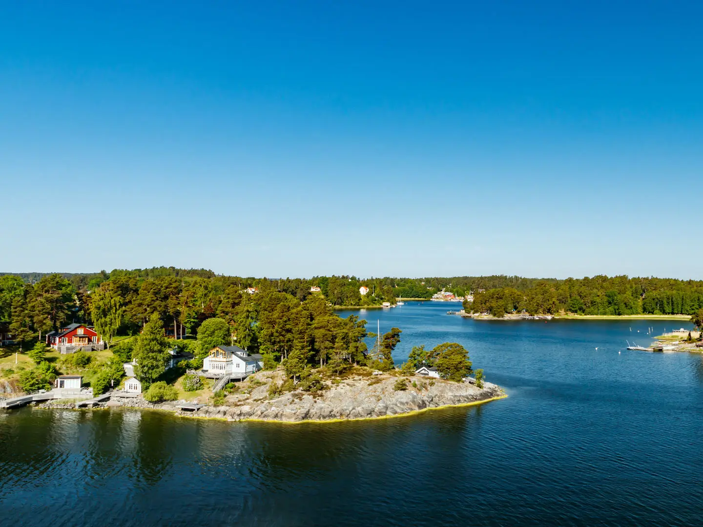
Stockholms Skärgård (Stockholm Archipelago)
How would you rate Stockholms Skärgård (Stockholm Archipelago)?
Tap a star to share your experience and help other hikers.
Stockholm Archipelago Trail: island-hopping through the Baltic
HikeList Score
Stockholms Skärgård (Stockholm Archipelago) scored 89/100 on HikeList's trail-quality metrics.
See score breakdownHide breakdown
- Ideal length 76
- Balanced challenge 90
- Scenery & wildness 98
- Varied terrain 77
- Accommodation 100
- Food & support 88
- Path quality 87
- Season flexibility 89
Computed from length, challenge, scenery & wildness, terrain variety, accommodation, food & support, path quality and season flexibility.
The Stockholm Archipelago Trail, or Skärgårdsleden, is a ~270 km waymarked hiking route through the Stockholm Archipelago in Sweden, linking paths across 20 Baltic islands from Arholma to Landsort. A full thru-hike takes about 18–21 days including ferry transfers, but most hikers walk single island sections or combine a few over a long weekend. Overall difficulty is moderate: many legs are easy road or gravel walking, while others use rooty forest paths and slippery granite rock.
Route Overview
The route runs north to south from Arholma to Landsort (Öja), island by island, rather than as a continuous land path. Waxholmsbolaget public ferries from central Stockholm — mainly Strömkajen and Stadshuskajen — make the logistics workable without a private boat, with one self-service rowing-boat link between Ingmarsö and Finnhamn. The 20 sections include Arholma, Yxlan, Finnhamn, Svartsö, Möja, Sandhamn, Runmarö, Ornö, Utö, Rånö, Nåttarö and Landsort. Most sections are around 12 km; Brottö is the shortest at about 1 km and Ornö the longest at 34.1 km. For other Swedish coastal hikes, compare the Bohus Coast Trail, Höga Kustenleden and Bohusleden.
A new trail built from old island paths
Opened in October 2024, the Stockholm Archipelago Trail connected and waymarked existing island footpaths into one recognised long-distance route. It was conceived by Michael Lemmel and Marie Östblom, co-funded by Tillväxtverket and the European Union, and delivered with Region Stockholm, the Stockholm County Administrative Board and local municipalities. Its stated aim is to spread visitors across more islands, lengthen the walking season and support sustainable tourism in the fragile archipelago environment. National Geographic named it a “Best of the World” destination for 2025.
Notable highlights
- Arholma (northern terminus): A historic outpost island with pilot-station heritage and Arholma Nord, a former naval coastal-defence battery now open as a museum.
- Sandhamn (sailing village): A 17th-century sailing and customs village on Sandön, known for its harbour, waterfront restaurants and Trouville beach.
- Finnhamn and Svartsö (classic short trip): Middle-archipelago islands of pine forest, smooth rock and quiet coves, with hostels and campsites that make them easy to combine.
- Utö (mining history and rougher walking): A larger southern island with medieval iron-mining history, windmills, sandy beaches and some of the trail’s rockier, more challenging terrain.
- Landsort / Öja (southern terminus): A narrow, weather-beaten island with Sweden’s oldest lighthouse, in service since 1689, and a noted bird-migration setting.
- Allemansrätten wild camping: Sweden’s Right of Public Access allows responsible tent camping and berry picking in suitable places, subject to local rules.
Challenges to expect
The main difficulty is not altitude but logistics and surfaces. Ferry timetables control your days, especially outside peak summer, and restaurants or accommodation can be seasonal. Underfoot, expect a mix of gravel roads, forest paths, exposed granite, roots, wet boardwalks and rocky shore. Some short stretches, including parts of Furusund and Yxlan, are not physically marked, so carry a map or GPS route.
HikeList Score
Stockholms Skärgård (Stockholm Archipelago) scored 89/100 on HikeList's trail-quality metrics.
See score breakdownHide breakdown
- Ideal length 76
- Balanced challenge 90
- Scenery & wildness 98
- Varied terrain 77
- Accommodation 100
- Food & support 88
- Path quality 87
- Season flexibility 89
Computed from length, challenge, scenery & wildness, terrain variety, accommodation, food & support, path quality and season flexibility.
 Sweden
Show more data Show less
- Coastal
- Forest
- Rocky
- Dirt
- Gravel
- Paved
- Boardwalk
- Hotels
- Hostels
- B&Bs
- Campsites
- Wild Camping Spots
- Family Friendly
- Pet Friendly
- Restrooms
- Water Sources
- Campsites
- Shelters
- Picnic Areas
Download Our Full Guide to Stockholms Skärgård (Stockholm Archipelago) FREE!
Get our comprehensive guide to this hike for free. Save it for later reading or print out at home.
Photos from hikers
Taken on the trail by people who've reviewed Stockholms Skärgård (Stockholm Archipelago).
Stockholms Skärgård (Stockholm Archipelago): The Complete Guide
 i
Image by Elena Noeva
i
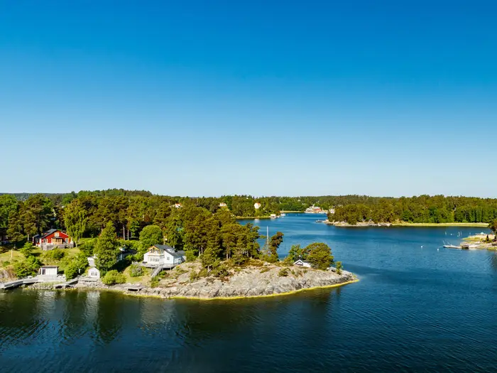
Image by Elena Noeva The Stockholm Archipelago Trail is a rare long-distance walk where the route is stitched together by boats as much as by footpaths. Over about 270 km, it links 20 island sections from Arholma in the northern archipelago to Landsort (Öja) in the south.
This is low, sea-level Sweden: pink-grey granite, pine forest, reed-fringed coves, sandy bays and Baltic horizons. The walking suits day hikers and weekend island-hoppers as well as experienced walkers aiming to complete the full north–south traverse.
Do not expect a continuous land trail or mountain-style effort. The challenge is planning around Waxholmsbolaget ferries, seasonal services, island accommodation and mixed surfaces, from gravel lanes to rooty forest paths, wet boardwalk and slippery rock.
Most sections are easy to moderate, with Utö, Ålö and Nåttarö graded challenging. A full end-to-end journey usually needs 18–21 days including transfers, but the trail is deliberately built so individual islands or short combinations work well.
This guide covers stages, days, accommodation, food, transport, terrain and the common mistakes that catch out first-time archipelago hikers.
Stage-by-Stage Guide
Distances below are the official island-section distances. The Stockholm Archipelago Trail is not a continuous land path: every stage depends on ferry timing, and many services, cafés and accommodation options are seasonal. For each island, carry enough water and food to finish the section unless an open service has been booked or checked in advance.
Stage 1: Arholma section — 13.4 km
Arholma is the northern terminus and a good first test of the route’s character: low island walking, open Baltic views, pine woodland and sections of bare granite rather than sustained climbing. The marked trail begins at the quay on Arholma, so ferry arrival time determines the start of the day.
The main landmark is Arholma Nord, the former Cold War coastal-defence artillery battery now operating as a museum. The island’s history as a pilot-station and customs outpost gives this stage a more maritime feel than many of the quieter middle-archipelago sections.
Underfoot, expect a mix of gravel tracks, lanes, forest path and exposed granite. The rock can be slippery after rain, and progress may be slower than the distance suggests if carrying a full pack.
Food, water and accommodation should be arranged before arrival; do not assume year-round services. Access is by Waxholmsbolaget archipelago ferry, with onward movement governed by the next ferry south or a return towards the mainland. The route is waymarked with the trail’s blue/yellow markings, but the official interactive map is still worth carrying for quay approaches and any local diversions.
Stage 2: Lidö section — 11.9 km
Lidö is a compact island stage with the same classic archipelago mix: shoreline, forest, small clearings and smooth rock. It is a manageable day on paper, but ferry spacing can make it feel longer if there is a tight connection to meet.
Lidö Värdshus is the key accommodation and service point associated with the island. Opening dates and meal availability are seasonal, so book ahead rather than relying on turning up.
The walking is generally low and rolling, with short rises rather than climbs. Watch for wet boardwalk and polished granite after rain, especially where the route comes close to the shore.
Public access is by ferry, normally as part of the Waxholmsbolaget network. Current ferry times, overnight options and any island service opening dates should be checked before travelling. Navigation is waymarked, but keep the official map available because missing a junction can cost valuable time before a ferry departure.
Stage 3: Furusund section — 7.2 km
Furusund is one of the shorter stages, but it needs more navigation care than the distance suggests. This section is not physically waymarked, so it should be walked with the official interactive map or GPS route loaded before setting out.
The stage is useful as a short link in the northern archipelago rather than a big walking day. Expect a mixture of village lanes, gravel and local paths, with the trail staying low and close to the settled island landscape.
Because the section is short, it can be combined with ferry travel or another nearby island if the timetable allows. Do not plan a tight connection without allowing for map-checking and slower navigation through unmarked sections.
Food, water and accommodation availability should be checked before travelling. Ferry access is via the archipelago network, and any mainland connection or road access details should be planned around the current timetable rather than assumed.
Stage 4: Yxlan section — 24 km
Yxlan is the longest northern-archipelago walking day and one of the key stages where logistics and navigation matter more than elevation. At 24 km, it is a full day for most walkers, especially with ferry connections at either end.
This section is also not physically waymarked. Use the official map or a downloaded GPS line throughout, and do not rely on finding blue/yellow trail marks at junctions.
The terrain is likely to feel varied over this distance: lanes and gravel sections make for efficient walking, while forest path, roots and rock slow the pace. As elsewhere in the archipelago, wet granite is the main underfoot hazard rather than steep terrain.
Carry a full day’s food and water unless open services have been checked in advance. Accommodation at or near the end must be arranged island by island, and ferry timing should be treated as part of the stage plan. This is not a stage to start late unless an overnight on Yxlan has been secured.
Stage 5: Finnhamn section — 10.1 km
Finnhamn is one of the most practical middle-archipelago bases, with hostels and campsites noted for the island. It works well as a standalone stage or as part of the classic Finnhamn–Ingmarsö–Svartsö cluster.
The walking is typical middle archipelago: pine forest, smooth granite, coves and short stretches of easier track. The stage is not long, but wet rock and rooty paths can still make footwear choice important.
Finnhamn is also important because of the self-service rowing-boat connection to Ingmarsö. If linking the two stages, the rowing-boat procedure, availability and any local instructions should be checked before travelling.
Food and water availability is seasonal, even on islands with hostels or campsites. Ferry access is by public archipelago boat, with the high-summer Nordlinjen improving island-to-island movement roughly from late June to mid-August. Outside that period, connections may require routing back via mainland hubs.
Stage 6: Ingmarsö section — 9.8 km, with rowing-boat link to Finnhamn
Ingmarsö is a moderate-length island section that is often planned together with Finnhamn because of the short self-service rowing-boat link between the islands. The walking itself is low and varied, with forest, lanes, small-scale island settlement and shoreline sections.
The rowing boat is the main logistical feature. Treat it as part of the day’s plan, not an afterthought: weather, daylight and the need to meet a ferry can all affect how comfortable this link feels. Local instructions for the Båtluffarleden rowing-boat connection should be followed.
Terrain is not mountainous, but the usual archipelago surfaces apply: gravel, roots, boardwalk in wet ground and exposed granite. After rain, allow extra time for careful foot placement on rock.
Carry food and water unless current island services have been checked. Accommodation should be booked on Ingmarsö, Finnhamn or the next island according to ferry times. Navigation is waymarked on the trail section, but the official map is recommended around the rowing-boat link and ferry quays.
Stage 7: Brottö section — about 1 km
Brottö is the shortest official island section, at roughly 1 km. It is best understood as a short connective stage within the island-hopping network rather than a full day’s hike.
Despite the short distance, Brottö is one of the sections that is not physically waymarked. Use the official map or GPS route, particularly if moving quickly between ferry connections.
The terrain should be straightforward compared with the longer forest-and-granite stages, but the same practical rules apply: check the landing point, know where the next ferry leaves from, and do not assume services are available. Food, water and accommodation are better planned on the surrounding larger islands.
Because the section is so short, it can be combined with ferry travel and neighbouring stages when timetables align. Current ferry times should be checked before travelling, especially outside the main summer through-boat season.
Stage 8: Svartsö section — 17.9 km
Svartsö is one of the more substantial middle-archipelago stages and a strong candidate for an overnight stop, with hostels and campsites associated with the island. The distance makes it a proper walking day without being one of the route’s officially challenging sections.
The character is classic Stockholm archipelago: pine forest, smooth granite, sheltered coves and quiet island lanes. Expect a steady alternation between easier gravel or road walking and slower forest or rocky ground.
Svartsö pairs naturally with Finnhamn and Ingmarsö, but ferry timing still controls what is realistic. In high summer, the Nordlinjen can make through-island movement simpler; outside that window, connections often thin out and may route via the mainland.
Food, water and accommodation should be checked and booked in advance, especially outside peak season. Navigation is waymarked, but carry the official map for ferry-approach details and to avoid losing time at junctions.
Stage 9: Möja section — 13.8 km
Möja has a stronger village and working-island feel than some of the quieter forested sections. It is known for traditional fishing and boat-building, a summer harbour and the Möja archipelago museum.
The stage is moderate in length and should be planned as a full island day if ferry times are limited. Terrain is a mixture of village lanes, tracks, woodland and coastal rock, with short ups and downs rather than long climbs.
Services on Möja are seasonal, so food, water and any accommodation should be checked before travelling. The island is served by public ferry, and current Waxholmsbolaget departures are central to planning both arrival and onward travel.
Navigation is waymarked, but the route still crosses a lived-in island landscape where lanes, side tracks and harbour areas can be confusing. Keep the official map accessible, and allow extra time if visiting the museum or harbour rather than walking directly through.
Stage 10: Grinda section — 9.8 km
Grinda is a popular and relatively accessible island nature reserve, with short, gentle walking compared with the longer remote-feeling stages. It is a good recovery day in an end-to-end schedule or a practical single-island outing from Stockholm.
The island has an early-1900s värdshus, accommodation options and sandy swimming spots. Because Grinda is popular, summer availability can be tight; book accommodation and check meal opening times before relying on them.
Terrain is generally forgiving by archipelago standards, but still includes forest paths, gravel, shoreline rock and some rooty sections. Wet granite remains slippery even on easier islands.
Access is particularly practical because Grinda is served by Waxholmsbolaget and also by Strömma’s Cinderella boats in season. Navigation is waymarked, though the official map remains useful around quays, accommodation areas and short side paths to beaches.
Stage 11: Sandhamn section, Sandön — 8.1 km
Sandhamn on Sandön is one of the most serviced and best-known stops on the route. The village is a historic sailing and customs settlement, with a busy harbour, Seglarhotell, waterfront restaurants and the broad sandy beach at Trouville.
The walking is comparatively short, but the island can feel busier than the quieter northern and middle-archipelago stages. Expect a mix of sandy ground, village lanes, pine forest and coastal paths rather than sustained rough going.
Food and accommodation are more available here than on many islands, but also more seasonal and demand-led. Book ahead, especially in summer, and check current restaurant and hotel opening dates.
Sandhamn is served by public ferries and by Strömma’s Cinderella boats in season, making it one of the easier stages to slot into a weekend itinerary. Navigation is waymarked, but harbour areas and beach side-trips can distract from the main route; keep the official map handy.
Stage 12: Runmarö section — 18.5 km
Runmarö is a longer middle-to-southern archipelago stage and needs a proper day’s allowance. The distance is not extreme, but the combination of ferry timing, lanes, forest and rocky ground can make it demanding with a full pack.
The stage should be treated as self-sufficient unless current services have been checked. Carry enough food and water to reach the end of the section, and arrange accommodation before arrival if staying on or near the island.
Terrain is typical for the route: low but broken, with gravel or paved sections interspersed with forest paths, roots, boardwalk and exposed granite. After rain, the rock and wooden sections may be slow and slippery.
Access is by ferry through the archipelago network, often planned via mainland hubs such as Stavsnäs for this part of the archipelago. Exact connections should be checked before travelling. Navigation is waymarked, but a downloaded route is recommended because missing a turn can have knock-on effects for ferry departures.
Stage 13: Nämdö section — 13.1 km
Nämdö is a moderate-length island stage that fits well between the longer Runmarö and Ornö days. It offers the familiar mix of quiet island walking, forest, meadows, shoreline and low granite rather than any major climb.
The route is best planned around the ferry timetable, with enough slack for slower going on wet rock or boardwalk. The island setting can make distances deceptive: a missed ferry may mean a long wait rather than a quick road exit.
Food, water and accommodation availability should be checked before travelling. There is no continuous hut system on the Stockholm Archipelago Trail, so each overnight must be planned island by island, or by responsible camping where permitted under allemansrätten and local nature-reserve rules.
Navigation is waymarked, but carry the official map and a charged phone or GPS. Weather exposure is mainly coastal rather than mountainous: wind and rain can make open rock and ferry waiting points feel much harsher than the elevation suggests.
Stage 14: Ornö section — 34.1 km
Ornö is the longest single section of the trail and should be treated as one of the biggest planning days of the full traverse. It is the largest island on the route, with forest, manor history, small lakes and varied walking.
At 34.1 km, this stage is not just a long walk; it is a long island walk where ferry timing, daylight and accommodation availability all matter. Many walkers will prefer to split the island if suitable accommodation or camping arrangements are available. This should be checked before travelling.
Terrain varies between more efficient lanes or tracks and slower forest, root, boardwalk and granite sections. The route remains low, but repeated small rises, rough footing and the need to keep moving can make it tiring.
Carry a full day’s food and water unless open services have been checked. Ferry and road access should be planned carefully, commonly involving the southern archipelago network and mainland hubs such as Dalarö or Nynäshamn depending on the wider itinerary. Navigation is waymarked, but a downloaded map is strongly recommended because the length leaves little margin for avoidable detours.
Stage 15: Fjärdlång section — 11.7 km
Fjärdlång is a moderate island stage after the long Ornö day. It offers a more contained archipelago walking experience, with forest, shoreline rock and quieter paths.
The distance is manageable, but the island-hopping context still matters. A late ferry arrival can turn an easy-looking stage into a rushed afternoon, especially if accommodation or the next boat is fixed.
Expect the normal mix of gravel, path, roots, boardwalk and granite. Wet conditions make the exposed rock the main caution point; trekking poles can be useful for balance on slick slabs and uneven forest ground.
Food, water and accommodation should be checked before travelling. Ferry access is by the public archipelago network, with high-summer through-services making island-to-island movement easier than in shoulder season. Navigation is waymarked, but the official map should still be used around quays and any route junctions.
Stage 16: Utö section — 18.4 km, challenging
Utö is one of only three sections officially graded challenging, and it should not be underestimated. The island is larger, rockier and more varied than many earlier stages, with medieval iron-mining heritage, preserved windmills, sandy beaches and some of the trail’s rougher terrain.
The challenge is underfoot rather than vertical. Expect slower movement over rock, roots and uneven paths, plus exposed granite that becomes slippery when wet. The 18.4 km distance can feel harder than similar-length stages on easier islands.
Utö has established visitor infrastructure, including Utö Värdshus, but food, water and accommodation still need checking and booking in advance. Summer demand can be high, while shoulder-season opening dates may be limited.
Access is by ferry, and Utö is also important for the onward connection towards Ålö. Navigation is waymarked, but pay close attention where the route leaves busier village or harbour areas for rougher paths. If combining Utö with Ålö, build in time for the Utö–Ålö connector and avoid planning around the last possible ferry.
Stage 17: Rånö section — 12 km
Rånö is a moderate southern-archipelago stage between the tougher Utö/Ålö/Nåttarö sections. It can function as a shorter walking day in a full traverse, depending on ferry timings and where accommodation has been booked.
The terrain remains typical of the route: forest, gravel, shore paths, rock and possible wet boardwalk. It is low-level walking, but the surface can still be tiring after several consecutive island days.
Food, water and accommodation availability should be checked before travelling. Do not assume that a shorter section means easy resupply; on smaller islands, services may be limited or seasonal.
Public transport access is by ferry through the southern archipelago network, with Nynäshamn one of the relevant mainland hubs for this part of the route. Navigation is waymarked, and the official map is useful for coordinating the walking line with the correct quay and onward boat.
Stage 18: Ålö section — 13.2 km, challenging, plus Utö–Ålö connector about 4.6 km
Ålö is the second of the officially challenging southern sections. The stage distance is 13.2 km, but if linking directly from Utö the additional Utö–Ålö connector of about 4.6 km must be included in the day’s total.
The walking is rougher than the average archipelago stage, with rocky and uneven paths, forest sections and exposed granite. Wet weather can slow progress significantly, and this is a stage where footwear with reliable grip matters.
Food and water should be carried unless current services have been checked. Accommodation should be arranged before arrival, either on the relevant island or by using ferry connections to a booked overnight elsewhere.
Navigation is waymarked on the stage, but the connector and ferry logistics need careful planning. Do not schedule this as a tight transfer day: a small delay on rough ground can affect the ability to catch the onward boat.
Stage 19: Nåttarö section — 9.5 km, challenging
Nåttarö is short but officially challenging, so the distance should not be judged like an easy 10 km road walk. The island is known for fine sandy beaches, caves and Stora Sand bay, but the paths are rocky and up-and-down by archipelago standards.
Expect rougher footing, short rises and descents, roots, rock and shoreline sections. Wet granite is the main hazard, and the harder terrain can be awkward if carrying a heavy thru-hiking pack.
The beaches make this a rewarding stage in settled weather, but they also mean the island can be more attractive in summer. Food, water and accommodation or camping arrangements should be checked before travelling.
Ferry access is through the southern archipelago network, with Nynäshamn relevant as a mainland hub. Navigation is waymarked, but keep the official map ready around beach areas and side paths so that the main trail is not confused with local routes.
Stage 20: Landsort section, Öja — 10.7 km
The final stage crosses Öja to Landsort, the southern terminus of the Stockholm Archipelago Trail. This is a narrow, weather-exposed island with a strong maritime feel and open Baltic horizons.
The key landmark is Landsort lighthouse, Sweden’s oldest lighthouse, first lit in 1689. The island also has a partly preserved coastal-artillery battery and a renowned bird-migration observatory, making this stage feel distinct from the forested middle-archipelago islands.
Terrain remains low but can be exposed to wind and weather. Expect granite, coastal paths, village sections and uneven ground rather than any major ascent. In poor weather, allow extra time and keep waterproof layers accessible rather than buried in the pack.
Food, water, accommodation and return transport should be arranged before arrival, as this is the end of the island chain rather than a place to improvise onward walking. Public ferry connections link Landsort/Öja with the southern archipelago transport network and Nynäshamn area, but current timetables should be checked before travelling. Navigation is waymarked, though the official map is still useful for the final approach, quay location and any local route changes.
Recommended Itinerary
Standard 20-day end-to-end itinerary
This is the cleanest way to plan the full Skärgårdsleden: one official island section per walking day, with ferry transfers fitted around the route rather than assumed to run on demand. It suits walkers who want to complete every section without turning the journey into a race.
The itinerary works best in the high-summer through-boat period, when the Nordlinjen and Sydlinjen make island-to-island travel more straightforward. Outside roughly late June to mid-August, expect more routing via mainland hubs such as Vaxholm, Stavsnäs, Dalarö, Norrtälje and Nynäshamn, and allow extra time. Current Waxholmsbolaget timetables, accommodation opening dates and any trail diversions should be checked before travelling.
| Day | From | To | Approx. distance | Why this stage makes sense | Services/accommodation notes |
|---|---|---|---|---|---|
| 1 | Arholma | Arholma section | 13.4 km | A manageable first section from the northern terminus, starting at the quay on Arholma. It gives time to adjust to archipelago surfaces before the longer middle-island days. | Arholma is reached by Waxholmsbolaget ferry. Book an overnight or plan the onward ferry before committing to the start date. |
| 2 | Lidö | Lidö section | 11.9 km | Another moderate-length island day, useful while settling into the ferry rhythm. | Lidö Värdshus is one of the named island accommodation options on the route, but opening dates are seasonal and should be checked before booking. |
| 3 | Furusund | Furusund section | 7.2 km | A short day, but not one to treat casually because Furusund is one of the unmarked sections. Use the official interactive map or GPS. | Keep the day flexible around ferry times. Do not rely on waymarks here. |
| 4 | Yxlan | Yxlan section | 24 km | One of the longer northern stages and also unmarked, so it deserves an early start and settled navigation. | Carry what is needed for the full day and check the next ferry connection in advance. This is not a good stage to leave to late-afternoon improvisation. |
| 5 | Finnhamn | Finnhamn section | 10.1 km | A shorter middle-archipelago stage after Yxlan, with classic pine, granite and cove walking. | Finnhamn has hostel and campsite options, but seasonality matters. Book ahead in busy summer periods. |
| 6 | Ingmarsö | Ingmarsö section, including the Ingmarsö–Finnhamn rowing-boat link | 9.8 km, plus ~0.4 km rowing link | A compact walking day, but logistically distinctive because the Finnhamn–Ingmarsö connector uses a self-service rowing boat. | Check current instructions for the rowing-boat link before relying on it. Build in time for the crossing and avoid planning this as a tight ferry-change day. |
| 7 | Brottö | Brottö section | ~1 km | The shortest section on the trail. It is best treated as a transfer-and-positioning day rather than a full hiking day. | Brottö is also unmarked, so use the official map/GPS even though the distance is short. This is a logical day to absorb ferry waiting time. |
| 8 | Svartsö | Svartsö section | 17.9 km | A substantial but sensible middle-island day, longer than the preceding stages but still below the biggest southern distances. | Svartsö has hostel and campsite options. Check availability and seasonal opening before planning it as a guaranteed overnight. |
| 9 | Möja | Möja section | 13.8 km | A moderate day on one of the route’s key inhabited islands, with enough distance to feel like a proper walking stage without pushing the pace. | Möja has summer harbour activity and village services, but island services are seasonal. Confirm food and accommodation before arrival. |
| 10 | Grinda | Grinda section | 9.8 km | A shorter, gentler stage and a useful recovery day after several middle-archipelago sections. | Grinda is a popular island with accommodation options including an inn, so booking ahead is sensible in high season. |
| 11 | Sandhamn (Sandön) | Sandhamn section | 8.1 km | A short walking day that fits well around ferry arrivals and departures to one of the archipelago’s busiest islands. | Sandhamns Seglarhotell and waterfront services make this one of the easier places to organise a comfortable overnight, but it is also popular and seasonal booking is important. |
| 12 | Runmarö | Runmarö section | 18.5 km | A longer day after two shorter sections, keeping the north-to-south progression moving without yet reaching the hardest terrain. | Arrange the overnight and onward ferry before starting. Carry food and wet-weather layers rather than assuming flexible resupply. |
| 13 | Nämdö | Nämdö section | 13.1 km | A moderate stage that works well before the longest single section of the entire route. | Use this day to position carefully for Ornö. Ferry and accommodation arrangements for the next stage should already be fixed. |
| 14 | Ornö | Ornö section | 34.1 km | The longest section on the trail and the major distance test of the standard itinerary. Start early and avoid loading this day with complicated onward travel. | Do not start without a clear end-of-day plan. If aiming to split or shorten the day, check official mapping, transport and accommodation before booking. |
| 15 | Fjärdlång | Fjärdlång section | 11.7 km | A shorter day after Ornö, useful for recovery and for resetting ferry logistics before the southern challenging sections. | Seasonal accommodation and camping arrangements should be checked in advance. Keep plans flexible if ferries dictate a later start. |
| 16 | Utö | Utö section | 18.4 km | The first of the officially challenging sections, with rockier ground and more demanding underfoot conditions rather than major ascent. | Utö has named accommodation at Utö Värdshus, plus other island facilities in season. Book ahead and do not assume late availability. |
| 17 | Rånö | Rånö section | 12 km | A moderate-length stage between the tougher southern islands, useful for managing fatigue before Ålö and Nåttarö. | Check ferry timings carefully, especially if linking this day with transfers to or from Utö/Ålö. |
| 18 | Ålö | Ålö section, with the Utö–Ålö connector | 13.2 km, plus ~4.6 km connector | Although not the longest day, Ålö is graded challenging and should be planned for slow progress over rougher ground. | Treat the connector and onward travel as part of the day’s logistics. Check mapping and ferries before fixing accommodation. |
| 19 | Nåttarö | Nåttarö section | 9.5 km | A short but challenging southern section, where rocky, up-and-down paths can take longer than the distance suggests. | Do not judge the day by kilometres alone. Confirm seasonal services and overnight options before travelling. |
| 20 | Landsort (Öja) | Landsort section, southern terminus | 10.7 km | A fitting final stage: moderate distance, exposed island terrain and a clear end point at Landsort/Öja. | Plan the return ferry and onward travel via the Nynäshamn side before the final day. Timetables should be checked before travelling. |
Slower variant: 21 days or more
A slower schedule suits walkers travelling outside the peak through-boat season, anyone relying heavily on island accommodation rather than camping, and hikers who prefer not to combine ferry pressure with long walking days.
The most useful extra time is a buffer day before or after Ornö, or around the southern trio of Utö, Ålö and Nåttarö. Ornö is the obvious stage to treat with caution because it is 34.1 km, but any attempt to split it depends on current accommodation, transport and official mapping. This should be checked before travelling.
A slower plan is also more forgiving if wind, rain or ferry connections disrupt the neat one-section-per-day rhythm. Wet granite, roots and boardwalks can slow progress even when ascent is negligible.
Faster variant: about 18 days
A faster end-to-end walk is realistic only for fit, well-organised hikers with light packs, firm accommodation plans and good ferry connections. It is most plausible in the high-summer Nordlinjen/Sydlinjen period, when through-boat links reduce the need to route back through the mainland.
Time is usually saved by treating very short sections, especially Brottö, as part of a transfer day, and by pairing shorter walking stages where ferry times make that possible. Do not assume this will work from the map alone: current timetables and the official route planner should be checked before booking.
The faster variant should not compress the hardest days blindly. Yxlan is long and unmarked, Ornö is the longest section, and Utö, Ålö and Nåttarö are the only sections graded challenging; those are the stages where extra time is more valuable than an ambitious schedule.
Planning the Route
The Stockholm Archipelago Trail is best planned as a chain of island walks, not as a conventional end-to-end footpath. The walking itself is usually manageable, but each day has to fit ferry departures, accommodation opening dates and the amount of food and water available on the next island.
For a full north-to-south traverse, allow 18–21 days rather than trying to compress the route. That gives enough margin for ferry connections, short island sections that do not fill a whole day, and longer or rougher sections such as Yxlan, Ornö, Utö, Ålö and Nåttarö.
Choose the right format
| Plan | Best for | Practical notes |
|---|---|---|
| Single-island day walk | Casual walkers, families, Stockholm-based trips | Choose islands with straightforward ferry access and short sections, such as Grinda, Sandhamn or Brottö. Check return ferries before committing to the walk. |
| Two- or three-island weekend | Most independent hikers | Works well where ferries and accommodation line up, especially in the middle archipelago. Finnhamn, Ingmarsö and Svartsö are natural candidates, but timetables dictate what is realistic. |
| Full thru-hike | Experienced, organised hikers | Plan it as an island-hopping itinerary with booked nights and ferry legs fixed in advance. A few buffer hours, and ideally some schedule slack, are useful. |
| Section hiking over several trips | Very practical | This is one of the best ways to walk the route. Each island section stands alone, so it is easy to return for unfinished sections when ferries and accommodation suit. |
Build the itinerary around ferries first
Ferries are the main constraint. Waxholmsbolaget is the key operator, with boats from central Stockholm at Strömkajen and mainland archipelago hubs including Vaxholm, Stavsnäs, Dalarö, Norrtälje and Nynäshamn. Strömma’s Cinderella boats also serve popular islands such as Vaxholm, Grinda and Sandhamn.
In high summer, the Nordlinjen and Sydlinjen through-boats make island-to-island planning much easier, running through much of the route roughly from late June to mid-August. Outside that period, connections thin out and many moves may need to be routed via the mainland. Current timetables, through-boat dates and the Waxholmsbolaget Boat Hopping pass should be checked before travelling.
Do not assume that a short walking day means an easy logistics day. Brottö is only about 1 km, while Furusund is 7.2 km and Sandhamn 8.1 km, but the usable day still depends on when the boat arrives and leaves. Conversely, long sections such as Yxlan at 24 km and Ornö at 34.1 km need early starts or overnight planning that fits the ferry schedule.
Plan accommodation island by island
There is no continuous hut chain. Accommodation is a mix of hotels, värdshus, vandrarhem, B&Bs, guesthouses, campsites and shelters, concentrated on the larger or better-served islands such as Utö, Sandhamn, Lidö, Grinda, Finnhamn and Svartsö.
Book each night separately and check opening dates carefully. Many island services are seasonal, and a place that works in July may not be open or convenient in May, September or outside the main season. Payment and bookings are in Swedish krona, not euros.
Allemansrätten allows responsible one-night wild camping in suitable places, but it is not a substitute for planning. Nature-reserve rules, private land, livestock areas, fire restrictions and sensitive coastal habitats all matter. Where camping is part of the plan, the legal and practical position for that specific island should be checked before travelling.
Food and water planning
Food planning should be conservative. Some islands have restaurants, cafés or seasonal shops, but availability changes with the season and opening hours can be limited. Carry enough food to finish the current section and to cover a missed meal or delayed ferry.
Water is equally worth planning in advance. Do not rely on finding untreated natural water on low granite islands, and do not assume every quay or accommodation stop has a publicly available tap. Fill up whenever there is a reliable opportunity, and check water availability for remote or off-season nights before travelling.
Navigation and waymarking
Most sections are waymarked with blue and yellow bands and arrows, but navigation should not be treated as automatic. Carry the official interactive map or GPS route, especially where forest paths, granite slabs and shoreline tracks make the line less obvious.
Three sections require particular attention: Brottö, Furusund and Yxlan are not physically marked and need map or GPS navigation. These are not technically difficult in mountain terms, but a missed turn can cost time when there is a ferry to catch.
The Ingmarsö–Finnhamn link uses a self-service rowing boat, so build in extra time and avoid treating it like a guaranteed timed ferry. The Utö–Ålö connector is another separate link to include when calculating the southern stages.
Pace and daily mileage
A fast schedule is rarely the best approach. The islands are low, but progress can be slowed by rooty forest paths, wet boardwalk, slippery granite, rocky shoreline and repeated short rises rather than sustained climbs. Wet rock is the main underfoot hazard.
The official sections vary widely in length, so some days are naturally short and others are demanding. Ornö is the longest single section at 34.1 km and should be treated as a full walking day. Utö, Ålö and Nåttarö are the only sections graded challenging and are better planned with spare time rather than squeezed between tight ferry connections.
Shortening, extending and bailing out
The route is very easy to shorten in theory because each island section is independent. In practice, the options depend on ferry frequency and season. Popular islands and mainland hubs give the most flexibility; quieter islands may leave few same-day alternatives.
This makes the trail well suited to section hiking. A sensible approach is to pick a cluster of islands, plan the ferry in and out, then book accommodation only where the transport works. For a full traverse, identify a few practical exit points via mainland hubs before setting off, especially outside the high-summer through-boat period.
What to fix before booking
Before committing to dates, line up the essentials in this order:
- Ferries: arrival, onward boat and exit route for every island.
- Accommodation: confirmed opening dates and location relative to the trail and quay.
- Food and water: what is available on each island, and what must be carried.
- Navigation: downloaded route, official map access and a plan for Brottö, Furusund and Yxlan.
- Weather and surfaces: footwear and clothing for wet granite, boardwalk and exposed coastal wind.
- Camping rules: if using allemansrätten, check nature-reserve restrictions and fire rules for the specific island.
The main planning mistake is treating the trail as a continuous footpath where the next village automatically solves the next problem. On Skärgårdsleden, the next stage only works when the boat, bed, food and map all line up.
Towns, Villages and Overnight Stops
Accommodation on Skärgårdsleden is planned island by island. There is no continuous hut chain, and many island hotels, värdshus, hostels, B&Bs, campsites and cafés are seasonal, so overnight stops should be booked around ferry times rather than treated as walk-up facilities.
For a full north-to-south traverse, carry enough food to cover gaps between served islands. On smaller or less developed sections, assume limited or no shop provision unless accommodation has specifically stated that meals or supplies are available. Current opening dates, ferry times and prices should be checked before travelling.
Responsible one-night wild camping is possible in suitable places under allemansrätten, but nature-reserve rules and local restrictions still apply. It is most useful as a backup on quieter islands, not a substitute for planning food, water and ferry connections.
Arholma
Arholma is the northern terminus, and the trail starts at the quay on the island. It is a sensible first overnight if arriving late by archipelago ferry or if starting the 13.4 km Arholma section the following morning.
Accommodation is seasonal and should be arranged before arrival. Do not assume shops or food service will be open outside the main visitor season; carry at least the first day’s food if timings are tight.
Arholma is reached by Waxholmsbolaget ferry. It is worth allowing time here rather than rushing straight onto the trail, as the island has the former Arholma Nord coastal-defence battery and open-sea views that set the character for the northern archipelago.
Lidö
Lidö is the second island section, with an 11.9 km walk. It is one of the more practical early overnight stops because Lidö Värdshus is a known island lodging option.
Book ahead and check the season carefully. Food provision should be treated as tied to whatever is open on the island, rather than assumed as a permanent shop-and-café stop.
Lidö is linked by public archipelago ferry, so walkers should line up the previous and following boat connections before committing to a night here. It works well as a slower start to the route after Arholma rather than trying to push too many northern islands into one day.
Furusund
Furusund has a short 7.2 km trail section, but it needs extra navigation attention because it is one of the sections not physically waymarked. Use the official map or GPS track rather than relying on painted trail markers.
It can be treated as a light walking day, a ferry-transfer day, or combined with nearby logistics if the timetable allows. Accommodation and food details vary and should be checked before travelling.
Because the walking distance is short, the main reason to stop here is usually transport timing rather than trail difficulty. If ferry connections line up well, many hikers will move on rather than make Furusund a full overnight.
Yxlan
Yxlan is a longer 24 km island section and is also not physically waymarked. It needs a more deliberate plan than its low elevation suggests: navigation, daylight and ferry departure times all matter.
An overnight on or near Yxlan can make sense if the ferry timetable does not support a comfortable same-day transfer, but accommodation availability is not something to assume. This should be checked before travelling.
Food should be carried for the day. Treat Yxlan as a proper full walking stage, not as a short island stroll, especially outside high summer when onward connections may be thinner.
Finnhamn
Finnhamn is one of the strongest middle-archipelago overnight stops. The island has hostels and campsites, and its 10.1 km section fits naturally with a relaxed walking day or a weekend pairing with nearby islands.
It is also logistically important because the Finnhamn–Ingmarsö link uses the self-service rowing boat on the Båtluffarleden connection. Build in time for this crossing and do not plan it as if it were a scheduled ferry.
Food and café provision is seasonal. If staying in a hostel or campsite, check whether meals, cooking facilities or supplies are available at the time of year booked.
Ingmarsö
Ingmarsö sits immediately on the other side of the rowing-boat link from Finnhamn and has a 9.8 km section. It is a useful stop when pairing these islands, but the crossing itself should be treated as part of the day’s logistics.
Accommodation and food availability should be checked before travelling. Do not rely on being able to resupply here unless a specific service has been booked or is open for the season.
The main planning point is timing: the rowing-boat connection, walking time and the next ferry all need to fit together. In poor weather or late in the day, it is better to have a conservative overnight plan than to depend on a tight onward connection.
Brottö
Brottö is the shortest section of the trail, at about 1 km, and it is not physically waymarked. It is more of a connector-style walking stop than a major overnight destination.
Most walkers will fold Brottö into a ferry-transfer day rather than stay specifically for the walking. Accommodation and food options should not be assumed; this should be checked before travelling.
Because the trail distance is so short, the practical issue is navigation and timing rather than stamina. Have the official map available and know the next ferry before stepping off the boat.
Svartsö
Svartsö is a key middle-archipelago overnight island, with a 17.9 km trail section and known hostel and campsite provision. It is one of the better places to slow down, dry gear, and avoid over-stacking ferry transfers.
Book accommodation ahead, especially in the main summer season. Food provision is seasonal, so check whether meals or cooking facilities are available and carry supplies if staying self-catered.
Svartsö pairs naturally with Finnhamn and other middle-archipelago sections. Its length also makes it a more substantial walking day than many of the shorter islands, so avoid planning a late arrival unless onward transport and lodging are secure.
Möja
Möja is a traditional fishing and boat-building island with village life, a summer harbour and the Möja archipelago museum. Its 13.8 km section makes it a worthwhile overnight candidate rather than only a quick transfer stop.
Accommodation and food should be booked or checked in advance. Summer services can make the island feel well served, but that should not be assumed in spring, autumn or on quieter weekdays.
Möja is a good place to pause for the cultural side of the archipelago as well as the walking. For a continuous traverse, it also helps break the middle part of the route into more manageable ferry-and-walk stages.
Grinda
Grinda is one of the easiest overnight stops to plan, with a known värdshus, a popular nature-reserve setting and short, gentle walking on its 9.8 km section. It is also one of the islands served by Strömma’s Cinderella boats in addition to the wider ferry network.
Accommodation and meals should still be booked ahead, particularly in summer. The island’s popularity does not guarantee same-day beds or open food service outside the main season.
Grinda is a good choice for hikers wanting a lower-effort day, a reset night, or a simple section walk from Stockholm. Sandy swimming spots make it attractive in warm weather, but ferry times remain the controlling factor for the day.
Sandhamn (Sandön)
Sandhamn is the most service-oriented stop on the route. It has Sandhamns Seglarhotell, a harbour, waterfront restaurants and the broad Trouville sandy beach nearby, making it one of the easiest places to plan an overnight with food.
It is still seasonal and can be busy, so accommodation should be reserved rather than left to chance. Restaurant opening hours should be checked outside peak summer.
Sandhamn’s 8.1 km section is relatively short, so many hikers use it as a recovery or half-day stage. It is also served by Strömma’s Cinderella boats, making it a practical access or exit point for section-hikers.
Runmarö
Runmarö has an 18.5 km section, so it is a more serious walking day than several of the smaller islands. It can work as an overnight stop if accommodation is arranged, but services should not be assumed.
Carry food unless a specific meal or supply option has been confirmed with the place you are staying. Ferry timing is especially important here because the section is long enough to leave little margin if starting late.
For section-hikers, Runmarö is best planned as a full day rather than a casual add-on after another island. Check whether the day’s final boat is realistic before committing to walking the whole section in one go.
Nämdö
Nämdö sits in the southern half of the trail and has a 13.1 km section. It is a useful potential overnight between Runmarö and the longer southern islands.
Accommodation and food options should be checked before travelling. As with other quieter islands, the safest assumption is that services are seasonal and may be limited outside the busiest period.
Nämdö is best used as part of a carefully timed ferry sequence. If the next connection does not line up, staying overnight may be more sensible than forcing a late transfer.
Ornö
Ornö is the largest island on the route and has the longest single section at 34.1 km. This is one of the most important accommodation-planning points on the whole trail.
Do not treat Ornö as just another low-level island stage. Even without major ascent, the distance, mixed surfaces and ferry logistics make it a long day, and walkers should check whether an overnight on or near the island is needed.
Food should be carried for the full section unless specific services have been checked in advance. Ornö’s forested terrain, small lakes and varied walking make it rewarding, but the practical priority is avoiding a rushed finish against the last ferry.
Fjärdlång
Fjärdlång has an 11.7 km section and sits between the longer Ornö stage and the southern islands around Utö. It can be useful as a quieter overnight if accommodation or camping arrangements fit the ferry timetable.
No fixed food or lodging assumption should be made. This should be checked before travelling, and walkers should carry enough food to cover the stage.
Fjärdlång often functions best as a buffer in the itinerary. It gives flexibility after Ornö and before moving into the more challenging southern sections.
Utö
Utö is one of the most practical and rewarding southern overnight stops. It has Utö Värdshus, medieval iron-mining heritage, preserved windmills, sandy beaches and an 18.4 km section graded challenging.
Book accommodation ahead and check opening dates. Food provision is more likely here than on smaller islands, but meals and shops should still be checked before relying on them.
Utö is a good place to build in a stronger overnight plan before or after the rockier southern walking. The terrain is more demanding underfoot than the elevation profile suggests, so a late ferry arrival followed by the full section is rarely ideal.
Rånö
Rånö has a 12 km section and sits within the southern island sequence between Utö, Ålö and Nåttarö. It is a useful staging point only if the ferry plan and accommodation or camping arrangements are clear.
Food and lodging should not be assumed. This should be checked before travelling, and hikers should carry supplies for the day.
Rånö’s role is mainly logistical: it helps break the southern archipelago into workable pieces. Pay close attention to ferry timing, as the surrounding sections include some of the route’s more challenging terrain.
Ålö
Ålö is a challenging section of 13.2 km, with the Utö–Ålö connector adding around 4.6 km to the logistics. It should be planned as part of the southern trail block rather than treated as a simple short walk.
Accommodation and food availability should be checked before travelling. Carry enough food and water for the full day, especially if combining the connector with the main section.
The main reason to stop on or near Ålö is to avoid overloading the Utö–Rånö–Nåttarö sequence. Wet rock and rougher surfaces can slow progress, so leave more time than the distance alone suggests.
Nåttarö
Nåttarö is one of the three challenging sections, with 9.5 km of rocky, up-and-down walking. It is known for fine sand beaches, caves and Stora Sand bay, but the terrain still needs proper footwear and careful timing.
An overnight can work well if accommodation or camping is arranged, particularly if ferry times make a same-day onward journey awkward. Food service should not be assumed and should be checked before travelling.
Nåttarö is often a place where the route feels physically tougher than the map distance implies. Build in margin for slower walking on rock and roots, especially in wet conditions.
Landsort (Öja)
Landsort, the village on Öja, is the southern terminus. The final 10.7 km section ends the route on Sweden’s southernmost archipelago island, with the country’s oldest lighthouse, a partly preserved coastal-artillery battery and a bird-migration observatory.
It is a strong final overnight if accommodation is available, especially if ferry times would otherwise make the finish rushed. Lodging and food should be booked or checked in advance, as this is not a place to rely on unplanned services.
The main ferry access for the southern end is through the Nynäshamn side of the archipelago network. Confirm current boat times before fixing a finish date, particularly outside the high-summer through-boat period.
Mainland ferry hubs and fallback overnights
Several mainland hubs are important for section-hiking, resupply and backup accommodation even though they are not trail sections: Stockholm, Vaxholm, Stavsnäs, Dalarö, Norrtälje and Nynäshamn. Waxholmsbolaget ferries run from central Stockholm at Strömkajen and from these archipelago hubs, while Strömma’s Cinderella boats serve popular islands such as Vaxholm, Grinda and Sandhamn.
Outside the Nordlinjen and Sydlinjen high-summer through-boat period, mainland routing becomes much more important. If an island accommodation date or ferry connection does not work, it may be easier to return to a mainland hub for the night and rejoin the route the next day.
This is also the safest resupply strategy for a full traverse. Use served islands such as Grinda, Sandhamn and Utö where possible, but do not depend on every island having open shops, restaurants or late transport.
Getting to the Start
The northern terminus is on Arholma, an island in the northern Stockholm Archipelago. The marked Stockholm Archipelago Trail begins at the quay (kajen) on Arholma, so the final approach is by Waxholmsbolaget archipelago ferry.
Ferry planning matters more than the land journey. Check the current Waxholmsbolaget timetable before fixing accommodation, especially outside high summer, when connections thin out and routes may require travel via mainland hubs rather than island-to-island through-boats. This should be checked before travelling.
By train
Arholma has no train station. For most rail-based journeys, Stockholm is the practical gateway: arrive in the city, then connect either to Waxholmsbolaget boats from Strömkajen in central Stockholm or continue by public transport towards a northern mainland ferry hub such as Norrtälje.
Do not assume a same-day rail, bus and ferry connection will line up with a comfortable walking start on Arholma. The first stage is an island circuit beginning at the quay, so many walkers are better served by reaching Arholma the day before they intend to walk.
By bus
Bus travel is useful for reaching mainland archipelago hubs before taking a ferry to Arholma. For the northern start, the key mainland area to plan around is Norrtälje, which is one of the Waxholmsbolaget ferry hubs serving the archipelago.
Specific bus routes, transfer points and seasonal ferry connections should be checked before travelling. Build in a margin: a missed bus-to-boat connection can mean losing the day, particularly outside the late-June to mid-August high-summer period.
By car
Driving can work if you only plan to walk Arholma as a single section, or if someone is dropping you at a mainland ferry departure point. For a full north-to-south traverse to Landsort (Öja), leaving a car near the start is usually awkward because the finish is far to the south and also island-based.
Long-stay parking near the relevant mainland ferry departure point should be checked before travelling. Do not rely on small harbour parking being suitable for multi-day use unless current local rules allow it.
From the nearest airport
The nearest practical air gateway is Stockholm. From there, transfer into the city for Waxholmsbolaget departures from Strömkajen, or continue onwards to a mainland archipelago hub for a shorter ferry approach to Arholma.
Allow generous time between flight arrival and the ferry. Late arrivals may require an overnight in Stockholm or on the northern mainland before continuing to Arholma the next day.
Where to stay before starting
The cleanest start is to overnight on Arholma and begin walking from the quay the following morning. This avoids depending on a morning ferry and gives more flexibility if the day’s boat timetable is sparse.
A second option is to stay in Stockholm or near a northern mainland ferry hub, then take the ferry to Arholma on the first walking day. This only works well when the ferry arrival leaves enough daylight for the Arholma section and any onward logistics.
Island accommodation in the archipelago is seasonal, and there is no continuous hut chain on the trail. Book the first night before travel and check opening dates, ferry times and any same-day onward plan together rather than separately.
Getting Home from the Finish
Landsort (Öja) is an island finish, so getting home starts with a ferry back to the mainland. For most walkers the practical exit is by Waxholmsbolaget ferry towards the Nynäshamn side, then onward by public transport, taxi or pre-arranged lift.
Do not treat the finish day like a normal road-end walk. Ferry times control the whole exit plan, services are seasonal, and a late arrival on Landsort can mean staying overnight rather than leaving the same day. Check the current Waxholmsbolaget timetable before fixing accommodation, train tickets or flights.
By train
The nearest practical rail access is at Nynäshamn on the mainland, after taking the ferry off Landsort/Öja. From there, plan onward travel towards Stockholm or other Swedish destinations.
Exact train times and connections should be checked before travelling, especially if finishing outside the main summer ferry season. Build in a buffer between the ferry and any onward train, as a missed boat connection can affect the rest of the day.
By bus
Bus can be useful for local connections around the Nynäshamn side, but the key constraint is still the ferry off Landsort. Do not assume there will be a convenient late-evening bus after the final boat.
Current bus routes, stops and evening/weekend services should be checked before travelling. If the final ferry connection is late, staying locally is often simpler than trying to force a same-day return to Stockholm.
By car/taxi
A private car cannot remove the island-ferry requirement: the trail ends on Landsort/Öja, so walkers still need to return by boat to the mainland first. If being collected, arrange the pick-up for the mainland side rather than the island itself, and base the meeting time on the published ferry timetable.
Taxi availability around mainland archipelago hubs can be limited compared with a city. Pre-book if relying on one, particularly outside high summer, on Sundays, or if arriving late in the day. This should be checked before travelling.
From the nearest airport
There is no direct airport-style exit from Landsort. The practical sequence is ferry from Landsort/Öja to the mainland, onward travel via Nynäshamn, then travel towards Stockholm for airport connections.
Avoid booking a flight too close to the planned finish time. Ferry timetables, weather disruption, seasonal service reductions and a delayed final walking day can all make a same-day flight risky. Airport transfer details should be checked before travelling.
Where to stay at the finish
Staying overnight at or near the finish is often the most resilient plan, especially if completing the Landsort section late in the day. Landsort is a small island finish, so any accommodation must be arranged in advance and treated as seasonal.
If island accommodation is unavailable or the ferry timing works better, plan to overnight on the mainland side around Nynäshamn after leaving Öja. This gives more flexibility for onward transport the next morning and reduces the pressure to match the final walk exactly to a boat departure.
Which Direction Should You Walk?
Standard direction: Arholma to Landsort
The natural direction for the Stockholm Archipelago Trail is north to south, from Arholma to Landsort (Öja). This follows the official island order, with the 20 sections running from the northern terminus down through the middle archipelago to the southern terminus.
For a full end-to-end hike, this is the simplest direction to plan because it matches the route structure: Arholma, Lidö, Furusund, Yxlan, Finnhamn, Ingmarsö, Brottö, Svartsö, Möja, Grinda, Sandhamn, Runmarö, Nämdö, Ornö, Fjärdlång, Utö, Rånö, Ålö, Nåttarö and finally Landsort. It also aligns with the usual psychological shape of the trail: starting on a historic northern outpost island and finishing at Landsort, a clear and memorable endpoint with Sweden’s oldest lighthouse.
Transport and ferry logistics
Direction matters less for walking difficulty than for ferry planning. This is not a continuous land trail: every end-to-end itinerary depends on Waxholmsbolaget ferry times, seasonal through-boats and the occasional need to route via mainland hubs.
In high summer, the Nordlinjen and Sydlinjen through-boats make island-to-island movement more straightforward, roughly from late June to mid-August. Outside that period, connections thin out and you may need to travel via places such as Vaxholm, Stavsnäs, Dalarö, Norrtälje or Nynäshamn rather than moving neatly from one island to the next. Current timetables should be checked before travelling, whichever direction you choose.
North to south has the practical advantage of matching the official sequence and most route planning. Reverse walking is possible, but every ferry connection, overnight stop and food resupply needs to be rebuilt in the opposite order rather than simply following the standard section flow.
Scenery and difficulty progression
The route has a good north-to-south progression. It begins with the open, historic northern archipelago around Arholma, moves through classic middle-archipelago islands such as Finnhamn, Svartsö, Möja, Grinda and Sandhamn, then builds towards the longer and rougher southern sections.
The three officially challenging sections — Utö, Ålö and Nåttarö — all sit in the southern half of the trail. Walking north to south means these rockier, more demanding island stages come after several easier and moderate sections, when the rhythm of ferry travel, navigation and archipelago surfaces is already familiar. In reverse, the trail asks for some of its tougher walking early.
Climbs are not a deciding factor. The archipelago is low, with short rises over granite rather than sustained ascents, so there is no meaningful uphill advantage in either direction. Wet rock, roots, boardwalks and ferry timing matter far more than gradient.
Weather and wind
There is no strong route-wide walking advantage based on direction. The trail stays close to sea level and regularly crosses exposed granite, shorelines and open Baltic viewpoints, so wind and rain can affect any stage.
A forecast check is more useful than choosing a direction for weather reasons. In wet or windy conditions, the exposed rock on islands such as Utö, Ålö and Nåttarö needs particular care.
Accommodation flow
Accommodation does not form a continuous hut chain in either direction. You book island by island, using a mix of hotels, värdshus, vandrarhem, guesthouses, campsites and, where appropriate, responsible one-night wild camping under allemansrätten.
North to south is still easier to organise because it follows the standard route order and makes it simpler to pair accommodation with the official section sequence. Reverse itineraries are entirely workable, especially for short trips, but seasonal openings and ferry times must be checked carefully before committing to dates.
Recommendation
For a full end-to-end hike, walk north to south from Arholma to Landsort. It follows the official direction, makes planning clearer, gives a better build-up through the archipelago, and ends at the strongest natural finish point on Öja.
Walk south to north only if ferry availability, accommodation openings or a section-hiking plan make it more convenient. The walking itself is not significantly harder in reverse, but the logistics are usually cleaner in the standard north-to-south direction.
Accommodation Along the Route
Accommodation on the Stockholm Archipelago Trail is island-based rather than trail-based. There is no continuous hut chain, no standard stage-to-stage booking system and no guarantee that every island section has an open bed on the night you need it.
Most walkers should plan accommodation first, then fit the walking and ferry times around those bookings. This is especially important outside high summer, when both island services and through-boat links are reduced.
What to expect
Accommodation is a mix of hotels, island inns (värdshus), hostels (vandrarhem), B&Bs, guesthouses, campsites and occasional shelters. The strongest bases are on the larger or more visited islands, including Lidö, Finnhamn, Svartsö, Grinda, Sandhamn and Utö.
Some smaller or less served islands have limited options, and opening dates can be highly seasonal. A full end-to-end walk should not be treated like a mainland trail where a bed can usually be found in the next village.
Sweden’s allemansrätten allows responsible one-night wild camping in suitable places, but this is not a blanket right to camp anywhere. Nature-reserve rules, private homes, cultivated land and local restrictions must be respected, and camping should always be discreet, low-impact and well away from houses.
Booking strategy
Book ahead for any fixed itinerary, particularly in June, July and August, on weekends, and on the popular islands such as Grinda, Sandhamn and Utö. These islands attract day visitors, sailors and holidaymakers as well as hikers, so accommodation pressure is not driven by the trail alone.
For a full 18–21 day traverse, build the plan around three linked checks:
- Is there accommodation or a legal camping option on the island?
- Is it open on the date needed?
- Do the ferries allow you to arrive, walk the section and move on without being stranded?
Do not assume that the Nordlinjen and Sydlinjen summer through-boats solve every overnight gap. They are useful in high summer, but outside roughly late June to mid-August most itineraries require more routing via mainland hubs, and this can change where it makes sense to sleep.
Best overnight bases
For hikers wanting a more comfortable, inn-to-inn style trip, the most practical bases are the better-served islands with known accommodation clusters: Lidö, Finnhamn, Svartsö, Grinda, Sandhamn and Utö. These are the places most likely to suit private rooms, meals and shorter onward ferry moves, though current opening dates should still be checked before booking travel.
A strict inn-to-inn traverse of all 20 sections is more demanding. Some stages are remote, seasonal or awkwardly linked by ferries, and it may be necessary to mix accommodation types, return to a mainland hub for a night, or use responsible camping where permitted.
Accommodation by island
| Place | Accommodation level | Best for | Notes |
|---|---|---|---|
| Arholma | Limited | Starting the trail with an overnight on the northern terminus | Historic outpost island reached by Waxholmsbolaget ferry. Accommodation and opening dates should be checked before travelling. |
| Lidö | Good | A serviced early-route overnight | Lidö Värdshus is one of the named island inns on the route. Book ahead in the main season. |
| Furusund | Limited | Short section logistics | The walking section is short, but this is not one of the main accommodation hubs identified for the route. This should be checked before travelling. |
| Yxlan | Limited | Long-section planning | The Yxlan section is 24 km and unmarked, so overnight planning should be tied closely to ferry times and navigation. Accommodation should be checked before travelling. |
| Finnhamn | Good | Hostel/campsite-style island-hopping | One of the stronger middle-archipelago bases, with hostels and campsites noted on the route. Also relevant for the self-service rowing-boat link with Ingmarsö. |
| Ingmarsö | Limited | Linking with Finnhamn | Useful for the Finnhamn–Ingmarsö rowing-boat connection, but do not assume accommodation availability without checking current options. |
| Brottö | None / very limited | Short transit section | The Brottö section is about 1 km and is not physically waymarked. Treat it as a connector rather than a reliable overnight stop. This should be checked before travelling. |
| Svartsö | Good | Middle-archipelago base | One of the better-served islands on the route, with hostels and campsites noted. A practical overnight for walkers combining central sections. |
| Möja | Limited | Village-based stop with services to check | A traditional fishing and boat-building island with village life and a summer harbour. Accommodation should be booked only after checking current openings and ferries. |
| Grinda | Good | Comfortable short-stay walking | A popular nature-reserve island with Grinda värdshus, sandy swimming spots and gentle walking. Expect high summer and weekend demand. |
| Sandhamn (Sandön) | Good | Hotel/restaurant-based overnight | Sandhamns Seglarhotell and the harbour make this one of the strongest accommodation stops, but also one of the busiest. Book well ahead in season. |
| Runmarö | Limited | Longer-section planning | The Runmarö section is 18.5 km. Accommodation should be checked before travelling, especially outside the main summer period. |
| Nämdö | Limited | Quiet island stop | Not one of the principal accommodation hubs listed for the route. Check availability, ferry times and any seasonal closures before committing to an overnight. |
| Ornö | Limited | Managing the longest section | Ornö has the trail’s longest single section at 34.1 km. Accommodation and transport planning matter here; current options should be checked before travelling. |
| Fjärdlång | Limited | Southern island-hopping logistics | Useful as part of the southern sequence, but accommodation should not be assumed. This should be checked before travelling. |
| Utö | Good | Strong southern base and rest night | One of the best-known serviced islands on the route, with Utö Värdshus and a larger visitor economy. Good for walkers before or after the challenging Utö and Ålö sections. |
| Rånö | Limited | Linking the southern islands | Accommodation availability should be checked before travelling, and ferry timing may dictate whether it works as an overnight. |
| Ålö | Limited | Combining with Utö | Ålö is a challenging section and is linked to Utö by a connector. Many walkers may find it more practical to plan around Utö, but current options should be checked. |
| Nåttarö | Limited | Camping/beach-oriented stop, subject to rules | Nåttarö is a challenging section with sandy beaches and rocky paths. Check current accommodation, campsite availability and any local nature-reserve rules before relying on it. |
| Landsort (Öja) | Limited | Final night at the southern terminus | The finish is the village of Landsort on Öja, home to Sweden’s oldest lighthouse. Accommodation and ferry timing back towards Nynäshamn should be checked before travelling. |
Camping and shelters
Camping can make the full route much easier, but it should be treated as a planning tool rather than a licence to camp anywhere. Suitable flat ground can be limited on rocky islands, and many attractive coastal areas are sensitive, privately used or protected.
Carry enough flexibility to move on if a spot is unsuitable. On inhabited islands, avoid camping near houses, jetties, cultivated land, grazing areas or busy swimming beaches.
Luggage transfer and taxis
The trail is designed around public ferries, not luggage transfer. There is no route-wide baggage-moving system or taxi-transfer structure to rely on for an end-to-end walk.
Private arrangements may be possible in some places, particularly around the busier islands or mainland hubs, but this should be checked before travelling. For most independent hikers, the practical solution is to pack light enough to carry everything between ferries and over rough granite, roots and boardwalks.
Practical accommodation advice
- Reserve beds directly island by island; do not leave high-season nights to chance.
- Check whether meals are available where you sleep, as shops and restaurants are seasonal.
- Keep ferry timetables beside the accommodation plan; a good room is not useful if the boat times make the stage unworkable.
- Consider using Stockholm or mainland hubs such as Vaxholm, Stavsnäs, Dalarö, Norrtälje or Nynäshamn to reset awkward sections outside the summer through-boat period.
- If relying on camping, check nature-reserve rules and carry a setup suitable for rocky, exposed archipelago ground.
Camping and Wild Camping
Camping is possible on the Stockholm Archipelago Trail, but it needs more planning than on a continuous mainland trail. This is an island-hopping route, so each night must be matched to ferry times, seasonal services and the camping rules for that particular island.
There is no continuous hut or campsite chain. Most walkers who camp will mix official campsites, occasional wild camping under allemansrätten, and paid indoor accommodation where camping is impractical or the weather turns.
Campsites on the Route
Campsites and camping-friendly services are concentrated on the larger and more visited islands rather than evenly spread along the trail. Finnhamn and Svartsö are good examples of islands where hostels and campsites make camping logistics more straightforward.
Other served islands such as Grinda, Sandhamn, Utö and the larger ferry-linked communities are more likely to have accommodation, food and practical facilities nearby, but opening periods are seasonal. Campsites, hostels and island accommodation should be booked or checked island by island before committing to an itinerary.
Do not assume that every island section has a campsite, shop, tap or staffed accommodation. Outside the main summer season, services thin out quickly, and ferry connections may force a night somewhere different from the walking plan.
Wild Camping and Allemansrätten
Sweden’s allemansrätten allows responsible one-night wild camping in suitable places, provided you keep away from homes, cultivated land and sensitive ground. On this route, that freedom is useful, but it is not a blanket right to camp anywhere.
Local nature-reserve rules can restrict camping, fires and where tents may be pitched. Where signs, reserve notices or local instructions give specific rules, those override general expectations under allemansrätten. This should be checked locally on each island, especially in protected areas and around popular beaches, harbours and villages.
The practical challenge is finding a genuinely suitable pitch. The archipelago has plenty of smooth granite, forest and shore, but much of it is either too hard for pegs, too exposed to wind, close to private houses, or environmentally sensitive. A freestanding tent or a shelter system that can cope with rock platforms is more useful than relying on deep soil.
Where Camping Works Best
Camping works best on sections with established visitor infrastructure and enough time to check rules after landing. Finnhamn and Svartsö are among the most straightforward camping islands because they have known campsite and hostel provision.
For wild camping, quieter stretches away from ferry quays, houses, harbours and busy beaches are more realistic than the compact village areas. Larger islands give more flexibility, but a longer section such as Ornö still needs careful planning because the day’s ferry and walking distance may leave little margin for searching late in the evening.
On very short sections, such as Brottö, camping is unlikely to be the main reason to stop unless it fits a wider ferry plan. On popular islands such as Sandhamn and Grinda, expect more people, more private land pressure and more clearly managed visitor areas.
Water and Food for Campers
Do not rely on natural freshwater. The route is surrounded by the Baltic, and inland water sources are not a dependable camping supply.
Carry enough drinking water between ferry hubs, accommodation, cafés, shops or known taps, and check availability before travelling. Seasonal closures matter: a shop, café or hostel that solves the water problem in July may not be open in May, September or outside the main summer timetable.
A stove is useful, but fire rules must be treated seriously. Open fires may be restricted by local regulations, nature-reserve rules or seasonal fire bans, and exposed granite and dry pine woodland are poor places for careless cooking. Use a stable stove setup and follow any posted fire instructions.
Leave No Trace in the Archipelago
The islands are low, exposed and often fragile, so camping impact is highly visible. Camp late, leave early and keep groups small.
Use durable ground where possible, avoid mossy or delicate vegetation, and do not pitch on cultivated land or near homes. Pack out all rubbish, including food scraps, and use toilets at ferry quays, campsites or visitor facilities whenever available.
If there is no toilet, waste must be dealt with discreetly and well away from paths, houses and water. The practical answer on busier islands is to plan around official facilities rather than relying on remote backcountry routines.
Seasonal Camping Considerations
June and July give long daylight and the best ferry coverage, but they are also the busiest months on popular islands. Late August and September can be quieter, but the Nordlinjen and Sydlinjen through-boats generally stop in mid-August, so island-to-island camping itineraries become harder.
Spring and autumn nights can feel cold and damp near sea level, especially on exposed granite and shoreline pitches. Wind is often a bigger issue than altitude on this route, so choose sheltered sites and avoid camping too close to open shore in unsettled weather.
For a full end-to-end traverse, camping can reduce accommodation costs and increase flexibility, but it does not remove the need to plan. Ferries, water, food, legal pitching and seasonal services still decide whether each stage is workable.
Food, Water and Resupply
Food planning on the Stockholm Archipelago Trail is governed by the same issue as transport: seasonality. The larger and more visited islands can be comfortable places to eat when cafés, restaurants, inns and hostels are open, but the route is not a continuous trail with dependable daily shops.
For a full end-to-end walk, carry a flexible food buffer and resupply from the mainland whenever ferry routing allows. Stockholm, Norrtälje, Nynäshamn and the mainland ferry hubs are much better places to buy trail food than the smaller islands. Do not build a schedule that depends on finding groceries on every island.
How to plan food
Sandhamn (Sandön), Grinda, Utö, Lidö, Finnhamn and Svartsö are among the more service-oriented islands named on the route, with accommodation such as värdshus, hotels, hostels or campsites. These are the best places to plan meals out, but opening dates and hours are seasonal and should be checked before travelling.
Smaller or quieter sections should be treated as self-catered hiking days. This is especially important on longer sections such as Yxlan, Svartsö, Runmarö, Ornö and Utö, and on any day where a missed ferry would leave you waiting for hours.
Do not assume evening meals, Sunday opening or late arrivals will be covered. If accommodation is booked, check whether it offers dinner, breakfast, packed lunches or cooking facilities before relying on it.
Water planning
Potable water should be topped up at accommodation, open cafés/restaurants, campsites or other staffed services where available. Do not assume every quay, ferry stop or picnic area has a drinking-water tap.
Sea water is not a drinking source. The trail crosses low granite islands with forest, boggy ground, coves and some inland water, but natural surface water should not be treated as reliably potable. If using natural water in an emergency or on a wild-camping night, filter and/or treat it.
On short island sections, starting with enough water for the full walk is usually the simplest approach. On longer, warmer or more exposed days over granite and road, carry a full day’s supply unless a known refill point has been arranged. Many walkers will want at least 1.5–2 litres for ordinary day sections, and more for hot weather, long gaps or dry camping.
Section-by-section resupply notes
| Section | Food availability | Water availability | Notes |
|---|---|---|---|
| Arholma | Treat as limited and seasonal unless a meal has been arranged locally. | Refill before setting out or at booked accommodation/services if available. | Northern terminus; do not arrive assuming full resupply. |
| Lidö | Better prospects than many small islands because Lidö Värdshus is on the route, but opening is seasonal. | Likely best arranged through the värdshus or accommodation when open. | Check meal times before relying on dinner or breakfast. |
| Furusund | Do not rely on trail-side food without checking ahead. | Start with enough water for the section. | Short section, but also one of the unmarked map/GPS sections. |
| Yxlan | Carry a full day’s food. | Carry enough water for the full 24 km unless a specific refill has been arranged. | One of the longer sections and not physically waymarked. |
| Finnhamn | Seasonal services around accommodation/camping are possible; check current opening. | Refill at accommodation/campsite services when open. | Commonly paired with nearby islands; useful place to plan a stop if services are operating. |
| Ingmarsö | Treat food as limited unless checked. | Carry water from the start or refill at known accommodation/services. | Includes the self-service rowing-boat link to Finnhamn, so avoid running short before the crossing. |
| Brottö | No dependable resupply for the walking section. | Carry what you need. | Very short section, but not physically waymarked. |
| Svartsö | Seasonal island services and accommodation may help, but should be checked before travelling. | Refill at booked accommodation/campsite services if available. | At 17.9 km, it is safer to start with a full day’s food and water. |
| Möja | More likely to have seasonal harbour/village services than quieter islands, but do not assume hours. | Refill only at known services or accommodation. | Good candidate for a planned meal stop if current opening times work with ferries. |
| Grinda | One of the easier islands for food when Grinda’s inn/services are open. | Refill at staffed services or accommodation when open. | Popular and accessible, but still seasonal. |
| Sandhamn (Sandön) | One of the strongest food stops on the trail, with waterfront restaurants and Sandhamns Seglarhotell. | Good refill prospects at staffed services when open. | Still check seasonal hours, especially outside high summer. |
| Runmarö | Treat as self-catered unless a specific stop has been checked. | Carry enough water for the 18.5 km section unless a refill is arranged. | Longer day; do not rely on ad hoc resupply. |
| Nämdö | Limited unless checked. | Carry water from the start or refill at known services/accommodation. | Plan as a simple hiking day rather than a resupply day. |
| Ornö | Do not rely on mid-section food unless a specific service has been checked. | Carry a full day’s water unless a known refill point is built into the route. | Longest section at 34.1 km; pack meals, snacks and extra margin. |
| Fjärdlång | Treat as limited and seasonal. | Carry what you need or refill only at known accommodation/campsite services. | Better planned as a self-contained island stage. |
| Utö | Better food prospects than many islands because Utö is larger and has Utö Värdshus, but opening should be checked. | Refill at staffed services/accommodation when open. | Challenging terrain; carry enough water even if eating on the island. |
| Rånö | Limited unless checked. | Carry water for the section. | Do not assume food or drinking water at the landing point. |
| Ålö | Treat as self-catered. | Carry water from Utö or another known refill point. | Challenging section linked with the Utö–Ålö connector; avoid starting under-supplied. |
| Nåttarö | Limited unless seasonal services have been checked. | Carry enough water for the section. | Challenging rocky paths; hot weather increases water demand. |
| Landsort (Öja) | End-of-route food should be checked rather than assumed. | Refill only at known accommodation/services. | Southern terminus; ferry timing may matter more than resupply once the walk is complete. |
Terrain, Conditions and Difficulty in Practice
What the walking is actually like underfoot
The Stockholm Archipelago Trail is low-level throughout, but it is not uniformly easy walking. The main surfaces are a mix of gravel roads, village lanes, short paved sections, forest paths, rooty singletrack, wet boardwalk, bare granite and rocky shoreline.
The easiest kilometres are usually near ferry quays, villages and larger island service areas, where the route uses gravel tracks, lanes and smoother paths. These sections are straightforward in normal conditions and suit lighter footwear, day packs and relaxed walking.
The slower ground comes where the route crosses pine and spruce forest, mossy heath and exposed granite. Roots, polished rock slabs and uneven shoreline can make short sections feel much harder than their distance suggests, especially with an overnight pack.
Granite, roots and wet boardwalk
The defining surface is glacier-smoothed archipelago granite. In dry weather it is generally grippy enough with decent footwear, but when wet it can become slippery, particularly on sloping slabs and shoreline rock.
Forest sections add roots, soft moss and occasional boggier ground. Boardwalk is used over wet areas, but it should still be treated with care after rain, as timber can be slick.
This is not scrambling or technical climbing terrain, and there is no sustained mountain exposure. The practical risk is more mundane: slips on wet rock, twisted ankles on roots, and losing time on rougher sections when trying to meet a ferry.
Roads, lanes and settled sections
There is some road and lane walking, especially through villages, small farmland areas and around ferry-access points. These stretches are part of the character of the route: island walking here is a blend of natural shore, forest, harbour, lane and settlement rather than continuous wilderness path.
Road walking is not the main difficulty, but it can affect pacing. Smooth lanes may be quick; rough forest and shore paths immediately afterwards may be much slower. Build daily plans around the slowest terrain, not the average kilometres alone.
Climbing and physical effort
Altitude is not the challenge. The route stays close to sea level, with no significant summit and only short rises over low island terrain. The listed high point of around 60 m should be treated as an approximate planning figure rather than a notable objective.
The climbs that do occur are usually short granite or forest rises. They can be steep enough to interrupt rhythm but are not sustained ascents in the mountain-walking sense.
Fitness still matters on the longer sections. Ornö, at 34.1 km, is the longest single island section, while Yxlan at 24 km and several 17–18 km sections require sensible pacing if combined with ferry transfers or overnight logistics.
Which sections feel harder
Only Utö, Ålö and Nåttarö are officially graded challenging. Expect these southern sections to feel rougher and more demanding underfoot, with rockier, more up-and-down paths and less margin if conditions are wet.
Ornö is not singled out as one of the challenging sections, but its 34.1 km length makes it a serious day for many walkers. Distance, ferry timing and pack weight can make it feel harder than its technical grade.
Shorter island sections such as Brottö, Furusund, Grinda, Sandhamn and Landsort are easier to manage as individual walks, but still need normal care on rock, boardwalk and coastal paths. A short distance does not always mean smooth underfoot.
Waymarking and navigation difficulty
Most of the trail is waymarked with blue/yellow bands and arrows, including reflective centres. However, Brottö, Furusund and Yxlan are not physically marked and require the official interactive map or GPS.
Navigation is usually less about compass work and more about staying alert through mixed terrain, junctions, settlements and ferry approaches. On unmarked sections, do not rely on simply following a worn path.
Because the trail is split across islands, a navigation mistake can have a larger knock-on effect than on a normal circular day walk. Missing a quay, taking the wrong track, or losing time on wet granite can mean missing the planned boat.
Seasonal conditions
The practical walking season is roughly May to September. June and July bring the longest daylight, which helps on longer sections and when ferry timings are tight.
Wet weather changes the difficulty more than cold or altitude. Rain makes granite, roots and boardwalk significantly more slippery, and can turn softer forest sections into slower going.
Late August and September are often quieter, but transport options change as the Nordlinjen and Sydlinjen through-boats stop after the main summer period. That affects difficulty in practice: shorter daylight, thinner connections and seasonal services leave less flexibility if a section takes longer than planned.
Winter is not a realistic season for an end-to-end traverse, mainly because ferries and island services are reduced. Any off-season island walking should be planned as individual trips with current ferry times, opening dates and local conditions checked before travelling.
Footwear and pack implications
Light trail shoes can work well in dry summer conditions on the easier gravel, lane and forest sections, but footwear needs enough grip for wet granite and boardwalk. Smooth-soled casual shoes are a poor choice if rain is likely.
A heavy pack makes the rockier sections noticeably harder. For a full traverse, keeping overnight gear compact and stable is more useful than carrying mountain equipment for altitude that never really arrives.
Trekking poles are optional rather than essential, but they can help on wet boardwalk, rooty forest paths and short granite descents. Rubber tips may be useful on rock and paved stretches.
Gates, fields and access
This is not primarily a stile-and-pasture route. The walking is more often through forest, shore, village lanes, meadows and small farmland areas than through long sequences of enclosed fields.
Allemansrätten gives broad responsible access, but it does not override nature-reserve rules, private gardens or local restrictions. Any camping, fires, or off-path access in sensitive areas should be checked locally before relying on it.
What makes the route easier or harder in practice
The trail is moderate overall because the terrain is low and the distances can be broken into individual island sections. Many islands can be walked as day trips or easy weekend combinations when weather, ferry times and accommodation line up.
It becomes harder when several factors combine: wet granite, rooty forest, a long section such as Ornö or Yxlan, a heavy pack, seasonal service closures, and a fixed ferry departure. The main planning skill is matching terrain time to boat time.
For most walkers, success on Skärgårdsleden depends less on climbing ability and more on conservative pacing, grippy footwear, current ferry planning and the discipline to treat short rocky island sections with the same care as longer inland hikes.
Weather and Best Time to Walk
The practical walking season is May to September. For a full end-to-end traverse, the easiest window is late June to mid-August, when the Nordlinjen and Sydlinjen through-boats generally make island-to-island travel much simpler. Outside that high-summer window, the route can still be walked in sections, but ferry connections thin out and many journeys require routing back via mainland hubs.
The trail is low and has no mountain exposure, but it is still an archipelago route. Wind, rain and wet rock matter more than altitude: smooth granite, roots and boardwalk can become slippery quickly, especially on the rockier sections such as Utö, Ålö and Nåttarö.
Best months for different plans
| Period | Best for | Practical considerations |
|---|---|---|
| May to early June | Quieter section hikes and long weekends | A good walking period, but ferry connections and island services may be more limited than in high summer. Accommodation opening dates should be checked before booking. |
| Late June to mid-August | The simplest full-route logistics | Best for a continuous island-hopping traverse because the Nordlinjen and Sydlinjen through-boats usually run daily through the main season. Expect the busiest islands and most competition for popular accommodation. |
| Late August to September | Quieter walking, warm water and fewer crowds | Often a strong choice for independent walkers, but the through-boat season normally ends around mid-August. Ferry plans need more care, and seasonal accommodation may start closing. |
| October to April | Not recommended for a traverse | Winter and off-season walking are impractical for the full route because ferries and island services run reduced schedules. Any short island day walk in this period needs separate transport and weather planning. |
Daylight and daily timing
June and July give the longest daylight, which is useful on a route controlled by ferry times. Long daylight is especially helpful when combining walking with boat transfers, waiting at quays, or tackling longer sections such as Yxlan and Ornö.
In the shoulder seasons, shorter days make timing less forgiving. Start early, avoid depending on the final ferry of the day where possible, and build in time for slow progress over wet rock or rooty forest paths.
Rain, wind and trail surfaces
Rain changes the character of the route. The trail frequently crosses glacier-smoothed granite, rocky shoreline, roots and wet boardwalk; all can be slick when damp. Shoes with reliable grip are more important here than heavy mountain boots, and trekking poles can be useful on wet slabs and uneven forest paths.
Open shore sections can feel exposed in wind even though the islands are low. A waterproof shell and a warm layer belong in the pack throughout the walking season, including summer, because ferry waits and quay transfers can be colder than the walking itself.
Ferries and seasonal services
Weather planning on Skärgårdsleden is inseparable from ferry planning. Waxholmsbolaget timetables, the high-summer Nordlinjen and Sydlinjen dates, and any Strömma Cinderella services should be checked before committing to accommodation. The same applies to the multi-day Boat Hopping pass if using one.
Accommodation is island-based rather than a continuous hut chain, and many hotels, inns, hostels, campsites and food options are seasonal. In July and early August, book ahead; in May, June and September, check that each place is open on the exact dates needed.
Winter realism
A winter thru-hike is not realistic for this route. The problem is not elevation, but the combination of reduced ferry schedules, fewer open island services and potentially difficult underfoot conditions on rock, boardwalk and forest paths.
For winter, treat Skärgårdsleden as occasional day walks on individual islands only, with transport, daylight and return ferries checked before travelling.
Safety Notes
The Stockholm Archipelago Trail is not a mountain route, but it does demand sensible judgement. The main safety issues are ferry dependence, variable island services, slippery coastal rock, exposed weather, navigation gaps on unmarked sections and the fact that a missed connection can leave you stuck on an island overnight.
Emergency help
Sweden’s emergency number is 112 for police, ambulance, fire and sea-rescue emergencies. Save it in your phone before starting, along with your accommodation contacts and the current Waxholmsbolaget timetable links for the islands you are using that day.
Mobile reception should not be treated as guaranteed everywhere, especially away from villages, in forested sections or on smaller islands. Download the official route map, ferry timetables and accommodation details for offline use before leaving the mainland or a serviced harbour.
Navigation and remoteness
Most of the route is waymarked with blue/yellow bands and arrows, but Brottö, Furusund and Yxlan are not physically marked. These sections need the official interactive map or GPS track rather than blind reliance on signage.
Even on marked islands, carry a charged phone, power bank and offline mapping. The route often links forest paths, shoreline rock, village lanes and gravel roads, and it is easy to lose time if a junction is missed near a ferry deadline.
The islands are low and inhabited in places, but some sections still feel remote once away from the quay. Plan each day around the last realistic ferry, not just the walking distance.
Slippery rock, roots and boardwalks
The most common underfoot hazard is wet granite. Smooth, glacier-polished slabs can become extremely slippery after rain, sea spray or morning dew, particularly near the shoreline.
Roots, mossy forest paths and wet boardwalk also need care. Trekking shoes or boots with reliable grip are more useful here than footwear chosen only for road walking.
Take extra care on the three officially challenging islands: Utö, Ålö and Nåttarö. Their difficulty comes from rockier, more uneven ground rather than altitude.
Weather exposure
The archipelago is low, open and close to sea level, so weather can feel more severe than the elevation suggests. Wind, rain and cooler Baltic air can arrive quickly on exposed shorelines, quays and open granite.
Carry a waterproof layer and a warm layer even in summer. In May, early June and September, cold wind and rain can make ferry waits and exposed sections uncomfortable if clothing is too light.
In settled summer weather, the opposite problem is heat and sun exposure. Granite reflects heat, shade can be limited on open shore sections, and water sources or shops are not evenly spread between islands, so start with enough drinking water for the full section.
Ferries, missed connections and the rowing-boat link
This route is stitched together by public ferries, so transport is part of the safety plan. Check the current Waxholmsbolaget timetable before setting off each day, especially outside the late-June to mid-August high-summer period when through-boat options thin out.
Build in a buffer before ferries. A slow section, wet rock, a navigation mistake or a longer meal stop can be enough to miss the last useful boat.
The Ingmarsö–Finnhamn link uses a self-service rowing boat. Only use it if conditions, daylight and the ability of the group make the crossing sensible; otherwise adjust the plan. The current status of this connector should be checked before travelling.
Road walking and villages
Some sections use gravel roads, village lanes and short paved stretches. Stay alert for local traffic, bicycles and service vehicles, particularly near quays, harbours and accommodation areas.
Walk on the safer side of the road, keep dogs controlled and use reflective or bright clothing if finishing late. The trail’s reflective waymark centres help with visibility, but they are not a substitute for a headtorch if walking near dusk.
Water and swimming safety
The route stays close to the Baltic and passes beaches and rocky swimming spots, but water safety still matters. Enter from safe, obvious places rather than slippery rock, avoid swimming alone, and remember that cold water and wind can sap energy quickly outside high summer.
Keep a safe distance from ferry wash, harbour traffic and private boat movements around quays. Do not plan to rely on swimming or informal boat lifts as part of the route.
Camping, wildlife and livestock
Allemansrätten allows responsible one-night wild camping in suitable places, but nature-reserve rules and local restrictions still apply. Choose discreet, durable ground, keep away from homes and cultivated land, and avoid lighting fires unless clearly permitted and safe.
Livestock is not a major defining hazard on this route, but some islands include meadow and small farmland. Where the path crosses farmland, close gates, keep dogs under close control and give animals space.
Solo hiking
Solo hiking is realistic on the Stockholm Archipelago Trail, but logistics leave less margin for error than the low terrain suggests. Share the day’s island, route section, accommodation and intended ferry with someone reliable.
On quieter islands or outside high summer, do not assume there will be other walkers nearby. Carry enough food, water and warm clothing to wait several hours for help or transport if needed.
Daily safety checklist
Before leaving each morning, check:
- Current ferry times for the island you are leaving and the island you are trying to reach.
- Last useful departure, not just the next departure.
- Weather forecast, especially wind, rain and temperature.
- Offline map/GPS, particularly for Brottö, Furusund and Yxlan.
- Phone battery and power bank.
- Water and food for the whole section, allowing for closed or seasonal services.
- Accommodation or camping plan for that night.
- Any trail diversions, nature-reserve rules or local notices affecting the section.
If any of these are uncertain, shorten the day or switch to a simpler island section. On this trail, safe planning is usually about avoiding avoidable logistical traps rather than managing technical terrain.
Gear Recommendations
The Stockholm Archipelago Trail is low in altitude, but it is not a simple town-to-town footpath. Gear choices should reflect island-hopping logistics, wet granite, rooty forest paths, boardwalks, ferry waits and seasonal services rather than mountain conditions.
A light, weather-resistant set-up is usually better than heavy trekking kit. The route repeatedly returns to quays, villages and ferry links, but individual islands can still feel remote once the boat has left.
Footwear
Choose footwear for grip, not for big climbs. The hardest surfaces are smooth granite slabs, wet rock, roots, boardwalk and rocky shoreline, especially on the more challenging sections on Utö, Ålö and Nåttarö.
Trail shoes or lightweight hiking boots with a sticky, well-lugged sole are the best fit for most walkers. Waterproof footwear can be useful in wet grass, boggy boardwalk sections and spring or autumn conditions, but quick-drying trail shoes may be more comfortable in warm summer weather.
Avoid smooth-soled trainers. Granite becomes slippery when wet, and several sections mix gravel road with short, awkward rocky or rooty stretches.
Waterproofs and Warm Layers
Carry a proper waterproof jacket even in settled summer weather. The route is exposed to Baltic weather, and ferry transfers can leave walkers waiting on open quays with little shelter.
A light insulating layer is also important. The islands are low, but wind off the water can make ferry crossings, evening camps and early starts colder than the map suggests.
For May, late August and September, add a warmer mid-layer and consider waterproof trousers. Long daylight in June and July makes logistics easier, but it does not remove the need for wind and rain protection.
Navigation
Do not rely only on waymarks. Most of the route is marked with blue/yellow bands and arrows, but Brottö, Furusund and Yxlan are not physically marked and require the official interactive map or GPS navigation.
Carry navigation in at least two forms:
| Item | Why it matters here |
|---|---|
| Offline route map or GPS track | Essential for unmarked sections and useful where paths cross forest, lanes and shoreline rock |
| Charged phone | Needed for ferry timetables, route checks and accommodation communication |
| Power bank | Important on multi-island days and for thru-hikers linking ferries over 18–21 days |
| Small paper notes or screenshots | Useful when signal, battery or app access becomes unreliable |
Keep ferry times accessible offline before leaving the mainland or a served island. The walking day is often dictated by the next Waxholmsbolaget boat rather than by distance alone.
Water and Food Carry
Do not assume that cafés, shops or accommodation kitchens will be open on every island, especially outside the main summer season. Many services are seasonal, and a missed ferry can turn a short day into a long wait.
Carry enough water for the full island section being walked, plus a margin for waiting at quays. This matters most on longer or more committing days such as Yxlan, Svartsö, Runmarö, Ornö and Utö, and on any day when services have not been checked in advance.
Food planning should be done island by island. Inn-to-inn hikers can travel lighter, but should still carry lunch and emergency snacks; campers and end-to-end walkers need a more conservative food plan because there is no continuous hut or resupply chain.
Trekking Poles
Trekking poles are optional rather than essential. There is little sustained ascent, but poles can help on wet boardwalk, rooty forest paths and short granite rises.
Collapsible poles are the most practical choice. They are easier to manage on ferries, in accommodation, and during the Ingmarsö–Finnhamn self-service rowing-boat link.
Camping Gear
Campers should keep the kit compact and weather-resistant. Allemansrätten allows responsible one-night wild camping in suitable places, but nature-reserve rules must be followed and this should be checked before travelling.
A practical camping set-up for this route should include:
- A lightweight tent that copes with wind on exposed island ground.
- A warm enough sleeping bag and mat for cool coastal nights.
- Dry bags or a waterproof pack liner, especially for ferry days and the rowing-boat connector.
- A compact cooking set-up if self-catering, used only where permitted.
- A head torch for late-season evenings and camp tasks, even though June and July have long daylight.
Camping on granite can make pegging harder than on soft ground, so a tent that pitches securely with flexible anchoring options is useful. Choose campsites carefully and avoid fragile shore, meadow or nature-reserve areas where camping is restricted.
Sun and Insect Protection
The trail alternates between forest and open shoreline, so carry sun protection even on cool days. Sunglasses, a cap and sunscreen are useful on exposed granite, beaches and ferry decks.
Insect protection is sensible in warmer months, particularly around forest, reed-fringed coves and damp boardwalk areas. Lightweight long sleeves can be more useful than carrying extra treatments.
Gear by Hiking Style
| Hiking style | Best gear approach |
|---|---|
| Inn-to-inn / värdshus hikers | Keep the pack light, but still carry waterproofs, warm layer, food for the day, water, navigation and a power bank. Do not strip the kit down as if every island has guaranteed open services. |
| Campers | Add a compact tent, sleep system, food storage, cooking kit where permitted, dry bags and a more cautious water/food plan. Check seasonal campsites, accommodation opening dates and nature-reserve rules before relying on any overnight plan. |
| Fast day hikers / section hikers | A small daypack is enough for many single-island walks, but include grippy footwear, rain shell, phone with offline map, ferry timetable, water, snacks and a warm layer for ferry waits. |
| End-to-end hikers | Prioritise durability, battery management and dry storage. The route is not technically hard, but repeated ferries, seasonal services and island-by-island logistics make self-sufficiency more important than the low elevation suggests. |
Seasonal Extras
For May and September, pack warmer layers and more robust waterproofing. These months can be quieter, but ferry connections and island services are thinner than in high summer, so extra food and battery capacity become more important.
For June and July, prioritise sun protection, insect protection and water carry. Long daylight helps with ferry timing, but exposed rock and beaches can make hot sections feel more draining than the elevation profile suggests.
For late August, conditions can still be good for walking and swimming, but the Nordlinjen and Sydlinjen through-boat season usually ends around mid-August. Ferry dates and onward connections should be checked before travelling.
Budget and Costs
Sweden uses the Swedish krona (SEK/kr), not the euro. For this trail, the main costs are ferries, island accommodation and food on smaller islands, where choice can be limited and seasonal.
Exact prices change by season, operator and booking date, so current ferry fares, Boat Hopping pass prices, accommodation rates and campsite charges should be checked before booking. High summer is the most expensive period and also when the Nordlinjen and Sydlinjen through-boats make the end-to-end logistics simplest.
Main cost drivers
| Cost item | What to budget for | Planning note |
|---|---|---|
| Ferries | Waxholmsbolaget island ferries, possible Strömma Cinderella boats, and any mainland-hub connections | Waxholmsbolaget’s multi-day Boat Hopping / Ö-kort passes, including 5- and 30-day options, may be better value for a continuous or multi-island trip. Check current prices and validity before committing. |
| Accommodation | Hotels, värdshus, vandrarhem, B&Bs, guesthouses, campsites or wild camping | There is no continuous hut chain. Book island by island, especially on popular or smaller islands and outside peak season when openings vary. |
| Food | Self-catering supplies, cafés, restaurants and packed lunches | Food is generally easier on larger, busier islands and more limited on smaller islands. Carry enough for ferry delays and islands with few services. |
| Campsites | Paid campsites where available, plus responsible one-night wild camping under allemansrätten where permitted | Nature-reserve rules can restrict camping, so do not assume every attractive shoreline or forest edge is available. |
| Mainland access | Getting from Stockholm or a mainland hub to the relevant ferry departure | Ferries run from central Stockholm at Strömkajen and from hubs including Vaxholm, Stavsnäs, Dalarö, Norrtälje and Nynäshamn. The best-value access plan depends on the section being walked. |
| Taxis | Occasional contingency use near mainland hubs only | Taxis should not be treated as part of the normal island-to-island plan. Ferry timing is the key transport cost and constraint. |
| Luggage transfer | Not a standard assumption for this route | The route is an island-hopping network, not a single inn-to-inn land trail. Any private baggage help or packaged support should be checked before travelling. |
Budget approach
The lowest-cost way to walk sections of Skärgårdsleden is to combine ferries with camping and self-catering. Allemansrätten can make responsible one-night wild camping possible in suitable places, but nature-reserve rules still apply and paid campsites may be the better option on some islands.
For a full 18–21 day traverse, ferry costs are unavoidable. A Waxholmsbolaget Boat Hopping / Ö-kort pass is likely to be worth comparing against individual ferry fares, particularly if travelling during the high-summer period when through-boat links are more useful. Confirm current prices before booking.
Food costs can be kept down by carrying supplies from Stockholm or mainland hubs before moving into the archipelago. This matters most on smaller islands, where shops, cafés and restaurants may be limited or seasonal.
Mid-range approach
A mid-range budget usually means using hostels, simple guesthouses, island inns where necessary, and the occasional campsite. This is often the most practical balance for hikers who want to keep pack weight manageable but avoid planning every night around wild camping.
Expect accommodation availability to shape the itinerary as much as walking distance. Larger and more visited islands such as Grinda, Sandhamn, Utö, Finnhamn and Svartsö have more established visitor infrastructure, but they can still book out or operate seasonally.
Eating a mix of self-catered meals and paid meals is sensible. Restaurants and cafés add flexibility, but relying on them every day is risky unless opening times have been checked for each island.
Comfortable approach
A comfortable trip uses island hotels, värdshus and guesthouses, with restaurant meals where available. This is the easiest style logistically but normally the most expensive, especially on popular islands and during peak summer.
This approach needs early booking. The trail has no chain of guaranteed long-distance hiker accommodation, so each night must be arranged around ferry arrivals, section length and seasonal opening dates.
Comfortable end-to-end walkers should also budget for itinerary slack. A missed ferry or poor connection can mean an extra night on an island or a reroute via a mainland hub.
Section-hiking costs
Skärgårdsleden is often cheaper and easier when walked as single islands or two- to three-island weekends. In that format, costs are mostly a return ferry journey, one or two nights of accommodation or camping, and food.
Short trips also reduce the risk of paying for unused accommodation after a ferry-timetable change. For spring or autumn, when services thin out and the Nordlinjen and Sydlinjen through-boats are not running, section-hiking can be much better value than trying to force a continuous traverse.
Costs to check before booking
Before setting a firm budget, check:
- Waxholmsbolaget single fares and Boat Hopping / Ö-kort pass prices.
- Current ferry timetables, especially the Nordlinjen and Sydlinjen summer through-boat dates.
- Strömma Cinderella boat prices if using services to islands such as Vaxholm, Grinda or Sandhamn.
- Accommodation opening dates and cancellation terms on each island.
- Campsite charges and any local nature-reserve camping restrictions.
- Food availability on smaller islands and outside the main summer season.
- Any private luggage, taxi or package support if relying on it. This should be checked before travelling.
Luggage Transfer, Guided Tours and Support Services
Luggage transfer
Do not plan the Stockholm Archipelago Trail around a normal inn-to-inn luggage-transfer service. This is an island-hopping route stitched together by public ferries, not a continuous land trail with road access at every overnight stop, so the standard European model of a courier moving bags between hotels is unlikely to fit the full route.
For most walkers, the practical solution is to carry a compact overnight pack and keep the itinerary realistic. This is especially important on days where ferry timing, boarding points and walking distance all need to line up, such as the longer sections on Yxlan, Runmarö and Ornö, or the southern islands where Utö, Ålö and Nåttarö are graded challenging.
If staying in island accommodation such as a värdshus, vandrarhem, hotel, B&B or campsite, ask directly whether luggage can be left before check-in or after check-out. Do not assume this is available on smaller or seasonal islands. This should be checked before travelling.
A good workaround for section-hikers is to leave non-walking luggage in Stockholm or at a mainland base, then take only the kit needed for one island or a two- or three-island trip. This suits the trail well, as many walkers use it for short island combinations rather than an uninterrupted 18–21 day traverse.
Self-guided walking packages
No continuous hut chain or single booking system covers the whole Skärgårdsleden. Accommodation, ferries and food need to be planned island by island, and many services operate seasonally.
Self-guided arrangements are still very workable, but they are usually built from separate bookings rather than a single trail package. A practical self-guided plan normally includes:
- pre-booked accommodation on served islands such as Lidö, Finnhamn, Svartsö, Möja, Grinda, Sandhamn, Utö or other suitable stops;
- Waxholmsbolaget ferry timings for every island transfer;
- Strömma Cinderella boats where useful for popular islands such as Vaxholm, Grinda and Sandhamn;
- a plan for the high-summer Nordlinjen and Sydlinjen through-boats, where they simplify island-to-island travel;
- food resupply planning, as shops and restaurants are not guaranteed on every island or outside the main season;
- use of the official interactive map/GPS, especially on Brottö, Furusund and Yxlan, which are not physically waymarked.
For a full end-to-end itinerary, allow extra flexibility around ferry connections. Outside roughly late June to mid-August, the through-boat options reduce and many journeys require routing back via the mainland, so a neatly linear day-by-day plan can become much harder.
Guided tours
The trail is well suited to independent walkers who are comfortable booking ferries and accommodation. A full guided end-to-end trek is not something to assume exists as a regular product, and availability should be checked before travelling.
Guided support is more likely to be useful in shorter formats: a guided day on a popular island, a nature or heritage walk, or a bespoke private arrangement for a small group. Islands with strong visitor infrastructure, museums or historic sites — such as Arholma, Möja, Sandhamn, Utö and Landsort (Öja) — are the most logical places to look for local guiding, but dates and language options vary by season.
A guide may be worth considering if you want help interpreting local history, nature reserves, lighthouse or military heritage, or if the group is unfamiliar with Swedish ferry logistics. It is less necessary for navigation on the waymarked sections, provided the official map is used and ferry times are planned carefully.
Ferries and boat support
Waxholmsbolaget is the key support service for the route. Its ferries link Stockholm and mainland hubs such as Vaxholm, Stavsnäs, Dalarö, Norrtälje and Nynäshamn with the archipelago islands, and the trail only works if walking days are planned around those departures.
Strömma also runs Cinderella boats from central Stockholm to popular islands including Vaxholm, Grinda and Sandhamn. These can be useful for shorter trips or for joining and leaving the route, but they should be treated as scheduled passenger services rather than trail-specific support.
In high summer, the Nordlinjen and Sydlinjen through-boats are particularly useful because they connect many islands along the route. Their operating window is roughly late June to mid-August; current dates, routes and times should be checked before booking accommodation around them.
Waxholmsbolaget also offers multi-day Boat Hopping passes, including 5- and 30-day options. These may suit walkers combining several island sections, but value depends entirely on the exact itinerary and ferry pattern. Confirm current prices and conditions before buying.
The Ingmarsö–Finnhamn link is different from the rest of the route because it uses a self-service rowing boat. Build in time for this crossing and do not treat it like a scheduled ferry connection.
Taxis and transfers
Taxi transfers are mainly relevant on the mainland side of the journey, not between most island trailheads. They may help with getting to or from ferry hubs such as Vaxholm, Stavsnäs, Dalarö, Norrtälje or Nynäshamn, especially for early departures, late arrivals or groups carrying extra kit.
On the islands themselves, do not rely on road transfers unless arranged in advance with local accommodation or a local operator. Many sections are short enough to walk from the quay, but longer islands such as Yxlan, Runmarö and Ornö need more careful planning if accommodation is not close to the start or finish point.
Private boat transfers may be possible in parts of the archipelago, but they should not be assumed and can be expensive. This should be checked before travelling.
What to arrange before leaving Stockholm
| Support need | Best practical approach | Book or check ahead? |
|---|---|---|
| Luggage transfer | Carry a light pack; leave surplus luggage in Stockholm or at a mainland base where possible | Yes, if relying on baggage storage or accommodation holding bags |
| Accommodation | Book each island separately; expect seasonal opening dates | Yes, especially in summer and outside peak season when fewer places are open |
| Ferries | Plan every walking day around Waxholmsbolaget and, where useful, Strömma services | Always check current timetables before travelling |
| Multi-day ferry travel | Consider a Waxholmsbolaget Boat Hopping pass for multi-island trips | Check current pass prices, validity and route coverage |
| Guided walking | Look for local or bespoke options rather than assuming a full-trail guided departure | Yes; availability is seasonal |
| Mainland taxi transfers | Use only where public transport or ferry timing makes access awkward | Yes for early, late or group transfers |
| Island transfers | Ask accommodation locally if any transfer is possible | Yes; do not assume availability |
The most reliable form of support on this route is good planning: compact luggage, ferry times checked close to departure, accommodation booked island by island, and a clear fallback if a connection is missed.
Shorter Hikes and Best Sections
The Stockholm Archipelago Trail works very well as a section-hiking route. Each island section can be walked on its own, but the practical limit is nearly always the boat timetable rather than the walking distance.
For any short itinerary, check Waxholmsbolaget and, where useful, Strömma Cinderella departures before booking beds. In high summer the Nordlinjen and Sydlinjen through-boats make island-to-island combinations much easier; outside that period, expect to route more often via mainland hubs such as Vaxholm, Stavsnäs, Dalarö, Norrtälje or Nynäshamn.
| Best for | Start and end | Approx. distance | Why choose it | Transport notes |
|---|---|---|---|---|
| Best day walk / first taste | Grinda → Grinda island section | 9.8 km | A popular green island nature reserve with gentle walking, pine forest, sandy swimming spots and the early-1900s Grinda värdshus. It is one of the most straightforward ways to sample the archipelago trail without committing to complex transfers. | Strömma runs Cinderella boats to Grinda from Strandvägen/Nybrokajen. Waxholmsbolaget services should also be checked when planning outward and return sailings. |
| Best for beginners | Grinda → Grinda island section | 9.8 km | Short, accessible and service-friendly compared with the longer or rougher islands. Still expect roots, granite and wet rock after rain, but the logistics are simpler than on the outer southern sections. | Choose a day with a clear return boat option. Avoid making Furusund, Yxlan or Brottö a first outing unless comfortable navigating with the official map/GPS, as those sections are not physically waymarked. |
| Best public-transport short trip | Sandhamn (Sandön) → Sandhamn island section | 8.1 km | A compact section with a strong payoff: the historic harbour village, waterfront restaurants, Sandhamns Seglarhotell and the broad Trouville sandy beach. | Strömma’s Cinderella boats serve Sandhamn from Strandvägen/Nybrokajen. Check current sailing dates and last return departures, especially outside the main summer season. |
| Best weekend section | Finnhamn → Svartsö, as a ferry-linked two-island trip | About 28 km over the Finnhamn and Svartsö sections; add Ingmarsö 9.8 km and Brottö 1 km for a longer version | A classic middle-archipelago pairing: pine forest, smooth granite, quiet coves, hostels and campsites. If adding Ingmarsö, the Finnhamn–Ingmarsö link uses the self-service rowing boat. | Best in high summer when through-boat links are easiest. Outside that window, build the weekend around Waxholmsbolaget departures and allow more time for mainland connections. |
| Best 3–5 day section for fit walkers | Utö → Landsort (Öja), via Rånö, Ålö and Nåttarö | About 64 km across the named island sections, plus the Utö–Ålö connector where used | The strongest short thru-hike for walkers wanting the wilder southern feel: Utö’s mining heritage and beaches, Rånö, the challenging Ålö and Nåttarö sections, Stora Sand on Nåttarö, then the lighthouse island of Landsort. | Plan around Sydlinjen/Waxholmsbolaget sailings in summer; outside that period, links thin out and routing via Dalarö and Nynäshamn may be necessary. This should be checked before travelling. |
| Best single section for scenery | Landsort (Öja) → Landsort island section | 10.7 km | A narrow, weather-beaten southern terminus island with open Baltic horizons, Sweden’s oldest lighthouse, a partly preserved coastal-artillery battery and a renowned bird-migration observatory. | Plan access and exit via the Nynäshamn side of the archipelago network and check current ferry times carefully; a missed return sailing can complicate the day. |
| Best for villages and accommodation | Sandhamn (Sandön) → Sandhamn island section | 8.1 km | The best short choice if accommodation, restaurants and harbour life matter as much as the walking. Sandhamn is a long-established sailing and customs village with the Seglarhotell and waterfront services. | Book accommodation early in the main season and check opening dates outside summer. Ferry timings should be matched to check-in and evening meal plans. |
| Best for camping | Finnhamn and Svartsö sections | 10.1 km and 17.9 km respectively | Both islands are good practical bases because they have campsites as well as other simple accommodation. The terrain gives classic archipelago camping scenery: pine forest, granite, coves and sea views. | Allemansrätten allows responsible one-night wild camping in suitable places, but nature-reserve rules still apply. Campsites and island services are seasonal, so check opening dates before relying on them. |
For a low-stress first trip, choose a marked island with frequent boats and on-island services: Grinda and Sandhamn are the safest recommendations. For a more independent section-hike, Finnhamn, Ingmarsö, Brottö and Svartsö create a satisfying middle-archipelago progression, but only if the boat and rowing-boat logistics line up.
Do not judge difficulty purely by distance. Utö, Ålö and Nåttarö are the only sections graded challenging, but even short island walks can feel slow on wet granite, roots and boardwalks. Conversely, Brottö is only about 1 km, but it is not physically waymarked and should be treated as a map/GPS section rather than a casual signed stroll.
Highlights and Points of Interest
The Stockholm Archipelago Trail is less about single summit viewpoints and more about a sequence of island landscapes: low granite, pine forest, coves, sandy bays, harbour villages and open Baltic horizons. The places below are the main stops worth building extra time around, especially if you are walking selected sections rather than the full 20-island route.
Arholma: northern terminus and open-sea views
Arholma is a strong place to start the route, with a historic role as a pilot-station and customs outpost island. The trail begins at the quay, so it is easy to step straight from the Waxholmsbolaget ferry onto the route.
The key point of interest is Arholma Nord, a former Cold War coastal-defence artillery battery now open as a museum. Opening times are seasonal and should be checked before travelling.
Arholma is also one of the better early sections for wide open-sea views. It sets the tone for the whole trail: short rises over glacier-smoothed rock, forest patches and a close relationship with the Baltic rather than any major climb.
Finnhamn, Ingmarsö and Svartsö: classic middle-archipelago walking
Finnhamn and Svartsö are among the most useful islands for a slower two- or three-day archipelago trip. They offer the classic middle-archipelago mix of pine forest, smooth granite, quiet coves, hostels and campsites.
This part of the trail is also memorable because of the Ingmarsö–Finnhamn self-service rowing-boat link. It is one of the route’s distinctive logistical moments and should be treated as part of the plan, not an afterthought.
Svartsö has one of the longer middle sections at 17.9 km, so it suits walkers who want a proper day on foot without moving into the more difficult southern terrain. Finnhamn, Ingmarsö and Svartsö together make a practical island-hopping combination in the main ferry season.
Möja: fishing-island culture and village life
Möja is a traditional fishing and boat-building island in Värmdö, with a summer harbour, village life and the Möja archipelago museum. It is one of the stronger cultural stops on the route rather than just a walking stage.
This is a good island for anyone wanting to understand how the archipelago has functioned as a working seascape, not only as a holiday area. Museum opening times and local services should be checked before travelling, particularly outside high summer.
Grinda: easy walking, swimming spots and a classic värdshus
Grinda is a popular green island nature reserve and one of the more accessible, relaxed sections of the trail. Its walking is short and gentle by the standards of the full route, with sandy swimming spots and an early-1900s inn, or värdshus.
It is a sensible choice for families, first-time archipelago walkers or anyone wanting a lower-effort section with good scenery and established visitor facilities. Because it is popular and easy to reach, accommodation and meal bookings are best arranged ahead in the main season.
Sandhamn and Sandön: harbour, beach and sailing culture
Sandhamn, on Sandön, is one of the most recognisable settlements on the trail. It is a 17th-century sailing and customs village, known for its harbour, Seglarhotell, waterfront restaurants and busy summer atmosphere.
The broad sandy beach at Trouville is a major reason to linger here, especially in warm weather. Sandhamn is also known as the setting for Viveca Sten’s crime novels, which adds a clear cultural hook for readers interested in Swedish fiction.
This is a good place to schedule an unhurried afternoon or overnight if you want a livelier island stop rather than a quiet campsite or forest section.
Ornö: the longest island section
Ornö is the largest island on the route and carries the longest single section at 34.1 km. It is a more substantial walking commitment than most of the trail’s island stages.
The appeal is variety: forest, small lakes and manor history rather than a single headline sight. Walkers aiming to complete the full trail should treat Ornö as a key planning day, with food, timing and accommodation arranged carefully around ferry connections.
For section-hikers, Ornö suits those wanting one of the route’s biggest days on foot without leaving the archipelago setting.
Utö and Ålö: mining heritage, windmills and rougher terrain
Utö is one of the standout southern islands, both for its history and its walking. It has medieval iron-mining heritage, with mines counted among Sweden’s oldest, as well as preserved windmills, sandy beaches and rockier trail surfaces.
Utö is officially graded challenging, and Ålö is challenging too. This is not mountain difficulty, but the granite, roots, short ups and downs and exposed rock demand more care than the easier gravel and village-lane sections farther north.
The Utö–Ålö connector is part of this southern sequence, so walkers combining the islands should plan the day as a continuous logistical unit. Wet rock can be slippery, and the walking should not be underestimated simply because the terrain stays close to sea level.
Nåttarö: sand, caves and rocky paths
Nåttarö is another southern highlight, known for fine sand beaches, caves and Stora Sand bay. It is also one of only three sections on the trail graded challenging.
The contrast is the main attraction: inviting beaches and bays combined with rocky, up-and-down paths. It is worth allowing extra time here if the plan includes swimming, exploring the shore or taking a slower pace over rougher ground.
Landsort and Öja: lighthouse, batteries and bird migration
Landsort, the village on Öja, is the southern terminus and a fitting end point for the route. The island is narrow and weather-beaten, with a distinctly outer-archipelago feel.
Its main landmark is Landsort lighthouse, Sweden’s oldest lighthouse, first lit in 1689. The island also has a partly preserved coastal-artillery battery and a renowned bird-migration observatory.
This is one of the best places on the route to schedule spare time rather than rushing straight onto the return connection. Lighthouse access, observatory details and any guided visits should be checked before travelling.
Landscape highlights along the whole route
The repeated landscape pattern is one of the trail’s greatest strengths: red-grey granite slabs, pine and spruce forest, soft moss, heath, meadows, reed-fringed coves and Baltic sea horizons. The walking constantly shifts between gravel roads, village lanes, forest paths, boardwalks and shoreline rock.
There is no major summit to target. The best viewpoints are usually short granite rises or open shorelines where the islands drop away into low skerries and open water.
Allemansrätten, Sweden’s Right of Public Access, is part of the experience when used responsibly. It allows one-night wild camping and berry picking in suitable places, but nature-reserve rules still apply and local restrictions must be respected.
Common Mistakes and Planning Tips
Mistake: treating the trail like a continuous footpath
The Stockholm Archipelago Trail is an island-hopping route, not a land-based thru-walk where you can simply keep walking until dusk. Each day has to fit around ferry departures, island accommodation and, on one leg, the self-service rowing boat between Ingmarsö and Finnhamn.
Fix: plan the route as a sequence of island sections first, then add ferries and overnight stops around them. Build in waiting time at quays, and do not assume that a missed boat can be replaced by another convenient departure later the same day. Waxholmsbolaget timetables, the Nordlinjen and Sydlinjen summer through-boats, and any Strömma Cinderella services being used should be checked before travelling.
Mistake: relying on the high-summer ferry pattern outside high summer
The route is most straightforward when the Nordlinjen and Sydlinjen through-boats link islands daily, roughly from late June to mid-August. Outside that window, through-travel becomes less direct and often requires routing via mainland hubs such as Vaxholm, Stavsnäs, Dalarö, Norrtälje or Nynäshamn.
Fix: choose dates before building the itinerary. A 20-section traverse planned for July may not work the same way in May or September, even if the walking conditions are good. If travelling outside peak season, expect thinner connections and be ready to shorten, reorder or section-hike the route.
Mistake: booking accommodation too late or assuming there is a hut chain
There is no continuous long-distance hut system on Skärgårdsleden. Accommodation is island-based: hotels, värdshus, vandrarhem, B&Bs, guesthouses, campsites and shelters are concentrated on better-served islands such as Utö, Sandhamn, Lidö, Grinda, Finnhamn and Svartsö, and many places are seasonal.
Fix: reserve each island night as a separate booking and check opening dates before relying on any place. For a full 18–21 day traverse, accommodation should drive the schedule as much as the walking distances do. If wild camping under allemansrätten, check nature-reserve rules and choose discreet one-night sites only where camping is permitted and suitable.
Mistake: assuming every island has easy food and resupply
Some islands have summer services, restaurants or accommodation-linked meals, but the route crosses many small communities and quiet islands where opening hours can be limited or seasonal. A village name on the map does not guarantee a shop, a café or drinking water at the time you arrive.
Fix: plan food day by day. Carry enough food for the next section and a reserve for ferry delays, especially outside high summer. Check meal options with accommodation when booking, and do not leave dinner or breakfast dependent on an unconfirmed island service.
Mistake: underestimating the long and awkward sections
The terrain is low, but that does not make every day easy. Ornö is the longest single section at 34.1 km, Yxlan is 24 km, and Runmarö, Svartsö and Utö are also substantial walking days. Utö, Ålö and Nåttarö are the only sections graded challenging, with rockier, more up-and-down ground.
Fix: judge the day by distance, ferry deadline and surface, not ascent. On longer islands, start early enough to walk at a steady pace without rushing for the boat. If carrying camping gear, reduce expectations on the challenging southern sections and avoid combining demanding islands unless the ferry timing and overnight plan are secure.
Mistake: relying only on waymarks
Most of the trail is marked with blue/yellow bands and arrows, but Brottö, Furusund and Yxlan are not physically marked and require map or GPS navigation. Even on marked sections, forest paths, gravel roads, rock slabs and boardwalks can make junctions easy to miss.
Fix: use the official interactive map or route planner alongside any downloaded navigation. Save maps offline before boarding ferries, and carry a power bank if navigating by phone. Treat unmarked sections as map-led walks rather than signposted trail stages.
Mistake: ignoring wet rock and boardwalk conditions
The archipelago’s smooth granite is part of the route’s appeal, but it becomes slippery when wet. Rooty forest paths, exposed slabs and wet boardwalk over boggy ground can slow progress, particularly on the more challenging southern islands.
Fix: wear footwear with good grip rather than choosing shoes only for dry gravel tracks. In wet weather, allow extra time and avoid rushing over granite or timber. Trekking poles can help on uneven forest and rock, but they are not a substitute for careful foot placement on slick slabs.
Mistake: planning ferry transfers too tightly after long walking days
A short distance on paper can still take longer than expected if the path is rocky, wet or poorly marked. Missing an onward ferry can affect accommodation, meals and the next day’s route, especially where services are seasonal or infrequent.
Fix: add a buffer before every important boat. This matters most on longer stages, on unmarked sections, and when connecting through mainland hubs. If a ferry is essential, plan to arrive at the quay early rather than aiming for the last possible minute.
Mistake: forgetting the Ingmarsö–Finnhamn rowing-boat link is different from a ferry
The Ingmarsö–Finnhamn connector is a self-service rowing-boat link, not a scheduled passenger ferry. It should not be treated like a guaranteed timed boat departure.
Fix: read the current instructions for the Båtluffarleden rowing link before setting off, and leave enough daylight and time for the crossing. If conditions, availability or practical arrangements are unclear, this should be checked before travelling.
Mistake: choosing the wrong ferry pass or assuming one ticket covers every plan
Waxholmsbolaget offers multi-day Boat Hopping passes, such as 5- or 30-day options, but the best value depends on the itinerary, dates and number of ferry legs. Strömma’s Cinderella boats are a separate service to popular islands such as Vaxholm, Grinda and Sandhamn.
Fix: price the actual route before buying a pass. Count the planned ferry legs, check which operator runs each journey, and confirm current prices in SEK before booking. For a short weekend, individual tickets may suit; for a longer island-hopping itinerary, an Ö-kort may be useful.
Mistake: using an old plan without checking current route conditions
Skärgårdsleden opened in 2024 and links many existing island paths into one network. Ferry dates, seasonal services, accommodation opening periods and any trail diversions can change from year to year.
Fix: check the official trail map, ferry timetables and island accommodation shortly before departure, not only when the trip is first planned. This is especially important for late August and September trips, when the walking can still be good but the high-summer through-boat pattern has usually ended.
Mistake: carrying either too much or too little for the style of trip
The route is flexible: a day walk on Grinda or Sandhamn needs a very different kit list from a multi-week traverse with camping gear. Overpacking makes the rocky and rooty sections harder; underpacking leaves little margin if food, water, weather or ferry timing does not work as expected.
Fix: pack to the itinerary, not to the total trail distance. For day sections, carry normal walking essentials, food, water, waterproofs and navigation. For multi-day trips, add a realistic reserve for island logistics, but avoid unnecessary mountain kit: the route’s difficulty comes from ferries, surfaces and services, not altitude.
Final Advice
The Stockholm Archipelago Trail suits hikers who like independent planning as much as walking. The physical demands are moderate for most of the route, but the trail is not a simple linear footpath: progress depends on ferries, seasonal accommodation, island services and, on the Ingmarsö–Finnhamn link, a self-service rowing boat.
The single most important task is to build the itinerary around boat times, not walking distances. Check current Waxholmsbolaget timetables, Nordlinjen and Sydlinjen summer operating dates, island accommodation opening seasons and any route diversions before committing to travel days.
For most walkers, the trail works best as a section hike: one island as a day trip, or two or three islands linked over a long weekend. A full Arholma-to-Landsort traverse is rewarding, but it is more of an island-hopping expedition than a conventional thru-hike, and it needs flexibility in case a ferry connection, weather day or accommodation plan changes.
The route’s greatest reward is the variety of the Stockholms skärgård at walking pace: quiet pine forest, open granite shore, small harbours, sandy beaches and long Baltic views, with each island feeling distinct. Finnhamn, Svartsö, Möja, Sandhamn, Ornö, Utö, Nåttarö and Landsort (Öja) all make strong anchors for shorter trips.
Do not underestimate the surfaces. Wet granite, roots, rocky shoreline and boardwalk can slow progress more than the elevation profile suggests, and the challenging sections on Utö, Ålö and Nåttarö deserve dry-footed care rather than rushing for a ferry.
Navigation is generally straightforward where waymarked, but Brottö, Furusund and Yxlan are not physically marked and should be walked with the official interactive map or GPS route ready offline. Carry enough food and water for each island day, especially outside peak summer, when cafés, shops and overnight options may be limited.
For a first visit, choose a well-served island or a short multi-island combination before attempting the whole route. For a full traverse, book the key overnights early, keep ferry plans flexible, and treat the Skärgårdsleden as what it is: a beautifully linked archipelago network where the logistics are part of the hike.
Northern terminus of the trail, with open sea views and access by public ferry.
An island section of moderate length on the northern part of the route.
A shorter island section; note that some short parts are not physically marked.
One of the longer island sections, with some stretches where waymarking is not continuous.
A classic middle-archipelago island section that can link with Ingmarsö by self-service rowing boat.
A moderate-length island section connected to Finnhamn by the trail’s rowing-boat leg.
The shortest section on the Stockholm Archipelago Trail.
A middle-archipelago section often combined with Finnhamn for a short multi-day trip.
A mid-length island section reached by the archipelago ferry network.
A compact island section suited to a shorter walking day.
A shorter section on Sandön, with harbour services and sandy shoreline near the route.
A longer island section on the southbound route through the archipelago.
A moderate island section in the southern half of the trail.
The longest official island section of the Stockholm Archipelago Trail.
A near-average-length island section with typical coastal and forest terrain.
A southern island section with rockier walking and notable iron-mining history.
A mid-length section continuing the route through the southern archipelago.
A typical-length island section on the approach towards the trail’s southern end.
A shorter southern island section before the final leg to Landsort.
Southern terminus of the trail, on a narrow island known for its lighthouse and bird migration.
Reviews
How would you rate Stockholms Skärgård (Stockholm Archipelago)?
Tap a star to start your review — you could be the first.