South Staffordshire Railway Walk
How would you rate South Staffordshire Railway Walk?
Tap a star to share your experience and help other hikers.
South Staffordshire Railway Walk: Easy Rail-Trail Guide
HikeList Score
South Staffordshire Railway Walk scored 66/100 on HikeList's trail-quality metrics.
See score breakdownHide breakdown
- Ideal length 55
- Balanced challenge 50
- Scenery & wildness 72
- Varied terrain 83
- Accommodation 66
- Food & support 75
- Path quality 80
- Season flexibility 63
Computed from length, challenge, scenery & wildness, terrain variety, accommodation, food & support, path quality and season flexibility.
The South Staffordshire Railway Walk is an easy, traffic-free rail trail on the western edge of Wolverhampton and into South Staffordshire, England. The longer Aldersley Stadium to Pensnett/Kingswinford corridor is about 17.7 km and fits comfortably into 1 day on foot. It suits walkers, runners, cyclists, families, and pushchairs; the core Local Nature Reserve section is also suitable for wheelchair users. Expect a largely flat all-weather path through wooded cuttings, urban fringe, the Smestow Brook valley and canal-side countryside.
Route Overview
Walk north to south from Aldersley Stadium / WV Active at Claregate, north-west Wolverhampton, towards Pensnett, Wall Heath and Kingswinford, just north of Brierley Hill. The commonly walked core section runs via Tettenhall, Smestow Valley Local Nature Reserve, Compton, Castlecroft and Lower Penn to Wombourne Station and the Railway Cafe. Continuing south links with the Kingswinford Railway Walk towards Himley and the Pensnett/Kingswinford area. The route is linear, so plan a return journey or make an out-and-back from a chosen access point. Free car parking is noted at Wombourne Station and Himley Station. For another waterside route idea, see the Ashby Canal Trail, or compare the Amber Valley Route.
From GWR Bypass Line to Local Nature Reserve
The walk follows the former Wombourne Branch Line, built by the Great Western Railway between 1912 and 1925 to bypass Wolverhampton. Passenger services ran only from 1925 to 1932, but the line continued to carry freight and, after D-Day, brought wounded Allied servicemen to local hospitals. It became part of British Railways’ Western Region in 1948 and closed completely under the Beeching cuts in 1965, with the last train running on 24 June 1965. The corridor later reopened as a recreational railway path.
Notable highlights
- Smestow Valley Local Nature Reserve: At the Wolverhampton end, the path runs through a wooded reserve beside the Smestow Brook and the Staffordshire & Worcestershire Canal. It is a good section for birdlife, wildflowers and a greener start to the route.
- Former Tettenhall Station, now Cupcake Lane Cafe: A restored Great Western Railway station converted into a vintage tea room. The old platforms and railway character make it one of the most obvious heritage stops on the walk.
- Wombourne Station and the Railway Cafe: The former Bratch/Wombourne station is the only purpose-built station on the branch. It is a natural turnaround point for the core walk and can be busy on summer weekends.
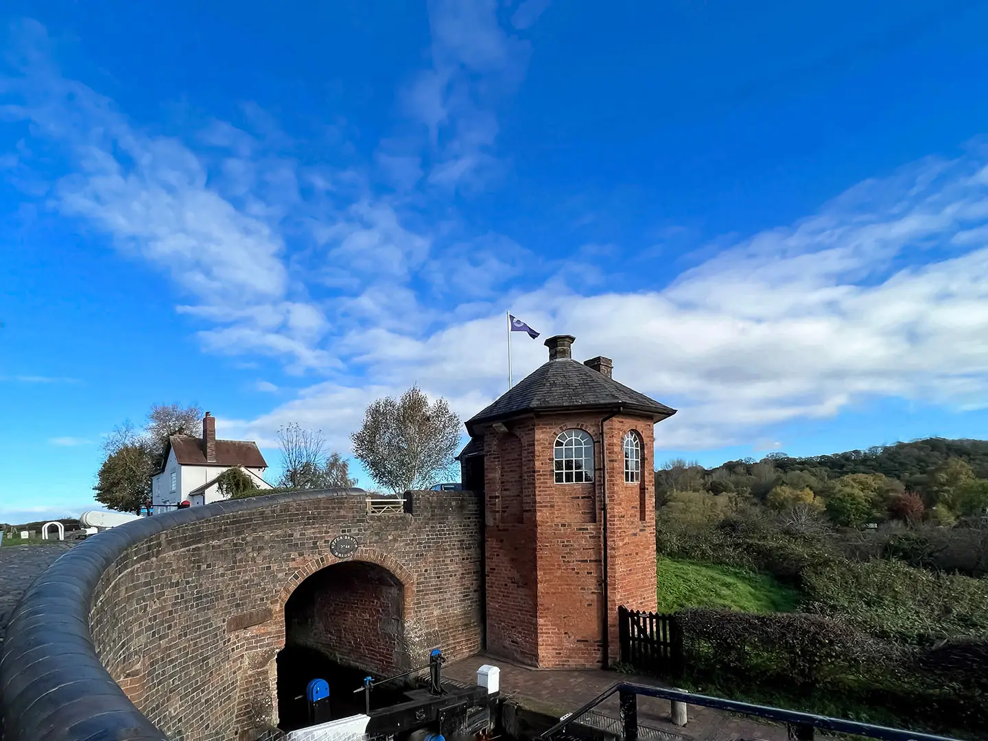
- Bratch Locks: A striking flight of locks on the Staffordshire & Worcestershire Canal near Wombourne. The octagonal toll house and canal setting make it a worthwhile short detour from the railway path.
- Original railway structures: Bridges, embankments and platform remains survive along the alignment. These features help the route still feel clearly like an old GWR branch line rather than just a park path.
Challenges to expect
This is an easy walk, but the full 17.7 km corridor is still a long day if walked end to end. The main practical issue is logistics: it is point-to-point, so arrange a return or choose an out-and-back section. The core path is all-weather, but some southern stretches can be softer and muddier after rain. Expect shared use with cyclists and runners, especially near Wolverhampton, Tettenhall and Wombourne.
HikeList Score
South Staffordshire Railway Walk scored 66/100 on HikeList's trail-quality metrics.
See score breakdownHide breakdown
- Ideal length 55
- Balanced challenge 50
- Scenery & wildness 72
- Varied terrain 83
- Accommodation 66
- Food & support 75
- Path quality 80
- Season flexibility 63
Computed from length, challenge, scenery & wildness, terrain variety, accommodation, food & support, path quality and season flexibility.
 United Kingdom
 England
Show more data Show less
- Forest
- Urban
- River
- Gravel
- Paved
- Dirt
- Hotels
- Campsites
- Wheelchair Accessible
- Stroller Accessible
- Family Friendly
- Pet Friendly
- Restrooms
- Picnic Areas
- Campsites
Photos from hikers
Taken on the trail by people who've reviewed South Staffordshire Railway Walk.
Reviews
How would you rate South Staffordshire Railway Walk?
Tap a star to start your review — you could be the first.